Tag: Car Rental

  • San Diego: Should You Rent a Car or Rely on Public Transit?

    San Diego: Should You Rent a Car or Rely on Public Transit?

    San Diego sits in the middle of the American spectrum on this question. It is neither a transit city nor as car-dependent as Phoenix or Los Angeles. The downtown core is compact and walkable, the Trolley links it to Old Town, Mission Valley, the university area and the Mexican border, a ferry crosses the bay to Coronado, and the airport is only a few kilometers from the Gaslamp Quarter. But the things that make San Diego special are spread along a long coastline: La Jolla, Point Loma, the beach towns and North County are either off the rail network or a slow bus ride away, and most day trips are car trips. This guide explains how the city is laid out, how the MTS Trolley, buses and coastal trains work, what driving and parking are really like, when a car earns its keep, and gives you a straightforward way to decide.

    The short answer

    Rent a car if La Jolla, Torrey Pines, Point Loma and the beach towns are the heart of your trip, if you are staying in a beach neighborhood or in North County, if you plan day trips to the Safari Park, LEGOLAND, Temecula, Julian or the desert, if you have young children, or if this is part of a road trip. Skip the car if you are staying downtown in the Gaslamp Quarter or Little Italy for a convention, a Padres game or a short city break, and your plans are the waterfront, the USS Midway, Balboa Park, Old Town, Coronado by ferry and a day in Tijuana; the Trolley, the ferry, buses and the occasional ride-hail will cover that, and you will avoid steep downtown hotel parking fees. Many visitors do best with a hybrid: car-free city days and a car for the coast and the day trips. Compare rental rates for any of these plans on our San Diego car rental page.

    How San Diego is laid out

    Downtown San Diego sits on the east shore of San Diego Bay, with the Gaslamp Quarter, East Village and Petco Park to the south, Little Italy and the airport to the north, and Balboa Park rising on the mesa just to the northeast. West of the airport, the Point Loma peninsula shelters the bay, with Cabrillo National Monument at its tip and Ocean Beach at its northern end. North of that, Mission Bay’s lagoons are fronted by Mission Beach and Pacific Beach, and La Jolla sits on the headland beyond, about 20 kilometers (12 miles) from downtown. Inland, Old Town and Mission Valley follow the San Diego River east toward San Diego State University, and North County’s beach towns and inland suburbs stretch 50 kilometers (30 miles) up the coast. The freeways tie it together: I-5 runs north-south along the coast from the Mexican border through downtown to Los Angeles; I-805 is its inland twin; I-8 runs east from Ocean Beach through Mission Valley toward Arizona; I-15 heads inland to Escondido, Temecula and Las Vegas; and SR 163 runs through Balboa Park’s canyon between downtown and the northern suburbs.

    Hotels cluster downtown around the Gaslamp and the convention center, in Little Italy, near the airport and on Harbor and Shelter Islands, in Mission Valley along I-8, in the beach neighborhoods, in Coronado and in La Jolla. Our San Diego hotel search lets you compare them.

    Getting in from the airport

    San Diego International (SAN) sits on the bay about 5 kilometers (3 miles) northwest of downtown, and getting into the city is quick. A taxi or ride-hail from the marked zones outside the terminals takes about ten minutes to the Gaslamp outside rush hour and about twenty to La Jolla or Pacific Beach. On public transit, an MTS bus runs between the terminals and downtown, and the airport-run shuttle connects the terminals with the Old Town Transit Center, where you can change to the Trolley, the Coaster commuter train and Amtrak. For a rental, shared shuttle buses run from the terminals to the consolidated Rental Car Center on the north side of the airport, where the major companies have their counters. The airport has been redeveloping Terminal 1 and its roads for several years, so pickup zones and routes may have moved since your last visit; check the airport’s site for current ground-transport details. Our SAN airport guide covers the layout.

    San Diego transit, explained

    The San Diego Metropolitan Transit System (MTS) runs the Trolley and most buses across the southern half of the county, and the North County Transit District runs the Coaster commuter train and North County’s buses. Its limitation is the coast, where rail barely reaches and the buses are slow for sightseeing.

    The Trolley

    The San Diego Trolley, opened in 1981, is the backbone. The UC San Diego Blue Line runs from the Mexican border at San Ysidro through downtown and Old Town, then north along the Mid-Coast extension to UC San Diego and the University Towne Center area near La Jolla. The Green Line runs from downtown past Old Town, through Mission Valley’s hotels and malls, to Snapdragon Stadium, San Diego State and Santee. The Orange Line runs east from downtown to El Cajon, and the Copper Line links El Cajon and Santee; a vintage Silver Line loops downtown on limited days. Trains run from early morning until around midnight, typically every 15 minutes on the main lines through the day and less often late at night. Downtown stops serve Little Italy, the Santa Fe Depot, the convention center, the Gaslamp and Petco Park.

    Buses

    MTS buses cover most of the city, and several are useful to visitors: routes along Park Boulevard and El Cajon Boulevard pass Balboa Park and the zoo, buses from the Old Town Transit Center fan out to Ocean Beach, Mission Beach, Pacific Beach and La Jolla, and routes cross the Coronado Bridge to Coronado. Frequencies drop in the evenings and on weekends on many routes, so check the timetable before relying on a bus for a late return.

    The Coaster and the Pacific Surfliner

    NCTD’s Coaster runs up the coast from the Santa Fe Depot downtown through Old Town, Sorrento Valley, Solana Beach, Encinitas and Carlsbad to Oceanside, with a busier schedule on weekdays than at weekends. It is a scenic and relaxed way to reach the North County beach towns. Amtrak’s Pacific Surfliner follows much of the same line and continues to Los Angeles Union Station in about three hours, then on to Santa Barbara. Coastal landslides near San Clemente have periodically suspended or reduced service in recent years, so check the current status before building a trip around the train.

    Fares and tickets

    One fare system covers the Trolley and MTS buses. Pay with a PRONTO card or the PRONTO app, which cap what you pay at the price of a day pass once you have taken enough rides in a day, or buy tickets from the machines on the Trolley platforms. Tap before boarding, because fare inspectors check on board. The Coaster and the Surfliner have their own fares, and reduced fares are available for seniors, riders with disabilities and younger riders. Check the MTS site for current fares before you go.

    Accessibility

    The Trolley has low-floor cars and step-free stations throughout, and all MTS buses are accessible, with ramps and space for wheelchairs.

    Beyond MTS

    • The Coronado ferry. Ferries cross the bay from the Broadway Pier area downtown to the Coronado Ferry Landing in about fifteen minutes, with bicycles welcome on board; the landing is a short walk from Orange Avenue.
    • Ride-hail and taxis. Uber and Lyft operate across the county, and for trips to La Jolla, Point Loma, the beach towns and the brewery districts, they are much faster than the bus. Surge pricing after big events can be steep.
    • Walking and cycling. Downtown, the Embarcadero, Coronado and the beach boardwalks are excellent on foot or by bike. Shared e-bikes and e-scooters operate in many neighborhoods, subject to city rules, including slow zones on the boardwalks.
    • Tours and hop-on buses. Trolley-style sightseeing tours loop the main sights,, and day tours run to the Safari Park.
    • Crossing to Tijuana. The Blue Line runs to San Ysidro, where most visitors walk across the border. Carry a valid passport; Mexico’s Instituto Nacional de Migración sets the entry rules, and the return requires U.S. entry documents that U.S. Customs and Border Protection accepts for your nationality.
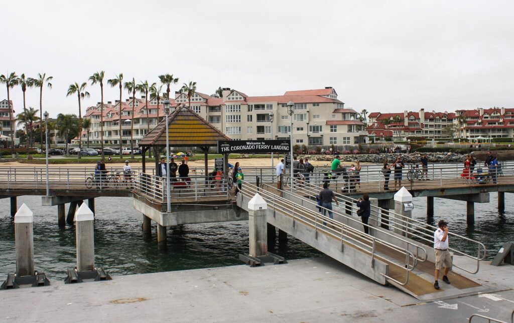
    The Coronado Ferry Landing on San Diego Bay
    The Coronado Ferry Landing, a short crossing from downtown and a short walk from Orange Avenue (Photo: Bernard Gagnon via Wikimedia Commons, CC BY-SA 3.0)

    Driving in San Diego: what it is really like

    By the standards of Southern California, San Diego is a reasonable place to drive: the freeways are well signed, the streets are easy to navigate once you know the main corridors, and traffic is lighter than in Los Angeles. The frustrations are specific. Weekday rush hours, roughly 6 to 9 a.m. and 3 to 7 p.m., slow I-5 and I-805 through the central city and at the Merge, where the two meet near Del Mar, along with I-15 and I-8 through Mission Valley. Sunday afternoons bring heavy northbound traffic on I-5 as weekend visitors head back to Orange County and Los Angeles. Events clog downtown, from Padres games and conventions to the Comic-Con crowds, and summer weekends fill the roads to the beaches.
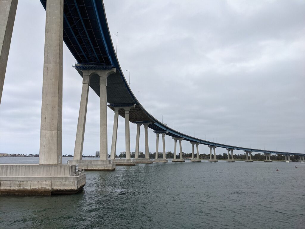
    The curving San Diego-Coronado Bridge over San Diego Bay
    The San Diego-Coronado Bridge, the drive to Coronado's beaches and the Hotel del Coronado (Photo: Mds08011 via Wikimedia Commons, CC BY 4.0)

    Parking

    Parking is the real cost of a car in San Diego. Downtown has metered street parking with posted hours and many garages, which charge premium event rates on game and concert nights, and most downtown hotels charge a hefty nightly fee for parking or valet. Balboa Park’s lots, free for decades, have moved to paid parking in recent years, so check the park’s current rules before you go. In La Jolla, time-limited street parking near the Cove and the village fills quickly, especially on weekends, and paid garages fill the gap. The beach lots in Mission Beach, Pacific Beach and Ocean Beach fill by late morning on summer weekends, and street parking in those neighborhoods is tight. Never leave valuables visible in a parked car at a beach or trailhead.

    Rules and conditions worth knowing

    • The border. Southbound I-5 and I-805 end at the San Ysidro crossing, and the last U.S. exits come quickly; watch the signs, because missing them puts you in the lanes for Mexico, where most rental agreements do not allow the car to go.
    • Mexico with a rental. Most U.S. rental companies forbid or restrict driving into Mexico, and those that allow it require Mexican auto insurance; for a Tijuana day trip, walking across is far simpler.
    • Express lanes and tolls. The I-15 Express Lanes and the I-5 lanes in North County are free for qualifying carpools and tolled for solo drivers with a FasTrak account, and SR 125 in the South Bay is a toll road; rental companies bill tolls through their own programs, often with a daily fee, so ask at the counter.
    • Phones. California law bans holding a phone while driving; use a mount and hands-free mode.
    • Right turns on red are permitted after a full stop unless signed otherwise.
    • Checkpoints. Border Patrol checkpoints operate on the main highways north and east of the city, including I-5 near San Onofre; carry ID.
    • Road conditions. 511 San Diego and the California Department of Transportation publish closures, crashes and conditions, including winter snow on the mountain roads to Julian and on I-8 east of the city.

    When renting a car makes sense

    • The coast. La Jolla, Torrey Pines, Point Loma, Cabrillo National Monument, Sunset Cliffs and the beach towns are strung along the shore, with slow bus links between them; a car lets you see several in a day.
    • North County and inland day trips. The Safari Park, LEGOLAND and the Flower Fields in Carlsbad, the Temecula wine country, Julian and Anza-Borrego are all a 40-minute to two-hour drive away.
    • Beach stays. If you are staying in Mission Beach, Pacific Beach, La Jolla or North County, a car makes getting downtown and to the attractions much easier.
    • Families. Car seats, beach gear and early starts at the zoo all argue for a car, and our family car rental guide looks at vehicle choice.
    • Road trips. Los Angeles is two to three hours north and Phoenix about five and a half hours east; our Los Angeles to San Diego route guide and Phoenix to San Diego route guide cover the drives.

    If any of those apply, our rental car booking tips cover insurance, deposits and the questions to ask at the counter.

    When it does not

    • You are staying downtown and your plans are the waterfront, Balboa Park, Old Town and Coronado by ferry.
    • You are in town for a convention, Comic-Con or a Padres game, when downtown parking is at its most expensive and the Trolley stops beside the venues.
    • Your main day trip is Tijuana, which is easiest on the Trolley and on foot.
    • You are staying at a single resort in Coronado or on Mission Bay and plan to spend most of the time on the sand, with ride-hail for the occasional dinner.

    The hybrid plan for a city-plus-coast trip

    Go car-free for the downtown days and rent for the coast and the day trips, and think about where you pick up. Every major company operates from the airport’s Rental Car Center, which is convenient but adds airport fees and surcharges; neighborhood offices downtown and elsewhere in the city can avoid some of those charges and make sense if you are spending the first nights in the Gaslamp or Little Italy. A pattern that works well: take a taxi or ride-hail from the airport, spend two or three car-free days on the waterfront, in Balboa Park, in Old Town and on the Coronado ferry, then pick up a car for La Jolla, Point Loma and the beaches, and a day in Carlsbad, Temecula or at the Safari Park, and return it to the airport on the way to your flight home. Compare the day rates on our San Diego car rental page against a full-trip rental and the difference is usually obvious.

    A worked cost comparison

    Numbers change with the season and the booking window, so treat this as a method rather than a quote, and check current rates before deciding. For a three-night city break downtown for two people, the car-free version costs a couple of ride-hail trips from and to the airport, Trolley and bus fares capped at a day pass each per day, the ferry to Coronado, and perhaps two ride-hail trips to La Jolla and Ocean Beach; the rental version adds three days of a compact car, airport fees and surcharges, three nights of downtown hotel parking and fuel. Transit wins clearly, largely because of parking. For a five-night stay with two coast days and a trip to the Safari Park, the hybrid version adds a two-day rental from a city location and fuel, against ride-hail trips of 30 to 60 minutes each way for the car-free version; the rental usually wins for two or more people. For a week at a beach hotel with a family, a rental for the whole stay is the practical answer, especially if the hotel’s parking is free or reasonable. Run the rental rates for your dates on our San Diego car rental page and put them beside the parking and ride-hail costs before you choose.

    Driving out of San Diego in each season

    The highways out of San Diego are good, but each has its own character. I-5 north to Los Angeles follows the coast through North County and past Camp Pendleton, about 200 kilometers (120 miles) downtown to downtown; allow two hours with light traffic and three or more at rush hour, on Friday afternoons northbound and on Sunday afternoons,. I-15 north reaches Temecula in about an hour and Las Vegas in about five, crossing the Mojave, where summer heat makes a breakdown dangerous. I-8 east to Phoenix climbs through the mountains east of the city, where winter storms can bring snow and ice to the high passes, then drops into the low desert past El Centro and Yuma, some of the hottest country in North America in summer; about five and a half hours in all, with fuel stops far apart. The mountain roads to Julian occasionally require chains after winter snow. In fall, Santa Ana wind events bring wildfire risk and occasional road closures. In summer, start desert drives early with a full tank and plenty of water. Before any long drive, check the Caltrans and 511 San Diego conditions.

    Decision table

    Your tripRecommendationWhy
    City break downtownNo carThe waterfront, Balboa Park, Old Town and Coronado by ferry are all reachable without one
    Convention, Comic-Con or a Padres gameNo carThe Trolley stops beside the venues; event and hotel parking is expensive
    Tijuana day tripNo carTrolley to San Ysidro and walk across; rentals rarely allowed into Mexico
    Coronado or Mission Bay resort, mostly on the sandNo car, ride-hail for outingsAvoids parking fees for a car you rarely use
    La Jolla, Point Loma and the beach townsRent for those daysThe coast is poorly served by rail
    City plus North County day tripsHybrid: rent from a city location for the trip daysCar-free downtown, car for the Safari Park, Carlsbad or Temecula
    Family beach holidayRent for the whole stayCar seats, beach gear and spread-out attractions
    Southern California or Southwest road tripRent (consider one-way to Los Angeles or Phoenix)San Diego is one stop on the route

    Money-saving tips for both options

    • On transit: use PRONTO so your fares cap at a day pass automatically, and combine the Trolley with the Coronado ferry and walking downtown.
    • On a rental: compare airport and neighborhood pickup, rent only for the days you need, book early for summer, and decline extras you already have through a credit card or home policy (check first).
    • On the hotel: if you are renting, price the parking into the room rate; beach and Mission Valley hotels often charge far less than downtown.
    • On timing: avoid I-5 at rush hour and on Sunday afternoons northbound; our best time to fly to San Diego guide lists the busiest weeks, and for the rest of Southern California, our guide to renting a car in Los Angeles covers the other end of I-5, and our Phoenix car guide covers the far end of I-8.
    • On ride-hail: for a group of three or four on a short trip, a single ride often costs less than four fares and saves a long bus ride; our guide to car, transit or taxi sets out the general trade-offs.
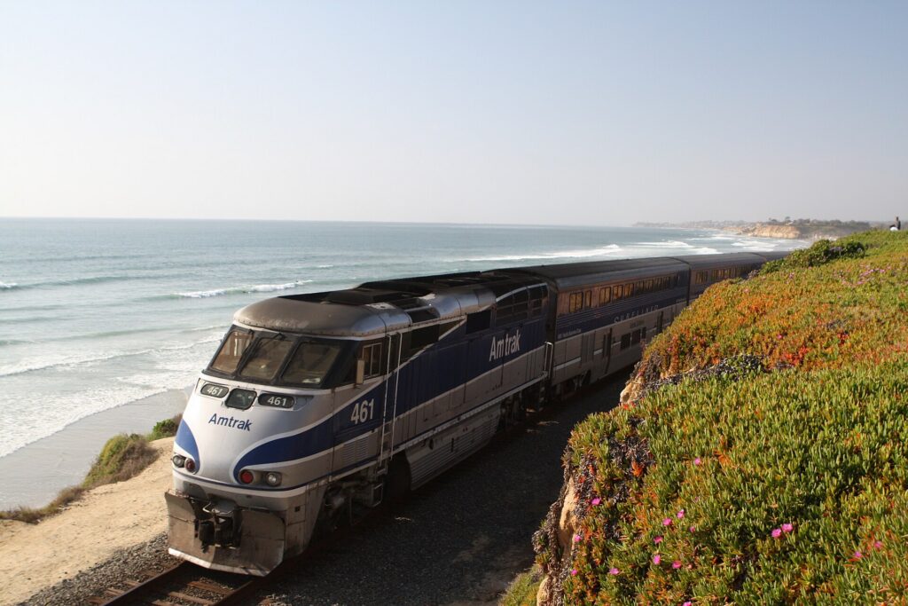
    An Amtrak Pacific Surfliner train in Del Mar, north of San Diego
    The Pacific Surfliner and the Coaster follow the coast north to the beach towns and Los Angeles (Photo: catlin.wolfard via Wikimedia Commons, CC BY-SA 3.0)

    Frequently asked questions

    Is it worth renting a car in San Diego?

    For La Jolla, Point Loma, the beach towns and North County day trips, yes. For a downtown stay built around the waterfront, Balboa Park, Old Town and Coronado, no.

    Is San Diego public transit good for tourists?

    Good for downtown, Old Town, Mission Valley and the border, and the ferry covers Coronado. The coast is harder: buses reach the beaches and La Jolla, but slowly.

    How do I get from San Diego airport to downtown?

    A taxi or ride-hail in about ten minutes, or an MTS bus. The airport shuttle to the Old Town Transit Center connects with the Trolley, the Coaster and Amtrak.

    Can I take the Trolley to Mexico?

    Yes. The Blue Line runs to San Ysidro, where you walk across the border. Carry a valid passport and the documents you need to re-enter the United States.

    Is parking expensive in San Diego?

    Downtown, yes, especially at hotels and on event nights. It is easier and cheaper in the beach neighborhoods outside summer weekends, and in Mission Valley.

    Can I take the train from San Diego to Los Angeles?

    Yes, on the Amtrak Pacific Surfliner from the Santa Fe Depot or Old Town to Union Station in about three hours, when coastal landslides are not disrupting service.

    Can I drive a rental car into Mexico?

    Usually not. Most U.S. rental companies forbid it, and those that allow it require Mexican insurance. Walk across at San Ysidro instead.

    Whichever way you go, start with the flight. Compare cheap flights to San Diego, choose a neighborhood with our San Diego hotel search, and if the coast or North County is on the list, price the rental for those dates on our San Diego car rental page. For what to do once you arrive, start with our first-timer’s guide to San Diego.

  • Philadelphia: Should You Rent a Car or Rely on Public Transit?

    Philadelphia: Should You Rent a Car or Rely on Public Transit?

    Philadelphia is a city that punishes cars and rewards feet. William Penn laid out Center City in 1682 as a tight grid of narrow streets between two rivers, long before anyone imagined parking, and the historic core around Independence Hall still has brick sidewalks, cobbled lanes and streets barely wide enough for a delivery truck. Almost everything a first-time visitor wants to see, from the Liberty Bell to Reading Terminal Market, the art museum and the restaurants of Rittenhouse Square, fits inside an area you can walk across in under an hour, and SEPTA’s subway, trolleys, buses and regional trains cover the rest, including a direct train from the airport. Driving, by contrast, means some of the most congested expressways on the East Coast, a parking authority whose enforcement is part of local folklore, and hotel parking fees that add up quickly. But the car still has a job here. Valley Forge, Longwood Gardens, Lancaster County’s Amish country, Bucks County and the Jersey Shore are all classic day trips, and most of them are hard or impossible without one. This guide explains how the city is laid out, how SEPTA and the other rail systems work, what driving is really like, and gives you a straightforward way to decide.

    The short answer

    Skip the car for a city visit, which is what most first trips to Philadelphia are: SEPTA, your feet, Indego bike share and the occasional taxi will cover the historic district, Center City, the Parkway museums, South Philadelphia, Fishtown and University City, and you will save the parking and the stress. Rent a car only for the days you leave the city, for Valley Forge, Longwood Gardens and the Brandywine Valley, Lancaster County, New Hope and Bucks County, Gettysburg or the Shore, or if you are visiting family in the suburbs, traveling with small children and a lot of gear, or making Philadelphia one stop on an East Coast road trip. For most visitors, the right answer is a car-free city stay plus a one- or two-day rental. Compare rental rates for those days on our Philadelphia car rental page.

    How Philadelphia is laid out

    Center City is the rectangle between the Delaware River on the east and the Schuylkill River on the west, roughly two miles across and a mile deep, with City Hall at the center where Broad Street and Market Street cross. North-south streets are numbered, starting from Front Street at the Delaware and rising to the twenties by the Schuylkill, and east-west streets carry names, many of them trees, such as Chestnut, Walnut, Locust, Spruce and Pine. Old City and Society Hill, with Independence Hall and the oldest houses, fill the eastern end near the Delaware; Rittenhouse Square anchors the western half; the Benjamin Franklin Parkway runs diagonally northwest from City Hall to the art museum. South Philadelphia, with the Italian Market, East Passyunk and the stadiums, stretches below South Street; Northern Liberties and Fishtown lie north along the Delaware; University City is across the Schuylkill to the west. Most streets in the grid are one-way, which is logical once you know the pattern and baffling until you do. Beyond Center City the city runs far to the northeast and northwest, and the suburbs, the Main Line, Montgomery County, Delaware County, Bucks County and South Jersey across the river, are where public transit starts to thin out.

    Hotels cluster around City Hall and the Convention Center, around Rittenhouse Square, in Old City near the historic sites, in University City near 30th Street Station, and in a large group near the airport. Our Philadelphia hotel search lets you compare them.

    Getting in from the airport

    Philadelphia International (PHL) is in the southwest corner of the city, about 13 km (8 miles) from Center City, and it has one of the simplest airport connections in the country. The SEPTA Airport Line, a Regional Rail service, stops at every terminal and runs to University City, 30th Street Station, Suburban Station and Jefferson Station in around 25 minutes, typically every half hour from early morning until late evening; SEPTA’s site lists the current ticket options for the line. Taxis charge a flat fare between the airport and Center City, which takes the guesswork out of the trip, and ride-hail pickups are in marked zones outside baggage claim. The drive takes about 20 minutes in light traffic on I-95 and much longer at rush hour. The rental car companies are off-airport and run shuttles from the terminals to their lots. Unless you are heading straight out of the city, there is no reason to pick up a car on arrival. The airport’s site covers current ground transport, and our PHL airport guide covers the layout.

    A SEPTA Market-Frankford Line train in Philadelphia
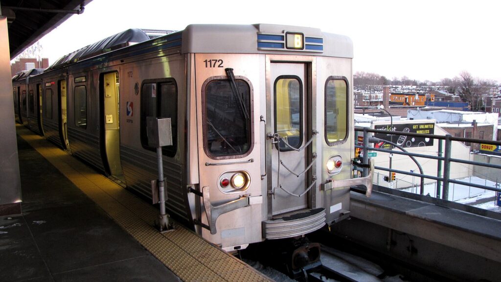
    The Market-Frankford Line, which links Old City, City Hall, 30th Street Station and Fishtown (Photo: Ben Schumin from Montgomery Village, Maryland, USA via Wikimedia Commons, CC BY-SA 2.0)

    Philadelphia’s transit, explained

    SEPTA, the Southeastern Pennsylvania Transportation Authority, runs almost everything: two subway lines, a network of trolleys, the buses, and a large Regional Rail system that reaches the suburbs, the airport and Trenton in New Jersey. It is one of the few American transit systems that uses every mode, and for a visitor based in Center City it covers nearly everything worth seeing. It has also faced serious funding shortfalls in recent years that have brought threatened and sometimes actual service cuts, so check current schedules on SEPTA’s site before relying on a route, especially in the evenings.

    The subway and trolleys

    Two lines form a cross through the city. The Market-Frankford Line runs east-west under Market Street through Center City, with stops for Old City, Independence Mall, City Hall and 30th Street Station, then rises onto an elevated track to University City in the west and to Fishtown and the Northeast in the other direction. The Broad Street Line runs north-south under Broad Street, meeting the Market-Frankford Line at City Hall, and is the way to the stadiums at the southern end and to Temple University in the north. SEPTA has been renaming its rail transit lines under a SEPTA Metro brand, so on newer maps and signs the Market-Frankford Line appears as the L and the Broad Street Line as the B. The subway-surface trolleys run underground beneath Market Street in Center City and surface in West Philadelphia, which makes them useful for University City, and a separate trolley line runs along Girard Avenue past the zoo and through Fishtown.

    Buses

    Buses fill in the rest of the city, including the routes along South Street, Chestnut and Walnut, up to the art museum area, and out to Manayunk. Frequencies are good on the main corridors and much thinner late at night and on the outer routes. Check real-time arrivals in the SEPTA app rather than trusting a printed schedule.

    Regional Rail

    More than a dozen Regional Rail lines fan out from the Center City tunnel, which links Jefferson Station, Suburban Station and 30th Street Station. For visitors, the most useful are the Airport Line, the Manayunk/Norristown Line, the Chestnut Hill lines for the northwest neighborhoods, and the Trenton Line, which connects with New Jersey Transit trains to New York for travelers who want the cheaper, slower alternative to Amtrak. Service on most lines is roughly hourly outside the rush.

    Fares and tickets

    The simplest way to pay on the subway, trolleys and buses is to tap a contactless bank card or phone at the reader, or to load a reusable SEPTA Key card at station kiosks; paying with a Key card or contactless costs less than paying cash on a bus, and transfers are handled automatically within a set time. Regional Rail fares depend on the zone and whether you travel at peak times, and the Airport Line has its own fare. Day and weekly passes are available and worth it on a heavy sightseeing day. Young children ride free with a fare-paying adult; check SEPTA for the current age limit and fares before you go.

    Accessibility

    Every SEPTA bus is accessible, and a growing number of subway and Regional Rail stations have elevators, but some older subway stations and trolley stops still do not. SEPTA’s site lists accessible stations and elevator outages, and it is worth checking before you plan a route with luggage or a stroller.

    Beyond SEPTA

    • Walking. Center City is flat and compact, and you can walk from Independence Hall to Rittenhouse Square in about 25 minutes and to the art museum in about 40. On a pleasant day, walking is faster than waiting for a bus for most trips inside the grid.
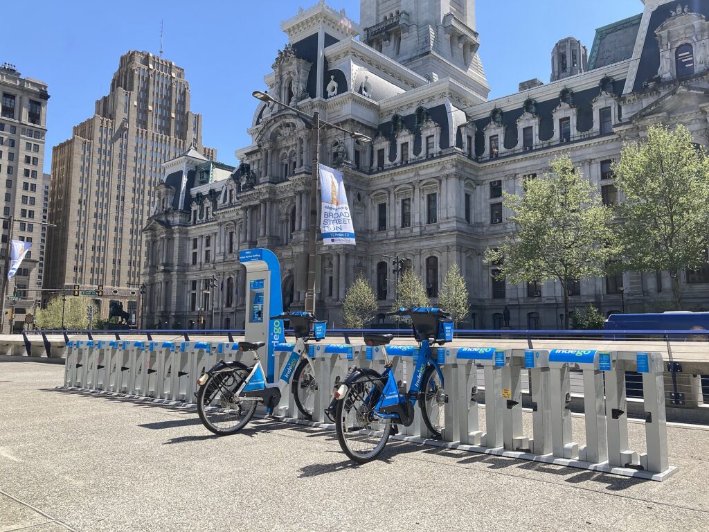
    • Indego bike share. Indego has hundreds of stations across Center City and the neighborhoods around it, including electric bikes, and the Schuylkill River Trail from Center City past Boathouse Row is the best ride in the city.
    • PATCO. The PATCO Speedline runs from Center City across the Benjamin Franklin Bridge to Camden and the South Jersey suburbs, and it is the way to the Adventure Aquarium and the Battleship New Jersey.
    • Amtrak and New Jersey Transit. Amtrak connects 30th Street Station with New York, Washington and Boston on the Northeast Corridor, and with Harrisburg via Lancaster on the Keystone line, which makes Amish country a feasible car-free day trip. New Jersey Transit runs trains to Atlantic City and the River Line from Camden to Trenton.
    • Taxis and ride-hail. Uber, Lyft and licensed taxis operate across the city; for a group of three or four, a short ride is competitive with transit fares and far quicker for late-night returns.
    • Seasonal ferry. In the warmer months, a passenger ferry has typically crossed the Delaware between Penn’s Landing and the Camden waterfront; check before you go.
    30th Street Station, Philadelphia's main Amtrak and Regional Rail hub
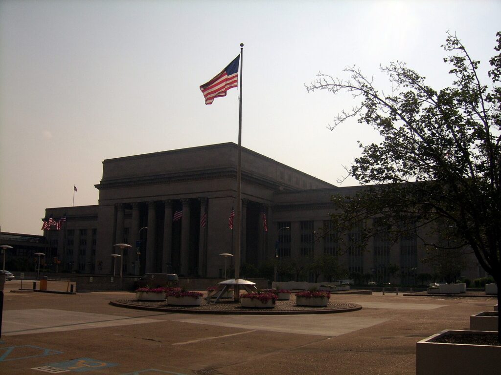
    30th Street Station, where Amtrak, Regional Rail and the Airport Line meet (Photo: Reading Tom from Reading, UK via Wikimedia Commons, CC BY 2.0)

    Driving in Philadelphia: what it is really like

    Philadelphia is not the hardest city in the country to drive in, but it is harder than its size suggests. The Schuylkill Expressway (I-76), the main route from the western suburbs, Valley Forge and the Pennsylvania Turnpike into Center City, is a narrow, winding road squeezed between the river and the hills, and it jams every weekday morning and evening and often on weekends; locals have called it the “Sure-Kill” for decades. I-95 along the Delaware, the route from the airport and to New York, has its own rush-hour crawl and a long-running program of construction. The Vine Street Expressway (I-676) across the north of Center City links the two and backs up at both ends. Roosevelt Boulevard in the Northeast, a twelve-lane road with a grim safety record, now has automated speed cameras. Inside Center City, the grid of narrow one-way streets, double-parked delivery trucks, cyclists, pedestrians who cross against the light, and the cobblestones and tight corners of Old City and Society Hill make driving slow and stressful for anyone who does not know the pattern.

    Traffic on the Schuylkill Expressway (Interstate 76) in Philadelphia
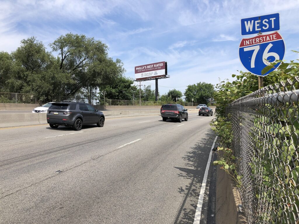
    The Schuylkill Expressway, the main road in from the western suburbs and one of the most congested in the region (Photo: Famartin via Wikimedia Commons, CC BY-SA 4.0)

    Parking

    This is where most visitors decide the car is not worth it. On-street parking in Center City is scarce, metered and time-limited, and residential blocks in the surrounding neighborhoods are restricted to permit holders for all but a short period. The Philadelphia Parking Authority enforces the rules with an efficiency that has been the subject of its own reality television show, and a ticket or a tow is an expensive souvenir. Garages and lots are plentiful around City Hall, the Convention Center and Old City, and many offer early-bird and evening rates, but daily rates are high, and hotels charge a substantial nightly fee, often for valet only. Outside Center City, parking at the stadiums, the zoo, Valley Forge, Longwood Gardens and most suburban sights is simple, and the historic sites in Old City have a garage under the Independence Visitor Center. Pay street meters at the kiosk or with the parking authority’s app, read every sign on the block, and never park in a bus zone, a loading zone or a crosswalk.

    Rules and conditions worth knowing

    • Tolls. The Pennsylvania Turnpike, the New Jersey Turnpike and the bridges across the Delaware are tolled, most of them electronically. Many Pennsylvania Turnpike plazas no longer take cash, and the bill follows the plate; ask the rental company how its toll program works and what it charges.
    • Cameras. Red-light cameras operate at many intersections, and speed cameras on Roosevelt Boulevard and in school zones; fines follow the car, and the rental company will bill you with a fee on top.
    • Wipers on, lights on. Pennsylvania law requires headlights whenever your wipers are in use because of the weather.
    • Right turns on red are permitted after a full stop unless signed otherwise, which in Center City they often are. Left turns on red from one one-way street onto another are also legal after a stop.
    • Snow. A few storms a year bring snow emergency routes, where parked cars must be moved or towed; if you have a rental in the city during a storm, check where it is parked.
    • Game days. Eagles, Phillies, Flyers and 76ers games back up I-95, I-76 and Broad Street around the stadium complex in South Philadelphia. Take the Broad Street Line instead.
    An Indego bike share station in Philadelphia
    Indego bike share, the quickest way along the Schuylkill River Trail (Photo: Robert Perry via Wikimedia Commons, CC0)

    When renting a car makes sense

    • Valley Forge and the Main Line. Valley Forge National Historical Park is about 40 minutes northwest, and the park itself, with its driving tour past the encampment sites, is best seen by car.
    • Longwood Gardens and the Brandywine Valley. About an hour southwest, with Winterthur and the Brandywine museum nearby; public transport barely reaches them.
    • Lancaster County. The train reaches Lancaster city, but the farms, covered bridges and back roads of Amish country need a car.
    • Bucks County and New Hope. An hour north along the Delaware, with Washington Crossing Historic Park on the way.
    • The Jersey Shore. Cape May, Ocean City and the smaller shore towns are far easier by car; Atlantic City is the exception, with bus and train service.
    • East Coast road trips. Philadelphia sits between Washington and New York on I-95; our route guides for Washington, DC to Philadelphia and Philadelphia to Boston cover the drives, and our guides to Washington, DC and Boston cover what to do when you arrive.

    If any of those apply, our rental car booking tips cover insurance, deposits and the questions to ask at the counter, and our family car rental guide looks at vehicle choice.
    When it does not

    • You are staying in Center City, Old City or University City and your plans are the historic district, the museums, the markets and the neighborhoods.
    • You are in town for a convention, a game, a graduation or the Fourth of July, when parking is at its worst and SEPTA goes where you are going.
    • You are arriving or leaving by Amtrak, or combining Philadelphia with New York or Washington by train.
    • You are traveling solo or as a couple, and the rental, insurance, tolls and hotel parking add up to more than a week of transit and taxis.

    The hybrid plan for a city-plus-countryside trip

    Go car-free for the city days and rent for the countryside days, and think carefully about where you pick up. Renting at the airport makes sense only if you are heading straight out of the city on arrival, toward Longwood Gardens and the Brandywine Valley, for example, which are closer to PHL than to Center City. Renting from a downtown or 30th Street Station location makes sense if you are spending the first nights in the city, because you avoid the airport’s concession fees and the nightly hotel parking on the days you are not using the car. A common pattern that works well: the Airport Line into the city, two or three car-free days, pick up a rental in Center City in the morning, drive out for Valley Forge or Lancaster County, and return it that evening or on the way back to the airport. Leave early to beat the Schuylkill Expressway, and plan the return for after the evening rush. Compare the day rates on our Philadelphia car rental page against a full-trip rental and the difference is usually obvious.

    A worked cost comparison

    Numbers change with the season and the booking window, so treat this as a method rather than a quote, and check current rates before deciding. For a four-night city break in Center City for two people, the car-free version costs two return Airport Line fares, transit rides or a couple of day passes, an Indego ride or two along the river, and perhaps two or three short taxi trips at night; the rental version adds four days of a compact car, four nights of hotel parking at Center City rates, fuel and the airport concession fees, and buys you very little you could not walk or ride to. The transit option wins easily. For the same four nights with a day at Longwood Gardens and a day in Lancaster County, the car-free version would need an Amtrak return to Lancaster and taxis once you arrive, and would struggle to reach Longwood at all; the hybrid version adds a two-day rental picked up downtown, fuel, a toll or two and one or two nights of parking. The hybrid wins on both cost and time for almost everyone. For a family of four visiting the suburbs for a week, a rental for the whole stay is the practical answer, and the airport pickup is worth its fee. Run the rental rates for your dates on our Philadelphia car rental page and put them beside the transit costs before you choose.

    Driving out of Philadelphia in each season

    The day trips from Philadelphia are easy drives in any season, but the traffic changes with the calendar. In summer, the problem is the Shore: the Atlantic City Expressway and the roads to Cape May and Ocean City fill on Friday afternoons and Sunday evenings from Memorial Day to Labor Day, so go mid-week or leave very early. Summer thunderstorms can also flood low roads, including sections of the Schuylkill Expressway, for an hour or two. In fall, the roads to Bucks County, Lancaster County and the Brandywine Valley fill on foliage weekends in October, and Eagles Sundays make I-95 around the stadiums slow; weekday trips are calmer. In winter, snow is occasional rather than constant, and the main highways are plowed quickly, but a nor’easter can make the suburbs slow for a day or two, and the Christmas displays at Longwood Gardens draw heavy evening traffic through December. Rental cars come on all-season tires, which are fine for most winter days. In spring, the Schuylkill Expressway is at its worst on weekday rush hours as always, but the drive to Valley Forge and Longwood during the April blossoms and the May garden season is one of the best reasons to have a car. In every season, the rule is the same: leave Center City before the morning rush or after it, and come back after the evening one.

    Decision table

    Your tripRecommendationWhy
    City break in Center City, couple or soloNo carWalking, SEPTA and Indego cover it; parking is expensive and strictly enforced
    Fourth of July, a convention or a gameNo carStreets close, parking vanishes, and SEPTA goes to the Parkway and the stadiums
    City plus Valley Forge or Longwood GardensHybrid: rent downtown for one or two daysCar-free city days, car only when you leave
    Lancaster County and Amish countryRent for the day, or Amtrak plus a local tourThe train reaches Lancaster, but the farms and back roads need a car
    Philadelphia with New York or WashingtonNo car; take the trainAmtrak between city centers is faster than driving and parking
    Family visit to the suburbsRent for the whole staySuburban transit is thin and distances are long
    Jersey Shore beach daysRent, and go mid-weekMost shore towns are hard to reach without a car
    East Coast road tripRent (consider one-way)Philadelphia is a stop on I-95, not the destination

    Money-saving tips for both options

    • On transit: tap a contactless card or use a SEPTA Key card rather than paying cash; buy a day pass for a heavy sightseeing day; walk inside Center City whenever the weather allows.
    • On a rental: compare airport and downtown pickup, rent only for the days you leave the city, check the toll program before you drive, decline extras you already have through a credit card or home policy (check first), and fill the tank away from the airport.
    • On the hotel: if you are renting, price the parking fee into the room rate, and look at garages with evening or weekend rates near your hotel, which are often cheaper than hotel valet.
    • On timing: avoid the Schuylkill Expressway and I-95 in the weekday peaks and on game days, and the Shore roads on summer weekends; the best time to fly to Philadelphia guide lists the busiest weekends in the city.
    • On intercity trips: for New York, the SEPTA Trenton Line plus New Jersey Transit is slower than Amtrak but usually much cheaper; for Washington and Boston, compare Amtrak with a one-way rental for a group.

    Frequently asked questions

    Is it worth renting a car in Philadelphia?

    For a city visit, no; walking and SEPTA cover the sights, and parking is expensive and strictly enforced. For Valley Forge, Longwood Gardens, Lancaster County, Bucks County or the Shore, yes, for those days only.

    Is SEPTA good for tourists?

    Good within the city: the two subway lines, the trolleys and the buses reach nearly every sight, and the Airport Line connects every terminal to Center City. Check current schedules, as service levels have been affected by funding problems.

    How do I get from Philadelphia airport to Center City?

    The SEPTA Airport Line train in around 25 minutes, typically every half hour, or a flat-fare taxi or ride-hail in 20 to 40 minutes depending on traffic.

    How do I pay for SEPTA?

    Tap a contactless bank card or phone at the reader, or buy and load a SEPTA Key card at a station kiosk. Paying cash on a bus costs more and does not include a transfer.

    Can I get to Valley Forge without a car?

    It is possible by SEPTA bus from the Norristown area, but it is slow, and the park is spread out. A car, a bike or a tour is far easier.

    Is parking expensive in Philadelphia?

    In Center City, yes: street spaces are scarce and time-limited, garage day rates are high, and hotels charge a substantial nightly fee. Outside the center, parking is easy.

    Is it hard to drive in Philadelphia?

    The expressways are congested and the Center City grid is narrow, one-way and busy with pedestrians and cyclists. It is manageable with patience and a navigation app, but most visitors are happier without a car in the city.

    Whichever way you go, start with the flight. Compare cheap flights to Philadelphia, choose a neighborhood with our Philadelphia hotel search, and if the countryside is on the list, price the rental for those days on our Philadelphia car rental page. For what to see once you are here, start with our first-timer’s guide to Philadelphia.

  • Houston: Should You Rent a Car or Rely on Public Transit?

    Houston: Should You Rent a Car or Rely on Public Transit?

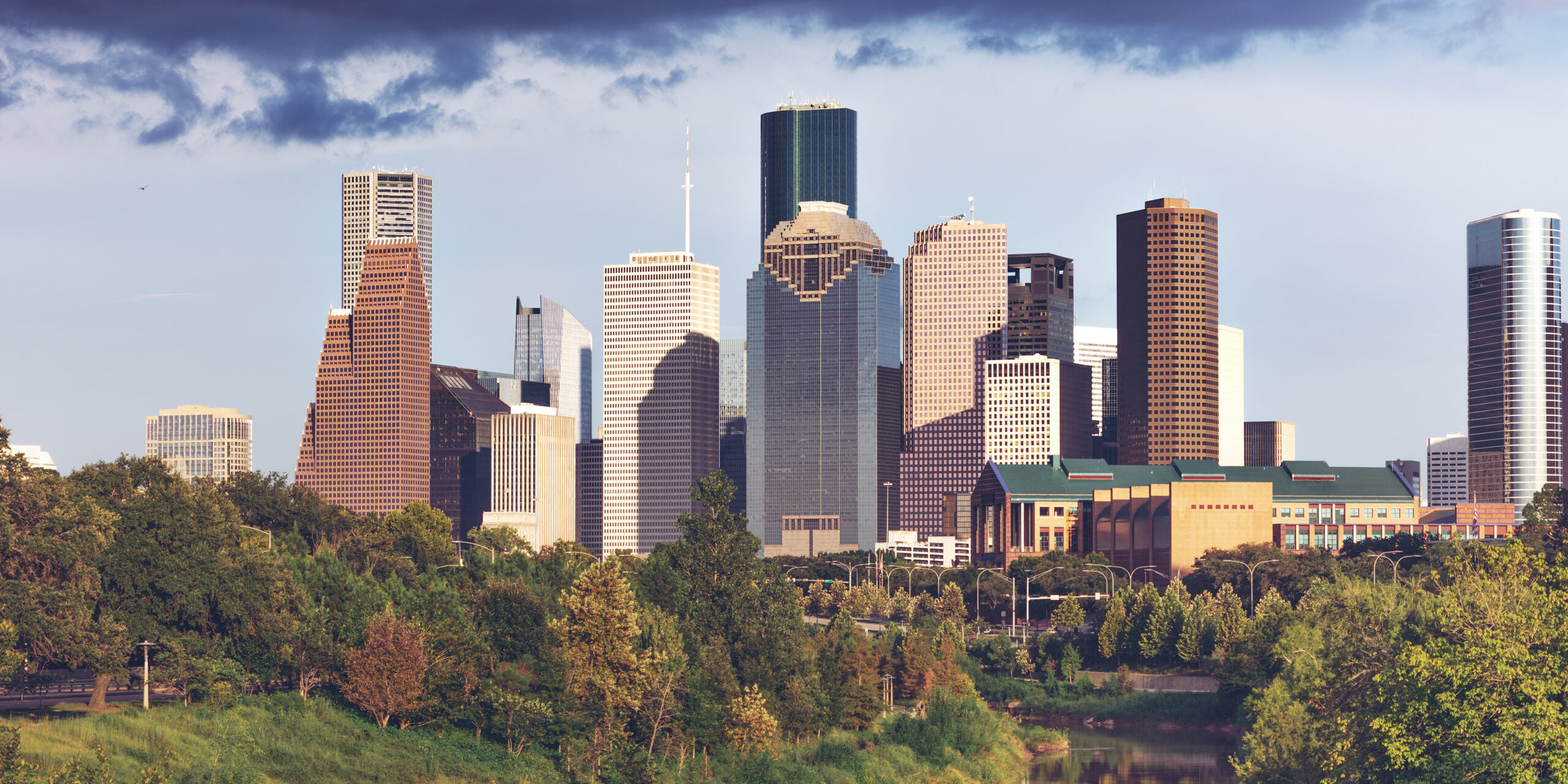
    Houston is the car city other car cities point to. It covers more than 600 square miles, has no zoning code to concentrate its offices, shops and homes, and is laced with freeways, toll roads and three concentric ring roads, and most Houstonians drive everywhere. So the honest answer to “should I rent a car?” is often yes. But not always. METRO’s light-rail Red Line runs through the part of Houston most visitors actually want to see, linking downtown, Midtown, the Museum District, Hermann Park, the Texas Medical Center and NRG Park, and a stay inside that corridor can be done comfortably with the train, your feet and the occasional ride-hail, without paying for hotel parking or sitting in freeway traffic. This guide explains how the city is laid out, how METRO works, what driving here is really like, when a car earns its keep, and how to decide.

    The short answer

    Rent a car if Space Center Houston, Galveston or the Kemah Boardwalk is on the itinerary, if you are visiting family in the suburbs, eating your way along Bellaire Boulevard, working in the Energy Corridor or The Woodlands, or driving on to Dallas, Austin or San Antonio. That is a lot of visitors. Skip the car if you are staying downtown, in Midtown, in the Museum District or near the Medical Center, and your plans are the museums, Hermann Park, the Theater District, a convention at the George R. Brown or a game at NRG Stadium or Daikin Park; the Red Line, walking and a few ride-hail trips to Montrose or the Heights will cover it. Compare rental rates for any of these plans on our Houston car rental page.

    How Houston is laid out

    Think of Houston as a wheel. At the hub is downtown, on the south bank of Buffalo Bayou. Around it runs the 610 Loop, about ten kilometers (six miles) out, and “inside the Loop” is local shorthand for the older, denser, more walkable city: downtown, Midtown, Montrose, the Museum District, the Heights, EaDo, the Third Ward and River Oaks. The second ring is Beltway 8, whose main lanes are the Sam Houston Tollway, and the third, far out in the suburbs, is the Grand Parkway. Radial freeways run out like spokes: I-45 north toward IAH and Dallas and southeast toward Galveston, I-10 west through the Energy Corridor and east toward Louisiana, I-69/US-59 southwest and northeast, and US-290 to the northwest. The Galleria and Uptown sit just outside the Loop on its west side, the Medical Center and NRG Park inside it to the south, and Space Center Houston about 40 kilometers (25 miles) southeast. A trip that looks short on the map can take 45 minutes at rush hour.

    Hotels cluster downtown, in the Galleria area, around the Medical Center and the Museum District, in Montrose, along I-10 in the Energy Corridor, and near both airports. Our Houston hotel search lets you compare them.

    Getting in from the airport

    Neither airport has a rail link. George Bush Intercontinental (IAH) is about 37 kilometers (23 miles) north of downtown; the drive takes 30 to 45 minutes without traffic and an hour or more at rush hour, via I-69, I-45 or the Hardy Toll Road. Taxis and ride-hail pick up outside every terminal, and taxis charge fixed zone fares to downtown and some other districts, so check the posted rate before you set off. METRO’s local bus to downtown is cheap but takes around an hour. The rental companies share a consolidated rental car center reached by a shuttle bus from the terminals. William P. Hobby (HOU) is about 11 kilometers (7 miles) southeast of downtown, 20 to 30 minutes by car on I-45; taxis and ride-hail are quick and relatively cheap from here, local METRO buses connect to downtown, and the rental cars are close to the terminal. Hobby is also the better airport for Space Center Houston and Galveston, which are on its side of the city. The Houston Airport System’s site has current ground-transport details, and our guides to IAH and Hobby cover the layouts.

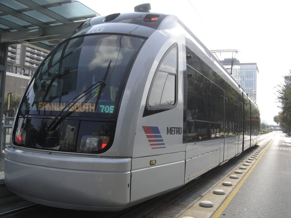
    A METRORail train in downtown Houston
    The METRORail Red Line, which links downtown, the Museum District, the Medical Center and NRG Park (Photo: Zereshk via Wikimedia Commons, CC BY 3.0)

    Houston’s transit, explained

    METRO, the Metropolitan Transit Authority of Harris County, runs the light rail, the bus network and the commuter park-and-ride buses. It is cheap and, along its core routes, frequent and dependable; its limitation is coverage, because the rail network is short for a city this size.

    METRORail

    Three lines. The Red Line is the one that matters most: it runs north to south from the Northline area through downtown along Main Street, then through Midtown, the Museum District (with stops by the Museum of Fine Arts and the Museum of Natural Science), Hermann Park and Rice University, the Texas Medical Center, and NRG Park, home of the Texans and the rodeo. Trains run frequently from early morning until around midnight. The Green Line runs east from downtown through EaDo, past Shell Energy Stadium, into the historic East End, and the Purple Line runs southeast through the Third Ward, past Texas Southern University and the University of Houston. Both share tracks through downtown and connect with the Red Line there. Rail is proof-of-payment: you pay at the platform machine or tap your fare card on the validator before boarding, and inspectors check tickets on board.

    Buses

    The bus network was redesigned around a grid of frequent routes, many of which run every 15 minutes or better throughout the day, seven days a week, and it reaches Montrose, the Heights, the Galleria, Chinatown and the airports. In Uptown, the METRORapid Silver Line runs bus rapid transit in dedicated lanes along Post Oak Boulevard past the Galleria. Outside the frequent network, some routes run only every half hour or hourly, especially in the evening; check times before relying on one.

    Fares and tickets

    METRO charges a flat local fare on buses and trains, among the lowest of any major American system, and it includes free transfers in any direction for three hours. Pay with a reloadable METRO Q fare card, through the METRO Q Mobile Ticketing app, or with exact cash on buses; check METRO’s site for current fares, day-pass options and whether tapping a bank card is accepted when you travel. Riders aged 70 and over ride free, and seniors, students and riders with disabilities qualify for reduced fares.

    Accessibility

    All rail stations are level-boarding and all buses are low-floor and accessible, and METROLift provides paratransit for riders who qualify.

    Beyond METRO

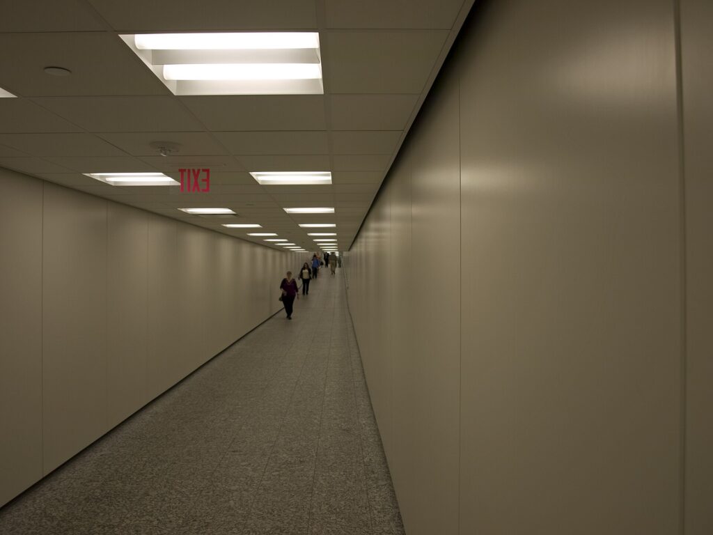
    • Walking and the tunnels. Downtown, Midtown, Montrose, the Museum District and the Heights are walkable in themselves, and downtown’s tunnel network, roughly six miles of air-conditioned passages under the office towers, is a lifesaver in summer. Note that the tunnels are open on weekdays during business hours only.
    • Bikes and the bayou trails. Houston BCycle, the city’s bike share, has stations downtown and in the inner neighborhoods, and a long and growing network of hike-and-bike trails follows Buffalo Bayou and the other bayous. In summer, ride early or late.
    • Taxis and ride-hail. Uber, Lyft and licensed taxis operate across the city.
    • Space Center Houston and Galveston. Neither is practical by public transit for a visitor. Ride-hail works for the Space Center, and organized tours run to both. On the island, Galveston’s restored trolley and local buses help once you are there.
    • Intercity travel. Amtrak’s Sunset Limited stops in Houston a few times a week on its route between New Orleans and Los Angeles, and intercity buses connect Houston with Dallas, Austin and San Antonio many times a day, a reasonable alternative to a one-way rental for solo travelers.
    A shopping and food plaza in the downtown Houston pedestrian tunnel system
    Downtown's air-conditioned tunnel network, open on weekdays, and the best way to cross the core in August (Photo: Ymblanter via Wikimedia Commons, CC BY-SA 3.0)

    Driving in Houston: what it is really like

    Houston’s freeways are enormous, including stretches of the Katy Freeway (I-10) among the widest in the world, and drivers move fast. The frustrations are specific. Rush hour, roughly 6 to 9 in the morning and 3:30 to 7 in the evening, jams every radial freeway and the 610 Loop, especially the West Loop by the Galleria and I-45 north of downtown. Construction is permanent somewhere, and a years-long rebuild of I-45 and the freeways around downtown is under way. And Texas frontage roads, the one-way service roads that run beside most freeways, take getting used to: exits come early, businesses sit on the frontage road rather than the freeway, and many interchanges have “Texas U-turn” lanes that let you reverse direction without a traffic light. Houston’s freeways have a reputation for serious crashes, so leave space and drive defensively. Houston TranStar publishes live traffic speeds, incidents and flood-prone roadways.

    The interchange of Interstate 10 and US-59 near downtown Houston
    The I-10 and US-59 interchange near downtown, where two of the radial freeways that shape Houston traffic meet (Photo: Ken Lund via Wikimedia Commons, CC BY-SA 2.0)

    Tolls

    Houston has an extensive network of toll roads, including the Sam Houston Tollway, the Hardy Toll Road to IAH, the Westpark Tollway and parts of the Grand Parkway, and most of them are fully cashless. Tolls are collected by transponder, the local EZ TAG issued by the Harris County Toll Road Authority, which also works with the Texas TxTag and Dallas TollTag, or by a bill mailed to the plate owner. With a rental car, that owner is the rental company, which will pass the tolls on with a daily or per-use fee. Ask at the counter how its toll program works; for a short stay, setting your navigation app to avoid tolls is often cheaper.

    Parking

    Downtown has plenty of garages and surface lots, priced highest on weekdays and during games and concerts, and metered street parking paid by machine or through the city’s ParkHouston app; read the posted hours on each meter. Hotels downtown and in the Galleria charge a nightly fee, often valet-only. Valet is common at restaurants across the city, and malls generally offer free self-parking. Space Center Houston charges for parking, and Galveston charges for parking along much of the seawall.

    Rules and conditions worth knowing

    • Flooding. Heavy rain can flood underpasses and low roads within minutes. Never drive into water on the road; the National Weather Service’s advice is “turn around, don’t drown”. The NWS Houston/Galveston office issues flash-flood warnings.
    • Hurricanes. From June to November, a tropical storm can close roads and trigger evacuations along the coast. If one is forecast, follow official guidance and do not head for Galveston.
    • Heat. A parked car becomes dangerously hot within minutes in summer; never leave children or pets inside, even briefly, and use a sunshade.
    • Speed limits are typically 60 to 65 mph on urban freeways and up to 75 mph on rural interstates, and frontage roads are often 45 to 55 mph.
    • Right turns on red are permitted after a full stop unless signed otherwise.
    • Texting while driving is illegal statewide, and handheld phone use is banned in school zones.
    • Move over or slow down for stopped emergency, tow and highway maintenance vehicles with flashing lights; it is the law in Texas.
    • Red-light cameras were banned in Texas in 2019, but police patrol the freeways heavily.

    When renting a car makes sense

    • Space Center Houston. It is 40 kilometers (25 miles) southeast, with no rail link; a car also lets you add the Kemah Boardwalk or Galveston the same day.
    • Galveston. An hour down I-45, with beaches, the Strand and the cruise terminals, and far easier with your own wheels.
    • Chinatown, Hillcroft and the suburbs. The best international food is spread along miles of suburban boulevards.
    • Business outside the core. The Energy Corridor, the Westchase district, The Woodlands and the port are all car commutes.
    • Family visits. Most Houstonians live beyond the Loop, and a car earns its keep daily.
    • Texas road trips. Dallas is about four hours north, Austin about three hours west and San Antonio a little farther; our Dallas to Houston route guide covers the most popular drive.

    If any of those apply, our rental car booking tips cover insurance, deposits and the questions to ask at the counter, and our family car rental guide looks at vehicle choice.
    When it does not

    • You are staying downtown, in Midtown, in the Museum District or near the Medical Center, and your plans are along the Red Line.
    • You are in town for a convention, a medical appointment in the Medical Center, or a Texans game or the rodeo at NRG Park, all of which are on the train.
    • You are visiting for a short city break and happy to use ride-hail for Montrose and the Heights.
    • You are traveling solo, and the rental, tolls, insurance and hotel parking add up to more than a handful of ride-hail trips.

    The hybrid plan for a city-plus-coast trip

    Go car-free for the city days and rent for the Space Center and Galveston, and think about where you pick up. If you fly into Hobby and are heading straight for the coast, renting at the airport makes sense: you are already on the south side, and the Space Center and Galveston are down I-45 without crossing the city. If you are spending the first nights in the Museum District or downtown, take a taxi or ride-hail in, use the Red Line for a few days, and rent from a city location for the days you need a car, which avoids the airport concession fees and several nights of hotel parking. If you are combining Houston with Dallas, a one-way rental between the two is usually available, though it may carry a drop fee; read our Dallas car-versus-transit guide for that end of the trip. Compare the day rates on our Houston car rental page against a full-trip rental and the difference is usually obvious.

    A worked cost comparison

    Numbers change with the season and the booking window, so treat this as a method rather than a quote, and check current rates before deciding. For a four-night city break in the Museum District for two people, the car-free version costs two ride-hail trips to and from the airport, a handful of METRO fares, and perhaps four short ride-hail trips to Montrose, the Heights and back; the rental version adds four days of a car, hotel parking, tolls and fees, fuel and airport concession charges. The car-free option wins easily. For the same four nights with a day at Space Center Houston and a day in Galveston, the car-free version adds two long ride-hail round trips or two tour tickets per person; the hybrid version adds a two-day rental from a city location, fuel, a little in tolls and parking at the Space Center and on the island. For two people the hybrid usually comes out ahead, and for a family of four it is clearly cheaper and far more flexible. For a week visiting family in the suburbs, or a business trip to the Energy Corridor, a rental for the whole stay is the only practical answer. Run the rental rates for your dates on our Houston car rental page and put them beside the ride-hail estimates before you choose.

    Driving to Galveston, Dallas and beyond in each season

    The two drives most visitors make are south to the coast and north to Dallas. Galveston is about an hour down I-45, past the NASA turnoff and across the causeway onto the island. Dallas is about 385 kilometers (240 miles) north on I-45, three and a half to four hours without traffic, past the Sam Houston statue at Huntsville and the giant Buc-ee’s travel center at Madisonville. In summer, the challenge is heat and weekend traffic: southbound to Galveston on Saturday mornings and northbound on Sunday afternoons, the freeway crawls, so leave early, and keep the tank well above a quarter on the long Dallas run. Summer is also hurricane season, and if a storm is approaching, the coast is the place not to be; watch the forecast and the DriveTexas road-conditions map. In fall, the weather is ideal and the coast is quieter after Labor Day, though football weekends fill the highways. In winter, the roads are usually clear, sea fog can settle over the causeway and the coast, and on the rare days of ice, when bridges and overpasses freeze first, the right call is to wait a day. In spring, thunderstorms bring blinding rain and street flooding, and a slow drive is a safe one. In every season, crossing Houston itself is usually the slowest part of the trip.

    Decision table

    Your tripRecommendationWhy
    City break in the Museum District, downtown or MidtownNo carThe Red Line links the main sights; hotel parking and tolls add up
    Convention, Medical Center visit or game at NRGNo carAll are on the Red Line, and event parking is expensive
    City plus Space Center Houston and GalvestonHybrid: rent for the coast daysCar-free city days, car for the southeast
    Flying into Hobby for the coastRent at the airportHobby is already on the south side, on the way to both
    Staying in Montrose or the HeightsNo car, or a short rentalWalkable neighborhoods; ride-hail fills the gaps
    Family visit to the suburbsRent for the whole staySuburban distances make the car worthwhile daily
    Business in the Energy Corridor or The WoodlandsRent at IAHBoth are freeway commutes far from the rail line
    Texas road tripRent (consider one-way to Dallas)Houston is the start, not the destination

    Money-saving tips for both options

    • On transit: use the free three-hour transfer window to link trains and buses on one fare, and pick a hotel within walking distance of a Red Line station.
    • On a rental: compare airport and city pickup, understand the toll program before you drive away, set your navigation to avoid tolls on short hops, decline extras you already have through a credit card or home policy (check first), and book early for rodeo season.
    • On the hotel: if you are renting, price the parking fee into the room rate, and look for hotels with free self-parking outside downtown.
    • On timing: avoid the freeways in the weekday peaks and I-45 to Galveston on summer Saturday mornings; the best time to fly to Houston guide lists the busiest weeks.
    • On the airport run: for two or more people, a taxi’s fixed zone fare or a ride-hail from Hobby is cheap; from IAH, compare it with the bus if you are traveling light.

    Frequently asked questions

    Is it worth renting a car in Houston?

    For Space Center Houston, Galveston, the suburbs or a road trip, yes. For a stay along the Red Line in the Museum District, downtown or Midtown, usually not.

    Is Houston public transit good for tourists?

    Good along the Red Line, which links downtown, the Museum District, Hermann Park, the Medical Center and NRG Park, and very cheap. Beyond that corridor, you will rely on buses, ride-hail or a car.

    How do I get from IAH to downtown Houston?

    A taxi at a fixed zone fare or a ride-hail in 30 to 45 minutes without traffic, or METRO’s local bus in about an hour for the standard fare.

    Can I get to Space Center Houston without a car?

    Yes, by ride-hail or on an organized tour, but there is no practical public transit option. With a car, you can add Kemah or Galveston the same day.

    Do I need an EZ TAG to drive in Houston?

    Not necessarily. Many toll roads are cashless, so a rental car’s toll program or a bill by mail will cover you, usually with a fee. Ask at the counter, or set your navigation to avoid tolls.

    Is driving in Houston difficult?

    The freeways are big, fast and busy, and rush hour is slow, but the roads are wide and well signed. Leave space, learn the frontage-road system, and never drive into floodwater.

    Is parking expensive in Houston?

    Downtown and hotel parking can be, especially on event nights. Malls generally offer free self-parking, and outside the core it is rarely a problem.

    Whichever way you go, start with the flight. Compare cheap flights to Houston, choose a neighborhood with our Houston hotel search, and if Space Center Houston or Galveston is on the list, price the rental for those dates on our Houston car rental page.

  • San Francisco: Should You Rent a Car or Rely on Public Transit?

    San Francisco: Should You Rent a Car or Rely on Public Transit?

    San Francisco is one of the few American cities where the honest answer to “should I rent a car?” is, for most visitors, no. The city is small, about 11 km (7 miles) across, dense and walkable, and its transit network, a mix of buses, light rail, historic streetcars, cable cars, BART and ferries, reaches nearly every sight a visitor wants to see. Driving, by contrast, means steep hills, one-way grids, expensive and scarce parking, bridge tolls and, at the tourist viewpoints, a well-documented problem with car break-ins. But the Bay Area is much bigger than the city, and the places that draw many visitors beyond it, the redwoods at Muir Woods, the wine country of Napa and Sonoma, the Monterey coast and Big Sur, Yosemite and the long drive south to Los Angeles, are far easier with a car. This guide explains how the city is laid out, how transit and fares work, what driving and parking are really like, when a car earns its keep, and gives you a straightforward way to decide.

    The short answer

    Skip the car for the days you spend in San Francisco itself. If your plans are the Golden Gate Bridge, Alcatraz, Fisherman’s Wharf, Chinatown, North Beach, Golden Gate Park and the Mission, Muni, the cable cars, BART and your own feet will cover them, and you will save the nightly hotel parking fee and the worry of leaving a car on the street. Rent a car for the days you leave the city: wine country, the coast, Point Reyes, Monterey and Big Sur, Yosemite, or a one-way drive to Los Angeles. Rent for the whole stay only if you are staying with family in the suburbs, working in Silicon Valley, or traveling with small children and a lot of gear to places transit does not reach. For most visitors, the right plan is a car-free city stay followed by a rental on the day you leave town. Compare rental rates for any of these plans on our San Francisco car rental page.

    How San Francisco is laid out

    San Francisco occupies the tip of a peninsula, with the Pacific on the west, the bay on the north and east, and the Golden Gate Bridge leading north to Marin County. Market Street is the main diagonal spine, running from the Ferry Building on the waterfront southwest toward Twin Peaks, and most transit runs along or under it. North of Market are the Financial District, Union Square, Chinatown, Nob Hill, North Beach and, on the northern waterfront, Fisherman’s Wharf and the Marina; south of Market are SoMa, the convention center, the ballpark, Mission Bay, and then the Mission and the Castro. The western half of the city, the Richmond and the Sunset, is a grid of residential streets that runs out to Ocean Beach, with Golden Gate Park between them and the Presidio at the northern end. The eastern half is compact enough to walk, if you accept the hills; the western half is best reached by Muni.

    Hotels cluster around Union Square, in the Financial District and SoMa, along the Embarcadero, and at Fisherman’s Wharf, with smaller properties in Nob Hill, North Beach and the Marina. Our San Francisco hotel search lets you compare them, and it is worth checking each hotel’s parking fee if you do plan to drive, because it can add a large sum to every night of the stay.

    Getting in from the airport

    San Francisco International (SFO) is about 21 km (13 miles) south of downtown, in San Mateo County. BART runs from its own station at the International Terminal straight to the downtown stations under Market Street in about 30 minutes, for a distance-based fare that includes an airport surcharge; it is usually the fastest option at rush hour. The free AirTrain links all the terminals, the BART station and the rental car center, where every major company has its counters. Taxis and ride-hail pick up from designated zones on the arrivals level, and the drive downtown on US-101 takes 25 to 45 minutes depending on traffic. If you are flying into Oakland (OAK) instead, a BART connector links the airport to the main network. Check the airport’s site for current ground-transport details; our SFO airport guide covers the layout.

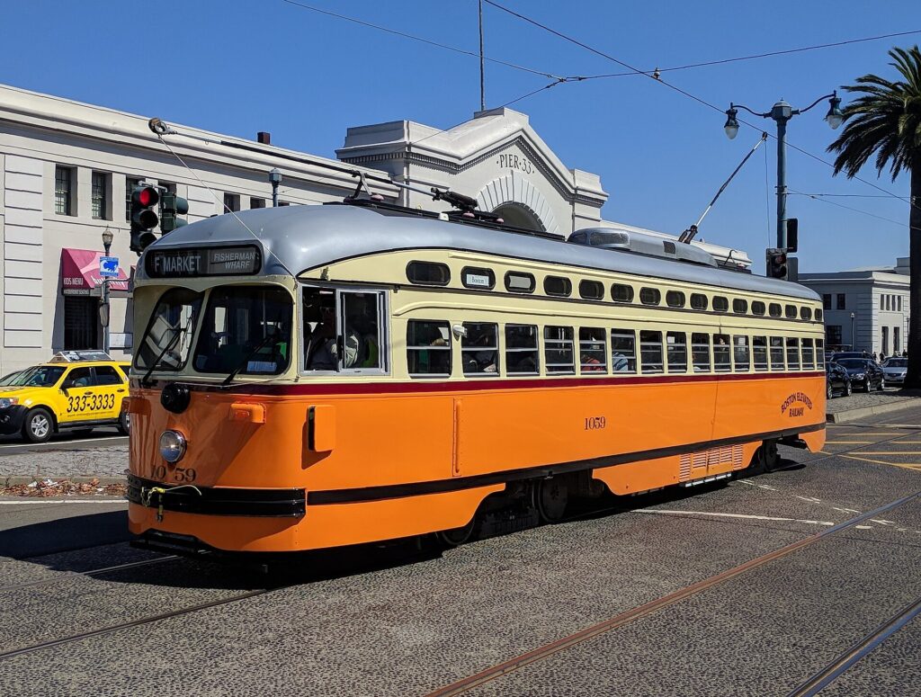
    A historic F-line streetcar running along the Embarcadero in San Francisco
    The F line: historic streetcars from the Castro to Fisherman's Wharf, for the standard Muni fare (Photo: Grendelkhan via Wikimedia Commons, CC BY-SA 4.0)

    San Francisco’s transit, explained

    Transit in San Francisco is a patchwork of agencies that works better than its reputation. Within the city, Muni, run by SFMTA, operates the buses, the light rail, the historic streetcars and the cable cars. BART is the regional rapid-transit system connecting the city to the airport and the East Bay, Caltrain runs down the peninsula to Silicon Valley, and several ferry operators cross the bay. One card, Clipper, works across all of them.

    Muni buses and light rail

    Muni’s buses and electric trolleybuses cover virtually every street in the city, and the busiest routes, such as the 38R on Geary to the Richmond and the 14R on Mission Street, run every few minutes. Muni Metro light rail runs underground beneath Market Street, sharing four downtown stations with BART (Embarcadero, Montgomery, Powell and Civic Center), and then fans out to the Castro, the Sunset, Ocean Beach and the ballpark. The Central Subway, which opened in 2022, extends the T line under Union Square to Chinatown. Several routes run all night on an owl schedule.

    Historic streetcars

    The F line runs restored streetcars from cities around the world along Market Street from the Castro to the Ferry Building, and then along the Embarcadero to Fisherman’s Wharf. It is a practical way to reach the Wharf and a sightseeing ride in itself, and it charges the standard Muni fare.

    Cable cars

    Three lines survive: the Powell-Hyde and Powell-Mason lines from Union Square over Nob Hill to the Wharf area, and the California Street line from the Financial District over Nob Hill. They are genuine public transit, but slow, with a separate, higher single fare that does not include transfers; most visitors ride them once or twice for the experience, which the Visitor Passport covers.

    BART and Caltrain

    BART is the fastest way to the airport, the Mission (16th Street and 24th Street stations), Oakland and Berkeley, but it runs only along the Market Street and Mission corridor within the city and does not serve the Wharf, the Presidio or Golden Gate Park. Caltrain, whose electrified trains leave from Fourth and King streets near the ballpark, runs down the peninsula to Palo Alto and San José.

    Fares and tickets

    Use a Clipper card, which you can buy at stations or add to the wallet on your phone, or the MuniMobile app for Muni tickets. A Muni fare includes transfers to other Muni buses and trains for a set period, generally two hours; the cable cars are priced separately. The Muni Visitor Passport, sold for one, three or seven consecutive days, covers unlimited rides on buses, light rail, streetcars and cable cars, and is the best deal for most sightseers. BART and Caltrain charge by distance. Children and teenagers have ridden Muni free under the city’s youth program; check SFMTA’s site for current fares and rules before you go.

    Accessibility

    Muni buses are low-floor or lift-equipped, the underground Muni Metro and BART stations have elevators, and Muni’s accessible-services pages describe the stops that work for wheelchairs. The cable cars and the steepest hills are the exception; for those, the buses that run parallel routes are the accessible alternative.

    Beyond Muni and BART

    • Walking. The northeastern quarter of the city, from the Ferry Building through Chinatown and North Beach to the Wharf, is walkable in an afternoon. The hills are real, so plan routes that go around them, or take the cable car up and walk down.
    • Ferries. Golden Gate Ferry runs from the Ferry Building to Sausalito and Larkspur, San Francisco Bay Ferry to Oakland, Alameda and Vallejo, and other operators from Pier 41 to Sausalito and Tiburon. The ferry to Sausalito is the easiest way to see the bay, the bridge and Alcatraz from the water. The Alcatraz boat leaves from Pier 33.
    • Bikes and scooters. Bay Wheels bike share, including e-bikes, has docks across the eastern half of the city. The flat waterfront from the Ferry Building to the Golden Gate Bridge, the car-free stretch of Golden Gate Park and the ride across the bridge to Sausalito are excellent; the hills elsewhere are best left to e-bikes.
    • Taxis, ride-hail and robotaxis. Uber, Lyft and licensed taxis operate everywhere, and driverless Waymo cars run as a ride-hail service across the city, which many visitors try once for the novelty. For a group of three or four, a short ride is competitive with transit fares.
    • Regional buses. Golden Gate Transit buses cross the bridge to Marin, and on busy weekends a seasonal shuttle serves Muir Woods, where reservations are required for parking and the shuttle; the park’s site explains the system.
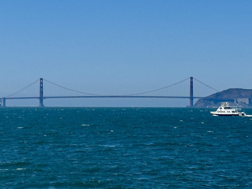
    The Golden Gate Bridge seen from a ferry on San Francisco Bay
    The bay from a ferry deck, the easiest car-free way to Sausalito (Photo: Missvain via Wikimedia Commons, CC0)

    Driving in San Francisco: what it is really like

    Driving in San Francisco is manageable but rarely pleasant for visitors. The hills are the first surprise: some streets are steep enough that you cannot see the road ahead as you crest them, and stopping and starting on a slope at a four-way stop takes concentration. The grid is full of one-way streets, turn restrictions and transit-only lanes painted red, which private cars may not use except to turn at the next corner, and cameras enforce them. Cable car tracks and streetcar rails run down the middle of several streets, and cable cars have the right of way. Pedestrians and cyclists are everywhere and expect drivers to yield. Traffic is heaviest on the approaches to the Bay Bridge, on US-101 where it runs through the city on Van Ness Avenue and Lombard Street, and on Nineteenth Avenue through the Sunset, which is the route between the Golden Gate Bridge and the southern freeways.

    Parking and break-ins

    Parking is the bigger issue. Street parking in the busy neighborhoods is scarce, meters are demand-priced and cost more at busy times, residential areas limit non-permit holders to a couple of hours, and weekly street-cleaning hours are strictly ticketed. Many major streets become tow-away zones during rush hours, and curb colors carry rules of their own: red for no stopping, yellow for commercial loading, white for passenger drop-off, green for short-term parking and blue for disabled permits. City and private garages downtown and at the Wharf are the reliable option, and hotels charge a substantial nightly fee for valet or self-parking. Then there are the break-ins. Vehicle break-ins have long been a well-known problem in San Francisco, and although reported numbers have fallen from their peak, rental cars parked at tourist stops, such as the Golden Gate Bridge viewpoints, the Palace of Fine Arts, Alamo Square, Twin Peaks and Fisherman’s Wharf, remain frequent targets. The practical precautions are simple: leave nothing in the car at all, not even a jacket or an empty bag; do not move luggage into the trunk in the parking lot, where it can be seen; park in a staffed garage where you can; and never leave bags in the car overnight. Many visitors plan their day so that the car goes straight from the hotel garage to the highway with the luggage and comes back empty.

    The hairpin bends of Lombard Street on Russian Hill
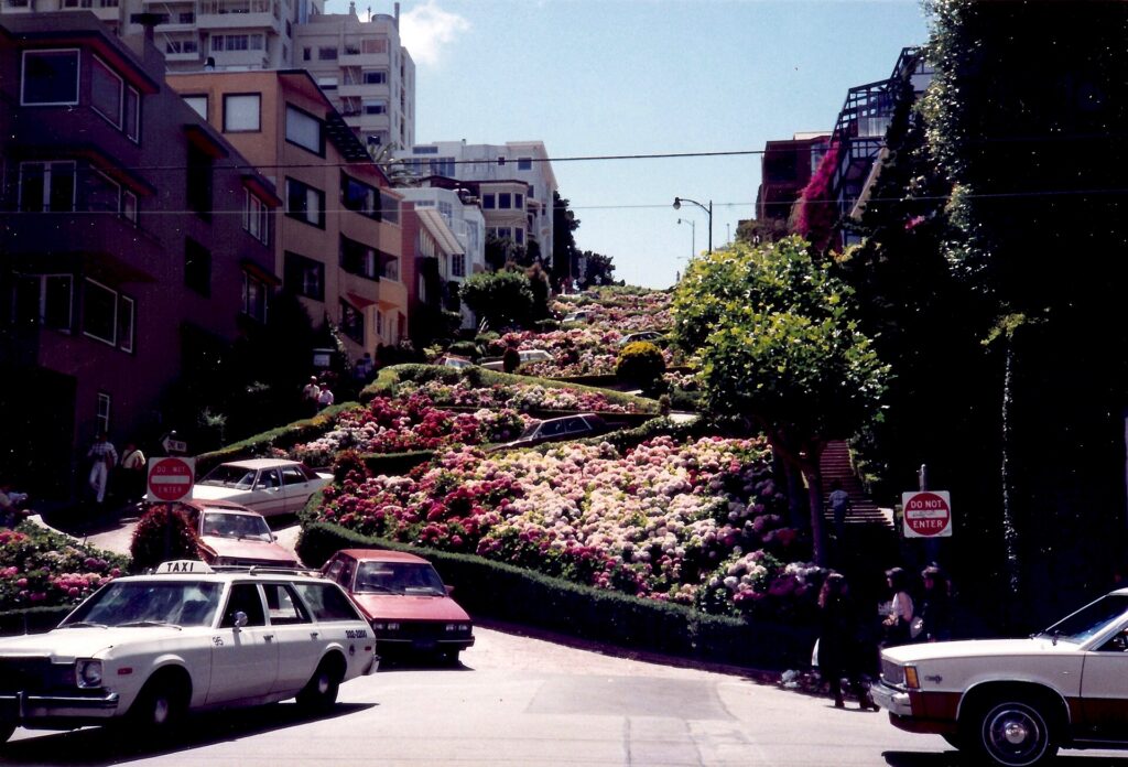
    Lombard Street: a reminder that San Francisco's hills make driving harder than the map suggests (Photo: Infrogmation via Wikimedia Commons, CC BY-SA 4.0)

    Rules and conditions worth knowing

    • Curb your wheels on hills. City law requires it on steep grades: turn the front wheels toward the curb when facing downhill and away from it when facing uphill, and set the parking brake. Parking enforcement does ticket this.
    • Bridge tolls. The Golden Gate Bridge charges a toll southbound, into the city, and the Bay Bridge charges westbound, into the city; both are cashless. Rental companies usually enroll the car in a toll program that adds a service fee, and the Golden Gate Bridge allows a one-time payment online after crossing; ask at the counter which applies.
    • Transit lanes. Red-painted lanes are for Muni and taxis; driving in them outside a turn brings a camera ticket to the rental company, which will pass it on with a fee.
    • Right turns on red are permitted after a full stop unless signed otherwise, and California requires hands-free use of phones while driving.
    • Fuel in California is among the most expensive in the country, so factor it into any long drive.
    • Road conditions. 511.org covers Bay Area traffic and transit, and Caltrans publishes highway closures, including Highway 1 through Big Sur and the mountain roads to Yosemite.

    When renting a car makes sense

    • Wine country. Napa and Sonoma are an hour to ninety minutes north, and the wineries are spread out; a car works if someone in the group is not drinking, and a tour is the alternative.
    • The coast and Point Reyes. Point Reyes National Seashore, the coast road north through Marin, and Half Moon Bay to the south are car trips.
    • Monterey, Carmel and Big Sur, two to three hours south, are best explored by car, with stops along the way.
    • Yosemite, about four hours east, needs a car and ideally a night or two.
    • Silicon Valley and the suburbs. If you are working in the South Bay or visiting family across the Bay Area, the distances make a car worthwhile daily.
    • California road trips. The drive south to Los Angeles is a classic; our San Francisco to Los Angeles route guide covers the options, and our Los Angeles car-versus-transit guide explains why the car question flips once you get there.

    If any of those apply, our rental car booking tips cover insurance, deposits and the questions to ask at the counter, and our family car rental guide looks at vehicle choice.
    When it does not

    • You are staying in the city and your plans are the bridge, Alcatraz, the Wharf, the museums and the neighborhoods.
    • You are in town for a conference at Moscone Center, a Giants or Warriors game, or a festival, when parking is at its worst and transit stops at the door.
    • You want Sausalito or Muir Woods for a day, which a ferry, a bike or a tour covers.
    • Your hotel charges a large nightly parking fee and the car would sit in the garage most of the stay.

    The hybrid plan for a city-plus-day-trips visit

    Go car-free for the city days and rent only for the days you leave town, and think carefully about where you pick up. Collecting a car at the SFO rental car center makes sense if you are heading straight out of town on arrival, south to Monterey or east to Yosemite, because the freeways are right there and you never enter city traffic. Renting from one of the downtown or Fisherman’s Wharf offices makes sense if you are spending your first nights in the city, because you avoid paying for a car, and hotel parking, on the nights you are not using it. A pattern that works well: BART into the city, three car-free days, pick up a rental in the city on the morning you leave, spend a day in wine country or on the coast, and either return the car at the airport on the way to your flight or keep driving south to Los Angeles on a one-way rental. On the day you pick up, check out of the hotel with your bags already in the car, and keep them out of sight. Compare the day rates on our San Francisco car rental page against a full-trip rental, and the difference is usually obvious.

    A worked cost comparison

    Numbers change with the season and the booking window, so treat this as a method rather than a quote, and check current rates before deciding. For a four-night city stay for two people, the car-free version costs a return BART trip from the airport for two, two three-day Visitor Passports, and perhaps a couple of ride-hail trips at night; the rental version adds four days of a compact car, four nights of hotel parking at city rates, fuel, bridge tolls and garage fees at the sights, and buys you very little you could not reach by transit. The transit option wins easily. For the same four nights with a day in wine country, the car-free version adds a guided wine tour for two; the hybrid version adds a one-day rental from a city office, fuel and a Golden Gate Bridge toll. For a couple, the costs are often similar, and the choice comes down to whether anyone wants to stay sober enough to drive; for a family of four, the rental usually wins. For a week that ends with a drive down the coast to Los Angeles, a one-way rental picked up on the last city morning is the only practical answer, and a one-way drop fee is usually cheaper than the extra days and parking of a car collected at the airport on arrival. Run the rental rates for your dates on our San Francisco car rental page and put them beside the transit and tour costs before you choose.

    Driving south to Monterey, Big Sur and Los Angeles in each season

    The drive south from San Francisco is one of the great road trips in the country, and the route you choose matters more than the season. The fastest way to Los Angeles is Interstate 5 through the Central Valley, about six hours without stops; US-101 through Salinas, Paso Robles and Santa Barbara takes an hour or so longer and is far more scenic; and Highway 1 along the coast through Big Sur is an all-day drive, or better, two days with a night in Monterey or Big Sur. In summer, the coast is often foggy in the mornings, the Big Sur pullouts are crowded, and the Central Valley on Interstate 5 is very hot; start early. In fall, the fog lifts, the light is golden and the traffic thins after Labor Day, which makes September and October the best months for the coast road. In winter, the storms that bring San Francisco its rain can trigger landslides that close sections of Highway 1 through Big Sur, sometimes for months, so check Caltrans before you set off and have US-101 as the fallback; the Grapevine on Interstate 5 north of Los Angeles is occasionally closed by snow. In spring, the hills are green, the wildflowers are out and the coast is at its most dramatic, though some Highway 1 repairs may still be under way. If Yosemite is on the list, note that Tioga Road through the high country closes for the winter, usually from November until late spring, and chains may be required on the park roads in snow. Whichever route you take, our San Francisco to Los Angeles route guide covers the drive, and our Los Angeles first-timer’s guide covers what to do when you arrive.

    Highway 1 and Bixby Creek Bridge on the Big Sur coast
    Highway 1 at Bixby Bridge, the reason to rent a car on the way south to Los Angeles (Photo: Daniel Hartwig from San Jose, CA, USA via Wikimedia Commons, CC BY 2.0)

    Decision table

    Your tripRecommendationWhy
    City break, couple or soloNo carMuni, the cable cars, BART and walking cover the sights; parking is costly and break-ins are common
    Conference at Moscone CenterNo carBART and Muni stop nearby; downtown parking is scarce and expensive
    City plus Sausalito or Muir WoodsNo car: ferry, bike or tourThe ferry and the Muir Woods shuttle or a tour cover both
    City plus a day in wine countryHybrid: one-day rental from a city office, or a tourCar-free city days; a designated driver or a guide for Napa and Sonoma
    Monterey, Big Sur or YosemiteRent for those daysLong drives with spread-out stops
    Family visit to the suburbs or Silicon ValleyRent for the whole staySuburban distances make the car worthwhile daily
    Family with small children and gearCar-free in the city, rent for day tripsTransit and taxis work in the city; a car helps beyond it
    California road tripRent one-way to Los AngelesSan Francisco is the start, not the destination

    Money-saving tips for both options

    • On transit: buy a Visitor Passport if you will ride the cable cars more than once; use Clipper for BART and the ferries; walk downhill and ride uphill.
    • On a rental: rent only for the days you leave the city, compare airport and city pickup, decline extras you already have through a credit card or home policy (check first), and ask how the rental company handles bridge tolls before you drive onto the Golden Gate Bridge.
    • On parking: compare a garage near your hotel with the hotel’s own fee, and never leave anything in the car.
    • On timing: avoid the Bay Bridge and US-101 at rush hour, and leave for wine country or the coast early on weekends; the best time to fly to San Francisco guide lists the busiest weekends.
    • On day trips: for one or two people, a ferry to Sausalito or a guided tour to Muir Woods or wine country often costs less than a rental plus parking, fuel and tolls.

    Frequently asked questions

    Is it worth renting a car in San Francisco?

    Not for the city itself; transit, walking and the occasional ride-hail are cheaper and easier. Rent only for day trips or a road trip beyond the city.

    Is San Francisco public transit good for tourists?

    Yes. Muni buses, light rail, streetcars and cable cars reach almost every sight, BART connects the airport and the East Bay, and one Clipper card or Visitor Passport covers it all.

    How do I get from SFO to downtown San Francisco?

    BART from the International Terminal in about 30 minutes, or a taxi or ride-hail in 25 to 45 minutes depending on traffic.

    Is it safe to leave a car parked in San Francisco?

    Vehicle break-ins are common, especially at tourist spots. Leave nothing in the car, including in the trunk, and use a staffed garage where you can.

    How do I pay the Golden Gate Bridge toll in a rental car?

    The toll is charged southbound and is cashless. Most rental companies bill it through a toll program with a service fee; the bridge also accepts a one-time online payment after crossing. Ask at the counter.

    Can I get to Muir Woods without a car?

    Yes, by guided tour or by the seasonal shuttle, and reservations are required for the shuttle and for parking.

    Is it hard to drive in San Francisco?

    The hills, one-way streets, transit lanes and parking rules take concentration, and parking is scarce and expensive. It is manageable, but most visitors find it is not worth the stress.

    Whichever way you go, start with the flight. Compare cheap flights to San Francisco, choose a neighborhood with our San Francisco hotel search, and if wine country or the coast is on the list, price the rental for those days on our San Francisco car rental page. For what to see once you are there, start with our first-timer’s guide to San Francisco.

  • Washington, DC: Should You Rent a Car or Rely on Metro?

    Washington, DC: Should You Rent a Car or Rely on Metro?

    Washington, DC is one of the few American cities where a visitor can leave the car at home without a second thought. The Metro was built in the 1970s to move federal workers between the suburbs and the monuments, and it still does exactly that: nearly every sight on a first-timer’s list, from the Capitol to Arlington National Cemetery, is within a short walk of a station, and two of the region’s three airports are on the system. Driving, by contrast, means some of the heaviest traffic in the country, traffic circles that confuse even locals, a dense network of speed and red-light cameras, streets that close for motorcades without warning, and hotel parking that can cost as much as a modest dinner every night. But the car still has a job here. Mount Vernon, Shenandoah, Harpers Ferry, Gettysburg and the Chesapeake are all day trips, and the suburbs of Maryland and Virginia sprawl far beyond the rail lines. This guide explains how the city is laid out, how the Metro, buses and bikes work, what driving is really like, and gives you a straightforward way to decide.

    The short answer

    Skip the car for a city visit, which is what most first trips to Washington are: the Metro, your feet, Capital Bikeshare and the occasional taxi will cover the Mall, the museums, Capitol Hill, Dupont Circle, Georgetown, the Wharf and Arlington, and you will save the parking and the stress. Rent a car only for the days you leave the city, for Mount Vernon, Shenandoah National Park, Harpers Ferry, Gettysburg, Annapolis or the Delaware beaches, or if you are visiting family in the outer suburbs, traveling with small children and a lot of gear, or making Washington one stop on an East Coast road trip. For most visitors, the right answer is a car-free city stay plus a one- or two-day rental. Compare rental rates for those days on our Washington, DC car rental page.

    How Washington is laid out

    Washington was planned, and the plan helps. The city is divided into four quadrants (NW, NE, SW and SE) that meet at the Capitol, and every address carries its quadrant, so 700 G Street NW and 700 G Street SE are in different parts of town. Numbered streets run north-south, lettered streets run east-west (there is no J Street), and broad diagonal avenues named after the states cut across the grid, meeting at traffic circles and squares such as Dupont, Logan and Thomas circles. The National Mall runs west from the Capitol to the Lincoln Memorial along the Potomac; downtown and Penn Quarter lie just north of it, Capitol Hill east of it, and the Wharf and Navy Yard along the rivers to the south. Northwest Washington, where most visitors spend their evenings, holds Dupont Circle, Logan Circle, U Street, Adams Morgan and Georgetown. Across the Potomac, Arlington and Alexandria in Virginia are effectively part of the city, and the Capital Beltway, I-495, rings the whole region about 15 to 20 km out from the center.

    Hotels cluster downtown and in Penn Quarter, around Dupont Circle, in Georgetown and Foggy Bottom, on Capitol Hill, at the Wharf and Navy Yard, and across the river in Arlington, Rosslyn and Crystal City, which are usually cheaper and a few Metro stops from the Mall. Our Washington, DC hotel search lets you compare them.

    Getting in from the airports

    Washington has three airports, and the Metro serves two of them directly. From Reagan National (DCA), in Arlington just across the river, the Blue and Yellow lines leave from a station connected to the terminal by walkways, and the ride to the Mall or downtown takes 15 to 25 minutes; a taxi takes about the same outside rush hour. From Dulles (IAD), about 42 km (26 miles) west, the Silver Line leaves from a station linked to the main terminal by a pedestrian walkway, and reaches downtown in around 50 minutes to an hour; a taxi or ride-hail takes 40 minutes in light traffic and much longer at rush hour. From Baltimore/Washington (BWI), a free shuttle bus runs from the terminal to the BWI rail station, where MARC commuter trains and Amtrak run to Union Station in about half an hour to 40 minutes; the drive takes 45 minutes to well over an hour. Every airport has rental companies, and at Dulles and BWI they are reached by shuttle. Unless you are heading straight out of the city, there is no reason to pick up a car on arrival. The Reagan National, Dulles and BWI sites cover current ground transport, and our Reagan National airport guide covers the layout.

    An Orange Line train arriving at Farragut West, one of the Metro's vaulted concrete stations
    The Metro's vaulted stations: six lines, and nearly every sight within a short walk (Photo: Rainclaw7 via Wikimedia Commons, CC BY-SA 4.0)

    Washington’s transit, explained

    The Washington Metropolitan Area Transit Authority, WMATA, runs the Metrorail and Metrobus systems. The Metro is clean, generally reliable and, with its vaulted concrete stations, one of the most distinctive subway systems in the world. Its limitation is that it was designed as a commuter railway, with long lines reaching deep into the suburbs and a few gaps in the city itself.

    Metrorail

    Six color-coded lines, Red, Orange, Blue, Silver, Green and Yellow, serve nearly 100 stations in DC, Maryland and Virginia. The Red Line is a U-shaped line through downtown that reaches Union Station, Dupont Circle and the National Zoo at Woodley Park. The Orange, Blue and Silver lines share a tunnel under the Mall, with stations at the Smithsonian, Federal Triangle, Capitol South and Foggy Bottom, before splitting in Virginia; the Blue Line serves Arlington National Cemetery, the Pentagon and Reagan National, and the Silver Line runs out to Tysons and Dulles. The Green and Yellow lines run north-south through Penn Quarter, with the Green Line reaching Navy Yard for Nationals Park and U Street, and the Yellow Line crossing the Potomac to Reagan National and Old Town Alexandria. The main transfer stations are Metro Center, Gallery Place, L’Enfant Plaza and Fort Totten. The gaps are Georgetown, which never got a station (walk from Foggy Bottom or Dupont Circle), and H Street NE (walk from Union Station). Trains run from early morning until around midnight, later on Friday and Saturday nights; check WMATA for current hours and weekend track work, which can reduce service on individual lines. Stand on the right on the escalators and walk on the left, or you will hear about it.

    Metrobus

    Metrobus covers the areas the trains miss, including Georgetown, Adams Morgan and the neighborhoods off the rail lines, and local systems such as Arlington’s ART, Alexandria’s DASH and Fairfax Connector fill in the suburbs. The Metrobus network was redesigned in 2025, so route names in older guides may no longer apply; use WMATA’s trip planner or a maps app. The DC Circulator buses, which once looped around the Mall, were discontinued at the end of 2024.

    Fares and tickets

    Metrorail fares depend on the distance traveled and the time of day, with higher fares during weekday rush hours and lower fares on weekends and late at night. You pay with a SmarTrip card, sold at station vending machines, or with SmarTrip in your phone’s wallet, and WMATA has been rolling out tap-to-pay with contactless bank cards; check its site for current acceptance. You tap in and, importantly, tap out, because the fare is calculated when you exit. One-day, three-day and seven-day unlimited passes are available and are worth it for heavy sightseeing days. Metrobus charges a flat fare, and transfers between bus and rail within a set window are discounted or free. Up to two children aged four and under ride free with each paying adult.

    Accessibility

    Every Metro station has elevators, and every bus is low-floor and accessible; elevator outages are posted on WMATA’s site, and the system is one of the more accessible in the country.

    Beyond the Metro

    • Walking. The core is flat and compact, and walking between the Mall, Penn Quarter, the White House and Capitol Hill is often faster than taking a train. The distances along the Mall itself are longer than they look.
    • Capital Bikeshare. Capital Bikeshare has hundreds of docking stations across DC, Arlington, Alexandria and the Maryland suburbs, with classic bikes and e-bikes, single rides and day passes. Protected bike lanes run on Pennsylvania Avenue and several downtown streets, and the Mount Vernon Trail, the Capital Crescent Trail and the C&O Canal towpath make for superb rides out of the city. Dockless e-scooters and e-bikes from several operators fill in the rest.
    • Taxis and ride-hail. Uber, Lyft and metered taxis operate everywhere; they are the practical choice for Georgetown late at night or for a group of three or four going a short distance.
    • Water taxis. In the warmer months, a water taxi service links the Wharf, Georgetown, Old Town Alexandria and National Harbor, which is both transport and a scenic ride.
    • Commuter trains and Amtrak. From Union Station, Amtrak reaches Baltimore, Philadelphia, New York and Boston along the Northeast Corridor, and south to Richmond and beyond. MARC trains run to BWI and Baltimore, and on weekdays to Harpers Ferry; Virginia Railway Express runs weekday commuter trains to Fredericksburg and Manassas.
    A Capital Bikeshare station on the National Mall near the Washington Monument
    Capital Bikeshare docks cover DC, Arlington, Alexandria and the Maryland suburbs (Photo: G. Edward Johnson via Wikimedia Commons, CC BY 4.0)

    Driving in Washington: what it is really like

    Washington regularly ranks among the most congested regions in the United States, and the city itself adds a layer of complexity that visitors do not expect. The traffic circles, where several avenues meet with inner and outer lanes and underpasses, are genuinely confusing on a first attempt. Reversible and rush-hour rules change roads by the hour: Rock Creek Parkway runs one way inbound in the morning and outbound in the evening, parking lanes on major arteries become travel lanes at rush hour, and turns that are legal at noon are banned at 5 p.m. Security closures around the White House, the Capitol and embassies, for motorcades, demonstrations and state visits, can shut streets without notice. And the Capital Beltway, I-395 and I-66 are congested for long stretches of every weekday, with the evening rush often starting before 4 p.m.

    Traffic around Dupont Circle in Washington, DC
    Dupont Circle, one of the traffic circles where several avenues meet and visitors lose their way (Photo: Ben Schumin via Wikimedia Commons, CC BY-SA 3.0)

    Parking

    Hotel parking downtown is expensive, usually valet only, and charged per night; commercial garages are cheaper, especially if booked through an app, but still add up over a few days. Street parking is metered in commercial areas, typically Monday to Saturday and into the evening in busy neighborhoods, and paid through the ParkMobile app or the meter; many meters are free on Sundays, but read every sign. Residential streets are largely restricted to two hours for non-residents, and rush-hour no-parking zones are enforced by tow truck, which is the costliest mistake a visitor can make. Around the Mall, the handful of metered spaces fill early, and there is effectively nowhere to park near the most popular museums on a spring weekday. Arlington National Cemetery and Mount Vernon have their own paid lots, and Old Town Alexandria has garages near King Street.

    Rules and conditions worth knowing

    • Cameras. DC has one of the densest networks of automated speed, red-light, stop-sign and bus-lane cameras in the country. Fines follow the car, and the rental company will bill you, with an administrative fee.
    • No turn on red. Right turns on red are prohibited at a large and growing number of DC intersections; obey the signs, which are everywhere.
    • Tolls and express lanes. I-66 inside the Beltway is tolled in the peak direction during rush hours, and the Express Lanes on I-495 and I-95 in Virginia charge dynamic tolls; all require an E-ZPass or the rental company’s toll program. The Dulles Toll Road charges tolls, while the Dulles Access Road beside it is free for airport traffic.
    • Parkways. The George Washington Memorial Parkway, the Baltimore-Washington Parkway and Rock Creek Parkway are scenic National Park Service roads with lower speed limits and no commercial vehicles.
    • Snow. A modest snowfall can bring the region to a standstill; if a storm is forecast, stay off the roads and take the Metro.
    • Conditions. The District Department of Transportation, DDOT, posts closures and work zones in the city, and 511 Virginia covers the Virginia highways and express lanes.
    The Beaux-Arts facade of Union Station in Washington, DC
    Union Station, for Amtrak to Philadelphia and New York and MARC trains to BWI and Baltimore (Photo: Ralf Roletschek (talk) – Infos über Fahrräder auf fahrradmonteur.de Wikis in der Ausbildung via Wikimedia Commons, CC BY-SA 3.0)

    When renting a car makes sense

    • Mount Vernon and the Potomac. The drive down the George Washington Memorial Parkway past Old Town Alexandria is one of the prettiest in the region, and it is the easiest way to see Mount Vernon and Great Falls in a day.
    • Shenandoah National Park and Skyline Drive, about 90 minutes west, are car-only, and October’s foliage is spectacular.
    • Harpers Ferry, Antietam and Gettysburg, the Civil War sites to the northwest and north, are easiest by car and combine well in one long day.
    • Annapolis, the Chesapeake and the Delaware beaches. The Eastern Shore and the Atlantic beaches are two to three hours east across the Chesapeake Bay Bridge.
    • The Udvar-Hazy Center near Dulles is reachable by the Silver Line and a connecting bus, but much easier by car.
    • Family in the suburbs beyond the Metro lines in Maryland and Northern Virginia.
    • East Coast road trips. Philadelphia is about 225 km (140 miles) up I-95; our Washington, DC to Philadelphia route guide covers the drive and its tolls.

    If any of those apply, our rental car booking tips cover insurance, deposits and the questions to ask at the counter, and our family car rental guide looks at vehicle choice.
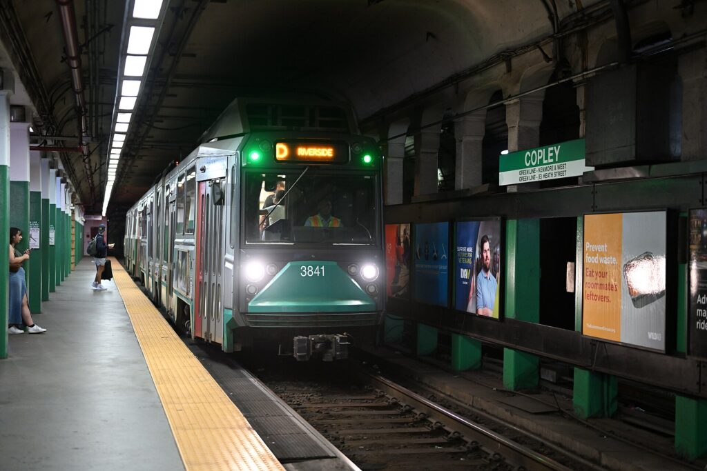
    When it does not

    • Your plans are the Mall, the museums, the Capitol, Georgetown and the neighborhoods.
    • You are staying downtown, where overnight parking adds substantially to the room rate.
    • You are in town for a conference, a game at Nationals Park or Capital One Arena, or the Fourth of July, when the Metro is far faster than any road.
    • Your day trips are Baltimore, Philadelphia or New York, which are faster and more relaxing by train.

    The hybrid plan for a city-plus-countryside trip

    Go car-free for the city days and rent only for the days you leave, and think about where you pick up. Renting at Reagan National is a smart trick even if you arrived days earlier: ride the Metro back to the airport, pick up a car, and you are on the George Washington Memorial Parkway toward Mount Vernon or on I-66 toward Shenandoah in minutes, without driving through downtown. Neighborhood rental offices downtown and in Arlington avoid airport fees but mean driving out through city traffic. For a trip heading west to Shenandoah and Harpers Ferry, Dulles is well placed; for Annapolis or Baltimore, BWI. A common pattern: arrive by Metro or train, spend three car-free days in the city, rent at Reagan National for a day or two in Virginia, and return it at the airport before your flight, or drop it and take the Metro back to your hotel. Book ahead for spring, October and holiday weekends. Compare the day rates on our Washington, DC car rental page against a full-trip rental and the difference is usually obvious.

    A worked cost comparison

    Numbers change with the season and the booking window, so treat this as a method rather than a quote, and check current rates before deciding. For a four-night city break downtown for two people, the car-free version costs Metro rides from the airport, a couple of day passes or pay-as-you-go fares, and perhaps a few ride-hail trips back from Georgetown or Adams Morgan at night; the rental version adds four days of a compact car, four nights of valet parking at downtown rates, fuel, and the constant risk of camera fines and tow-away zones, and buys you nothing the Metro does not already provide. The car-free option wins by a wide margin. For the same four nights plus a day at Mount Vernon and a day in Shenandoah, the hybrid version adds a two-day rental picked up at Reagan National, fuel, the park entrance fee and parking at Mount Vernon, and it is clearly cheaper and more flexible than tours for two people. For a family of four visiting relatives in the suburbs for a week, a full-trip rental, picked up at whichever airport is closest to the relatives, usually beats a week of long Metro rides and ride-hail. Run the rental rates for your dates on our Washington, DC car rental page and put them beside the transit costs before you choose.

    Driving out of Washington in each season

    The day trips around Washington are some of the best in the East, but the roads out of the city change with the seasons. In spring, the parkways are at their loveliest, with redbuds and dogwoods along the Potomac, but cherry blossom weekends choke the roads around the Tidal Basin and the George Washington Memorial Parkway near the airport; leave early and go on a weekday. In summer, the beach traffic toward the Chesapeake Bay Bridge on Friday afternoons and back on Sunday afternoons is legendary, afternoon thunderstorms bring sudden downpours, and the Blue Ridge is a welcome escape from the heat of the city. In fall, Skyline Drive in Shenandoah is the region’s great foliage drive, peaking around mid-October, and weekend traffic at the park entrances can back up for long stretches, so arrive early or go mid-week; Gettysburg and Harpers Ferry are at their best in the same weeks. In winter, the highways are usually clear, but a snowstorm can close Skyline Drive and turn the Beltway into a parking lot, and rental cars come with all-season tires, not winter ones. In every season, avoid leaving or returning to the city between about 3:30 and 7 p.m. on weekdays, when the Beltway, I-66, I-95 and I-270 are all at their worst.

    Decision table

    Your tripRecommendationWhy
    City break, couple or soloNo carThe Metro, walking and Capital Bikeshare cover everything; parking is expensive
    Conference, game or the Fourth of JulyNo carStreets close, parking vanishes, and the Metro stops at the door
    City plus Mount Vernon or ShenandoahHybrid: rent at Reagan National for those daysCar-free city days, a quick escape to the parkways
    Baltimore, Philadelphia or New YorkTrainAmtrak and MARC from Union Station are faster than I-95
    Family visit to the suburbsRent for the whole staySuburban distances beyond the Metro make a car worthwhile daily
    Young children and lots of gearMetro in the city, rent for day tripsEvery station has elevators; a car helps only outside the core
    East Coast road tripRent (consider one-way)Washington is one stop, not the destination
    Staying in Arlington or AlexandriaNo car, or rent for day tripsThe Blue and Yellow lines reach the Mall in minutes

    Money-saving tips for both options

    • On transit: buy an unlimited pass for heavy sightseeing days, travel outside the weekday rush hours when fares are lower, remember to tap out, and use the free museums as air-conditioned rest stops between stations.
    • On a rental: rent only for the days you leave the city, compare airport and neighborhood pickup, use the rental company’s toll program or your own E-ZPass for the express lanes, and decline extras you already have through a credit card or home policy (check first).
    • On the hotel: if you are renting, price the parking fee into the room rate, or choose a hotel in Arlington or Alexandria where parking is cheaper and the Metro is close.
    • On timing: avoid the weekday rush hours and summer Friday afternoons toward the beaches; the best time to fly to Washington, DC guide lists the busiest weekends.
    • On fines: obey every speed limit and turn restriction, because the cameras are everywhere and the rental company adds a fee to each ticket.

    Frequently asked questions

    Is it worth renting a car in Washington, DC?

    Not for the city. The Metro reaches nearly every sight, parking is expensive and traffic is heavy. Rent only for day trips to Mount Vernon, Shenandoah, Harpers Ferry or Gettysburg.

    Is the Washington Metro good for tourists?

    Very. It serves the Mall, Capitol Hill, Arlington, Dupont Circle, Navy Yard and two of the three airports. The main gap is Georgetown, which is a short walk or bus ride from the nearest stations.

    How do I get from Reagan National Airport to downtown?

    Take the Blue or Yellow Line from the airport’s own Metro station; the Mall and downtown are 15 to 25 minutes away. A taxi takes about the same outside rush hour.

    How do I pay for the Metro?

    With a SmarTrip card from a station machine or SmarTrip in your phone’s wallet; contactless bank cards are being introduced. Tap in and tap out, because the fare is calculated at the exit.

    Can I get to Mount Vernon without a car?

    Yes, by a tour, by bike along the Mount Vernon Trail, or by seasonal boat from the Wharf or Old Town Alexandria. A car is simplest if you also want Great Falls or Old Town on the same day.

    Is parking expensive in Washington, DC?

    Downtown, yes: hotel valet parking is costly and street parking is limited, time-restricted and strictly enforced. It is cheaper across the river in Arlington and Alexandria.

    Is it hard to drive in Washington, DC?

    It is harder than most visitors expect, because of the traffic circles, rush-hour lane rules, security closures and automated cameras. Outside the city, the parkways and highways are straightforward, apart from the congestion.

    Whichever way you go, start with the flight. Compare cheap flights to Washington, DC across all three airports, choose a neighborhood with our Washington, DC hotel search, and if the countryside is on the list, price the rental for those days on our Washington, DC car rental page. For what to see once you are here, our first-timer’s guide to Washington, DC has the plan.

  • Boston: Should You Rent a Car or Rely on Public Transit?

    Boston: Should You Rent a Car or Rely on Public Transit?

    Boston is one of the few American cities where a visitor is genuinely better off without a car. Its historic core is small enough to walk across in under an hour, the airport is a short subway or bus ride across the harbor, and the T, the oldest subway system in the country, reaches almost every sight a first-timer wants to see. Driving, meanwhile, is famously hard work: streets laid out on colonial cow paths and harbor landfill, one-way systems that change direction without warning, rotaries, tunnels, tolls, residents-only parking on most neighborhood streets and garage rates that rival New York’s. That said, Boston is also the gateway to New England, and the moment your plans include Cape Cod, the Berkshires, the coast of Maine or the fall foliage in the mountains, a car becomes the obvious choice. This guide explains how transit works, what driving is really like, and how to decide.

    The short answer

    Skip the car for any trip based in Boston or Cambridge, which is most visits. The T, your feet, the Bluebikes bike-share and the occasional taxi will cover the Freedom Trail, Back Bay, the North End, the Seaport, Fenway and Harvard faster and far more cheaply than driving, and you will not pay to park overnight. Rent a car for the days that need one: Cape Cod beyond the ferry towns, the North Shore beaches, Newport, the White Mountains or Vermont in foliage season, a visit to family in the suburbs, or a longer New England road trip. Even then, pick it up on the morning you leave the city and return it when you get back. If a car is on the list, compare rates for your dates on our Boston car rental page.

    How Boston is laid out

    Boston grew on a hilly peninsula in a harbor, and much of today’s city sits on land that was once water: Back Bay, the South End and large parts of the waterfront were all filled in during the nineteenth century. Downtown, the Financial District and the North End hold the oldest, most irregular streets and most of the Freedom Trail. Beacon Hill rises beside Boston Common, and the Public Garden leads west into Back Bay, whose streets are a neat grid with cross streets named alphabetically from Arlington to Hereford. The South End is south of Back Bay, Fenway and Kenmore lie to the west, and the Seaport sits across the Fort Point Channel on the harbor. The Charles River separates Boston from Cambridge, home to Harvard and MIT, which is effectively part of the same city for a visitor. From end to end, the areas most visitors see fit within about 5 km (3 miles).

    Hotels cluster in Back Bay, downtown and the Financial District, the Seaport, and in Cambridge around Kendall Square and Harvard Square, with airport hotels in East Boston and cheaper options in the suburbs along the T. The best rule is to stay near a subway station, ideally on the Red or Green Line. Our Boston hotel search lets you compare them.

    Getting in from the airport

    Boston Logan International (BOS) is only about 5 kilometers (3 miles) from downtown, and getting into the city is quick. The Silver Line SL1 bus stops at every terminal and runs through the Ted Williams Tunnel to the Seaport and South Station, where it connects with the Red Line, commuter rail and Amtrak; it has been free to board at the airport in recent years. Free Massport shuttle buses run from the terminals to Airport station on the Blue Line, which reaches the Aquarium and Government Center in under ten minutes. Water taxis cross the harbor to the downtown waterfront and the Seaport from the airport’s dock, a quick and scenic ride if your hotel is near the water. Taxis and ride-hail pick up outside each terminal and take 15 to 30 minutes to downtown through the harbor tunnels, much longer at rush hour, and the fare includes tunnel tolls. Logan Express buses run to Back Bay and several suburban park-and-ride lots. The rental companies share a consolidated Rental Car Center reached by shuttle bus; unless you are driving straight out of the city, there is no reason to use it on arrival. The Massport site covers current ground-transport options; our Logan airport guide covers the layout.

    An MBTA Green Line train at Copley station in Back Bay
    The Green Line, the oldest subway line in America and the route to Back Bay and Fenway (Photo: 4300streetcar via Wikimedia Commons, CC BY 4.0)

    Boston’s transit, explained

    The Massachusetts Bay Transportation Authority, the MBTA or simply the T, runs the subway, the buses, the commuter rail and several ferries. It has had well-publicized reliability problems in recent years, but for a visitor it remains by far the easiest way around the city.

    The subway

    Four color-coded lines meet in the center. The Red Line runs from Alewife through Harvard, Central and Kendall/MIT in Cambridge, across the Longfellow Bridge to Park Street, Downtown Crossing and South Station, then south to Ashmont and Braintree. The Green Line, a light-rail line that opened in 1897 as the first subway in America, runs under Boylston Street through Park Street, Copley and Kenmore before splitting into four branches, B, C, D and E, which run on the surface; it is the line for Back Bay, Fenway Park, the Museum of Fine Arts and, since its extension in 2022, Somerville and Medford. The Orange Line runs north to south through North Station, Downtown Crossing, Back Bay and the South End to Jamaica Plain. The Blue Line runs from Government Center under the harbor to the airport and Revere Beach. Park Street, Downtown Crossing, Government Center and State are the transfer hubs. Trains run from around 5 a.m. until shortly after midnight, with no overnight service; check the last train times if you are out late.

    Buses and the Silver Line

    Buses cover the neighborhoods between subway lines and are the way to places such as the JFK Library and Castle Island. The Silver Line is a bus rapid transit service with its own lanes and tunnels in places: the SL1 runs to the airport, and the SL2 serves the Seaport, both from South Station.

    Commuter rail and ferries

    The commuter rail runs from South Station, Back Bay and North Station to the suburbs and beyond, and it is the way to day trips: Salem and Rockport on the Newburyport/Rockport Line, Concord on the Fitchburg Line, Providence on the Providence Line, and Worcester, Lowell and Plymouth. In summer, the CapeFLYER weekend train runs from South Station to Hyannis on Cape Cod. The T’s ferries link Long Wharf with Charlestown, Hingham and Hull, and private operators run seasonal fast ferries to Salem and Provincetown and the Harbor Islands ferry.

    Fares and tickets

    You can now pay on the subway, the buses and the Silver Line by tapping a contactless credit or debit card, a phone or a watch at the fare gate or the bus reader, which is the simplest option for most visitors. Plastic CharlieCards, which you can load at station machines, and paper CharlieTickets also work. The subway charges a flat fare for any trip, with a cheaper fare on local buses and discounted transfers when you tap the same card or phone; day and week passes are sold for heavier use. Children 11 and under ride free with a paying adult. Commuter rail fares depend on the zone and ferries have their own fares; buy them in the mTicket app or on board. Check the MBTA’s site for current fares before you go.

    Accessibility

    Every bus is accessible, and most subway stations have elevators, but some Green Line surface stops and a few older stations are not step-free, and elevator outages do happen. The MBTA’s website shows accessible stations and current elevator status; if you are traveling with a wheelchair, a stroller or heavy luggage, check before you set out.

    Beyond the T

    • Walking. Boston is one of the most walkable cities in North America. Boston Common to the North End is fifteen minutes, the Public Garden to Copley Square ten, and the Freedom Trail is designed to be walked.
    • Bluebikes. The bike-share network has hundreds of stations across Boston, Cambridge, Somerville, Brookline and neighboring towns, with single rides, day passes and electric bikes. The paths along the Charles are the best rides.
    • Water taxis and ferries. Water taxis connect the airport, the waterfront, the Seaport and Charlestown, and the T’s ferry from Long Wharf to the Charlestown Navy Yard costs little and doubles as a harbor tour.
    • Taxis and ride-hail. Licensed taxis and the ride-hail apps operate across the city; they are the way home after the trains stop.
    • Intercity trains and buses. Amtrak runs the Acela and Northeast Regional from South Station and Back Bay to Providence, New York, Philadelphia and Washington, and the Downeaster from North Station to Portland, Maine. Intercity buses run from the South Station bus terminal to New York and across New England.
    A Bluebikes bike-share station beside Lansdowne station near Fenway Park
    Bluebikes, the bike-share network across Boston, Cambridge and neighboring towns (Photo: 4300streetcar via Wikimedia Commons, CC BY 4.0)

    Driving in Boston: what it is really like

    Boston drivers have a national reputation, and the streets explain much of it. Downtown and the North End are a knot of narrow one-way streets that follow the lines of the seventeenth-century town; lane markings fade or vanish; streets change names at intersections; and GPS directions struggle in the tunnels, where the signal drops just as you need to choose an exit. The Big Dig, the vast project that buried the elevated Central Artery in tunnels under downtown in the 2000s, made the city far more pleasant, but it created a maze of ramps and tunnels that challenges newcomers. Traffic is heavy at rush hour on I-93, the Massachusetts Turnpike (I-90) and the Southeast Expressway, around Fenway on game days, and on the routes to Cape Cod on summer weekends. Local drivers are quick and assertive.

    The Leonard P. Zakim Bunker Hill Memorial Bridge carrying I-93 into Boston
    The Zakim Bridge, where I-93 emerges from the Big Dig tunnels north of downtown (Photo: 4300streetcar via Wikimedia Commons, CC BY 4.0)

    Parking

    Parking is the biggest reason not to drive. Hotels charge a steep nightly fee for valet or self-parking, and downtown and Back Bay garages are among the most expensive in the country. Much of the street parking in the residential neighborhoods, including all of Beacon Hill and much of the North End and the South End, is reserved for residents with permits. Metered spaces in Back Bay and downtown have time limits and are paid by machine or through the ParkBoston app. Street cleaning on posted days in the warmer months and snow emergency parking bans on main roads in winter both mean towing, and recovering a towed rental is expensive and time-consuming.

    Rules and conditions worth knowing

    • Tolls are all-electronic. The Massachusetts Turnpike, the harbor tunnels and the Tobin Bridge have no toll booths; cameras read an E-ZPass transponder or the license plate. Rental companies pass the tolls on with a service fee, so ask how their toll program works when you pick up.
    • Storrow Drive and Memorial Drive, the riverside parkways, have low bridges and ban trucks and commercial vehicles. Rental moving trucks that ignore the signs regularly get stuck, especially around the September move-in.
    • Rotaries. Traffic already in the circle generally has priority; enter carefully and signal your exit.
    • Hands-free law. Massachusetts bans holding a phone while driving; use a mount and voice commands.
    • Pedestrians. Drivers must stop for pedestrians in crosswalks, and in Boston there are a lot of them.
    • Right turns on red are legal in Massachusetts after a full stop unless signed otherwise, but many downtown intersections prohibit them; read the signs.
    • Winter. Snow and ice are routine from December to March, and a nor’easter can make roads dangerous for a day. Mass511 publishes traffic and road conditions.
    The Sagamore Bridge over the Cape Cod Canal
    The Sagamore Bridge onto Cape Cod, the summer bottleneck on Friday afternoons (Photo: Tichnor Bros. Inc., Boston, Mass. via Wikimedia Commons, Public domain)

    When renting a car makes sense

    • Cape Cod. The ferries and the CapeFLYER reach Provincetown and Hyannis, but the beaches, lighthouses and towns of the Outer Cape and the Cape Cod National Seashore are best explored by car.
    • Fall foliage. The White Mountains, Vermont and the Berkshires are two to three hours away, and the back roads are the point.
    • The coast. Newport, the North Shore beyond Salem and Rockport, and the coast of Maine are easier with a car, even where a train reaches the first town.
    • Family in the suburbs. Greater Boston’s suburbs are spread out, and a car earns its keep daily.
    • A Northeast road trip. Boston is the natural start or finish of a trip through New England or down the coast; our Philadelphia to Boston route guide covers the drive between the two cities, about 480 km (300 miles) and five to six hours without traffic.

    If any of those apply, our rental car booking tips cover insurance, deposits and the questions to ask at the counter, and our family car rental guide looks at vehicle choice.
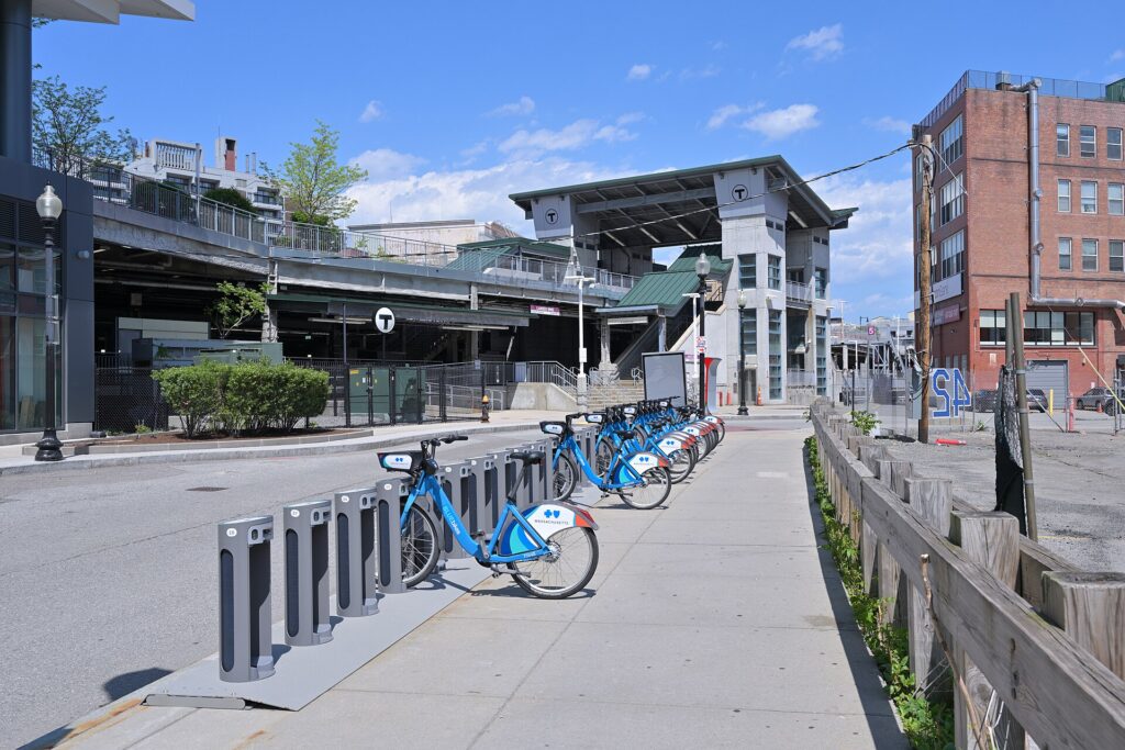
    When it does not

    • You are staying in Boston or Cambridge and your plans are the city.
    • You are here for a game at Fenway or the Garden, the Marathon, the Fourth of July or a conference, when parking is at its worst and the T stops at the door.
    • Your day trips are Salem, Concord, Rockport, Providence or Plymouth, all reachable by commuter rail.
    • You are traveling solo or as a couple and the rental, insurance, tolls and hotel parking add up to more than the fares.

    The hybrid plan for a city-plus-New England trip

    Spend the city days car-free and rent only for the days you leave town, and think about where you pick up. The airport’s Rental Car Center has the widest selection and makes sense if you are heading straight out of the city on arrival, since the tunnels lead directly to I-93 and the Turnpike without crossing downtown. For a trip that starts in the city, the rental offices in Back Bay and downtown let you pick up the morning you leave, so you never pay hotel parking on nights the car would sit unused. A common pattern: take the Silver Line or Blue Line into the city, spend two or three days on foot and on the T, pick up a car in Back Bay, head to Cape Cod or the mountains, and return it at the airport on the way to your flight, which most companies allow for little or no extra charge. Compare day rates on our Boston car rental page against a full-trip rental and the difference is usually obvious.

    A worked cost comparison

    Numbers change with the season and the booking window, so treat this as a method rather than a quote, and check current rates before deciding. For a four-night city break for two people, the car-free version costs the airport transfer, which can be free on the Silver Line, a handful of subway rides or two week passes, and perhaps a couple of taxis late at night; the rental version adds four days of a compact car, four nights of hotel parking at Boston rates, fuel, tolls and the airport fees. Transit wins by a wide margin. For the same four nights with two days on Cape Cod, the car-free version adds round-trip fast ferry tickets to Provincetown or the CapeFLYER to Hyannis; the hybrid version adds a two-day rental picked up in Back Bay, fuel, and parking at the beaches. For two people staying in Provincetown, the ferry is often cheaper; for several towns and beaches, or a family of four, the car usually wins. For a week-long New England road trip, a rental is the only practical answer, and an airport pickup is still simpler than getting into the city and back out again. Run the rental rates for your dates on our Boston car rental page and put them beside the ferry and train fares before you choose.

    Driving out of Boston in each season

    The roads out of Boston are good, but timing makes a large difference. In summer, the challenge is Cape Cod traffic: every Friday afternoon, all of Greater Boston seems to head south on Route 3 toward the Sagamore Bridge, and every Sunday afternoon it all comes back, turning a drive of just over an hour into three or more. Leave before noon on Friday or after dark, return early on Sunday or on Monday, and the drive is easy. In fall, foliage weekends fill the roads north into New Hampshire and Vermont, especially the Indigenous Peoples’ Day weekend in October; a weekday trip is far more pleasant. In winter, the highways are plowed quickly and generally open, but a nor’easter can make any road treacherous for a day, and the mountain roads call for care and a car with good tires; ski traffic heads north on Friday evenings and back on Sunday afternoons. In spring, the roads are clear and the crowds thin, though potholes follow the thaw. In every season, avoid I-93 and the Turnpike near the city during the weekday rush.

    Decision table

    Your tripRecommendationWhy
    City break in Boston or CambridgeNo carThe T and your feet cover everything; parking is expensive and scarce
    Game, Marathon, Fourth of July or conferenceNo carRoads close, parking vanishes, and the T stops at the venue
    Day trips to Salem, Concord or ProvidenceNo carCommuter rail reaches each in under 90 minutes
    City plus a few days on Cape CodHybrid: rent in Back Bay for the Cape days, or take the ferryCar-free city days, car or ferry for the Cape
    Fall foliage in the mountainsRent for those daysThe back roads of New Hampshire and Vermont need a car
    Family visit to the suburbsRent for the whole staySuburban distances make the car worthwhile daily
    New England road tripRent at the airportThe tunnels lead straight to the highways; no downtown driving
    Driving up from Philadelphia or New YorkDrive in, park and leave the carUse the T in the city; choose a hotel with parking you have priced

    Money-saving tips for both options

    • On transit: take the Silver Line from the airport, tap the same card or phone each time, buy a day or week pass for heavy sightseeing days, and let children 11 and under ride free.
    • On a rental: compare airport and Back Bay pickup, book early for summer and October, understand the toll program before you drive off, decline extras you already have through a credit card or home policy (check first), and never leave the car on a street-cleaning or snow-emergency route.
    • On the hotel: if you are renting, price the parking fee into the room rate, or look at hotels in Cambridge or near suburban T stations with cheaper or free parking.
    • On timing: avoid the Friday afternoon exodus to Cape Cod and the Sunday return, the weekday rush on I-93, and the move-in days at the end of August; the best time to fly to Boston guide lists the busiest weekends.
    • On the day trips: for Salem, Concord, Rockport and Providence, a commuter rail ticket costs far less than a day’s rental plus parking, and the Boston first-timer’s guide lists which trips work without a car.

    Frequently asked questions

    Is it worth renting a car in Boston?

    Not for the city. For Cape Cod, the mountains, the coast beyond the train lines or a family visit in the suburbs, yes; rent for those days only.

    Is Boston public transit good for tourists?

    Yes. Four subway lines, the Silver Line and the ferries reach nearly every sight, and the core is so compact that you will walk much of it anyway. Service stops shortly after midnight.

    How do I get from Logan Airport to downtown Boston?

    The Silver Line SL1 bus to South Station, the free shuttle to the Blue Line at Airport station, a water taxi to the waterfront, or a taxi or ride-hail through the tunnels in 15 to 30 minutes outside rush hour.

    Can I get to Cape Cod without a car?

    Yes. Fast ferries run from Boston to Provincetown in season, the CapeFLYER train runs to Hyannis on summer weekends, and buses serve the Cape year-round. A car is still better for exploring several towns and beaches.

    Is driving in Boston really that bad?

    It is challenging: confusing streets, tunnels, assertive drivers and scarce, expensive parking. It is manageable outside rush hour, but few visitors find it worth the trouble inside the city.

    How do tolls work in a rental car in Massachusetts?

    All tolls are electronic. The rental company’s transponder or plate-billing program charges you the tolls plus a service fee, so ask about the terms at pickup.

    Where should I park if I drive into Boston?

    At your hotel, after pricing its parking fee, or at a suburban T station with a garage, and take the train into the city. Avoid residents-only streets and posted street-cleaning days.

    Whichever way you go, start with the flight. Compare cheap flights to Boston, choose a neighborhood with our Boston hotel search, and if Cape Cod or the mountains are on the list, price the rental for those dates on our Boston car rental page.

  • Seattle: Should You Rent a Car or Rely on Public Transit?

    Seattle: Should You Rent a Car or Rely on Public Transit?

    Seattle is a city where the right answer to “should I rent a car?” depends almost entirely on where you are going after you land. For the city itself, the answer is usually no: the light rail runs from the airport terminal to downtown, the core is compact and walkable if hilly, the buses, streetcars, monorail, water taxis and ferries cover most of what a visitor wants, and parking downtown is expensive and car break-ins are common. But Seattle is also the gateway to Mount Rainier, the Olympic Peninsula, the Cascades, the San Juan Islands and Vancouver, and none of those is practical on public transit alone. Add a region split by water and hills, with tolled bridges and a tunnel, ferries that carry cars, and an international border two hours north, and it is worth getting the plan right. This guide explains how the city is laid out, how transit and fares work, what driving here is really like, how the ferries and the border fit in, and gives you a straightforward way to decide.

    The short answer

    Skip the car if you are staying downtown, near Pike Place Market, in Belltown, South Lake Union or Capitol Hill, and your plans are the market, the waterfront, Seattle Center, Pioneer Square, the neighborhoods, a game and a ferry ride; the light rail, buses, your feet and the occasional ride-hail will cover that, and you will not pay for hotel parking. The same goes for most cruise passengers, who can ride the light rail or take a transfer from the airport to the piers. Rent a car if Mount Rainier, the Olympic Peninsula, the North Cascades, Leavenworth or a road trip to Vancouver or Portland is on the itinerary, if you are staying with family in the suburbs, or if you are traveling with young children and a lot of gear. For a city-plus-mountains trip, rent only for the days you leave the city. Compare rental rates for any of these plans on our Seattle car rental page.

    How Seattle is laid out

    Seattle is squeezed onto a narrow strip of hilly land between Puget Sound to the west and Lake Washington to the east, and the water shapes everything. Downtown faces Elliott Bay, with Pike Place Market and the waterfront at its edge, Belltown to the north, Pioneer Square and the Chinatown-International District to the south, and the stadiums just beyond. Seattle Center and South Lake Union sit about a mile north, below Queen Anne Hill, and Capitol Hill and First Hill rise steeply to the east. Lake Union and the Ship Canal then cut the city in two, and the northern neighborhoods, Fremont, Ballard, Wallingford and the University District, are reached by a handful of bridges, several of them drawbridges that lift for boats. Interstate 5 runs north-south through the middle of everything, State Route 99 runs through a tunnel under downtown, and two floating bridges, I-90 and SR 520, cross Lake Washington to Bellevue, Redmond and the Eastside, where Microsoft and many other employers are based. The practical result is that short distances on the map can mean a steep climb, a bridge opening or a traffic jam, and that the core is far easier on foot and transit than by car.

    Hotels cluster downtown around the retail core and Pike Place Market, in Belltown and South Lake Union, in Bellevue for Eastside business, and along International Boulevard near the airport, where cruise passengers and early flyers often stay. Our Seattle hotel search lets you compare them.

    Getting in from the airport

    Seattle-Tacoma International (SEA) is about 20 kilometers (13 miles) south of downtown, and it is one of the few big U.S. airports with rail straight into the city. The Link light rail station is a covered walk from the terminal across the parking garage, and 1 Line trains run to Pioneer Square, downtown and Capitol Hill in roughly 40 minutes, frequently from early morning until around midnight. Taxis, ride-hail and hotel shuttles pick up on designated floors of the parking garage, and the drive downtown along I-5 takes 25 minutes at quiet times and an hour or more at rush hour. The rental car facility is off the airport grounds, reached by a dedicated shuttle bus from the terminal, so allow extra time at both ends of the trip. For cruise passengers, most lines sell transfers from the airport to the piers, and ride-hail is the simplest alternative. Check the Port of Seattle, which runs the airport, for current ground-transport details; our SEA airport guide covers the layout.

    A Sound Transit Link light rail train in Seattle
    Link light rail: from the Sea-Tac terminal to downtown in roughly 40 minutes (Photo: Oran Viriyincy via Wikimedia Commons, CC BY-SA 2.0)

    Seattle’s transit, explained

    Seattle’s transit is run by several agencies that share one fare system: Sound Transit runs the Link light rail and regional express buses, King County Metro runs the city buses and the water taxis, the city runs the streetcars, and a private operator runs the monorail. For a visitor based in the core, it covers the sights well, and it has improved dramatically in the last decade as the light rail has grown.

    Link light rail

    The 1 Line is the backbone. From the airport it runs north through the Rainier Valley and the stadiums to the International District, Pioneer Square and a tunnel under downtown, then on to Capitol Hill, the University of Washington, the University District, Northgate and Lynnwood in the northern suburbs. For a visitor it connects the airport, downtown, the stadiums, Capitol Hill and the university in one line. The 2 Line serves Bellevue and Redmond on the Eastside and is designed to connect to downtown Seattle across the I-90 floating bridge; check Sound Transit’s map for which segments are running when you travel. Trains are frequent through the day, clean and step-free.

    Buses, streetcars and the monorail

    King County Metro buses cover the rest of the city, with the lettered RapidRide lines running the busiest corridors frequently all day: the C Line to West Seattle, the D Line to Ballard and the E Line up Aurora Avenue. The Seattle Streetcar has two separate lines, one from Westlake through South Lake Union and one from Pioneer Square through the International District to First Hill and Capitol Hill. The Seattle Center Monorail, built for the 1962 World’s Fair, runs between Westlake Center downtown and Seattle Center in about two minutes, every few minutes through the day, and it is the easiest way to reach the Space Needle.

    Fares and tickets

    The regional fare card is ORCA, which works on the light rail, buses, streetcars, water taxis, the monorail and, for walk-on passengers, some ferry routes. Buy a card at a light-rail station vending machine or load one online, add value, and tap it on the reader before boarding a train or as you board a bus; transfers within a set window are included. The Transit GO Ticket app sells mobile tickets on most services as an alternative. Children and teenagers 18 and under ride free on most local transit in the region, and seniors and riders with disabilities can get a reduced-fare permit. Check current fares on the agencies’ sites before you go.

    Accessibility

    Every light-rail station is step-free with elevators, buses are low-floor with ramps, and the streetcars board level with the platform. Elevator outages at the deep downtown and Capitol Hill stations do happen, so check service alerts if you depend on them.

    Beyond buses and trains

    • Walking. Downtown, the market, the waterfront, Belltown and Pioneer Square are easy walking, and the new waterfront promenade makes a flat route along the water. The hills between the waterfront and First Hill or Capitol Hill are steep enough to change your route; take the light rail up and walk down.
    • Washington State Ferries. From Colman Dock downtown, ferries cross to Bainbridge Island and Bremerton, and other routes leave from Edmonds, Mukilteo, West Seattle and Anacortes for the Kitsap and Olympic peninsulas, Whidbey Island and the San Juans. Walk-on passengers ride cheaply and never wait long; cars can wait hours on summer weekends, and some routes, including the San Juans, take vehicle reservations. WSDOT runs the system and publishes schedules and wait times.
    • Water taxis. King County’s passenger-only water taxis run from Pier 50 downtown to West Seattle, for Alki Beach, and to Vashon Island.
    • Taxis and ride-hail. Uber, Lyft and licensed taxis operate across the city; for a group, or for the neighborhoods off the light rail such as Fremont and Ballard, a short ride is quick and competitive with transit.
    • Bikes and scooters. Shared e-bikes and e-scooters are widely available, and the Burke-Gilman Trail along the Ship Canal and the Elliott Bay Trail along the water are excellent flat rides. The hills make an electric assist worthwhile.
    • Trains and intercity buses. Amtrak Cascades trains run from King Street Station north to Vancouver and south to Portland, and intercity buses serve the same corridor.
    The Seattle Center Monorail station at the northern end of the line from Westlake Center
    The 1962 monorail still covers the mile from downtown to the Space Needle in about two minutes (Photo: Naus via Wikimedia Commons, CC BY-SA 4.0)

    Driving in Seattle: what it is really like

    Seattle is not an easy city to drive in, and locals will tell you so. I-5 through downtown is congested for much of the day and badly so at rush hour, with reversible express lanes north of downtown that change direction by time of day. SR 99, the main alternative, runs through a tolled tunnel under downtown. The bridges are the choke points: the floating bridges to the Eastside back up every weekday, and the drawbridges over the Ship Canal lift for boats outside rush hours, stopping traffic for several minutes at a time. Downtown streets are steep, many are one-way, and bus lanes, bike lanes and turn restrictions change block by block. None of this is dangerous, but it is slow, and on a short visit it eats into your time.

    Interstate 5 and the Seattle skyline at dusk
    I-5 through downtown Seattle, the city's spine and its most reliable traffic jam (Photo: Dllu via Wikimedia Commons, CC BY-SA 4.0)

    Parking

    Downtown parking is expensive. Hotels charge a substantial nightly fee, and commercial garages are priced for commuters and event crowds; on game nights near the stadiums and at Seattle Center, rates climb higher still. Street parking is metered through pay stations and the PayByPhone app, and the city adjusts rates by neighborhood and time of day according to demand, so check the posted hours carefully. Outside the core, in Fremont, Ballard and the residential neighborhoods, parking is easier but often time-limited or reserved for residents. On the hills, set the parking brake and turn your wheels toward the curb. The most important rule: leave nothing visible in a parked car. Car break-ins are common in Seattle, including at trailheads, viewpoints and hotel garages, and rental cars are a favorite target.

    Rules and conditions worth knowing

    • Tolls. The SR 520 floating bridge, the SR 99 tunnel and the express toll lanes on I-405 are tolled electronically, with no booths. Rental companies pass the tolls on with their own fees; ask how their toll program works when you pick up the car, and plan routes around the tolled roads if you want to avoid it.
    • Hands-free law. Washington bans holding a phone while driving, including at red lights; use a mount and hands-free mode.
    • Right turns on red are permitted after a full stop unless signed otherwise, and pedestrians have the right of way at every intersection, marked or not.
    • Mountain passes in winter. Snoqualmie Pass on I-90 and Stevens Pass on US 2 can require traction tires or chains when conditions are bad, and they occasionally close. WSDOT publishes pass reports; check before you go from November to April.
    • Mount Rainier in winter. The park requires every vehicle to carry tire chains during the winter season, and the road to Paradise has its own hours and closures. See Mount Rainier National Park. Many rental agreements restrict the use of chains, so read yours before you plan a winter visit.
    • Ferries. Arrive early for car ferries in summer, check whether your route takes reservations, and remember that a car on a ferry costs far more than a walk-on passenger.
    • Wildlife and rain. Deer and elk are common on rural roads at dawn and dusk, and the first rain after a dry spell makes roads slick with oil; slow down.

    Driving to Vancouver and crossing the border

    The drive north to Vancouver is one of the classic Pacific Northwest road trips: about 230 kilometers (140 miles) on I-5, around three hours without a long border queue, through the farmland of the Skagit Valley and past Bellingham to the border at Blaine. There are several crossings in the area; the Peace Arch and Pacific Highway crossings at Blaine are the busiest, and the crossings at Lynden and Sumas, a little farther east, are the alternatives when the main queues are long. Waits range from minutes to hours, and are worst on summer weekends, holidays in either country and Friday and Sunday afternoons; both governments publish current wait times, and drivers enrolled in NEXUS have dedicated lanes.

    The documents you need depend on your citizenship and on how you cross, so treat the rules as principles and check the official sources before you leave: every traveler needs acceptable identity and travel documents, U.S. and Canadian citizens need a passport or another approved document, and many other nationalities need a visa or an electronic authorization for one or both countries. The Canada Border Services Agency sets the rules for entering Canada, and U.S. Customs and Border Protection sets them for coming back. Two more principles: cannabis is legal in both Washington and British Columbia but it is illegal to carry it across the border in either direction, and firearms, some foods and large amounts of cash have declaration rules of their own. If you are driving a rental, confirm before you book that the company allows the car into Canada, carry the rental agreement, and expect a one-way drop-off across the border to be expensive or unavailable. Our Seattle to Vancouver route guide covers the drive, and our Vancouver car-or-transit guide explains why many visitors do not need a car once they arrive.

    The Peace Arch at the border crossing between Blaine, Washington, and Surrey, British Columbia
    The Peace Arch at Blaine, the busiest crossing on the drive from Seattle to Vancouver (Photo: Weixi Zeng via Wikimedia Commons, CC BY-SA 3.0)

    When renting a car makes sense

    • Mount Rainier. Paradise is two to two and a half hours away, there is no scheduled public transit into the park, and the trailheads are spread out.
    • The Olympic Peninsula. Hurricane Ridge, Lake Crescent, the Hoh Rain Forest and the coast are a loop of several hundred miles, usually with a ferry crossing; it is effectively car-only.
    • The North Cascades, Leavenworth and the mountain passes, all day trips or overnights over the Cascades.
    • A road trip to Vancouver or Portland, if you want to stop along the way; otherwise the train is a strong alternative.
    • Family in the suburbs or the Eastside. Transit reaches much of the region, but suburban distances add up.
    • The San Juan Islands with a car. Possible with a ferry reservation from Anacortes, although walking on and renting bikes or using local shuttles on the islands is often easier.

    If any of those apply, our rental car booking tips cover insurance, deposits and the questions to ask at the counter, and our family car rental guide looks at vehicle choice.
    When it does not

    • You are staying downtown or near the market and your plans are the city.
    • You are in town for a cruise, a conference or a game, when parking downtown is at its worst and the light rail stops at the stadiums and the airport.
    • You are going to Vancouver and back without stops, when the Amtrak Cascades train avoids the border traffic, the car rental’s cross-border rules and parking at both ends.
    • You want Bainbridge, Alki or Vashon for a day, which are all walk-on trips by ferry or water taxi.

    The hybrid plan for a city-plus-mountains trip

    Go car-free for the city days and rent for the days you leave town, and think carefully about where you pick up. The airport rental facility has the widest choice but adds a shuttle ride and airport concession fees; renting from a downtown or neighborhood branch avoids those fees and means you never pay hotel parking on the nights you are not using the car. A pattern that works well: the light rail in from the airport, two or three car-free days downtown, a car picked up in the city for a day at Mount Rainier and a night on the Olympic Peninsula, then the car returned before heading home by light rail. If Vancouver is part of the trip, consider doing that leg by train and keeping the rental for the Washington days, or check the cross-border and one-way rules carefully if you plan to drive. Book ahead for July, August and holiday weekends. Compare the day rates on our Seattle car rental page against a full-trip rental and the difference is usually obvious.

    A worked cost comparison

    Numbers change with the season and the booking window, so treat this as a method rather than a quote, and check current rates before deciding. For a four-night city break downtown for two people, the car-free version costs two return light-rail fares from the airport, a few transit day trips, a ferry to Bainbridge and perhaps two or three ride-hail trips to Fremont and Ballard; the rental version adds four days of a compact car, four nights of downtown hotel parking, tolls, fuel and the airport fees, and buys you very little you could not ride to. Transit wins easily. For the same four nights with a day at Mount Rainier, the hybrid version adds a one-day rental from a city branch, fuel for the round trip and the park entrance fee, and it is almost always cheaper than a guided tour for two, and far cheaper than keeping a car all week. For a week touring Rainier, the Olympic Peninsula and the islands, a rental is the only practical answer, and the ferry fares for the car belong in the budget alongside fuel. For a Seattle-and-Vancouver trip, compare the train for two against a rental with cross-border permission, parking in two expensive downtowns and the border wait; for most couples without other plans on the road, the train wins. Run the rental rates for your dates on our Seattle car rental page and put them beside the transit and train fares before you choose.

    Driving out of Seattle in each season

    The roads out of Seattle change character with the seasons. In summer, the challenge is volume: I-5 north toward the border and south toward Tacoma is slow on Friday afternoons, the car ferries to Bainbridge, Kingston and the San Juans can have waits of several sailings, and the parking areas at Paradise on Mount Rainier and at popular trailheads fill early, so leave at dawn. Wildfire smoke can close trails and roads in the Cascades in August and September. In fall, the first rains make the roads slick, the leaves turn along US 2 and the North Cascades Highway, and the high passes can get their first snow by late October; the North Cascades Highway, SR 20, closes for the winter once the snow arrives. In winter, the city itself rarely sees snow, but when it does the hills become impassable and the region slows to a crawl; the passes need traction tires or chains at times, Rainier requires chains to be carried, and the ski traffic to Snoqualmie Pass makes weekend mornings busy on I-90. Days are short, so plan to be off mountain roads before dark. In spring, the roads to Paradise and Hurricane Ridge have limited hours, the high roads open in stages through late spring and early summer, and the tulip weekends in the Skagit Valley in April back up I-5 north. In every season, check WSDOT’s travel alerts before you set out, and the drive itself, with Rainier or the Olympics appearing through the clouds, is the reason you rented the car.

    Decision table

    Your tripRecommendationWhy
    City break downtown, couple or soloNo carLight rail from the airport, a walkable core and expensive parking
    Alaska cruise before or afterNo carLight rail, cruise transfers or ride-hail cover the airport-to-pier run
    City plus a day at Mount RainierHybrid: rent for one day from a city branchCar-free city days, no hotel parking, no transit into the park
    Olympic Peninsula or North CascadesRent for the tripLong loops with no practical transit
    Seattle plus Vancouver, no stopsTrainAvoids border traffic, cross-border rental rules and parking in both cities
    Pacific Northwest road tripRent, with cross-border permissionStops along the way make the car worthwhile; check the one-way fee
    Business trip to Bellevue or RedmondLight rail or ride-hail; rent if meetings are spread outThe Eastside is car-oriented, but tolls and traffic add up
    Family visit to the suburbsRent for the whole staySuburban distances make the car worthwhile daily

    Money-saving tips for both options

    • On transit: get an ORCA card or the mobile ticket app on day one; children and teenagers ride free; walk on the ferries rather than driving on.
    • On a rental: compare airport and city pickup, book early for summer, understand the toll program before you drive, decline extras you already have through a credit card or home policy (check first), and confirm the Canada policy if Vancouver is even a possibility.
    • On the hotel: if you are renting, price the parking fee into the room rate, and consider a hotel outside the core with free parking for the car days.
    • On timing: avoid I-5 and the floating bridges at rush hour, the car ferries on summer Friday afternoons and Sunday evenings, and the border on holiday weekends in either country; the best time to fly to Seattle guide lists the busiest weekends.
    • On the mountains: for one day at Rainier, a one-day rental almost always beats a tour for two or more people; for a solo traveler, compare the two.

    Frequently asked questions

    Is it worth renting a car in Seattle?

    For Mount Rainier, the Olympic Peninsula, the Cascades or a road trip, yes. For a downtown city break, a cruise or a conference, no; the light rail, buses and your feet are enough.

    Is Seattle public transit good for tourists?

    Good in the core: the light rail links the airport, downtown, the stadiums, Capitol Hill and the university, and buses, streetcars, the monorail and the water taxis fill most gaps. It thins out in the suburbs and does not reach the national parks.

    How do I get from Sea-Tac to downtown Seattle?

    The Link light rail in roughly 40 minutes from a station beside the terminal, or a taxi or ride-hail in 25 minutes to an hour depending on I-5 traffic.

    Can I drive a rental car from Seattle to Vancouver?

    Usually, but not always: confirm that your rental company allows the car into Canada, carry the agreement, and expect one-way cross-border drop-offs to cost extra or be unavailable. Check the border documents you need before you go.

    Can I get to Mount Rainier without a car?

    Not on scheduled public transit. Guided day tours run from Seattle, but for most visitors a one-day rental is simpler and cheaper.

    Is parking expensive in downtown Seattle?

    Yes, both at hotels and in commercial garages, especially on game nights. Street parking is metered with demand-based rates, and you should never leave anything visible in the car.

    Do Seattle’s toll roads work with rental cars?

    Yes. The tolls are electronic, and the rental company bills them to you, usually with a service fee; ask at the counter how their program works.

    Whichever way you go, start with the flight. Compare cheap flights to Seattle, choose a neighborhood with our Seattle hotel search, and if Rainier or Vancouver is on the list, price the rental for those dates on our Seattle car rental page. For the rest of the trip, see our first-timer’s guide to Seattle.

  • Las Vegas: Do You Really Need a Rental Car?

    Las Vegas: Do You Really Need a Rental Car?

    Las Vegas is a strange case for the “should I rent a car?” question. The valley is a sprawling, car-built desert metropolis of more than two million people, with freeways, huge parking garages and almost no rail transit. Yet most visitors spend nearly all their time on a single boulevard about 6 km (4 miles) long, where a car is more of a burden than a help: the resorts charge for parking, the traffic on the Strip crawls at night, and the Monorail, the Deuce bus, free trams and your own feet cover the distances. The answer changes the moment the desert enters the plan, because Red Rock Canyon, the Hoover Dam, the Valley of Fire and the national parks beyond are all car trips or organized tours. This guide explains how the city is laid out, how the Monorail, buses and trams work, what driving and parking are really like, when a rental is worth it, and gives you a straightforward way to decide.

    The short answer

    Skip the car if you are staying on the Strip or downtown for a few nights and your plans are casinos, shows, pools, restaurants and Fremont Street; taxis, ride-hail, the Monorail, the Deuce and walking will cover that, and you will save on parking fees. That is most first-time visitors. Rent a car if Red Rock, the Hoover Dam, the Valley of Fire, Mount Charleston, Zion or the Grand Canyon are on the itinerary, if you are staying off the Strip in Summerlin or Henderson, if you are traveling with young children, or if Las Vegas is one stop on a Southwest road trip. And the hybrid, car-free on the Strip and a one- or two-day rental for the desert, is often the smartest plan of all. Compare rental rates for any of these plans on our Las Vegas car rental page.

    How Las Vegas is laid out

    The Las Vegas Valley is a wide desert basin ringed by mountains, and the city spreads across it on a grid of long, straight arterial roads. Its spine is Las Vegas Boulevard. The southern section, the Strip, technically lies outside the city limits in unincorporated Clark County and runs from Mandalay Bay and the Welcome sign in the south to the STRAT tower in the north, with the big resorts lined up on both sides. Interstate 15 runs parallel to it a few hundred meters to the west, and the airport sits directly to the southeast. North of the STRAT, the boulevard continues to downtown, the original city around Fremont Street, about 3 km (2 miles) beyond the end of the Strip, with the Arts District in between. East of the Strip are the Convention Center and Paradise Road; west, across I-15, are Chinatown on Spring Mountain Road and then the suburbs rising toward Summerlin and Red Rock Canyon. Henderson spreads to the southeast. The Strip and downtown are dense; everything else assumes a car.

    Hotels cluster along the Strip, around downtown and Fremont Street, near the Convention Center, and in the locals’ resorts of Summerlin and Henderson. Our Las Vegas hotel search lets you compare them.

    Getting in from the airport

    Harry Reid International (LAS) is one of the most conveniently placed big airports in the country: its runways run right beside the south end of the Strip, about 8 km (5 miles) from its center, and downtown is about 20 minutes away. Taxis queue at both Terminal 1 and Terminal 3, the ride to a Strip resort takes 15 to 25 minutes, and fares are regulated by the state. Ride-hail pickups are in designated areas of the terminal parking garages, which are well signed. Shared shuttle vans serve the major resorts, and several RTC bus routes stop at the airport, although none runs along the Strip itself, so a bus trip with luggage usually means a transfer. All the rental companies operate from the off-airport Rent-A-Car Center, about 5 km (3 miles) from the terminals and reached by free dedicated shuttle buses that run every few minutes; allow extra time for that shuttle when you return the car. Check the airport’s site for current ground-transport details; our LAS airport guide covers the layout.

    A Las Vegas Monorail train running behind the Strip resorts
    The Monorail runs along the east side of the Strip from the MGM Grand to the SAHARA (Photo: Nandaro via Wikimedia Commons, CC BY-SA 3.0)

    Las Vegas transit, explained

    Las Vegas has no subway or light rail. What it has is a privately built Monorail along the east side of the Strip, a public bus network run by the Regional Transportation Commission (RTC) with two Strip routes that run all day and night, and a set of free trams and tunnels that link specific resorts. For a Strip-and-downtown trip, together they are entirely adequate; for anything beyond, they thin out fast.

    The Las Vegas Monorail

    The Las Vegas Monorail runs for about 6 km (4 miles) along the east side of the Strip, from the MGM Grand in the south to the SAHARA in the north, with stations at the back of several resorts along the way, including Paris and Horseshoe, Flamingo and Caesars Palace, Harrah’s and the LINQ, and the Las Vegas Convention Center. Trains are frequent and the ride from end to end takes about a quarter of an hour. It is ideal for convention-goers and for hopping between the east-side resorts, but it has limits: the stations are tucked behind the casinos, so reaching them can mean a long walk through the resort, it does not serve the west side of the Strip directly, and it goes neither to the airport nor to downtown. It runs from the morning until after midnight, later on weekends; single rides and multi-day passes are sold at the stations and online.

    The Deuce and the SDX

    RTC’s Deuce is a double-decker bus that runs the full length of the Strip and on to downtown, 24 hours a day, stopping in front of or beside nearly every resort. It is slow in the evening traffic, but the view from the top deck is a sightseeing tour in itself, and it is the only transit that covers both sides of the Strip and downtown in one ride. The SDX (Strip and Downtown Express) runs a similar route with far fewer stops, which makes it the faster choice between the Strip and Fremont Street. Both stop at the South Strip Transfer Terminal, where other routes connect to the airport.

    Fares and tickets

    RTC sells passes for set periods, such as two hours, a day or three days, that cover the Deuce, the SDX and the rest of the bus network. Buy them on the rideRTC app on your phone or from the ticket machines at the Strip stops; the Strip routes cost more than the regular residential routes. Monorail tickets are separate. If you plan to ride more than twice in a day, a day pass is the obvious choice. Check RTC’s site for current fares before you go.

    Accessibility

    RTC buses are low-floor and accessible, and the Monorail stations have elevators. The pedestrian bridges over the Strip’s main intersections have elevators and escalators, although they are not always working, and distances inside the resorts are long.

    Beyond RTC and the Monorail

    • Walking and the pedestrian bridges. The Strip is walkable in stretches, and at the busiest intersections, such as Tropicana Avenue and Flamingo Road, you cross the boulevard on overhead bridges rather than at street level. Distances are deceptive: a resort that looks next door can be a 15-minute walk away, and in summer that walk is hot.
    • Free trams. A free tram links Mandalay Bay, Luxor and Excalibur on the west side of the south Strip, and another connects Park MGM, Aria and Bellagio. They save a surprising amount of walking.
    • The Vegas Loop. The Boring Company’s tunnels under the Convention Center campus carry visitors in Tesla cars between the halls for free, and the network is being extended to more resorts. Useful for conventions; check what is open when you travel.
    • Taxis and ride-hail. Taxis wait at every resort’s taxi stand, and Uber and Lyft pick up at designated ride-hail zones, usually in or beside the parking garages. For a group of three or four, a ride is competitive with bus passes and far quicker.
    • Tours and shuttles. Organized tours run from the Strip resorts to the Hoover Dam, Red Rock, the Valley of Fire, the Grand Canyon and Zion, with hotel pickup; for visitors who do not want to drive in the desert, they are a genuine alternative to a rental.
    • Intercity coaches connect Las Vegas with Los Angeles, Phoenix and other cities. A high-speed rail line to Southern California is under construction, but until it opens the choices are drive, fly or take the bus.
    An RTC Deuce double-decker bus on the Las Vegas Strip
    The Deuce runs the length of the Strip and on to downtown, 24 hours a day (Photo via Wikimedia Commons, Public domain)

    Driving in Las Vegas: what it is really like

    Outside the Strip, Las Vegas is an easy place to drive: wide, straight roads, a logical grid, freeways that are mostly free-flowing outside rush hour, and ample parking at the malls, locals’ casinos and attractions. The frustrations are concentrated on and around the Strip. Las Vegas Boulevard itself is slow at almost any hour and gridlocked on weekend nights, when it is full of cruising cars and limousines; locals avoid it and use the parallel roads, Frank Sinatra Drive and Dean Martin Drive on the west side and Koval Lane and Paradise Road on the east, which reach the back entrances and garages of the resorts. I-15 through the resort corridor jams at rush hour and on Friday afternoons and Sunday mornings, when visitors from Southern California arrive and leave. And the big events, from New Year’s Eve to the Grand Prix, close streets for days.

    Stopped traffic on Las Vegas Boulevard on the Strip
    Las Vegas Boulevard at night: often slower than walking, which is why locals use the back roads (Photo: Coolcaesar via Wikimedia Commons, CC BY-SA 4.0)

    Parking

    Parking is the main reason a car costs more on the Strip than it seems. Most of the big resorts now charge for self-parking and valet, including for their own hotel guests at many properties, and the daily charge adds up over a stay; some loyalty-program tiers and a few off-Strip and downtown properties offer free or validated parking. The garages themselves are enormous and well signed, but it can be a ten-minute walk from your space to the lobby. Downtown, most casinos validate parking for guests and players, and the Arts District has street parking. Outside the resort corridor, parking at Chinatown, the malls, the Springs Preserve and the locals’ casinos is generally free and easy. If you do rent for the whole stay, factor the parking fee into the room rate when you compare hotels.

    Rules and conditions worth knowing

    • The heat. From June to September, the car can be dangerously hot inside after sitting in the sun; never leave children or pets in it, carry plenty of water on any desert drive, keep the fuel tank topped up, and know that services are far apart once you leave the city. A breakdown in the desert in July is serious.
    • Flash floods. During the summer monsoon and winter storms, water pours across roads and fills the dips and washes that are signed as flood zones. Never drive into flowing water; the storms pass within hours.
    • Handheld phones are banned while driving in Nevada; use hands-free only.
    • Pedestrians are everywhere on and around the Strip, often distracted; watch for them at the resort entrances and turning lanes.
    • Right turns on red are permitted after a full stop unless signed otherwise.
    • Impaired driving is enforced heavily in a city built around drinking; take a taxi after a night out.
    • Park entry. Red Rock’s scenic drive requires a timed-entry reservation during the day for much of the year, and the national parks charge an entrance fee per vehicle. NVRoads publishes Nevada road conditions and closures.
    The Hoover Dam with the Mike O'Callaghan-Pat Tillman Memorial Bridge behind it
    The Hoover Dam and its bypass bridge, about 45 minutes from the Strip by car (Photo: Alan Stark from Goodyear, AZ, United States via Wikimedia Commons, CC BY-SA 2.0)

    When renting a car makes sense

    • Red Rock Canyon and Mount Charleston. Both are 30 to 45 minutes from the Strip, with no practical transit, and the scenic drive and the trailheads need a car.
    • The Hoover Dam and Lake Mead. About 45 minutes southeast; a car lets you combine the dam, the bypass bridge walkway, Boulder City and the lake in one day.
    • The Valley of Fire, an hour northeast, is a car trip, and its best light is early and late in the day.
    • Zion, the Grand Canyon and Death Valley. Each is a long day or an overnight; a car gives you the freedom to start at dawn and stop where you like.
    • Staying off the Strip. Summerlin and Henderson resorts and vacation rentals are spread out and assume a car.
    • Southwest road trips. Las Vegas pairs naturally with Los Angeles, Phoenix, Utah’s national parks and the Grand Canyon; our Los Angeles to Las Vegas and Las Vegas to Phoenix route guides cover the two classic drives.

    If any of those apply, our rental car booking tips cover insurance, deposits and the questions to ask at the counter, and our family car rental guide looks at vehicle choice.
    When it does not

    • You are staying on the Strip or downtown and your plans are casinos, shows, pools and restaurants.
    • You are in town for a convention, where the Monorail, the Vegas Loop and taxis serve the halls.
    • You are coming for a big weekend event, such as New Year’s Eve, EDC or the Grand Prix, when streets close and parking is at its worst.
    • You want the Hoover Dam or the Grand Canyon for a single day and are happy to take an organized tour with hotel pickup.
    • You plan to drink; taxis and ride-hail are everywhere and cheaper than a DUI.

    The hybrid plan for a Strip-plus-desert trip

    Go car-free for the Strip days and rent only for the desert days, and think about where you pick up. Renting at the airport’s Rent-A-Car Center makes sense if you are heading straight out of town on arrival, to Zion, the Grand Canyon or Death Valley, because the freeways are minutes away and you never enter the Strip traffic. For a mid-trip day or two in the desert, many Strip resorts have rental desks in the lobby or nearby, which saves a taxi ride to the airport and the airport’s concession fees, and means you pay for parking only on the nights you have the car. A common pattern that works well: taxi from the airport to the Strip, two or three car-free days, pick up a rental at your resort for Red Rock and the Hoover Dam or a long day to the Grand Canyon, and return it at the airport on the way to your flight home. Book ahead for spring, fall and the big event weekends. Compare the day rates on our Las Vegas car rental page against a full-trip rental and the difference is usually obvious.

    A worked cost comparison

    Numbers change with the season and the booking window, so treat this as a method rather than a quote, and check current rates before deciding. For a four-night Strip trip for two people, the car-free version costs a return taxi or ride-hail from the airport, a couple of Deuce day passes, and a few rides between resorts and downtown; the rental version adds four days of a compact car, four nights of resort parking fees, fuel, and the taxes and airport fees that add a noticeable percentage to the headline rate, and buys you very little on a boulevard where traffic is slower than the bus. The car-free option wins easily. For the same four nights with one day at Red Rock and the Hoover Dam, the tour version adds two seats on a day tour; the hybrid version adds a one-day rental picked up on the Strip, one night of parking, fuel, and the Red Rock entry fee. Priced honestly, a tour is often similar for one or two people, the rental usually wins for three or four, and the rental wins on flexibility for anyone who wants to hike, linger for sunset or see both places at their own pace. For a week that includes Zion and the Grand Canyon, a rental is the only practical answer, and an airport pickup is simplest. Run the rental rates for your dates on our Las Vegas car rental page and put them beside the tour prices before you choose.

    Driving out of Las Vegas in each season

    The highways out of Las Vegas are among the most scenic in the West, and the seasons change them. In summer, the challenge is heat: temperatures in Death Valley and on the desert stretches of I-15 and US-93 can pass 45 °C (113 °F), so leave at dawn, carry several liters of water per person, keep the air conditioning and the tank in good order, and watch for monsoon storms and flash floods in the afternoons from July to September. In fall, conditions are ideal, and the weekend traffic is the main issue: the drive back to Southern California on I-15 on a Sunday afternoon can take hours longer than the four or so it takes on a quiet weekday, with the bottlenecks at the state line near Primm and at the Cajon Pass. In winter, the desert roads are mild, but snow and ice reach the higher country: the road up to Mount Charleston can require chains or four-wheel drive, and the routes to the Grand Canyon’s South Rim and to Zion via the high plateaus can be icy; check conditions before you go. In spring, strong winds blow dust across the highways and can make high-sided vehicles hard to handle, while the wildflowers and the mild temperatures make it the best season for the long drives. In every season, remember the clock: Arizona does not observe daylight saving time, so on the drive to the Grand Canyon or Phoenix the time is the same as Nevada’s in summer and an hour ahead in winter.

    Decision table

    Your tripRecommendationWhy
    Strip weekend, couple or soloNo carTaxis, the Monorail, the Deuce and walking cover it; parking fees add up
    Convention tripNo carThe Monorail, the Vegas Loop and taxis serve the halls
    Big event weekend (New Year’s Eve, EDC, the Grand Prix)No carStreet closures, heavy traffic and scarce parking
    Strip plus Red Rock or the Hoover DamHybrid: rent for a day, or take a tourCar-free Strip days, car or tour for the desert
    Zion, the Grand Canyon or Death ValleyRent at the airportLong distances, early starts and the freeways minutes from the rental center
    Staying in Summerlin or HendersonRent for the whole staySuburban distances and free parking make the car worthwhile
    Family with young childrenRent, or hybridCar seats, heat and day trips all argue for a car
    Southwest road tripRent (consider one-way to Los Angeles or Phoenix)Las Vegas is a stop, not the destination

    Money-saving tips for both options

    • On transit: buy a day or three-day RTC pass if you will ride more than twice a day; use the free trams on the south Strip; take the SDX rather than the Deuce when speed matters.
    • On a rental: compare airport and Strip pickup, book early for spring, fall and the big weekends, decline extras you already have through a credit card or home policy (check first), and return the car full, because fuel near the rental center costs more.
    • On the hotel: if you are renting, price the parking fee and the resort fee into the room rate, and look at downtown and off-Strip resorts where parking is often free or validated.
    • On timing: avoid Las Vegas Boulevard on weekend nights and I-15 toward California on Sunday afternoons; the best time to fly to Las Vegas guide lists the busiest weekends.
    • On tours: for one or two people doing a single desert day, compare a tour with hotel pickup against a rental plus parking, fuel and entry fees; the tour is often close in price and there is no driving after a late night.

    Frequently asked questions

    Do you need a rental car in Las Vegas?

    For the Strip and downtown, no; taxis, ride-hail, the Monorail, the Deuce and walking are enough. For Red Rock, the Hoover Dam, the Valley of Fire and the national parks, yes, or an organized tour.

    Is public transportation good in Las Vegas?

    Good along the Strip and to downtown, with the 24-hour Deuce, the faster SDX and the Monorail. Beyond the resort corridor, buses are slower and less frequent, and there is no rail to the airport.

    How do I get from Las Vegas airport to the Strip?

    A taxi or ride-hail in 15 to 25 minutes, a shared shuttle van, or an RTC bus with a transfer. All rental cars are collected from the off-airport Rent-A-Car Center by shuttle.

    Is parking free on the Las Vegas Strip?

    At most big resorts, no; they charge for self-parking and valet, often even for hotel guests. Some off-Strip and downtown casinos offer free or validated parking.

    Can I get to the Grand Canyon from Las Vegas without a car?

    Yes, on an organized day tour by coach, or by air tour; the West Rim is about two and a half hours away and the South Rim about four and a half.

    Is it easy to drive in Las Vegas?

    Outside the Strip, yes: wide, straight roads and plentiful parking. On the Strip itself, traffic is slow, pedestrians are everywhere, and the back roads behind the resorts are faster.

    Should I rent a car to drive from Los Angeles to Las Vegas?

    It is one of the classic American road trips, about four hours on I-15 without traffic, and a one-way rental is widely available; just avoid the return on a Sunday afternoon.

    Whichever way you go, start with the flight. Compare cheap flights to Las Vegas, choose a neighborhood with our Las Vegas hotel search, and if the desert is on the list, price the rental for those dates on our Las Vegas car rental page. For what to see, start with our first-timer’s guide to Las Vegas.

  • Atlanta: Should You Rent a Car or Rely on Public Transit?

    Atlanta: Should You Rent a Car or Rely on Public Transit?

    Atlanta has a reputation as one of the most car-dependent cities in America, and for the people who live here it is mostly deserved: a metro area of more than six million people spread across dozens of counties, freeways that jam twice a day, and suburbs that were built with no thought of a train. But visitors are not commuters, and the Atlanta a visitor sees looks different. The airport has its own rail station inside the terminal, and the MARTA trains from it run straight to downtown, Midtown and Buckhead, which is where most hotels and most of the sights are. The BeltLine’s Eastside Trail links several of the best neighborhoods on foot, and ride-hail is quick and widely available for the gaps. A rental car earns its keep for the Braves’ ballpark, Buford Highway, Stone Mountain and the North Georgia mountains, and for anyone staying in the suburbs. This guide explains how the city and MARTA work, what driving here is really like, and how to decide.

    The short answer

    Skip the car if you are staying downtown, in Midtown or in Buckhead and your plans are the aquarium and Centennial Olympic Park, the Martin Luther King Jr. National Historical Park, the High Museum and Piedmont Park, the BeltLine, a Hawks game, a Falcons game or a convention. MARTA from the airport, your feet and the occasional ride-hail will cover it, and you will avoid hotel parking fees that can add a large sum to each night. Rent a car if you are staying in the suburbs or with family, if a Braves game, Stone Mountain, the Chattahoochee, Buford Highway or a day trip to the mountains, Athens or Chattanooga is on the list, or if Atlanta is one stop on a Southern road trip. And for many visitors the right answer is both: car-free for the city days, a rental for the day trips. Compare rental rates for any of these plans on our Atlanta car rental page.

    How Atlanta is laid out

    Atlanta has no grid. Its streets follow old ridgelines and railway lines, so they curve and change names, and the most famous of them, Peachtree Street, runs north along a ridge from downtown through Midtown to Buckhead, where it becomes Peachtree Road. There are dozens of other streets with Peachtree in their names; always check the full address. Downtown holds the state capitol, the convention center, the stadium, the arena and the Centennial Olympic Park attractions. Midtown, about three kilometers (two miles) north, has the arts district, Piedmont Park, Georgia Tech and a cluster of high-rise hotels. Buckhead, another eight kilometers (five miles) north, is the upscale business and shopping district. East of downtown and Midtown, the historic in-town neighborhoods, the Old Fourth Ward, Inman Park, Little Five Points, Virginia-Highland and Decatur, are linked by the BeltLine and, in part, by MARTA’s east-west line. Two freeways, I-75 and I-85, merge into the Downtown Connector through the middle of the city, I-20 crosses it east to west, and the I-285 ring road, known as the Perimeter, circles the whole thing; locals divide the region into ITP and OTP, inside and outside the Perimeter. The airport is due south, just inside I-285.

    Hotels cluster downtown around Peachtree Center and the convention district, in Midtown along Peachtree Street, in Buckhead near Lenox Square, around the airport in College Park and Hapeville, and in the suburban business districts along I-285. Our Atlanta hotel search lets you compare them.

    Getting in from the airport

    Hartsfield-Jackson Atlanta International (ATL) is about 16 kilometers (10 miles) south of downtown, with a rail station built into the terminal. The MARTA Airport station is at the west end of the Domestic Terminal, beside baggage claim, and the Red and Gold Line trains from it reach Five Points downtown in about 20 minutes, Midtown in under half an hour, and Buckhead in around 40 minutes, for the same flat fare as any other ride. Taxis operate on flat rates from the airport to downtown, Midtown and Buckhead, and ride-hail pickups are signposted from baggage claim; the drive downtown takes 20 to 30 minutes in light traffic and much longer at rush hour, when the Downtown Connector backs up. All the rental companies are at the Rental Car Center, a large consolidated facility reached by the free ATL SkyTrain from the Domestic Terminal. If you land at the international terminal, a shuttle or the Plane Train connects you to the domestic side, so allow extra time. Check the airport’s site for current ground-transport details; our ATL airport guide covers the layout.

    A MARTA train arriving at Five Points station in downtown Atlanta
    Five Points, where all four MARTA lines meet; the airport is about 20 minutes south (Photo: RedRails via Wikimedia Commons, CC BY-SA 4.0)

    Atlanta’s transit, explained

    The Metropolitan Atlanta Rapid Transit Authority, MARTA, runs the heavy-rail network, the bus system and the downtown streetcar. The rail system is fast, reasonably frequent and, for a visitor based in the city core, genuinely useful: it links the airport, downtown, Midtown, Buckhead and Decatur, which covers most of the itinerary for a first trip. Its limitation is coverage. The lines run along a cross-shaped spine, many in-town neighborhoods are a long walk from a station, and the suburbs beyond are largely unserved by rail.

    MARTA rail

    Four lines, colored Red, Gold, Blue and Green, meet at Five Points downtown. The Red and Gold Lines run north-south: from the airport through College Park and East Point, through downtown (Garnett, Five Points, Peachtree Center, Civic Center), through Midtown (North Avenue, Midtown and Arts Center stations) and on to Lindbergh Center, where they split. The Red Line continues to Buckhead, the Medical Center and North Springs; the Gold Line serves Lenox, for Lenox Square, and continues to Doraville, near the international restaurants of Buford Highway. The Blue and Green Lines run east-west: west from Five Points past the GWCC and Vine City stations, for Mercedes-Benz Stadium and State Farm Arena, and east through King Memorial, for Sweet Auburn and Oakland Cemetery, and Inman Park/Reynoldstown, for Inman Park and Little Five Points, with the Blue Line continuing to Decatur. Trains typically run every 10 to 20 minutes depending on the line and the time of day, from early morning until around 1 a.m., less often on weekends.

    Buses and the streetcar

    MARTA’s bus network fills in the gaps, including routes to the Atlanta History Center, Zoo Atlanta, Ponce City Market and the in-town neighborhoods, but it is slow and infrequent by big-city standards. The Atlanta Streetcar, run by MARTA, is a short loop through downtown that links Centennial Olympic Park with Peachtree Center and the Martin Luther King Jr. historic district on Auburn Avenue; it is slow, but it is the easiest way between the two biggest sight clusters downtown.

    Fares and tickets

    MARTA charges a flat fare for any ride, whatever the distance, and the fare includes transfers between trains and buses within a set time window, which makes the airport-to-Buckhead ride exceptional value. Pay with a reloadable Breeze card, sold with a small card fee at vending machines in every station, or through the Breeze mobile app; MARTA has been introducing contactless payment with bank cards and phones, so check the current options on its site before you travel. Multi-day passes are available and worth it for a busy sightseeing trip. Check MARTA’s site for current fares.

    Accessibility

    All MARTA rail stations have elevators and step-free access to the platforms, and buses are equipped with ramps or lifts. Elevator outages do happen, and MARTA posts them on its site and app; check before you rely on a particular station with luggage or a wheelchair.

    Beyond MARTA

    • Walking. Downtown, Midtown and the in-town neighborhoods are walkable within themselves, although the summer heat and the hills make distances feel longer than they look.
    • The BeltLine. The Atlanta BeltLine‘s Eastside Trail is a paved, car-free path of about three miles that links Piedmont Park, Ponce City Market, the Old Fourth Ward, Inman Park and Krog Street Market. It is the best way to see those neighborhoods, on foot or by bike.
    • Scooters and bikes. Shared e-scooters and e-bikes are widely available in the city core through the usual apps. The city has at times restricted scooter riding overnight, so check the app’s rules before you plan a late ride home.
    • Taxis and ride-hail. Uber, Lyft and licensed taxis operate everywhere, and for trips between neighborhoods off the rail lines, Ponce City Market to Buckhead, or Midtown to the Westside, they are much quicker than the bus. Surge pricing after games and concerts at the stadium can be steep; walking to a MARTA station is usually faster anyway.
    • Trains and intercity buses. Amtrak’s Crescent, between New York and New Orleans, calls daily at the Peachtree station north of Midtown; Amtrak has the schedule. Intercity buses connect Atlanta with cities across the Southeast.
    An Atlanta Streetcar tram on Auburn Avenue in the Sweet Auburn district
    The Atlanta Streetcar on Auburn Avenue, linking the King historic district with Centennial Olympic Park (Photo: brandon walker via Wikimedia Commons, CC0)

    Driving in Atlanta: what it is really like

    Atlanta’s traffic is among the worst in the country, and its reputation is earned on the freeways. The Downtown Connector, where I-75 and I-85 share a dozen or more lanes through the heart of the city, is one of the busiest stretches of road in the United States and crawls every weekday morning and afternoon. I-285, especially its northern arc through the business districts, and GA 400 through Buckhead are the other chronic bottlenecks, and any crash or rainstorm multiplies the delay. Rush hour runs roughly from 6 to 10 a.m. and from 3 to 7 p.m., and Friday afternoons are the worst of the week. Surface streets are less stressful but confusing, with changing names, one-way sections downtown, and those endless Peachtrees. On the plus side, drivers are generally courteous and parking outside the core is easy.

    Traffic on the Downtown Connector, where I-75 and I-85 run together through Atlanta
    The Downtown Connector, where I-75 and I-85 merge through the middle of the city, and where rush hour is measured (Photo: Famartin via Wikimedia Commons, CC BY-SA 4.0)

    Parking

    Parking is the hidden cost of a car in Atlanta. Downtown, Midtown and Buckhead hotels charge a substantial nightly fee, usually for valet, and it is rarely included in the room rate. Commercial lots and garages downtown are plentiful but priced up sharply on game and concert days near Mercedes-Benz Stadium and State Farm Arena. Street parking in the city core is metered, and most meters are paid through the ParkMobile app; read the signs carefully, because enforcement is strict and private lots are known for towing and booting quickly. Outside the core, at Stone Mountain, the malls, the Atlanta History Center and suburban attractions, parking is straightforward, although Stone Mountain Park charges a daily vehicle fee.

    Rules and conditions worth knowing

    • Hands-free law. Georgia bans holding or supporting a phone while driving; use a mount and voice controls.
    • Express lanes. Several freeways have variably priced express lanes that require a Peach Pass transponder; Peach Pass explains how they work. With a rental car, either use the rental company’s toll program, which carries daily fees, or stay in the free general lanes.
    • Move Over law. Georgia requires drivers to move over a lane, or slow down, for stopped emergency and service vehicles, including the state’s yellow HERO trucks that help stranded motorists on metro freeways.
    • Right turns on red are permitted after a full stop unless signed otherwise.
    • Cameras monitor school-zone speed limits and some intersections; fines follow the car, and the rental company will bill you with a fee on top.
    • Storms and ice. Summer thunderstorms bring sudden downpours and flooded underpasses; slow down and never drive into standing water. A rare winter ice storm can make untreated roads treacherous; if one is forecast, stay put. Georgia 511 publishes traffic, closures and conditions.
    • Fuel in Georgia is usually priced below the national average, one small point in the rental’s favor.

    When renting a car makes sense

    • A Braves game. Truist Park and The Battery are northwest of the city in Cobb County and not on the MARTA rail network; driving, with parking booked in advance, or a ride-hail are the realistic options.
    • Stone Mountain, the Chattahoochee and Kennesaw Mountain. All are within 45 minutes of downtown and effectively car-only.
    • Buford Highway. The Gold Line reaches Doraville, but the restaurants are strung out along miles of strip malls; a car makes an evening of it far easier.
    • Day trips. The North Georgia mountains, Athens, Chattanooga and Callaway Gardens are all 90 minutes to two hours away and need a car.
    • Staying in the suburbs or with family. Outside the MARTA corridors, a car is how the region works.
    • Southern road trips. Atlanta to Charlotte, Chattanooga and Nashville, Savannah and the coast, or Birmingham; our Atlanta to Charlotte route guide covers the four-hour drive up I-85.

    If any of those apply, our rental car booking tips cover insurance, deposits and the questions to ask at the counter, and our family car rental guide looks at vehicle choice.

    When it does not

    • You are staying downtown, in Midtown or in Buckhead near a MARTA station, and your plans are the city’s main sights.
    • You are in town for a convention at the Georgia World Congress Center, a Falcons, Atlanta United or Hawks game, or a stadium concert, when downtown parking is at its most expensive and MARTA stops beside the venues.
    • You are on a short trip or a long layover and want to see the MLK historic site or the aquarium between flights.
    • You are traveling solo or as a couple, and the rental, the toll program and the hotel parking add up to more than a few ride-hail trips.
    Walkers and cyclists on the Atlanta BeltLine Eastside Trail in Inman Park
    The BeltLine's Eastside Trail, the car-free way between Piedmont Park, Ponce City Market and Inman Park (Photo: John Phelan via Wikimedia Commons, CC BY 4.0)

    The hybrid plan for a city-plus-countryside trip

    Go car-free for the city days and rent for the day trips, and think carefully about where you pick up. Renting at the airport’s Rental Car Center makes sense if you are heading straight out of the city on arrival, because the freeways are a few minutes away and you avoid the Downtown Connector. Renting from a downtown, Midtown or Buckhead location makes sense if you are spending the first nights in the city, because you avoid the airport’s concession fees and facility charges and the hotel parking on the nights you are not using the car. A pattern that works well: MARTA from the airport to a Midtown hotel, two or three car-free days, pick up a rental in the city for the day trips, and return it at the airport on the way to your flight, which most companies allow for little or no extra charge. Compare the day rates on our Atlanta car rental page against a full-trip rental and the difference is usually obvious.

    A worked cost comparison

    Numbers change with the season and the booking window, so treat this as a method rather than a quote, and check current rates before deciding. For a four-night city break in Midtown for two people, the car-free version costs two MARTA rides from the airport and back per person, a multi-day pass or a handful of single fares, and perhaps three or four ride-hail trips to Inman Park, the Westside or Buckhead; the rental version adds four days of a compact car, four nights of hotel valet parking, fuel, the airport fees and paid parking at every stop, and buys you very little you could not ride to. The transit option wins easily. For the same four nights with a Braves game and a day at Stone Mountain, the car-free version adds a round-trip ride-hail to Truist Park, which can surge after the game, and another to Stone Mountain; the hybrid version adds a two-day rental picked up in Midtown, fuel, stadium parking and the park’s vehicle fee. For two people the costs are often close; for a family of four the rental usually wins. For a week touring the North Georgia mountains, Chattanooga or the coast, a rental is the only practical answer, and the airport pickup, with its fees, is still simpler than a trip into the city to collect a car downtown. Run the rental rates for your dates on our Atlanta car rental page and put them beside the ride-hail estimates before you choose.

    Driving out of Atlanta in each season

    The roads out of Atlanta are easy once you clear the Perimeter, and the timing matters more than the route. In spring, the mountains are green and the waterfalls are full, but severe thunderstorms can bring sudden downpours, and spring-break traffic heading south on I-75 toward Florida jams on Friday afternoons and Saturday mornings. In summer, leave early for the mountains, the lakes and the Chattahoochee to beat the heat and the afternoon storms, and expect holiday weekends to fill every highway out of the city. In fall, the leaf season in the North Georgia mountains, from mid-October into early November, brings weekend traffic to GA 400 and the mountain towns that rivals a summer holiday; go mid-week if you can, and avoid the drive home on Sunday afternoon. In winter, the roads are usually clear and the traffic lighter, but the mountains can see snow and ice, and a rare ice storm in the city makes staying put the only sensible choice. In every season, time your departure and return to avoid the Downtown Connector and I-285 at rush hour, and check Georgia 511 before you set off.

    Decision table

    Your tripRecommendationWhy
    City break downtown or in MidtownNo carMARTA runs from the airport to both; hotel parking is expensive
    Convention, Falcons, Hawks or Atlanta United gameNo carMARTA stops beside the venues; event parking is costly
    Long layoverNo carThe train from the terminal reaches downtown in about 20 minutes
    City plus a Braves game or Stone MountainHybrid: rent in the city for a day or twoCar-free city days, car for the places MARTA does not reach
    North Georgia mountains, Athens or ChattanoogaRentDay trips of 90 minutes to two hours, with no practical transit
    Family visit to the suburbsRent for the whole staySuburban distances make the car worthwhile daily
    Family with young childrenRent, with a hotel that includes parkingCar seats, heat and spread-out attractions all argue for a car
    Southern road tripRent (consider one-way to Charlotte or Savannah)Atlanta is the start, not the destination

    Money-saving tips for both options

    • On transit: take MARTA from the airport instead of a taxi; buy a multi-day pass for a busy trip; choose a hotel within a short walk of a station.
    • On a rental: compare airport and city pickup, book early for spring break, Masters week and fall weekends, decline the toll program if you will stay out of the express lanes, decline extras you already have through a credit card or home policy (check first), and fill up before returning the car.
    • On the hotel: if you are renting, price the parking fee into the room rate, and consider a hotel outside the core with free parking for the days you have the car.
    • On timing: avoid the Downtown Connector and I-285 in the weekday peaks and on Friday afternoons; the best time to fly to Atlanta guide lists the busiest weekends, when traffic and parking are at their worst.
    • On event days: ride MARTA to the stadium and the arena rather than paying event parking, and wait out the ride-hail surge with a drink nearby after the game.

    Frequently asked questions

    Is it worth renting a car in Atlanta?

    For a city break based downtown, in Midtown or in Buckhead, no; MARTA and ride-hail cover it. For a Braves game, Stone Mountain, the suburbs, Buford Highway or day trips, yes.

    Is MARTA good for tourists?

    For the core, yes: it links the airport, downtown, Midtown, Buckhead and Decatur, and stops beside the stadium and the arena. It does not reach the Braves’ ballpark, most of the BeltLine or the suburbs.

    How do I get from Atlanta airport to downtown?

    The MARTA Red or Gold Line from the Airport station in the Domestic Terminal, about 20 minutes to Five Points, or a flat-rate taxi or a ride-hail in 20 to 30 minutes outside rush hour.

    How do I pay for MARTA?

    With a reloadable Breeze card from the station machines or through the Breeze app, and increasingly by contactless card or phone; the flat fare includes transfers between trains and buses within a set window.

    Can I get to a Braves game on MARTA?

    Not directly by train. Truist Park is in Cobb County, off the rail network; most fans drive or take a ride-hail.

    Is parking expensive in Atlanta?

    At downtown, Midtown and Buckhead hotels, and around the stadium on event days, yes. Outside the core, it is usually easy and often free.

    Is it hard to drive in Atlanta?

    The freeways are congested at rush hour, and the surface streets are confusing, but drivers are generally courteous. Avoid the peaks, use a navigation app, and stay out of the express lanes without a Peach Pass.

    Whichever way you go, start with the flight. Compare cheap flights to Atlanta, choose a neighborhood with our Atlanta hotel search, and if a day trip or a Braves game is on the list, price the rental for those dates on our Atlanta car rental page. For what to see once you are there, our first-timer’s guide to Atlanta covers the whole city.

  • Denver: Should You Rent a Car or Rely on Public Transit?

    Denver: Should You Rent a Car or Rely on Public Transit?

    Denver is a city where the honest answer to “should I rent a car?” depends almost entirely on whether you are going into the mountains. The city itself is easier without one than most Western cities: a train runs straight from the airport to Union Station, downtown, LoDo, the Highlands and RiNo are walkable, a light-rail network reaches the suburbs and Golden, and anyone 19 or under rides RTD free. Downtown hotel parking is expensive, and you will not need a car to see the museums, the ballparks or the breweries. But many people who fly to Denver are on their way to the ski areas, Rocky Mountain National Park or Red Rocks, and for those trips a car is usually the simplest answer, as long as you understand what mountain driving involves at altitude and in winter. This guide explains how the city is laid out, how RTD and its fares work, what driving here and on I-70 is really like in every season, the bus and train options into the mountains, and gives you a straightforward way to decide.

    The short answer

    Rent a car if Rocky Mountain National Park, the I-70 ski areas and mountain towns, Mount Blue Sky, Colorado Springs or a Western road trip are on the itinerary, if you are staying in the suburbs or with family, or if you are skiing with children and gear. Skip the car if you are staying downtown, in LoDo or near the Convention Center for a city break, a conference, a concert or a game, and your plans are the museums, Union Station, RiNo, the Highlands, Cherry Creek and a Rockies or Broncos game; the A Line, the light rail, your feet and the occasional ride-hail will cover that, and you will not pay for hotel parking. And if you want the mountains without driving, the ski train, the state’s Bustang buses and private shuttles are a genuine third option for some trips. Compare rental rates for any of these plans on our Denver car rental page.

    How Denver is laid out

    Denver spreads across the high plains at the foot of the Front Range, and the mountains always mark west. The main city grid is aligned north-south, with Broadway dividing east from west addresses and Ellsworth Avenue dividing north from south; numbered avenues run east-west and named streets run north-south. Downtown is the exception. Its grid was laid out along the South Platte River and Cherry Creek, so it sits at an angle to everything else, and its numbered streets (15th Street, 16th Street, 17th Street) are not the same as the city’s numbered avenues (such as 17th Avenue), which trips up many first-time drivers. Union Station and LoDo sit at its northwest end, the Capitol at the southeast end, RiNo to the northeast and the Highlands across I-25. Cherry Creek is a few miles southeast, and the metro area then sprawls for many miles in every direction, with the airport far out on the plains to the northeast and the foothills, Red Rocks and Golden about half an hour west.

    Hotels cluster in LoDo and around Union Station, downtown near the Convention Center and the 16th Street corridor, in Cherry Creek, in the Denver Tech Center to the south, and near the airport. Our Denver hotel search lets you compare them.

    Getting in from the airport

    Denver International (DEN) is about 40 kilometers (25 miles) northeast of downtown, farther out than most big-city airports, but it has a direct rail link. RTD’s A Line commuter train leaves from a station at the south end of the main terminal and reaches Union Station in under 40 minutes, running every 15 minutes for most of the day. It carries a higher airport fare than a regular RTD ride but costs far less than a taxi. RTD also runs SkyRide buses from the airport to Boulder and some suburbs. Taxis and ride-hail pick up on the terminal’s ground-transport level, and the drive downtown via Peña Boulevard and I-70 takes 30 to 50 minutes depending on traffic. Most rental companies are off-airport, reached by shuttle bus, which adds time at both ends. If you are heading straight to the ski areas, several private shuttle companies run door-to-door vans from DEN to the mountain resorts, which is the option to compare against a rental. Check the airport’s site for current ground-transport details; our DEN airport guide covers the layout.

    An RTD A Line commuter train to Denver International Airport at Union Station
    The A Line at Union Station: the train that links downtown with DEN in under 40 minutes (Photo: Point00000 via Wikimedia Commons, CC BY-SA 4.0)

    Denver’s transit, explained

    The Regional Transportation District, RTD, runs the trains and buses across Denver and its suburbs. For a visit based downtown it is entirely adequate, and the rail network is extensive by the standards of Western cities; its limitation is frequency and coverage away from the rail lines, where buses can run every 30 minutes or less often, especially in the evenings and on weekends.

    Commuter rail and light rail

    Almost everything meets at Union Station. The commuter rail lines run from its train hall: the A Line to the airport, the B Line northwest toward Westminster, the G Line to Arvada and Wheat Ridge, and the N Line north toward Thornton. The light-rail network runs from Union Station and a loop through downtown out to the southern and western suburbs: lines serve the Denver Tech Center, Littleton and Lone Tree to the south, Aurora to the east, and the W Line runs west to Lakewood and Golden. For visitors, the most useful stops are Union Station, the downtown loop near the Convention Center and the Performing Arts Complex, the Ball Arena and Empower Field stops for games, and the A Line stops at 38th and Blake for RiNo. Check RTD’s map for current routes before you travel.

    Buses and the MallRide

    Buses fill in the rest of the city, including City Park and Cherry Creek. The free MallRide shuttle has traditionally run along the 16th Street pedestrian corridor between Union Station and Civic Center Station, which makes the length of downtown easy without a ticket; check its current routing, because the street has been through a long reconstruction. The Flatiron Flyer is a fast bus service along US-36 between Union Station and Boulder, and it is the easy way to reach Boulder without a car.

    Fares and tickets

    RTD simplified its fares in recent years into a standard local fare, which covers buses and trains across the system for a set period, and a separate higher fare for trips to or from the airport. Buy tickets through RTD’s mobile ticketing app or from the machines at rail stations, and check RTD’s site for day passes and the current payment options before you arrive. The biggest saving for families: riders 19 and under travel free on all RTD services under the youth zero-fare program. Seniors and riders with disabilities qualify for discounts.

    Accessibility

    RTD’s rail stations are step-free and its trains and buses are accessible, with ramps or lifts on buses and level or near-level boarding on the trains; RTD’s site lists elevator outages and paratransit details.

    Beyond RTD

    • Walking. Downtown, LoDo and the Highlands, linked by pedestrian bridges over I-25, are easy on foot, and RiNo is one train stop from Union Station.
    • The trails. The paved Cherry Creek Trail and South Platte River Trail meet at Confluence Park, just below LoDo, and run for miles, away from traffic. Shared e-bikes and e-scooters are widely available, and a bike is often the quickest way between downtown and Cherry Creek or Washington Park.
    • Taxis and ride-hail. Uber, Lyft and licensed taxis operate across the metro area; for a group, a short ride can beat transit on price and time.
    • Red Rocks shuttles. The amphitheater is not on RTD, but private shuttle services run from downtown and other pickup points on many concert nights.
    • The ski train. The Winter Park Express, run by Amtrak, has operated on winter weekends from Union Station through the Moffat Tunnel to a stop at the base of Winter Park Resort, a scenic ride of about two hours; check Amtrak for the current season.
    • Bustang and mountain shuttles. The Colorado Department of Transportation’s Bustang intercity coaches run from Union Station along I-70 to the mountain towns and on to Glenwood Springs and Grand Junction, with a seasonal service to several ski areas on winter weekends. Private companies run shuttles from DEN and downtown to Vail, Breckenridge, Keystone and other resorts.
    The 16th Street pedestrian corridor through downtown Denver
    16th Street, the pedestrian spine of downtown Denver between Union Station and Civic Center (Photo: Scott McLeod via Wikimedia Commons, CC BY 4.0)

    Driving in Denver and beyond: what it is really like

    Within the city, Denver is a straightforward place to drive: wide roads, a logical grid outside downtown, and plentiful parking once you leave the core. I-25, the main north-south freeway past downtown, is congested every weekday morning and evening, and its interchange with I-70 north of downtown, known locally as the Mousetrap, is a daily bottleneck. Game days and concerts at Coors Field, Ball Arena and Empower Field back up the streets around LoDo and the I-25 exits, and parking near the venues becomes expensive. Toll roads are the other trap for visitors: E-470, the beltway on the east side that many drivers use to reach the airport, and several other express lanes are cashless and bill by license plate, and a rental company will pass the tolls on with its own fees, so ask about its toll program at the counter or set your navigation to avoid tolls. Peña Boulevard, the main road into the airport, is free.

    Interstate 70 on the east side of Denver near the airport exit
    I-70 on Denver's east side, the same highway that carries weekend traffic into the mountains (Photo: Ken Lund from Reno, Nevada, USA via Wikimedia Commons, CC BY-SA 2.0)

    Parking

    Downtown Denver hotels charge a substantial nightly fee for parking, often valet only, and garages near Union Station, Larimer Square and the arenas are priced for commuters and event crowds. Street meters are paid by machine or app, and enforcement runs into the evening and on Saturdays on many blocks, so read the posted hours rather than assuming parking is free after six. Outside the core, parking is easy and often free. The mountain trailheads are a different story: the popular lots in Rocky Mountain National Park, at Hanging Lake and along the I-70 corridor fill early on summer weekends, and several now require reservations, which is one reason to start early.

    Rules and conditions worth knowing

    • Colorado’s traction law. On the I-70 mountain corridor west of Denver, a passenger-vehicle traction law applies during the colder months, generally from September through May, and CDOT can put it into effect on other mountain highways when conditions call for it. When it is in effect, cars need tires rated for mud and snow or winter tires with adequate tread, or four-wheel or all-wheel drive, or chains or an approved traction device. Fines are meaningful, and much higher if an unprepared car blocks the road. Ask the rental company for an all-wheel-drive car with suitable tires, and check that the rental agreement allows chains before you buy any.
    • Road conditions. COtrip, the Colorado Department of Transportation‘s traveler site and app, shows closures, chain and traction-law status and live cameras for every mountain pass; check it before you leave Denver, not when you reach the foothills.
    • Altitude and your car. Engines lose power in thin air, so expect slower climbs on the long grades up I-70, and on the way down, shift to a lower gear rather than riding the brakes; the signs warning truckers that they are “not down yet” apply to rental cars too. Fill up before the long mountain stretches.
    • Altitude and you. The I-70 corridor climbs above 3,000 m (10,000 feet) at the Eisenhower-Johnson Memorial Tunnel and Vail Pass. Headaches and drowsiness are common on a first day up high, so drink water and avoid a long mountain drive straight off a flight.
    • Hail and storms. The Denver area is one of the most hail-prone regions in the country, and summer afternoon storms can dent a car in minutes. Park under cover when storms are forecast, and understand what the rental’s damage waiver covers.
    • Wildlife. Deer and elk cross the foothill and mountain highways at dawn and dusk, and bighorn sheep often graze beside I-70 near Georgetown. Slow down, and never stop in a travel lane to photograph them.
    • Park reservations. Rocky Mountain National Park uses timed-entry reservations for much of the summer and early fall, and Mount Blue Sky requires a timed reservation for the summit road; book before you set off.
    • Cameras and turns. Photo radar and red-light cameras operate in Denver, and the rental company will pass on any fines. Right turns on red are permitted after a full stop unless signed otherwise.
    The Eisenhower-Johnson Memorial Tunnel carrying I-70 under the Continental Divide
    The Eisenhower-Johnson Memorial Tunnel, where I-70 passes under the Continental Divide at about 3,400 meters (Photo: Benjamin Clark from Tallahassee, Florida, USA via Wikimedia Commons, CC BY 2.0)

    When renting a car makes sense

    • Rocky Mountain National Park. There is no public transit from Denver, the drive via Boulder or Loveland takes about two hours, and Trail Ridge Road is best done at your own pace; the town of Estes Park runs free summer shuttles once you arrive.
    • Skiing with a family. Gear, children and flexible timing all argue for a car, as long as it is all-wheel drive with suitable tires.
    • Colorado Springs, Pikes Peak and the Garden of the Gods. About 110 kilometers (70 miles) south on I-25; a day trip that needs a car.
    • Western road trips. Denver to Salt Lake City takes roughly eight hours, either over I-80 through southern Wyoming or along I-70 through Glenwood Canyon and eastern Utah; our Denver to Salt Lake City route guide covers the drive.

    If any of those apply, our rental car booking tips cover insurance, deposits and the questions to ask at the counter, and our family car rental guide looks at vehicle choice.
    When it does not

    • You are staying downtown or in LoDo and your plans are the city.
    • You are in town for a conference, a concert, a Rockies game or a Broncos game, when downtown and stadium parking are at their most expensive and the light rail stops at the gates.
    • You are heading to Winter Park, or a resort served by Bustang or a door-to-door shuttle, and will stay put once you arrive; most ski towns have free local buses.
    • You are traveling solo and the rental, fees, tolls and parking add up to more than the train and a few ride-hail trips.

    The hybrid plan for a city-plus-mountains trip

    Go car-free for the city days and rent for the mountain days, and think carefully about where you pick up. Renting at the airport makes sense if you are heading straight to the mountains on arrival, because E-470 and I-70 let you skirt most of the city, though the off-airport shuttle adds time and airport fees add cost. Renting from a city location makes sense if you are spending the first nights downtown, because you avoid the hotel parking on the nights you are not using the car. A pattern that works well: the A Line into Union Station, two or three car-free days in the city, a rental picked up from a city branch for the mountain days, and the car returned at the airport on the way to the flight home, which most companies allow for little or no extra charge. Book ahead for ski holidays and summer weekends, when all-wheel-drive cars run short, and confirm the tires if you are traveling between September and May. Compare the day rates on our Denver car rental page against a full-trip rental and the difference is usually obvious.

    A worked cost comparison

    Numbers change with the season and the booking window, so treat this as a method rather than a quote, and check current rates before deciding. For a four-night city break downtown for two people, the car-free version costs two return A Line fares, a few days of local transit and perhaps three or four ride-hail trips to Cherry Creek or the Highlands; the rental version adds four days of a compact car, four nights of hotel parking at downtown rates, fuel, toll fees if you take E-470, and airport concession charges, and buys you almost nothing you could not reach by train. The car-free option wins easily. For the same four nights with two days in the mountains, the car-free version adds return Bustang or shuttle tickets to a ski town for two; the hybrid version adds a two-day rental picked up in the city, fuel for the climb up I-70, and parking or resort fees. Priced honestly, the bus or shuttle is often cheaper for one or two people, the rental is usually cheaper for a family of four, and the rental wins on flexibility for Rocky Mountain National Park or an early trailhead. For a ski week at one resort, a door-to-door shuttle often beats a week’s rental plus resort parking. Run the rental rates for your dates on our Denver car rental page and put them beside the shuttle fares before you choose.

    Driving the I-70 mountain corridor in each season

    I-70 west of Denver is the only interstate route through the central Colorado Rockies, and it is both spectacular and demanding. From the foothills it climbs past Idaho Springs and Georgetown to the Eisenhower-Johnson Memorial Tunnel, which carries it under the Continental Divide at about 3,400 m (11,000 feet) and is among the highest vehicle tunnels in the world, then drops to the Summit County resorts and climbs again over Vail Pass. In summer, the problems are traffic and storms: westbound on Friday evening and Saturday morning and eastbound on Sunday afternoon, much of the metro area is on the road, and afternoon thunderstorms bring heavy rain, hail and occasional rockfall or debris-flow closures, most often in Glenwood Canyon farther west. In fall, the aspen weekends in September bring summer-style traffic back, and the first snow on the passes can arrive while Denver is still warm; the traction law starts applying from September. In winter, the highway is plowed and usually open, but storms can close the tunnel approaches or Vail Pass for hours, black ice forms in the shaded stretches even on sunny days, and ski traffic on weekend mornings and Sunday afternoons can turn a 90-minute drive into three hours or more. Leave early or travel mid-week, carry water, snacks and warm layers in case of a closure, and check COtrip before you set off. A peak-period express toll lane runs on part of the corridor near Idaho Springs and can save time on busy days. In spring, March and April bring some of the heaviest snowstorms of the year, so do not assume winter is over; by late May, the roads are usually clear but the high passes can still see snow.

    Decision table

    Your tripRecommendationWhy
    City break downtown or in LoDo, couple or soloNo carThe A Line, light rail and walking cover it; hotel parking is expensive
    Conference, concert or gameNo carEvent parking is costly and the light rail stops at the venues
    Rocky Mountain National ParkRent for those daysNo transit from Denver; the park and Trail Ridge Road need a car
    City plus a mountain day or twoHybrid: rent in the city for the mountain days, or take BustangCar-free city days, car or coach for the mountains
    Ski week at a single resortDoor-to-door shuttle, Bustang or the ski trainResorts have free local buses and parking costs extra
    Family ski trip with gearRent at the airport, all-wheel drive with suitable tiresGear, children, weather and the traction law all argue for a capable car
    Family visit to the suburbsRent for the whole staySuburban distances make the car worthwhile daily
    Western road tripRent (consider one-way to Salt Lake City)Denver is the start, not the destination

    Money-saving tips for both options
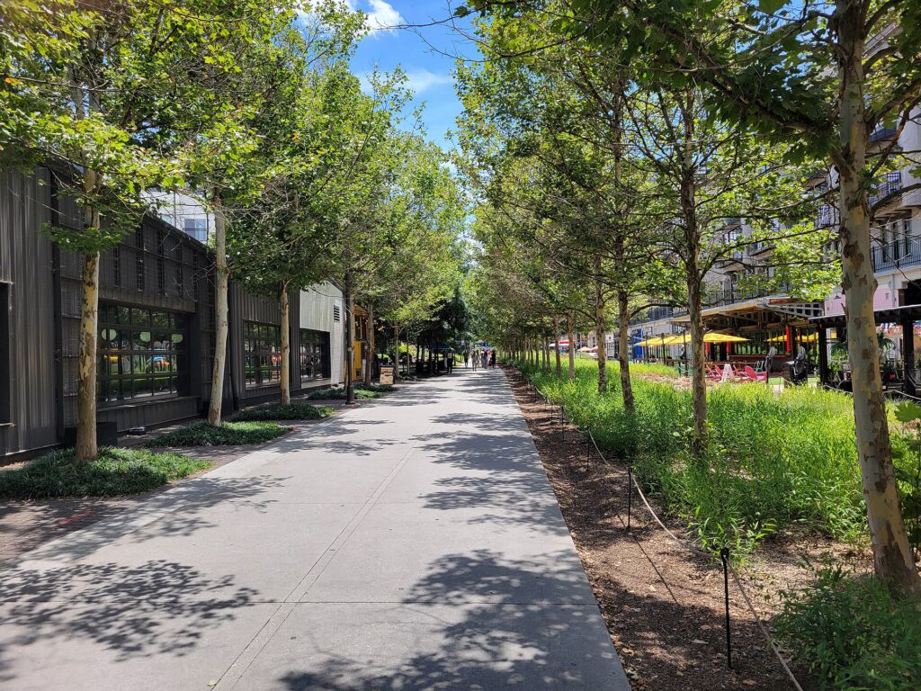
    • On transit: take the A Line rather than a taxi from the airport; buy a day pass for a heavy sightseeing day; riders 19 and under are free; use the free MallRide downtown when it is running.
    • On a rental: compare airport and city pickup, book early for ski holidays and summer, ask for all-wheel drive and suitable tires between September and May, decline extras you already have through a credit card or home policy (check first), understand the toll program before you drive E-470, and park under cover in hail season.
    • On the hotel: if you are renting, price the parking fee into the room rate.
    • On timing: avoid I-25 in the weekday peaks and I-70 westbound on Saturday mornings and eastbound on Sunday afternoons; the best time to fly to Denver guide lists the busiest weekends.
    • On the mountains: for one or two people staying in a single ski town, Bustang, the ski train or a shuttle usually costs less than a rental plus fuel and resort parking. Our car, transit or taxi guide covers the general trade-offs.

    Frequently asked questions

    Is it worth renting a car in Denver?

    For Rocky Mountain National Park, a family ski trip, the suburbs or a road trip, yes. For a downtown city break, a conference, a concert or a game, no; the train, light rail and your feet are enough.

    Is Denver public transit good for tourists?

    Good for the core and better than most Western cities: a train from the airport, light rail to the suburbs and Golden, and a free downtown shuttle. It thins out away from the rail lines, and it does not reach the mountains.

    How do I get from Denver airport to downtown?

    The A Line train to Union Station in under 40 minutes, or a taxi or ride-hail in 30 to 50 minutes depending on traffic.

    Can I get to the ski areas from Denver without a car?

    Yes. Private shuttles run from DEN to the major resorts, Bustang runs along I-70 with seasonal ski service, and the Winter Park Express train has run on winter weekends.

    Do I need four-wheel drive or snow tires to drive I-70 in winter?

    Colorado’s traction law requires suitable tires, four-wheel or all-wheel drive, or chains when it is in effect on the mountain corridor, generally from September through May. Ask for an all-wheel-drive rental and check the tires.

    Is parking expensive in downtown Denver?

    At hotels and near the stadiums, yes. Meters are enforced into the evening on many blocks, so check the posted hours.

    Does the altitude affect driving in the mountains?

    Your car will have less power on the climbs and needs lower gears on the descents, and you may feel tired or light-headed on your first day up high. Hydrate and do not push a long drive straight after a flight.

    Whichever way you go, start with the flight. Compare cheap flights to Denver, choose a neighborhood with our Denver hotel search, plan the city days with our first-timer’s guide to Denver, and if the mountains are on the list, price the rental for those dates on our Denver car rental page.