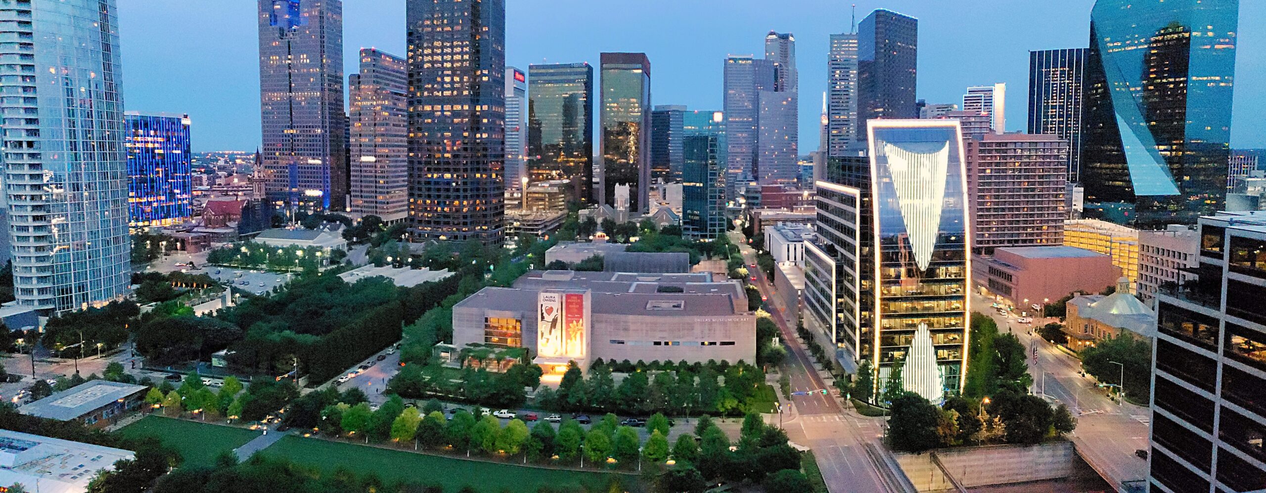
Tag: Car Rental

  • Dallas: Should You Rent a Car or Rely on Public Transit?

    Dallas: Should You Rent a Car or Rely on Public Transit?

    Dallas has a reputation as a place where nobody walks and everybody drives, and for much of the metro that reputation is earned. The Dallas-Fort Worth area sprawls across more than a dozen counties, its freeways are among the widest in the country, and its two big cities, its stadiums and its suburbs sit tens of miles apart. It is also incomplete. Dallas also runs one of the longest light-rail networks in the United States, a train goes straight from DFW Airport to downtown, a free vintage trolley covers Uptown, and the neighborhoods most visitors actually spend their time in, downtown, the Arts District, Uptown, Deep Ellum and Bishop Arts, are compact and connected. The right answer depends almost entirely on where you are going beyond the center. This guide explains how the city is laid out, how DART and the regional trains work, what driving here is really like, including the tolls, the heat and the storms, and gives you a straightforward way to decide.

    The short answer

    Skip the car if you are staying downtown, in the Arts District or in Uptown for a city break, a convention or the State Fair, and your plans are the museums, Klyde Warren Park, Dealey Plaza, Deep Ellum, Bishop Arts and a Mavericks game; DART, the M-Line trolley, your feet and the occasional ride-hail will cover it, and you will not pay for hotel parking. Rent a car if you are going to a Cowboys or Rangers game in Arlington, visiting family in the suburbs, spending serious time in Fort Worth, or driving on to Houston, Austin or Waco. For many visitors the hybrid works best: car-free city days and a one- or two-day rental for everything else. Compare rates for any of these plans on our Dallas car rental page.

    How Dallas is laid out

    Downtown Dallas sits inside a tight ring of freeways on the east bank of the Trinity River: I-35E on the west, I-30 on the south, I-345 on the east and Woodall Rodgers, now partly covered by Klyde Warren Park, on the north. The Arts District fills the northern edge of downtown, with Uptown and Victory Park just beyond it; Deep Ellum is directly east; the Cedars and Fair Park are to the southeast; and Oak Cliff, with the Bishop Arts District, is across the river to the southwest. The vast northern suburbs of Richardson, Plano and Frisco lie beyond Uptown and the Park Cities. DFW Airport lies about 32 km (20 miles) to the northwest, halfway to Fort Worth, with Irving and Las Colinas between it and the city, and Arlington, home of the Cowboys and Rangers, sits south of the airport between the two big downtowns. The center is walkable in cooler months; everything beyond it was built around the car.

    Hotels cluster downtown and in the Arts District, in Uptown, around the airport and Las Colinas, and in the northern suburbs along the tollways, where many corporate campuses are. Our Dallas hotel search lets you compare them.

    Getting in from the airport

    Dallas has two airports, and the answer is different for each. At DFW, the DART Orange Line leaves from DFW Airport Station at Terminal B and reaches downtown Dallas in about 50 minutes for a standard local fare; from other terminals, ride the Skylink train or the landside Terminal Link shuttle to Terminal B. TEXRail runs from the same station to downtown Fort Worth in under an hour, stopping in Grapevine. Taxis and ride-hail pick up at every terminal, and the drive to downtown Dallas takes 25 to 45 minutes depending on traffic. Every major rental company operates from the consolidated Rental Car Center south of the terminals, reached by dedicated shuttle buses from each terminal. At Love Field, the smaller airport where Southwest is based, downtown is only about 10 km (6 miles) away, a 15- to 20-minute taxi or ride-hail, and a DART shuttle bus connects the terminal to Inwood/Love Field station on the light rail; the rental counters are in the garage across from the terminal. Check the DFW site and the Love Field site for current ground-transport details, and our DFW airport guide for the layout.
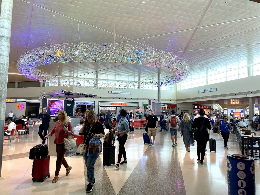
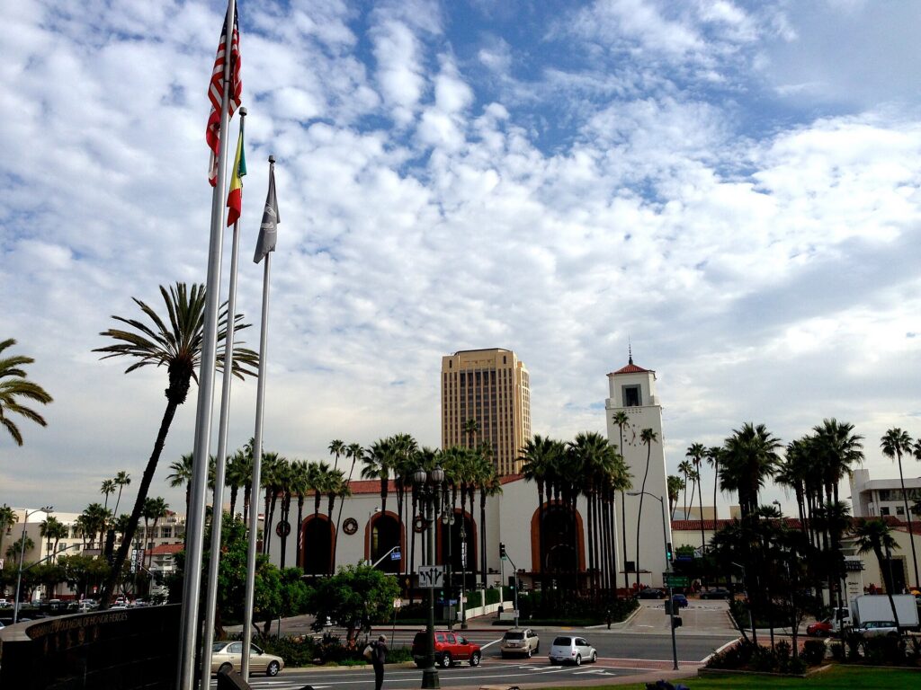
    The terminal at Dallas Love Field (DAL)
    Dallas Love Field, Southwest's home base, about 15 to 20 minutes by car from downtown (Photo: EEJCC via Wikimedia Commons, CC BY-SA 4.0)

    Dallas’s transit, explained

    Dallas Area Rapid Transit, known as DART, runs the light rail, the buses and the streetcar across Dallas and a dozen surrounding cities. It is clean, air-conditioned and, on the rail lines, frequent enough for visitors, and it covers more of the places you want to go than its reputation suggests. Its limitation is the metro’s scale: the rail lines radiate from downtown along the main corridors, and the buses that fill the gaps run less often than a visitor from New York or Chicago would expect.

    DART light rail

    Four lines, all of which run through the downtown transit mall. The Red and Blue lines run north through Uptown’s Cityplace station toward Richardson, Plano and Garland, and south past Union Station and the Cedars into Oak Cliff, with the Red Line stopping at the Dallas Zoo. The Green Line runs from the northwest past the Market Center and Victory station at the American Airlines Center, through downtown to Deep Ellum and Fair Park, which makes it the State Fair line. The Orange Line shares the Green Line’s tracks in the city, then heads west through Irving and Las Colinas to DFW Airport. DART’s newer Silver Line commuter rail, running across the northern suburbs from DFW to Plano, has been coming into service; check DART’s map for its status when you travel. Trains run from early morning until around midnight.

    Streetcars and the trolley

    The Dallas Streetcar runs from Union Station across the Trinity to the Bishop Arts District in Oak Cliff, which is the easiest car-free way to reach it. The M-Line trolley, run by the McKinney Avenue Transit Authority with restored vintage streetcars, is free and runs every day from the Arts District up McKinney Avenue through Uptown to Cityplace, connecting with DART; the M-Line’s site has the route.

    Buses

    Buses fill in the rest, including routes to White Rock Lake, the Arboretum and the neighborhoods off the rail lines, and on-demand GoLink minibuses serve some suburban zones. Frequencies drop in the evenings and on weekends.

    Fares and tickets

    Buy tickets in the GoPass app or from the machines on every rail platform. Single rides, a midday pass and a day pass are valid across trains, buses and the streetcar, and a regular local pass covers the Orange Line to DFW; continuing into Fort Worth on the TRE or TEXRail needs a regional pass. Reduced fares are available for children, seniors and students. Check DART’s site for current prices before you go.

    Accessibility

    All DART rail stations are accessible, with level boarding from the platforms, and the bus fleet is low-floor with ramps.
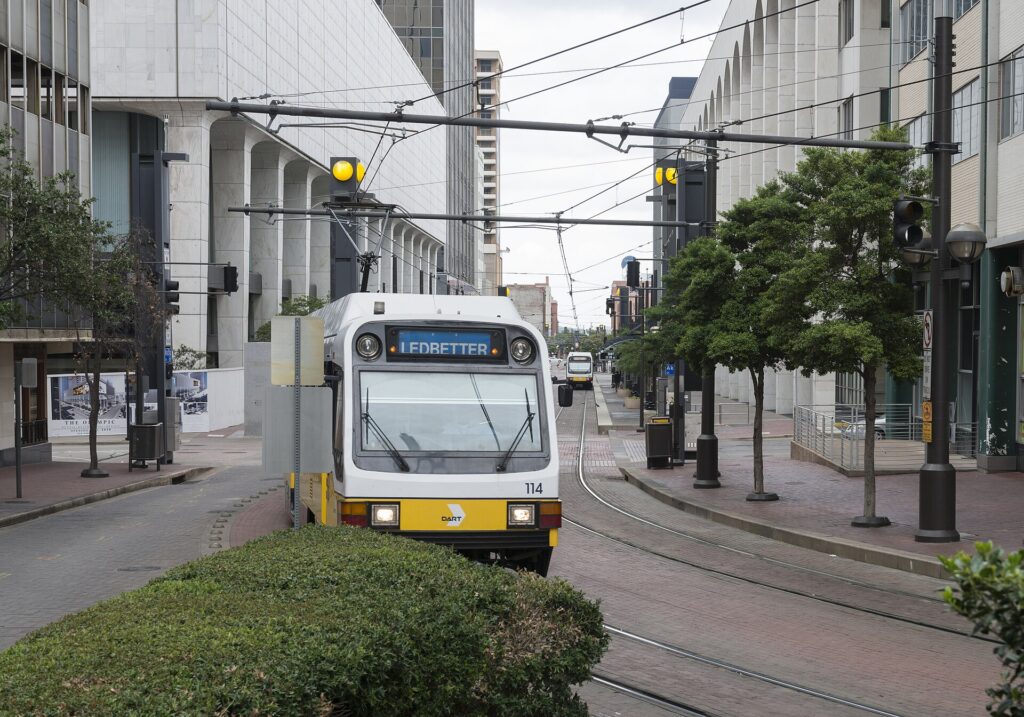
    A DART light-rail train in downtown Dallas
    DART light rail, one of the longest light-rail networks in the United States, with a direct line to DFW Airport (Photo: Carol M. Highsmith via Wikimedia Commons, Public domain)

    Beyond DART

    • Walking. Downtown, the Arts District, Klyde Warren Park, Uptown and Deep Ellum are pleasant on foot from October to May. From June to September, save walking for mornings and evenings.
    • The Katy Trail and bikes. The Katy Trail runs about 3.5 miles through Uptown on a former railroad line, and the loop around White Rock Lake is about 9 miles; both are best by bike in the cooler hours.
    • Taxis and ride-hail. Uber, Lyft and taxis operate across the metro and are quick for short hops between Uptown, Deep Ellum and Bishop Arts.
    • Regional trains. The Trinity Railway Express commuter line runs between Dallas Union Station and downtown Fort Worth, with a stop at CentrePort that connects by shuttle bus to DFW, on a reduced weekend schedule. TEXRail links DFW to Grapevine and Fort Worth.
    • Amtrak. The Texas Eagle stops daily at Union Station on its way between Chicago and San Antonio via Fort Worth and Austin; Amtrak has the schedule. There is no passenger train to Houston.
    • Intercity buses connect Dallas with Houston, Austin and San Antonio several times a day, a reasonable alternative to a one-way rental for solo travelers.
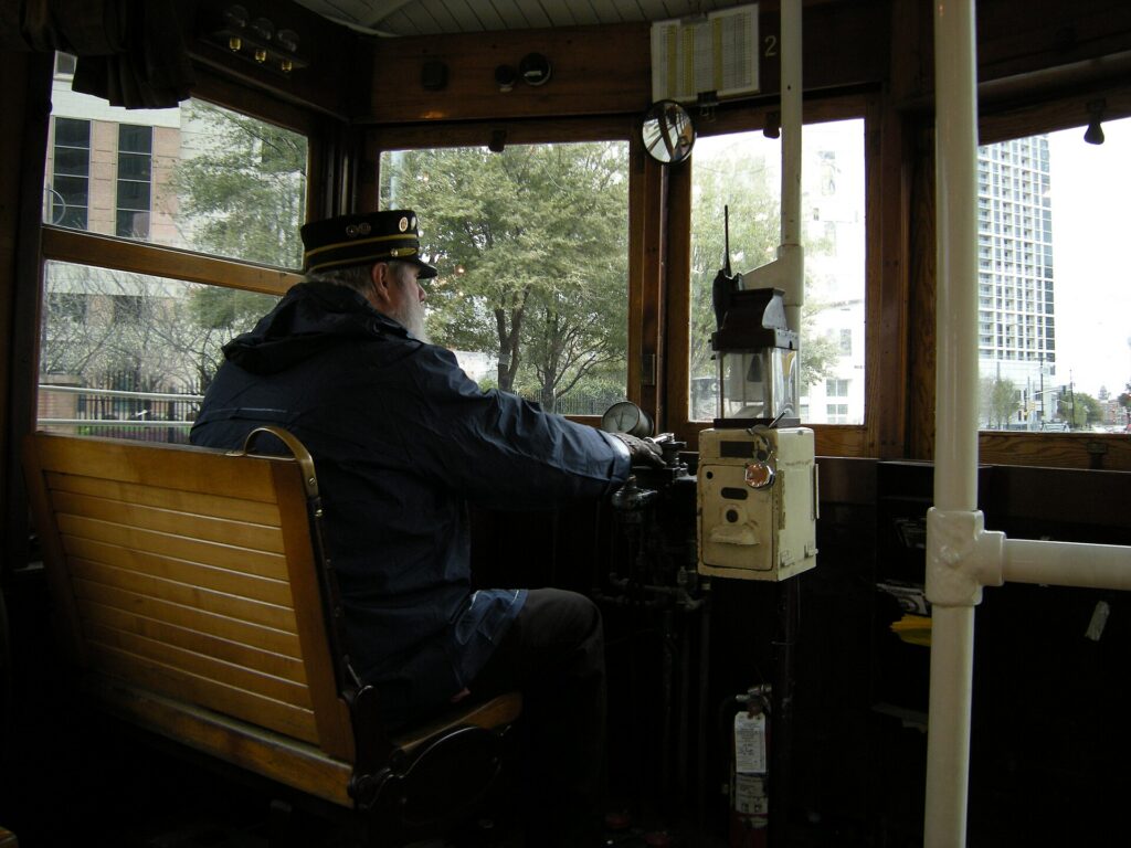
    A vintage M-Line trolley on McKinney Avenue in Uptown Dallas
    The free M-Line trolley runs restored vintage streetcars through Uptown every day (Photo: Joe Mabel via Wikimedia Commons, CC BY-SA 3.0)

    Driving in Dallas: what it is really like

    Dallas is built for driving, and in many ways it is easy: wide freeways, plentiful signage, free parking almost everywhere outside the core, and fuel prices below the national average. The frustrations are specific. Rush hour jams I-35E, US 75, I-635 and the Dallas North Tollway every weekday morning and evening, and a single crash can back up a freeway for miles. Construction is permanent on some corridor or other, and lane shifts and closures change weekly. The interchanges are huge, among them the five-level High Five where US 75 meets I-635, and the frontage roads that run beside every Texas freeway, with their one-way flow and U-turn lanes under the overpasses, take a day to get used to. And game days in Arlington, when the Cowboys or Rangers are at home, clog I-30 and the roads around the stadiums for hours before and after.
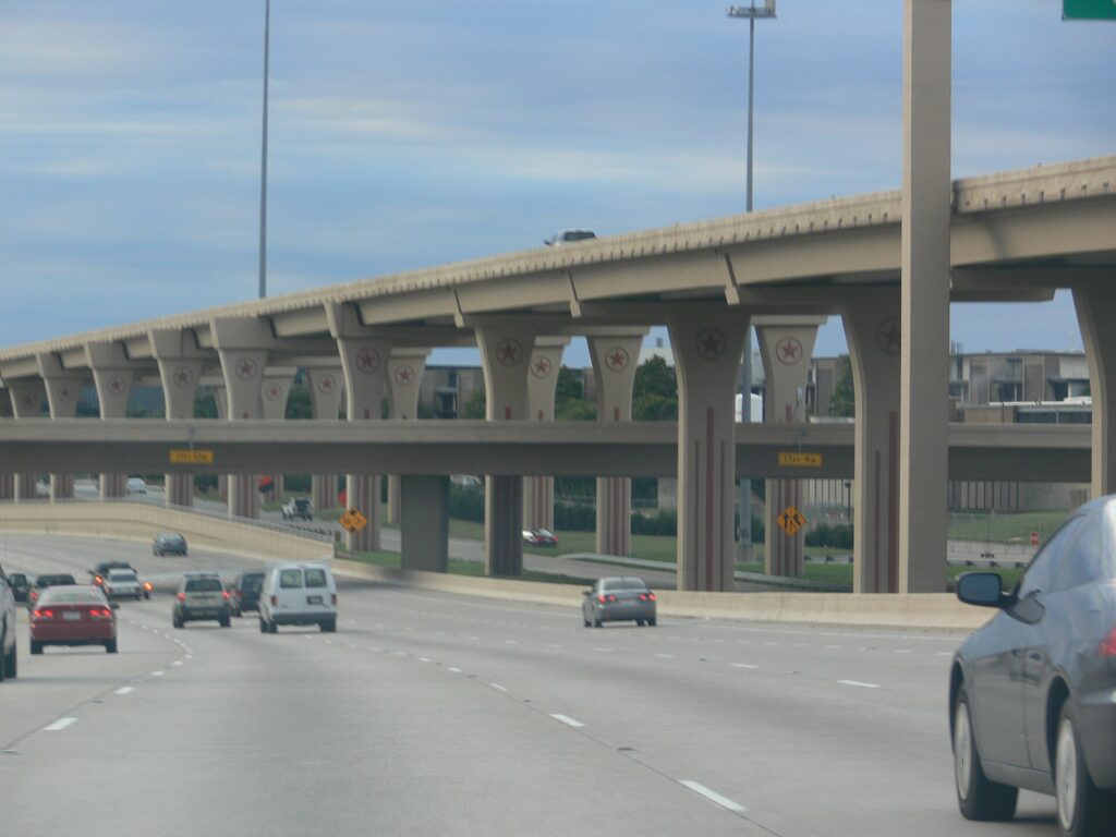
    The five-level High Five Interchange in north Dallas
    The High Five, where US 75 meets I-635: Dallas's freeways are vast, and so are its rush hours (Photo: Photo: Andreas Praefcke via Wikimedia Commons, CC BY 3.0)

    Tolls

    The Dallas North Tollway, the President George Bush Turnpike, the Sam Rayburn Tollway and several other roads are run by the North Texas Tollway Authority, and all of them are cashless: tolls are charged to a TollTag or billed by mail from a photo of the plate, at a higher rate. Express lanes on LBJ Freeway and parts of I-35E use variable pricing. Rental companies handle this through toll programs, usually a flat daily fee plus the tolls, charged on every day of the rental once you use one tolled road. Read the policy at the counter, or set your navigation app to avoid tolls; most city trips add only a few minutes.

    Parking

    Downtown has garages and metered street parking, and most downtown and Uptown hotels charge a nightly fee, often valet-only. Uptown restaurants lean heavily on valet, which is quick and inexpensive by big-city standards. Deep Ellum and Bishop Arts have paid lots and limited street parking, and towing is strictly enforced, so read the signs. Parking at AT&T Stadium and Globe Life Field on game days is expensive and fills early, and some lots are a long walk from the gates. Outside the core, at the Arboretum, the zoo, the malls and the suburbs, parking is plentiful and usually free.

    Rules and conditions worth knowing

    • Heat. A parked car in a Dallas summer becomes dangerously hot in minutes; never leave a child or a pet inside, and use a sunshade.
    • Storms and flash floods. Spring thunderstorms bring hail that can dent a car in minutes and downpours that flood underpasses quickly. Park under cover when storms are forecast, and never drive into water over the road; the National Weather Service’s “Turn Around, Don’t Drown” advice exists for a reason.
    • Ice. On the few days a year when freezing rain hits, bridges and overpasses ice first and the city largely stops. Stay put if you can. DriveTexas publishes road conditions and closures statewide.
    • Phones. Texting while driving is illegal statewide, and handheld phone use is banned in school zones.
    • Right turns on red are permitted after a full stop unless signed otherwise.
    • Move over. Texas law requires you to move over or slow down for stopped emergency, police and road-maintenance vehicles.
    • Speed limits run 60 to 70 mph on urban freeways and up to 75 mph on rural interstates such as I-45 toward Houston.

    When renting a car makes sense

    • Cowboys and Rangers games. AT&T Stadium and Globe Life Field are in Arlington, which has no rail link and very limited public transit; a car, a game-day shuttle or a ride-hail is the practical way in.
    • Fort Worth, properly. The TRE reaches downtown Fort Worth, but the Stockyards and the Cultural District are spread out; a car makes a full day easy.
    • The suburbs. Family in Plano, Frisco or McKinney, or business on a corporate campus along the tollways,.
    • Day trips. Grapevine, Waco, Glen Rose and the lakes are car trips.
    • Texas road trips. Houston, Austin and San Antonio are three to five hours away; our Dallas to Houston route guide covers the most popular drive.
    • Families with young children, for whom a car, a cooler and air conditioning simplify every summer day.

    If any of those apply, our rental car booking tips cover insurance, deposits and the questions to ask at the counter, and our family car rental guide looks at vehicle choice.

    When it does not

    • You are staying downtown, in the Arts District or in Uptown, and your plans are the center.
    • You are in town for a convention, a Mavericks or Stars game, or a concert at the American Airlines Center, all on DART.
    • You are going to the State Fair, where the Green Line stops at the gate and parking is expensive and slow.
    • You flew into Love Field for a short city break; the taxi downtown costs less than a day of hotel parking.

    The hybrid plan for a city-plus-Texas trip

    Go car-free for the city days and rent for the rest, and think carefully about where you pick up. Renting at DFW makes sense if you are heading straight to Arlington, Fort Worth or the suburbs, because the airport sits between them and you avoid downtown traffic entirely. Renting at a neighborhood branch downtown or in Uptown makes sense if you are spending the first nights in the city, because you avoid the airport’s concession fees and several nights of hotel parking. A pattern that works well: the Orange Line or a taxi into the city, two or three car-free days, a rental picked up in town for Fort Worth and a game in Arlington, and the car returned at DFW on the way to the flight home. If you are continuing to Houston, a one-way rental is usually available, though it may carry a drop fee; compare the day rates on our Dallas car rental page against a full-trip rental and the difference is usually clear.

    A worked cost comparison

    Numbers change with the season and the booking window, so treat this as a method rather than a quote, and check current rates before deciding. For a four-night city break downtown for two people, the car-free version costs two Orange Line fares from DFW or one taxi from Love Field, a few DART day passes, and perhaps three or four ride-hail trips to Bishop Arts, Lower Greenville and back; the rental version adds four days of a compact car, four nights of hotel parking, fuel, the airport concession fees and probably a toll-program charge. The transit option wins easily. For the same four nights with a day in Fort Worth and a Rangers game, the car-free version adds TRE regional passes and ride-hail to and from Arlington, which surges on game nights; the hybrid version adds a two-day rental picked up in town, stadium parking and fuel. For two people the costs are often close, and the car wins on convenience; for a family of four, the rental is usually cheaper. For a week split between Dallas and Houston, a one-way rental is the practical answer for most travelers; compare the drop fee against a bus plus a second rental in Houston. Run the rental rates for your dates on our Dallas car rental page and put them beside the transit costs before you choose.

    Driving Dallas to Houston and beyond in each season

    The drive to Houston is the most common road trip out of Dallas: about 385 km (240 miles) south on I-45, three and a half to four hours without traffic, across flat farmland and piney woods. The landmarks are the giant Buc-ee’s travel center at Madisonville, roughly halfway, and the towering statue of Sam Houston beside the highway at Huntsville. In summer, the challenge is heat and holiday traffic; leave early, keep the tank above a quarter, and expect Friday afternoons southbound and Sunday afternoons northbound to be slow. In spring, thunderstorms can bring blinding rain and hail to the open stretches, and flash flooding closes low roads; check the forecast and the National Weather Service before you set out. In fall, the weather is ideal, but football weekends, the State Fair and Texas-OU weekend fill the highways around Dallas. In winter, the road is usually clear, but on the rare ice days the interstate can close entirely, and the right call is to wait a day. In every season, the last hour into Houston, where I-45 meets that city’s traffic, is usually the slowest part of the trip.

    Decision table

    Your tripRecommendationWhy
    City break downtown or Uptown, couple or soloNo carDART, the free trolley and short ride-hail trips cover it; hotel parking is expensive
    Convention or business downtownNo carThe Orange Line runs from DFW to downtown, and the center is compact
    State FairNo carThe Green Line stops at Fair Park; fair parking is slow and costly
    Cowboys or Rangers gameRent for the day, or ride-hailArlington has no rail link and very limited transit
    City plus Fort WorthHybrid: rent in town for the Fort Worth day, or take the TRECar-free city days, car or train for Cowtown
    Family visit to the suburbsRent for the whole staySuburban distances make the car worthwhile daily
    Short trip via Love FieldNo carDowntown is a 15- to 20-minute ride away
    Texas road tripRent (consider one-way to Houston)Dallas is the start, not the destination

    Money-saving tips for both options

    • On transit: ride the free M-Line through Uptown; buy a day pass for a heavy sightseeing day, which also covers the train to DFW; and use the Orange Line rather than a taxi from the airport if you are traveling light.
    • On a rental: compare airport and in-town pickup, book early for October and the holidays, understand the toll program before you drive off, decline extras you already have through a credit card or home policy (check first), and park under cover in hail season.
    • On the hotel: if you are renting, price the nightly parking into the room rate, and consider a hotel near DFW or in the suburbs with free parking for the car days.
    • On timing: avoid the freeways in the weekday peaks and I-30 on game days, and look at the best time to fly to Dallas guide for the busiest weekends.
    • On the big picture: for one or two people staying central, transit plus the occasional ride-hail almost always costs less than a rental; our guide to car, transit or taxi explains how to run the numbers.

    Frequently asked questions

    Is it worth renting a car in Dallas?

    For Arlington, Fort Worth, the suburbs or a road trip, yes. For a city break or a convention based downtown or in Uptown, no; DART, the trolley and ride-hail are enough.

    Is Dallas public transit good for tourists?

    Better than its reputation. The light rail reaches downtown, the Arts District, Deep Ellum, Fair Park, the zoo and DFW, and the free trolley covers Uptown. It thins out quickly in the suburbs and does not reach Arlington.

    How do I get from DFW Airport to downtown Dallas?

    The DART Orange Line from Terminal B in about 50 minutes, or a taxi or ride-hail in 25 to 45 minutes depending on traffic.

    How do I get from Love Field to downtown?

    A taxi or ride-hail in 15 to 20 minutes, or the DART shuttle bus to Inwood/Love Field station and the light rail into downtown.

    Do I need a toll tag to drive in Dallas?

    No, but many major roads are cashless toll roads. A rental car’s toll program covers them for a fee, or you can set your navigation app to avoid tolls.

    Can I get to Fort Worth without a car?

    Yes. The Trinity Railway Express runs between the two downtowns, and TEXRail links DFW with Fort Worth. For the Stockyards and the museums, add a ride-hail or local bus at the Fort Worth end.

    How do I get to a Cowboys game without a car?

    Ride-hail, a game-day shuttle, or a rental; Arlington has no train service. Plan the trip home in advance.

    Whichever way you go, start with the flight. Compare cheap flights to Dallas, choose a neighborhood with our Dallas hotel search, and if Arlington, Fort Worth or a road trip is on the list, price the rental for those dates on our Dallas car rental page. For what to do once you are there, see our first-timer’s guide to Dallas.

  • Chicago: Should You Rent a Car or Rely on Public Transit?

    Chicago: Should You Rent a Car or Rely on Public Transit?

    Chicago is the rare American city where most visitors are better off without a car. It has the second-largest public transit system in the country, trains that run from both airports straight into downtown, a 24-hour rail line to O’Hare, a compact core of walkable neighborhoods, a lakefront trail made for bikes, and some of the most expensive parking and highest rental taxes anywhere in the Midwest. The expressways into the city are also among the most congested in the nation. But the question is not quite closed. Chicago is the hub of the Midwest, and a surprising number of travelers use it as the start of a road trip to Wisconsin, Michigan or the Illinois countryside, visit family in the far-flung suburbs, or want the freedom to reach Starved Rock or the Indiana Dunes on their own schedule. This guide explains how the city is laid out, how the ‘L’, the buses and Metra work, what driving and parking here are really like, and gives you a straightforward way to decide.

    The short answer

    Skip the car if you are staying downtown, in River North, the West Loop, the Magnificent Mile or a North Side neighborhood, and your plans are the museums, the lakefront, the river, the ballparks and the restaurants; the ‘L’, the buses, Divvy bikes and your feet will cover all of it, and you will save the parking fees, the taxes and the traffic. That is most visitors. Rent a car if you are driving on to Milwaukee, Wisconsin’s lakes, Michigan or Minneapolis, if you are visiting family in the outer suburbs, if you have a day planned at Starved Rock or Galena, or if you are traveling with small children and a lot of gear to a hotel outside the transit network. And if you need a car for only part of the trip, rent it only for those days, picking up in the city rather than at O’Hare. Compare rental rates for any of these plans on our Chicago car rental page.

    How Chicago is laid out

    Chicago is a grid, and a very logical one. Every address is numbered from the intersection of State and Madison Streets in the Loop, with 800 numbers to a mile, so 1600 North is two miles north of Madison and 3200 West is four miles west of State. Lake Michigan forms the eastern edge of everything. Downtown is the Loop, the business district inside the ring of elevated tracks, with Millennium Park and the Art Institute on its lake side; the Chicago River wraps its north and west sides. North of the river are River North and the Magnificent Mile, then the Gold Coast, Old Town, Lincoln Park and Lakeview along the lake. West of the Loop is the West Loop and Fulton Market; the Museum Campus and the South Loop are to the south, with Chinatown, Pilsen and, farther down the lake, Hyde Park. The city extends for miles in every direction, and the suburbs for many more, with O’Hare on the northwest edge and Midway on the Southwest Side.

    Hotels cluster in the Loop, River North, the Magnificent Mile and the West Loop, with a large group around O’Hare in Rosemont and a scattering in the neighborhoods. Our Chicago hotel search lets you compare them, and it is worth checking the parking fee on any hotel before you decide on a car.

    Getting in from the airports

    O’Hare (ORD) is about 27 km (17 miles) northwest of the Loop. The CTA Blue Line leaves from a station beneath the parking garage in the middle of the terminal complex, runs 24 hours a day, and reaches the Loop in about 45 minutes for a slightly higher fare than a normal ride; it is the cheapest way downtown and, at rush hour, often the fastest. By taxi or ride-hail, the drive along the Kennedy Expressway takes anywhere from 30 minutes late at night to well over an hour at the evening peak. The rental companies share a multi-modal facility reached by the free airport transit train. Midway (MDW), about 16 km (10 miles) southwest of the Loop, is simpler still: the CTA Orange Line starts at the terminal and reaches the Loop in about 25 minutes, and the rental counters and taxis are a short walk away. The Chicago airports’ site covers ground transport at both; our O’Hare airport guide covers the layout.

    A CTA 'L' train on the elevated tracks at the northeast corner of the Loop
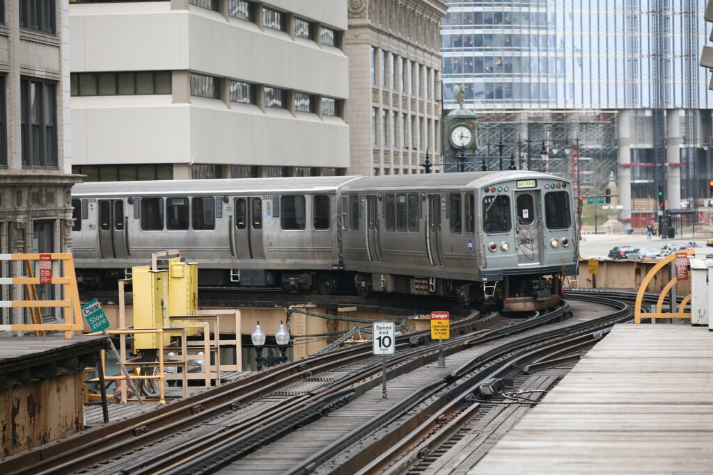
    The 'L' on the elevated Loop tracks, the cheapest sightseeing ride in the city (Photo: Daniel Schwen via Wikimedia Commons, CC BY-SA 4.0)

    Chicago’s transit, explained

    The Chicago Transit Authority runs the ‘L’ trains and the city buses, Metra runs the commuter rail to the suburbs, and Pace runs the suburban buses. For a visitor, the CTA alone covers almost everything, and it is frequent, extensive and, on the main lines, around the clock.

    The ‘L’

    Eight color-coded lines and about 145 stations. The Red Line is the backbone, running north-south through the city under State Street, with stops for the Magnificent Mile, Wrigley Field (Addison), Chinatown and the White Sox ballpark. The Blue Line runs from O’Hare through Logan Square, Wicker Park and the Loop to the West Side. Both run 24 hours. The Brown, Green, Orange, Pink and Purple Lines circle the Loop on the elevated tracks that give the district its name, and then fan out to the North Side, the West Side, Oak Park and Midway; the Yellow Line is a short shuttle to Skokie. Riding the Brown Line around the elevated Loop at dusk is one of the best cheap sightseeing trips in the city. Trains on most lines run every few minutes at peak times and less often late at night; check the CTA’s train tracker for real-time arrivals.

    Buses

    The CTA’s bus network follows the grid and reaches everywhere the ‘L’ does not, including the Museum Campus, Navy Pier and the lakefront neighborhoods. Useful routes for visitors run along Michigan Avenue, the lakefront and the major east-west streets, and some of the busiest run through the night. Buses get caught in traffic at rush hour, but for short trips across the grid they are hard to beat.

    Metra and the South Shore Line

    Metra’s eleven commuter lines leave from four downtown terminals, Union Station, the Ogilvie Transportation Center, LaSalle Street and Millennium Station, for the suburbs, including Evanston, Oak Park and the Chicago Botanic Garden. Service is frequent at rush hour and thinner at weekends. The separate South Shore Line runs from Millennium Station to Indiana Dunes National Park and South Bend.

    Fares and tickets

    The simplest way to pay on the CTA is to tap a contactless bank card or a phone wallet at the turnstile or on the bus; you can also buy a reusable Ventra card at stations, or use the Ventra app, which also sells Metra tickets. One-, three- and seven-day unlimited passes are good value if you will ride more than a few times a day, and transfers within two hours are discounted or included depending on how you pay. Trips starting at the O’Hare station cost more than a standard ride. Children under seven ride free, and there are reduced fares for older children, seniors and riders with disabilities. Check the CTA’s site for current fares before you go.

    Accessibility

    Every CTA bus is accessible, and most ‘L’ stations have elevators, though some older stations on the elevated lines do not; the CTA is working through them and marks accessible stations on its maps. Check before relying on a particular station with a wheelchair or a stroller.

    Beyond the CTA

    • Walking and the Pedway. The Loop, River North, the Magnificent Mile and the lakefront are all easy on foot, and the grid makes it hard to get lost. In winter, the Pedway, a network of underground tunnels and overhead bridges beneath about forty blocks of the Loop, links stations, office buildings and department stores out of the wind.
    • Divvy bikes. The city’s bike-share system has thousands of pedal bikes and e-bikes at docks across the city, and the Lakefront Trail, the Riverwalk and a growing network of protected lanes make it the best way to see the shore. Buy a day pass or ride by the minute through the Divvy app.
    • Water taxis. In the warmer months, water taxis run along the river between the train stations, Michigan Avenue and Chinatown, and across the harbor between Navy Pier and the Museum Campus. They are transport and a sightseeing trip at once.
    • Taxis and ride-hail. Licensed taxis and the ride-hail apps operate across the city. For a group of three or four, a short ride is competitive with transit fares, and late at night it is the easy way home from the neighborhoods off the 24-hour lines.
    • Amtrak. Union Station is the hub of the national rail network, with frequent trains to Milwaukee and regular services to Detroit, St. Louis and beyond; Amtrak is a genuine alternative to a rental for trips to Milwaukee.
    A Divvy bike-share bike on the Lakefront Trail in Chicago
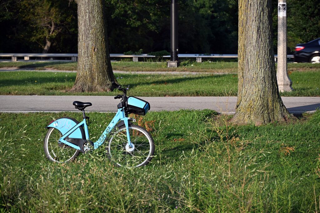
    A Divvy bike on the Lakefront Trail, the best way to see the shore (Photo: DimiTalen via Wikimedia Commons, CC0)

    Driving in Chicago: what it is really like

    Driving in Chicago is manageable for anyone used to a big American city, and the grid makes navigation easy, but it is rarely fast. The expressways, the Kennedy to O’Hare, the Dan Ryan south, the Eisenhower west, the Stevenson toward Midway and the Edens north, converge on downtown and jam every weekday morning and evening, and the city consistently ranks among the most congested in the United States. The Circle Interchange, where they meet west of the Loop, is notorious. Lake Shore Drive, officially renamed Jean Baptiste Point DuSable Lake Shore Drive, is the scenic exception: an expressway along the lakefront with the skyline on one side and the beaches on the other, and one of the great urban drives in the country, though it too backs up at rush hour and trucks are banned from it. Downtown streets are dense with pedestrians, cyclists, buses and delivery vehicles, many turns are restricted, and summer brings construction on the main routes and street closures for festivals and parades.

    Lake Shore Drive running north along Lake Michigan in the evening
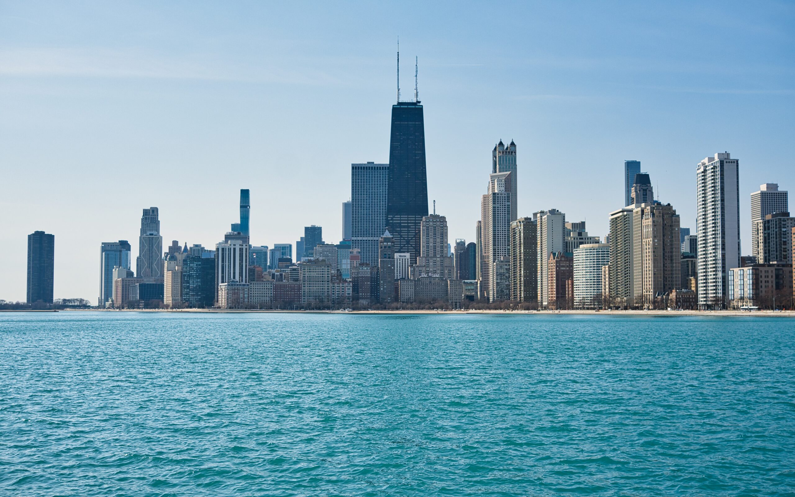
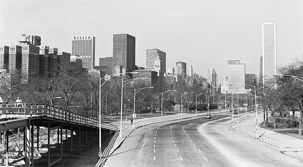
    Lake Shore Drive, one of the great urban drives in America, and still jammed at rush hour (Photo: Downtowngal via Wikimedia Commons, CC BY-SA 4.0)

    Parking

    Parking is where a Chicago rental gets expensive. The city’s parking meters were leased to a private operator in 2008, and the rates in the Loop and River North are among the highest of any American city; pay at the street boxes or with the ParkChicago app, and read the signs for rush-hour restrictions, which tow cars from some arterial streets at peak times. Downtown hotels charge a substantial nightly fee, often for valet only, and the garages are priced accordingly, although booking a garage space online in advance can cut the rate considerably. In the neighborhoods, residential permit zones cover many side streets in the evenings, and street cleaning signs from spring to fall mean a ticket or a tow for the unwary. In winter, the city bans overnight parking on certain signed arterial streets from December 1 to April 1, and a separate ban kicks in on other routes after a heavy snowfall. The city’s impound lots are a long way from anywhere, and retrieving a towed car costs a day of your trip.

    Rules and conditions worth knowing

    • Tolls. The Illinois Tollway, which includes the roads to O’Hare’s western side, the Tri-State around the suburbs and the route toward Wisconsin, is fully electronic, with no cash booths. Rental companies offer transponder programs for a daily fee; if you decline, you can usually pay the tolls online by license plate within the grace period on the Illinois Tollway’s site. I-PASS and E-ZPass transponders both work.
    • Cameras. Speed cameras operate near parks and schools across the city, and red-light cameras at more than a hundred intersections; the fines follow the car, and the rental company will bill you with a fee on top.
    • Phones. Illinois bans handheld phone use while driving; hands-free only.
    • Right turns on red are permitted after a full stop unless signed otherwise, and many downtown intersections are signed otherwise.
    • Winter driving. The city and state plow quickly, and rental cars on all-season tires cope with most Chicago winters, but lake-effect snow bands and ice storms can make the expressways treacherous for a few hours. Check conditions before long drives from December to March.
    • Fuel and taxes. Layered state, county and city taxes make fuel in Chicago noticeably pricier than in Indiana or Wisconsin, and Chicago and O’Hare add some of the steepest rental taxes and fees in the country. Fill up across the state line on a road trip.
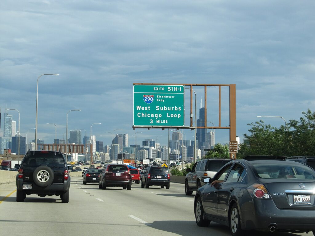
    Traffic on the Kennedy Expressway approaching downtown Chicago
    The Kennedy Expressway, the road from O'Hare, where the Blue Line often beats a taxi at rush hour (Photo: Ken Lund from Reno, Nevada, USA via Wikimedia Commons, CC BY-SA 2.0)

    When renting a car makes sense

    • Midwest road trips. Chicago is the natural start for a drive north to Milwaukee, Madison and Minneapolis, or east around the lake to Michigan; our route guides for Chicago to Minneapolis and Chicago to Detroit cover the two classic runs.
    • State parks and small towns. Starved Rock State Park, Galena and Lake Geneva in Wisconsin are effectively car-only.
    • Family in the suburbs. The suburbs sprawl for 50 miles or more, and while Metra reaches many of them, a car earns its keep daily if your base is out there.
    • Families with small children and gear staying outside the city, where the train is not an option.
    • A hotel near O’Hare for a business trip to the suburbs, where offices are spread out along the tollways.

    If any of those apply, our rental car booking tips cover insurance, deposits and the questions to ask at the counter, and our family car rental guide looks at vehicle choice.

    When it does not

    • You are staying downtown, in River North, the West Loop or a North Side neighborhood, and your plans are the city.
    • You are in town for a convention at McCormick Place, a ball game, a concert or a festival, when traffic and parking are at their worst and transit goes straight to the door.
    • Your day trips are Oak Park, Evanston, the Indiana Dunes or Milwaukee, all of which have direct trains.
    • You are traveling solo or as a couple and would spend more on the rental, taxes and parking than on a week of transit passes and the odd taxi.

    The hybrid plan for a city-plus-road-trip visit

    Go car-free for the city days and rent only for the days you leave town, and think carefully about where you pick up. Renting at O’Hare makes sense if you are driving straight out on arrival toward Wisconsin or the western suburbs, because the tollways are right there and you never enter downtown traffic. For everyone else, it pays to take the Blue Line or the Orange Line into the city, spend the first days without a car, and pick up from a neighborhood or downtown rental office on the morning you leave; you avoid the airport concession fees and several nights of hotel parking. If your road trip ends somewhere else, a one-way rental to Minneapolis or Detroit is a classic Midwest itinerary, though one-way fees vary widely by company and season. Book ahead for summer weekends and holiday weeks. Compare the day rates on our Chicago car rental page against a full-trip rental and the difference is usually obvious.

    A worked cost comparison

    Numbers change with the season and the booking window, so treat this as a method rather than a quote, and check current rates before deciding. For a four-night city break downtown for two people, the car-free version costs two Blue Line trips each way, a pair of multi-day CTA passes, perhaps a Divvy day pass and two or three late-night ride-hail trips; the rental version adds four days of a compact car with Chicago’s rental taxes, four nights of hotel parking at downtown rates, fuel and the airport fees, and buys you nothing you could not reach faster by train. The transit option wins by a wide margin. For the same four nights with a day at Starved Rock, the car-free version cannot easily do it; the hybrid version adds a single-day rental picked up in the city, fuel and a toll or two, and is still far cheaper than a four-day rental with parking. For a week-long road trip to Wisconsin or Michigan that starts in Chicago, a rental is the only practical answer, and the question becomes where to pick it up: O’Hare, if you leave on arrival; the city, if you spend the first nights downtown. Run the rental rates for your dates on our Chicago car rental page and put them beside the transit costs before you choose.

    Driving out of Chicago in each season

    Getting out of Chicago is the hardest part of any road trip from it. In summer, the problem is traffic: northbound on the Edens and the Kennedy on Friday afternoons, as the city heads for Wisconsin’s lakes and the Michigan dunes, and southbound on Sunday evenings, can add an hour or more to the drive, and construction season narrows the expressways from spring to fall. Leave early in the morning or after the evening peak. In fall, the drives north to Door County and Wisconsin’s farm country, and east into Michigan, are at their most beautiful in early-to-mid October, and the roads are quieter once school is back. In winter, the expressways are plowed and generally open, but lake-effect snow can hit northwest Indiana and southwest Michigan hard, making the I-94 run toward Detroit slow or dangerous for a few hours at a time, and Wisconsin and Minnesota can see heavy snow on the way to Minneapolis; check the forecast and the state road-condition sites before you leave, and carry a scraper, a full tank and a warm layer. In spring, the roads are wet and potholed after the freeze-thaw, and the first thunderstorms arrive. In every season, remember that the drive to Detroit crosses into Eastern time, so you lose an hour going east and gain it coming back.

    Decision table

    Your tripRecommendationWhy
    City break downtown, couple or soloNo carThe ‘L’, buses, Divvy and walking cover it; parking and rental taxes are high
    Convention at McCormick PlaceNo carShuttles, buses and Metra serve it; downtown traffic is at its worst
    Ball game, concert or festivalNo carThe Red Line goes to both ballparks; festival street closures make driving miserable
    City plus one day outHybrid: rent in the city for that dayCar-free city days, a single-day rental for Starved Rock or Galena
    Oak Park, Evanston, Milwaukee or the DunesNo car: take the ‘L’, Metra, Amtrak or the South Shore LineAll have direct trains from downtown
    Family visit to the suburbsRent for the whole staySuburban distances make the car worthwhile daily
    Business trip to suburban officesRent at O’HareThe tollways start at the airport; offices are spread out
    Midwest road tripRent (consider one-way to Minneapolis or Detroit)Chicago is the start, not the destination

    Money-saving tips for both options

    • On transit: tap your card or phone, buy a multi-day pass if you will ride often, take the Blue or Orange Line from the airport instead of a taxi, and remember children under seven ride free.
    • On a rental: pick up in the city to avoid the airport fees, rent only for the days you leave town, compare the transponder fee with paying tolls online, decline extras you already have through a credit card or home policy (check first), and fill up outside Chicago.
    • On the hotel: if you are renting, price the parking fee into the room rate, and look at garages you can book online nearby, which are often cheaper than hotel valet.
    • On timing: avoid the expressways in the weekday peaks and on summer Friday afternoons, and watch for convention weeks, when both hotels and traffic are at their worst; the best time to fly to Chicago guide lists the busiest dates.
    • On day trips: for one or two people, a return Amtrak or South Shore Line ticket usually costs less than a day’s rental plus fuel, parking and tolls, and you can read on the way.

    Frequently asked questions

    Is it worth renting a car in Chicago?

    For a city visit, no; the transit is good and parking, taxes and traffic are all expensive. For road trips, the suburbs, state parks and small towns, yes, and rent only for those days.

    Is Chicago public transit good for tourists?

    Very. The ‘L’ and the buses reach almost every sight, the Red and Blue Lines run 24 hours, and both airports have direct train service to the Loop.

    How do I get from O’Hare to downtown Chicago?

    The Blue Line in about 45 minutes, around the clock, or a taxi or ride-hail in 30 minutes to more than an hour depending on traffic.

    How do I get from Midway to downtown Chicago?

    The Orange Line from the terminal to the Loop in about 25 minutes, or a taxi or ride-hail in 20 to 40 minutes.

    Is parking expensive in downtown Chicago?

    Yes, among the most expensive in the country, both on the street and at hotels. Booking a garage online in advance helps, but a downtown visit is cheaper without a car.

    Do I need to pay tolls in a rental car in Chicago?

    Only on the tollways, which are cashless. Use the rental company’s transponder program or pay online by license plate within the grace period.

    Is it safe to ride the ‘L’ at night?

    The main lines are busy into the evening and generally safe; late at night, ride in a car with other passengers, near the front where the operator is, and consider a taxi for the last leg.

    Whichever way you go, start with the flight. Compare cheap flights to Chicago, choose a neighborhood with our Chicago hotel search, read our first-timer’s guide to Chicago, and if a road trip is on the list, price the rental for those dates on our Chicago car rental page.

  • Minneapolis: Should You Rent a Car or Rely on Public Transit?

    Minneapolis: Should You Rent a Car or Rely on Public Transit?

    Minneapolis is one of the few mid-sized American cities where a visitor can genuinely get by without a car. A light-rail line runs from both airport terminals straight into downtown, a second line connects downtown with the University of Minnesota and downtown Saint Paul, the core is compact and walkable, and in winter the skyways let you cross dozens of blocks without stepping outside. Add a superb bike network for the lakes and the river, and a city break here is easy on transit. But the Twin Cities are also a spread-out metro built around freeways, the buses thin out beyond the core, and the places many visitors want to see beyond the city, Stillwater, Duluth, the North Shore and the lake country, are car trips. Winter adds its own rules, from snow emergency towing to ice on I-35. This guide explains how the city is laid out, how transit and fares work, what driving here is really like in every season, and gives you a straightforward way to decide.

    The short answer

    Skip the car if you are staying downtown, in the North Loop or near the river for a city break, a conference, a concert or a game, and your plans are the riverfront, the museums, the lakes, the Mall of America and Saint Paul; the Blue and Green Lines, the skyways, a bike and the occasional ride-hail will cover all of that, and you will save on downtown parking. Rent a car if Duluth, the North Shore, Stillwater, the lake country or the river towns are on the itinerary, if you are staying in the suburbs or with family, if you are traveling with young children and gear in winter, or if Minneapolis is one stop on a Midwest road trip. And for most visitors who want both, the hybrid, a few car-free days in the city and a rental for the days out, is the best value. Compare rental rates for any of these plans on our Minneapolis car rental page.

    How Minneapolis is laid out

    The Mississippi runs through the middle of Minneapolis from north to southeast. Downtown sits on the west bank at St. Anthony Falls, with the North Loop warehouse district on its northwestern edge beside Target Field, and the stadium district of Downtown East on the other side. Across the river are Northeast, the arts and brewery quarter, and the main campus of the University of Minnesota. South Minneapolis, a large grid of numbered streets and named avenues, holds Eat Street, Uptown, Lake Street, the Chain of Lakes and Minnehaha Falls. Saint Paul, the state capital, is about 16 km (10 miles) east along I-94, and the airport and the Mall of America sit in between, to the south. A ring of interstates, I-494 and I-694, circles the whole metro, and I-35 splits in two, running through Minneapolis as I-35W and through Saint Paul as I-35E. The inner city is compact and well served; the suburbs beyond it assume a car.

    Hotels cluster downtown along Nicollet Mall and near the convention center, in the North Loop, by the river at St. Anthony Main, near the University, in downtown Saint Paul, and in Bloomington near the airport and the Mall of America, which is also on the Blue Line. Our Minneapolis hotel search lets you compare them.

    Getting in from the airport

    Minneapolis-Saint Paul International (MSP) is about 16 km (10 miles) south of downtown Minneapolis, and it is one of the best-connected airports in the country by rail. The METRO Blue Line light rail stops at both terminals and runs to downtown Minneapolis in about 25 minutes for a standard transit fare, continuing to Target Field station in the North Loop; the ride between Terminal 1 and Terminal 2 is free, which matters because the terminals are not within walking distance of each other. For Saint Paul, a Metro Transit bus runs from Terminal 1 to downtown Saint Paul, or you can take the Blue Line downtown and change to the Green Line. Taxis and ride-hail pick up at both terminals, and the drive to either downtown takes about 20 minutes outside rush hour. The rental counters are in the parking ramps beside each terminal. Check the airport’s site for current ground-transport details and which airlines use which terminal; our MSP airport guide covers the layout.

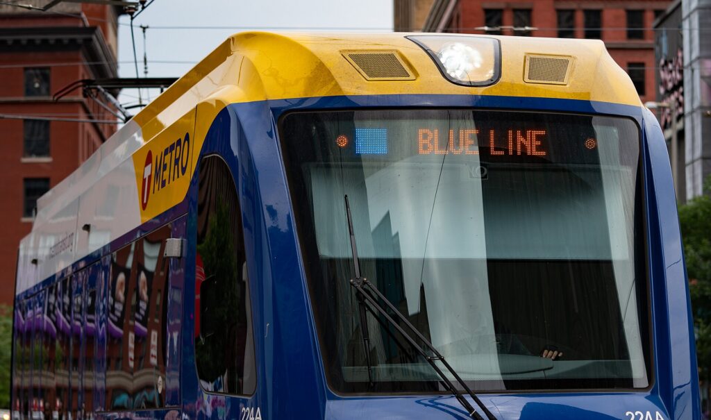
    A METRO Blue Line light-rail train in downtown Minneapolis
    The METRO light rail: the Blue Line runs from both airport terminals to downtown in about 25 minutes (Photo: Tony Webster from Minneapolis, Minnesota, United States via Wikimedia Commons, CC BY 2.0)

    Minneapolis transit, explained

    Metro Transit runs the light rail, the buses and the rapid-bus lines across the Twin Cities. For a visitor based in the core it is entirely adequate; its limitation, as in most American cities, is that service away from the main corridors is less frequent than a visitor from Chicago or New York would expect, and evenings and weekends are thinner still.

    The light rail

    Two lines. The Blue Line runs from Target Field through downtown along 5th Street, then south past Cedar-Riverside, Lake Street and Minnehaha Falls (50th Street/Minnehaha Park station) to Fort Snelling, both airport terminals, and the Mall of America in Bloomington. The Green Line runs from Target Field through downtown on the same tracks, across the river to the University of Minnesota, and then along University Avenue, past the Hmong and Vietnamese restaurants, the soccer stadium and the State Capitol, to Union Depot in downtown Saint Paul, in around 45 minutes end to end. An extension of the Green Line to the southwestern suburbs has been under construction for years; check Metro Transit’s site for its status when you travel. Trains run from early morning until after midnight, with more limited service in the small hours.

    Buses and rapid buses

    Buses fill in the rest, including the routes to the Walker, Mia, Uptown and the lakes. A growing network of rapid-bus lines, identified by letters and colors, runs on the busiest corridors with fewer stops and ticket machines at the stations. Frequencies drop in the evenings and on weekends outside the core routes; check times before relying on a bus for a late return.

    Fares and tickets

    Buy tickets from the machines at any light-rail or rapid-bus station, which take cards and cash, or use the Metro Transit app on your phone; a reloadable Go-To card is worth it for a longer stay, and day passes are available. A single fare includes transfers between trains and buses for a set period. The light rail works on proof of payment: there are no turnstiles, so buy before you board, because inspectors check and the fines are steep. Fares are modest by big-city standards; check Metro Transit’s site for current prices before you go.

    Accessibility

    Every light-rail station is step-free, trains have level boarding, and buses are low-floor with ramps; the skyways are accessible by elevator from most connected buildings.

    Beyond Metro Transit

    • Walking and the skyways. Downtown, the North Loop and the riverfront are walkable, and the skyway system, roughly 15 km (9.5 miles) of enclosed, heated bridges and corridors one story above the street, connects some 80 blocks of downtown, including hotels, restaurants, the arenas and the convention center. The skyways are owned by the buildings they cross, so hours vary: most are open from early morning into the evening on weekdays, with shorter hours on weekends. Saint Paul has its own, smaller system.
    • Bikes. Minneapolis is one of the most bike-friendly cities in the country, with separated paths around the Chain of Lakes, along both banks of the Mississippi, and on the Midtown Greenway, a former rail corridor across South Minneapolis. Shared bikes and e-scooters are widely available in the warmer months.
    • Taxis and ride-hail. The main apps and licensed taxis operate across the Twin Cities; for a group, a short ride to Uptown, Northeast or the lakes is competitive with transit and quicker to the places off the rail lines.
    • The State Fair buses. In late August, express buses and free park-and-ride shuttles run to the fairgrounds from across the metro, and they are far easier than driving and parking at the fair.
    • Intercity trains and buses. Amtrak runs daily trains between Chicago and Saint Paul’s Union Depot, which is on the Green Line, via Milwaukee; intercity buses connect the Twin Cities with Duluth, Chicago and other Midwest cities.
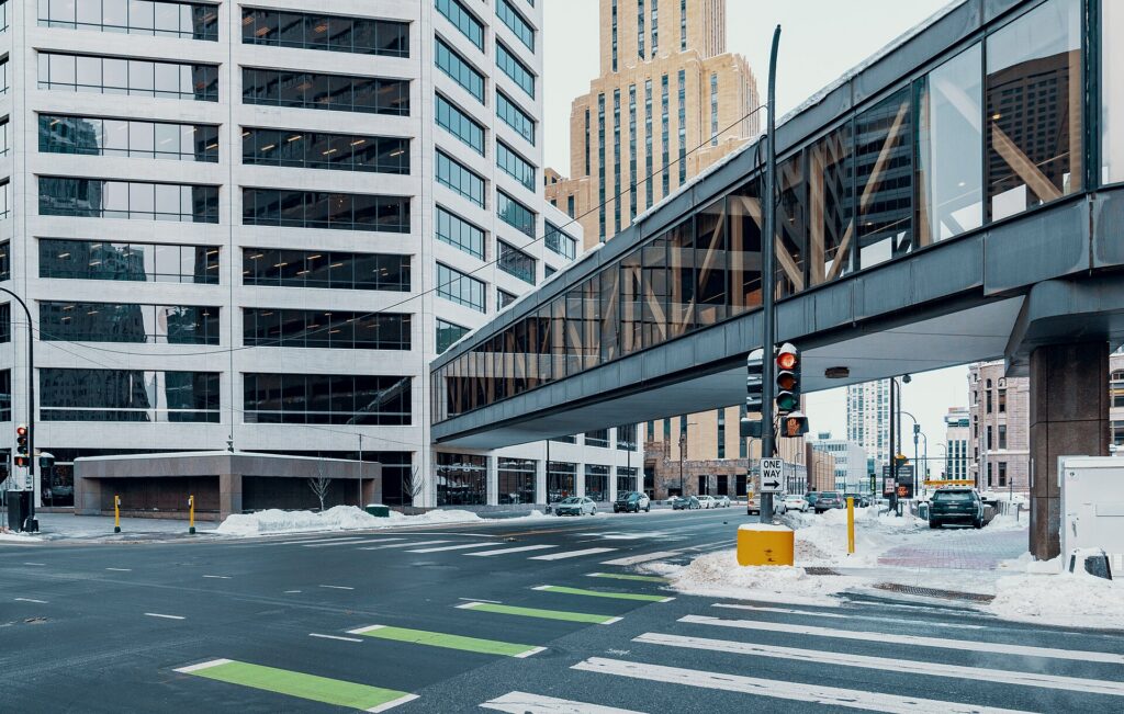
    An enclosed skyway over 3rd Avenue South in downtown Minneapolis in winter
    The skyways: about 15 km (9.5 miles) of heated walkways above downtown, which is how Minneapolis gets around in January (Photo: Tony Webster from Minneapolis, Minnesota, United States via Wikimedia Commons, CC BY-SA 2.0)

    Driving in the Twin Cities: what it is really like

    By the standards of the biggest American cities, the Twin Cities are easy to drive: a logical freeway network, plenty of parking outside the downtowns, and drivers who are, on the whole, courteous to the point of indecision at four-way stops. The frustrations are specific. Rush hour on I-94 between the two downtowns, on I-35W, on I-494 near the airport and on the Crosstown (Highway 62) is slow every weekday morning and afternoon. Construction season runs from spring thaw to late fall and closes lanes, ramps and sometimes entire stretches of freeway for weeks. Event traffic around Target Field, U.S. Bank Stadium and Target Center snarls the edges of downtown before and after games. And winter changes everything, from how you drive to where you can park.

    Parking

    Downtown Minneapolis parking is expensive by Midwest standards, though well below Chicago’s: hotels charge a substantial nightly fee, often valet-only, and the public ramps raise their rates on game and concert nights near the stadiums. On-street meters are common downtown and in the busier neighborhoods, many run into the evening, and you can pay at the meter or by app. Outside the core, parking at the lakes, Minnehaha Falls, the Mall of America and the suburbs is easy and often free, although the lakeside lots fill on summer weekends.

    Rules and conditions worth knowing

    • Snow emergencies. After a significant snowfall, Minneapolis declares a snow emergency with a three-day parking rotation so the plows can clear the streets: from 9 p.m. on day one, no parking on marked Snow Emergency Routes; from 8 a.m. on day two, no parking on the even-numbered side of other streets; from 8 a.m. on day three, no parking on the odd-numbered side. Cars left in the way are ticketed and towed, and visitors are caught every winter. The City of Minneapolis announces emergencies on its site and through text alerts, and Saint Paul runs its own similar system. The simple fix is to park in a hotel lot or a ramp when snow is forecast.
    • Winter tires are not required in Minnesota, and rental cars usually come on all-seasons, which is generally fine in the plowed metro. Leave extra following distance, watch for black ice on bridges and ramps, and keep the tank at least half full in the cold.
    • Headlights are required whenever it is raining or snowing, not just at night.
    • Hands-free law. Holding a phone while driving is illegal in Minnesota; use a mount and voice control.
    • Express lanes on I-394, I-35W and I-35E charge solo drivers a variable toll electronically through a transponder; unless your rental includes one, stay in the regular lanes. Otherwise there are no toll roads in Minnesota.
    • Right turns on red are permitted after a full stop unless signed otherwise.
    • Deer are common on rural highways at dawn and dusk, especially in the fall.
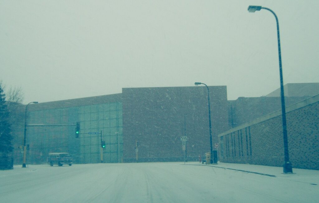
    A snowstorm in Minneapolis
    After a big snowfall, snow emergency rules decide where you can park, and cars in the wrong place are towed (Photo: Tony Webster from Portland, Oregon, United States via Wikimedia Commons, CC BY 2.0)

    When renting a car makes sense

    • Duluth and the North Shore. Two and a half hours north on I-35, then up Highway 61 along Lake Superior to Gooseberry Falls, Split Rock Lighthouse and beyond; there is no practical way to do it without a car.
    • Stillwater and the St. Croix Valley, about 45 minutes east, and the river towns of Red Wing and Wabasha to the south along the Mississippi bluffs.
    • Paisley Park, the Minnesota Landscape Arboretum and the western suburbs, which are poorly served by transit.
    • The lake country. A weekend “up north” at a cabin or resort in the Brainerd lakes or beyond is a Minnesota institution, and a car is essential.
    • Family in the suburbs. The Twin Cities suburbs are spread out and designed around driving; a car earns its keep daily.
    • Midwest road trips. Minneapolis is a natural stop on a loop through Wisconsin and Chicago; our Chicago to Minneapolis route guide covers the drive, and our Chicago car-versus-transit guide covers the other end.

    If any of those apply, our rental car booking tips cover insurance, deposits and the questions to ask at the counter, and our family car rental guide looks at vehicle choice.

    When it does not

    • You are staying downtown, in the North Loop or by the river and your plans are the city.
    • You are in town for a conference, a game or a concert, when downtown parking is at its worst and the light rail stops at the stadium doors.
    • You are visiting the State Fair, where the express buses and shuttles beat driving and parking.
    • You are traveling solo or as a couple and the rental, insurance and hotel parking add up to more than the trains and a few rides.

    The hybrid plan for a city-plus-day-trips visit

    Go car-free for the city days and rent for the days out, and think carefully about where you pick up. Renting at the airport makes sense if you are heading straight out of town, or staying in Bloomington or the suburbs, because the freeways are minutes from the terminal and you never enter downtown traffic. Renting from a downtown or neighborhood branch makes sense if you are spending the first nights in the city, because you avoid the airport fees and the hotel parking on the nights you are not using the car. A pattern that works well: the Blue Line into the city, two or three car-free days, pick up a rental downtown, drive to Stillwater or Duluth for the days out, and return the car at the airport on the way to the flight home. Minnesota adds a rental-vehicle tax on top of the airport fees, so the gap between an airport rental and a downtown one can be noticeable; compare the day rates on our Minneapolis car rental page against a full-trip rental and the difference is usually obvious.

    A worked cost comparison

    Numbers change with the season and the booking window, so treat this as a method rather than a quote, and check current rates before deciding. For a four-night city break downtown for two people, the car-free version costs two Blue Line rides from the airport and back, a couple of transit day passes, and perhaps two or three evening ride-hail trips; the rental version adds four days of a compact car, four nights of hotel parking at downtown rates, fuel and the airport fees and taxes. The transit option wins easily. For the same four nights with a day in Stillwater, the hybrid version adds one day’s rental picked up downtown, fuel and parking in Stillwater, which is far cheaper than keeping a car for the whole stay. For a week with two nights in Duluth and on the North Shore, a rental for the whole trip starts to make sense, especially for a family, and the airport pickup is the simplest. Run the rental rates for your dates on our Minneapolis car rental page and put them beside the transit costs before you choose.

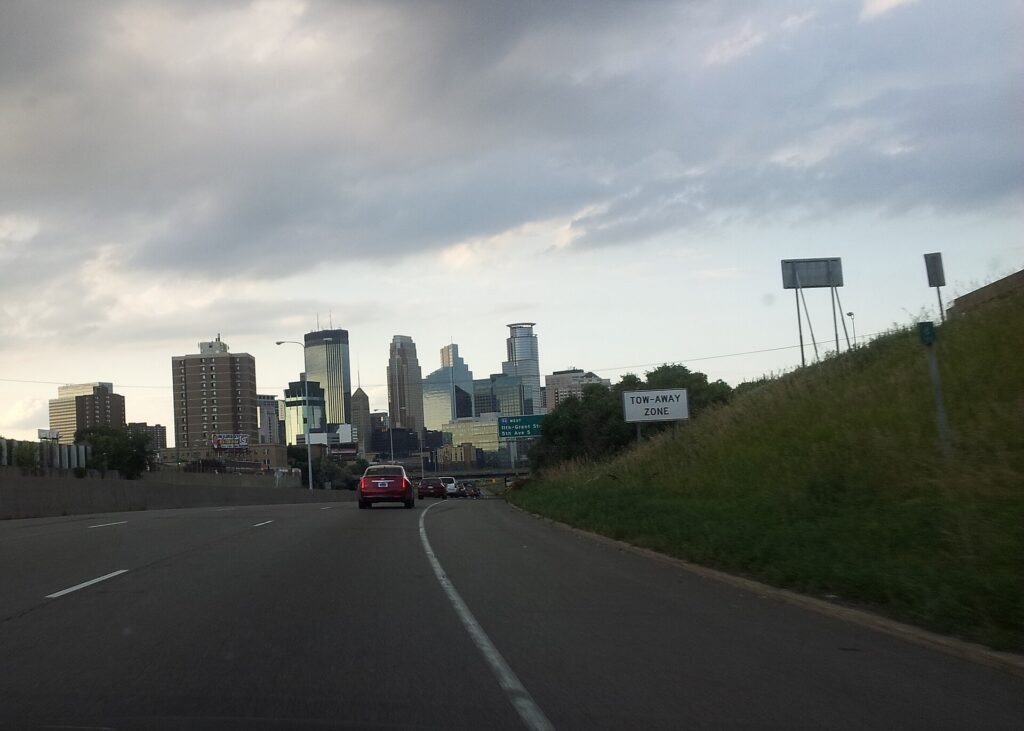
    Traffic on Interstate 35W in Minneapolis
    Interstate 35W, the main north-south freeway through Minneapolis (Photo: Gabriel Vanslette via Wikimedia Commons, CC BY 3.0)

    Driving north to Duluth and the North Shore in each season

    The drive from the Twin Cities to Duluth is about 250 km (155 miles) on I-35, a straightforward divided interstate through farmland, forest and lake country that takes about two and a half hours; from Duluth, Highway 61 runs northeast along the shore of Lake Superior toward Two Harbors, Gooseberry Falls, Split Rock Lighthouse and, eventually, the Canadian border. In summer, the problems are traffic and parking: northbound on Friday afternoon and southbound on Sunday afternoon, much of the metro is heading to and from the cabin, and the state park lots on the North Shore fill by late morning on weekends. Leave early, or go mid-week. In fall, the color along the North Shore usually peaks from late September into early October, and those weekends bring summer-level traffic and full hotels in Duluth and the shore towns; book ahead. In winter, I-35 is plowed and generally open, but snow and blowing snow can reduce visibility sharply in open country, Duluth’s streets climb steep hills from the lake, and Lake Superior can generate its own snow squalls; check Minnesota 511 before you leave, carry a winter kit, and keep the tank full. In spring, the thaw brings potholes and frost-heaved roads, and the waterfalls along the shore are at their most powerful as the snow melts.

    Decision table

    Your tripRecommendationWhy
    City break downtown, couple or soloNo carThe Blue Line from the airport, the skyways and a bike cover it; parking is expensive
    Conference, game or concertNo carEvent parking is costly and the light rail stops at the stadiums
    State Fair visitNo carExpress buses and park-and-ride shuttles beat driving
    City plus a day in Stillwater or the river townsHybrid: rent downtown for one dayCar-free city days, car for the day out
    Duluth and the North ShoreRent, ideally at the airportI-35 is minutes from the terminal; the shore needs a car
    Family visit to the suburbsRent for the whole staySuburban distances make the car worthwhile daily
    Winter trip with young childrenRent, and park in a ramp or hotel lotGear, cold and snow emergency rules all argue for a garage
    Midwest road tripRent (consider one-way from Chicago)Minneapolis is a stop, not the destination

    Money-saving tips for both options

    • On transit: ride the Blue Line from the airport rather than a taxi; buy a day pass for a heavy sightseeing day; use the free ride between terminals if your airline is in the other one.
    • On a rental: compare airport and downtown pickup, book early for summer weekends, the State Fair and fall color season, decline extras you already have through a credit card or home policy (check first), and stay out of the express lanes without a transponder.
    • On the hotel: if you are renting, price the parking fee into the room rate, and consider staying in Saint Paul or Bloomington, where parking is cheaper and the light rail still reaches downtown Minneapolis.
    • On timing: avoid I-94 and I-35W in the weekday peaks and I-35 north on summer Friday afternoons; our best time to fly to Minneapolis guide lists the busiest weekends.
    • On winter: check for snow emergencies every evening after a snowfall, because a tow and impound fee will wipe out anything you saved on the rental.

    Frequently asked questions

    Is it worth renting a car in Minneapolis?

    For Duluth, the North Shore, Stillwater, the suburbs or a road trip, yes. For a city break based downtown or in the North Loop, no; the light rail, the skyways and a bike are enough.

    Is Minneapolis public transit good for tourists?

    Good within the core: the Blue Line reaches the airport, Minnehaha Falls and the Mall of America, and the Green Line reaches the University and Saint Paul. Buses cover the lakes and neighborhoods, less frequently.

    How do I get from MSP airport to downtown Minneapolis?

    The Blue Line light rail from either terminal in about 25 minutes, or a taxi or ride-hail in about 20 minutes outside rush hour.

    Can I get to Saint Paul without a car?

    Yes. The Green Line runs from downtown Minneapolis to downtown Saint Paul in around 45 minutes, and a bus runs from the airport’s Terminal 1.

    What is a snow emergency?
    A declaration after heavy snow that sets a three-day rotation of parking restrictions so the plows can clear the streets. Cars parked in the wrong place are ticketed and towed, so park in a ramp or hotel lot when snow is forecast.

    Are the skyways open all the time?
    No. They belong to the buildings they connect, so hours vary; most are open from early morning into the evening on weekdays, with shorter hours on weekends.

    Do I need winter tires to drive in Minnesota?

    No, and rentals usually come on all-seasons. Drive slowly on snow, leave plenty of distance, and check road conditions before heading north in winter.

    Whichever way you go, start with the flight. Compare cheap flights to Minneapolis, choose a neighborhood with our Minneapolis hotel search, and if Duluth or the St. Croix are on the list, price the rental for those dates on our Minneapolis car rental page.

  • Phoenix: Should You Rent a Car or Rely on Public Transit?

    Phoenix: Should You Rent a Car or Rely on Public Transit?

    Phoenix is one of the most car-dependent big cities in the United States, and for most visitors the honest answer to “should I rent a car?” is yes. The metro area sprawls across a desert valley roughly the size of a small state, the attractions are spread between Phoenix, Scottsdale, Tempe, Mesa and a dozen other cities, the best trailheads have no transit at all, and Sedona and the Grand Canyon, the reasons many people fly here, are road trips. But there are real exceptions. Sky Harbor is only a few kilometers from downtown and is linked to the light rail by a free airport train, the light rail runs through the three most walkable districts in the Valley, driverless robotaxis and ride-hail cover the gaps, and a visitor on a downtown conference, a Tempe stay or a resort break may barely need a car at all. This guide explains how the Valley is laid out, how Valley Metro and its fares work, what driving here is really like in the heat and the monsoon, when a car earns its keep, and gives you a straightforward way to decide.

    The short answer

    Rent a car if Sedona, the Grand Canyon, Tucson or any other day trip is on the itinerary, if you want to hike Camelback, South Mountain or the McDowell Sonoran Preserve at dawn, if you are staying in Scottsdale, the suburbs or with family, if you are following several teams around the Cactus League ballparks, or if you are traveling with children. That is most visitors. Skip the car if you are staying downtown, in Roosevelt Row or in Tempe for a conference, a game, a concert or a short city break, and your plans are the museums, the ballpark, the arts district, Mill Avenue and the airport; the light rail, your feet and the occasional ride-hail will cover that, and you will not pay for parking. And if you are staying at a resort and plan to spend most of the time by the pool, ride-hail for the occasional outing is often cheaper than a car sitting in a valet lot. Compare rental rates for any of these plans on our Phoenix car rental page.

    How Phoenix is laid out

    Phoenix and its neighbors fill a broad, flat valley ringed by mountains, and almost all of it is laid out on a single grid. In Phoenix, Central Avenue divides east from west and Washington Street divides north from south; numbered Streets run north-south east of Central, and numbered Avenues run north-south west of it, so 16th Street and 16th Avenue are about 5 kilometers (3 miles) apart. The major arterials fall roughly every mile, which makes navigation easy and distances long. Downtown sits near the center of the city, with Roosevelt Row immediately north and Sky Harbor immediately east. Tempe and Arizona State University are a short hop southeast of the airport, Mesa beyond them, Scottsdale to the northeast, and the West Valley cities of Glendale, Peoria, Goodyear and Surprise to the west, where many spring training ballparks and the Cardinals’ stadium sit. A web of freeways links it all: I-10 and I-17 meet west of downtown at the interchange locals call the Stack, and the Loop 101, Loop 202 and Loop 303 ring the Valley, with SR 51 and US 60 filling in.

    Hotels cluster downtown around the convention center and the ballpark, near the airport, along the Camelback corridor, in Old Town Scottsdale and the resort belt north of it, in Tempe, and in the Roosevelt Row area. Our Phoenix hotel search lets you compare them.

    Getting in from the airport

    Phoenix Sky Harbor International (PHX) is about 5 kilometers (3 miles) east of downtown, and getting into the city is unusually easy. The free PHX Sky Train runs around the clock between Terminals 3 and 4, the East Economy parking area, and the 44th Street station, where you change to the Valley Metro light rail for downtown Phoenix, Tempe or Mesa; the trip downtown takes around half an hour including the change. The Sky Train also connects to the Rental Car Center, the consolidated facility west of the terminals where every major company has its counters, and shuttle buses run there as well. Taxis and ride-hail pick up at marked zones outside each terminal, and the drive downtown takes 10 to 15 minutes outside rush hour; driverless Waymo robotaxis also serve the airport. For Scottsdale, allow 20 to 30 minutes by car, and for the West Valley 30 to 45. Check the airport’s site for current ground-transport details; our PHX airport guide covers the layout.

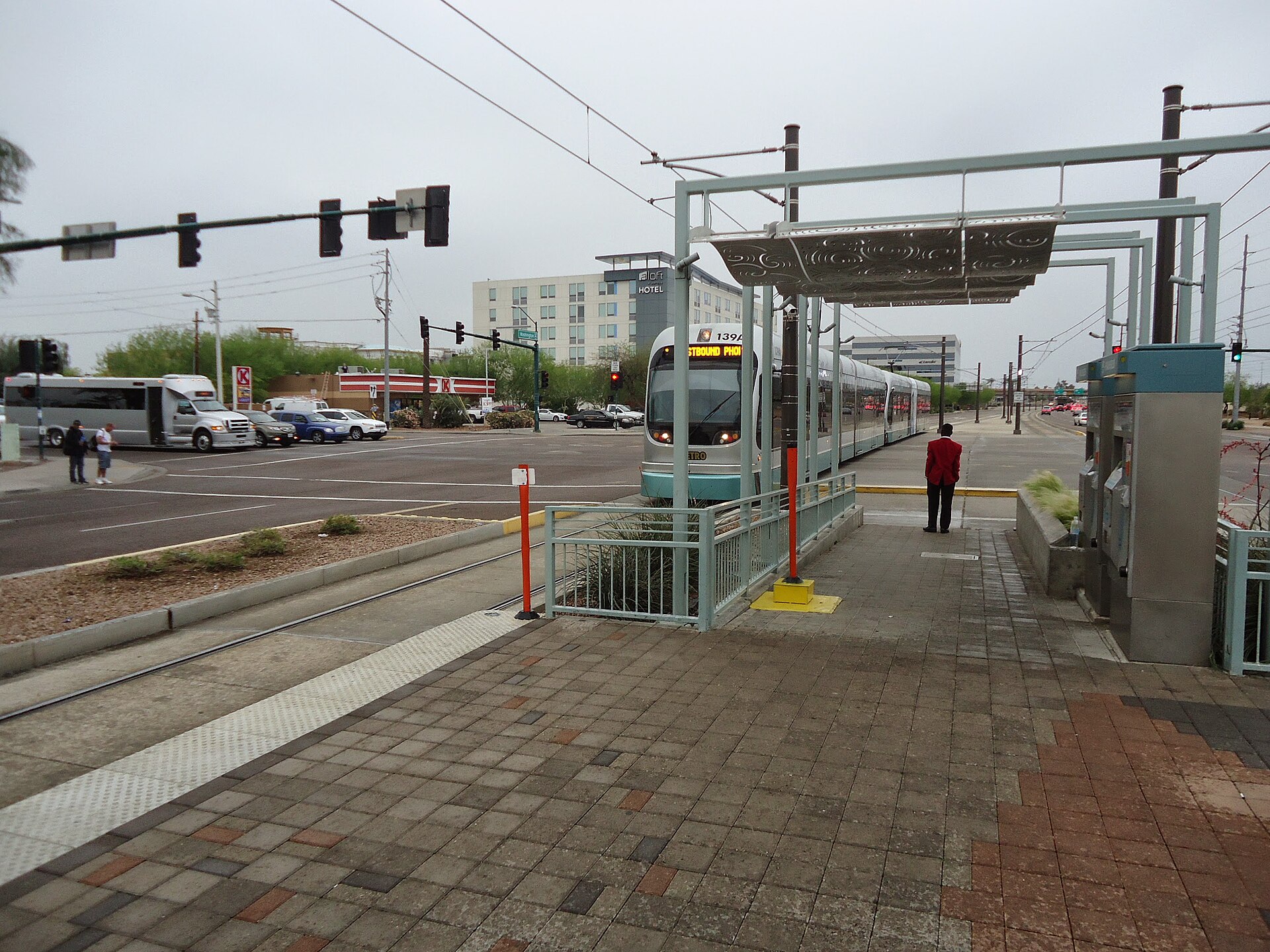
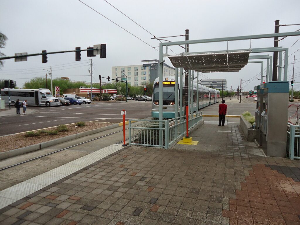
    A Valley Metro light rail train approaching a station in downtown Phoenix
    Valley Metro light rail links the airport's Sky Train, Tempe, downtown and Central Avenue (Photo: Tomwsulcer via Wikimedia Commons, CC0)

    Phoenix transit, explained

    Valley Metro runs the light rail, the Tempe Streetcar and most of the bus network across the region. It is clean, air-conditioned and straightforward, and along its core corridor it is a genuinely useful way for a visitor to get around; its limitation is coverage, because a single rail system cannot serve a metro area this spread out, and the buses that fill in the rest run on the mile grid at frequencies that suit commuters more than sightseers.

    The light rail

    The light rail runs for more than 40 kilometers (25 miles) through the heart of the Valley. From the east, it starts in Mesa, runs through downtown Mesa and Tempe, past Arizona State University and Tempe Town Lake, crosses to the 44th Street station for the airport, and continues along Washington and Jefferson Streets into downtown Phoenix, stopping near Chase Field, the convention center and the downtown arena. From downtown it turns north along Central Avenue past Roosevelt Row, the Heard Museum and the Phoenix Art Museum, and on to north Phoenix, and since the South Central extension opened in 2025, a branch also runs south from downtown along Central Avenue toward South Mountain. The system operates as two lines that share tracks through downtown; check Valley Metro’s map for the current line names and end stations. Trains run from early morning until late evening, roughly every 12 to 20 minutes depending on the time of day.

    Streetcar and buses

    The Tempe Streetcar loops through downtown Tempe, along Mill Avenue and past the lake and the university, connecting to the light rail. Valley Metro’s buses run along most of the major arterials on the mile grid, with express routes to the suburbs; they reach places like the Desert Botanical Garden and the Phoenix Zoo, but frequencies drop in the evenings and on weekends, and waiting at a bus stop in summer is hard work. Check the timetable before relying on a bus for a return trip.

    Fares and tickets

    One fare system covers the light rail, streetcar and local buses. Buy single rides or a day pass from the ticket machines on every light-rail platform, or use the Valley Metro app on your phone, and keep your ticket with you, because fare inspectors check on board. A day pass is the best value for a sightseeing day with several rides, and reduced fares are available for seniors and younger riders. Check Valley Metro’s site for current fares and payment options before you go.

    Accessibility

    Every light-rail station is level-boarding and step-free, and the fleet of trains, streetcars and buses is accessible; the stations have shade structures, which matter more here than almost anywhere.

    Beyond Valley Metro

    • Free circulators. Several cities run free neighborhood shuttles: the Scottsdale Trolley loops Old Town and the resort corridor, and Tempe’s Orbit buses serve the neighborhoods around the university. They are handy for short hops once you are in those districts.
    • Ride-hail and robotaxis. Uber and Lyft operate across the Valley, and Phoenix is one of the places where driverless Waymo robotaxis carry the public, across much of Phoenix, Scottsdale, Tempe, Mesa and Chandler. For short trips, especially in a group, ride-hail is competitive with transit and much faster to places the light rail does not reach.
    • Walking and cycling. Downtown, Roosevelt Row, Old Town Scottsdale and Mill Avenue are walkable, and paths along the canals and around Tempe Town Lake are good for cycling in the cooler months; shared bikes and e-scooters operate in parts of the Valley. In summer, walking more than a few blocks in the afternoon is not advisable.
    • Tours. Day tours to Sedona and the Grand Canyon pick up from hotels across the Valley, and they are the main alternative to driving for visitors who want the canyon without the car; the Grand Canyon Railway from Williams, about three hours north, is another.
    • Intercity travel. Buses connect Phoenix with Tucson, Flagstaff, Las Vegas and Southern California. Amtrak does not serve Phoenix itself; the nearest station is in Maricopa, about 55 kilometers (35 miles) south.
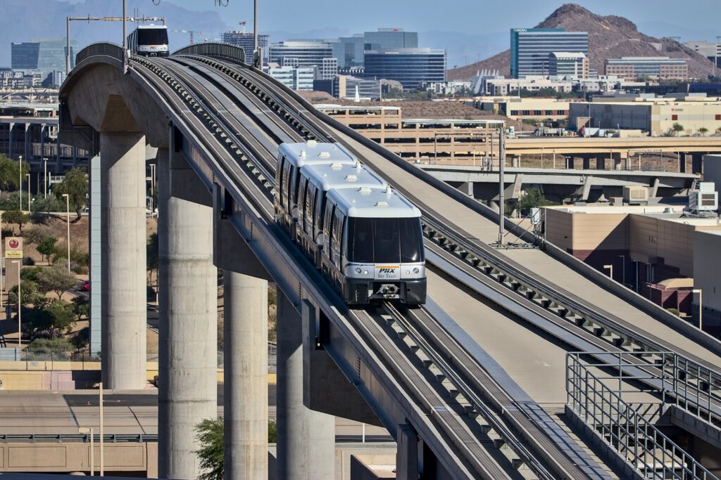
    The PHX Sky Train approaching Terminal 4 at Phoenix Sky Harbor
    The free PHX Sky Train connects the terminals, the light rail and the Rental Car Center (Photo: Hunter Trick (TrickHunter) via Wikimedia Commons, CC BY-SA 4.0)

    Driving in Phoenix: what it is really like

    By the standards of most large American cities, Phoenix is easy to drive: a logical grid, wide arterials, a dense freeway network, good signage and plentiful parking outside the busiest districts. The frustrations are specific. Weekday rush hours, roughly 6 to 9 a.m. and 3:30 to 6:30 p.m., slow I-10 through Tempe and the West Valley, I-17 north of downtown, SR 51, and the Loop 101 through Scottsdale and Tempe. Big events, from spring training and the Phoenix Open to Cardinals games in Glendale, bring heavy traffic around the venues. Construction is constant on a freeway network that is still growing. And the distances are long: a trip from a Scottsdale resort to a ballpark in Goodyear can take the best part of an hour.

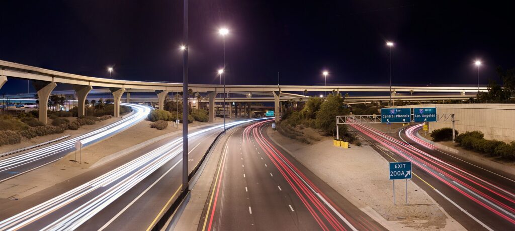
    The Stack, the interchange of Interstate 10 and Interstate 17 in Phoenix, at night
    The Stack, where I-10 meets I-17 west of downtown; the freeways are easy outside the weekday rush hours (Photo: Alan Stark from Goodyear, AZ, United States via Wikimedia Commons, CC BY-SA 2.0)

    Parking

    Parking in Phoenix is easier and cheaper than in most big cities. Downtown has metered street parking and many garages, which get busy and more expensive on game and concert nights. Old Town Scottsdale has free public parking garages, with time limits on some spaces. Tempe’s Mill Avenue area has garages and metered streets. The resorts usually charge for self-parking or valet, sometimes folded into the resort fee, so check before you book. Trailhead parking is the real challenge: the small lots at Camelback’s Echo Canyon and Cholla trails and at Piestewa Peak fill early on cool-season weekends, often before sunrise, so arrive early or use ride-hail. At Sky Harbor, the economy lots are linked to the terminals by the Sky Train.

    Rules and conditions worth knowing

    • The heat and your car. A parked car becomes dangerously hot within minutes in summer; never leave a child or a pet inside, even briefly. Use a windshield sunshade, cover the steering wheel and seats, keep extra water in the car, and remember that batteries and tires are more likely to fail in extreme heat, so do not skip the rental company’s warning lights.
    • Dust storms. During the monsoon, a haboob can cut visibility to near zero on the freeway in seconds. ADOT’s advice is to pull as far off the road as you safely can, turn off all your lights, set the parking brake and take your foot off the brake pedal so that other drivers do not follow your taillights, and wait until it passes.
    • Flooded washes. Never drive into a flooded road or wash, even if it looks shallow; the water can be far deeper and faster than it appears. Under Arizona’s so-called Stupid Motorist Law, drivers who go around barricades into flooded areas can be billed for the cost of their rescue.
    • Cameras. Several Valley cities, notably Scottsdale and Paradise Valley, use speed and red-light cameras on city streets; fines follow the car and the rental company will bill you, often with a fee.
    • Phones. Arizona law bans holding a phone while driving; use a mount and hands-free mode.
    • HOV lanes. The carpool lanes on the freeways are restricted to vehicles with two or more people during weekday rush hours and open to everyone at other times; check the signs.
    • Right turns on red are permitted after a full stop unless signed otherwise.
    • Road conditions. AZ511, run by the Arizona Department of Transportation, publishes closures, crashes and weather alerts, including snow on I-17 and I-40 in the high country.
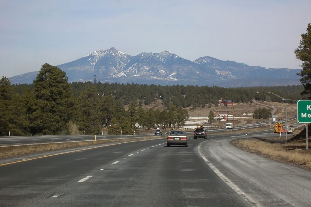
    Interstate 17 near Flagstaff in the Arizona high country
    I-17 climbs from the desert to the pine country around Flagstaff in about two hours (Photo: Bernard Gagnon via Wikimedia Commons, CC BY-SA 3.0)

    When renting a car makes sense

    • Sedona and the Grand Canyon. Sedona is about two hours north on I-17 and the Grand Canyon’s South Rim three and a half to four hours; a car lets you reach the trailheads early and stop at Montezuma Castle and Jerome along the way. Many Sedona trailhead lots require a Red Rock Pass, and the national park charges a vehicle entrance fee.
    • Sunrise hikes. Camelback, Piestewa Peak, South Mountain and the McDowell Sonoran Preserve are best at first light, before the heat, when transit is not running to them and ride-hail can be slow to arrive.
    • Scottsdale and the resort belt. The resorts, Taliesin West, the Musical Instrument Museum and the golf courses are spread across the northeast Valley, well away from the light rail.
    • Spring training. Ten ballparks across the Valley, several in the West Valley far from the rail line; a car makes a ballpark tour easy.
    • Families. Car seats, pool bags and the summer heat all argue for a car, and our family car rental guide looks at vehicle choice.
    • Road trips. Tucson, Las Vegas via the Hoover Dam, San Diego and Southern California; our Phoenix to San Diego route guide and Las Vegas to Phoenix route guide cover two classics.

    If any of those apply, our rental car booking tips cover insurance, deposits and the questions to ask at the counter.

    When it does not

    • You are staying downtown, in Roosevelt Row or in Tempe, and your plans are along the light rail.
    • You are in town for a convention, a Suns or Diamondbacks game, or a concert downtown, when parking near the venues is at its most expensive and the light rail stops beside them.
    • You are staying at a resort and plan to spend most of your time by the pool and the spa, with ride-hail for the occasional dinner.
    • You want the Grand Canyon for a day and are happy to take an organized tour.

    The hybrid plan for a city-plus-desert trip

    Go car-free for the city days and rent for the day trips, and think about where you pick up. Every major company operates from the Sky Harbor Rental Car Center, which is convenient but adds airport fees and surcharges, some of which have long helped fund the region’s sports venues. Neighborhood rental offices in Phoenix, Tempe and Scottsdale avoid some of those charges and make sense if you are spending the first nights in the city. A pattern that works well: take the Sky Train and light rail or a ride-hail to your hotel, spend two or three car-free days downtown and in Tempe, pick up a car from a city location for Scottsdale, a sunrise hike and a night in Sedona or at the Grand Canyon, and return it to the airport on the way to your flight home, which many companies allow at little or no extra cost. Book early for February and March, when the Rental Car Center can run short of cars. Compare the day rates on our Phoenix car rental page against a full-trip rental and the difference is usually obvious.

    A worked cost comparison

    Numbers change with the season and the booking window, so treat this as a method rather than a quote, and check current rates before deciding. For a three-night city break downtown for two people, the car-free version costs two light-rail day passes each and perhaps three or four ride-hail trips to the Desert Botanical Garden, Old Town Scottsdale and back; the rental version adds three days of a compact car, airport fees and surcharges, three nights of hotel parking and fuel, and buys you little you could not reach otherwise. The transit option wins. For a four-night stay with a day in Sedona, the car-free version adds an organized Sedona tour for two; the hybrid version adds a one-day rental from a city location, fuel and a Red Rock Pass. For two people the rental is usually cheaper than the tour and far more flexible; for one person the tour can be competitive. For a week at a Scottsdale resort with golf, hiking and the Grand Canyon, a rental for the whole stay is the only practical answer, and the airport pickup, despite the surcharges, is simpler than paying for ride-hail across the Valley every day. Run the rental rates for your dates on our Phoenix car rental page and put them beside the tour and ride-hail costs before you choose.

    Driving out of Phoenix in each season

    The highways out of Phoenix are good, but they cross some of the most extreme terrain in the country, and conditions change fast with altitude and season. I-17 north to Sedona and Flagstaff climbs from the desert floor to over 2,000 meters (about 7,000 feet) near Flagstaff in about two hours; in summer it is the escape route, jammed northbound on Friday afternoons and southbound on Sunday afternoons, and in winter the upper stretch and I-40 can be snowy or icy while Phoenix is sunny and warm, so check AZ511 before you leave and ask for an all-wheel-drive car if snow is forecast. US 93 northwest to Las Vegas runs through Wickenburg and Kingman and crosses the Colorado River on the bridge beside the Hoover Dam; it is about five hours, remote in places, and fuel stops are far apart. I-8 west to San Diego crosses the low desert past Gila Bend and Yuma, some of the hottest country in North America in summer, before climbing through the mountains east of San Diego; about five and a half hours in all, and Border Patrol checkpoints operate on some highways in the borderlands, so carry ID. I-10 runs southeast to Tucson in about two hours and west to Los Angeles. In summer, the risk on every route is the heat: a breakdown in the desert is dangerous, so start with a full tank, carry plenty of water, keep your phone charged, and stay with the car if it breaks down. During the monsoon, add dust storms and flash floods. In winter, the low desert is perfect for driving, and the high country needs respect. For the canyon, Grand Canyon National Park posts current road and weather conditions.

    Decision table

    Your tripRecommendationWhy
    City break downtown or in TempeNo carThe light rail links the airport, downtown, Roosevelt Row and Tempe
    Convention or game downtownNo carThe light rail stops beside the venues; event parking is expensive
    Resort stay, mostly by the poolNo car, ride-hail for outingsAvoids resort parking fees for a car you rarely use
    Scottsdale, golf and sunrise hikesRent for the whole stayResorts, courses and trailheads are far from transit
    City plus Sedona or the Grand CanyonHybrid: rent from a city location for the trip daysCar-free city days, car for the high country
    Grand Canyon without drivingOrganized tourHotel pickup and no long drive
    Spring training ballpark tourRent at the airportTen ballparks spread across the Valley
    Arizona or Southwest road tripRent (consider one-way to Las Vegas or San Diego)Phoenix is the start, not the destination

    Money-saving tips for both options

    • On transit: the Sky Train is free; buy a day pass for a heavy sightseeing day on the light rail; use the free Scottsdale Trolley and Tempe Orbit once you are in those districts.
    • On a rental: compare airport and neighborhood pickup, book early for February and March, decline extras you already have through a credit card or home policy (check first), and buy the Red Rock Pass or national park pass in advance where you can.
    • On the hotel: if you are renting, price the parking or resort fee into the room rate, and look at resorts whose fees include parking.
    • On timing: avoid the freeways in the weekday rush hours, I-17 northbound on summer Friday afternoons and southbound on Sunday afternoons; the best time to fly to Phoenix guide lists the busiest weeks, and for a wider Southwest trip our guide to whether you need a car in Las Vegas covers the other end of the drive.
    • On ride-hail: for a group of three or four on a short trip, a single ride often costs less than four transit fares and saves waiting in the heat.

    Frequently asked questions

    Is it worth renting a car in Phoenix?

    For Scottsdale, the trailheads, the ballparks, Sedona and the Grand Canyon, yes, and that is most visitors. For a downtown or Tempe stay built around the light rail, no.

    Is Phoenix public transit good for tourists?

    Good along its core corridor: the light rail links the airport’s Sky Train, Tempe, downtown, Roosevelt Row and the Heard Museum. It thins out quickly beyond that, and the buses are slow for sightseeing.

    How do I get from Phoenix Sky Harbor to downtown?

    The free Sky Train to the 44th Street station and then the light rail, in about half an hour, or a taxi, ride-hail or robotaxi in 10 to 15 minutes outside rush hour.

    Can I get to Sedona or the Grand Canyon without a car?

    Yes, on organized day tours that pick up from Phoenix hotels, or by combining an intercity bus with local tours. A car gives you far more flexibility.

    Is it safe to drive in Phoenix in summer?

    Yes, with precautions: keep water in the car, never leave anyone in a parked vehicle, pull off the road in a dust storm, and never drive into a flooded wash.

    Is parking expensive in Phoenix?

    Less than in most big cities. Downtown garages cost more on event nights, resorts charge for parking or valet, and Old Town Scottsdale has free public garages.

    Do I need a four-wheel drive for Arizona?

    Not for the paved highways to Sedona, the Grand Canyon, Tucson, Las Vegas or San Diego. Consider all-wheel drive in winter if snow is forecast for Flagstaff and the high country.

    Whichever way you go, start with the flight. Compare cheap flights to Phoenix, choose a neighborhood with our Phoenix hotel search, and if Sedona or the Grand Canyon is on the list, price the rental for those dates on our Phoenix car rental page. For what to do once you arrive, start with our first-timer’s guide to Phoenix.

  • Cancun: Should You Rent a Car or Rely on Public Transit?

    Cancun: Should You Rent a Car or Rely on Public Transit?

    Cancun splits visitors into two camps. Many never need a car at all: they take a shuttle from the airport to an all-inclusive in the Hotel Zone, ride the cheap, frequent city buses when they want to see downtown, take the ferry to Isla Mujeres, and book a tour for Chichén Itzá. Others treat Cancun as the airport for the whole Mexican Caribbean and want to drive south to Tulum and the cenotes, west to the colonial towns and the ruins, and stop wherever a jungle road or a quiet beach looks interesting. Both approaches work, and the right one depends less on the city than on the trip you have in mind. Driving here is also genuinely different from driving at home, with mandatory Mexican insurance that catches many visitors out at the rental counter, speed bumps that appear without warning, and full-service gas stations with their own etiquette. This guide explains how the area is laid out, how the buses, colectivos, ferries and the new train work, what driving is really like, when a car is worth it, and gives you a straightforward way to decide.

    The short answer

    Skip the car if you are staying in the Hotel Zone or downtown and your plans are the beaches, downtown, Isla Mujeres and one or two organized day trips; the R-1 and R-2 buses, taxis, ferries and tours cover all of it, and you avoid the insurance, the parking and the stress. That is most visitors on a first trip. Rent a car if you want to explore the Riviera Maya on your own schedule, visit several cenotes, reach Chichén Itzá or Tulum at opening time before the tour buses, stay in Tulum, Puerto Morelos or Playa del Carmen, or are traveling as a family or group, where a car quickly becomes cheaper than tours. And if you want independence without driving, the ADO buses, the colectivo vans and the Tren Maya connect Cancun with Playa del Carmen, Tulum, Valladolid and Chichén Itzá. Compare rental rates for any of these plans on our Cancun car rental page.

    How Cancun is laid out

    Cancun is really two cities joined by one road. The Hotel Zone, a thin barrier island shaped like a 7, runs for about 22 kilometers between the Caribbean and the Nichupté lagoon, and almost everything on it sits on Boulevard Kukulcán, with addresses given as kilometer markers from km 0 near downtown to the mid-20s near Punta Nizuc. Downtown, El Centro, is on the mainland at the northern end, laid out around Avenida Tulum, the main street, with the ADO bus station, the markets and the square at Parque de las Palapas. North of downtown, Puerto Juárez has the Isla Mujeres ferry pier, and beyond it are the newer resorts of Costa Mujeres. The airport is on the mainland south of the city, near the southern end of the Hotel Zone. From there, Highway 307 runs south along the coast through Puerto Morelos, Playa del Carmen and the resort corridor of the Riviera Maya to Tulum, while Highway 180D, a toll road, runs west across the peninsula to Valladolid, Chichén Itzá and Mérida.

    Hotels cluster along the whole length of the Hotel Zone, with the densest nightlife around Punta Cancún at km 9, and in smaller, cheaper properties downtown. Our Cancun hotel search lets you compare them.

    Getting in from the airport

    Cancun International (CUN) has several terminals, spaced well apart and linked by an inter-terminal shuttle, and every transport option starts outside the one you land at. ADO buses run from the terminals to the downtown bus station on Avenida Tulum and directly to Playa del Carmen, for a modest fare; from downtown, the R-1 or R-2 city bus or a taxi reaches the Hotel Zone. Pre-booked shuttles, shared or private, are the most popular way to reach Hotel Zone and Riviera Maya resorts, and many all-inclusives include or sell them. Airport taxis are federally licensed and charge fixed, zone-based fares that are higher than city taxis; ordinary city taxis and most ride-hail drivers are not allowed to pick up at the terminals. The drive to the Hotel Zone takes 15 to 30 minutes, to downtown about 25, and to Playa del Carmen roughly 45 minutes to an hour. Every major rental company has counters in the terminals or a free shuttle to a nearby lot. On the way out, you will pass a hall of people offering transport and “information”; many are selling timeshares, so head for the exit and your pre-arranged ride. The airport operator, ASUR, lists the terminals, and our CUN airport guide covers the layout.

    ADO bus platforms outside a terminal at Cancun International Airport
    ADO buses leave the airport terminals for downtown Cancun and Playa del Carmen (Photo: Mrkstvns via Wikimedia Commons, CC BY-SA 4.0)

    Cancun’s transit, explained

    Cancun has no metro or tram; its public transport is a dense network of privately operated city buses, supplemented by intercity coaches, shared vans and, since late 2023, a long-distance train. It is cheap, frequent on the routes that matter to visitors, and entirely adequate for a Hotel Zone and downtown stay.

    The Hotel Zone buses

    The routes visitors use are the R-1 and R-2, which run the length of Boulevard Kukulcán through the Hotel Zone and into downtown along Avenida Tulum, with a windshield sign showing “Zona Hotelera” or the route number. They come every few minutes for most of the day and run from early morning until late at night, you flag them down at the marked stops or anywhere safe along the boulevard, and you pay the driver in cash in pesos, a small flat fare, with no transfers. Keep small bills and coins; drivers rarely have change for a large note. The ride from the southern Hotel Zone to downtown takes 30 to 45 minutes depending on traffic. The buses are basic and busy at shift-change times, but safe and very widely used by visitors.

    ADO intercity buses

    ADO runs comfortable, air-conditioned, first-class coaches from the downtown terminal and the airport to Puerto Morelos, Playa del Carmen, Tulum, Valladolid, Chichén Itzá, Mérida and beyond. Buy tickets at the counter, from machines or online, and on busy routes buy a day ahead in high season. For a car-free Riviera Maya trip, ADO is the backbone.

    Colectivos

    Shared white vans, known as colectivos, run constantly along Highway 307 from downtown Cancun to Puerto Morelos and Playa del Carmen, and from Playa del Carmen onward to Tulum, stopping anywhere along the highway on request. They are cheaper than ADO, leave when full, and are the easiest way to reach the resort entrances, cenotes and small beaches between the towns. Pay in cash in pesos.

    The Tren Maya

    The Tren Maya, a new intercity railway around the Yucatán Peninsula, has a station near Cancun’s airport and connects with Puerto Morelos, Playa del Carmen, Tulum, Valladolid, Chichén Itzá and Mérida. It is comfortable and scenic, but frequencies are still limited and the stations can be some way from the town centers or sites they serve, so check the current timetable and onward connections before you plan a day around it.

    Accessibility

    This is Cancun’s weakest area. Many city buses have steps and few are wheelchair-accessible, and sidewalks in the Hotel Zone are narrow in places. ADO coaches and the Tren Maya are more accommodating, and accessible private transfers and taxis can be arranged in advance.

    A city bus in the Cancun Hotel Zone
    The R-1 and R-2 buses run the length of the Hotel Zone into downtown for a small flat fare (Photo: O.iyle via Wikimedia Commons, CC BY-SA 4.0)

    Beyond the buses

    • Taxis. Plentiful in the Hotel Zone and downtown, and unmetered: fares are set by zone, rates in the Hotel Zone are higher than downtown, and you should always agree on the price before getting in. Hotels can tell you the going rate for common trips, and many display a rate sheet.
    • Ride-hail. Uber operates in Cancun, but it has faced strong opposition from local taxi unions, and pickups at the airport and some hotels are restricted. Check what is permitted when you travel, and treat it as a useful extra rather than something to rely on.
    • Ferries. Passenger ferries leave for Isla Mujeres from Puerto Juárez, north of downtown, and from piers in the Hotel Zone; a separate car ferry runs from Punta Sam, although you do not need a car on the island. For Cozumel, ferries leave from Playa del Carmen.
    • Walking and cycling. Downtown and Punta Cancún are walkable, and a paved path runs along much of Boulevard Kukulcán for bikes and runners, best used in the early morning before the heat and traffic build.
    • Golf carts. On Isla Mujeres, a rented golf cart is the classic way to tour the island, and a scooter or bicycle works too.
    • Tours. For Chichén Itzá, Tulum, the cenotes, Isla Contoy and the whale sharks, organized tours with hotel pickup are the most common car-free option and remove every logistical question.
    A fast ferry crossing from Cancun to Isla Mujeres
    Ferries to Isla Mujeres leave from Puerto Juárez and the Hotel Zone; no car needed on the island (Photo: Bernard DUPONT via Wikimedia Commons, CC BY-SA 2.0)

    Driving in Cancun and beyond: what it is really like

    Outside the city, driving on the Yucatán Peninsula is easier than many visitors expect: the land is flat, the main highways are in reasonable condition, and signage to the big sights is clear. The challenges are specific. Topes, speed bumps, appear on every road through every village and at many junctions, sometimes unmarked and occasionally large enough to damage a car taken at speed. Highway 307, the coastal road from Cancun to Tulum, is busy with trucks, tour buses and colectivos stopping without warning, and its speed limits change frequently. In the city, Boulevard Kukulcán and Avenida Tulum get congested at rush hour, and Cancun’s many traffic circles (glorietas) take some getting used to. And the road rules are enforced by several layers of police, from municipal traffic officers in town to the National Guard on the highways.

    Boulevard Kukulcán, the single road through the Cancun Hotel Zone
    Boulevard Kukulcán, where every Hotel Zone address is a kilometer marker (Photo: MARELBU via Wikimedia Commons, CC BY 3.0)

    Parking

    Parking is rarely a serious problem. Most Hotel Zone resorts have parking for guests, sometimes for a daily fee; downtown has street parking and paid lots; and the malls have large lots. The public beaches in the Hotel Zone have limited parking, and the spaces at Playa Delfines fill early on weekends. At the archaeological sites, Chichén Itzá and Tulum have paid parking lots, and Tulum’s town and beach road can be congested. Never leave valuables visible in a parked car, and use the attended lots where they exist.

    Rules and conditions worth knowing

    • Mexican liability insurance is mandatory, and your insurance at home and most credit-card coverage do not satisfy it. Many online quotes exclude it, so the price at the counter can be far higher than the price you booked; read what the rate includes before you pay, and expect a sizable deposit hold on your credit card.
    • Your license: a valid U.S. or Canadian driver’s license is generally accepted for tourists; carry your passport and rental papers too.
    • Gas stations are full-service. Check that the pump reads zero before fueling begins, pay in pesos where you can, and tip the attendant a little for washing the windshield.
    • Toll roads: the 180D toll highway to Valladolid and Chichén Itzá is faster, safer and better maintained than the free road; tolls are paid at booths, and cash in pesos is the safest way to pay.
    • Checkpoints by the military or National Guard are routine on the highways; slow down, be polite, and follow instructions.
    • Police stops: if you are stopped, stay calm and courteous and ask for a written ticket that you can pay officially; the U.S. State Department and the Government of Canada both publish advice on driving in Mexico.
    • Night driving: avoid rural roads after dark, when topes, pedestrians, cyclists and animals are hard to see.
    • Help on the road: 911 is Mexico’s emergency number, and the government’s Green Angels roadside assistance patrols the main highways.

    When renting a car makes sense

    • The cenotes. The Ruta de los Cenotes near Puerto Morelos and the cenotes around Tulum and Valladolid are spread out and best visited early, when the water is clearest and the crowds are thin.
    • Chichén Itzá at opening time. Driving out the evening before, staying in Valladolid, and walking in at opening is the best way to see the site, and impossible on a day tour.
    • Tulum and the Riviera Maya. A car lets you base yourself in Tulum or Puerto Morelos and cover the ruins, beaches, parks and Sian Ka’an on your own schedule.
    • Families and groups. For four people, a rental quickly becomes cheaper than tours and taxis, and car seats solve a real problem.
    • A Yucatán loop. Cancun, Valladolid, Mérida and back is one of the great road trips in Mexico, and a round trip back to the airport avoids the steep one-way fees most companies charge.

    If any of those apply, our rental car booking tips cover insurance, deposits and the questions to ask at the counter, and our family car rental guide looks at vehicle choice.

    When it does not

    • You are staying at an all-inclusive in the Hotel Zone and plan to leave it only for downtown, Isla Mujeres and one or two tours.
    • You are staying downtown and are happy with the R-1 and R-2 buses and the ferries.
    • You are in town for a wedding, a conference or spring break, when the car will sit in the lot.
    • You want to see Tulum and Playa del Carmen and are comfortable on ADO buses and colectivos.

    The hybrid plan for a beach-plus-ruins trip

    Go car-free for the beach days and rent for the exploring days, and think about where you pick up. Renting at the airport makes sense if you are heading straight to Tulum, Puerto Morelos or Playa del Carmen, because Highway 307 starts beside the terminal and you never enter city traffic. If you are spending the first nights in the Hotel Zone, a shuttle from the airport and a one- or two-day rental from a Hotel Zone or downtown office for the Chichén Itzá or cenote days saves you paying for a car that sits in the resort lot. A pattern that works well: shuttle to the Hotel Zone, three car-free days of beach, downtown and Isla Mujeres, then a rental for the second half of the trip, driving to Valladolid and Chichén Itzá, down to Tulum and the cenotes, and back to the airport for the flight home. Book ahead for Christmas, spring break and Easter, and check what insurance is included before you commit. Compare day rates on our Cancun car rental page against a full-trip rental and the difference is usually clear.

    A worked cost comparison

    Prices change with the season, the exchange rate and the booking window, so treat this as a method rather than a quote, and check current rates before deciding. For a five-night all-inclusive stay in the Hotel Zone for two people, the car-free version costs a return airport shuttle, a few R-1 bus rides and a taxi back from downtown, return ferry tickets to Isla Mujeres, and one organized Chichén Itzá tour; the rental version adds five days of a compact car with the mandatory insurance, resort parking, fuel and tolls, and buys you little you could not have reached by bus, ferry or tour. The car-free option wins clearly. For the same five nights with two days of exploring, the car-free version adds two organized tours for two; the hybrid version adds a two-day rental from the Hotel Zone with insurance, fuel, the 180D tolls and site parking. For two people the costs are often close, and the rental wins on flexibility and early starts; for a family of four, the rental is usually clearly cheaper. For a week based in Tulum or Puerto Morelos, a rental from the airport is the most practical answer unless you are comfortable with colectivos and taxis for every outing. Run the rental rates for your dates, with insurance, on our Cancun car rental page and put them beside the tour prices before you choose.

    Driving Highway 307 and the Riviera Maya in each season

    Highway 307 from Cancun to Tulum is a divided highway for most of its length and one of the main arteries of the Mexican Caribbean, and conditions change through the year. In winter (December to April), the weather is dry and the driving easy, but traffic is at its heaviest, the resort entrances and the big parks see queues, and the Tulum ruins and the popular cenotes are crowded by mid-morning; go early. Around Easter week, Mexican families fill the roads and the beaches, and you should expect slower traffic everywhere. In late spring, the roads are quieter, the heat builds, and the first rains arrive; this is an excellent time to drive. In summer, short, heavy downpours can flood low sections of road and city streets for an hour or two, and visibility drops sharply in a storm; slow down and wait it out. In the fall, hurricane season can close roads, ferries and the airport for a few days, and fuel stations can run short as a storm approaches; if a warning is issued, follow official instructions, fill the tank early and stay put. The drive west to Valladolid and Chichén Itzá on the 180D is straight, fast and largely empty in every season; plan to arrive before dark. In any season, the combination of a quiet cenote in the morning and an empty beach in the afternoon is the reason many visitors rent a car here in the first place.

    Decision table

    Your tripRecommendationWhy
    All-inclusive in the Hotel ZoneNo carShuttle, R-1 and R-2 buses, ferries and tours cover it
    Spring break or a weddingNo carThe car would sit in the lot; taxis handle nights out
    Downtown stay on a budgetNo carCheap buses to the beaches, ADO for day trips
    Beach plus a day or two of ruins and cenotesHybrid: rent for those days, or book toursCar-free beach days, flexibility for the exploring days
    Chichén Itzá at opening timeRentOvernight in Valladolid and beat the tour buses
    Based in Tulum or Puerto MorelosRent at the airportHighway 307 starts at the terminal; sights are spread out
    Family of four or moreRentCheaper than tours for a group, and car seats are easier
    Riviera Maya without drivingADO, colectivos and the Tren MayaFrequent, cheap and connect the main towns and sites

    Money-saving tips for both options

    • On transit: use the R-1 and R-2 instead of taxis within the Hotel Zone, carry small bills and coins, take colectivos rather than ADO for short hops along Highway 307, and buy ADO tickets a day ahead in high season.
    • On taxis: agree on the fare before you get in, ask your hotel for the going rate, and remember that downtown taxis are cheaper than those waiting at Hotel Zone resorts.
    • On a rental: compare prices that include Mexican liability insurance, not headline rates; check what your credit card covers for collision damage, and get it in writing; photograph the car before you leave; and return it with a full tank from a station you trust. Mexico’s consumer protection agency, Profeco, handles complaints about misleading pricing.
    • On tolls and fuel: the 180D toll is worth it for time and safety; carry pesos for the booths and the gas stations.
    • On timing: rent outside Christmas, spring break and Easter if you can, and avoid Highway 307 on holiday weekends; the best time to fly to Cancun guide lists the busiest weeks.

    Frequently asked questions

    Is it worth renting a car in Cancun?

    For exploring the cenotes, Tulum, Valladolid and Chichén Itzá on your own schedule, or for a family, yes. For a Hotel Zone beach stay with a tour or two, no; buses, taxis and ferries are enough.

    Is public transport in Cancun good for tourists?

    Yes, for a cheap, basic system. The R-1 and R-2 buses cover the Hotel Zone and downtown frequently, and ADO coaches, colectivos and the Tren Maya link the wider region.

    How do I get from Cancun airport to the Hotel Zone?

    A pre-booked shuttle or an airport taxi in 15 to 30 minutes, or the ADO bus to downtown followed by the R-1 or R-2 city bus or a taxi.

    Can I get to Chichén Itzá or Tulum without a car?

    Yes. ADO buses run from downtown Cancun to both, the Tren Maya serves stations near each, and organized tours with hotel pickup are widely available.

    Do I need Mexican car insurance?

    Yes. Mexican third-party liability insurance is required by law, and insurance from home usually does not cover it. Check that it is included in the rental price before you pay.

    Is it safe to drive in the Cancun area?

    The main highways are generally safe in daylight, and many visitors drive the region without problems. Watch for speed bumps, avoid rural roads at night, and check your government’s current advisory before you go.

    Are taxis in Cancun metered?

    No. Fares are set by zone, so agree on the price before you get in. Hotel Zone taxis charge more than those downtown.

    Whichever way you go, start with the flight. Compare cheap flights to Cancun, choose an area with our Cancun hotel search, and if the ruins and cenotes are on the list, price the rental for those days on our Cancun car rental page. For the sights themselves, read our first-timer’s guide to Cancun.

  • Miami: Should You Rent a Car or Rely on Public Transit?

    Miami: Should You Rent a Car or Rely on Public Transit?

    Miami is a city where the answer to “should I rent a car?” depends almost entirely on where you sleep and what you want to see. The famous parts of the city, South Beach, downtown, Brickell and Wynwood, are compact, flat and increasingly well served by free trolleys, the free Metromover and ride-hail, and parking in them is expensive and scarce. But Miami-Dade is a huge, sprawling county built around the car, the transit network thins out quickly beyond the core, and the trips that many visitors come for, the Everglades, the Florida Keys and the drive up the coast, are car trips. In between sits a surprisingly useful set of options: a rail line from the airport to downtown, a free people mover, trolleys on Miami Beach, and a fast intercity train to Fort Lauderdale, Palm Beach and Orlando. This guide explains how the city is laid out, how transit and fares work, what driving here is really like, when a car earns its keep, and gives you a straightforward way to decide.

    The short answer

    Skip the car if you are staying in South Beach, Brickell or downtown and your plans are the beach, the Art Deco District, Wynwood, Little Havana, the museums and the nightlife; walking, the free trolleys and Metromover, the Airport Flyer bus and the occasional ride-hail will cover it, and you will not pay nightly valet fees. Rent a car if the Everglades, the Florida Keys or the Gulf Coast are on the itinerary, if you are staying in the suburbs, Doral or near the airport, if you are traveling with small children and gear, or if Miami is one stop on a Florida road trip. And if you want the best of both, rent for a day or two in the middle of a car-free stay. Compare rental rates for any of these plans on our Miami car rental page.

    How Miami is laid out

    Miami is really two cities joined by causeways. On the mainland, the City of Miami has downtown and Brickell on Biscayne Bay, Wynwood, the Design District and Little Haiti to the north, Little Havana to the west, and Coconut Grove and Coral Gables (a separate city) to the south, with the airport about 13 kilometers (8 miles) west of downtown. Across the bay, Miami Beach is a separate city on a long barrier island, with South Beach at its southern tip, Mid-Beach and North Beach above it, and the towns of Surfside, Bal Harbour and Sunny Isles continuing north. Five causeways cross the bay between them; the MacArthur and the Julia Tuttle carry most of the traffic. Beyond that, Miami-Dade County spreads west toward the Everglades and south toward Homestead and the Keys, and north into Broward County and Fort Lauderdale without a break. The core is compact enough to explore without a car; the county is not.

    Hotels cluster in South Beach, along Collins Avenue in Mid-Beach and North Beach, in Brickell and downtown, near the airport and in Doral, and in smaller numbers in Coconut Grove and Coral Gables. If you are going car-free, South Beach, Brickell and downtown are the easiest bases.

    Getting in from the airport

    Miami International (MIA) is well connected by Florida standards. The free MIA Mover train runs from the terminal to the Miami Intermodal Center, where you will find the Rental Car Center, with every major company under one roof, and the Miami Airport station for Metrorail’s Orange Line, which reaches downtown and Brickell in around 15 to 20 minutes, and for Tri-Rail, the commuter train north to Fort Lauderdale and Palm Beach. For Miami Beach, the Airport Flyer bus runs from the terminal to South Beach and up Collins Avenue for a standard bus fare, and takes around 45 minutes to an hour depending on traffic. Taxis charge flat fares to zones on Miami Beach, and ride-hail pickups are on the arrivals level; the drive to South Beach takes 20 to 40 minutes, longer at rush hour. Check the airport’s site for current ground-transport details; our MIA airport guide covers the layout.

    A Metromover car on its elevated track in downtown Miami
    The Metromover: free, automated and the easiest way around downtown and Brickell (Photo: Phillip Pessar via Wikimedia Commons, CC BY 2.0)

    Miami’s transit, explained

    Miami-Dade Transit runs Metrorail, Metromover and the Metrobus network. The rail lines are clean, elevated and useful for the corridors they serve, and the free Metromover is one of the best-value rides in the country; the limitation is coverage, because Metrorail does not cross the bay to Miami Beach, and the buses that fill the gaps are often slow in traffic.

    Metrorail

    An elevated heavy-rail system of about 40 kilometers (25 miles) with two lines, Green and Orange, that share tracks through the center of the city. The Orange Line starts at the airport; the Green Line starts in the northwest suburbs; both run through the Civic Center hospital district, Overtown and downtown (Government Center station), then south through Brickell and on to Vizcaya, Coconut Grove, Douglas Road, University (for Coral Gables and the University of Miami) and Dadeland. For a visitor, the useful stretch is the airport to downtown and the run south to Vizcaya and the Grove. Trains run from early morning until around midnight, with lower frequency in the evenings and on weekends.

    Metromover

    A free, automated, elevated people mover with three loops: the Inner Loop around downtown, the Omni Loop north to Museum Park, the Pérez Art Museum and the Adrienne Arsht Center, and the Brickell Loop south through the financial district. It connects with Metrorail at Government Center and Brickell stations, stops near Bayside Marketplace and the Kaseya Center, and is the easiest way to move around the core. Riding a full loop is also a cheap tour of the skyline.

    Buses and trolleys

    Metrobus covers the whole county, including the Airport Flyer to Miami Beach and routes across the causeways, but buses share the roads with everyone else and can be slow. For visitors, the more useful services are the free trolleys: the City of Miami trolley routes serve Brickell, downtown, Wynwood, Little Havana, Coconut Grove and other neighborhoods; the Miami Beach trolley runs free loops through South Beach, Mid-Beach and North Beach; and Coral Gables runs its own free trolley along Ponce de Leon Boulevard. Several cities also run Freebee, a free on-demand electric shuttle booked through an app, within set zones.

    Fares and tickets

    Metromover and the city trolleys are free. For Metrorail and Metrobus, you can load an EASY Card or EASY Ticket at station machines, pay through the transit agency’s app, and, on most readers, tap a contactless bank card or phone wallet; check the current options and fares on the Miami-Dade Transit site before you go. Day and week passes are available and can pay off on a heavy sightseeing day.

    Accessibility

    All Metrorail and Metromover stations have elevators, and buses and trolleys have ramps or lifts. Elevator outages do happen, so check the agency’s service alerts before relying on a particular station.

    Beyond Miami-Dade Transit

    • Walking and cycling. South Beach, downtown, Brickell and Wynwood are flat and walkable, though the heat and the sun from May to October make distances feel longer. Citi Bike Miami docks are spread across Miami Beach and the city, the Miami Beach Beachwalk and Baywalk are good for cycling, and shared e-scooters operate in parts of the city.
    • Taxis and ride-hail. Uber, Lyft and licensed taxis operate everywhere. For a group of three or four, a ride across the causeway is often competitive with transit and much faster.
    • Brightline. The intercity train runs from MiamiCentral station downtown to Aventura, Fort Lauderdale, Boca Raton, West Palm Beach and Orlando International Airport, in about three and a half hours to Orlando. Brightline is the way to add a Fort Lauderdale or Palm Beach day, or the theme parks, without a car.
    • Tri-Rail. The Tri-Rail commuter line runs north from the airport through Broward and Palm Beach counties, with some trains continuing to MiamiCentral downtown; it is slower than Brightline but cheaper.
    • Tours and shuttles. Tour companies run day trips from Miami hotels to the Everglades, Key West and the Keys, a practical alternative to driving for a single day out.
    A Miami-Dade Metrorail train on the elevated line
    Metrorail's Orange Line links the airport with downtown and Brickell (Photo: Dough4872 via Wikimedia Commons, CC BY-SA 4.0)

    Driving in Miami: what it is really like

    Driving in Miami is not difficult in the technical sense: the roads are flat, wide and on a grid, and signage is clear. It is, however, stressful. Traffic on I-95, the Palmetto Expressway (SR 826) and the Dolphin Expressway (SR 836) is heavy for much of the day, not only at rush hour, and local driving is assertive: fast lane changes, late merges and little patience at green lights. The causeways to Miami Beach back up on weekend evenings, during events and whenever there is a crash or a drawbridge opening, and South Beach itself is slow going at night. Heavy summer downpours can reduce visibility to almost nothing and flood low-lying streets within minutes.

    A causeway crossing Biscayne Bay between Miami and Miami Beach
    The causeways to Miami Beach, which back up on weekend evenings and event nights (Photo: Ivan Curra via Wikimedia Commons, CC BY-SA 3.0)

    Parking

    Parking is the strongest argument against a car in the core. Many South Beach hotels offer only valet parking, charged by the night, and it can add significantly to the cost of a stay. On-street parking in South Beach and Brickell is metered, paid by app or machine, and expensive, and the city garages fill on weekends and during events; residential zones are strictly enforced and towing is fast and costly. Downtown and Brickell have plenty of garages, priced for office workers during the week. Outside the core, parking at the malls, Coral Gables, Coconut Grove, Key Biscayne and the Everglades visitor centers is straightforward, though Shark Valley’s lot fills early on winter weekends.

    Rules and conditions worth knowing

    • Tolls are all electronic. The Dolphin Expressway, the Airport Expressway, Florida’s Turnpike, the express lanes on I-95 and the Rickenbacker and Venetian Causeways charge tolls, mostly with no cash booths. Rental companies bill tolls plus a daily convenience fee through their own programs, which can add up; ask at the counter what applies, and whether you can use your own transponder. SunPass explains how Florida’s system works.
    • Headlights in the rain. Florida law requires headlights in rain, smoke and fog. In a heavy downpour, slow down and leave a large gap; do not stop in the travel lanes.
    • Flooded streets. Heavy storms and the seasonal king tides in the fall can flood streets in Miami Beach, Brickell and other low-lying areas. Do not drive through standing water; salt water damages cars, and the rental agreement will not cover it kindly.
    • Hurricanes. If a storm threatens, follow evacuation orders; Miami Beach and the Keys are evacuated first. FL511 publishes road conditions and closures.
    • Red-light cameras operate at many intersections; fines follow the car, and the rental company will bill you with a fee added.
    • Right turns on red are permitted after a full stop unless signed otherwise.
    • Move over for emergency and service vehicles stopped on the shoulder, which is Florida law, and do not hold a phone while driving through school or work zones.
    The Seven Mile Bridge on the Overseas Highway in the Florida Keys
    The Seven Mile Bridge on the Overseas Highway: Key West is three and a half to four hours from Miami (Photo: David Broad via Wikimedia Commons, CC BY 3.0)

    When renting a car makes sense

    • The Everglades. Shark Valley and the Ernest F. Coe Visitor Center at the main park entrance are each about an hour from the city and have no useful public transit; Everglades National Park charges a per-vehicle entrance fee.
    • The Florida Keys. Key Largo is an easy day, Key West a long one, and the drive down the Overseas Highway is part of the experience.
    • Staying outside the core. Doral, the airport area, Kendall and the western suburbs are poorly served by transit for visitors.
    • Families with small children and gear. Beach equipment, strollers and car seats are easier with a car, especially for trips to Zoo Miami, Key Biscayne and the Everglades.
    • Florida road trips. Miami to Orlando, Naples and the Gulf Coast, or Palm Beach; our Orlando to Miami route guide covers the drive most visitors combine with the theme parks.

    If any of those apply, our rental car booking tips cover insurance, deposits and the questions to ask at the counter, and our family car rental guide looks at vehicle choice.

    When it does not

    • You are staying in South Beach and your plans are the beach, the Art Deco District and the restaurants.
    • You are in Brickell or downtown, where the Metromover, Metrorail and trolleys connect most of what you want to see.
    • You are in town for Art Basel, the Heat, a concert or a cruise, when parking is at its worst and ride-hail is easier.
    • You are traveling solo or as a couple and the rental, tolls, insurance and nightly valet add up to more than the rides you would take.

    The hybrid plan for a city-plus-Everglades-or-Keys trip

    Go car-free for the city days and rent for the day trips, and think carefully about where you pick up. Renting at the airport’s Rental Car Center makes sense if you are heading straight out of town on arrival, or if you are staying near the airport or in Doral; it has the widest choice and the easiest access to the highways. Renting from a neighborhood office in Miami Beach or Brickell makes sense if you are spending the first nights in the city, because you avoid the airport fees and the nightly valet on the nights you are not using the car. A common pattern that works well: the Airport Flyer, Metrorail or a taxi to your hotel, two or three car-free days, a one- or two-day rental from a city office for the Everglades and Key Largo, and a return at the airport on the way home, where one-way returns within the city are usually allowed. Book ahead for the winter season and the holidays, and ask about the toll program when you pick up. Compare the day rates on our Miami car rental page against a full-trip rental and the difference is usually obvious.

    A worked cost comparison

    Numbers change with the season and the booking window, so treat this as a method rather than a quote, and check current rates before deciding. For a four-night beach break in South Beach for two people, the car-free version costs the Airport Flyer or a flat-rate taxi each way, free trolleys on Miami Beach, and three or four ride-hail trips across the causeway to Wynwood, Little Havana and Brickell; the rental version adds four days of a compact car, four nights of hotel valet, the rental toll program, fuel and airport fees, and buys you very little you could not reach otherwise. The car-free option wins easily. For the same four nights with a day in the Everglades and a day in Key Largo, the car-free version adds two guided tours with hotel pickup for two people; the hybrid version adds a two-day rental from a city office, fuel, tolls, the park entrance fee and two nights of valet if you keep the car overnight. Priced honestly, the tours are often competitive for a couple who want a guide and an airboat ride, and the rental wins for families and anyone who wants to set their own pace, stop at the fruit stands in Homestead or snorkel at John Pennekamp. For a week split between Miami and Key West, a rental is the practical answer, and a one-way rental or a flight home from Key West is worth pricing. Run the rental rates for your dates on our Miami car rental page and put them beside the tour prices before you choose.

    Driving from Miami to the Keys in each season

    The Overseas Highway, US 1, runs from the mainland at Florida City across dozens of bridges to Key West, and it is one of the great drives in the United States. It is also mostly a two-lane road with few places to pass, and first-time visitors underestimate how long it takes. From Miami, allow around an hour to Key Largo and three and a half to four hours to Key West without traffic, and more with it. In winter, the high season, the road is at its busiest: southbound traffic builds on Friday afternoons and northbound on Sunday afternoons, and the stretch through the Upper Keys can crawl on holiday weekends. Leave early, or travel mid-week. In spring, the weather is at its best, with calm seas for snorkeling, but spring break and festival weekends add traffic. In summer, the road is quieter, the water is warm, and afternoon thunderstorms can make the bridges slow and slick; drive in the morning when you can. In fall, the peak of hurricane season, check the forecast before you set out; the Keys are the first place in the region to be evacuated, and the Overseas Highway is the only road out. In every season, obey the speed limits, which drop through the towns and are strictly enforced, watch the mile markers that serve as addresses along the route, and allow time to stop; the drive across the Seven Mile Bridge is a reason to go in itself. The Florida Keys tourism council has current information for each island.

    Decision table

    Your tripRecommendationWhy
    Beach break in South Beach, couple or soloNo carWalking, free trolleys and ride-hail cover it; hotel valet is expensive
    City break in Brickell or downtownNo carMetromover, Metrorail and trolleys link the core and the airport
    Art Basel, a cruise or a big eventNo carParking is at its worst; ride-hail and transit are easier
    City plus the Everglades or Key LargoHybrid: rent for a day or two from a city office, or take a tourCar-free city days, car or tour for the day trips
    Miami plus Key WestRent (consider one-way)The Overseas Highway is the trip; transit does not serve it well
    Family with small childrenRent for the whole stayGear, heat and spread-out attractions favor a car
    Staying near the airport or in DoralRent at the airportTransit to the sights is slow from the suburbs
    Florida road trip with OrlandoRent, or take Brightline one wayThe train links downtown Miami and Orlando airport

    Money-saving tips for both options

    • On transit: use the free Metromover and trolleys; take the Airport Flyer to Miami Beach instead of a taxi if you travel light; buy a day pass for a heavy Metrorail day.
    • On a rental: compare airport and city pickup, book early for the winter season, ask how the toll program is charged, decline extras you already have through a credit card or home policy (check first), and fill the tank before you return the car.
    • On the hotel: if you are renting, price the nightly valet into the room rate, and consider a hotel in Mid-Beach, Brickell or downtown with cheaper self-parking.
    • On timing: avoid I-95 and the causeways at rush hour, and the Overseas Highway southbound on Friday afternoons and northbound on Sunday afternoons in winter; the best time to fly to Miami guide lists the busiest weekends.
    • On day trips: for one or two people doing a single Everglades day, a guided tour with hotel pickup can cost less than a rental plus valet, tolls and fuel.

    Frequently asked questions

    Is it worth renting a car in Miami?

    For the Everglades, the Keys, the suburbs or a Florida road trip, yes. For a beach or city break based in South Beach, Brickell or downtown, no; transit, trolleys and ride-hail are enough.

    Is Miami public transit good for tourists?

    Good for the airport, downtown, Brickell and the Metrorail corridor south to Coconut Grove, with the free Metromover and trolleys filling gaps. It is weaker for Miami Beach, which has no rail link, and for the suburbs.

    How do I get from Miami airport to South Beach?

    The Airport Flyer bus in around 45 minutes to an hour, a flat-rate taxi, or ride-hail in 20 to 40 minutes depending on traffic.

    Can I visit the Everglades without a car?

    Yes, on a guided tour with hotel pickup from Miami; tour companies run daily trips. Public transit does not reach the park entrances.

    How do tolls work in a Miami rental car?

    Tolls are collected electronically, and rental companies charge them to you through their own programs, usually with a daily fee. Ask at the counter what the program costs before you drive away.

    Is parking expensive in South Beach?

    Yes. Hotel valet is charged by the night, street meters are pricey, garages fill on weekends, and towing in residential zones is strict.

    Can I take the train from Miami to Orlando?

    Yes. Brightline runs from downtown Miami to Orlando International Airport in about three and a half hours, with stops in Fort Lauderdale, Boca Raton and West Palm Beach.

    Whichever way you go, start with the flight. Compare cheap flights to Miami, choose a base with our South Beach hotel search, and if the Everglades or the Keys are on the list, price the rental for those dates on our Miami car rental page. For what to see once you arrive, start with our first-timer’s guide to Miami.

  • Vancouver: Should You Rent a Car or Rely on Public Transit?

    Vancouver: Should You Rent a Car or Rely on Public Transit?

    Vancouver is one of the few North American cities where the honest answer to “should I rent a car?” is usually a confident no, and one of the few where the exceptions are so appealing that many visitors end up renting one anyway. Downtown is a compact peninsula with no freeway running into it, the SkyTrain reaches the airport, the suburbs and most of what you want to see, a ferry crosses to the North Shore for the price of a bus fare, and parking is expensive and scarce. But the mountains, the Sea to Sky Highway to Whistler, the ferry terminals to Vancouver Island and the Fraser Valley are all much easier with a vehicle, and for a lot of trips the smart plan is to go car-free in the city and rent for one or two days. This guide explains how the region is laid out, how transit and fares work, what driving and parking are really like, and gives you a straightforward way to decide.

    The short answer

    Skip the car if you are staying downtown, in the West End, Yaletown or Kitsilano, and your plans are the city itself: Stanley Park, Granville Island, Gastown, the beaches, the North Shore attractions, a Canucks game. Rent a car if you are driving to Whistler or Squamish, visiting the Fraser Valley or the Okanagan, taking a rental across on the ferry to Vancouver Island, staying with family in the suburbs, or travelling in the wet months with young children and a lot of gear. And for most first-time visitors the best answer is both: transit and walking for the city days, then a rental from a downtown location for exactly the days you leave town. Compare rates for either approach on our Vancouver car rental page.

    How Vancouver is laid out

    The City of Vancouver is a peninsula bounded by Burrard Inlet to the north and the Fraser River to the south, with a smaller peninsula, downtown, jutting into the inlet at the top. English Bay and False Creek separate downtown from the rest of the city; three bridges (Lions Gate to the North Shore, and the Burrard, Granville and Cambie bridges across False Creek) carry all the traffic in and out. There is no freeway into downtown; the closest, Highway 1, runs along the eastern edge of the city. That single fact explains most of Vancouver’s traffic and most of the case against renting a car for a downtown stay.

    Hotels cluster downtown and in Coal Harbour, in the West End near the beaches and Stanley Park, in Yaletown along False Creek, and in Richmond near the airport. The first three put you within walking distance of most sights; Richmond is cheaper, convenient for early flights, and on the Canada Line, but it is 25 minutes from downtown by train and further by car in traffic. Our Vancouver hotel search lets you compare all of them.

    Getting in from the airport

    From Vancouver International (YVR)

    YVR is on Sea Island in Richmond, about 12 kilometres from downtown, and the transit connection is one of the best of any airport in North America. The Canada Line SkyTrain leaves from a station inside the terminal, between the domestic and international halls, and reaches Waterfront Station downtown in about 25 minutes, with stops at Vancouver City Centre and Yaletown-Roundhouse on the way. Trains run every few minutes from early morning until after midnight. Tap a credit card, debit card or phone at the gate, or buy a Compass card from the machines; a small airport surcharge is added to the fare when you board at the airport stations. Taxis and ride-hail pick up outside arrivals, and the rental counters are in the parkade across from the terminal. The airport’s site has current ground-transport details; our YVR airport guide covers the layout.

    A Canada Line SkyTrain at a station in Vancouver
    A Canada Line train at Vancouver City Centre: the line runs from the airport to Waterfront Station in about 25 minutes (Photo: Dan Udey

    Camera location49° 16′ 53.4″ N, 123° 07′ 04.8″ W   View this and other nearby images on: OpenStreetMap 49.281500; -123.118000 via Wikimedia Commons, CC BY 2.0)

    From Abbotsford (YXX) or Bellingham (BLI)

    If a low fare has brought you into Abbotsford, 70 kilometres east in the Fraser Valley, or across the border into Bellingham, Washington, a rental car is close to essential; transit into Vancouver from either is slow and involves several changes, and from Bellingham it involves a border crossing.

    Vancouver’s transit, explained

    TransLink runs an integrated network of SkyTrain lines, buses, the SeaBus and the West Coast Express commuter train across Metro Vancouver, and for visitors it is simple to use, frequent and safe.

    SkyTrain

    Three automated lines. The Canada Line runs north-south from Waterfront Station through downtown to Richmond and the airport. The Expo Line runs from Waterfront east through Chinatown, Main Street-Science World and Commercial-Broadway to Burnaby, New Westminster and Surrey. The Millennium Line runs from VCC-Clark through Commercial-Broadway east to Coquitlam, and an extension along Broadway toward Arbutus has been under construction for years; check the TransLink map for what is open when you travel. For a visitor the useful stops are Waterfront (Gastown, Canada Place, the SeaBus), Vancouver City Centre (Robson Street), Yaletown-Roundhouse, Main Street-Science World, Commercial-Broadway (the Drive) and the airport.

    Buses

    Buses fill in everything the trains do not reach, and several are effectively sightseeing routes: the 19 through Stanley Park, the 50 to Granville Island, the 4 and 14 to the University of British Columbia and the Museum of Anthropology, and the 236 from Lonsdale Quay up to Capilano and Grouse Mountain. The RapidBus routes are limited-stop expresses with their own lanes on the busiest corridors.

    The SeaBus

    A passenger ferry that crosses Burrard Inlet from Waterfront Station to Lonsdale Quay in North Vancouver in twelve minutes, every fifteen minutes or better through the day, for a regular transit fare. It is the connection to the North Shore mountains and a genuinely scenic ride; the view of the skyline on the return crossing is one of the best in the city.

    The SeaBus passenger ferry crossing Burrard Inlet between downtown Vancouver and North Vancouver
    The SeaBus crosses Burrard Inlet to the North Shore in twelve minutes for a regular transit fare (Photo: ~riley via Wikimedia Commons, CC BY-SA 3.0)

    Fares, Compass and tap-to-pay

    You do not need to buy anything in advance. Tap a contactless credit card, debit card, phone or watch at any fare gate or bus reader; a single tap covers 90 minutes of transfers in any direction. Alternatively, buy a Compass card from any SkyTrain station and load it with stored value or a DayPass. SkyTrain and SeaBus fares are zoned, with three zones across the region and higher fares for crossing zone boundaries during weekday daytime; buses are a single flat fare regardless of distance. Boarding the Canada Line at YVR or the other Sea Island stations adds an airport surcharge. Children twelve and under ride free. Check TransLink’s site for current fares before you go.

    Accessibility

    Every SkyTrain station has elevators, all buses are low-floor with ramps, and the SeaBus and its terminals are step-free. It is one of the more accessible transit systems in Canada.

    Beyond TransLink

    • False Creek ferries. The Aquabus and False Creek Ferries are small private boats linking the foot of Hornby Street, Yaletown, Granville Island, the Olympic Village and Science World. They take a few minutes, cost a few dollars, and are the best way to reach Granville Island.
    • Mobi bike share. Docks across downtown, the West End, Kitsilano and Mount Pleasant. The seawall is flat, separated from traffic, and covers Stanley Park, Coal Harbour, False Creek and Kitsilano; a bike is the ideal way to see it.
    • Seaplanes. Harbour Air flies from the downtown waterfront to Victoria, Nanaimo and the islands. Expensive, but a 35-minute flight replaces a half-day of ferries and driving.
    • BC Ferries. The Tsawwassen terminal, south of the airport, serves Victoria and the Gulf Islands; Horseshoe Bay, in West Vancouver, serves Nanaimo, Bowen Island and the Sunshine Coast. Both are reachable by bus, but a car makes the island end of the trip far easier.
    • Taxis and ride-hail. Uber and Lyft operate across Metro Vancouver, and licensed taxis are plentiful downtown. For a group, a short ride can cost about the same as transit fares and save time late at night.
    • Coaches to Whistler. Scheduled coach services run from downtown hotels and the airport to Whistler along the Sea to Sky, which is how many visitors do the trip without renting.

    Driving in Vancouver: what it is really like

    Vancouver drivers are courteous by big-city standards and the street grid is easy to follow, but the geography works against you. Every route into downtown crosses a bridge, and the three False Creek bridges and the Lions Gate Bridge jam solidly in the weekday peaks, roughly seven to nine-thirty in the morning and three-thirty to six-thirty in the evening. The Lions Gate, with its three lanes and counterflow system, is the North Shore’s single bottleneck, and a Sunday evening return from Whistler can add an hour just to cross it. Highway 1 through Burnaby and the Massey Tunnel under the Fraser are the other reliable jams. There are no road tolls anywhere in Metro Vancouver, which is one genuine advantage over Toronto.

    The Lions Gate Bridge across the First Narrows between Stanley Park and the North Shore
    The Lions Gate Bridge: three lanes, a counterflow system, and the North Shore's rush-hour bottleneck (Photo: Xiao23 via Wikimedia Commons, CC BY-SA 3.0)

    Parking

    Parking is the deciding factor. Downtown hotels charge a substantial nightly fee, commercial lots downtown and in Yaletown are among the most expensive in Canada, and street parking is metered, short-term and strictly enforced. Stanley Park and the beaches have pay parking that fills by mid-morning on summer weekends. Add a week of hotel parking to a week of rental and you have paid for a great many SkyTrain rides.

    Rules and conditions worth knowing

    • Winter tires are required by law on designated BC highways, including the Sea to Sky Highway to Whistler and Highway 1 east of Hope, from October 1 to April 30. Rental cars from Vancouver locations are not guaranteed to have them; ask specifically if you are driving to the mountains in those months. DriveBC publishes road conditions and closures.
    • Right turns on red are permitted after a full stop unless signed otherwise.
    • Intersection safety cameras issue speed and red-light tickets; fines follow the car, and rental companies bill you with an administrative fee.
    • Bike lanes are extensive and physically separated downtown; check your mirror at every turn.
    • Distracted driving penalties in BC are among the strictest in Canada; mount the phone before you move.
    • Wildlife and weather on the Sea to Sky: heavy rain and, in winter, snow and black ice above Squamish. Allow more time than the map suggests.
    The Sea to Sky Highway along Howe Sound between Vancouver and Whistler
    Howe Sound from Horseshoe Bay, the start of the Sea to Sky Highway to Whistler, the one drive most visitors rent a car for (Photo: Roy Luck via Wikimedia Commons, CC BY 2.0)

    When renting a car makes sense

    • Whistler and the Sea to Sky. The drive is the point, and a car lets you stop at Shannon Falls, the Sea to Sky Gondola and Brandywine Falls on the way.
    • Vancouver Island by ferry. Rental cars are allowed on BC Ferries (confirm with your rental company), and Victoria, Tofino and the island are far easier with one.
    • The Fraser Valley and the Okanagan. Wineries, Harrison Hot Springs, Fort Langley and the four-hour drive to Kelowna are all car trips.
    • Family in the suburbs. Surrey, Burnaby, Coquitlam and Langley are on transit but spread out; a car earns its keep daily.
    • Arriving at Abbotsford or Bellingham. Covered above; almost always yes.
    • Winter with young children. Rain, gear and a stroller on a crowded bus is a hard combination; a car and a hotel with parking can be worth every dollar.

    If any of those apply, our rental car booking tips cover insurance, deposits and the questions to ask at the counter, and our family car rental guide looks at vehicle choice.

    When it does not

    • You are staying downtown, in the West End, Yaletown, Coal Harbour or Kitsilano.
    • Your plans are Stanley Park, Granville Island, Gastown, the beaches, the North Shore attractions and a game or a show.
    • You are visiting during cruise season, the Celebration of Light or a big game, when downtown traffic and parking are at their worst.
    • You are travelling as a couple or solo and value time over a fixed vehicle.
    • You are visiting in the wet season and would rather not drive unfamiliar roads in the rain.

    The hybrid plan most visitors should use

    Go car-free for the city portion of the trip, then rent for exactly the days you leave town, picking up from a downtown location rather than the airport. Downtown pickups avoid airport surcharges, let you skip the drive in at peak time, and spare you hotel parking on the nights you are not using the car. Book ahead for the dates you need; walk-up availability on a summer weekend is poor, and vehicles with winter tires are limited in the ski months. Return the car the evening before you fly and take the Canada Line to the airport. Compare the day rates on our Vancouver car rental page against a full-trip rental and the difference is usually obvious.

    Rental logistics in Vancouver, if you do rent

    A few local details make the rental itself smoother. Where to pick up: the airport counters sit in the parkade directly across from the terminal, and every major company also has downtown branches, most of them clustered around the hotel district on Burrard, Robson and West Georgia streets and in Yaletown; downtown pickup avoids the airport concession fees that are added to YVR rentals and lets you collect the car on the morning you actually leave the city. One-way rentals to Whistler, Kelowna or Calgary are common and can be cheaper than a return when the road trip is the point; the Vancouver-to-Calgary drive through the Rockies is one of the great routes in Canada, and a car that ends in Calgary pairs well with a flight home from there. Ferries: most companies allow their vehicles on BC Ferries within the province, but confirm at the counter and factor the vehicle fare into the budget, because a car adds significantly to the cost of the Victoria crossing compared with walking on. Insurance: British Columbia has a public auto insurer, and rental agreements include basic third-party coverage; collision coverage is sold as an add-on unless your credit card or home policy provides it, so check before you arrive rather than deciding at the counter. Electric vehicles are common in Vancouver’s rental fleets and charging is easy in the city, thinner on the Sea to Sky and in the interior; a hybrid is the safer choice for a mountain trip. Fuel is more expensive in Metro Vancouver than almost anywhere else in Canada because of regional taxes, which is one more reason to keep the car for the out-of-town days only. And in the ski months, ask explicitly for a vehicle fitted with winter tires when you book, not when you collect; the supply is limited, and the highway signs at Horseshoe Bay are not a suggestion.

    Decision table

    Your tripRecommendationWhy
    Weekend downtown, couple or soloNo carEverything is walkable, on the seawall or one SkyTrain ride away; parking would cost more than transit
    Four or five days with a Whistler day tripHybrid: rent for one or two days downtownCar-free city days, car for the Sea to Sky
    City plus Vancouver IslandHybrid, or rent for the island portionRentals can go on the ferry; the island needs a car, the city does not
    Family visit to Surrey, Burnaby or LangleyRent for the whole staySuburban distances make the car worthwhile daily
    Winter trip with small childrenRent, choose a hotel with parkingRain and gear make transit hard work
    Ski trip to Whistler, staying in WhistlerRent at YVR with winter tires, or take the coachWhistler village itself is car-free; the car is only for getting there
    Flying into Abbotsford or BellinghamRent at the airportTransit into the city is slow from both
    Cruise passenger with a day or two in the cityNo carCanada Place is walking distance from downtown hotels

    Money-saving tips for both options

    • On transit: tap the same card every time so the 90-minute transfer registers; ride the SeaBus and the False Creek ferries as sightseeing instead of paying for a harbour tour; use a DayPass on a heavy sightseeing day.
    • On a rental: compare downtown and airport pickup prices, book early for summer and the ski months, ask about winter tires and ferry policies, decline extras you already have through a credit card or home policy (check first), and refuel before you return.
    • On the hotel: if you are renting, price the parking fee into the room rate; a slightly pricier hotel with included parking can be cheaper.
    • On timing: avoid the bridges in the weekday peaks and the Lions Gate on Sunday evenings; the best time to fly to Vancouver guide lists the event weekends when downtown is busiest.
    • On the airport run: the Canada Line is faster than a taxi in daytime traffic and, for one or two people, far cheaper.

    Frequently asked questions

    Is it worth renting a car in Vancouver?

    Only if you are leaving the city: Whistler, the ferries, the Fraser Valley, or the suburbs. For a downtown-focused visit, transit, the seawall and the ferries are faster and far cheaper once parking is counted.

    Is Vancouver public transit good for tourists?

    Yes. The Canada Line connects the airport to downtown in 25 minutes, the SkyTrain and buses reach nearly every major sight, tap-to-pay means no ticket to buy, and the SeaBus is a scenic ride for a bus fare.

    How do I get from YVR to downtown Vancouver?

    The Canada Line SkyTrain from inside the terminal to Waterfront Station, about 25 minutes. Taxis and ride-hail are available outside arrivals.

    Can I use my credit card on Vancouver transit?

    Yes. Tap a contactless credit or debit card, or a phone or watch, at the fare gate or on the bus. A Compass card is the alternative.

    Do I need winter tires to drive to Whistler?

    By law, yes, from October 1 to April 30 on the Sea to Sky Highway. Ask for them when you book, or take the coach.

    Is parking expensive in downtown Vancouver?

    Yes. Hotel and commercial lot rates are among the highest in Canada, and street parking is scarce and strictly enforced.

    Can I take a rental car on the ferry to Victoria?

    Most Vancouver rental companies allow travel within British Columbia including BC Ferries, but confirm the policy when you book.

    Whichever way you go, start with the flight. Compare cheap flights to Vancouver, choose a neighbourhood with our Vancouver hotel search, and if Whistler or the island is on the list, price the rental for those dates on our Vancouver car rental page.

  • Rome: Car Rental or Public Transit?

    Rome: Car Rental or Public Transit?

    Rome is the easiest decision in this series: for a stay in the city itself, do not rent a car. The historic centre is a camera-enforced limited-traffic zone that will fine a rental car automatically, parking is scarce and confusing, the traffic is a sport the locals have been practising since childhood, and the sights are closer together than most visitors expect, so walking is not only possible but the best way to see the place. What Rome does have is cheap if imperfect transit, licensed taxis with fixed airport fares, and one of Europe’s best rail hubs for day trips. The car question only becomes real when your plans leave the city: a road trip through Tuscany or Umbria, a few days in a farmhouse in the hills, or the small towns of the countryside north of Rome that the trains do not reach. This guide explains how the city is laid out, how transit and tickets work, what driving here is really like, how the limited-traffic zones catch visitors out, and gives you a straightforward way to decide.

    The short answer

    Skip the car for any stay in Rome itself: the Colosseum, the Vatican, the Pantheon, Trastevere, Monti and the Borghese are all walkable from each other, and the metro, buses, trams and taxis cover the rest. Take the train for the classic day trips, Florence, Naples, Pompeii, Orvieto, Tivoli, Ostia Antica and the Castelli Romani, all of which are well served by rail. Rent a car only for the days when you are leaving Rome for the countryside: a Tuscany or Umbria road trip, the hill towns and lakes of Tuscia to the north, the beaches and villages along the southern coast, or a rural stay where the nearest station is miles away. Even then, pick it up on the day you leave the city, not the day you arrive. Compare rental rates for those days on our Rome car rental page.

    How Rome is laid out

    The Rome that visitors come to see is small. The historic centre sits in a bend of the Tiber, mostly inside the Aurelian Walls that the emperors built in the third century, and a brisk walk across it from the Vatican in the west to Termini station in the east takes about an hour. The Centro Storico, with the Pantheon, Piazza Navona and the Trevi Fountain, fills the bend of the river; the ancient centre, with the Colosseum, the Forum and the Palatine, lies to its southeast; Monti sits between the Forum and Termini; and Trastevere, the Vatican and the orderly grid of Prati are across the river on the west bank. Testaccio and the Aventine are to the south. Beyond the walls, the city sprawls for kilometres to the Grande Raccordo Anulare, the motorway ring road known as the GRA, and the airports lie outside it, Fiumicino to the southwest near the coast and Ciampino to the southeast.

    Hotels cluster in the Centro Storico, around Termini for budget and trains, in Trastevere for the evenings, in Monti near the Forum, and in Prati for the Vatican and a calmer residential feel. Our Rome hotel search lets you compare them.

    Getting in from the airport

    Fiumicino (FCO), Rome’s main airport, is about 30 kilometres from the centre and has its own railway station a short walk from arrivals. The Leonardo Express runs nonstop to Termini in around half an hour, every 15 to 30 minutes through the day; the FL1 regional train is cheaper and slower and stops at Trastevere, Ostiense and Tiburtina, which can leave you closer to your hotel. Buy tickets from the machines or the Trenitalia app, and if you have a paper ticket for the FL1, validate it before boarding. Licensed white taxis charge a fixed fare from Fiumicino to any address inside the Aurelian Walls, displayed on the taxi door and at the rank; use only the official rank outside arrivals and ignore anyone offering a ride inside the terminal. Coach companies run cheaper buses to Termini. Ciampino (CIA), about 15 kilometres southeast, has no rail link of its own; buses run to Termini and to the nearest metro and train stations, and taxis charge a fixed fare into the centre. The rental companies have counters at both airports. Aeroporti di Roma has current ground-transport details, and our Fiumicino airport guide covers the layout.

    Rome’s transit, explained

    ATAC, the city transport company, runs the metro, buses and trams. Romans complain about it, and it is sometimes crowded, late or on strike, but for a visitor it is cheap and covers every sight you are likely to want. Its main limitation is that the metro skirts the historic centre rather than crossing it, because every attempt to dig a tunnel through Rome runs into archaeology.

    The metro

    Three lines. Line A runs from the northwest to the southeast and is the one visitors use most: Ottaviano for the Vatican, Flaminio for Piazza del Popolo, Spagna for the Spanish Steps, Barberini for the Trevi Fountain, Repubblica, Termini and San Giovanni. Line B crosses it at Termini and runs south past Cavour for Monti, Colosseo, Circo Massimo and Piramide for Testaccio and the Ostia trains, to EUR; a branch, B1, splits off to the northeast. Line C runs in from the eastern suburbs to San Giovanni, where it meets Line A, and is being extended through the centre toward the Colosseum and beyond; check ATAC’s map for which of the new stations have opened when you travel. Trains run from early morning until about 11.30 pm, later on Friday and Saturday nights.

    Buses and trams

    Buses fill the gaps the metro leaves, and several routes are essentially tourist lines. The 40 and the 64 run from Termini along Via Nazionale to Piazza Venezia, Largo Argentina and the Vatican; the 64 is famously crowded and famously worked by pickpockets. The H bus links Termini with Trastevere. The number 8 tram runs from near Piazza Venezia across the river through Trastevere and is the easiest way into that neighbourhood from the centre when it is running normally; trams 2, 3 and 19 serve Flaminio, the Aventine and the Villa Borghese area. Night buses, marked with an N, run on the main corridors after the metro closes. At rush hour, walking is often faster.

    Fares and tickets

    A standard ticket, the BIT, is valid for 100 minutes on buses and trams, with one metro journey included, and there are 24-hour, 48-hour and 72-hour passes and a weekly ticket. The simplest option for most visitors is to tap a contactless bank card or phone at the metro gates and on the readers aboard buses and trams, using the same card each time. Paper tickets are sold at tobacconists, newsstands and station machines and must be validated on first use, in the gate or in the machine on board; inspectors do check, and the on-the-spot fine is far more than a week of tickets. Check ATAC’s site for current fares before you go.

    Accessibility

    Accessibility is improving but uneven: newer stations have lifts, several older Line A stations do not, and most buses and trams are low-floor. The bigger obstacle is the city itself: cobbles, narrow pavements and steps make the historic centre hard going for wheelchairs and strollers, and taxis are often the practical answer.

    Beyond ATAC

    • Walking. The best way to see Rome, by a long way. The Pantheon is within a 40-minute walk of the Colosseum, the Vatican, Trastevere and the Spanish Steps, and the walks between them are where you find the city. Bring shoes that can handle fifteen kilometres of stone a day.
    • Taxis. Licensed Rome taxis are white, with a roof sign and a licence number on the door. Find them at ranks in the main piazzas and at the stations, or book through an app such as itTaxi or FreeNow; hailing one in the street rarely works. Uber operates mainly as a booking app for licensed taxis and private-hire cars rather than as a cheap alternative.
    • Bikes and e-scooters. Shared e-bikes and e-scooters are available across much of the city through the usual apps. They are handy along the Tiber cycle path and in Villa Borghese and the flatter neighbourhoods; on the cobbles, the hills and in the traffic around Piazza Venezia they take nerve. Italy has tightened its e-scooter rules, and helmets are now compulsory.
    • Regional trains. Trenitalia’s regional lines run from Termini, Tiburtina and Ostiense to Tivoli, Frascati and the Castelli Romani, Orvieto and the coast; the Metromare line runs from next to Piramide to Ostia Antica and the beach at Ostia.
    • High-speed trains. Trenitalia and Italo run fast trains from Termini to Florence in about an hour and a half and Naples in just over an hour, which makes both, and Pompeii beyond Naples, practical day trips. Book ahead for the best fares.
    A Line A metro train arriving at Flaminio station in Rome
    Line A of the Rome Metro at Flaminio, the stop for Piazza del Popolo (Photo: Mint0ri via Wikimedia Commons, CC0)

    Driving in Rome: what it is really like

    Driving in Rome is not dangerous so much as demanding. Lanes are suggestions, scooters fill every gap on both sides of you, horns are a means of communication rather than an insult, and the large piazzas, Piazza Venezia above all, are roundabouts without markings where confidence counts for more than right of way. The locals are skilled and fast and expect you to be the same. The GRA and the roads into the centre jam every weekday morning and evening. None of that is impossible for a confident driver, but two further features make it a genuinely bad idea for visitors: the limited-traffic zones and the parking.

    A limited-traffic zone gate with camera and sign on Via Cavour in Rome
    A ZTL gate on Via Cavour: drive through when it reads varco attivo and the fine follows you home (Photo: CAPTAIN RAJU via Wikimedia Commons, CC BY-SA 4.0)

    The ZTL: the fine you will not see coming

    Most of the historic centre is a Zona a Traffico Limitato, or ZTL, where only residents and permit holders may drive during enforcement hours. The entry points, called varchi, have cameras and an electronic sign that reads “varco attivo” when the zone is being enforced. The main Centro Storico zone is active through the day on weekdays and for much of Saturday, and there are night zones in Trastevere, Testaccio, San Lorenzo and Monti on weekend nights. Drive through an active gate in a rental car and the camera records the plate; months later, the fine arrives through the rental company, which adds its own administration fee for passing on your details, and it is not unusual for a visitor to receive several fines for one confused afternoon. Some hotels inside the zone can register a guest’s plate for access to unload; ask before you arrive, and never assume a satellite navigation app will route you around the zone. Roma Servizi per la Mobilità, the city’s mobility agency, publishes the zones and their hours.

    Parking

    Street parking in Rome follows a colour code. Blue lines mean paid parking, at meters or through parking apps; white lines are free but almost always full; yellow lines are reserved for residents, disabled permit holders or loading, and parking in them risks a fine or a tow. A car left in the wrong place can be towed with impressive speed. There are a few large garages, including under Villa Borghese, and hotel parking in a nearby garage can cost nearly as much per night as the rental itself. In the countryside parking is easier, though usually outside the walls, since most medieval centres have their own ZTL too.

    Rules and conditions worth knowing

    • International Driving Permit. Drivers with a non-EU licence, including Canadian, American and British licence holders, should carry an International Driving Permit alongside their home licence; it is required by Italian law, and you get it at home before you leave.
    • Tolls. The motorways, or autostrade, are tolled. Take a ticket on entry and pay on exit by card or cash, and avoid the yellow Telepass lanes, which are for electronic transponders only. Autostrade per l’Italia publishes routes, tolls and traffic.
    • Speed cameras. Fixed cameras are common, and many motorways use Tutor average-speed cameras over long sections. The motorway limit is 130 km/h, lower in rain.
    • Headlights must be on at all times on motorways and main roads outside built-up areas.
    • No right turn on red. Unlike in North America, a red light means stop, whatever the direction.
    • Drink-driving limits are lower than in most of North America, and zero for drivers with less than three years’ experience.
    • Winter equipment. From 15 November to 15 April, many roads, especially in the Apennines, require winter tyres or snow chains on board where signed; ask the rental company whether the car is equipped if you are heading into the mountains.
    • Fuel. Petrol is benzina and diesel is gasolio; many stations have a cheaper self-service side and a pricier attended side.
    A country road leading to cypress trees and a farmhouse in the Val d'Orcia, Tuscany
    The Val d'Orcia in southern Tuscany, a little over two hours from Rome and the classic reason to rent (Photo: kuhnmi via Wikimedia Commons, CC BY 2.0)

    When renting a car makes sense

    • A Tuscany or Umbria road trip. The hill towns, vineyards and farmhouse stays of southern Tuscany and Umbria are the classic reason to rent; the A1 motorway puts Orvieto about an hour and a half north and the Val d’Orcia a little over two hours.
    • Tuscia and the lakes. The countryside north of Rome, with Viterbo, Lake Bolsena, Lake Bracciano and the cliff-top village of Civita di Bagnoregio, is poorly served by public transport and rewarding by car.
    • The southern coast. Sperlonga, Sabaudia and the Circeo national park are summer escapes that a car makes simple.
    • Rural stays. An agriturismo in the hills is a wonderful base and almost always car-dependent.
    • Families with luggage leaving Rome. Once you are out of the city, a car solves the logistics of children, bags and small towns.

    If any of those apply, our rental car booking tips cover insurance, deposits and the questions to ask at the counter, and our family car rental guide looks at vehicle choice. Book an automatic well ahead if you need one, since manual transmission is still the default in Italy, and choose the smallest car that fits, because village streets and parking spaces are narrow.

    When it does not

    • You are staying in Rome and your plans are the city: a car will cost you parking and fines and save you nothing.
    • Your day trips are Florence, Naples, Pompeii, Orvieto, Tivoli or Ostia Antica, all easier by train.
    • You are visiting the Amalfi Coast, where the roads are narrow, parking is scarce and the train to Naples or Salerno plus the ferries and buses is the better plan.
    • You are in town for Easter, a papal event or a big match, when traffic and closures around the Vatican and the Stadio Olimpico make driving pointless.

    The hybrid plan for a city-plus-countryside trip

    Go car-free for the Rome days and rent only for the countryside, and think carefully about where you pick up. The best place to collect a car for a road trip is usually Fiumicino airport, even if you are not flying that day: it sits outside the city with direct access to the motorway network, so you never have to drive through the centre or near a ZTL gate, and the Leonardo Express or the FL1 gets you there from Termini or Trastevere in half an hour. The rental offices around Termini are closer to most hotels, but driving out of the station area means navigating some of the busiest streets in Rome. A pattern that works well: arrive at Fiumicino, take the train into the city, spend three or four car-free days in Rome, take the train back out to the airport to collect a car, drive north into Tuscany or Umbria, and either return to Fiumicino for the flight home or drop the car in Florence and continue by train, if the one-way fee is reasonable. Compare the day rates on our Rome car rental page against a full-trip rental and the difference is usually obvious.

    A worked cost comparison

    Numbers change with the season and the booking window, so treat this as a method rather than a quote, and check current rates before deciding. For a four-night city break for two people, the car-free version costs two train tickets each way to the airport or one fixed-fare taxi, a couple of 72-hour transit passes or a few days of contactless fares, and perhaps two or three taxi rides at night; the rental version adds four days of a compact car, four nights of garage parking at central rates, fuel, and the very real risk of a ZTL fine arriving months later with an administration fee on top. The transit option wins by a wide margin. For the same four nights plus a day trip to Florence, the high-speed train, booked ahead, gets two people there and back faster and with less stress than the three-hour drive each way, and avoids Florence’s ZTL too. For a week split between Rome and a Tuscan farmhouse, the hybrid plan is the clear winner: four car-free days in Rome, then a rental collected at Fiumicino for the countryside days only. Run the rental rates for your dates on our Rome car rental page and put them beside the train fares before you choose.

    Driving out of Rome in each season

    Once you are past the GRA, driving in central Italy is a pleasure: good motorways, beautiful secondary roads and towns worth stopping in every half hour. The seasons still shape the experience. In summer, the problem is the exodus: on the weekends of late July and early August, and around Ferragosto on 15 August, the motorways out of Rome and the coast roads to the beaches carry what Italians call the esodo, and the Sunday evening return can double journey times. Leave early, travel mid-week, and never leave anything visible in a parked car. In autumn, the heavy rains of October and November can flood underpasses and turn the GRA into a crawl, but the countryside is at its best for the harvest and the vineyards. In winter, the lowlands are mild, but the Apennines east of Rome get real snow, and the winter-equipment rule from 15 November to 15 April applies on the mountain roads. In spring, the roads are at their most pleasant, with the exception of Easter and the long weekends around 25 April and 1 May, when Romans head for the country in large numbers. In every season, the last few kilometres into a hill town are the ones to watch: the old centres are almost always ZTLs, so park outside the walls and walk in.

    Decision table

    Your tripRecommendationWhy
    City break in Rome, couple or soloNo carWalking, the metro and taxis cover it; parking and ZTL fines are real costs
    Easter, papal events or a big matchNo carClosures and crowds around the Vatican and the Olimpico
    Day trips to Florence, Naples or PompeiiTrainHigh-speed rail is faster than driving and avoids city-centre parking
    Tivoli, Ostia Antica, Orvieto, FrascatiTrainRegional trains and the Metromare serve them directly
    Rome plus a Tuscany or Umbria road tripHybrid: rent at Fiumicino for the countryside daysCar-free city days, easy motorway access from the airport
    Tuscia, the lakes, Civita di BagnoregioOne or two days’ rentalPoor public transport, easy driving
    Farmhouse or villa stayRent for the rural daysMost agriturismi are car-dependent
    Amalfi Coast from RomeTrain to Naples or Salerno, then ferry or busNarrow roads and scarce parking on the coast

    Money-saving tips for both options

    • On transit: tap the same contactless card every time, buy a 48-hour or 72-hour pass for heavy sightseeing days, and walk whenever the distance is under two kilometres, which in the centre is most of the time.
    • At the airport: the FL1 is much cheaper than the Leonardo Express for one or two people; for three or four with luggage, the fixed-fare taxi can be the better deal.
    • On a rental: pick up at Fiumicino on the day you leave Rome, book an automatic early if you need one, carry your International Driving Permit, decline extras you already have through a credit card or home policy (check first), and photograph the car at pickup and return.
    • On fines: learn to recognise the ZTL signs and the “varco attivo” display, and keep to the speed limits on Tutor-monitored motorways; either mistake can cost more than the rental.
    • On timing: avoid the GRA at rush hour and the motorways on summer Saturdays and Sunday evenings; the best time to fly to Rome guide lists the busiest holidays, and our guide to car, transit or taxi in a new city covers the wider trade-offs.

    Frequently asked questions

    Is it worth renting a car in Rome?

    Not for the city. Rent only for the days you spend in the countryside, and pick the car up at Fiumicino on the way out.

    Is Rome public transport good for tourists?

    Good enough, and cheap. The metro, the 40 and 64 buses, the H bus and the 8 tram reach every major sight, although the metro skirts the historic centre and walking is often quicker.

    How do I get from Fiumicino airport to the centre of Rome?

    The Leonardo Express to Termini in around half an hour, the cheaper FL1 regional train to Trastevere, Ostiense and Tiburtina, a fixed-fare white taxi, or an airport coach.

    What is a ZTL in Rome?

    A limited-traffic zone covering most of the historic centre and several neighbourhoods, enforced by cameras at the entry points. Driving through an active gate in a rental car produces a fine, passed on months later with an administration fee.

    Do I need an International Driving Permit in Italy?

    Yes, if your licence was issued outside the EU. Carry it with your home licence.

    Is it easy to find parking in Rome?

    No. Blue lines are paid, white lines are free and nearly always full, and yellow lines are reserved.

    Can I get to Florence or Pompeii from Rome without a car?

    Yes, easily. High-speed trains reach Florence in about an hour and a half and Naples in just over an hour, with the local train from Naples continuing to Pompeii.

    Whichever way you go, start with the flight. Compare cheap flights to Rome, choose a neighbourhood with our Rome hotel search, and if the countryside is on the list, price the rental for those days only on our Rome car rental page. For what to see once you are there, start with our first-timer’s guide to Rome.

  • Los Angeles: Should You Rent a Car or Rely on Public Transit?

    Los Angeles: Should You Rent a Car or Rely on Public Transit?

    Los Angeles is the city that made the car famous, and for decades the answer to “do I need to rent one?” was an automatic yes. That answer is now out of date. The Metro rail network has grown to reach Hollywood, downtown, Koreatown, Pasadena, Long Beach, Santa Monica and, since 2025, a station connected to the airport, and each of the districts most visitors want to see is walkable on its own. At the same time, Los Angeles is still enormous, the freeways still define it, and the beaches of Malibu, the theme parks in Orange County, the San Gabriel Valley’s restaurants and every day trip out of the city are far easier with a car. This guide explains how the city is laid out, how transit works, what driving and parking are really like, and gives you a straightforward way to decide.

    The short answer

    Skip the car if you are staying in Hollywood, downtown, Koreatown, Santa Monica or Pasadena for a city break of three or four days, and your plans are the Walk of Fame, Griffith Observatory, downtown’s museums and food halls, Santa Monica and Venice, Universal Studios and a Dodgers or Lakers game; the Metro, your feet and the occasional ride-hail will cover that, and you will not pay the nightly parking fees that Los Angeles hotels charge. Rent a car if Malibu and the Pacific Coast Highway, Disneyland, the Getty and the Westside, the San Gabriel Valley, Joshua Tree, Palm Springs, San Diego or Las Vegas are on the itinerary, if you are traveling as a family with small children, or if you are staying in the Valley, the South Bay or with friends in the suburbs. For many visitors, the hybrid, car-free for the city days and a short rental for the driving days, is the best of both. Compare rental rates for any of these plans on our Los Angeles car rental page.

    How Los Angeles is laid out

    Los Angeles is not one city but a basin of dozens of them, stitched together by freeways and boulevards. Downtown sits roughly in the middle, with Union Station, the hub of the rail network, on its northern edge. West of downtown, Wilshire Boulevard runs sixteen miles to the ocean through Koreatown, the Miracle Mile and Museum Row, Beverly Hills, Westwood and Santa Monica. To the northwest, Hollywood sits at the foot of the hills, with West Hollywood beside it and Griffith Park above; over the hills is the San Fernando Valley, with Burbank, Universal City and North Hollywood. Pasadena is to the northeast, the San Gabriel Valley to the east, and the airport, the South Bay beaches and Long Beach are to the southwest and south. Malibu stretches along the coast northwest of Santa Monica, and Disneyland is in Anaheim, in Orange County, about 28 miles southeast of downtown. The distances are the thing visitors underestimate: Santa Monica to downtown is about 15 miles, and at rush hour that can take more than an hour by car.

    Hotels cluster in Hollywood, downtown around LA Live and the historic core, in Santa Monica and Venice, in West Hollywood and Beverly Hills, near the airport, and in Anaheim around Disneyland. The base you choose decides how much time you spend in transit. Our Los Angeles hotel search lets you compare them.

    Getting in from the airport

    Los Angeles International (LAX) is on the coast in Westchester, about 18 miles southwest of downtown, and the terminal loop is one of the most congested roads in the region. The FlyAway bus runs from the terminals to Union Station downtown, and to Van Nuys in the Valley, using the freeway carpool lanes where it can. The Metro connection runs from the LAX/Metro Transit Center station, reached from the terminals by a free shuttle and, once it opens, by the airport’s new automated people mover train; from there the C and K lines connect to the rest of the rail network. Taxis and ride-hail pick up at the LAX-it lot, a short shuttle ride or walk from the terminals, rather than at the curb. And every major rental company is reached by shuttle from the arrivals level. The drive downtown or to Santa Monica takes 30 minutes at night and an hour or more at rush hour. If you are arriving at Hollywood Burbank Airport, you are much closer to Hollywood, Universal and the Valley, and there are Metrolink and Amtrak stations beside the airport. Check the airport’s site for current ground-transport details; our LAX airport guide covers the layout.

    A Los Angeles Metro A Line train and Metrolink trains at Union Station
    Metro Rail now links Hollywood, downtown, Pasadena, Long Beach and Santa Monica (Photo: RailTypes via Wikimedia Commons, CC BY 4.0)

    Los Angeles transit, explained

    The Los Angeles County Metropolitan Transportation Authority, known simply as Metro, runs the rail network and most of the buses. It is cheaper and more extensive than its reputation and the fastest way across the city at rush hour on the routes it serves; its limitation is coverage, because much of the Westside and the hills are still a bus ride from the nearest station.

    Metro Rail

    The rail network is a mix of subway and light rail, with lines identified by letter and color. The B Line subway is the visitor’s line: it runs from Union Station through downtown and Koreatown’s edge to Hollywood/Vine and Hollywood/Highland, then under the hills to Universal City and North Hollywood. The D Line subway runs under Wilshire Boulevard from downtown through Koreatown, and is being extended west in stages toward Beverly Hills, Century City and Westwood. The E Line light rail runs from East Los Angeles through Little Tokyo and downtown to Exposition Park, USC and Culver City, and on to downtown Santa Monica, a few blocks from the pier. The A Line runs from the San Gabriel Valley foothills through Pasadena and downtown to Long Beach, one of the longest light-rail lines in the world. The C and K lines serve the South Bay, Inglewood’s stadium district and the airport transit center. Trains run from early morning until around midnight.

    Buses

    Metro’s buses fill in the rest, including the Rapid lines with fewer stops on the main boulevards, and two busways that work like rail: the G Line across the San Fernando Valley and the J Line between the San Gabriel Valley, downtown and San Pedro. Several cities run their own buses that connect with Metro: Santa Monica’s Big Blue Bus, with a Rapid route to the airport; Culver City’s buses; and the city of Los Angeles’s DASH shuttles, which run short, cheap loops through downtown, Hollywood and other neighborhoods, including the route up to Griffith Observatory.

    Fares and tickets

    Metro uses the TAP card, which you can buy at any rail station vending machine or add to the wallet on your phone. You tap on every bus and every train, including at the gates and the validators on the platform, and a single fare includes free transfers for two hours. The best feature for visitors is fare capping: once you have spent the equivalent of a day pass in a day, or a weekly pass in a week, the rest of your rides are free, so there is no need to decide in advance which pass to buy. DASH and the Big Blue Bus accept TAP too. Check Metro’s site for current fares and for any changes to how you can pay before you go.

    Safety and comfort

    Metro has added staff, security and cleaning after years of complaints, and most visitors find the main lines perfectly usable, especially by day. Late at night the usual big-city awareness applies: ride in a busy car and keep valuables out of sight.

    Accessibility

    Every Metro rail station has elevators and step-free boarding, and every Metro bus is low-floor with a ramp or lift. Elevator outages do happen; Metro publishes their status.

    Beyond Metro

    • Walking. Downtown, Little Tokyo, Hollywood Boulevard, Santa Monica and Venice, Old Pasadena and Koreatown are all pleasant on foot. Walking between them is not.
    • Ride-hail and taxis. Uber and Lyft are everywhere and are the default for crossing the gaps in the rail network, especially at night; licensed taxis operate too. For a group of three or four, a short ride-hail trip can cost less than the transit fares combined.
    • Driverless taxis. Waymo operates self-driving robotaxis across a growing part of the city, including Santa Monica, Hollywood and downtown, booked through its app; check its current service area.
    • Metrolink and Amtrak. Metrolink commuter trains run from Union Station to the suburbs, Burbank’s airport, Orange County and the Inland Empire. Amtrak’s Pacific Surfliner runs along the coast to Anaheim, San Diego and Santa Barbara, and is the best car-free day trip out of the city.
    • Bikes and scooters. Metro Bike Share and dockless e-scooters are common in downtown, Hollywood, Santa Monica and Venice, and the Marvin Braude Bike Trail along the beach is the best ride in the city.
    • Universal’s shuttle. Universal Studios runs a free shuttle up the hill from the Universal City/Studio City B Line station.
    The exterior of Union Station in downtown Los Angeles
    Union Station, the hub for Metro Rail, the FlyAway bus, Metrolink and Amtrak (Photo: ZhengZhou via Wikimedia Commons, CC BY-SA 3.0)

    Driving in Los Angeles: what it is really like

    Driving in Los Angeles is less terrifying than its reputation and more time-consuming than visitors expect. The freeways are wide, well signed and fast outside the peaks, and locals refer to them with the definite article: “the 405”, “the 10”, “the 101”. Weekday rush hours run roughly from 6 to 10 a.m. and from 3 to 7 p.m., the 405 through the Sepulveda Pass and past the airport, the 10 between downtown and Santa Monica, and the 101 through Hollywood and the Cahuenga Pass are congested for much of the day, and a single crash can add an hour to a trip. For shorter trips, boulevards like Sunset and Wilshire are often as quick. Locals measure distance in minutes, not miles, and check a traffic app before every trip. Weekend mornings and weekday evenings after seven are the easiest times to drive.

    Traffic on a Los Angeles freeway
    The freeways: fast at 10 p.m., slow at 5 p.m., and the reason Angelenos measure distance in minutes (Photo: Eric Polk via Wikimedia Commons, CC BY-SA 4.0)

    Parking

    Parking is the hidden cost of a Los Angeles rental. Hotels in Hollywood, downtown, Santa Monica and Beverly Hills charge a substantial nightly fee, and many offer valet only. Street parking exists almost everywhere but comes with rules: meters, time limits, residential permit zones, and weekly street-cleaning hours when cars are ticketed or towed. Read every sign on the pole, and remember the curb colors: red means no stopping, white is for passenger loading, green is short-term, and yellow is for commercial loading. Restaurants and bars often offer valet, and many shopping centers and museums, including the Getty Center, charge for their garages. Beach lots fill by late morning on summer weekends.

    Malibu's beach and pier on the Pacific Coast Highway
    Malibu's beach and pier, reached along the Pacific Coast Highway: the drive that makes a rental worthwhile (Photo: Photograph by Mike Peel (www.mikepeel.net). via Wikimedia Commons, CC BY-SA 4.0)

    Rules and conditions worth knowing

    • Carpool lanes on most freeways are marked with a diamond and require two or more people, sometimes three; the ExpressLanes on the 10 and the 110 charge solo drivers a toll and require a FasTrak transponder. Ask the rental company how it handles tolls.
    • Toll roads in Orange County, on the routes around Irvine and inland, are cashless and billed by plate; the rental company will pass the charge on with a fee, so avoid them unless you have agreed a toll plan.
    • Car break-ins are common at trailheads, beaches and tourist areas. Leave nothing visible in the car, not even a jacket or a charging cable, and never leave luggage in the trunk overnight in a street spot.
    • Right turns on red are allowed after a full stop unless a sign says otherwise.
    • Hands-free only: California law bans holding a phone while driving, including at red lights; mount it before you set off.
    • Fuel in California is among the most expensive in the country, which adds up on day trips to Las Vegas or Joshua Tree.
    • Weather and fire: the first rain after a dry spell makes the roads slick, winter storms can close mountain and canyon roads, and wildfires or Santa Ana wind events can close the Pacific Coast Highway and the canyon routes at short notice. Caltrans publishes current conditions and closures.

    When renting a car makes sense

    • Malibu and the Pacific Coast Highway. The beaches at Zuma, Point Dume and El Matador, the canyon roads and the Santa Monica Mountains trailheads are effectively car-only. Check for closures along the fire-affected stretches before you go.
    • Disneyland and Orange County. A car makes the Anaheim day and the beaches of Huntington and Laguna far simpler, especially with children.
    • The Getty, the Westside and the canyons. The Getty Center, Brentwood, Westwood and the hilltop viewpoints are poorly served by rail until the D Line extension is complete.
    • The San Gabriel Valley. The best Chinese restaurants in North America are spread across strip malls in Alhambra, San Gabriel and Monterey Park, and a car turns a food crawl into an afternoon.
    • Day trips and road trips. Joshua Tree, Palm Springs, Big Bear, Santa Barbara and the drives to San Diego and Las Vegas, or up the coast toward San Francisco on our San Francisco to Los Angeles route.
    • Families and anyone staying in the suburbs. Car seats, beach gear and long distances all argue for a car.

    If any of those apply, our rental car booking tips cover insurance, deposits, tolls and the questions to ask at the counter, and our family car rental guide looks at vehicle choice.

    When it does not

    • You are staying in Hollywood, downtown or Santa Monica and your plans are the sights along the B, D and E lines.
    • You are in town for a concert, a game at Crypto.com Arena or Dodger Stadium, or a convention downtown, when parking is expensive and the Metro or a shuttle gets you close.
    • You are traveling solo or as a couple for a short trip, and the rental, the hotel parking, the fuel and the time spent in traffic add up to more than the occasional ride-hail.

    The hybrid plan for a city-plus-coast trip

    Go car-free for the city days and rent for the driving days, and think carefully about where you pick up. Renting at LAX makes sense if you are heading straight to the beach cities, Orange County or out of town, because the airport sits beside the 405 and the 105. Renting from a neighborhood branch in Hollywood, downtown or Santa Monica makes sense if you are spending the first nights in the city, because you avoid the airport’s fees and the queue for the shuttle, and you do not pay hotel parking on the nights the car would sit unused. A pattern that works well: FlyAway or Metro into the city, two or three car-free days, a car picked up on the morning you head for Malibu, the Getty or Disneyland, and returned at the airport on the way home. Compare the day rates on our Los Angeles car rental page against a full-trip rental and the difference is usually obvious.

    A worked cost comparison

    Numbers change with the season and the booking window, so treat this as a method rather than a quote, and check current rates before deciding. For a four-night city break for two people based in Hollywood, the car-free version costs two FlyAway or Metro trips from the airport, capped Metro fares for each day, and perhaps three or four ride-hail trips to Griffith Observatory, the Getty or a late dinner; the rental version adds four days of a compact car, four nights of hotel parking, fuel, the airport fees, and time spent looking for street parking, and buys you very little you could not ride to. The car-free option wins comfortably. For the same four nights plus a day in Malibu and a day at Disneyland, the car-free version needs long ride-hail trips or the train and a bus to Anaheim; a two-day rental picked up from a Hollywood branch, plus fuel and parking at the beach and the park, usually costs less for two people and far less for four, and saves hours. For a week-long family trip with the theme parks and a day in San Diego, a rental for the whole stay is the practical answer, and a hotel with included parking, easier to find in Anaheim, Pasadena or near the airport, saves a meaningful amount. Run the rental rates for your dates on our Los Angeles car rental page and put them beside a realistic ride-hail budget before you choose.

    Driving out of Los Angeles in each season

    The road trips are where a rental earns its keep, and each has its own seasonal quirks. In summer, the Pacific Coast Highway to Malibu is at its most beautiful and its most crowded; go early on a weekday and expect the beach lots to fill by late morning. The Interstate 15 to Las Vegas, about four to five hours in normal traffic, crosses the Mojave Desert, where summer temperatures can pass 43 °C (110 °F); carry water, keep the tank topped up, and avoid the Sunday afternoon return, when the southbound traffic out of Las Vegas backs up for miles. The Interstate 5 to San Diego takes around two to three hours and is busiest on Friday afternoons and holiday weekends. In fall, the desert cools down, making it the best season for Joshua Tree and Palm Springs, but the Santa Ana winds can close canyon roads and PCH during fire events, so check conditions before you go. In winter, the Grapevine, the steep section of the Interstate 5 over the mountains toward San Francisco and the Central Valley, is closed by snow a few times a season, and the Cajon Pass on the Interstate 15 can be affected too; chains may be required on mountain roads to Big Bear. In spring, the deserts bloom and the coast road toward Santa Barbara is at its greenest, although Highway 1 through Big Sur has a history of landslide closures; check Caltrans before planning the full coastal route.

    Decision table

    Your tripRecommendationWhy
    City break in Hollywood or downtown, couple or soloNo carThe B, D and E lines cover the main sights; hotel parking is expensive
    Beach break in Santa Monica or VeniceNo carThe E Line reaches downtown; bikes and the beach path cover the coast
    City plus Malibu, the Getty or DisneylandHybrid: rent from a city branch for the driving daysCar-free city days, car for the places Metro does not reach
    Family trip with theme parksRent for the whole stayCar seats, gear and distances make the car worthwhile daily
    Concert, game or convention downtownNo carParking is scarce and costly; Metro and shuttles serve the venues
    Staying in the Valley, South Bay or suburbsRentTransit exists but trips are long; the car saves hours
    Joshua Tree, Palm Springs or Big BearRentNo practical transit; the drive is the trip
    Road trip to San Diego, Las Vegas or San FranciscoRent (consider one-way)Los Angeles is the start, not the destination; the train is an option to San Diego

    Money-saving tips for both options

    • On transit: load a TAP card into your phone’s wallet and let fare capping do the work; use DASH for short hops downtown and in Hollywood; take the FlyAway or Metro from LAX rather than a ride-hail at rush hour.
    • On a rental: compare airport and neighborhood pickup, book early for summer and the holidays, decline extras you already have through a credit card or home policy (check first), agree a toll plan or avoid the toll roads, and return the car full.
    • On the hotel: if you are renting, price the parking fee into the room rate, and consider a base with free or cheaper parking in Pasadena, the Valley or near the airport.
    • On timing: drive before 7 a.m., between 10 a.m. and 2 p.m., or after 7 p.m.; avoid the 405 and the 10 in the weekday peaks; and check the best time to fly to Los Angeles guide for the busiest holiday weekends.
    • On ride-hail: compare apps, walk a block away from the busiest pickup points, and use it to fill the gaps in the rail network rather than for every trip; our guide to car, transit or taxi in a new city sets out the general trade-offs.

    Frequently asked questions

    Is it worth renting a car in Los Angeles?

    For Malibu, the theme parks, the San Gabriel Valley, day trips or a family trip, yes. For a short city break based in Hollywood, downtown or Santa Monica, no; the Metro, walking and occasional ride-hail are cheaper and often faster.

    Is Los Angeles public transit good for tourists?

    Better than its reputation. The Metro rail lines link Hollywood, downtown, Koreatown, Universal, Pasadena, Long Beach and Santa Monica, and fare capping keeps costs low. Coverage thins out on the Westside, in the hills and at the beaches north of Santa Monica.

    How do I get from LAX to downtown or Hollywood?

    The FlyAway bus to Union Station, the Metro from the LAX/Metro Transit Center, or a taxi or ride-hail from the LAX-it lot. For Hollywood, take the Metro or FlyAway to Union Station and transfer to the B Line.

    Can I visit Disneyland without a car?

    Yes. Take Amtrak’s Pacific Surfliner or Metrolink from Union Station to Anaheim and a short bus or ride-hail to the park, or stay in a hotel near the park that runs a shuttle. It takes longer than driving outside rush hour.

    How bad is traffic in Los Angeles?

    Among the worst in the country at rush hour, especially on the 405, the 10 and the 101. Outside the peaks, and on weekend mornings, it is manageable. Plan in minutes, not miles.

    Whichever way you go, start with the flight. Compare cheap flights to Los Angeles, choose a neighborhood with our Los Angeles hotel search, and if the coast, the parks or the desert are on the list, price the rental for those dates on our Los Angeles car rental page. For what to see once you are there, our first-timer’s guide to Los Angeles has the sights, neighborhoods and itineraries.

  • Toronto: Should You Rent a Car or Rely on Public Transit?

    Toronto: Should You Rent a Car or Rely on Public Transit?

    Ask a Torontonian whether you should rent a car for your visit and you will usually get a laugh before you get an answer. The answer, for most trips, is no. Toronto’s downtown is compact and walkable, its subway and streetcar network reaches almost everything a first-time visitor wants to see, and driving in the core means paying for parking that can rival the cost of a hotel room in a smaller city. But “most trips” is not “all trips”. If you are heading to Niagara Falls, cottage country or the suburbs, travelling with small children in January, or splitting your time between the city and somewhere else in Ontario, a car can be the difference between a relaxed week and a logistical one. This guide lays out how the city is built, how its transit really works, what driving here is actually like, and a straightforward way to decide which option fits your trip.

    The short answer

    Skip the car if you are staying downtown or near a subway line and your plans are the city itself: the CN Tower, the museums, the neighbourhoods, a game, a show, the islands. Transit, walking and the occasional taxi will cover all of it, and you will not think about parking once. Rent a car if you have day trips on the list, if you are staying with family in the suburbs, if you are travelling in deep winter with young children and a lot of gear, or if Toronto is one stop on a longer Ontario itinerary. And in many cases the smartest answer is both: go car-free for the city days and pick up a rental from a downtown location for the one or two days you actually need it. Compare rates for either approach on our Toronto car rental page.

    How Toronto is laid out

    Toronto is a grid on a slope that runs gently down to Lake Ontario. Yonge Street is the north-south spine, and the main east-west streets (Front, King, Queen, Dundas, College, Bloor, St. Clair, Eglinton) cross it at roughly even intervals. Downtown is the rectangle between the lake and Bloor Street, and between roughly Bathurst Street in the west and the Don River in the east. Almost everything on a first-time visitor’s list sits inside that rectangle or within one subway ride of it. That geography is why transit works so well here: the sights cluster along two subway lines and a handful of streetcar routes, and the distances between them are short.

    Hotels cluster in four areas. The Entertainment District and the Financial District put you within walking distance of the CN Tower, Union Station, the theatres and the waterfront. Yorkville, at Bloor and Bay, is the upscale option beside the museums. The waterfront hotels trade a slightly longer walk for lake views. Airport-area hotels near Pearson are the cheapest, and the worst choice if you plan to spend your evenings downtown without a car. Our Toronto hotel search lets you compare all four.

    Getting in from the airport

    From Toronto Pearson (YYZ)

    Pearson is about 25 kilometres from downtown, and on a bad afternoon the drive can take an hour. The UP Express train solves that: it leaves Terminal 1 every fifteen minutes for most of the day, stops at Weston and Bloor, and reaches Union Station in about 25 minutes, with PRESTO cards and tap-to-pay accepted. If you are arriving at Terminal 3, the free inter-terminal train takes you to Terminal 1 in a couple of minutes. The cheaper option is the TTC’s 900 Airport Express bus to Kipling station at the western end of the Bloor-Danforth subway line, which works well if your hotel is on that line or you are on a tight budget and have time. Taxis and ride-hail services pick up outside both terminals, and every major rental company has counters in the terminals. The official Pearson site keeps current ground-transport details and terminal maps; our Pearson airport guide covers the layout.

    A UP Express train at the Toronto Pearson airport station
    The UP Express links Pearson Terminal 1 to Union Station in about 25 minutes (Photo: David Wilson from Oak Park, Illinois, USA via Wikimedia Commons, CC BY 2.0)

    From Billy Bishop Toronto City Airport (YTZ)

    Billy Bishop sits on the western edge of the Toronto Islands, and the mainland terminal is at the foot of Bathurst Street. A pedestrian tunnel and a short ferry, both free, connect the two. From the mainland it is a walk to the western waterfront hotels, a streetcar ride along Queens Quay or up Bathurst to the rest of downtown, or a short taxi. If you are flying in from Ottawa, Montreal, Halifax, New York, Boston, Chicago or Washington and staying downtown, Billy Bishop is often the more convenient airport even at a somewhat higher fare; the airport’s site lists routes and access options.

    From Hamilton (YHM)

    If a low-cost fare has brought you into Hamilton, roughly 75 kilometres away, this is the one arrival where a rental car almost always makes sense. Ground transport into Toronto without one is slow, and a car makes Niagara, which is closer to Hamilton than to Toronto, an easy add-on.

    Toronto’s transit, explained

    The Toronto Transit Commission runs the subway, streetcars and buses. It is the third-busiest transit system in North America, it is generally safe and frequent, and for visitors it is simpler than it looks on the map.

    The subway

    Two lines do most of the work. Line 1 (Yonge-University) is a U shape that runs down Yonge Street from the northern suburbs through downtown to Union Station and back up University Avenue and Spadina Road; it touches the Eaton Centre, City Hall, Union Station, the museums at Museum and St. George stations, and Yorkville. Line 2 (Bloor-Danforth) runs east-west across the city along Bloor Street and the Danforth, from Kipling in the west to Kennedy in the east, crossing Line 1 at Bloor-Yonge and St. George. Line 4 (Sheppard) is a short line in the north that few visitors use. Newer light-rail lines have been under construction across the city for years; check the TTC’s current map for what is open when you travel. Trains run from early morning until around 1:30 a.m., later on Saturdays, with a network of Blue Night buses and streetcars covering the small hours.

    The Great Hall inside Union Station, Toronto
    Union Station: the hub for GO Transit, VIA Rail, the UP Express and Line 1 of the subway (Photo: Milan Suvajac via Wikimedia Commons, CC BY-SA 4.0)

    Streetcars

    Toronto has the largest streetcar network in the Americas, and it is the most pleasant way to see the downtown grid. The main east-west routes run along Queen, King, Dundas and College streets and Queens Quay; the north-south routes on Spadina and Bathurst connect the waterfront to the Bloor-Danforth line. Streetcars share the road with cars on most streets, which makes them slower than the subway but far better for watching the city go by. Two rules that catch visitors out: you board through any door and tap on board, and cars driving behind a streetcar must stop when its doors are open, so never step off without looking.

    A red TTC streetcar on a downtown Toronto street
    TTC streetcars run on most of the main downtown east-west streets (Photo: Chicken4War via Wikimedia Commons, CC BY-SA 4.0)

    Fares, PRESTO and tap-to-pay

    You do not need to buy anything before you ride. Tap a contactless credit card, debit card, phone or watch on the reader at any fare gate or on any bus or streetcar and you are paid. A single tap covers a two-hour transfer window in any direction, so a subway ride, a streetcar and a bus within two hours cost one fare. If you would rather not tap a card, buy a PRESTO card from a machine in any subway station and load it; PRESTO also works on the UP Express and on GO Transit and the transit systems in the surrounding regions, and since the One Fare program began, transfers between the TTC and those systems within the window no longer cost a second fare. Children twelve and under ride the TTC free. Check the TTC’s site for current fares and any day-pass options before you go.

    Accessibility

    Most, though not all, subway stations have elevators, all buses and the newer streetcars are low-floor and accessible, and the TTC publishes a list of accessible stations. If step-free access matters, plan around that list rather than assuming every station has it.

    Beyond the TTC

    • GO Transit is the regional rail and bus network, hubbed at Union Station. It reaches Hamilton, Oakville, Oshawa, Barrie and the whole suburban ring, and runs seasonal weekend trains and year-round buses to Niagara Falls. See GO Transit for schedules.
    • VIA Rail runs from Union Station to Montreal, Ottawa, Kingston and Windsor; the Toronto-Montreal corridor is a genuine alternative to flying or driving between the two cities.
    • Bike Share Toronto has hundreds of docks across the central city and operates year-round. It is the best way to cover the waterfront trail and to get between neighbourhoods that are a little too far to walk.
    • The Toronto Islands ferries leave from the Jack Layton Ferry Terminal at the foot of Bay Street; the islands themselves are car-free.
    • Walking and the PATH. Downtown is flat and dense. In winter, the PATH network of underground walkways links Union Station, most of the Financial District and the Eaton Centre, which is how locals move around in January.
    • Taxis and ride-hail. Uber and Lyft both operate, and licensed taxis are plentiful downtown. For a group of three or four, a short taxi ride can cost about the same as transit fares and save real time late at night.

    Driving in Toronto: what it is really like

    Toronto is not a hard city to drive in by the standards of New York or Boston. The grid is logical, drivers are generally orderly, and signage is clear. What makes it tiring is volume. Highway 401, the main east-west artery across the north of the city, is one of the busiest highways in North America. The Gardiner Expressway, the elevated road that carries traffic along the waterfront into downtown, and the Don Valley Parkway, which feeds in from the northeast, both jam solidly in the morning and evening peaks, roughly seven to nine-thirty and four to six-thirty on weekdays, and regularly at other times when there is an event at the stadiums or a lane closed for construction. Summer is construction season, and it shows.

    Traffic on the Gardiner Expressway, Toronto
    The Gardiner Expressway: the main route into downtown by car, and the main reason many visitors leave the car at the hotel (Photo: Coolcaesar via Wikimedia Commons, CC BY 4.0)

    Parking

    This is the deciding factor for most visitors. Downtown hotels typically charge a substantial nightly fee for parking, and overnight rates at commercial lots are not much better. Street parking exists but is metered, time-limited, and on the main streets is prohibited during rush hours, with towing enforced. The city’s Green P lots are the most predictable option. Add it up for a five-night stay and the parking alone can cost more than a week of transit for two people, before you have paid for the car or the fuel.

    Tolls, cameras and rules worth knowing

    • Highway 407, the toll road that runs across the top of the region, uses electronic tolling with no booths. Rental companies pass the tolls through, usually with an administrative fee per trip; ask the counter how they handle it before you use it.
    • Red-light and automated speed cameras operate across the city; fines follow the car, and the rental company will bill you.
    • Streetcars: when a streetcar stops and its doors open, traffic behind it must stop. It is the law in Ontario and it is enforced.
    • Right turns on red are permitted after a full stop unless signed otherwise, as in most of North America.
    • Bike lanes are extensive downtown and often physically separated; check your mirror before every turn.
    • Winter: Ontario does not require winter tires, and rental cars usually come on all-seasons. For the city that is fine. If you are heading north to ski or to cottage country between December and March, ask specifically for a vehicle with winter tires.

    When renting a car makes sense

    • Day trips. Niagara Falls and Niagara-on-the-Lake, Stratford, Prince Edward County, Blue Mountain, Elora, Muskoka and Algonquin are all far easier and more flexible by car. Most of our day-trip suggestions assume one.
    • Family in the suburbs. If you are staying in Mississauga, Brampton, Vaughan, Markham or Scarborough with relatives, a car makes evenings downtown and days in the suburbs both workable.
    • Winter with young children. Strollers, car seats, snowsuits and a streetcar in a February snowstorm are a hard combination. A car and a hotel with parking can be worth every dollar.
    • Multi-stop Ontario or cross-border trips. Toronto to Ottawa, Montreal, Detroit or Buffalo is a natural drive, and a one-way rental can be cheaper than the extra flights.
    • Arriving at Hamilton. Covered above; almost always yes.
    • Accessibility or mobility needs that transit cannot comfortably meet.

    If any of those apply, our rental car booking tips cover insurance, deposits and the questions to ask at the counter, and our family car rental guide looks at vehicle choice.

    When it does not

    • You are staying downtown or within a few minutes of a subway station.
    • Your plans are the icons, the museums, the neighbourhoods, a show and a game.
    • You are visiting for a festival, a conference or a sporting event, when downtown traffic and parking are at their worst.
    • You are travelling as a couple or solo and value your time over a fixed vehicle.
    • You dislike driving in snow and are visiting between December and March.

    The hybrid plan most visitors should use

    Go car-free for the city portion of the trip, then rent a car for exactly the days you need it, picking it up from a downtown location rather than the airport. Downtown pickups let you avoid airport surcharges, skip the drive in from Pearson at peak time, and avoid paying hotel parking on the nights you are not using the car. Book the rental in advance for the specific dates; walk-up availability downtown on a summer weekend is poor. Return it the evening before you fly, take the UP Express or a taxi to the airport, and the whole thing costs a fraction of a week-long rental. Compare the day rates on our Toronto car rental page against the full-trip rate and the difference is usually obvious.

    Decision table

    Your tripRecommendationWhy
    Weekend downtown, couple or soloNo carEverything is walkable or one subway ride; parking would cost more than the transit
    Four or five days, one day trip to NiagaraHybrid: rent for one day downtownCar-free city days, car for the one day it matters
    Family visit to the suburbsRent for the whole staySuburban transit is slower and the car earns its keep daily
    Winter trip with small childrenRent, choose a hotel with parkingWeather and gear make transit hard work
    Ontario road trip starting or ending in TorontoRent (consider one-way)Toronto is the bookend, not the destination
    Flying into HamiltonRent at the airportGround transport without a car is poor
    Conference, TIFF week or a big gameNo carDowntown traffic and parking are at their worst
    Business trip, meetings across the regionRent, or taxi and GODepends on how spread out the meetings are

    Money-saving tips for both options

    • On transit: tap the same card every time so transfers register; use the two-hour window to combine errands; ride the streetcars for sightseeing rather than paying for a bus tour.
    • On a rental: compare downtown and airport pickup prices, book early for summer and holiday weekends, decline extras you already have through your credit card or home insurance (check first), ask about the 407 toll policy, and refuel before you return.
    • On the hotel: if you are renting, price the parking fee into the room rate when you compare; a slightly pricier hotel with included parking can be the cheaper choice.
    • On timing: avoid arriving or leaving downtown by car in the weekday peaks; the best time to fly to Toronto guide lists the event weeks when downtown traffic is heaviest.
    • On the airport run: the UP Express is almost always faster than a taxi from Pearson in daytime traffic, and for one or two people it is cheaper too.

    Frequently asked questions

    Is it worth renting a car in Toronto?

    Only if you are leaving the city, staying in the suburbs, or travelling in winter with young children. For a downtown-focused visit, transit and walking are faster and far cheaper once parking is counted.

    Is Toronto public transit good for tourists?

    Yes. Two subway lines and the downtown streetcars reach nearly every major sight, tap-to-pay means no ticket to buy, and a single fare covers two hours of transfers.

    How do I get from Pearson Airport to downtown Toronto?

    The UP Express train from Terminal 1 to Union Station takes about 25 minutes. The TTC 900 bus to Kipling station is cheaper and slower; taxis and ride-hail are available outside both terminals.

    Can I use my credit card on the TTC?

    Yes. Tap a contactless credit or debit card, or a phone or watch, at the fare gate or on board. A PRESTO card is an alternative and also works on GO Transit and the UP Express.

    Is parking expensive in downtown Toronto?

    Yes. Hotel and commercial lot rates are high enough that for a stay of several nights the parking alone can exceed the cost of transit for two people for the whole trip.

    Do I need winter tires to drive in Toronto?

    Not by law, and rentals usually come on all-season tires, which are adequate for the city. Ask for winter tires if you are driving north to ski country or cottage country between December and March.

    Can I get to Niagara Falls without a car?

    Yes: GO Transit runs seasonal weekend trains and year-round buses, VIA Rail serves the region, and many companies run day tours from downtown. A car gives you more flexibility for Niagara-on-the-Lake and the wineries.

    Whichever way you go, start with the flight. Compare cheap flights to Toronto, choose a neighbourhood with our Toronto hotel search, and if a day trip is on the list, price the rental for those dates on our Toronto car rental page.