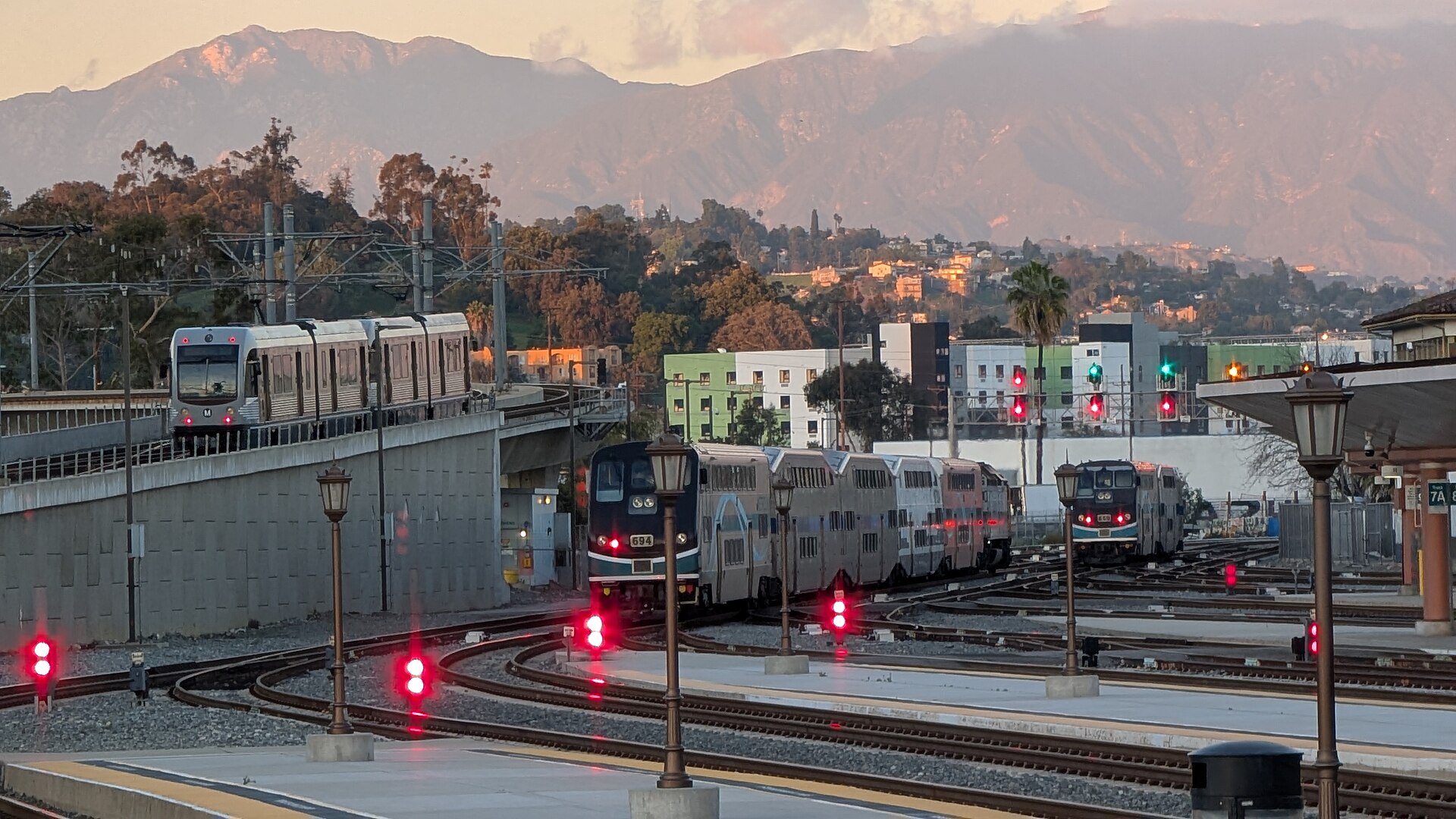
Los Angeles is the city that made the car famous, and for decades the answer to “do I need to rent one?” was an automatic yes. That answer is now out of date. The Metro rail network has grown to reach Hollywood, downtown, Koreatown, Pasadena, Long Beach, Santa Monica and, since 2025, a station connected to the airport, and each of the districts most visitors want to see is walkable on its own. At the same time, Los Angeles is still enormous, the freeways still define it, and the beaches of Malibu, the theme parks in Orange County, the San Gabriel Valley’s restaurants and every day trip out of the city are far easier with a car. This guide explains how the city is laid out, how transit works, what driving and parking are really like, and gives you a straightforward way to decide.
The short answer
Skip the car if you are staying in Hollywood, downtown, Koreatown, Santa Monica or Pasadena for a city break of three or four days, and your plans are the Walk of Fame, Griffith Observatory, downtown’s museums and food halls, Santa Monica and Venice, Universal Studios and a Dodgers or Lakers game; the Metro, your feet and the occasional ride-hail will cover that, and you will not pay the nightly parking fees that Los Angeles hotels charge. Rent a car if Malibu and the Pacific Coast Highway, Disneyland, the Getty and the Westside, the San Gabriel Valley, Joshua Tree, Palm Springs, San Diego or Las Vegas are on the itinerary, if you are traveling as a family with small children, or if you are staying in the Valley, the South Bay or with friends in the suburbs. For many visitors, the hybrid, car-free for the city days and a short rental for the driving days, is the best of both. Compare rental rates for any of these plans on our Los Angeles car rental page.
How Los Angeles is laid out
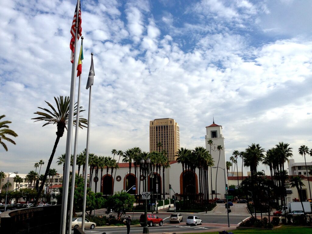
Los Angeles is not one city but a basin of dozens of them, stitched together by freeways and boulevards. Downtown sits roughly in the middle, with Union Station, the hub of the rail network, on its northern edge. West of downtown, Wilshire Boulevard runs sixteen miles to the ocean through Koreatown, the Miracle Mile and Museum Row, Beverly Hills, Westwood and Santa Monica. To the northwest, Hollywood sits at the foot of the hills, with West Hollywood beside it and Griffith Park above; over the hills is the San Fernando Valley, with Burbank, Universal City and North Hollywood. Pasadena is to the northeast, the San Gabriel Valley to the east, and the airport, the South Bay beaches and Long Beach are to the southwest and south. Malibu stretches along the coast northwest of Santa Monica, and Disneyland is in Anaheim, in Orange County, about 28 miles southeast of downtown. The distances are the thing visitors underestimate: Santa Monica to downtown is about 15 miles, and at rush hour that can take more than an hour by car.
Hotels cluster in Hollywood, downtown around LA Live and the historic core, in Santa Monica and Venice, in West Hollywood and Beverly Hills, near the airport, and in Anaheim around Disneyland. The base you choose decides how much time you spend in transit. Our Los Angeles hotel search lets you compare them.
Getting in from the airport
Los Angeles International (LAX) is on the coast in Westchester, about 18 miles southwest of downtown, and the terminal loop is one of the most congested roads in the region. The FlyAway bus runs from the terminals to Union Station downtown, and to Van Nuys in the Valley, using the freeway carpool lanes where it can. The Metro connection runs from the LAX/Metro Transit Center station, reached from the terminals by a free shuttle and, once it opens, by the airport’s new automated people mover train; from there the C and K lines connect to the rest of the rail network. Taxis and ride-hail pick up at the LAX-it lot, a short shuttle ride or walk from the terminals, rather than at the curb. And every major rental company is reached by shuttle from the arrivals level. The drive downtown or to Santa Monica takes 30 minutes at night and an hour or more at rush hour. If you are arriving at Hollywood Burbank Airport, you are much closer to Hollywood, Universal and the Valley, and there are Metrolink and Amtrak stations beside the airport. Check the airport’s site for current ground-transport details; our LAX airport guide covers the layout.
Los Angeles transit, explained
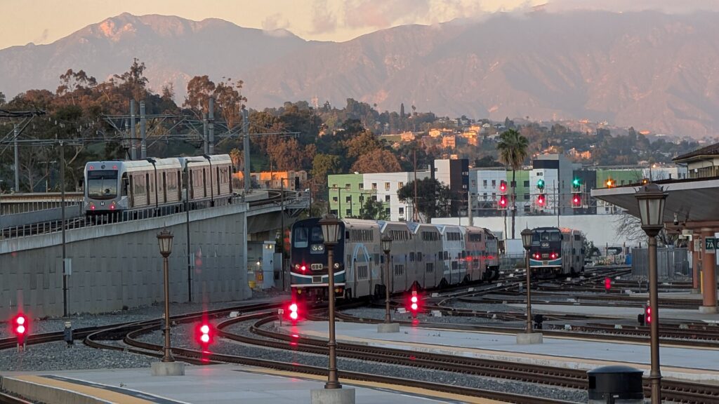
The Los Angeles County Metropolitan Transportation Authority, known simply as Metro, runs the rail network and most of the buses. It is cheaper and more extensive than its reputation and the fastest way across the city at rush hour on the routes it serves; its limitation is coverage, because much of the Westside and the hills are still a bus ride from the nearest station.
Metro Rail
The rail network is a mix of subway and light rail, with lines identified by letter and color. The B Line subway is the visitor’s line: it runs from Union Station through downtown and Koreatown’s edge to Hollywood/Vine and Hollywood/Highland, then under the hills to Universal City and North Hollywood. The D Line subway runs under Wilshire Boulevard from downtown through Koreatown, and is being extended west in stages toward Beverly Hills, Century City and Westwood. The E Line light rail runs from East Los Angeles through Little Tokyo and downtown to Exposition Park, USC and Culver City, and on to downtown Santa Monica, a few blocks from the pier. The A Line runs from the San Gabriel Valley foothills through Pasadena and downtown to Long Beach, one of the longest light-rail lines in the world. The C and K lines serve the South Bay, Inglewood’s stadium district and the airport transit center. Trains run from early morning until around midnight.
Buses
Metro’s buses fill in the rest, including the Rapid lines with fewer stops on the main boulevards, and two busways that work like rail: the G Line across the San Fernando Valley and the J Line between the San Gabriel Valley, downtown and San Pedro. Several cities run their own buses that connect with Metro: Santa Monica’s Big Blue Bus, with a Rapid route to the airport; Culver City’s buses; and the city of Los Angeles’s DASH shuttles, which run short, cheap loops through downtown, Hollywood and other neighborhoods, including the route up to Griffith Observatory.
Fares and tickets
Metro uses the TAP card, which you can buy at any rail station vending machine or add to the wallet on your phone. You tap on every bus and every train, including at the gates and the validators on the platform, and a single fare includes free transfers for two hours. The best feature for visitors is fare capping: once you have spent the equivalent of a day pass in a day, or a weekly pass in a week, the rest of your rides are free, so there is no need to decide in advance which pass to buy. DASH and the Big Blue Bus accept TAP too. Check Metro’s site for current fares and for any changes to how you can pay before you go.
Safety and comfort
Metro has added staff, security and cleaning after years of complaints, and most visitors find the main lines perfectly usable, especially by day. Late at night the usual big-city awareness applies: ride in a busy car and keep valuables out of sight.
Accessibility
Every Metro rail station has elevators and step-free boarding, and every Metro bus is low-floor with a ramp or lift. Elevator outages do happen; Metro publishes their status.
Beyond Metro
- Walking. Downtown, Little Tokyo, Hollywood Boulevard, Santa Monica and Venice, Old Pasadena and Koreatown are all pleasant on foot. Walking between them is not.
- Ride-hail and taxis. Uber and Lyft are everywhere and are the default for crossing the gaps in the rail network, especially at night; licensed taxis operate too. For a group of three or four, a short ride-hail trip can cost less than the transit fares combined.
- Driverless taxis. Waymo operates self-driving robotaxis across a growing part of the city, including Santa Monica, Hollywood and downtown, booked through its app; check its current service area.
- Metrolink and Amtrak. Metrolink commuter trains run from Union Station to the suburbs, Burbank’s airport, Orange County and the Inland Empire. Amtrak’s Pacific Surfliner runs along the coast to Anaheim, San Diego and Santa Barbara, and is the best car-free day trip out of the city.
- Bikes and scooters. Metro Bike Share and dockless e-scooters are common in downtown, Hollywood, Santa Monica and Venice, and the Marvin Braude Bike Trail along the beach is the best ride in the city.
- Universal’s shuttle. Universal Studios runs a free shuttle up the hill from the Universal City/Studio City B Line station.
Driving in Los Angeles: what it is really like
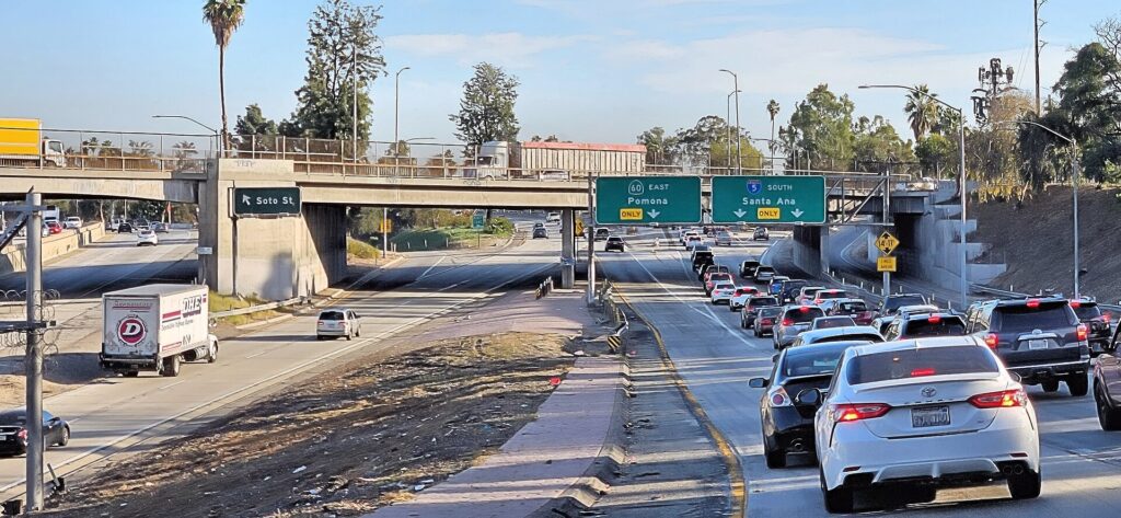
Driving in Los Angeles is less terrifying than its reputation and more time-consuming than visitors expect. The freeways are wide, well signed and fast outside the peaks, and locals refer to them with the definite article: “the 405”, “the 10”, “the 101”. Weekday rush hours run roughly from 6 to 10 a.m. and from 3 to 7 p.m., the 405 through the Sepulveda Pass and past the airport, the 10 between downtown and Santa Monica, and the 101 through Hollywood and the Cahuenga Pass are congested for much of the day, and a single crash can add an hour to a trip. For shorter trips, boulevards like Sunset and Wilshire are often as quick. Locals measure distance in minutes, not miles, and check a traffic app before every trip. Weekend mornings and weekday evenings after seven are the easiest times to drive.
Parking
Parking is the hidden cost of a Los Angeles rental. Hotels in Hollywood, downtown, Santa Monica and Beverly Hills charge a substantial nightly fee, and many offer valet only. Street parking exists almost everywhere but comes with rules: meters, time limits, residential permit zones, and weekly street-cleaning hours when cars are ticketed or towed. Read every sign on the pole, and remember the curb colors: red means no stopping, white is for passenger loading, green is short-term, and yellow is for commercial loading. Restaurants and bars often offer valet, and many shopping centers and museums, including the Getty Center, charge for their garages. Beach lots fill by late morning on summer weekends.
Rules and conditions worth knowing
- Carpool lanes on most freeways are marked with a diamond and require two or more people, sometimes three; the ExpressLanes on the 10 and the 110 charge solo drivers a toll and require a FasTrak transponder. Ask the rental company how it handles tolls.
- Toll roads in Orange County, on the routes around Irvine and inland, are cashless and billed by plate; the rental company will pass the charge on with a fee, so avoid them unless you have agreed a toll plan.
- Car break-ins are common at trailheads, beaches and tourist areas. Leave nothing visible in the car, not even a jacket or a charging cable, and never leave luggage in the trunk overnight in a street spot.
- Right turns on red are allowed after a full stop unless a sign says otherwise.
- Hands-free only: California law bans holding a phone while driving, including at red lights; mount it before you set off.
- Fuel in California is among the most expensive in the country, which adds up on day trips to Las Vegas or Joshua Tree.
- Weather and fire: the first rain after a dry spell makes the roads slick, winter storms can close mountain and canyon roads, and wildfires or Santa Ana wind events can close the Pacific Coast Highway and the canyon routes at short notice. Caltrans publishes current conditions and closures.
When renting a car makes sense
- Malibu and the Pacific Coast Highway. The beaches at Zuma, Point Dume and El Matador, the canyon roads and the Santa Monica Mountains trailheads are effectively car-only. Check for closures along the fire-affected stretches before you go.
- Disneyland and Orange County. A car makes the Anaheim day and the beaches of Huntington and Laguna far simpler, especially with children.
- The Getty, the Westside and the canyons. The Getty Center, Brentwood, Westwood and the hilltop viewpoints are poorly served by rail until the D Line extension is complete.
- The San Gabriel Valley. The best Chinese restaurants in North America are spread across strip malls in Alhambra, San Gabriel and Monterey Park, and a car turns a food crawl into an afternoon.
- Day trips and road trips. Joshua Tree, Palm Springs, Big Bear, Santa Barbara and the drives to San Diego and Las Vegas, or up the coast toward San Francisco on our San Francisco to Los Angeles route.
- Families and anyone staying in the suburbs. Car seats, beach gear and long distances all argue for a car.
If any of those apply, our rental car booking tips cover insurance, deposits, tolls and the questions to ask at the counter, and our family car rental guide looks at vehicle choice.
When it does not
- You are staying in Hollywood, downtown or Santa Monica and your plans are the sights along the B, D and E lines.
- You are in town for a concert, a game at Crypto.com Arena or Dodger Stadium, or a convention downtown, when parking is expensive and the Metro or a shuttle gets you close.
- You are traveling solo or as a couple for a short trip, and the rental, the hotel parking, the fuel and the time spent in traffic add up to more than the occasional ride-hail.
The hybrid plan for a city-plus-coast trip
Go car-free for the city days and rent for the driving days, and think carefully about where you pick up. Renting at LAX makes sense if you are heading straight to the beach cities, Orange County or out of town, because the airport sits beside the 405 and the 105. Renting from a neighborhood branch in Hollywood, downtown or Santa Monica makes sense if you are spending the first nights in the city, because you avoid the airport’s fees and the queue for the shuttle, and you do not pay hotel parking on the nights the car would sit unused. A pattern that works well: FlyAway or Metro into the city, two or three car-free days, a car picked up on the morning you head for Malibu, the Getty or Disneyland, and returned at the airport on the way home. Compare the day rates on our Los Angeles car rental page against a full-trip rental and the difference is usually obvious.
A worked cost comparison
Numbers change with the season and the booking window, so treat this as a method rather than a quote, and check current rates before deciding. For a four-night city break for two people based in Hollywood, the car-free version costs two FlyAway or Metro trips from the airport, capped Metro fares for each day, and perhaps three or four ride-hail trips to Griffith Observatory, the Getty or a late dinner; the rental version adds four days of a compact car, four nights of hotel parking, fuel, the airport fees, and time spent looking for street parking, and buys you very little you could not ride to. The car-free option wins comfortably. For the same four nights plus a day in Malibu and a day at Disneyland, the car-free version needs long ride-hail trips or the train and a bus to Anaheim; a two-day rental picked up from a Hollywood branch, plus fuel and parking at the beach and the park, usually costs less for two people and far less for four, and saves hours. For a week-long family trip with the theme parks and a day in San Diego, a rental for the whole stay is the practical answer, and a hotel with included parking, easier to find in Anaheim, Pasadena or near the airport, saves a meaningful amount. Run the rental rates for your dates on our Los Angeles car rental page and put them beside a realistic ride-hail budget before you choose.
Driving out of Los Angeles in each season
The road trips are where a rental earns its keep, and each has its own seasonal quirks. In summer, the Pacific Coast Highway to Malibu is at its most beautiful and its most crowded; go early on a weekday and expect the beach lots to fill by late morning. The Interstate 15 to Las Vegas, about four to five hours in normal traffic, crosses the Mojave Desert, where summer temperatures can pass 43 °C (110 °F); carry water, keep the tank topped up, and avoid the Sunday afternoon return, when the southbound traffic out of Las Vegas backs up for miles. The Interstate 5 to San Diego takes around two to three hours and is busiest on Friday afternoons and holiday weekends. In fall, the desert cools down, making it the best season for Joshua Tree and Palm Springs, but the Santa Ana winds can close canyon roads and PCH during fire events, so check conditions before you go. In winter, the Grapevine, the steep section of the Interstate 5 over the mountains toward San Francisco and the Central Valley, is closed by snow a few times a season, and the Cajon Pass on the Interstate 15 can be affected too; chains may be required on mountain roads to Big Bear. In spring, the deserts bloom and the coast road toward Santa Barbara is at its greenest, although Highway 1 through Big Sur has a history of landslide closures; check Caltrans before planning the full coastal route.
Decision table
| Your trip | Recommendation | Why |
|---|---|---|
| City break in Hollywood or downtown, couple or solo | No car | The B, D and E lines cover the main sights; hotel parking is expensive |
| Beach break in Santa Monica or Venice | No car | The E Line reaches downtown; bikes and the beach path cover the coast |
| City plus Malibu, the Getty or Disneyland | Hybrid: rent from a city branch for the driving days | Car-free city days, car for the places Metro does not reach |
| Family trip with theme parks | Rent for the whole stay | Car seats, gear and distances make the car worthwhile daily |
| Concert, game or convention downtown | No car | Parking is scarce and costly; Metro and shuttles serve the venues |
| Staying in the Valley, South Bay or suburbs | Rent | Transit exists but trips are long; the car saves hours |
| Joshua Tree, Palm Springs or Big Bear | Rent | No practical transit; the drive is the trip |
| Road trip to San Diego, Las Vegas or San Francisco | Rent (consider one-way) | Los Angeles is the start, not the destination; the train is an option to San Diego |
Money-saving tips for both options
- On transit: load a TAP card into your phone’s wallet and let fare capping do the work; use DASH for short hops downtown and in Hollywood; take the FlyAway or Metro from LAX rather than a ride-hail at rush hour.
- On a rental: compare airport and neighborhood pickup, book early for summer and the holidays, decline extras you already have through a credit card or home policy (check first), agree a toll plan or avoid the toll roads, and return the car full.
- On the hotel: if you are renting, price the parking fee into the room rate, and consider a base with free or cheaper parking in Pasadena, the Valley or near the airport.
- On timing: drive before 7 a.m., between 10 a.m. and 2 p.m., or after 7 p.m.; avoid the 405 and the 10 in the weekday peaks; and check the best time to fly to Los Angeles guide for the busiest holiday weekends.
- On ride-hail: compare apps, walk a block away from the busiest pickup points, and use it to fill the gaps in the rail network rather than for every trip; our guide to car, transit or taxi in a new city sets out the general trade-offs.
Frequently asked questions
Is it worth renting a car in Los Angeles?
For Malibu, the theme parks, the San Gabriel Valley, day trips or a family trip, yes. For a short city break based in Hollywood, downtown or Santa Monica, no; the Metro, walking and occasional ride-hail are cheaper and often faster.
Is Los Angeles public transit good for tourists?
Better than its reputation. The Metro rail lines link Hollywood, downtown, Koreatown, Universal, Pasadena, Long Beach and Santa Monica, and fare capping keeps costs low. Coverage thins out on the Westside, in the hills and at the beaches north of Santa Monica.
How do I get from LAX to downtown or Hollywood?
The FlyAway bus to Union Station, the Metro from the LAX/Metro Transit Center, or a taxi or ride-hail from the LAX-it lot. For Hollywood, take the Metro or FlyAway to Union Station and transfer to the B Line.
Can I visit Disneyland without a car?
Yes. Take Amtrak’s Pacific Surfliner or Metrolink from Union Station to Anaheim and a short bus or ride-hail to the park, or stay in a hotel near the park that runs a shuttle. It takes longer than driving outside rush hour.
How bad is traffic in Los Angeles?
Among the worst in the country at rush hour, especially on the 405, the 10 and the 101. Outside the peaks, and on weekend mornings, it is manageable. Plan in minutes, not miles.
Whichever way you go, start with the flight. Compare cheap flights to Los Angeles, choose a neighborhood with our Los Angeles hotel search, and if the coast, the parks or the desert are on the list, price the rental for those dates on our Los Angeles car rental page. For what to see once you are there, our first-timer’s guide to Los Angeles has the sights, neighborhoods and itineraries.
Keep planning with TicketScanner
- Los Angeles car rentals — compare airport and neighborhood pickup
- Cheap flights to Los Angeles
- Los Angeles hotels — factor parking into the rate
- Things to do in Los Angeles: a first-timer's guide
- Best time to fly to Los Angeles: month by month
- Los Angeles International (LAX) airport guide
- Driving Los Angeles to San Diego
- Driving Los Angeles to Las Vegas
- Rental car booking tips
- Car, transit or taxi in a new city?
Leave a Reply