Tag: Car Rental

  • Salt Lake City: Should You Rent a Car or Rely on Public Transit?

    Salt Lake City: Should You Rent a Car or Rely on Public Transit?

    Salt Lake City is a split decision. For the city itself, it has one of the better transit setups in the Mountain West: a light-rail line straight from the airport terminal to downtown, a free-fare zone in the center, trains to the university, the suburbs and the soccer stadium, and a commuter railroad that runs the length of the Wasatch Front. But very few people fly to Salt Lake City just for the city. Most come to ski the Cottonwood Canyons or Park City, to drive south to the national parks, or to see the Great Salt Lake, and for almost all of that, a car is either essential or much easier. And in winter, the car itself comes with a catch: the canyon roads to the ski resorts have traction rules that many rental cars do not meet. This guide explains how the city is laid out, how UTA’s trains and buses work, what driving here is really like in every season, how the ski buses and shuttles compare with a rental, and gives you a straightforward way to decide.

    The short answer

    Rent a car if the national parks, Antelope Island, the Bonneville Salt Flats or a Utah road trip are on the itinerary, if you are skiing several resorts and want flexibility, if you are staying with family in the suburbs, or if you are traveling with children and gear. Skip the car if you are staying downtown for a city break, a convention, General Conference or a game, and your plans are Temple Square, the Capitol, the museums on the east bench and Sugar House; TRAX, the S-Line streetcar, your feet and the occasional ride-hail will cover that, and you will not pay for parking. And for skiing, there is a real middle path: the ski buses and resort shuttles reach the canyon resorts and Park City without you having to worry about winter traction rules or scarce parking. Compare rental rates for any of these plans on our Salt Lake City car rental page.

    How Salt Lake City is laid out

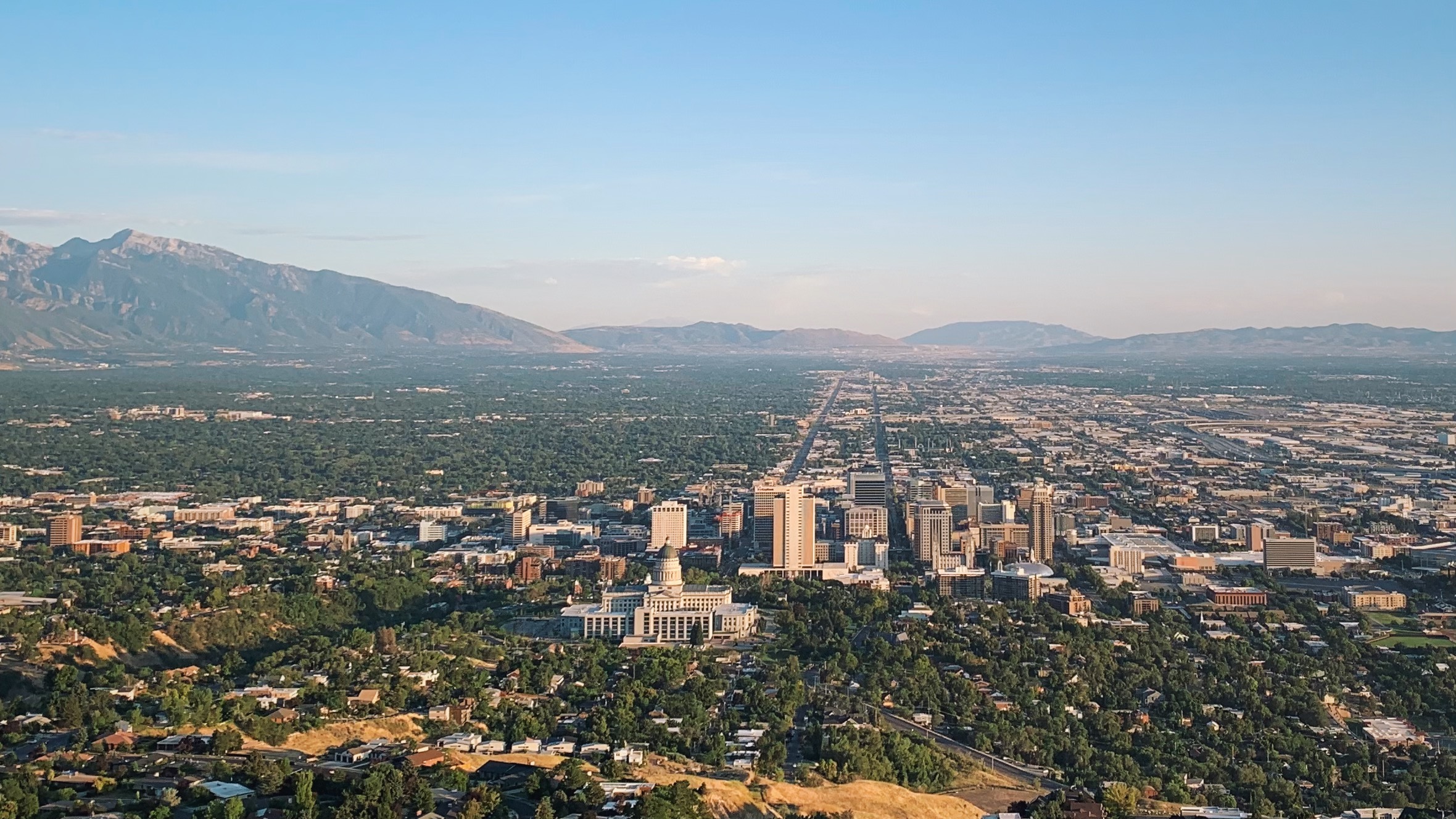
    Salt Lake City is built on one of the most logical street grids in the country, and it starts at Temple Square. The corner of Main Street and South Temple is the origin point, and almost every address in the valley counts blocks from there: 400 South is four blocks south of the temple, 700 East is seven blocks east, and an address such as 1300 South 900 East is a pair of coordinates rather than a street name. The pioneers laid out enormous blocks and streets wide enough, as the story goes, for a wagon team to turn around, so the streets are broad and easy to drive but the blocks are long on foot; a walk of “four blocks” is closer to a mile than a stroll. Downtown sits at the north end of the valley, with the State Capitol on the hill above it, the Avenues climbing to the northeast, the University of Utah on the east bench, and Sugar House a few miles to the southeast. The suburbs then fill the valley south for more than twenty miles, with the Cottonwood Canyons opening in the Wasatch on the east side and the airport to the west, beside the lake. The inner city is compact enough for transit; everything beyond it assumes a car.

    Hotels cluster downtown around Temple Square, the Salt Palace and the Delta Center, which is the natural base for a car-free visit, with more near the airport and along I-15 in the southern suburbs, and resort lodging up the canyons and in Park City. Our downtown and Temple Square hotel page and wider Salt Lake City hotel search let you compare them.

    Getting in from the airport

    Salt Lake City International (SLC) is about 6 kilometers (4 miles) west of downtown, closer than almost any other big-city airport in the country. The TRAX Green Line leaves from a station beside the terminal and reaches downtown in about 20 minutes, stopping along North Temple and at several downtown stations, for a standard fare; it is the easiest airport rail connection in the West. Taxis and ride-hail pick up at the terminal, and the drive downtown takes 10 to 20 minutes outside rush hour. The rental counters are in the garage facing the terminal, so there is no shuttle bus to a remote lot, and I-80 and I-215 are minutes from the exit, which means you can be on the road to Park City or the Cottonwood Canyons within half an hour of collecting the keys. Private shuttle companies run shared and private transfers from the airport to Park City and the canyon resorts, and many ski lodges arrange their own. Check the airport’s site for current ground-transport details; our SLC airport guide covers the layout, including the long walk to the far gates.
    A UTA TRAX Green Line train at Gallivan Plaza in downtown Salt Lake City
    TRAX in downtown Salt Lake City: free to ride within the Free Fare Zone, and about 20 minutes from the airport (Photo: An Errant Knight via Wikimedia Commons, CC BY-SA 4.0)

    Salt Lake City’s transit, explained

    The Utah Transit Authority, UTA, runs the light rail, the commuter trains, the streetcar and the buses across the Wasatch Front. For a downtown-based visitor it is clean, simple and genuinely useful; its limitation, as in most Western cities, is coverage and frequency once you leave the rail lines, especially in the evenings and on Sundays.

    TRAX light rail

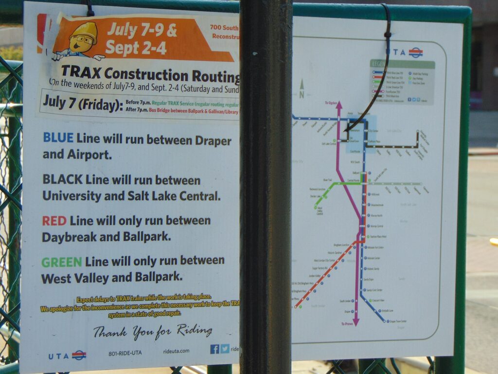
    Three lines. The Green Line runs from the airport through downtown and out to West Valley City. The Red Line runs from the University of Utah and its hospital through downtown and south to the Daybreak development in South Jordan, where the Salt Lake Bees now play. The Blue Line runs from Salt Lake Central Station through downtown and south to Sandy, for the soccer stadium, and on to Draper. All three share the downtown tracks, and rides that start and end inside UTA’s downtown Free Fare Zone are free, on TRAX and on local buses, which covers Temple Square, City Creek, the Delta Center, the Salt Palace and most downtown hotels. Trains run from early morning until late evening, with less frequent service on Sundays.

    FrontRunner and the S-Line

    FrontRunner is the commuter railroad that runs north to Ogden and south to Provo from Salt Lake Central Station, useful for a day in Ogden’s historic 25th Street or a visit to Provo; it has historically not run on Sundays, so check the schedule. The S-Line streetcar is a short line from a TRAX connection in South Salt Lake to the heart of Sugar House, and it is the easiest way to reach that neighborhood.

    Buses and ski buses

    Buses fill in the rest, including the routes up to the Natural History Museum, Red Butte Garden and This Is the Place on the east bench. In winter, UTA has run ski bus service up Big and Little Cottonwood Canyons from park-and-ride lots in the valley to Solitude, Brighton, Snowbird and Alta, and the buses are exempt from the parking scramble at the top. Service levels have been cut back in some recent seasons, so check the current ski schedule on UTA’s site before building a trip around it, and expect full buses on powder mornings.

    Fares and tickets

    Buy tickets from the machines at TRAX and FrontRunner stations or through UTA’s mobile ticketing, and keep proof of payment for the whole trip; fare inspectors check on the trains. FrontRunner fares rise with distance, while TRAX and local buses charge a flat fare with transfers allowed within a time limit, and young children ride free with a paying adult. Ski buses have their own fares, and some resort passes have included free rides in past seasons. Payment options change, so check UTA’s site for current fares and ticketing before you go.

    Accessibility

    TRAX platforms offer level boarding, the buses are low-floor with ramps, and FrontRunner has accessible cars; UTA also runs paratransit for eligible riders.

    Beyond UTA

    • Walking. Downtown, the Avenues, 9th and 9th and Sugar House are pleasant on foot, but allow more time than the map suggests; the blocks are long and the streets wide.
    • Bike share and scooters. The city has a bike-share system and shared e-scooters in the warmer months, and protected bike lanes on several downtown streets. The foothill trails and City Creek Canyon are popular rides.
    • Taxis and ride-hail. Uber, Lyft and taxis operate across the valley; for a group, a short ride is competitive with transit fares and much quicker to the east bench or the neighborhoods off the rail lines.
    • Park City buses. A commuter bus connects downtown Salt Lake City with Park City, and within Park City the town’s own buses are free and reach both ski resorts, Main Street and the lodging areas, so a car-free ski week in Park City is realistic.
    • Ski and airport shuttles. Private shuttle companies run between the airport, downtown hotels, Park City and the canyon resorts; they are the easiest way to reach a slopeside lodge without driving.
    • Amtrak and intercity buses. The California Zephyr stops at Salt Lake Central Station once a day in each direction, at night, and intercity buses connect the city with other Western cities.
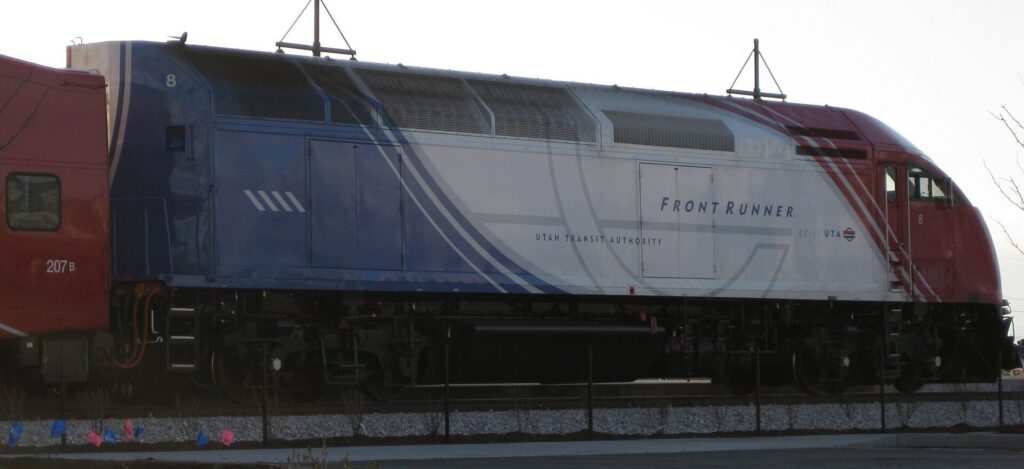
    A UTA FrontRunner commuter train at Provo station
    FrontRunner, the commuter railroad between Ogden, Salt Lake City and Provo (Photo: А at English Wikipedia via Wikimedia Commons, Public domain)

    Driving in Salt Lake City and beyond: what it is really like

    Salt Lake City is an easy place to drive by big-city standards: wide streets, a grid that tells you where you are, plenty of parking outside downtown, and freeways that are generally quick outside rush hour. The frustrations are specific. I-15, the north-south spine of the valley, backs up every weekday morning and evening, and I-215, the belt route, has its own bottlenecks near the canyon mouths. Some suburban intersections use unusual designs, such as continuous-flow intersections and “ThrU-turns”, that can surprise drivers from elsewhere; follow the signs and lane markings carefully. Construction season runs from spring to fall on the main routes. And the winter weather changes everything above the valley floor: the city might be dry while the canyons are in a full snowstorm.
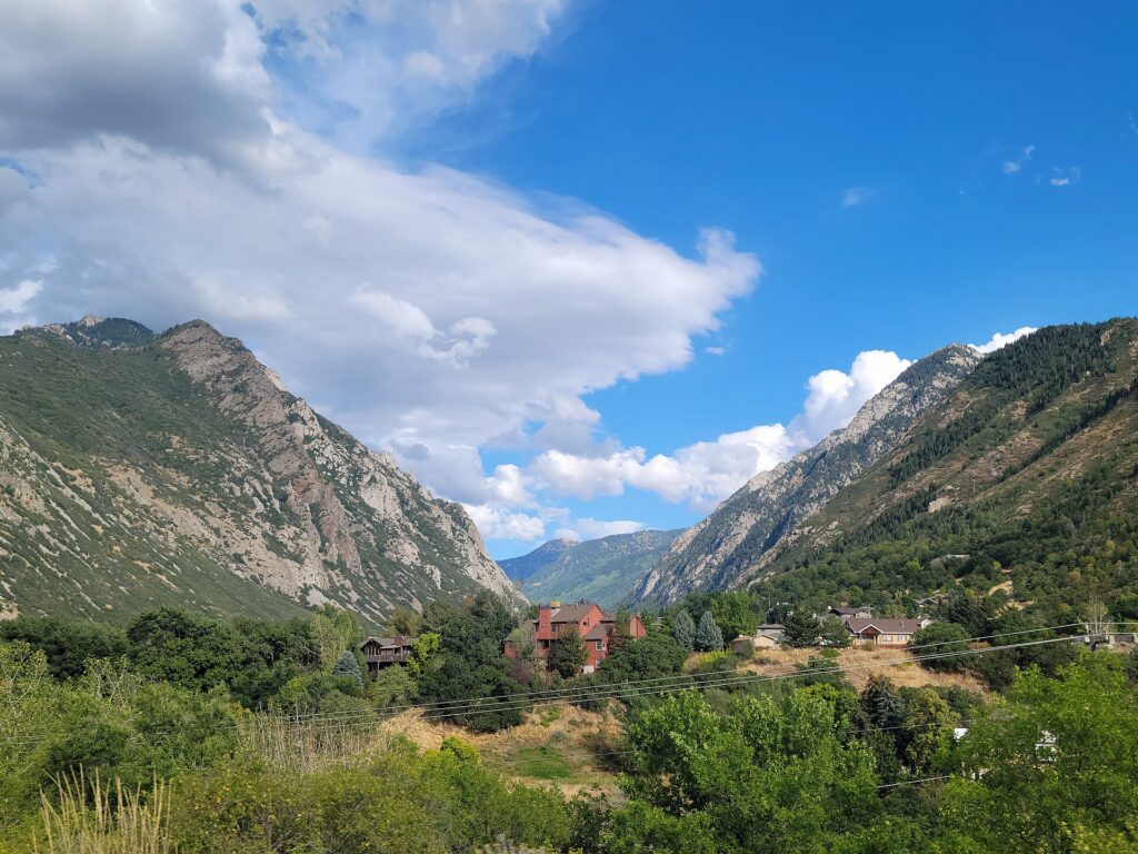
    Little Cottonwood Canyon, the road corridor to Snowbird and Alta
    Little Cottonwood Canyon, where winter traction rules and avalanche closures shape every ski day (Photo: GyozaDumpling via Wikimedia Commons, CC BY-SA 4.0)

    Parking

    Downtown parking is moderately priced by big-city standards. Street meters are paid at kiosks or by app, and meters downtown have traditionally been free on Sundays and holidays; check the signs where you park. Garages at City Creek and around Temple Square are plentiful, and many downtown businesses validate. Hotels charge a nightly fee that is worth adding to the room rate when you compare. Outside the center, parking at the museums, the zoo, the malls and most trailheads is straightforward, although popular canyon trailheads fill early on summer weekends. The hardest parking in the region is at the ski resorts on busy days: several of the canyon resorts now charge for parking or require advance reservations on weekends and holidays, and the lots can fill before the lifts open after a big storm.

    Rules and conditions worth knowing

    • Canyon traction rules. Big and Little Cottonwood Canyons, the roads to Solitude, Brighton, Snowbird and Alta, have winter traction requirements, roughly from October to April. When UDOT puts restrictions in place, vehicles generally need four-wheel or all-wheel drive with tires rated for mud and snow (look for M+S or the mountain-snowflake symbol on the sidewall), or approved chains or traction devices, and troopers can turn back or fine drivers who do not comply. Many rental cars are front-wheel drive, and rental agreements often prohibit chains, so if you plan to drive the canyons, book an AWD or 4WD vehicle and check the tires at the counter. UDOT Traffic shows current restrictions, closures and canyon cameras.
    • Avalanche closures. After heavy snow, Little Cottonwood Canyon in particular closes for avalanche control, sometimes for hours, and guests at Alta and Snowbird can be kept indoors, a practice known locally as “interlodge”. Build slack into your plans on storm days and never stop in a marked avalanche zone.
    • The “red snake”. On powder mornings, the line of brake lights up Little Cottonwood can stretch back to the valley. Leave early, carpool, or take the bus.
    • Blood alcohol limit. Utah’s legal limit for drivers is 0.05 percent, lower than the rest of the country; the only safe plan after drinks is not to drive.
    • Wildlife. Deer are common on canyon roads and suburban edges at dawn and dusk, and moose appear in the higher canyons and around Park City; slow down.
    • Speed limits reach 80 mph on some rural interstates, and the long empty stretches toward the parks make it easy to drift above them; the Highway Patrol is active.
    • Right turns on red are permitted after a full stop unless signed otherwise.
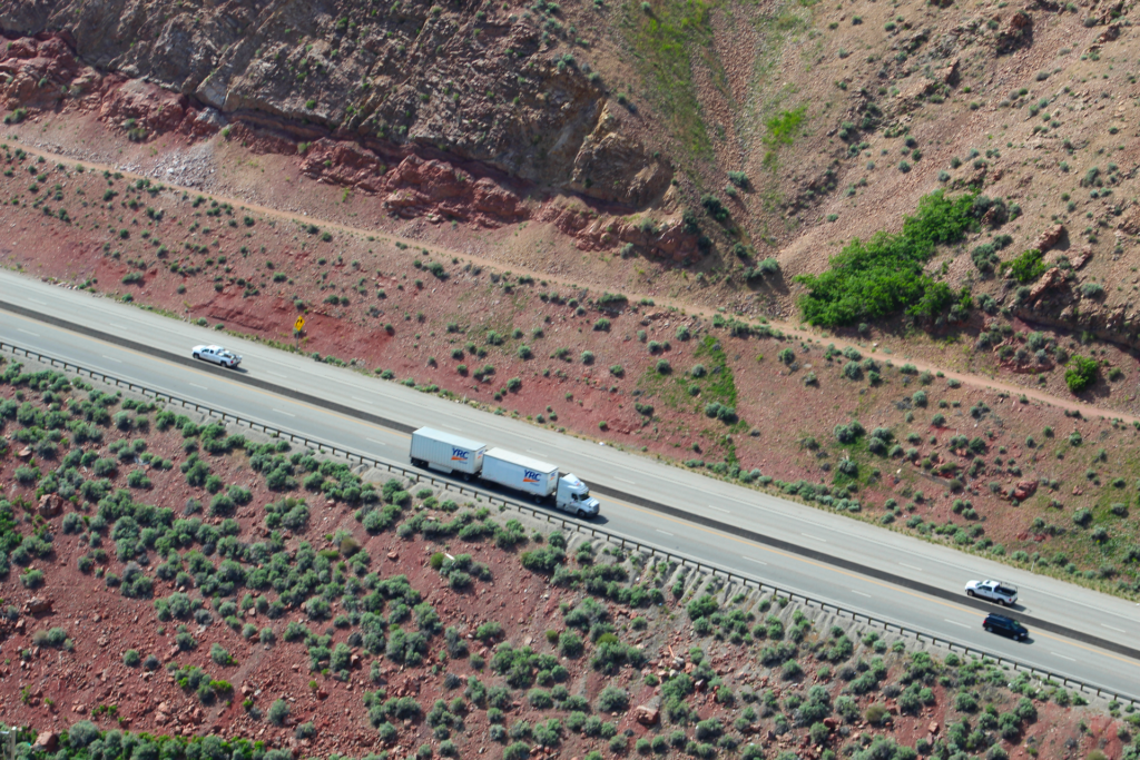
    Interstate 80 climbing through Parleys Canyon east of Salt Lake City
    I-80 through Parleys Canyon, the main road from Salt Lake City to Park City (Photo: Grant Handy via Wikimedia Commons, CC BY-SA 4.0)

    When renting a car makes sense

    • The national parks. Arches and Canyonlands, Capitol Reef, Bryce Canyon and Zion are all at least three and a half hours away and connected by long, scenic highways; there is no practical way to see them without a car. Check each park’s rules before you go: Zion runs a shuttle on its main canyon road for much of the year, and Arches has used timed-entry reservations in recent peak seasons. International visitors should also check the National Park Service site, as entrance fees for non-US residents at the busiest parks have recently changed.
    • Skiing several resorts. A car, preferably AWD with the right tires, lets you chase the snow between the Cottonwood Canyons and Park City.
    • Antelope Island, the Bonneville Salt Flats and Golden Spike are all car trips of one to two hours each way.
    • Family in the suburbs. The valley is long and spread out; a car earns its keep daily.
    • Traveling with children and gear. Skis, car seats and luggage make shuttles and buses awkward.
    • Western road trips. Salt Lake City to Las Vegas takes about six hours on I-15, and to Denver about eight via I-80 across southern Wyoming; our Denver to Salt Lake City route guide covers the drive, and our Denver car-versus-transit guide covers the other end.

    If any of those apply, our rental car booking tips cover insurance, deposits and the questions to ask at the counter, and our family car rental guide looks at vehicle choice.

    When it does not

    • You are staying downtown and your plans are Temple Square, the Capitol, the museums and Sugar House.
    • You are in town for a convention, General Conference or a game at the Delta Center, when downtown parking is at its busiest and TRAX stops at the door.
    • You are skiing one resort or staying in Park City, where the free town buses, the ski buses and a shuttle from the airport cover everything.
    • You are traveling solo on a short trip and the rental, parking and fuel add up to more than the train and a few rides.

    The hybrid plan for a city-plus-mountains trip

    Go car-free for the city days and rent for the canyon or park days, and think carefully about where you pick up. Because the airport is so close to downtown and the rental counters are in the garage at the terminal, an airport pickup is more convenient here than in most cities, and heading straight to Park City or the canyons from the airport keeps you out of downtown traffic entirely. Renting from a downtown location can still make sense if you are spending the first nights in the city, because you avoid paying hotel parking on nights the car would sit unused. A pattern that works well: TRAX from the airport to a downtown hotel, two car-free days, then a rental for the mountain or park days, returned at the airport on the way to the flight home. In winter, reserve an AWD or 4WD vehicle well ahead for the canyon days, because they sell out on holiday weekends. Compare the day rates on our Salt Lake City car rental page against a full-trip rental and the difference is usually obvious.

    A worked cost comparison

    Numbers change with the season and the booking window, so treat this as a method rather than a quote, and check current rates before deciding. For a four-night city break downtown for two people, the car-free version costs two TRAX fares each way from the airport, a few bus or streetcar rides to the east bench and Sugar House, and perhaps a couple of ride-hail trips in the evening; the rental version adds four days of a compact car, four nights of hotel parking, fuel, and airport fees and taxes, and buys you very little you could not ride to. Transit wins easily. For a five-day ski trip staying in the city, compare an AWD rental for five days, plus fuel and any resort parking fees, against ski bus fares or daily shuttles for two; the bus is cheaper when it runs frequently and your resort is on its route, and the car wins when you want to ski different resorts, leave early on powder days, or travel with children. For a week-long national park loop, a rental is the only practical answer, and it is worth comparing a round trip from Salt Lake City with a one-way rental to Las Vegas, which saves a long drive back but adds a one-way fee. Run the rental rates for your dates on our Salt Lake City car rental page and put them beside the transit and shuttle costs before you choose.

    Driving the canyons and the Wasatch in each season

    The roads from Salt Lake City into the mountains are short, steep and beautiful, and they are where visitors most often underestimate the conditions. In winter, Big and Little Cottonwood Canyons climb about 900 m (3,000 feet) in less than ten miles on narrow, winding roads, and traction rules apply whenever UDOT declares them; a front-wheel-drive rental on all-season tires can be turned back at the canyon mouth. Little Cottonwood is avalanche terrain and closes for control work after big storms, and on powder mornings the traffic can take an hour or more. I-80 through Parleys Canyon to Park City is a wide interstate and much easier, but it is steep and can ice up in storms, and Guardsman Pass, the summer shortcut between Big Cottonwood and Park City, is closed in winter. In spring, the canyon roads are wet and clear while the resorts are still skiing, rockfall is more common during the thaw, and the high trails stay snowbound into June. In summer, the canyons are the city’s escape from the heat, trailhead lots fill early on weekends, and the Alpine Loop and Mirror Lake Highway into the Uinta Mountains open for scenic drives. Afternoon thunderstorms bring lightning to exposed ridges and flash floods to the southern slot canyons. In fall, the color on the canyon roads draws heavy weekend traffic from late September, and the first snow can close the high roads by late October. In every season, check UDOT Traffic before you set off, and the National Weather Service in Salt Lake City for storm warnings.

    Decision table

    Your tripRecommendationWhy
    City break downtown, couple or soloNo carTRAX from the airport, a free downtown zone and walkable sights
    Convention, General Conference or a gameNo carDowntown parking is busiest and TRAX stops at the venues
    Ski week in Park CityShuttle from the airport, free town busesBoth resorts and Main Street are on the free system
    Skiing the Cottonwood Canyons from the cityAWD or 4WD rental, or the ski busTraction rules and scarce parking favor the right car or the bus
    City plus a day at Antelope Island or Park CityHybrid: rent for the day tripCar-free city days, a car for the lake and the mountains
    National parks loopRent (consider one-way to Las Vegas)Long distances with no practical transit
    Family visit to the suburbsRent for the whole stayThe valley is long and spread out
    Western road trip via DenverRent (compare a one-way fee)Salt Lake City is a stop, not the destination

    Money-saving tips for both options

    • On transit: ride free within the downtown Free Fare Zone, take TRAX from the airport instead of a taxi, and check whether your ski pass includes bus rides.
    • On a rental: compare airport and downtown pickup, book AWD early for ski holidays, check the tires for canyon driving, decline extras you already have through a credit card or home policy (check first), and fill up before the canyons and the long empty stretches toward the parks.
    • On the hotel: if you are renting, add the parking fee to the room rate when you compare, and consider a hotel outside downtown with free parking on the TRAX line.
    • On timing: avoid I-15 in the weekday peaks and the Cottonwood Canyons on powder weekend mornings; the best time to fly to Salt Lake City guide lists the busiest weekends.
    • On the parks: if you plan to visit several national parks, an annual pass for the vehicle usually costs less than paying at each gate.

    Frequently asked questions

    Is it worth renting a car in Salt Lake City?
    For the national parks, the lake, a road trip or skiing several resorts, yes. For a downtown city break, a convention or General Conference, no; TRAX and your feet are enough.

    Is Salt Lake City public transit good for tourists?

    Good for the core: TRAX runs from the airport terminal to downtown, the university and the suburbs, and rides within the downtown Free Fare Zone are free. It thins out in the evenings, on Sundays and away from the rail lines.

    How do I get from Salt Lake City airport to downtown?

    The TRAX Green Line in about 20 minutes for a standard fare, or a taxi or ride-hail in 10 to 20 minutes outside rush hour.

    Can I ski in Utah without a car?

    Yes. Park City’s free buses and airport shuttles make a car-free week there easy, and UTA’s ski buses serve the Cottonwood Canyon resorts in winter, though schedules vary by season.

    Do I need four-wheel drive to drive to the ski resorts?

    For Big and Little Cottonwood Canyons, when traction restrictions are in effect you generally need four-wheel or all-wheel drive with suitable tires, or approved chains. Check UDOT’s current rules before you go, and ask for an AWD vehicle when you book.

    Is parking expensive in downtown Salt Lake City?
    Less than in most big cities. Meters are moderate and have traditionally been free on Sundays and holidays; hotel parking fees are the main cost.

    Can I visit the national parks from Salt Lake City without a car?

    Only on an organized tour. The parks are three and a half to four and a half hours away with no practical public transport; for independent travel, rent a car.

    Whichever way you go, start with the flight. Compare cheap flights to Salt Lake City, choose a neighborhood with our Salt Lake City hotel search, and if the canyons or the parks are on the list, price the rental for those dates on our Salt Lake City car rental page. For what to see once you arrive, start with our first-timer’s guide to Salt Lake City.

  • Charlotte: Should You Rent a Car or Rely on Public Transit?

    Charlotte: Should You Rent a Car or Rely on Public Transit?

    Charlotte sits in the middle of the car question. It grew up around the automobile, with a ring of interstates, suburbs spilling into two states and an airport with no rail link, yet its center has changed faster than almost any in the South. A light-rail line now runs from the southern suburbs through South End and Uptown to NoDa and the university, a streetcar crosses Uptown, and the neighborhoods most visitors want are packed along those two lines. If your trip is Uptown, the museums, the NASCAR Hall of Fame, South End breweries and a game, you can do it without a car and save the hotel parking. If it includes the Speedway, Lake Norman, the Whitewater Center or the Blue Ridge Mountains, you will want one for part of the stay. This guide explains how the city is laid out, how the transit system works, what driving here is really like, and gives you a straightforward way to decide.

    The short answer

    Skip the car if you are staying in Uptown or South End for a city break, a conference or a game, and your plans are the central sights, the Rail Trail, NoDa and Plaza Midwood; the LYNX Blue Line, the Gold Line streetcar, your feet and the occasional ride-hail will cover that, and you will not pay nightly parking. Rent a car if you are going to a race at Charlotte Motor Speedway, spending time at Lake Norman or the Whitewater Center, heading to Asheville and the mountains, staying with family in the suburbs, or using Charlotte as the start of a Carolinas road trip. Go hybrid, and this is what most visitors should do, if your trip mixes the two: stay car-free for the city days and rent only for the days that leave it. Compare rates for any of these plans on our Charlotte car rental page.

    How Charlotte is laid out

    Charlotte is a hub-and-spoke city. At the center is Uptown, the compact business district built around the crossroads of Trade and Tryon Streets and wrapped in a tight inner freeway loop, I-277. From there the old trading roads radiate outward as the main avenues: South Boulevard to the south, Central Avenue and Independence Boulevard to the east, North Davidson to the northeast, Wilkinson Boulevard west toward the airport. I-77 crosses the city north to Lake Norman and south to Carowinds, I-85 runs northeast to Concord and southwest toward Atlanta, and I-485, a beltway of roughly 110 kilometers (67 miles), marks the practical edge of the metro. Outside Uptown the streets follow no grid, so a navigation app is essential.

    For a visitor, the geography is simpler. South End, Dilworth, Uptown, NoDa and Plaza Midwood sit within about five kilometers (three miles) of the Square, and three of them are on the Blue Line. The Speedway, the Whitewater Center, Lake Norman and the mountains are 20 minutes to two hours out by road. Hotels cluster in Uptown, South End, near the airport, in University City and around Concord Mills near the Speedway; our Charlotte hotel search compares them.

    Getting in from the airport

    Charlotte Douglas International (CLT) is about 11 kilometers (7 miles) west of Uptown, and it is not on the rail network. A taxi or ride-hail is the quickest way into the center, 15 to 20 minutes in normal traffic and considerably longer at the weekday rush, with pickups from the designated zones outside baggage claim. The CATS Route 5 bus runs between the terminal and the Charlotte Transportation Center in Uptown, beside the Spectrum Center, for a standard local fare; it takes roughly half an hour and connects there with the Blue Line and the Gold Line. The rental car counters are in the hourly parking deck opposite the terminal, a short walk from baggage claim, and you are on Billy Graham Parkway or I-85 within minutes. A rail line to the airport has been discussed and planned for years, but it is not something to count on for your trip. Our CLT airport guide covers the terminal layout.

    The LYNX Blue Line tracks and Rail Trail at East Park Avenue in South End, Charlotte
    The Blue Line through South End, where the Rail Trail runs beside the tracks (Photo: City Dweller 2 via Wikimedia Commons, CC BY-SA 4.0)

    Charlotte’s transit, explained

    The Charlotte Area Transit System, known as CATS, runs the light rail, the streetcar and the buses. For a visitor based in the center it is clean, easy and more than adequate. Its limitation is coverage: there is one rail line, and beyond its corridor the buses rarely beat a car or a ride-hail for time.

    The LYNX Blue Line

    The Blue Line is the backbone, and it runs through almost everything a visitor needs. From I-485 in the south it heads north into South End, where the New Bern, East/West Boulevard, Bland Street and Carson stations sit along the Rail Trail, then through Uptown with stops at Stonewall (for Bank of America Stadium), 3rd Street/Convention Center, the Charlotte Transportation Center (for the Spectrum Center and the Gold Line) and 7th Street. North of Uptown it reaches 36th Street in NoDa, then runs out through University City to the UNC Charlotte main campus, about 30 kilometers (19 miles) from the southern end. Trains run from early morning until after midnight, frequently at peak times and less often late and on Sundays, with extra service on event days. Suburban stations have park-and-ride lots.

    The CityLYNX Gold Line

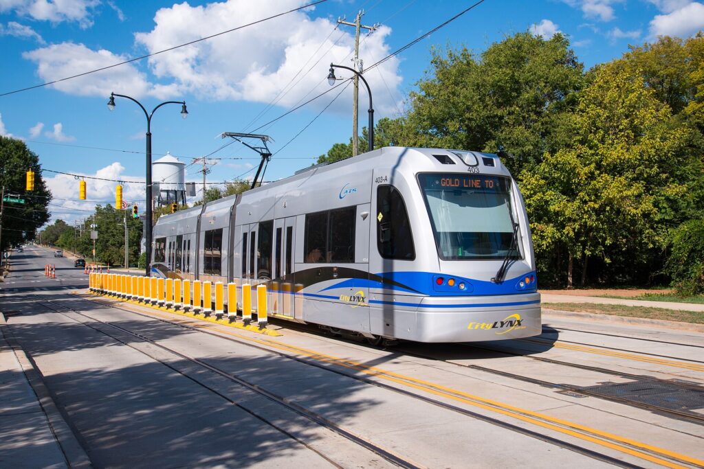
    The Gold Line is a modern streetcar that crosses Uptown east to west along Trade Street and Elizabeth Avenue, from the historically Black Johnson C. Smith University area on the west side through the Square and the Charlotte Transportation Center to the hospitals and restaurants of Elizabeth and the edge of Plaza Midwood on the east. It is short, about six kilometers (four miles), and slower than walking at busy times, but it is handy for hopping across Uptown in the heat, and it has been fare-free in recent years; check CATS for the current policy.

    Buses

    Buses fill in the rest, including the Route 5 airport bus, Central Avenue to Plaza Midwood, and routes to Freedom Park and SouthPark. Service thins out in the evenings and on weekends, so check return times. There is no practical transit to the Whitewater Center, the Speedway, Carowinds or Lake Norman.

    Fares and tickets

    Buy single rides or a day pass from the machines on every Blue Line platform, or use the CATS Pass app. The light rail works on proof of payment with no gates, so buy before you board and keep your ticket handy for inspectors, who do check. A single ride includes a transfer window to local buses; express buses cost more, and day passes are good value for several rides. Fares are low by big-city standards; check CATS’s site for current prices and payment options.

    Accessibility

    Every Blue Line station has level boarding and ramps or elevators, the streetcars are low-floor, and every bus has a ramp or lift and priority seating. CATS also runs a paratransit service for eligible riders, which visitors with a disability can arrange in advance.

    Beyond CATS

    • Walking and the Rail Trail. Uptown is compact and easy on foot, and the Rail Trail runs alongside the Blue Line through South End, so you can walk between stations and ride back. In summer, walk in the morning or evening; Charlotte’s humidity makes a midday mile feel much longer.
    • Greenways and scooters. The Little Sugar Creek Greenway runs from Uptown south past Freedom Park, and shared e-scooters and e-bikes in parts of the center are a quick way to reach Dilworth or Plaza Midwood from a Blue Line stop.
    • Taxis and ride-hail. Uber and Lyft operate across the metro, and for two or more people a short ride to Plaza Midwood, Myers Park or Optimist Hall is competitive with transit and much quicker. Expect surge pricing and long waits after Panthers games, big concerts and on race nights.
    • Intercity trains and buses. Amtrak’s Piedmont trains link Charlotte with Raleigh several times a day, and the Carolinian and the Crescent continue north toward Washington and New York, with the Crescent also heading south to Atlanta and New Orleans. Amtrak’s site has the schedules. Intercity buses serve Atlanta, Raleigh and the coast.
    A CityLYNX Gold Line streetcar at the French Street stop in Charlotte
    The CityLYNX Gold Line streetcar, crossing Uptown along Trade Street and Elizabeth Avenue (Photo: Mark Clifton via Wikimedia Commons, CC BY-SA 2.0)

    Driving in Charlotte and beyond: what it is really like

    Charlotte is an easier city to drive in than Atlanta, and outside the rush hours most visitors find it straightforward: wide roads, plentiful parking beyond Uptown, and interstates to every corner of the metro. The frustrations are predictable. I-77 between Uptown and Lake Norman is the most congested corridor, which is why it has express toll lanes. I-85 toward Concord backs up every weekday and stops dead on race days. I-485 jams at the I-77 interchange in the south, and I-277 slows at every peak and every stadium event. Rush hours run from about 7 to 9 in the morning and 4 to 6:30 in the evening, and Friday afternoons are the worst as the city heads for the lakes and the mountains. Construction is constant in one of the fastest-growing cities in the country.

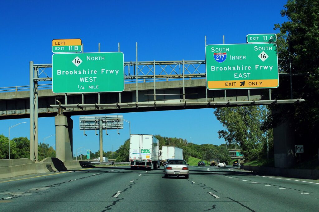
    Interstate 77 northbound approaching the I-277 inner loop in Charlotte
    I-77 at the I-277 loop around Uptown, where every rush hour and stadium event backs up (Photo: formulanone from Huntsville, United States via Wikimedia Commons, CC BY-SA 2.0)

    Parking

    Parking shows Charlotte’s two personalities. Uptown hotels typically charge a substantial nightly fee, often valet only, and garages near the stadium and the Spectrum Center switch to event pricing on game days; street meters are paid by machine or app and enforced. South End is tighter than it looks, and a paid lot is usually the answer. Everywhere else, parking is easy and mostly free: the malls, Freedom Park, NoDa’s side streets, the park-and-ride lots. The Whitewater Center charges for parking but not for entry to the grounds, and at the Speedway on race days arriving early is the only strategy that works.

    Rules and conditions worth knowing

    • Tolls. The I-77 express lanes north of Uptown and the Monroe Expressway to the southeast are electronic only, with no cash booths. North Carolina’s NC Quick Pass transponder works on them, and without one the toll is billed by plate, which rental companies pass on with an administration fee. Ask about the rental’s toll program at the counter, or simply stay in the free lanes.
    • Headlights with wipers. North Carolina law requires headlights whenever your windshield wipers are on, which, in a summer thunderstorm, is often.
    • Summer storms can flood underpasses and cut visibility on the interstates in minutes. Slow down, and never drive through water across a road.
    • Ice is rare but paralyzing, because the region has little equipment to treat roads. If it is forecast, stay put.
    • Texting while driving is illegal in North Carolina, and seatbelts are required for every occupant, front and back.
    • Right turns on red are permitted after a full stop unless signed otherwise, and the Move Over law requires you to change lanes or slow down for stopped emergency and service vehicles.
    • South Carolina starts 20 minutes south of Uptown at Carowinds and Fort Mill; you will cross the line without noticing.

    NCDOT, the state transportation department, publishes road conditions, closures and construction alerts.

    Lake Norman, north of Charlotte
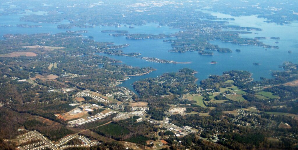
    Lake Norman, 30 to 45 minutes up I-77 and one of the day trips that needs a car (Photo: James St. John via Wikimedia Commons, CC BY 2.0)

    When renting a car makes sense

    • Race weekends and the NASCAR trail. Charlotte Motor Speedway in Concord has no transit link, and the team showrooms are spread out.
    • Lake Norman. Marinas, lakeside restaurants and boat rentals in Cornelius, Davidson and Mooresville are 30 to 45 minutes up I-77 and are effectively car-only.
    • The Whitewater Center. Fifteen minutes west of Uptown by car, and a pricey ride-hail round trip otherwise.
    • The mountains. Asheville, the Biltmore Estate and the Blue Ridge Parkway are about two hours west, and Crowders Mountain State Park is 45 minutes. There is no practical public transport to any of them.
    • Family in the suburbs. Ballantyne, Matthews, Huntersville and the South Carolina side are built for cars.
    • Carolinas road trips. Charleston, Myrtle Beach and the Outer Banks are all drives from Charlotte, and Atlanta is about four hours down I-85; our Atlanta to Charlotte route guide covers that drive, and our Atlanta car-or-transit guide covers the city at the other end.

    If any of those apply, our rental car booking tips cover insurance, deposits and the questions to ask at the counter, and our family car rental guide looks at vehicle choice.

    When it does not

    • You are staying in Uptown or South End and your plans are the museums, the Hall of Fame, the breweries and the neighborhoods on the Blue Line.
    • You are in town for a conference at the Convention Center, a Hornets game or a Panthers or Charlotte FC match, when the Blue Line stops beside every venue and event parking is at its most expensive.
    • You are on a short stopover of a day or two, which is how many people first see Charlotte; a ride-hail from the airport and the light rail are all you need.
    • You are traveling solo, and the rental plus Uptown parking would cost more than a handful of ride-hail trips.

    The hybrid plan for a city-plus-region trip

    Go car-free for the city days and rent for the days that leave it, and think carefully about where you pick up. Renting at the airport is the most convenient, with the largest choice of cars and the longest opening hours, and it makes sense if you are heading straight to the mountains, the Speedway or Lake Norman on arrival, because the airport sits by I-85 and you never touch Uptown traffic. Renting from a neighborhood or Uptown office makes sense if you are spending the first nights in the city, because you avoid the airport concession fees and several nights of hotel parking. A pattern that works well for a four- or five-day trip: ride-hail or the Route 5 bus into Uptown, two or three car-free days on the Blue Line, then collect a car for a day at the Whitewater Center and a day in the mountains or at Lake Norman, and return it at the airport on the way to your flight. Book early for Memorial Day weekend, when rental demand spikes along with hotel rates, and for the summer holidays. Compare the day rates on our Charlotte car rental page against a full-trip rental and the difference is usually obvious.

    A worked cost comparison

    Numbers change with the season and the booking window, so treat this as a method rather than a quote. For a three-night city break in Uptown for two, the car-free version costs a ride-hail each way to the airport, a few Blue Line day passes and three or four short rides to Plaza Midwood or Optimist Hall. The rental version adds three days of a compact car, three nights of Uptown hotel parking, fuel and airport concession fees, and buys almost nothing you could not reach by train. Car-free wins easily. For the same three nights plus a day at the Whitewater Center and a day in Asheville, the car-free version needs a ride-hail round trip to the Whitewater Center, which is manageable, and a day tour or private transfer to the mountains, which is not. The hybrid adds a two-day rental collected in the city, fuel for about 400 kilometers (250 miles) and the Whitewater Center’s parking fee, and wins clearly, more so with every extra passenger. For a race weekend, a car from the airport is the practical answer. Put the rates for your dates from our Charlotte car rental page beside the ride-hail estimates before you choose.

    Driving from Charlotte to the mountains in each season

    The drive west to Asheville and the Blue Ridge is the one most visitors with a car end up making, and it is easy: interstates and four-lane highways the whole way, with the mountains appearing on the horizon about an hour and a half out. What changes is the traffic and what you find at the top. In spring, the valleys green up weeks before the high ridges, and higher sections of the Blue Ridge Parkway can stay closed into April, so check the park’s road status. In summer, the mountains are much cooler than Charlotte, so the westbound roads are busy on Friday evenings and eastbound on Sunday afternoons, and afternoon storms roll across the ridges. In fall, color reaches the high ridges in early October and the valleys by month’s end, and leaf-season weekends bring heavy traffic; go on a weekday and book mountain hotels early. In winter, the interstates are generally open but the Parkway closes in sections whenever there is ice or snow. Hurricane Helene badly damaged western North Carolina in 2024, and some roads, trails and Parkway sections have been slow to reopen; check the Parkway’s site and NCDOT before you set off.

    Decision table

    Your tripRecommendationWhy
    City break in Uptown or South EndNo carThe Blue Line, the Gold Line and your feet cover it; Uptown parking is expensive
    Convention, Panthers, Hornets or Charlotte FCNo carThe Blue Line stops beside every venue; event parking is at its priciest
    Short stopover of a day or twoNo carRide-hail from CLT and the light rail are all you need
    City plus Whitewater Center or Lake NormanHybrid: rent in the city for those daysCar-free city days, car for the places transit does not reach
    Race weekend at the SpeedwayRent at the airport and book earlyNo transit to Concord; allow hours for race-day traffic
    Asheville and the Blue RidgeRentNo practical public transport to the mountains
    Family visit to the suburbsRent for the whole staySuburban distances make the car worthwhile daily
    Carolinas or Southeast road tripRent (consider one-way to Atlanta)Charlotte is the start, not the destination

    Money-saving tips for both options

    • On transit: buy a day pass for a heavy sightseeing day, use the Gold Line across Uptown while it stays fare-free, and use the park-and-ride lots if you have a car and want a day in the center.
    • On a rental: compare airport and neighborhood pickup, book early for Memorial Day weekend and summer, decline extras you already have through a credit card or home policy (check first), and avoid the toll lanes unless you understand how the rental company bills them.
    • On the hotel: if you are renting, price the parking fee into the room rate; a hotel in South End or near a Blue Line park-and-ride can be cheaper overall than Uptown once parking is added.
    • On timing: avoid I-77 and I-85 at the weekday peaks, the westbound roads on Friday evening and the Concord area on any race weekend; the best time to fly to Charlotte guide lists the busiest weekends.
    • On game days: ride the Blue Line to Stonewall for the stadium or the Transportation Center for the Spectrum Center, and skip event parking and the post-game surge.

    Frequently asked questions

    Is it worth renting a car in Charlotte?

    For the Speedway, Lake Norman, the Whitewater Center, the mountains or the suburbs, yes. For a city break based in Uptown or South End, a conference or a game, no; the light rail, the streetcar and ride-hail are enough.

    Is Charlotte public transit good for tourists?

    Good along the Blue Line corridor, which happens to link most of the neighborhoods visitors want: South End, Uptown and NoDa. Beyond it, buses are slower and less frequent, and transit does not reach the airport by rail.

    How do I get from Charlotte airport to Uptown?

    A taxi or ride-hail in 15 to 20 minutes outside rush hour, or the CATS Route 5 bus to the Charlotte Transportation Center in about half an hour for a standard fare.

    Can I get to Charlotte Motor Speedway without a car?

    Not by public transit. A ride-hail works, but expect heavy surge pricing and long waits after a race. Most fans drive and arrive early.

    Is parking expensive in Uptown Charlotte?

    At hotels and on event nights, yes, and hotel parking is often valet only. Outside Uptown and South End, parking is easy and usually free.

    Are there toll roads in Charlotte?

    A few: the I-77 express lanes north of Uptown and the Monroe Expressway to the southeast, both electronic only. Every destination in this guide is reachable on free roads.

    Where does the light rail go in Charlotte?

    The LYNX Blue Line runs from I-485 in the south through South End and Uptown to NoDa, University City and UNC Charlotte in the northeast. It does not go to the airport, the Speedway or the Whitewater Center.

    Whichever way you go, start with the flight. Compare cheap flights to Charlotte, choose a neighborhood with our Charlotte hotel search, plan the sights with our first-timer’s guide to Charlotte, and if the Speedway, the lakes or the mountains are on the list, price the rental for those dates on our Charlotte car rental page.

  • Quebec City: Should You Rent a Car or Rely on Public Transit?

    Quebec City: Should You Rent a Car or Rely on Public Transit?

    Quebec City is the clearest case in this series. Inside the walls, a car is not merely unnecessary but a liability: the streets are narrow, steep and cobbled, many are closed to traffic for much of the summer, parking is scarce and expensive, and everything a visitor wants is within a twenty-minute walk. Outside the walls, the neighbourhoods where the restaurants are, the Plains, the museums and even Montmorency Falls are on foot or a short bus ride. And yet the two things that make Quebec City more than a two-day stop, the Île d’Orléans across the bridge and the Charlevoix coast beyond it, are car country, with no useful transit at all. So the answer for most visitors is not one or the other but a sequence: no car for the city, a car for a day or two beyond it. This guide explains how the city is laid out, how the buses and the ferry work, the airport transfer, what driving and parking are really like in a walled city that gets three metres of snow, when a car is worth it, and gives you a straightforward way to decide.

    The short answer

    Do not rent a car for the city. If you are staying inside the walls, in Saint-Jean-Baptiste, in Saint-Roch or along the Grande Allée, and your plans are the Old Town, the Plains, the museums, the ferry and Montmorency, you will walk almost everywhere and take the bus for the rest, and a rental will sit in a garage costing money. Rent for a day or two if the Île d’Orléans, Sainte-Anne-de-Beaupré, the Canyon Sainte-Anne, Jacques-Cartier park, the ski hills or Charlevoix are on the itinerary, or if you are continuing on to Tadoussac, the Gaspé or Montreal by road. Rent for the whole trip only if you are staying outside the city, visiting family in the suburbs, or coming in winter to ski at Mont-Sainte-Anne or the Massif daily. Compare rental rates for any of these plans on our Quebec City car rental page.

    How Quebec City is laid out

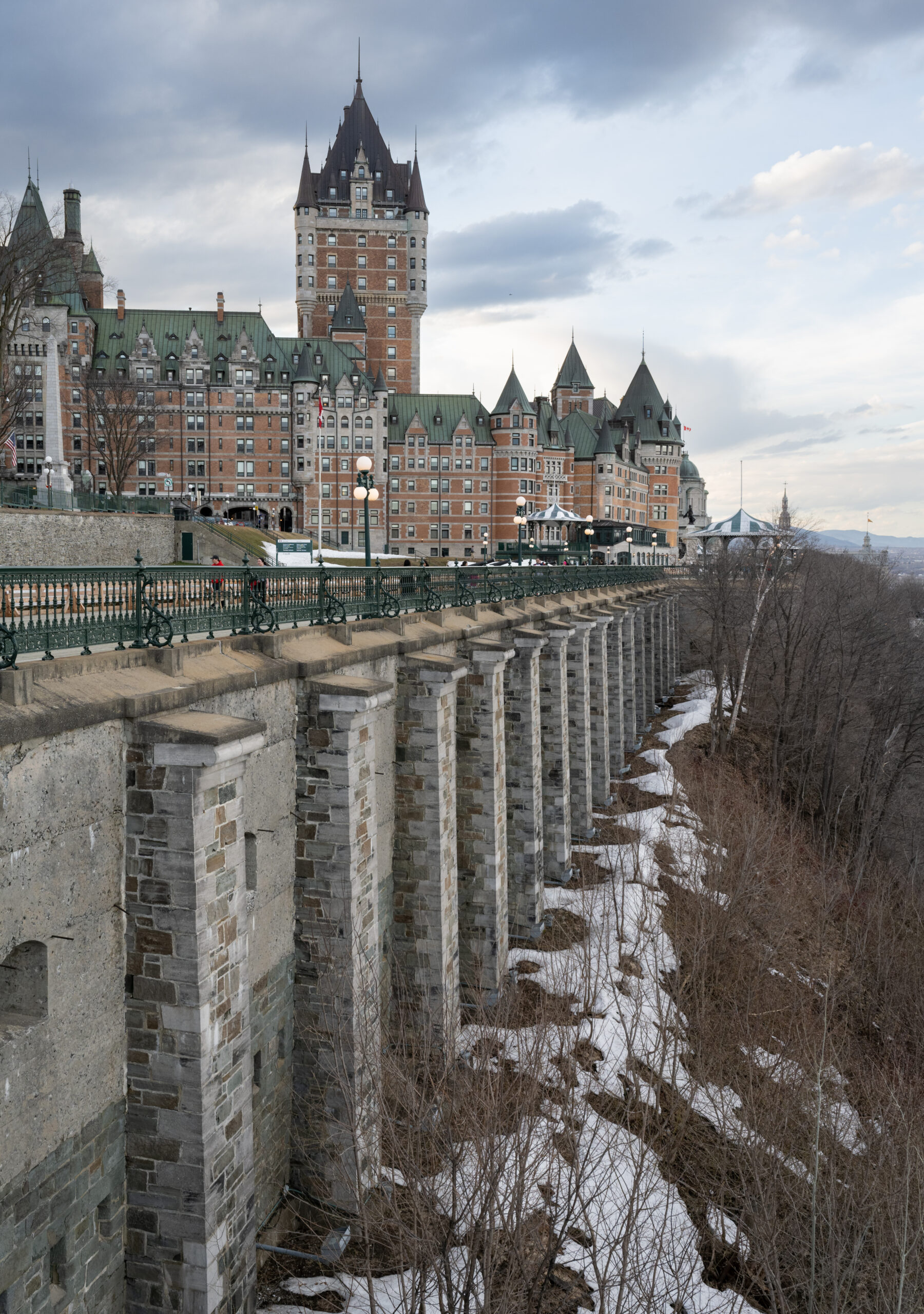
    The city sits on the north bank of the St. Lawrence where the river narrows, on and below a cliff. The Upper Town, on the clifftop, is the walled Old Town of the Château Frontenac, the Terrasse Dufferin, the Place d’Armes and the ramparts, with the Citadelle at its highest point. The Lower Town, at the foot of the cliff, holds Place Royale, the Petit-Champlain, the Old Port, the Gare du Palais railway station and the Musée de la civilisation, and is connected to the Upper Town by the funicular, the Breakneck Stairs and several steep streets. West of the walls, along the clifftop, are the Plains of Abraham, the Grande Allée, the Parliament and the Musée national des beaux-arts, and beyond them the residential Montcalm neighbourhood. Just outside the Saint-Jean gate is Saint-Jean-Baptiste; down the hill from it, on the flat land along the Saint-Charles River, is Saint-Roch, and across the river is Limoilou. The airport, the university, the Centre Vidéotron arena and the suburbs lie to the west and north; Montmorency Falls and the bridge to the Île d’Orléans are fifteen minutes east along the river; Lévis is across the water. The historic core and the inner neighbourhoods are entirely walkable, though the hills are real.

    Hotels cluster inside the walls in Old Quebec, along the Grande Allée, in Saint-Roch, and near the airport and the arena for value. Very few hotels inside the walls have their own parking, and those that do charge for it. Our Quebec City hotel search lets you compare them.

    Getting in from the airport

    Québec City Jean Lesage International (YQB) is about 15 kilometres west of the Old Town, and the transfer is simple. Taxis charge a fixed fare to the downtown zone, which includes the Old Town, and take 20 to 30 minutes; ride-hail is also available. An RTC bus route links the terminal to the network, with a change to a Métrobus line for the Old Town, for a standard fare and about an hour; it is the cheap option and fine without much luggage. And every major rental company is in the terminal; renting on arrival makes sense only if you are heading straight out of the city, to the island, Charlevoix or a ski hill, rather than into the walls. Check the airport’s site and the RTC for current service; our YQB airport guide covers the layout. If you arrive by train from Montreal, the Gare du Palais is in the Lower Town, a ten-minute walk or a short taxi from the Old Town’s hotels.

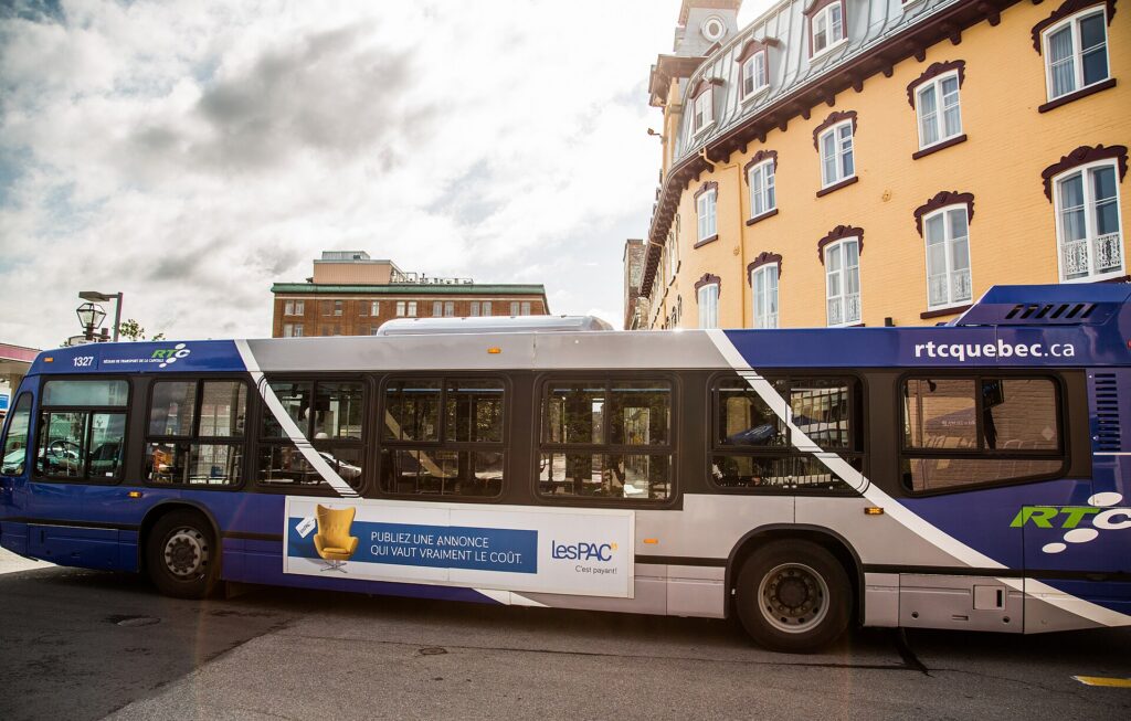
    An RTC Métrobus in Quebec City
    The RTC's Métrobus lines: frequent, and the only transit a visitor needs (Photo: Tony Webster via Wikimedia Commons, CC BY-SA 4.0)

    Quebec City’s transit, explained

    The Réseau de transport de la Capitale, the RTC, runs the city’s buses; there is no metro and no light rail, though a tramway has been planned and debated for years. For a visitor, the network is simpler than it looks, because four Métrobus lines, numbered 800 to 807, run frequently along the main corridors and cover nearly everything, and the rest of the routes rarely matter.

    The Métrobus lines

    The 800 and 801 run from the western suburbs and the university along the Boulevard René-Lévesque and the Grande Allée corridor past the Plains, the Parliament and the Saint-Jean gate to the Old Town and down to the Lower Town and Saint-Roch, then east; the 802 and 807 cover the northern and eastern corridors. Between them, they connect the Old Town with the Grande Allée, the Musée national des beaux-arts, Saint-Roch, Limoilou, the university, the Centre Vidéotron and the Galeries de la Capitale mall, and a regular route continues east to Montmorency Falls. Buses run from early morning until around midnight, with reduced frequency on weekends.

    Fares and tickets

    Buy a single ticket, a day pass or a multi-day pass from the ticket outlets and machines, load fares on the OPUS card used across Quebec, or, on the newer buses, tap a contactless credit card; paying cash on board is possible but exact change is required. A single fare gives you a transfer window across the network. Children and seniors have reduced fares; check the RTC’s site for current prices and for the tourist passes it offers in summer.

    Accessibility

    The Métrobus fleet is low-floor and accessible; the Old Town’s hills and stairs are the real accessibility challenge, and the funicular is the step-free link between the Upper and Lower Towns.

    Beyond the buses

    • Walking. The Old Town is 4.6 kilometres around inside its walls; the Château to the Plains is fifteen minutes, the Château to Saint-Roch twenty, and the Lower Town is directly below. Most of a first visit is on foot, and the Upper Town to Lower Town transitions are the only real climbs.
    • The funicular links the Terrasse Dufferin with the Petit-Champlain for a small fare; the Breakneck Stairs beside it are free and famous.
    • The Lévis ferry crosses the St. Lawrence from the Old Port in twelve minutes, every half hour or so, and the view of the Château on the cliff from the deck is the best in the city; it is also the connection to the south-shore bus network.
    • Bikes. The àVélo bike-share system operates from spring to fall, and the flat riverside path east from the Old Port to Montmorency Falls, the Corridor du Littoral, is one of the best rides in eastern Canada; the island’s loop is a classic day ride for the fit.
    • Taxis and ride-hail. Licensed taxis and ride-hail cover the city; a ride from the Old Town to Saint-Roch or the Grande Allée is short and cheap, and to Montmorency it is competitive with the bus for two or more.
    • Calèches. The horse-drawn carriages that tour the Old Town are transport in name only, but a ride is a pleasant way to see the ramparts once.
    • Intercity. VIA Rail runs to Montreal in three hours from the Gare du Palais, and intercity buses serve Montreal, Charlevoix, the Saguenay and Tadoussac from the same station.
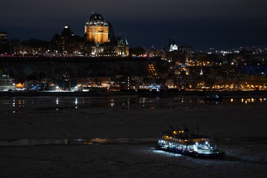
    The view of the Château Frontenac from the Lévis ferry on the St. Lawrence
    The Lévis ferry: twelve minutes across the river and the best view of the city for the price of a bus fare (Photo: Hayden Soloviev via Wikimedia Commons, CC BY 4.0)

    Driving in Quebec City: what it is really like

    Outside the walls, Quebec City is an ordinary mid-sized city to drive in: the Autoroutes 40, 73 and 440 ring and cross it, traffic jams on the bridges to Lévis and on the Boulevard Laurier corridor at rush hour, and construction season runs from May to October. Inside the walls, it is something else. The streets are narrow and steep, the corners are tight, the one-way system is a puzzle, and in summer many of the Old Town’s streets, including the Petit-Champlain and the streets around the Place d’Armes, are closed to traffic or restricted to residents for most of the day; in the Carnaval and the Festival d’été, the closures spread across the Upper Town and the Grande Allée. Winter adds three metres of snow: the Old Town’s streets narrow further between the banks, overnight parking bans for snow clearing move cars around the city, and the hills ice. It is not dangerous, but it is slow and stressful, and a driver spends the day looking for somewhere to leave the car.

    A narrow street inside the walls of Old Quebec
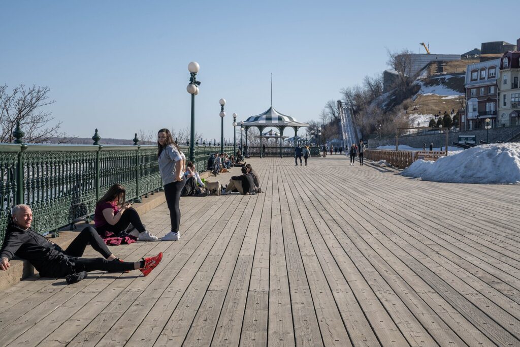
    Inside the walls: narrow, steep, cobbled and, in summer, closed to cars for much of the day (Photo: Wilfredor via Wikimedia Commons, CC0)

    Parking

    Parking inside the walls is the single strongest argument against a car. The few hotel garages charge a substantial nightly fee; the public garages, at the Hôtel de Ville, under the Place d’Youville and at the Old Port, are the practical options and fill on summer weekends and during the festivals; street parking is metered, time-limited and scarce. The city’s advice to visitors arriving by car is to leave it in a garage on the edge of the Old Town and walk, and it is good advice. Outside the walls, the picture improves quickly: the Grande Allée and Montcalm have metered street parking that is free overnight and on Sundays, Saint-Roch has garages and street parking, and the museums, the Plains, Montmorency and the island’s attractions all have their own lots. In winter, watch for the snow-removal signs, which impose temporary bans with short notice, and note that many street spaces are reserved for residents with permits.

    Rules and conditions worth knowing

    • Winter tires are required by law in Quebec on every vehicle from December 1 to March 15, and rental cars in the province are equipped accordingly; if your dates straddle those boundaries, ask.
    • No right turn on red on the Island of Montreal, but it is permitted in Quebec City and the rest of the province after a full stop, unless a sign prohibits it.
    • Signs are in French only. Arrêt is stop, and the pictograms are standard; a few minutes with a glossary before you drive is enough.
    • Photo radar operates on the autoroutes and at intersections across the region; fines follow the car and the rental company will bill you.
    • Snow-clearing bans. After a snowfall, temporary no-parking signs and flashing lights announce overnight clearing; a car left in the way is towed. Check the city’s snow-removal app or ask your hotel.
    • Autoroute 20 and 40 to Montreal are toll-free; the Pierre-Laporte and Quebec bridges to Lévis are free but slow at rush hour.
    • Fuel is more expensive in Quebec than in Ontario or Alberta.
    • Charlevoix’s roads are hilly, twisting and, in winter, demanding; the Route 138 along the river is spectacular and slow, and moose are a real hazard at dusk north of Baie-Saint-Paul. Québec 511 publishes road conditions.
    A country road on the Île d'Orléans near Quebec City
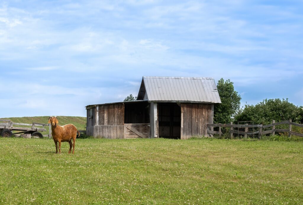
    The Île d'Orléans, fifteen minutes from the walls and the main reason to rent for a day (Photo: Wilfredor via Wikimedia Commons, CC0)

    When renting a car makes sense

    • The Île d’Orléans. The 67-kilometre loop of farms, cideries, vineyards and stone villages has no transit; a car or a strong pair of legs is the only way round.
    • The Côte-de-Beaupré. Sainte-Anne-de-Beaupré, the Canyon Sainte-Anne, Mont-Sainte-Anne and the Cap Tourmente bird reserve are strung along the same road east of the falls.
    • Charlevoix. Baie-Saint-Paul, the Massif, La Malbaie and the river road are the great trip from the city, and a car is essential; an overnight makes it better.
    • Tadoussac and the whales, three hours northeast, in season from June to October.
    • Jacques-Cartier National Park and the Valcartier waterpark and tubing park, north of the city.
    • Skiing daily at Mont-Sainte-Anne, Stoneham or the Massif; shuttles exist from some hotels, but a car makes a ski trip simple.
    • A road trip to Montreal, the Gaspé, the Saguenay or New England; one-way rentals to Montreal are routine, and our Montreal to Quebec City route guide covers the drive and our Montreal transit guide the other end.

    If any of those apply, our rental car booking tips cover insurance, deposits and the questions to ask at the counter.

    When it does not

    • You are staying anywhere inside the walls or in the inner neighbourhoods and your plans are the city and Montmorency.
    • You are in town for the Carnaval or the Festival d’été, when the Upper Town and the Grande Allée close and parking vanishes.
    • You are arriving by train from Montreal, which delivers you to the Lower Town on foot.
    • You are travelling solo or as a couple, when a taxi to Montmorency and a day pass cost less than a day of rental and parking.

    The hybrid plan

    Arrive without a car, spend the city days on foot and on the Métrobus, and rent for the day or two you leave the walls. Where to pick up: the rental companies have branches at the Gare du Palais in the Lower Town, along the Boulevard René-Lévesque near the Parliament, and in Sainte-Foy near the university, all of which avoid the airport concession fees and put you on the road east to the island in fifteen minutes; collect it in the morning of the day you need it and return it the same evening, or return it at the airport on the way to the flight home, which most companies allow within the city at little or no extra charge. For Charlevoix, a two-day rental with a night in Baie-Saint-Paul or La Malbaie is the shape most visitors settle on. Ask about winter tires if your dates fall outside the December-to-March mandate, and if you are skiing, ask for a roof rack or a vehicle that fits the gear. Compare the day rates on our Quebec City car rental page against a full-trip rental; with the parking inside the walls added, the hybrid almost always wins.

    A worked cost comparison

    Numbers change with the season and the booking window, so treat this as a method rather than a quote, and check current rates before deciding. For a three-night stay inside the walls for two people, the car-free version costs a fixed-fare taxi from the airport and back, a day pass or two for the Métrobus and the Montmorency bus, the ferry both ways, and perhaps one ride-hail to Saint-Roch for dinner; the rental version adds three days of a compact car, three nights of Old Town garage parking at the highest rates in the city, fuel and the airport fees, and buys nothing you could not walk or ride to. Transit wins by a wide margin. For the same three nights plus a day on the island and the Côte-de-Beaupré, the hybrid adds a one-day rental from the Lower Town, fuel and nothing else, since the island’s attractions have free parking; it is cheap and the only practical way to do the loop. For a five-day trip with two nights in Charlevoix, a rental from the day you leave the city to the day you return, or a one-way to Montreal, is the answer, and it is still cheaper than a car parked inside the walls for the city days. Run the rates for your dates and put them beside the transit fares before you choose.

    Decision table

    Your tripRecommendationWhy
    City break inside the walls, couple or soloNo carEverything is walkable; parking is scarce and expensive; streets close in summer
    Carnaval or Festival d’étéNo carStreet closures across the Upper Town; the Métrobus and your feet are the way in
    City plus the Île d’OrléansHybrid: one-day rental from the Lower TownThe island has no transit; the city needs no car
    City plus CharlevoixHybrid: two-day rental with a night on the coastThe river road and the villages are car country
    Arriving by train from MontrealNo car, rent locally if neededThe station is in the Lower Town
    Ski trip, dailyRent for the stay, at a hotel with parkingThe hills are 40 minutes out; winter tires are supplied
    Family visit to the suburbsRent for the whole staySuburban distances make the car worthwhile daily
    Quebec plus Tadoussac, the Gaspé or MontrealRent (consider one-way)Quebec City is the start of the drive, not its end

    Money-saving tips for both options

    • On transit: buy a day pass if you will ride the bus to Montmorency and the museums; take the ferry to Lévis for the view instead of a paid cruise; use the funicular once and the stairs the rest of the time.
    • On a rental: pick up in the Lower Town or on René-Lévesque rather than at the airport, rent only for the days you leave the walls, decline extras you already have through a credit card or home policy (check first), and fill up on the way back rather than near the Old Town.
    • On the hotel: if you are renting, choose a hotel on the Grande Allée or in Saint-Roch with parking rather than one inside the walls; if you are not, the Old Town’s car-free premium is worth paying for the atmosphere.
    • On timing: avoid the bridges to Lévis in the weekday peaks and the island’s road on summer Sunday afternoons, when everyone returns at once; the best time to fly to Quebec City guide lists the busy weekends.
    • On Montreal: for two people, the train from Montreal is usually cheaper than a one-way rental plus fuel, unless you want the car at the Quebec end anyway.

    Frequently asked questions

    Is it worth renting a car in Quebec City?
    Not for the city, where a car is a liability inside the walls. For the Île d’Orléans, Charlevoix, the ski hills or a road trip, yes; rent for those days only.

    Is Quebec City public transit good for tourists?
    Adequate and simple: four frequent Métrobus lines cover the corridors a visitor uses, a bus reaches Montmorency Falls, and the ferry crosses to Lévis. There is no metro, and for the Old Town itself you will not need any of it.

    How do I get from Quebec City airport to the Old Town?

    A fixed-fare taxi in 20 to 30 minutes, ride-hail, or an RTC bus with a change in about an hour. A rental only makes sense if you are heading straight out of the city.

    Can I get to the Île d’Orléans without a car?

    Only by bike or on a tour; there is no bus service on the island. A one-day rental is the practical answer.

    Do I need winter tires in Quebec City?

    They are required by law on every vehicle from December 1 to March 15, and rentals are equipped. Outside those dates, ask.

    Where can I park in Old Quebec?

    In the public garages at the Hôtel de Ville, under the Place d’Youville and at the Old Port, or at your hotel if it has a garage; street parking inside the walls is scarce, metered and time-limited. Park on the edge and walk.

    Should I drive or take the train from Montreal?

    The train for a city visit: three hours, station to Lower Town, no parking. Drive if you want the island and Charlevoix or are continuing on; our Montreal to Quebec City guide covers the route.

    Whichever way you go, start with the flight. Compare cheap flights to Quebec City, choose a neighbourhood with our Quebec City hotel search, and if the island or Charlevoix is on the list, price the rental for those dates on our Quebec City car rental page.

  • Halifax: Should You Rent a Car or Rely on Public Transit?

    Halifax: Should You Rent a Car or Rely on Public Transit?

    Halifax splits neatly into two trips, and they need different answers. The first is the city: a compact peninsula where the waterfront, the Citadel, the Public Gardens, downtown, the North End and Point Pleasant Park are all within a half-hour walk of each other, where a twelve-minute ferry is both transit and the best sightseeing in town, and where downtown parking is a daily expense with no benefit. For that trip, a car is a nuisance. The second is the coast: Peggy’s Cove, Lunenburg and the South Shore, the Annapolis Valley, the Bay of Fundy and, farther out, the Cabot Trail, none of which has useful public transport, and all of which are the reasons many people fly to Nova Scotia at all. For that trip, a car is essential. Add an airport thirty-five kilometres from downtown and the arithmetic gets interesting. This guide explains how the peninsula is laid out, how the buses and ferries work, the airport transfer, what driving and parking are really like, when a car is worth it, and gives you a straightforward way to decide.

    The short answer

    Skip the car for the city. If you are staying downtown, on the waterfront, in the South End or in the North End and your plans are the boardwalk, the Citadel, the museums, the Gardens, Point Pleasant and Dartmouth, you will walk and take the ferry and never miss it, and you will not pay downtown parking. Rent for the coast. Peggy’s Cove, Lunenburg, the valley, Lawrencetown and the Fundy shore are car trips, and the Cabot Trail is a multi-day one. For most first-time visitors, the hybrid is right: car-free for the city days, a one- or two-day rental picked up downtown for the coast. And because the airport is so far out, a whole-trip rental picked up at the airport is worth pricing for any group of two or more, since it can cost less than two taxis and buy you the coast for free. Compare rental rates for any of these plans on our Halifax car rental page.

    How Halifax is laid out

    The city centre sits on a peninsula in Halifax Harbour, with the water on three sides and Citadel Hill in the middle. Downtown runs down the eastern slope of the hill to the waterfront and the boardwalk, with Argyle Street’s bars, the Grand Parade, Province House and the Art Gallery in a few blocks. Spring Garden Road runs west from downtown past the Public Gardens toward the universities and the South End, which ends at Point Pleasant Park on the harbour mouth. North of the Citadel and the Common is the North End, with Gottingen and Agricola streets, the Hydrostone and the Narrows beyond. The two harbour bridges, the Macdonald and the MacKay, cross to Dartmouth on the eastern shore, which is also reached by the ferries. Beyond the peninsula, the city sprawls west toward Bedford and the airport highway, and east through Dartmouth toward the Eastern Shore. The peninsula is walkable, though the hill is steep; everything beyond it assumes a car or a bus.

    Hotels cluster on the downtown waterfront, along Spring Garden Road and in the South End near the universities, in Dartmouth by the ferry for value, and along the airport highway in Bedford and at the airport itself for early flights. Downtown hotels charge for parking; those in Dartmouth and the suburbs usually include it. Our Halifax hotel search lets you compare them.

    Getting in from the airport

    Halifax Stanfield International (YHZ) is about 35 kilometres northeast of downtown at Enfield, and the transfer is the first transport decision of the trip. A taxi or ride-hail takes 30 to 40 minutes on Highway 102 and is priced for the distance; for one person it is the largest single cost of a car-free Halifax visit. Halifax Transit’s MetroX Route 320 runs from the terminal to downtown in about an hour for a premium transit fare, roughly hourly, and is the cheap option for a traveller without much luggage. Hotel shuttles serve the airport-area hotels and a few downtown ones. And every major rental company is in the terminal, with the divided highway running straight into the city; for two or more people, a rental picked up at the airport is often cheaper than two taxi rides, and it is the natural choice if the coast is in the plan. Check the airport’s site and Halifax Transit for current service; our YHZ airport guide covers the layout.

    Halifax’s transit, explained

    Halifax Transit runs the buses and the harbour ferries. There is no rail. For a visitor based on the peninsula, the network matters less than in most cities, because the sights are on foot; the ferries and a handful of bus routes cover the rest.

    The ferries

    Two routes cross the harbour from the terminal on the downtown waterfront: the Alderney ferry to downtown Dartmouth, twelve minutes, every fifteen to thirty minutes from early morning to late evening, and the Woodside ferry to the eastern side of Dartmouth on weekdays. The service has run since 1752 and is the oldest saltwater ferry in North America. A regular transit fare buys the crossing, with the downtown skyline, the Navy dockyard and the bridges around you, and it is the single best-value experience in the city. The ferry is also the practical way to Dartmouth’s restaurants, its farmers’ market at Alderney Landing and its lakes.

    Buses

    The bus network fans out from downtown across the peninsula and over the bridges, with the frequent routes along Spring Garden, Robie, Gottingen and Barrington streets, and routes to Point Pleasant, the universities, the Halifax Shopping Centre, Bedford and the Dartmouth suburbs. The MetroX 320 is the airport bus. Frequencies are good on the main routes during the day and thin in the evenings and on Sundays; check times before relying on a bus for a late return.

    Fares and tickets

    Pay cash on board with exact change, buy tickets from the outlets around the city, or use the HFXGO app for single fares and passes on your phone; the airport bus charges a higher fare. A fare gives you 90 minutes of transfers across buses and ferries. Children twelve and under ride free. Check Halifax Transit’s site for current prices.

    Accessibility

    The buses are low-floor and accessible, and the ferry terminals are step-free; the hill between the waterfront and the Citadel is the peninsula’s real accessibility challenge.

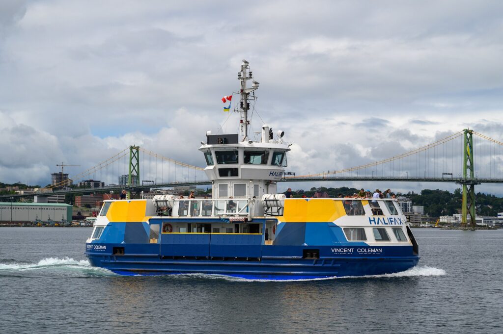
    The Halifax Transit ferry Vincent Coleman on the harbour
    The Halifax-Dartmouth ferry: North America's oldest saltwater ferry, and the best-value ride in the city (Photo: Gordon Leggett via Wikimedia Commons, CC BY 4.0)

    Beyond Halifax Transit

    • Walking. The boardwalk is four kilometres end to end; the waterfront to the Citadel is ten steep minutes; the Citadel to the North End’s restaurants is fifteen; Spring Garden to Point Pleasant is twenty-five. Most of a first visit is on foot.
    • Bikes. The city has a growing network of protected bike lanes, a bike-share system in the warmer months, and the Chain of Lakes and Shearwater Flyer trails for longer rides; the peninsula’s hills are the only drawback.
    • Taxis and ride-hail. Uber and licensed taxis cover the city; a ride from downtown to the North End or Point Pleasant is short and cheap, and to Peggy’s Cove and back it is possible but expensive.
    • Tours. Coach and small-group tours run daily in season to Peggy’s Cove, Lunenburg and the valley from downtown hotels; for a solo traveller who wants one day on the coast without renting, they are the practical answer.
    • Intercity. Maritime Bus connects Halifax with Moncton, Fredericton, Charlottetown, Sydney and the Cape Breton towns from the downtown terminal; VIA Rail’s Ocean runs to Moncton and Montreal a few days a week from the station beside the Westin.
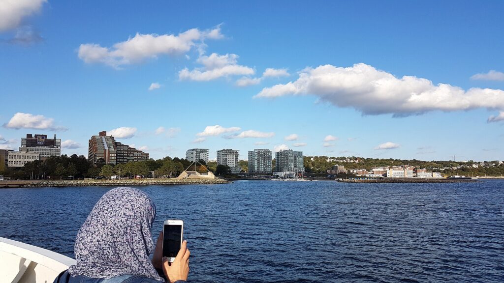
    Dartmouth seen from the Halifax ferry
    Dartmouth from the ferry: twelve minutes across, and where the hotel value is (Photo: Coastal Elite from Halifax, Canada via Wikimedia Commons, CC BY-SA 2.0)

    Driving in Halifax: what it is really like

    Outside the peninsula, Halifax is an easy place to drive: the 100-series highways are fast and uncrowded by big-city standards, the roads to the coast are two-lane and scenic, and drivers are polite to a fault, stopping for pedestrians at every crossing. On the peninsula, it is a different matter. The downtown grid is steep, several streets are one-way, the waterfront roads jam in summer, the two harbour bridges back up at rush hour with a toll on each, and the Armdale Rotary at the western neck of the peninsula is the city’s most reliable traffic jam. Construction season runs from May to November, and the downtown has been a building site for a decade. And winter adds the freeze-thaw: snow, then rain, then ice on the hills, and parking bans during snow clearing that move cars around the city overnight.

    Parking

    Downtown hotels charge a nightly parking fee, lower than Toronto’s but a real daily cost, and the commercial garages around the waterfront and Spring Garden are priced accordingly. Street parking downtown is metered through the HotSpot app, time-limited and scarce on summer days and on cruise-ship days; it is free in the evenings and on Sundays and holidays. The waterfront lots fill on festival days. Outside the core, parking is easy and mostly free: Point Pleasant Park, the Public Gardens’ surrounding streets, the North End’s side streets, Dartmouth’s ferry terminal and the museums and attractions on the coast all have lots. In winter, overnight parking bans during snow clearing are announced by the city and enforced with tows; ask your hotel.

    Rules and conditions worth knowing

    • Winter tires are not required by law in Nova Scotia, and rentals often come on all-seasons; for the coast roads and the Cabot Trail between December and March, ask for winter tires when you book. Nova Scotia 511 publishes road conditions.
    • The harbour bridges charge a toll each way, paid by cash, MACPASS transponder or, increasingly, by plate; a rental may be billed for it afterward.
    • Pedestrians have the right of way at every marked crosswalk, and Halifax drivers stop; visitors who do not are the ones who cause the accidents.
    • Peggy’s Cove Road and the Lighthouse Route along the South Shore are two-lane, winding and slow, with coaches in summer; allow more time than the map suggests, and go early.
    • Fog on the coast roads in spring and early summer can cut visibility to a few metres; drive accordingly.
    • Moose are a hazard on the Cape Breton highways at dawn and dusk, and deer on the roads near the city.
    • Fuel is more expensive in Nova Scotia than in Ontario or Alberta; fill up in the city before the coast.
    Peggy's Cove lighthouse on the granite shore
    Peggy's Cove, 45 minutes from downtown by car and the first reason most visitors rent (Photo: Dennis G. Jarvis via Wikimedia Commons, CC BY-SA 2.0)

    When renting a car makes sense

    • Peggy’s Cove, 45 minutes southwest, which a tour can cover but a car does better and earlier.
    • Lunenburg, Mahone Bay and Chester along the South Shore, ninety minutes away and the classic day.
    • The Annapolis Valley and its wineries, Grand-Pré and the Fundy shore, an hour and a half northwest.
    • Lawrencetown Beach and the Eastern Shore, for surfing and the empty coast.
    • The Cabot Trail in Cape Breton, five hours away and the great road trip of the region, better as two or three nights.
    • Prince Edward Island and the Confederation Bridge, three hours north, or New Brunswick‘s Fundy coast.
    • Staying outside the peninsula, in Bedford, the Dartmouth suburbs or with family.
    • A group of two or more arriving at the airport, for whom the rental can be cheaper than the taxis alone.

    If any of those apply, our rental car booking tips cover insurance, deposits and the questions to ask at the counter.

    When it does not

    • You are staying on the peninsula and your plans are the city and Dartmouth.
    • You are in town for a conference, a concert at the Scotiabank Centre, Canada Day or the Busker Festival, when the waterfront closes and parking vanishes.
    • You are travelling solo and a coach tour to Peggy’s Cove and Lunenburg costs less than a day of rental, fuel and insurance.
    • You are arriving on a cruise ship, which lands you on the boardwalk.

    The hybrid plan

    Go car-free for the city days and rent for the coast, and choose the pickup point by the shape of the trip. If the coast is at the end, pick up downtown on the morning you leave the city, drive the South Shore or the valley, and return the car at the airport on the way to the flight home, which most companies allow within the region at little or no extra charge; the downtown branches are around the waterfront hotels and along Robie Street. If the coast is at the start, rent at the airport, drive straight to Peggy’s Cove and Lunenburg, and drop the car downtown when you settle into the city. If you are two or more and the taxi fares are close to the rental, rent for the whole trip and pick a hotel in Dartmouth or the South End that includes parking. Ask for winter tires from December to March. Compare the day rates on our Halifax car rental page against a full-trip rental and the difference is usually obvious.

    A worked cost comparison

    Numbers change with the season and the booking window, so treat this as a method rather than a quote, and check current rates before deciding. For a three-night city break downtown for two people, the car-free version costs two taxi rides from the airport or the MetroX bus, a couple of ferry fares and a day pass, and perhaps one ride-hail to Point Pleasant; the rental version adds three days of a compact car, three nights of downtown hotel parking, fuel and airport fees, and buys nothing you could not walk or ferry to. Transit wins clearly, and the taxi fare is the only real expense. For the same three nights plus Peggy’s Cove and Lunenburg, the car-free version adds a coach tour for two, which is convenient but fixed to the coach’s timetable; the hybrid adds a one-day rental from downtown, fuel and nothing else, since the coast attractions have free parking, and gives you the lighthouse at dawn without the crowds. For two people, the hybrid usually costs about the same as the tour and is far more flexible; for one person, the tour usually wins. For a week with the Cabot Trail, a rental for the whole stay from the airport is the only practical answer, and the airport taxi it replaces pays for the first day. Run the rates for your dates and put them beside the taxi and tour prices before you choose.

    The Lunenburg waterfront with its painted buildings
    Lunenburg, ninety minutes down the South Shore and a car trip only (Photo: daryl_mitchell via Wikimedia Commons, CC BY-SA 2.0)

    Decision table

    Your tripRecommendationWhy
    City break on the peninsula, couple or soloNo carEverything is walkable or on the ferry; downtown parking is a daily cost
    Canada Day, Busker Festival or a cruise-ship dayNo carThe waterfront closes and parking vanishes
    City plus Peggy’s Cove and Lunenburg, two or more peopleHybrid: one-day rental from downtownCar-free city days, a car for the coast at your own pace
    City plus one coast day, soloNo car; take a tourA coach tour costs less than a solo rental
    Two or more arriving at YHZ, any planPrice a whole-trip airport rentalThe rental can cost less than two taxi rides and includes the coast
    Cabot Trail, PEI or the Fundy coastRent for the whole trip from the airportMulti-day road trips with no transit alternative
    Family visit to Bedford or the Dartmouth suburbsRent for the whole staySuburban distances make the car worthwhile daily
    Winter city breakNo carIce on the hills and parking bans; the pubs and museums are on foot

    Money-saving tips for both options

    • On transit: take the MetroX bus from the airport if you are alone and travelling light; ride the ferry for the crossing instead of a paid harbour tour; buy fares through the HFXGO app; children twelve and under are free.
    • On a rental: compare airport and downtown pickup, rent only for the coast days unless you are a group, ask for winter tires in the cold months, decline extras you already have through a credit card or home policy (check first), and fill up in the city before the coast roads.
    • On the hotel: if you are renting, choose a hotel in Dartmouth or the South End that includes parking and ride the ferry in; if you are not, the downtown waterfront’s car-free premium is worth paying for the boardwalk at your door.
    • On timing: avoid the bridges and the Armdale Rotary in the weekday peaks, and the Peggy’s Cove road on summer afternoons, when the coaches arrive; the best time to fly to Halifax guide lists the busy weekends.
    • On tours: for a solo traveller, a small-group tour to the South Shore is cheaper than a rental and includes a guide who knows where the lobster is good.

    Frequently asked questions

    Is it worth renting a car in Halifax?

    Not for the city, which is walkable and served by the ferry. For Peggy’s Cove, Lunenburg, the valley and the Cabot Trail, yes; rent for those days, or for the whole trip if you are a group arriving at the airport.

    Is Halifax public transit good for tourists?

    Adequate: the ferries are excellent and the buses cover the peninsula, but the sights are on foot anyway. There is no rail, and the airport bus takes about an hour.

    How do I get from Halifax airport to downtown?

    The MetroX 320 bus in about an hour for a premium fare; a taxi or ride-hail in 30 to 40 minutes; a hotel shuttle; or a rental from the terminal.

    Can I get to Peggy’s Cove without a car?

    By coach or small-group tour from downtown, daily in season, or by taxi at a price; there is no public bus. A one-day rental is the flexible answer for two or more.

    Do I need winter tires in Halifax?

    Not by law, but the coast roads and the Cabot Trail ice from December to March; ask for them when you book, and for the city alone, leave the car and walk.

    Is parking expensive in downtown Halifax?

    Moderate: hotel fees are a real daily cost and street parking is scarce in summer, but it is free in the evenings and on Sundays, and everything outside the core is easy.

    Do the harbour bridges have tolls?

    Yes, a small toll each way on both the Macdonald and MacKay bridges, paid by cash, transponder or plate. The ferry, for pedestrians, is a transit fare.

    Whichever way you go, start with the flight. Compare cheap flights to Halifax, choose a neighbourhood with our Halifax hotel search, and if the coast is on the list, price the rental for those dates on our Halifax car rental page.

  • Winnipeg: Should You Rent a Car or Rely on Public Transit?

    Winnipeg: Should You Rent a Car or Rely on Public Transit?

    Winnipeg is a prairie city that grew up around a railway and then around the car, and most of its residents drive. But the Winnipeg a visitor comes for is unusually concentrated: The Forks, the Canadian Museum for Human Rights, the Exchange District, the Legislative Building and Saint-Boniface are all within twenty minutes of each other on foot, the airport is ten minutes from downtown, and most of the hotels outside the core include parking anyway. So the question is less about the city than about the season and the day trips: Assiniboine Park and the polar bears are a bus ride in July and a car ride in January; Grand Beach, Lower Fort Garry, the Mennonite village and Riding Mountain are car trips in any season; and the Jets’ arena is in the middle of downtown. This guide explains how the city is laid out, how the buses and the rapid-transit line work, the airport transfer, what driving and parking are really like in a place where -30 is a normal January morning, when a car is worth it, and gives you a straightforward way to decide.

    The short answer

    Skip the car if you are staying downtown, in the Exchange District or near The Forks for a city break, a Jets game, a conference or a festival, and your plans are the museums, the rivers, the Exchange and Saint-Boniface; you will walk almost everywhere and take a bus or a ride-hail to Assiniboine Park. Rent a car if the beaches, Lower Fort Garry, the Mint, Fort Whyte, Steinbach, Riding Mountain or the Whiteshell are on the itinerary, if you are staying in the suburbs or with family, if you are visiting in deep winter and want the zoo, the aurora and the Voyageur festival without waiting for buses at -30, or if you are continuing on a prairie road trip. For most first-time visitors, the hybrid is right: car-free in the core, a one-day rental for the countryside. Compare rental rates for any of these plans on our Winnipeg car rental page.

    How Winnipeg is laid out

    Winnipeg sits at the confluence of the Red River, flowing north, and the Assiniboine, flowing east, and the two rivers define it. Downtown occupies the wedge north of the Assiniboine and west of the Red, with Portage Avenue and Main Street as its axes and their famous intersection at its heart; the Exchange District is the block of heritage warehouses north of Portage and Main, with the Jets’ arena on its edge; The Forks and the Human Rights Museum are at the tip of the wedge where the rivers meet; and the Legislative Building stands on the Assiniboine’s north bank at the western edge of downtown. Across the Red by the Esplanade Riel footbridge is Saint-Boniface, the French quarter; south across the Assiniboine are Osborne Village and, further, Corydon Avenue‘s Little Italy and the residential south end toward the university; west along Portage are the Polo Park shopping district and the airport; further west is Assiniboine Park. The North End, beyond the rail yards, holds the old immigrant neighbourhoods and the Main Street strip. The core is walkable and flat; the rest of the city is spread out across the prairie and assumes a car or a bus.

    Hotels cluster downtown around the arena and the convention centre, in the Exchange District, at The Forks, along the airport strip on Wellington Avenue, and around Polo Park; most outside the core include parking. Our Winnipeg hotel search lets you compare them.

    Getting in from the airport

    Winnipeg Richardson International (YWG) is about 10 kilometres west of downtown along Wellington Avenue and Portage, and the transfer is one of the easiest in the country. A taxi or ride-hail takes 15 to 20 minutes and is inexpensive by big-city standards. Winnipeg Transit’s Route 20 runs from the terminal along Wellington and Portage to downtown for a standard fare in about half an hour. Hotel shuttles serve the airport-strip hotels. And every major rental company is in the terminal, with Route 90 and the Perimeter Highway close by for anyone heading straight to the lake or the parks. Check the airport’s site and Winnipeg Transit for current service; our YWG airport guide covers the layout.

    Winnipeg’s transit, explained

    Winnipeg Transit runs the city’s buses; there is no rail, and the long-debated light rail has never been built. What the city does have is a rapid-transit busway, the Blue line, which runs on its own right-of-way from downtown south to the University of Manitoba, and a network of frequent routes along Portage, Main, Pembina, Henderson and the other arterials that, for a visitor, covers everything the walkable core does not. In 2025, Winnipeg Transit overhauled its whole network into a spine-and-feeder system with more frequent main lines and fewer meandering routes; the route numbers and patterns changed, so check the current map rather than an older guidebook.

    The routes that matter to a visitor

    The Blue rapid-transit line links downtown, Osborne Village, the Fort Rouge neighbourhoods and the university and stadium in the south; the Portage Avenue lines run west past Polo Park to the airport area and, with a change, to Assiniboine Park; the Main Street and Henderson lines run north and northeast to the North End and the river; and the routes across the Provencher Bridge serve Saint-Boniface, though the footbridge is quicker from The Forks. Downtown itself has a free-fare zone on some routes along Portage and Main, and the Downtown Spirit, when it runs, is a free circulator. Buses run from early morning until after midnight on the main lines.

    Fares and tickets

    Pay cash on board with exact change, buy tickets from the outlets around the city, or use a Peggo card, the reloadable smart card sold at the transit centres, Shoppers Drug Mart locations and online; a fare gives you a transfer window across the network, and day passes are available. Check Winnipeg Transit’s site for current prices and for the tap-to-pay options that have been rolling out.

    Accessibility

    The fleet is low-floor and accessible; the winter sidewalks and the wait at an unsheltered stop at -30 are the real challenge, and a ride-hail is the honest answer on the coldest days.

    A Winnipeg Transit bus at Balmoral Station
    Winnipeg Transit's Balmoral Station: the bus network is the city's only transit, and the core does not need much of it (Photo: Jimj wpg via Wikimedia Commons, CC BY-SA 4.0)

    Beyond Winnipeg Transit

    • Walking. The Forks to the Exchange is fifteen minutes; The Forks to Saint-Boniface over the Esplanade Riel is five; the Legislative Building to Osborne Village over the Osborne Bridge is ten. The core is flat and compact, and in summer it is entirely on foot.
    • The river trail. In winter, when the ice is thick enough, the skating and walking trail on the Red and Assiniboine from The Forks is a genuine, if seasonal, route to Osborne Village and Saint-Boniface, with warming huts along the way. Skates rent at The Forks.
    • River taxis. Splash Dash runs water taxis on the rivers from The Forks to the Legislative Building, Osborne Village and the Saint-Boniface cathedral in summer; slow, scenic and cheap.
    • Bikes. A growing network of protected lanes and the river trails make summer cycling easy, and the city is flat; bike rentals are available at The Forks and in Osborne Village, and a bike-share has been piloted.
    • Taxis and ride-hail. Uber and licensed taxis cover the city; a ride from downtown to Assiniboine Park, the Mint or Fort Whyte is short and, for a group, competitive with the bus.
    • Intercity. Buses connect Winnipeg with Brandon, Thunder Bay, Regina and Minneapolis from the downtown terminals; VIA Rail’s Canadian runs to Toronto and Vancouver and its Hudson Bay line to Churchill from the Union Station beside The Forks.
    The Esplanade Riel pedestrian bridge and the Winnipeg skyline
    The Esplanade Riel: the walk from The Forks to Saint-Boniface takes five minutes and needs no car (Photo: Tony Webster from Minneapolis, Minnesota, United States via Wikimedia Commons, CC BY-SA 2.0)

    Driving in Winnipeg: what it is really like

    Winnipeg is one of the easiest big Canadian cities to drive in for most of the year: flat, gridded, with the Perimeter Highway ringing it, wide arterials, cheap and plentiful parking outside the core, and drivers who are unhurried. The frustrations are specific. Route 90, Pembina Highway and the bridges over the rivers jam in the weekday peaks; construction season runs from May to October and the city’s roads, famous for their potholes after every thaw, are always being repaired somewhere; and the intersection of Portage and Main was closed to pedestrians for decades and has only recently reopened, so its crossings still confuse visitors. And winter is the real difference. Snow stays on the ground from November to March, the side streets rut and narrow, black ice on the bridges is routine, the city imposes snow-route parking bans overnight after storms, and extreme cold, -30 °C and below, is a normal occurrence that a rental car needs to be ready for.

    Parking

    Downtown parking is inexpensive by the standards of any other big Canadian city. The hotels charge a modest nightly fee or include it, the surface lots and garages around the arena and the convention centre are priced for locals, and street parking downtown is metered through the PayByPhone app and free in the evenings and on Sundays and holidays. On Jets game nights, the lots nearest the arena fill and the prices rise, but the walk from a few blocks away is short. Outside the core, parking is easy and almost always free: The Forks has large lots that charge a small fee in summer, Assiniboine Park, the zoo, the Mint, Fort Whyte, the museums and the malls all have their own. In winter, watch for the snow-route signs, which impose overnight bans on the main streets after a storm and are enforced with tows.

    Rules and conditions worth knowing

    • Winter tires are not required by law in Manitoba, and rental cars usually come on all-seasons; for the highways to the lake and the parks between November and March, ask for winter tires when you book. Manitoba 511 publishes road conditions and closures, and the Perimeter and the highways do close in blizzards.
    • Extreme cold. Below about -25 °C, cars struggle to start; park in a garage on the coldest nights if you can, keep the tank above half full, and ask at the counter how to use the block-heater cord, which every Winnipeg parking lot has outlets for.
    • Photo radar operates in school zones, construction zones and at intersections across the city; fines follow the car and the rental company will bill you.
    • Right turns on red are permitted after a full stop unless signed otherwise.
    • Wildlife. Deer are common on the Perimeter and the highways at dawn and dusk, and moose and bears on the roads to Riding Mountain and the Whiteshell.
    • The Red River floodway and the spring floods occasionally close roads north and south of the city in April; check before a spring day trip.
    • Fuel is cheaper in Manitoba than in most of Canada.
    The Assiniboine Park Pavilion in Winnipeg in December
    Assiniboine Park in December: a bus ride in summer, a car in January (Photo: Reid Campbell via Wikimedia Commons, CC0)

    When renting a car makes sense

    • Grand Beach and Lake Winnipeg, an hour north, with Gimli and the Interlake on the way.
    • Lower Fort Garry, half an hour north on the Red, and the Oak Hammock Marsh bird sanctuary nearby.
    • Steinbach‘s Mennonite Heritage Village, an hour southeast.
    • Riding Mountain National Park, three hours northwest, and the Whiteshell, two hours east; both are overnight trips.
    • Birds Hill Park, half an hour northeast, for the Folk Festival and the trails.
    • The Mint, Fort Whyte Alive and the aviation museum, which are reachable by bus but awkward.
    • Assiniboine Park and the zoo in winter, when the bus and the walk from the stop are a cold proposition.
    • The aurora. On a clear winter night, the northern lights are visible half an hour outside the city’s glow, and a car is the only way there.
    • Family in the suburbs, or a prairie road trip to Saskatchewan, Minnesota or North Dakota.

    If any of those apply, our rental car booking tips cover insurance, deposits and the questions to ask at the counter.

    When it does not

    • You are staying downtown, in the Exchange or at The Forks and your plans are the core.
    • You are in town for a Jets game, an arena concert or a convention, when the venue is a walk from every downtown hotel.
    • You are coming for the Fringe, Nuit Blanche or the Festival du Voyageur, which are on foot or a short bus ride.
    • You are travelling solo and a couple of ride-hails to the park and the Mint cost less than a day of rental.

    The hybrid plan

    Go car-free for the city days and rent for the countryside, and because the airport is so close, the pickup decision is easy: collect the car at the terminal on the morning of the day-trip day if you are staying on the airport strip, or from one of the downtown branches around the convention centre and Portage Avenue if you are in the core, and return it the same evening or at the airport on the way to the flight home. The airport concession fees in Winnipeg are modest, and the drive from the terminal to the Perimeter Highway is ten minutes. Ask for winter tires from November to March, and if the aurora is on the list, a night rental with a full tank and a thermos is the whole plan. Compare the day rates on our Winnipeg car rental page against a full-trip rental; because parking is cheap, the full-trip rental is closer to break-even here than in most cities, and for a family it often wins.

    A worked cost comparison

    Numbers change with the season and the booking window, so treat this as a method rather than a quote, and check current rates before deciding. For a three-night city break downtown for two people, the car-free version costs two short taxi rides from the airport or the Route 20 bus, a day pass or two, and a ride-hail to Assiniboine Park and back; the rental version adds three days of a compact car, three nights of modest hotel parking, fuel and airport fees, and buys the park, the Mint and Fort Whyte in exchange. If those are on the list, the rental is close to break-even; if not, transit wins. For the same three nights plus Grand Beach or Lower Fort Garry, a one-day rental plus fuel is cheap and the only practical way to go; the hybrid wins. For a family of four in winter, with the zoo, the Voyageur festival, the aurora and the airport all on the list, a rental for the whole stay from the terminal, with a hotel that includes parking, is usually cheaper than the taxis and ride-hails it replaces and far warmer. Run the rates for your dates and put them beside the taxi and transit fares before you choose.

    Skaters crossing the rail bridge on the river trail at The Forks in Winnipeg
    The river trail at The Forks, the one form of Winnipeg transport that only works in winter (Photo: Lorie Shaull from St Paul, United States via Wikimedia Commons, CC BY 2.0)

    Decision table

    Your tripRecommendationWhy
    City break downtown or in the Exchange, couple or soloNo carThe core is walkable; the park is a bus or a ride-hail away
    Jets game, arena concert or conventionNo carThe arena is a walk from every downtown hotel
    Summer city break with the park and the zooNo carThe bus and the river taxi reach the park; the core is on foot
    City plus Grand Beach, Lower Fort Garry or SteinbachHybrid: one-day rentalCar-free city days, a car for the prairie
    Winter visit with the zoo, the Voyageur festival and the auroraRent, with winter tiresCold, distance and the night drive all argue for a car
    Family of four, any seasonPrice a whole-trip rentalCheap parking and a close airport make it close to break-even
    Family visit to the suburbsRent for the whole staySuburban distances make the car worthwhile daily
    Riding Mountain, the Whiteshell or a prairie road tripRent for the whole tripWinnipeg is the start, not the destination

    Money-saving tips for both options

    • On transit: take the Route 20 bus from the airport if you are travelling light; walk the core; use the river taxi in summer for the ride and the view; buy a day pass if you will ride to the park and back.
    • On a rental: compare airport and downtown pickup, rent only for the day-trip days unless you are a family, ask for winter tires in the cold months, decline extras you already have through a credit card or home policy (check first), plug in the block heater on the coldest nights, and fill up in the city, where fuel is cheap.
    • On the hotel: if you are renting, choose a hotel that includes parking, which most outside the core do; if you are not, stay downtown or in the Exchange and walk.
    • On timing: avoid Route 90, Pembina and the bridges in the weekday peaks, the arena lots on game nights, and the highway to Grand Beach on summer Sunday afternoons; the best time to fly to Winnipeg guide lists the busy weekends.
    • On the aurora: a night rental and a drive north on Highway 59 past the city lights is the cheapest northern-lights trip in the country; check the aurora forecast first.

    Frequently asked questions

    Is it worth renting a car in Winnipeg?

    Not for the core, which is walkable and close to the airport. For the beaches, the forts, the parks, the aurora, a winter visit with children or a family trip where parking is cheap, yes.

    Is Winnipeg public transit good for tourists?

    Adequate: an airport bus, a rapid-transit busway to the university, and frequent arterial routes cover what the walkable core does not. There is no rail, and winter waits at unsheltered stops are cold.

    How do I get from Winnipeg airport to downtown?

    A taxi or ride-hail in 15 to 20 minutes, the Route 20 bus in about half an hour, a hotel shuttle, or a rental from the terminal.

    Can I get to Assiniboine Park and the zoo without a car?

    Yes, by bus along Portage with a change, by river taxi in summer, or by ride-hail in fifteen minutes. In winter, the ride-hail is the honest answer.

    Do I need winter tires in Winnipeg?

    Not by law, but the highways drift and ice from November to March; ask for them when you book, and for the city alone, drive carefully on all-seasons.

    Is parking expensive in downtown Winnipeg?

    No; it is among the cheapest of any big Canadian city, free on the street in the evenings and on Sundays, and included at most hotels outside the core. Game nights near the arena are the exception.

    Can I drive from Winnipeg to Churchill?

    No; Churchill has no road. The train from Union Station takes two days, and the flight takes two hours.

    Whichever way you go, start with the flight. Compare cheap flights to Winnipeg, choose a neighbourhood with our Winnipeg hotel search, and if the lake or the parks are on the list, price the rental for those dates on our Winnipeg car rental page.

  • Edmonton: Should You Rent a Car or Rely on Public Transit?

    Edmonton: Should You Rent a Car or Rely on Public Transit?

    Edmonton is a car city that has been building its way toward being something else. It is enormous by area, spread across the prairie on both sides of a deep river valley, with an airport thirty kilometres from downtown and a mall in the west end that is one of its biggest attractions; most of its residents drive, and most visitors assume they will too. But the last decade has changed the picture for a visitor with a downtown or Old Strathcona base: the LRT now links the airport bus, the university, downtown, the Ice District and the southeast at street level, the two central neighbourhoods are walkable and connected by the river valley trails, and parking downtown on a game night is enough to make anyone reconsider. So the answer depends on which Edmonton you are visiting. This guide explains how the city is laid out, how transit and fares work, the airport transfer, what driving and parking are really like in every season, when a car is worth it, and gives you a straightforward way to decide.

    The short answer

    Rent a car if Jasper, Elk Island, the Ukrainian Village, the lakes, a drive to Calgary or the north is on the itinerary, if you are staying in the suburbs or with family, if West Edmonton Mall is a major part of the plan, or if you are visiting in deep winter with young children. That is a large share of visitors. Skip the car if you are staying downtown, in the Ice District or in Old Strathcona for a city break, an Oilers game, a conference or the August festivals, and your plans are the museums, the Legislature, Whyte Avenue and the river valley; the LRT, your feet and the occasional ride-hail will cover that, and you avoid downtown parking and the long airport drive. For many first-timers, the hybrid is right: car-free in the city, a one- or two-day rental picked up downtown for Elk Island and the mall. Compare rental rates for any of these plans on our Edmonton car rental page.

    How Edmonton is laid out

    Edmonton is a numbered grid on the prairie, split diagonally by the North Saskatchewan River valley, with avenues running east-west and streets north-south from a centre point near the old town; 100 Street and 100 Avenue meet downtown, and the numbers climb outward. Downtown sits on the north bank of the river, with the Ice District and Rogers Place on its northern edge, Churchill Square and the museums in its middle, the Legislature on its southwestern corner above the valley, and Jasper Avenue running through it. Across the High Level Bridge to the south are the university and Old Strathcona, with Whyte Avenue (82 Avenue) as its main street. The west end holds 124 Street, the mall and the Telus World of Science; the north holds Commonwealth Stadium and Alberta Avenue; the southeast holds Mill Woods and the Valley Line; and the city then continues for kilometres in every direction. The inner core is compact and walkable; everything beyond it assumes a car or a long bus ride.

    Hotels cluster downtown and in the Ice District, in Old Strathcona and near the university, along the west end near the mall, and on the south side along Gateway Boulevard for value. Most Edmonton hotels outside the downtown core include parking, which changes the arithmetic. Our Edmonton hotel search lets you compare them.

    Getting in from the airport

    Edmonton International (YEG) is about 30 kilometres south of downtown beside Leduc, and the transfer is the first transport decision of the trip. A taxi or ride-hail takes 30 to 45 minutes and is priced for the distance; for one person it is the single most expensive thing about a car-free Edmonton visit. The airport’s public bus, Route 747, runs to Century Park LRT station on the south side of the city, from which the Capital Line reaches the university and downtown in about 25 minutes, for a modest combined fare; it is the cheap option and takes about an hour. Hotel shuttles serve the airport-area and some downtown hotels. And every major rental company is in the terminal, with the divided Queen Elizabeth II Highway running straight from the airport to the city’s southern edge in about half an hour. For two or more people, or with luggage, a rental picked up at the airport is often cheaper than two taxi rides, and it is the obvious choice if the trip includes Jasper or Elk Island. Check the airport’s site and Edmonton Transit for current service; our YEG airport guide covers the layout.

    The terminal at Edmonton International Airport (YEG)
    Edmonton International, 30 kilometres from downtown: the transfer is the first transport decision of the trip (Photo: Ohyeh via Wikimedia Commons, CC BY-SA 3.0)

    Edmonton’s transit, explained

    Edmonton Transit Service runs the LRT and the bus network. It is clean and generally reliable, and for a visitor based downtown or in Old Strathcona it covers the core well; its limitation, as in Calgary, is coverage of the outer city and the evening frequencies on the buses.

    The LRT

    Three lines. The Capital Line runs from Clareview in the northeast, past Commonwealth Stadium, through downtown in a tunnel with stations at Churchill (for the museums and city hall), Central and Bay/Enterprise, then south across the river to the University, Southgate mall and Century Park, where the airport bus connects. The Metro Line shares the downtown tunnel and runs northwest past the Royal Alexandra Hospital and MacEwan University toward the north. The Valley Line, the newest, runs at street level from downtown at Churchill and 102 Street, across a new bridge over the river valley past the Muttart Conservatory and Bonnie Doon, and southeast to Mill Woods, with a western extension under construction toward the mall. For a visitor, the Capital Line is the workhorse: it links the stadium, downtown and the university in fifteen minutes, and the Old Strathcona strip is a ten-minute walk from University station. Rogers Place is beside MacEwan station on the Metro Line and a short walk from Churchill. Trains run from early morning until after midnight.

    Buses

    Buses fill in the rest: the Route 747 airport service, the routes to the mall and the west end, Fort Edmonton Park, the Telus World of Science, Whyte Avenue’s own crosstown route, and the neighbourhoods off the rail lines. Frequencies drop in the evenings and on weekends outside the core routes; check times before relying on a bus for a late return, and use ride-hail for the last leg if in doubt.

    Fares and tickets

    Edmonton uses the Arc card, the regional smart card, which you can buy at LRT stations and load with value; you can also tap a contactless credit or debit card or phone wallet directly on the validators at stations and on buses. A fare gives you 90 minutes of transfers across the LRT and buses, and daily fare caps apply so that you never pay more than a day pass. Children twelve and under ride free. The airport bus charges a premium fare. Check Edmonton Transit’s site for current prices.

    Accessibility

    Every LRT station is step-free, and every bus is low-floor and accessible.

    A Valley Line LRT train departing Churchill stop in downtown Edmonton
    The Valley Line at Churchill stop: Edmonton's newest LRT line runs at street level through downtown (Photo: Matthew Boonstra via Wikimedia Commons, CC BY-SA 4.0)

    Beyond Edmonton Transit

    • Walking. Downtown is compact; the Legislature to the Ice District is twenty minutes; the High Level Bridge takes you from downtown to the university and Old Strathcona in half an hour on foot, and the pedestrian path on the bridge has the best view in the city.
    • Bikes and the valley trails. The river valley’s 160 kilometres of trails connect nearly every sight a visitor wants, from the Legislature to Fort Edmonton and from the Muttart to Hawrelak Park. Bike-share e-bikes and scooters operate in the warmer months, and rental shops downtown and near Whyte hire by the day. The funicular at 100 Street drops you into the valley from downtown without the climb.
    • The High Level Bridge Streetcar. A heritage tram runs across the top deck of the High Level Bridge between downtown and Old Strathcona on summer days; it is transport, a sight and the best photo in the city for a small fare.
    • Taxis and ride-hail. Uber and licensed taxis cover the city; for a group, a short ride to the mall or 124 Street is competitive with transit fares and far quicker.
    • Intercity. Buses connect Edmonton with Calgary, Red Deer, Jasper and the north from the downtown terminal; the Calgary route is frequent and cheap and competitive with a one-way rental for a solo traveller.

    Driving in Edmonton and beyond: what it is really like

    Edmonton is an easy city to drive in by the standards of the big eastern cities: wide roads, a logical grid, plentiful and often free parking outside the core, and drivers who are calm. The frustrations are specific. The Anthony Henday ring road and the Whitemud and Yellowhead freeways jam in the weekday peaks and after any crash; the river crossings are the pinch points, with the High Level, Walterdale and Groat bridges backing up at rush hour; construction season runs from May to October and the Valley Line’s western extension has closed lanes in the west end for years; and Whyte Avenue on a weekend night is a slow crawl with nowhere to park. And winter is the real difference. Snow stays on the ground from November to March, the side streets rut and narrow between snowbanks, black ice on the bridges is routine, and extreme cold, -30 °C and below, is a normal occurrence that a rental car needs to be ready for.

    Parking

    Downtown parking is the one place Edmonton is genuinely expensive. The Ice District’s garages are priced for game nights, when the streets around Rogers Place fill hours before the puck drops; the office-tower lots and hotel garages charge nightly fees comparable to Calgary’s; and street parking downtown is metered by the EPark system, which uses licence plates and an app or a machine, and is free in the evenings and on Sundays and holidays. Outside the core, parking is easy and usually free: the museums, Fort Edmonton, the Legislature grounds, the mall, the parks and the Valley Zoo all have lots, and most hotels outside downtown include parking in the rate, which is a genuine saving compared with Toronto or Vancouver. Whyte Avenue is the exception in the south: the strip itself is tight, but the side streets and the market lot are workable except on weekend evenings and during the Fringe.

    Rules and conditions worth knowing

    • Winter tires are not required by law in Alberta, and rental cars usually come on all-seasons. For the city, in a normal winter, that is manageable with care. For the Yellowhead to Jasper or any highway between November and April, ask for winter tires when you book. Alberta 511 publishes road conditions and closures.
    • Extreme cold. Below about -25 °C, cars struggle to start and tire pressure drops. Rentals are generally in good condition, but park in a garage on the coldest nights if you can, and keep the tank above half full.
    • Block heaters. Edmonton’s parking lots have electrical outlets for a reason. A rental will usually have a block-heater cord; ask at the counter how to use it if the forecast is severe.
    • Photo radar is widespread across the city, including automated speed and intersection cameras; fines follow the car and the rental company will bill you.
    • Right turns on red are permitted after a full stop unless signed otherwise.
    • Wildlife on the highways. Deer are common on the Yellowhead and Highway 2 at dawn and dusk; moose are a genuine hazard on the road to Jasper and in the north. Slow down at those hours.
    • Park passes. Elk Island and Jasper both need a Parks Canada pass per vehicle, sold online and at the gates.
    • Fuel is cheaper in Alberta than in most of Canada.
    The High Level Bridge over the North Saskatchewan River in Edmonton
    The High Level Bridge links downtown to Old Strathcona and the university: a walk, a bike ride or a summer streetcar (Photo: Glenlarson at English Wikipedia via Wikimedia Commons, Public domain)

    When renting a car makes sense

    • Jasper and the northern Rockies. Four hours west on the Yellowhead; the drive is the point, the trailheads are spread out, and the Icefields Parkway continues south to Lake Louise for a return via Calgary.
    • Elk Island National Park, forty minutes east, with the bison herds and the dark-sky preserve, has no transit.
    • The Ukrainian Cultural Heritage Village, on the same road as Elk Island.
    • West Edmonton Mall and the west end, if it is a major part of the plan; the bus works, but with children and a waterpark day, a car is easier.
    • Fort Edmonton Park and the Valley Zoo, which are reachable by bus but awkward.
    • Family in the suburbs. Edmonton’s suburbs are on transit but spread out; a car earns its keep daily.
    • Deep winter with young children. A car, a hotel with parking and a plugged-in block heater make the whole trip simpler.
    • Alberta road trips. Calgary via Highway 2 and Drumheller, the lakes, or the north; our Calgary to Edmonton route guide covers the first of those, and our Calgary transit guide the other end.

    If any of those apply, our rental car booking tips cover insurance, deposits and the questions to ask at the counter.

    When it does not

    • You are staying downtown or in Old Strathcona and your plans are the city.
    • You are in town for an Oilers game, a concert at Rogers Place or a conference in the Ice District, when parking is at its worst and the LRT stops at the door.
    • You are coming for the Fringe or the Folk Festival, when Old Strathcona and Gallagher Park are pedestrian zones in all but name and the LRT and the valley trails are the way in.
    • You are travelling solo and the rental, insurance and downtown parking add up to more than the airport bus, a few transit fares and a ride-hail or two.

    The hybrid plan

    Go car-free for the city days and rent for the day trips, and think about where you pick up. If Jasper is in the plan, rent at the airport on arrival or on the way out and skip the city drive; the Yellowhead west is reached from the ring road without touching downtown. If Elk Island and the mall are the goal, pick up downtown or on the south side on the morning you need it, avoid the airport concession fees, and return it the same evening or at the airport on the way home, which most companies allow within the city at little or no extra charge. Ask for winter tires from November to April. Compare the day rates on our Edmonton car rental page against a full-trip rental and the difference is usually obvious.

    A worked cost comparison

    Numbers change with the season and the booking window, so treat this as a method rather than a quote, and check current rates before deciding. For a three-night city break downtown for two people, the car-free version costs the airport bus and LRT each way, a couple of day passes, and two or three short ride-hails to 124 Street or Whyte; the rental version adds three days of a compact car, three nights of downtown hotel parking, fuel and the airport concession fees, and buys you the mall and Fort Edmonton in exchange. If those two are on the list, the rental is close to break-even; if they are not, transit wins clearly. For the same three nights plus Elk Island, a one-day rental from downtown plus the park pass and fuel is cheap and turns a logistical problem into a forty-minute drive; the hybrid wins. For a week with Jasper, a rental for the whole stay from the airport is the only practical answer, and it is still cheaper than two taxis plus a mid-trip pickup. Run the rates for your dates and put them beside the transit fares before you choose.

    The Yellowhead Highway approaching the Rockies in Jasper National Park
    The Yellowhead Highway into Jasper, four hours west of Edmonton and the main reason to rent for the whole trip (Photo: Benfwilliamson via Wikimedia Commons, CC0)

    Driving to Jasper in each season

    The Yellowhead Highway (Highway 16) west from Edmonton to Jasper is four hours of divided highway across the parkland to Hinton, then two-lane road into the mountains and the park gate. In summer, it is an easy, beautiful drive, with the only problems being traffic through the townsite and full parking lots at Maligne Lake and the Athabasca Falls by mid-morning; leave early. In fall, the larches and aspens turn in late September, the Dark Sky Festival in October fills the town, and the first snow can arrive in the mountains while Edmonton is still mild. In winter, the highway is plowed and generally open, but the section west of Hinton ices and drifts, wildlife is on the road at dusk, daylight is short, and a rental without winter tires is not the vehicle for it; check Alberta 511 before leaving and carry a full tank, warm clothes and a charged phone. Marmot Basin’s ski season and the frozen Maligne Canyon icewalk are the reasons to make the drive in the cold. In spring, the road is wet, the trails above the valley are still snowbound into June, and the animals, including bears, are on the move. In every season, the last hour, as the mountains rise out of the foothills, is one of the reasons people fly to Edmonton in the first place.

    Decision table

    Your tripRecommendationWhy
    City break downtown or in Old Strathcona, couple or soloNo carThe LRT and the valley trails cover it; downtown parking is expensive
    Oilers game, arena concert or conferenceNo carThe LRT stops at the door; game-night parking is the worst in the city
    Fringe or Folk Festival weekNo carOld Strathcona and Gallagher Park are best reached on foot or by LRT
    City plus Elk Island or the mallHybrid: one-day rental from downtownCar-free city days, a car for the day trips
    Jasper, several daysRent at the airport for the whole tripThe Yellowhead starts at the ring road; the park needs a car
    Family visit to the suburbsRent for the whole staySuburban distances make the car worthwhile daily
    Deep winter with childrenRent, with winter tires, at a hotel with parkingCold, gear and the mall all argue for a car
    Alberta road tripRent (consider one-way to Calgary)Edmonton is the start, not the destination

    Money-saving tips for both options

    • On transit: take the Route 747 bus and the LRT from the airport rather than a taxi; tap a credit card and let the daily fare cap work for you; children twelve and under are free; ride the summer streetcar over the High Level Bridge for the price of a coffee.
    • On a rental: compare airport and downtown pickup, book early for the August festivals and the ski weeks, ask for winter tires in the cold months, decline extras you already have through a credit card or home policy (check first), plug in the block heater on the coldest nights, and buy the park pass online before you reach the gates.
    • On the hotel: if you are renting, choose a hotel outside the core that includes parking; if you are not, stay on the Capital Line and ride in.
    • On timing: avoid the river crossings and the ring road in the weekday peaks, the Ice District in the two hours before a game, and Whyte Avenue on weekend nights; the best time to fly to Edmonton guide lists the busiest weekends.
    • On the day trips: for one or two people, an intercity bus to Jasper or Calgary can beat a rental if you do not need a car at the other end.

    Frequently asked questions

    Is it worth renting a car in Edmonton?

    For Jasper, Elk Island, the suburbs, the mall or a road trip, yes, and that covers many visitors. For a downtown or Old Strathcona city break, an Oilers game or the festivals, no; the LRT and your feet are enough.

    Is Edmonton public transit good for tourists?

    Good within the core: three LRT lines link the stadium, downtown, the Ice District, the university and the southeast, and an airport bus connects at Century Park. It thins out quickly beyond that and does not reach the mall by rail yet.

    How do I get from Edmonton airport to downtown?

    The Route 747 bus to Century Park LRT station and the train downtown, in about an hour; a taxi or ride-hail in 30 to 45 minutes; a hotel shuttle; or a rental from the terminal.

    Can I get to Jasper from Edmonton without a car?

    Yes, by intercity bus or by VIA Rail’s transcontinental train, which stops in Jasper on a few days a week. Within the park, though, you will want a car or a tour to reach the lakes and trailheads.

    Do I need winter tires to drive in Edmonton?

    Not by law in Alberta, but the highways to Jasper and Calgary ice from November to April; ask for them when you book, and for the city alone, drive carefully on all-seasons.

    Is parking expensive in downtown Edmonton?

    On weekdays and game nights, yes; evenings, Sundays and holidays are free on the street. Outside the core, parking is easy and most hotels include it.

    Can I drive a rental car to Calgary and leave it there?

    Yes; one-way rentals between Edmonton and Calgary are routine, usually with a modest drop fee. Our Calgary to Edmonton route guide covers the drive.

    Whichever way you go, start with the flight. Compare cheap flights to Edmonton, choose a neighbourhood with our Edmonton hotel search, and if Jasper or Elk Island is on the list, price the rental for those dates on our Edmonton car rental page.

  • Ottawa: Should You Rent a Car or Rely on Public Transit?

    Ottawa: Should You Rent a Car or Rely on Public Transit?

    Ottawa is one of the easiest Canadian cities to visit without a car, and one of the few where the question is genuinely close for a lot of visitors. The core is compact: Parliament Hill, the ByWard Market, the National Gallery, the canal, Elgin Street and the Glebe are all within a half-hour walk of each other, the O-Train now runs from the airport through downtown, and the city has more kilometres of paved recreational pathway than almost anywhere in North America. But Ottawa’s second great attraction is Gatineau Park, a wilderness of hills and lakes fifteen minutes from Parliament that has no useful transit at all, and its third is the countryside of canal villages, rafting rivers and sugar shacks around it. So the answer depends on which Ottawa you are visiting. This guide explains how the city is laid out, how transit and fares work, what driving and parking are really like, when a car is worth it, and gives you a straightforward way to decide.

    The short answer

    Skip the car if you are staying downtown, in the ByWard Market or in the Glebe, and your plans are Parliament, the museums, the canal and the neighbourhoods; the O-Train, your feet and a bike will cover everything, and you will not pay downtown parking. Rent a car if Gatineau Park, the Nordik Spa, Wakefield, Merrickville, the rafting rivers or a road trip on to Montreal or Kingston is on the itinerary, if you are staying in the suburbs or Kanata, or if you are visiting in winter with young children. And for most first-time visitors who want both, the hybrid answer is the right one: car-free in the city, a one- or two-day rental picked up downtown for the park and the day trips. Compare rental rates for any of these plans on our Ottawa car rental page.

    How Ottawa is laid out

    Ottawa sits on the south bank of the Ottawa River, with Gatineau, Quebec, on the north bank and five bridges between them. The Rideau Canal runs south from the river through the middle of the city and splits the centre in two: west of it, Parliament Hill, the Sparks Street mall, Centretown and Elgin Street; east of it, the Château Laurier, the Rideau Centre, the ByWard Market, the National Gallery and Lowertown. The Glebe and Lansdowne are south along the canal; Little Italy, Chinatown and Dows Lake are to the southwest; Hintonburg, Wellington West and Westboro run west along the river; New Edinburgh, Rockcliffe and the aviation museum are east along Sussex Drive. Beyond that, the city is a wide ring of suburbs, with Kanata and the Senators’ arena far to the west, Orleans to the east, and Barrhaven and the airport to the south. The inner ring is walkable and cyclable; the suburbs assume a car.

    Hotels cluster around Parliament and the Rideau Centre, in the ByWard Market, along the O-Train corridor to the west, and near the airport and in Kanata for business travellers. Our Ottawa hotel search lets you compare them.

    Getting in from the airport

    Ottawa Macdonald-Cartier International (YOW) is about 10 kilometres south of downtown, and the arrival options have improved sharply. The O-Train‘s Line 4 runs from a station at the terminal to South Keys, where you change to Line 2 north to Bayview and then Line 1 east into downtown; it is a two-change journey but a cheap and reliable one. Taxis and ride-hail pick up outside arrivals and reach the centre in 20 to 30 minutes on the Airport Parkway. Every major rental company has counters in the terminal. Check the airport’s site and OC Transpo for current service; our YOW airport guide covers the layout.

    uOttawa station on the O-Train Confederation Line in Ottawa
    The O-Train's Line 1 at uOttawa station: the rail spine through downtown (Photo: Hutima via Wikimedia Commons, CC BY-SA 4.0)

    Ottawa’s transit, explained

    OC Transpo runs the O-Train light rail and the bus network on the Ontario side; the STO runs the buses in Gatineau, and the two systems accept each other’s fares on cross-river routes. The O-Train has had a difficult first few years, with reliability problems on Line 1 that made local headlines, so check for service notices on the day; when it is running, it is the fastest way across the city.

    The O-Train

    Line 1, the Confederation Line, runs east-west through downtown in a tunnel, with stations at Parliament, Rideau (for the Market and the Rideau Centre), uOttawa and Lyon, and continues west to Tunney’s Pasture and beyond, and east to Blair and, as the extensions open, toward Orleans. Line 2, the Trillium Line, runs north-south from Bayview, where it meets Line 1, past Carleton University and south to Limebank, and Line 4 branches off it to the airport at South Keys. For a visitor, Line 1 is the one you will use daily: Parliament station is a block from the Hill, Rideau is under the Market, and the ride between them is two minutes.

    Buses

    Buses feed the rail lines and cover the neighbourhoods off them, including Elgin Street, the Glebe and Lansdowne, Westboro and Wellington West, the Museum of Nature, the aviation museum at Rockcliffe, and, on game nights, the Senators’ arena in Kanata. Frequencies are good on the main routes during the day and thin out in the evenings; check times before relying on a bus for a late return.

    Fares and tickets

    Tap a contactless credit or debit card, or a phone wallet, on the readers at O-Train fare gates and bus doors, or buy a Presto card, the same card used in Toronto, and load it; single-ride paper tickets are also sold at station machines. A fare gives you 90 minutes of transfers across trains and buses, and day passes are available. Children twelve and under ride free with a fare-paying adult. Fares to and from the airport station are the standard fare. Check OC Transpo’s site for current prices and any special-event fares.

    Accessibility

    Every O-Train station is step-free, and every bus is low-floor and accessible.

    Beyond OC Transpo

    • Walking. Parliament to the Market is ten minutes; the Market to the Glebe is thirty along the canal. Most of a first visit is on foot.
    • Bikes and the pathways. The National Capital Commission’s pathway network runs for hundreds of kilometres along the canal, both rivers and out into Gatineau; bike-share e-bikes and scooters operate from spring to fall, and rental shops near the Market and at Dows Lake hire by the day. On Sunday mornings in summer, the parkways along the river and in Gatineau Park close to cars for cyclists. For a warm-weather visit, a bike is the best transit in the city.
    • Taxis and ride-hail. Uber, Lyft and licensed taxis cover the city; for a group, a short ride is competitive with transit fares and far quicker to Westboro or the aviation museum.
    • Crossing to Gatineau. The Museum of History and old Hull are a walk over the Alexandra or Portage bridge; STO buses cross from downtown; a bike is the best way to the Gatineau side’s paths.
    • Intercity. VIA Rail runs from the station east of downtown to Montreal in two hours and Toronto in four and a half; intercity buses serve the same cities and the towns of the valley.
    The Rideau Canal locks below the Château Laurier in Ottawa
    The canal locks below the Château Laurier: the pathways that start here are Ottawa's best summer transit (Photo: DavidWEnstrom via Wikimedia Commons, CC BY-SA 4.0)

    Driving in Ottawa: what it is really like

    Ottawa is an easy city to drive in by the standards of the big Canadian cities. The roads are wide, the grid is mostly logical, the Queensway (Highway 417) runs east-west across the city and is the way to the suburbs, and traffic is calmer than in Toronto or Montreal. The frustrations are specific. The Queensway jams in the weekday peaks, especially through the centre. The bridges to Gatineau back up at rush hour with commuters crossing provinces. Downtown is a tangle of one-way streets around Parliament, with Wellington Street in front of the Hill closed to through traffic, and it is not a place to drive between sights that are ten minutes apart on foot. Construction season runs from May to October. And winter is real: snow is cleared efficiently, but the side streets narrow to one lane between snowbanks, freezing rain is a hazard, and the Gatineau Park roads are closed to cars for the ski season.

    Parking

    Downtown hotels charge a nightly parking fee that is lower than Toronto’s but not trivial, and the commercial garages around the Rideau Centre and Sparks Street are priced accordingly. Street parking is metered downtown, with a phone-app option, and is free on Sundays and holidays in most of the core; it is scarce in the ByWard Market at any hour, and nearly impossible on a summer weekend evening. The museums have their own lots, which are the easy part; the aviation and agriculture museums, the War Museum and the Museum of History all have parking on site. In Gatineau Park, the parking lots at the lakes and the main trailheads fill by mid-morning on summer weekends and during the fall colour season, and the park charges for parking at the popular beaches. During Canada Day, the Tulip Festival and Winterlude, parking near the events is not worth attempting; take the O-Train.

    Rules and conditions worth knowing

    • Two provinces. Cross a bridge and the rules change: Quebec requires winter tires on every vehicle from December 1 to March 15, including rentals, and Quebec’s rental cars will have them; Ontario does not require them, and an Ontario rental may be on all-seasons. If you plan to drive in Gatineau in winter, ask for winter tires when you book.
    • Right turns on red are permitted after a full stop in Ottawa and, since 2003, in Gatineau outside the old Montreal-style ban, but watch for signs at individual intersections.
    • Photo radar and red-light cameras operate in Ottawa’s school zones and at major intersections; fines follow the car and the rental company will bill you.
    • Gatineau Park’s parkways close to cars on summer Sunday mornings and for the winter; check the National Capital Commission’s site for closures and the fall colour weekend shuttle system.
    • Highway 417 and the 401 to Toronto are toll-free; the 407 near Toronto is a toll road that bills the rental company by plate. See our Toronto to Ottawa route guide.
    • Fuel is cheaper in Ontario than in Quebec; fill up on the Ottawa side.
    • Wildlife is real on the Gatineau Park roads and the rural highways at dusk.
    The view from the Champlain Lookout in Gatineau Park in autumn
    Gatineau Park, fifteen minutes from Parliament and the main reason to rent a car (Photo: Dwong33 via Wikimedia Commons, Public domain)

    When renting a car makes sense

    • Gatineau Park. The Mackenzie King Estate, the Champlain Lookout, Meech Lake and the trailheads have no useful transit; a car turns the park from a logistical problem into a fifteen-minute drive.
    • Chelsea, Wakefield and the Nordik Spa, in the hills beyond the park.
    • Merrickville and the canal villages, an hour southwest along the Rideau.
    • Whitewater rafting on the Ottawa River near Beachburg, ninety minutes west.
    • Upper Canada Village, Kingston and the Thousand Islands, ninety minutes to two hours south.
    • Sugar shacks in March and April, in the valley on both sides of the river.
    • Senators games at the Kanata arena, which is a long bus ride from downtown; a car or a ride-hail is faster.
    • Staying in the suburbs or Kanata, or visiting family there.
    • A road trip on to Montreal, Quebec City or Toronto; one-way rentals between the cities are routine.

    If any of those apply, our rental car booking tips cover insurance, deposits and the questions to ask at the counter.

    When it does not

    • You are staying downtown, in the Market or in the Glebe and your plans are the city.
    • You are in town for Canada Day, the Tulip Festival or Winterlude, when the streets around the events close and parking vanishes.
    • You are visiting in summer and happy to cycle; the pathways reach most of what a visitor wants.
    • You are travelling solo and the rental, insurance and parking add up to more than a couple of ride-hails and a day pass.

    The hybrid plan

    Go car-free for the city days and rent for the park and the countryside. Pick the car up downtown, not at the airport: the airport concession fees are avoided, you do not pay hotel parking on the nights you are not using the car, and the drive to Gatineau Park from downtown is fifteen minutes over the Portage Bridge. Most companies have branches around the Rideau Centre and along Catherine Street south of downtown. Return it downtown before the last city day or at the airport on the way to the flight, which most companies allow within the city at little or no extra charge. Ask for winter tires from November to April if Gatineau is in the plan. Compare the day rates on our Ottawa car rental page against a full-trip rental and the difference is usually obvious.

    A worked cost comparison

    Numbers change with the season and the booking window, so treat this as a method rather than a quote, and check current rates before deciding. For a three-night city break downtown for two, the car-free version costs two O-Train fares from the airport and back, a day pass or two, a bike-share afternoon and perhaps one ride-hail to Westboro for dinner; the rental version adds three days of a compact car, three nights of hotel parking, fuel and airport fees, and buys almost nothing you could not walk or ride to. Transit wins easily. For the same three nights plus a Gatineau Park day, the car-free version adds a taxi or ride-hail to the park and back, which is possible but awkward for a trailhead; the hybrid version adds a one-day rental from downtown, fuel and park parking, and gives you the whole park, the lookouts and Wakefield. The hybrid wins on value and flexibility. For a five-day trip with Merrickville, rafting and a drive on to Montreal, a rental for the whole stay from the airport, returned one-way in Montreal, is the only practical answer. Run the rates for your dates and put them beside the transit fares before you choose.

    York Street in the ByWard Market, Ottawa
    The ByWard Market: walkable from Parliament, and the hardest place in the city to park (Photo: Tony Webster via Wikimedia Commons, CC BY-SA 4.0)

    Decision table

    Your tripRecommendationWhy
    City break downtown, couple or soloNo carEverything is walkable or on Line 1; parking is a cost with no benefit
    Canada Day, Tulip Festival or WinterludeNo carStreet closures and no parking; the O-Train stops at the events
    City plus Gatineau ParkHybrid: one-day rental from downtownCar-free city days, a car for the park
    Summer visit, activeNo car, rent bikesThe pathway network reaches most sights and the Gatineau side
    Winter with young childrenRent, with winter tiresGear, cold and Gatineau’s ski trails all argue for a car
    Family visit to the suburbs or KanataRent for the whole staySuburban distances make the car worthwhile daily
    Ottawa plus Montreal or KingstonRent (consider one-way) or take the trainVIA Rail is competitive between the cities; a car adds the countryside
    Senators game nightRide-hail or a rentalThe Kanata arena is a long bus ride from downtown

    Money-saving tips for both options

    • On transit: tap a credit card rather than buying paper tickets; use a day pass on a heavy museum day; children twelve and under are free; take the O-Train from the airport.
    • On a rental: pick up downtown rather than at the airport, rent only for the park and day-trip days, ask for winter tires in the cold months if Gatineau is in the plan, decline extras you already have through a credit card or home policy (check first), and fill up in Ontario.
    • On the hotel: if you are renting, price the parking fee into the room rate, or choose a hotel with free parking on the O-Train corridor and ride in.
    • On timing: avoid the Queensway and the bridges in the weekday peaks, and Gatineau Park’s parkways on summer Sunday mornings and fall colour weekends, when they close or fill; the best time to fly to Ottawa guide lists the busy weekends.
    • On the museums: the parking lots are free or cheap, but the O-Train and the pathways reach the National Gallery, the Museum of History and the Museum of Nature without a car.

    Frequently asked questions

    Is it worth renting a car in Ottawa?

    Not for the city, which is compact and well served by the O-Train and the pathways. For Gatineau Park, the canal villages, the rafting rivers or the suburbs, yes; rent for those days only.

    Is Ottawa public transit good for tourists?

    Good within the core: Line 1 links Parliament, the Market and the university in minutes, and the airport is now on the rail network. Buses cover the rest. Check for O-Train service notices on the day.

    How do I get from Ottawa airport to downtown?

    The O-Train, with changes at South Keys and Bayview, for a standard fare; a taxi or ride-hail in 20 to 30 minutes; or a rental from the terminal.

    Can I get to Gatineau Park without a car?

    Only awkwardly: a taxi or ride-hail to a trailhead, a bike along the pathways to the park’s southern edge, or a tour. A one-day rental is the practical answer.

    Do I need winter tires in Ottawa?

    Not by law in Ontario, but yes in Quebec from December 1 to March 15, which includes Gatineau and the park. Ask for them when you book.

    Is parking expensive in downtown Ottawa?

    Moderate by big-city standards, with hotel fees lower than Toronto’s; the ByWard Market is the hard place to park at any time, and event days are impossible.

    Should I drive or take the train from Toronto or Montreal?

    VIA Rail is two hours from Montreal and four and a half from Toronto, city centre to city centre, and is hard to beat for a city visit. Drive if you want the countryside or are continuing on a road trip; our Toronto to Ottawa guide covers the route, and our Montreal transit guide covers the other end.

    Whichever way you go, start with the flight. Compare cheap flights to Ottawa, choose a neighbourhood with our Ottawa hotel search, and if Gatineau Park is on the list, price the rental for those days on our Ottawa car rental page.

  • Calgary: Should You Rent a Car or Rely on Public Transit?

    Calgary: Should You Rent a Car or Rely on Public Transit?

    Calgary is the first city in this series where the honest answer to “should I rent a car?” is often yes. It is a spread-out, car-oriented prairie city with a good but limited light-rail system, and, more to the point, most people who fly here are on their way to Banff, Lake Louise and the Rockies, ninety minutes west on a highway that was built for exactly that drive. But “often” is not “always”. If your trip is the city itself, the CTrain and the walkable downtown core cover it well, downtown parking on a weekday is expensive, and scheduled shuttle coaches run straight from the airport to Banff for visitors who would rather not drive in the mountains. This guide explains how the city is laid out, how transit and fares work, what driving here is really like in every season, how the mountain shuttles compare with a rental, and gives you a straightforward way to decide.

    The short answer

    Rent a car if Banff, Lake Louise, Kananaskis, Drumheller or the wider Rockies are on the itinerary, if you are staying in the suburbs or with family, if you are visiting in winter with young children and ski gear, or if Calgary is one stop on an Alberta road trip. That is most visitors. Skip the car if you are staying downtown or in the Beltline for a city break, a conference or the Stampede, and your plans are downtown, the river pathways, Kensington, Inglewood, 17th Avenue and a Flames game; the CTrain, your feet and the occasional taxi will cover that, and you will not pay for parking. And if you want the mountains without the driving, the shuttle coaches to Banff and Lake Louise are a genuine third option. Compare rental rates for any of these plans on our Calgary car rental page.

    How Calgary is laid out

    Calgary is a grid on the prairie, split into quadrants (NW, NE, SW, SE) by Centre Street and the Bow River, and every address carries its quadrant; 17th Avenue SW and 17th Avenue SE are several kilometres apart. Downtown sits on the south bank of the Bow, with the Beltline, the dense inner neighbourhood of restaurants and apartments, directly south of it, and Kensington across the river to the northwest. Inglewood, the oldest neighbourhood, is a short hop east along the river; Mission and 17th Avenue are south of the Beltline. The city then sprawls for kilometres in every direction, with the airport in the northeast and the Trans-Canada Highway running west out of the city toward the mountains. The inner ring is compact and walkable; everything beyond it assumes a car.

    Hotels cluster downtown around the Calgary Tower and Stephen Avenue, in the Beltline, along the airport corridor in the northeast, and in the west of the city on the Trans-Canada, which is where visitors on their way to Banff often stay. Our Calgary hotel search lets you compare them.

    Getting in from the airport

    Calgary International (YYC) is in the northeast of the city, about 17 kilometres from downtown, and the CTrain does not reach it. Calgary Transit’s Route 300 runs a direct bus between the terminal and downtown in about 45 minutes, for a premium fare; the regular Route 100 connects the airport to the Blue Line CTrain at McKnight-Westwinds station for a standard fare and a longer trip. Taxis and ride-hail pick up outside arrivals, and the drive downtown along Deerfoot Trail takes 25 to 40 minutes depending on traffic. Every major rental company has counters in the terminal, and the rental car centre is a short walk or shuttle from the doors. If Banff is your destination, several scheduled shuttle companies run coaches straight from the airport to Banff and Lake Louise several times a day, which is the option to compare against a rental. Check the airport’s site for current ground-transport details; our YYC airport guide covers the layout.

    A CTrain light-rail train on 7 Avenue in downtown Calgary
    The CTrain on 7 Avenue: free to ride within the downtown zone (Photo: Milan Suvajac via Wikimedia Commons, CC BY-SA 4.0)

    Calgary’s transit, explained

    Calgary Transit runs the CTrain light rail and the bus network. It is clean, safe and reliable, and for a downtown-based visit it is entirely adequate; its limitation is coverage, because the two rail lines serve the city’s spine and the buses that fan out from them run less frequently than a visitor from Toronto or Montreal would expect.

    The CTrain

    Two lines. The Red Line runs from the deep northwest through Kensington (Sunnyside station), across the river into downtown along 7 Avenue, and south past the Stampede grounds (Victoria Park/Stampede and Erlton/Stampede stations) and Chinook Centre to the far south. The Blue Line runs from the northeast, where a bus links it to the airport, through downtown on the same 7 Avenue tracks and out to the west, past the University of Calgary’s western campus. Both lines share the downtown transit corridor along 7 Avenue, and every CTrain ride within the downtown free-fare zone along 7 Avenue is free; you only tap or buy a ticket when you leave the zone. A third line, the Green Line, has been under construction for years; check Calgary Transit’s map for its status when you travel. Trains run from early morning until after midnight.

    Buses

    Buses fill in the rest, including the airport routes, the MAX rapid-bus lines with their own lanes on the busier corridors, and the routes to the zoo, Heritage Park, WinSport and the outer neighbourhoods. Frequencies drop sharply in the evenings and on weekends outside the core routes; check times before relying on a bus for a return trip.

    Fares and tickets

    Buy single tickets or a day pass from the machines at any CTrain station, or use the My Fare app on your phone; tickets are valid for 90 minutes of travel in any direction across trains and buses. There is no tap-to-pay with a credit card on Calgary Transit at the time of writing, so plan to use the app or the machines. The Route 300 airport bus charges a higher fare than the standard one. Children twelve and under ride free with a fare-paying adult. Check Calgary Transit’s site for current fares before you go.

    Accessibility

    Every CTrain station is step-free and every bus is low-floor and accessible; the system is one of the more accessible in Canada.

    Beyond Calgary Transit

    • Walking and the +15. Downtown, the Beltline and the river pathways are walkable, and the +15 skywalk network, some 18 kilometres of enclosed bridges and corridors one storey above street level, connects most downtown buildings, the Core shopping centre and the Calgary Tower, which is how the city gets around in January.
    • The river pathways. Calgary has one of the longest urban pathway networks in North America, running along the Bow and Elbow rivers past Prince’s Island, the Peace Bridge, Inglewood and out to Fish Creek. A rented bike or a shared e-scooter, which are widely available in the warmer months, is the best way to see the inner city.
    • Taxis and ride-hail. Uber and licensed taxis operate across the city; for a group, a short ride is competitive with transit fares and far quicker to the neighbourhoods off the CTrain.
    • Mountain shuttles. Scheduled coaches run from the airport and downtown hotels to Canmore, Banff and Lake Louise year-round, and within Banff National Park the Roam transit buses connect the town, the hot springs, the gondola, Lake Louise and Moraine Lake in season, where private vehicles are now heavily restricted. A visitor who wants the mountains without driving can do it entirely by coach and bus; Banff and Lake Louise Tourism lists the operators.
    • Intercity buses connect Calgary with Edmonton, Red Deer and the mountain towns from the downtown terminal.
    One of the +15 elevated walkways connecting downtown Calgary buildings
    The +15 network: 18 kilometres of enclosed walkways above downtown, which is how Calgary gets around in January (Photo: Mule hollandaise via Wikimedia Commons, CC0)

    Driving in Calgary and beyond: what it is really like

    Calgary is an easy city to drive in by the standards of the big eastern cities: wide roads, a logical grid, plentiful parking outside the core, and drivers who are, on the whole, calm. The frustrations are specific. Deerfoot Trail, the north-south freeway between the airport and downtown, jams every weekday morning and evening and whenever there is a crash, which is often. Crowchild and Glenmore Trails are the other reliable bottlenecks. The Stampede closes streets around the grounds for ten days in July and makes downtown parking nearly impossible. And construction season runs from May to October on the main routes.

    Traffic on Deerfoot Trail, Calgary's main north-south freeway
    Deerfoot Trail, the route between the airport and downtown, and the city's most reliable traffic jam (Photo: davebloggs007 via Wikimedia Commons, CC BY 2.0)

    Parking

    Downtown Calgary has some of the highest weekday parking rates in Canada, driven by the energy-industry office towers; hotels charge a substantial nightly fee, and the commercial lots are priced for corporate accounts. The good news for visitors is that the picture changes outside office hours: street parking is free in the evenings and on Sundays and holidays, and many lots drop their rates after 6 p.m. and on weekends. The city runs on the ParkPlus system, which uses licence plates rather than tickets on the dashboard; register the rental’s plate at a machine or in the app when you park on the street. Outside the core, parking at the zoo, Heritage Park, the malls and the mountain trailheads is straightforward, though Banff’s town centre and the Lake Louise and Moraine Lake lots fill early in summer, which is exactly why Parks Canada has moved to shuttles there.

    Rules and conditions worth knowing

    • Winter tires are not required by law in Alberta, and rental cars usually come on all-seasons. For the city, in a chinook winter, that is generally fine. For the Trans-Canada to Banff and any mountain road between November and April, ask for winter tires when you book; the highway can be dry in Calgary and glare ice at Canmore on the same afternoon. Alberta 511 publishes road conditions and closures.
    • Hail. Calgary sits in one of the most hail-prone regions in North America, and a summer thunderstorm can dent a car in minutes. Park under cover when storms are forecast, and understand what the rental’s damage waiver covers.
    • Wildlife on the highways. Deer and elk are common on the Trans-Canada at dawn and dusk, and bighorn sheep on the road at Banff are a daily event. Slow down and do not stop in the driving lane to photograph them.
    • Park passes. Every vehicle entering Banff National Park needs a Parks Canada pass, sold online and at the park gates; Kananaskis Country requires its own Alberta conservation pass.
    • Photo radar and intersection cameras operate across the city; fines follow the car and the rental company will bill you.
    • Right turns on red are permitted after a full stop unless signed otherwise.
    • Fuel is cheaper in Alberta than in most of Canada, one small point in the rental’s favour.
    The Trans-Canada Highway approaching the Rockies near Banff
    The Trans-Canada Highway west of Calgary: Banff is 90 minutes, Lake Louise two hours (Photo: Chris Woodrich via Wikimedia Commons, CC BY-SA 4.0)

    When renting a car makes sense

    • Banff, Lake Louise and the Icefields Parkway. The drive is the point, the trailheads are spread out, and a car lets you go early, before the shuttles and the crowds; note the restrictions at Moraine Lake and plan around the shuttle there.
    • Kananaskis Country, the less-visited mountain range south of the Trans-Canada, is effectively car-only.
    • Drumheller and the badlands, ninety minutes east, home of the Royal Tyrrell dinosaur museum, is a car trip.
    • Family in the suburbs. Calgary’s suburbs are on transit but spread out; a car earns its keep daily.
    • Winter with young children and ski gear. A car and a hotel with parking make the whole trip simpler.
    • Alberta road trips. Calgary to Edmonton, Waterton, Head-Smashed-In Buffalo Jump or Jasper via the Icefields Parkway; our Calgary to Edmonton route guide covers the first of those.

    If any of those apply, our rental car booking tips cover insurance, deposits and the questions to ask at the counter, and our family car rental guide looks at vehicle choice.

    When it does not

    • You are staying downtown or in the Beltline and your plans are the city.
    • You are in town for a conference, a Flames game or the Stampede, when downtown parking is at its worst and the CTrain stops at the grounds.
    • You want the mountains for a day or two and are happy to take the coach and use the Roam buses in Banff.
    • You are travelling solo and the rental, insurance and parking add up to more than the shuttles.

    The hybrid plan for a city-plus-mountains trip

    Go car-free for the city days and rent for the mountain days, and think carefully about where you pick up. Renting at the airport makes sense if you are heading straight to Banff on arrival, because the Trans-Canada is a few minutes from the terminal and you never enter downtown traffic. Renting downtown makes sense if you are spending the first nights in the city, because you avoid the airport concession fees and the hotel parking on the nights you are not using the car. A common pattern that works well: coach or taxi into the city, two or three car-free days, pick up a rental downtown, drive to Banff for the mountain days, and return the car at the airport on the way to the flight home, which most companies allow within the city at little or no extra charge. Book ahead for July, August and the ski holidays, and ask for winter tires from November to April. Compare the day rates on our Calgary car rental page against a full-trip rental and the difference is usually obvious.

    A worked cost comparison

    Numbers change with the season and the booking window, so treat this as a method rather than a quote, and check current rates before deciding. For a four-night city break downtown for two people, the car-free version costs a return airport bus or taxi for two, a couple of transit day passes, and perhaps two or three short ride-hail trips to Inglewood and back; the rental version adds four days of a compact car, four nights of hotel parking at downtown rates, fuel and the airport concession fees, and buys you very little you could not walk or ride to. The transit option wins easily. For the same four nights with two days in Banff, the car-free version adds return coach tickets to Banff for two and the free Roam buses in the park; the hybrid version adds a two-day rental picked up downtown, the park pass, fuel for the round trip, and parking in Banff. Priced honestly, the coach is usually cheaper for two people, and the rental is usually cheaper for four, and the rental wins on flexibility for anyone who wants Moraine Lake shuttles, Kananaskis, an early trailhead or a stop in Canmore. For a seven-day mountain trip based in Canmore or Banff, a rental is the only practical answer, and the airport pickup, with its concession fee, is still cheaper than the taxi into the city and back to collect a car downtown. Run the rental rates for your dates on our Calgary car rental page and put them beside the coach fares before you choose.

    Driving the Calgary-to-Banff corridor in each season

    The Trans-Canada from Calgary to Banff is a divided highway for its whole length, with wildlife fencing and overpasses through the park, and in summer it is one of the easiest mountain drives anywhere. It is also where most first-time visitors underestimate the conditions. In summer, the problems are traffic and parking: westbound on Friday evening and eastbound on Sunday afternoon, all of Calgary is on the road, and the Lake Louise and Moraine Lake lots fill before eight in the morning, which is why Parks Canada runs shuttles from a park-and-ride and restricts private vehicles at Moraine. Go early, or go on a weekday. In fall, the larch fortnight at the end of September brings summer traffic back for two weeks, and the first snow can arrive in the mountains in September while Calgary is still warm. In winter, the highway is plowed and generally open, but it ices at the Canmore gap and in the shade of the mountains even on a sunny day, and a chinook that clears Calgary’s streets can leave the Bow Valley in a snowstorm; winter tires, a full tank, and a check of Alberta 511 before you leave are not optional. Ski traffic to Sunshine, Lake Louise and Norquay makes weekend mornings busy. In spring, the road is often wet, the hiking trails are still snowbound above the valley floor, and the animals are on the move at dusk. In every season, the drive itself, with the front range appearing on the horizon about half an hour out of the city, is one of the reasons people fly to Calgary in the first place.

    Decision table

    Your tripRecommendationWhy
    City break downtown, couple or soloNo carThe CTrain, the +15 and the river pathways cover it; weekday parking is expensive
    Stampede weekNo carStreets close, parking vanishes, and the CTrain stops at the grounds
    Banff and Lake Louise, several daysRent at the airportThe highway starts at the terminal; trailheads need a car
    City plus a mountain day or twoHybrid: rent downtown for the mountain days, or take the coachCar-free city days, car or coach for the Rockies
    Mountains without drivingCoach to Banff plus Roam busesScheduled shuttles and park transit cover the main sights
    Family visit to the suburbsRent for the whole staySuburban distances make the car worthwhile daily
    Winter ski trip with childrenRent at the airport with winter tiresGear, weather and the highway all argue for a car
    Alberta road tripRent (consider one-way to Edmonton)Calgary is the start, not the destination

    Money-saving tips for both options

    • On transit: ride the CTrain free within the downtown zone; buy a day pass for a heavy sightseeing day; children twelve and under are free.
    • On a rental: compare airport and downtown pickup, book early for July, August and the ski weeks, ask for winter tires in the cold months, decline extras you already have through a credit card or home policy (check first), park under cover in hail season, and buy the park pass online before you reach the gates.
    • On the hotel: if you are renting, price the parking fee into the room rate, and remember that street parking downtown is free in the evenings and on Sundays.
    • On timing: avoid Deerfoot in the weekday peaks and the Trans-Canada westbound on Friday evening and eastbound on Sunday afternoon in summer, when all of Calgary is coming back from the mountains; the best time to fly to Calgary guide lists the busiest weekends.
    • On the mountain shuttles: for one or two people going to Banff for a few days, a return coach ticket and the free Roam buses usually cost less than a rental plus fuel, parking and the park pass.

    Frequently asked questions

    Is it worth renting a car in Calgary?

    For the Rockies, the badlands, the suburbs or a road trip, yes, and that is most visitors. For a downtown city break, a conference or the Stampede, no; the CTrain and your feet are enough.

    Is Calgary public transit good for tourists?

    Good within the inner city: two CTrain lines, a free downtown zone and the +15 network cover the core. It thins out quickly beyond that, and it does not reach the airport by rail.

    How do I get from Calgary airport to downtown?

    The Route 300 bus in about 45 minutes, a taxi or ride-hail in 25 to 40 minutes, or the Route 100 bus to the Blue Line CTrain for a standard fare.

    Can I get to Banff from Calgary without a car?

    Yes. Scheduled coaches run from the airport and downtown to Banff and Lake Louise several times a day, and Roam transit covers the main sights within the park.

    Do I need winter tires to drive to Banff?

    Not by law in Alberta, but the Trans-Canada and every mountain road can be icy from November to April; ask for them when you book.

    Is parking expensive in downtown Calgary?

    On weekdays during office hours, very. Evenings, Sundays and holidays are free on the street and cheap in most lots.

    Can I take a rental car into Banff National Park?

    Yes, with a Parks Canada pass for the vehicle. Note that private vehicles are restricted at Moraine Lake and, at peak times, at Lake Louise, where shuttles run from a park-and-ride.

    Whichever way you go, start with the flight. Compare cheap flights to Calgary, choose a neighbourhood with our Calgary hotel search, and if the mountains are on the list, price the rental for those dates on our Calgary car rental page.

  • Detroit: Should You Rent a Car or Rely on Public Transit?

    Detroit: Should You Rent a Car or Rely on Public Transit?

    Detroit is the Motor City, and it was built around the car in a way few places on earth can match: the freeways were cut through the city in the 1950s and 1960s, the streetcars were torn out, and the region spread for miles in every direction along wide avenues and mile roads. So it will not surprise you that for many visitors the honest answer to “should I rent a car?” is yes. But the picture has changed. Downtown, Midtown and the riverfront have become dense, walkable districts again, the QLine streetcar runs up Woodward Avenue, the elevated People Mover circles downtown, a bike-share system covers the core, and ride-hail is cheap and quick for short hops. Parking downtown can be expensive on game days, and a rental sitting in a hotel garage for a three-day city break is money wasted. The right answer depends on where you stay and what you plan to see. This guide explains how the region is laid out, how the transit works, what driving here is really like, what to know about driving into Canada, and gives you a straightforward way to decide.

    The short answer

    Rent a car if The Henry Ford in Dearborn, the suburbs, the Detroit Zoo, Ann Arbor, Cranbrook or a road trip to Toronto, Chicago or northern Michigan are on the itinerary, if you are staying with family or in a suburban hotel, or if you are traveling with small children and gear. That is a lot of visitors. Skip the car if you are staying downtown or in Midtown for a city break, a convention, a concert or a game, and your plans are the riverfront, the DIA, the Motown Museum, Eastern Market, Corktown and the stadiums; walking, the QLine, the People Mover, MoGo bikes and the occasional ride-hail will cover that, and you will not pay for parking. And if you need a car for only part of the trip, rent it only for those days, picking up in the city rather than at the airport. Compare rental rates for any of these plans on our Detroit car rental page.

    How Detroit is laid out

    Detroit is a wheel laid over a grid. Downtown sits on the north bank of the Detroit River, with the great avenues radiating from it like spokes: Woodward Avenue, the main street of the region, runs north through Midtown and New Center to the suburbs and all the way to Pontiac; Michigan Avenue runs west through Corktown to Dearborn; Gratiot runs northeast and Jefferson follows the river east. Beyond the inner city, the grid takes over, measured by the mile roads that count north from downtown; 8 Mile Road forms much of the city’s northern boundary, and suburbs such as Ferndale, Royal Oak, Southfield and Troy lie beyond it. Dearborn is to the west, the Grosse Pointes to the east along Lake St. Clair, and Windsor, Ontario, is directly across the river to the south. The core that visitors care most about, downtown, Midtown, Corktown and the riverfront, is compact; the region as a whole is enormous, and most of it assumes a car.

    Hotels cluster downtown around Campus Martius and the Renaissance Center, in Midtown and Corktown, in Dearborn, around the airport in Romulus, and along the suburban freeways in Southfield, Troy and Novi. Our Detroit hotel search lets you compare them, and it is worth checking the parking fee on any downtown hotel before you decide on a car.

    Getting in from the airport

    Detroit Metropolitan Wayne County Airport (DTW) is in Romulus, about 32 km (20 miles) southwest of downtown, and there is no rail link. By taxi or ride-hail, the drive along I-94 takes 25 to 40 minutes, longer at the weekday peaks. SMART, the suburban bus agency, runs express buses between the airport and downtown along Michigan Avenue; they cost a fraction of a taxi and take considerably longer, and they are a reasonable option for a solo traveler with light bags who is not in a hurry. The Michigan Flyer coach links the airport with Ann Arbor and East Lansing. Every major rental company serves DTW, with shuttle buses from both terminals to their lots, and if you are heading straight to Dearborn, Ann Arbor or the suburbs, the freeways start at the airport’s doorstep. Check the airport’s site for current ground-transport details; our DTW airport guide covers the terminals.

    A QLine streetcar on Woodward Avenue in Detroit
    The QLine on Woodward Avenue, linking downtown, Midtown's museums and New Center (Photo: Michael Barera via Wikimedia Commons, CC BY-SA 4.0)

    Detroit’s transit, explained

    Transit in Detroit is split among several operators: the city’s Department of Transportation (DDOT) runs the buses inside the city, SMART runs the suburban buses, and the QLine and the People Mover serve the core. For a visitor based downtown or in Midtown, the rail pieces are genuinely useful; the bus network works but runs less often than a visitor from Chicago or Toronto would expect.

    The QLine

    The QLine is a streetcar that runs about 5 km (3.3 miles) up Woodward Avenue, from Congress Street downtown past Campus Martius, the Fox Theatre, the stadiums, Midtown’s museums and Wayne State University to Grand Boulevard in New Center, where the Fisher Building and the Amtrak station are. It shares the road with traffic, so it is not fast, but it links most of the city’s big sights in a straight line, and it runs every 15 minutes or so through the day. Rides have been fare-free in recent years; check the current policy before you go.

    The People Mover

    The Detroit People Mover is an automated elevated train that runs a one-way loop of about 4.7 km (2.9 miles) around downtown, with 13 stations, including the Renaissance Center, Huntington Place, Greektown, Grand Circus Park and the stops nearest the stadiums. A full loop takes about 15 minutes. It is a handy way to hop around downtown, especially in bad weather, and the ride above the streets, with views of the river and the Art Deco towers, is a sightseeing trip in itself. Fares have been nominal or waived in recent years; check before you ride.

    Buses

    DDOT’s buses cover the city along the main avenues, with the Woodward, Gratiot, Michigan and Jefferson routes the most useful for visitors, and SMART’s buses run out along the same spokes into the suburbs. Frequencies vary widely by route and time of day, service thins in the evenings and on weekends, and on some routes you may wait 20 minutes or more. Real-time arrival apps help a great deal.

    Fares and tickets

    DDOT and SMART share a regional fare system called Dart, with passes for a few hours, a day, a week or a month that work on both agencies’ buses. The simplest option for a visitor is to buy passes in the Dart app on your phone; you can also pay cash on board, usually with exact change. Reduced fares are available for children, seniors and riders with disabilities. Check the agencies’ sites for current fares.

    Accessibility

    DDOT and SMART buses are low-floor with ramps, the QLine’s stations are level with the streetcar floor, and the People Mover’s stations have elevators, though an elevator out of service can make a station unusable; check before relying on a particular stop with a wheelchair or a stroller.

    Beyond DDOT and SMART

    • Walking. Downtown, the riverfront, Midtown and Corktown are all walkable, and the RiverWalk and the Dequindre Cut are among the best urban walks in the Midwest. Distances between neighborhoods are longer than they look on a map, though, and some stretches in between are empty.
    • MoGo bikes. Detroit’s bike-share system has pedal bikes and e-bikes at docks across downtown, Midtown, Corktown and the riverfront, and in several inner suburbs. The RiverWalk, the Dequindre Cut and the ride to Belle Isle make it the best way to see the waterfront.
    • Taxis and ride-hail. Ride-hail is quick and relatively inexpensive by big-city standards, and for a group of three or four it can cost less than transit for short trips. Late at night it is the easy way back to your hotel.
    • Amtrak. The Wolverine runs several times a day from Detroit’s New Center station and Dearborn to Ann Arbor and Chicago, and north to Pontiac. Amtrak is a real alternative to driving to Chicago or Ann Arbor.
    • The D2A2 coach. An express coach links downtown Detroit and Ann Arbor, handy for a day trip without a car.
    • To Windsor. Transit Windsor has run a tunnel bus between the two downtowns; check whether it is operating when you travel, and carry the same documents you would need by car. Via Rail trains run from Windsor to Toronto.
    A Detroit People Mover train on its elevated track downtown
    The People Mover's one-way loop around downtown, a sightseeing ride as much as transport (Photo: Sönke Biehl via Wikimedia Commons, CC BY-SA 2.0)

    Driving in Detroit: what it is really like

    Driving in Detroit is easier than in most big American cities. The freeways are wide and plentiful, traffic is lighter than in Chicago or Toronto outside the peaks, and the grid of mile roads makes navigation simple. The main freeways are I-94, which runs from the airport through the city toward Port Huron; I-75, which runs north-south through downtown toward Toledo and northern Michigan; I-96, heading northwest toward Lansing and Grand Rapids; the Lodge Freeway (M-10), the quick route from downtown to Southfield; and I-696, the crosstown route through the northern suburbs. Rush hours bring slowdowns, especially on I-94, I-75 and I-696, and construction season, from spring to fall, closes lanes and sometimes whole freeway segments on weekends; a project to replace the I-375 spur with a street-level boulevard is reshaping the eastern edge of downtown. The one habit that confuses every visitor is the Michigan left: on many divided boulevards, including stretches of Woodward, left turns are banned at intersections, and you instead drive through, make a U-turn at a marked crossover in the median, and come back to turn right. Watch for the signs and it soon feels natural.

    The Chrysler Freeway (I-75) looking south toward downtown Detroit
    Detroit's freeways are wide and usually flow well outside the rush hours (Photo: Sean_Marshall via Wikimedia Commons, CC BY-SA 2.0)

    Parking

    Parking in Detroit is generally cheaper and easier to find than in Chicago or Toronto, but it has its moments. Downtown has street meters, payable at kiosks or with the ParkDetroit app, and plenty of garages and surface lots; hotels charge a nightly fee, often for valet only. On game, concert and festival days, the lots around Comerica Park, Ford Field, Little Caesars Arena and Hart Plaza raise their prices sharply, and traffic around the District Detroit backs up before and after events. Midtown and Corktown have street parking and small lots, and parking at the suburban hotels, malls and attractions is usually free. Read the signs for rush-hour and street-cleaning restrictions, and in winter look out for snow emergency rules on main streets.

    Rules and conditions worth knowing

    • Tolls. Michigan’s freeways are toll-free. The tolls you are likely to meet are on the crossings to Canada: the Detroit-Windsor Tunnel, the Ambassador Bridge and the other international bridges.
    • Phones. Michigan bans holding or using a phone while driving; hands-free only.
    • Right turns on red are permitted after a full stop unless signed otherwise.
    • Potholes. Michigan’s freeze-thaw winters produce famously bad potholes in late winter and spring. Drive with some caution in the right lane and report damage to the rental company.
    • Winter driving. The freeways are plowed and salted quickly, and rental cars on all-season tires cope with most Detroit winters, but a heavy snowfall or freezing rain can make roads slick for a day. The state’s Department of Transportation has road conditions and closures.
    • Fuel and fees. Airport rentals carry concession fees that city locations avoid, and gas stations are plentiful everywhere except downtown, so fill up in the suburbs before you return the car.

    Driving into Canada

    A rental makes a trip to Windsor, Point Pelee or Toronto easy, but crossing an international border in a rented car comes with a few principles. First, check the rental company’s cross-border policy before you book: most large companies allow their US cars into Canada, some restrict certain vehicle classes, and one-way rentals that end in Canada often carry a steep drop fee. Carry the rental agreement, and ask for proof of insurance that is valid in Canada. Second, everyone in the car needs documents both countries accept: for US citizens, a passport, passport card, NEXUS card or enhanced driver’s license; for everyone else, a passport plus whatever visa or status you need to enter Canada and to re-enter the United States. Third, declare what you carry, including food, alcohol, tobacco and large amounts of cash, and leave cannabis and firearms behind. The authoritative sources are the Canada Border Services Agency for entering Canada and U.S. Customs and Border Protection for returning. Across the river, speed limits and fuel are in kilometers and liters. The tunnel is the quickest route from downtown to downtown Windsor, the Ambassador Bridge connects to Southwest Detroit’s freeways, and the newest crossing, the Gordie Howe International Bridge, built to link I-75 directly to Ontario’s highways, is the natural route toward Toronto; check each crossing’s current status, tolls and wait times before you set off.

    The Ambassador Bridge over the Detroit River, seen from the Windsor side
    The Ambassador Bridge to Windsor: check your rental's cross-border policy before you cross (Photo: Chris Woodrich via Wikimedia Commons, CC BY-SA 4.0)

    When renting a car makes sense

    • Dearborn and the suburbs. The Henry Ford, the Detroit Zoo, Cranbrook and the suburban restaurants are spread out, and a car makes a day far easier.
    • Road trips. Detroit is the start of classic drives east to Toronto, west to Chicago, or north to the lakes and the Mackinac Bridge; our route guides for Detroit to Toronto and Chicago to Detroit cover the two big city runs.
    • Family visits and suburban hotels. If your base is in Troy, Novi or the Grosse Pointes, a car earns its keep daily.
    • Families with small children and gear, for whom the bus is not practical.
    • Business trips to suburban offices, where the auto companies, suppliers and engineering firms are spread along the freeways.

    If any of those apply, our rental car booking tips cover insurance, deposits and the questions to ask at the counter, and our family car rental guide looks at vehicle choice.

    When it does not

    • You are staying downtown or in Midtown, and your plans are the riverfront, the museums, Motown, Eastern Market and Corktown.
    • You are in town for a game, a concert, a festival or a convention at Huntington Place, when parking prices and traffic are at their worst and the People Mover and QLine go to the door.
    • Your day trips are Ann Arbor or Chicago, both reachable by Amtrak, or Ann Arbor by the D2A2 coach.
    • You are traveling solo or as a couple and would spend more on the rental, fees and hotel parking than on ride-hail and the odd transit pass.

    The hybrid plan for a city-plus-suburbs visit

    Go car-free for the downtown days and rent only for the days you leave the core, and think about where you pick up. Renting at DTW makes sense if you are heading straight to Dearborn, Ann Arbor or a suburban hotel, because the freeways start at the airport and you never touch downtown traffic. For everyone else, it pays to take a taxi or ride-hail downtown, spend the first days without a car, and pick up from a downtown or nearby rental office on the morning you head out; you avoid the airport fees and several nights of hotel parking. If your trip continues to Chicago or Toronto, a one-way rental is a classic itinerary, though one-way fees vary widely, and cross-border one-ways cost more. Book ahead for summer weekends, the Dream Cruise, football weekends and the holidays. Compare day rates on our Detroit car rental page against a full-trip rental and the difference is usually obvious.

    A worked cost comparison

    Numbers change with the season and the booking window, so treat this as a method rather than a quote, and check current rates before deciding. For a three-night city break downtown for two people, the car-free version costs a ride-hail each way from DTW, a handful of short ride-hail trips, perhaps a MoGo day pass and a transit pass; the rental version adds three days of a compact car with airport fees, three nights of hotel parking, fuel and event-day parking, and buys you little you could not reach almost as easily without it. The car-free option wins. For the same three nights plus a day at The Henry Ford, the hybrid version adds a single-day rental picked up downtown, or a pair of ride-hail trips to Dearborn, and both are cheaper than a three-day rental with parking. For a week split between the city, the suburbs and a drive to Toronto or up north, a rental is the practical answer, and the question becomes where to pick it up and whether your rental company allows the car into Canada. Run the rental rates for your dates on our Detroit car rental page and put them beside ride-hail and transit costs before you choose.

    Driving out of Detroit in each season

    The big drives from Detroit each have their own seasonal rhythm. In summer, the northbound I-75 is packed on Friday afternoons as the region heads “up north” to the lakes, cottages and the Mackinac Bridge, and southbound on Sunday evenings; leave early in the morning to avoid it. Border crossings to Canada are busiest on summer weekends and holiday Mondays in both directions. In fall, the drives north to Traverse City and the Leelanau Peninsula, and the color along the rivers, peak in early-to-mid October, and the roads are quieter once school is back. In winter, the freeways are plowed and generally open, but lake-effect snow can hit Ontario’s Highway 401 toward Toronto, west Michigan on the way to Chicago and the northern Lower Peninsula hard, making long drives slow for a few hours at a time; check the forecast and road conditions before you leave, and carry a scraper, a full tank and a warm layer. In spring, the roads are wet and potholed after the freeze-thaw, and construction season begins. The drive to Toronto takes about four hours on Highway 401 plus the border, and the drive to Chicago about four and a half hours on I-94, crossing into Central time, so you gain an hour going west and lose it coming back. Before a Toronto trip, read our Toronto car-versus-transit guide, because you will not want the car downtown there either.

    Decision table

    Your tripRecommendationWhy
    City break downtown or in MidtownNo carWalking, the QLine, the People Mover, MoGo and ride-hail cover it; hotel parking adds up
    Game, concert or festivalNo carThe People Mover and QLine serve the venues; event parking is expensive
    City plus The Henry FordHybrid: one-day rental or ride-hailDearborn is 20 minutes away by car
    Ann Arbor or ChicagoNo car: Amtrak or the D2A2 coachDirect services from Detroit
    Windsor for the dayEither: tunnel by car, or the tunnel bus if it is runningCheck documents and the rental’s cross-border policy
    Family visit to the suburbsRent for the whole staySuburban distances make the car worthwhile daily
    Business trip to suburban officesRent at DTWThe freeways start at the airport; offices are spread out
    Road trip to Toronto, Chicago or up northRent (check cross-border rules for Canada)Detroit is the start, not the destination

    Money-saving tips for both options

    • Without a car: stay downtown or in Midtown near the QLine, use the People Mover and MoGo for short hops, and share ride-hail trips with your group from the airport and between neighborhoods.
    • On a rental: pick up in the city to avoid the airport fees, rent only for the days you leave the core, decline extras you already have through a credit card or home policy (check first), and fill up before you return the car.
    • On the hotel: if you are renting, price the parking fee into the room rate, or stay in Dearborn or the suburbs where parking is usually free.
    • On timing: avoid the freeways at the weekday peaks and the northbound I-75 on summer Fridays, and watch for event weekends, when hotels and parking are at their most expensive; the best time to fly to Detroit guide lists the busiest dates.
    • On day trips: for one or two people, Amtrak or the D2A2 coach to Ann Arbor usually costs less than a day’s rental plus fuel and parking.

    Frequently asked questions

    Do you need a car in Detroit?

    Not for a downtown and Midtown visit, where walking, the QLine, the People Mover and ride-hail cover the main sights. For Dearborn, the suburbs and road trips, a car makes life much easier, so rent for those days.

    Is public transit in Detroit good for tourists?

    For the core, yes: the QLine and the People Mover link most of the big sights. The bus network works but runs less frequently than in Chicago or Toronto, so many visitors combine transit with ride-hail.

    How do I get from DTW to downtown Detroit?

    By taxi or ride-hail in 25 to 40 minutes, or by SMART’s express bus, which is much cheaper and slower. There is no train.

    Is parking expensive in downtown Detroit?

    Usually moderate by big-city standards, but hotel parking adds up over several nights and lots near the stadiums charge much more on game and event days.

    Can I drive a rental car from Detroit into Canada?

    Usually, with most major companies, but check the policy before you book, carry the rental agreement and proof of insurance valid in Canada, and make sure everyone in the car has documents both countries accept.

    Are there tolls around Detroit?

    Not on Michigan’s freeways. You pay tolls only at the international crossings, such as the tunnel and bridges to Canada.

    What is a Michigan left?

    On many divided roads, left turns at intersections are banned; you drive through, make a U-turn at a marked median crossover, and turn right at the intersection instead.

    Whichever way you go, start with the flight. Compare cheap flights to Detroit, choose a neighborhood with our Detroit hotel search, read our first-timer’s guide to Detroit, and if Dearborn, Windsor or a road trip is on the list, price the rental for those dates on our Detroit car rental page.

  • Montreal: Should You Rent a Car or Rely on Public Transit?

    Montreal: Should You Rent a Car or Rely on Public Transit?

    Montreal is a city where locals rent cars to leave, not to stay. The metro reaches nearly every neighbourhood a visitor cares about, the 747 bus runs from the airport around the clock, BIXI bikes are on every second corner from spring to fall, and the parts of the city worth seeing, Old Montreal, downtown, the Plateau, Mile End, the mountain, are close together and best on foot. Driving, meanwhile, comes with a set of local rules and conditions that catch first-timers out: no right turns on red anywhere on the island, a legal requirement for winter tires from December to March, a permanent construction season, one-way streets, and parking regulations that fill a small book. And yet the Laurentians, the Eastern Townships and Quebec City are all easy, beautiful drives, so a car for a day or two is often the right call. This guide explains how the island is laid out, how transit and fares work, what driving here is really like, and gives you a straightforward way to decide.

    The short answer

    Skip the car if you are staying downtown, in Old Montreal, the Plateau or Mile End, and your plans are the city itself. Transit, walking and a BIXI will cover all of it, and you will never think about parking, snow-removal bans or which way the street runs. Rent a car if you are driving to Mont-Tremblant, the Laurentians or the Eastern Townships, combining Montreal with Quebec City or Ottawa by road, visiting a sugar shack in March, staying with family off the island, or travelling in deep winter with young children and a lot of gear. And for many first-time visitors the best answer is both: transit for the city days, then a rental from a downtown location for exactly the days you leave. Compare rates on our Montreal car rental page.

    How Montreal is laid out

    Montreal is an island in the St. Lawrence, and Mount Royal, the wooded hill the city is named for, sits in the middle of it. Downtown is on the south slope of the mountain between it and the river; Old Montreal and the Old Port are on the riverbank below downtown; the Plateau and Mile End are on the east side of the mountain; Westmount and Notre-Dame-de-Grâce are on the west. Almost everything a first-time visitor wants is inside that ring, and most of it is walkable from the metro’s Orange and Green lines, which cross under downtown. The suburbs on and off the island are served by the metro’s outer stations, the REM and the commuter trains. Note that Montreal’s “north” is not true north: the street grid is rotated, and locals call the direction toward the river “south” and the direction away from it “north” regardless of the compass.

    Hotels cluster downtown around the Bell Centre and Central Station, in Old Montreal among the boutique conversions, in the Quartier des Spectacles for the festivals, and in the Plateau for a more local feel. All four are on or near the metro. Our Montreal hotel search lets you compare them.

    Getting in from the airport

    From Montréal-Trudeau (YUL)

    Trudeau is in Dorval, about 20 kilometres west of downtown. The 747 bus, run by the STM, leaves from outside arrivals around the clock and runs to downtown along René-Lévesque Boulevard, ending at the Berri-UQAM metro station, in about 45 to 70 minutes depending on traffic. Buy the fare at the machines in the terminal; it includes 24 hours of unlimited travel on the STM network, which makes it the best-value airport transfer in Canada. A flat-rate taxi fare applies from the airport to downtown, and ride-hail services pick up at the terminal. A REM light-rail station is under construction at the airport; check the airport’s site for its status. Every major rental company has counters in the terminal. Our Trudeau airport guide covers the layout.

    Montreal’s transit, explained

    The Société de transport de Montréal, the STM, runs the metro and buses on the island. It is frequent, clean, safe and, for visitors, simple once you know the four lines.

    The metro

    Four colour-coded lines. The Orange Line is a U that runs under downtown from Bonaventure and Central Station north through the Plateau (Sherbrooke, Mont-Royal, Laurier stations) and Little Italy (Jean-Talon) and out to Laval. The Green Line runs east-west under downtown along Boulevard de Maisonneuve, from Atwater and Westmount through the shopping district (Peel, McGill), the Quartier des Spectacles (Place-des-Arts) and Berri-UQAM to the Olympic Park (Pie-IX, Viau) and the east end. The Yellow Line is a short link from Berri-UQAM under the river to Parc Jean-Drapeau (the islands, the casino, Osheaga and the Grand Prix circuit) and Longueuil. The Blue Line serves the north side of the mountain and the Université de Montréal. The trains run on rubber tires, which is why they are quiet and why the whole system is underground; almost every station has a different piece of art or architecture. Trains run from about 5:30 a.m. to around 1 a.m., later on Saturdays. The STM’s site has maps and service alerts.

    A platform on the Montreal Metro
    The Montreal Metro: four lines, rubber-tired trains, and a different piece of art in nearly every station (Photo: Alexcaban via Wikimedia Commons, CC BY 3.0)

    Buses

    Buses fill in everything the metro does not reach. The useful ones for visitors are the 747 to the airport, the 55 up Saint-Laurent Boulevard through the Plateau and Mile End, the 11 to the top of Mount Royal, and the 129 and 24 along Sherbrooke Street past the museums. Night buses cover the hours after the metro closes.

    The REM

    The Réseau express métropolitain is a new automated light-rail network that has opened in stages since 2023. The first section runs from Brossard on the South Shore over the new Champlain Bridge to Central Station downtown; further branches to the West Island, the northern suburbs and the airport have been opening or are under construction. For most visitors it matters mainly as the future airport link and as the way to Parc Jean-Drapeau’s South Shore neighbours; check rem.info for what is running when you travel.

    A REM light-rail train in Montreal
    The REM light-rail network, opened in stages from 2023, links the South Shore and the suburbs to Central Station downtown (Photo: Harrison Keely via Wikimedia Commons, CC BY 4.0)

    Fares and the OPUS card

    The reliable way to pay is to buy an OPUS card from the machines in any metro station and load it with single fares, a bundle, or an unlimited pass; single-use paper tickets are also sold at the machines. Unlimited passes come in one-day, three-day, weekend, weekly and monthly versions, and the three-day and weekend passes are good value for a sightseeing trip. The 747 airport fare includes a 24-hour pass. Children eleven and under ride free with a fare-paying adult. The STM has been rolling out contactless payment with credit and debit cards; check its site for what is accepted on buses and at the turnstiles when you travel rather than assuming you can tap. Fares are integrated across the region under the ARTM authority, so an appropriate zone fare covers the metro, buses, the REM and the exo commuter trains.

    Accessibility

    The metro was built in the 1960s and 1970s, and although the STM has been adding elevators steadily, many stations still lack them. All buses are low-floor and accessible, and the REM is fully step-free. If step-free access matters, check the STM’s list of accessible stations and plan around it.

    Beyond the STM

    • BIXI. Montreal invented the modern bike-share system, and BIXI has hundreds of stations across the central city with a growing winter service. The city has one of the most extensive bike-lane networks in North America, including the protected paths along the Lachine Canal, the river and the Plateau’s main streets. A day of BIXI is often the best way to see the city.
    • Walking and the underground city. Downtown, Old Montreal and the Plateau are all walkable. In winter, the RESO, the underground pedestrian network, links Central Station, most downtown hotels, the shopping centres, the Bell Centre and several metro stations over roughly 30 kilometres of corridors.
    • exo commuter trains serve the suburbs and the North Shore from Central Station and Lucien-L’Allier.
    • VIA Rail runs from Central Station to Quebec City, Ottawa and Toronto; the Quebec City route in particular is a genuine alternative to driving.
    • Taxis and ride-hail. Uber operates across Montreal, and licensed taxis are plentiful downtown. For a group of three or four, a short ride is competitive with transit fares and quicker late at night.
    A BIXI bike-share station beside Parc Jeanne-Mance in Montreal
    BIXI, Montreal's bike-share system, has hundreds of stations and a city built for cycling (Photo: Jane Bingley via Wikimedia Commons, CC BY-SA 4.0)

    Driving in Montreal: what it is really like

    Montrealers drive assertively, the road network is old and under permanent repair, and there are a handful of rules that differ from the rest of North America. It is manageable, but it is not relaxing, and the case for a car inside the city is weak.

    Rules and conditions worth knowing

    • No right turns on red anywhere on the island of Montreal. This is the single rule that trips up visitors most. Right on red is legal elsewhere in Quebec (except where signed), but not on the island; a red light means stop and wait.
    • Winter tires are mandatory in Quebec from December 1 to March 15 on every passenger vehicle, rentals included. Cars rented in Montreal in those months will be equipped; if you drive in from Ontario or the U.S., yours must be too, or you risk a fine.
    • Signs are in French. Arrêt means stop, and the key parking words are interdit (prohibited), sauf (except), livraison (delivery) and the days of the week. A photo of any sign you are unsure of, translated on your phone, is the visitor’s friend.
    • Construction season is permanent. Orange cones are a running joke in the city for a reason; expect detours on any route, especially in summer. Quebec’s Quebec 511 service lists closures.
    • The Décarie (Autoroute 15), the Métropolitaine (Autoroute 40) and the Ville-Marie (Autoroute 720) expressways carry most through traffic and jam in the peaks, roughly seven to nine-thirty and three-thirty to six-thirty on weekdays. The bridges on and off the island, the Champlain, the Jacques-Cartier and the Mercier, are the bottlenecks. The Autoroute 30 bypass south of the city has a tolled section; the new Champlain Bridge does not.
    • Photo radar and red-light cameras operate across the city; fines follow the car and the rental company will bill you.
    • Bike lanes are extensive and many are two-way on one side of the street; check for cyclists coming from both directions before turning.
    • Moving day, July 1, fills the streets with trucks and is best avoided by car.

    Parking

    Parking is the deciding factor, as in most big cities, with a Montreal twist. Downtown hotels charge a substantial nightly fee, commercial lots are expensive, and street parking, where it exists, comes with signs that stack four or five conditions on one pole. In winter, snow-removal operations impose temporary parking bans street by street, announced by orange signs and enforced by towing; a rental car parked on the wrong street after a snowfall can be gone by morning. If you do rent, choose a hotel with parking and leave the car there for the city days.

    The Montreal skyline from the Kondiaronk lookout on Mount Royal
    Downtown from the Mount Royal lookout, a 20-minute walk up from the Plateau and no car required (Photo: Andre Carrotflower via Wikimedia Commons, CC BY-SA 4.0)

    When renting a car makes sense

    • The Laurentians and Mont-Tremblant. Ninety minutes north; skiing, lakes and a pedestrian village. Coaches run, but a car gives you the villages along the way.
    • The Eastern Townships. An hour and a half east; wineries, cider, lakes and small towns like Magog and Knowlton. Effectively car-only.
    • Quebec City or Ottawa by road. Both are three hours or less, and both work by VIA Rail too; a car makes sense if you want to stop in the countryside or continue beyond.
    • Sugar shacks in March and April. The cabanes à sucre are in the countryside; a car or a tour is the only way.
    • Family off the island. Laval, Longueuil and the outer suburbs are on transit but spread out; a car earns its keep daily.
    • Deep winter with young children. Strollers, snowsuits and metro stations without elevators are a hard combination.
    • Cross-border trips to Vermont, upstate New York or the Adirondacks, all within two hours.

    If any of those apply, our rental car booking tips cover insurance, deposits and the questions to ask at the counter, and our family car rental guide looks at vehicle choice.

    When it does not

    • You are staying downtown, in Old Montreal, the Plateau or Mile End.
    • Your plans are the old city, the mountain, the museums, the markets, the festivals and a Canadiens game.
    • You are visiting during the Grand Prix, the jazz festival or Osheaga, when downtown streets are closed and parking is impossible.
    • You are travelling as a couple or solo and value your time over a fixed vehicle.
    • You dislike driving in snow and are visiting between December and March.

    The hybrid plan most visitors should use

    Go car-free for the city days, then rent for exactly the days you leave town, picking up from a downtown location rather than the airport. Downtown pickups avoid airport surcharges, skip the drive in at peak time, and save hotel parking on the nights you are not using the car. Book ahead for the dates you need, especially in ski season and for the Townships in fall. Return the car the evening before you fly and take the 747 to the airport. Compare the day rates on our Montreal car rental page against a full-trip rental and the difference is usually obvious.

    Rental logistics in Montreal, if you do rent

    A few local details make the rental itself smoother. Where to pick up: the airport counters are in the terminal, and every major company has downtown branches, most of them around Central Station, the Bell Centre and the hotel district along René-Lévesque and Sherbrooke; a downtown pickup avoids the airport concession fees and lets you collect the car on the morning you actually leave the island rather than paying for it to sit in a hotel garage. Winter tires are supplied on every Quebec rental between December 1 and March 15 because the law requires it, but if your dates straddle those boundaries, ask; a car rented on November 28 may still be on all-seasons. One-way rentals to Quebec City, Ottawa or Toronto are routine, and dropping the car in Quebec City after the drive along the north shore of the St. Lawrence pairs well with a VIA Rail return. Insurance: Quebec’s public plan covers injury but not vehicle damage, so collision coverage is sold as an add-on unless your credit card or home policy provides it; check before you arrive. Crossing the border into Vermont or New York is allowed by most companies, but confirm, and carry the rental agreement. Fuel is priced per litre and, like everywhere in Quebec, higher than in neighbouring Ontario; fill up before you return. And if your trip includes a sugar shack in March, ask for the address in advance and load it into your phone; the best ones are on rural roads where the French-only signage and the spring mud make navigation part of the adventure.

    Decision table

    Your tripRecommendationWhy
    Weekend in Old Montreal or downtownNo carEverything is walkable or one metro ride; parking would cost more than transit
    Four or five days with a Tremblant or Townships day tripHybrid: rent for one or two days downtownCar-free city days, car for the countryside
    Montreal plus Quebec CityTrain, or hybridVIA Rail is comfortable and central; a car only if you want to stop along the way
    Family visit to Laval or the South ShoreRent for the whole staySuburban distances make the car worthwhile daily
    Winter trip with small childrenRent, choose a hotel with parkingSnow, gear and stairs make transit hard work; winter tires are supplied
    Ski trip to Tremblant, staying at the resortRent at YUL, or take the resort coachThe village is pedestrian; the car is only for getting there
    Grand Prix, jazz festival or Osheaga weekendNo carStreet closures and no parking downtown
    Business trip, meetings across the regionRent, or taxi and the REMDepends on how spread out the meetings are

    Money-saving tips for both options

    • On transit: the 747 fare doubles as a 24-hour pass, so plan a sightseeing day around your arrival; a three-day or weekend pass usually beats single fares for a short trip; children eleven and under are free.
    • On a rental: compare downtown and airport pickup, book early for ski season and fall colour weekends, decline extras you already have through a credit card or home policy (check first), and ask how the company handles the Autoroute 30 toll.
    • On the hotel: if you are renting, price the parking fee into the room rate and confirm the hotel’s lot is off-street, so snow-removal bans are not your problem.
    • On timing: avoid the bridges and the Décarie in the weekday peaks and stay off the roads on July 1; the best time to fly to Montreal guide lists the festival weekends when downtown is closed to traffic.
    • On the airport run: the 747 is far cheaper than a taxi for one or two people; the flat-rate taxi is competitive for three or four with luggage.

    Frequently asked questions

    Is it worth renting a car in Montreal?

    Only if you are leaving the island: Tremblant, the Townships, Quebec City by road, or the suburbs. For a city visit, the metro, walking and BIXI are faster and far cheaper once parking is counted.

    Is Montreal public transit good for tourists?

    Yes. Four metro lines reach nearly every major sight, the 747 bus links the airport around the clock, and a three-day pass covers a typical visit.

    How do I get from Trudeau airport to downtown Montreal?

    The 747 bus, about 45 to 70 minutes, with a fare that includes 24 hours of transit; or a flat-rate taxi or ride-hail. An REM station at the airport is under construction.

    Can I turn right on a red light in Montreal?

    No. Right turns on red are prohibited everywhere on the island of Montreal, although they are allowed elsewhere in Quebec unless signed.

    Do I need winter tires to drive in Montreal?

    Yes, by law, from December 1 to March 15 on every passenger vehicle. Rental cars in Quebec are equipped in those months.

    Can I use my credit card on the Montreal metro?

    Contactless payment has been rolling out; check the STM’s site for current acceptance. Buying an OPUS card or tickets from the station machines always works.

    Is parking expensive in downtown Montreal?

    Yes, and complicated: hotel and lot fees are high, street signs stack multiple restrictions, and winter snow-removal bans are enforced by towing.

    Whichever way you go, start with the flight. Compare cheap flights to Montreal, choose a neighbourhood with our Montreal hotel search, and if the Laurentians or the Townships are on the list, price the rental for those dates on our Montreal car rental page.