Tag: USA Travel

  • Best Time to Fly to Salt Lake City: Seasons, Weather & Prices

    Best Time to Fly to Salt Lake City: Seasons, Weather & Prices

    Salt Lake City runs on two calendars at once, and its airfares follow both. In winter it is the most convenient ski gateway in North America, with seven resorts within about an hour of the terminal and powder that draws skiers from both coasts and from overseas. From spring to fall it is one of the two main gateways, with Las Vegas, to Utah’s national parks, and road-trippers pour through on their way to Arches, Bryce Canyon and Zion. Layer on top of that a Delta hub that makes the airport one of the best connected in the West, twice-yearly church conferences that fill every downtown hotel, a July holiday that belongs to Utah alone, and a winter weather pattern, the valley inversion, that no temperature table can show, and you have a city where the “best time” depends entirely on why you are going. This guide walks through the weather month by month, the fare seasons, the events and holidays that move prices, and how to handle the airport.

    The short answer

    For the city and the canyons without skis, the best value-and-weather windows are mid-May to mid-June, before the summer heat and the peak road-trip season, and mid-September to mid-October, when the canyons turn gold and red, the air is clear and the national parks are at their most comfortable. For skiing, January outside the holiday weekends and early March combine deep snow with fares below the Christmas and Presidents’ Day peaks. The cheapest fares usually come in late April and May, when the ski season is over and the summer has not started, in November before Thanksgiving, and in early December. The most expensive stretches are the Christmas and New Year ski weeks, the Martin Luther King Jr. and Presidents’ Day weekends, March spring-break weeks, and June to August generally, when the parks drive demand. Whatever you choose, run a flexible-date search on our Salt Lake City flights page; a shift of a few days around a holiday weekend or a General Conference can change the fare band entirely.
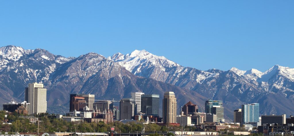
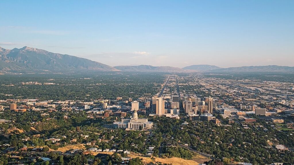
    The downtown Salt Lake City skyline with the Wasatch Mountains behind
    Downtown Salt Lake City with the Wasatch Range behind (Photo: Invictus323 via Wikimedia Commons, CC BY 4.0)

    Salt Lake City’s weather, season by season

    Salt Lake City sits about 1,300 m (4,300 feet) above sea level on the floor of a valley between the Wasatch Range to the east and the Oquirrh Mountains to the west, with the Great Salt Lake to the northwest. That gives it a semi-arid climate with four distinct seasons: hot, dry summers, cold winters with regular snow, and short, changeable springs and falls, while the ski areas a few thousand feet higher are far colder and snowier than the city. The figures below are approximate seasonal patterns based on the long-term climate normals from NOAA’s National Weather Service office in Salt Lake City; check the current forecast before you pack, because a storm can drop the temperature sharply in a few hours, and the mountains are always colder than the valley.

    MonthTypical daytime highTypical overnight lowWhat it feels likeFare pressure
    Januaryaround 3 °C (38 °F)around -5 °C (23 °F)Cold, often gray in the valley during inversions; deep powder in the mountainsHigh for MLK weekend, otherwise moderate
    Februaryaround 7 °C (44 °F)around -3 °C (27 °F)Still wintry; storms alternate with clear, cold daysModerate; Presidents’ Day spike
    Marcharound 12 °C (54 °F)around 1 °C (34 °F)Mild in the city, often big snow in the canyons; longer days on the slopesHigh during spring-break weeks
    Aprilaround 16 °C (61 °F)around 4 °C (40 °F)Changeable; blossom in the valley, spring skiing up high, late snow possibleModerate early, falling as the resorts close
    Mayaround 22 °C (72 °F)around 9 °C (49 °F)Green and pleasant; spring showers; high trails still snowboundLow to moderate; rises for Memorial Day
    Junearound 28 °C (83 °F)around 14 °C (58 °F)Warm, dry and sunny; the canyons are green and coolHigh
    Julyaround 34 °C (93 °F)around 19 °C (67 °F)Hot and dry; afternoon thunderstorms late in the monthPeak
    Augustaround 33 °C (91 °F)around 18 °C (65 °F)Hot; monsoon storms; wildfire smoke possible in some yearsHigh, easing late in the month
    Septemberaround 27 °C (80 °F)around 13 °C (55 °F)Often the best month: warm, dry and clear; fall color begins up highModerate, falling after Labor Day
    Octoberaround 18 °C (65 °F)around 6 °C (42 °F)Crisp and bright; peak canyon color early; first snow in the mountainsLow to moderate
    Novemberaround 10 °C (50 °F)around -1 °C (31 °F)Cooling fast; the first valley snow; ski areas open late in the monthLow, then high for Thanksgiving
    Decemberaround 3 °C (38 °F)around -5 °C (23 °F)Cold and festive; inversions begin; the mountains are in full winterLow early, then peak for the holidays

    Three things the table cannot show. First, the inversion: on calm winter days a layer of cold air settles in the valley under warmer air above, trapping haze and pollution over the city for days at a time, sometimes a week or more, until a storm clears it. The city can sit under a gray lid at freezing point while the ski resorts twenty minutes up the canyons are in bright sunshine, which is one more reason to go uphill. Second, the snow: the Wasatch receives far more snow than the valley floor, and it is famously light and dry, partly thanks to the lake, which can add moisture to passing storms. The city might see a dusting while Alta measures a foot. Third, the dry heat and the sun: summer days feel less oppressive than the numbers suggest because the humidity is low, but the sun at altitude burns quickly, nights cool off, and you will drink more water than you planned.

    How Salt Lake City’s fare seasons work

    Three calendars drive seats into Salt Lake City: the ski season, which pulls visitors from late November to April and peaks on holiday weekends; the national parks and road-trip season, which runs from spring to fall and peaks in summer; and the city’s own calendar of conventions, church conferences and events. Behind all three is the Delta hub, which gives the airport more nonstop routes than a metro area of its size would normally support and keeps competition healthy on the big domestic routes, with Southwest, United, American, Alaska and several low-cost carriers also serving the city. The result is a double-peaked year, with winter holiday spikes and a long summer plateau, and two genuine shoulder seasons in between.

    Peak season

    Roughly December 20 to January 3, the Martin Luther King Jr. weekend in mid-January, Presidents’ Day weekend in mid-February, the March spring-break weeks, and June through mid-August. The winter peaks are driven by skiers and are sharpest at the canyon and Park City lodging, which spills over into city hotels; the summer peak is driven by national park road trips, family travel and the long July holiday stretch that includes both Independence Day and Pioneer Day. If you must travel in peak, book early, fly mid-week, and compare Park City lodging against a city hotel with a rental car.

    Shoulder season

    Mid-April to early June and September to October. April offers spring skiing at the higher resorts and blossom in the valley; late May and early June offer green canyons, pleasant heat and the parks before the summer crowds. September and October are the best months of the year for many visitors: settled weather, spectacular fall color in Big Cottonwood Canyon and along the Alpine Loop, and the southern parks at their most comfortable temperatures. Watch Memorial Day, Labor Day, the October General Conference weekend and Utah’s school fall break.

    Low season

    Late April and May in the mountain towns, which locals call mud season, November before Thanksgiving, and the first half of December. Fares are at their lowest, city hotels discount, and the ski resorts are either closed or just opening. Early December can be excellent value for skiers if the early storms have delivered, but it is a gamble; the higher resorts, such as Alta, Snowbird and Brighton, are the safer bets for early snow.

    As elsewhere, mid-week departures and early or late flights usually price below Friday and Sunday afternoons on the same route, and a search across a whole month reveals cheaper pairs of dates close to your first choice. Our guide to the best times to book explains how to read those patterns.

    Salt Lake City month by month

    January

    Deep winter and prime powder. The resorts are in full swing after the Christmas rush, and the weeks after New Year’s are among the best value of the ski season, apart from the Martin Luther King Jr. Day weekend (the third Monday of January), a big ski-travel weekend. January is also peak inversion season, so the city can be gray and cold while the mountains are sunny. The Sundance Film Festival, long held in Park City in late January and a major driver of Park City prices, is moving to Boulder, Colorado, from 2027, so late-January demand in the Park City area may ease; check before assuming.

    February

    Similar conditions with more daylight, reliable snow and low-to-moderate fares outside the Presidents’ Day weekend (the third Monday of February), one of the busiest ski weekends of the year. Weekdays in early and late February are some of the best ski value in the calendar, and the Jazz and the Mammoth are both at home through the month.

    March

    Often the snowiest month in the mountains, with big spring storms and longer, warmer days, which makes it many skiers’ favorite. It is also the month of spring break, when school holidays across the country send families to the slopes over several weeks; fares and lodging rise sharply in those weeks. In the valley, March brings the first mild days and blossom.

    April

    A month of transitions. The resorts close one by one, with Snowbird and some higher mountains often open into late spring, while the valley turns green and the orchards and the cherry trees at the Capitol bloom. The church’s General Conference, held on the first weekend of April, fills downtown hotels and adds crowds around Temple Square. Otherwise fares fall steadily through the month.

    May

    One of the best value months. The valley is green and warm, the canyons are waterfalls of snowmelt, and the southern national parks are pleasant before the summer heat, though the high country above about 2,700 m (9,000 feet) is often still under snow. Fares are low apart from the Memorial Day weekend at the end of the month.

    June

    Summer arrives with long days and dry heat. The Utah Arts Festival fills Library Square in late June, Utah Pride takes over downtown in early June, and the canyon trails open as the snow melts. Fares step up through the month as school ends and road-trip season begins in earnest.

    July

    Peak summer and peak heat. Independence Day is followed three weeks later by Pioneer Day on July 24, a Utah state holiday commemorating the arrival of the first pioneers in 1847, with a big downtown parade, rodeos and fireworks; for Utahns it is a bigger celebration than the Fourth. The canyons and Park City offer cooler air, and the southern parks are very hot. Fares are at their summer high.

    August

    Hot, with late-summer monsoon thunderstorms that can bring flash floods to the southern slot canyons, and wildfire smoke in some years. Fares ease in the second half as schools across the West return, which in Utah happens earlier than in many states. Late August is a good value window for the parks if you can handle the heat.

    September

    The month many locals would send you to: warm, dry, clear and calm, with the summer crowds thinning after Labor Day. The Utah State Fair runs in early September, the aspens start to turn at high elevation by late in the month, and the southern parks become comfortable for hiking again. Fares are moderate and falling.

    October

    Crisp, bright and often spectacular, with the canyon color peaking early in the month. The October General Conference weekend (the first weekend of the month) is the one date to book around downtown, and Utah’s school fall break brings a brief family-travel bump. The first snow usually dusts the peaks, and fares are low to moderate.

    November

    Winter arrives. The first snow often reaches the valley, the resorts open from about Thanksgiving depending on the snow, and fares and hotel rates are among the lowest of the year, with the exception of the Thanksgiving weekend itself, which is a heavy travel period nationally.

    December

    Two months in one. The first half continues November’s low pricing, with the holiday lights around Temple Square and City Creek and early-season skiing on reduced terrain. From about December 20, fares and lodging jump for the Christmas and New Year ski weeks, which are the most expensive of the year in Park City and the canyons.
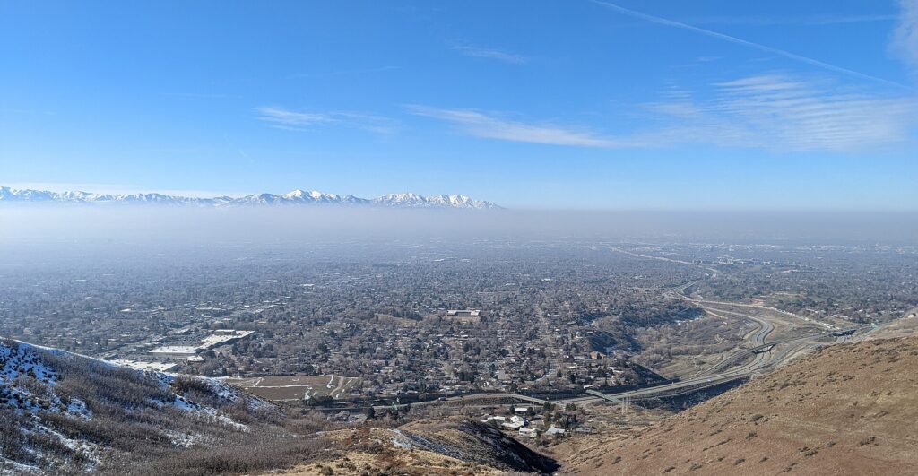
    Winter inversion haze lying over the Salt Lake Valley
    Salt Lake City in winter: snowy, cold and sometimes hazy under an inversion while the mountains above are in sunshine (Photo: Derrellwilliams via Wikimedia Commons, CC BY-SA 4.0)

    Events that move Salt Lake City flight and hotel prices

    Cross-check these against your dates before you book. Exact dates shift each year; Visit Salt Lake keeps the current calendar.

    • Christmas to New Year: the peak of the ski season and the most expensive stretch of the year.
    • Martin Luther King Jr. weekend (third Monday of January) and Presidents’ Day weekend (third Monday of February): the biggest ski weekends.
    • Spring break (March, varying by school district across the country).
    • General Conference (first weekends of April and October): downtown hotels fill with visitors from around the world.
    • The Salt Lake Temple open house: the church plans a public open house for the renovated temple before its rededication, which is likely to raise demand for downtown hotels for as long as it runs; check Temple Square’s site for the dates.
    • Memorial Day, Independence Day and Pioneer Day (July 24).
    • Labor Day weekend and Utah’s school fall break in October.
    • Thanksgiving weekend, and the resort opening weekends around it.
    • Jazz and Mammoth home games, University of Utah football Saturdays, big concerts and conventions at the Salt Palace. Our Salt Lake City events page shows what is on sale for your dates.

    Getting in from the airport

    Salt Lake City has one commercial airport, Salt Lake City International (SLC), about 6 kilometers (4 miles) west of downtown, which makes it one of the closest major airports to its city center in the country. It was rebuilt from scratch as a single terminal with long concourses, opened in phases from 2020; the new building is bright and spacious, but the walk from security to the far gates is long, so allow extra time. Delta runs one of its main hubs here, with nonstop flights to most large US cities and a handful of international routes, and the other major and low-cost airlines serve the big domestic markets. Getting downtown: the TRAX Green Line light rail runs from the station beside the terminal to downtown in about 20 minutes, taxis and ride-hail pick up at the terminal, and the drive downtown takes 10 to 20 minutes outside rush hour. The rental counters are in the garage facing the terminal. For skiers, shuttle companies run to Park City and the canyon resorts, and the drive to the nearest lifts is under an hour. Our Salt Lake City car-versus-transit guide works through the rental decision, and our SLC airport guide covers the layout.
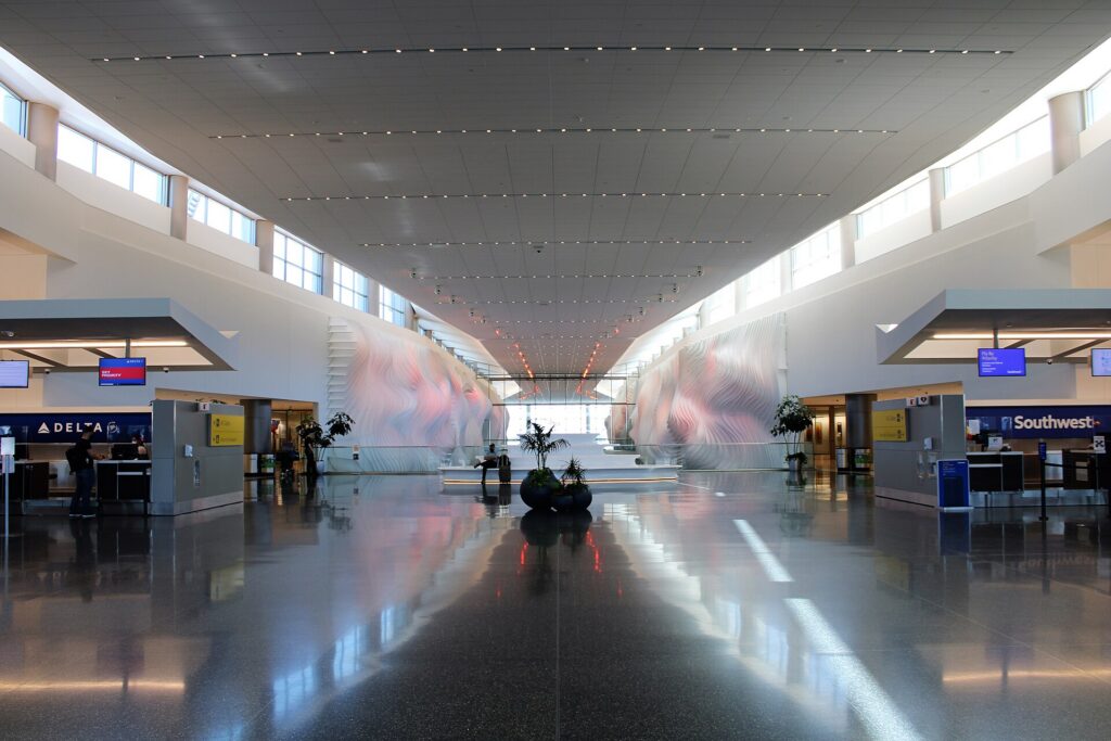
    Inside the new terminal at Salt Lake City International Airport (SLC)
    Salt Lake City International (SLC), rebuilt from 2020 and only about 20 minutes from downtown by TRAX (Photo: Farragutful via Wikimedia Commons, CC BY-SA 4.0)

    Timing tricks that work for Salt Lake City

    • Search the whole month. Holiday weekends create sharp edges in the fare calendar. A calendar search on TicketScanner shows them instantly, and the week after Presidents’ Day or MLK weekend is often much cheaper than the weekend itself.
    • Price lodging before the flight in ski season. A cheap fare into a holiday week is not cheap once a slopeside room is added. Compare a Salt Lake City hotel search with a rental car against canyon or Park City lodging for the same dates.
    • Use the hub. Delta’s network means nonstop flights from many mid-sized cities, and competition on the big routes from Los Angeles, Denver, Phoenix, Seattle and the Bay Area keeps fares reasonable outside the peaks.
    • Consider an open-jaw park trip. Fly into Salt Lake City and out of Las Vegas, or the reverse, and drive through Arches, Capitol Reef, Bryce Canyon and Zion on the way; compare flights to Las Vegas and the one-way rental fee before you commit.
    • Or pair it with Denver. The drive between the two cities takes about eight hours; our Denver to Salt Lake City route guide covers it, and our guide to the best time to fly to Denver shows how that city’s seasons line up.
    • Build a winter buffer. Snowstorms can disrupt SLC and close the canyon roads between December and March; avoid the tightest connections and leave a spare morning before an important flight home. Our guide to how early to arrive covers what to allow.
    • Flying out of Salt Lake City instead? The same seasonality applies in reverse; see cheap flights from Salt Lake City.
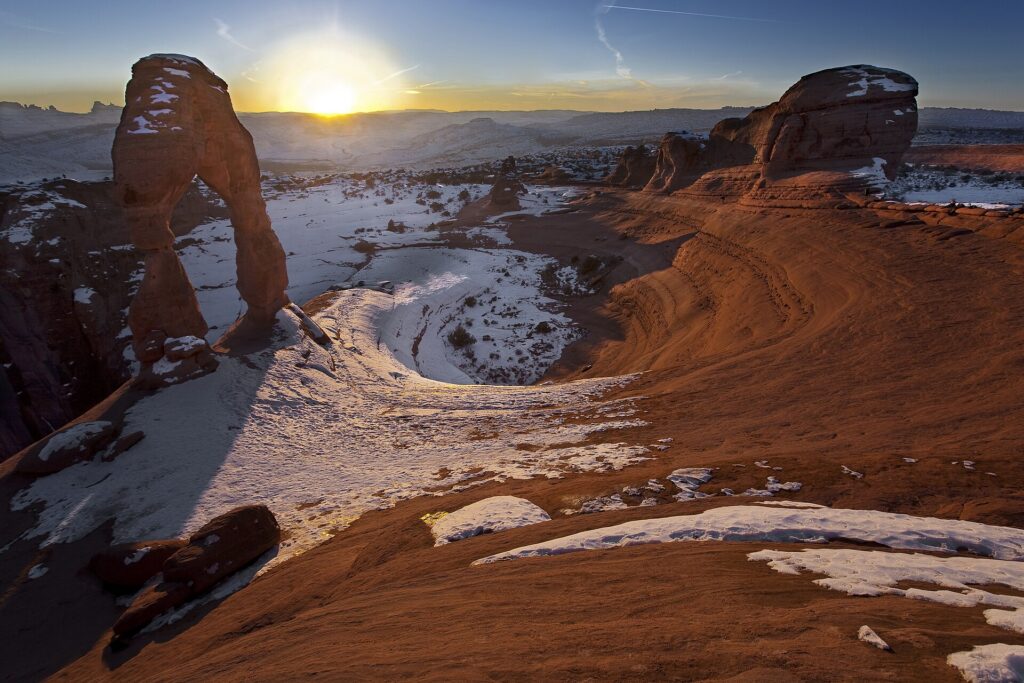
    Delicate Arch in Arches National Park at sunset, with the La Sal Mountains behind
    Arches National Park, about four hours from Salt Lake City and one reason summer fares stay high (Photo: Arches National Park via Wikimedia Commons, Public domain)

    What to pack, by season

    Winter (December to March): a warm, waterproof coat, hat, gloves and boots with grip for the city, and full ski layers for the mountains, where temperatures are much lower. Sunglasses and sunscreen matter on bright snow. Spring (April to May): layers and a rain shell, with a warm layer for late cold snaps and the high canyons. Summer (June to August): light, breathable clothing, a wide-brimmed hat, strong sunscreen and a refillable water bottle, plus a fleece for canyon evenings and a rain shell for afternoon storms. Fall (September to October): layers again, a warm jacket by late October, and hiking shoes for the canyon trails. For the national parks in any season, add sturdy footwear and more water than you think you need.

    The best time to fly to Salt Lake City for…

    Skiing

    Mid-January to early March outside the holiday weekends, for the best snow and value; March for longer days and big storms; early December only if you are flexible and watching the snow reports.

    The national parks

    Late April to early June and mid-September to late October, when temperatures in the southern parks are comfortable and the crowds are thinner than in summer. Check Arches and the other parks’ own pages for any reservation systems in force.

    Fall color

    Late September to mid-October, when the aspens and maples turn in Big Cottonwood Canyon, along the Alpine Loop and around Park City.

    The lowest fares

    Late April and May, November before Thanksgiving, and early December. Pair with a city break, a museum trip or the parks.

    Temple Square and church events

    Book early for General Conference weekends and the temple open house once its dates are set, and consider staying outside downtown if the center is full; TRAX makes it easy to get in.

    International visitors

    Visitors from Visa Waiver Program countries need an approved ESTA before boarding; most others need a visa. The State Department’s travel site explains what applies to you, and the TSA lists what you can carry through security. Many international visitors connect through another US hub; clear immigration at your first point of entry and allow for it in your connection time.

    Frequently asked questions

    What is the cheapest month to fly to Salt Lake City?

    Late April and May are consistently among the lowest, along with November before Thanksgiving and the first half of December.

    What is the best month to visit Salt Lake City for weather?

    September, with late May, early June and early October close behind. July and August are hot; December and January can bring inversion haze in the valley.

    What is the best month to ski in Utah?

    February and March usually offer the deepest base and reliable storms, and weekdays outside Presidents’ Day and spring break are the best value. January has excellent snow but more inversion days in the valley.

    What is an inversion?

    A winter weather pattern in which cold air is trapped in the valley beneath warmer air above, holding haze and pollution over the city until a storm clears it. The mountains above are often sunny while it lasts.

    Should I fly into Salt Lake City or Las Vegas for the national parks?

    Salt Lake City is closer to Arches, Canyonlands and Capitol Reef; Las Vegas is closer to Zion. For a loop through all five, fly into one and out of the other.

    How far ahead should I book?

    Earliest for the Christmas ski weeks, the holiday weekends, spring break and General Conference, when fares and lodging tend only to rise; for the shoulder months, fares are stable enough that finding the right dates matters more than booking early.

    Does it snow in Salt Lake City?

    Yes, regularly from November to March in the valley, though it often melts within days; the mountains above get many times more, which is why the skiing is so good.

    Ready to pick your dates? Compare fares across the whole month on our Salt Lake City flights page, then find a room with our Salt Lake City hotel search. For what to do when you land, start with our first-timer’s guide to Salt Lake City.

  • Salt Lake City: Should You Rent a Car or Rely on Public Transit?

    Salt Lake City: Should You Rent a Car or Rely on Public Transit?

    Salt Lake City is a split decision. For the city itself, it has one of the better transit setups in the Mountain West: a light-rail line straight from the airport terminal to downtown, a free-fare zone in the center, trains to the university, the suburbs and the soccer stadium, and a commuter railroad that runs the length of the Wasatch Front. But very few people fly to Salt Lake City just for the city. Most come to ski the Cottonwood Canyons or Park City, to drive south to the national parks, or to see the Great Salt Lake, and for almost all of that, a car is either essential or much easier. And in winter, the car itself comes with a catch: the canyon roads to the ski resorts have traction rules that many rental cars do not meet. This guide explains how the city is laid out, how UTA’s trains and buses work, what driving here is really like in every season, how the ski buses and shuttles compare with a rental, and gives you a straightforward way to decide.

    The short answer

    Rent a car if the national parks, Antelope Island, the Bonneville Salt Flats or a Utah road trip are on the itinerary, if you are skiing several resorts and want flexibility, if you are staying with family in the suburbs, or if you are traveling with children and gear. Skip the car if you are staying downtown for a city break, a convention, General Conference or a game, and your plans are Temple Square, the Capitol, the museums on the east bench and Sugar House; TRAX, the S-Line streetcar, your feet and the occasional ride-hail will cover that, and you will not pay for parking. And for skiing, there is a real middle path: the ski buses and resort shuttles reach the canyon resorts and Park City without you having to worry about winter traction rules or scarce parking. Compare rental rates for any of these plans on our Salt Lake City car rental page.

    How Salt Lake City is laid out

    Salt Lake City is built on one of the most logical street grids in the country, and it starts at Temple Square. The corner of Main Street and South Temple is the origin point, and almost every address in the valley counts blocks from there: 400 South is four blocks south of the temple, 700 East is seven blocks east, and an address such as 1300 South 900 East is a pair of coordinates rather than a street name. The pioneers laid out enormous blocks and streets wide enough, as the story goes, for a wagon team to turn around, so the streets are broad and easy to drive but the blocks are long on foot; a walk of “four blocks” is closer to a mile than a stroll. Downtown sits at the north end of the valley, with the State Capitol on the hill above it, the Avenues climbing to the northeast, the University of Utah on the east bench, and Sugar House a few miles to the southeast. The suburbs then fill the valley south for more than twenty miles, with the Cottonwood Canyons opening in the Wasatch on the east side and the airport to the west, beside the lake. The inner city is compact enough for transit; everything beyond it assumes a car.

    Hotels cluster downtown around Temple Square, the Salt Palace and the Delta Center, which is the natural base for a car-free visit, with more near the airport and along I-15 in the southern suburbs, and resort lodging up the canyons and in Park City. Our downtown and Temple Square hotel page and wider Salt Lake City hotel search let you compare them.

    Getting in from the airport

    Salt Lake City International (SLC) is about 6 kilometers (4 miles) west of downtown, closer than almost any other big-city airport in the country. The TRAX Green Line leaves from a station beside the terminal and reaches downtown in about 20 minutes, stopping along North Temple and at several downtown stations, for a standard fare; it is the easiest airport rail connection in the West. Taxis and ride-hail pick up at the terminal, and the drive downtown takes 10 to 20 minutes outside rush hour. The rental counters are in the garage facing the terminal, so there is no shuttle bus to a remote lot, and I-80 and I-215 are minutes from the exit, which means you can be on the road to Park City or the Cottonwood Canyons within half an hour of collecting the keys. Private shuttle companies run shared and private transfers from the airport to Park City and the canyon resorts, and many ski lodges arrange their own. Check the airport’s site for current ground-transport details; our SLC airport guide covers the layout, including the long walk to the far gates.

    A UTA TRAX Green Line train at Gallivan Plaza in downtown Salt Lake City
    TRAX in downtown Salt Lake City: free to ride within the Free Fare Zone, and about 20 minutes from the airport (Photo: An Errant Knight via Wikimedia Commons, CC BY-SA 4.0)

    Salt Lake City’s transit, explained

    The Utah Transit Authority, UTA, runs the light rail, the commuter trains, the streetcar and the buses across the Wasatch Front. For a downtown-based visitor it is clean, simple and genuinely useful; its limitation, as in most Western cities, is coverage and frequency once you leave the rail lines, especially in the evenings and on Sundays.

    TRAX light rail

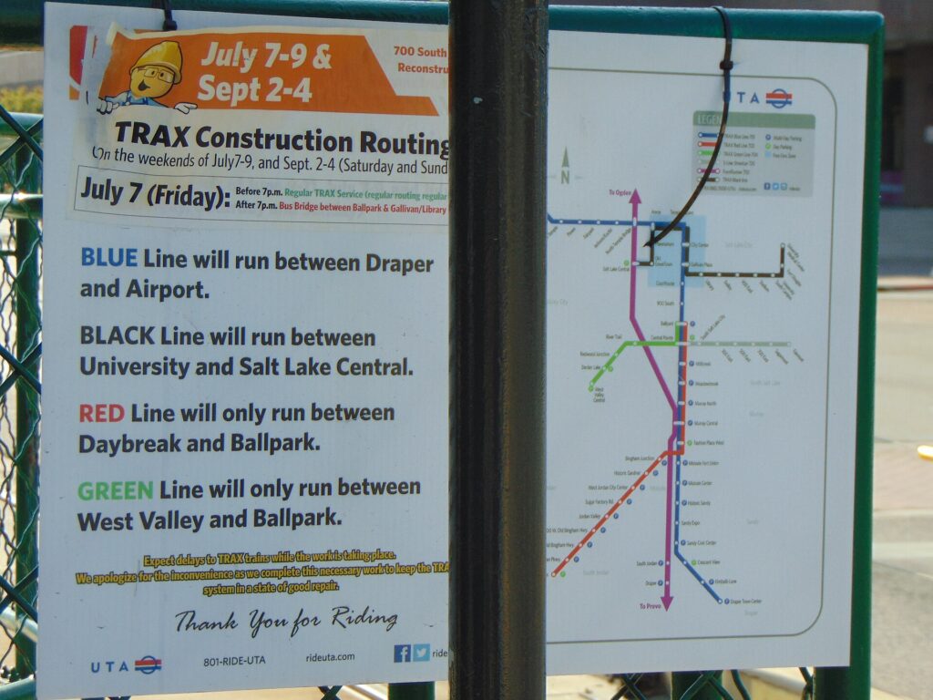
    Three lines. The Green Line runs from the airport through downtown and out to West Valley City. The Red Line runs from the University of Utah and its hospital through downtown and south to the Daybreak development in South Jordan, where the Salt Lake Bees now play. The Blue Line runs from Salt Lake Central Station through downtown and south to Sandy, for the soccer stadium, and on to Draper. All three share the downtown tracks, and rides that start and end inside UTA’s downtown Free Fare Zone are free, on TRAX and on local buses, which covers Temple Square, City Creek, the Delta Center, the Salt Palace and most downtown hotels. Trains run from early morning until late evening, with less frequent service on Sundays.

    FrontRunner and the S-Line

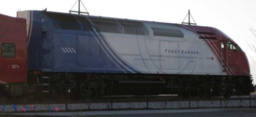
    FrontRunner is the commuter railroad that runs north to Ogden and south to Provo from Salt Lake Central Station, useful for a day in Ogden’s historic 25th Street or a visit to Provo; it has historically not run on Sundays, so check the schedule. The S-Line streetcar is a short line from a TRAX connection in South Salt Lake to the heart of Sugar House, and it is the easiest way to reach that neighborhood.

    Buses and ski buses

    Buses fill in the rest, including the routes up to the Natural History Museum, Red Butte Garden and This Is the Place on the east bench. In winter, UTA has run ski bus service up Big and Little Cottonwood Canyons from park-and-ride lots in the valley to Solitude, Brighton, Snowbird and Alta, and the buses are exempt from the parking scramble at the top. Service levels have been cut back in some recent seasons, so check the current ski schedule on UTA’s site before building a trip around it, and expect full buses on powder mornings.

    Fares and tickets

    Buy tickets from the machines at TRAX and FrontRunner stations or through UTA’s mobile ticketing, and keep proof of payment for the whole trip; fare inspectors check on the trains. FrontRunner fares rise with distance, while TRAX and local buses charge a flat fare with transfers allowed within a time limit, and young children ride free with a paying adult. Ski buses have their own fares, and some resort passes have included free rides in past seasons. Payment options change, so check UTA’s site for current fares and ticketing before you go.

    Accessibility

    TRAX platforms offer level boarding, the buses are low-floor with ramps, and FrontRunner has accessible cars; UTA also runs paratransit for eligible riders.

    Beyond UTA

    • Walking. Downtown, the Avenues, 9th and 9th and Sugar House are pleasant on foot, but allow more time than the map suggests; the blocks are long and the streets wide.
    • Bike share and scooters. The city has a bike-share system and shared e-scooters in the warmer months, and protected bike lanes on several downtown streets. The foothill trails and City Creek Canyon are popular rides.
    • Taxis and ride-hail. Uber, Lyft and taxis operate across the valley; for a group, a short ride is competitive with transit fares and much quicker to the east bench or the neighborhoods off the rail lines.
    • Park City buses. A commuter bus connects downtown Salt Lake City with Park City, and within Park City the town’s own buses are free and reach both ski resorts, Main Street and the lodging areas, so a car-free ski week in Park City is realistic.
    • Ski and airport shuttles. Private shuttle companies run between the airport, downtown hotels, Park City and the canyon resorts; they are the easiest way to reach a slopeside lodge without driving.
    • Amtrak and intercity buses. The California Zephyr stops at Salt Lake Central Station once a day in each direction, at night, and intercity buses connect the city with other Western cities.
    A UTA FrontRunner commuter train at Provo station
    FrontRunner, the commuter railroad between Ogden, Salt Lake City and Provo (Photo: А at English Wikipedia via Wikimedia Commons, Public domain)

    Driving in Salt Lake City and beyond: what it is really like

    Salt Lake City is an easy place to drive by big-city standards: wide streets, a grid that tells you where you are, plenty of parking outside downtown, and freeways that are generally quick outside rush hour. The frustrations are specific. I-15, the north-south spine of the valley, backs up every weekday morning and evening, and I-215, the belt route, has its own bottlenecks near the canyon mouths. Some suburban intersections use unusual designs, such as continuous-flow intersections and “ThrU-turns”, that can surprise drivers from elsewhere; follow the signs and lane markings carefully. Construction season runs from spring to fall on the main routes. And the winter weather changes everything above the valley floor: the city might be dry while the canyons are in a full snowstorm.

    Little Cottonwood Canyon, the road corridor to Snowbird and Alta
    Little Cottonwood Canyon, where winter traction rules and avalanche closures shape every ski day (Photo: GyozaDumpling via Wikimedia Commons, CC BY-SA 4.0)

    Parking

    Downtown parking is moderately priced by big-city standards. Street meters are paid at kiosks or by app, and meters downtown have traditionally been free on Sundays and holidays; check the signs where you park. Garages at City Creek and around Temple Square are plentiful, and many downtown businesses validate. Hotels charge a nightly fee that is worth adding to the room rate when you compare. Outside the center, parking at the museums, the zoo, the malls and most trailheads is straightforward, although popular canyon trailheads fill early on summer weekends. The hardest parking in the region is at the ski resorts on busy days: several of the canyon resorts now charge for parking or require advance reservations on weekends and holidays, and the lots can fill before the lifts open after a big storm.

    Rules and conditions worth knowing

    • Canyon traction rules. Big and Little Cottonwood Canyons, the roads to Solitude, Brighton, Snowbird and Alta, have winter traction requirements, roughly from October to April. When UDOT puts restrictions in place, vehicles generally need four-wheel or all-wheel drive with tires rated for mud and snow (look for M+S or the mountain-snowflake symbol on the sidewall), or approved chains or traction devices, and troopers can turn back or fine drivers who do not comply. Many rental cars are front-wheel drive, and rental agreements often prohibit chains, so if you plan to drive the canyons, book an AWD or 4WD vehicle and check the tires at the counter. UDOT Traffic shows current restrictions, closures and canyon cameras.
    • Avalanche closures. After heavy snow, Little Cottonwood Canyon in particular closes for avalanche control, sometimes for hours, and guests at Alta and Snowbird can be kept indoors, a practice known locally as “interlodge”. Build slack into your plans on storm days and never stop in a marked avalanche zone.
    • The “red snake”. On powder mornings, the line of brake lights up Little Cottonwood can stretch back to the valley. Leave early, carpool, or take the bus.
    • Blood alcohol limit. Utah’s legal limit for drivers is 0.05 percent, lower than the rest of the country; the only safe plan after drinks is not to drive.
    • Wildlife. Deer are common on canyon roads and suburban edges at dawn and dusk, and moose appear in the higher canyons and around Park City; slow down.
    • Speed limits reach 80 mph on some rural interstates, and the long empty stretches toward the parks make it easy to drift above them; the Highway Patrol is active.
    • Right turns on red are permitted after a full stop unless signed otherwise.
    Interstate 80 climbing through Parleys Canyon east of Salt Lake City
    I-80 through Parleys Canyon, the main road from Salt Lake City to Park City (Photo: Grant Handy via Wikimedia Commons, CC BY-SA 4.0)

    When renting a car makes sense

    • The national parks. Arches and Canyonlands, Capitol Reef, Bryce Canyon and Zion are all at least three and a half hours away and connected by long, scenic highways; there is no practical way to see them without a car. Check each park’s rules before you go: Zion runs a shuttle on its main canyon road for much of the year, and Arches has used timed-entry reservations in recent peak seasons. International visitors should also check the National Park Service site, as entrance fees for non-US residents at the busiest parks have recently changed.
    • Skiing several resorts. A car, preferably AWD with the right tires, lets you chase the snow between the Cottonwood Canyons and Park City.
    • Antelope Island, the Bonneville Salt Flats and Golden Spike are all car trips of one to two hours each way.
    • Family in the suburbs. The valley is long and spread out; a car earns its keep daily.
    • Traveling with children and gear. Skis, car seats and luggage make shuttles and buses awkward.
    • Western road trips. Salt Lake City to Las Vegas takes about six hours on I-15, and to Denver about eight via I-80 across southern Wyoming; our Denver to Salt Lake City route guide covers the drive, and our Denver car-versus-transit guide covers the other end.

    If any of those apply, our rental car booking tips cover insurance, deposits and the questions to ask at the counter, and our family car rental guide looks at vehicle choice.

    When it does not

    • You are staying downtown and your plans are Temple Square, the Capitol, the museums and Sugar House.
    • You are in town for a convention, General Conference or a game at the Delta Center, when downtown parking is at its busiest and TRAX stops at the door.
    • You are skiing one resort or staying in Park City, where the free town buses, the ski buses and a shuttle from the airport cover everything.
    • You are traveling solo on a short trip and the rental, parking and fuel add up to more than the train and a few rides.

    The hybrid plan for a city-plus-mountains trip

    Go car-free for the city days and rent for the canyon or park days, and think carefully about where you pick up. Because the airport is so close to downtown and the rental counters are in the garage at the terminal, an airport pickup is more convenient here than in most cities, and heading straight to Park City or the canyons from the airport keeps you out of downtown traffic entirely. Renting from a downtown location can still make sense if you are spending the first nights in the city, because you avoid paying hotel parking on nights the car would sit unused. A pattern that works well: TRAX from the airport to a downtown hotel, two car-free days, then a rental for the mountain or park days, returned at the airport on the way to the flight home. In winter, reserve an AWD or 4WD vehicle well ahead for the canyon days, because they sell out on holiday weekends. Compare the day rates on our Salt Lake City car rental page against a full-trip rental and the difference is usually obvious.

    A worked cost comparison

    Numbers change with the season and the booking window, so treat this as a method rather than a quote, and check current rates before deciding. For a four-night city break downtown for two people, the car-free version costs two TRAX fares each way from the airport, a few bus or streetcar rides to the east bench and Sugar House, and perhaps a couple of ride-hail trips in the evening; the rental version adds four days of a compact car, four nights of hotel parking, fuel, and airport fees and taxes, and buys you very little you could not ride to. Transit wins easily. For a five-day ski trip staying in the city, compare an AWD rental for five days, plus fuel and any resort parking fees, against ski bus fares or daily shuttles for two; the bus is cheaper when it runs frequently and your resort is on its route, and the car wins when you want to ski different resorts, leave early on powder days, or travel with children. For a week-long national park loop, a rental is the only practical answer, and it is worth comparing a round trip from Salt Lake City with a one-way rental to Las Vegas, which saves a long drive back but adds a one-way fee. Run the rental rates for your dates on our Salt Lake City car rental page and put them beside the transit and shuttle costs before you choose.

    Driving the canyons and the Wasatch in each season

    The roads from Salt Lake City into the mountains are short, steep and beautiful, and they are where visitors most often underestimate the conditions. In winter, Big and Little Cottonwood Canyons climb about 900 m (3,000 feet) in less than ten miles on narrow, winding roads, and traction rules apply whenever UDOT declares them; a front-wheel-drive rental on all-season tires can be turned back at the canyon mouth. Little Cottonwood is avalanche terrain and closes for control work after big storms, and on powder mornings the traffic can take an hour or more. I-80 through Parleys Canyon to Park City is a wide interstate and much easier, but it is steep and can ice up in storms, and Guardsman Pass, the summer shortcut between Big Cottonwood and Park City, is closed in winter. In spring, the canyon roads are wet and clear while the resorts are still skiing, rockfall is more common during the thaw, and the high trails stay snowbound into June. In summer, the canyons are the city’s escape from the heat, trailhead lots fill early on weekends, and the Alpine Loop and Mirror Lake Highway into the Uinta Mountains open for scenic drives. Afternoon thunderstorms bring lightning to exposed ridges and flash floods to the southern slot canyons. In fall, the color on the canyon roads draws heavy weekend traffic from late September, and the first snow can close the high roads by late October. In every season, check UDOT Traffic before you set off, and the National Weather Service in Salt Lake City for storm warnings.

    Decision table

    Your tripRecommendationWhy
    City break downtown, couple or soloNo carTRAX from the airport, a free downtown zone and walkable sights
    Convention, General Conference or a gameNo carDowntown parking is busiest and TRAX stops at the venues
    Ski week in Park CityShuttle from the airport, free town busesBoth resorts and Main Street are on the free system
    Skiing the Cottonwood Canyons from the cityAWD or 4WD rental, or the ski busTraction rules and scarce parking favor the right car or the bus
    City plus a day at Antelope Island or Park CityHybrid: rent for the day tripCar-free city days, a car for the lake and the mountains
    National parks loopRent (consider one-way to Las Vegas)Long distances with no practical transit
    Family visit to the suburbsRent for the whole stayThe valley is long and spread out
    Western road trip via DenverRent (compare a one-way fee)Salt Lake City is a stop, not the destination

    Money-saving tips for both options

    • On transit: ride free within the downtown Free Fare Zone, take TRAX from the airport instead of a taxi, and check whether your ski pass includes bus rides.
    • On a rental: compare airport and downtown pickup, book AWD early for ski holidays, check the tires for canyon driving, decline extras you already have through a credit card or home policy (check first), and fill up before the canyons and the long empty stretches toward the parks.
    • On the hotel: if you are renting, add the parking fee to the room rate when you compare, and consider a hotel outside downtown with free parking on the TRAX line.
    • On timing: avoid I-15 in the weekday peaks and the Cottonwood Canyons on powder weekend mornings; the best time to fly to Salt Lake City guide lists the busiest weekends.
    • On the parks: if you plan to visit several national parks, an annual pass for the vehicle usually costs less than paying at each gate.

    Frequently asked questions

    Is it worth renting a car in Salt Lake City?

    For the national parks, the lake, a road trip or skiing several resorts, yes. For a downtown city break, a convention or General Conference, no; TRAX and your feet are enough.

    Is Salt Lake City public transit good for tourists?

    Good for the core: TRAX runs from the airport terminal to downtown, the university and the suburbs, and rides within the downtown Free Fare Zone are free. It thins out in the evenings, on Sundays and away from the rail lines.

    How do I get from Salt Lake City airport to downtown?

    The TRAX Green Line in about 20 minutes for a standard fare, or a taxi or ride-hail in 10 to 20 minutes outside rush hour.

    Can I ski in Utah without a car?

    Yes. Park City’s free buses and airport shuttles make a car-free week there easy, and UTA’s ski buses serve the Cottonwood Canyon resorts in winter, though schedules vary by season.

    Do I need four-wheel drive to drive to the ski resorts?

    For Big and Little Cottonwood Canyons, when traction restrictions are in effect you generally need four-wheel or all-wheel drive with suitable tires, or approved chains. Check UDOT’s current rules before you go, and ask for an AWD vehicle when you book.

    Is parking expensive in downtown Salt Lake City?

    Less than in most big cities. Meters are moderate and have traditionally been free on Sundays and holidays; hotel parking fees are the main cost.

    Can I visit the national parks from Salt Lake City without a car?

    Only on an organized tour. The parks are three and a half to four and a half hours away with no practical public transport; for independent travel, rent a car.

    Whichever way you go, start with the flight. Compare cheap flights to Salt Lake City, choose a neighborhood with our Salt Lake City hotel search, and if the canyons or the parks are on the list, price the rental for those dates on our Salt Lake City car rental page. For what to see once you arrive, start with our first-timer’s guide to Salt Lake City.

  • Things to Do in Salt Lake City: A First-Timer’s Guide

    Things to Do in Salt Lake City: A First-Timer’s Guide

    Salt Lake City gets treated as a connection. Delta runs one of its biggest hubs here, so millions of travelers see the airport and nothing else, and many who do leave the terminal head straight up a canyon to ski or south toward the national parks. They miss a city with far more going on than its quiet reputation suggests: a downtown laid out around Temple Square, the historic heart of a worldwide church, a domed Capitol on a hill with the whole valley below it, a natural history museum that ranks among the best in the West, walkable neighborhoods full of coffee shops and independent restaurants, two major-league teams in the same downtown arena, and a food and drink scene that has outgrown every joke about Utah’s liquor laws. And the mountains are not ninety minutes away but twenty-five: seven ski areas sit within about an hour of downtown, with the Great Salt Lake on the other side of town. This guide covers the sights that earn a day, the neighborhoods worth a half-day, the food, the skiing and the sports, the day trips that make Salt Lake City a base as much as a destination, and the practical details that turn a layover into a trip.

    If you are still comparing cheap flights to Salt Lake City, read this alongside our guides to the best time to fly to Salt Lake City and whether you need a car (for downtown, often not; for the canyons and the parks, usually yes). Between the three you can plan the whole trip.

    The Salt Lake City skyline with the snow-capped Wasatch Range beyond
    Downtown Salt Lake City at the foot of the Wasatch, with ski areas less than an hour away (Photo: Iansmh98 via Wikimedia Commons, CC BY-SA 4.0)

    Salt Lake City at a glance for first-timers

    • Airport: Salt Lake City International (SLC), about 6 km (4 miles) west of downtown, rebuilt from scratch and opened in stages from 2020. The TRAX Green Line runs from the terminal to downtown in roughly 20 minutes, and it is one of the closest big airports to its city center in the country. See our SLC airport guide.
    • Getting around: downtown is compact and TRAX light rail is free within the downtown Free Fare Zone; the University of Utah, Sugar House and the airport are all on rail. For the ski canyons, Park City and the national parks, most visitors rent a car. Our car-versus-transit guide explains when it helps.
    • Money: US dollars. Sales tax is added at the register rather than shown on the tag, and hotel taxes are higher again. Tipping 18 to 20 percent in restaurants is expected.
    • Altitude and air: the city sits about 1,300 m (4,300 feet) above sea level and the ski areas are far higher. The air is dry, so drink more water than usual and wear sunscreen in every season.
    • Weather: four distinct seasons: hot, dry summers, a long clear fall, snowy winters with occasional inversion haze in the valley, and a changeable spring. Our month-by-month guide has the detail.
    • Where to stay: downtown near Temple Square for the sights, the arena and TRAX; Sugar House for a neighborhood feel; the airport area for early flights; Park City or the canyon lodges if skiing is the whole point. Our Salt Lake City hotel search covers them all.

    Temple Square and downtown

    Temple Square is where the city began and where most first visits start. The pioneers who arrived in the valley in 1847, members of The Church of Jesus Christ of Latter-day Saints, laid out their city from this point, and the block and the surrounding campus remain the church’s worldwide headquarters. The granite Salt Lake Temple, completed in 1893 after forty years of construction, has been closed for a long seismic renovation, and the church plans a public open house with free tickets before the temple is rededicated; check the official Temple Square site for reservations and the current state of the grounds. After it is rededicated, only church members entering for worship go inside, but the gardens, the visitors’ center and much of the campus are open to everyone. The domed Tabernacle, famous for its acoustics and its enormous organ, is home to the Tabernacle Choir at Temple Square, whose weekly Music & the Spoken Word broadcast on Sunday mornings is free to attend. Across North Temple, the 21,000-seat Conference Center has a landscaped rooftop garden with a view of the Wasatch, and the Family History Library, the largest genealogical library in the world, is free and open to anyone who wants to trace their own ancestors. The Beehive House, the home of Brigham Young, offers free tours. Visitors of any faith, or none, are welcome throughout; dress is casual, and volunteers offer tours and answer questions without pressure.

    Immediately south, City Creek Center is an open-air shopping district with a restored creek running through it and a retractable glass roof. West of the square, the Delta Center hosts the Utah Jazz and the NHL’s Utah Mammoth, and the Salt Palace Convention Center fills the blocks to the south. Abravanel Hall, home of the Utah Symphony, and the Eccles Theater, where Broadway tours stop, are both a short walk away. Our downtown and Temple Square hotel page lists the options in the center.

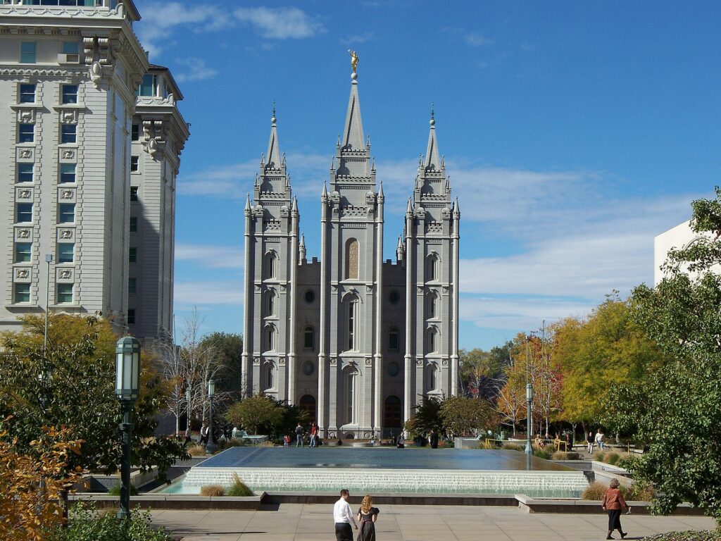
    The granite Salt Lake Temple on Temple Square in downtown Salt Lake City
    Temple Square, the historic heart of the city and headquarters of The Church of Jesus Christ of Latter-day Saints (Photo: Bobjgalindo via Wikimedia Commons, CC BY 4.0)

    Capitol Hill and City Creek Canyon

    The Utah State Capitol sits on the hill directly north of downtown, a granite building with a great central dome, completed in 1916 and restored after a major seismic retrofit in the 2000s. It is free to enter, the rotunda and the chambers are open when the legislature is not sitting, and free guided tours run on weekdays; the steps give the best easy view in the city, straight down State Street to the southern end of the valley, with the Oquirrh Mountains to the west and the Wasatch to the east. East of the Capitol, City Creek Canyon is a narrow wooded canyon that runs straight out of the city into the mountains, with a paved road that is closed to cars on alternating days in summer so walkers and cyclists have it to themselves. Memory Grove, at the canyon mouth, is a quiet war-memorial park a few minutes’ walk from downtown. For a longer hike with a summit, Ensign Peak, a short, steep climb from the top of the Avenues, is where the pioneer leaders are said to have surveyed the valley in 1847, and it has the city’s best sunset view.

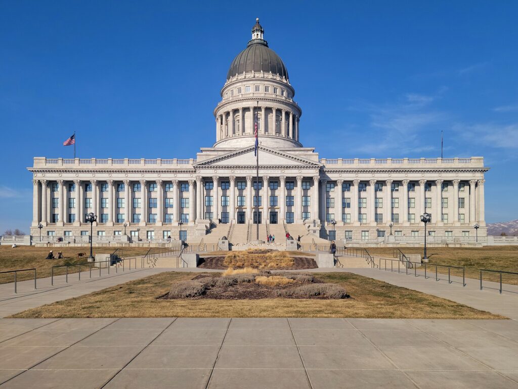
    The south front of the domed Utah State Capitol above downtown Salt Lake City
    The Utah State Capitol, free to visit, with the best easy view of the valley from its steps (Photo: GyozaDumpling via Wikimedia Commons, CC BY-SA 4.0)

    The east bench: museums, gardens and the pioneer story

    The foothills above the University of Utah hold the city’s best cluster of attractions. The Natural History Museum of Utah, in the Rio Tinto Center, a building terraced into the hillside, is the highlight: a wall of dinosaur skulls and skeletons from Utah’s extraordinary fossil beds, galleries on the Great Salt Lake, the state’s Native peoples and its geology, and a top-floor terrace with a view across the valley. Next door, Red Butte Garden is a large botanical garden with foothill trails and a summer outdoor concert series that sells out quickly. Down the hill, This Is the Place Heritage Park marks the spot where Brigham Young is said to have first looked out over the valley; it has a monument and a reconstructed pioneer village with costumed interpreters, craft demonstrations and a small train, and it tells the settlement story, including the Native nations who were already here. The Hogle Zoo is across the road, and the Utah Museum of Fine Arts is on the campus below. TRAX’s Red Line reaches the university, and buses cover the rest.

    Neighborhoods worth a half-day

    Sugar House

    A few miles southeast of downtown and reached on the S-Line streetcar, Sugar House is the city’s liveliest neighborhood away from the center: independent shops, bookstores, restaurants and bars along Highland Drive and 2100 South, and Sugar House Park, a big green space with a pond and a view of the Wasatch. It is the easiest place in the city to spend an unplanned afternoon.

    9th and 9th and 15th and 15th

    Named for their intersections, these two small commercial nodes east of downtown are the city’s most charming, with cafés, a vintage movie theater, bakeries and restaurants set among tree-lined streets of bungalows. Liberty Park, home of Tracy Aviary, is a short walk from 9th and 9th.

    The Avenues

    Climbing the hill northeast of Temple Square, the Avenues is the city’s oldest residential district, a grid of Victorian houses and small corner restaurants with views of downtown. Walk up from the Capitol, take in Ensign Peak, and come back down for dinner.

    Central Ninth and the Granary District

    South and west of downtown, these former warehouse and light-industrial areas have filled with breweries, distilleries, coffee roasters and restaurants. They are less polished than Sugar House and more fun for it.

    Museums, culture and family attractions

    Tracy Aviary, in Liberty Park, is one of the oldest bird parks in the country, with free-flight bird shows in summer. The Clark Planetarium, at the Gateway, has a dome theater and free exhibit floors. The Leonardo, a science and art museum in the old downtown library building on Library Square, is aimed at older children and curious adults. The Church History Museum, beside Temple Square, is free and covers the church’s story in art and artifacts. For live performance, the Utah Symphony, Utah Opera and Ballet West are the main companies, and the Eccles Theater hosts Broadway tours. Library Square, with the striking curved glass Salt Lake City Public Library by Moshe Safdie, is worth a visit for the building alone: walk up the sloping outer wall to the rooftop garden. For what is on stage and in the arenas during your dates, our Salt Lake City events page lists concerts, shows and games.

    Skiing the Wasatch

    Salt Lake City has a claim no other big American city can match: world-class skiing within about 40 minutes of downtown, and the airport less than an hour from the lifts. Utah’s license plates advertise “the Greatest Snow on Earth”, and the dry, light powder that falls on the Wasatch is the reason. Big Cottonwood Canyon holds Solitude and Brighton, the latter a local favorite with night skiing. Little Cottonwood Canyon, next door, holds Snowbird and Alta, two of the most celebrated ski mountains in the country for steep terrain and deep snow; Alta is one of the few resorts in North America that remains skiers only. Park City, over Parleys Canyon on I-80, has Park City Mountain, one of the largest ski areas in the country, and Deer Valley, known for grooming and service. The season generally runs from late November or early December into April, and Snowbird often stays open later. The canyon roads are the catch: they are narrow, steep and prone to closures for avalanche control after big storms, parking at several resorts now requires payment or reservations on busy days, and traction rules apply to cars in winter; our car-versus-transit guide covers the rules and the ski buses. Ski Utah has resort information and snow reports. Salt Lake City hosted the 2002 Winter Games and has been chosen to host again in 2034.

    Sports

    The Utah Jazz play NBA basketball at the Delta Center, one of the loudest arenas in the league, and since 2024 they have shared it with the city’s NHL team, now called the Utah Mammoth, which has given downtown a winter game-night crowd almost every week from October to April. Real Salt Lake plays MLS soccer, and the Utah Royals play in the NWSL, both at the soccer stadium in Sandy, south of the city and within reach of the TRAX Blue Line. The Salt Lake Bees, the Triple-A baseball team, have moved to a new ballpark in the Daybreak development in South Jordan, at the end of the TRAX Red Line. On fall Saturdays, the University of Utah’s football team fills Rice-Eccles Stadium, where the 2002 Olympic opening ceremony was held. Check what is on sale in Salt Lake City for your dates before you book flights.

    What to eat and drink, and where

    Salt Lake City’s food scene is more varied than visitors expect. Start with the local classics: fry sauce, the pink mix of ketchup and mayonnaise served with fries at every burger stand; the pastrami burger, a Utah drive-in staple; Utah-style scones, which are fried dough with honey butter rather than anything British; and funeral potatoes, a cheesy potato casserole that turns up at every family gathering. Drive-through “dirty soda” shops, mixing sodas with syrups and cream, are a local obsession. Beyond those, State Street and the west side have excellent Mexican food; the valley’s large Pacific Islander communities mean good Tongan and Samoan food; and downtown, Sugar House, 9th and 9th and the Central Ninth warehouse district hold the ambitious new restaurants. The Downtown Farmers Market in Pioneer Park runs on Saturdays in summer and early fall. As for drinks, Utah’s reputation lags the reality. The city has a thriving craft beer scene, several distilleries and plenty of bars; draft beer is limited to a lower alcohol content than elsewhere, with stronger beers sold in cans and bottles, restaurants serve wine and cocktails with food, and bars admit only those 21 and over. Wine and spirits for home are sold only in state-run liquor stores, which are closed on Sundays and holidays.

    Salt Lake City through the seasons

    Winter (December to March) is ski season: the canyons get deep, dry snow, the resorts are busy, and the Jazz and the Mammoth are both at home. The valley itself is colder and grayer than the mountains, and on still days a temperature inversion can trap haze over the city for a week, which is exactly when locals head uphill into the sunshine. Spring (April to May) is changeable, with late snow in the city and spring skiing in the canyons into April; it is the quietest, cheapest time in the valley, and the orchards and gardens bloom. Summer (June to August) is hot and dry, with long evenings, the Utah Arts Festival and Utah Pride in June, Pioneer Day on July 24 with a big parade and fireworks, and cool air in the high canyons. Fall (September to October) is the local favorite: warm, clear days, the aspens and maples turning gold and red in the canyons from late September, the Utah State Fair in early September, and the national parks at their most comfortable. The church’s General Conference, held on the first weekend of April and October, brings large crowds downtown; plan hotels around it. Our month-by-month guide has the fare patterns that go with each season.

    Salt Lake City with kids

    Salt Lake City is one of the most family-oriented cities in the country, and it shows. The Natural History Museum of Utah, with its dinosaurs and hands-on galleries, is the obvious first stop, and the Hogle Zoo and This Is the Place Heritage Park, with its pioneer village and train, sit side by side for a full day. The Leonardo, the Clark Planetarium and the Loveland Living Planet Aquarium in the southern suburbs fill a rainy afternoon. In summer, the fountains at City Creek Center and the splash pads in the city parks are free, and a drive up Big Cottonwood Canyon to a lake at the top makes an easy mountain afternoon. In winter, every resort has a ski school, and Antelope Island’s bison make a memorable day at any time of year. Our family car rental guide covers the vehicle question for canyon and park trips.

    Salt Lake City on a budget

    A lot of the best of Salt Lake City costs nothing. Temple Square, the Tabernacle Choir broadcast, the Conference Center roof garden, the Family History Library, the Beehive House tour, the Church History Museum and the State Capitol are all free, as are Memory Grove, City Creek Canyon, Ensign Peak and the Library Square rooftop. TRAX rides within the downtown Free Fare Zone cost nothing, and the train from the airport is cheap. Eat well for less on State Street and the west side, at the drive-ins and at the Saturday farmers market. Downtown hotel rates are usually at their most reasonable outside convention weeks, General Conference weekends and the ski holidays. Compare rates by neighborhood on our Salt Lake City hotel search.

    Day trips from Salt Lake City

    Antelope Island State Park, about an hour north across a causeway into the Great Salt Lake, is the essential lake trip: free-roaming bison and pronghorn, beaches where the salt water holds you up, and wide views across the water; the lake’s level rises and falls from year to year, and biting brine flies can be a nuisance in early summer. Park City, about 40 minutes east on I-80, is a former silver-mining town with a historic Main Street, galleries, restaurants, summer mountain biking and the Utah Olympic Park; the Sundance Film Festival, which put the town on the map every January, is moving to Boulder, Colorado, from 2027. The Bonneville Salt Flats, about 90 minutes to two hours west on I-80, are a blinding white plain famous for land-speed records. Golden Spike National Historical Park, about two hours north, marks where the first transcontinental railroad was completed in 1869. The Alpine Loop through American Fork Canyon, about an hour south and closed in winter, passes Timpanogos Cave and is one of the prettiest fall-color drives in the state. Utah’s famous national parks are farther than most visitors assume: Arches and Canyonlands near Moab are around four hours southeast, Capitol Reef and Bryce Canyon about four, and Zion around four and a half to the south. They are overnight trips rather than day trips, and Arches has used a timed-entry reservation system in recent peak seasons, so check the National Park Service site for current rules before you go. All of these are car trips; see our Salt Lake City car rental page. For a longer road trip, the drive between Salt Lake City and Denver takes about eight hours; our Denver to Salt Lake City route guide covers it, and our guide to things to do in Denver covers the other end. Utah’s official tourism site covers the wider state.

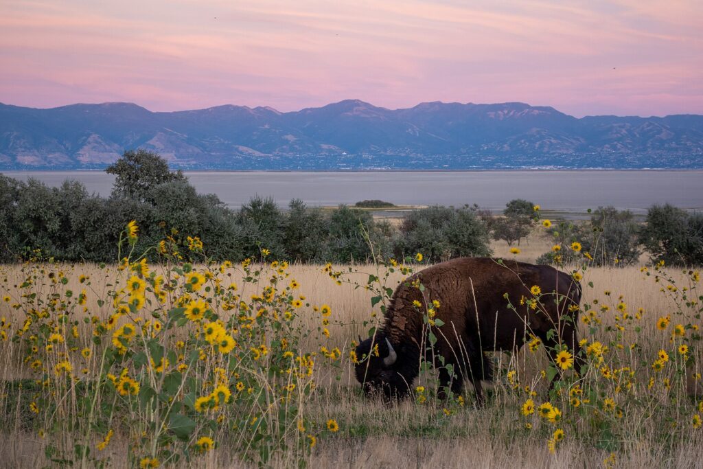
    The shoreline of Antelope Island in the Great Salt Lake
    Antelope Island, an hour north of downtown, with bison, beaches and the Great Salt Lake all around (Photo: Matthew Dillon from Hollywood, CA, USA via Wikimedia Commons, CC BY 2.0)

    Two sample itineraries

    Two days, no car

    Day one: TRAX from the airport, Temple Square and the Conference Center roof garden in the morning, lunch at City Creek or on Main Street, the walk up to the State Capitol and through Memory Grove in the afternoon, and dinner in the Avenues or downtown, with a Jazz or Mammoth game if one is on. Day two: TRAX to the university and a bus up to the Natural History Museum and Red Butte Garden in the morning, This Is the Place in the early afternoon, then the S-Line to Sugar House for the park, the shops and dinner.

    Four days, with the mountains and the lake

    Add a day in the canyons, skiing in winter or hiking and a scenic drive up Big Cottonwood in summer and fall, and a day split between Antelope Island and the Great Salt Lake shore, or Park City and the Olympic Park. Pick up a car downtown for those days and return it at the airport on the way home; in winter, confirm the car meets the canyon traction rules before you drive up.

    Practical details

    • Transit: buy tickets at TRAX station machines or through UTA’s app; rides that start and end in the downtown Free Fare Zone are free. UTA has maps, fares and service alerts; our transit-versus-car guide goes into detail.
    • From SLC: the TRAX Green Line to downtown, a taxi or ride-hail, or a rental from the counters in the garage facing the terminal. The airport’s site covers ground transport.
    • Weather: layers in every season, sunscreen and sunglasses year-round, a warm coat and good footwear from November to March, and water for summer heat. NOAA’s National Weather Service office in Salt Lake City has the forecast and air-quality context during inversions.
    • Sundays: the city is quieter on Sundays; most attractions and restaurants open, but some shops close, state liquor stores are shut, and some transit runs a reduced schedule.
    • Time zone: Mountain, two hours behind New York and one ahead of Los Angeles.
    • Entry requirements: visitors from Visa Waiver Program countries need an approved ESTA before boarding; most others need a visa. The State Department’s travel site is the authoritative source.
    • Safety: the areas visitors spend their time in are generally safe; use ordinary big-city awareness around the downtown transit hubs late at night, and in the mountains, check avalanche and weather conditions before heading off the groomed runs or up a trail.

    Frequently asked questions

    How many days do you need in Salt Lake City?

    Two full days covers Temple Square, the Capitol, the east bench museums and a neighborhood; add a day for Antelope Island or Park City, several for skiing, and at least three or four for a loop through the national parks.

    What is the number one thing to do in Salt Lake City?

    For a first visit, Temple Square and the walk up to the Capitol. In winter, ski the Cottonwood Canyons, which are closer to a major city than any comparable resorts in the country.

    Is Salt Lake City walkable?

    Downtown is, though the blocks are much longer than in most cities and a walk takes longer than the map suggests. The Avenues, Sugar House and 9th and 9th are pleasant on foot; the rest of the valley assumes a car.

    Do I need a car in Salt Lake City?

    Not for downtown, the university or Sugar House, all on TRAX or the streetcar. For the canyons, Park City, Antelope Island and the national parks, yes.

    Can non-members visit Temple Square?

    Yes. The grounds, gardens, visitors’ center, Tabernacle, Conference Center and Family History Library are open to all visitors free of charge. The temple itself is open to the public only during a pre-dedication open house; after rededication, entry is for church members attending worship.

    What is Salt Lake City known for?

    Temple Square and the church headquarters, the Great Salt Lake, the 2002 Winter Olympics, powder skiing in the Wasatch, the Utah Jazz, and its role as the gateway to Utah’s national parks.

    Ready to go? Compare flights to Salt Lake City, find a place to stay with our Salt Lake City hotel search, and if the canyons or the parks are on the list, price a rental car for those days.

  • Best Time to Fly to Charlotte: Seasons, Weather & Prices

    Best Time to Fly to Charlotte: Seasons, Weather & Prices

    Charlotte’s airfares follow a different logic from most American cities. Charlotte Douglas is one of American Airlines’ biggest hubs, and most of the people on the planes are connecting to somewhere else, which means the price of a ticket to Charlotte itself depends as much on the airline’s network as on the city’s own calendar. That calendar matters too: a long, humid summer, a spring and fall that are among the most pleasant in the country, a NASCAR race on Memorial Day weekend that draws one of the biggest crowds in American sport, NFL and college football from September to January, and a convention and banking calendar that fills Uptown hotels on weeknights. This guide walks through the weather month by month, the fare seasons, the events that move prices, and how to handle one of the busiest connecting airports in the world.

    The short answer

    For weather and value together, the best windows are mid-April to mid-May, avoiding Memorial Day weekend, and late September to early November, when the heat has broken, the skies are dry and the Blue Ridge Mountains two hours west are turning color. The cheapest fares usually come in January and February, after the New Year return, and in the first half of December. The most expensive stretches are Memorial Day weekend, when the Coca-Cola 600 fills hotels from Concord to Uptown, the summer school holidays from mid-June to mid-August, Thanksgiving and the Christmas and New Year weeks, and any weekend with a Panthers home game, the ACC Championship or a big stadium concert. Whatever you choose, run a flexible-date search on our Charlotte flights page; shifting a trip by a few days around a race or a holiday weekend can change the fare band entirely.

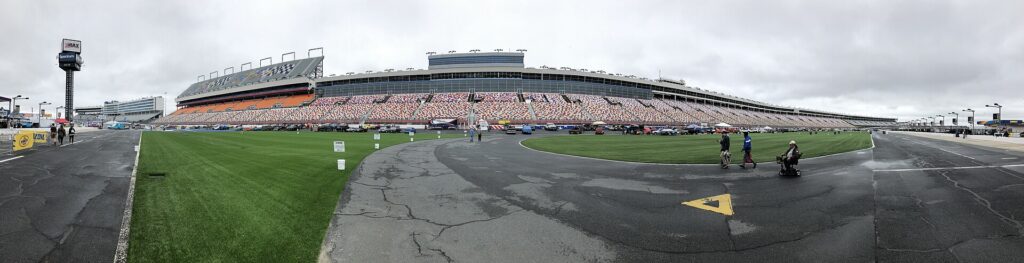
    Charlotte Motor Speedway in Concord on a race weekend in May
    Charlotte Motor Speedway, where the Coca-Cola 600 on Memorial Day weekend makes it the priciest hotel weekend of the year (Photo: Ken Lund from Reno, Nevada, USA via Wikimedia Commons, CC BY-SA 2.0)

    Charlotte’s weather, season by season

    Charlotte sits in the Piedmont of North Carolina at an elevation of about 230 meters (750 feet), between the Blue Ridge to the west and the coastal plain to the east. It has a humid subtropical climate: long, hot and humid summers with afternoon thunderstorms, short winters that are mostly mild but can bring a hard freeze or an ice storm, and a spring and fall that stretch for months. The figures below are approximate seasonal patterns based on the long-term climate normals for Charlotte Douglas from NOAA’s National Weather Service; check the current forecast before you pack, because spring and fall can swing ten degrees from one day to the next.

    MonthTypical daytime highTypical overnight lowWhat it feels likeFare pressure
    Januaryaround 11 °C (52 °F)around 0 °C (32 °F)Cool and often gray; an ice or snow event can shut the city for a day or twoLow, after the New Year return
    Februaryaround 13 °C (56 °F)around 2 °C (35 °F)Changeable; warm spells alternate with cold snapsLow; rises for Presidents’ Day weekend
    Marcharound 18 °C (64 °F)around 5 °C (41 °F)Spring arrives early; the first blossoms by mid-monthModerate; spring break spike
    Aprilaround 23 °C (73 °F)around 9 °C (49 °F)Dogwoods, azaleas and heavy pine pollen; near-perfect temperaturesModerate to high
    Mayaround 27 °C (80 °F)around 14 °C (58 °F)Warm and green; humidity building by the end of the monthModerate, with a Memorial Day race spike
    Junearound 31 °C (87 °F)around 19 °C (66 °F)Hot and humid; afternoon thunderstorms beginHigh from mid-month
    Julyaround 32 °C (90 °F)around 21 °C (70 °F)The hottest month; muggy nights and pop-up stormsHigh, especially around the Fourth
    Augustaround 31 °C (88 °F)around 21 °C (69 °F)Still hot and humid; the heat eases a little late in the monthHigh, softening after schools return
    Septemberaround 28 °C (82 °F)around 17 °C (63 °F)Warm; drier by the end of the month; tropical-storm remnants possibleModerate, falling after Labor Day
    Octoberaround 22 °C (72 °F)around 11 °C (51 °F)Often the best month: dry, sunny and mildModerate; football and race weekends spike
    Novemberaround 17 °C (62 °F)around 5 °C (41 °F)Crisp and clear; fall color lingers in the cityLow to moderate, peak at Thanksgiving
    Decemberaround 12 °C (54 °F)around 2 °C (35 °F)Cool and mostly dry; festive lights across the regionLow until mid-month, then peak

    Three things the table cannot show. First, the humidity: from June to early September, the air in Charlotte feels hotter than the numbers suggest, and a 32 °C (90 °F) afternoon with a thunderstorm building is normal. Second, the pollen: for a few weeks in late March and April, pine pollen turns cars, patios and anything left outside yellow, and allergy sufferers should plan accordingly. Third, winter weather: Charlotte sees measurable snow in some winters and none in others, but a quarter-inch of ice is enough to close schools, snarl the interstates and delay flights, because the region has little equipment to deal with it.

    How Charlotte’s fare seasons work

    Three forces drive prices into Charlotte. The first is the hub: American Airlines carries the large majority of passengers at Charlotte Douglas and runs a huge connecting operation, which gives the city a remarkable number of nonstop routes but also means less fare competition on many of them than at airports with several big carriers. The second is business travel: the banks, the energy and technology companies and the Charlotte Convention Center keep weekday flights and Uptown hotels busy year-round, especially Monday to Thursday. The third is the leisure calendar: summer holidays, the Memorial Day race, football season, and the regional pull of the mountains and the lakes. The result is a relatively flat fare curve with sharp spikes around specific weekends, and hotel prices that often move more than airfares do.

    Peak season

    Mid-June to mid-August, plus Memorial Day weekend, Thanksgiving week and roughly December 20 to January 2. Summer is driven by families, with Charlotte both a destination and a gateway to the beaches and the mountains. Memorial Day weekend is in a class of its own for hotels: the Coca-Cola 600 fills Concord, University City and much of Uptown, and weekend rates climb steeply. If you must travel in peak, book early, fly mid-week, and consider staying on the Blue Line away from the race-weekend hotspots.

    Shoulder season

    March to May and September to November. April and October are the two best months for weather, and both have busy weekends: spring break and college graduations in the spring, and football, the fall NASCAR weekend and homecoming weekends in the fall. Weekdays are usually good value in both seasons, and early May and early November are often the sweet spots.

    Low season

    January and February outside the holiday weekends, and the first half of December. Fares and hotel rates are at their lowest, the weather is cool but mostly manageable, and the Hornets are in season. The exceptions are Martin Luther King Jr. weekend, Presidents’ Day weekend and any big convention. Build a buffer into connections in case of an ice storm.

    As elsewhere, mid-week departures and early or late flights usually price below Friday and Sunday afternoons on the same route, and a search across a whole month reveals cheaper pairs of dates close to your first choice. Our guide to the best times to book explains how to read those patterns.

    Charlotte month by month

    January

    Cool, often gray and, after the first week, one of the two cheapest months to fly in. Highs are usually in the low teens Celsius (mid-50s Fahrenheit), with occasional cold snaps and the small but real chance of an ice storm that stops the city. The museums, the NASCAR Hall of Fame and the Hornets at the Spectrum Center are the main draws, and a Panthers playoff game, when there is one, fills Uptown for a weekend. Martin Luther King Jr. weekend brings a small bump.

    February

    Similar weather with more warm days and low fares outside Presidents’ Day weekend. Charlotte FC usually opens its MLS season late in the month or in early March. A strong value month for a city break focused on museums, food and breweries.

    March

    Spring comes early to the Piedmont. The first blossoms appear by mid-month, patios reopen, and the St. Patrick’s Day parade fills Uptown. Spring break from mid-March into April raises fares from the Northeast and Midwest, and when Charlotte hosts the ACC men’s basketball tournament, as it does in some years, Uptown hotels fill for that week.

    April

    Arguably the prettiest month, with dogwoods and azaleas in bloom across Myers Park and Dilworth, near-perfect temperatures and the Knights opening their baseball season at Truist Field. The catch is pine pollen, heaviest in early-to-mid April. Easter weekend and college events raise prices a little; weekdays remain good value.

    May

    Warm, green and busy. Quail Hollow Club hosts a PGA Tour event in most years, college graduations fill hotels on a couple of weekends, and Memorial Day weekend brings the Coca-Cola 600 at Charlotte Motor Speedway, the longest race on the NASCAR calendar. Book race weekend months ahead; the rest of May is fine value.

    June

    Summer arrives with heat, humidity and afternoon thunderstorms. The Whitewater Center, Lake Norman and the ballpark come into their own, and Juneteenth celebrations fill the city. Fares climb from mid-month as schools finish across the country. Early June is the value play.

    July

    The hottest month and part of the summer peak. The Fourth of July fireworks over Uptown are the big event, the Knights play most nights, and the mountains, two hours west and noticeably cooler, are at their busiest. Plan outdoor sightseeing for the morning and leave the afternoon for the museums.

    August

    Still hot and humid, with Charlotte Pride filling Uptown on a weekend in August and the Panthers’ preseason starting. Many schools in the South return in the first half of the month, and North Carolina’s public schools by the last week, so late August is usually softer on prices than July.

    September

    Warm and gradually drier, with prices falling after Labor Day. Football season begins, and Panthers home Sundays and big college games raise weekend hotel rates. The Festival in the Park fills Freedom Park, and this is the peak of hurricane season, when the remnants of a tropical storm occasionally bring a day or two of heavy rain.

    October

    Often the best month of the year: dry, sunny and mild, with the fall color reaching the Blue Ridge Mountains in the middle of the month. The fall NASCAR weekend at the Speedway, Panthers games, college homecomings and conventions make some weekends expensive; weekdays are excellent value.

    November

    Crisp, clear and quieter, with fall color lingering in the city’s oaks and maples until mid-month. Fares are low to moderate until Thanksgiving, when the Uptown parade and holiday travel create one of the busiest weeks of the year at the airport. The holiday lights at the Speedway switch on in mid-to-late November.

    December

    Two months in one. The first weekend often brings the ACC Championship Game to Bank of America Stadium, which fills Uptown hotels. The first half is otherwise cheap, with holiday lights at the Speedway and in McAdenville, Christmas Town USA. From about December 20, fares jump for the holidays, and a college bowl game around New Year adds another spike.

    An aerial view of the Uptown Charlotte skyline
    Uptown Charlotte from the air (Photo: Precisionviews via Wikimedia Commons, CC BY-SA 4.0)

    Events that move Charlotte flight and hotel prices

    Cross-check these against your dates before you book. Exact dates shift each year; Charlotte’s Got A Lot, the city’s official visitor site, keeps the current calendar.

    • Martin Luther King Jr. weekend and Presidents’ Day weekend in January and February.
    • Spring break (mid-March to mid-April), and the ACC men’s basketball tournament in the years Charlotte hosts it.
    • College graduations in May, when families fill hotels near the universities and Uptown.
    • The PGA Tour event at Quail Hollow in most Mays.
    • Memorial Day weekend and the Coca-Cola 600: the single biggest hotel spike of the year in Concord and University City, felt in Uptown too.
    • The Fourth of July and Labor Day weekends.
    • Carolina Panthers home games (September to January), the Speedway’s fall NASCAR weekend, and college football weekends.
    • Thanksgiving, the ACC Championship Game in early December, and Christmas to New Year with its bowl game.
    • Conventions and stadium concerts, which can fill Uptown hotels mid-week without warning. Our Charlotte events page shows what is on sale for your dates.

    Getting in from the airport

    Charlotte Douglas International (CLT) is about 11 kilometers (7 miles) west of Uptown and one of the busiest airports in the world by flight operations, most of them American Airlines and American Eagle flights feeding its hub. That hub gives Charlotte nonstops to most large U.S. cities, Canada, Mexico, the Caribbean and several European gateways, and a handful of other U.S. carriers, including low-cost airlines, also serve the airport. The terminal is a single building with several concourses fanning out from a central atrium, famous for its white rocking chairs, and it has been in the middle of a long expansion program, so allow extra time at the curb and in security at peak hours. Getting to Uptown: a taxi or ride-hail takes 15 to 20 minutes in normal traffic; the CATS Route 5 bus runs between the terminal and the Charlotte Transportation Center in Uptown for a standard local fare; and the rental car counters are a short walk from baggage claim. There is no rail link to the airport yet. Our Charlotte car-versus-transit guide works through whether to rent, and our CLT airport guide covers the layout.

    The central atrium of the terminal at Charlotte Douglas International Airport (CLT)
    Charlotte Douglas (CLT), one of American Airlines' largest hubs and one of the busiest airports in the world by flights (Photo: SunDawn via Wikimedia Commons, CC BY-SA 4.0)

    Timing tricks that work for Charlotte

    • Search the whole month. Race weekends, football Sundays and holidays create sharp edges in the calendar. A flexible search on TicketScanner shows them instantly.
    • Book the hotel first on big weekends. A cheap fare into Memorial Day weekend or an ACC Championship weekend is not cheap once the room is added. Run a Charlotte hotel search for the same dates before you commit.
    • Fly mid-week. Charlotte’s business traffic makes Monday morning and Thursday and Friday afternoon the priciest flights on many routes; Tuesday and Wednesday are usually the value.
    • Compare nearby airports. Because one airline dominates CLT, it is worth checking Greenville-Spartanburg, about an hour and a half southwest, and Raleigh-Durham, about two and a half hours northeast, especially from cities with low-cost service to them. Add the cost of the drive before you decide.
    • Consider Atlanta for a road trip. Atlanta is about four hours down I-85, and a one-way trip between the two cities works well; see our best time to fly to Atlanta guide and our Atlanta to Charlotte route guide.
    • Build a buffer for storms. Summer thunderstorms and the occasional winter ice storm cause ground stops at CLT that ripple across American’s network; avoid the tightest connections. Our guide to how early to arrive covers what to allow.
    • Flying out of Charlotte instead? The hub gives you a huge choice of nonstops; see cheap flights from Charlotte.
    Romare Bearden Park with the Uptown Charlotte skyline behind
    Romare Bearden Park in Uptown: spring and fall are the seasons to be outdoors in Charlotte (Photo: Fortibus via Wikimedia Commons, CC BY-SA 4.0)

    What to pack, by season

    Spring (March to May): layers for mornings and evenings, a light rain jacket, and antihistamines if pollen bothers you. Summer (June to August): the lightest, most breathable clothing you own, sunscreen, a hat, a water bottle, a compact umbrella for the afternoon storms, and a light layer for the heavily air-conditioned museums and restaurants. Fall (September to November): summer clothes into early October, then layers and a light jacket for the evenings. Winter (December to February): a warm coat, layers and shoes that can handle rain; the occasional ice storm is a reason to stay put rather than a reason to pack snow boots. If you are adding a mountain day, bring a warmer layer than the city needs in any season.

    The best time to fly to Charlotte for…

    The best weather

    Mid-April to mid-May, and late September to early November, with October the pick of the year.

    Racing

    Memorial Day weekend for the Coca-Cola 600, booked months ahead with the hotel first, or the Speedway’s fall race weekend. For the NASCAR Hall of Fame and a Speedway tour without the crowds, any weekday outside race weeks.

    Football and other sports

    September to early January for the Panthers and the college games, including the ACC Championship in early December; October to April for the Hornets; April to September for the Knights and summer evenings at Truist Field.

    The lowest fares

    January and February outside the holiday weekends, and early December before the holidays.

    Families

    Spring break or early June, when the Whitewater Center and Lake Norman are open and the heat has not yet peaked, or late August, once schools across the South have returned and prices soften.

    International visitors

    Visitors from Visa Waiver Program countries need an approved ESTA before boarding; most others need a visa. The State Department’s travel site explains what applies to you, and the TSA lists what you can carry through security. Most international travelers connect through CLT, and immigration and customs take place at your first U.S. airport, so allow a generous connection if Charlotte is your port of entry.

    Frequently asked questions

    What is the cheapest month to fly to Charlotte?

    January and February are usually the lowest outside the holiday weekends, followed by early December and weekdays in November before Thanksgiving.

    What is the best month to visit Charlotte for weather?

    October, with April and early May close behind. July and August are hot and humid; January can be cold and gray.

    How expensive is Charlotte on Memorial Day weekend?

    Very, for hotels: the Coca-Cola 600 makes it the priciest weekend of the year in Concord and University City and one of the priciest in Uptown. Flights rise too, though less sharply. The weeks either side are much cheaper.

    Why are flights to Charlotte sometimes expensive?

    Charlotte is a fortress hub for American Airlines, so on many routes there is little nonstop competition. Flexible dates, mid-week travel and a comparison with Greenville-Spartanburg or Raleigh-Durham usually find a better fare.

    How early should I get to the Charlotte airport?

    Two hours for domestic flights is sensible at busy times, and more at peak holiday periods or while construction affects the terminal; allow three for international departures.

    How far ahead should I book?

    Earlier for Memorial Day weekend, summer, Thanksgiving, Christmas and big football weekends, when fares tend only to rise; for January, February and weekday shoulder trips, fares are stable enough that finding the right dates matters more.

    Does it snow in Charlotte?

    Occasionally. Some winters bring a snowfall or two and others none, and ice storms are the bigger risk; when they happen, the city largely shuts down for a day or two.

    Ready to pick your dates? Compare fares across the whole month on our Charlotte flights page, then find a room with our Charlotte hotel search. For what to do when you land, start with our first-timer’s guide to Charlotte.

  • Charlotte: Should You Rent a Car or Rely on Public Transit?

    Charlotte: Should You Rent a Car or Rely on Public Transit?

    Charlotte sits in the middle of the car question. It grew up around the automobile, with a ring of interstates, suburbs spilling into two states and an airport with no rail link, yet its center has changed faster than almost any in the South. A light-rail line now runs from the southern suburbs through South End and Uptown to NoDa and the university, a streetcar crosses Uptown, and the neighborhoods most visitors want are packed along those two lines. If your trip is Uptown, the museums, the NASCAR Hall of Fame, South End breweries and a game, you can do it without a car and save the hotel parking. If it includes the Speedway, Lake Norman, the Whitewater Center or the Blue Ridge Mountains, you will want one for part of the stay. This guide explains how the city is laid out, how the transit system works, what driving here is really like, and gives you a straightforward way to decide.

    The short answer

    Skip the car if you are staying in Uptown or South End for a city break, a conference or a game, and your plans are the central sights, the Rail Trail, NoDa and Plaza Midwood; the LYNX Blue Line, the Gold Line streetcar, your feet and the occasional ride-hail will cover that, and you will not pay nightly parking. Rent a car if you are going to a race at Charlotte Motor Speedway, spending time at Lake Norman or the Whitewater Center, heading to Asheville and the mountains, staying with family in the suburbs, or using Charlotte as the start of a Carolinas road trip. Go hybrid, and this is what most visitors should do, if your trip mixes the two: stay car-free for the city days and rent only for the days that leave it. Compare rates for any of these plans on our Charlotte car rental page.

    How Charlotte is laid out

    Charlotte is a hub-and-spoke city. At the center is Uptown, the compact business district built around the crossroads of Trade and Tryon Streets and wrapped in a tight inner freeway loop, I-277. From there the old trading roads radiate outward as the main avenues: South Boulevard to the south, Central Avenue and Independence Boulevard to the east, North Davidson to the northeast, Wilkinson Boulevard west toward the airport. I-77 crosses the city north to Lake Norman and south to Carowinds, I-85 runs northeast to Concord and southwest toward Atlanta, and I-485, a beltway of roughly 110 kilometers (67 miles), marks the practical edge of the metro. Outside Uptown the streets follow no grid, so a navigation app is essential.

    For a visitor, the geography is simpler. South End, Dilworth, Uptown, NoDa and Plaza Midwood sit within about five kilometers (three miles) of the Square, and three of them are on the Blue Line. The Speedway, the Whitewater Center, Lake Norman and the mountains are 20 minutes to two hours out by road. Hotels cluster in Uptown, South End, near the airport, in University City and around Concord Mills near the Speedway; our Charlotte hotel search compares them.

    Getting in from the airport

    Charlotte Douglas International (CLT) is about 11 kilometers (7 miles) west of Uptown, and it is not on the rail network. A taxi or ride-hail is the quickest way into the center, 15 to 20 minutes in normal traffic and considerably longer at the weekday rush, with pickups from the designated zones outside baggage claim. The CATS Route 5 bus runs between the terminal and the Charlotte Transportation Center in Uptown, beside the Spectrum Center, for a standard local fare; it takes roughly half an hour and connects there with the Blue Line and the Gold Line. The rental car counters are in the hourly parking deck opposite the terminal, a short walk from baggage claim, and you are on Billy Graham Parkway or I-85 within minutes. A rail line to the airport has been discussed and planned for years, but it is not something to count on for your trip. Our CLT airport guide covers the terminal layout.

    The LYNX Blue Line tracks and Rail Trail at East Park Avenue in South End, Charlotte
    The Blue Line through South End, where the Rail Trail runs beside the tracks (Photo: City Dweller 2 via Wikimedia Commons, CC BY-SA 4.0)

    Charlotte’s transit, explained

    The Charlotte Area Transit System, known as CATS, runs the light rail, the streetcar and the buses. For a visitor based in the center it is clean, easy and more than adequate. Its limitation is coverage: there is one rail line, and beyond its corridor the buses rarely beat a car or a ride-hail for time.

    The LYNX Blue Line

    The Blue Line is the backbone, and it runs through almost everything a visitor needs. From I-485 in the south it heads north into South End, where the New Bern, East/West Boulevard, Bland Street and Carson stations sit along the Rail Trail, then through Uptown with stops at Stonewall (for Bank of America Stadium), 3rd Street/Convention Center, the Charlotte Transportation Center (for the Spectrum Center and the Gold Line) and 7th Street. North of Uptown it reaches 36th Street in NoDa, then runs out through University City to the UNC Charlotte main campus, about 30 kilometers (19 miles) from the southern end. Trains run from early morning until after midnight, frequently at peak times and less often late and on Sundays, with extra service on event days. Suburban stations have park-and-ride lots.

    The CityLYNX Gold Line

    The Gold Line is a modern streetcar that crosses Uptown east to west along Trade Street and Elizabeth Avenue, from the historically Black Johnson C. Smith University area on the west side through the Square and the Charlotte Transportation Center to the hospitals and restaurants of Elizabeth and the edge of Plaza Midwood on the east. It is short, about six kilometers (four miles), and slower than walking at busy times, but it is handy for hopping across Uptown in the heat, and it has been fare-free in recent years; check CATS for the current policy.

    Buses

    Buses fill in the rest, including the Route 5 airport bus, Central Avenue to Plaza Midwood, and routes to Freedom Park and SouthPark. Service thins out in the evenings and on weekends, so check return times. There is no practical transit to the Whitewater Center, the Speedway, Carowinds or Lake Norman.

    Fares and tickets

    Buy single rides or a day pass from the machines on every Blue Line platform, or use the CATS Pass app. The light rail works on proof of payment with no gates, so buy before you board and keep your ticket handy for inspectors, who do check. A single ride includes a transfer window to local buses; express buses cost more, and day passes are good value for several rides. Fares are low by big-city standards; check CATS’s site for current prices and payment options.

    Accessibility

    Every Blue Line station has level boarding and ramps or elevators, the streetcars are low-floor, and every bus has a ramp or lift and priority seating. CATS also runs a paratransit service for eligible riders, which visitors with a disability can arrange in advance.

    Beyond CATS

    • Walking and the Rail Trail. Uptown is compact and easy on foot, and the Rail Trail runs alongside the Blue Line through South End, so you can walk between stations and ride back. In summer, walk in the morning or evening; Charlotte’s humidity makes a midday mile feel much longer.
    • Greenways and scooters. The Little Sugar Creek Greenway runs from Uptown south past Freedom Park, and shared e-scooters and e-bikes in parts of the center are a quick way to reach Dilworth or Plaza Midwood from a Blue Line stop.
    • Taxis and ride-hail. Uber and Lyft operate across the metro, and for two or more people a short ride to Plaza Midwood, Myers Park or Optimist Hall is competitive with transit and much quicker. Expect surge pricing and long waits after Panthers games, big concerts and on race nights.
    • Intercity trains and buses. Amtrak’s Piedmont trains link Charlotte with Raleigh several times a day, and the Carolinian and the Crescent continue north toward Washington and New York, with the Crescent also heading south to Atlanta and New Orleans. Amtrak’s site has the schedules. Intercity buses serve Atlanta, Raleigh and the coast.
    A CityLYNX Gold Line streetcar at the French Street stop in Charlotte
    The CityLYNX Gold Line streetcar, crossing Uptown along Trade Street and Elizabeth Avenue (Photo: Mark Clifton via Wikimedia Commons, CC BY-SA 2.0)

    Driving in Charlotte and beyond: what it is really like

    Charlotte is an easier city to drive in than Atlanta, and outside the rush hours most visitors find it straightforward: wide roads, plentiful parking beyond Uptown, and interstates to every corner of the metro. The frustrations are predictable. I-77 between Uptown and Lake Norman is the most congested corridor, which is why it has express toll lanes. I-85 toward Concord backs up every weekday and stops dead on race days. I-485 jams at the I-77 interchange in the south, and I-277 slows at every peak and every stadium event. Rush hours run from about 7 to 9 in the morning and 4 to 6:30 in the evening, and Friday afternoons are the worst as the city heads for the lakes and the mountains. Construction is constant in one of the fastest-growing cities in the country.

    Interstate 77 northbound approaching the I-277 inner loop in Charlotte
    I-77 at the I-277 loop around Uptown, where every rush hour and stadium event backs up (Photo: formulanone from Huntsville, United States via Wikimedia Commons, CC BY-SA 2.0)

    Parking

    Parking shows Charlotte’s two personalities. Uptown hotels typically charge a substantial nightly fee, often valet only, and garages near the stadium and the Spectrum Center switch to event pricing on game days; street meters are paid by machine or app and enforced. South End is tighter than it looks, and a paid lot is usually the answer. Everywhere else, parking is easy and mostly free: the malls, Freedom Park, NoDa’s side streets, the park-and-ride lots. The Whitewater Center charges for parking but not for entry to the grounds, and at the Speedway on race days arriving early is the only strategy that works.

    Rules and conditions worth knowing

    • Tolls. The I-77 express lanes north of Uptown and the Monroe Expressway to the southeast are electronic only, with no cash booths. North Carolina’s NC Quick Pass transponder works on them, and without one the toll is billed by plate, which rental companies pass on with an administration fee. Ask about the rental’s toll program at the counter, or simply stay in the free lanes.
    • Headlights with wipers. North Carolina law requires headlights whenever your windshield wipers are on, which, in a summer thunderstorm, is often.
    • Summer storms can flood underpasses and cut visibility on the interstates in minutes. Slow down, and never drive through water across a road.
    • Ice is rare but paralyzing, because the region has little equipment to treat roads. If it is forecast, stay put.
    • Texting while driving is illegal in North Carolina, and seatbelts are required for every occupant, front and back.
    • Right turns on red are permitted after a full stop unless signed otherwise, and the Move Over law requires you to change lanes or slow down for stopped emergency and service vehicles.
    • South Carolina starts 20 minutes south of Uptown at Carowinds and Fort Mill; you will cross the line without noticing.

    NCDOT, the state transportation department, publishes road conditions, closures and construction alerts.

    Lake Norman, north of Charlotte
    Lake Norman, 30 to 45 minutes up I-77 and one of the day trips that needs a car (Photo: James St. John via Wikimedia Commons, CC BY 2.0)

    When renting a car makes sense

    • Race weekends and the NASCAR trail. Charlotte Motor Speedway in Concord has no transit link, and the team showrooms are spread out.
    • Lake Norman. Marinas, lakeside restaurants and boat rentals in Cornelius, Davidson and Mooresville are 30 to 45 minutes up I-77 and are effectively car-only.
    • The Whitewater Center. Fifteen minutes west of Uptown by car, and a pricey ride-hail round trip otherwise.
    • The mountains. Asheville, the Biltmore Estate and the Blue Ridge Parkway are about two hours west, and Crowders Mountain State Park is 45 minutes. There is no practical public transport to any of them.
    • Family in the suburbs. Ballantyne, Matthews, Huntersville and the South Carolina side are built for cars.
    • Carolinas road trips. Charleston, Myrtle Beach and the Outer Banks are all drives from Charlotte, and Atlanta is about four hours down I-85; our Atlanta to Charlotte route guide covers that drive, and our Atlanta car-or-transit guide covers the city at the other end.

    If any of those apply, our rental car booking tips cover insurance, deposits and the questions to ask at the counter, and our family car rental guide looks at vehicle choice.

    When it does not

    • You are staying in Uptown or South End and your plans are the museums, the Hall of Fame, the breweries and the neighborhoods on the Blue Line.
    • You are in town for a conference at the Convention Center, a Hornets game or a Panthers or Charlotte FC match, when the Blue Line stops beside every venue and event parking is at its most expensive.
    • You are on a short stopover of a day or two, which is how many people first see Charlotte; a ride-hail from the airport and the light rail are all you need.
    • You are traveling solo, and the rental plus Uptown parking would cost more than a handful of ride-hail trips.

    The hybrid plan for a city-plus-region trip

    Go car-free for the city days and rent for the days that leave it, and think carefully about where you pick up. Renting at the airport is the most convenient, with the largest choice of cars and the longest opening hours, and it makes sense if you are heading straight to the mountains, the Speedway or Lake Norman on arrival, because the airport sits by I-85 and you never touch Uptown traffic. Renting from a neighborhood or Uptown office makes sense if you are spending the first nights in the city, because you avoid the airport concession fees and several nights of hotel parking. A pattern that works well for a four- or five-day trip: ride-hail or the Route 5 bus into Uptown, two or three car-free days on the Blue Line, then collect a car for a day at the Whitewater Center and a day in the mountains or at Lake Norman, and return it at the airport on the way to your flight. Book early for Memorial Day weekend, when rental demand spikes along with hotel rates, and for the summer holidays. Compare the day rates on our Charlotte car rental page against a full-trip rental and the difference is usually obvious.

    A worked cost comparison

    Numbers change with the season and the booking window, so treat this as a method rather than a quote. For a three-night city break in Uptown for two, the car-free version costs a ride-hail each way to the airport, a few Blue Line day passes and three or four short rides to Plaza Midwood or Optimist Hall. The rental version adds three days of a compact car, three nights of Uptown hotel parking, fuel and airport concession fees, and buys almost nothing you could not reach by train. Car-free wins easily. For the same three nights plus a day at the Whitewater Center and a day in Asheville, the car-free version needs a ride-hail round trip to the Whitewater Center, which is manageable, and a day tour or private transfer to the mountains, which is not. The hybrid adds a two-day rental collected in the city, fuel for about 400 kilometers (250 miles) and the Whitewater Center’s parking fee, and wins clearly, more so with every extra passenger. For a race weekend, a car from the airport is the practical answer. Put the rates for your dates from our Charlotte car rental page beside the ride-hail estimates before you choose.

    Driving from Charlotte to the mountains in each season

    The drive west to Asheville and the Blue Ridge is the one most visitors with a car end up making, and it is easy: interstates and four-lane highways the whole way, with the mountains appearing on the horizon about an hour and a half out. What changes is the traffic and what you find at the top. In spring, the valleys green up weeks before the high ridges, and higher sections of the Blue Ridge Parkway can stay closed into April, so check the park’s road status. In summer, the mountains are much cooler than Charlotte, so the westbound roads are busy on Friday evenings and eastbound on Sunday afternoons, and afternoon storms roll across the ridges. In fall, color reaches the high ridges in early October and the valleys by month’s end, and leaf-season weekends bring heavy traffic; go on a weekday and book mountain hotels early. In winter, the interstates are generally open but the Parkway closes in sections whenever there is ice or snow. Hurricane Helene badly damaged western North Carolina in 2024, and some roads, trails and Parkway sections have been slow to reopen; check the Parkway’s site and NCDOT before you set off.

    Decision table

    Your tripRecommendationWhy
    City break in Uptown or South EndNo carThe Blue Line, the Gold Line and your feet cover it; Uptown parking is expensive
    Convention, Panthers, Hornets or Charlotte FCNo carThe Blue Line stops beside every venue; event parking is at its priciest
    Short stopover of a day or twoNo carRide-hail from CLT and the light rail are all you need
    City plus Whitewater Center or Lake NormanHybrid: rent in the city for those daysCar-free city days, car for the places transit does not reach
    Race weekend at the SpeedwayRent at the airport and book earlyNo transit to Concord; allow hours for race-day traffic
    Asheville and the Blue RidgeRentNo practical public transport to the mountains
    Family visit to the suburbsRent for the whole staySuburban distances make the car worthwhile daily
    Carolinas or Southeast road tripRent (consider one-way to Atlanta)Charlotte is the start, not the destination

    Money-saving tips for both options

    • On transit: buy a day pass for a heavy sightseeing day, use the Gold Line across Uptown while it stays fare-free, and use the park-and-ride lots if you have a car and want a day in the center.
    • On a rental: compare airport and neighborhood pickup, book early for Memorial Day weekend and summer, decline extras you already have through a credit card or home policy (check first), and avoid the toll lanes unless you understand how the rental company bills them.
    • On the hotel: if you are renting, price the parking fee into the room rate; a hotel in South End or near a Blue Line park-and-ride can be cheaper overall than Uptown once parking is added.
    • On timing: avoid I-77 and I-85 at the weekday peaks, the westbound roads on Friday evening and the Concord area on any race weekend; the best time to fly to Charlotte guide lists the busiest weekends.
    • On game days: ride the Blue Line to Stonewall for the stadium or the Transportation Center for the Spectrum Center, and skip event parking and the post-game surge.

    Frequently asked questions

    Is it worth renting a car in Charlotte?

    For the Speedway, Lake Norman, the Whitewater Center, the mountains or the suburbs, yes. For a city break based in Uptown or South End, a conference or a game, no; the light rail, the streetcar and ride-hail are enough.

    Is Charlotte public transit good for tourists?

    Good along the Blue Line corridor, which happens to link most of the neighborhoods visitors want: South End, Uptown and NoDa. Beyond it, buses are slower and less frequent, and transit does not reach the airport by rail.

    How do I get from Charlotte airport to Uptown?

    A taxi or ride-hail in 15 to 20 minutes outside rush hour, or the CATS Route 5 bus to the Charlotte Transportation Center in about half an hour for a standard fare.

    Can I get to Charlotte Motor Speedway without a car?

    Not by public transit. A ride-hail works, but expect heavy surge pricing and long waits after a race. Most fans drive and arrive early.

    Is parking expensive in Uptown Charlotte?

    At hotels and on event nights, yes, and hotel parking is often valet only. Outside Uptown and South End, parking is easy and usually free.

    Are there toll roads in Charlotte?

    A few: the I-77 express lanes north of Uptown and the Monroe Expressway to the southeast, both electronic only. Every destination in this guide is reachable on free roads.

    Where does the light rail go in Charlotte?

    The LYNX Blue Line runs from I-485 in the south through South End and Uptown to NoDa, University City and UNC Charlotte in the northeast. It does not go to the airport, the Speedway or the Whitewater Center.

    Whichever way you go, start with the flight. Compare cheap flights to Charlotte, choose a neighborhood with our Charlotte hotel search, plan the sights with our first-timer’s guide to Charlotte, and if the Speedway, the lakes or the mountains are on the list, price the rental for those dates on our Charlotte car rental page.

  • Things to Do in Charlotte: A First-Timer’s Guide

    Things to Do in Charlotte: A First-Timer’s Guide

    Charlotte is the biggest city in the Carolinas, and most people who pass through it never leave the airport. Charlotte Douglas is one of American Airlines’ largest hubs, so millions of travelers change planes under the white rocking chairs in the terminal atrium every year and fly on. That is their loss. The city outside has grown into one of the most pleasant urban centers in the South: a compact downtown, which locals call Uptown, built around a crossroads that has been the heart of the city since colonial times; modern art museums and the NASCAR Hall of Fame within a few blocks of each other; a light-rail line lined with breweries, food halls and converted textile mills; leafy streetcar suburbs; one of the largest man-made whitewater rivers in the world fifteen minutes from the skyline; and the Blue Ridge Mountains, the lakes and the racing towns of the Piedmont within a couple of hours. This guide covers the sights, the neighborhoods, the food, the racing and sports, the day trips and the practical details that turn a layover city into a real trip.

    If you are still comparing cheap flights to Charlotte, read this alongside our guides to the best time to fly to Charlotte and whether you need a car. Between the three you can plan the whole trip.

    Aerial view of the Uptown Charlotte skyline
    Uptown Charlotte, where the Bank of America Corporate Center tops the tallest skyline in the Carolinas (Photo: Precisionviews; edits (perspective correction and colour correction) made by Cmao20 (talk). Derivative file of File:Uptown Charlotte 2018 taking by DJI Phantom 4 pro.jpg via Wikimedia Commons, CC BY-SA 4.0)

    Charlotte at a glance for first-timers

    • Airport: Charlotte Douglas International (CLT), about 11 km (7 miles) west of Uptown; a taxi or ride-hail takes 15 to 20 minutes, and the CATS Route 5 bus runs to the Charlotte Transportation Center downtown. See our CLT airport guide.
    • Getting around: the LYNX Blue Line light rail links South End, Uptown, NoDa and the university, and the CityLYNX Gold Line streetcar crosses Uptown east to west. Uptown and South End are walkable. For the Speedway, the lakes, the Whitewater Center and the mountains, you will want a car.
    • Money: U.S. dollars. State and county sales tax is added at the till, and hotel rooms carry extra occupancy taxes. Tipping 18 to 20 percent in sit-down restaurants is customary.
    • Weather: hot, humid summers with afternoon thunderstorms, short and mostly mild winters with the occasional ice storm, and a long spring and fall that are the best times to visit. Our month-by-month guide has the detail.
    • Where to stay: Uptown for the museums, the arenas, the stadium and the light rail; South End for breweries, restaurants and the Rail Trail; Dilworth or Myers Park for a quieter, leafy stay; Concord or University City for race weekends. Our Charlotte hotel search covers them all.

    Uptown: the Square, the wards and the parks

    Charlotte grew up where two old trading paths crossed, and that intersection, Trade and Tryon Streets, is still the center of the city. Locals call it the Square, and each corner holds a bronze statue by Raymond Kaskey representing the forces that built Charlotte: a gold miner for commerce, a mill worker for industry, a railroad builder for transportation, and a mother and child for the future. Above them rises the Bank of America Corporate Center, 60 stories and the tallest building in the Carolinas, a reminder that Charlotte is the second-largest banking center in the country after New York. Uptown is divided into four historic wards. Fourth Ward, to the northwest, is the prettiest, with restored Victorian houses on quiet streets and the Settlers’ Cemetery, which has graves from the Revolutionary era. Third Ward holds Romare Bearden Park, named for the celebrated collagist born in Charlotte, facing Truist Field, where the Charlotte Knights play Triple-A baseball with the skyline as a backdrop; it is one of the best places in the city to spend a summer evening. First Ward, to the east, has First Ward Park and the start of the Little Sugar Creek Greenway.

    Levine Center for the Arts and the NASCAR Hall of Fame

    A few blocks south of the Square on South Tryon, the Levine Center for the Arts gathers several institutions around a single plaza. The Mint Museum Uptown has a strong American collection and an outstanding craft and design gallery of glass, ceramics, furniture and fashion. The Bechtler Museum of Modern Art, in a terracotta building by the Swiss architect Mario Botta, shows mid-century modernism, and Niki de Saint Phalle’s glittering mosaic Firebird on the sidewalk out front is the most photographed sculpture in the city. The Harvey B. Gantt Center for African-American Arts + Culture, named for Charlotte’s first Black mayor, occupies a striking building inspired by the Myers Street School, the city’s first school for Black children. The Mint’s original home, the Mint Museum Randolph in Eastover, is the relocated building of the branch U.S. Mint that opened here in the 1830s to coin gold from the Carolina gold rush, and it became the first art museum in North Carolina in 1936. One block west of the Levine Center, the NASCAR Hall of Fame is the attraction that surprises visitors most. Even people with no interest in racing enjoy it: a banked ramp lined with historic cars shows how steep the tracks really are, the pit-stop challenge lets you change a tire against the clock, and the racing simulators are as close as most of us will get to 190 miles an hour. Allow at least two hours.

    The NASCAR Hall of Fame in Uptown Charlotte
    The NASCAR Hall of Fame, a block from the Levine Center for the Arts and fun even for non-fans (Photo: Ken Lund from Reno, Nevada, USA via Wikimedia Commons, CC BY-SA 2.0)

    South End and the Rail Trail

    Just south of Uptown, along the LYNX Blue Line, South End has turned from a district of rail yards and warehouses into the liveliest neighborhood in the city. The Rail Trail, a walking and cycling path beside the light-rail tracks, ties it together, with public art, pocket parks and a steady stream of people heading between patios. Along and just off it are restaurants, coffee shops, design stores and taprooms, and Atherton Mill, a restored textile mill beside the tracks, has shops and places to eat. Because the Blue Line stops every few blocks, it is easy to ride down from Uptown, walk the Rail Trail south for an hour with stops, and ride back. Farther south on the same line, the Olde Mecklenburg Brewery, known for German-style lagers and a big beer garden, is the city’s most famous brewery.

    Neighborhoods worth a half-day

    NoDa

    North Davidson, universally called NoDa, is Charlotte’s arts district, a former mill village northeast of Uptown with murals on every other wall, small galleries, independent music venues, bars and restaurants along North Davidson and 36th Street. The Blue Line’s 36th Street station puts it ten minutes from the center, and NoDa Brewing is one of the city’s pioneering craft breweries.

    Plaza Midwood

    East of Uptown along Central Avenue, Plaza Midwood is the city’s most eclectic neighborhood: dive bars and cocktail lounges, vintage and record shops, barbecue and taco joints. Continue out Central Avenue and you reach the international corridor, with Vietnamese, Mexican, Salvadoran, Ethiopian and many other restaurants in modest strip malls.

    Dilworth and Myers Park

    Dilworth, laid out in 1891 as Charlotte’s first streetcar suburb, has bungalows, Latta Park and a strip of restaurants along East Boulevard. Myers Park, next door, was planned in the 1910s around Queens Road, whose canopy of huge willow oaks is one of the loveliest streets in the South. Freedom Park, at its edge, is the city’s favorite green space, with a lake and the Festival in the Park each September.

    Camp North End and Optimist Hall

    Just north of Uptown, Camp North End occupies a sprawling 1920s Ford Model T assembly plant later used by the Army, now a creative campus with food stalls, bars, studios, murals and outdoor events. A short ride away, Optimist Hall is a food hall in a restored 1890s textile mill. Together they are the best introduction to how Charlotte has reused its industrial past.

    Museums, culture and family attractions

    Discovery Place Science, on North Tryon in Uptown, is the city’s hands-on science museum, with an IMAX dome theater and galleries that fill a rainy day; its smaller sister, Discovery Place Nature, sits beside Freedom Park. The Charlotte Museum of History, in the east of the city, preserves the Hezekiah Alexander House, a 1774 stone house that is the oldest surviving home in Mecklenburg County, and tells the story of the region’s Revolutionary past, including the Mecklenburg Declaration of Independence, whose claimed date of May 20, 1775 still appears on the North Carolina flag. It is also where you learn why Charlotte is the Queen City, after Queen Charlotte, wife of George III, and why its NBA team is the Hornets: a British general in 1780 is said to have called the town a hornet’s nest of rebellion. The Billy Graham Library, near the airport, is a free museum telling the evangelist’s life story; Graham was born on a dairy farm in Charlotte. For live performance, Blumenthal Arts runs the Belk Theater, which hosts touring Broadway shows, and the Charlotte Symphony performs downtown. For what is on during your dates, our Charlotte events page lists concerts, shows and games.

    The Whitewater Center, the greenways and the lakes

    The U.S. National Whitewater Center, about fifteen minutes west of Uptown on the Catawba River, is the city’s great outdoor playground. At its heart is a man-made whitewater river with rapids big enough for serious rafting and kayaking, surrounded by more than a thousand acres of forest with miles of hiking and mountain-biking trails, zip lines, climbing walls, flatwater paddling on the Catawba, and a riverside bar with live music on summer evenings. Entry to the grounds and trails is free; you pay for parking and activity passes, and it is worth booking rafting ahead on summer weekends. Back in the city, the Little Sugar Creek Greenway runs from the edge of Uptown south past Freedom Park and is part of the longer Cross Charlotte Trail, the best way to see the neighborhoods at walking pace. North of the city, Lake Norman, the largest man-made lake in North Carolina, is where Charlotte goes boating in summer, with marinas and lakeside restaurants in Cornelius and Mooresville.

    The man-made whitewater channels of the U.S. National Whitewater Center in Charlotte
    The U.S. National Whitewater Center, fifteen minutes from Uptown on the Catawba River (Photo: Cpl. Ed Galo via Wikimedia Commons, Public domain)

    Racing: the Speedway and NASCAR country

    Charlotte is the center of American stock-car racing, and most NASCAR teams are based within an hour of Uptown. Charlotte Motor Speedway, about half an hour northeast in Concord, is one of the sport’s great tracks. Its biggest event is the Coca-Cola 600 on the Sunday of Memorial Day weekend, the longest race on the NASCAR calendar, run from late afternoon into the night before one of the largest crowds of any American sporting event; the track’s fall race weekend has in recent years used the Roval, which combines the oval with an infield road course. On race weekends hotels from Concord to Uptown fill and prices climb, and traffic on I-85 is severe, so plan early. Outside race weekends, the Speedway runs track tours, and in the holiday season it becomes a drive-through light show. Several race teams have showrooms open to visitors in Concord and in Mooresville, which calls itself Race City USA; check hours before you go.

    Sports

    Charlotte’s other teams play in or near Uptown. Bank of America Stadium, at the southwest edge of Uptown, is home to the Carolina Panthers of the NFL and Charlotte FC, the MLS club that drew one of the largest crowds in league history to its first home match; it also hosts the ACC Championship Game in December, a college bowl game around New Year and big stadium concerts. The Charlotte Hornets play NBA basketball at the Spectrum Center, beside the light-rail and streetcar stops, from October to April. The Charlotte Knights play at Truist Field from April to September, and the Charlotte Checkers play minor-league hockey at the domed Bojangles Coliseum. Quail Hollow Club, in the south of the city, hosts a PGA Tour event most springs. Check what is on sale in Charlotte before you book flights, because a Panthers game, a race weekend or a big concert can fill every hotel in the center.

    What to eat, and where

    Start with barbecue: North Carolina’s two great styles meet here, the pork shoulder with a tangy, lightly tomatoed vinegar dip of the Piedmont, whose capital, Lexington, is an hour northeast, and the whole-hog, vinegar-and-pepper style of the east. Order it chopped with slaw and hush puppies. Southern cooking fills the rest of the plate: fried chicken, biscuits, shrimp and grits, pimento cheese, collards, banana pudding and sweet tea. Bojangles, the chicken-and-biscuit chain now found across the South, opened its first restaurant in Charlotte in 1977, and Cheerwine, the cherry soda on every menu, comes from Salisbury, forty minutes up I-85. The international corridor along Central Avenue and parts of South Boulevard has some of the best Vietnamese, Mexican and Latin American food in the Carolinas at modest prices. The food halls at Optimist Hall and Camp North End are the easiest way to sample the newer scene, and South End, Plaza Midwood, Dilworth and NoDa are where most of the city’s best chefs cook. Charlotte also has one of the fastest-growing brewery scenes in the South, with dozens of taprooms across South End, NoDa and the old industrial districts.

    Charlotte through the seasons

    Spring (March to May) is the showpiece: dogwoods and azaleas bloom across Myers Park and Dilworth in late March and April, patios reopen in South End, the Knights and Charlotte FC start their seasons, and the Coca-Cola 600 on Memorial Day weekend brings the whole region to Concord. The drawback is the pine pollen, which coats every car in yellow dust for a few weeks in April. Summer (June to August) is hot and humid, with afternoon thunderstorms, so do the Whitewater Center in the morning, the museums in the afternoon, and finish at a ballgame or on a brewery patio; the Fourth of July fireworks over Uptown and Charlotte Pride in August are the big events. Fall (September to November) is the local favorite, warm and dry into October, with Panthers and college football on every screen, the Festival in the Park, the Speedway’s fall race weekend, and color arriving in the Blue Ridge in mid-to-late October. Winter (December to February) is short, mostly mild and the quietest time to visit, with the holiday lights at the Speedway and in McAdenville, the Thanksgiving parade in Uptown, and the Hornets in season. Our month-by-month guide has the fare patterns that go with each season.

    Charlotte with kids

    Charlotte is an easy city with children. Discovery Place Science is the obvious rainy-day morning, with Discovery Place Nature, beside the Freedom Park playground and lake, for younger children. The NASCAR Hall of Fame’s simulators and pit-stop challenge are a hit with anyone over about eight, and the Whitewater Center has kid-friendly zip lines, climbing and flatwater paddling. In summer the splash pads at Romare Bearden Park and First Ward Park are free, and a Knights game at Truist Field, with fireworks nights and a skyline view, is a cheap and cheerful evening. Carowinds, the amusement park that straddles the state line about twenty minutes south of Uptown, has a water park and some of the tallest roller coasters in the country. For families driving to the mountains, the lakes or the coast, our family car rental guide covers the vehicle question.

    Charlotte on a budget

    Much of the best of Charlotte is free: the Square and the Fourth Ward, Romare Bearden Park, the Rail Trail and the greenways, Freedom Park, the grounds and trails of the Whitewater Center (you pay only for parking), the murals of NoDa and Plaza Midwood, the Billy Graham Library, and the Gold Line streetcar across Uptown, which has run fare-free in recent years. Eat well for less along Central Avenue and at the food halls. Hotel rates outside race weekends, big games and conventions are generally lower than in Atlanta or Washington, DC, and a stay in South End or near a Blue Line station can save money without costing convenience. Compare rates by neighborhood on our Charlotte hotel search.

    Day trips from Charlotte

    The Blue Ridge Mountains are the classic escape. Asheville, about two hours west, is a mountain city of breweries, galleries and art deco architecture, and just outside it the Biltmore Estate, the Vanderbilt family’s French Renaissance chateau, is the largest privately owned house in the country. The Blue Ridge Parkway runs past both, with overlooks, waterfalls and trails; parts of the region, including sections of the Parkway, were badly damaged by Hurricane Helene in 2024, so check the park’s site for closures before you plan a route. Closer in, Crowders Mountain State Park, about 45 minutes west, has a steep summit hike with views back to the Charlotte skyline, and Kings Mountain National Military Park, just over the South Carolina line, preserves the site of a 1780 battle that turned the Revolutionary War in the South. Reed Gold Mine, about 40 minutes east, is the site of the first documented gold discovery in the United States, in 1799, with underground tours and gold panning. Charleston and Myrtle Beach are about three and a half hours away and better as overnights, and Atlanta is about four hours down I-85; our Atlanta to Charlotte route guide covers that drive, and our Atlanta guide covers the city at the other end. All of these are car trips; see our Charlotte car rental page.

    Mountain ridges seen from the Blue Ridge Parkway in North Carolina
    The Blue Ridge Parkway, about two hours west of Charlotte and the classic mountain day trip (Photo: James St. John via Wikimedia Commons, CC BY 2.0)

    Two sample itineraries

    Two days, no car

    Day one: the Square and a walk through the Fourth Ward in the morning, the Mint Museum Uptown or the Bechtler after lunch, the NASCAR Hall of Fame in the late afternoon, and dinner on Tryon Street or a Hornets game at night. Day two: the Blue Line to South End for brunch and a long walk along the Rail Trail, then the Blue Line north to NoDa for murals, a brewery and live music, and a late dinner in Plaza Midwood or at Optimist Hall.

    Four days, with the region

    Add a day at the Whitewater Center, rafting in the morning and hiking the trails in the afternoon. Then pick up a car and spend one day on the racing trail, with a Speedway tour in Concord and a team showroom in Mooresville followed by an evening at Lake Norman, and one day in the mountains, at Crowders Mountain or, with an early start, Asheville. Return the car at the airport on the way home.

    Practical details

    • Transit: buy tickets from the machines on Blue Line platforms or use the CATS Pass app; the light rail works on proof of payment, so keep your ticket for inspectors. Charlotte Area Transit System (CATS) has maps and service alerts; our transit-versus-car guide goes into detail.
    • From CLT: a taxi or ride-hail to Uptown in 15 to 20 minutes, the CATS Route 5 bus to the Charlotte Transportation Center, or a rental from the airport. The airport’s site covers ground transport.
    • Weather: light clothing, sunscreen and water in summer; layers in spring and fall; a warm coat for winter cold snaps. The National Weather Service’s Greenville-Spartanburg office, which covers Charlotte, has the forecast and the severe thunderstorm warnings common in spring and summer.
    • Time zone: Eastern, the same as New York and Atlanta.
    • Safety: the usual big-city awareness applies, especially in Uptown late at night and around transit stations; do not leave anything visible in a parked car.
    • Entry requirements: visitors from Visa Waiver Program countries need an approved ESTA before boarding; most others need a visa. The State Department’s travel site is the authoritative source. Charlotte’s Got A Lot, the city’s official visitor site, has current event listings.

    Frequently asked questions

    How many days do you need in Charlotte?

    Two full days covers Uptown, the museums, the NASCAR Hall of Fame, South End and NoDa; add one for the Whitewater Center and one or two for the Speedway, Lake Norman or the mountains.

    What is the number one thing to do in Charlotte?

    For most visitors, the NASCAR Hall of Fame, which is fun even for non-fans. For a second choice, walk the Rail Trail through South End on a sunny afternoon, or spend a day rafting at the Whitewater Center.

    Is Charlotte walkable?

    Uptown, South End, NoDa, Plaza Midwood and Dilworth are pleasant on foot, and the Blue Line links the first three. Beyond them, the city assumes a car or a ride-hail.

    Do I need a car in Charlotte?

    Not if you stay in Uptown or South End and stick to the central sights. For the Speedway, the lakes, the Whitewater Center and day trips, yes; rent only for those days.

    Is Charlotte expensive?

    Generally less than Atlanta or Washington, DC, and hotel rates are reasonable outside race weekends, Panthers games and big conventions, when they climb sharply.

    What is Charlotte known for?

    Banking, NASCAR, the Panthers and the Hornets, one of the country’s busiest airport hubs, barbecue and a booming brewery scene, and a Revolutionary history that gave it the nicknames the Queen City and the Hornet’s Nest.

    Ready to go? Compare flights to Charlotte, find a place to stay with our Charlotte hotel search, and if the Speedway, the lakes or the mountains are on the list, price a rental car for those days.

  • Detroit: Should You Rent a Car or Rely on Public Transit?

    Detroit: Should You Rent a Car or Rely on Public Transit?

    Detroit is the Motor City, and it was built around the car in a way few places on earth can match: the freeways were cut through the city in the 1950s and 1960s, the streetcars were torn out, and the region spread for miles in every direction along wide avenues and mile roads. So it will not surprise you that for many visitors the honest answer to “should I rent a car?” is yes. But the picture has changed. Downtown, Midtown and the riverfront have become dense, walkable districts again, the QLine streetcar runs up Woodward Avenue, the elevated People Mover circles downtown, a bike-share system covers the core, and ride-hail is cheap and quick for short hops. Parking downtown can be expensive on game days, and a rental sitting in a hotel garage for a three-day city break is money wasted. The right answer depends on where you stay and what you plan to see. This guide explains how the region is laid out, how the transit works, what driving here is really like, what to know about driving into Canada, and gives you a straightforward way to decide.

    The short answer

    Rent a car if The Henry Ford in Dearborn, the suburbs, the Detroit Zoo, Ann Arbor, Cranbrook or a road trip to Toronto, Chicago or northern Michigan are on the itinerary, if you are staying with family or in a suburban hotel, or if you are traveling with small children and gear. That is a lot of visitors. Skip the car if you are staying downtown or in Midtown for a city break, a convention, a concert or a game, and your plans are the riverfront, the DIA, the Motown Museum, Eastern Market, Corktown and the stadiums; walking, the QLine, the People Mover, MoGo bikes and the occasional ride-hail will cover that, and you will not pay for parking. And if you need a car for only part of the trip, rent it only for those days, picking up in the city rather than at the airport. Compare rental rates for any of these plans on our Detroit car rental page.

    How Detroit is laid out

    Detroit is a wheel laid over a grid. Downtown sits on the north bank of the Detroit River, with the great avenues radiating from it like spokes: Woodward Avenue, the main street of the region, runs north through Midtown and New Center to the suburbs and all the way to Pontiac; Michigan Avenue runs west through Corktown to Dearborn; Gratiot runs northeast and Jefferson follows the river east. Beyond the inner city, the grid takes over, measured by the mile roads that count north from downtown; 8 Mile Road forms much of the city’s northern boundary, and suburbs such as Ferndale, Royal Oak, Southfield and Troy lie beyond it. Dearborn is to the west, the Grosse Pointes to the east along Lake St. Clair, and Windsor, Ontario, is directly across the river to the south. The core that visitors care most about, downtown, Midtown, Corktown and the riverfront, is compact; the region as a whole is enormous, and most of it assumes a car.

    Hotels cluster downtown around Campus Martius and the Renaissance Center, in Midtown and Corktown, in Dearborn, around the airport in Romulus, and along the suburban freeways in Southfield, Troy and Novi. Our Detroit hotel search lets you compare them, and it is worth checking the parking fee on any downtown hotel before you decide on a car.

    Getting in from the airport

    Detroit Metropolitan Wayne County Airport (DTW) is in Romulus, about 32 km (20 miles) southwest of downtown, and there is no rail link. By taxi or ride-hail, the drive along I-94 takes 25 to 40 minutes, longer at the weekday peaks. SMART, the suburban bus agency, runs express buses between the airport and downtown along Michigan Avenue; they cost a fraction of a taxi and take considerably longer, and they are a reasonable option for a solo traveler with light bags who is not in a hurry. The Michigan Flyer coach links the airport with Ann Arbor and East Lansing. Every major rental company serves DTW, with shuttle buses from both terminals to their lots, and if you are heading straight to Dearborn, Ann Arbor or the suburbs, the freeways start at the airport’s doorstep. Check the airport’s site for current ground-transport details; our DTW airport guide covers the terminals.

    A QLine streetcar on Woodward Avenue in Detroit
    The QLine on Woodward Avenue, linking downtown, Midtown's museums and New Center (Photo: Michael Barera via Wikimedia Commons, CC BY-SA 4.0)

    Detroit’s transit, explained

    Transit in Detroit is split among several operators: the city’s Department of Transportation (DDOT) runs the buses inside the city, SMART runs the suburban buses, and the QLine and the People Mover serve the core. For a visitor based downtown or in Midtown, the rail pieces are genuinely useful; the bus network works but runs less often than a visitor from Chicago or Toronto would expect.

    The QLine

    The QLine is a streetcar that runs about 5 km (3.3 miles) up Woodward Avenue, from Congress Street downtown past Campus Martius, the Fox Theatre, the stadiums, Midtown’s museums and Wayne State University to Grand Boulevard in New Center, where the Fisher Building and the Amtrak station are. It shares the road with traffic, so it is not fast, but it links most of the city’s big sights in a straight line, and it runs every 15 minutes or so through the day. Rides have been fare-free in recent years; check the current policy before you go.

    The People Mover

    The Detroit People Mover is an automated elevated train that runs a one-way loop of about 4.7 km (2.9 miles) around downtown, with 13 stations, including the Renaissance Center, Huntington Place, Greektown, Grand Circus Park and the stops nearest the stadiums. A full loop takes about 15 minutes. It is a handy way to hop around downtown, especially in bad weather, and the ride above the streets, with views of the river and the Art Deco towers, is a sightseeing trip in itself. Fares have been nominal or waived in recent years; check before you ride.

    Buses

    DDOT’s buses cover the city along the main avenues, with the Woodward, Gratiot, Michigan and Jefferson routes the most useful for visitors, and SMART’s buses run out along the same spokes into the suburbs. Frequencies vary widely by route and time of day, service thins in the evenings and on weekends, and on some routes you may wait 20 minutes or more. Real-time arrival apps help a great deal.

    Fares and tickets

    DDOT and SMART share a regional fare system called Dart, with passes for a few hours, a day, a week or a month that work on both agencies’ buses. The simplest option for a visitor is to buy passes in the Dart app on your phone; you can also pay cash on board, usually with exact change. Reduced fares are available for children, seniors and riders with disabilities. Check the agencies’ sites for current fares.

    Accessibility

    DDOT and SMART buses are low-floor with ramps, the QLine’s stations are level with the streetcar floor, and the People Mover’s stations have elevators, though an elevator out of service can make a station unusable; check before relying on a particular stop with a wheelchair or a stroller.

    Beyond DDOT and SMART

    • Walking. Downtown, the riverfront, Midtown and Corktown are all walkable, and the RiverWalk and the Dequindre Cut are among the best urban walks in the Midwest. Distances between neighborhoods are longer than they look on a map, though, and some stretches in between are empty.
    • MoGo bikes. Detroit’s bike-share system has pedal bikes and e-bikes at docks across downtown, Midtown, Corktown and the riverfront, and in several inner suburbs. The RiverWalk, the Dequindre Cut and the ride to Belle Isle make it the best way to see the waterfront.
    • Taxis and ride-hail. Ride-hail is quick and relatively inexpensive by big-city standards, and for a group of three or four it can cost less than transit for short trips. Late at night it is the easy way back to your hotel.
    • Amtrak. The Wolverine runs several times a day from Detroit’s New Center station and Dearborn to Ann Arbor and Chicago, and north to Pontiac. Amtrak is a real alternative to driving to Chicago or Ann Arbor.
    • The D2A2 coach. An express coach links downtown Detroit and Ann Arbor, handy for a day trip without a car.
    • To Windsor. Transit Windsor has run a tunnel bus between the two downtowns; check whether it is operating when you travel, and carry the same documents you would need by car. Via Rail trains run from Windsor to Toronto.
    A Detroit People Mover train on its elevated track downtown
    The People Mover's one-way loop around downtown, a sightseeing ride as much as transport (Photo: Sönke Biehl via Wikimedia Commons, CC BY-SA 2.0)

    Driving in Detroit: what it is really like

    Driving in Detroit is easier than in most big American cities. The freeways are wide and plentiful, traffic is lighter than in Chicago or Toronto outside the peaks, and the grid of mile roads makes navigation simple. The main freeways are I-94, which runs from the airport through the city toward Port Huron; I-75, which runs north-south through downtown toward Toledo and northern Michigan; I-96, heading northwest toward Lansing and Grand Rapids; the Lodge Freeway (M-10), the quick route from downtown to Southfield; and I-696, the crosstown route through the northern suburbs. Rush hours bring slowdowns, especially on I-94, I-75 and I-696, and construction season, from spring to fall, closes lanes and sometimes whole freeway segments on weekends; a project to replace the I-375 spur with a street-level boulevard is reshaping the eastern edge of downtown. The one habit that confuses every visitor is the Michigan left: on many divided boulevards, including stretches of Woodward, left turns are banned at intersections, and you instead drive through, make a U-turn at a marked crossover in the median, and come back to turn right. Watch for the signs and it soon feels natural.

    The Chrysler Freeway (I-75) looking south toward downtown Detroit
    Detroit's freeways are wide and usually flow well outside the rush hours (Photo: Sean_Marshall via Wikimedia Commons, CC BY-SA 2.0)

    Parking

    Parking in Detroit is generally cheaper and easier to find than in Chicago or Toronto, but it has its moments. Downtown has street meters, payable at kiosks or with the ParkDetroit app, and plenty of garages and surface lots; hotels charge a nightly fee, often for valet only. On game, concert and festival days, the lots around Comerica Park, Ford Field, Little Caesars Arena and Hart Plaza raise their prices sharply, and traffic around the District Detroit backs up before and after events. Midtown and Corktown have street parking and small lots, and parking at the suburban hotels, malls and attractions is usually free. Read the signs for rush-hour and street-cleaning restrictions, and in winter look out for snow emergency rules on main streets.

    Rules and conditions worth knowing

    • Tolls. Michigan’s freeways are toll-free. The tolls you are likely to meet are on the crossings to Canada: the Detroit-Windsor Tunnel, the Ambassador Bridge and the other international bridges.
    • Phones. Michigan bans holding or using a phone while driving; hands-free only.
    • Right turns on red are permitted after a full stop unless signed otherwise.
    • Potholes. Michigan’s freeze-thaw winters produce famously bad potholes in late winter and spring. Drive with some caution in the right lane and report damage to the rental company.
    • Winter driving. The freeways are plowed and salted quickly, and rental cars on all-season tires cope with most Detroit winters, but a heavy snowfall or freezing rain can make roads slick for a day. The state’s Department of Transportation has road conditions and closures.
    • Fuel and fees. Airport rentals carry concession fees that city locations avoid, and gas stations are plentiful everywhere except downtown, so fill up in the suburbs before you return the car.

    Driving into Canada

    A rental makes a trip to Windsor, Point Pelee or Toronto easy, but crossing an international border in a rented car comes with a few principles. First, check the rental company’s cross-border policy before you book: most large companies allow their US cars into Canada, some restrict certain vehicle classes, and one-way rentals that end in Canada often carry a steep drop fee. Carry the rental agreement, and ask for proof of insurance that is valid in Canada. Second, everyone in the car needs documents both countries accept: for US citizens, a passport, passport card, NEXUS card or enhanced driver’s license; for everyone else, a passport plus whatever visa or status you need to enter Canada and to re-enter the United States. Third, declare what you carry, including food, alcohol, tobacco and large amounts of cash, and leave cannabis and firearms behind. The authoritative sources are the Canada Border Services Agency for entering Canada and U.S. Customs and Border Protection for returning. Across the river, speed limits and fuel are in kilometers and liters. The tunnel is the quickest route from downtown to downtown Windsor, the Ambassador Bridge connects to Southwest Detroit’s freeways, and the newest crossing, the Gordie Howe International Bridge, built to link I-75 directly to Ontario’s highways, is the natural route toward Toronto; check each crossing’s current status, tolls and wait times before you set off.

    The Ambassador Bridge over the Detroit River, seen from the Windsor side
    The Ambassador Bridge to Windsor: check your rental's cross-border policy before you cross (Photo: Chris Woodrich via Wikimedia Commons, CC BY-SA 4.0)

    When renting a car makes sense

    • Dearborn and the suburbs. The Henry Ford, the Detroit Zoo, Cranbrook and the suburban restaurants are spread out, and a car makes a day far easier.
    • Road trips. Detroit is the start of classic drives east to Toronto, west to Chicago, or north to the lakes and the Mackinac Bridge; our route guides for Detroit to Toronto and Chicago to Detroit cover the two big city runs.
    • Family visits and suburban hotels. If your base is in Troy, Novi or the Grosse Pointes, a car earns its keep daily.
    • Families with small children and gear, for whom the bus is not practical.
    • Business trips to suburban offices, where the auto companies, suppliers and engineering firms are spread along the freeways.

    If any of those apply, our rental car booking tips cover insurance, deposits and the questions to ask at the counter, and our family car rental guide looks at vehicle choice.

    When it does not

    • You are staying downtown or in Midtown, and your plans are the riverfront, the museums, Motown, Eastern Market and Corktown.
    • You are in town for a game, a concert, a festival or a convention at Huntington Place, when parking prices and traffic are at their worst and the People Mover and QLine go to the door.
    • Your day trips are Ann Arbor or Chicago, both reachable by Amtrak, or Ann Arbor by the D2A2 coach.
    • You are traveling solo or as a couple and would spend more on the rental, fees and hotel parking than on ride-hail and the odd transit pass.

    The hybrid plan for a city-plus-suburbs visit

    Go car-free for the downtown days and rent only for the days you leave the core, and think about where you pick up. Renting at DTW makes sense if you are heading straight to Dearborn, Ann Arbor or a suburban hotel, because the freeways start at the airport and you never touch downtown traffic. For everyone else, it pays to take a taxi or ride-hail downtown, spend the first days without a car, and pick up from a downtown or nearby rental office on the morning you head out; you avoid the airport fees and several nights of hotel parking. If your trip continues to Chicago or Toronto, a one-way rental is a classic itinerary, though one-way fees vary widely, and cross-border one-ways cost more. Book ahead for summer weekends, the Dream Cruise, football weekends and the holidays. Compare day rates on our Detroit car rental page against a full-trip rental and the difference is usually obvious.

    A worked cost comparison

    Numbers change with the season and the booking window, so treat this as a method rather than a quote, and check current rates before deciding. For a three-night city break downtown for two people, the car-free version costs a ride-hail each way from DTW, a handful of short ride-hail trips, perhaps a MoGo day pass and a transit pass; the rental version adds three days of a compact car with airport fees, three nights of hotel parking, fuel and event-day parking, and buys you little you could not reach almost as easily without it. The car-free option wins. For the same three nights plus a day at The Henry Ford, the hybrid version adds a single-day rental picked up downtown, or a pair of ride-hail trips to Dearborn, and both are cheaper than a three-day rental with parking. For a week split between the city, the suburbs and a drive to Toronto or up north, a rental is the practical answer, and the question becomes where to pick it up and whether your rental company allows the car into Canada. Run the rental rates for your dates on our Detroit car rental page and put them beside ride-hail and transit costs before you choose.

    Driving out of Detroit in each season

    The big drives from Detroit each have their own seasonal rhythm. In summer, the northbound I-75 is packed on Friday afternoons as the region heads “up north” to the lakes, cottages and the Mackinac Bridge, and southbound on Sunday evenings; leave early in the morning to avoid it. Border crossings to Canada are busiest on summer weekends and holiday Mondays in both directions. In fall, the drives north to Traverse City and the Leelanau Peninsula, and the color along the rivers, peak in early-to-mid October, and the roads are quieter once school is back. In winter, the freeways are plowed and generally open, but lake-effect snow can hit Ontario’s Highway 401 toward Toronto, west Michigan on the way to Chicago and the northern Lower Peninsula hard, making long drives slow for a few hours at a time; check the forecast and road conditions before you leave, and carry a scraper, a full tank and a warm layer. In spring, the roads are wet and potholed after the freeze-thaw, and construction season begins. The drive to Toronto takes about four hours on Highway 401 plus the border, and the drive to Chicago about four and a half hours on I-94, crossing into Central time, so you gain an hour going west and lose it coming back. Before a Toronto trip, read our Toronto car-versus-transit guide, because you will not want the car downtown there either.

    Decision table

    Your tripRecommendationWhy
    City break downtown or in MidtownNo carWalking, the QLine, the People Mover, MoGo and ride-hail cover it; hotel parking adds up
    Game, concert or festivalNo carThe People Mover and QLine serve the venues; event parking is expensive
    City plus The Henry FordHybrid: one-day rental or ride-hailDearborn is 20 minutes away by car
    Ann Arbor or ChicagoNo car: Amtrak or the D2A2 coachDirect services from Detroit
    Windsor for the dayEither: tunnel by car, or the tunnel bus if it is runningCheck documents and the rental’s cross-border policy
    Family visit to the suburbsRent for the whole staySuburban distances make the car worthwhile daily
    Business trip to suburban officesRent at DTWThe freeways start at the airport; offices are spread out
    Road trip to Toronto, Chicago or up northRent (check cross-border rules for Canada)Detroit is the start, not the destination

    Money-saving tips for both options

    • Without a car: stay downtown or in Midtown near the QLine, use the People Mover and MoGo for short hops, and share ride-hail trips with your group from the airport and between neighborhoods.
    • On a rental: pick up in the city to avoid the airport fees, rent only for the days you leave the core, decline extras you already have through a credit card or home policy (check first), and fill up before you return the car.
    • On the hotel: if you are renting, price the parking fee into the room rate, or stay in Dearborn or the suburbs where parking is usually free.
    • On timing: avoid the freeways at the weekday peaks and the northbound I-75 on summer Fridays, and watch for event weekends, when hotels and parking are at their most expensive; the best time to fly to Detroit guide lists the busiest dates.
    • On day trips: for one or two people, Amtrak or the D2A2 coach to Ann Arbor usually costs less than a day’s rental plus fuel and parking.

    Frequently asked questions

    Do you need a car in Detroit?

    Not for a downtown and Midtown visit, where walking, the QLine, the People Mover and ride-hail cover the main sights. For Dearborn, the suburbs and road trips, a car makes life much easier, so rent for those days.

    Is public transit in Detroit good for tourists?

    For the core, yes: the QLine and the People Mover link most of the big sights. The bus network works but runs less frequently than in Chicago or Toronto, so many visitors combine transit with ride-hail.

    How do I get from DTW to downtown Detroit?

    By taxi or ride-hail in 25 to 40 minutes, or by SMART’s express bus, which is much cheaper and slower. There is no train.

    Is parking expensive in downtown Detroit?

    Usually moderate by big-city standards, but hotel parking adds up over several nights and lots near the stadiums charge much more on game and event days.

    Can I drive a rental car from Detroit into Canada?

    Usually, with most major companies, but check the policy before you book, carry the rental agreement and proof of insurance valid in Canada, and make sure everyone in the car has documents both countries accept.

    Are there tolls around Detroit?

    Not on Michigan’s freeways. You pay tolls only at the international crossings, such as the tunnel and bridges to Canada.

    What is a Michigan left?

    On many divided roads, left turns at intersections are banned; you drive through, make a U-turn at a marked median crossover, and turn right at the intersection instead.

    Whichever way you go, start with the flight. Compare cheap flights to Detroit, choose a neighborhood with our Detroit hotel search, read our first-timer’s guide to Detroit, and if Dearborn, Windsor or a road trip is on the list, price the rental for those dates on our Detroit car rental page.

  • Best Time to Fly to Detroit: Seasons, Weather & Prices

    Best Time to Fly to Detroit: Seasons, Weather & Prices

    Detroit is an easy city to fly to and a surprisingly interesting one to time. Detroit Metropolitan Wayne County Airport (DTW) is one of Delta’s biggest hubs, with nonstop flights from almost every large city in North America and long-haul service to Europe and Asia, and low-cost carriers compete hard on the leisure routes to Florida, the Southwest and the East Coast. That keeps the airfare side of a Detroit trip fairly predictable. What moves the total price is the city’s calendar and its climate: a long, gray winter that makes January and February the cheapest months of the year; a short, sweet summer when the riverfront, Belle Isle and the festivals are at their best; a run of big events, from the auto show in January to the Grand Prix, the Dream Cruise, the Jazz Festival and the marathon, that can fill downtown hotels on particular weekends; and football Saturdays in Ann Arbor and Lions Sundays downtown that ripple through the whole region’s hotel market in the fall. This guide walks through the weather month by month, the fare and hotel seasons, the events that move prices, and how to get into the city from DTW.

    The short answer

    For the best balance of weather and price, go in late May to mid-June, when the parks are green and the patios open before the summer peak, or in September to mid-October, when the weather is often the most settled of the year and the fall color arrives. The cheapest fares and hotel rates come from January to early March, outside the auto show and the holiday weekends, when the city is cold and quiet and the hotels are hungry. The most expensive stretches are big event weekends: Movement and the Grand Prix around the end of May, the Fourth of July and the fireworks, the Woodward Dream Cruise in August, the Jazz Festival on Labor Day weekend, the marathon in October, Thanksgiving and the holiday weeks. Detroit’s summer peak is gentler than in coastal cities, because the region’s own residents head north to the lakes rather than into town. Whatever you choose, run a flexible-date search on our Detroit flights page; a shift of a few days can change the fare band entirely.

    The Detroit RiverWalk at Milliken State Park with downtown Detroit behind
    The Detroit RiverWalk in summer, when the city is at its liveliest and hotel rates at their highest (Photo: Fredlyfish4 via Wikimedia Commons, CC BY-SA 4.0)

    Detroit’s weather, season by season

    Detroit has a humid continental climate shaped by the Great Lakes. Winters are cold, cloudy and snowy, with a handful of Arctic outbreaks most years; spring is short and changeable, with cool, damp weeks and sudden warm spells; summers are warm to hot and humid, with thunderstorms; and fall is crisp and clear, with frost arriving in October. The figures below are approximate seasonal patterns based on the long-term climate normals from NOAA’s National Weather Service office for Detroit; check the current forecast before you pack, because a week in April can bring both snow and summer warmth.

    MonthTypical daytime highTypical overnight lowWhat it feels likeFare pressure
    Januaryaround 0 °C (32 °F)around -7 °C (19 °F)Cold, gray and snowy; the coldest monthLow after New Year’s week; auto show bump
    Februaryaround 2 °C (35 °F)around -6 °C (21 °F)Deep winter, with the odd thawLow
    Marcharound 8 °C (46 °F)around -2 °C (29 °F)Raw and changeable; snow and mild days alternateLow to moderate; spring break
    Aprilaround 15 °C (59 °F)around 4 °C (39 °F)Cool and showery; spring arrives in fitsModerate
    Mayaround 21 °C (70 °F)around 10 °C (50 °F)Green and pleasant; the best of springModerate; high on Memorial Day weekend
    Junearound 27 °C (80 °F)around 16 °C (60 °F)Warm, long days; thunderstormsHigh
    Julyaround 29 °C (84 °F)around 18 °C (64 °F)Hot and humid; the warmest monthHigh
    Augustaround 28 °C (82 °F)around 17 °C (63 °F)Hot and humid, easing late in the monthHigh, softer after mid-month
    Septemberaround 24 °C (75 °F)around 13 °C (55 °F)Warm, drier and often sunnyModerate; high on Labor Day weekend
    Octoberaround 17 °C (62 °F)around 6 °C (43 °F)Crisp and clear; fall colorModerate, with a marathon spike
    Novemberaround 9 °C (48 °F)around 1 °C (34 °F)Gray and cooling fast; first snow possibleLow, then high for Thanksgiving
    Decemberaround 3 °C (37 °F)around -4 °C (25 °F)Cold, cloudy and festive; snow likelyModerate early, then peak for the holidays

    Three things the table cannot show. First, the clouds: the Great Lakes keep Detroit under gray skies for much of November to February, and the lack of sun makes winter feel longer than the thermometer suggests. Second, the cold snaps: a few times most winters, Arctic air drops overnight lows well below -18 °C (0 °F) and the wind chill makes exposed skin a concern; snowfall is usually moderate rather than extreme, since the city sits upwind of the heaviest lake-effect bands, but a single storm can still close roads and delay flights. Third, the summer storms: thunderstorms build on hot afternoons from June to August, sometimes with damaging wind, and they are the main cause of summer delays at DTW.

    How Detroit’s fare seasons work

    Three calendars drive demand for Detroit. The first is the leisure and events calendar, which is concentrated between Memorial Day and mid-October, when the riverfront, the festivals, the ballpark and the big weekends draw visitors from across the Midwest and Ontario. The second is business travel: the auto industry, its suppliers and the engineering firms of the suburbs keep weekday flights and hotels near the airport and along the freeways busy year-round, with a lull at the holidays and in high summer. The third is the hub effect: because DTW is a major Delta connecting hub, there are far more seats into Detroit than the local market alone would support, so fares from other hubs and from Florida and the Sun Belt are often competitive, while routes where Delta faces little competition can be pricier. For most visitors, the hotel is the bigger swing factor, and it swings on event weekends.
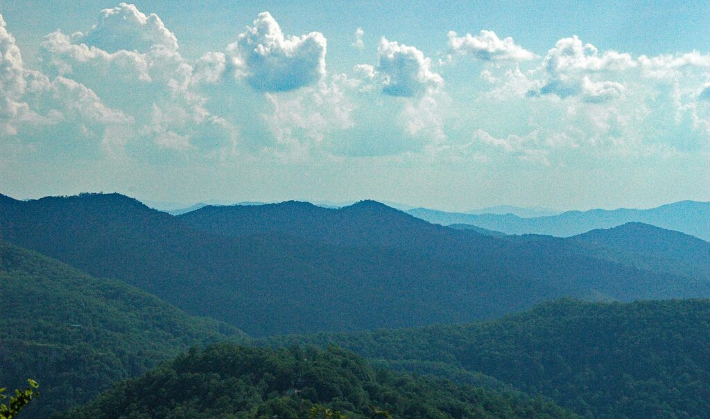
    Peak season

    Late May to August, the big event weekends in September and October, and roughly Thanksgiving through New Year’s Day. Summer brings the highest hotel rates of the year downtown, with Memorial Day weekend, the Fourth of July and Dream Cruise weekend at the top; the holidays bring family travel and the big Thanksgiving Day parade and Lions game. If you must travel in peak, book early, fly mid-week and compare hotels across neighborhoods and the suburbs rather than only downtown.

    Shoulder season

    April to mid-May and mid-September to early November. Late spring gives you long days and green parks before the summer surge; fall gives you the most reliable weather and the color. Watch for home football weekends, both the Lions downtown and the University of Michigan in Ann Arbor, which can lift hotel rates across the region on fall weekends.

    Low season

    January to early March, outside New Year’s week, the auto show and the long weekends. Fares and hotel rates are at their lowest, the museums and restaurants are quiet, and the Red Wings and Pistons are in season. The trade-off is cold, gray weather and the chance of a snowstorm; build a buffer into connections.

    As elsewhere, mid-week departures and early or late flights usually price below Friday and Sunday afternoons on the same route, and a search across a whole month reveals cheaper pairs of dates close to your first choice. Our guide to the best times to book explains how to read those patterns.

    Detroit month by month

    January

    The cheapest month of the year to fly and to stay, after the New Year week, and the coldest. The Detroit Auto Show at Huntington Place, one of the oldest in the country, has returned to a winter slot after a few years in September; check its current dates, because it fills downtown hotels while it runs. Otherwise the city is yours: no lines at the DIA, skating at Campus Martius, and Red Wings and Pistons games at Little Caesars Arena.

    February

    Deep winter, with low fares and gray skies, broken by Presidents’ Day weekend and the occasional thaw. An excellent month for a museum, music and food trip if you pack for the cold, and hotel rates downtown are at their softest.

    March

    Raw and changeable, with snow one day and a mild spell the next. Corktown’s St. Patrick’s Day parade, one of the oldest in the Midwest, fills Michigan Avenue on the Sunday before the holiday, and college spring breaks lift fares in the middle of the month. The first half of March is still one of the cheapest windows of the year.

    April

    Spring arrives unevenly. The Tigers open their season at Comerica Park, in weather that can include snow flurries, and Opening Day is an unofficial city holiday. Fares are moderate, and graduation weekends at the region’s universities begin to fill hotels in Ann Arbor and the suburbs late in the month.

    May

    Green and pleasant, and the start of the busy season. Movement, the electronic music festival in Hart Plaza, takes over Memorial Day weekend and draws fans from around the world to the birthplace of techno, and the Detroit Grand Prix brings IndyCar racing to downtown streets around the end of the month or the start of June. Book around those weekends and May is a lovely time to visit.

    June

    Long days and warm weather. The riverfront and Belle Isle are at their best, the patios fill, and in late June the fireworks over the Detroit River, a joint celebration of Canada Day and the Fourth of July watched from both shores, draw enormous crowds downtown. Fares and hotel rates climb through the month; early June is the value play.

    July

    Peak summer: hot, humid and busy, with the Fourth of July, the free Concert of Colors world music festival in Midtown, Tigers games, and the beaches on Belle Isle and at Metroparks around the region. Many locals head “up north” to the lakes, which keeps city hotel rates below those of coastal cities in the same weeks.

    August

    The Woodward Dream Cruise, on the third Saturday of the month, is billed as the world’s largest one-day automotive event, with classic cars and huge crowds along Woodward Avenue through the northern suburbs, and hotels along the route fill for the weekend. The rest of the month is hot and summery, with slightly softer prices once schools start late in the month.
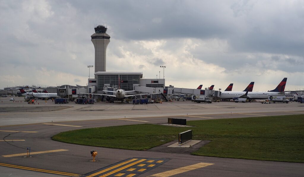
    September

    One of the best months to visit: warm, drier and settled. Labor Day weekend brings the free Detroit Jazz Festival downtown and Arts, Beats and Eats in Royal Oak, and the month continues with design events, since Detroit is a UNESCO City of Design, and the start of football season, with the Lions at Ford Field and Michigan in Ann Arbor. Outside the big weekends, it is excellent value.

    October

    Crisp and clear, with fall color on Belle Isle and in the parks and orchards around the region. The Detroit Free Press Marathon, in mid-October, is one of the few international marathons in the world, crossing the Ambassador Bridge into Canada and returning through the tunnel, and that weekend is busy downtown. The rest of the month is quiet and good value.

    November

    Gray and cooling, with the first snow possible late in the month. The first half is quiet and cheap. America’s Thanksgiving Parade marches down Woodward on Thanksgiving morning, the Lions play their traditional home game that afternoon, and the holiday tree goes up at Campus Martius; Thanksgiving week brings a sharp spike in fares as the whole country travels.

    December

    Two months in one. The first half is festive and moderately priced, with the rink and markets downtown and Noel Night, when Midtown’s museums and shops open their doors for an evening of music and lights in early December. From about the middle of the month, fares rise sharply for Christmas and New Year.

    Skaters on the ice rink at Campus Martius Park in downtown Detroit in winter
    Skating at Campus Martius: Detroit in winter is cold, gray and the cheapest time of year to visit (Photo: Michael Barera via Wikimedia Commons, CC BY-SA 4.0)

    Events that move Detroit flight and hotel prices

    Cross-check these against your dates before you book. Exact dates shift each year; Visit Detroit, the official tourism site, keeps the current calendar.

    • Detroit Auto Show (winter, at Huntington Place; check the current dates).
    • University graduations (late April and early May), which fill hotels in Ann Arbor and the suburbs.

    • Movement (Memorial Day weekend) and the Detroit Grand Prix (around the end of May or the start of June).
    • River fireworks (late June) and the Fourth of July.
    • Woodward Dream Cruise (the third Saturday of August).
    • Detroit Jazz Festival and Arts, Beats and Eats (Labor Day weekend).
    • Football weekends: the Lions at Ford Field and Michigan home games in Ann Arbor, from September.
    • Detroit Free Press Marathon (mid-October).
    • Thanksgiving, with the parade and the Lions game, through New Year’s Day.
    • Home games and concerts: Tigers from April to September, Red Wings and Pistons from October. Our Detroit events page shows what is on sale for your dates.

    Getting in from the airport

    Detroit Metropolitan Wayne County Airport (DTW) is in Romulus, about 32 km (20 miles) southwest of downtown Detroit, and it has two terminals. The McNamara Terminal, Delta’s hub, is a single long concourse with an elevated Express Tram running its length and a colorful light-and-music tunnel linking the concourses; Delta’s long-haul flights to Europe and Asia leave from here. The other terminal, the former North Terminal, handles most other airlines. The drive to downtown along I-94 takes 25 to 40 minutes by taxi or ride-hail, longer at rush hour; there is no rail link, but SMART runs express buses between the airport and downtown along Michigan Avenue, which are far cheaper and considerably slower, and the Michigan Flyer coach connects the airport with Ann Arbor and East Lansing. Rental companies run shuttle buses from both terminals to their lots. Our Detroit car-versus-transit guide works through the ground-transport decision, and our DTW airport guide covers the terminals.

    The McNamara Terminal at Detroit Metropolitan Wayne County Airport
    The McNamara Terminal at DTW, Delta's Midwest hub and gateway to Europe and Asia (Photo: Dllu via Wikimedia Commons, CC BY-SA 4.0)

    Timing tricks that work for Detroit

    • Check the event calendar first. A cheap fare on Memorial Day weekend, Dream Cruise weekend or Labor Day weekend can come with a hotel rate that doubles the trip. Run a Detroit hotel search for the same dates before you commit.
    • Look at the suburbs. When downtown is full, hotels in Dearborn, near the airport or along the northern freeways are often much cheaper, and with a rental car the drive in is short outside rush hour.
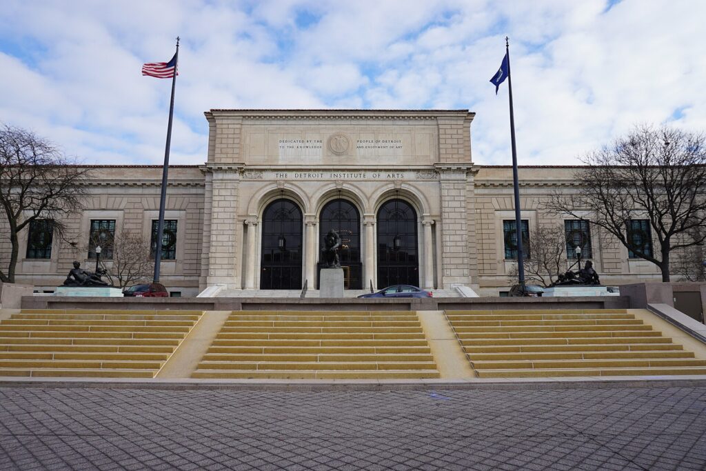
    • Fly mid-week in shoulder season. Business travelers fill Monday morning and Thursday evening flights, and downtown hotels full of conference-goers on weekdays can be cheaper on weekends outside summer.
    • Go in winter for value. January to early March has the lowest prices of the year and the DIA, the Motown Museum and the restaurants at their quietest; just pack for the cold.
    • Coming from southwestern Ontario? Many travelers from Windsor and London drive across the border to fly from DTW because of its much larger route network. If you do, allow generous time for the crossing, carry documents both countries accept, and check U.S. Customs and Border Protection and the Canada Border Services Agency for current rules.
    • Build a weather buffer. Snowstorms in winter and thunderstorms in summer both cause delays at DTW; avoid the tightest connections. Our guide to how early to arrive covers what to allow.
    • Flying out of Detroit instead? DTW’s Delta network makes it one of the best departure airports in the Midwest for Europe and Asia; see cheap flights from Detroit.
    Classic Austin-Healey sports cars at the Woodward Dream Cruise
    The Woodward Dream Cruise in August, one of the busiest hotel weekends of the summer (Photo: Dane via Wikimedia Commons, CC BY 2.0)

    What to pack, by season

    Winter (December to March): a warm, windproof coat, a hat, gloves and a scarf, waterproof boots with grip for slushy sidewalks, and thermal layers for the coldest days. Spring (April to May): layers, a rain jacket and a sweater, because a warm afternoon can turn cold by evening, especially near the river. Summer (June to August): light, breathable clothing, sunscreen, a swimsuit for Belle Isle or a hotel pool, an umbrella for thunderstorms, and a light layer for air-conditioned museums and evenings on the RiverWalk. Fall (September to November): a medium jacket by October and a warm coat by November, plus layers for football games, which get cold after dark. In every season, bring comfortable walking shoes for downtown and Midtown, and your passport if Windsor is on the list.

    The best time to fly to Detroit for…

    Summer on the riverfront

    Mid-June to mid-July for long days, the fireworks and Belle Isle’s beach, or late August for warm weather with slightly softer prices. Book early for the big weekends.

    Good weather without the crowds

    September after Labor Day, or the first two weeks of June.

    The lowest fares

    Mid-January to early March, outside the auto show and the long weekends.

    Baseball and football

    May, June and September for comfortable Tigers games at Comerica Park; September to December for the Lions at Ford Field, with Thanksgiving Day the most famous (and most expensive) game of the year.

    Music lovers

    Memorial Day weekend for Movement and techno, Labor Day weekend for the free Jazz Festival, and any time of year for a Motown Museum tour.

    Families

    June to August, when Belle Isle, the Detroit Zoo, the RiverWalk and Greenfield Village at The Henry Ford are all in full swing; early December for the holiday lights and skating downtown.

    International visitors

    Travelers from Visa Waiver Program countries need an approved ESTA before they board; most others need a visa. The State Department’s travel site explains what applies to you, and the TSA lists what you can carry through security. If you plan a side trip to Windsor, check that your entry status allows you to leave and re-enter the United States by land before you go.

    Frequently asked questions

    What is the cheapest month to fly to Detroit?

    January, after the New Year week, followed by February and early March, outside the auto show and the long weekends.

    What is the best month to visit Detroit for weather?

    September, with late May, June and early October close behind. July and August are hot and humid; January and February are cold and gray.

    Is DTW a good airport to fly into?

    Yes. It is a large, modern Delta hub with a wide route network and two efficient terminals, and it has often ranked well in passenger satisfaction surveys. Its main drawback is the distance from downtown and the lack of a rail link.

    When are hotels most expensive in Detroit?
    On big event weekends: Memorial Day, the Grand Prix, the Fourth of July, the Dream Cruise, Labor Day, marathon weekend and Thanksgiving, plus the auto show in winter.

    How cold does Detroit get in winter?

    Daytime highs around freezing are typical in January, but Arctic outbreaks can push overnight lows below -18 °C (0 °F) for a few days most winters, with wind chills colder still.

    How far ahead should I book?

    Earlier for summer event weekends, football weekends, Thanksgiving and the holidays, when fares and hotel rates tend only to rise; from January to early March, fares are stable enough that finding the right dates matters more than booking early.

    Can I combine Detroit with Chicago or Toronto?

    Easily. Chicago is about four and a half hours west by car or a little longer on Amtrak, and Toronto about four hours east plus the border crossing. See our guides to things to do in Chicago and things to do in Toronto.

    Ready to pick your dates? Compare fares across the whole month on our Detroit flights page, then find a room with our Detroit hotel search. For what to do when you land, start with our first-timer’s guide to Detroit, and if you are weighing a car, read rent a car or use transit in Detroit.

  • Things to Do in Detroit: A First-Timer’s Guide

    Things to Do in Detroit: A First-Timer’s Guide

    Detroit rewards the visitor who arrives with an open mind. For decades the Motor City was shorthand for industrial decline, and the people who have not been still picture empty streets and abandoned factories. What they find instead is a downtown that has filled back up with restaurants, hotels and people, a riverfront that has been turned from parking lots and silos into one of the best urban walks in the country, an art museum with a collection that rivals any in America, the studio where Motown was born, the city that invented techno, and neighborhoods whose food, from Coney Islands and square pizza to Yemeni coffee and Mexican bakeries, reflects more than a century of migration. It is also a city built by and for the automobile, and the story of the car, from the Model T to the modern pickup, is told here better than anywhere on earth. This guide covers the sights that earn a day, the neighborhoods worth a half-day, the music, the sports, the food, the day trips across the river and into the suburbs, and the practical details that make a first visit easy.
    If you are still comparing cheap flights to Detroit, read this alongside our guides to the best time to fly to Detroit and whether to rent a car or rely on transit (in the Motor City, the answer is more nuanced than you might expect). Between the three you can plan the whole trip.

    The Detroit skyline across the Detroit River from Windsor, Ontario
    Downtown Detroit across the river from Windsor, where the best skyline view is in Canada (Photo: Andrew Heneen via Wikimedia Commons, CC BY 4.0)

    Detroit at a glance for first-timers

    • Airport: Detroit Metropolitan Wayne County Airport (DTW), in Romulus, about 32 km (20 miles) southwest of downtown, is one of Delta’s largest hubs, with nonstops across North America and long-haul flights to Europe and Asia. The drive downtown on I-94 takes 25 to 40 minutes. See our DTW airport guide.
    • Getting around: downtown, Midtown and the riverfront are walkable, the elevated People Mover loops around downtown and the QLine streetcar runs up Woodward Avenue to Midtown and New Center. Beyond that core, Detroit is a car city, and our car-versus-transit guide explains when a rental earns its keep.
    • Money: US dollars. Michigan’s sales tax is 6 percent, added at the register, with extra taxes on hotel rooms. Tipping 18 to 20 percent in restaurants is expected. Canadian dollars are sometimes accepted near the border, at a poor rate; use a card.
    • Weather: four distinct seasons: cold, gray and snowy winters, a short spring, warm and humid summers, and a crisp, colorful fall. Our month-by-month guide has the detail.
    • Where to stay: downtown around Campus Martius for walking access to the riverfront, the stadiums and the theaters; Midtown for the museums; Corktown for the restaurants; Dearborn or the northern suburbs if you have a car. Our Detroit hotel search covers them all.

    Downtown: Campus Martius, Woodward and the Art Deco towers

    Downtown Detroit is laid out like a wheel, a plan drawn up by Judge Augustus Woodward after a fire destroyed the town in 1805, with the great avenues radiating from a set of central squares. The hub is Campus Martius Park, the city’s living room, where office workers eat lunch among the fountains, a sandy urban beach appears in summer, and an ice rink and a towering Christmas tree take over from November. Woodward Avenue runs north from here toward Grand Circus Park and the theater district, and south to the river. Detroit’s 1920s boom left one of the finest collections of Art Deco skyscrapers in America, and several have lobbies you can walk into. The Guardian Building, completed in 1929 and nicknamed the Cathedral of Finance, has a vaulted banking hall covered in Pewabic and Rookwood tile in shades of orange and gold; step inside even if you see nothing else. At the foot of Woodward, the Spirit of Detroit, a large bronze figure holding a gilded sphere, sits outside the municipal center, and across Jefferson Avenue Hart Plaza hosts the big summer festivals. The glass towers of the Renaissance Center, long synonymous with General Motors, dominate the riverfront to the east; the ground-floor atrium leads straight out onto the RiverWalk.

    Campus Martius Park in downtown Detroit surrounded by office towers
    Campus Martius, the hub of Judge Woodward's plan and downtown's living room (Photo: Michael Barera via Wikimedia Commons, CC BY-SA 4.0)

    The riverfront: the RiverWalk, the Dequindre Cut and Belle Isle

    Twenty years ago most of the Detroit riverfront was cement silos, parking lots and fences. Today the Detroit RiverWalk runs for more than three miles along the water from near the Renaissance Center east toward the Belle Isle bridge, with gardens, fountains, a carousel and benches facing Windsor, Ontario, which sits directly across the river to the south; this is one of the few places where Canada lies south of the United States. Rent a MoGo bike-share bike and ride east along the river, then turn north up the Dequindre Cut, a former railroad line sunk below street level and turned into a greenway lined with murals and graffiti, which brings you out at Eastern Market. At the eastern end of the RiverWalk, the MacArthur Bridge crosses to Belle Isle, an island park of 982 acres in the middle of the Detroit River, larger than Central Park in New York. It has been run as a Michigan state park since 2014, and it holds a surprising number of treasures: the Belle Isle Aquarium, opened in 1904 in a building by Albert Kahn with a green-tiled vaulted ceiling; the Anna Scripps Whitcomb Conservatory, a glass-domed botanical house; the James Scott Memorial Fountain, a marble extravaganza that runs in the warmer months; the Dossin Great Lakes Museum, which tells the story of the freighters that still pass the island; and a beach and a giant slide for summer afternoons. Walking and cycling onto the island are free; vehicles need a Michigan Recreation Passport, which non-residents buy as a day or annual pass at the entrance.

    Belle Isle Park and the Detroit River in Detroit
    Belle Isle, an island park in the Detroit River larger than Central Park (Photo: Michael Barera via Wikimedia Commons, CC BY-SA 4.0)

    Neighborhoods worth a half-day

    Midtown and the Cultural Center

    North of downtown along Woodward, Midtown is home to Wayne State University, the city’s great museums, and a dense strip of cafes, bars and shops.

    Corktown and Michigan Central

    Detroit’s oldest surviving neighborhood, settled by Irish immigrants in the nineteenth century, is now one of its liveliest dining districts, with barbecue, cocktail bars and bakeries along Michigan Avenue. It is dominated by Michigan Central Station, the huge Beaux-Arts railroad terminal that stood empty for decades as the symbol of the city’s decline. Ford bought it, restored it and reopened it in 2024 as the anchor of a technology campus, and the grand hall is open to visitors; check the station’s current hours and tour options before you go.

    Eastern Market

    The largest historic public market district in the country, with sheds dating to the 1890s, Eastern Market is at its best on a Saturday morning, when farmers, butchers, flower sellers and food trucks fill the sheds and the surrounding streets, and tens of thousands of Detroiters come to shop.

    New Center

    At the north end of the QLine, New Center was built in the 1920s as a second downtown. Its centerpiece is Albert Kahn’s Fisher Building, completed in 1928, whose three-story arcade of marble, bronze and painted ceilings is often called the city’s largest art object. The Motown Museum is a short walk west along West Grand Boulevard.

    Southwest Detroit

    Southwest Detroit, around Bagley Street and Vernor Highway in the area known as Mexicantown, is the heart of the city’s Mexican and Latino community, with taquerias, panaderias and grocery stores, and the best view of the Ambassador Bridge soaring overhead.

    Hamtramck and the east side

    Hamtramck, a separate small city surrounded by Detroit, was built by Polish immigrants who worked in the auto plants and is now home to large Yemeni and Bangladeshi communities as well; its main streets are a lesson in how Detroit has always absorbed newcomers. To the east, the mansions of Indian Village show the wealth of the auto age, and the Heidelberg Project, the artist Tyree Guyton’s long-running outdoor installation of painted houses and found objects, has been partly dismantled and is being transformed; check what is open before making the trip.

    Museums, culture and family attractions

    The Detroit Institute of Arts, in Midtown’s Cultural Center, is one of the great art museums of the United States and the essential visit of any trip. Its heart is Rivera Court, where Diego Rivera’s Detroit Industry murals, painted in 1932 and 1933, cover all four walls with the workers, furnaces and assembly lines of the Ford Rouge plant; they are among the finest works of art in the country, and many visitors come to Detroit for them alone. The rest of the collection runs from ancient Egypt to a Van Gogh self-portrait, the first Van Gogh bought by an American museum, and it is strong in African American art. General admission is free for residents of Wayne, Oakland and Macomb counties, whose taxes support the museum; visitors from elsewhere pay a modest fee. Across the street and nearby, the Charles H. Wright Museum of African American History, one of the largest such museums in the world, walks visitors through the journey from Africa through slavery, the Underground Railroad, which ended for many at the Detroit River, and the Great Migration to the civil rights era. In Dearborn, 20 minutes west, The Henry Ford is a destination in itself: the Henry Ford Museum of American Innovation holds the bus on which Rosa Parks refused to give up her seat, the limousine in which President Kennedy was shot and a hall of historic cars and locomotives; Greenfield Village, next door, is an open-air museum of historic buildings including the Wright brothers’ bicycle shop and Thomas Edison’s Menlo Park laboratory; and the Ford Rouge Factory Tour takes you above the working assembly line where pickups are built. Allow a full day for the complex. For what is on stage at the Fox Theatre, Orchestra Hall and the Detroit Opera House during your dates, our Detroit events page lists concerts, shows and games.

    The Woodward Avenue entrance of the Detroit Institute of Arts
    The Detroit Institute of Arts, home of Diego Rivera's Detroit Industry murals (Photo: Michael Barera via Wikimedia Commons, CC BY-SA 4.0)

    Motown, techno and jazz

    Detroit’s gift to the world is its music, and no visit is complete without a pilgrimage to the Motown Museum on West Grand Boulevard. This modest house, which Berry Gordy named Hitsville U.S.A., is where the Supremes, Marvin Gaye, Stevie Wonder, the Temptations, Smokey Robinson and the Jackson 5 made the records that defined the 1960s, and the guided tour ends in Studio A, the small basement room where the hits were cut; tours sell out, so book ahead. Motown moved to Los Angeles in 1972, but the music never left. Detroit is the birthplace of techno, created in the 1980s by a group of young producers from the suburb of Belleville, and the Movement electronic music festival draws fans from around the world to Hart Plaza on Memorial Day weekend. Jazz has deep roots too: Baker’s Keyboard Lounge, on Livernois Avenue, claims to be the oldest continuously operating jazz club in the world, and the Detroit Jazz Festival on Labor Day weekend is one of the largest free jazz festivals anywhere. The grand old theaters are part of the experience: the Fox Theatre, a 1928 movie palace with about 5,000 seats and one of the most lavish interiors in America, hosts touring shows and concerts, and the Masonic Temple, the largest in the world, has a theater of its own.

    Sports

    Detroit has teams in all four major leagues, and three of the venues are within walking distance of each other downtown. Comerica Park, home of the Tigers, has views of the skyline, a Ferris wheel and a carousel inside the ballpark, and a statue garden of Tiger greats beyond the outfield; Opening Day in early April is an unofficial city holiday. Next door, Ford Field, home of the Lions, was built around an old department store warehouse, and the Lions’ home game on Thanksgiving Day, a tradition that goes back to the 1930s, is one of the fixtures of the American football calendar. Little Caesars Arena, a few blocks north in the District Detroit, is home to the Red Wings, one of the most successful franchises in hockey, which is why Detroit calls itself Hockeytown, and to the Pistons of the NBA. In late May or early June, the Detroit Grand Prix brings IndyCar racing to a street circuit downtown. And a short drive west in Ann Arbor, University of Michigan football fills Michigan Stadium, the Big House, the largest stadium in the United States, on fall Saturdays. Check what is on sale in Detroit for your dates before you book flights.

    What to eat, and where

    Start with the Coney Island, Detroit’s signature hot dog: a natural-casing frank in a steamed bun, covered in a beanless meat chili, mustard and chopped onions. American Coney Island and Lafayette Coney Island stand side by side on Lafayette Boulevard downtown, each with loyalists who will not set foot in the other, and “coney islands”, the diners that serve them, are on street corners across the region. Then there is Detroit-style pizza, baked in rectangular steel pans originally borrowed from the auto plants, with cheese spread to the edges so it caramelizes into a crisp, lacy crust and sauce ladled on top; Buddy’s, which claims to have created it in 1946, is the place to start. Beyond the classics, Detroit’s best food is in its communities: shawarma, grilled meats and Lebanese pastries in Dearborn, home to one of the largest Arab American communities in the country; tacos and tortas in Southwest Detroit; Yemeni coffee houses, Bangladeshi curry and Polish bakeries in Hamtramck, where lines form before dawn for paczki, the Polish doughnuts, on Fat Tuesday; flaming cheese in Greektown; and a new generation of chef-driven restaurants in Corktown, Midtown and downtown. Saturday breakfast at Eastern Market is a Detroit ritual.

    Detroit through the seasons

    Winter (December to March) is cold and gray, with regular snow and occasional deep freezes, but downtown makes the most of it: the rink at Campus Martius, the holiday markets, the Red Wings and Pistons in season, and the auto show at Huntington Place in January. Hotels are at their cheapest. Spring (April to May) is short and changeable; the Tigers open the season in April, the trees on Belle Isle come into leaf, and Movement closes out May with a weekend of techno. Summer (June to August) is the best time to see the city at its liveliest: the RiverWalk, Belle Isle’s beach, the beach at Campus Martius, the Grand Prix, fireworks over the river in late June, patios across downtown and Corktown, and the Woodward Dream Cruise, when tens of thousands of classic cars parade up Woodward Avenue through the northern suburbs on the third Saturday of August. It can be hot and humid, with thunderstorms. Fall (September to November) opens with the Jazz Festival and brings crisp, clear days, color on Belle Isle and in the parks, Lions and Michigan football, the Detroit Free Press Marathon, which crosses into Canada and back, and America’s Thanksgiving Parade on Woodward. Our month-by-month guide has the fare patterns that go with each season.

    Detroit with kids

    Detroit is a better family destination than its reputation suggests. The Henry Ford in Dearborn is the standout, with trains, planes and hands-on invention exhibits in the museum and steam train, carousel and Model T rides at Greenfield Village; allow a full day. The Michigan Science Center in Midtown has a planetarium and plenty of buttons to push, and the Detroit Zoo, just north of the city in Royal Oak, is one of the largest zoos in the Midwest, with a polar bear tunnel and a penguin center where the birds swim overhead. On Belle Isle, the aquarium, the nature center and the giant slide keep children happy for hours, and the RiverWalk’s carousel, splash fountains and wide paths are easy with a stroller. In winter, skating at Campus Martius is a treat, and a Tigers game in summer, with the Ferris wheel and carousel inside the ballpark, is a rite of passage. For families planning to drive, our family car rental guide covers the vehicle question.

    Detroit on a budget

    A great deal of Detroit’s best is free or nearly so: the RiverWalk and the Dequindre Cut, Campus Martius and the downtown lobbies of the Guardian and Fisher Buildings, Belle Isle on foot or by bike, the murals of Eastern Market, the Heidelberg Project, and the big festivals, including the Jazz Festival, the fireworks and the Dream Cruise, which cost nothing to attend. The DIA is free for tri-county residents and inexpensive for everyone else. Food is a bargain by big-city standards: a pair of coneys, a square of pizza, a Dearborn shawarma or a plate of tacos in Southwest Detroit will not dent your budget. Hotels are generally cheaper than in Chicago or Toronto, especially from January to March, though they spike on big event weekends. Compare them by neighborhood on our Detroit hotel search.

    Day trips from Detroit

    Windsor, Ontario, is the day trip everyone asks about, because it is right there: across the river, reached by the Detroit-Windsor Tunnel from downtown or the Ambassador Bridge from Southwest Detroit. Its riverfront parks and sculpture garden have the best view of the Detroit skyline, and there is a casino, Canadian food and a walkable downtown. It is an international border, so the principles are simple. Everyone needs identity and citizenship documents that both countries accept: for US citizens, that means a passport, passport card, NEXUS card or enhanced driver’s license, which Michigan issues; for everyone else, a passport plus whatever visa or status you need to enter Canada and to re-enter the United States, which you should check before you go rather than at the booth. Declare what you carry, leave cannabis behind (it cannot cross the border in either direction, even though it is legal on both sides), and allow extra time for queues. The official sources are the Canada Border Services Agency for entering Canada and U.S. Customs and Border Protection for coming back. Dearborn is 20 minutes west, with The Henry Ford, the Arab American National Museum and the food. Ann Arbor, about 45 minutes west, is a lively college town with the University of Michigan campus, bookshops and an excellent farmers’ market. Frankenmuth, about 90 minutes north, is a Bavarian-themed town famous for fried chicken dinners and a vast year-round Christmas store. Across the river, Point Pelee National Park, about an hour beyond Windsor, is the southernmost tip of mainland Canada and a famous stop for migrating birds and butterflies. For longer drives, see our route guides for driving from Detroit to Toronto, about four hours on Ontario’s Highway 401, and Chicago to Detroit, then read our guides to things to do in Toronto and things to do in Chicago. Price a car on our Detroit car rental page. Visit Detroit, the official tourism site, covers the region.

    Two sample itineraries

    Three days, mostly car-free

    Day one: Campus Martius, the Guardian Building and the downtown lobbies in the morning, lunch at the coney islands on Lafayette, then the RiverWalk and the Dequindre Cut by bike, with dinner in Corktown and a look at Michigan Central. Day two: the QLine to Midtown for the DIA and the Rivera murals, lunch on Cass Avenue, the Wright Museum in the afternoon, and a show at the Fox or a Tigers game at night. Day three: Eastern Market in the morning (on a Saturday if you can), the Motown Museum in the afternoon, and Detroit-style pizza for dinner.

    Five days, with a car

    Add a full day at The Henry Ford and the Rouge Factory Tour with dinner in Dearborn, an afternoon on Belle Isle, and a day in Windsor with your passport, or a drive to Ann Arbor, Cranbrook or Frankenmuth.

    Practical details

    • Transit: the People Mover loops around downtown, the QLine runs up Woodward to New Center, and DDOT and SMART buses cover the city and suburbs. Our transit-versus-car guide goes into detail.
    • From DTW: a taxi or ride-hail in 25 to 40 minutes, a SMART express bus, or a rental from the lots near the terminals. The airport’s site has current ground-transport options.
    • Weather: a serious coat, hat and gloves from December to March, layers in spring and fall, and light clothes and sunscreen in summer. NOAA’s National Weather Service office for Detroit has the forecast.
    • Time zone: Eastern, the same as New York and Toronto and one hour ahead of Chicago.
    • Entry requirements: international visitors from Visa Waiver Program countries need an approved ESTA before flying to the US; most others need a visa. The State Department’s travel site is the authoritative source, and a side trip to Windsor means checking Canada’s rules as well.
    • Safety: downtown, Midtown, Corktown, the riverfront and the main visitor areas are busy and generally safe; use ordinary big-city awareness at night, stick to lit, busy streets, and take a ride-hail rather than walking long distances between neighborhoods after dark.

    Frequently asked questions

    How many days do you need in Detroit?

    Three days covers downtown, the riverfront, the DIA, Motown and Eastern Market; add a day for The Henry Ford in Dearborn and another for Belle Isle, Windsor or Ann Arbor.

    What is the number one thing to do in Detroit?

    The Detroit Institute of Arts and the Rivera murals, followed closely by the Motown Museum. In summer, add a bike ride along the RiverWalk.

    Is Detroit safe for tourists?

    The areas visitors spend their time in, downtown, Midtown, Corktown and the riverfront, are busy and generally safe, especially by day. As in any big city, stay aware at night and use a ride-hail between neighborhoods.

    Do I need a car in Detroit?

    Not for a downtown and Midtown visit, where walking, the QLine and the People Mover cover the sights. For Dearborn, the suburbs and day trips, a car makes life much easier.

    Can I visit Windsor, Canada, from Detroit?

    Yes, easily, through the tunnel or over the bridge, but it is an international border: carry documents both countries accept, such as a passport, and check the official border agency sites before you go.

    What food is Detroit known for?

    The Coney Island hot dog and Detroit-style square pizza, plus Middle Eastern food in Dearborn, paczki in Hamtramck, Vernors, Faygo and Better Made chips.

    Ready to go? Compare flights to Detroit, find a place to stay with our Detroit hotel search, and if Dearborn, Windsor or a road trip is on the list, price a rental car for those days.

  • San Diego: Should You Rent a Car or Rely on Public Transit?

    San Diego: Should You Rent a Car or Rely on Public Transit?

    San Diego sits in the middle of the American spectrum on this question. It is neither a transit city nor as car-dependent as Phoenix or Los Angeles. The downtown core is compact and walkable, the Trolley links it to Old Town, Mission Valley, the university area and the Mexican border, a ferry crosses the bay to Coronado, and the airport is only a few kilometers from the Gaslamp Quarter. But the things that make San Diego special are spread along a long coastline: La Jolla, Point Loma, the beach towns and North County are either off the rail network or a slow bus ride away, and most day trips are car trips. This guide explains how the city is laid out, how the MTS Trolley, buses and coastal trains work, what driving and parking are really like, when a car earns its keep, and gives you a straightforward way to decide.

    The short answer

    Rent a car if La Jolla, Torrey Pines, Point Loma and the beach towns are the heart of your trip, if you are staying in a beach neighborhood or in North County, if you plan day trips to the Safari Park, LEGOLAND, Temecula, Julian or the desert, if you have young children, or if this is part of a road trip. Skip the car if you are staying downtown in the Gaslamp Quarter or Little Italy for a convention, a Padres game or a short city break, and your plans are the waterfront, the USS Midway, Balboa Park, Old Town, Coronado by ferry and a day in Tijuana; the Trolley, the ferry, buses and the occasional ride-hail will cover that, and you will avoid steep downtown hotel parking fees. Many visitors do best with a hybrid: car-free city days and a car for the coast and the day trips. Compare rental rates for any of these plans on our San Diego car rental page.

    How San Diego is laid out

    Downtown San Diego sits on the east shore of San Diego Bay, with the Gaslamp Quarter, East Village and Petco Park to the south, Little Italy and the airport to the north, and Balboa Park rising on the mesa just to the northeast. West of the airport, the Point Loma peninsula shelters the bay, with Cabrillo National Monument at its tip and Ocean Beach at its northern end. North of that, Mission Bay’s lagoons are fronted by Mission Beach and Pacific Beach, and La Jolla sits on the headland beyond, about 20 kilometers (12 miles) from downtown. Inland, Old Town and Mission Valley follow the San Diego River east toward San Diego State University, and North County’s beach towns and inland suburbs stretch 50 kilometers (30 miles) up the coast. The freeways tie it together: I-5 runs north-south along the coast from the Mexican border through downtown to Los Angeles; I-805 is its inland twin; I-8 runs east from Ocean Beach through Mission Valley toward Arizona; I-15 heads inland to Escondido, Temecula and Las Vegas; and SR 163 runs through Balboa Park’s canyon between downtown and the northern suburbs.

    Hotels cluster downtown around the Gaslamp and the convention center, in Little Italy, near the airport and on Harbor and Shelter Islands, in Mission Valley along I-8, in the beach neighborhoods, in Coronado and in La Jolla. Our San Diego hotel search lets you compare them.

    Getting in from the airport

    San Diego International (SAN) sits on the bay about 5 kilometers (3 miles) northwest of downtown, and getting into the city is quick. A taxi or ride-hail from the marked zones outside the terminals takes about ten minutes to the Gaslamp outside rush hour and about twenty to La Jolla or Pacific Beach. On public transit, an MTS bus runs between the terminals and downtown, and the airport-run shuttle connects the terminals with the Old Town Transit Center, where you can change to the Trolley, the Coaster commuter train and Amtrak. For a rental, shared shuttle buses run from the terminals to the consolidated Rental Car Center on the north side of the airport, where the major companies have their counters. The airport has been redeveloping Terminal 1 and its roads for several years, so pickup zones and routes may have moved since your last visit; check the airport’s site for current ground-transport details. Our SAN airport guide covers the layout.

    San Diego transit, explained

    The San Diego Metropolitan Transit System (MTS) runs the Trolley and most buses across the southern half of the county, and the North County Transit District runs the Coaster commuter train and North County’s buses. Its limitation is the coast, where rail barely reaches and the buses are slow for sightseeing.

    The Trolley

    The San Diego Trolley, opened in 1981, is the backbone. The UC San Diego Blue Line runs from the Mexican border at San Ysidro through downtown and Old Town, then north along the Mid-Coast extension to UC San Diego and the University Towne Center area near La Jolla. The Green Line runs from downtown past Old Town, through Mission Valley’s hotels and malls, to Snapdragon Stadium, San Diego State and Santee. The Orange Line runs east from downtown to El Cajon, and the Copper Line links El Cajon and Santee; a vintage Silver Line loops downtown on limited days. Trains run from early morning until around midnight, typically every 15 minutes on the main lines through the day and less often late at night. Downtown stops serve Little Italy, the Santa Fe Depot, the convention center, the Gaslamp and Petco Park.

    Buses

    MTS buses cover most of the city, and several are useful to visitors: routes along Park Boulevard and El Cajon Boulevard pass Balboa Park and the zoo, buses from the Old Town Transit Center fan out to Ocean Beach, Mission Beach, Pacific Beach and La Jolla, and routes cross the Coronado Bridge to Coronado. Frequencies drop in the evenings and on weekends on many routes, so check the timetable before relying on a bus for a late return.

    The Coaster and the Pacific Surfliner

    NCTD’s Coaster runs up the coast from the Santa Fe Depot downtown through Old Town, Sorrento Valley, Solana Beach, Encinitas and Carlsbad to Oceanside, with a busier schedule on weekdays than at weekends. It is a scenic and relaxed way to reach the North County beach towns. Amtrak’s Pacific Surfliner follows much of the same line and continues to Los Angeles Union Station in about three hours, then on to Santa Barbara. Coastal landslides near San Clemente have periodically suspended or reduced service in recent years, so check the current status before building a trip around the train.

    Fares and tickets

    One fare system covers the Trolley and MTS buses. Pay with a PRONTO card or the PRONTO app, which cap what you pay at the price of a day pass once you have taken enough rides in a day, or buy tickets from the machines on the Trolley platforms. Tap before boarding, because fare inspectors check on board. The Coaster and the Surfliner have their own fares, and reduced fares are available for seniors, riders with disabilities and younger riders. Check the MTS site for current fares before you go.

    Accessibility

    The Trolley has low-floor cars and step-free stations throughout, and all MTS buses are accessible, with ramps and space for wheelchairs.

    Beyond MTS

    • The Coronado ferry. Ferries cross the bay from the Broadway Pier area downtown to the Coronado Ferry Landing in about fifteen minutes, with bicycles welcome on board; the landing is a short walk from Orange Avenue.
    • Ride-hail and taxis. Uber and Lyft operate across the county, and for trips to La Jolla, Point Loma, the beach towns and the brewery districts, they are much faster than the bus. Surge pricing after big events can be steep.
    • Walking and cycling. Downtown, the Embarcadero, Coronado and the beach boardwalks are excellent on foot or by bike. Shared e-bikes and e-scooters operate in many neighborhoods, subject to city rules, including slow zones on the boardwalks.
    • Tours and hop-on buses. Trolley-style sightseeing tours loop the main sights,, and day tours run to the Safari Park.
    • Crossing to Tijuana. The Blue Line runs to San Ysidro, where most visitors walk across the border. Carry a valid passport; Mexico’s Instituto Nacional de Migración sets the entry rules, and the return requires U.S. entry documents that U.S. Customs and Border Protection accepts for your nationality.
    The Coronado Ferry Landing on San Diego Bay
    The Coronado Ferry Landing, a short crossing from downtown and a short walk from Orange Avenue (Photo: Bernard Gagnon via Wikimedia Commons, CC BY-SA 3.0)

    Driving in San Diego: what it is really like

    By the standards of Southern California, San Diego is a reasonable place to drive: the freeways are well signed, the streets are easy to navigate once you know the main corridors, and traffic is lighter than in Los Angeles. The frustrations are specific. Weekday rush hours, roughly 6 to 9 a.m. and 3 to 7 p.m., slow I-5 and I-805 through the central city and at the Merge, where the two meet near Del Mar, along with I-15 and I-8 through Mission Valley. Sunday afternoons bring heavy northbound traffic on I-5 as weekend visitors head back to Orange County and Los Angeles. Events clog downtown, from Padres games and conventions to the Comic-Con crowds, and summer weekends fill the roads to the beaches.

    The curving San Diego-Coronado Bridge over San Diego Bay
    The San Diego-Coronado Bridge, the drive to Coronado's beaches and the Hotel del Coronado (Photo: Mds08011 via Wikimedia Commons, CC BY 4.0)

    Parking

    Parking is the real cost of a car in San Diego. Downtown has metered street parking with posted hours and many garages, which charge premium event rates on game and concert nights, and most downtown hotels charge a hefty nightly fee for parking or valet. Balboa Park’s lots, free for decades, have moved to paid parking in recent years, so check the park’s current rules before you go. In La Jolla, time-limited street parking near the Cove and the village fills quickly, especially on weekends, and paid garages fill the gap. The beach lots in Mission Beach, Pacific Beach and Ocean Beach fill by late morning on summer weekends, and street parking in those neighborhoods is tight. Never leave valuables visible in a parked car at a beach or trailhead.

    Rules and conditions worth knowing

    • The border. Southbound I-5 and I-805 end at the San Ysidro crossing, and the last U.S. exits come quickly; watch the signs, because missing them puts you in the lanes for Mexico, where most rental agreements do not allow the car to go.
    • Mexico with a rental. Most U.S. rental companies forbid or restrict driving into Mexico, and those that allow it require Mexican auto insurance; for a Tijuana day trip, walking across is far simpler.
    • Express lanes and tolls. The I-15 Express Lanes and the I-5 lanes in North County are free for qualifying carpools and tolled for solo drivers with a FasTrak account, and SR 125 in the South Bay is a toll road; rental companies bill tolls through their own programs, often with a daily fee, so ask at the counter.
    • Phones. California law bans holding a phone while driving; use a mount and hands-free mode.
    • Right turns on red are permitted after a full stop unless signed otherwise.
    • Checkpoints. Border Patrol checkpoints operate on the main highways north and east of the city, including I-5 near San Onofre; carry ID.
    • Road conditions. 511 San Diego and the California Department of Transportation publish closures, crashes and conditions, including winter snow on the mountain roads to Julian and on I-8 east of the city.

    When renting a car makes sense

    • The coast. La Jolla, Torrey Pines, Point Loma, Cabrillo National Monument, Sunset Cliffs and the beach towns are strung along the shore, with slow bus links between them; a car lets you see several in a day.
    • North County and inland day trips. The Safari Park, LEGOLAND and the Flower Fields in Carlsbad, the Temecula wine country, Julian and Anza-Borrego are all a 40-minute to two-hour drive away.
    • Beach stays. If you are staying in Mission Beach, Pacific Beach, La Jolla or North County, a car makes getting downtown and to the attractions much easier.
    • Families. Car seats, beach gear and early starts at the zoo all argue for a car, and our family car rental guide looks at vehicle choice.
    • Road trips. Los Angeles is two to three hours north and Phoenix about five and a half hours east; our Los Angeles to San Diego route guide and Phoenix to San Diego route guide cover the drives.

    If any of those apply, our rental car booking tips cover insurance, deposits and the questions to ask at the counter.

    When it does not

    • You are staying downtown and your plans are the waterfront, Balboa Park, Old Town and Coronado by ferry.
    • You are in town for a convention, Comic-Con or a Padres game, when downtown parking is at its most expensive and the Trolley stops beside the venues.
    • Your main day trip is Tijuana, which is easiest on the Trolley and on foot.
    • You are staying at a single resort in Coronado or on Mission Bay and plan to spend most of the time on the sand, with ride-hail for the occasional dinner.

    The hybrid plan for a city-plus-coast trip

    Go car-free for the downtown days and rent for the coast and the day trips, and think about where you pick up. Every major company operates from the airport’s Rental Car Center, which is convenient but adds airport fees and surcharges; neighborhood offices downtown and elsewhere in the city can avoid some of those charges and make sense if you are spending the first nights in the Gaslamp or Little Italy. A pattern that works well: take a taxi or ride-hail from the airport, spend two or three car-free days on the waterfront, in Balboa Park, in Old Town and on the Coronado ferry, then pick up a car for La Jolla, Point Loma and the beaches, and a day in Carlsbad, Temecula or at the Safari Park, and return it to the airport on the way to your flight home. Compare the day rates on our San Diego car rental page against a full-trip rental and the difference is usually obvious.

    A worked cost comparison

    Numbers change with the season and the booking window, so treat this as a method rather than a quote, and check current rates before deciding. For a three-night city break downtown for two people, the car-free version costs a couple of ride-hail trips from and to the airport, Trolley and bus fares capped at a day pass each per day, the ferry to Coronado, and perhaps two ride-hail trips to La Jolla and Ocean Beach; the rental version adds three days of a compact car, airport fees and surcharges, three nights of downtown hotel parking and fuel. Transit wins clearly, largely because of parking. For a five-night stay with two coast days and a trip to the Safari Park, the hybrid version adds a two-day rental from a city location and fuel, against ride-hail trips of 30 to 60 minutes each way for the car-free version; the rental usually wins for two or more people. For a week at a beach hotel with a family, a rental for the whole stay is the practical answer, especially if the hotel’s parking is free or reasonable. Run the rental rates for your dates on our San Diego car rental page and put them beside the parking and ride-hail costs before you choose.

    Driving out of San Diego in each season

    The highways out of San Diego are good, but each has its own character. I-5 north to Los Angeles follows the coast through North County and past Camp Pendleton, about 200 kilometers (120 miles) downtown to downtown; allow two hours with light traffic and three or more at rush hour, on Friday afternoons northbound and on Sunday afternoons,. I-15 north reaches Temecula in about an hour and Las Vegas in about five, crossing the Mojave, where summer heat makes a breakdown dangerous. I-8 east to Phoenix climbs through the mountains east of the city, where winter storms can bring snow and ice to the high passes, then drops into the low desert past El Centro and Yuma, some of the hottest country in North America in summer; about five and a half hours in all, with fuel stops far apart. The mountain roads to Julian occasionally require chains after winter snow. In fall, Santa Ana wind events bring wildfire risk and occasional road closures. In summer, start desert drives early with a full tank and plenty of water. Before any long drive, check the Caltrans and 511 San Diego conditions.

    Decision table

    Your tripRecommendationWhy
    City break downtownNo carThe waterfront, Balboa Park, Old Town and Coronado by ferry are all reachable without one
    Convention, Comic-Con or a Padres gameNo carThe Trolley stops beside the venues; event and hotel parking is expensive
    Tijuana day tripNo carTrolley to San Ysidro and walk across; rentals rarely allowed into Mexico
    Coronado or Mission Bay resort, mostly on the sandNo car, ride-hail for outingsAvoids parking fees for a car you rarely use
    La Jolla, Point Loma and the beach townsRent for those daysThe coast is poorly served by rail
    City plus North County day tripsHybrid: rent from a city location for the trip daysCar-free downtown, car for the Safari Park, Carlsbad or Temecula
    Family beach holidayRent for the whole stayCar seats, beach gear and spread-out attractions
    Southern California or Southwest road tripRent (consider one-way to Los Angeles or Phoenix)San Diego is one stop on the route

    Money-saving tips for both options

    • On transit: use PRONTO so your fares cap at a day pass automatically, and combine the Trolley with the Coronado ferry and walking downtown.
    • On a rental: compare airport and neighborhood pickup, rent only for the days you need, book early for summer, and decline extras you already have through a credit card or home policy (check first).
    • On the hotel: if you are renting, price the parking into the room rate; beach and Mission Valley hotels often charge far less than downtown.
    • On timing: avoid I-5 at rush hour and on Sunday afternoons northbound; our best time to fly to San Diego guide lists the busiest weeks, and for the rest of Southern California, our guide to renting a car in Los Angeles covers the other end of I-5, and our Phoenix car guide covers the far end of I-8.
    • On ride-hail: for a group of three or four on a short trip, a single ride often costs less than four fares and saves a long bus ride; our guide to car, transit or taxi sets out the general trade-offs.
    An Amtrak Pacific Surfliner train in Del Mar, north of San Diego
    The Pacific Surfliner and the Coaster follow the coast north to the beach towns and Los Angeles (Photo: catlin.wolfard via Wikimedia Commons, CC BY-SA 3.0)

    Frequently asked questions

    Is it worth renting a car in San Diego?

    For La Jolla, Point Loma, the beach towns and North County day trips, yes. For a downtown stay built around the waterfront, Balboa Park, Old Town and Coronado, no.

    Is San Diego public transit good for tourists?

    Good for downtown, Old Town, Mission Valley and the border, and the ferry covers Coronado. The coast is harder: buses reach the beaches and La Jolla, but slowly.

    How do I get from San Diego airport to downtown?

    A taxi or ride-hail in about ten minutes, or an MTS bus. The airport shuttle to the Old Town Transit Center connects with the Trolley, the Coaster and Amtrak.

    Can I take the Trolley to Mexico?

    Yes. The Blue Line runs to San Ysidro, where you walk across the border. Carry a valid passport and the documents you need to re-enter the United States.

    Is parking expensive in San Diego?

    Downtown, yes, especially at hotels and on event nights. It is easier and cheaper in the beach neighborhoods outside summer weekends, and in Mission Valley.

    Can I take the train from San Diego to Los Angeles?

    Yes, on the Amtrak Pacific Surfliner from the Santa Fe Depot or Old Town to Union Station in about three hours, when coastal landslides are not disrupting service.

    Can I drive a rental car into Mexico?

    Usually not. Most U.S. rental companies forbid it, and those that allow it require Mexican insurance. Walk across at San Ysidro instead.

    Whichever way you go, start with the flight. Compare cheap flights to San Diego, choose a neighborhood with our San Diego hotel search, and if the coast or North County is on the list, price the rental for those dates on our San Diego car rental page. For what to do once you arrive, start with our first-timer’s guide to San Diego.