Tag: USA Travel

  • Things to Do in San Francisco: A First-Timer’s Guide

    Things to Do in San Francisco: A First-Timer’s Guide

    San Francisco packs more into its compact square, roughly 11 km (7 miles) on each side, than most cities manage in ten times the space. On a single walk you can climb from a row of Victorian houses to a hilltop view of the whole bay, drop into the oldest Chinatown in North America, and finish at a waterfront market hall with the Bay Bridge lit up across the water. The Golden Gate Bridge, the cable cars and Alcatraz are every bit as good as their reputation, but the city’s real pleasure is the texture between them: steep streets that open onto sudden views, neighborhoods with sharply different personalities, fog that rolls through the bridge towers on a summer afternoon, and a food culture that helped invent the way America eats now. This guide covers the sights that earn a day, the neighborhoods worth a half-day, the food, the sports and the festival year, the day trips to wine country, the redwoods and the coast, and the practical details that turn a short visit into a trip.

    If you are still comparing cheap flights to San Francisco, read this alongside our guides to the best time to fly to San Francisco and whether you need a car. Between the three you can plan the whole trip.
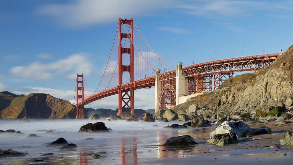
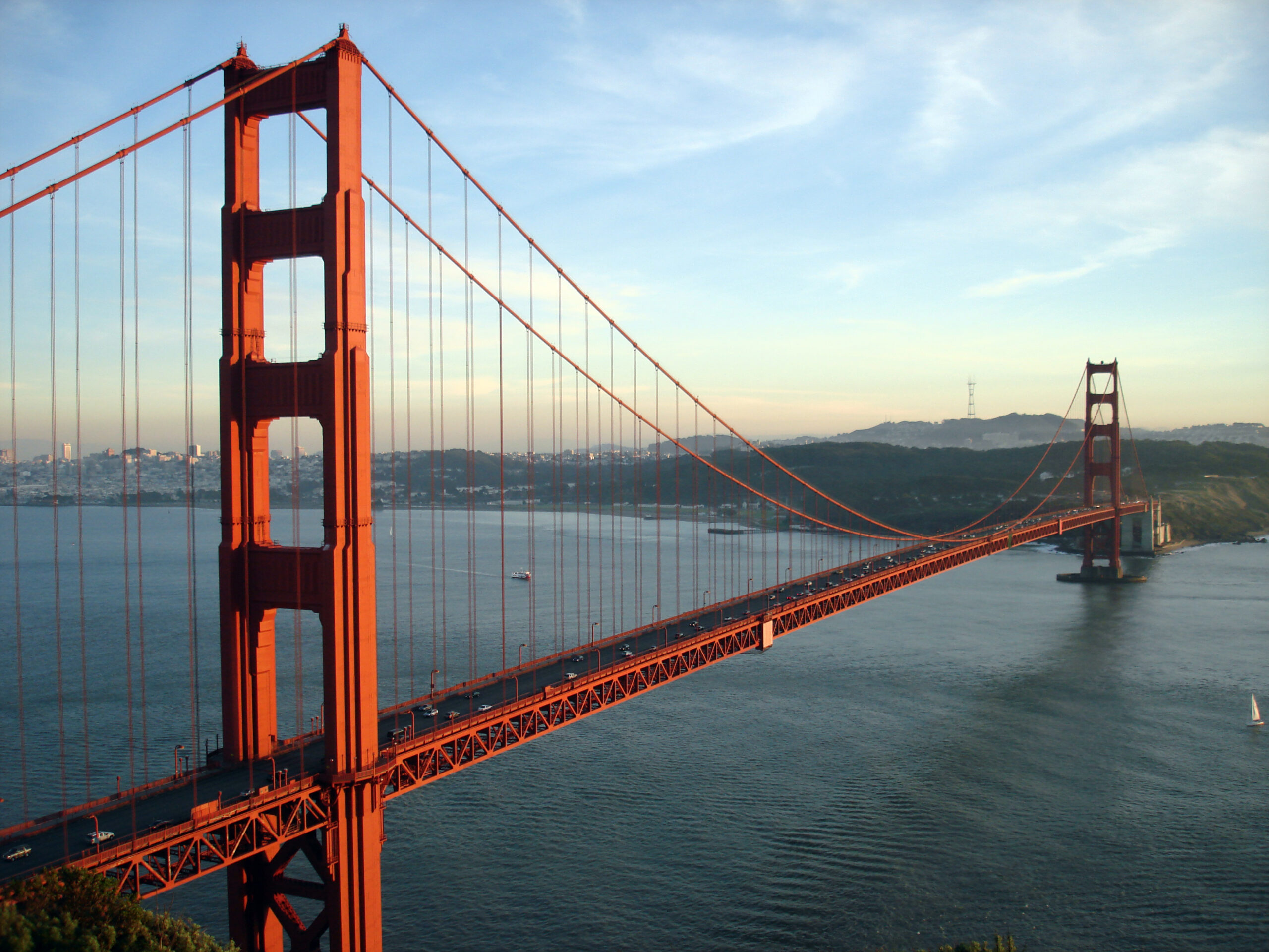
    The Golden Gate Bridge seen from Marshall's Beach in the Presidio
    The Golden Gate Bridge from Marshall's Beach, below the Presidio's coastal bluffs (Photo: Frank Schulenburg via Wikimedia Commons, CC BY-SA 4.0)

    San Francisco at a glance for first-timers

    • Airport: San Francisco International (SFO), about 21 km (13 miles) south of downtown. BART trains run from the International Terminal to downtown in about 30 minutes, and the AirTrain links every terminal to the BART station and the rental car center. See our SFO airport guide.
    • Getting around: the city is compact, hilly and best seen on foot and by transit: Muni buses, light rail, historic streetcars and the cable cars cover San Francisco itself, and BART runs under Market Street to the airport and the East Bay. A car is a burden in the city and useful only for day trips.
    • Money: US dollars. Sales tax is added at the register, hotel taxes are high, and some restaurants add a disclosed surcharge to the bill to cover the city’s health-care mandate for employees. Tipping 18 to 20 percent in restaurants is expected.
    • Weather: mild all year and rarely hot or freezing, with summer fog, a wet season from roughly November to March, and the warmest, clearest days in September and October. Pack layers in every month. Our month-by-month guide has the detail.
    • Where to stay: Union Square for transit and shopping; Fisherman’s Wharf for families and the Alcatraz ferry; the Embarcadero and SoMa for business trips and the ballpark; Nob Hill, North Beach or Hayes Valley for character. Our San Francisco hotel search covers them all.

    The Golden Gate Bridge, the Presidio and Crissy Field

    The Golden Gate Bridge opened in 1937, and it still stops people in their tracks: two Art Deco towers painted International Orange, a span of about 2.7 km (1.7 miles) across the mouth of the bay, and, on a summer afternoon, fog pouring through the cables like a slow waterfall. Walking at least part of the way across is the essential San Francisco experience: start at the Welcome Center on the city side, walk the east sidewalk to the first tower or all the way to Marin, and bring a warm layer, because the wind on the deck is fierce. Below the southern anchorage, Fort Point, a brick Civil War-era fort, sits right under the roadway and gives the most dramatic upward view of the span. The bridge sits inside the Golden Gate National Recreation Area, one of the most visited parks in the national system. East of the bridge, Crissy Field is a restored tidal marsh and beach with a flat waterfront path, the best place to photograph the bridge at water level. Behind it, the Presidio, a former Army post turned national park site, holds forested trails, historic barracks and Presidio Tunnel Tops, a park built over a freeway tunnel with one of the best free views in the city.

    Alcatraz and the waterfront

    Alcatraz, the island prison in the middle of the bay, held federal inmates from 1934 to 1963 and was later occupied for nineteen months by Native American activists, and today it is run by the National Park Service as one of the best-interpreted historic sites in the country. The cellhouse audio tour, narrated in part by former guards and prisoners, is gripping. The only way to visit is on the official ferry from Pier 33, and tickets sell out days or weeks ahead in summer, so book as soon as your dates are firm. The park’s site links to the authorized ticket seller; resellers charge a premium for the same boat. Back on shore, the Embarcadero runs along the waterfront from the Bay Bridge to Fisherman’s Wharf, lined with palm trees, piers and the historic streetcars of the F line. Its anchor is the Ferry Building, the clock-towered terminal at the foot of Market Street, now a food hall of Bay Area producers with a superb Saturday farmers’ market. A short walk north, the Exploratorium on Pier 15 is a hands-on science museum that adults enjoy as much as children.
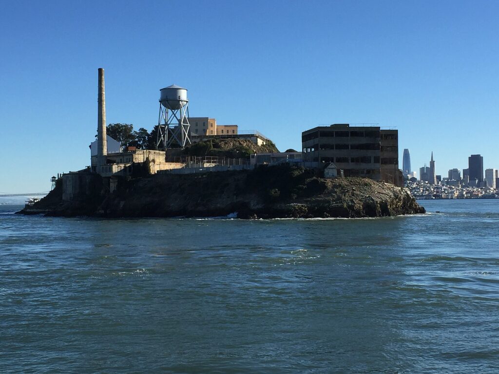
    Alcatraz Island and its cellhouse seen from a boat on San Francisco Bay
    Alcatraz from the water: the only way on is the official ferry from Pier 33, so book early (Photo: RL0919 via Wikimedia Commons, CC BY-SA 4.0)

    Fisherman’s Wharf and North Beach

    Fisherman’s Wharf is unashamedly touristy, and still worth a morning. Pier 39 has the sea lions, who hauled out on its floating docks after the 1989 earthquake and never left, and whose numbers rise and fall with the seasons. Further west, the Musée Mécanique is a free-to-enter hall of antique arcade machines, and the Hyde Street Pier, part of the San Francisco Maritime National Historical Park, has historic ships you can board. Eat clam chowder in a sourdough bread bowl from the stands along Jefferson Street, then walk up to Ghirardelli Square, the old chocolate factory. From the Wharf, the Powell-Hyde cable car climbs past the top of Lombard Street, whose single block of eight hairpin bends between Hyde and Leavenworth is more fun to walk down than to drive. Over the hill, North Beach is the old Italian quarter and the home of the Beat writers: City Lights Bookstore, still publishing and selling poetry on Columbus Avenue, the cafés where people have been nursing espressos since the 1950s, Washington Square with the twin spires of Saints Peter and Paul Church, and a dozen places for pizza, focaccia and pasta. Climb the Filbert Steps or the streets above to Coit Tower on Telegraph Hill, whose lobby is covered in Depression-era murals of California life, and whose top has a 360-degree view of the bay.

    Cable cars, Chinatown and Union Square

    San Francisco’s cable cars are the last manually operated cable car system in the world, a National Historic Landmark that still runs on the same principle as the first line of 1873: a steel cable moving under the street, gripped and released by the operator. There are three lines. The Powell-Hyde and Powell-Mason lines start at the turntable at Powell and Market streets and climb over Nob Hill to the Wharf, and the Powell-Hyde has the better views; the California Street line runs from the Financial District up Nob Hill and is usually far less crowded. The Powell turntable queue can be an hour at midday in summer, so ride early or late. The free Cable Car Museum on Nob Hill lets you look down on the giant wheels that pull the cables. At the foot of the Powell lines, Union Square is the hotel and shopping district. A few blocks north, the Dragon Gate on Grant Avenue marks the entrance to Chinatown, the oldest in North America and one of the most densely packed neighborhoods in the country. Grant Avenue is the souvenir strip; Stockton Street, a block over, is where residents shop for produce and roast duck; and the alleys between them hold temples and a fortune cookie factory in Ross Alley. The Central Subway, which opened in 2022, links Chinatown to Union Square and SoMa by light rail.
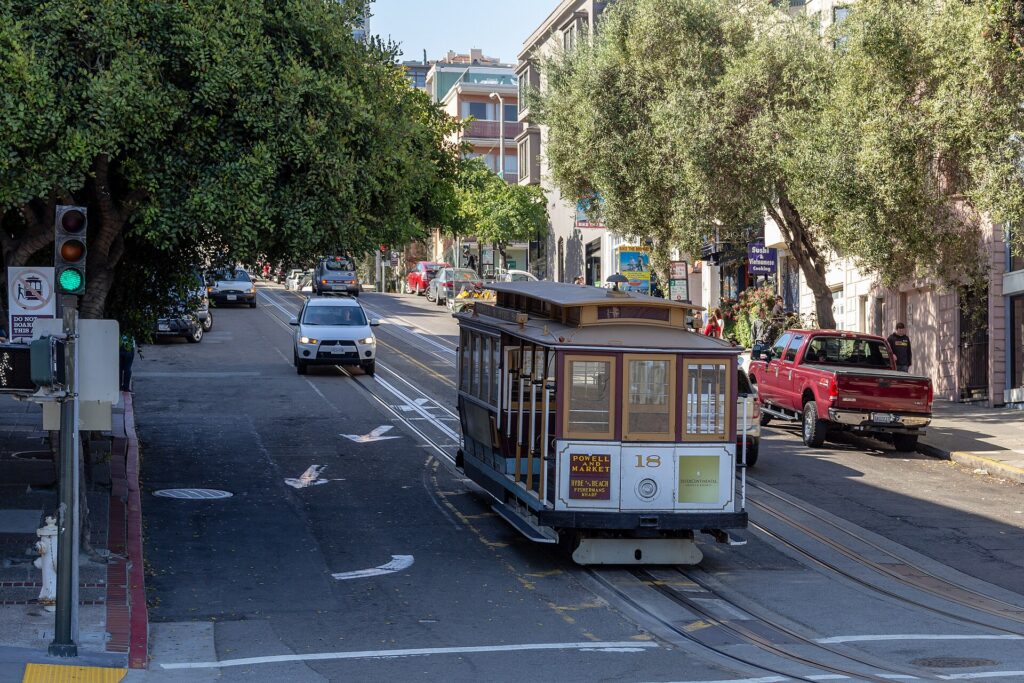
    A cable car climbing Hyde Street in San Francisco
    A cable car on Hyde Street, the steepest and most scenic of the three lines (Photo: Dietmar Rabich via Wikimedia Commons, CC BY-SA 4.0)

    Golden Gate Park and the Pacific coast

    Golden Gate Park runs for about 5 km (3 miles) from the Haight to the ocean and is larger than Central Park in New York. Its museum core has two of the city’s best: the de Young, with American art, textiles and a copper-clad tower whose observation floor is free to visit, and the California Academy of Sciences, which fits an aquarium, a planetarium, a natural history museum and a four-story rainforest dome under a living roof planted with native wildflowers. Between them are the Japanese Tea Garden, the oldest public Japanese garden in the United States, and the Victorian glasshouse of the Conservatory of Flowers. The eastern stretch of the main drive is now a permanent car-free promenade, which makes the park perfect for a bike ride; keep going west past the bison paddock and the Dutch windmills and you reach Ocean Beach, a long, wild strand where the water is cold and the currents are dangerous, so it is for walking, not swimming. North along the coast, the Lands End trail follows the cliffs past the ruins of the Sutro Baths, a vast Victorian bathhouse, with views of the Golden Gate from the ocean side; at its end, the Legion of Honor, a sister museum to the de Young, holds European art, including a large Rodin collection, in a hilltop palace.

    Neighborhoods worth a half-day

    The Mission

    The Mission is the city’s oldest neighborhood and its sunniest. It is the home of the Mission-style burrito, of the murals of Balmy Alley and Clarion Alley, of Mission Dolores, whose adobe chapel, completed in 1791, is the oldest intact building in the city, and of Dolores Park, a sloping lawn with a skyline view where half of San Francisco spends sunny weekend afternoons.

    The Castro

    The Castro has been the heart of LGBTQ San Francisco since the 1970s; the landmark Castro Theatre and the GLBT Historical Society Museum tell the story, including that of Harvey Milk.

    Haight-Ashbury and Hayes Valley

    The Haight, the center of the 1967 Summer of Love, still trades on the memory with vintage and record stores. Hayes Valley, a short walk east, is the boutique-and-restaurant district near the opera house and symphony hall, and Alamo Square, between the two, is where the row of Victorian houses known as the Painted Ladies lines up in front of the downtown skyline.

    Japantown and the Richmond

    Japantown is one of only three historic Japantowns left in the United States, with a Peace Pagoda, ramen counters and Japanese bookstores. Further west, Clement Street in the Inner Richmond is the city’s second Chinatown and the place for dim sum without the downtown crowds.

    SoMa and Mission Bay

    South of Market is the tech and convention district: Moscone Center, Yerba Buena Gardens, the ballpark, and the San Francisco Museum of Modern Art, one of the largest modern-art museums in the country, whose ground-floor galleries are free to enter.

    Museums, culture and family attractions

    Beyond SFMOMA, the de Young, the Legion of Honor, the Academy of Sciences and the Exploratorium, the city has a deep bench. The Asian Art Museum at Civic Center has one of the largest collections of Asian art in the West, across the plaza from a City Hall whose dome is taller than the U.S. Capitol’s. The Walt Disney Family Museum in the Presidio tells the story of the man rather than the brand. The Palace of Fine Arts, a Roman-style rotunda and lagoon left over from the 1915 world’s fair, is a free, photogenic stop near the Marina. The San Francisco Symphony, Opera and Ballet share the Civic Center, and the theaters around Union Square host touring Broadway shows. For what is on stage and in the arenas during your dates, our San Francisco events page lists concerts, shows and games.

    Sports and the festival year

    The San Francisco Giants play baseball at Oracle Park, one of the most beautiful ballparks in the country, set on the bay in SoMa, where home runs to right field splash into McCovey Cove among the waiting kayakers. The Golden State Warriors play basketball at Chase Center in Mission Bay, which they share with the Golden State Valkyries of the WNBA. The 49ers play at Levi’s Stadium in Santa Clara, about an hour south. The festival calendar is just as full: the Chinese New Year Parade in February or early March, one of the largest outside Asia; San Francisco Pride on the last weekend of June; Outside Lands in Golden Gate Park in August; and, in early October, Fleet Week with the Blue Angels over the bay and the free Hardly Strictly Bluegrass weekend in the park. Check what is on sale in San Francisco for your dates before you book flights.

    What to eat, and where

    San Francisco eats better than almost anywhere in the country, and at every price. Start with the classics. Sourdough bread, made here since the Gold Rush, is best eaten plain from a good bakery. The Mission burrito, a foil-wrapped monster of rice, beans, meat and salsa, is the defining cheap meal; argue with locals about the best taquería and you will get a dozen answers. Cioppino, the tomato-based fish stew invented by Italian fishermen in North Beach, and Dungeness crab, whose local season normally opens in late fall though openings have been delayed in some recent years, are the seafood dishes to seek out. Dim sum in Chinatown and on Clement Street, a coffee at one of the Beat-era cafés in North Beach, an Irish coffee at the Buena Vista near the Wharf, which popularized the drink in America, and a fortune cookie warm from the Ross Alley factory round out the list. Beyond those, the restaurant scene is built on the produce of the farms around the bay. Book popular restaurants ahead, especially on weekends.

    San Francisco through the seasons

    San Francisco’s seasons do not follow the calendar the way visitors expect. Winter (December to February) is the rainy season, but between storms it is often clear, green and mild, with highs around 14 °C (57 °F); hotel rates are low outside the big conventions. Spring (March to May) brings wildflowers on the hills and fewer crowds than summer. Summer (June to August) is the busiest season and, famously, the foggiest: the fog rolls in from the ocean most afternoons, and the bridge in July can feel like November, while the Mission and the eastern neighborhoods stay sunnier. Fall (September to October) is the local favorite and the true summer: the fog retreats, the days are the warmest of the year, and the festival season peaks with Fleet Week and Hardly Strictly Bluegrass. Our month-by-month guide has the fare patterns that go with each season.

    San Francisco with kids

    San Francisco is a surprisingly good city with children, as long as you plan for the hills and the weather. The California Academy of Sciences is the obvious full day, with the rainforest dome, the coral reef tank and the African penguins; the Exploratorium is the other. A cable car ride and the sea lions at Pier 39 are highlights for almost every child. The San Francisco Zoo, at the ocean end of the city, has a children’s zoo, and Golden Gate Park has playgrounds, paddle boats on Stow Lake and a carousel. Presidio Tunnel Tops has one of the best playgrounds in the city, with a view of the bridge. Bring layers for everyone, because a warm morning in the Mission can become a cold, windy afternoon at the bridge. For families heading beyond the city, our family car rental guide covers the vehicle question.

    San Francisco on a budget

    San Francisco is expensive, but a surprising amount of the best of it is free: walking the Golden Gate Bridge, Crissy Field, the Presidio and Tunnel Tops, Lands End and the Sutro Baths ruins, Golden Gate Park, the de Young’s observation tower, the ground-floor galleries at SFMOMA, the Cable Car Museum, the Musée Mécanique, Chinatown, the murals of the Mission, Dolores Park, and the view from Twin Peaks or the Filbert Steps. A Muni Visitor Passport, sold for one, three or seven days, covers buses, streetcars and cable cars and pays for itself quickly. Eat cheaply at the taquerías of the Mission and the dim sum shops of Chinatown and the Richmond. Hotel rates drop sharply in winter outside convention weeks and are highest in September and October; compare rates by neighborhood on our San Francisco hotel search, and remember that a hotel near a BART or Muni Metro station saves both time and money.

    Day trips from San Francisco

    Sausalito, across the Golden Gate, is the easiest escape: take the ferry from the Ferry Building or Pier 41, or rent a bike, ride across the bridge and take the ferry back. Muir Woods, about 45 minutes north, is a grove of old-growth coast redwoods, some more than a thousand years old; reservations are required for both parking and the shuttle, so book ahead through the park’s site. Napa and Sonoma, the wine country, are an hour to ninety minutes north, with hundreds of wineries; a tour or a designated driver is essential. Point Reyes National Seashore, about ninety minutes northwest, has elk, a lighthouse and wild beaches. South, Half Moon Bay is an easy half-day, and Monterey and Carmel, two to three hours south, have the aquarium, the 17-Mile Drive and the start of Big Sur. Yosemite, about four hours east, needs at least one night. Berkeley and Oakland are a BART ride away. Most of these are car trips; see our San Francisco car rental page. If you are continuing south, the drive to Los Angeles is a California classic; our San Francisco to Los Angeles route guide covers it, and our first-timer’s guide to Los Angeles picks up where this one leaves off. San Francisco Travel covers the city and the wider Bay Area.
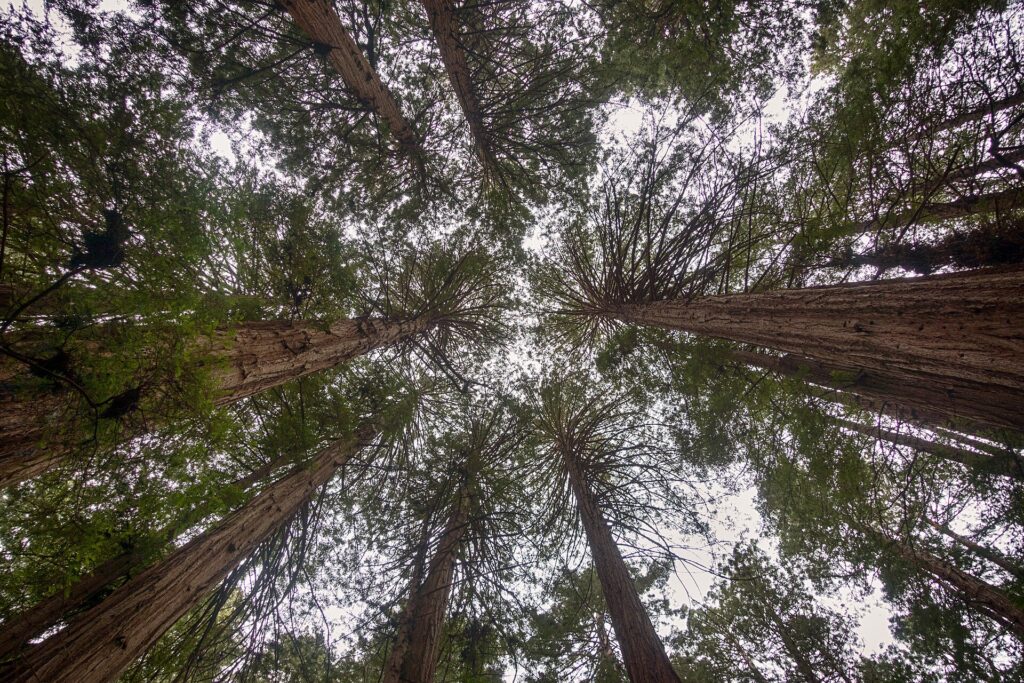
    Old-growth coast redwoods in Muir Woods National Monument
    Muir Woods, about 45 minutes north of the city; reserve parking or the shuttle before you go (Photo: Eric Kilby from Somerville, MA, USA via Wikimedia Commons, CC BY-SA 2.0)

    Two sample itineraries

    Three days, no car

    Day one: an early cable car on the Powell-Hyde line to Fisherman’s Wharf, the sea lions and the Hyde Street Pier, then the afternoon ferry to Alcatraz, and dinner in North Beach. Day two: the Ferry Building in the morning, the Embarcadero and Coit Tower, then Chinatown and Union Square in the afternoon, and a show or dinner in Hayes Valley. Day three: the Golden Gate Bridge on foot from the Welcome Center, Crissy Field and Tunnel Tops, then Golden Gate Park, the Academy of Sciences or the de Young, and a burrito and a sunset in the Mission.

    Five days, with day trips

    Add a day on a rented bike across the bridge to Sausalito, back by ferry, with Lands End on the way home; then pick up a car for Muir Woods and Point Reyes, or for a day in Napa or Sonoma, returning it before you head back into the city or on the way to the airport.

    Practical details

    • Transit: use a Clipper card, available as a physical card or in your phone’s wallet, or the MuniMobile app, on Muni, BART, Caltrain and the ferries. SFMTA runs Muni and has maps; our transit-versus-car guide goes into detail.
    • From SFO: BART from the International Terminal to downtown, a taxi or ride-hail, or a rental from the AirTrain-linked rental car center. The airport’s site covers ground transport.
    • Weather: layers in every month, a windproof jacket for the bridge and the waterfront, and sun protection when the fog lifts. The National Weather Service’s Bay Area office is the forecast to check.
    • Time zone: Pacific, three hours behind New York.
    • Entry requirements: Canadians need a valid passport; visitors from Visa Waiver Program countries need an approved ESTA before boarding, and everyone else needs a visa. U.S. Customs and Border Protection is the authoritative source.
    • Safety: the main sights are as safe as any big American city’s, but parts of the Tenderloin and the stretch of Market Street around Civic Center are rough, especially after dark, and are best walked through with awareness rather than lingered in. Vehicle break-ins are a well-known problem at tourist stops: if you drive, leave nothing at all in the car, including in the trunk.

    Frequently asked questions

    How many days do you need in San Francisco?

    Three full days covers the bridge, Alcatraz, the Wharf, Chinatown, North Beach, Golden Gate Park and the Mission. Five lets you add Sausalito, Muir Woods or wine country.

    What is the number one thing to do in San Francisco?

    Walk across the Golden Gate Bridge. If you only have time for one booked activity, make it Alcatraz, and reserve it as soon as your dates are set.

    Is San Francisco walkable?

    Very, if you do not mind hills. Most of the sights are within a few miles of each other, and the cable cars and Muni fill the gaps when the slopes get steep.
    Do I need a car in San Francisco?

    No, and a car is usually more trouble than it is worth in the city because of parking costs and break-ins. Rent one only for the days you leave town.

    Why is San Francisco so cold in summer?

    Cool ocean water and the heat of California’s interior pull fog through the Golden Gate on most summer afternoons. September and October are warmer and clearer.

    What is San Francisco known for?

    The Golden Gate Bridge, the cable cars, Alcatraz, the fog, the hills, sourdough and the Mission burrito, the counterculture of the 1960s, and its role as the gateway to Silicon Valley and wine country.

    Ready to go? Compare flights to San Francisco, find a place to stay with our San Francisco hotel search, and if wine country or the coast is on the list, price a rental car for those days.

  • Best Time to Fly to Washington, DC: Seasons, Weather & Prices

    Best Time to Fly to Washington, DC: Seasons, Weather & Prices

    Washington, DC runs on two calendars at once, and its prices follow both. The first is the tourist calendar: the cherry blossoms in late March and early April, a spring school-trip season that puts busloads of eighth-graders on every museum step until June, a hot summer centered on the Fourth of July, and a golden fall. The second is the government calendar: Congress in session from Tuesday to Thursday, lobbyists and consultants and conventions filling downtown hotels on weeknights, and an August recess and a Christmas break when the city empties. The result is a place where a Saturday night can cost less than a Tuesday, where August is hot but cheap, and where the week between Christmas and New Year, expensive almost everywhere else, is one of the best-value hotel weeks of the year. Add three airports that compete for the same passengers and you have a city with more ways to save than most. This guide walks through the weather month by month, the fare and hotel seasons, the events that move prices, and how to choose between Reagan National, Dulles and BWI.

    The short answer

    For the best balance of weather and price, go in late April to mid-May, after the blossoms and before the heat, or in late October and the first half of November, when the weather is still pleasant and the fall conference peak is easing. The cheapest time for hotels is January and February, outside the long weekends and inauguration years, together with August, when Congress is away, and the week between Christmas and New Year, although holiday flights themselves are not cheap. The most expensive stretches are cherry blossom season from late March to mid-April, the spring school-trip months that follow it, the Fourth of July week, and September and October weekdays, when Congress, conventions and good weather all coincide. Wherever you land, run a flexible-date search on our Washington, DC flights page and compare all three airports; a shift of a few days, or a switch from Reagan National to BWI, can change the fare band entirely.

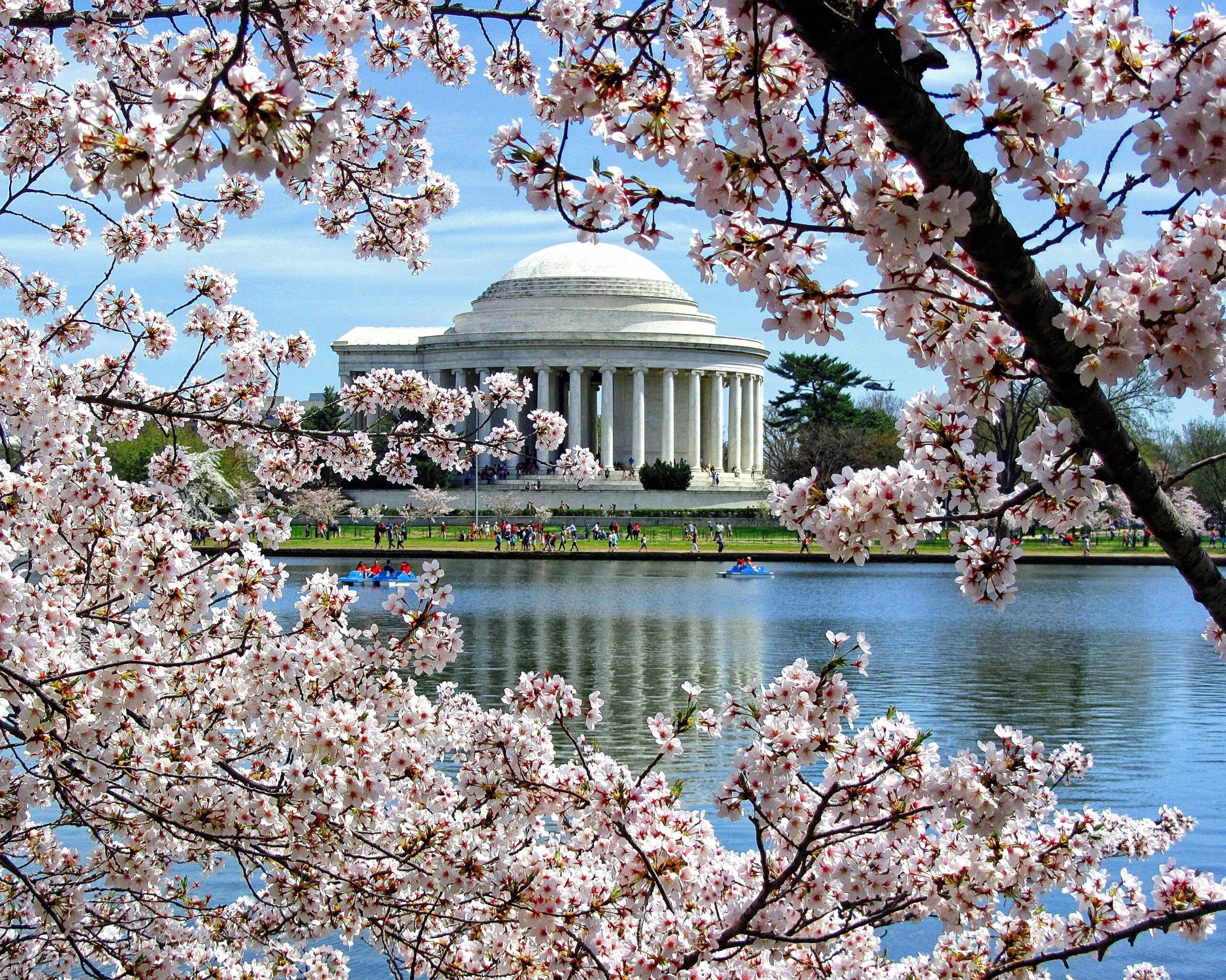
    Cherry blossoms around the Tidal Basin with the Jefferson Memorial behind
    Peak bloom at the Tidal Basin, the most expensive week of the Washington spring (Photo: Alpacaaviator via Wikimedia Commons, CC BY-SA 4.0)

    Washington’s weather, season by season

    Washington sits on the Potomac at the edge of the South, with a humid subtropical climate that surprises visitors from the north. Summers are long, hot and sticky, with afternoon thunderstorms; winters are generally mild, with cold spells and an occasional heavy snowstorm that shuts the federal government for a day; and spring and fall are the seasons worth planning around. The figures below are approximate seasonal patterns based on the long-term climate normals for Reagan National Airport from NOAA’s National Weather Service; check the current forecast before you pack, because March and November can each hold a warm day and a freeze in the same week.

    MonthTypical daytime highTypical overnight lowWhat it feels likeFare pressure
    Januaryaround 7 °C (44 °F)around -2 °C (29 °F)Cold and gray; snow some years, mild spells othersLow, except inauguration years and MLK weekend
    Februaryaround 9 °C (48 °F)around -1 °C (31 °F)Still cold; the likeliest month for a big snowstormLow; rises for Presidents’ Day weekend
    Marcharound 14 °C (57 °F)around 3 °C (38 °F)Changeable; the blossoms open late in the monthModerate, then peak for the blossoms
    Aprilaround 20 °C (68 °F)around 8 °C (47 °F)Spring proper; blossoms, dogwoods, showersPeak, especially hotels
    Mayaround 25 °C (77 °F)around 14 °C (57 °F)Warm and green; humidity starts to buildHigh; graduation weekends fill hotels
    Junearound 29 °C (85 °F)around 19 °C (66 °F)Hot and humid; thunderstorms; long eveningsHigh
    Julyaround 32 °C (89 °F)around 22 °C (71 °F)The hottest month; heat indexes far above the thermometerHigh around the Fourth, then moderate
    Augustaround 31 °C (87 °F)around 21 °C (70 °F)Hot and sticky; the city empties during the recessLow to moderate for hotels
    Septemberaround 27 °C (81 °F)around 17 °C (63 °F)Warm; the humidity breaks later in the monthHigh on weekdays once Congress returns
    Octoberaround 21 °C (70 °F)around 11 °C (52 °F)Dry, sunny and mild; the best walking weather of the yearHigh, especially weekday hotels
    Novemberaround 15 °C (59 °F)around 5 °C (41 °F)Cool and clear; foliage lingers into the monthModerate; flights spike at Thanksgiving
    Decemberaround 9 °C (49 °F)around 1 °C (33 °F)Cool to cold and festive; snow is unusualModerate; hotels soft after mid-month, flights high

    Three things the table cannot show. First, the humidity: a July afternoon at 32 °C in Washington, on an unshaded Mall with marble reflecting the sun, feels far hotter than the number, and heat advisories are routine. Plan the memorials for early morning and after dark, and the air-conditioned museums for the middle of the day. Second, the snow: Washington gets little of it in an average winter, but the city handles it badly, and a few inches can close schools, slow the Metro’s outdoor sections and cancel flights at all three airports. Third, the storms: summer thunderstorms build most afternoons from June to August and can ground departures for an hour or two, and the Atlantic hurricane season occasionally sends the remnants of a tropical storm up the coast between August and October.

    How Washington’s fare seasons work

    Three forces set prices for a Washington trip. The first is tourism, which peaks in spring, when the blossoms and the school groups arrive, and again in summer for families and international visitors. The second is government and business: when Congress is in session, weekday hotel demand is intense, trade associations and conventions fill the Walter E. Washington Convention Center, and the airports are full of consultants flying in on Monday and home on Thursday. The third is competition: three airports, a United hub at Dulles, a large American Airlines operation at Reagan National, and Southwest as the biggest carrier at BWI mean that fares into the Washington area are often lower than to smaller cities at similar distances, and that one airport frequently undercuts the others on the same day. Flights and hotels therefore follow slightly different curves: flights peak for the holidays and summer, while hotels peak in spring and on fall weekdays, and are soft on weekends and in August.

    Peak season

    Late March to June, with the cherry blossom weeks and Easter at the top, followed by the school-trip season and the university graduation weekends in May. The Fourth of July week is a short, sharp peak of its own. September and October are the second hotel peak, driven by Congress, conventions and perfect weather, though that peak is concentrated on weeknights; a Friday-to-Sunday stay in October can cost much less than Tuesday to Thursday. If you must travel in peak, book early, consider a weekend stay, and look at hotels across the river in Arlington.

    Shoulder season

    Late April to mid-May outside graduation weekends, late June, and November before Thanksgiving. These weeks give you pleasant weather, most of spring’s or fall’s color, and noticeably lower hotel rates. Watch Memorial Day weekend, Veterans Day and the weekend before Thanksgiving.

    Low season

    January and February outside the long weekends, and August for hotels. Winter rates are at their annual low, the museums are at their quietest, and Metropolitan Washington Restaurant Week, usually in January and again in August, offers set menus at fixed prices across the city. The exception is inauguration years, when the January 20 swearing-in fills hotels across the whole region. August is hot, but Congress is on recess, weekday business travel drops away, and the city’s hotels discount accordingly.

    As elsewhere, mid-week departures and early or late flights usually price below Friday and Sunday afternoons on the same route, and a search across a whole month reveals cheaper pairs of dates close to your first choice. Our guide to the best times to book explains how to read those patterns.

    Washington month by month

    January

    Cold, often gray, and after the New Year one of the cheapest months to stay. Congress returns early in the month, which keeps some weekday rates higher than the season suggests, and the Martin Luther King Jr. weekend on the third Monday brings a small bump. In inauguration years, which come every four years, the week around January 20 is the most expensive of the entire cycle and hotels sell out months ahead. Otherwise, the museums are quiet, Restaurant Week is on, and the Capitals and Wizards are at home.

    February

    The likeliest month for a real snowstorm and the last of the low season. Presidents’ Day weekend, on the third Monday, lifts fares and hotel rates modestly, and it is a popular weekend for families to visit the capital. The rest of the month is excellent value for a museum-heavy trip, and the National Portrait Gallery’s presidents’ hall is at its least crowded.

    March

    Two months in one. The first half is quiet, changeable and still cheap. From mid-month, spring break and the first school groups arrive, and when the cherry blossoms approach peak bloom, usually in the last week of March or the first days of April, hotel rates climb to their highest level of the spring. The National Cherry Blossom Festival runs for about four weeks and publishes its schedule early in the year; the Park Service’s bloom forecast comes out in early March.

    April

    Peak season. The blossoms usually finish by mid-April, but the dogwoods, azaleas and tulips follow, Easter adds a family spike, and the White House Easter Egg Roll brings its own crowd. The school-trip season is in full swing, which means long lines at the Capitol and the Air and Space Museum on weekdays. Book early, and consider a weekend stay to soften the rate.

    May

    Warm, green and busy. Passport DC opens the embassies to visitors on weekends in May, university graduations fill hotels on specific weekends in the middle of the month, and Memorial Day weekend brings a parade and a free concert on the Capitol’s West Lawn. The weeks between graduation weekends are a good value window.

    June

    The heat arrives and the school groups thin out. Capital Pride fills the city early in the month, Juneteenth brings events across the city, and the Smithsonian Folklife Festival sets up on the Mall toward the end of June and runs into July. Fares are high for summer travel; hotels are firm but not at spring levels.

    July

    The hottest month, and the Fourth of July is the reason to come or to avoid it: a parade on Constitution Avenue, a concert on the West Lawn and fireworks over the Mall, watched by hundreds of thousands of people. Hotel rates spike for the holiday itself and ease afterward, and the rest of July is busy with families and international visitors but manageable. Plan every outdoor day around the heat.

    August

    Hot, humid and one of the best-value months for a hotel. Congress is on recess, the city’s professional population takes its vacations, and business hotels discount to fill rooms, especially on weekdays. Restaurant Week returns, the Nationals are at home, and the museums, although busy with families, are air-conditioned. If you can handle the heat, August is the capital at a discount.

    September

    Congress returns after Labor Day, conventions resume and weekday hotel rates climb sharply. The first half of the month is still hot; by the second half the humidity breaks and the weather turns lovely. Weekends are noticeably cheaper than weekdays, so a Friday-to-Monday trip is the smart play.

    October

    The best weather of the year: dry, sunny days, cool nights, and fall color that reaches its peak in Shenandoah around mid-month and in the city late in the month. It is also a busy conference month, the Marine Corps Marathon fills Arlington and the Mall late in the month, and weekday hotels are expensive. Book early and favor weekends.

    November

    Cool, clear and quieter, with the last of the foliage early in the month. Veterans Day brings ceremonies at Arlington National Cemetery. Thanksgiving week is a paradox: flights around the holiday are expensive, but Washington’s hotels are among the cheapest of the year because government and business travel stops. Before Thanksgiving, November is a shoulder-season sweet spot.

    December

    Festive and generally mild. The National Christmas Tree is lit on the Ellipse early in the month, the ice rink opens in the National Gallery’s sculpture garden, and holiday markets set up downtown. Congress often leaves by mid-December, and from then until New Year’s Day hotel rates drop to some of their lowest levels, even as holiday flights stay high. A late-December trip on a well-timed fare is one of the capital’s best deals.

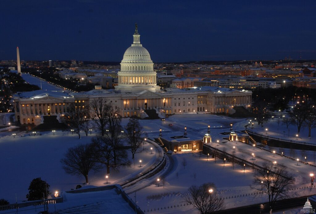
    The U.S. Capitol after a winter snowfall
    Washington in winter: quiet museums, the lowest hotel rates and the occasional snowstorm (Photo: USCapitol via Wikimedia Commons, Public domain)

    Events that move Washington flight and hotel prices

    Cross-check these against your dates before you book. Exact dates shift each year; the official Washington, DC visitor site keeps the current calendar.

    • Presidential inauguration (January 20, every four years, next in 2029): the single largest hotel spike in the city’s calendar.
    • Martin Luther King Jr. weekend and Presidents’ Day weekend (third Mondays of January and February).
    • National Cherry Blossom Festival (late March to mid-April), with the peak bloom weekend the most expensive of the spring.
    • Spring school-trip season (March to early June), which fills hotels and museums on weekdays.
    • University graduations (weekends in mid-May) and Memorial Day weekend.
    • Capital Pride (June) and the Smithsonian Folklife Festival (late June into July).
    • Fourth of July on the National Mall.
    • Congressional sessions and large conventions, which fill downtown on weeknights; if mid-week rates look strangely high, that is usually why.
    • Marine Corps Marathon (late October) and home games for the Nationals, Capitals, Wizards and Commanders. Our Washington, DC events page shows what is on sale for your dates.

    Getting in from the airports

    Washington has three airports, and choosing the right one can save more than choosing the right week. Reagan National (DCA), across the Potomac in Arlington, is the closest: the Metro’s Blue and Yellow lines stop at the terminal, and you can be on the Mall in about 20 minutes. A federal perimeter rule limits most of its nonstop flights to shorter domestic routes, with a limited number of exemptions, so long-haul and most international flights use the other two. Dulles (IAD), about 42 km (26 miles) west in Virginia, is United’s hub and the main international gateway, with Eero Saarinen’s swooping main terminal; the Metro’s Silver Line reaches it, and the ride downtown takes around 50 minutes to an hour, while a taxi takes 40 minutes to well over an hour depending on traffic. Baltimore/Washington (BWI), about 50 km (30 miles) northeast, is Southwest’s biggest operation in the region and often has the lowest fares; a free shuttle bus links the terminal to the BWI rail station, where MARC commuter trains and Amtrak reach Union Station in roughly half an hour to 40 minutes. When you search, include all three: a cheaper fare into BWI or Dulles usually beats a more expensive one into Reagan National even after the longer ride. Our guides to Reagan National, Dulles and BWI cover the layouts, and our car-versus-Metro guide explains the onward options.

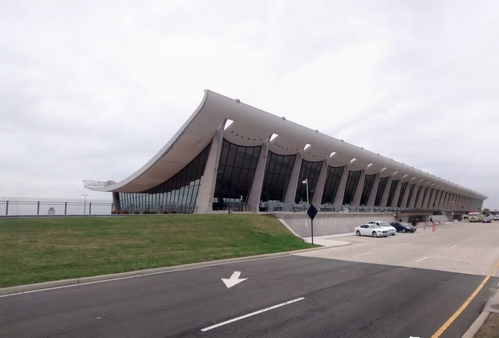
    Eero Saarinen's main terminal at Washington Dulles International Airport
    Dulles, the region's international gateway, now on the Metro's Silver Line (Photo: Gunnar Klack via Wikimedia Commons, CC BY-SA 4.0)

    Timing tricks that work for Washington

    • Search all three airports. The same dates can price very differently into DCA, IAD and BWI. TicketScanner’s search compares them side by side.
    • Stay on weekends. Washington’s hotel market is built around weekday government and business travel, so Friday and Saturday nights are often the cheapest of the week, the reverse of most leisure cities.
    • Use the recess. August, Thanksgiving week and the last two weeks of December are when Congress is away and hotels discount. Run a Washington, DC hotel search for those dates before you decide.
    • Book the blossoms early, or skip the peak. Rates in the peak bloom week can be far higher than those of two weeks later; the dogwoods and azaleas of late April are nearly as beautiful and far cheaper.
    • Stay across the river. Arlington, Crystal City and Rosslyn are a few Metro stops from the Mall and usually cheaper than downtown.
    • Combine cities. Philadelphia, Baltimore and New York are all on the Amtrak line; an open-jaw trip, flying into one and out of another, often costs no more than a round trip. See flights to Philadelphia for comparison.
    • Build a buffer. Summer thunderstorms and winter snow can disrupt all three airports at once; avoid the tightest connections. Our guide to how early to arrive covers what to allow.
    • Flying out of Washington instead? The same seasonality applies in reverse; see cheap flights from Washington, DC.
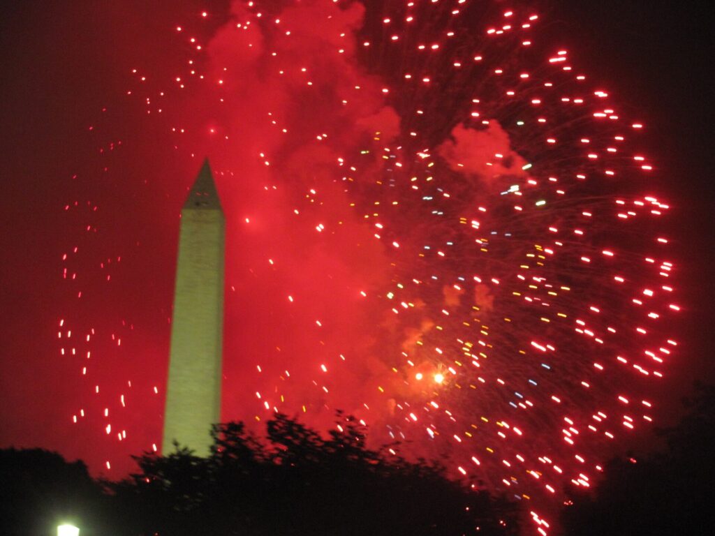
    Fourth of July fireworks beside the Washington Monument
    Independence Day on the National Mall, a short, sharp summer peak for hotels (Photo: Caballero1967 via Wikimedia Commons, CC BY-SA 4.0)

    What to pack, by season

    Winter (December to February): a warm coat, a hat and gloves, and waterproof shoes in case of slush; days vary from mild to properly cold. Spring (March to May): layers, a light rain jacket and an umbrella, with a warmer layer for cherry blossom sunrises. Summer (June to August): the lightest clothing you own, a hat, sunscreen, a refillable water bottle, and a sweater for the powerful air-conditioning in the museums. Fall (September to November): light clothing in September, layers and a jacket by late October. In every season, bring the most comfortable walking shoes you have; a day on the Mall is many kilometers on foot, and security lines move faster with a small bag.

    The best time to fly to Washington for…

    The cherry blossoms

    The last week of March or the first week of April, but watch the Park Service’s bloom forecast before you book, and book as early as the forecast allows.

    Museums without the crowds

    January, February and the first half of March, when the school groups have not arrived and hotels are at their cheapest.

    The best weather

    Late April to mid-May, and October, with late September close behind.

    The lowest hotel rates

    August, Thanksgiving week and the second half of December, plus weekends in almost any month.

    Families

    Late June or August for school vacations, planning outdoor sightseeing for mornings and evenings, or Thanksgiving week for a cooler, quieter visit.

    International visitors

    Visitors from Visa Waiver Program countries need an approved ESTA before boarding, and most others need a visa; the State Department’s travel site explains what applies to you. Domestic travelers need a REAL ID-compliant license or a passport at airport security, and the TSA lists what you can carry.

    Frequently asked questions

    What is the cheapest month to fly to Washington, DC?

    January and February are consistently the lowest for both flights and hotels outside the long weekends; August is also very cheap for hotels, and the late-December hotel lull is a bargain if you find a reasonable fare.

    When is the best time to see the cherry blossoms?

    Peak bloom usually falls in the last week of March or the first days of April and lasts only a few days. The National Park Service forecasts it in early March, and the festival runs for about four weeks around it.

    Why are Washington hotels cheaper on weekends?

    Because the city’s hotels depend on government, lobbying and convention travel from Monday to Thursday. On weekends and during congressional recesses, they discount to fill the rooms.

    Which airport should I fly into for Washington, DC?

    Reagan National is the most convenient, with the Metro at the terminal and the Mall 20 minutes away. Dulles has the international flights and the Silver Line; BWI often has the lowest fares and a train to Union Station. Compare all three.

    Is Washington too hot to visit in summer?

    It is hot and humid, but manageable if you see the memorials early and late and spend the afternoons in the air-conditioned museums, which are free.

    How far ahead should I book?

    Earlier for the cherry blossoms, the spring school season, the Fourth of July and inauguration years, when prices tend only to rise; for January, February and August, fares are stable enough that choosing the right dates matters more.

    Does it snow in Washington, DC?

    Some, in most winters, though average totals are modest. The occasional big storm can close the city and the airports for a day, so leave slack in a January or February itinerary.

    Ready to pick your dates? Compare fares across the whole month and all three airports on our Washington, DC flights page, then find a room with our Washington, DC hotel search. For what to do when you land, start with our first-timer’s guide to Washington, DC.

  • Washington, DC: Should You Rent a Car or Rely on Metro?

    Washington, DC: Should You Rent a Car or Rely on Metro?

    Washington, DC is one of the few American cities where a visitor can leave the car at home without a second thought. The Metro was built in the 1970s to move federal workers between the suburbs and the monuments, and it still does exactly that: nearly every sight on a first-timer’s list, from the Capitol to Arlington National Cemetery, is within a short walk of a station, and two of the region’s three airports are on the system. Driving, by contrast, means some of the heaviest traffic in the country, traffic circles that confuse even locals, a dense network of speed and red-light cameras, streets that close for motorcades without warning, and hotel parking that can cost as much as a modest dinner every night. But the car still has a job here. Mount Vernon, Shenandoah, Harpers Ferry, Gettysburg and the Chesapeake are all day trips, and the suburbs of Maryland and Virginia sprawl far beyond the rail lines. This guide explains how the city is laid out, how the Metro, buses and bikes work, what driving is really like, and gives you a straightforward way to decide.

    The short answer

    Skip the car for a city visit, which is what most first trips to Washington are: the Metro, your feet, Capital Bikeshare and the occasional taxi will cover the Mall, the museums, Capitol Hill, Dupont Circle, Georgetown, the Wharf and Arlington, and you will save the parking and the stress. Rent a car only for the days you leave the city, for Mount Vernon, Shenandoah National Park, Harpers Ferry, Gettysburg, Annapolis or the Delaware beaches, or if you are visiting family in the outer suburbs, traveling with small children and a lot of gear, or making Washington one stop on an East Coast road trip. For most visitors, the right answer is a car-free city stay plus a one- or two-day rental. Compare rental rates for those days on our Washington, DC car rental page.

    How Washington is laid out

    Washington was planned, and the plan helps. The city is divided into four quadrants (NW, NE, SW and SE) that meet at the Capitol, and every address carries its quadrant, so 700 G Street NW and 700 G Street SE are in different parts of town. Numbered streets run north-south, lettered streets run east-west (there is no J Street), and broad diagonal avenues named after the states cut across the grid, meeting at traffic circles and squares such as Dupont, Logan and Thomas circles. The National Mall runs west from the Capitol to the Lincoln Memorial along the Potomac; downtown and Penn Quarter lie just north of it, Capitol Hill east of it, and the Wharf and Navy Yard along the rivers to the south. Northwest Washington, where most visitors spend their evenings, holds Dupont Circle, Logan Circle, U Street, Adams Morgan and Georgetown. Across the Potomac, Arlington and Alexandria in Virginia are effectively part of the city, and the Capital Beltway, I-495, rings the whole region about 15 to 20 km out from the center.

    Hotels cluster downtown and in Penn Quarter, around Dupont Circle, in Georgetown and Foggy Bottom, on Capitol Hill, at the Wharf and Navy Yard, and across the river in Arlington, Rosslyn and Crystal City, which are usually cheaper and a few Metro stops from the Mall. Our Washington, DC hotel search lets you compare them.

    Getting in from the airports

    Washington has three airports, and the Metro serves two of them directly. From Reagan National (DCA), in Arlington just across the river, the Blue and Yellow lines leave from a station connected to the terminal by walkways, and the ride to the Mall or downtown takes 15 to 25 minutes; a taxi takes about the same outside rush hour. From Dulles (IAD), about 42 km (26 miles) west, the Silver Line leaves from a station linked to the main terminal by a pedestrian walkway, and reaches downtown in around 50 minutes to an hour; a taxi or ride-hail takes 40 minutes in light traffic and much longer at rush hour. From Baltimore/Washington (BWI), a free shuttle bus runs from the terminal to the BWI rail station, where MARC commuter trains and Amtrak run to Union Station in about half an hour to 40 minutes; the drive takes 45 minutes to well over an hour. Every airport has rental companies, and at Dulles and BWI they are reached by shuttle. Unless you are heading straight out of the city, there is no reason to pick up a car on arrival. The Reagan National, Dulles and BWI sites cover current ground transport, and our Reagan National airport guide covers the layout.

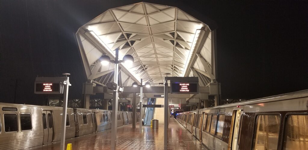
    An Orange Line train arriving at Farragut West, one of the Metro's vaulted concrete stations
    The Metro's vaulted stations: six lines, and nearly every sight within a short walk (Photo: Rainclaw7 via Wikimedia Commons, CC BY-SA 4.0)

    Washington’s transit, explained

    The Washington Metropolitan Area Transit Authority, WMATA, runs the Metrorail and Metrobus systems. The Metro is clean, generally reliable and, with its vaulted concrete stations, one of the most distinctive subway systems in the world. Its limitation is that it was designed as a commuter railway, with long lines reaching deep into the suburbs and a few gaps in the city itself.

    Metrorail

    Six color-coded lines, Red, Orange, Blue, Silver, Green and Yellow, serve nearly 100 stations in DC, Maryland and Virginia. The Red Line is a U-shaped line through downtown that reaches Union Station, Dupont Circle and the National Zoo at Woodley Park. The Orange, Blue and Silver lines share a tunnel under the Mall, with stations at the Smithsonian, Federal Triangle, Capitol South and Foggy Bottom, before splitting in Virginia; the Blue Line serves Arlington National Cemetery, the Pentagon and Reagan National, and the Silver Line runs out to Tysons and Dulles. The Green and Yellow lines run north-south through Penn Quarter, with the Green Line reaching Navy Yard for Nationals Park and U Street, and the Yellow Line crossing the Potomac to Reagan National and Old Town Alexandria. The main transfer stations are Metro Center, Gallery Place, L’Enfant Plaza and Fort Totten. The gaps are Georgetown, which never got a station (walk from Foggy Bottom or Dupont Circle), and H Street NE (walk from Union Station). Trains run from early morning until around midnight, later on Friday and Saturday nights; check WMATA for current hours and weekend track work, which can reduce service on individual lines. Stand on the right on the escalators and walk on the left, or you will hear about it.

    Metrobus

    Metrobus covers the areas the trains miss, including Georgetown, Adams Morgan and the neighborhoods off the rail lines, and local systems such as Arlington’s ART, Alexandria’s DASH and Fairfax Connector fill in the suburbs. The Metrobus network was redesigned in 2025, so route names in older guides may no longer apply; use WMATA’s trip planner or a maps app. The DC Circulator buses, which once looped around the Mall, were discontinued at the end of 2024.

    Fares and tickets

    Metrorail fares depend on the distance traveled and the time of day, with higher fares during weekday rush hours and lower fares on weekends and late at night. You pay with a SmarTrip card, sold at station vending machines, or with SmarTrip in your phone’s wallet, and WMATA has been rolling out tap-to-pay with contactless bank cards; check its site for current acceptance. You tap in and, importantly, tap out, because the fare is calculated when you exit. One-day, three-day and seven-day unlimited passes are available and are worth it for heavy sightseeing days. Metrobus charges a flat fare, and transfers between bus and rail within a set window are discounted or free. Up to two children aged four and under ride free with each paying adult.

    Accessibility

    Every Metro station has elevators, and every bus is low-floor and accessible; elevator outages are posted on WMATA’s site, and the system is one of the more accessible in the country.

    Beyond the Metro

    • Walking. The core is flat and compact, and walking between the Mall, Penn Quarter, the White House and Capitol Hill is often faster than taking a train. The distances along the Mall itself are longer than they look.
    • Capital Bikeshare. Capital Bikeshare has hundreds of docking stations across DC, Arlington, Alexandria and the Maryland suburbs, with classic bikes and e-bikes, single rides and day passes. Protected bike lanes run on Pennsylvania Avenue and several downtown streets, and the Mount Vernon Trail, the Capital Crescent Trail and the C&O Canal towpath make for superb rides out of the city. Dockless e-scooters and e-bikes from several operators fill in the rest.
    • Taxis and ride-hail. Uber, Lyft and metered taxis operate everywhere; they are the practical choice for Georgetown late at night or for a group of three or four going a short distance.
    • Water taxis. In the warmer months, a water taxi service links the Wharf, Georgetown, Old Town Alexandria and National Harbor, which is both transport and a scenic ride.
    • Commuter trains and Amtrak. From Union Station, Amtrak reaches Baltimore, Philadelphia, New York and Boston along the Northeast Corridor, and south to Richmond and beyond. MARC trains run to BWI and Baltimore, and on weekdays to Harpers Ferry; Virginia Railway Express runs weekday commuter trains to Fredericksburg and Manassas.
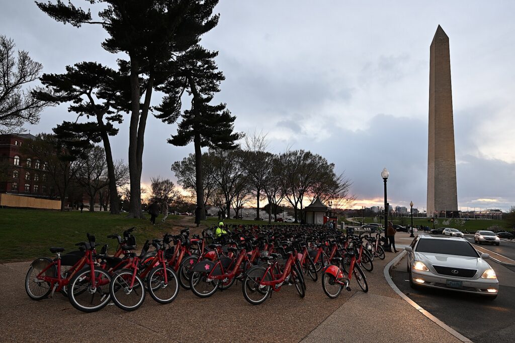
    A Capital Bikeshare station on the National Mall near the Washington Monument
    Capital Bikeshare docks cover DC, Arlington, Alexandria and the Maryland suburbs (Photo: G. Edward Johnson via Wikimedia Commons, CC BY 4.0)

    Driving in Washington: what it is really like

    Washington regularly ranks among the most congested regions in the United States, and the city itself adds a layer of complexity that visitors do not expect. The traffic circles, where several avenues meet with inner and outer lanes and underpasses, are genuinely confusing on a first attempt. Reversible and rush-hour rules change roads by the hour: Rock Creek Parkway runs one way inbound in the morning and outbound in the evening, parking lanes on major arteries become travel lanes at rush hour, and turns that are legal at noon are banned at 5 p.m. Security closures around the White House, the Capitol and embassies, for motorcades, demonstrations and state visits, can shut streets without notice. And the Capital Beltway, I-395 and I-66 are congested for long stretches of every weekday, with the evening rush often starting before 4 p.m.

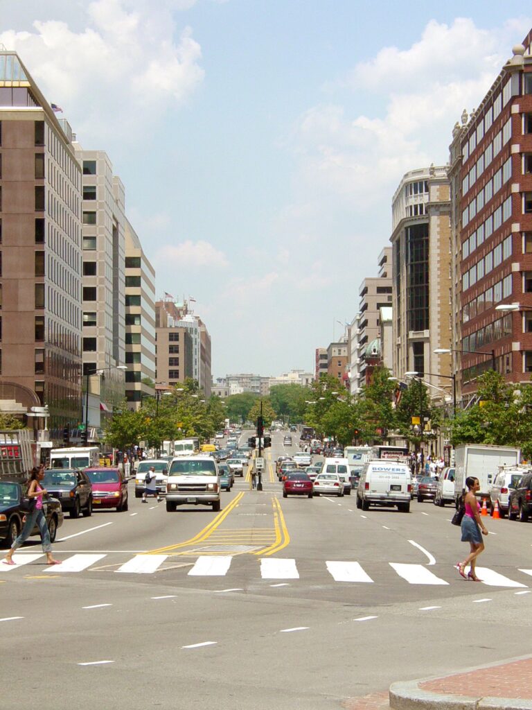
    Traffic around Dupont Circle in Washington, DC
    Dupont Circle, one of the traffic circles where several avenues meet and visitors lose their way (Photo: Ben Schumin via Wikimedia Commons, CC BY-SA 3.0)

    Parking

    Hotel parking downtown is expensive, usually valet only, and charged per night; commercial garages are cheaper, especially if booked through an app, but still add up over a few days. Street parking is metered in commercial areas, typically Monday to Saturday and into the evening in busy neighborhoods, and paid through the ParkMobile app or the meter; many meters are free on Sundays, but read every sign. Residential streets are largely restricted to two hours for non-residents, and rush-hour no-parking zones are enforced by tow truck, which is the costliest mistake a visitor can make. Around the Mall, the handful of metered spaces fill early, and there is effectively nowhere to park near the most popular museums on a spring weekday. Arlington National Cemetery and Mount Vernon have their own paid lots, and Old Town Alexandria has garages near King Street.

    Rules and conditions worth knowing

    • Cameras. DC has one of the densest networks of automated speed, red-light, stop-sign and bus-lane cameras in the country. Fines follow the car, and the rental company will bill you, with an administrative fee.
    • No turn on red. Right turns on red are prohibited at a large and growing number of DC intersections; obey the signs, which are everywhere.
    • Tolls and express lanes. I-66 inside the Beltway is tolled in the peak direction during rush hours, and the Express Lanes on I-495 and I-95 in Virginia charge dynamic tolls; all require an E-ZPass or the rental company’s toll program. The Dulles Toll Road charges tolls, while the Dulles Access Road beside it is free for airport traffic.
    • Parkways. The George Washington Memorial Parkway, the Baltimore-Washington Parkway and Rock Creek Parkway are scenic National Park Service roads with lower speed limits and no commercial vehicles.
    • Snow. A modest snowfall can bring the region to a standstill; if a storm is forecast, stay off the roads and take the Metro.
    • Conditions. The District Department of Transportation, DDOT, posts closures and work zones in the city, and 511 Virginia covers the Virginia highways and express lanes.
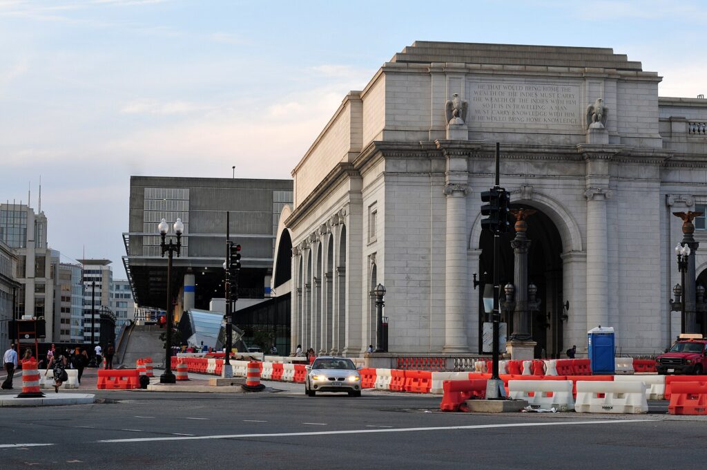
    The Beaux-Arts facade of Union Station in Washington, DC
    Union Station, for Amtrak to Philadelphia and New York and MARC trains to BWI and Baltimore (Photo: Ralf Roletschek (talk) – Infos über Fahrräder auf fahrradmonteur.de Wikis in der Ausbildung via Wikimedia Commons, CC BY-SA 3.0)

    When renting a car makes sense

    • Mount Vernon and the Potomac. The drive down the George Washington Memorial Parkway past Old Town Alexandria is one of the prettiest in the region, and it is the easiest way to see Mount Vernon and Great Falls in a day.
    • Shenandoah National Park and Skyline Drive, about 90 minutes west, are car-only, and October’s foliage is spectacular.
    • Harpers Ferry, Antietam and Gettysburg, the Civil War sites to the northwest and north, are easiest by car and combine well in one long day.
    • Annapolis, the Chesapeake and the Delaware beaches. The Eastern Shore and the Atlantic beaches are two to three hours east across the Chesapeake Bay Bridge.
    • The Udvar-Hazy Center near Dulles is reachable by the Silver Line and a connecting bus, but much easier by car.
    • Family in the suburbs beyond the Metro lines in Maryland and Northern Virginia.
    • East Coast road trips. Philadelphia is about 225 km (140 miles) up I-95; our Washington, DC to Philadelphia route guide covers the drive and its tolls.

    If any of those apply, our rental car booking tips cover insurance, deposits and the questions to ask at the counter, and our family car rental guide looks at vehicle choice.

    When it does not

    • Your plans are the Mall, the museums, the Capitol, Georgetown and the neighborhoods.
    • You are staying downtown, where overnight parking adds substantially to the room rate.
    • You are in town for a conference, a game at Nationals Park or Capital One Arena, or the Fourth of July, when the Metro is far faster than any road.
    • Your day trips are Baltimore, Philadelphia or New York, which are faster and more relaxing by train.

    The hybrid plan for a city-plus-countryside trip

    Go car-free for the city days and rent only for the days you leave, and think about where you pick up. Renting at Reagan National is a smart trick even if you arrived days earlier: ride the Metro back to the airport, pick up a car, and you are on the George Washington Memorial Parkway toward Mount Vernon or on I-66 toward Shenandoah in minutes, without driving through downtown. Neighborhood rental offices downtown and in Arlington avoid airport fees but mean driving out through city traffic. For a trip heading west to Shenandoah and Harpers Ferry, Dulles is well placed; for Annapolis or Baltimore, BWI. A common pattern: arrive by Metro or train, spend three car-free days in the city, rent at Reagan National for a day or two in Virginia, and return it at the airport before your flight, or drop it and take the Metro back to your hotel. Book ahead for spring, October and holiday weekends. Compare the day rates on our Washington, DC car rental page against a full-trip rental and the difference is usually obvious.

    A worked cost comparison

    Numbers change with the season and the booking window, so treat this as a method rather than a quote, and check current rates before deciding. For a four-night city break downtown for two people, the car-free version costs Metro rides from the airport, a couple of day passes or pay-as-you-go fares, and perhaps a few ride-hail trips back from Georgetown or Adams Morgan at night; the rental version adds four days of a compact car, four nights of valet parking at downtown rates, fuel, and the constant risk of camera fines and tow-away zones, and buys you nothing the Metro does not already provide. The car-free option wins by a wide margin. For the same four nights plus a day at Mount Vernon and a day in Shenandoah, the hybrid version adds a two-day rental picked up at Reagan National, fuel, the park entrance fee and parking at Mount Vernon, and it is clearly cheaper and more flexible than tours for two people. For a family of four visiting relatives in the suburbs for a week, a full-trip rental, picked up at whichever airport is closest to the relatives, usually beats a week of long Metro rides and ride-hail. Run the rental rates for your dates on our Washington, DC car rental page and put them beside the transit costs before you choose.

    Driving out of Washington in each season

    The day trips around Washington are some of the best in the East, but the roads out of the city change with the seasons. In spring, the parkways are at their loveliest, with redbuds and dogwoods along the Potomac, but cherry blossom weekends choke the roads around the Tidal Basin and the George Washington Memorial Parkway near the airport; leave early and go on a weekday. In summer, the beach traffic toward the Chesapeake Bay Bridge on Friday afternoons and back on Sunday afternoons is legendary, afternoon thunderstorms bring sudden downpours, and the Blue Ridge is a welcome escape from the heat of the city. In fall, Skyline Drive in Shenandoah is the region’s great foliage drive, peaking around mid-October, and weekend traffic at the park entrances can back up for long stretches, so arrive early or go mid-week; Gettysburg and Harpers Ferry are at their best in the same weeks. In winter, the highways are usually clear, but a snowstorm can close Skyline Drive and turn the Beltway into a parking lot, and rental cars come with all-season tires, not winter ones. In every season, avoid leaving or returning to the city between about 3:30 and 7 p.m. on weekdays, when the Beltway, I-66, I-95 and I-270 are all at their worst.

    Decision table

    Your tripRecommendationWhy
    City break, couple or soloNo carThe Metro, walking and Capital Bikeshare cover everything; parking is expensive
    Conference, game or the Fourth of JulyNo carStreets close, parking vanishes, and the Metro stops at the door
    City plus Mount Vernon or ShenandoahHybrid: rent at Reagan National for those daysCar-free city days, a quick escape to the parkways
    Baltimore, Philadelphia or New YorkTrainAmtrak and MARC from Union Station are faster than I-95
    Family visit to the suburbsRent for the whole staySuburban distances beyond the Metro make a car worthwhile daily
    Young children and lots of gearMetro in the city, rent for day tripsEvery station has elevators; a car helps only outside the core
    East Coast road tripRent (consider one-way)Washington is one stop, not the destination
    Staying in Arlington or AlexandriaNo car, or rent for day tripsThe Blue and Yellow lines reach the Mall in minutes

    Money-saving tips for both options

    • On transit: buy an unlimited pass for heavy sightseeing days, travel outside the weekday rush hours when fares are lower, remember to tap out, and use the free museums as air-conditioned rest stops between stations.
    • On a rental: rent only for the days you leave the city, compare airport and neighborhood pickup, use the rental company’s toll program or your own E-ZPass for the express lanes, and decline extras you already have through a credit card or home policy (check first).
    • On the hotel: if you are renting, price the parking fee into the room rate, or choose a hotel in Arlington or Alexandria where parking is cheaper and the Metro is close.
    • On timing: avoid the weekday rush hours and summer Friday afternoons toward the beaches; the best time to fly to Washington, DC guide lists the busiest weekends.
    • On fines: obey every speed limit and turn restriction, because the cameras are everywhere and the rental company adds a fee to each ticket.

    Frequently asked questions

    Is it worth renting a car in Washington, DC?

    Not for the city. The Metro reaches nearly every sight, parking is expensive and traffic is heavy. Rent only for day trips to Mount Vernon, Shenandoah, Harpers Ferry or Gettysburg.

    Is the Washington Metro good for tourists?

    Very. It serves the Mall, Capitol Hill, Arlington, Dupont Circle, Navy Yard and two of the three airports. The main gap is Georgetown, which is a short walk or bus ride from the nearest stations.

    How do I get from Reagan National Airport to downtown?

    Take the Blue or Yellow Line from the airport’s own Metro station; the Mall and downtown are 15 to 25 minutes away. A taxi takes about the same outside rush hour.

    How do I pay for the Metro?

    With a SmarTrip card from a station machine or SmarTrip in your phone’s wallet; contactless bank cards are being introduced. Tap in and tap out, because the fare is calculated at the exit.

    Can I get to Mount Vernon without a car?

    Yes, by a tour, by bike along the Mount Vernon Trail, or by seasonal boat from the Wharf or Old Town Alexandria. A car is simplest if you also want Great Falls or Old Town on the same day.

    Is parking expensive in Washington, DC?

    Downtown, yes: hotel valet parking is costly and street parking is limited, time-restricted and strictly enforced. It is cheaper across the river in Arlington and Alexandria.

    Is it hard to drive in Washington, DC?

    It is harder than most visitors expect, because of the traffic circles, rush-hour lane rules, security closures and automated cameras. Outside the city, the parkways and highways are straightforward, apart from the congestion.

    Whichever way you go, start with the flight. Compare cheap flights to Washington, DC across all three airports, choose a neighborhood with our Washington, DC hotel search, and if the countryside is on the list, price the rental for those days on our Washington, DC car rental page. For what to see once you are here, our first-timer’s guide to Washington, DC has the plan.

  • Things to Do in Washington, DC: A First-Timer’s Guide

    Things to Do in Washington, DC: A First-Timer’s Guide

    Washington, DC is the rare capital where the best things cost nothing. The Smithsonian’s museums on the National Mall are free, the memorials are open around the clock, the Capitol and the Library of Congress give free tours, and the National Gallery of Art, one of the great art museums in the country, charges no admission either. That changes how you plan a trip here: the question is not what you can afford but how many days you have and how to pace them, because it is easy to walk fifteen miles along the Mall in two days and see only half of it. Beyond the monuments is a city many visitors never find, of row-house neighborhoods, a waterfront reborn, Ethiopian and Salvadoran restaurants, jazz history on U Street and a canal towpath that runs from Georgetown to the Allegheny Mountains. This guide covers the sights that earn a day, the neighborhoods worth a half-day, the museums on and off the Mall, the big events, the food, the day trips, and the practical details that make a first visit work.

    If you are still comparing cheap flights to Washington, DC, read this alongside our guides to the best time to fly to Washington, DC and whether to rent a car or ride the Metro. Between the three you can plan the whole trip.

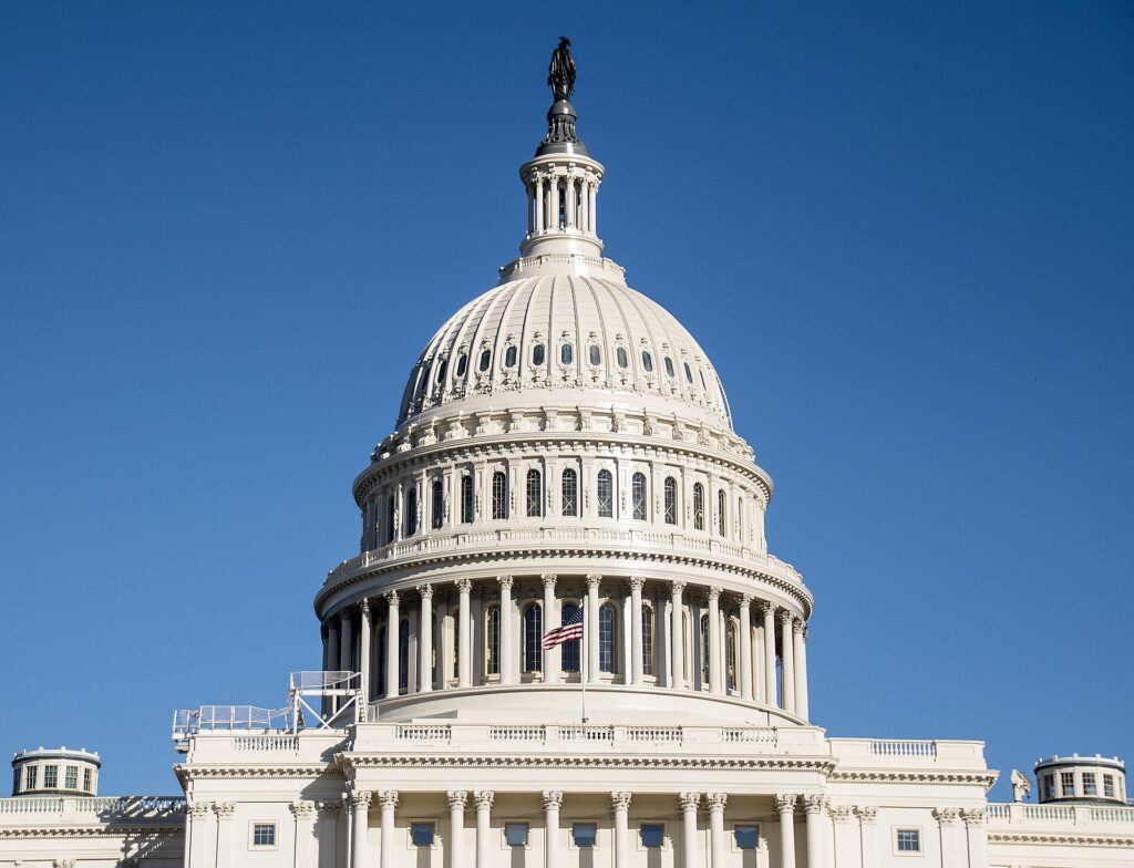
    The west front of the United States Capitol in Washington, DC
    The U.S. Capitol, where free tours start at the underground Visitor Center (Photo: Ron Cogswell from Arlington, Virginia, USA via Wikimedia Commons, CC BY 2.0)

    Washington, DC at a glance for first-timers

    • Airports: three. Reagan National (DCA), across the Potomac in Arlington, is about 6 km (4 miles) from the Mall and has its own Metro station; see our Reagan National guide. Dulles (IAD), about 42 km (26 miles) west in Virginia, is on the Metro’s Silver Line and handles most long-haul and international flights; see our Dulles guide. Baltimore/Washington (BWI), northeast toward Baltimore, is linked to Union Station by train; see our BWI guide.
    • Getting around: the Metro reaches almost everything a visitor needs except Georgetown, and the core is flat and walkable. Capital Bikeshare docks are everywhere. A car is a liability in the city and useful only for day trips.
    • Money: U.S. dollars. Sales tax is added at the till, and some restaurants add a service charge to the bill, so read it before tipping the customary 18 to 20 percent on top.
    • Weather: four real seasons, with a hot, humid summer, a mild and changeable winter, and a spring and fall that are the best times to walk the Mall. Our month-by-month guide has the detail.
    • Where to stay: Penn Quarter and downtown for walking to the Mall; Dupont Circle for restaurants and a residential feel; Capitol Hill, Georgetown, the Wharf or Navy Yard for character; Arlington and Crystal City across the river for lower rates on the Metro. Our Washington, DC hotel search covers them all.

    The National Mall and the memorials

    The National Mall is the three-kilometer lawn that runs from the Capitol to the Lincoln Memorial, and it is where almost every first visit begins. The National Park Service looks after it, and the memorials are open 24 hours a day, which is worth knowing because they are at their best early in the morning and after dark, when the crowds and the summer heat have gone. Start at the Washington Monument, the marble obelisk at the center; the elevator to the observation level runs on timed tickets, most of them reserved online in advance for a small booking fee, and the view along the axis of the Mall explains the city’s plan in a glance. West of it, the World War II Memorial frames the Reflecting Pool, and at the far end the Lincoln Memorial, with the seated Lincoln and the steps where Martin Luther King Jr. gave the “I Have a Dream” speech, looks back toward the Capitol. On either side of the Reflecting Pool are the Vietnam Veterans Memorial, the black granite wall with more than 58,000 names, and the Korean War Veterans Memorial, with its patrol of steel soldiers. South of the Mall, the Tidal Basin loop takes in the Martin Luther King Jr. Memorial, the long, open-air FDR Memorial and the domed Jefferson Memorial on the water. The full circuit from the Capitol to the Lincoln Memorial, around the Tidal Basin and back is around 10 km, so wear real shoes and carry water in summer.

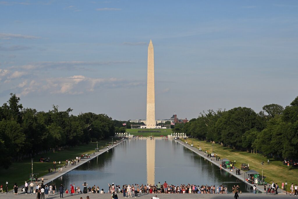
    The Lincoln Memorial Reflecting Pool with the Washington Monument beyond
    The Reflecting Pool between the Lincoln Memorial and the Washington Monument, best at dawn or after dark (Photo: G. Edward Johnson via Wikimedia Commons, CC BY 4.0)

    Capitol Hill: the Capitol, the Library of Congress and the Supreme Court

    At the east end of the Mall, the U.S. Capitol offers free guided tours from its underground Visitor Center, Monday to Saturday; reserve them through the Capitol Visitor Center or through your representative’s or senator’s office, which can also arrange gallery passes to watch the House or Senate in session. Across the street, the Thomas Jefferson Building of the Library of Congress is the most beautiful interior in the city, a gilded, painted and mosaic-covered hall built in the 1890s, with a Gutenberg Bible and a reconstruction of Jefferson’s own library; entry is free, with timed passes recommended. The Supreme Court, beside it, is open to visitors on weekdays, with courtroom lectures on days the court is not sitting. Behind the Capitol, the row-house streets of Capitol Hill lead to Eastern Market, a brick market hall from the 1870s where the weekend farmers’ and flea markets are the neighborhood’s social life. Allow a full morning for the Capitol, the library and the court together, and book the tours before you fly.

    The White House, the Archives and Penn Quarter

    You can see the White House from Lafayette Square on the north side and the Ellipse on the south, but a tour inside is a project: U.S. citizens request one through their member of Congress, and visitors from other countries through their embassy in Washington, weeks to months in advance. The White House Visitor Center on Pennsylvania Avenue is the fallback for everyone else. Six blocks east, the National Archives displays the Declaration of Independence, the Constitution and the Bill of Rights in its domed Rotunda; admission is free and the line moves quickly outside the spring school-trip season. North of the Archives, Penn Quarter is the downtown entertainment district: Ford’s Theatre, where Lincoln was shot and which is still a working theater with a museum below it, the shared building of the National Portrait Gallery and the Smithsonian American Art Museum with its glass-roofed courtyard, Capital One Arena, and the small Chinatown with its Friendship Archway. This is the most convenient place to stay for a first visit, and the restaurant density is high.

    The Smithsonian and the museums on the Mall

    The Smithsonian Institution runs the largest museum complex in the world, and most of its museums line the Mall; they are free and open every day of the year except December 25. The National Museum of Natural History has the Hope Diamond, the elephant in the rotunda and a spectacular fossil hall. The National Museum of American History has the flag that inspired the national anthem, the Greensboro lunch counter and Dorothy’s ruby slippers. The National Air and Space Museum has been through a multi-year renovation with galleries reopening in phases, and it is the most popular museum in the city; free timed-entry passes are the way in. The National Museum of African American History and Culture, the bronze-clad building beside the Washington Monument, is the most moving museum in Washington and needs at least three hours; start at the bottom, in the history galleries, and work up. The National Museum of the American Indian, the Hirshhorn for modern art in its round concrete drum, and the National Museum of Asian Art complete the row. Across the Mall, the National Gallery of Art, which is separate from the Smithsonian but just as free, has the only Leonardo da Vinci painting in the Americas in its West Building, I. M. Pei’s East Building for modern art, and a sculpture garden that becomes an ice rink in winter.

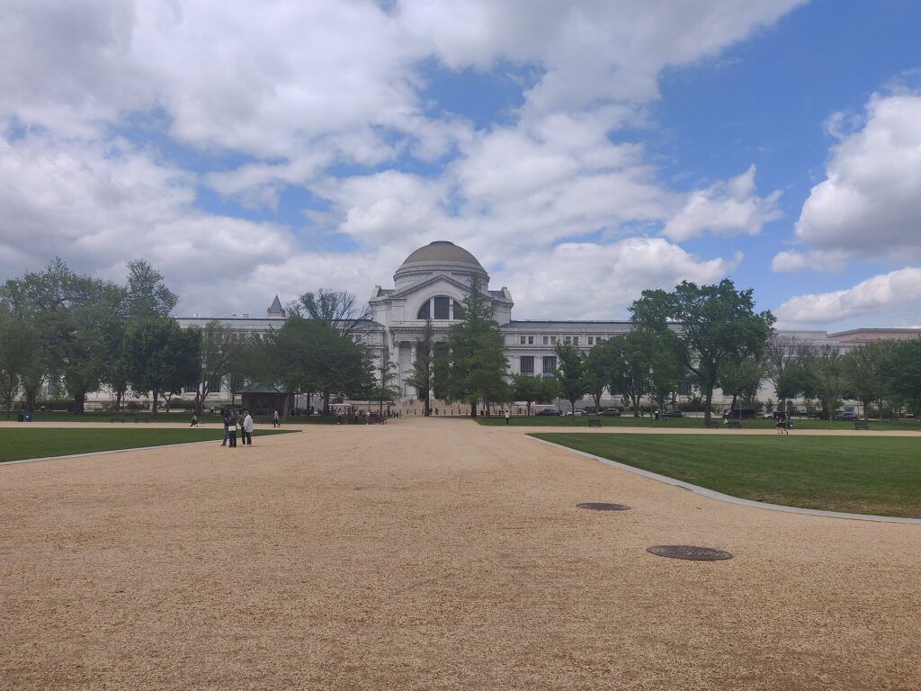
    The National Museum of Natural History on the National Mall
    The National Museum of Natural History, one of the free Smithsonian museums on the Mall (Photo: Kurt Kaiser via Wikimedia Commons, CC0)

    Neighborhoods worth a half-day

    Georgetown

    Older than the city itself, Georgetown is the cobbled, brick-and-federal-house neighborhood on the Potomac, with shopping along M Street and Wisconsin Avenue, the university on the hill, the gardens of Dumbarton Oaks and the Old Stone House, one of the oldest buildings in the city. The towpath of the C&O Canal starts here, and the waterfront park is the place for a sunset. There is no Metro stop; walk from Foggy Bottom or Dupont Circle.

    Dupont Circle and Embassy Row

    A traffic circle with a fountain at its center and a ring of grand mansions around it, many of them embassies along Massachusetts Avenue. The Phillips Collection, which opened in 1921 as America’s first museum of modern art, is here, with Renoir’s Luncheon of the Boating Party; the Sunday farmers’ market fills the circle year-round. It is one of the best neighborhoods to stay in.

    Logan Circle, 14th Street and U Street

    Fourteenth Street is the city’s restaurant row, running north from Logan Circle’s Victorian row houses to U Street, the historic center of Black Washington once known as Black Broadway, where Duke Ellington grew up and the Lincoln and Howard theaters still host shows. Ben’s Chili Bowl, open since 1958, serves the half-smoke that every visitor should try once.

    Adams Morgan and Columbia Heights

    Eighteenth Street in Adams Morgan is the nightlife strip, with bars, live music and late-night jumbo pizza slices; next door, Columbia Heights and Mount Pleasant have the Salvadoran pupuserias that reflect one of the city’s largest immigrant communities.

    The Wharf and Navy Yard

    The Southwest waterfront has been rebuilt as the Wharf, a mile of restaurants, piers, a concert hall and hotels, beside the Municipal Fish Market, the oldest continuously operating open-air fish market in the country. Navy Yard, along the Anacostia River to the east, has Nationals Park, the Yards Park and a riverwalk lined with breweries.

    Museums beyond the Mall, culture and family attractions

    The Smithsonian’s National Zoo, in Woodley Park on the Red Line, is free, set on a wooded hillside in Rock Creek Park, and has giant pandas again after a short absence. The United States Holocaust Memorial Museum, just off the Mall, is free but requires timed passes for the permanent exhibition in the busy months. The International Spy Museum at L’Enfant Plaza and the Museum of the Bible charge admission and draw big crowds. The Renwick Gallery, across from the White House, shows contemporary craft in a beautiful 1850s building. Across the river, Arlington National Cemetery, on the Blue Line, is the resting place of more than 400,000 service members and President Kennedy; the changing of the guard at the Tomb of the Unknown Soldier happens every half hour in summer and every hour in winter. Near Dulles Airport, the Smithsonian’s Udvar-Hazy Center holds the Space Shuttle Discovery, an SR-71 Blackbird and hundreds of other aircraft in two enormous hangars, and it is worth the trip for anyone who loved Air and Space. For live performance, the Shakespeare Theatre Company, Arena Stage and the Folger Shakespeare Library are the serious houses, the Anthem at the Wharf and the 9:30 Club are the best music venues, and Wolf Trap in Virginia is the summer outdoor stage. For concerts, shows and games during your dates, our Washington, DC events page lists what is on sale.

    The big events: cherry blossoms and the Fourth of July

    Two events define the Washington calendar. The National Cherry Blossom Festival runs for about four weeks from late March to mid-April, built around the peak bloom of the Yoshino cherry trees around the Tidal Basin, the descendants of a gift from Tokyo in 1912. Peak bloom usually falls in late March or the first days of April and lasts only a few days; the Park Service publishes a forecast in early March, and the official Washington, DC visitor site tracks the festival’s parade, kite festival and events. Go at sunrise if you want photographs without a crowd. The Fourth of July is the other: a parade along Constitution Avenue, a free concert on the Capitol’s West Lawn, and fireworks over the Reflecting Pool watched by hundreds of thousands of people on the Mall. Both are wonderful and both fill the city’s hotels; book the room before the flight. Every fourth January, the presidential inauguration takes over the city completely, and the next is in 2029.

    Sports

    The Washington Nationals play baseball at Nationals Park in Navy Yard from April to September, and a weeknight game there, with the Capitol dome visible from the upper deck, is one of the easiest nights out in the city. The Capitals (NHL) and the Wizards (NBA) share Capital One Arena in Penn Quarter, directly above the Gallery Place Metro station. D.C. United play soccer at Audi Field on the Anacostia waterfront, and the Mystics play WNBA basketball in Congress Heights. The Commanders play NFL football at their stadium in Landover, Maryland, a long trip out of the city on game days. Check what is on sale in Washington, DC for your dates before you book flights.

    What to eat, and where

    Washington’s food is shaped by its immigrant communities more than by any single local dish. The Washington area has one of the largest Ethiopian communities outside Africa, and injera with shared stews is a DC dinner in Shaw, on U Street, and increasingly in the Maryland and Virginia suburbs. The Salvadoran pupusa is the local comfort food in Columbia Heights and Mount Pleasant. The half-smoke, a coarse, smoky sausage served with chili, is the city’s own, and mumbo sauce, the sweet-sour sauce on wings from carry-outs across the city, is the other native flavor. Because Washington sits between Maryland and Virginia, Chesapeake blue crabs and crab cakes dominate summer menus, steamed and dusted with Old Bay. The Michelin Guide has covered the city for years, and the fine-dining scene around 14th Street, Penn Quarter and the Wharf rivals much larger cities. For grazing, Union Market in Northeast is the best food hall, Eastern Market has the weekend stalls, and the Municipal Fish Market sells steamed crabs and oysters from the barges at the Wharf. Brunch is a competitive sport on 14th Street and in Adams Morgan.

    Washington through the seasons

    What you do in Washington depends heavily on the season. Spring (March to May) is the peak: cherry blossoms in late March and early April, the dogwoods and azaleas after them, the embassies’ open houses in May, and school groups on every museum step from March to June. Summer (June to August) is hot and humid, so plan the monuments for early morning and evening, the museums for the afternoon heat, and the Smithsonian Folklife Festival on the Mall around the Fourth of July. Congress goes into recess in August, weekday hotel rates soften, and the city slows down. Fall (September to November) is the local favorite: warm, dry days in September, foliage along Rock Creek and the C&O Canal in late October, the Marine Corps Marathon, and baseball in the playoffs in a good year. Winter (December to February) is mild by northeastern standards but changeable, with occasional snowstorms that shut the city down for a day; the National Christmas Tree on the Ellipse and the ice rink in the National Gallery’s sculpture garden light up December, and the museums are at their quietest in January and February. Our month-by-month guide has the fare patterns that go with each season.

    Washington with kids

    Few cities are easier with children, because the biggest attractions are free and you can leave after an hour without feeling you have wasted a ticket. The Natural History museum, with its dinosaurs, insect zoo and gem hall, is the obvious first stop; Air and Space and the Udvar-Hazy Center are the second. The National Zoo, free and on the Metro, fills a morning, and the carousel on the Mall is a reward for good behavior between museums. The Spy Museum suits older children, and the Capitol tour and the Archives work best for kids who have studied American history at school. Paddle boats on the Tidal Basin in spring and summer and the fountains at the Yards Park win over reluctant teenagers. Children aged four and under ride the Metro free with a paying adult. If you are driving in from elsewhere, our family car rental guide covers the vehicle question.

    Washington on a budget

    This is the cheapest great city in the country to sightsee in. The Smithsonian museums, the National Gallery, the zoo, the memorials, the Capitol and Library of Congress tours, the Archives, Arlington National Cemetery and the Holocaust Museum are all free, and a Metro day pass covers the transport. Pack lunch for the Mall, because the museum cafés are expensive, and eat dinner in Columbia Heights, Adams Morgan or at the food halls. The expense is the hotel: Washington’s weekday rates are driven by government and business travel, so weekends, August and the weeks around Christmas are often much cheaper than a Tuesday in April. Staying across the river in Arlington or Crystal City, on the Blue and Yellow lines, saves money without costing much time. Compare rates by neighborhood on our Washington, DC hotel search.

    Day trips from Washington

    Mount Vernon, George Washington’s plantation estate on the Potomac, is about 25 km (16 miles) south along the George Washington Memorial Parkway; the Mount Vernon site has tickets and hours, and cyclists can ride the whole way on the Mount Vernon Trail. Old Town Alexandria, on the Blue and Yellow lines, is an 18th-century port town with a mile of shops and restaurants on King Street down to the river. Annapolis, an hour east, has the Naval Academy and a harbor full of sailboats; Baltimore, an hour north by train, has the Inner Harbor and Fort McHenry. Philadelphia is under two hours by Amtrak, and our guide to things to do in Philadelphia covers it; drivers can use our Washington, DC to Philadelphia route guide. West of the city, Great Falls on the Potomac is 30 minutes away, Harpers Ferry is about 90 minutes, and Shenandoah National Park and Skyline Drive are about 90 minutes to the Front Royal entrance, spectacular in October. Gettysburg is about two hours north. Most of these need a car; see our Washington, DC car rental page, and rent only for the days you leave the city.

    Row houses along the C&O Canal in Georgetown, Washington, DC
    Georgetown, older than the city itself, where the C&O Canal towpath begins (Photo: Sdkb via Wikimedia Commons, CC BY-SA 4.0)

    Two sample itineraries

    Three days, no car

    Day one: the Capitol tour and the Library of Congress in the morning, lunch at Eastern Market, the National Gallery of Art in the afternoon, and dinner in Penn Quarter. Day two: the African American history museum at opening, the Washington Monument, then the Natural History museum after lunch; walk the memorials from the World War II Memorial to Lincoln at sunset, and eat on 14th Street. Day three: Arlington National Cemetery in the morning, Georgetown and the waterfront in the afternoon, and a Nationals game or dinner at the Wharf.

    Five days, with the region

    Add a day for Air and Space, the zoo and U Street, then rent a car for Mount Vernon and Old Town Alexandria, or for Shenandoah and Harpers Ferry, returning it before you head back into the city. Philadelphia or Baltimore by train is the car-free alternative.

    Practical details

    • Transit: tap a SmarTrip card, or SmarTrip in your phone’s wallet, at the fare gates; fares depend on distance and time of day, and one-day and multi-day passes are available. WMATA has maps and service alerts; our car-versus-Metro guide goes into detail.
    • From the airports: the Blue or Yellow Line from Reagan National, the Silver Line from Dulles, and MARC or Amtrak trains from the BWI rail station, reached by a free shuttle from the terminal.
    • Weather: light clothing, sunscreen and water in summer; layers in spring and fall; a warm coat from December to February. The National Weather Service’s Baltimore/Washington office has the forecast.
    • Time zone: Eastern, the same as New York, Philadelphia and Toronto.
    • Security: expect bag checks at every museum and federal building, leave pocketknives at the hotel, and allow extra time; streets around the White House and the Capitol close without warning for motorcades and demonstrations.
    • Entry requirements: visitors from Visa Waiver Program countries need an approved ESTA before boarding; most others need a visa. The State Department’s travel site is the authoritative source.

    Frequently asked questions

    How many days do you need in Washington, DC?

    Three full days covers the Mall, the Capitol, the main Smithsonian museums and one or two neighborhoods; add a day for Arlington and Georgetown, and another for Mount Vernon or a trip into Virginia.

    Are the museums in Washington really free?

    The Smithsonian museums, the National Gallery of Art, the National Zoo, the Archives and the Holocaust Museum are all free, though a few require free timed passes at busy times. The Spy Museum and the Museum of the Bible charge admission.

    What is the number one thing to do in Washington, DC?

    Walk the National Mall from the Capitol to the Lincoln Memorial, ideally in the evening, when the memorials are lit and the heat has gone.

    Is Washington, DC walkable?

    Very, in the core. The Mall, downtown, Capitol Hill, Dupont Circle and Georgetown are all walkable, and the Metro connects them; the distances along the Mall are longer than they look.

    Do I need a car in Washington, DC?

    No. Parking is expensive, traffic is heavy and the Metro covers almost everything. Rent for a day trip to Mount Vernon or Shenandoah if you want one.

    Can you tour the White House?

    Yes, but it must be requested well in advance through a member of Congress for U.S. citizens, or through your embassy for international visitors. Tours are free and not guaranteed.

    Ready to go? Compare flights to Washington, DC into all three airports, find a place to stay with our Washington, DC hotel search, and if Virginia or Maryland is on the list, price a rental car for those days.

  • Best Time to Fly to Boston: Seasons, Weather & Prices

    Best Time to Fly to Boston: Seasons, Weather & Prices

    Boston runs on calendars that most cities do not have. It is a major tourist city with a short, glorious summer and the most famous fall foliage in the country, but it is also a college town on an enormous scale, with dozens of universities whose move-in days, parents’ weekends and graduations fill every hotel in the city several times a year. Add a medical and biotech economy that keeps the convention center busy, the oldest annual marathon in the world, a regatta that brings rowing crews from across the globe, and four professional teams with devoted followings, and you have a city where hotel rates, more than airfares, decide the real cost of a trip. The weather matters too: Boston winters are cold, snowy and occasionally stormy, and its springs arrive late. This guide walks through the weather month by month, the fare seasons, the events that move prices, and how to handle the airport.

    The short answer

    For the best combination of weather and value, aim for early June, before the summer peak takes hold, and the first half of November, when the foliage crowds have gone but the city is still mild and lively. Late September and October are the most beautiful weeks of the year, with crisp days and the leaves turning across New England, and also the most expensive, with hotel rates that rank among the highest in the country. The cheapest fares and rooms come in January, February and early March, outside the school vacation week in February. The priciest stretches are September and October, graduation weekends in May, Marathon weekend in April, and July and August for airfares. Whatever you choose, run a flexible-date search on our Boston flights page; moving a trip by a few days around a graduation or a holiday weekend can change the hotel bill far more than the fare.

    Fall color in the Boston Public Garden
    Boston in the fall, the season with the best weather and the highest hotel rates (Photo: Nina La via Wikimedia Commons, CC BY 3.0)

    Boston’s weather, season by season

    Boston sits on the Atlantic at the edge of a sheltered harbor, and the ocean shapes its weather in every season. Winters are cold and damp, with snow most years and a nor’easter or two capable of dropping a foot or more in a day; spring is late, cool and changeable, especially near the water; summers are warm and sometimes humid, with a sea breeze that can make the waterfront several degrees cooler than the suburbs; and fall is long, dry and bright. The figures below are approximate seasonal patterns based on the long-term Logan Airport climate normals from NOAA’s National Weather Service; check the current forecast before you pack, because a week in March or November can hold both a mild afternoon and a snowstorm.

    MonthTypical daytime highTypical overnight lowWhat it feels likeFare pressure
    Januaryaround 3 °C (37 °F)around -5 °C (23 °F)Cold and raw off the harbor; snow and the odd nor’easterLow after New Year’s week
    Februaryaround 4 °C (39 °F)around -4 °C (25 °F)Often the snowiest month; bright, cold days between stormsLow; rises for Presidents’ Day and school vacation week
    Marcharound 8 °C (46 °F)around -1 °C (31 °F)Gray and changeable; a late snowstorm is commonLow
    Aprilaround 14 °C (57 °F)around 5 °C (41 °F)Cool, showery, the first blossoms late in the monthModerate; Marathon weekend spike
    Mayaround 19 °C (67 °F)around 10 °C (50 °F)Green and pleasant, cool by the waterHigh on graduation weekends
    Junearound 25 °C (77 °F)around 16 °C (60 °F)Warm and long-lit; often the best month for weatherModerate to high
    Julyaround 28 °C (82 °F)around 19 °C (66 °F)Warm to hot, humid spells, thunderstormsHigh
    Augustaround 27 °C (81 °F)around 18 °C (65 °F)Warm and humid; the harbor is at its warmestHigh, then a move-in spike at month’s end
    Septemberaround 23 °C (73 °F)around 14 °C (58 °F)Warm days, cool nights, low humidityPeak for hotels
    Octoberaround 17 °C (62 °F)around 8 °C (47 °F)Crisp and bright; foliage seasonPeak for hotels
    Novemberaround 11 °C (52 °F)around 3 °C (38 °F)Cooling fast; bare trees by midmonthModerate, falling; Thanksgiving spike
    Decemberaround 6 °C (42 °F)around -2 °C (29 °F)Cold, festive, the first snow likelyLow until mid-month, then high

    Three things the table cannot show. First, the nor’easter: a coastal storm that tracks up the Atlantic and can bring heavy snow, high winds and coastal flooding, usually between December and March. Most years bring at least one, and when one is forecast, flights cancel pre-emptively and the city slows for a day or two. Second, the sea breeze: on a spring or early summer afternoon, the wind can turn onshore and drop the temperature on the waterfront by 5 to 10 degrees in an hour, so a warm morning in the Public Garden does not guarantee a warm evening in the Seaport. Third, humidity: the numbers for July and August look moderate, but a humid week in the upper 80s °F feels a good deal hotter, and many older buildings and triple-deckers are not air-conditioned.

    How Boston’s fare seasons work

    Four calendars drive demand for Boston: summer tourism, which fills the flights from June to August; the academic year, which sends a wave of students and parents through the city at the start of September, again on parents’ weekends in October, and again at graduation in May; the fall foliage, which makes late September and October the peak for hotels and for travelers heading on to Vermont, New Hampshire and Maine; and the conventions and medical meetings, which fill downtown and the Seaport on weekdays at any time of year. The result is an unusual pattern in which airfares peak in summer but hotel rates peak in the fall, and the two do not always move together. Boston Logan is also a busy, competitive airport, with JetBlue as its largest carrier and all the major airlines present, which helps keep fares on many domestic routes reasonable even when rooms are not.

    Peak season

    June through October, plus graduation weekends, Marathon weekend and the week between Christmas and New Year. Summer airfares are at their highest in July and early August, when families travel and the Cape Cod crowds pass through Logan. From Labor Day to the end of October, hotel rates climb to the year’s maximum: the students are back, conventions return, the weather is at its best, and leaf-peepers from around the world use Boston as the gateway to New England. If you must travel in peak, book the hotel early, consider Cambridge, Brookline or a hotel near a T station farther out, and fly mid-week.

    Shoulder season

    April to May and November. April is cool but green by the end of the month, with baseball back at Fenway, and May is lovely, but both carry spikes, for the Marathon and for commencements, that can make a single weekend as expensive as October. November, once the leaves have fallen, is the value month of the fall: mild in the first half, quiet, and with hotel rates well down from their October highs, until Thanksgiving week pushes fares up again.

    Low season

    January through mid-March, outside the holidays and school vacation week. Fares and rooms are at their lowest, the museums are uncrowded, the Celtics and Bruins are in season, and the city is cold but entirely functional. The trade-off is weather: build a buffer into connections, because a nor’easter can ground flights for a day. Early December, before the holiday rush, is another quiet, inexpensive window.

    As elsewhere, mid-week departures and early or late flights usually price below Friday and Sunday afternoons on the same route, and a search across a whole month reveals cheaper pairs of dates close to your first choice. Our guide to the best times to book explains how to read those patterns.

    Boston month by month

    January

    Cold, often snowy and, after the first week, one of the cheapest months of the year for both flights and hotels. The Celtics and Bruins play at TD Garden, the Frog Pond rink on Boston Common is open for skating, and the museums, the Museum of Fine Arts, the Gardner, the Museum of Science, are at their quietest. Pack for real cold and plan indoor days; the city handles snow well, and the T keeps running.

    February

    Similar weather and often the snowiest month, with low fares outside Presidents’ Day weekend (the third Monday of February) and the Massachusetts school vacation week that surrounds it, when local families travel and flights out of Boston and hotels in the ski country fill. A good month for a museum, food and hockey weekend.

    March

    Gray, changeable and usually cheap. The St. Patrick’s Day parade through South Boston, held on the Sunday around March 17, is one of the biggest in the country and fills the bars for the weekend. College spring breaks empty the student neighborhoods for a week or two, and a late snowstorm is always possible.

    April

    Spring arrives slowly, and the calendar gets busy. Patriots’ Day, the third Monday of April, brings the Boston Marathon, reenactments at Lexington and Concord at dawn, and a Red Sox morning game at Fenway, and hotel rates around the course and in Back Bay are among the highest of the year that weekend. The Massachusetts school vacation week falls the same week. Opening Day at Fenway, the magnolias on Commonwealth Avenue in the last week of the month, and the Swan Boats’ return to the Public Garden lagoon mark the start of the season.

    May

    Green, pleasant and, on the right weekends, very expensive. Commencement season runs through the second half of the month, when Harvard, MIT, Boston University, Northeastern, Boston College and dozens of other schools hold graduations, and families book hotels a year ahead; if your dates coincide, look well outside the city. The Boston Calling music festival fills Memorial Day weekend. The weekdays between the big weekends are much better value.

    June

    Often the best month for weather, with long evenings and warmth without the full humidity of July. Harbor ferries run on their summer schedules, Pride fills the city early in the month, and Harborfest begins in the last days of June. Fares rise as schools finish; the first two weeks are the value play.

    July

    Peak summer. The Fourth of July brings the Boston Pops concert and fireworks at the Hatch Shell on the Esplanade, one of the most famous Independence Day celebrations in the country, and the USS Constitution’s annual turnaround cruise in the harbor. Airfares are at their summer high, the Harbor Islands and Cape Cod are at their best, and the North End’s saints’ feasts begin on summer weekends. Expect humid spells and thunderstorms.

    August

    Warm and humid, with the North End feasts, the biggest of which closes the neighborhood’s streets on the last weekend of the month. The final days of August and the first of September bring the city’s strangest event: the mass move-in, when tens of thousands of students arrive at once and apartment leases turn over, rental trucks clog the streets, and hotels near the universities sell out. Avoid those days if you can.

    September

    Many Bostonians would say this is the best month of the year: warm days, cool nights, low humidity and the whole city back from vacation. It is also where hotel rates reach their annual peak, with conventions, parents’ weekends and pennant races at Fenway all competing for rooms. Airfares are moderate after Labor Day, so the hotel is the number to watch.

    October

    The postcard month. The foliage turns across New England through the month, starting in the northern mountains in late September and reaching the Boston area in the second half of October; the Indigenous Peoples’ Day (Columbus Day) weekend, the second Monday, is the busiest leaf-peeping weekend of the year. The Head of the Charles Regatta fills the river and the hotels for a weekend in the second half of the month, and Salem’s month of Halloween events draws huge crowds on weekends. Book early.

    November

    Rates fall steadily once the leaves are down, and the first half of the month is often mild enough for walking the Freedom Trail in a light jacket. Thanksgiving, the fourth Thursday, sends fares up for the week; Plymouth, an hour south, marks the holiday in style. The holiday lights go up on Boston Common late in the month.

    December

    Two months in one. The first half is quiet and inexpensive, with the tree lighting on the Common, holiday markets, the Boston Pops holiday concerts at Symphony Hall and the reenactment of the Boston Tea Party on December 16. From about December 18, fares rise sharply for Christmas and New Year, and the city celebrates New Year’s Eve with First Night events and fireworks over the harbor.

    Boston Common under snow in winter
    Boston in winter: cold and snowy, but the cheapest time of year to visit (Photo: Ethan Long via Wikimedia Commons, CC BY-SA 2.0)

    Events that move Boston flight and hotel prices

    Cross-check these against your dates before you book. Exact dates shift each year; Meet Boston, the city’s tourism bureau, keeps the current calendar.

    • Presidents’ Day weekend and February school vacation (third week of February).
    • St. Patrick’s Day parade (the Sunday around March 17).
    • Boston Marathon and Patriots’ Day (third Monday of April): a severe hotel spike across Back Bay and downtown.
    • Commencement weekends (second half of May): rooms sell out months ahead across the city and Cambridge.
    • Fourth of July and Harborfest.
    • Student move-in (the last days of August and September 1) and parents’ weekends in October.
    • Foliage season and the Head of the Charles (October): the highest hotel rates of the year.
    • Thanksgiving week and Christmas to New Year.
    • Red Sox, Celtics, Bruins and Patriots home games, playoff runs and stadium concerts. Our Boston events page shows what is on sale for your dates.
    • Medical and technology conventions at the Seaport, which can fill downtown hotels on weeknights without warning; if mid-week rates look strangely high, that is usually why.

    Getting in from the airport

    Boston is served by Boston Logan International (BOS), in East Boston on the far side of the harbor and only about 5 kilometers (3 miles) from downtown, which makes it one of the most convenient major airports in the country. It has four terminals, A, B, C and E, with Terminal E handling most international flights, and there are nonstop flights from nearly every large U.S. city and from dozens of destinations in Europe and beyond. Getting downtown is easy. The Silver Line SL1 bus runs from every terminal to South Station, where it connects with the Red Line, Amtrak and commuter rail, and has been free to board at the airport in recent years; free Massport shuttle buses link the terminals to Airport station on the Blue Line, which reaches downtown in minutes; water taxis cross the harbor to the waterfront; and taxis and ride-hail reach downtown through the harbor tunnels in 15 to 30 minutes when traffic is light. Logan Express buses run to Back Bay and several suburbs. Two alternatives are worth checking when Logan fares are high: Providence (PVD), about an hour south, has its own MBTA commuter rail station, and Manchester-Boston Regional (MHT) in New Hampshire is about an hour north by car. Our Boston car-versus-transit guide explains why most visitors do not need a car, and our Logan airport guide covers the layout.

    A terminal at Boston Logan International Airport
    Boston Logan, just 5 kilometers (3 miles) across the harbor from downtown (Photo: CaribDigita via Wikimedia Commons, Public domain)

    Timing tricks that work for Boston

    • Search the whole month. Boston’s spikes are narrow: a graduation weekend or Marathon Monday can sit beside perfectly normal dates. A calendar search on TicketScanner shows the edges instantly.
    • Price the hotel first in the fall and in May. In September, October and on commencement weekends, the room costs more than the flight. Run a Boston hotel search for the same dates before you commit.
    • Look across the river. Cambridge and Somerville hotels on the Red Line can be cheaper than Back Bay on weekends, and business-district hotels in the Seaport and the Financial District often drop their rates on Friday and Saturday nights.
    • Fly mid-week. Boston’s business and university traffic makes Monday morning and Friday and Sunday afternoon the busiest flights; Tuesday to Thursday is usually the value.
    • Check Providence and Manchester. A cheaper fare into PVD with a commuter rail ride, or into MHT with a rental car, can beat Logan, especially in summer.
    • Build a winter buffer. Nor’easters can ground flights for a day between December and March; avoid tight connections, and read our guide to how early to arrive at the airport.
    • Flying out of Boston instead? The same seasonality applies in reverse; see cheap flights from Boston.
    Sailboats on the Charles River Basin in Boston in summer
    Summer on the Charles River, when airfares to Boston are at their highest (Photo: EgorovaSvetlana via Wikimedia Commons, CC BY-SA 4.0)

    What to pack, by season

    Winter (December to March): a warm, waterproof coat, a hat, gloves and boots with grip for slushy sidewalks and icy brick. Spring (April to May): layers, a rain jacket and a sweater for the evenings, especially near the water. Summer (June to August): light, breathable clothing, sunscreen, an umbrella for thunderstorms and a light layer for air-conditioned museums and harbor cruises. Fall (September to November): layers and a medium jacket, heavier by November. In any season, bring comfortable shoes: Boston’s brick sidewalks and cobblestones are hard on thin soles, and you will walk more than you expect.

    The best time to fly to Boston for…

    Fall foliage

    Early to mid-October for the mountains of Vermont, New Hampshire and Maine, and the second half of October for Boston itself, booked months in advance.

    The Marathon

    Patriots’ Day weekend in April, with the hotel booked as soon as you have a bib or a plan, or stay outside the city on a T line.

    Baseball at Fenway

    June, when the weather is warm but not humid, or September for the pennant race; April games are often cold.

    The lowest fares

    January through early March, outside Presidents’ Day week, and early December. Pair with museums, restaurants and a Celtics or Bruins game.

    Families

    Late June and early July, for the Harbor Islands, the Aquarium and the Fourth of July, or the first half of November for smaller crowds and lower rates.

    International visitors

    Travelers from Visa Waiver Program countries need an approved ESTA before boarding; most others need a visa. The State Department’s travel site explains what applies to you, and the TSA lists what you can carry through security.

    Frequently asked questions

    What is the cheapest month to fly to Boston?

    January and February are consistently the lowest for both flights and hotels, outside the February school vacation week, followed by early March and early December.

    What is the best month to visit Boston for weather?

    June and September, with October close behind for crisp days and foliage. July and August are warm and can be humid; winter is cold and snowy.

    When is fall foliage in Boston?

    The color reaches the Boston area in the second half of October, after peaking earlier in northern New England. The Arnold Arboretum and the Public Garden are the best places to see it in the city.

    Why are Boston hotels so expensive in the fall?

    Because everything happens at once: the students are back, the convention calendar is full, the weather is at its best and foliage visitors use Boston as their base. September and October are among the most expensive months of any American city.

    Should I avoid Boston in winter?

    Not if you pack for it. January and February are cold, but they bring the lowest prices, empty museums and hockey and basketball season. Allow for a possible storm delay.

    How far ahead should I book?

    For graduation weekends, the Marathon and October, book the hotel months ahead. For winter and November, finding the right dates matters more than booking early.

    Is it better to fly into Boston or Providence?

    Boston for convenience, since Logan is minutes from downtown. Providence is worth checking when Logan fares are high, with a commuter rail link from the airport to the city.

    Ready to pick your dates? Compare fares across the whole month on our Boston flights page, then find a room with our Boston hotel search. For what to do when you land, start with our first-timer’s guide to Boston.

  • Boston: Should You Rent a Car or Rely on Public Transit?

    Boston: Should You Rent a Car or Rely on Public Transit?

    Boston is one of the few American cities where a visitor is genuinely better off without a car. Its historic core is small enough to walk across in under an hour, the airport is a short subway or bus ride across the harbor, and the T, the oldest subway system in the country, reaches almost every sight a first-timer wants to see. Driving, meanwhile, is famously hard work: streets laid out on colonial cow paths and harbor landfill, one-way systems that change direction without warning, rotaries, tunnels, tolls, residents-only parking on most neighborhood streets and garage rates that rival New York’s. That said, Boston is also the gateway to New England, and the moment your plans include Cape Cod, the Berkshires, the coast of Maine or the fall foliage in the mountains, a car becomes the obvious choice. This guide explains how transit works, what driving is really like, and how to decide.

    The short answer

    Skip the car for any trip based in Boston or Cambridge, which is most visits. The T, your feet, the Bluebikes bike-share and the occasional taxi will cover the Freedom Trail, Back Bay, the North End, the Seaport, Fenway and Harvard faster and far more cheaply than driving, and you will not pay to park overnight. Rent a car for the days that need one: Cape Cod beyond the ferry towns, the North Shore beaches, Newport, the White Mountains or Vermont in foliage season, a visit to family in the suburbs, or a longer New England road trip. Even then, pick it up on the morning you leave the city and return it when you get back. If a car is on the list, compare rates for your dates on our Boston car rental page.

    How Boston is laid out

    Boston grew on a hilly peninsula in a harbor, and much of today’s city sits on land that was once water: Back Bay, the South End and large parts of the waterfront were all filled in during the nineteenth century. Downtown, the Financial District and the North End hold the oldest, most irregular streets and most of the Freedom Trail. Beacon Hill rises beside Boston Common, and the Public Garden leads west into Back Bay, whose streets are a neat grid with cross streets named alphabetically from Arlington to Hereford. The South End is south of Back Bay, Fenway and Kenmore lie to the west, and the Seaport sits across the Fort Point Channel on the harbor. The Charles River separates Boston from Cambridge, home to Harvard and MIT, which is effectively part of the same city for a visitor. From end to end, the areas most visitors see fit within about 5 km (3 miles).

    Hotels cluster in Back Bay, downtown and the Financial District, the Seaport, and in Cambridge around Kendall Square and Harvard Square, with airport hotels in East Boston and cheaper options in the suburbs along the T. The best rule is to stay near a subway station, ideally on the Red or Green Line. Our Boston hotel search lets you compare them.

    Getting in from the airport

    Boston Logan International (BOS) is only about 5 kilometers (3 miles) from downtown, and getting into the city is quick. The Silver Line SL1 bus stops at every terminal and runs through the Ted Williams Tunnel to the Seaport and South Station, where it connects with the Red Line, commuter rail and Amtrak; it has been free to board at the airport in recent years. Free Massport shuttle buses run from the terminals to Airport station on the Blue Line, which reaches the Aquarium and Government Center in under ten minutes. Water taxis cross the harbor to the downtown waterfront and the Seaport from the airport’s dock, a quick and scenic ride if your hotel is near the water. Taxis and ride-hail pick up outside each terminal and take 15 to 30 minutes to downtown through the harbor tunnels, much longer at rush hour, and the fare includes tunnel tolls. Logan Express buses run to Back Bay and several suburban park-and-ride lots. The rental companies share a consolidated Rental Car Center reached by shuttle bus; unless you are driving straight out of the city, there is no reason to use it on arrival. The Massport site covers current ground-transport options; our Logan airport guide covers the layout.

    An MBTA Green Line train at Copley station in Back Bay
    The Green Line, the oldest subway line in America and the route to Back Bay and Fenway (Photo: 4300streetcar via Wikimedia Commons, CC BY 4.0)

    Boston’s transit, explained

    The Massachusetts Bay Transportation Authority, the MBTA or simply the T, runs the subway, the buses, the commuter rail and several ferries. It has had well-publicized reliability problems in recent years, but for a visitor it remains by far the easiest way around the city.

    The subway

    Four color-coded lines meet in the center. The Red Line runs from Alewife through Harvard, Central and Kendall/MIT in Cambridge, across the Longfellow Bridge to Park Street, Downtown Crossing and South Station, then south to Ashmont and Braintree. The Green Line, a light-rail line that opened in 1897 as the first subway in America, runs under Boylston Street through Park Street, Copley and Kenmore before splitting into four branches, B, C, D and E, which run on the surface; it is the line for Back Bay, Fenway Park, the Museum of Fine Arts and, since its extension in 2022, Somerville and Medford. The Orange Line runs north to south through North Station, Downtown Crossing, Back Bay and the South End to Jamaica Plain. The Blue Line runs from Government Center under the harbor to the airport and Revere Beach. Park Street, Downtown Crossing, Government Center and State are the transfer hubs. Trains run from around 5 a.m. until shortly after midnight, with no overnight service; check the last train times if you are out late.

    Buses and the Silver Line

    Buses cover the neighborhoods between subway lines and are the way to places such as the JFK Library and Castle Island. The Silver Line is a bus rapid transit service with its own lanes and tunnels in places: the SL1 runs to the airport, and the SL2 serves the Seaport, both from South Station.

    Commuter rail and ferries

    The commuter rail runs from South Station, Back Bay and North Station to the suburbs and beyond, and it is the way to day trips: Salem and Rockport on the Newburyport/Rockport Line, Concord on the Fitchburg Line, Providence on the Providence Line, and Worcester, Lowell and Plymouth. In summer, the CapeFLYER weekend train runs from South Station to Hyannis on Cape Cod. The T’s ferries link Long Wharf with Charlestown, Hingham and Hull, and private operators run seasonal fast ferries to Salem and Provincetown and the Harbor Islands ferry.

    Fares and tickets

    You can now pay on the subway, the buses and the Silver Line by tapping a contactless credit or debit card, a phone or a watch at the fare gate or the bus reader, which is the simplest option for most visitors. Plastic CharlieCards, which you can load at station machines, and paper CharlieTickets also work. The subway charges a flat fare for any trip, with a cheaper fare on local buses and discounted transfers when you tap the same card or phone; day and week passes are sold for heavier use. Children 11 and under ride free with a paying adult. Commuter rail fares depend on the zone and ferries have their own fares; buy them in the mTicket app or on board. Check the MBTA’s site for current fares before you go.

    Accessibility

    Every bus is accessible, and most subway stations have elevators, but some Green Line surface stops and a few older stations are not step-free, and elevator outages do happen. The MBTA’s website shows accessible stations and current elevator status; if you are traveling with a wheelchair, a stroller or heavy luggage, check before you set out.

    Beyond the T

    • Walking. Boston is one of the most walkable cities in North America. Boston Common to the North End is fifteen minutes, the Public Garden to Copley Square ten, and the Freedom Trail is designed to be walked.
    • Bluebikes. The bike-share network has hundreds of stations across Boston, Cambridge, Somerville, Brookline and neighboring towns, with single rides, day passes and electric bikes. The paths along the Charles are the best rides.
    • Water taxis and ferries. Water taxis connect the airport, the waterfront, the Seaport and Charlestown, and the T’s ferry from Long Wharf to the Charlestown Navy Yard costs little and doubles as a harbor tour.
    • Taxis and ride-hail. Licensed taxis and the ride-hail apps operate across the city; they are the way home after the trains stop.
    • Intercity trains and buses. Amtrak runs the Acela and Northeast Regional from South Station and Back Bay to Providence, New York, Philadelphia and Washington, and the Downeaster from North Station to Portland, Maine. Intercity buses run from the South Station bus terminal to New York and across New England.
    A Bluebikes bike-share station beside Lansdowne station near Fenway Park
    Bluebikes, the bike-share network across Boston, Cambridge and neighboring towns (Photo: 4300streetcar via Wikimedia Commons, CC BY 4.0)

    Driving in Boston: what it is really like

    Boston drivers have a national reputation, and the streets explain much of it. Downtown and the North End are a knot of narrow one-way streets that follow the lines of the seventeenth-century town; lane markings fade or vanish; streets change names at intersections; and GPS directions struggle in the tunnels, where the signal drops just as you need to choose an exit. The Big Dig, the vast project that buried the elevated Central Artery in tunnels under downtown in the 2000s, made the city far more pleasant, but it created a maze of ramps and tunnels that challenges newcomers. Traffic is heavy at rush hour on I-93, the Massachusetts Turnpike (I-90) and the Southeast Expressway, around Fenway on game days, and on the routes to Cape Cod on summer weekends. Local drivers are quick and assertive.

    The Leonard P. Zakim Bunker Hill Memorial Bridge carrying I-93 into Boston
    The Zakim Bridge, where I-93 emerges from the Big Dig tunnels north of downtown (Photo: 4300streetcar via Wikimedia Commons, CC BY 4.0)

    Parking

    Parking is the biggest reason not to drive. Hotels charge a steep nightly fee for valet or self-parking, and downtown and Back Bay garages are among the most expensive in the country. Much of the street parking in the residential neighborhoods, including all of Beacon Hill and much of the North End and the South End, is reserved for residents with permits. Metered spaces in Back Bay and downtown have time limits and are paid by machine or through the ParkBoston app. Street cleaning on posted days in the warmer months and snow emergency parking bans on main roads in winter both mean towing, and recovering a towed rental is expensive and time-consuming.

    Rules and conditions worth knowing

    • Tolls are all-electronic. The Massachusetts Turnpike, the harbor tunnels and the Tobin Bridge have no toll booths; cameras read an E-ZPass transponder or the license plate. Rental companies pass the tolls on with a service fee, so ask how their toll program works when you pick up.
    • Storrow Drive and Memorial Drive, the riverside parkways, have low bridges and ban trucks and commercial vehicles. Rental moving trucks that ignore the signs regularly get stuck, especially around the September move-in.
    • Rotaries. Traffic already in the circle generally has priority; enter carefully and signal your exit.
    • Hands-free law. Massachusetts bans holding a phone while driving; use a mount and voice commands.
    • Pedestrians. Drivers must stop for pedestrians in crosswalks, and in Boston there are a lot of them.
    • Right turns on red are legal in Massachusetts after a full stop unless signed otherwise, but many downtown intersections prohibit them; read the signs.
    • Winter. Snow and ice are routine from December to March, and a nor’easter can make roads dangerous for a day. Mass511 publishes traffic and road conditions.
    The Sagamore Bridge over the Cape Cod Canal
    The Sagamore Bridge onto Cape Cod, the summer bottleneck on Friday afternoons (Photo: Tichnor Bros. Inc., Boston, Mass. via Wikimedia Commons, Public domain)

    When renting a car makes sense

    • Cape Cod. The ferries and the CapeFLYER reach Provincetown and Hyannis, but the beaches, lighthouses and towns of the Outer Cape and the Cape Cod National Seashore are best explored by car.
    • Fall foliage. The White Mountains, Vermont and the Berkshires are two to three hours away, and the back roads are the point.
    • The coast. Newport, the North Shore beyond Salem and Rockport, and the coast of Maine are easier with a car, even where a train reaches the first town.
    • Family in the suburbs. Greater Boston’s suburbs are spread out, and a car earns its keep daily.
    • A Northeast road trip. Boston is the natural start or finish of a trip through New England or down the coast; our Philadelphia to Boston route guide covers the drive between the two cities, about 480 km (300 miles) and five to six hours without traffic.

    If any of those apply, our rental car booking tips cover insurance, deposits and the questions to ask at the counter, and our family car rental guide looks at vehicle choice.

    When it does not

    • You are staying in Boston or Cambridge and your plans are the city.
    • You are here for a game at Fenway or the Garden, the Marathon, the Fourth of July or a conference, when parking is at its worst and the T stops at the door.
    • Your day trips are Salem, Concord, Rockport, Providence or Plymouth, all reachable by commuter rail.
    • You are traveling solo or as a couple and the rental, insurance, tolls and hotel parking add up to more than the fares.

    The hybrid plan for a city-plus-New England trip

    Spend the city days car-free and rent only for the days you leave town, and think about where you pick up. The airport’s Rental Car Center has the widest selection and makes sense if you are heading straight out of the city on arrival, since the tunnels lead directly to I-93 and the Turnpike without crossing downtown. For a trip that starts in the city, the rental offices in Back Bay and downtown let you pick up the morning you leave, so you never pay hotel parking on nights the car would sit unused. A common pattern: take the Silver Line or Blue Line into the city, spend two or three days on foot and on the T, pick up a car in Back Bay, head to Cape Cod or the mountains, and return it at the airport on the way to your flight, which most companies allow for little or no extra charge. Compare day rates on our Boston car rental page against a full-trip rental and the difference is usually obvious.

    A worked cost comparison

    Numbers change with the season and the booking window, so treat this as a method rather than a quote, and check current rates before deciding. For a four-night city break for two people, the car-free version costs the airport transfer, which can be free on the Silver Line, a handful of subway rides or two week passes, and perhaps a couple of taxis late at night; the rental version adds four days of a compact car, four nights of hotel parking at Boston rates, fuel, tolls and the airport fees. Transit wins by a wide margin. For the same four nights with two days on Cape Cod, the car-free version adds round-trip fast ferry tickets to Provincetown or the CapeFLYER to Hyannis; the hybrid version adds a two-day rental picked up in Back Bay, fuel, and parking at the beaches. For two people staying in Provincetown, the ferry is often cheaper; for several towns and beaches, or a family of four, the car usually wins. For a week-long New England road trip, a rental is the only practical answer, and an airport pickup is still simpler than getting into the city and back out again. Run the rental rates for your dates on our Boston car rental page and put them beside the ferry and train fares before you choose.

    Driving out of Boston in each season

    The roads out of Boston are good, but timing makes a large difference. In summer, the challenge is Cape Cod traffic: every Friday afternoon, all of Greater Boston seems to head south on Route 3 toward the Sagamore Bridge, and every Sunday afternoon it all comes back, turning a drive of just over an hour into three or more. Leave before noon on Friday or after dark, return early on Sunday or on Monday, and the drive is easy. In fall, foliage weekends fill the roads north into New Hampshire and Vermont, especially the Indigenous Peoples’ Day weekend in October; a weekday trip is far more pleasant. In winter, the highways are plowed quickly and generally open, but a nor’easter can make any road treacherous for a day, and the mountain roads call for care and a car with good tires; ski traffic heads north on Friday evenings and back on Sunday afternoons. In spring, the roads are clear and the crowds thin, though potholes follow the thaw. In every season, avoid I-93 and the Turnpike near the city during the weekday rush.

    Decision table

    Your tripRecommendationWhy
    City break in Boston or CambridgeNo carThe T and your feet cover everything; parking is expensive and scarce
    Game, Marathon, Fourth of July or conferenceNo carRoads close, parking vanishes, and the T stops at the venue
    Day trips to Salem, Concord or ProvidenceNo carCommuter rail reaches each in under 90 minutes
    City plus a few days on Cape CodHybrid: rent in Back Bay for the Cape days, or take the ferryCar-free city days, car or ferry for the Cape
    Fall foliage in the mountainsRent for those daysThe back roads of New Hampshire and Vermont need a car
    Family visit to the suburbsRent for the whole staySuburban distances make the car worthwhile daily
    New England road tripRent at the airportThe tunnels lead straight to the highways; no downtown driving
    Driving up from Philadelphia or New YorkDrive in, park and leave the carUse the T in the city; choose a hotel with parking you have priced

    Money-saving tips for both options

    • On transit: take the Silver Line from the airport, tap the same card or phone each time, buy a day or week pass for heavy sightseeing days, and let children 11 and under ride free.
    • On a rental: compare airport and Back Bay pickup, book early for summer and October, understand the toll program before you drive off, decline extras you already have through a credit card or home policy (check first), and never leave the car on a street-cleaning or snow-emergency route.
    • On the hotel: if you are renting, price the parking fee into the room rate, or look at hotels in Cambridge or near suburban T stations with cheaper or free parking.
    • On timing: avoid the Friday afternoon exodus to Cape Cod and the Sunday return, the weekday rush on I-93, and the move-in days at the end of August; the best time to fly to Boston guide lists the busiest weekends.
    • On the day trips: for Salem, Concord, Rockport and Providence, a commuter rail ticket costs far less than a day’s rental plus parking, and the Boston first-timer’s guide lists which trips work without a car.

    Frequently asked questions

    Is it worth renting a car in Boston?

    Not for the city. For Cape Cod, the mountains, the coast beyond the train lines or a family visit in the suburbs, yes; rent for those days only.

    Is Boston public transit good for tourists?

    Yes. Four subway lines, the Silver Line and the ferries reach nearly every sight, and the core is so compact that you will walk much of it anyway. Service stops shortly after midnight.

    How do I get from Logan Airport to downtown Boston?

    The Silver Line SL1 bus to South Station, the free shuttle to the Blue Line at Airport station, a water taxi to the waterfront, or a taxi or ride-hail through the tunnels in 15 to 30 minutes outside rush hour.

    Can I get to Cape Cod without a car?

    Yes. Fast ferries run from Boston to Provincetown in season, the CapeFLYER train runs to Hyannis on summer weekends, and buses serve the Cape year-round. A car is still better for exploring several towns and beaches.

    Is driving in Boston really that bad?

    It is challenging: confusing streets, tunnels, assertive drivers and scarce, expensive parking. It is manageable outside rush hour, but few visitors find it worth the trouble inside the city.

    How do tolls work in a rental car in Massachusetts?

    All tolls are electronic. The rental company’s transponder or plate-billing program charges you the tolls plus a service fee, so ask about the terms at pickup.

    Where should I park if I drive into Boston?

    At your hotel, after pricing its parking fee, or at a suburban T station with a garage, and take the train into the city. Avoid residents-only streets and posted street-cleaning days.

    Whichever way you go, start with the flight. Compare cheap flights to Boston, choose a neighborhood with our Boston hotel search, and if Cape Cod or the mountains are on the list, price the rental for those dates on our Boston car rental page.

  • Things to Do in Boston: A First-Timer’s Guide

    Things to Do in Boston: A First-Timer’s Guide

    Boston is the easiest big city in America to fall for on a first visit. It is compact enough to cross on foot in an afternoon, old enough that the story of the American Revolution is written into its street plan, and young enough, with a quarter of a million students in the metro area every fall, that it never feels like a museum. In a single day you can follow a red-brick line past the meeting houses of the 1770s, eat cannoli in the North End and watch a game in the oldest ballpark in the major leagues. This guide covers the sights that earn a day, the neighborhoods worth a half-day, the museums, the sports and the food, the day trips that make Boston the natural base for New England, and the practical details that turn a checklist into a trip.

    If you are still comparing cheap flights to Boston, read this alongside our guides to the best time to fly to Boston and whether you need a car (for the city itself, you do not). Between the three you can plan the whole trip.

    The Boston skyline across the Charles River
    Boston from across the Charles River, with Back Bay and downtown behind the Esplanade (Photo: Ethan Dyson via Wikimedia Commons, CC BY-SA 4.0)

    Boston at a glance for first-timers

    • Airport: Boston Logan International (BOS), in East Boston across the harbor, only about 5 km (3 miles) from downtown, one of the closest big-city airports in the country. The Silver Line bus, the Blue Line subway, a water taxi or a cab gets you in. See our Logan airport guide.
    • Getting around: the MBTA, known to everyone as the T, runs the oldest subway in the country, and its Red, Orange, Blue and Green lines reach nearly every sight. The historic core is small and walkable, and most visitors never need a car; our car-versus-transit guide explains why.
    • Money: US dollars. Massachusetts adds a 6.25 percent sales tax at the register, restaurant meals in Boston carry a slightly higher meals tax, and most clothing under a set price per item is exempt. Tipping 18 to 20 percent in restaurants is expected.
    • Weather: four real seasons: cold, snowy winters with the occasional nor’easter, a late and changeable spring, warm and humid summers cooled by the harbor breeze, and a fall that is the best in the country. Our month-by-month guide has the detail.
    • Where to stay: Back Bay for Newbury Street, Copley Square and the easiest all-round base; downtown and the Financial District for the Freedom Trail; the Seaport for new hotels and harbor views; Cambridge for Harvard, MIT and slightly lower weekend rates. Our Boston hotel search covers them all.

    The Freedom Trail: Boston Common to Bunker Hill

    The Freedom Trail is where nearly every first visit starts, and for good reason. It is a line of red brick and paint, about 4 km (2.5 miles) long, that links sixteen sites of the Revolutionary era, and you can walk it on your own for free or join one of the guided walks led by costumed guides. It begins on Boston Common, laid out in 1634 and the oldest public park in the country, and climbs past the gold-domed Massachusetts State House to Park Street Church and the Granary Burying Ground, where Paul Revere, Samuel Adams and John Hancock are buried. From there it runs past King’s Chapel and the Old South Meeting House, where the mass meeting that set off the Boston Tea Party began, to the Old State House, the oldest surviving public building in the city, with the Boston Massacre site marked outside. Faneuil Hall and the Quincy Market food hall behind it are the halfway point and the obvious lunch stop. The second half crosses into the North End for the Paul Revere House, the oldest house in downtown Boston, and the Old North Church, where two lanterns were hung in the steeple on the night of April 18, 1775, then crosses the bridge to Charlestown for the USS Constitution, the oldest commissioned warship afloat in the world, and the granite obelisk of the Bunker Hill Monument, whose 294 steps repay the climb with a view back over the city. Allow a full day. Several of the sites are part of Boston National Historical Park, whose rangers run free talks and whose visitor center at Faneuil Hall is a useful first stop.

    The Old State House on the Freedom Trail in downtown Boston
    The Old State House, one of sixteen stops on the Freedom Trail (Photo: James E. Buttersworth via Wikimedia Commons, Public domain)

    Beacon Hill, the Public Garden and the Charles River

    Next to the Common, the Public Garden is the country’s first public botanical garden and the prettiest few acres in the city: a lagoon crossed by a miniature suspension bridge, weeping willows, formal flower beds and, from spring until the end of summer, the pedal-powered Swan Boats that have been gliding around the pond since 1877. Children head straight for the bronze Make Way for Ducklings statues. North of the Common, Beacon Hill is the Boston of postcards: steep, narrow streets of red-brick row houses with black shutters and gas lamps, cobbled Acorn Street, the private green of Louisburg Square, and Charles Street at the foot of the hill with its antique shops, cafés and restaurants. Walk down from the hill to the Charles River Esplanade, the riverside park that runs west along the Boston bank, with boathouses, lawns and the Hatch Shell, where the Boston Pops play their free Fourth of July concert.

    Back Bay and Copley Square

    Back Bay was tidal marsh until the nineteenth century, when the city filled it in and laid it out as a grid of French-style boulevards, and it is now the most elegant neighborhood in Boston. Commonwealth Avenue runs through it with a tree-lined mall down the middle, and the brownstone mansions on either side are among the best-preserved Victorian streetscapes in the country. Newbury Street, one block south, is eight blocks of boutiques, galleries and café terraces. At Copley Square, H. H. Richardson’s Trinity Church faces the Boston Public Library, whose McKim Building is open to everyone: climb the marble staircase to Bates Hall, the grand reading room with its barrel-vaulted ceiling and green lamps, and find the courtyard with its fountain and café. The finish line of the Boston Marathon is painted across Boylston Street just outside. For a view from above, the observation floors at the top of the Prudential Tower look straight down over the whole city, the river and the harbor.

    The North End, the waterfront and the Seaport

    The North End is Boston’s oldest neighborhood and its Little Italy: narrow streets, laundry lines, espresso bars, bakeries and red-sauce restaurants along Hanover and Salem Streets, and, in July and August, the religious feasts where statues of the saints are carried through the streets. Come for dinner and stay for a cannoli. Below it, the Rose Kennedy Greenway is the ribbon of parks, fountains, a carousel and food trucks laid over the path of the elevated highway that was buried in the Big Dig, and it leads to the harbor. The Harborwalk follows the waterfront past Long Wharf, where ferries leave for the Harbor Islands and Provincetown, to the New England Aquarium and its giant ocean tank. Across the Fort Point Channel, the Seaport has grown in twenty years from parking lots into a district of glass towers, restaurants and the Institute of Contemporary Art, whose cantilevered building hangs over the water. On the channel itself, the Boston Tea Party Ships and Museum lets you board replica ships and throw a crate of tea into the harbor.

    Neighborhoods worth a half-day

    Cambridge: Harvard and MIT

    Across the river and a few stops on the Red Line, Harvard Square is a crossroads of bookshops, cafés and street musicians at the gates of Harvard Yard, where you can walk among the red-brick buildings, rub the foot of the John Harvard statue and visit the Harvard Art Museums and the Harvard Museum of Natural History. MIT, two stops closer to Boston, has the Great Dome, Frank Gehry’s Stata Center, a campus full of public sculpture and the MIT Museum in Kendall Square.

    The South End

    The largest Victorian row-house district in the country, with bow-fronted brownstones on leafy squares, many of the city’s best restaurants along Tremont Street and Washington Street, and the SoWa Open Market of artists, food trucks and vintage stalls on Sundays from spring to fall.

    Fenway and the Kenmore area

    Beyond the ballpark, the Fenway neighborhood holds the Back Bay Fens, the first link of Frederick Law Olmsted’s Emerald Necklace of parks, the Fenway Victory Gardens, and two of the city’s great museums, all within a short walk of Kenmore Square.

    Charlestown

    Across the harbor from the North End, Charlestown has the Navy Yard, the USS Constitution and quiet colonial-era streets climbing to Bunker Hill; the small MBTA ferry from Long Wharf is the cheapest harbor cruise in town.

    Chinatown and Jamaica Plain

    Chinatown, between downtown and the South End, is small, dense and the place for dim sum and late-night noodles. Jamaica Plain, on the Orange Line, is leafy and relaxed, with Jamaica Pond and the Arnold Arboretum, Harvard’s living collection of trees, famous for its lilacs in May.

    Museums, culture and family attractions

    The Museum of Fine Arts is one of the great encyclopedic museums of the country, with outstanding Egyptian and Japanese collections, a wing of American art that includes John Singleton Copley and John Singer Sargent, and one of the best collections of Impressionist painting outside Paris; plan half a day. Around the corner, the Isabella Stewart Gardner Museum is a Venetian-style palace built around a flowering courtyard and left exactly as its founder arranged it, which is why empty frames still hang where the paintings stolen in the unsolved 1990 heist once were; anyone named Isabella gets in free. The Institute of Contemporary Art in the Seaport is the place for modern work, and the Harvard Art Museums reward a detour to Cambridge. The Museum of Science, on the Charles River Dam, has a planetarium and a famous indoor lightning show. The John F. Kennedy Presidential Library and Museum, in a striking I. M. Pei building on Columbia Point overlooking the harbor, tells the story of the Kennedy presidency. Symphony Hall is home to the Boston Symphony Orchestra and the Boston Pops, and the theater district hosts touring Broadway shows and the Boston Ballet. Our Boston events page lists what is on stage and in the arenas during your dates.

    Sports

    Fenway Park, home of the Red Sox since 1912, is the oldest ballpark in the major leagues, with the 37-foot left-field wall known as the Green Monster, a manual scoreboard; the season runs from early April to late September, and the ballpark offers guided tours year-round. The Celtics (basketball) and the Bruins (hockey) share TD Garden, built above North Station, from October into spring. The Patriots and the New England Revolution play at Gillette Stadium in Foxborough, about 40 km (25 miles) southwest, reached by special commuter trains on game days. The Boston Marathon, the world’s oldest annual marathon, runs on Patriots’ Day, the third Monday of April, and the whole city turns out along the route. In October, the Head of the Charles Regatta fills the river with rowing crews from around the world over a weekend. Check what is on sale in Boston for your dates before you book flights.

    Fenway Park, home of the Boston Red Sox, with the Green Monster in left field
    Fenway Park, the oldest ballpark in the major leagues, home of the Red Sox since 1912 (Photo: Zoke via Wikimedia Commons, CC BY-SA 4.0)

    What to eat, and where

    Boston’s food starts with the sea. Clam chowder, thick, creamy and made with quahogs, is on every menu, and the version at the oyster bars is the one to try. The lobster roll comes two ways, cold with mayonnaise or warm with butter, and everyone has an opinion. Raw bars serve local oysters from Wellfleet, Duxbury and the rest of the Massachusetts coast, and fried clams, scallops and cod are summer staples. The North End is the place for Italian, from pizza and pasta to the cannoli and sfogliatelle in the bakeries. Chinatown has the dim sum, the South End and the Seaport the ambitious new restaurants, and Cambridge and Somerville the best neighborhood spots. For something quick, Quincy Market behind Faneuil Hall is a busy food hall, the Boston Public Market near Haymarket is an indoor market of New England producers, and the open-air Haymarket produce stalls beside it run on Fridays and Saturdays. Boston cream pie was invented at the Omni Parker House hotel, which still serves it.

    Boston through the seasons

    Boston changes completely with the calendar, and what you do depends on when you come. Winter (December to March) is cold, often snowy, and cozy: skating on the Frog Pond on Boston Common, the holiday lights on the Common and along Commonwealth Avenue, the Celtics and Bruins at the Garden, long afternoons in the museums, and First Night celebrations on New Year’s Eve. Spring (April to May) arrives late but with a rush: the Marathon, Opening Day at Fenway, magnolias on Commonwealth Avenue, the Swan Boats back on the lagoon, lilacs at the Arnold Arboretum and, in late May, college commencements that fill every hotel. Summer (June to August) is harbor season: ferries to the Harbor Islands, the Fourth of July concert and fireworks on the Esplanade, outdoor movies and concerts, the North End feasts, and day trips to Cape Cod and the North Shore beaches. Fall (September to November) is the reason many people come: crisp days, the foliage in New England from late September to late October, the Head of the Charles, Salem’s Halloween month, pennant races at Fenway and the students back in town. Our month-by-month guide has the fare patterns that go with each season.

    Boston with kids

    Boston is one of the best cities in the country for children. The New England Aquarium, with its four-story ocean tank, penguins and harbor seals, and the Museum of Science are full days on their own. The Boston Children’s Museum, on the Fort Point Channel under its giant milk-bottle landmark, is excellent for under-tens. The Swan Boats and the duckling statues in the Public Garden, the Frog Pond spray pool in summer and skating rink in winter, the carousel on the Greenway and the Boston Tea Party Ships fill the rest. Older children enjoy the USS Constitution, climbing Bunker Hill and the amphibious duck tours that splash into the Charles. In summer, the ferry to the Boston Harbor Islands, where Georges Island has a Civil War fort to explore and Spectacle Island has a beach and trails, is the best day out. For families adding a road trip to Cape Cod or the mountains, our family car rental guide covers the vehicle question.

    Boston on a budget

    Boston hotels are among the most expensive in the country, especially in the fall, but a surprising amount of the city costs nothing. The Freedom Trail, Boston Common, the Public Garden, Beacon Hill, the Esplanade, the Greenway and the Harborwalk are all free; so are Harvard Yard, the MIT campus, the Boston Public Library, the USS Constitution and the Bunker Hill Monument. Several museums offer free or reduced-price evenings or days, and the Institute of Contemporary Art has long offered free admission on Thursday evenings; check each museum’s site before you go. Eat well for less in Chinatown, at the food trucks on the Greenway, at the Boston Public Market and in the North End’s pizza places. Stay in Cambridge, Brookline or near a T station outside the core for lower rates, and visit in January, February or early March, when rooms can cost half their October price. Compare rates by neighborhood on our Boston hotel search.

    Day trips from Boston

    Lexington and Concord, 30 to 40 minutes west by car, are where the Revolution’s first shots were fired on April 19, 1775: Minute Man National Historical Park links the battle road, the North Bridge and the visitor centers, and Walden Pond, Henry David Thoreau’s retreat, is a few minutes further. Salem, half an hour north by commuter rail or, in summer, by ferry, has the witch trial history, the excellent Peabody Essex Museum and a month-long Halloween festival every October. Cape Cod is the classic summer escape: beaches, lighthouses, dunes, clam shacks and, at its tip, Provincetown, reachable by fast ferry from Boston in season. Plymouth, an hour south, has Plymouth Rock, the Mayflower II and the living-history museum of Plimoth Patuxet. Newport, Rhode Island, with its Gilded Age mansions, is about an hour and a half by car, and Portland, Maine, about two and a half hours by the Amtrak Downeaster. The White Mountains of New Hampshire, two to three hours north, are the heart of leaf-peeping country in early October. Salem, Concord, Rockport and Providence are easy by train; Cape Cod, Newport and the mountains are best by car, so see our Boston car rental page. Visit Massachusetts, the state tourism office, covers the whole region, and our guides to New York and Philadelphia cover the next cities down the Northeast Corridor.

    Boston Harbor and the downtown waterfront
    Boston Harbor, where ferries leave Long Wharf for the Harbor Islands, Salem and Provincetown (Photo: Beyond My Ken via Wikimedia Commons, CC BY-SA 4.0)

    Two sample itineraries

    Three days, first visit

    Day one: the Freedom Trail from Boston Common to Faneuil Hall in the morning, lunch at Quincy Market, the Paul Revere House and the Old North Church in the afternoon, and dinner in the North End with a cannoli to finish. Day two: Charlestown for the USS Constitution and Bunker Hill in the morning, the Public Garden and Beacon Hill at midday, Newbury Street, Copley Square and the Boston Public Library in the afternoon, and a Red Sox game or a concert at Symphony Hall at night. Day three: the Museum of Fine Arts or the Gardner in the morning, the Red Line to Harvard Square for the afternoon, and a seafood dinner in the Seaport.

    Five days, with New England

    Add a day on the harbor, with the Aquarium, the Harbor Islands ferry and the Tea Party Ships, and a day trip: Lexington and Concord or Salem by train, or pick up a car for Cape Cod or Newport and return it before you head to the airport.

    Practical details

    • Transit: tap a contactless card or phone at subway fare gates and on buses, or use a reloadable CharlieCard; subway fares are flat and buses are cheaper. The MBTA has maps, fares and service alerts; our transit-versus-car guide goes into detail.
    • From Logan: the Silver Line SL1 bus to South Station, a free Massport shuttle to the Blue Line at Airport station, a water taxi across the harbor, or a taxi through the tunnels. The Massport site covers ground transport.
    • Weather: layers in spring and fall, a real coat, hat and waterproof boots from December to March, light clothing and an umbrella in summer. The National Weather Service’s Boston office has the forecast.
    • Time zone: Eastern, the same as New York, Washington and Toronto.
    • Entry requirements: visitors from Visa Waiver Program countries need an approved ESTA before boarding; most others need a visa. The State Department’s travel site is the authoritative source.
    • Safety: one of the safest large cities in the country; the usual awareness applies around the busiest stations late at night.

    Frequently asked questions

    How many days do you need in Boston?

    Three full days covers the Freedom Trail, Beacon Hill, Back Bay, one museum, Cambridge and a game or a show; add a fourth or fifth for the harbor and a day trip to Salem, Concord or Cape Cod.

    What is the number one thing to do in Boston?

    Walk the Freedom Trail, at least from Boston Common to the Old North Church. If you have one evening, make it a game at Fenway Park between April and September.

    Is Boston walkable?

    Extremely. The historic core, Beacon Hill, Back Bay, the North End and the waterfront are all within a half-hour walk of each other, and the T covers Cambridge, Fenway and the Seaport.

    Do I need a car in Boston?

    No. Parking is expensive, the streets are notoriously confusing, and the T and your feet are faster for nearly everything. Rent one only for Cape Cod, Newport or the mountains.

    Is Boston expensive?

    Hotels are, particularly from September to November and during graduation season in May. Many of the best sights are free, and winter rates are dramatically lower.

    What is Boston known for?

    The American Revolution, Harvard and MIT, Fenway Park and passionate sports fans, the Marathon, clam chowder and lobster rolls, and the most beautiful fall in the country.

    Ready to go? Compare flights to Boston, find a place to stay with our Boston hotel search, and see what is on at Fenway, the Garden and Symphony Hall for your dates on our Boston events page.

  • Best Time to Fly to Seattle: Seasons, Weather & Prices

    Best Time to Fly to Seattle: Seasons, Weather & Prices

    Seattle’s reputation for rain is the first thing most people think of when they plan a trip, and it is the least useful. The city gets less rain in a year than New York, Boston or Miami; what it has instead is a long, soft, gray season from October to May, when drizzle falls on more days than not, and a short, brilliant summer from July to September that is among the driest and most comfortable of any big American city. Airfares follow that summer closely, and they are pushed higher by something most visitors do not see coming: Seattle is the main U.S. home port for Alaska cruises, and from spring to fall, tens of thousands of passengers fly in and out on the weekends to board ships at the downtown piers. Add a large tech-industry business market, a convention calendar, a busy sports schedule, and a steady flow of Canadians coming south from Vancouver, and the “best time” question has a clear answer and a few important exceptions. This guide walks through the weather month by month, the fare seasons, the events and cruise weekends that move prices, and how to handle the airport.

    The short answer

    For weather, the best time to visit Seattle is July to mid-September, when the rain almost stops, the mountains are out and the evenings are long. For value, the sweet spots are late May and June, when the city is green and the summer rush has not peaked, and the second half of September, often warm and dry with the cruise and family crowds thinning. The cheapest fares usually come from January to early March and in November outside Thanksgiving week, when the city is gray, mild and quiet. The most expensive stretches are July and August, especially Friday to Sunday on cruise-ship weekends, the big summer event weekends like Seafair and Labor Day, and the Thanksgiving and Christmas holidays. Whatever you choose, run a flexible-date search on our Seattle flights page; moving a trip from a Saturday to a Tuesday in summer can change the fare and the hotel rate more than moving it by a month.

    An Alaska cruise ship docked at Pier 66 on the Seattle waterfront
    Alaska cruise ships turn around in Seattle every weekend from spring to fall, filling flights and hotels (Photo: Joe Mabel via Wikimedia Commons, CC BY-SA 4.0)

    Seattle’s weather, season by season

    Seattle sits on Puget Sound between the Olympic Mountains to the west and the Cascades to the east, and the Pacific keeps it mild: winters rarely freeze for long, summers rarely get hot, and the city’s rain, about 990 mm (39 inches) a year at the airport, falls mostly as light, persistent drizzle between October and May. The figures below are approximate seasonal patterns at Sea-Tac, based on the long-term climate normals published by NOAA and the National Weather Service’s Seattle office; check the current forecast before you pack, and remember that the mountains an hour away can be twenty degrees colder than the city.

    MonthTypical daytime highTypical overnight lowWhat it feels likeFare pressure
    Januaryaround 9 °C (48 °F)around 3 °C (37 °F)Gray, damp and dark by late afternoon; snow in the city is rare but possibleLow, except the New Year week
    Februaryaround 10 °C (50 °F)around 3 °C (37 °F)Much the same, with a little more light and the odd bright, cold dayLow; rises for Presidents’ Day weekend
    Marcharound 12 °C (54 °F)around 4 °C (39 °F)Showers and sun breaks; cherry blossoms by the end of the monthLow to moderate
    Aprilaround 15 °C (59 °F)around 6 °C (43 °F)Changeable; tulips in the Skagit Valley; the first cruise ships arriveModerate; spring break spike
    Mayaround 19 °C (66 °F)around 9 °C (48 °F)Greener and drier; long evenings beginModerate; cruise weekends start to bite
    Junearound 22 °C (71 °F)around 12 °C (53 °F)Pleasant, but often gray until July; locals call it “June gloom”High, rising through the month
    Julyaround 26 °C (79 °F)around 14 °C (57 °F)Dry, sunny and long; the driest month of the yearPeak
    Augustaround 26 °C (79 °F)around 14 °C (57 °F)Warm and dry; heat waves and wildfire smoke are possible in some yearsPeak
    Septemberaround 22 °C (72 °F)around 12 °C (53 °F)Often the best month: warm, dry, clear, with cooler nightsHigh early, easing after Labor Day
    Octoberaround 16 °C (60 °F)around 8 °C (46 °F)Crisp and colorful, with the rain returning by mid-monthModerate, falling
    Novemberaround 11 °C (51 °F)around 4 °C (40 °F)The wettest month; windstorms are possibleLow, except Thanksgiving week
    Decemberaround 8 °C (46 °F)around 2 °C (36 °F)Dark, damp and festive; snow in the mountains, rain in the cityLow until mid-month, then peak

    Three things the table cannot show. First, the gray: it is the number of cloudy days, not the amount of rain, that defines Seattle’s winter. In midwinter the sun sets around half past four in the afternoon, and whole weeks can pass under low cloud, which some visitors find cozy and others find oppressive; if you are coming for views of Mount Rainier and the Olympics, winter is the season you are least likely to see them. Second, the summer is genuinely dry: July and August together average only a small fraction of the annual rain, humidity is low, and a typical summer day is clear, 25 °C and bright until after nine in the evening. Many homes and older hotels have no air conditioning, so the occasional heat wave, when the temperature can climb well past 32 °C (90 °F), is felt more than the numbers suggest. Third, wildfire smoke: in some recent summers, fires in Washington, Oregon or British Columbia have blown smoke over the city for days at a time, usually in August or September, turning the sky orange and hiding the mountains. It is not every year, and it is unpredictable, but it is worth checking air quality before a late-summer trip built around hiking.

    How Seattle’s fare seasons work

    Four calendars drive seats into Seattle. The first is the weather, which concentrates leisure travel into the dry months. The second is the Alaska cruise season, roughly late April to October, when ships leave from the downtown piers and from Smith Cove near Magnolia, turning over thousands of passengers every weekend; cruise travelers typically fly in on Friday or Saturday, sail, and fly home a week later, which fills flights and downtown and airport hotels on exactly the days leisure visitors want. The third is business travel: the region’s big tech, aerospace and health employers keep weekday flights busy year-round, and the Seattle Convention Center fills downtown hotels whenever a large conference is in town. The fourth is sports and events, from Seahawks home games in the fall and winter to Seafair, Bumbershoot and the summer stadium concerts. The result is a high, long summer, a winter that is genuinely cheap outside the holidays, and two shoulders where the weather and the prices both cooperate.

    Peak season

    Late June to early September, plus Thanksgiving week and roughly December 18 to January 2. July and August are the most expensive months for both flights and hotels, and within them, Friday-to-Sunday cruise turnaround days are the sharpest spikes; downtown hotel rates on a summer Saturday can be a multiple of a midweek night in February. If you must travel in peak, book early, fly midweek, and consider arriving on a Tuesday or Wednesday, when the cruise crowds are at sea.

    Shoulder season

    May to late June and mid-September to October. May and June give you green hillsides, long evenings and blooming gardens, with the risk of cool gray days into early July; September gives you the most reliable weather of the year with thinning crowds after Labor Day. Early October is crisp and colorful, and fares drop steadily through the month. Watch Memorial Day, Labor Day and any weekend with a big convention.

    Low season

    Early November to mid-December, and January to early March, apart from the holidays and Presidents’ Day weekend. Fares and hotel rates are at their lowest, the museums, restaurants and markets are uncrowded, and the ski areas at Snoqualmie Pass and Stevens Pass, an hour or two east, are open. The trade-off is short days, frequent drizzle and a low chance of seeing the mountains. Pack a waterproof layer and plan an indoor day for every outdoor one.

    As elsewhere, midweek departures and early or late flights usually price below Friday and Sunday afternoons on the same route, and a search across a whole month reveals cheaper pairs of dates close to your first choice. Our guide to the best times to book explains how to read those patterns.

    Seattle month by month

    January

    Gray, mild and, after New Year, one of the two cheapest months to fly. Highs hover around 9 °C (48 °F), the rain is usually a drizzle rather than a downpour, and snow in the city is unusual but brings everything to a halt when it comes, because Seattle’s hills and its limited fleet of plows do not mix. The museums, Pike Place Market and the restaurants are at their least crowded, the Kraken are in season, and the Seahawks may be at home in the playoffs. A good month for a food-and-culture trip at low prices.

    February

    Similar weather with a little more daylight, and low fares outside Presidents’ Day weekend (the third Monday of February), when school breaks send families to the mountains. The Chinese New Year celebrations in the Chinatown-International District fall in late January or February, and the ski areas are at their deepest. Strong value for a city break.

    March

    Showers, sun breaks and the first real sense of spring. The cherry trees on the University of Washington quad bloom in the second half of the month and draw big weekend crowds; Emerald City Comic Con, one of the larger fan conventions on the West Coast, has taken place in spring in recent years and can fill downtown hotels. Otherwise fares are still low, and March is one of the better value months.

    April

    Changeable, with warm sunny days, cold showers and everything in between. The Skagit Valley Tulip Festival, about an hour north, runs through the month and packs the fields on weekends; the Mariners’ season is under way; and the first Alaska cruise ships of the year arrive toward the end of the month. Washington’s school spring break, usually in early April, is a small spike. Otherwise a moderate, good-value month.

    May

    Drier, greener and noticeably longer days. Opening Day of boating season, on the first Saturday of May, fills the Montlake Cut with decorated boats and a rowing regatta; the Seattle International Film Festival starts in the second half of the month; and Northwest Folklife fills Seattle Center over Memorial Day weekend. Cruise weekends start to push up hotel rates. Early May is the value window.

    June

    Pleasant but often gray until the Fourth of July, which locals call “June gloom”. The Fremont Solstice Parade and festival fall near the solstice, and Pride, one of the largest on the West Coast, fills the last weekend of the month with a parade downtown and events on Capitol Hill. Fares climb from mid-month as schools let out; the first half of June is the last shoulder bargain before summer.

    July

    The start of Seattle’s real summer: dry, sunny, and light until well after nine at night. The Fourth of July fireworks over Lake Union draw big crowds to Gas Works Park, Seafair’s neighborhood festivals and parades run through the month, and Mount Rainier’s wildflower season starts late in the month. Every cruise weekend is busy, and fares and hotels are at their annual peak.

    August

    Warm, dry and busy. Seafair Weekend, usually the first weekend of August, brings hydroplane races and an air show over Lake Washington; the Mariners are chasing the playoffs; and Rainier’s meadows are at their best. Heat waves and wildfire smoke are possible, and the last week, once schools start elsewhere, can be slightly softer on price.

    September

    The month many Seattleites would send you to. Labor Day weekend brings Bumbershoot to Seattle Center and PAX West, a large gaming convention, to downtown, and hotels are tight; after that, the weather is often the most settled of the year, the summer crowds leave, and fares ease week by week. The Seahawks’ home season and the University of Washington’s football Saturdays begin. The second half of the month is the best value-and-weather combination of the year.

    October

    Crisp, colorful and increasingly wet, with the rain usually returning for good by the middle of the month. Fall color in the Arboretum and along the Cascades highways, salmon runs in the local creeks, and the Kraken’s season opener fill the calendar, and fares keep falling. The Alaska cruise season winds down over the course of the month.

    November

    The wettest month, with the occasional windstorm and some of the cheapest fares of the year outside Thanksgiving week, one of the busiest travel periods in the country. The holiday lights go up downtown and at Pike Place late in the month, and the ski areas usually open by Thanksgiving if the snow cooperates.

    December

    Two months in one. The first half continues November’s low prices, with holiday markets, the lights, the Christmas ships that sail the lakes and the Sound with choirs aboard, and the mountains in early winter. From about December 18, fares jump for the Christmas and New Year holidays, and the Space Needle’s New Year’s Eve fireworks draw crowds to Seattle Center.

    The Seattle Aquarium on the waterfront on a typical rainy day
    A typical gray-season day on the Seattle waterfront: drizzle, not downpour (Photo: MarmadukePercy via Wikimedia Commons, CC BY-SA 3.0)

    Events that move Seattle flight and hotel prices

    Cross-check these against your dates before you book. Exact dates shift each year; Visit Seattle keeps the current calendar.

    • Alaska cruise turnaround weekends (late April to October): the steadiest weekend pressure on flights and downtown hotels all summer.
    • Memorial Day weekend and Northwest Folklife at Seattle Center.
    • Pride (last weekend of June).
    • Fourth of July and Seafair Weekend (usually the first weekend of August).
    • Labor Day weekend, with Bumbershoot and PAX West at the same time.
    • Large conventions at the Seattle Convention Center, which can fill downtown on weeknights; if midweek rates look strangely high, that is usually why.
    • Seahawks home games (September to January) and Mariners, Sounders and Kraken home stands, plus stadium concerts. Our Seattle events page shows what is on sale for your dates.
    • Thanksgiving week and Christmas to New Year.
    • Canadian long weekends, such as Victoria Day in May, BC Day in early August and Canadian Thanksgiving in October, which bring Vancouver-area visitors south and lengthen the border queues on I-5.

    Getting in from the airport

    Seattle’s main airport is Seattle-Tacoma International (SEA), run by the Port of Seattle and universally called Sea-Tac, about 20 kilometers (13 miles) south of downtown. It is the main hub for Alaska Airlines and a major hub for Delta, with nonstop flights to most large U.S. and Canadian cities and to Europe and Asia, and it is busy enough that you should allow real time for security at peak hours. Getting downtown: the Link light rail station is a walk across the parking garage from the terminal, and trains reach downtown in roughly 40 minutes; taxis and ride-hail pick up on a floor of the garage; and the rental car facility is a shuttle ride away from the terminal. If you are on a cruise, most lines run transfers from the airport to the piers, and taxis and ride-hail make the trip in 25 minutes to an hour depending on I-5 traffic. For combined trips with Vancouver, it is worth pricing an open-jaw ticket, into Seattle and out of Vancouver International (YVR) or the reverse; Bellingham, near the border, has a small airport with limited service. Our Seattle car-versus-transit guide works through the ground options, and our SEA airport guide covers the layout.

    The Central Terminal at Seattle-Tacoma International Airport (SEA)
    Seattle-Tacoma International (SEA), the hub for Alaska Airlines and a major Delta gateway (Photo: Walter Siegmund (talk) via Wikimedia Commons, CC BY-SA 3.0)

    Timing tricks that work for Seattle

    • Avoid cruise turnaround days. In summer, Friday to Sunday flights and downtown hotel nights carry the cruise premium. Arrive Tuesday or Wednesday and the same trip can cost noticeably less.
    • Book the hotel first in summer. A cheap fare into a Seafair or Labor Day weekend is not cheap once the room is added. Run a Seattle hotel search for the same dates before you commit to either.
    • Aim for September. The second half of the month has summer weather at shoulder prices, and it is the local favorite for a reason.
    • Consider an open jaw with Vancouver. Seattle and Vancouver are about three hours apart by road or four by train, and flying into one and out of the other can save a long backtrack; our best time to fly to Vancouver guide covers the other end.
    • Use winter for a city break. From January to early March, fares and hotel rates are at their lowest and the city’s food, coffee and museums are at their least crowded.
    • Allow time at Sea-Tac. Security lines at peak summer and holiday hours can be long; our guide to how early to arrive covers what to allow.
    • Flying out of Seattle instead? The same seasonality applies in reverse; see cheap flights from Seattle.
    The Seattle skyline across Lake Union from Gas Works Park
    The skyline across Lake Union from Gas Works Park, where summer evenings stay light past nine (Photo: WikiPedant via Wikimedia Commons, CC BY-SA 4.0)

    What to pack, by season

    Winter (November to February): a warm waterproof jacket with a hood, layers, and shoes that can handle wet sidewalks; do as locals do and skip the umbrella, which the wind turns inside out. Spring (March to May): layers and the same waterproof jacket, because showers and sun breaks alternate hourly. Summer (June to September): light clothing for the days, a sweater or light jacket for the evenings and the ferry decks, sunglasses and sunscreen for the long, bright days, and hiking shoes if you are heading to Rainier or the Olympics. Fall (October): layers again, and the waterproof jacket back in the bag by mid-month. For the mountains in any season, pack warmer than the city requires; the Paradise area of Mount Rainier can have snow on the ground into July.

    The best time to fly to Seattle for…

    Summer weather and views of the mountains

    Mid-July to mid-September, when rain is rare and Mount Rainier and the Olympics are visible most days.

    Mount Rainier and the national parks

    Late July to early September for wildflowers at Paradise and open high roads; the park has used timed-entry reservations for its busiest areas in peak summer. Mount Rainier National Park has current conditions and requirements.

    An Alaska cruise

    May, June and September usually offer lower cruise and hotel prices than July and August. Fly in at least a day before sailing, and avoid booking the tightest flight home on disembarkation morning.

    The lowest fares

    January to early March and November outside Thanksgiving. Pair them with a museum-and-food itinerary and a waterproof jacket.

    Families

    Late June or late August, when the weather is reliable and the city’s parks, beaches and ferries are at their best; book early, and avoid cruise weekends if you can.

    Cross-border and international visitors

    Canadians need a valid passport to fly in; travelers from Visa Waiver Program countries need an approved ESTA before boarding, and everyone else needs a visa. U.S. Customs and Border Protection explains what applies to you, and the TSA lists what you can carry through security. If your trip includes Vancouver or Victoria, check the Canada Border Services Agency for what you need to enter Canada, and remember that the rules differ depending on whether you cross by land, sea or air.

    Frequently asked questions

    What is the cheapest month to fly to Seattle?

    January and February are consistently the lowest, followed by early March and November outside Thanksgiving week.

    What is the best month to visit Seattle for weather?

    August and September, with July close behind. All three are dry and sunny, and September is usually less crowded and cheaper.

    Does it really rain all the time in Seattle?

    No. The city’s annual rainfall is lower than New York’s or Boston’s; it just falls as frequent light drizzle from October to May. Summers are among the driest of any big American city.

    How do Alaska cruises affect Seattle prices?

    From late April to October, cruise passengers fill flights and hotels from Friday to Sunday. Midweek arrivals avoid most of that premium.

    Should I fly into Seattle or Vancouver for a Pacific Northwest trip?

    Price both. Seattle usually has more nonstop options from U.S. cities, but an open-jaw ticket, into one and out of the other, often works best if you plan to visit both.

    How far ahead should I book?

    Early for July, August, Labor Day and the holidays, when fares tend only to rise; for November through early March, fares are stable enough that finding the right dates matters more than booking months ahead.

    When can you see Mount Rainier from Seattle?

    On clear days in any season, but most reliably from July to September. Locals say “the mountain is out” when it appears, and in winter it can stay hidden for weeks.

    Ready to pick your dates? Compare fares across the whole month on our Seattle flights page, then find a room with our Seattle hotel search. For what to do when you land, start with our first-timer’s guide to Seattle.

  • Seattle: Should You Rent a Car or Rely on Public Transit?

    Seattle: Should You Rent a Car or Rely on Public Transit?

    Seattle is a city where the right answer to “should I rent a car?” depends almost entirely on where you are going after you land. For the city itself, the answer is usually no: the light rail runs from the airport terminal to downtown, the core is compact and walkable if hilly, the buses, streetcars, monorail, water taxis and ferries cover most of what a visitor wants, and parking downtown is expensive and car break-ins are common. But Seattle is also the gateway to Mount Rainier, the Olympic Peninsula, the Cascades, the San Juan Islands and Vancouver, and none of those is practical on public transit alone. Add a region split by water and hills, with tolled bridges and a tunnel, ferries that carry cars, and an international border two hours north, and it is worth getting the plan right. This guide explains how the city is laid out, how transit and fares work, what driving here is really like, how the ferries and the border fit in, and gives you a straightforward way to decide.

    The short answer

    Skip the car if you are staying downtown, near Pike Place Market, in Belltown, South Lake Union or Capitol Hill, and your plans are the market, the waterfront, Seattle Center, Pioneer Square, the neighborhoods, a game and a ferry ride; the light rail, buses, your feet and the occasional ride-hail will cover that, and you will not pay for hotel parking. The same goes for most cruise passengers, who can ride the light rail or take a transfer from the airport to the piers. Rent a car if Mount Rainier, the Olympic Peninsula, the North Cascades, Leavenworth or a road trip to Vancouver or Portland is on the itinerary, if you are staying with family in the suburbs, or if you are traveling with young children and a lot of gear. For a city-plus-mountains trip, rent only for the days you leave the city. Compare rental rates for any of these plans on our Seattle car rental page.

    How Seattle is laid out

    Seattle is squeezed onto a narrow strip of hilly land between Puget Sound to the west and Lake Washington to the east, and the water shapes everything. Downtown faces Elliott Bay, with Pike Place Market and the waterfront at its edge, Belltown to the north, Pioneer Square and the Chinatown-International District to the south, and the stadiums just beyond. Seattle Center and South Lake Union sit about a mile north, below Queen Anne Hill, and Capitol Hill and First Hill rise steeply to the east. Lake Union and the Ship Canal then cut the city in two, and the northern neighborhoods, Fremont, Ballard, Wallingford and the University District, are reached by a handful of bridges, several of them drawbridges that lift for boats. Interstate 5 runs north-south through the middle of everything, State Route 99 runs through a tunnel under downtown, and two floating bridges, I-90 and SR 520, cross Lake Washington to Bellevue, Redmond and the Eastside, where Microsoft and many other employers are based. The practical result is that short distances on the map can mean a steep climb, a bridge opening or a traffic jam, and that the core is far easier on foot and transit than by car.

    Hotels cluster downtown around the retail core and Pike Place Market, in Belltown and South Lake Union, in Bellevue for Eastside business, and along International Boulevard near the airport, where cruise passengers and early flyers often stay. Our Seattle hotel search lets you compare them.

    Getting in from the airport

    Seattle-Tacoma International (SEA) is about 20 kilometers (13 miles) south of downtown, and it is one of the few big U.S. airports with rail straight into the city. The Link light rail station is a covered walk from the terminal across the parking garage, and 1 Line trains run to Pioneer Square, downtown and Capitol Hill in roughly 40 minutes, frequently from early morning until around midnight. Taxis, ride-hail and hotel shuttles pick up on designated floors of the parking garage, and the drive downtown along I-5 takes 25 minutes at quiet times and an hour or more at rush hour. The rental car facility is off the airport grounds, reached by a dedicated shuttle bus from the terminal, so allow extra time at both ends of the trip. For cruise passengers, most lines sell transfers from the airport to the piers, and ride-hail is the simplest alternative. Check the Port of Seattle, which runs the airport, for current ground-transport details; our SEA airport guide covers the layout.

    A Sound Transit Link light rail train in Seattle
    Link light rail: from the Sea-Tac terminal to downtown in roughly 40 minutes (Photo: Oran Viriyincy via Wikimedia Commons, CC BY-SA 2.0)

    Seattle’s transit, explained

    Seattle’s transit is run by several agencies that share one fare system: Sound Transit runs the Link light rail and regional express buses, King County Metro runs the city buses and the water taxis, the city runs the streetcars, and a private operator runs the monorail. For a visitor based in the core, it covers the sights well, and it has improved dramatically in the last decade as the light rail has grown.

    Link light rail

    The 1 Line is the backbone. From the airport it runs north through the Rainier Valley and the stadiums to the International District, Pioneer Square and a tunnel under downtown, then on to Capitol Hill, the University of Washington, the University District, Northgate and Lynnwood in the northern suburbs. For a visitor it connects the airport, downtown, the stadiums, Capitol Hill and the university in one line. The 2 Line serves Bellevue and Redmond on the Eastside and is designed to connect to downtown Seattle across the I-90 floating bridge; check Sound Transit’s map for which segments are running when you travel. Trains are frequent through the day, clean and step-free.

    Buses, streetcars and the monorail

    King County Metro buses cover the rest of the city, with the lettered RapidRide lines running the busiest corridors frequently all day: the C Line to West Seattle, the D Line to Ballard and the E Line up Aurora Avenue. The Seattle Streetcar has two separate lines, one from Westlake through South Lake Union and one from Pioneer Square through the International District to First Hill and Capitol Hill. The Seattle Center Monorail, built for the 1962 World’s Fair, runs between Westlake Center downtown and Seattle Center in about two minutes, every few minutes through the day, and it is the easiest way to reach the Space Needle.

    Fares and tickets

    The regional fare card is ORCA, which works on the light rail, buses, streetcars, water taxis, the monorail and, for walk-on passengers, some ferry routes. Buy a card at a light-rail station vending machine or load one online, add value, and tap it on the reader before boarding a train or as you board a bus; transfers within a set window are included. The Transit GO Ticket app sells mobile tickets on most services as an alternative. Children and teenagers 18 and under ride free on most local transit in the region, and seniors and riders with disabilities can get a reduced-fare permit. Check current fares on the agencies’ sites before you go.

    Accessibility

    Every light-rail station is step-free with elevators, buses are low-floor with ramps, and the streetcars board level with the platform. Elevator outages at the deep downtown and Capitol Hill stations do happen, so check service alerts if you depend on them.

    Beyond buses and trains

    • Walking. Downtown, the market, the waterfront, Belltown and Pioneer Square are easy walking, and the new waterfront promenade makes a flat route along the water. The hills between the waterfront and First Hill or Capitol Hill are steep enough to change your route; take the light rail up and walk down.
    • Washington State Ferries. From Colman Dock downtown, ferries cross to Bainbridge Island and Bremerton, and other routes leave from Edmonds, Mukilteo, West Seattle and Anacortes for the Kitsap and Olympic peninsulas, Whidbey Island and the San Juans. Walk-on passengers ride cheaply and never wait long; cars can wait hours on summer weekends, and some routes, including the San Juans, take vehicle reservations. WSDOT runs the system and publishes schedules and wait times.
    • Water taxis. King County’s passenger-only water taxis run from Pier 50 downtown to West Seattle, for Alki Beach, and to Vashon Island.
    • Taxis and ride-hail. Uber, Lyft and licensed taxis operate across the city; for a group, or for the neighborhoods off the light rail such as Fremont and Ballard, a short ride is quick and competitive with transit.
    • Bikes and scooters. Shared e-bikes and e-scooters are widely available, and the Burke-Gilman Trail along the Ship Canal and the Elliott Bay Trail along the water are excellent flat rides. The hills make an electric assist worthwhile.
    • Trains and intercity buses. Amtrak Cascades trains run from King Street Station north to Vancouver and south to Portland, and intercity buses serve the same corridor.
    The Seattle Center Monorail station at the northern end of the line from Westlake Center
    The 1962 monorail still covers the mile from downtown to the Space Needle in about two minutes (Photo: Naus via Wikimedia Commons, CC BY-SA 4.0)

    Driving in Seattle: what it is really like

    Seattle is not an easy city to drive in, and locals will tell you so. I-5 through downtown is congested for much of the day and badly so at rush hour, with reversible express lanes north of downtown that change direction by time of day. SR 99, the main alternative, runs through a tolled tunnel under downtown. The bridges are the choke points: the floating bridges to the Eastside back up every weekday, and the drawbridges over the Ship Canal lift for boats outside rush hours, stopping traffic for several minutes at a time. Downtown streets are steep, many are one-way, and bus lanes, bike lanes and turn restrictions change block by block. None of this is dangerous, but it is slow, and on a short visit it eats into your time.

    Interstate 5 and the Seattle skyline at dusk
    I-5 through downtown Seattle, the city's spine and its most reliable traffic jam (Photo: Dllu via Wikimedia Commons, CC BY-SA 4.0)

    Parking

    Downtown parking is expensive. Hotels charge a substantial nightly fee, and commercial garages are priced for commuters and event crowds; on game nights near the stadiums and at Seattle Center, rates climb higher still. Street parking is metered through pay stations and the PayByPhone app, and the city adjusts rates by neighborhood and time of day according to demand, so check the posted hours carefully. Outside the core, in Fremont, Ballard and the residential neighborhoods, parking is easier but often time-limited or reserved for residents. On the hills, set the parking brake and turn your wheels toward the curb. The most important rule: leave nothing visible in a parked car. Car break-ins are common in Seattle, including at trailheads, viewpoints and hotel garages, and rental cars are a favorite target.

    Rules and conditions worth knowing

    • Tolls. The SR 520 floating bridge, the SR 99 tunnel and the express toll lanes on I-405 are tolled electronically, with no booths. Rental companies pass the tolls on with their own fees; ask how their toll program works when you pick up the car, and plan routes around the tolled roads if you want to avoid it.
    • Hands-free law. Washington bans holding a phone while driving, including at red lights; use a mount and hands-free mode.
    • Right turns on red are permitted after a full stop unless signed otherwise, and pedestrians have the right of way at every intersection, marked or not.
    • Mountain passes in winter. Snoqualmie Pass on I-90 and Stevens Pass on US 2 can require traction tires or chains when conditions are bad, and they occasionally close. WSDOT publishes pass reports; check before you go from November to April.
    • Mount Rainier in winter. The park requires every vehicle to carry tire chains during the winter season, and the road to Paradise has its own hours and closures. See Mount Rainier National Park. Many rental agreements restrict the use of chains, so read yours before you plan a winter visit.
    • Ferries. Arrive early for car ferries in summer, check whether your route takes reservations, and remember that a car on a ferry costs far more than a walk-on passenger.
    • Wildlife and rain. Deer and elk are common on rural roads at dawn and dusk, and the first rain after a dry spell makes roads slick with oil; slow down.

    Driving to Vancouver and crossing the border

    The drive north to Vancouver is one of the classic Pacific Northwest road trips: about 230 kilometers (140 miles) on I-5, around three hours without a long border queue, through the farmland of the Skagit Valley and past Bellingham to the border at Blaine. There are several crossings in the area; the Peace Arch and Pacific Highway crossings at Blaine are the busiest, and the crossings at Lynden and Sumas, a little farther east, are the alternatives when the main queues are long. Waits range from minutes to hours, and are worst on summer weekends, holidays in either country and Friday and Sunday afternoons; both governments publish current wait times, and drivers enrolled in NEXUS have dedicated lanes.

    The documents you need depend on your citizenship and on how you cross, so treat the rules as principles and check the official sources before you leave: every traveler needs acceptable identity and travel documents, U.S. and Canadian citizens need a passport or another approved document, and many other nationalities need a visa or an electronic authorization for one or both countries. The Canada Border Services Agency sets the rules for entering Canada, and U.S. Customs and Border Protection sets them for coming back. Two more principles: cannabis is legal in both Washington and British Columbia but it is illegal to carry it across the border in either direction, and firearms, some foods and large amounts of cash have declaration rules of their own. If you are driving a rental, confirm before you book that the company allows the car into Canada, carry the rental agreement, and expect a one-way drop-off across the border to be expensive or unavailable. Our Seattle to Vancouver route guide covers the drive, and our Vancouver car-or-transit guide explains why many visitors do not need a car once they arrive.

    The Peace Arch at the border crossing between Blaine, Washington, and Surrey, British Columbia
    The Peace Arch at Blaine, the busiest crossing on the drive from Seattle to Vancouver (Photo: Weixi Zeng via Wikimedia Commons, CC BY-SA 3.0)

    When renting a car makes sense

    • Mount Rainier. Paradise is two to two and a half hours away, there is no scheduled public transit into the park, and the trailheads are spread out.
    • The Olympic Peninsula. Hurricane Ridge, Lake Crescent, the Hoh Rain Forest and the coast are a loop of several hundred miles, usually with a ferry crossing; it is effectively car-only.
    • The North Cascades, Leavenworth and the mountain passes, all day trips or overnights over the Cascades.
    • A road trip to Vancouver or Portland, if you want to stop along the way; otherwise the train is a strong alternative.
    • Family in the suburbs or the Eastside. Transit reaches much of the region, but suburban distances add up.
    • The San Juan Islands with a car. Possible with a ferry reservation from Anacortes, although walking on and renting bikes or using local shuttles on the islands is often easier.

    If any of those apply, our rental car booking tips cover insurance, deposits and the questions to ask at the counter, and our family car rental guide looks at vehicle choice.

    When it does not

    • You are staying downtown or near the market and your plans are the city.
    • You are in town for a cruise, a conference or a game, when parking downtown is at its worst and the light rail stops at the stadiums and the airport.
    • You are going to Vancouver and back without stops, when the Amtrak Cascades train avoids the border traffic, the car rental’s cross-border rules and parking at both ends.
    • You want Bainbridge, Alki or Vashon for a day, which are all walk-on trips by ferry or water taxi.

    The hybrid plan for a city-plus-mountains trip

    Go car-free for the city days and rent for the days you leave town, and think carefully about where you pick up. The airport rental facility has the widest choice but adds a shuttle ride and airport concession fees; renting from a downtown or neighborhood branch avoids those fees and means you never pay hotel parking on the nights you are not using the car. A pattern that works well: the light rail in from the airport, two or three car-free days downtown, a car picked up in the city for a day at Mount Rainier and a night on the Olympic Peninsula, then the car returned before heading home by light rail. If Vancouver is part of the trip, consider doing that leg by train and keeping the rental for the Washington days, or check the cross-border and one-way rules carefully if you plan to drive. Book ahead for July, August and holiday weekends. Compare the day rates on our Seattle car rental page against a full-trip rental and the difference is usually obvious.

    A worked cost comparison

    Numbers change with the season and the booking window, so treat this as a method rather than a quote, and check current rates before deciding. For a four-night city break downtown for two people, the car-free version costs two return light-rail fares from the airport, a few transit day trips, a ferry to Bainbridge and perhaps two or three ride-hail trips to Fremont and Ballard; the rental version adds four days of a compact car, four nights of downtown hotel parking, tolls, fuel and the airport fees, and buys you very little you could not ride to. Transit wins easily. For the same four nights with a day at Mount Rainier, the hybrid version adds a one-day rental from a city branch, fuel for the round trip and the park entrance fee, and it is almost always cheaper than a guided tour for two, and far cheaper than keeping a car all week. For a week touring Rainier, the Olympic Peninsula and the islands, a rental is the only practical answer, and the ferry fares for the car belong in the budget alongside fuel. For a Seattle-and-Vancouver trip, compare the train for two against a rental with cross-border permission, parking in two expensive downtowns and the border wait; for most couples without other plans on the road, the train wins. Run the rental rates for your dates on our Seattle car rental page and put them beside the transit and train fares before you choose.

    Driving out of Seattle in each season

    The roads out of Seattle change character with the seasons. In summer, the challenge is volume: I-5 north toward the border and south toward Tacoma is slow on Friday afternoons, the car ferries to Bainbridge, Kingston and the San Juans can have waits of several sailings, and the parking areas at Paradise on Mount Rainier and at popular trailheads fill early, so leave at dawn. Wildfire smoke can close trails and roads in the Cascades in August and September. In fall, the first rains make the roads slick, the leaves turn along US 2 and the North Cascades Highway, and the high passes can get their first snow by late October; the North Cascades Highway, SR 20, closes for the winter once the snow arrives. In winter, the city itself rarely sees snow, but when it does the hills become impassable and the region slows to a crawl; the passes need traction tires or chains at times, Rainier requires chains to be carried, and the ski traffic to Snoqualmie Pass makes weekend mornings busy on I-90. Days are short, so plan to be off mountain roads before dark. In spring, the roads to Paradise and Hurricane Ridge have limited hours, the high roads open in stages through late spring and early summer, and the tulip weekends in the Skagit Valley in April back up I-5 north. In every season, check WSDOT’s travel alerts before you set out, and the drive itself, with Rainier or the Olympics appearing through the clouds, is the reason you rented the car.

    Decision table

    Your tripRecommendationWhy
    City break downtown, couple or soloNo carLight rail from the airport, a walkable core and expensive parking
    Alaska cruise before or afterNo carLight rail, cruise transfers or ride-hail cover the airport-to-pier run
    City plus a day at Mount RainierHybrid: rent for one day from a city branchCar-free city days, no hotel parking, no transit into the park
    Olympic Peninsula or North CascadesRent for the tripLong loops with no practical transit
    Seattle plus Vancouver, no stopsTrainAvoids border traffic, cross-border rental rules and parking in both cities
    Pacific Northwest road tripRent, with cross-border permissionStops along the way make the car worthwhile; check the one-way fee
    Business trip to Bellevue or RedmondLight rail or ride-hail; rent if meetings are spread outThe Eastside is car-oriented, but tolls and traffic add up
    Family visit to the suburbsRent for the whole staySuburban distances make the car worthwhile daily

    Money-saving tips for both options

    • On transit: get an ORCA card or the mobile ticket app on day one; children and teenagers ride free; walk on the ferries rather than driving on.
    • On a rental: compare airport and city pickup, book early for summer, understand the toll program before you drive, decline extras you already have through a credit card or home policy (check first), and confirm the Canada policy if Vancouver is even a possibility.
    • On the hotel: if you are renting, price the parking fee into the room rate, and consider a hotel outside the core with free parking for the car days.
    • On timing: avoid I-5 and the floating bridges at rush hour, the car ferries on summer Friday afternoons and Sunday evenings, and the border on holiday weekends in either country; the best time to fly to Seattle guide lists the busiest weekends.
    • On the mountains: for one day at Rainier, a one-day rental almost always beats a tour for two or more people; for a solo traveler, compare the two.

    Frequently asked questions

    Is it worth renting a car in Seattle?

    For Mount Rainier, the Olympic Peninsula, the Cascades or a road trip, yes. For a downtown city break, a cruise or a conference, no; the light rail, buses and your feet are enough.

    Is Seattle public transit good for tourists?

    Good in the core: the light rail links the airport, downtown, the stadiums, Capitol Hill and the university, and buses, streetcars, the monorail and the water taxis fill most gaps. It thins out in the suburbs and does not reach the national parks.

    How do I get from Sea-Tac to downtown Seattle?

    The Link light rail in roughly 40 minutes from a station beside the terminal, or a taxi or ride-hail in 25 minutes to an hour depending on I-5 traffic.

    Can I drive a rental car from Seattle to Vancouver?

    Usually, but not always: confirm that your rental company allows the car into Canada, carry the agreement, and expect one-way cross-border drop-offs to cost extra or be unavailable. Check the border documents you need before you go.

    Can I get to Mount Rainier without a car?

    Not on scheduled public transit. Guided day tours run from Seattle, but for most visitors a one-day rental is simpler and cheaper.

    Is parking expensive in downtown Seattle?

    Yes, both at hotels and in commercial garages, especially on game nights. Street parking is metered with demand-based rates, and you should never leave anything visible in the car.

    Do Seattle’s toll roads work with rental cars?

    Yes. The tolls are electronic, and the rental company bills them to you, usually with a service fee; ask at the counter how their program works.

    Whichever way you go, start with the flight. Compare cheap flights to Seattle, choose a neighborhood with our Seattle hotel search, and if Rainier or Vancouver is on the list, price the rental for those dates on our Seattle car rental page. For the rest of the trip, see our first-timer’s guide to Seattle.

  • Things to Do in Seattle: A First-Timer’s Guide

    Things to Do in Seattle: A First-Timer’s Guide

    Seattle has a reputation that arrives before you do: rain, coffee, grunge, tech money and the Space Needle. Some of that is true and most of it is beside the point. What first-time visitors actually find is a city squeezed between saltwater and freshwater, with snow-capped volcanoes on the horizon, a century-old public market that is still a working market, a new waterfront that has replaced an elevated highway with a promenade, ferries that double as the cheapest harbor cruise in the country, and neighborhoods that each feel like a small town with its own main street. Mount Rainier, the Olympic Peninsula, the San Juan Islands and Vancouver are all within a few hours. This guide covers the sights that earn a day, the neighborhoods worth a half-day, the food, the sports, the seasons, the day trips that make Seattle a base for the whole Pacific Northwest, and the practical details that turn a cruise stopover or a work trip into a proper visit.

    If you are still comparing cheap flights to Seattle, read this alongside our guides to the best time to fly to Seattle and whether you need a rental car. Between the three you can plan the whole trip.

    The Seattle skyline and the Space Needle with Mount Rainier behind
    Downtown Seattle and the Space Needle, with Mount Rainier on the horizon (Photo: SounderBruce via Wikimedia Commons, CC BY-SA 4.0)

    Seattle at a glance for first-timers

    • Airport: Seattle-Tacoma International (SEA), about 20 km (13 miles) south of downtown; the Link light rail runs from the terminal to downtown in roughly 40 minutes, and a taxi, ride-hail or rental covers everything else. See our SEA airport guide.
    • Getting around: downtown, Pike Place Market, the waterfront, Pioneer Square and Capitol Hill are walkable, if hilly, and the light rail, buses, streetcars and the monorail link most of what a visitor needs. For Mount Rainier, the Olympic Peninsula and the drive to Vancouver, you will want a car.
    • Money: U.S. dollars. Washington has no state income tax, and it makes up for it at the register: the combined sales tax in Seattle is just over 10 percent, among the highest of any big U.S. city, and hotels and rental cars carry extra taxes on top. Tipping 18 to 20 percent in restaurants is standard.
    • Weather: mild all year, rarely very hot or very cold, with a famously gray, drizzly stretch from October to May and a dry, sunny summer from July to September. Our month-by-month guide has the detail.
    • Where to stay: downtown and around Pike Place Market for walking to almost everything; Belltown for bars and restaurants; South Lake Union and Queen Anne for Seattle Center; Capitol Hill for nightlife; the airport strip if you have an early flight or a cruise transfer. Our Seattle hotel search covers them all.

    Pike Place Market and the waterfront

    Start where Seattle starts. Pike Place Market opened in 1907 so that farmers could sell directly to shoppers, and more than a century later it is still a working market rather than a museum: produce stalls, flower sellers, fishmongers, bakeries, butchers, craft tables and tiny restaurants spread over several levels on the bluff above Elliott Bay. Go early, before the cruise-ship and tour-group crowds arrive around mid-morning, and walk the whole thing: the arcade under the famous neon clock, the fish stall where the staff throw salmon over the counter, Rachel the bronze pig, the lower levels full of comic shops and oddities, and Post Alley, with its notorious gum wall. The coffee shop that bills itself as the original Starbucks draws a queue all day; the market is full of better places to sit down. From the market’s newer terraces, the Overlook Walk now carries you straight down the bluff to the waterfront, which the city has rebuilt as a continuous public promenade since the elevated Alaskan Way Viaduct was torn down. Along it you will find the Seattle Aquarium and its newer Ocean Pavilion, the Seattle Great Wheel on Pier 57, souvenir shops and seafood bars on the old piers, and Colman Dock, the ferry terminal. A short walk north of the market, the Olympic Sculpture Park, run by the Seattle Art Museum, zigzags down to the water with large outdoor works and a view across the Sound to the Olympic Mountains, and it is free.

    The neon Public Market Center sign and clock at Pike Place Market
    Pike Place Market, open since 1907 and still a working market (Photo: Madi Fawcett via Wikimedia Commons, CC BY-SA 4.0)

    Seattle Center: the Space Needle, Chihuly and MoPOP

    The grounds of the 1962 World’s Fair, about a mile north of downtown, hold three of the city’s most visited sights. The Space Needle is the one everyone photographs, and the observation level, with its glass walls and a rotating glass floor below, gives a full circle of city, water and, on a clear day, Mount Rainier; the view is worth paying for in clear weather and is not in fog, so check the sky before you buy. Beside it, Chihuly Garden and Glass shows the work of the Tacoma-born glass artist Dale Chihuly in darkened galleries, a glass-and-steel conservatory and a garden where glass sculptures grow among the plants; it is far better than its gift-shop reputation suggests. The Museum of Pop Culture, MoPOP, is the lumpy, multicolored Frank Gehry building the monorail runs through, with exhibits on Seattle music from Jimi Hendrix to Nirvana, science fiction, horror and video games, and a hands-on studio where you can play instruments. The Pacific Science Center, with its white Gothic arches, is the family option, and Climate Pledge Arena, rebuilt inside the old roof, hosts the Kraken, the Storm and the big concerts. The best way to arrive is the Seattle Center Monorail, another 1962 survivor, which covers the mile from Westlake Center in about two minutes. For the classic postcard view of the Needle in front of the skyline, walk up to Kerry Park on Queen Anne Hill at sunset.

    Pioneer Square, the Underground and the International District

    Seattle’s original downtown burned to the ground in 1889 and was rebuilt in brick and stone, a story level higher than before, which left the old storefronts at the bottom of the new streets. Pioneer Square is that rebuilt district, with Romanesque buildings, cast-iron pergolas, art galleries, bookshops and bars, and the Underground Tour takes you through the buried sidewalks and basements below with a guide and a good deal of humor. The free Seattle unit of Klondike Gold Rush National Historical Park, in a historic building on the square, explains how the 1897 gold rush turned Seattle into the outfitting town for the stampede north and made the city’s fortune. Smith Tower, which opened in 1914 and was for decades the tallest building on the West Coast, has an open-air observation deck and a speakeasy-style bar. A few blocks east, the Chinatown-International District is one of the oldest Asian American neighborhoods on the West Coast, with Chinese, Japanese, Vietnamese and Filipino roots; the Wing Luke Museum tells that history through the old hotel it occupies, and Uwajimaya, the big Asian grocery, has an excellent food court. The Mariners’ and Seahawks’ stadiums sit just south of both neighborhoods.

    On the water: ferries, lakes and the great parks

    Seattle is built around water, and seeing the city from it is not optional. The simplest and cheapest way is the Washington State Ferries run from Colman Dock to Bainbridge Island, about 35 minutes each way, with the skyline, the Space Needle and, in clear weather, Mount Rainier and the Olympics all in view from the outside decks; walk-on passengers pay only on the westbound leg, and Winslow, the town at the ferry landing, has cafés, a small museum of art and wine bars within a few minutes’ walk. The run to Bremerton is longer and threads through narrower passages. On the city’s freshwater side, Lake Union is ringed with houseboats, seaplane docks and kayak rentals, and paddling past the floating homes of Eastlake and Westlake is a classic summer afternoon. Gas Works Park, on the north shore, turned a rusting gasification plant into a grassy hill with the best view of downtown across the lake. The Hiram M. Chittenden Locks in Ballard lift boats between the lake system and Puget Sound, and the fish ladder beside them has an underwater viewing room where you can watch salmon climbing upstream, best from July into September. Discovery Park, the largest park in the city, has bluffs, meadows, forest trails and a beach walk to the West Point Lighthouse; the Washington Park Arboretum and its Japanese Garden are the city’s gardens; and Alki Beach in West Seattle, reached by the water taxi from Pier 50 and a short walk or shuttle, has a long beach promenade with a skyline view.

    A Washington State ferry crossing Elliott Bay, seen from Queen Anne Hill
    The Bainbridge Island ferry: the cheapest harbor cruise in the country (Photo: Guywelch2000 via Wikimedia Commons, CC BY 4.0)

    Neighborhoods worth a half-day

    Capitol Hill

    The densest, liveliest neighborhood in the city, a short ride from downtown on the light rail. The Pike and Pine corridor is Seattle’s nightlife and restaurant strip, with record stores, cocktail bars, music venues and a long history as the center of the city’s LGBTQ community. At the north end, Volunteer Park has a Victorian glass conservatory, a water tower you can climb for the view and the Seattle Asian Art Museum, and Lake View Cemetery next door is where Bruce Lee and his son Brandon are buried.

    Fremont

    The self-declared “Center of the Universe” has a sense of humor about itself: a giant concrete troll crushing a real Volkswagen under the Aurora Bridge, a salvaged Soviet-era statue of Lenin, a rocket bolted to a building, and a Sunday market. It sits on the Ship Canal with a flat towpath trail along the water toward Gas Works Park, and its streets are full of cafés, breweries and vintage stores. The Fremont Solstice Parade, with its painted cyclists, is the neighborhood’s big day in June.

    Ballard

    Settled by Scandinavian fishermen and still home to the fishing fleet that works the Alaska waters, Ballard is now one of the city’s best places to eat and drink. The National Nordic Museum tells the story of Nordic immigration to the Northwest, the brewery district between the Locks and downtown Ballard has more than a dozen taprooms within walking distance, Ballard Avenue is lined with restaurants in old brick buildings, and the Sunday farmers market is one of the best in the city.

    Queen Anne and South Lake Union

    Queen Anne rises steeply above Seattle Center, with grand old houses, Kerry Park’s famous view and a pleasant village along the top of the hill. South Lake Union, below it, has been rebuilt as Amazon’s headquarters district, with the glass Spheres downtown, the Museum of History and Industry in Lake Union Park, and the Center for Wooden Boats, where you can rent a rowboat or sailboat by the hour.

    The University District

    The University of Washington’s campus has a Gothic-style library, views of Rainier across the Drumheller Fountain, and a quad of cherry trees that draws crowds when they bloom in late March. The Burke Museum of natural history and culture, with its visible working labs, and the Henry Art Gallery are both on campus, and the light rail makes it an easy trip from downtown.

    Museums, culture and family attractions

    The Seattle Art Museum downtown, with Jonathan Borofsky’s giant Hammering Man outside, has strong collections of Northwest Coast Native art, Asian art and modern American painting; its sister museum, the Asian Art Museum, is in Volunteer Park. The Museum of Flight, beside Boeing Field in the south of the city, is one of the largest air and space museums in the world, with a Concorde, the first jet Air Force One, a space shuttle trainer and the original red barn where Boeing began; plan half a day. The Frye Art Museum on First Hill is free, and the Seattle Aquarium on the waterfront has sea otters, a giant Pacific octopus and a focus on the life of Puget Sound. For performing arts, Benaroya Hall is home to the Seattle Symphony, McCaw Hall at Seattle Center hosts Seattle Opera and Pacific Northwest Ballet, the Paramount and the Moore are the grand old theaters for touring shows, and the Showbox, the Crocodile and the Neptune keep the city’s music reputation alive. For what is on stage and in the arenas during your dates, our Seattle events page lists concerts, shows and games.

    Sports

    Seattle is a loud sports town, and its stadiums are downtown, which makes a game easy to fit in. The Seahawks play NFL football at Lumen Field from September to January, in a stadium designed to trap crowd noise, and the Seattle “12th Man” is famous for it. The Sounders, one of the best-supported clubs in Major League Soccer, share the same stadium and march to their matches with a crowd behind a band, and the Reign play women’s professional soccer there too; Lumen Field also hosted matches during the 2026 World Cup. Next door, the Mariners play baseball at T-Mobile Park from April to September under a retractable roof that keeps rain off without closing the stadium in. The Kraken, the city’s NHL team, and the Storm, a four-time WNBA champion, play at Climate Pledge Arena at Seattle Center, and University of Washington football at Husky Stadium on the lake is a fall Saturday tradition, with fans arriving by boat. Check what is on sale in Seattle for your dates before you book flights.

    What to eat, and where

    Seattle eats from the water. Salmon is the signature, grilled, smoked or cured, and the first Copper River salmon of the season, flown in from Alaska in May, is a local event. Oysters from Puget Sound and Hood Canal, Dungeness crab and geoduck, the giant local clam, turn up on menus from waterfront shacks to the city’s best restaurants, and an oyster happy hour is one of the city’s great bargains. Coffee is the other obsession: the city built the modern espresso-bar culture, and independent roasters on Capitol Hill, in Fremont and in Ballard are where to taste it. Beyond that, Seattle’s food reflects its Pacific Rim ties: dim sum, pho and Vietnamese sandwiches in the International District, Japanese and Korean cooking across the city, and teriyaki, which Seattle adopted as its own everyday takeout decades ago. At the market, look for Beecher’s handmade cheese, the Russian pastries at Piroshky Piroshky and the tiny doughnuts at the Daily Dozen. The local street food is the Seattle dog, a grilled hot dog with cream cheese and onions, sold outside the stadiums and bars late at night. Washington is the second-largest wine-producing state in the country, and the tasting rooms of Woodinville, half an hour northeast, make an easy afternoon; Ballard and Fremont are the center of the craft beer scene.

    Seattle through the seasons

    Seattle is two cities, depending on when you arrive. Summer (July to September) is the reason locals put up with the rest of the year: dry, sunny, rarely hot, with long evenings that stay light past nine and the mountains visible almost every day. This is the season for ferries, kayaks, the Locks’ salmon run, rooftop bars and day trips to Rainier and the Olympics, and it is also the Alaska cruise season, when ships dock at the city’s piers every weekend. Seafair fills late July and early August with neighborhood parades, hydroplane races on Lake Washington and an air show over the lake, and Bumbershoot takes over Seattle Center on Labor Day weekend. Fall (October to November) starts golden and turns gray, with the rain usually returning by mid-October; it is a good season for museums, food and the start of the Seahawks and Kraken seasons. Winter (December to February) is mild, dark and damp, with snow rare in the city but deep in the mountains an hour east, where the ski areas at Snoqualmie Pass open. Spring (March to June) brings cherry blossoms on the university quad in late March, the tulip fields of the Skagit Valley in April, the Northwest Folklife Festival at Seattle Center on Memorial Day weekend, and Pride at the end of June. Our month-by-month guide has the fare patterns that go with each season.

    Seattle with kids

    Seattle is an easy city with children, rain or shine. Seattle Center is the obvious base, with the Pacific Science Center, the Seattle Children’s Museum, MoPOP’s instrument studio, the International Fountain, which children run through all summer, and the monorail to get there. The Woodland Park Zoo in the north of the city is known for its naturalistic habitats, and the Seattle Aquarium and a ferry ride to Bainbridge make a full waterfront day. The Museum of Flight lets kids sit in cockpits and walk through a Concorde, the fish ladder at the Locks is a hit in late summer, and the beaches at Alki and Golden Gardens are the summer afternoons. For rainy days, the Pacific Science Center, the children’s floors at the Central Library and the indoor play spaces of the big museums fill the gap. For families heading out on day trips to Rainier or the Olympics, our family car rental guide covers the vehicle question.

    Seattle on a budget

    Seattle is not a cheap city, but a lot of its best is free: Pike Place Market, the waterfront promenade, the Olympic Sculpture Park, the Klondike Gold Rush museum in Pioneer Square, the Locks and the fish ladder, Gas Works Park, Discovery Park, Kerry Park, the Fremont Troll and the Central Library, a striking glass-and-steel building downtown. The Frye Art Museum is always free, and several other museums offer free or reduced entry on certain days; check their sites. The Bainbridge ferry is one of the best-value harbor views anywhere, and children and teenagers 18 and under ride most local transit free. Eat well for less in the International District, at the market’s counters, at oyster and seafood happy hours, and at the city’s many teriyaki shops. A combination ticket like the CityPASS can pay off if you plan to do the Needle, Chihuly, the aquarium and MoPOP. Hotels are cheapest from November to March and most expensive on summer cruise weekends; compare rates by neighborhood on our Seattle hotel search.

    Day trips from Seattle

    Mount Rainier, the 4,392-meter (14,410-foot) volcano that dominates the skyline, is about two to two and a half hours to the Paradise area of Mount Rainier National Park, where the wildflower meadows peak from late July into August; the park has used timed-entry reservations for its busiest areas in peak summer, so check before you go. Snoqualmie Falls, an 82-meter (268-foot) waterfall, is about 45 minutes east. The Olympic Peninsula, across the Sound by ferry, has Hurricane Ridge, glacier-fed lakes, the Hoh Rain Forest and wild Pacific beaches; it is better as an overnight trip. Bainbridge Island is the easiest half-day by ferry, and the San Juan Islands, reached by state ferry from Anacortes about 90 minutes north, are the place for orca-watching and island inns. Leavenworth, a Bavarian-themed mountain town over Stevens Pass, is about two and a half hours east, and Tacoma, 45 minutes south, has the Museum of Glass and Chihuly’s Bridge of Glass.

    Vancouver is the big one, and it works better as two or three nights than as a day trip. It is about three hours north on I-5 when the border queue is short, or a scenic four-hour ride on the Amtrak Cascades train, which runs along the shore of Puget Sound and Chuckanut Bay for long stretches; see our Vancouver guide for what to do when you arrive and our Seattle to Vancouver route guide for the drive. Crossing into Canada, every traveler needs acceptable identity and travel documents for their citizenship, and the rules for returning to the U.S. are set separately; check the Canada Border Services Agency before you go north and U.S. Customs and Border Protection before you come back. Apart from Bainbridge and the train to Vancouver, these day trips are car trips; see our Seattle car rental page, and carry tire chains for Rainier and the mountain passes in winter.

    Mount Rainier above the wildflower meadows at Paradise
    Mount Rainier from Paradise, about two and a half hours from downtown Seattle (Photo: Mount Rainier National Park from Ashford, WA, United States via Wikimedia Commons, Public domain)

    Two sample itineraries

    Three days, no car

    Day one: Pike Place Market at opening time, the Overlook Walk down to the waterfront and the aquarium, the Olympic Sculpture Park in the afternoon, and dinner in Belltown. Day two: the monorail to Seattle Center for the Space Needle, Chihuly and MoPOP, then an afternoon ferry to Bainbridge and back for the skyline at sunset, and oysters downtown. Day three: the Underground Tour and the Klondike museum in Pioneer Square, lunch in the International District, the light rail to Capitol Hill for Volunteer Park and an evening on Pike and Pine, with a Mariners, Sounders or Kraken game if one is on.

    Five days, with the mountains and Vancouver

    Add a day for Fremont, Ballard and the Locks by bus or bike, then pick up a car and drive to Mount Rainier for a day, and either spend a night on the Olympic Peninsula or head north to Vancouver for two days, returning the car in Seattle or, if the rental company allows it, one way across the border.

    Practical details

    • Transit: load an ORCA card or a mobile ticket for the light rail, buses, streetcars, water taxis and monorail. Sound Transit has the Link maps; our car-versus-transit guide goes into detail.
    • From SEA: the Link light rail to downtown, a taxi or ride-hail from the parking garage, or a rental from the off-site rental car facility. The Port of Seattle, which runs the airport, covers ground transport.
    • Weather: layers and a waterproof jacket in every season; locals rarely carry umbrellas, because the rain is usually a drizzle. Sunglasses in summer, when the light is long and bright.
    • Time zone: Pacific, three hours behind New York, the same as Vancouver.
    • Entry requirements: Canadians need a valid passport to fly in; visitors from Visa Waiver Program countries need an approved ESTA before boarding, and everyone else needs a visa. U.S. Customs and Border Protection is the authoritative source. Visit Seattle has the current events calendar.
    • Safety: the tourist areas are generally safe with ordinary big-city awareness; parts of downtown around Third Avenue and Pioneer Square can feel rough at night, and car break-ins are common, so leave nothing visible in a parked car.

    Frequently asked questions

    How many days do you need in Seattle?

    Three days covers Pike Place, the waterfront, Seattle Center, Pioneer Square, a ferry ride and two neighborhoods; add one for Mount Rainier and two for Vancouver or the Olympic Peninsula.

    What is the number one thing to do in Seattle?

    Pike Place Market at opening time, followed by the walk down to the waterfront and a ferry to Bainbridge for the view of the city from the water.

    Is Seattle walkable?

    Downtown, the market, the waterfront, Pioneer Square, Belltown and Capitol Hill are, although the hills are steep. The light rail, buses and monorail link most of the rest.

    Do I need a car in Seattle?

    Not for the city itself, where parking is expensive and transit is good. For Mount Rainier, the Olympic Peninsula and the drive to Vancouver, yes; rent it for those days only.

    Does it really rain all the time in Seattle?

    No. Seattle gets less rain in a year than New York or Boston, but it falls as frequent drizzle from October to May under gray skies. July to September is dry and sunny.

    What is Seattle known for?

    Pike Place Market, the Space Needle, coffee, seafood, Boeing and the tech industry, the grunge music of the early 1990s, and a setting between Puget Sound, the lakes and the mountains.

    Ready to go? Compare flights to Seattle, find a place to stay with our Seattle hotel search, and if Rainier or Vancouver is on the list, price a rental car for those days.