Tag: Travel Guides

  • Things to Do in Dallas: A First-Timer’s Guide

    Things to Do in Dallas: A First-Timer’s Guide

    Dallas rarely sells itself on a postcard, and first-time visitors often arrive expecting glass towers, freeways and not much else. They leave having found the largest contiguous arts district in the country, a free art museum with five thousand years of collection, a park built on a deck over a freeway, the most sobering historic site in Texas at Dealey Plaza, neighborhoods of live music, murals and independent restaurants, one of the biggest state fairs in America every fall, and a food scene that runs from brisket and Tex-Mex to tacos as good as any north of the border. It is also the gateway to Fort Worth, a real Western town with cattle drives and world-class museums half an hour away. This guide covers the sights that earn a day, the neighborhoods worth a half-day, the food, the State Fair and the sports, the day trips, and the practical details that turn a business trip or a stopover into a proper visit.

    If you are still comparing cheap flights to Dallas, read this alongside our guides to the best time to fly to Dallas and whether you need a car. Between the three you can plan the whole trip.
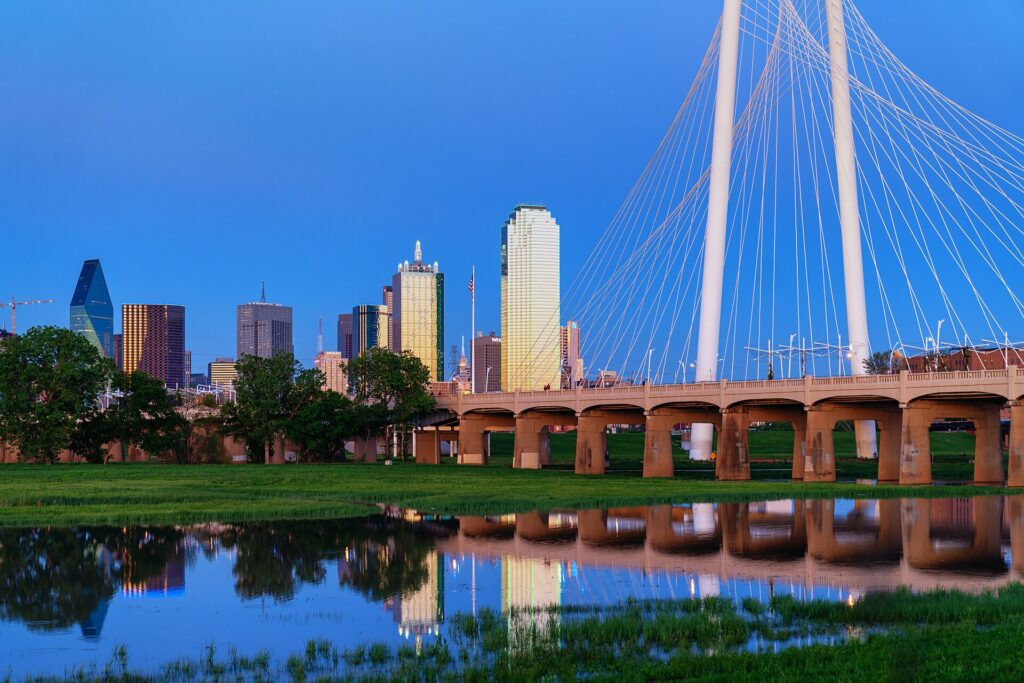
    The Dallas skyline across the Trinity River with the Margaret Hunt Hill Bridge
    Downtown Dallas from West Dallas, with Calatrava's Margaret Hunt Hill Bridge over the Trinity River (Photo: Tony Webster via Wikimedia Commons, CC BY-SA 2.0)

    Dallas at a glance for first-timers

    • Airports: Dallas Fort Worth International (DFW), about 32 km (20 miles) northwest of downtown Dallas, is the main airport and the largest hub of American Airlines. Dallas Love Field (DAL), only about 10 km (6 miles) from downtown, is the home base of Southwest Airlines and handles mostly domestic flights. See our DFW airport guide.
    • Getting around: DART runs one of the longest light-rail networks in the country, reaching downtown, the Arts District, Deep Ellum, Fair Park, the zoo and DFW, and the free M-Line trolley covers Uptown. The metro area is enormous, though, and many visitors rent a car for Fort Worth, Arlington and the suburbs.
    • Money: US dollars. Texas has no state income tax, but the combined sales tax in Dallas is 8.25 percent and hotel taxes add noticeably to a room rate. Tipping 18 to 20 percent in restaurants is expected, and valet parking, which is everywhere, deserves a few dollars.
    • Weather: mild winters with the occasional ice storm, a warm and stormy spring, long, very hot summers with regular 100 °F days, and a warm, pleasant fall. Our month-by-month guide has the detail.
    • Where to stay: downtown or the Arts District for museums, DART and Klyde Warren Park; Uptown for restaurants, bars and the trolley; Deep Ellum for live music; near DFW if you are splitting time with Fort Worth. Our Dallas hotel search covers them all.

    Downtown and Dealey Plaza

    Most visitors begin at Dealey Plaza, on the western edge of downtown, where President John F. Kennedy was assassinated on November 22, 1963. The plaza, the grassy knoll and the triple underpass look much as they did that day, and the former Texas School Book Depository on the corner of Elm and Houston streets now houses The Sixth Floor Museum at Dealey Plaza. Its exhibition tells the story of Kennedy’s life, the assassination and its aftermath with film, photographs and the preserved corner window from which the shots were fired, and it is restrained and deeply affecting; allow two hours and book a timed ticket in busy months. A block east, the John F. Kennedy Memorial, an open concrete cenotaph by Philip Johnson, is a quiet place to finish. Nearby, the red sandstone Old Red Courthouse of 1892 houses a museum of Dallas County history, and the West End has the Dallas Holocaust and Human Rights Museum. Walk east to see Thanks-Giving Square with its spiral chapel and Pioneer Plaza, where forty-nine bronze longhorns and three cowboys drive a herd down a hill beside the convention center.
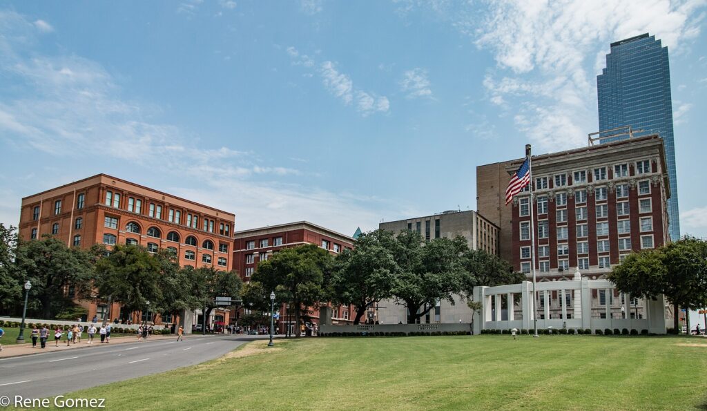
    Dealey Plaza and the former Texas School Book Depository in downtown Dallas
    Dealey Plaza, where President Kennedy was assassinated in 1963, with the Sixth Floor Museum in the former Book Depository (Photo: Renelibrary via Wikimedia Commons, CC BY-SA 4.0)

    The Arts District and Klyde Warren Park

    On the northern edge of downtown, the Dallas Arts District covers nineteen blocks and is the largest contiguous urban arts district in the United States. The anchor is the Dallas Museum of Art, whose collection spans five millennia, from ancient Mediterranean and pre-Columbian works to European painting, American art and contemporary galleries, and whose general admission is free. Across the street, the Nasher Sculpture Center, designed by Renzo Piano, has one of the finest collections of modern sculpture anywhere, with Rodin, Matisse, Picasso and Calder in a walled garden of live oaks, and the free Crow Museum of Asian Art is a quiet hour of jade, bronze and Japanese screens. For performance, the Meyerson Symphony Center by I. M. Pei is home to the Dallas Symphony Orchestra, the red drum of the Winspear Opera House hosts the Dallas Opera and touring Broadway shows, and the vertical Wyly Theatre is home to the Dallas Theater Center.

    Just north, Klyde Warren Park is the city’s favorite public space: a five-acre lawn built on a deck over the sunken Woodall Rodgers Freeway, opened in 2012 and busy from breakfast to late evening. There are food trucks every day, a children’s park with splash fountains, a dog park, free yoga and concerts, and lawn games, and it stitches the Arts District to Uptown in a way that has reshaped the whole area. Across the freeway, the Perot Museum of Nature and Science, a concrete cube with a glass escalator tube running down its face, has five floors of dinosaurs, gems and hands-on engineering labs that keep children busy for a full morning.
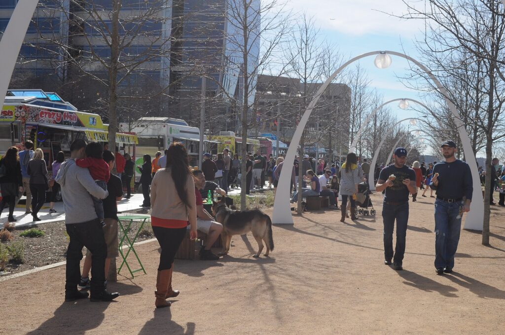
    Klyde Warren Park, the deck park over the freeway beside the Dallas Arts District
    Klyde Warren Park, five acres of lawn built over a sunken freeway between the Arts District and Uptown (Photo: Joe Mabel via Wikimedia Commons, CC BY-SA 3.0)

    Reunion Tower, the Trinity River and West Dallas

    Reunion Tower, the concrete shaft topped by a lattice ball that lights up at night, has been the signature of the Dallas skyline since 1978. Its observation deck gives, on a clear evening, the best overview of the city, from the downtown towers to the long green corridor of the Trinity River below. That river is Dallas’s next frontier. For decades it was hidden behind flood levees; now the white arch of the Margaret Hunt Hill Bridge, designed by Santiago Calatrava and opened in 2012, carries traffic across the floodplain to West Dallas, and the old Continental Avenue Bridge beside it has become a pedestrian bridge with seating, shade and views back to the skyline. At the western end, Trinity Groves is a cluster of restaurants and patios, and the sunset view of the city from here is one of the best in town. South of downtown, the Great Trinity Forest is one of the largest urban hardwood forests in the country.

    Neighborhoods worth a half-day

    Deep Ellum

    East of downtown along Elm, Main and Commerce streets, Deep Ellum was the center of the city’s Black commercial life and blues scene in the 1920s, when Blind Lemon Jefferson and Lead Belly played its streets. Today it is the city’s live-music and nightlife district: dozens of venues and bars, murals on nearly every wall, breweries and some of the best barbecue in Dallas. It is on the DART Green Line and walkable from downtown.

    Bishop Arts District

    Across the Trinity in Oak Cliff, a few blocks of 1920s storefronts around Bishop Avenue and Davis Street hold independent boutiques, bookshops, galleries, coffee shops and some of the most interesting restaurants in the city. The Dallas Streetcar runs here from Union Station, and the surrounding streets of Craftsman bungalows make for a good walk.

    Uptown and the Katy Trail

    North of downtown, Uptown is dense, walkable and polished, with restaurants and bars along McKinney Avenue, the West Village at its northern end, and the free M-Line trolley running vintage streetcars through the middle. The Katy Trail, a paved path on a former railroad corridor, runs about 3.5 miles toward Southern Methodist University and is where the city jogs, cycles and walks its dogs.

    Lower Greenville and Knox-Henderson

    Northeast of downtown, Lower Greenville Avenue is a strip of patios, bars and music venues that hosts one of the largest St. Patrick’s Day parades in the South, and Knox-Henderson nearby has restaurants and design shops in a leafier setting. Both are best in the evening.

    The Park Cities

    Highland Park and University Park, north of Uptown, are the city’s old-money enclaves, with SMU, the George W. Bush Presidential Library and Museum, and Highland Park Village, one of the country’s first planned shopping centers, opened in 1931.

    Museums, culture and family attractions

    Beyond the Arts District, the George W. Bush Presidential Library and Museum on the SMU campus has a full-scale replica of the Oval Office and a sobering exhibit on September 11, and the Meadows Museum, also at SMU, holds one of the largest collections of Spanish art outside Spain. Fair Park, east of Deep Ellum, is a National Historic Landmark of Art Deco exhibition halls built for the 1936 Texas Centennial, home to the African American Museum and busiest during the State Fair. The Dallas Zoo, the oldest in Texas, is on the DART Red Line south of downtown, and its Giants of the Savanna habitat lets giraffes, elephants and zebras share one landscape. At White Rock Lake, the Dallas Arboretum and Botanical Garden has sixty-six acres of gardens on the eastern shore, spectacular in spring during Dallas Blooms and in fall, when its pumpkin village draws crowds. For what is on during your dates, our Dallas events page lists concerts, shows and games.

    The State Fair of Texas

    For about three and a half weeks from late September into October, Fair Park becomes the State Fair of Texas, one of the largest state fairs in the country. It is presided over by Big Tex, the 55-foot talking cowboy who has greeted fairgoers since the 1950s, and it runs on fried food: the corny dog was popularized here, and every year the fair crowns new deep-fried inventions in its Big Tex Choice Awards. Beyond the food there are livestock shows, a huge auto show, free concerts every night, the Texas Star, one of the tallest Ferris wheels in North America, and the Art Deco halls of the park, lit up at night. The biggest day is the Red River Showdown, the University of Texas against the University of Oklahoma at the Cotton Bowl stadium inside the fairgrounds, usually in the second week of October, when half the stadium wears burnt orange and half crimson. Take DART’s Green Line to Fair Park rather than driving, go on a weekday for smaller crowds, and bring an appetite. If you are not coming for the fair, remember that it pushes up hotel rates on its weekends, on Texas-OU weekend in particular.

    Sports

    Dallas is a serious sports town, and its teams are spread across the metro. The Dallas Cowboys play at AT&T Stadium in Arlington, halfway to Fort Worth, a vast building with a retractable roof and one of the largest video boards in sport; it hosted matches of the 2026 World Cup, stages the Cotton Bowl Classic around New Year, and runs tours on non-event days, and the Cowboys play at home every Thanksgiving. Next door, the Texas Rangers, the 2023 World Series champions, play at Globe Life Field, which has a retractable roof for the summer heat. Arlington has no light rail, so a car, a shuttle or a ride-hail is the way in. Closer to the center, the Dallas Mavericks and the Dallas Stars share the American Airlines Center in Victory Park, walkable from Uptown and on DART, and a Mavericks game is the easiest big-league night out in the city. Check what is on sale in Dallas for your dates before you book flights.

    What to eat, and where

    Dallas eats Tex-Mex with conviction, and it has a claim on the style: the frozen margarita machine was invented here in 1971. Order cheese enchiladas in chili gravy, fajitas and a frozen margarita at least once. The second pillar is barbecue: Central Texas-style brisket, smoked for hours over post oak and sliced to order, with lines forming before lunch at the best places in Deep Ellum and beyond. Third, tacos: the taquerias of Oak Cliff serve al pastor, barbacoa and breakfast tacos as good as any in the state. Beyond that, Dallas is a steakhouse city, with grand dining rooms downtown and in Uptown, and a city of immigrant food: Korean restaurants along Royal Lane and in Carrollton, Vietnamese in Garland, and a large Asian dining district in Richardson. The Dallas Farmers Market on the edge of downtown has a food hall and weekend stalls, and the craft-brewery scene in Deep Ellum and the Design District is strong.

    Dallas through the seasons

    What you do in Dallas depends heavily on when you come. Spring (March to May) is the best-loved season: Dallas Blooms fills the Arboretum with tulips, bluebonnets line the highways outside the city in late March and April, patios open, and the Deep Ellum Arts Festival and the Lower Greenville St. Patrick’s Day parade bring crowds. It is also severe-storm season, so watch the forecast. Summer (June to mid-September) is long and hot, with afternoons regularly near or above 100 °F; the best plans are museums by day, Klyde Warren Park and the patios after dark, a Rangers game under the roof, and a morning at White Rock Lake before the heat. Fall (late September to November) is Dallas at its best, with the State Fair, Texas-OU weekend, pumpkins at the Arboretum, football every weekend and warm, clear afternoons. Winter (December to February) is mostly mild and sunny, with holiday lights in Highland Park and the Dallas Marathon in December, but an ice storm can shut the city down for a day or two in most winters. Our month-by-month guide has the fare patterns that go with each season.

    Dallas with kids

    Dallas is a very good city for children, largely because so much of it was built for families and for air conditioning. The Perot Museum is the obvious first stop, with its dinosaur hall and hands-on engineering floor. The Dallas Zoo is an easy train ride from downtown, and the Dallas World Aquarium’s rainforest walk-through works for all ages. Klyde Warren Park’s children’s area and splash pad are free, and the Arboretum has a children’s garden built around science and nature. In Arlington, Six Flags Over Texas, the original park of the chain, and its Hurricane Harbor water park fill a summer day. Fort Worth adds the longhorn cattle drive in the Stockyards and an excellent zoo, and Dinosaur Valley State Park, ninety minutes southwest, has real dinosaur footprints in the riverbed that children can stand in. For families renting a vehicle, our family car rental guide covers the choices.

    Dallas on a budget

    A surprising amount of the best of Dallas costs nothing. The Dallas Museum of Art and the Crow Museum are free, Klyde Warren Park and its daily programming are free, and so are Dealey Plaza, the Kennedy Memorial, Pioneer Plaza, the Katy Trail, the murals of Deep Ellum, White Rock Lake and the pedestrian bridge over the Trinity. The M-Line trolley through Uptown is free, and a DART day pass covers everything else on rail, including the airport. The Sixth Floor Museum, Reunion Tower and the Perot Museum charge admission but are fairly priced. Eat well for less at the taquerias of Oak Cliff, the barbecue joints, where a pound of brisket feeds two, and the food trucks at Klyde Warren. Because so much hotel demand is business travel, downtown and Uptown rates often fall on Friday and Saturday nights, and summer is the cheapest season for rooms. Compare rates by neighborhood on our Dallas hotel search.

    Day trips from Dallas

    Fort Worth, about 50 km (30 miles) west, is the essential side trip, and it feels like a different state. In the Stockyards National Historic District, cowhands drive a herd of Texas longhorns down Exchange Avenue twice a day, the Cowtown Coliseum holds a rodeo on weekend nights, and Billy Bob’s Texas is a honky-tonk the size of a warehouse. The Cultural District has three superb museums: the Kimbell Art Museum in Louis Kahn’s vaulted building, the Modern Art Museum of Fort Worth by Tadao Ando, and the free Amon Carter Museum of American Art. Visit Fort Worth has the details, and the Trinity Railway Express commuter train links the two downtowns. Grapevine, beside DFW, has a restored Main Street, wineries and a heritage railroad. Waco, about ninety minutes south on I-35, has Magnolia Market at the Silos and the Waco Mammoth National Monument. For a longer trip, Houston is about four hours south on I-45; our Dallas to Houston driving guide covers the route and our guide to things to do in Houston covers the city. Most of these trips need a car; compare rates on our Dallas car rental page.
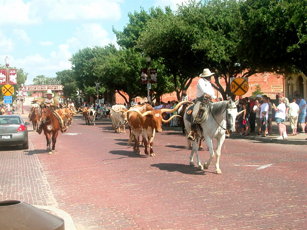
    Texas longhorns on the twice-daily cattle drive in the Fort Worth Stockyards
    The longhorn cattle drive in the Fort Worth Stockyards, half an hour west of Dallas (Photo: Lyndi & Jason from Dallastown, Pennsylvania, United States via Wikimedia Commons, CC BY-SA 2.0)

    Two sample itineraries

    Two days, no car

    Day one: Dealey Plaza and the Sixth Floor Museum in the morning, a walk through downtown past Thanks-Giving Square and Pioneer Plaza, lunch from the food trucks at Klyde Warren Park, the Dallas Museum of Art and the Nasher in the afternoon, and dinner and live music in Deep Ellum. Day two: the Perot Museum or a morning on the Katy Trail, the M-Line trolley through Uptown for lunch on McKinney Avenue, the streetcar to Bishop Arts for the afternoon, and sunset at Reunion Tower or Trinity Groves before a Mavericks game or a show.

    Four days, with Fort Worth

    Add a day for White Rock Lake and the Arboretum, the Bush Library and dinner on Lower Greenville, then pick up a car and spend a full day in Fort Worth, starting with the Kimbell and the Modern and finishing with the cattle drive, a steak and a honky-tonk in the Stockyards, returning the car at DFW on the way home.

    Practical details

    • Transit: buy DART tickets and passes in the GoPass app or at the machines on every rail platform; a day pass covers trains and buses. DART has maps and service alerts; our transit-versus-car guide goes into detail.
    • From DFW: the DART Orange Line from Terminal B to downtown in about 50 minutes, TEXRail to downtown Fort Worth, a taxi or ride-hail, or a rental from the consolidated Rental Car Center. The airport’s site covers ground transport. From Love Field, a DART shuttle bus connects to the light rail, and downtown is a short taxi ride.
    • Weather: sun protection and water from May to September, layers for spring and fall, and a proper jacket for winter cold snaps. The National Weather Service’s Fort Worth office covers Dallas and issues the storm warnings worth heeding in spring.
    • Time zone: Central, one hour behind New York and the same as Chicago and Houston.
    • Entry requirements: visitors from Visa Waiver Program countries need an approved ESTA before boarding; most others need a visa. The State Department’s travel site is the authoritative source.
    • Tourist information: Visit Dallas, the official tourism office, has current events and neighborhood guides.

    Frequently asked questions

    How many days do you need in Dallas?

    Two full days covers Dealey Plaza, the Arts District, Klyde Warren Park, Deep Ellum and Bishop Arts; add a third for White Rock Lake and a game, and a fourth for Fort Worth.

    What is the number one thing to do in Dallas?

    The Sixth Floor Museum at Dealey Plaza is the one sight almost every visitor should see. In the fall, the State Fair of Texas is the city’s defining experience.

    Is Dallas walkable?

    Downtown, the Arts District, Uptown, Deep Ellum and Bishop Arts are, and DART and the free trolley connect them. The rest of the metro assumes a car, and the summer heat makes long midday walks hard work.

    Do I need a car in Dallas?

    Not for the central neighborhoods. For Arlington, Fort Worth, the suburbs and road trips, yes; rent it only for the days you need it.

    Is Dallas expensive?

    Moderately. Hotels are cheaper than in New York or Los Angeles and often cheaper at weekends, many major sights are free, and food is good value, but State Fair weekends and big conventions push rates up.

    What is Dallas known for?

    Dealey Plaza and the Kennedy assassination, the Cowboys, the State Fair of Texas, Tex-Mex and brisket, a huge Arts District, and a booming business culture.

    Ready to go? Compare flights to Dallas, find a place to stay with our Dallas hotel search, and if Fort Worth, Arlington or a Texas road trip is on the list, price a rental car for those days.

  • Things to Do in Chicago: A First-Timer’s Guide

    Things to Do in Chicago: A First-Timer’s Guide

    Chicago surprises people who have not been. Visitors expect a big Midwestern city of offices and winter wind, and they find instead the most beautiful skyline in America rising straight out of a river, a lakefront of beaches and parkland that runs for miles without a single private building on it, one of the three or four great art museums in the country, neighborhoods with more personality than most whole cities, and a food scene that goes far beyond the deep-dish pizza everyone arrives wanting to try. It is a city built to be walked and ridden: the ‘L’ rattles above the Loop, the Riverwalk runs beneath the bridges, and the Lakefront Trail is where half the city spends its summer evenings. This guide covers the sights that earn a day, the neighborhoods worth a half-day, the food, the music and the sports, the day trips that the trains make easy, and the practical details that turn a long weekend into a trip you will want to repeat.

    If you are still comparing cheap flights to Chicago, read this alongside our guides to the best time to fly to Chicago and whether you need a car (for the city itself, you probably do not). Between the three you can plan the whole trip.

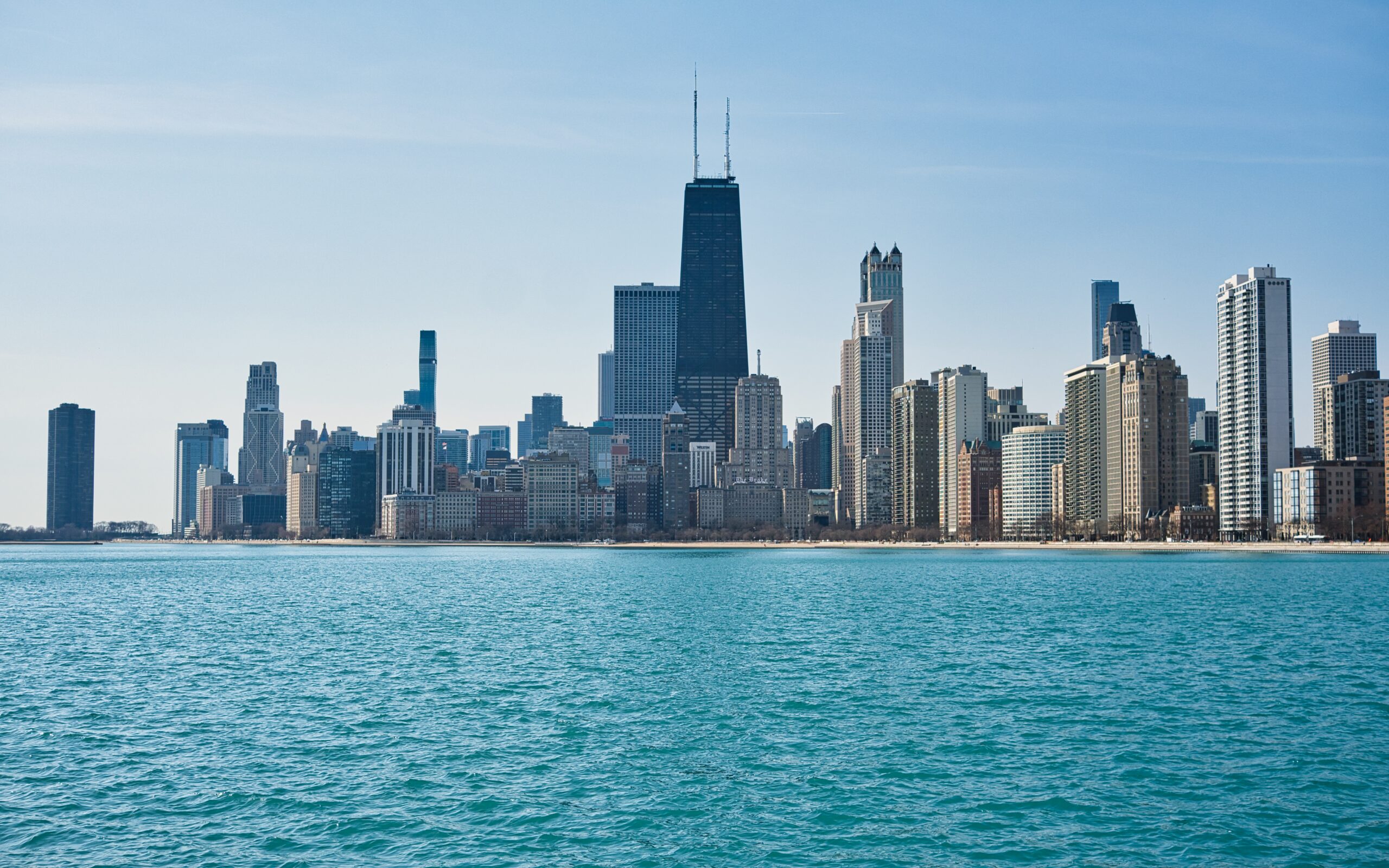
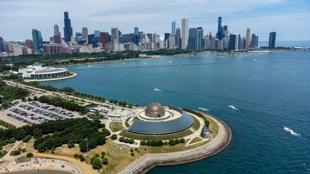
    The Chicago skyline across the water from the Adler Planetarium
    The Chicago skyline from the Museum Campus, the best free view in the city (Photo: Sea Cow via Wikimedia Commons, CC BY-SA 4.0)

    Chicago at a glance for first-timers

    • Airports: two of them. O’Hare International (ORD), about 27 km (17 miles) northwest of downtown, is one of the busiest airports in the world and a hub for United and American; the CTA Blue Line runs from the terminal to the Loop around the clock. Midway (MDW), on the Southwest Side, is smaller, closer and mostly domestic, with the Orange Line at the door. See our O’Hare airport guide.
    • Getting around: the CTA’s ‘L’ trains and buses cover the city, and the Red and Blue Lines run 24 hours; tap a contactless card or phone at the turnstile. The Loop, River North, the Magnificent Mile and the lakefront are all walkable, and Divvy bikes are everywhere. Our car-versus-transit guide explains when a car helps.
    • Money: US dollars. Chicago’s combined sales tax is one of the highest of any big American city, a little over 10 percent, and it is added at the register rather than shown on the tag; hotel taxes are higher still. Tipping 18 to 20 percent in restaurants is expected.
    • Weather: four emphatic seasons: cold, windy winters, a late and changeable spring, warm and humid summers cooled by the lake, and a crisp, clear fall. Our month-by-month guide has the detail.
    • Where to stay: the Loop for the museums, Millennium Park and the theaters; River North and the Magnificent Mile for restaurants and shopping; the West Loop for the dining scene; Lincoln Park or Wicker Park for a neighborhood feel. Our Chicago hotel search covers them all.

    The Loop and Millennium Park

    The Loop, named for the ring of elevated tracks that circles it, is the business district and the historic core, and it is where the city’s reputation as the birthplace of the skyscraper was earned after the Great Fire of 1871. Start at Millennium Park, on its eastern edge, which is free and is the city’s front lawn: Anish Kapoor’s Cloud Gate, the polished steel sculpture everyone calls the Bean, reflects the skyline and the crowds; Jaume Plensa’s Crown Fountain projects the faces of Chicagoans onto two glass towers that spout water in summer; Frank Gehry’s Jay Pritzker Pavilion hosts free concerts on summer evenings; and the Lurie Garden is a quiet planted meadow in the middle of it all. In winter the McCormick Tribune ice rink opens beside the Bean. From there, walk the Loop’s streets for the architecture: the Rookery, with a light-filled lobby remodeled by Frank Lloyd Wright; the dark brick Monadnock Building; the untitled Picasso in Daley Plaza, Chagall’s Four Seasons mosaic a few blocks south and Calder’s red Flamingo in Federal Plaza. The Chicago Cultural Center, across Michigan Avenue from the park, is free and has what is claimed as the largest Tiffany glass dome in the world. For the view, the Willis Tower Skydeck, on the 103rd floor of the building that was the world’s tallest when it opened in 1973, has the Ledge, glass boxes that hang out over the street.

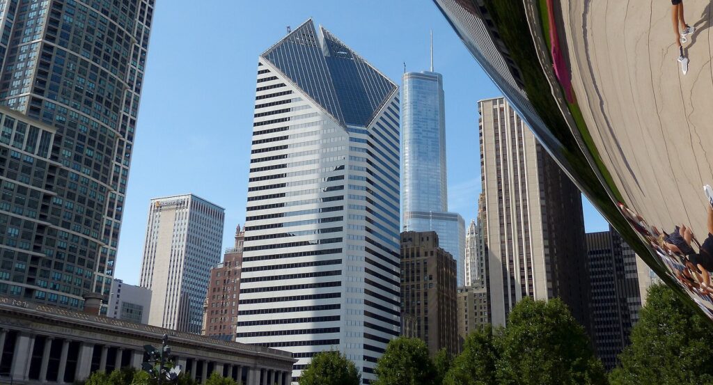
    The Chicago skyline reflected in Cloud Gate, the Bean, in Millennium Park
    Cloud Gate in Millennium Park, the sculpture every Chicagoan calls the Bean (Photo: Roman Boed from The Netherlands via Wikimedia Commons, CC BY 2.0)

    The river: the architecture cruise and the Riverwalk

    If you do one paid thing in Chicago, make it an architecture river cruise. The Chicago River runs through the middle of downtown, and a ninety-minute boat trip up its main and branch channels passes more than a century of skyscrapers, from the Wrigley Building and the Gothic Tribune Tower to the corncob towers of Marina City and the glass curves of the newer residential towers, with a guide explaining how the city reinvented the tall building again and again. The Chicago Architecture Center runs the best-known tour and has a gallery and a large model of the city at its riverside home; several other operators leave from the docks near Michigan Avenue. On foot, the Riverwalk follows the south bank of the main branch for more than a mile from the lake toward the Loop’s western edge, with wine bars, kayak rentals and seating on the water beneath the bascule bridges, several of which still lift for sailboats in spring and fall. The DuSable Bridge on Michigan Avenue is the classic spot to stand, with the river canyon on one side and the start of the Magnificent Mile on the other.

    The lakefront, the Magnificent Mile and Navy Pier

    Chicago’s great civic decision was to keep its lakefront public, and the result is extraordinary: parks, beaches and a trail along Lake Michigan for most of the city’s length. The Lakefront Trail runs about 29 km (18 miles) along the shore, with separate paths for bikes and walkers on the busiest stretches; rent a Divvy bike and ride north from Grant Park past Oak Street Beach to Lincoln Park, and you will see the skyline from its best angle. In summer, North Avenue Beach and Oak Street Beach fill with volleyball, sunbathers and swimmers, a surreal sight with office towers a few hundred yards behind the sand. Grant Park, between the Loop and the lake, holds Buckingham Fountain, which runs from spring to fall with a water show at the top of every hour. The Magnificent Mile, North Michigan Avenue from the river to Oak Street, is the city’s grand shopping street, with the historic Water Tower, one of the few buildings to survive the 1871 fire, and 360 Chicago, the observation deck near the top of the former John Hancock Center, whose lake view many locals prefer to the Skydeck. Navy Pier, a short walk east, is touristy but fun with children, with the Centennial Wheel, boat tours and fireworks on summer evenings.

    The Chicago Lakefront Trail along Lake Michigan with the skyline behind
    The Lakefront Trail, about 18 miles of public shoreline and the best way to see the city by bike (Photo: AlphaBeta135 via Wikimedia Commons, CC BY 4.0)

    Neighborhoods worth a half-day

    River North and the West Loop

    River North, just north of the river, has the densest concentration of restaurants, galleries and hotels in the city. The West Loop, and especially Randolph Street and Fulton Market, is where Chicago’s dining reputation is made: former meatpacking warehouses turned into restaurants, food halls and hotels, with some of the most talked-about kitchens in the country within a few blocks of each other.

    Lincoln Park and Old Town

    North of downtown along the lake, Lincoln Park combines the park itself, with the free Lincoln Park Zoo and the glasshouse conservatory, with a leafy neighborhood of brownstones, bars and blues clubs. Old Town, just south, is home to The Second City, the improv theater that launched a remarkable share of American comedy.

    Wicker Park, Bucktown and Logan Square

    On the Blue Line northwest of the Loop, Wicker Park and Bucktown center on the six-way intersection of Milwaukee, North and Damen Avenues: vintage shops, record stores, bars and brunch. The 606, an elevated rail line turned into a trail, runs through both. Logan Square, a few stops farther, has the boulevards, the cocktail bars and the Sunday farmers’ market.

    Lakeview and Wrigleyville

    Home to Wrigley Field and the Cubs, and to the lively bars around it on game days; Northalsted, in Lakeview, is one of the oldest recognized LGBTQ neighborhoods in the country. Farther north, Andersonville keeps its Swedish heritage and a strip of independent shops, and Uptown has the Green Mill, a jazz club with Prohibition-era history and live music every night.

    Pilsen and Chinatown

    Pilsen, on the Lower West Side, is the historic heart of Mexican Chicago, with street murals, bakeries, taquerias and the free National Museum of Mexican Art. Chinatown, on the Red Line south of the Loop, has dim sum, bakeries and a riverside park with water taxis back downtown in summer.

    Hyde Park

    On the South Side by the lake, Hyde Park is home to the University of Chicago, Frank Lloyd Wright’s Robie House and the Museum of Science and Industry, and it is the site of the Obama Presidential Center in Jackson Park; check its opening status and ticketing before you go.

    Museums, culture and family attractions

    The Art Institute of Chicago, on Michigan Avenue at the edge of Millennium Park, is one of the great museums of the world, and it deserves at least half a day: Seurat’s A Sunday on La Grande Jatte, Hopper’s Nighthawks, Grant Wood’s American Gothic, one of the finest Impressionist collections outside Paris, the miniature Thorne Rooms, and Renzo Piano’s Modern Wing. The Museum Campus, on the lake south of Grant Park, groups three institutions within a short walk: the Field Museum, whose natural history halls hold SUE, one of the most complete Tyrannosaurus rex skeletons ever found; the Shedd Aquarium, with beluga whales and a vast Caribbean reef tank; and the Adler Planetarium, the first planetarium in the Western Hemisphere, with the best skyline view in the city from its front lawn. The Museum of Science and Industry in Hyde Park, housed in a surviving building from the 1893 World’s Fair, has a captured German U-boat, a replica coal mine and hands-on exhibits that keep children busy for hours. The Museum of Contemporary Art near the Water Tower and the free Garfield Park Conservatory on the West Side round out the list. For performance, the Chicago Symphony Orchestra at Symphony Center and the Lyric Opera are world-class, the Goodman and Steppenwolf lead a deep theater scene, and the Broadway houses in the Loop host the touring hits. For what is on stage and in the arenas during your dates, our Chicago events page lists concerts, shows and games.

    The blues, jazz and the summer festivals

    Chicago invented electric blues, when musicians from the Mississippi Delta plugged in on the South Side after the Second World War, and the city still has clubs where you can hear it most nights of the week: Buddy Guy’s Legends in the South Loop and Kingston Mines and B.L.U.E.S. in Lincoln Park are the best known. Jazz has the Green Mill in Uptown and a handful of rooms downtown. In summer the music moves outdoors and much of it is free. The Chicago Blues Festival takes over Millennium Park in June, the Grant Park Music Festival gives free classical concerts at the Pritzker Pavilion through the summer, and the Chicago Jazz Festival fills Labor Day weekend. Lollapalooza, one of the biggest music festivals in the country, occupies Grant Park for four days in late July or early August. The Pride Parade on the last Sunday of June, the Air and Water Show over North Avenue Beach in August, and neighborhood street festivals nearly every summer weekend make the season one long party. In March, the city dyes the river green for the St. Patrick’s Day parade weekend, and in November the Magnificent Mile Lights Festival opens the holidays, with the German-style Christkindlmarket in Daley Plaza running until Christmas Eve.

    Sports

    Chicago is one of the great sports towns, with two teams in baseball and a fan base that fills bars from April to February. Wrigley Field, home of the Cubs since 1916, is the second-oldest ballpark in the major leagues, with ivy on the outfield walls, a hand-turned scoreboard and rooftop bleachers across the street; a day game there is one of the classic American experiences, even for people who do not follow baseball. The White Sox play at Rate Field on the South Side, on the Red Line, with cheaper tickets and excellent ballpark food. The Bears play football at Soldier Field on the lakefront from September to January; the Bulls and the Blackhawks share the United Center on the West Side, where the Michael Jordan statue stands outside; the Fire play soccer at Soldier Field and the Sky play basketball at Wintrust Arena. Check what is on sale in Chicago for your dates before you book flights.

    What to eat, and where

    Start with the classics, and then go further. Deep-dish pizza, baked in a tall pan with the cheese under the tomato sauce, is the famous one, and Lou Malnati’s, Giordano’s and Pizzeria Uno, which claims to have invented it in 1943, all have their loyalists; allow 45 minutes for it to bake. Locals, it should be said, eat more tavern-style pizza, a cracker-thin crust cut into squares. The Chicago-style hot dog comes on a poppy-seed bun with yellow mustard, onion, bright green relish, tomato, a pickle spear, sport peppers and celery salt, and never ketchup. The Italian beef, thin-sliced roast beef soaked in its juices on a roll with sweet peppers or hot giardiniera, is the city’s great sandwich. Beyond that, Chicago’s food is its neighborhoods: tacos and carnitas in Pilsen and Little Village, the Puerto Rican jibarito in Humboldt Park, Vietnamese on Argyle Street in Uptown, Korean and Middle Eastern on the North Side, Polish in Avondale, and some of the most ambitious fine dining in the country in the West Loop. Grab a bag of cheese-and-caramel popcorn, the “Chicago mix”, on the Magnificent Mile, and eat brunch in Wicker Park or Logan Square.

    Chicago through the seasons

    Chicago’s seasons are so distinct that it can feel like four different cities. Winter (December to March) is cold, windy and sometimes brutal, with lake-effect snow and wind chills that keep locals indoors; it is also when the museums are quiet, the theaters and the Bulls and Blackhawks are in season, the rink in Millennium Park is open, and hotels are at their cheapest. The Pedway, a network of underground walkways beneath the Loop, helps. Spring (April to May) arrives late and unevenly; the lake keeps the shore cool while the suburbs warm up, and the Cubs’ season opens in April weather that can include snow. Summer (June to August) is the reason people fall for the city: the beaches, the Lakefront Trail, the free concerts, the festivals, the patios and rooftop bars, and day games at Wrigley. It can be hot and humid, with thunderstorms, but the lake breeze helps. Fall (September to November) is crisp and clear, with the marathon in October, Open House Chicago opening the doors of buildings across the city, and the Bears at Soldier Field. Our month-by-month guide has the fare patterns that go with each season.

    Chicago with kids

    Chicago is excellent with children. The Museum Campus alone fills two days: the dinosaurs at the Field Museum, the belugas and the dolphins at the Shedd, and the sky shows at the Adler. The Museum of Science and Industry is a full day on its own, and the Chicago Children’s Museum is on Navy Pier, alongside the Centennial Wheel and summer boat rides. Lincoln Park Zoo is free, compact and easy with a stroller, and the farm-in-the-zoo section is a hit with small children. In summer, the Crown Fountain in Millennium Park doubles as a splash pad, the Maggie Daley Park next door has a climbing wall, play garden and, in winter, a skating ribbon, and the beaches have lifeguards from late May to Labor Day. A Cubs day game is a rite of passage. Kids ride the ‘L’ for free under seven, and the elevated ride around the Loop on the Brown Line is an attraction in itself. For families planning trips beyond the city, our family car rental guide covers the vehicle question.

    Chicago on a budget

    A remarkable amount of Chicago’s best is free: Millennium Park and the Bean, the Lakefront Trail and the beaches, the Riverwalk, the Lincoln Park Zoo and Conservatory, the Garfield Park Conservatory, the Chicago Cultural Center, the National Museum of Mexican Art, the Loop’s public art, and the summer concerts in Millennium and Grant Parks. The big museums offer free days for Illinois residents but not for visitors, so budget for them, and consider a multi-attraction pass if you plan to see four or more. Eat well for less on hot dogs, Italian beef, tacos in Pilsen and dim sum in Chinatown. A multi-day CTA pass makes transit almost free per ride, and hotel rates from January to March are among the lowest of any big American city. Compare rates by neighborhood on our Chicago hotel search.

    Day trips from Chicago

    Oak Park, on the Green Line or Metra just west of the city, has the largest collection of Frank Lloyd Wright buildings anywhere, including his Home and Studio and Unity Temple; the Frank Lloyd Wright Trust runs the tours. Evanston, on the Purple Line or Metra north, has the Northwestern University campus on the lake, and neighboring Wilmette has the domed Bahá’í House of Worship; the Chicago Botanic Garden in Glencoe is on the same Metra line. Indiana Dunes National Park, about an hour east on the South Shore Line train, has beaches and giant sand dunes on the southern shore of Lake Michigan; the National Park Service has the trail and beach details. Milwaukee, about 145 km (90 miles) north and 90 minutes by Amtrak, has Calatrava’s winged art museum on the lake, the Harley-Davidson Museum and its own brewing tradition. By car, Starved Rock State Park, about two hours southwest, has canyons and waterfalls along the Illinois River, and Lake Geneva in Wisconsin and Galena in the far northwest of the state are classic weekend escapes. For longer road trips, see our route guides for driving from Chicago to Minneapolis and Chicago to Detroit, or price a car on our Chicago car rental page. Choose Chicago, the city’s official tourism site, covers the region.

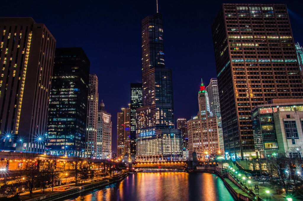
    The Chicago Riverwalk beneath the towers of the Chicago River
    The Riverwalk along the main branch of the Chicago River, with the Wrigley Building beyond (Photo: MK Feeney via Wikimedia Commons, CC BY 2.0)

    Two sample itineraries

    Three days, no car

    Day one: Millennium Park and the Bean in the morning, the Art Institute until mid-afternoon, then the architecture river cruise and a walk along the Riverwalk, with dinner in River North. Day two: the Museum Campus in the morning, lunch in Chinatown by water taxi or the Red Line, the Skydeck or 360 Chicago at sunset, and deep-dish pizza. Day three: a Divvy ride up the Lakefront Trail to Lincoln Park and the zoo, an afternoon in Wicker Park, and a blues club or a show at Second City at night.

    Five days, with the neighborhoods and a day out

    Add a day in Hyde Park for the Museum of Science and Industry and the Robie House, a Cubs game at Wrigley in season, a dinner on Randolph Street in the West Loop, and a day trip to Oak Park by the Green Line or to the Indiana Dunes on the South Shore Line.

    Practical details

    • Transit: tap a contactless card or phone at any ‘L’ turnstile or bus, or buy a Ventra card or multi-day pass. The CTA has maps and service alerts; our transit-versus-car guide goes into detail.
    • From O’Hare: the Blue Line to the Loop in about 45 minutes, a taxi or ride-hail, or a rental from the multi-modal facility. The Chicago airports’ site covers both O’Hare and Midway.
    • Weather: layers in every season, a serious coat, hat and gloves from December to March, and sunscreen for the beach in summer. NOAA’s National Weather Service office for Chicago has the forecast, and “cooler by the lake” is a real thing.
    • Time zone: Central, one hour behind New York and two ahead of Los Angeles.
    • Entry requirements: visitors from Visa Waiver Program countries need an approved ESTA before boarding; most others need a visa. The State Department’s travel site is the authoritative source.
    • Safety: the areas visitors spend their time in, downtown, the lakefront and the North Side neighborhoods, are busy and generally safe; use ordinary big-city awareness late at night, and on the ‘L’ late at night ride in a car with other passengers.

    Frequently asked questions

    How many days do you need in Chicago?

    Three full days covers the Loop, the Art Institute, the river cruise, the Museum Campus and one or two neighborhoods; add a day or two for Hyde Park, a ball game and a day trip.

    What is the number one thing to do in Chicago?

    The architecture river cruise, followed closely by the Art Institute. In summer, add a bike ride along the Lakefront Trail.

    Is Chicago walkable?

    Very, in the Loop, River North, the Magnificent Mile, the lakefront and the North Side neighborhoods, and the ‘L’ links them. The grid is logical and every address is numbered from State and Madison.

    Do I need a car in Chicago?

    Not for the city, where parking is expensive and transit is good. Rent one for Starved Rock, Galena or a road trip, and only for those days.

    Is Chicago expensive?

    Cheaper than New York or San Francisco, especially for hotels outside summer and big convention weeks, but taxes are high. Much of the best of the city is free.

    What food is Chicago known for?

    Deep-dish pizza, the Chicago-style hot dog and the Italian beef sandwich, plus tavern-style thin crust, cheese-and-caramel popcorn and an outstanding restaurant scene in the West Loop.

    Ready to go? Compare flights to Chicago, find a place to stay with our Chicago hotel search, and if a road trip is on the list, price a rental car for those days.

  • Things to Do in Minneapolis: A First-Timer’s Guide

    Things to Do in Minneapolis: A First-Timer’s Guide

    Minneapolis rewards people who come without expectations. Visitors picture a cold Midwestern business city, and they find a downtown built on the only major waterfall on the Mississippi, a chain of lakes inside the city limits ringed by busy paths, two art museums that would be the pride of a city three times its size, a theater scene second only to New York’s by some counts, and neighborhoods where breweries, Somali restaurants, Scandinavian bakeries and Indigenous kitchens sit a few blocks apart. The winters are genuinely hard, and the city has answered them with enclosed skyways, a winter festival calendar and a stubborn habit of going outside anyway. This guide covers the sights that earn a day, the neighborhoods worth a half-day, the food, the State Fair and the sports, the day trips, and the practical details that turn a quick visit into a trip.

    If you are still comparing cheap flights to Minneapolis, read this alongside our guides to the best time to fly to Minneapolis and whether you need a car. Between the three you can plan the whole trip.

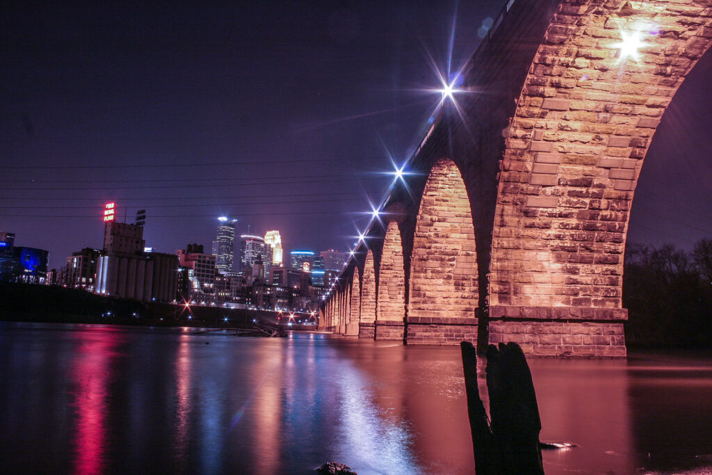
    The Stone Arch Bridge and the downtown Minneapolis skyline above the Mississippi River
    The Stone Arch Bridge and downtown Minneapolis, just below St. Anthony Falls (Photo: Tony Webster from Portland, Oregon, United States via Wikimedia Commons, CC BY 2.0)

    Minneapolis at a glance for first-timers

    • Airport: Minneapolis-Saint Paul International (MSP), about 16 km (10 miles) south of downtown Minneapolis, between the two cities. The METRO Blue Line light rail runs from both terminals to downtown in about 25 minutes. See our MSP airport guide.
    • Getting around: two light-rail lines, the Blue Line to the airport and the Mall of America and the Green Line to the University and downtown Saint Paul, plus buses. Downtown is walkable, and in winter the skyways let you cross it indoors. For day trips, most visitors rent a car.
    • Money: US dollars. Sales tax is added at the register, with extra city taxes on downtown hotels and restaurants; Minnesota does not tax most clothing, which makes shopping slightly cheaper. Tipping 18 to 20 percent in restaurants is expected.
    • Weather: four emphatic seasons: long, cold, snowy winters with Arctic outbreaks that push temperatures far below 0 °F, a short spring, warm and sometimes humid summers with thunderstorms, and a crisp, colorful fall. Our month-by-month guide has the detail.
    • Where to stay: downtown for the skyways, the theaters and the stadiums; the North Loop for restaurants and the riverfront; the St. Anthony Main side of the river for a quieter base by the falls; near the University or in Saint Paul if your plans are on that side. Our Minneapolis hotel search covers them all.

    Downtown: Nicollet Mall, the IDS Center and the skyways

    Downtown Minneapolis is compact, and its spine is Nicollet Mall, a pedestrian and transit street with public art and the bronze statue of Mary Tyler Moore tossing her hat, a nod to the television show set in the city. The IDS Center, the tallest building in the state since 1973, stands on the Mall, and its glass-roofed Crystal Court is the central crossroads of the skyway system, roughly 15 km (9.5 miles) of enclosed, heated bridges and corridors one story above the street that link some 80 blocks of downtown. Walking it in January, from a hotel to dinner to a Timberwolves game without a coat, is a genuinely Minneapolitan experience. The skyways are owned by the buildings they pass through, so hours vary: most are open from early morning into the evening on weekdays, with shorter hours on weekends. A block west, Hennepin Avenue is the theater district, with the restored Orpheum, State and Pantages theaters staging touring Broadway shows, and the First Avenue nightclub, where Prince filmed Purple Rain and whose exterior wall is covered in silver stars for the acts that have played there.

    The riverfront: St. Anthony Falls, the Stone Arch Bridge and Mill City

    Minneapolis exists because of St. Anthony Falls, the only natural major waterfall on the whole Mississippi, whose power drove the flour mills that made the city, for half a century, the milling capital of the world. The Stone Arch Bridge, a curving railroad viaduct built in 1883 and now open only to walkers and cyclists, crosses the river just below the falls and is the best viewpoint in the city, with the skyline on one side and the falls and mill ruins on the other. On the west bank, the Mill City Museum, run by the Minnesota Historical Society, is built inside the burned-out ruins of the Washburn A Mill, once the largest flour mill in the world; the Flour Tower ride and the observation deck are the highlights. Beside it, Water Works, a riverside park built into old mill foundations, is home to Owamni, the award-winning Indigenous restaurant, and the Guthrie Theater, the most celebrated regional theater in the country, has a cantilevered “Endless Bridge” over the riverbank that is free to walk onto during building hours. Across the river, the east bank has the cobblestone St. Anthony Main and Nicollet Island with its Victorian houses. The whole stretch is part of the Mississippi National River and Recreation Area, and the riverside paths continue for miles in both directions.

    The Walker, the Sculpture Garden and Mia

    Minneapolis has two art museums that justify the trip on their own. The Walker Art Center, on the edge of downtown by Loring Park, is one of the country’s leading museums of contemporary art. Across the street, the free Minneapolis Sculpture Garden holds some forty works across eleven acres, including Spoonbridge and Cherry by Claes Oldenburg and Coosje van Bruggen, the giant spoon with a cherry balanced on it that appears on half the postcards in town. The Minneapolis Institute of Art, universally called Mia, in the Whittier neighborhood south of downtown, is an encyclopedic museum that runs from Egyptian antiquity through European painting, including a well-known Rembrandt, to one of the strongest Asian collections in the country, and general admission is free. On the University of Minnesota campus, the free Weisman Art Museum, in a stainless-steel building by Frank Gehry, is worth the stop for the building alone, and the American Swedish Institute, in a turreted mansion south of downtown, tells the story of the Scandinavians who shaped the state.

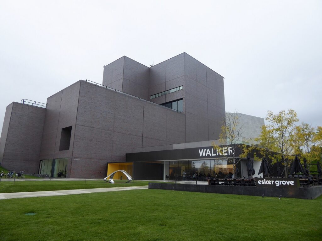
    The Walker Art Center, the contemporary art museum beside the Minneapolis Sculpture Garden
    The Walker Art Center, one of the country's leading contemporary art museums, beside the free Sculpture Garden (Photo: Daniel X. O'Neil via Wikimedia Commons, CC BY 2.0)

    The lakes, the Grand Rounds and Minnehaha Falls

    The city’s best public space is not downtown at all. The Chain of Lakes, a few miles southwest of downtown, is where Minneapolis lives in summer: Bde Maka Ska, the largest, with beaches, sailboats and paddleboard and kayak rentals; the quieter Lake of the Isles, ringed by grand houses; Cedar Lake, with the most natural shoreline; and Lake Harriet, with a bandshell that hosts free concerts on summer evenings, rose gardens and the restored Como-Harriet streetcar, which runs short rides in summer. Paved paths, separate for walkers and cyclists, circle every lake. They are part of the Grand Rounds, a loop of parkways and trails of about 80 km (50 miles) around the city, which links the lakes to the Mississippi and to Minnehaha Falls, a 16-meter (53-foot) waterfall in a wooded gorge made famous by Longfellow’s Song of Hiawatha. The falls are free, a short walk from a Blue Line station, and in a hard winter they freeze into a column of ice. The Minneapolis Park and Recreation Board runs it all; rent a bike and you can see the lakes and the falls in a day.

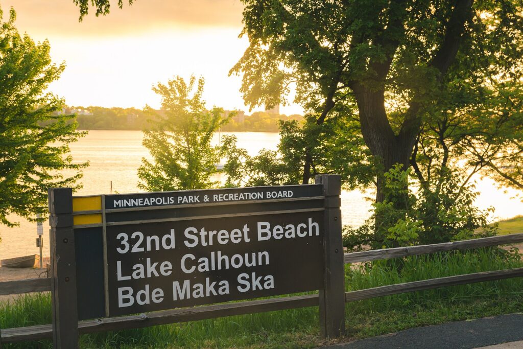
    The 32nd Street beach on Bde Maka Ska, the largest of the Minneapolis lakes
    Bde Maka Ska, the largest of the Chain of Lakes, where Minneapolis spends its summer (Photo: Tony Webster from Minneapolis, Minnesota, United States via Wikimedia Commons, CC BY-SA 2.0)

    Neighborhoods worth a half-day

    The North Loop

    The old warehouse district beside Target Field is now the city’s most fashionable neighborhood: brick lofts, boutique hotels, independent shops and many of the city’s best restaurants and cocktail bars along Washington Avenue, a short walk from the riverfront.

    Northeast

    Across the river, “Nordeast”, the old immigrant working-class district, is now the arts and brewery quarter: studios in former factories such as the Northrup King Building, a dense cluster of taprooms, old Polish delis, and Art-A-Whirl in May, one of the largest open-studio weekends in the country.

    Uptown and Lyn-Lake

    The streets around Hennepin and Lake, a short walk from Bde Maka Ska, are the traditional nightlife district; Lyn-Lake, a few blocks east, is the more independent strip. Combine either with the lakes.

    Eat Street and Whittier

    Nicollet Avenue south of downtown, branded Eat Street, has a mile of Vietnamese, Mexican, Somali and Korean restaurants and runs past Mia. Farther south, Lake Street and the Midtown Global Market, a food hall in a former Sears building, show the city’s immigrant communities at their liveliest.

    Cedar-Riverside and the University

    The West Bank, by the University of Minnesota, is the heart of the largest Somali community in the country, with cafés, markets and restaurants. Across the river, the main campus, Dinkytown and the Weisman are a Green Line stop away.

    Saint Paul

    The other Twin City deserves at least half a day. The Green Line runs to its downtown in around 45 minutes, past the Hmong and Vietnamese restaurants of University Avenue. Saint Paul has the Cass Gilbert-designed Minnesota State Capitol, the Cathedral of Saint Paul on its hill, Summit Avenue, a long boulevard of Victorian mansions where F. Scott Fitzgerald lived as a young man, the Science Museum, and the free Como Park Zoo and Conservatory.

    Museums, culture and family attractions

    For live performance, Minneapolis is exceptional. Beyond the Guthrie and the Hennepin Avenue theaters, the Minnesota Orchestra plays at Orchestra Hall on Nicollet Mall, the Children’s Theatre Company beside Mia is one of the most honored in the nation, and dozens of smaller companies give the Twin Cities more theater seats per person than almost anywhere outside New York. The music scene produced Prince, the Replacements and Hüsker Dü, and the clubs still matter: First Avenue and its smaller room, the 7th St Entry, the Turf Club in Saint Paul, and the Dakota for jazz. Prince fans can tour Paisley Park, his home and studio complex in suburban Chanhassen, about half an hour southwest; book ahead. The Mall of America, at the end of the Blue Line, is the largest mall in the country. Historic Fort Snelling, on the bluffs where the Minnesota River meets the Mississippi, tells the story of the fort and of the Dakota people whose homeland this is. For what is on during your dates, our Minneapolis events page lists concerts, shows and games.

    The State Fair and the festival year

    For twelve days ending on Labor Day, the Minnesota State Fair is the center of the state’s universe. It is one of the largest state fairs in the country, drawing close to two million visitors to the fairgrounds between the two downtowns, and locals call it the Great Minnesota Get-Together without irony. The attractions are prize animals, butter sculptures, a midway, grandstand concerts and, above all, the food, much of it on a stick. Go on a weekday morning and take the fair’s express buses or park-and-ride shuttles rather than driving. The rest of the year has its own calendar. The Saint Paul Winter Carnival, from late January into early February, is one of the oldest winter festivals in the country, with ice sculptures and parades; the Loppet ski festival fills Theodore Wirth Park around the same time; the Aquatennial in July has fireworks over the river; Twin Cities Pride fills Loring Park in late June; and the Twin Cities Marathon, in early October, runs past the lakes and the river. If you are coming for the fair, book the hotel first: rooms across the metro fill in late August.

    Sports

    Minneapolis has a team in every major league, and most play downtown. The Twins play baseball at Target Field in the North Loop, an open-air ballpark with a skyline view; April and September games can be cold, so bring a layer. The Vikings play at U.S. Bank Stadium, the translucent-roofed building in Downtown East that hosted a Super Bowl. The Timberwolves and the Lynx, one of the most successful franchises in WNBA history, play at Target Center, connected to the skyways. The Wild play hockey in downtown Saint Paul, in a state that takes the sport more seriously than any other, and Minnesota United play soccer at Allianz Field on the Green Line. Check what is on sale in Minneapolis for your dates before you book flights.

    What to eat, and where

    Minnesota’s food reputation used to rest on hotdish, the tater-tot-topped casserole of the church basement, and it still makes an appearance. The dish every visitor should try is the Jucy Lucy (or Juicy Lucy, depending on which bar you ask), a burger with the cheese sealed inside the patty, which two South Minneapolis bars, Matt’s and the 5-8 Club, both claim to have invented; let it cool before you bite. The North Loop and Northeast have the chef-driven restaurants; Owamni, on the riverfront, serves Indigenous food without wheat, dairy or cane sugar; Eat Street and Lake Street have pho, taquerías and Somali restaurants serving rice, goat and sambusas; University Avenue in Saint Paul is the place for Hmong food; and the Scandinavian heritage survives in bakeries and holiday lefse. Walleye, the state fish, turns up as a sandwich or pan-fried at supper clubs. Minnesota changed its liquor laws in 2011 to allow brewery taprooms, and the result is one of the densest craft-beer scenes in the country, concentrated in Northeast.

    Minneapolis through the seasons

    Winter (December to early March) is cold, sometimes brutally so, with snow on the ground for months and cold snaps below -25 °C (-13 °F), but the city is built for it: the skyways connect downtown, the lakes freeze solid enough for skating, pond hockey and ice fishing, Theodore Wirth Park has cross-country skiing and a tubing hill minutes from downtown, and the museums and theaters are at their best on a January night. Spring (late March to May) arrives late; the ice leaves the lakes in April, and the Twins’ home opener is often a hat-and-gloves affair. Summer (June to August) is the payoff: long evenings on the lakes, patios in the North Loop, the Aquatennial, and the State Fair to close it out. Fall (September to October) is the local favorite: warm afternoons, cool nights, the marathon, and fall color along the river that peaks in early-to-mid October. Our month-by-month guide has the fare patterns that go with each season.

    Minneapolis with kids

    Minneapolis is an easy city with children, in any weather. The Mall of America’s Nickelodeon Universe and aquarium are the obvious indoor day, and the Blue Line takes you there. In Saint Paul, the Science Museum of Minnesota has dinosaurs and a giant-screen theater, the Minnesota Children’s Museum is built for the under-tens, and the free Como Park Zoo and Conservatory is one of the best-value family days anywhere. In summer, the lake beaches, the Lake Harriet streetcar and Minnehaha Falls fill the days; in winter, the Children’s Theatre Company, tubing at the parks and the Winter Carnival’s ice sculptures keep everyone busy. For families heading north to Duluth, our family car rental guide covers the vehicle question.

    Minneapolis on a budget

    Much of the best of Minneapolis is free: Mia, the Sculpture Garden, the Weisman, the Stone Arch Bridge and the riverfront, the Chain of Lakes, Minnehaha Falls, the Lake Harriet bandshell concerts, the Guthrie’s Endless Bridge, the skyways, and the Como Park Zoo. The Walker has free hours on certain evenings; check its site. Light-rail fares are modest, and the ride between the two airport terminals is free. Eat well for less on Eat Street, at the Midtown Global Market on Lake Street, in the Somali cafés of Cedar-Riverside and along University Avenue in Saint Paul. Hotel rates in winter are among the lowest of any major American city, and outside State Fair week, convention weeks and big stadium events, downtown rates are reasonable year-round. Compare rates by neighborhood on our Minneapolis hotel search.

    Day trips from Minneapolis

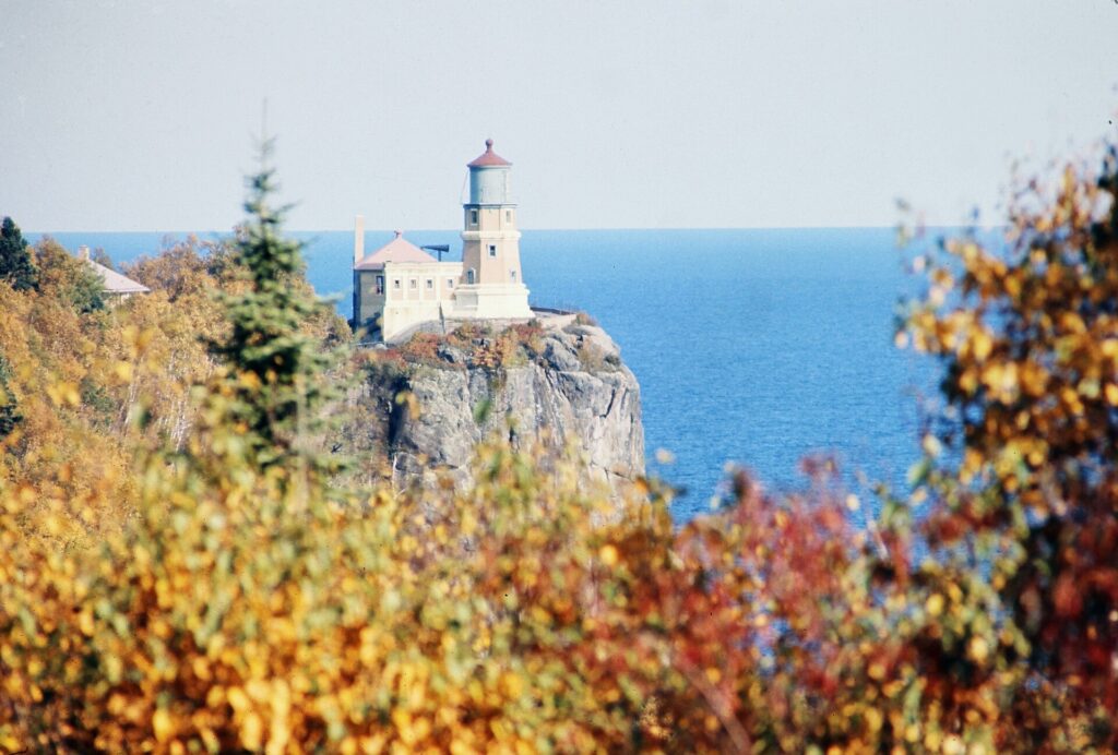
    Stillwater, about 45 minutes east on the St. Croix River, is the prettiest small town in the metro: a brick main street of antique shops and restaurants, a historic lift bridge, and paddlewheel cruises in summer. Duluth, about two and a half hours north on I-35, sits at the western tip of Lake Superior, with the Aerial Lift Bridge, a lakefront walk and the ore boats, and it is the gateway to the North Shore: Gooseberry Falls and Split Rock Lighthouse, both state parks, are within an hour of it along one of the most scenic roads in the Midwest. South along the Mississippi, Red Wing and Wabasha, where the National Eagle Center watches the bald eagles that winter on the river, make a good loop past the bluffs in fall color season. All of these are car trips; see our Minneapolis car rental page, and in winter check road conditions before heading north. Explore Minnesota covers the wider state. If you are combining the Twin Cities with Chicago, our Chicago to Minneapolis route guide covers the drive, and our guide to things to do in Chicago covers the other end.

    Split Rock Lighthouse on the cliffs above Lake Superior
    Split Rock Lighthouse on the North Shore, an easy extension of a Duluth day trip (Photo: Chris Light via Wikimedia Commons, CC BY-SA 4.0)

    Two sample itineraries

    Two days, no car

    Day one: Nicollet Mall and the Crystal Court, the Mill City Museum and the Guthrie’s Endless Bridge, a walk across the Stone Arch Bridge, lunch in the North Loop, the Walker and the Sculpture Garden in the afternoon, and a show on Hennepin Avenue or at First Avenue. Day two: Mia in the morning, lunch on Eat Street, an afternoon on a rented bike around the Chain of Lakes and down the Minnehaha Parkway to the falls, then the Blue Line back downtown and dinner in Northeast among the breweries.

    Four days, with Saint Paul and the St. Croix

    Add a day in Saint Paul by Green Line, then pick up a car for a day in Stillwater, or a night in Duluth and on the North Shore, returning it at the airport on the way home.

    Practical details

    • Transit: buy tickets at the light-rail station machines or in the Metro Transit app, or use a Go-To card; a day pass pays off on a busy sightseeing day. Metro Transit has maps and service alerts; our transit-versus-car guide goes into detail.
    • From MSP: the Blue Line from either terminal to downtown in about 25 minutes, a taxi or ride-hail in about 20 minutes outside rush hour, or a rental from the terminal ramps. The airport’s site covers ground transport and which airlines use which terminal.
    • Weather: serious winter gear from December to March, layers in spring and fall, and sunscreen and a rain layer in summer. NOAA’s National Weather Service office for the Twin Cities has the forecast and winter weather warnings.
    • Time zone: Central, one hour behind New York and two ahead of Los Angeles.
    • Entry requirements: visitors from Visa Waiver Program countries need an approved ESTA before boarding; most others need a visa. The State Department’s travel site is the authoritative source.
    • Safety: the areas visitors spend their time in, downtown, the riverfront, the lakes and the main neighborhoods, are busy and generally safe; use ordinary big-city awareness late at night downtown and on the light rail.

    Frequently asked questions

    How many days do you need in Minneapolis?

    Two full days covers downtown, the riverfront, the Walker, Mia and the lakes; add a day for Saint Paul and one or two for Stillwater, Duluth or the North Shore.

    What is the number one thing to do in Minneapolis?

    In late August, the State Fair. Any other time, the river: walk the Stone Arch Bridge at sunset, with St. Anthony Falls below and the skyline lit up behind it.

    Is Minneapolis walkable?

    Downtown, the North Loop, the riverfront and Uptown are, and the skyways make downtown walkable even in January. The lakes and Minnehaha Falls are best reached by bike or light rail.

    Do I need a car in Minneapolis?

    Not for downtown, the riverfront, the lakes or Saint Paul; the light rail and a bike cover them. For Stillwater, Duluth, the North Shore and the suburbs, yes.

    How cold does Minneapolis get in winter?

    January daytime highs are usually well below freezing, and cold snaps with temperatures below -25 °C (-13 °F) happen most winters. The skyways, the museums and good boots make it very manageable.

    What is Minneapolis known for?

    The lakes, St. Anthony Falls, the skyways, Prince, the Guthrie, the State Fair, the Jucy Lucy, and a winter locals are quietly proud of surviving.

    Ready to go? Compare flights to Minneapolis, find a place to stay with our Minneapolis hotel search, and if Duluth or the St. Croix are on the list, price a rental car for those days.

  • Things to Do in Phoenix: A First-Timer’s Guide

    Things to Do in Phoenix: A First-Timer’s Guide

    Phoenix is easy to misread from the air. Coming in to land, it looks like one enormous grid of rooftops and swimming pools stretching to the mountains, and plenty of visitors treat it that way: a resort, a round of golf, a spring training game and a flight home. They miss a city with some of the best museums in the West, a botanical garden devoted entirely to the desert, mountains you can climb before breakfast without leaving the city limits, an arts district that fills with thousands of people on the first Friday of every month, a food scene rooted in Sonoran Mexican cooking, and a winter climate that makes it the warmest big-city escape in the country from November to April. Sedona and the Grand Canyon are a morning’s drive away. This guide covers the sights that earn a day, the neighborhoods worth a half-day, the food, spring training and the sports, the day trips that make Phoenix a base as much as a destination, how to handle the summer heat, and the practical details that turn a resort stay into a trip.

    If you are still comparing cheap flights to Phoenix, read this alongside our guides to the best time to fly to Phoenix and whether you need a rental car. Between the three you can plan the whole trip.

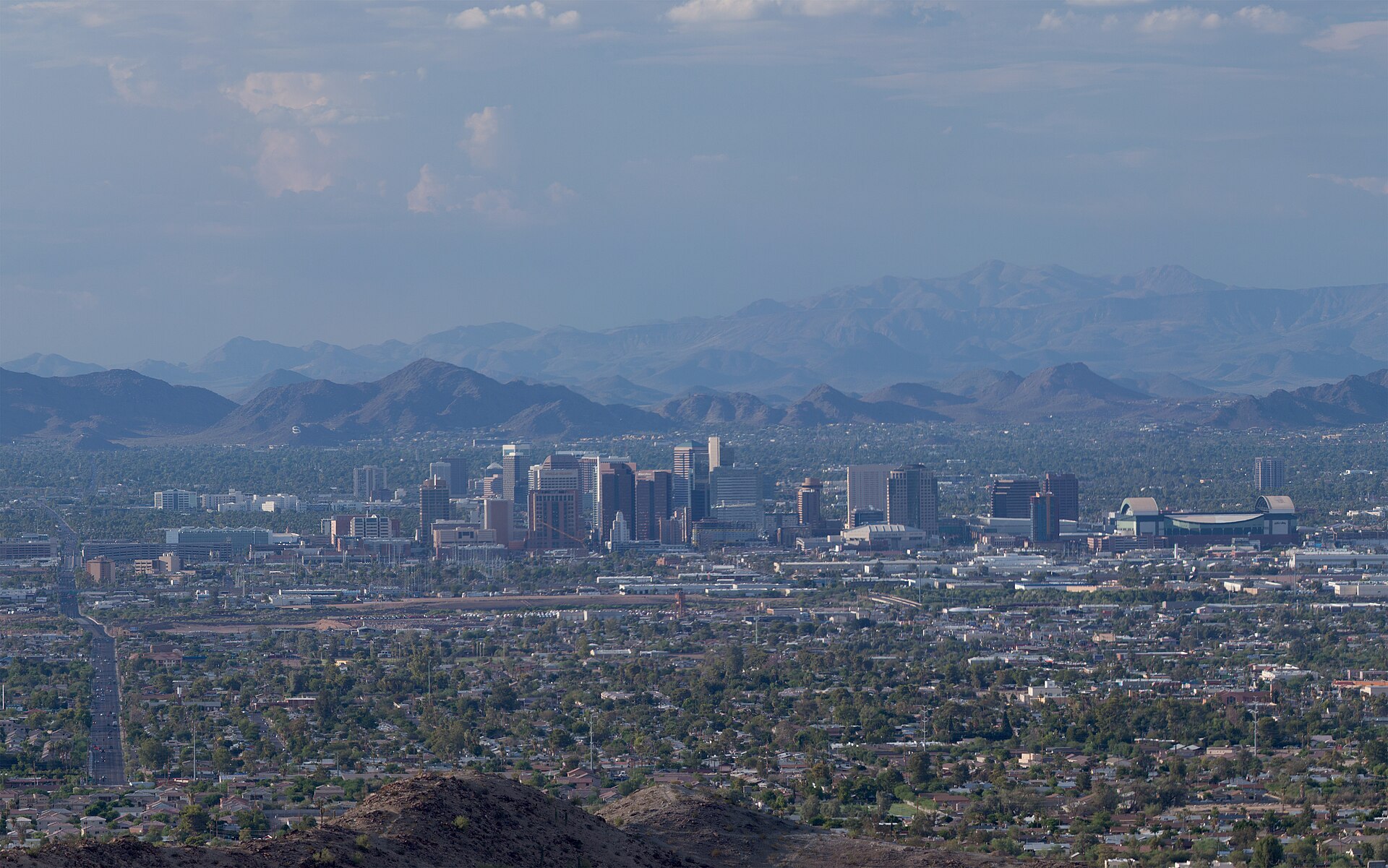
    The downtown Phoenix skyline with desert mountains behind
    Downtown Phoenix from South Mountain, at the center of a desert valley ringed by mountains (Photo: Alan Stark from Goodyear, AZ, United States via Wikimedia Commons, CC BY-SA 2.0)

    Phoenix at a glance for first-timers

    • Airport: Phoenix Sky Harbor International (PHX), about 5 km (3 miles) east of downtown, one of the closest big-city airports to its center in the country; the free PHX Sky Train links the terminals to the light rail, and a taxi, ride-hail or rental gets you anywhere in the Valley. See our PHX airport guide.
    • Getting around: Valley Metro light rail runs from the airport’s Sky Train connection through downtown Phoenix, Tempe and Mesa. Beyond that corridor, the Valley is built for driving, and most visitors rent a car for at least part of their stay.
    • Money: U.S. dollars. Sales tax is added at the register, and hotels and rental cars carry their own extra taxes and fees, so compare total prices. Many resorts add a nightly resort fee. Tipping 18 to 20 percent in restaurants is standard.
    • Weather: sunny almost every day, with mild winters, hot springs and falls, and summers that regularly pass 43 °C (110 °F). Arizona does not observe daylight saving time. Our month-by-month guide has the detail.
    • Where to stay: downtown for the ballpark, the convention center and the light rail; Roosevelt Row for galleries, bars and a local feel; Scottsdale for resorts, golf and nightlife; Tempe for the university and the lake; the Camelback corridor and Paradise Valley for the classic desert resorts. Our Phoenix hotel search covers them all.

    Downtown: Heritage Square, the Heard and the sports district

    Downtown Phoenix spent decades emptying out after dark and has spent the last two filling back up, helped by the light rail, the Arizona State University campus, and a cluster of new apartment towers. Start at Heritage Square, a block of restored late-19th-century houses that survived the city’s growth, including the Victorian Rosson House, which you can tour, and a converted brick building that holds Pizzeria Bianco, the restaurant that made Phoenix a name among pizza obsessives. The Arizona Science Center is next door, and the Children’s Museum of Phoenix is a few blocks away. A few blocks south, Chase Field, the home of the Arizona Diamondbacks, has a retractable roof and air conditioning that make summer baseball bearable, and the downtown arena beside it hosts the Suns, the Mercury and the big touring concerts. A short ride north on the light rail, the Heard Museum is one of the finest museums of American Indian art and culture in the country, with galleries on the peoples of the Southwest, a celebrated collection of Hopi katsina dolls, contemporary art, and a long-running, sobering exhibit on the federal boarding-school era; plan at least half a day. The Phoenix Art Museum, a few blocks away on Central Avenue, is one of the largest art museums in the Southwest, with strong fashion and Western American collections.

    Papago Park and the Desert Botanical Garden

    If you only do one thing in Phoenix, make it the Desert Botanical Garden. Set among the red sandstone buttes of Papago Park, on the border of Phoenix, Scottsdale and Tempe, it holds tens of thousands of desert plants from around the world along easy looped trails, with towering saguaros, blooming cactus gardens in spring, a wildflower loop, and exhibits on how the peoples of the Sonoran Desert have lived from its plants for centuries. Go at opening time in any season except winter, and consider the evening events: in December the garden’s paths are lined with thousands of luminarias, paper-bag lanterns, for one of the Valley’s favorite holiday traditions. Beside it, the Phoenix Zoo is spread across the same desert landscape and has a strong Arizona trail. Papago Park itself is free: the short scramble up to Hole-in-the-Rock, a natural window in a sandstone butte, is the classic sunset view over the city, and the lagoons, the white pyramid of Hunt’s Tomb (the resting place of Arizona’s first governor) and the flat walking loops around the buttes make an easy morning.

    Saguaros and cactus gardens at the Desert Botanical Garden in Papago Park
    The Desert Botanical Garden in Papago Park, the one sight no first visit should skip (Photo: Simeon87 via Wikimedia Commons, CC BY-SA 3.0)

    The mountains in the city: Camelback, Piestewa and South Mountain

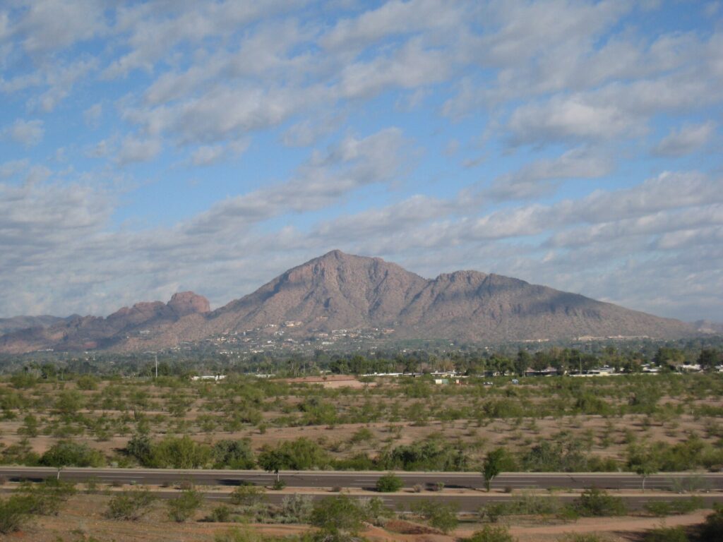
    What sets Phoenix apart from other Sun Belt cities is the mountains rising straight out of its neighborhoods. Camelback Mountain, the humped red peak between Phoenix and Paradise Valley, has two summit trails, Echo Canyon and Cholla, that are steep, rocky and genuinely strenuous, with handrails on the steepest sections of Echo Canyon; the view from the top across the whole Valley is worth it, but this is not a casual stroll, and the fire department carries out rescues here every year. Piestewa Peak, in the Phoenix Mountains Preserve to the north, has a similarly steep summit trail and gentler loops around its base. South Mountain Park and Preserve, on the city’s southern edge, is one of the largest city parks in the United States, with about 80 kilometers (50 miles) of trails, petroglyphs, and a road to Dobbins Lookout that gives you the famous view of the downtown skyline without the climb. In Scottsdale, the McDowell Sonoran Preserve protects a vast stretch of desert with well-marked trailheads and some of the best saguaro forests near the city. The rule for all of them is the same: start at first light, carry far more water than you think you need, and be off the trail before the day heats up.

    Camelback Mountain seen from Papago Park in Phoenix
    Camelback Mountain from Papago Park: a steep sunrise climb with a view over the whole Valley (Photo: Dru Bloomfield from Scottsdale, Arizona, USA via Wikimedia Commons, CC BY 2.0)

    Neighborhoods worth a half-day

    Roosevelt Row

    Just north of downtown, Roosevelt Row is the city’s arts district: murals on nearly every wall, galleries in old bungalows, coffee shops, bars and some of the best independent restaurants in Phoenix. On First Fridays, the monthly evening art walk, the streets fill with galleries, food trucks and street performers; it is one of the largest events of its kind in the country and free. It is on the light rail.

    Old Town Scottsdale

    Scottsdale’s historic core mixes Western-themed souvenir shops, serious galleries of Southwestern and Native art, the Scottsdale Museum of Contemporary Art, and a dense entertainment district of restaurants, cocktail bars and nightclubs that is the Valley’s busiest nightlife. On Thursday evenings the galleries host an art walk, and a free trolley loops the district.

    Tempe and Mill Avenue

    Home of Arizona State University, Tempe is the Valley’s college town: Mill Avenue has bars, restaurants and shops, Tempe Town Lake on the Salt River has paths for walking and cycling and paddleboard rentals, and the streetcar loops through downtown and the campus. It is on the light rail, and the Papago buttes rise just across the water.

    Arcadia and the Camelback corridor

    East Phoenix at the foot of Camelback Mountain, Arcadia is a leafy neighborhood of ranch houses and old citrus groves, with some of the city’s most popular brunch spots and patios. West of it, the Biltmore district is home to the Arizona Biltmore, the 1929 resort whose patterned concrete blocks show the influence of Frank Lloyd Wright; its lobby is worth a look even if you are not staying.

    Mesa and the Asian District

    Mesa, the Valley’s second-largest city, has a revived downtown on the light rail with the Arizona Museum of Natural History, and along Dobson Road an Asian District of Chinese, Vietnamese, Korean, Japanese and Filipino restaurants and markets that is one of the best-value food trips in the metro area.

    Museums, culture and family attractions

    The Musical Instrument Museum, in north Phoenix, is one of the most unexpected museums in the country: thousands of instruments from nearly every nation on Earth, with headsets that play each gallery’s music as you approach, an experience room where you can play some of them, and galleries devoted to famous musicians. In Scottsdale, Taliesin West, Frank Lloyd Wright’s winter home and architecture school, built from desert stone in the 1930s, is part of a UNESCO World Heritage listing of Wright’s work, and it can be seen only on guided tours, which are worth booking ahead in winter and spring. Pueblo Grande Museum Archaeological Park, beside the airport, preserves a platform mound built by the Hohokam, the people who dug the irrigation canals along the Salt River more than a thousand years ago; the modern city’s canals follow many of the same routes. For performance, the Orpheum Theatre and Symphony Hall downtown host the Phoenix Symphony, Arizona Opera and Ballet Arizona. For what is on stage and in the arenas during your dates, our Phoenix events page lists concerts, shows and games.

    Spring training and the winter season

    From mid-February to late March, the Valley becomes the home of the Cactus League, as half of Major League Baseball’s teams hold spring training in ten ballparks spread across Phoenix, Scottsdale, Tempe, Mesa, Glendale, Goodyear, Peoria and Surprise. The ballparks are small, the seats are close, tickets cost a fraction of a regular-season game, and on a warm March afternoon with a lawn seat and a cold drink it is one of the best days out in American sport. It is also the busiest time of the year for hotels, because it coincides with the peak of the winter-visitor season. Early February brings the WM Phoenix Open at TPC Scottsdale, one of the best-attended golf tournaments in the world, famous for the rowdy stadium around its 16th hole; January brings the Barrett-Jackson collector car auction to Scottsdale; and the Heard Museum’s Guild Indian Fair and Market, one of the most important Native art markets in the country, fills its grounds in early March. If your trip falls in this window, book the hotel before the flight; if it does not, the weeks just before and after are some of the best-value weeks of the Valley’s high season.

    Sports

    Phoenix is a four-league market with a year-round calendar. The Arizona Diamondbacks play baseball at Chase Field downtown from April to September, with the roof closed and the air conditioning running through the summer. The Phoenix Suns play basketball from October to April in the downtown arena, which they share with the Phoenix Mercury of the WNBA in summer. The Arizona Cardinals play NFL football at State Farm Stadium in Glendale, a building with a retractable roof and a grass field that rolls outside to catch the sun; the same stadium hosts the Fiesta Bowl around New Year and has staged several Super Bowls. Phoenix Raceway in Avondale hosts NASCAR weekends, and ASU’s Sun Devils play college football in Tempe. Golf is the other sport: the Valley has roughly 200 courses, and winter tee times at the famous ones sell out. Check what is on sale in Phoenix for your dates before you book flights.

    What to eat, and where

    Phoenix food starts with Sonoran Mexican cooking, the style of the neighboring Mexican state: flour tortillas as thin as paper, carne asada grilled over mesquite, cheese crisps, green corn tamales in late summer, and the chimichanga, the deep-fried burrito whose invention both Phoenix and Tucson claim. The Sonoran hot dog, bacon-wrapped and piled with beans, onions, tomatoes, mayonnaise and jalapeño sauce in a soft bolillo roll, is sold from carts and small stands across the city and is worth one lunch. Beyond that, the city has a national reputation for pizza, led by Pizzeria Bianco at Heritage Square; an excellent Asian food corridor in Mesa; a strong brunch culture in Arcadia and Roosevelt Row; and a growing group of chefs cooking with desert ingredients such as prickly pear, mesquite flour, cholla buds and Medjool dates from the farms of the lower Colorado River. Craft breweries are everywhere, and prickly pear margaritas are the local signature cocktail. The Saturday-morning farmers’ market downtown is good for Arizona produce, citrus in winter and local honey.

    Phoenix through the seasons

    Phoenix runs on a reversed calendar: winter is high season, and summer is when locals leave. Winter (December to February) is sunny and mild, with afternoons in the high teens to low 20s Celsius (mid-60s to low 70s Fahrenheit), chilly nights, and snow visible on the high peaks to the north; it is golf, hiking and patio season, the resorts are full of winter visitors from Canada and the Midwest, and the Phoenix Open arrives in early February. Spring (March to May) is the best of the year: spring training, wildflowers in wet years, the saguaros blooming white from late April, and pool weather by May. Summer (June to September) is extreme: highs regularly above 43 °C (110 °F), overnight lows that can stay above 30 °C (86 °F), and the monsoon from July bringing dust storms, lightning and sudden downpours. The city moves indoors, into the pools and up to the cool pine country two hours north, and resort rates fall dramatically. Fall (October to November) brings the heat down to perfect by November, with the Arizona State Fair, football and the return of the winter visitors. Our month-by-month guide has the fare patterns that go with each season.

    Staying safe in the summer heat

    Phoenix heat is not an inconvenience to push through; it is a genuine health risk, especially for visitors who are not used to it. From roughly late May to late September, plan outdoor activity for the first hours after sunrise and the evening, and spend the middle of the day indoors or in the water. Heat illness can develop quickly, and thirst is a late signal, so drink water steadily through the day and add electrolytes if you are active; wear a hat, loose light clothing and sunscreen. On the trails, start at dawn, carry more water than you expect to need, and turn back well before you run low; on days when a heat warning is in effect, the city closes the trails at Camelback and Piestewa Peak during the hottest hours. Dark pavement, playground slides, car seats and seat-belt buckles can get hot enough to burn skin, and a parked car heats up dangerously within minutes, so never leave a child or a pet in one, even briefly. The National Weather Service office in Phoenix issues the forecasts and heat warnings; check them each morning, and treat its advice as the plan for the day.

    Phoenix with kids

    Phoenix is an easy family city, especially from October to April. The Phoenix Zoo and the Desert Botanical Garden, side by side in Papago Park, make a full day. The Arizona Science Center downtown has a planetarium and hands-on galleries, the Children’s Museum of Phoenix is one of the best for under-tens in the West, and the Musical Instrument Museum’s experience room is a hit with every age. OdySea Aquarium, on the Salt River Pima-Maricopa Indian Community’s land beside Scottsdale, has sharks, penguins and hands-on exhibits. In summer, the big resort pools with lazy rivers and water slides, the Valley’s water parks and the ice rinks become the plan. Spring training suits children perfectly, with lawn seating and players signing autographs along the fences. For families heading out on day trips, our family car rental guide covers the vehicle question.

    Phoenix on a budget

    A lot of the best of Phoenix is free: the hiking trails at Camelback, Piestewa Peak, South Mountain and the McDowell Sonoran Preserve, Papago Park and Hole-in-the-Rock, Tempe Town Lake, First Fridays on Roosevelt Row, the Thursday art walk in Old Town Scottsdale, and the Arizona Capitol Museum. The Desert Botanical Garden, the Heard and the Musical Instrument Museum charge admission but are worth it, and some museums offer free or reduced entry on certain evenings; check their sites. Summer is the budget season: resort rates can drop to a fraction of their winter level, and many restaurants run summer deals for locals. Eat well for less along Dobson Road in Mesa, at the taquerias and Sonoran hot dog stands across the city, and at happy hours. A light-rail day pass covers downtown, Tempe and Mesa. Compare rates by neighborhood on our Phoenix hotel search.

    Day trips from Phoenix

    Sedona is about two hours north on I-17: red rock buttes, vortex trails, Cathedral Rock and Bell Rock, galleries and a canyon drive up Oak Creek to Flagstaff; many trailhead lots need a Red Rock Pass, and a free trailhead shuttle runs on busy days. On the way, Montezuma Castle National Monument preserves a cliff dwelling set into a limestone wall, and the old mining town of Jerome clings to a hillside above the Verde Valley. The South Rim of Grand Canyon National Park is about three and a half to four hours each way and is better as an overnight trip. Closer in, the Superstition Mountains east of Mesa have Lost Dutchman State Park, Canyon Lake and the start of the Apache Trail; Tucson, about two hours south, has Saguaro National Park and its own Sonoran food scene; and Casa Grande Ruins National Monument, an hour south, protects a four-story Hohokam great house. Las Vegas is about five hours northwest by way of the Hoover Dam; see our Las Vegas guide and the Las Vegas to Phoenix route guide. San Diego and the Pacific are about five and a half hours west on I-8; our Phoenix to San Diego route guide covers the drive. All of these are car trips; see our Phoenix car rental page, and carry extra water in summer. Visit Arizona covers the wider state.

    Cathedral Rock in Sedona, two hours north of Phoenix
    Cathedral Rock in Sedona, about two hours north of Phoenix on I-17 (Photo: Nikolai Gates Vetr via Wikimedia Commons, CC BY-SA 4.0)

    Two sample itineraries

    Three days, light car use

    Day one: the Heard Museum in the morning by light rail, lunch at Heritage Square, the Arizona Science Center or the Phoenix Art Museum in the afternoon, and dinner and bars on Roosevelt Row. Day two: a sunrise hike on Piestewa Peak or South Mountain, the Desert Botanical Garden, sunset at Hole-in-the-Rock, and an evening on Mill Avenue in Tempe. Day three: the Musical Instrument Museum, Taliesin West in the afternoon, and dinner and nightlife in Old Town Scottsdale, with ride-hail filling the gaps.

    Five days, with Sedona and the Grand Canyon

    Add a spring training game or a spa afternoon at a resort, then pick up a car and drive north to Sedona for a night, continue to the Grand Canyon’s South Rim for sunset and sunrise, and return through Flagstaff and down I-17, dropping the car at the Sky Harbor Rental Car Center on the way home.

    Practical details

    • Transit: buy light-rail and bus passes at station machines or in the Valley Metro app. Valley Metro has maps; our car-versus-transit guide goes into detail.
    • From PHX: the free Sky Train to the light rail at 44th Street, a taxi or ride-hail, or a rental from the Rental Car Center. The airport’s site covers ground transport.
    • Weather: sun protection and water in every season, a warm layer for winter evenings, and serious heat precautions from May to September. The National Weather Service’s Phoenix office issues heat and dust-storm warnings.
    • Time zone: Mountain Standard Time all year. Arizona does not change its clocks, so it matches Los Angeles in summer and Denver in winter; the Navajo Nation in the northeast does observe daylight saving time.
    • Entry requirements: Canadians need a valid passport; visitors from Visa Waiver Program countries need an approved ESTA before boarding, and everyone else needs a visa. U.S. Customs and Border Protection is the authoritative source.
    • Safety: the tourist areas are generally safe with ordinary big-city awareness; the heat, the trails and monsoon flash floods are the real hazards, so never drive into a flooded wash.

    Frequently asked questions

    How many days do you need in Phoenix?

    Three days covers the museums, the Desert Botanical Garden, a sunrise hike and two neighborhoods; add one for Sedona and two for the Grand Canyon.

    What is the number one thing to do in Phoenix?

    The Desert Botanical Garden, ideally at opening time, followed by sunset at Hole-in-the-Rock next door. From February to March, add a spring training game.

    Is Phoenix walkable?

    Downtown, Roosevelt Row, Old Town Scottsdale and Mill Avenue in Tempe are, and the light rail links several of them. The rest of the Valley assumes a car, and summer heat limits walking anywhere.

    Do I need a car in Phoenix?

    Not for downtown, Tempe and a resort stay with ride-hail. For Scottsdale’s attractions, the trailheads, Sedona and the Grand Canyon, yes, and that is most visitors.

    Is it safe to visit Phoenix in summer?

    Yes, if you plan around the heat: outdoor activity at dawn and dusk, the middle of the day indoors, plenty of water, and a check of the National Weather Service forecast each day. Resort rates are at their lowest.

    What is Phoenix known for?

    Desert sunshine, winter golf and resorts, spring training baseball, saguaros and the Sonoran Desert, Sonoran Mexican food, and being the gateway to Sedona and the Grand Canyon.

    Ready to go? Compare flights to Phoenix, find a place to stay with our Phoenix hotel search, and if Sedona or the Grand Canyon is on the list, price a rental car for those days.

  • Things to Do in Cancun: A First-Timer’s Guide

    Things to Do in Cancun: A First-Timer’s Guide

    Cancun has a reputation that is both deserved and incomplete. Yes, it is a 22-kilometer strip of resorts on a sandbar, with water so blue it looks retouched, spring-break clubs at the elbow of the island and all-inclusive buffets from one end to the other. But visitors who never leave the hotel pool miss nearly everything that makes this corner of Mexico remarkable: a working downtown with taco stands, markets and a lively evening square; Isla Mujeres a short ferry ride across the bay; a reef system that runs south for hundreds of kilometers; the freshwater sinkholes called cenotes scattered through the jungle; and the Maya world, from a small ruin beside the Hotel Zone golf course to Chichén Itzá, one of the most famous archaeological sites on the planet, a morning’s drive inland. This guide covers the beaches and sights that earn a day, the neighborhoods worth a half-day, the food, the big dates and the sports, the day trips that make Cancun a base rather than just a resort, and the practical details that turn a week at a hotel into a real trip.

    If you are still comparing cheap flights to Cancun, read this alongside our guides to the best time to fly to Cancun and whether you need a car. Between the three you can plan the whole trip.

    Aerial view of the Cancun Hotel Zone between the Caribbean and the Nichupté lagoon
    The Hotel Zone, a 22-kilometer sandbar with the Caribbean on one side and the lagoon on the other (Photo: dronepicr via Wikimedia Commons, CC BY 2.0)

    Cancun at a glance for first-timers

    • Airport: Cancun International (CUN), about 20 km (12 miles) south of downtown and roughly 15 to 25 minutes by road from most Hotel Zone resorts. It has several terminals that are not within walking distance of each other, so check which one your airline uses. ADO buses run to downtown and Playa del Carmen, and taxis, shuttles and rental counters are all at the terminals. See our CUN airport guide.
    • Getting around: the R-1 and R-2 city buses run the length of Boulevard Kukulcán through the Hotel Zone and into downtown for a small flat fare in pesos, and they run frequently from early morning until late at night. Taxis are plentiful but unmetered, so agree on the price before you get in. For Chichén Itzá, Tulum and the cenotes, most visitors book a tour or rent a car.
    • Money: Mexican pesos. US dollars are widely accepted in the Hotel Zone, but usually at a poor exchange rate, so pay in pesos where you can and withdraw from bank ATMs inside branches or malls. Tipping 10 to 15 percent in restaurants is customary, and a small tip for housekeeping, bartenders and guides is expected even at all-inclusives.
    • Weather: warm every day of the year. The dry season from November to April is the high season; the wet season from May to October is hotter and more humid, and the Atlantic hurricane season runs from June through November. Seaweed called sargassum can foul the Caribbean-facing beaches in the warmer months. Our month-by-month guide has the detail.
    • Where to stay: the Hotel Zone for the beach and the big resorts; downtown for local food, lower prices and the bus station; Costa Mujeres and Playa Mujeres, north of the city, for newer, quieter resorts; Puerto Morelos or Playa del Carmen if you would rather be in a town than on a strip. Our Cancun hotel search covers them all.

    The Hotel Zone: Boulevard Kukulcán and the beaches

    The Hotel Zone, the Zona Hotelera, is a long, thin barrier island shaped like the number 7, with the Caribbean on one side and the Nichupté lagoon on the other. A single road, Boulevard Kukulcán, runs its full length, and every address is given as a kilometer marker, from km 0 near downtown to the mid-20s at Punta Nizuc near the airport. The short upper arm of the 7, from roughly km 3 to km 9, faces north onto the Bahía de Mujeres, and its beaches, including Playa Langosta, Playa Tortugas and Playa Caracol, have calm, shallow water that suits children and weak swimmers. The long arm faces east onto the open Caribbean, with bigger waves, stronger currents and a flag system you should take seriously; red and black flags mean stay out of the water. Playa Delfines, around km 18, is the most famous public beach, with no hotel in front of it, a lookout over the sea, and the big colored CANCUN letters that everyone photographs. Playa Chac Mool and Playa Gaviota Azul, near Punta Cancún, are the other good public options. Every beach in Mexico is federal property and open to all, and public access points are signposted from the boulevard. Do not swim in the lagoon itself: crocodiles live there, and the signs mean it.

    Playa Delfines, the best-known public beach in the Cancun Hotel Zone
    Playa Delfines, a public beach with no hotel in front of it, around km 18 of Boulevard Kukulcán (Photo: ERVIN ESCOBAR via Wikimedia Commons, CC BY-SA 3.0)

    Downtown Cancun: Parque de las Palapas and the markets

    Cancun was built from scratch in the early 1970s as a planned resort, and its downtown, known simply as El Centro, grew up as the city where the people who run the resorts actually live. It is not pretty in the way of a colonial town, but it is lively, cheap and very Mexican. Start at Parque de las Palapas, the main square, where families gather after dark around food stalls selling marquesitas (crisp rolled crepes filled with cheese and Nutella), esquites and tacos, with live music on weekends. Avenida Tulum, the main street, runs past the city hall and the ADO bus station. Mercado 28 is the souvenir market, with hammocks, silver, blankets and embroidered clothing at lower prices than the Hotel Zone once you bargain. Mercado 23, a few blocks away, is the locals’ market for fruit, spices, piñatas and cheap lunch counters. The streets around Avenida Yaxchilán are full of taquerías and cantinas. The R-1 and R-2 buses connect the Hotel Zone to Avenida Tulum in about half an hour, and a taxi back after dinner is inexpensive.

    The water: Isla Mujeres, the reefs and the underwater museum

    The single best half-day from the Hotel Zone is a ferry to Isla Mujeres, a small, laid-back island across the bay. Ferries leave from Puerto Juárez, just north of downtown, and from piers in the Hotel Zone, and the crossing takes roughly 20 minutes from Puerto Juárez and longer from the Hotel Zone. On the island, Playa Norte has shallow, glassy water and some of the best sunsets in the region, the small town is walkable, and a rented golf cart takes you down to Punta Sur, the cliffs at the southern tip, where a sculpture garden and a small Maya shrine look out over the sea. The waters around Cancun belong to a marine national park, and they are part of the Mesoamerican Reef, the largest reef system in the Western Hemisphere. Snorkel and dive boats leave from the Hotel Zone marinas to shallow reefs off Punta Nizuc and Isla Mujeres, and to the Underwater Museum of Art, known as MUSA, a collection of hundreds of submerged sculptures designed to become an artificial reef and draw divers away from the natural one. From around June to September, whale sharks, the largest fish in the sea, gather off Isla Mujeres and Holbox, and tours leave at dawn; responsible operators limit swimmers per shark. For the reef at its best without a boat, Puerto Morelos, 30 minutes south, has a protected reef a short swim from the beach. CONANP, Mexico’s national protected-areas agency, manages the marine parks.

    Turquoise water and beach on Isla Mujeres, a short ferry ride from Cancun
    Isla Mujeres, the best half-day escape from the Hotel Zone (Photo: dronepicr via Wikimedia Commons, CC BY 2.0)

    Neighborhoods worth a half-day

    Punta Cancún and the Party Center

    The elbow of the Hotel Zone, around km 9, is where Cancun’s nightlife concentrates: a few blocks of big clubs, bars and restaurants, including the long-running Coco Bongo show-and-club. It is loud, expensive and busiest during spring break, and lively and well policed every evening.

    The lagoon side and La Isla

    Between km 12 and km 13, the La Isla shopping center sits on canals off the lagoon, with an aquarium and restaurants facing the water; the lagoon-side restaurants farther south are the places to watch the sun set over the mangroves.

    Costa Mujeres and Puerto Juárez

    North of downtown, the old fishing village of Puerto Juárez, with the Isla Mujeres ferry pier and simple seafood restaurants, gives way to Costa Mujeres and Playa Mujeres, where the newest large resorts line a quieter stretch of north-facing beach.

    Puerto Morelos

    Half an hour south, Puerto Morelos is the Riviera Maya’s small-town counterpoint to Cancun: a square by the sea, a leaning lighthouse, the reef just offshore and, inland, the Ruta de los Cenotes, a road lined with swimming holes in the jungle.

    Museums, culture and family attractions

    The Museo Maya de Cancún, at around km 16.5 of the Hotel Zone, is the essential rainy-day or first-afternoon stop, a modern museum run by Mexico’s national institute of anthropology and history with a strong collection of Maya artifacts from across the peninsula. Its admission includes the adjoining San Miguelito archaeological site, a small cluster of structures shaded by jungle, and a couple of kilometers south, the El Rey ruins sit beside the lagoon, often patrolled by large iguanas. INAH, which runs both and every other major site in the region, publishes opening days and fees. For families, the theme parks run by Grupo Xcaret, south of Cancun on the road to Tulum, are a big draw: Xcaret combines underground rivers, a butterfly pavilion, animal exhibits and an evening show about Mexican history and culture, Xel-Há is built around a snorkeling inlet, and Xplor is zip lines and underground rafting. Closer in, the Hotel Zone has an interactive aquarium, a water park and a family adventure park, and the ferry to Isla Mujeres is an adventure on its own for younger children. For shows, concerts and matches during your dates, our Cancun events page lists what is on sale.

    Festivals and the big dates

    Cancun does not have one defining festival the way some cities do; instead, its calendar is shaped by the holidays of the countries its visitors come from and by Mexico’s own. Spring break, spread across March, fills the Party Center and the Hotel Zone with American college students, and Semana Santa, the Easter week, brings Mexican families to the beaches in huge numbers. Carnival, the week before Lent in February or early March, brings parades and costumes to downtown and to Isla Mujeres. At the start of November, Día de Muertos brings altars, marigolds and candlelit cemeteries, and Xcaret stages a large festival around it. Nature keeps its own calendar: sea turtles nest on the Hotel Zone and Riviera Maya beaches from roughly May to October, and hotels often protect the nests with small fenced corrals. At Chichén Itzá, the spring and autumn equinoxes, around March 21 and September 22, produce the famous shadow of a serpent descending the steps of the great pyramid, and draw very large crowds. Avoid those weeks for quiet, or book early for the spectacle.

    Sports

    For spectator sport, the local team is the Tigres de Quintana Roo, who play in the Mexican Baseball League at the Estadio Beto Ávila in spring and summer; a game is cheap, loud and a genuinely local night out, with beer, tortas and a brass band. Concerts and boxing or lucha libre cards appear through the year; check what is on sale in Cancun for your dates. For participant sport, the water is the stadium. Diving ranges from easy reef dives and MUSA to the extraordinary cavern dives in the cenotes, which require certification and a specialized guide. Deep-sea fishing charters leave the marinas for sailfish, mahi-mahi and marlin, with sailfish most reliable in late winter and spring. Kiteboarding is popular on the north-facing beaches when the winter winds blow. The lagoon, meanwhile, is a playground for paddleboards and the speedboat “jungle tours” through the mangroves.

    What to eat, and where

    Cancun sits on the Yucatán Peninsula, and the peninsula has its own cuisine, distinct from the Mexican food most visitors know. The signature dish is cochinita pibil, pork marinated in sour orange and achiote and slow-cooked in banana leaves, served in tacos or tortas, usually in the morning; look for it in the markets and at the downtown taquerías. Sopa de lima, a chicken soup sharpened with local lime, panuchos and salbutes, small fried tortillas topped with shredded turkey or chicken and pickled onion, and poc chuc, grilled citrus-marinated pork, are the other Yucatecan staples. On the coast, the specialty is seafood: ceviche, aguachile, shrimp and fish tacos, and tikin xic, a whole fish rubbed with achiote and grilled, best eaten at a beach restaurant in Puerto Juárez, Isla Mujeres or Puerto Morelos. The Hotel Zone has the expensive steakhouses, sushi bars and international restaurants you would expect, but eating downtown is cheaper and better; Parque de las Palapas, Mercado 28 and Avenida Yaxchilán are the places to start, and tacos al pastor from a busy street stand are one of the great bargains of the trip. Try a local craft beer or a mezcal alongside the tequila.

    Cancun through the seasons

    Cancun is warm all year, but the character of a visit changes with the season. Winter (December to March) is high season: dry, sunny days, comfortable nights, and the occasional norte, a cold front from the north that brings wind, cloud and a couple of cooler days with rough seas. It is the most expensive and most crowded time. Spring (April to May) is hotter and still mostly dry, with spring break and Easter at the start and some of the best-value weeks of the year in late April and May, although this is also when the seaweed season usually begins. Summer (June to August) is hot and humid, with short tropical downpours, Mexican and European family holidays, whale sharks, turtle nesting, and the sargassum at its most variable; some years the east-facing beaches are clear, others they are heavily affected for weeks. Fall (September to November) is the heart of hurricane season, with September and October the wettest and quietest months and the lowest prices; by mid-November the weather turns dry again and the high season begins. Hurricanes are a real risk but not a constant one: most weeks, even in September, are simply hot with afternoon storms. Mexico’s national weather service and the U.S. National Hurricane Center track every storm. Our month-by-month guide has the fare patterns that go with each season.

    Cancun with kids

    Cancun is one of the easiest international destinations for families, especially from North America: short nonstop flights, no jet lag from the eastern half of the continent, and resorts built around children. Choose a hotel on the calm, shallow north-facing beaches rather than the surf-pounded east side. The ferry to Isla Mujeres and a golf cart around the island are a hit at almost any age. The Grupo Xcaret parks are the big full-day outings, with the most animal and water attractions for younger children at Xcaret and the snorkeling lagoon at Xel-Há for confident swimmers. The Museo Maya is manageable in an hour, and the iguanas at the El Rey ruins are a bonus. For older children, snorkeling at Puerto Morelos, a swim in a shallow cenote on the Ruta de los Cenotes, and an early morning at Chichén Itzá before the heat builds are memorable. Bring reef-safe sunscreen, rash guards and hats; the sun is fierce. For the vehicle question on a family trip, our family car rental guide covers car seats and choice of vehicle.

    Cancun on a budget

    Cancun can be very expensive or surprisingly cheap, depending on a few choices. The beaches are free and public, and a day at Playa Delfines, Playa Tortugas or Playa Norte on Isla Mujeres costs little beyond lunch. The R-1 and R-2 buses cost a fraction of a taxi, and the ADO buses to Playa del Carmen and Tulum and the colectivo vans along the coast make the Riviera Maya cheap to explore independently. Stay downtown and you can spend a fraction of Hotel Zone rates while being a short bus ride from the sand, and eat at the markets and taquerías for the price of a single resort cocktail. The archaeological sites charge modest fees compared with the theme parks; Chichén Itzá and Tulum can both be reached by ADO bus without a tour. The biggest savings are in timing: late April to early June and September to mid-November are far cheaper than winter, and package deals that bundle a flight and an all-inclusive hotel can undercut booking the two separately. Compare rates by area on our Cancun hotel search.

    Day trips from Cancun

    Chichén Itzá, roughly two and a half hours west by the toll highway, is the great Maya city of the peninsula and a UNESCO World Heritage Site: the pyramid of Kukulcán, the Great Ball Court, the Sacred Cenote and a vast site that is best seen at opening time, before the tour buses arrive; climbing the pyramid is no longer allowed. Combine it with a swim at a nearby cenote and lunch in Valladolid, a colonial town of pastel streets and a cathedral on a leafy square. Tulum, two hours south on Highway 307, has the most photographed ruins in Mexico, set on a cliff above a turquoise beach, plus a bohemian beach strip; go early. On the way, Playa del Carmen has ferries to Cozumel, a world-class dive island. The cenotes, from the Ruta de los Cenotes near Puerto Morelos to the famous Gran Cenote and Dos Ojos near Tulum, are the region’s natural wonder: clear freshwater pools in collapsed limestone caves, perfect for swimming and snorkeling. Holbox, a car-free island off the northern tip of the peninsula, is a long day or better an overnight, reached by road and a ferry from Chiquilá. Isla Contoy, a protected bird sanctuary north of Isla Mujeres, admits a limited number of visitors each day through licensed boat tours. And Sian Ka’an, the vast biosphere reserve south of Tulum and another UNESCO World Heritage Site, is a full day of lagoons, mangroves and dolphins. Most of these work as tours, by bus or with a rental; see our Cancun car rental page and our guide to getting around without one.

    El Castillo, the pyramid of Kukulcán at Chichén Itzá
    El Castillo at Chichén Itzá, about two and a half hours from Cancun and best seen at opening time (Photo: Daniel Schwen via Wikimedia Commons, CC BY-SA 4.0)

    Two sample itineraries

    Four days, no car

    Day one: a Hotel Zone beach in the morning, the Museo Maya and San Miguelito in the afternoon heat, and sunset on the lagoon side. Day two: an early ferry to Isla Mujeres, a golf cart to Punta Sur, lunch and Playa Norte, then back for dinner downtown at Parque de las Palapas. Day three: a snorkel or MUSA boat trip in the morning and an afternoon on Playa Delfines. Day four: an organized tour to Chichén Itzá, a cenote and Valladolid, which leaves early and returns after dark.

    Seven days, with the Riviera Maya

    Spend three days in Cancun as above, then pick up a car or take the ADO bus south: a night in Puerto Morelos with an afternoon on the Ruta de los Cenotes, two nights in Tulum for the ruins, the Gran Cenote and Sian Ka’an, and a final day at Xcaret or Xel-Há on the way back to the airport. Our car-versus-transit guide helps you decide how to cover that stretch.

    Practical details

    • Entry requirements: U.S. and Canadian citizens flying to Mexico need a valid passport and, at the time of writing, no visa for a tourist stay; the immigration officer on arrival decides how many days you are granted, so keep the record of entry you are given until you leave. Rules can change, so check the U.S. State Department or Government of Canada travel site before you go, and Mexico’s National Migration Institute for the Mexican side.
    • From CUN: the ADO bus to downtown, a pre-booked shuttle, an airport taxi, or a rental from the terminal. In arrivals, walk briskly past the people offering “free” transport or information; many are timeshare sales staff. Our airport guide covers the layout, and the operator’s site, ASUR, lists the terminals.
    • Tourist fees: the state of Quintana Roo charges foreign visitors a small tourism fee known as Visitax, and hotels add lodging taxes; check the current requirements before you travel.
    • Water and health: do not drink the tap water; hotels provide purified water. Use strong, reef-safe sunscreen and insect repellent, particularly at dusk and in the jungle.
    • Time zone: Quintana Roo stays on Eastern Standard Time all year, so it matches New York and Toronto in winter and runs an hour behind them in summer.
    • Safety: the Hotel Zone and the main tourist areas are well policed and most visits are trouble-free, but crime does occur in the region, as in any large city. Check your government’s current advisory for Quintana Roo, use official taxis at night, and keep valuables in the hotel safe.

    Frequently asked questions

    How many days do you need in Cancun?

    Four days covers the beaches, Isla Mujeres, downtown and a day trip to Chichén Itzá. A week lets you add Tulum, the cenotes and a slower pace on the Riviera Maya.

    What is the number one thing to do in Cancun?

    Beyond the beach itself, take the ferry to Isla Mujeres for a day. For the bigger picture, an early morning at Chichén Itzá is the one experience most visitors remember longest.

    Is Cancun walkable?

    Parts of it are. Downtown and Punta Cancún are pleasant on foot, but the Hotel Zone stretches over 20 kilometers, so use the buses or taxis to cover it.

    Do I need a car in Cancun?

    Not for the Hotel Zone, downtown or Isla Mujeres. For Tulum, the cenotes and Chichén Itzá, a car gives you freedom and early starts, but tours, ADO buses and the Tren Maya are real alternatives.

    Which Cancun beaches are best for swimming?

    The north-facing beaches between roughly km 3 and km 9, such as Playa Langosta and Playa Tortugas, and Playa Norte on Isla Mujeres, have the calmest water. The east-facing beaches are beautiful but often rough.

    What is Cancun known for?

    Turquoise Caribbean water, the resort strip of the Hotel Zone, spring break, the nearby Maya ruins of Chichén Itzá and Tulum, the cenotes, and some of the best diving and snorkeling in the Americas.

    Ready to go? Compare flights to Cancun, find a place to stay with our Cancun hotel search, and if the ruins and cenotes are on the list, price a rental car for those days.

  • Things to Do in Miami: A First-Timer’s Guide

    Things to Do in Miami: A First-Timer’s Guide

    Miami is not one place but several, strung along a bay and a barrier island, and first-time visitors who only see the sand in front of their hotel leave with half the picture. South Beach is the postcard: pastel Art Deco hotels, a wide white beach and Ocean Drive at night. But the city across the causeways is just as interesting: a downtown that has grown into a forest of glass towers around a bayfront art museum, the murals of Wynwood, the Cuban cafés and domino tables of Little Havana, the banyan-shaded streets of Coconut Grove and Coral Gables, a food scene that runs from colada windows to some of the best Peruvian and Haitian cooking in the country, and, an hour to the west, the Everglades, one of the strangest and most important wild places in North America. This guide covers the sights that earn a day, the neighborhoods worth a half-day, the food, the big events and the sports, the day trips that make Miami a base as much as a beach, and the practical details that turn a resort stay into a real trip.

    If you are still comparing cheap flights to Miami, read this alongside our guides to the best time to fly to Miami and whether you need a car. Between the three you can plan the whole trip.

    The Miami skyline rising above Biscayne Bay
    Downtown Miami and Brickell from Biscayne Bay, a skyline that has grown faster than almost any in the country (Photo: P. Hughes via Wikimedia Commons, CC BY 4.0)

    Miami at a glance for first-timers

    • Airport: Miami International (MIA), about 13 km (8 miles) west of downtown and roughly twice that from South Beach. Metrorail’s Orange Line runs from the airport to downtown, the Airport Flyer bus goes straight to Miami Beach, and taxis, ride-hail and the Rental Car Center are all reached from the terminal. Fort Lauderdale’s airport, about 45 minutes north, is the main alternative. See our MIA airport guide.
    • Getting around: the free Metromover loops through downtown and Brickell, Metrorail links the airport, downtown, Coconut Grove and Coral Gables, and free trolleys run in Miami Beach and several city neighborhoods. South Beach itself is flat and easy on foot or by bike. For the Everglades, the Keys and the far-flung neighborhoods, most visitors drive or use ride-hail.
    • Money: US dollars. Sales tax is added at the register, hotels add their own taxes and often a nightly resort fee, and tipping 18 to 20 percent is expected. Many restaurants in Miami Beach add an automatic service charge to the bill, so read it before you tip on top.
    • Weather: warm all year. The dry season from November to April is sunny and pleasant and is the high season; the wet season from May to October brings heat, humidity and short, violent afternoon storms, and hurricane season runs from June through November. Our month-by-month guide has the detail.
    • Where to stay: South Beach for the beach, the Art Deco District and the nightlife; Mid-Beach and North Beach for quieter sand and bigger resorts; Brickell and downtown for the skyline, the bay and the Metromover; Coconut Grove or Coral Gables for a leafy, local feel.

    South Beach and the Art Deco District

    South Beach, the southern end of the Miami Beach barrier island, is where most visitors start, and it earns its reputation. The Art Deco Historic District, the first twentieth-century neighborhood placed on the National Register of Historic Places, holds hundreds of low-rise hotels and apartment buildings from the 1930s and 1940s, painted in pastels and trimmed with neon, porthole windows and racing stripes. The best way to see it is on foot: the Miami Design Preservation League runs guided walking tours from its Art Deco Welcome Center on Ocean Drive, and a slow walk along Ocean Drive, Collins Avenue and Washington Avenue covers the highlights. Ocean Drive is at its most photogenic in the early morning and after dark, when the neon comes on. Across the road, the beach runs north for miles, backed by the dunes and Lummus Park, with the brightly painted lifeguard towers that have become a symbol of the city. At the southern tip, South Pointe Park has a pier, lawns and the best view of the cruise ships leaving PortMiami at dusk. Inland, Lincoln Road is a pedestrian mall of shops and restaurants designed by Morris Lapidus, and Española Way is a short, Mediterranean-style street of cafés and bars.

    Pastel Art Deco hotels along Ocean Drive in South Beach
    Ocean Drive in the Art Deco Historic District, best seen early in the morning or after dark (Photo: Robbschultz69 via Wikimedia Commons, CC BY-SA 4.0)

    Wynwood and the Design District

    Twenty years ago, Wynwood was a district of warehouses and garment factories north of downtown; now it is one of the largest collections of outdoor murals in the world. The Wynwood Walls, a ticketed open-air gallery of large-scale works by street artists from around the globe, is the centerpiece, but the murals cover almost every wall for blocks in every direction, and walking the streets around NW 2nd Avenue is free. The neighborhood has filled in with breweries, galleries, coffee shops, restaurants and bars, and it is busiest on the second Saturday of the month, when the galleries hold their Art Walk. Just north, the Design District went the other way, from furniture showrooms to a compact grid of luxury flagship stores wrapped in striking architecture and public art. It is also home to the Institute of Contemporary Art, Miami, a free museum with a sculpture garden, and a cluster of design-led restaurants. Between them, the two neighborhoods show the art-world side of Miami that Art Basel brings to a peak every December.

    Large-scale murals in the Wynwood arts district of Miami
    Wynwood, where murals cover almost every wall for blocks around the Wynwood Walls (Photo: osseous via Wikimedia Commons, CC BY 2.0)

    The water: Biscayne Bay, Key Biscayne and the beaches

    Miami is built around water, and some of its best days are spent on or beside it. Downtown’s Bayfront Park and Museum Park open onto Biscayne Bay, and the Baywalk links them to the Brickell waterfront. The causeways to the beach are sights in themselves: the Venetian Causeway, a low bridge hopping across a chain of residential islands, is a favorite route for cyclists and runners, while the MacArthur Causeway gives the classic view of the cruise ships and Star Island. South of downtown, the Rickenbacker Causeway crosses to Key Biscayne, where Crandon Park has a calm family beach and Bill Baggs Cape Florida State Park has a restored 1820s lighthouse, a quiet beach and a sea-wall trail looking back at the skyline. On Miami Beach, the character changes as you go north: South Beach is lively, Mid-Beach is lined with grand resorts and the paved Beachwalk, and North Beach and Surfside are quieter and more residential. Haulover Park, north of Bal Harbour, has a beach and an inlet where many fishing and sailing charters leave. Boat tours of the bay and Millionaire’s Row leave from Bayside Marketplace downtown, and paddleboard and kayak rentals are easy to find on the calm bay side of the islands.

    Neighborhoods worth a half-day

    Little Havana

    West of downtown along SW 8th Street, known as Calle Ocho, Little Havana is the heart of Cuban Miami. Stop at a ventanita, a walk-up coffee window, for a colada to share, watch the domino players in Máximo Gómez Park, look at the Walk of Fame stars and the murals, visit the cigar shops and the historic Tower Theater, and stay for a plate of ropa vieja. On the last Friday of each month, Viernes Culturales brings music and art to the street, and the Calle Ocho festival in March is one of the largest street parties in the country.

    Brickell and downtown

    Brickell, just south of the Miami River, is the city’s financial district and its densest neighborhood, a canyon of high-rise condos with rooftop bars and restaurants and the Brickell City Centre shopping complex. Downtown, to the north, has the museums in Museum Park, Bayside Marketplace, the Kaseya Center arena, the Freedom Tower and the Adrienne Arsht Center for the Performing Arts. The free Metromover links all of it, and riding its elevated loops is a good tour in its own right.

    Coconut Grove

    The Grove, on the bay south of Brickell, is one of the oldest settlements in the area, with shady streets under banyan trees, a marina full of sailboats, waterfront parks and a village center of shops and cafés. It is where Miami goes for a slower afternoon, and Vizcaya Museum and Gardens, a 1910s Italian Renaissance-style villa with formal gardens on the bay, is on its northern edge.

    Coral Gables

    A planned city from the 1920s, Coral Gables is all Mediterranean Revival architecture, tree canopy and wide boulevards. The Venetian Pool, a public swimming pool carved from a coral rock quarry with grottoes and waterfalls, is unique; the Biltmore Hotel is a landmark; and Miracle Mile is the main shopping street. Fairchild Tropical Botanic Garden, south of the city, is one of the finest tropical gardens in the country.

    Little Haiti and the MiMo District

    Little Haiti, north of the Design District, is the center of Haitian culture in the US, with the Little Haiti Cultural Complex, Caribbean markets, record shops and restaurants serving griot and diri djon djon. Farther north along Biscayne Boulevard, the MiMo District preserves the Miami Modern motels and buildings of the 1950s and 1960s, with a growing number of good restaurants.

    Museums, culture and family attractions

    The Pérez Art Museum Miami, in Museum Park on the bay, is the city’s flagship modern and contemporary art museum, and its building, with hanging gardens and a shaded terrace over the water, is worth the visit even before you go inside. Next door, the Phillip and Patricia Frost Museum of Science has a planetarium and a three-level aquarium that is a hit with children. On Miami Beach, The Bass shows contemporary art, and The Wolfsonian, run by Florida International University, has a remarkable collection of design and propaganda from the late nineteenth and early twentieth centuries. The Holocaust Memorial Miami Beach is small and deeply moving. The New World Center, a Frank Gehry building that is home to the New World Symphony, projects some concerts onto its outdoor wall for free WALLCAST screenings in the park, one of the best free evenings in the city. Downtown, the HistoryMiami Museum tells the story of South Florida, and the Adrienne Arsht Center hosts Broadway tours, opera and ballet. For families, Zoo Miami in the south of the county is large and suited to the climate, and Jungle Island on Watson Island has bird shows and animal encounters. For concerts, shows and games during your dates, our Miami events page lists what is on sale.

    Art Basel and the big events

    Miami’s calendar is packed, and a few events shape the city. Art Basel Miami Beach, in early December, is the big one: the art fair fills the Miami Beach Convention Center, dozens of satellite fairs and pop-ups spread across Wynwood, the Design District and the beach, and the parties run all week. Hotel rates are at their peak and restaurants are booked out, so plan months ahead or avoid those dates. In late March, Miami Music Week and the Ultra Music Festival bring the electronic music world to town, and the Miami Open tennis tournament runs at Hard Rock Stadium in Miami Gardens around the same time. In early May, the Formula 1 Miami Grand Prix fills the same stadium complex. Earlier in the year, Art Deco Weekend in January, the South Beach Wine and Food Festival in late February, the Coconut Grove Arts Festival and the Miami International Boat Show in February, and the Calle Ocho festival in March all draw crowds. Spring break brings college students to South Beach through March, and Miami Beach has in recent years introduced curfews and security measures on the busiest weekends. If you are coming for any of these, book the hotel before the flight; if you are not, check the dates and plan around them.

    Sports

    Miami is a four-team town, plus a soccer club with a global following. The Miami Heat play basketball at the Kaseya Center on the downtown waterfront, walkable from the Metromover and Bayside, and a game there is a lively night. The Miami Dolphins play football at Hard Rock Stadium in Miami Gardens, north of the city, from September to January; the University of Miami Hurricanes play there too. The Miami Marlins play baseball at loanDepot park, a retractable-roof stadium in Little Havana that keeps out the summer rain and heat. The Florida Panthers play hockey in Sunrise, west of Fort Lauderdale, and Inter Miami CF, the MLS club, has drawn huge interest since Lionel Messi arrived; it is moving from its temporary home in Fort Lauderdale to a new stadium at Miami Freedom Park, near the airport. Check what is on sale in Miami for your dates before you book flights.

    What to eat, and where

    Miami’s food is shaped by its Caribbean and Latin American communities, and eating well is one of the best reasons to leave the beach. Start with Cuban food: a Cuban sandwich, croquetas, pastelitos filled with guava and cheese, and a cafecito or a colada from a coffee window. Little Havana is the obvious place, and Versailles on Calle Ocho is the landmark, but good Cuban bakeries and cafés are all over the city, including near the airport and in Hialeah. Then explore further: Peruvian ceviche and Venezuelan arepas in Doral and Brickell, Haitian griot in Little Haiti, and Colombian and Nicaraguan kitchens across the western suburbs. From mid-October into early May, stone crab claws are in season, served cold with mustard sauce; Joe’s Stone Crab in South Beach, open since 1913, is the classic. Key lime pie is on nearly every dessert menu. For a big night, Brickell, the Design District and Miami Beach have the city’s high-end restaurants, and in August and September the Miami Spice program offers fixed-price menus at many of the best restaurants during the slow season, one of the best dining deals in the city.

    Miami through the seasons

    Miami is warm in every month, but the seasons are real, and what you do depends on when you come. Winter (December to February) is the high season: dry, sunny, warm by day and pleasant in the evening, with cool fronts that occasionally drop the temperature enough for locals to put on jackets. The beaches, restaurants and hotels are at their busiest, and Art Basel, the holidays and the festival calendar fill the weeks. Spring (March to May) is hotter and still dry until late May, with spring break, Ultra, the Miami Open and the Grand Prix bringing big crowds. Summer (June to August) is hot and humid, with afternoon thunderstorms most days; mornings are the time for the beach and outdoor sights, and the afternoons are for museums and long lunches. Hotel rates drop, the ocean is warm, and many locals think it is the best time for the water. Fall (September to November) is the peak of hurricane season, the quietest and cheapest time to visit, and it improves rapidly in November as the humidity falls. Our month-by-month guide has the fare patterns that go with each season.

    Miami with kids

    Miami is a good city for children, especially if you plan around the heat. The beaches are the main event: Crandon Park on Key Biscayne and the beaches in Mid-Beach and Surfside are calmer and quieter than South Beach, and the lifeguard towers make it easy to choose a supervised spot. The Frost Museum of Science, with its aquarium and planetarium, is the best rainy-afternoon option, and Zoo Miami, Jungle Island and the Venetian Pool in Coral Gables each fill a morning. Watching the cruise ships from South Pointe Park, riding the free Metromover above downtown, and a boat tour on Biscayne Bay are all easy wins. For a bigger outing, the Shark Valley tram tour in the Everglades, with alligators lying beside the path, is unforgettable for children of most ages. Pack sun protection, plan outdoor time for the morning, and our family car rental guide covers the vehicle question.

    Miami on a budget

    Much of the best of Miami costs nothing: the beach, the Art Deco District, South Pointe Park, the Wynwood murals outside the Walls, Little Havana’s streets and domino park, the Venetian Causeway on foot or by bike, the WALLCAST concerts at the New World Center, the ICA Miami in the Design District, and the Metromover and the city’s free trolleys. Stay a few blocks back from Ocean Drive and Collins, or in Mid-Beach or North Beach, and room rates drop sharply; always check whether a resort fee is added to the nightly rate before you book. Eat at Cuban cafés and bakeries, the Latin American kitchens in the western suburbs, and happy hours in Brickell and Wynwood. Summer and early fall are much cheaper for hotels, and Miami Spice makes the good restaurants affordable in August and September. Compare South Beach rates on our South Beach hotel page before you decide where to stay.

    Day trips from Miami

    The Everglades are the essential day trip. Everglades National Park has two easy entrances from Miami: Shark Valley, on the Tamiami Trail about an hour west, where a paved 15-mile loop can be walked, cycled or ridden on a tram tour to an observation tower, and the Ernest F. Coe Visitor Center near Homestead, from which the Anhinga Trail boardwalk offers some of the best alligator and bird viewing in the park. Airboat rides are run by private operators along the Tamiami Trail outside the park. Biscayne National Park, south of the city, is almost all water, with boat tours, snorkeling and paddling from its visitor center. The Florida Keys begin an hour south: Key Largo, with John Pennekamp Coral Reef State Park and its glass-bottom boats and snorkeling trips, is an easy day, while Key West, at the end of the Overseas Highway across the Seven Mile Bridge, is about three and a half to four hours each way and is better as an overnight; the Florida Keys tourism council covers the islands. North of the city, Fort Lauderdale has a beach promenade and canals, and Palm Beach has grand mansions and Worth Avenue, both reachable by Brightline train. Most of these are car trips; see our Miami car rental page, and if you are combining Miami with the theme parks, our Orlando to Miami drive guide covers the route. Greater Miami and the Beaches, the official tourism board, covers the wider region.

    Sawgrass and wetlands in Everglades National Park west of Miami
    Everglades National Park, about an hour from downtown Miami and the essential day trip (Photo: Judy Gallagher via Wikimedia Commons, CC BY 2.0)

    Two sample itineraries

    Three days, no car

    Day one: an early walk through the Art Deco District and along Ocean Drive, the morning on the beach at Lummus Park, lunch on Española Way, the Wolfsonian or the Bass in the afternoon, sunset at South Pointe Park and dinner in South Beach. Day two: a ride over the causeway to downtown, the Pérez Art Museum and a walk along the bay, lunch in Brickell, then Wynwood’s murals and breweries in the afternoon and a meal in the Design District. Day three: Little Havana in the morning for coffee and dominoes, Vizcaya and Coconut Grove in the afternoon, and a Heat game or a rooftop bar in Brickell at night.

    Five days, with the Everglades and the Keys

    Add a car for the last two days: one for the Everglades at Shark Valley and a drive back through Coral Gables, and one for Key Largo and the reef, or drive to Key West and stay the night, returning the car at the airport on the way home.

    Practical details

    • Transit: the Metromover is free; Metrorail and Metrobus take an EASY Card, the transit app or, on most readers, a contactless bank card. Miami-Dade Transit has maps and fares; our transit-versus-car guide goes into detail.
    • From MIA: the MIA Mover to the Miami Intermodal Center for Metrorail and the Rental Car Center, the Airport Flyer bus to Miami Beach, or a taxi or ride-hail from the arrivals level. The airport’s site covers ground transport.
    • Weather: light clothes, strong sun protection and a rain jacket or umbrella in every season, plus a light layer for air-conditioned interiors and the occasional cool winter evening. The National Weather Service’s Miami office is the forecast to check, especially in hurricane season.
    • Time zone: Eastern, the same as New York.
    • Entry requirements: Canadians need a valid passport; visitors from Visa Waiver Program countries need an approved ESTA before boarding, and everyone else needs a visa. U.S. Customs and Border Protection is the authoritative source.
    • Safety: the tourist districts are as safe as any big American city’s; use the usual care on quiet streets late at night, swim only near lifeguards and heed the beach flags for rip currents, and never leave valuables visible in a parked car.

    Frequently asked questions

    How many days do you need in Miami?

    Three full days covers South Beach, downtown, Wynwood and Little Havana; add a day for the Everglades and one or two more for the Keys.

    What is the number one thing to do in Miami?

    Walk the Art Deco District and spend the morning on South Beach. Then cross the causeway, because the city beyond the beach is what most visitors miss.

    Is Miami walkable?

    South Beach, downtown, Brickell, Wynwood, Coconut Grove and the center of Coral Gables are, and the free Metromover links downtown and Brickell. Between neighborhoods, distances and the heat make transit, ride-hail or a car more practical.

    Do I need a car in Miami?

    Not if you are staying in South Beach or Brickell and sticking to the city. For the Everglades, the Keys and the suburbs, yes; rent it for those days only.

    Is Miami expensive?

    In the winter high season and during Art Basel, spring break and the big festivals, very. From June to October, hotel rates fall sharply, and much of the best of the city is free.

    What is Miami known for?

    South Beach and its Art Deco hotels, Cuban culture in Little Havana, Latin American influence across the city, the Wynwood murals, Art Basel, the Everglades on its doorstep, and a skyline that has grown faster than almost any in the country.

    Ready to go? Compare flights to Miami, find a place to stay with our South Beach hotel search, and if the Everglades or the Keys are on the list, price a rental car for those days.

  • Things to Do in Vancouver: A First-Timer’s Guide

    Things to Do in Vancouver: A First-Timer’s Guide

    Vancouver is the rare big city where the setting is the main attraction. Downtown sits on a peninsula with the ocean on three sides and the Coast Mountains rising straight out of the water across the inlet, and a first-time visitor can walk from a glass tower to a temperate rainforest in the time it takes to cross most cities’ financial districts. That geography shapes how you should plan: think in terms of the peninsula (downtown, Stanley Park, the West End), the water (Granville Island, the beaches, the seawall), the North Shore (the mountains and the suspension bridges) and the neighbourhoods across False Creek, and give each a half-day or more. This guide covers the sights that genuinely earn their reputation, the neighbourhoods locals actually spend time in, the food, the sports, the day trips that make Vancouver a gateway as much as a destination, and the practical details that turn a good trip into a great one.

    If you are still comparing cheap flights to Vancouver, read this alongside our guides to the best time to fly to Vancouver and whether you need a car. Between the three you can plan the whole trip.

    The downtown Vancouver skyline and harbour with the North Shore mountains behind
    Downtown Vancouver from the harbour, with the North Shore mountains behind (Photo: dronepicr via Wikimedia Commons, CC BY 2.0)

    Vancouver at a glance for first-timers

    • Airport: Vancouver International (YVR), in Richmond about 12 km from downtown; the Canada Line SkyTrain runs from inside the terminal to Waterfront Station in about 25 minutes. See our YVR airport guide.
    • Getting around: SkyTrain, buses, the SeaBus to the North Shore, and small ferries across False Creek cover nearly everything; downtown is flat and walkable, and the seawall is made for bikes. Most visitors do not need a car unless they are heading to Whistler or the ferries.
    • Money: Canadian dollars. Shelf and menu prices do not include the federal GST and the provincial PST, which are added at the till. Tipping 15 to 20 percent in restaurants is customary. Tap-to-pay works almost everywhere, including on transit.
    • Weather: mild year-round, dry and warm from June to September, and wet from October to March. A waterproof shell is more useful than an umbrella. Our month-by-month guide has the detail.
    • Where to stay: downtown and Coal Harbour for walkability and views; the West End for the beaches and Stanley Park; Yaletown for restaurants and the False Creek seawall; Kitsilano for a local, beachy feel across the bridge. Our Vancouver hotel search covers all of them.

    Stanley Park and the Seawall

    Start here. Stanley Park is a 400-hectare forest at the tip of the downtown peninsula, larger than New York’s Central Park and far wilder, and the paved seawall that runs around its edge is the single best free thing to do in the city. The full loop is roughly nine kilometres and takes about an hour by bike or three on foot, passing the totem poles at Brockton Point, the Nine O’Clock Gun, the Lions Gate Bridge from underneath, Siwash Rock, and Third Beach, where locals gather for sunset. Rent a bike from one of the shops on Denman Street at the park entrance, or pick up a Mobi bike-share bicycle. Inside the park, the Vancouver Aquarium is the biggest draw for families, Prospect Point has the classic view across to the North Shore, and the trails through the interior, cedar, hemlock and fir, are quiet even on a summer weekend. The City of Vancouver publishes park maps and any seawall closures, which happen after winter storms.

    Granville Island

    Under the south end of the Granville Street Bridge, a former industrial island has become the city’s favourite public space. The Granville Island Public Market is the reason to go: dozens of stalls selling fish, produce, baked goods, cheese, and ready-to-eat lunch you carry outside to eat on the dock while buskers play and seagulls plot. Around the market are artisan studios, a brewery, theatres, a boat-building school and a Kids Market with its own water park. The best way to arrive is by water: the tiny Aquabus and False Creek Ferries boats shuttle across from the foot of Hornby Street, from Yaletown and from Science World, and the ride is an attraction in its own right. Go in the morning on a weekday if you want the market without the crowds.

    Granville Island Public Market in Vancouver
    Granville Island Public Market, a short Aquabus ride across False Creek from downtown (Photo: Roy Luck via Wikimedia Commons, CC BY 2.0)

    Gastown, Chinatown and the downtown core

    Gastown

    Vancouver began here, and the cobblestone streets and Victorian warehouses of Water Street are now full of restaurants, bars, design shops and the famous steam clock, which whistles on the quarter hour and draws a crowd that locals find slightly baffling. Gastown is at its best in the evening. Be aware that it borders the Downtown Eastside along Hastings Street, where the city’s homelessness and drug crisis is concentrated; it is not dangerous to walk through, but it can be confronting, and most visitors simply stay on Water and Cordova streets.

    The Gastown steam clock on Water Street, Vancouver
    The steam clock on Water Street in Gastown, the oldest part of the city (Photo: Xicotencatl via Wikimedia Commons, CC BY-SA 4.0)

    Chinatown

    One of the oldest and largest Chinatowns in North America sits just south of Gastown around Pender and Keefer streets. The Dr. Sun Yat-Sen Classical Chinese Garden, built by craftsmen from Suzhou using traditional methods, is a serene walled garden worth an hour; the surrounding blocks have bakeries, barbecue shops and, increasingly, some of the city’s most interesting new restaurants. Combine it with Gastown for a half-day on foot.

    Canada Place, Coal Harbour and the waterfront

    The white sails of Canada Place, the cruise terminal, are the city’s postcard building. Beside it, the Olympic Cauldron from the 2010 Winter Games sits at Jack Poole Plaza, and the Coal Harbour seawall runs west past the marinas, seaplane terminal and the Devonian Harbour Park toward Stanley Park, with the North Shore mountains filling the view the entire way. FlyOver Canada, a flight-simulation ride inside Canada Place, is a good rainy-day option with children. The Harbour Air seaplanes that land and take off beside the seawall are the most Vancouver form of transport there is; a scenic flight or the hop to Victoria is worth the money once.

    Robson Street, the Vancouver Art Gallery and the library

    Robson Street is the shopping and ramen strip that connects downtown to the West End. The Vancouver Art Gallery on Robson Square holds the definitive collection of Emily Carr, British Columbia’s most important painter, and the Vancouver Public Library’s central branch, a Colosseum-shaped building with a rooftop garden, is one of the city’s best pieces of architecture and free to wander.

    The North Shore: bridges, mountains and rainforest

    Capilano Suspension Bridge Park

    The Capilano Suspension Bridge swings 70 metres above the Capilano River in a rainforest canyon twenty minutes from downtown, and the park around it, with a treetop walkway and a cliff-edge path bolted to the canyon wall, is the North Shore’s most visited attraction. It is expensive and, in summer, busy; a free shuttle runs from Canada Place, and going early or late in the day helps. If the admission price puts you off, Lynn Canyon Park, further east, has a smaller free suspension bridge, swimming holes and forest trails.

    The Capilano Suspension Bridge in North Vancouver
    The Capilano Suspension Bridge in North Vancouver, 20 minutes from downtown (Photo: Markus Säynevirta via Wikimedia Commons, CC BY-SA 4.0)

    Grouse Mountain

    A gondola, the Skyride, climbs Grouse Mountain from the base station a few minutes past Capilano. At the top are the views back over the city and the Strait of Georgia, a grizzly bear refuge, a lumberjack show in summer and skiing and snowshoeing in winter. The Grouse Grind, a brutally steep 2.9-kilometre trail straight up the mountain, is a Vancouver institution; locals do it for fitness, visitors do it once and take the gondola down. Cypress and Seymour, the other two local mountains, are less commercial, better for serious skiing, and reachable by car or seasonal shuttle.
    Deep Cove and the SeaBus

    The SeaBus ferry from Waterfront Station crosses Burrard Inlet to Lonsdale Quay in twelve minutes for the price of a transit fare, and the view of the skyline from the water is worth the trip on its own. From Lonsdale, buses continue to the mountains and east to Deep Cove, a village on a fjord where you can rent a kayak or walk the short Quarry Rock trail to a viewpoint over Indian Arm.

    Beaches, parks and gardens

    Vancouver has real city beaches. English Bay, at the foot of the West End, is the downtown beach and the place to watch the sunset and, in late July and early August, the Celebration of Light fireworks. Kitsilano Beach, across the Burrard Bridge, has the city’s best people-watching, a heated outdoor saltwater pool that is one of the longest in Canada, and mountain views across the bay. Jericho and Spanish Banks, further west, are quieter and wider, with sand flats at low tide. Wreck Beach, below the University of British Columbia, is the clothing-optional one. Inland, Queen Elizabeth Park is the highest point in the city with a conservatory and formal gardens, and VanDusen Botanical Garden is 22 hectares of themed gardens that are lovely in every season, including a maze that children adore.

    Museums and culture

    The Museum of Anthropology at UBC is the one museum every visitor should make time for: a magnificent Arthur Erickson building on the cliffs above the Strait of Georgia holding one of the world’s great collections of Northwest Coast First Nations art, including monumental totem poles and Bill Reid’s carving The Raven and the First Men. Allow half a day including the bus ride out. Science World, the geodesic dome at the east end of False Creek, is the best children’s attraction in the city. The Museum of Vancouver and the H.R. MacMillan Space Centre share a site in Vanier Park beside Kitsilano; the Bill Reid Gallery downtown is a small, excellent introduction to the Haida artist. In summer, Bard on the Beach stages Shakespeare in tents in Vanier Park with the mountains as the backdrop, and it is one of the most Vancouver evenings you can have. For what is on stage and in the arenas during your dates, our Vancouver events page lists concerts, shows and games.

    Neighbourhoods worth a half-day

    The West End

    Between downtown and Stanley Park, the West End is dense, leafy, residential and walkable, with Denman and Davie streets for cafés and casual restaurants, English Bay at the bottom of the hill, and the park at the top. It is the best base in the city for a first visit without a car.

    Yaletown and False Creek

    Converted warehouses on the north shore of False Creek hold restaurants with long patios, and the seawall runs the whole way round the inlet past the Olympic Village and Science World to Granville Island. The Roundhouse, a former rail yard, is the neighbourhood’s community centre; the ferry docks are its transit.

    Kitsilano and West 4th

    Across the Burrard Bridge, Kitsilano is the beach town inside the city: West 4th Avenue for shops and brunch, Kits Beach for the afternoon, and the Vanier Park museums and Bard on the Beach a short walk away.

    Main Street and Mount Pleasant

    The city’s independent-shop and craft-brewery strip runs along Main Street from about 2nd to 30th Avenue, with a dense cluster of breweries in the industrial blocks of Mount Pleasant and murals from the annual mural festival on nearly every wall. This is where locals in their twenties and thirties spend their weekends.

    Commercial Drive

    The Drive, east of downtown, is the old Italian and Portuguese main street turned bohemian: espresso bars, cheap and good restaurants from every cuisine, and the best place in the city to watch a football match with a crowd.

    Richmond

    The city south of the Fraser River, on the Canada Line, has the most authentic Chinese food in North America, from dim sum halls to hole-in-the-wall noodle shops, and a summer night market that is an event in itself. Steveston, at Richmond’s southwest corner, is a historic fishing village where you can buy spot prawns off the boats and visit the Gulf of Georgia Cannery. Tourism Richmond maps the food.

    Sports and live events

    The Vancouver Canucks play at Rogers Arena from October to April, and a home game is the loudest thing that happens downtown. The Whitecaps (soccer) and BC Lions (football) share BC Place, the stadium with the retractable roof beside the arena. In summer, the Vancouver Canadians, a minor-league baseball team, play at Nat Bailey Stadium beside Queen Elizabeth Park; it is cheap, charming, and a favourite local evening. Concert tours stop at Rogers Arena and BC Place; smaller acts play the Commodore Ballroom and the Orpheum. Check what is on sale in Vancouver for your dates before you book flights, because a playoff run or a stadium show fills downtown hotels quickly. The festival calendar runs from the Cherry Blossom Festival in April through the jazz festival in June, the Celebration of Light and Pride in summer, the PNE fair in late August, and the Vancouver International Film Festival in the fall; Destination Vancouver keeps the dates.

    What to eat, and where

    Vancouver’s food is Pacific first and Asian second, and the two overlap constantly. The sushi is better and cheaper than almost anywhere outside Japan; wild salmon, spot prawns in May and June, and Dungeness crab are the local luxuries; and the city’s ramen, izakaya and Cantonese dim sum scenes are all serious. Richmond for dim sum and regional Chinese cooking; Robson Street for ramen; Main Street and Commercial Drive for the independent, chef-driven restaurants and breweries; Granville Island for lunch; the West End for casual Japanese, Korean and Thai. Two local institutions worth a detour: Japadog, the hot-dog stand on Robson that pioneered Japanese-style toppings, and the food trucks that cluster around the Vancouver Art Gallery at lunchtime. Dine Out Vancouver, in late January and February, offers prix-fixe menus at hundreds of restaurants and is the best value on the calendar.

    Vancouver with kids

    Science World, the Vancouver Aquarium, the Kids Market and water park on Granville Island, the Kitsilano outdoor pool, the beaches, the VanDusen maze, the Capilano treetop walkways and the grizzly bears on Grouse Mountain. The False Creek ferries and the SeaBus are adventures in themselves at no extra cost, and children twelve and under ride TransLink free.

    Day trips from Vancouver

    Whistler is two hours north on the Sea to Sky Highway, one of the most beautiful drives in North America, past Shannon Falls and the Sea to Sky Gondola at Squamish. In winter it is the largest ski resort in North America; in summer the Peak 2 Peak gondola, the mountain biking and the lakes make it just as worthwhile. Whistler Blackcomb has resort details; coach services run from downtown and the airport if you would rather not drive. Victoria, the provincial capital on Vancouver Island, is a BC Ferries crossing from Tsawwassen to Swartz Bay, about an hour and a half on the water plus the drives at either end, or a 35-minute seaplane from the downtown harbour; the Butchart Gardens and the Inner Harbour are the draws. Bowen Island, a twenty-minute ferry from Horseshoe Bay, is the easy island escape. Harrison Hot Springs, the Fraser Valley wineries and Fort Langley are all under two hours east by car. Most of these are easier with a vehicle; see our Vancouver car rental page, and note that BC requires winter tires on the Sea to Sky and other mountain highways from October to April, so ask for them when you book in those months. Destination BC covers the wider province.

    Two sample itineraries

    Two days, no car

    Day one: rent bikes on Denman Street and ride the Stanley Park seawall in the morning, lunch on Denman or Davie, the Aquabus to Granville Island in the afternoon, dinner in Yaletown. Day two: SeaBus to Lonsdale Quay and the bus to Capilano or Grouse in the morning, back for a late lunch in Gastown, the Dr. Sun Yat-Sen garden and Chinatown, sunset at English Bay, and a Canucks game or a show at night.

    Four days, with one day trip

    Add a day for Kitsilano, the Museum of Anthropology and Spanish Banks, a day for Main Street, Commercial Drive and Richmond’s food, and use the fourth for Whistler by car or coach, or Victoria by ferry or seaplane. Rent the car for that single day from a downtown location rather than the airport.
    Practical details

    • Transit: tap a credit card, debit card or phone at any fare gate or on any bus, or buy a Compass card; a single tap covers 90 minutes of transfers. Fares on the SkyTrain and SeaBus are zoned, buses are a flat fare, and a surcharge applies when you board the Canada Line at the airport stations. TransLink has maps and alerts; our transit-versus-car guide goes deeper.
    • From YVR: the Canada Line to Waterfront takes about 25 minutes. The airport’s site covers ground transport and terminal maps.
    • Weather: a waterproof shell year-round, layers in every season, and sunscreen in summer. Environment Canada’s forecast is the one to check.
    • Time zone: Pacific, three hours behind Toronto and Montreal and eight behind London.
    • Entry requirements: U.S. citizens need a valid passport; most other visa-exempt visitors arriving by air need an Electronic Travel Authorization. The Government of Canada’s visitor page is the authoritative source.
    • Safety: a safe city by any standard; the usual big-city awareness applies downtown at night, and the Downtown Eastside is best avoided after dark.

    Frequently asked questions

    How many days do you need in Vancouver?

    Three full days covers the peninsula, Granville Island and the North Shore comfortably; five lets you add Whistler or Victoria. A weekend is enough for Stanley Park, Granville Island and Gastown.

    What is the number one thing to do in Vancouver?

    The Stanley Park seawall by bike, ideally in the late afternoon so you finish at Third Beach for sunset.

    Is Vancouver walkable?

    Downtown, the West End, Yaletown and Gastown, very. The rest of the city is a short SkyTrain, bus or ferry ride, and the seawall connects most of the waterfront on foot or by bike.

    Do I need a car in Vancouver?

    Not for the city itself. Rent one for Whistler, the Sea to Sky, the Fraser Valley or a ferry trip to the island, ideally from a downtown location for just those days.

    Is Vancouver expensive?

    Hotels downtown are the main cost, especially from June to September and during cruise weekends. The parks, beaches, seawall, markets and many festivals are free, and transit is inexpensive. Shoulder-season flights and comparing hotels across neighbourhoods keep the total in check.

    What is Vancouver known for?

    Its setting between the ocean and the mountains, Stanley Park, Granville Island, outstanding Asian and Pacific food, the 2010 Winter Olympics, and being the gateway to Whistler and Vancouver Island.

    Ready to go? Compare flights to Vancouver, find a place to stay with our Vancouver hotel search, and if Whistler or the ferries are on the list, price a rental car for those days.

  • Things to Do in Rome: A First-Timer’s Guide

    Things to Do in Rome: A First-Timer’s Guide

    Rome is the one city where the guidebook cliché is simply true: you cannot see it all, and you should stop trying on the first afternoon. Two and a half thousand years of building sit on top of each other in the bend of the Tiber, and the street you take to dinner may follow a road the legions marched on. The trick for a first visit is to pick the handful of things that genuinely earn a whole morning, book the three that need booking, and leave the rest of the time for the neighbourhoods, the food and the long evenings in piazzas, which is where Rome actually happens. This guide covers the ancient centre, the Vatican, the piazzas, the neighbourhoods, the museums, the food, day trips by train, and the practical details that separate a good trip from a hot, queue-heavy one.

    If you are still comparing cheap flights to Rome, read this alongside our guides to the best time to fly to Rome and whether you need a car, which for most visitors here is a firm no. Between the three you can plan the whole trip.

    The Colosseum in Rome seen from the outside
    The Colosseum, the first stop on almost every visit to Rome (Photo: Acediscovery via Wikimedia Commons, CC BY 4.0)

    Rome at a glance for first-timers

    • Airport: Leonardo da Vinci, always called Fiumicino (FCO), about 30 km southwest of the centre; the Leonardo Express train reaches Termini station in around half an hour, and official white taxis charge a fixed fare into the centre. Ciampino (CIA), southeast of the city, handles the low-cost carriers. See our Fiumicino airport guide.
    • Getting around: on foot, above all; the historic centre is compact and most of the famous sights are within a 40-minute walk of each other. The metro skirts the centre, so buses and the number 8 tram fill the gaps.
    • Money: euros. Cards are accepted nearly everywhere, though small bars prefer cash. Tipping is not expected; rounding up is plenty, and the per-person cover charge, the coperto, is normal.
    • Weather: mild, wet winters, long hot summers with July and August well above 30 °C, and two glorious shoulders in spring and autumn. Our month-by-month guide has the detail.
    • Where to stay: the Centro Storico for walking everywhere; Monti for a village feel two minutes from the Forum; Trastevere for the evenings; Prati for the Vatican and calmer streets; around Termini for the budget and the trains. Our Rome hotel search covers them all.

    Ancient Rome: the Colosseum, the Forum and the Palatine

    Start with the Colosseum, because it is the building everyone has already seen and it is still astonishing in person: the largest amphitheatre the Romans ever built, inaugurated in 80 AD, with the exposed hypogeum where animals and gladiators waited beneath the arena floor. It is managed together with the Roman Forum and the Palatine Hill as a single archaeological park, and one ticket covers all three; buy it online from the park’s own site for a timed entry, because the walk-up queue in summer can run to hours and the ticket touts outside are best ignored. Do the Colosseum first thing or late in the day, then cross to the Forum, where the Senate house, the Arch of Titus and the Via Sacra are still legible with a map or a guide. Finish on the Palatine, the hill where Rome was founded and the emperors built their palaces; it is quieter and greener, with views over the Circus Maximus. Allow half a day for the three together and bring water, because the Forum has almost no shade.

    Two more ancient sites deserve a place on a first visit. The Pantheon, the best-preserved building of the ancient world, has a concrete dome that was the largest on earth for more than a thousand years and an open oculus at its centre through which rain falls onto the marble floor; it now charges a small admission for tourists, and the queue moves quickly. The Baths of Caracalla, south of the Circus Maximus, are vast, rarely crowded, and give a better sense of the scale of imperial Rome than anything in the Forum; in summer the opera stages performances among the ruins.

    The historic centre: piazzas, fountains and the Spanish Steps

    The Centro Storico is the medieval and Baroque city packed into the bend of the Tiber, and it is meant to be walked without much of a plan. Piazza Navona, built on the outline of a Roman stadium, holds Bernini’s Fountain of the Four Rivers and Borromini’s church of Sant’Agnese, and is the most theatrical square in the city. The Trevi Fountain, a few streets east, is grander in person than in the photographs and permanently crowded; go before eight in the morning or after eleven at night, and expect the city to manage access to the basin during busy periods after its recent restoration. The Spanish Steps climb from the designer shops of Via Condotti to the church of Trinità dei Monti, and sitting on them is now forbidden, which the police do enforce. Campo de’ Fiori has a morning market; the Jewish Ghetto beside it, one of the oldest Jewish communities in Europe, has the Portico d’Ottavia and the Turtle Fountain. The churches most visitors walk past hold Caravaggios: San Luigi dei Francesi and Sant’Agostino near Navona, and Santa Maria del Popolo at the top of the Tridente, all free to enter.

    Piazza Navona in Rome, the Baroque square built on the outline of a Roman stadium
    Piazza Navona, built on the outline of a Roman stadium (Photo: Meshari Alawfi via Wikimedia Commons, CC BY 4.0)

    The Vatican: St Peter’s, the Museums and the Sistine Chapel

    Vatican City is a separate state, but it is a twenty-minute walk or a short metro ride from the centre, and it is a full day. St Peter’s Basilica is free to enter, which is why the security queue in the piazza can be long; arrive when it opens in the morning, dress with shoulders and knees covered, and inside, see Michelangelo’s Pietà and Bernini’s baldachin, then climb the dome for the finest view in Rome. The Vatican Museums are the other half of the day: kilometres of galleries that end in the Raphael Rooms and the Sistine Chapel, where Michelangelo’s ceiling and Last Judgment need no introduction. Book a timed ticket on the museums’ own site weeks ahead in high season; the museums are closed on Sundays except the last Sunday of the month, when entry is free and the queue is enormous. Across the river, Castel Sant’Angelo, Hadrian’s mausoleum turned papal fortress, has a spiral ramp, frescoed apartments and a rooftop terrace facing the dome. Papal audiences are held most Wednesday mornings when the Pope is in Rome, and tickets are free through the Prefecture of the Papal Household.

    St Peter's Basilica and St Peter's Square in Vatican City
    St Peter's Basilica: free to enter, and the dome climb is the best view in Rome (Photo: Diliff via Wikimedia Commons, CC BY-SA 3.0)

    Neighbourhoods worth a half-day

    Trastevere

    Across the river from the Ghetto, Trastevere is the neighbourhood people picture when they imagine Rome: cobbled lanes, washing lines, ivy on ochre walls, and the piazza in front of Santa Maria in Trastevere, whose golden mosaics are among the finest in the city. It is quiet in the morning and very lively at night, when the restaurants and bars spill into the streets. Climb the Janiculum hill behind it for the panorama and the noon cannon, and cross the Ponte Sisto footbridge back to the centre.

    Monti

    Tucked between the Forum and Via Nazionale, Monti is the oldest residential quarter in Rome and now its most fashionable small neighbourhood, with wine bars, vintage shops and trattorias around Piazza della Madonna dei Monti. It is two minutes from the Colosseum and feels a world away, and the churches of San Pietro in Vincoli, with Michelangelo’s Moses, and Santa Prassede, with its Byzantine mosaics, are both here.

    Testaccio

    South of the Aventine, working-class Testaccio is the birthplace of Roman cooking: the covered market, the trattorias that built their reputations on the quinto quarto, or fifth quarter, of the animal, the hill of broken amphorae called Monte Testaccio, the Pyramid of Cestius and, beside it, the Non-Catholic Cemetery where Keats and Shelley are buried. It is the best neighbourhood in the city for eating.

    The Aventine

    The hill above Testaccio is residential and calm, and it holds three small pleasures within a hundred metres of each other: the Orange Garden with its view across the river to St Peter’s, the early Christian basilica of Santa Sabina with its carved wooden doors, and the keyhole in the gate of the Knights of Malta, through which the dome is perfectly framed at the end of an avenue of hedges.

    Prati

    The orderly nineteenth-century grid north of the Vatican is where Romans shop on Via Cola di Rienzo, eat at the Mercato Trionfale, one of the city’s largest food markets, and stay away from the crowds. It is the natural base for a Vatican-heavy visit.

    Museums, galleries and culture

    Rome’s museums are as good as any in Europe and, outside the Vatican, far less crowded. The Borghese Gallery, in the park of Villa Borghese, holds Bernini’s Apollo and Daphne and his David, six Caravaggios and a Titian in a villa built to show them off; entry is by timed two-hour slot and must be reserved in advance, and it is the one museum in the city that visitors most regret missing. The Capitoline Museums on the Campidoglio, in the piazza Michelangelo designed, are the oldest public museums in the world, with the bronze she-wolf, the colossal head of Constantine and a window over the Forum. Palazzo Massimo, the main site of the National Roman Museum beside Termini, has the frescoed garden room from the villa of Livia. For the modern city, MAXXI, Zaha Hadid’s museum of twenty-first-century art in Flaminio, and the Auditorium Parco della Musica next to it, Renzo Piano’s three-hall concert complex, are the reasons to leave the centre. For what is on stage during your dates, our Rome events page lists concerts, shows and matches.

    Sports

    Football is the city’s other religion. AS Roma and Lazio share the Stadio Olimpico in the Foro Italico, north of the centre beside the Tiber, and the derby between them, played twice a season, is one of the most intense fixtures in European football. Tickets for Serie A matches are named and sold through the clubs’ own channels, with the buyer’s passport details required, so buy ahead rather than at the turnstile and carry the same ID to the match. The same stadium hosts Italy’s home games in the Six Nations rugby championship in February and March, when the city fills with visiting fans. In May, the Internazionali d’Italia brings the world’s best tennis players to the clay courts of the Foro Italico, and the ring of marble athletes around the Stadio dei Marmi next door is worth a look even without a ticket. Check what is on sale in Rome for your dates before you book flights.

    What to eat, and where

    Roman cooking is simple, specific and fiercely local. The four pastas are cacio e pepe, carbonara, amatriciana and gricia, all built on pecorino, black pepper and, in three of the four, cured pork jowl; order at least two over the trip and you will understand why Romans argue about them. Carciofi alla giudia, artichokes fried until the leaves crisp like petals, are the dish of the Ghetto and are in season from late winter to spring. Supplì, fried rice croquettes with a heart of mozzarella, are the city’s street snack, and pizza al taglio, sold by the slice and weighed, is the lunch; Roman round pizza, thin and crisp, is a dinner dish and most pizzerias only fire their ovens in the evening. Testaccio is the place for offal and oxtail, Trastevere and Monti for a classic trattoria dinner, the Ghetto for Roman-Jewish cooking. Coffee is drunk standing at the bar, quickly, and costs a fraction of the table price; a maritozzo, a sweet bun split and filled with whipped cream, is the proper breakfast pastry. For gelato, trust the shops with covered metal tubs over the fluorescent mountains. Dinner starts late, rarely before half past seven, and a Roman evening is properly begun with an aperitivo in a piazza.

    Rome through the seasons

    Rome is a different city in each season, and what you do depends on when you come. Spring (March to May) is the classic season: wisteria on the walls, azaleas on the Spanish Steps in late April, the Forum green, Holy Week and Easter drawing pilgrims to the Vatican, and the city’s birthday on 21 April. It is also the most crowded, and the most expensive for hotels. Summer (June to August) is hot, often above 35 °C in July and August, but the city adapts: open-air cinema and concerts fill the parks, the opera moves to the Baths of Caracalla, and Romans leave town around Ferragosto on 15 August, when many family restaurants close. Sightsee early, siesta through the afternoon, and eat late. Autumn (September to November) is the Romans’ favourite: warm, golden light, the ottobrata, the run of fine October days the city is known for, the Rome Film Fest, and, by November, rain and the year’s lowest hotel rates. Winter (December to February) is mild by northern standards, damp, and quiet outside the holidays: nativity scenes in every church, the Christmas market in Piazza Navona, the Pope’s Christmas blessing, the Befana on 6 January, then six weeks of the emptiest museums of the year. Our month-by-month guide has the fare patterns that go with each season.

    Parks, views and the Appian Way

    Villa Borghese is the city’s central park, a landscaped estate above the Spanish Steps with rowing boats, bikes for hire, the Bioparco zoo and the Pincio terrace at its western edge, which gives the classic sunset view over Piazza del Popolo to the dome of St Peter’s. The Janiculum above Trastevere is the other great viewpoint, and the Vittoriano, the enormous white monument on Piazza Venezia, has a lift to a rooftop terrace that puts you in the middle of the skyline. South of the walls, the Appia Antica regional park preserves the first miles of the Roman road that ran to the heel of Italy: basalt paving, cypresses, the catacombs of San Callisto and San Sebastiano, and the tomb of Cecilia Metella. The road is closed to traffic on Sundays and holidays, when hiring a bike at the park’s visitor centre and riding out along the stones is one of the best half-days in Rome. The 118 bus runs out along it from the Circus Maximus.

    A narrow street in the Trastevere neighbourhood of Rome
    Trastevere, quiet in the morning and the liveliest neighbourhood in Rome at night (Photo: trolvag via Wikimedia Commons, CC BY-SA 3.0)

    Rome with kids

    Rome is easier with children than its reputation suggests, provided you keep the museum hours short. The Colosseum is the obvious hit, and the underground and arena-floor tours are worth the extra for older kids; the Bocca della Verità, the stone face that supposedly bites liars’ hands, takes ten minutes. Villa Borghese, with its boats, bikes, zoo and puppet theatre, is the full afternoon; Explora, the children’s museum near Piazza del Popolo, suits the under-tens. The catacombs on the Appia Antica are agreeably spooky, Castel Sant’Angelo is a real castle with cannons, and the Vatican dome climb is a genuine adventure for anyone over about eight. Gelato solves most disputes. In summer, the beach at Ostia is half an hour away on the train from Piramide. Strollers cope badly with the cobbles; bring a carrier.

    Rome on a budget

    An extraordinary amount of Rome is free: every church, including St Peter’s; the Pantheon for children and residents and for a small fee for everyone else; the Forum from the pavement of Via dei Fori Imperiali; the fountains, the piazzas, the Spanish Steps, the Pincio, the Janiculum and the Orange Garden; and the nasoni, the cast-iron street fountains that pour cold drinking water on nearly every block, so nobody needs to buy a bottle. State museums, including the Colosseum park, the Borghese and Palazzo Massimo, are free on the first Sunday of each month, and the Vatican Museums on the last Sunday; both come with queues to match. The Roma Pass bundles transit with museum entries and can pay off on a short, busy stay. Drink coffee at the bar, lunch on pizza al taglio, and order the house wine. The hotel tourist tax, charged per person per night, is unavoidable. Compare rates by neighbourhood on our Rome hotel search, and remember that Prati, Testaccio and the streets around Termini are consistently cheaper than the Centro Storico for the same standard of room.

    Day trips from Rome

    Rome’s rail hub makes it the easiest base in Italy for day trips, and almost none of them need a car. Ostia Antica, the excavated port city at the mouth of the Tiber, is a Pompeii without the crowds, half an hour from Piramide on the Metromare line. Tivoli, an hour east, has two UNESCO sites: the fountains and terraces of Villa d’Este and the sprawling ruins of Hadrian’s Villa. The Castelli Romani, the hill towns south of the city, are the Romans’ own escape, with Frascati’s white wine and porchetta stalls half an hour away by regional train. Orvieto, on its volcanic plug in Umbria, has the finest Gothic cathedral façade in Italy and is just over an hour by train. High-speed trains run by Trenitalia and Italo put Florence about an hour and a half away and Naples just over an hour, and from Naples the local train continues to Pompeii; both are long but entirely feasible days. A car earns its keep only for the countryside of Tuscia north of Rome and the cliff village of Civita di Bagnoregio; if that is the plan, see our Rome car rental page and pick the car up at the airport or Termini on the day you leave the city. Turismo Roma, the city’s official tourism site, covers the wider region and current events.

    Two sample itineraries

    Three days, on foot

    Day one: the Colosseum at opening, the Forum and the Palatine, lunch in Monti, the Capitoline Museums and the view from the Vittoriano, dinner in Trastevere. Day two: the Vatican Museums on the first slot, St Peter’s and the dome, lunch in Prati, Castel Sant’Angelo, an evening walk from Piazza Navona to the Pantheon and the Trevi Fountain after dark. Day three: the Borghese Gallery on a reserved slot, a wander through Villa Borghese to the Pincio, the Spanish Steps and the Caravaggios in Santa Maria del Popolo, an afternoon in Testaccio or the Ghetto, and a final dinner of cacio e pepe.

    Five days, with the region

    Add a day for the Appia Antica by bike and the Baths of Caracalla, and a day trip by train to Tivoli, Ostia Antica or Florence, returning to Rome for dinner. Nobody needs a car for any of it.

    Practical details

    • Transit: one ticket covers metro, buses and trams for 100 minutes, with day and multi-day passes available; tap a contactless card at the metro gates or on board. ATAC, the city transit operator, has maps; our transit-versus-car guide goes into detail.
    • From Fiumicino: the Leonardo Express to Termini, the slower FL1 regional train to Trastevere and Ostiense, a fixed-fare white taxi, or an airport bus. Aeroporti di Roma covers both airports.
    • Weather: comfortable shoes for the cobbles, a hat and water in summer, an umbrella from October to March. The Servizio Meteorologico forecast is the official one.
    • Time zone: Central European Time, six hours ahead of Toronto and New York.
    • Entry requirements: Canadian, American, British and most other visa-exempt travellers can spend up to 90 days in any 180 in the Schengen area without a visa, on a passport valid for at least three months beyond the planned departure. The EU’s Entry/Exit System now records non-EU travellers’ fingerprints and photo at the border, and the ETIAS travel authorisation is due to follow; check the official EU travel page for what applies to you before you travel.
    • Safety: violent crime is rare; pickpocketing on the 64 bus, on Metro line A and around Termini is not. Keep bags closed and in front of you in crowds.
    • Dress: shoulders and knees covered inside St Peter’s and the major basilicas, for everyone.

    Frequently asked questions

    How many days do you need in Rome?

    Three full days covers the ancient centre, the Vatican, the Borghese and two neighbourhoods without rushing; five lets you add the Appia Antica, Ostia Antica or Tivoli and a slow afternoon or two.

    What is the number one thing to do in Rome?

    The Colosseum and the Forum on a first morning, then the Pantheon. If you can only book one thing, book the Borghese Gallery.

    Is Rome walkable?

    Entirely, within the historic centre. The Vatican, the Colosseum and Trastevere are all within a 40-minute walk of the Pantheon, and the cobbles reward good shoes.

    Do I need a car in Rome?

    No, and inside the walls it is actively a problem: the historic centre is a camera-enforced limited-traffic zone and parking is scarce. Trains handle nearly every day trip.

    Is Rome expensive?

    Hotels in the centre in spring and autumn are, and the tourist tax adds to every night. Food, coffee, transit and the free churches and piazzas keep the rest of the trip reasonable.

    What is Rome known for?

    The Colosseum, the Vatican, the Pantheon, the fountains and piazzas of the Baroque centre, the four Roman pastas, and two and a half thousand years of history stacked in one walkable city.

    Ready to go? Compare flights to Rome, find a place to stay with our Rome hotel search, and if the countryside is on the list, price a rental car for those days only.

  • Things to Do in Los Angeles: A First-Timer’s Guide

    Things to Do in Los Angeles: A First-Timer’s Guide

    Los Angeles is not a city you see; it is a city you assemble. There is no single center, no walkable old town where the sights line up, and the first-time visitor who tries to “do LA” from one hotel in three days usually leaves tired, having spent half of it on the 405. Approached differently, it is one of the great destinations in the world: the Hollywood of the movies and the Hollywood of the hills, a downtown that has rebuilt itself around a concert hall and a free contemporary art museum, forty miles of beaches from Malibu to Palos Verdes, museums funded by oil and film fortunes, Dodger Stadium on a summer evening, and the best Mexican, Korean, Thai and Chinese food in the United States, much of it served from trucks and strip malls. This guide covers the sights that earn a day, the neighborhoods worth a half-day, the food, the sports and theme parks, the day trips, and the practical details that make the geography work for you rather than against you.

    If you are still comparing cheap flights to Los Angeles, read this alongside our guides to the best time to fly to Los Angeles and whether you need a car. Between the three you can plan the whole trip.

    The downtown Los Angeles skyline with the San Gabriel Mountains behind
    Downtown Los Angeles, which has become a destination in its own right over the last decade (Photo: Levi Clancy via Wikimedia Commons, CC BY-SA 4.0)

    Los Angeles at a glance for first-timers

    • Airport: Los Angeles International (LAX), on the coast in Westchester about 30 km (18 miles) southwest of downtown. The FlyAway bus to Union Station, a taxi or ride-hail from the LAX-it lot, the Metro connection from the airport’s transit center, or a rental car gets you in. Burbank, Long Beach, Orange County and Ontario are the alternatives. See our LAX airport guide.
    • Getting around: the Metro rail network now links downtown, Hollywood, Koreatown, Santa Monica, Pasadena, Long Beach and the airport, and each of those districts is walkable on its own. Between districts, and for Malibu, the theme parks and the day trips, most visitors drive or use ride-hail.
    • Money: US dollars. Sales tax in Los Angeles County is among the highest in the country and is added at the register; tipping 18 to 20 percent in restaurants is expected, and many restaurants add a service or health surcharge, so read the bill.
    • Weather: mild and dry almost all year, with a short rainy season from December to March, gray mornings at the coast in May and June, hot inland afternoons in summer and early fall, and the Santa Ana winds that bring fire weather in October and November. Our month-by-month guide has the detail.
    • Where to stay: Hollywood for the sights and the Metro; downtown for the museums, food halls and nightlife; Santa Monica or Venice for the beach; West Hollywood or Beverly Hills for shopping and restaurants; Pasadena for a quieter base. Our Los Angeles hotel search covers them all.

    Hollywood: the Sign, the Walk of Fame and Griffith Observatory

    Start with the view. Griffith Observatory, on the southern slope of Mount Hollywood in Griffith Park, is free to enter, has a planetarium and public telescopes, and offers the single best panorama in the city: the Hollywood Sign to the west, downtown to the southeast, and on a clear winter day the Pacific and Catalina Island beyond. It is also the best place to photograph the Hollywood Sign, which sits on Mount Lee across the canyon; the trails from the observatory and from Bronson Canyon get you closer, and the walk up to the summit behind the letters is a genuine three-hour hike. Down the hill, Hollywood Boulevard is the part every first-timer sees once: the Walk of Fame stars set into the sidewalk, the handprints in the forecourt of the TCL Chinese Theatre, the Dolby Theatre where the Oscars are held, and a lot of costumed characters and souvenir shops. The Hollywood Bowl, the outdoor amphitheater in the hills above, is the summer home of the LA Philharmonic and one of the best concert venues anywhere; bringing a picnic to a Bowl concert on a warm evening is as Los Angeles as it gets. For the working side of the industry, the Warner Bros. Studio Tour in Burbank takes you onto real backlots and sound stages.

    The Hollywood Sign on Mount Lee above Los Angeles
    The Hollywood Sign, best seen from Griffith Observatory or the trails of Griffith Park (Photo: Serouj via Wikimedia Commons, Public domain)

    Downtown: the Broad, Disney Hall and Grand Central Market

    Twenty years ago visitors were told to avoid downtown; now it is where many of them spend their best day. On Grand Avenue, Walt Disney Concert Hall, Frank Gehry’s stainless-steel sail, is the home of the LA Philharmonic and worth a walk around even without a ticket; the Broad next door is a free contemporary art museum with a serious collection, from Basquiat and Koons to Kusama’s infinity rooms, and free timed tickets that you should book ahead. Down the hill, Grand Central Market is the city’s century-old food hall, where a plate of carnitas and a coffee make the best cheap lunch downtown, and the Angels Flight funicular, which bills itself as the shortest railway in the world, climbs back up to Bunker Hill for a small fare. Across Broadway, the Bradbury Building has the wrought-iron atrium from Blade Runner, and The Last Bookstore nearby is one of the most photographed shops in the city. To the north, Olvera Street, the city’s oldest street, is a Mexican marketplace beside the 1818 Avila Adobe, and Union Station across the road is one of the finest railway stations in America and the hub of the Metro system. Little Tokyo, with the Japanese American National Museum, and the Arts District beyond it, with breweries and galleries, round out a full day on foot.

    The Westside: Santa Monica, Venice and the beaches

    The Pacific is what makes Los Angeles a resort as well as a city, and the beach cities are a different world from Hollywood. Santa Monica is the easy one: the pier with its Pacific Park ferris wheel and the sign marking the end of Route 66, the wide beach, Third Street Promenade for shopping, and the Metro E Line, which drops you a block from the sand. From the pier, the paved Marvin Braude Bike Trail runs south along the beach through Venice, whose boardwalk, with its skate park, Muscle Beach and street performers, is the city’s most reliable spectacle, and whose canals and Abbot Kinney Boulevard, a few blocks inland, are its most pleasant surprise. Further south, Manhattan Beach and Hermosa Beach are the volleyball-and-surf towns. North of Santa Monica, the Pacific Coast Highway runs through Pacific Palisades and into Malibu, where the beaches at Zuma, Point Dume and El Matador are the best in the county. The fires of January 2025 destroyed much of Pacific Palisades and stretches of the Malibu coast, and rebuilding will take years; the highway is open, but check current conditions and respect the closures before you plan a day there. The Santa Monica Mountains National Recreation Area behind Malibu has the canyon trails and the old movie ranches.

    Santa Monica Pier and the Pacific Park ferris wheel at the end of Route 66
    Santa Monica Pier, the end of Route 66 and the start of the beach path to Venice (Photo: Ken Lund from Reno, Nevada, USA via Wikimedia Commons, CC BY-SA 2.0)

    Museums and culture

    Los Angeles has more good museums than a first visit can hold, and most of the best are cheap or free. The Getty Center, on a hilltop in Brentwood, is free to enter (you pay for parking), reached by a tram from the parking structure, and combines Richard Meier’s travertine campus, gardens, a collection of European paintings and sculpture, and a view over the whole basin to the ocean; it is the one museum every visitor should see. The Getty Villa in Pacific Palisades, a recreated Roman villa full of Greek and Roman antiquities, needs a separate free timed ticket; check its status after the 2025 fires. On Wilshire Boulevard’s Museum Row, LACMA, the largest art museum in the western United States, has been rebuilding its main galleries for years; the Urban Light lamppost installation out front is always open and always photographed, and the new galleries are worth checking for status before you go. Next door, the Academy Museum of Motion Pictures is the museum the film industry finally built for itself, with the Oscars gallery, real props and costumes, and a sphere-shaped theater; the Petersen Automotive Museum across the street is a showpiece for car lovers; and the La Brea Tar Pits beside them are exactly what they sound like, active asphalt seeps in the middle of the city that have produced millions of Ice Age fossils, with a museum to show them. In Exposition Park, near USC, the Natural History Museum and the California Science Center, the permanent home of the space shuttle Endeavour, are free or cheap and superb with children; the shuttle is being moved into a new wing for a vertical display, so confirm what is viewable when you visit. In San Marino, next to Pasadena, the Huntington Library, Art Museum and Botanical Gardens, with its Gainsborough portraits, Gutenberg Bible and vast gardens, is worth most of a day.

    The Getty Center on its hilltop in Brentwood, Los Angeles
    The Getty Center: free admission, a tram ride up the hill, and one of the best views in the city (Photo: Ken Lund from Reno, Nevada, USA via Wikimedia Commons, CC BY-SA 2.0)

    Neighborhoods worth a half-day

    Koreatown

    The densest neighborhood in the city, west of downtown on the Metro D Line, and home to one of the largest Korean communities outside Korea. It is where Angelenos go for barbecue at midnight, for the Korean spas that are a rite of passage, for karaoke and for the bakeries and cafés along Wilshire and 6th Street. Go hungry and go late.

    Silver Lake, Los Feliz and Echo Park

    The hilly neighborhoods east of Hollywood are the city’s coffee-and-vintage belt: Sunset Junction and the reservoir loop in Silver Lake, Vermont and Hillhurst avenues in Los Feliz below Griffith Park, and Echo Park’s lake with its swan boats and view of the downtown skyline. This is where a visitor with an unplanned afternoon should go.

    West Hollywood and the Sunset Strip

    The Sunset Strip’s rock clubs, the Whisky a Go Go and the Troubadour, the comedy clubs, the design shops of Melrose Avenue and the restaurants along Santa Monica Boulevard make West Hollywood the city’s most concentrated nightlife district, and its Pride and Halloween celebrations are the biggest in the region.

    Beverly Hills and Rodeo Drive

    The most famous three blocks of shopping in the world are worth a walk even if you buy nothing, and the residential streets north of Santa Monica Boulevard, with their palms and mansions, are what most visitors picture when they think of Los Angeles.

    Pasadena

    Fifteen minutes from downtown on the Metro A Line, Pasadena is a proper small city with a walkable Old Town, the Rose Bowl in the Arroyo Seco, the Gamble House and the Craftsman bungalows, and the Huntington and Norton Simon museums.

    Long Beach and San Pedro

    At the south end of the Metro A Line, Long Beach has the Aquarium of the Pacific, the retired ocean liner Queen Mary and a lively waterfront; neighboring San Pedro is the working port, the departure point for Catalina Island, and home to the Korean Bell of Friendship on its clifftop.

    Theme parks

    Southern California invented the theme park and still runs the best ones. Disneyland, the original, and California Adventure next to it are in Anaheim, about 45 km (28 miles) southeast of downtown in Orange County; the drive is an hour in traffic, and most families either stay near the park or give it a full day with an early start. Universal Studios Hollywood, in the hills above Hollywood on the Metro B Line, combines the studio tram tour, the Wizarding World of Harry Potter and Super Nintendo World, and is the park to choose if you have one day and no car. Knott’s Berry Farm near Anaheim and Six Flags Magic Mountain in Valencia are the roller-coaster parks. Every park is cheaper booked online in advance and busiest on Saturdays, in summer and over the winter holidays.

    Sports

    Los Angeles is a two-of-everything sports town. The Dodgers play at Dodger Stadium, the 1962 ballpark in the hills above downtown with a view of the mountains, from late March to October, and a summer evening game with a Dodger Dog is the best cheap night out in the city. The Lakers and the Kings play at Crypto.com Arena beside the LA Live district downtown; the Clippers moved to their own Intuit Dome in Inglewood, next to SoFi Stadium, where the Rams and the Chargers play NFL football from September to January and which hosted matches at the 2026 World Cup. LAFC and the Galaxy play soccer, the Angels play in Anaheim, and college football fills the Rose Bowl and the Coliseum on fall Saturdays. Los Angeles hosts the Olympic Games in the summer of 2028, which will reshape the sports calendar and the hotel market for that year. Check what is on sale in Los Angeles for your dates before you book flights.

    What to eat, and where

    Los Angeles may be the best eating city in the United States, and the reason is that its best food is cheap. Start with tacos: from the trucks and stands of East Los Angeles and Boyle Heights, from the al pastor spits that appear on Hollywood street corners after dark, and from the sit-down Oaxacan and Sinaloan restaurants that are as good as anything in Mexico. Korean barbecue in Koreatown, Thai food in Thai Town on Hollywood Boulevard, Ethiopian along Fairfax in Little Ethiopia, Armenian in Glendale, Japanese on Sawtelle Boulevard and in Little Tokyo, and the Chinese food of the San Gabriel Valley, in Alhambra, San Gabriel and Monterey Park, which is the best in North America, are all within a half-hour drive. The two downtown institutions are Philippe the Original, which claims to have invented the French dip sandwich in 1918, and Langer’s in Westlake, whose pastrami sandwich is the city’s best-known lunch; Grand Central Market and the Smorgasburg market on Sundays at ROW DTLA cover the rest. For a restaurant meal, the concentrations are the Arts District, Silver Lake, West Hollywood, Culver City and Venice’s Abbot Kinney; book ahead for weekends.

    Los Angeles through the seasons

    The climate is mild enough that Los Angeles works in every month, but the city changes more than visitors expect. Winter (December to February) is the secret: clear air after the rains, snow on the San Gabriel Mountains behind the skyline, daytime highs in the high teens Celsius (the 60s Fahrenheit), the Rose Parade on New Year’s Day, the Grammys and the Oscars season, and the lowest hotel rates of the year outside the holidays. Rain, when it comes, comes in a few heavy storms. Spring (March to May) brings wildflowers in the hills, whale migration off Palos Verdes, the LA Marathon, and the coastal gray known as May Gray. Summer (June to September) is the beach, Dodger Stadium, the Hollywood Bowl season, June Gloom on the coast in the mornings, and heat in the Valley and inland that the beach cities never feel; it is also the busiest and most expensive season. Fall (October and November) is the local favorite: the ocean is at its warmest, the crowds have gone, and the Santa Ana winds bring the clearest skies of the year along with the fire risk that comes with them. Halloween, with the West Hollywood carnival, is enormous. Our month-by-month guide has the fare patterns that go with each season.

    Los Angeles with kids

    Few cities are easier with children. The theme parks are the obvious draw, but the free and cheap days are the ones families remember: the California Science Center and the Natural History Museum in Exposition Park, the La Brea Tar Pits, Griffith Observatory and the pony rides and merry-go-round in Griffith Park, the Santa Monica Pier and the beach path on rented bikes, the Aquarium of the Pacific in Long Beach, and the tide pools at Abalone Cove. The Los Angeles Zoo in Griffith Park is a manageable size. Distances are the challenge: plan each day around one part of the city, and if you are driving, leave before eight or after ten. Our family car rental guide covers the vehicle question.
    Los Angeles on a budget

    Much of the best of Los Angeles is free: the beaches, Griffith Observatory and the park, the Getty Center and the Getty Villa, the Broad, the Hollywood Walk of Fame, Olvera Street, the Venice boardwalk, Urban Light at LACMA, the Huntington on its free-admission days, and the hikes in Runyon Canyon and the Santa Monica Mountains. The Metro makes the sights cheap to reach, and daily fare capping means a heavy sightseeing day never costs more than a day pass. Eat from the trucks, the food halls and the strip malls rather than the hotel; a taco dinner for two costs less than a downtown cocktail. Hotel rates are lowest in January and February and in the weeks after Labor Day, and neighborhoods like Koreatown, Culver City and Pasadena are cheaper than the beach or Beverly Hills without being far from anything. Compare rates by neighborhood on our Los Angeles hotel search.

    Day trips from Los Angeles

    Los Angeles is a base for the whole of Southern California. San Diego is two hours south on Interstate 5, a fine city in its own right with the zoo, Balboa Park and Coronado; our Los Angeles to San Diego route guide and our San Diego guide cover it. Santa Barbara is ninety minutes north on the coast, with its Spanish mission and wine country behind it. Joshua Tree National Park is two and a half to three hours east, with Palm Springs and its mid-century architecture and aerial tramway on the way; both are best from October to April. Catalina Island is an hour by ferry from Long Beach or San Pedro, and the Channel Islands, from Ventura, are the wild version. Las Vegas is four hours up Interstate 15 and a classic road trip; our Los Angeles to Las Vegas route guide and our Las Vegas guide have the detail. All of these are car trips except Catalina and San Diego, which has Amtrak’s Pacific Surfliner along the coast; see our Los Angeles car rental page. Visit California covers the wider state, and Discover Los Angeles, the official tourism board, keeps the city’s event calendar.
    Two sample itineraries

    Three days, no car
    Day one: Metro to Hollywood for the Walk of Fame and the Chinese Theatre in the morning, a ride-hail or the DASH bus up to Griffith Observatory for the afternoon and sunset, dinner in Thai Town or Los Feliz. Day two: downtown on foot: the Broad and Disney Hall, lunch at Grand Central Market, Angels Flight, the Bradbury Building and the Last Bookstore, Olvera Street and Union Station, an evening in Little Tokyo or the Arts District, or a Dodgers game if they are home. Day three: the E Line to Santa Monica, the pier and a rented bike to Venice and back, a late lunch on Abbot Kinney, and sunset on the beach.
    Five days, with a car

    Add a day for the Getty Center and Museum Row on Wilshire, with Koreatown barbecue at night, then a day on the Pacific Coast Highway to Malibu’s beaches and a canyon hike, and if the family is along, swap either for Disneyland. Pick the car up on the morning of day four so the city days are car-free and the hotel parking bill is short.

    Practical details

    • Transit: buy a TAP card at any Metro station or load one into your phone’s wallet, tap on every ride, and let the daily and weekly fare caps do the rest. LA Metro has maps; our transit-versus-car guide goes into detail.
    • From LAX: the FlyAway bus to Union Station, the Metro connection from the airport’s transit center, a taxi or ride-hail from the LAX-it pickup lot, or a rental car. The airport’s site covers ground transport and the status of its new people-mover train.
    • Weather: a light layer for the coast in every season, a warm one for winter evenings, sun protection year-round, and a rain jacket from December to March. The National Weather Service’s Los Angeles office is the forecast to check, especially for heat and fire-weather warnings.
    • Time zone: Pacific, three hours behind New York.
    • Entry requirements: Canadians need a valid passport; visitors from Visa Waiver Program countries need an approved ESTA before boarding, and everyone else needs a visa. U.S. Customs and Border Protection is the authoritative source, and the TSA lists what you can carry through security.
    • Safety: the tourist districts are as safe as any big American city’s; downtown’s Skid Row, a few blocks east of the historic core, is best avoided, and the usual awareness applies on the Metro late at night. Lock the car and leave nothing visible in it, anywhere.

    Frequently asked questions

    How many days do you need in Los Angeles?

    Three full days covers Hollywood, downtown and the beach; five adds the Getty and Museum Row, Malibu or a theme park. A week lets you add San Diego, Joshua Tree or Santa Barbara.

    What is the number one thing to do in Los Angeles?

    Griffith Observatory at sunset, for the view of the Sign, the city and the ocean. After that, the Getty Center and a Dodgers game.

    Is Los Angeles walkable?

    District by district, yes: downtown, Hollywood, Santa Monica, Venice, Koreatown, Pasadena and Old Town are all walkable on their own. Between districts, you ride the Metro or drive.

    Do I need a car in Los Angeles?

    Not for a three-day trip based near the Metro. For Malibu, the theme parks, the San Gabriel Valley and any day trip, yes. Most visitors do best with a hybrid: car-free city days, then a rental for the driving days.

    Is Los Angeles expensive?

    Hotels and car rental are pricey by American standards, especially at the beach and in summer; food and the sights are not, because so much of the best of both is cheap or free.

    What is Los Angeles known for?

    Hollywood and the film industry, the beaches and the surf culture, the freeways, the Dodgers and the Lakers, the 1932, 1984 and upcoming 2028 Olympics, the tacos, and the fact that it is a hundred neighborhoods looking for a city.

    Ready to go? Compare flights to Los Angeles, find a place to stay with our Los Angeles hotel search, and if the coast or the desert is on the list, price a rental car for those days.

  • Things to Do in Toronto: A First-Timer’s Guide

    Things to Do in Toronto: A First-Timer’s Guide

    Toronto rewards a plan. Canada’s largest city is spread along a lakefront that runs for kilometres, and its best experiences are clustered in neighbourhoods that are each worth a half-day on their own. Try to see everything with no structure and you will spend your trip on the subway. Group the city by area, give yourself one “big” sight per day and one neighbourhood to wander, and Toronto opens up quickly. This guide is built for a first visit: the landmarks that genuinely earn their reputation, the museums and shows worth booking, the neighbourhoods locals actually spend time in, the food, the sports, the day trips, and the practical details that make the difference between a good trip and a great one.

    If you are still comparing cheap flights to Toronto, read this alongside our guides to the best time to fly to Toronto and whether you need a car. Between the three, you can plan the whole trip.

    Toronto skyline and CN Tower at sunset seen from the Toronto Islands
    The Toronto skyline from the Toronto Islands, a 15-minute ferry ride from downtown (Photo: Jchmrt via Wikimedia Commons, CC BY-SA 4.0)

    Toronto at a glance for first-timers

    • Airports: Toronto Pearson (YYZ), about 25 km northwest of downtown, handles nearly all international flights; Billy Bishop (YTZ) sits on an island minutes from the downtown core and serves short-haul routes in eastern Canada and the U.S. Northeast. See our Toronto Pearson airport guide.
    • Getting around: the TTC subway, streetcars and buses cover the central city well, and downtown is compact enough to walk. Most first-time visitors do not need a car unless they are planning day trips.
    • Money: Canadian dollars. Prices on menus and shelves do not include Ontario’s 13% HST, which is added at the till. Tipping 15 to 20 percent in restaurants is customary. Tap-to-pay is accepted almost everywhere, including on transit.
    • Language: English, with a genuinely multilingual population; Toronto is one of the most diverse cities in the world, and that shows in its food.
    • Where to stay: the Entertainment District and the Financial District for walkability to the big sights; Yorkville for upscale shopping and the museums; the waterfront for lake views; the Bloor-Yonge and Queen West areas for a more local feel. Our Entertainment District hotel guide and Toronto hotel search cover the options.

    The downtown icons

    CN Tower

    Yes, it is touristy, and yes, it is still worth it. The CN Tower was the world’s tallest free-standing structure for more than three decades, and the view from the main observation level takes in the whole city, the lake, and on a clear day the mist of Niagara Falls on the horizon. The glass floor is a rite of passage. The EdgeWalk, a hands-free walk around the outside of the main pod on a harness, is the city’s best-known thrill experience and books out in summer. Go at sunset if you can; the timed-entry ticket system means you should book the slot in advance rather than queue on the day.

    Ripley’s Aquarium of Canada and Rogers Centre

    Both sit at the foot of the tower. Ripley’s Aquarium is one of the best rainy-day and family attractions in the city, with a moving walkway through an underwater tunnel that small children will not want to leave. Next door, Rogers Centre is home to the Toronto Blue Jays from April to September; a weeknight game is one of the cheapest ways to sit under the open roof with the tower lit up above you.

    The Toronto Islands

    The single best thing to do in Toronto on a warm day costs the price of a ferry ticket. The Toronto Islands are a car-free chain of parkland a fifteen-minute ferry ride from the Jack Layton Ferry Terminal at the foot of Bay Street, with beaches, picnic lawns, bike rentals, a small amusement park (Centreville, open in the warmer months) and the definitive view of the skyline. Ward’s Island is the quieter, residential end; Centre Island has the amenities; Hanlan’s Point has the widest beach. Bring water and food, because options on the islands are limited, and check the City of Toronto’s parks pages for ferry schedules, which change by season.

    Downtown Toronto skyline seen from the Toronto Islands ferry
    The city from the Toronto Islands ferry, which leaves from Jack Layton Ferry Terminal at the foot of Bay Street (Photo: Chicken4War via Wikimedia Commons, CC BY-SA 4.0)

    Harbourfront and the waterfront trail

    Between the ferry terminal and the foot of Bathurst Street, Harbourfront Centre runs a year-round program of free outdoor concerts, craft studios you can watch at work, skating in winter and a summer sailing scene. The waterfront trail continues in both directions for kilometres; a rented bike from a Bike Share Toronto dock is the easiest way to cover it.

    Nathan Phillips Square and City Hall

    The plaza in front of Toronto’s modernist City Hall is the city’s civic living room: a reflecting pool in summer, a skating rink in winter, the illuminated TORONTO sign for the obligatory photo, and free events through the year. The Cavalcade of Lights in November switches on the holiday season here.

    St. Lawrence Market

    The St. Lawrence Market, a few blocks east of the Financial District, is the place to eat a peameal bacon sandwich, buy Ontario cheese and maple products, and see how Toronto shopped before supermarkets. The main South Market runs Tuesday to Sunday; the Saturday farmers’ market draws the crowds. Go hungry and go early.

    The Distillery District

    A ten-minute walk east of St. Lawrence Market, the Distillery District is a pedestrian-only cluster of Victorian industrial buildings that once housed the Gooderham & Worts distillery and now hold galleries, restaurants, a brewery, a sake maker and a theatre. It is at its most atmospheric in the evening and, in late November and December, during the Distillery Winter Village, when the lanes fill with lights and market stalls.

    Victorian brick buildings and cobblestone lane in the Distillery District, Toronto
    The pedestrian-only Distillery District, east of downtown (Photo: Mathew Ingram via Wikimedia Commons, CC BY 2.0)

    Museums, galleries and the stage

    Royal Ontario Museum

    Canada’s largest museum, the ROM, sits at Bloor Street and Avenue Road above its own subway station. The dinosaur galleries are the draw for families, the world-culture and natural-history collections reward a full day, and the Michael Lee-Chin Crystal, the angular glass addition on Bloor, is a landmark in its own right. Allow at least three hours.

    The Royal Ontario Museum on Bloor Street, Toronto, with its glass crystal addition
    The Royal Ontario Museum at Bloor and Avenue Road, beside the Museum subway station (Photo: Maksim Sokolov (Maxergon) via Wikimedia Commons, CC BY-SA 4.0)

    Art Gallery of Ontario

    On Dundas Street West at the edge of Chinatown, the AGO holds one of the world’s great collections of Henry Moore sculpture, the definitive gathering of the Group of Seven and Tom Thomson, and a Frank Gehry redesign whose spiral staircase and Galleria Italia are worth the visit alone. Check the gallery’s site for free or reduced-admission evenings, which have run on a regular weekly schedule in recent years.

    Casa Loma

    A Gothic Revival mansion built by a financier who ran out of money before he ran out of ambition, Casa Loma is Toronto’s castle: turrets, secret passages, an underground tunnel to the stables and gardens with a view over the city. It sits north of Dupont Street, an uphill walk from Dupont subway station. Seasonal events, including a summer symphony series and Halloween and holiday programming, sell out.

    The smaller museums worth your time

    The Hockey Hall of Fame at Yonge and Front lets you stand next to the Stanley Cup. The Bata Shoe Museum and the Gardiner Museum of ceramics, both near the ROM, are small, excellent and rarely crowded. The Aga Khan Museum, in Don Mills, pairs a serene modern building with a collection of Islamic art and is one of the city’s most beautiful spaces. Evergreen Brick Works, in the Don Valley, is a reclaimed brick factory with trails, a Saturday farmers’ market and a good café.

    Theatre, music and film

    Toronto is the third-largest English-language theatre centre in the world after London and New York. The Mirvish theatres on King Street West and Yonge Street host the touring Broadway productions; the Four Seasons Centre is home to the Canadian Opera Company and the National Ballet of Canada; Roy Thomson Hall hosts the Toronto Symphony; and Massey Hall, reopened after a full restoration, remains the city’s best room for a concert. Every September the Toronto International Film Festival takes over the Entertainment District, and its year-round home, the TIFF Lightbox on King Street, screens films every day. For what is on sale during your dates, our Toronto events page lists concerts, shows and games.

    Neighbourhoods worth a half-day

    Kensington Market and Chinatown

    Start on Spadina Avenue at Dundas, the heart of the largest of Toronto’s Chinatowns, for dim sum and bakeries, then walk two blocks west into Kensington Market. Kensington is a scruffy, colourful grid of vintage shops, cheese mongers, Latin American and Caribbean grocers, taquerias and patios, and it is at its best on Pedestrian Sundays, when the streets close to traffic on the last Sunday of the month from late spring to fall.

    Colourful shopfronts at Kensington Avenue and Baldwin Street in Kensington Market, Toronto
    Kensington Market, a few blocks west of Chinatown (Photo: Arild Vågen via Wikimedia Commons, CC BY-SA 4.0)

    Queen West, Ossington and Trinity Bellwoods

    Queen Street West from University Avenue to Bathurst is the shopping-and-brunch stretch; keep going past Bathurst and it becomes West Queen West, with galleries, independent boutiques and Graffiti Alley, the lane behind Queen where the murals run for blocks. Trinity Bellwoods Park is the neighbourhood’s front lawn on a summer afternoon, and Ossington Avenue, running north from Queen, has one of the city’s best concentrations of restaurants and bars.

    Yorkville

    Once the centre of the 1960s folk scene, Yorkville is now Toronto’s luxury district: the flagship stores on Bloor Street, the boutique hotels, the galleries on Hazelton Avenue and the outdoor tables where the film festival crowd gathers each September. It sits right beside the ROM, which makes it an easy pairing.

    The Danforth, Leslieville and the Beaches

    Take the Bloor-Danforth subway east and the neighbourhoods change character with each stop. The Danforth around Chester and Pape stations is Greektown, with the restaurants to match. Leslieville, along Queen Street East, is the brunch-and-antiques strip. Keep going east to the Beaches, where a wooden boardwalk runs along Woodbine and Kew beaches and the pace slows down entirely; it is a different city from the Financial District, and it is twenty-five minutes away.

    Little Italy, Koreatown and the west end

    College Street west of Bathurst is Little Italy, still lined with cafés and trattorias and lively late into the night. Bloor Street west of Bathurst is Koreatown, with barbecue restaurants and karaoke. Further west, Roncesvalles Avenue is the Polish-heritage main street beside High Park, Toronto’s largest park, with a free zoo, Grenadier Pond, the famous cherry blossoms in late April or early May, and outdoor Shakespeare in summer.

    Sports and live events

    Toronto is a serious sports city, and a game is one of the most local things a visitor can do. The Maple Leafs and Raptors play at Scotiabank Arena, attached to Union Station; the Blue Jays play at Rogers Centre beside the CN Tower; Toronto FC and the Argonauts share BMO Field at Exhibition Place; and the Marlies, the Leafs’ farm team, are the affordable hockey option. MLSE, which owns most of those teams, lists home schedules; for tickets across all of them, plus concerts at Scotiabank Arena, Budweiser Stage and Massey Hall, check what is on in Toronto for your dates before you book flights, because a playoff run or a stadium tour can tighten hotel availability quickly.

    The festival calendar is dense from June to September: Pride at the end of June, Canada Day on July 1, the Honda Indy in July, the Toronto Caribbean Carnival on the August long weekend, the Canadian National Exhibition from mid-August to Labour Day, and TIFF in September. The City of Toronto’s festivals calendar and Destination Toronto keep current dates.

    What to eat, and where

    Toronto’s defining food experience is not a dish but a map. More than half the city’s residents were born outside Canada, and each community has a main street. Eat dim sum in Chinatown or, for the real thing, in Scarborough or Markham; Caribbean roti and jerk in the west end and in Scarborough; Greek on the Danforth; Italian on College; Korean on Bloor; South Asian on Gerrard Street East, the Gerrard India Bazaar; Portuguese in Little Portugal along Dundas West; and Middle Eastern almost everywhere. The city’s own contributions are the peameal bacon sandwich at St. Lawrence Market and, less romantically, an outstanding brunch culture in Leslieville and on Queen West.

    Two restaurant festivals bring prix-fixe menus to hundreds of restaurants: Winterlicious in late January and February, and Summerlicious in July. Both are good ways to try the city’s more ambitious kitchens at a fixed price. In summer, patios matter: Toronto takes its outdoor dining seriously for the few months it can.

    Toronto with kids

    The Toronto Islands and Centreville, Ripley’s Aquarium, the ROM’s dinosaurs, the High Park zoo and playground, the Toronto Zoo in Scarborough (large, spread out, and best with a full day), skating at Nathan Phillips Square in winter, the Hockey Hall of Fame for older kids, and a Blue Jays game with the roof open. Children under 13 ride the TTC free, which makes getting between all of the above cheap.

    Day trips from Toronto

    Niagara Falls is the obvious one: about an hour and a half by car, reachable by seasonal GO train service and year-round bus, and offered by every tour company in the city. The boat to the base of the Horseshoe Falls is the experience worth paying for; Niagara Falls Tourism covers the rest. Niagara-on-the-Lake, twenty minutes further, is wine country and the home of the Shaw Festival. Stratford, two hours west, runs one of North America’s great theatre festivals from spring to fall. Prince Edward County, two and a half hours east, has wineries, sand dunes and small-town inns. Blue Mountain, north of the city, is the closest ski resort in winter and a hiking and cycling base in summer. Algonquin Provincial Park, three hours north, is the classic Ontario canoe landscape; Ontario Parks handles reservations. Most of these are far easier with a car; see our Toronto car rental page and our rental car booking tips if you are planning more than one.

    Two sample itineraries

    Two days, no car

    Day one: St. Lawrence Market for breakfast, walk to the Distillery District, streetcar back west along King Street through the Financial and Entertainment Districts, CN Tower at sunset, dinner on King West. Day two: Ferry to the Toronto Islands in the morning, back for lunch in Chinatown, Kensington Market in the afternoon, the AGO if it is a late-opening evening, and a game or a show at night.

    Four days, with one day trip

    Add a day for the ROM, Yorkville and Casa Loma, a day for the west end (Queen West, Ossington, High Park or the Beaches, depending on the season), and use the fourth day for Niagara Falls. Rent the car for that single day from a downtown location rather than the airport, which keeps parking out of the equation for the rest of the trip.

    Practical details

    • Transit: tap a credit card, debit card or phone on any TTC vehicle or fare gate, or buy a PRESTO card; a single tap covers a two-hour transfer window. The TTC’s site has maps and service alerts. Our transit-versus-car guide goes into detail.
    • From Pearson: the UP Express train reaches Union Station in about 25 minutes. Details on both airports are on the Pearson and Billy Bishop sites.
    • Weather: humid summers, cold snowy winters, and two lovely shoulder seasons. The best time to fly to Toronto guide has a month-by-month table; check Environment Canada’s forecast before you pack.
    • The PATH: a network of underground walkways connects most of the Financial District, Union Station and the Eaton Centre. In January it is how locals get around downtown without a coat.
    • Entry requirements: U.S. citizens need a valid passport; most other visa-exempt visitors arriving by air need an Electronic Travel Authorization. The Government of Canada’s visitor page is the authoritative source.
    • Safety: Toronto is a large, generally safe city; the usual big-city awareness applies downtown late at night.

    Frequently asked questions

    How many days do you need in Toronto?

    Three full days covers the icons and two or three neighbourhoods comfortably; five lets you add a day trip and slow down. A weekend is enough for the downtown core and the islands.

    What is the number one thing to do in Toronto?

    On a warm day, the ferry to the Toronto Islands, for the skyline view alone. In any season, the CN Tower at sunset is the classic.

    Is Toronto walkable?

    Downtown, very. The stretch from the waterfront north to Bloor Street and from the Distillery District west to Bathurst is flat and dense with things to see. Beyond that, the subway and streetcars fill the gaps.

    Do I need a car in Toronto?

    Not for the city itself. Rent one for day trips to Niagara, wine country or the parks, ideally from a downtown location for just those days.

    What is Toronto known for?

    The CN Tower, its diversity and food, the Toronto International Film Festival, its sports teams, and a waterfront and island park system that most first-time visitors underestimate.

    Is Toronto expensive?

    Hotels downtown are the main cost, especially in summer and during TIFF. Transit, the islands, the markets, the parks and many festivals are free or inexpensive. Booking flights in shoulder season and comparing hotels across neighbourhoods keeps the total manageable.

    Ready to go? Compare flights to Toronto, find a place to stay with our Toronto hotel search, and if Niagara is on the list, price a rental car for the day.