Tag: Travel Guides

  • Things to Do in Salt Lake City: A First-Timer’s Guide

    Things to Do in Salt Lake City: A First-Timer’s Guide

    Salt Lake City gets treated as a connection. Delta runs one of its biggest hubs here, so millions of travelers see the airport and nothing else, and many who do leave the terminal head straight up a canyon to ski or south toward the national parks. They miss a city with far more going on than its quiet reputation suggests: a downtown laid out around Temple Square, the historic heart of a worldwide church, a domed Capitol on a hill with the whole valley below it, a natural history museum that ranks among the best in the West, walkable neighborhoods full of coffee shops and independent restaurants, two major-league teams in the same downtown arena, and a food and drink scene that has outgrown every joke about Utah’s liquor laws. And the mountains are not ninety minutes away but twenty-five: seven ski areas sit within about an hour of downtown, with the Great Salt Lake on the other side of town. This guide covers the sights that earn a day, the neighborhoods worth a half-day, the food, the skiing and the sports, the day trips that make Salt Lake City a base as much as a destination, and the practical details that turn a layover into a trip.

    If you are still comparing cheap flights to Salt Lake City, read this alongside our guides to the best time to fly to Salt Lake City and whether you need a car (for downtown, often not; for the canyons and the parks, usually yes). Between the three you can plan the whole trip.
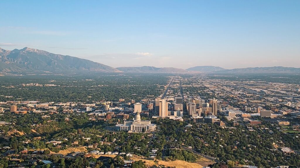
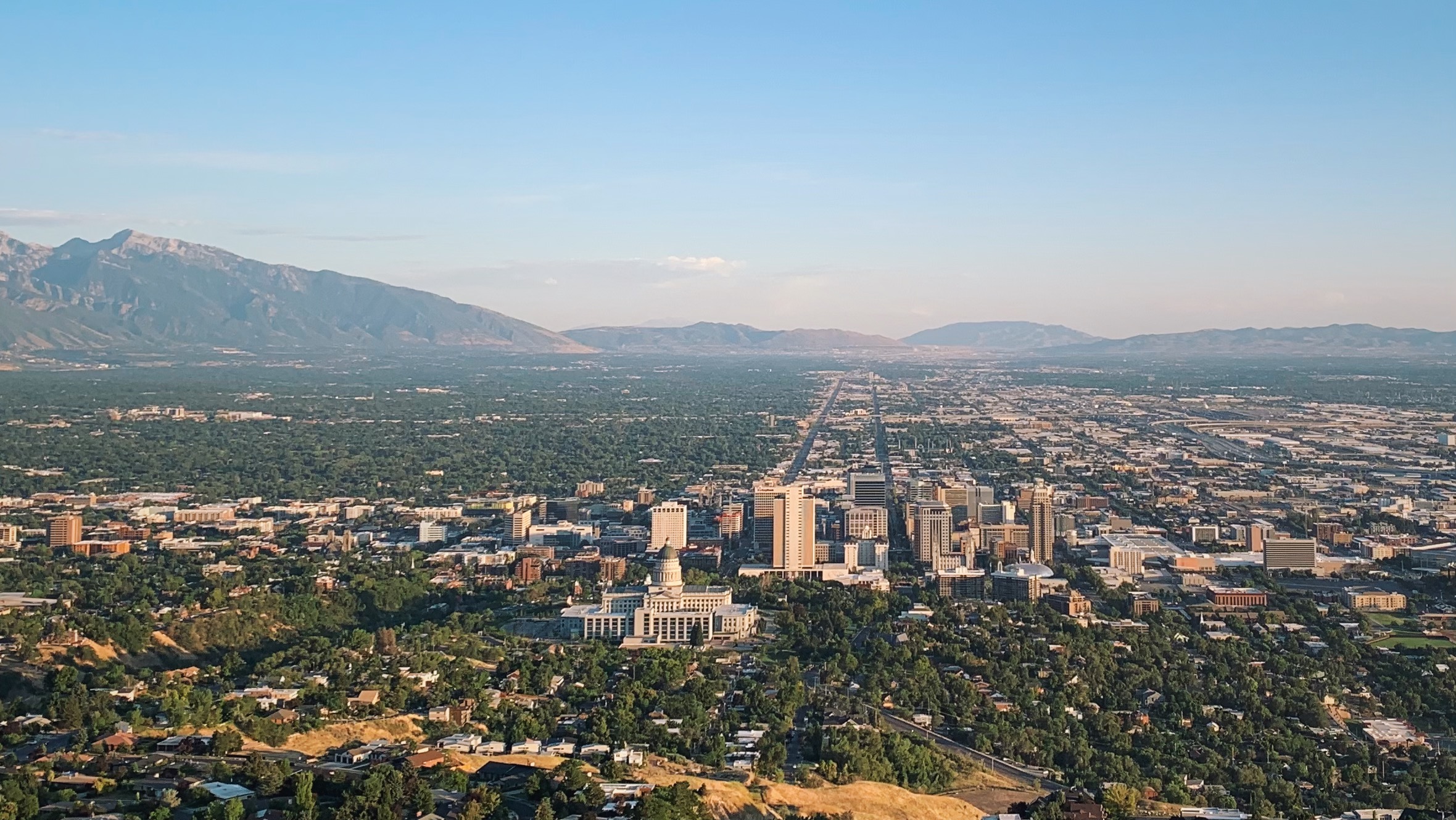
    The Salt Lake City skyline with the snow-capped Wasatch Range beyond
    Downtown Salt Lake City at the foot of the Wasatch, with ski areas less than an hour away (Photo: Iansmh98 via Wikimedia Commons, CC BY-SA 4.0)

    Salt Lake City at a glance for first-timers

    • Airport: Salt Lake City International (SLC), about 6 km (4 miles) west of downtown, rebuilt from scratch and opened in stages from 2020. The TRAX Green Line runs from the terminal to downtown in roughly 20 minutes, and it is one of the closest big airports to its city center in the country. See our SLC airport guide.
    • Getting around: downtown is compact and TRAX light rail is free within the downtown Free Fare Zone; the University of Utah, Sugar House and the airport are all on rail. For the ski canyons, Park City and the national parks, most visitors rent a car. Our car-versus-transit guide explains when it helps.
    • Money: US dollars. Sales tax is added at the register rather than shown on the tag, and hotel taxes are higher again. Tipping 18 to 20 percent in restaurants is expected.
    • Altitude and air: the city sits about 1,300 m (4,300 feet) above sea level and the ski areas are far higher. The air is dry, so drink more water than usual and wear sunscreen in every season.
    • Weather: four distinct seasons: hot, dry summers, a long clear fall, snowy winters with occasional inversion haze in the valley, and a changeable spring. Our month-by-month guide has the detail.
    • Where to stay: downtown near Temple Square for the sights, the arena and TRAX; Sugar House for a neighborhood feel; the airport area for early flights; Park City or the canyon lodges if skiing is the whole point. Our Salt Lake City hotel search covers them all.

    Temple Square and downtown

    Temple Square is where the city began and where most first visits start. The pioneers who arrived in the valley in 1847, members of The Church of Jesus Christ of Latter-day Saints, laid out their city from this point, and the block and the surrounding campus remain the church’s worldwide headquarters. The granite Salt Lake Temple, completed in 1893 after forty years of construction, has been closed for a long seismic renovation, and the church plans a public open house with free tickets before the temple is rededicated; check the official Temple Square site for reservations and the current state of the grounds. After it is rededicated, only church members entering for worship go inside, but the gardens, the visitors’ center and much of the campus are open to everyone. The domed Tabernacle, famous for its acoustics and its enormous organ, is home to the Tabernacle Choir at Temple Square, whose weekly Music & the Spoken Word broadcast on Sunday mornings is free to attend. Across North Temple, the 21,000-seat Conference Center has a landscaped rooftop garden with a view of the Wasatch, and the Family History Library, the largest genealogical library in the world, is free and open to anyone who wants to trace their own ancestors. The Beehive House, the home of Brigham Young, offers free tours. Visitors of any faith, or none, are welcome throughout; dress is casual, and volunteers offer tours and answer questions without pressure.

    Immediately south, City Creek Center is an open-air shopping district with a restored creek running through it and a retractable glass roof. West of the square, the Delta Center hosts the Utah Jazz and the NHL’s Utah Mammoth, and the Salt Palace Convention Center fills the blocks to the south. Abravanel Hall, home of the Utah Symphony, and the Eccles Theater, where Broadway tours stop, are both a short walk away. Our downtown and Temple Square hotel page lists the options in the center.
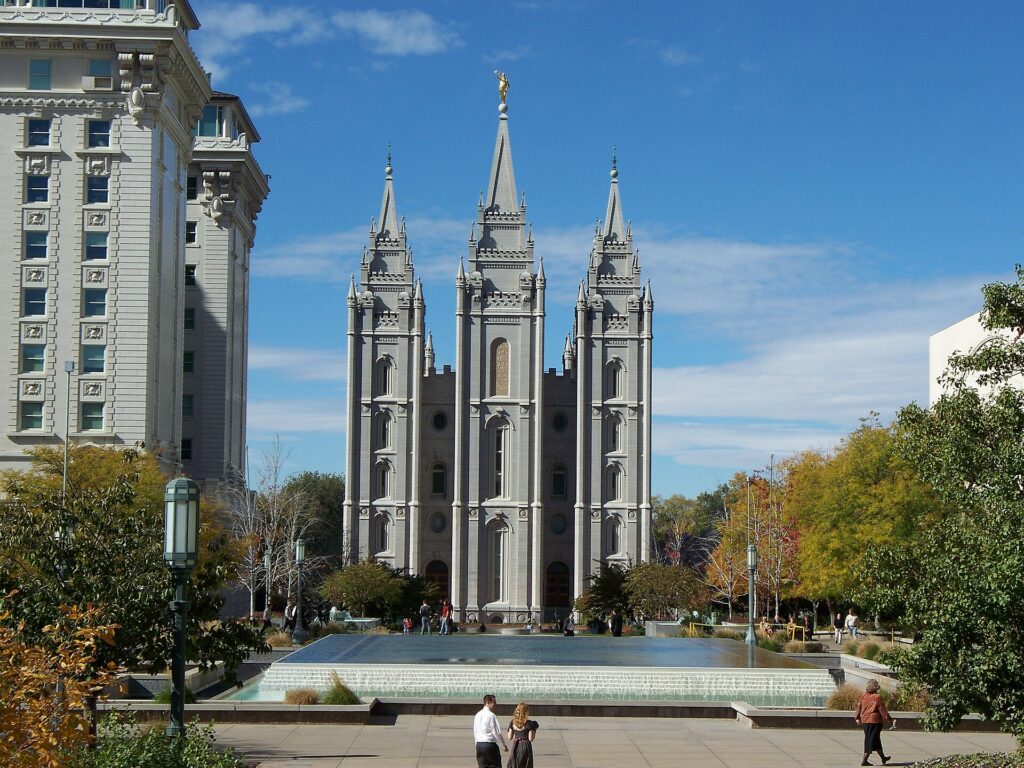
    The granite Salt Lake Temple on Temple Square in downtown Salt Lake City
    Temple Square, the historic heart of the city and headquarters of The Church of Jesus Christ of Latter-day Saints (Photo: Bobjgalindo via Wikimedia Commons, CC BY 4.0)

    Capitol Hill and City Creek Canyon

    The Utah State Capitol sits on the hill directly north of downtown, a granite building with a great central dome, completed in 1916 and restored after a major seismic retrofit in the 2000s. It is free to enter, the rotunda and the chambers are open when the legislature is not sitting, and free guided tours run on weekdays; the steps give the best easy view in the city, straight down State Street to the southern end of the valley, with the Oquirrh Mountains to the west and the Wasatch to the east. East of the Capitol, City Creek Canyon is a narrow wooded canyon that runs straight out of the city into the mountains, with a paved road that is closed to cars on alternating days in summer so walkers and cyclists have it to themselves. Memory Grove, at the canyon mouth, is a quiet war-memorial park a few minutes’ walk from downtown. For a longer hike with a summit, Ensign Peak, a short, steep climb from the top of the Avenues, is where the pioneer leaders are said to have surveyed the valley in 1847, and it has the city’s best sunset view.
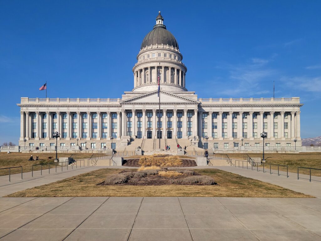
    The south front of the domed Utah State Capitol above downtown Salt Lake City
    The Utah State Capitol, free to visit, with the best easy view of the valley from its steps (Photo: GyozaDumpling via Wikimedia Commons, CC BY-SA 4.0)

    The east bench: museums, gardens and the pioneer story

    The foothills above the University of Utah hold the city’s best cluster of attractions. The Natural History Museum of Utah, in the Rio Tinto Center, a building terraced into the hillside, is the highlight: a wall of dinosaur skulls and skeletons from Utah’s extraordinary fossil beds, galleries on the Great Salt Lake, the state’s Native peoples and its geology, and a top-floor terrace with a view across the valley. Next door, Red Butte Garden is a large botanical garden with foothill trails and a summer outdoor concert series that sells out quickly. Down the hill, This Is the Place Heritage Park marks the spot where Brigham Young is said to have first looked out over the valley; it has a monument and a reconstructed pioneer village with costumed interpreters, craft demonstrations and a small train, and it tells the settlement story, including the Native nations who were already here. The Hogle Zoo is across the road, and the Utah Museum of Fine Arts is on the campus below. TRAX’s Red Line reaches the university, and buses cover the rest.

    Neighborhoods worth a half-day

    Sugar House

    A few miles southeast of downtown and reached on the S-Line streetcar, Sugar House is the city’s liveliest neighborhood away from the center: independent shops, bookstores, restaurants and bars along Highland Drive and 2100 South, and Sugar House Park, a big green space with a pond and a view of the Wasatch. It is the easiest place in the city to spend an unplanned afternoon.

    9th and 9th and 15th and 15th

    Named for their intersections, these two small commercial nodes east of downtown are the city’s most charming, with cafés, a vintage movie theater, bakeries and restaurants set among tree-lined streets of bungalows. Liberty Park, home of Tracy Aviary, is a short walk from 9th and 9th.

    The Avenues

    Climbing the hill northeast of Temple Square, the Avenues is the city’s oldest residential district, a grid of Victorian houses and small corner restaurants with views of downtown. Walk up from the Capitol, take in Ensign Peak, and come back down for dinner.

    Central Ninth and the Granary District

    South and west of downtown, these former warehouse and light-industrial areas have filled with breweries, distilleries, coffee roasters and restaurants. They are less polished than Sugar House and more fun for it.

    Museums, culture and family attractions

    Tracy Aviary, in Liberty Park, is one of the oldest bird parks in the country, with free-flight bird shows in summer. The Clark Planetarium, at the Gateway, has a dome theater and free exhibit floors. The Leonardo, a science and art museum in the old downtown library building on Library Square, is aimed at older children and curious adults. The Church History Museum, beside Temple Square, is free and covers the church’s story in art and artifacts. For live performance, the Utah Symphony, Utah Opera and Ballet West are the main companies, and the Eccles Theater hosts Broadway tours. Library Square, with the striking curved glass Salt Lake City Public Library by Moshe Safdie, is worth a visit for the building alone: walk up the sloping outer wall to the rooftop garden. For what is on stage and in the arenas during your dates, our Salt Lake City events page lists concerts, shows and games.

    Skiing the Wasatch

    Salt Lake City has a claim no other big American city can match: world-class skiing within about 40 minutes of downtown, and the airport less than an hour from the lifts. Utah’s license plates advertise “the Greatest Snow on Earth”, and the dry, light powder that falls on the Wasatch is the reason. Big Cottonwood Canyon holds Solitude and Brighton, the latter a local favorite with night skiing. Little Cottonwood Canyon, next door, holds Snowbird and Alta, two of the most celebrated ski mountains in the country for steep terrain and deep snow; Alta is one of the few resorts in North America that remains skiers only. Park City, over Parleys Canyon on I-80, has Park City Mountain, one of the largest ski areas in the country, and Deer Valley, known for grooming and service. The season generally runs from late November or early December into April, and Snowbird often stays open later. The canyon roads are the catch: they are narrow, steep and prone to closures for avalanche control after big storms, parking at several resorts now requires payment or reservations on busy days, and traction rules apply to cars in winter; our car-versus-transit guide covers the rules and the ski buses. Ski Utah has resort information and snow reports. Salt Lake City hosted the 2002 Winter Games and has been chosen to host again in 2034.

    Sports

    The Utah Jazz play NBA basketball at the Delta Center, one of the loudest arenas in the league, and since 2024 they have shared it with the city’s NHL team, now called the Utah Mammoth, which has given downtown a winter game-night crowd almost every week from October to April. Real Salt Lake plays MLS soccer, and the Utah Royals play in the NWSL, both at the soccer stadium in Sandy, south of the city and within reach of the TRAX Blue Line. The Salt Lake Bees, the Triple-A baseball team, have moved to a new ballpark in the Daybreak development in South Jordan, at the end of the TRAX Red Line. On fall Saturdays, the University of Utah’s football team fills Rice-Eccles Stadium, where the 2002 Olympic opening ceremony was held. Check what is on sale in Salt Lake City for your dates before you book flights.

    What to eat and drink, and where

    Salt Lake City’s food scene is more varied than visitors expect. Start with the local classics: fry sauce, the pink mix of ketchup and mayonnaise served with fries at every burger stand; the pastrami burger, a Utah drive-in staple; Utah-style scones, which are fried dough with honey butter rather than anything British; and funeral potatoes, a cheesy potato casserole that turns up at every family gathering. Drive-through “dirty soda” shops, mixing sodas with syrups and cream, are a local obsession. Beyond those, State Street and the west side have excellent Mexican food; the valley’s large Pacific Islander communities mean good Tongan and Samoan food; and downtown, Sugar House, 9th and 9th and the Central Ninth warehouse district hold the ambitious new restaurants. The Downtown Farmers Market in Pioneer Park runs on Saturdays in summer and early fall. As for drinks, Utah’s reputation lags the reality. The city has a thriving craft beer scene, several distilleries and plenty of bars; draft beer is limited to a lower alcohol content than elsewhere, with stronger beers sold in cans and bottles, restaurants serve wine and cocktails with food, and bars admit only those 21 and over. Wine and spirits for home are sold only in state-run liquor stores, which are closed on Sundays and holidays.

    Salt Lake City through the seasons

    Winter (December to March) is ski season: the canyons get deep, dry snow, the resorts are busy, and the Jazz and the Mammoth are both at home. The valley itself is colder and grayer than the mountains, and on still days a temperature inversion can trap haze over the city for a week, which is exactly when locals head uphill into the sunshine. Spring (April to May) is changeable, with late snow in the city and spring skiing in the canyons into April; it is the quietest, cheapest time in the valley, and the orchards and gardens bloom. Summer (June to August) is hot and dry, with long evenings, the Utah Arts Festival and Utah Pride in June, Pioneer Day on July 24 with a big parade and fireworks, and cool air in the high canyons. Fall (September to October) is the local favorite: warm, clear days, the aspens and maples turning gold and red in the canyons from late September, the Utah State Fair in early September, and the national parks at their most comfortable. The church’s General Conference, held on the first weekend of April and October, brings large crowds downtown; plan hotels around it. Our month-by-month guide has the fare patterns that go with each season.

    Salt Lake City with kids

    Salt Lake City is one of the most family-oriented cities in the country, and it shows. The Natural History Museum of Utah, with its dinosaurs and hands-on galleries, is the obvious first stop, and the Hogle Zoo and This Is the Place Heritage Park, with its pioneer village and train, sit side by side for a full day. The Leonardo, the Clark Planetarium and the Loveland Living Planet Aquarium in the southern suburbs fill a rainy afternoon. In summer, the fountains at City Creek Center and the splash pads in the city parks are free, and a drive up Big Cottonwood Canyon to a lake at the top makes an easy mountain afternoon. In winter, every resort has a ski school, and Antelope Island’s bison make a memorable day at any time of year. Our family car rental guide covers the vehicle question for canyon and park trips.

    Salt Lake City on a budget

    A lot of the best of Salt Lake City costs nothing. Temple Square, the Tabernacle Choir broadcast, the Conference Center roof garden, the Family History Library, the Beehive House tour, the Church History Museum and the State Capitol are all free, as are Memory Grove, City Creek Canyon, Ensign Peak and the Library Square rooftop. TRAX rides within the downtown Free Fare Zone cost nothing, and the train from the airport is cheap. Eat well for less on State Street and the west side, at the drive-ins and at the Saturday farmers market. Downtown hotel rates are usually at their most reasonable outside convention weeks, General Conference weekends and the ski holidays. Compare rates by neighborhood on our Salt Lake City hotel search.

    Day trips from Salt Lake City

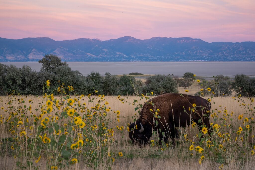
    Antelope Island State Park, about an hour north across a causeway into the Great Salt Lake, is the essential lake trip: free-roaming bison and pronghorn, beaches where the salt water holds you up, and wide views across the water; the lake’s level rises and falls from year to year, and biting brine flies can be a nuisance in early summer. Park City, about 40 minutes east on I-80, is a former silver-mining town with a historic Main Street, galleries, restaurants, summer mountain biking and the Utah Olympic Park; the Sundance Film Festival, which put the town on the map every January, is moving to Boulder, Colorado, from 2027. The Bonneville Salt Flats, about 90 minutes to two hours west on I-80, are a blinding white plain famous for land-speed records. Golden Spike National Historical Park, about two hours north, marks where the first transcontinental railroad was completed in 1869. The Alpine Loop through American Fork Canyon, about an hour south and closed in winter, passes Timpanogos Cave and is one of the prettiest fall-color drives in the state. Utah’s famous national parks are farther than most visitors assume: Arches and Canyonlands near Moab are around four hours southeast, Capitol Reef and Bryce Canyon about four, and Zion around four and a half to the south. They are overnight trips rather than day trips, and Arches has used a timed-entry reservation system in recent peak seasons, so check the National Park Service site for current rules before you go. All of these are car trips; see our Salt Lake City car rental page. For a longer road trip, the drive between Salt Lake City and Denver takes about eight hours; our Denver to Salt Lake City route guide covers it, and our guide to things to do in Denver covers the other end. Utah’s official tourism site covers the wider state.
    The shoreline of Antelope Island in the Great Salt Lake
    Antelope Island, an hour north of downtown, with bison, beaches and the Great Salt Lake all around (Photo: Matthew Dillon from Hollywood, CA, USA via Wikimedia Commons, CC BY 2.0)

    Two sample itineraries

    Two days, no car

    Day one: TRAX from the airport, Temple Square and the Conference Center roof garden in the morning, lunch at City Creek or on Main Street, the walk up to the State Capitol and through Memory Grove in the afternoon, and dinner in the Avenues or downtown, with a Jazz or Mammoth game if one is on. Day two: TRAX to the university and a bus up to the Natural History Museum and Red Butte Garden in the morning, This Is the Place in the early afternoon, then the S-Line to Sugar House for the park, the shops and dinner.

    Four days, with the mountains and the lake

    Add a day in the canyons, skiing in winter or hiking and a scenic drive up Big Cottonwood in summer and fall, and a day split between Antelope Island and the Great Salt Lake shore, or Park City and the Olympic Park. Pick up a car downtown for those days and return it at the airport on the way home; in winter, confirm the car meets the canyon traction rules before you drive up.

    Practical details

    • Transit: buy tickets at TRAX station machines or through UTA’s app; rides that start and end in the downtown Free Fare Zone are free. UTA has maps, fares and service alerts; our transit-versus-car guide goes into detail.
    • From SLC: the TRAX Green Line to downtown, a taxi or ride-hail, or a rental from the counters in the garage facing the terminal. The airport’s site covers ground transport.
    • Weather: layers in every season, sunscreen and sunglasses year-round, a warm coat and good footwear from November to March, and water for summer heat. NOAA’s National Weather Service office in Salt Lake City has the forecast and air-quality context during inversions.
    • Sundays: the city is quieter on Sundays; most attractions and restaurants open, but some shops close, state liquor stores are shut, and some transit runs a reduced schedule.
    • Time zone: Mountain, two hours behind New York and one ahead of Los Angeles.
    • Entry requirements: visitors from Visa Waiver Program countries need an approved ESTA before boarding; most others need a visa. The State Department’s travel site is the authoritative source.
    • Safety: the areas visitors spend their time in are generally safe; use ordinary big-city awareness around the downtown transit hubs late at night, and in the mountains, check avalanche and weather conditions before heading off the groomed runs or up a trail.

    Frequently asked questions

    How many days do you need in Salt Lake City?

    Two full days covers Temple Square, the Capitol, the east bench museums and a neighborhood; add a day for Antelope Island or Park City, several for skiing, and at least three or four for a loop through the national parks.

    What is the number one thing to do in Salt Lake City?

    For a first visit, Temple Square and the walk up to the Capitol. In winter, ski the Cottonwood Canyons, which are closer to a major city than any comparable resorts in the country.

    Is Salt Lake City walkable?

    Downtown is, though the blocks are much longer than in most cities and a walk takes longer than the map suggests. The Avenues, Sugar House and 9th and 9th are pleasant on foot; the rest of the valley assumes a car.

    Do I need a car in Salt Lake City?

    Not for downtown, the university or Sugar House, all on TRAX or the streetcar. For the canyons, Park City, Antelope Island and the national parks, yes.

    Can non-members visit Temple Square?

    Yes. The grounds, gardens, visitors’ center, Tabernacle, Conference Center and Family History Library are open to all visitors free of charge. The temple itself is open to the public only during a pre-dedication open house; after rededication, entry is for church members attending worship.

    What is Salt Lake City known for?

    Temple Square and the church headquarters, the Great Salt Lake, the 2002 Winter Olympics, powder skiing in the Wasatch, the Utah Jazz, and its role as the gateway to Utah’s national parks.

    Ready to go? Compare flights to Salt Lake City, find a place to stay with our Salt Lake City hotel search, and if the canyons or the parks are on the list, price a rental car for those days.

  • Things to Do in Charlotte: A First-Timer’s Guide

    Things to Do in Charlotte: A First-Timer’s Guide

    Charlotte is the biggest city in the Carolinas, and most people who pass through it never leave the airport. Charlotte Douglas is one of American Airlines’ largest hubs, so millions of travelers change planes under the white rocking chairs in the terminal atrium every year and fly on. That is their loss. The city outside has grown into one of the most pleasant urban centers in the South: a compact downtown, which locals call Uptown, built around a crossroads that has been the heart of the city since colonial times; modern art museums and the NASCAR Hall of Fame within a few blocks of each other; a light-rail line lined with breweries, food halls and converted textile mills; leafy streetcar suburbs; one of the largest man-made whitewater rivers in the world fifteen minutes from the skyline; and the Blue Ridge Mountains, the lakes and the racing towns of the Piedmont within a couple of hours. This guide covers the sights, the neighborhoods, the food, the racing and sports, the day trips and the practical details that turn a layover city into a real trip.

    If you are still comparing cheap flights to Charlotte, read this alongside our guides to the best time to fly to Charlotte and whether you need a car. Between the three you can plan the whole trip.

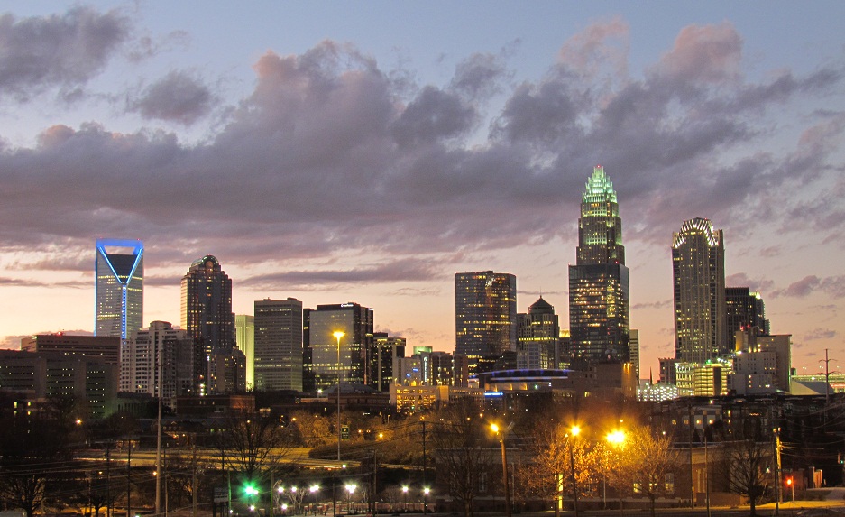
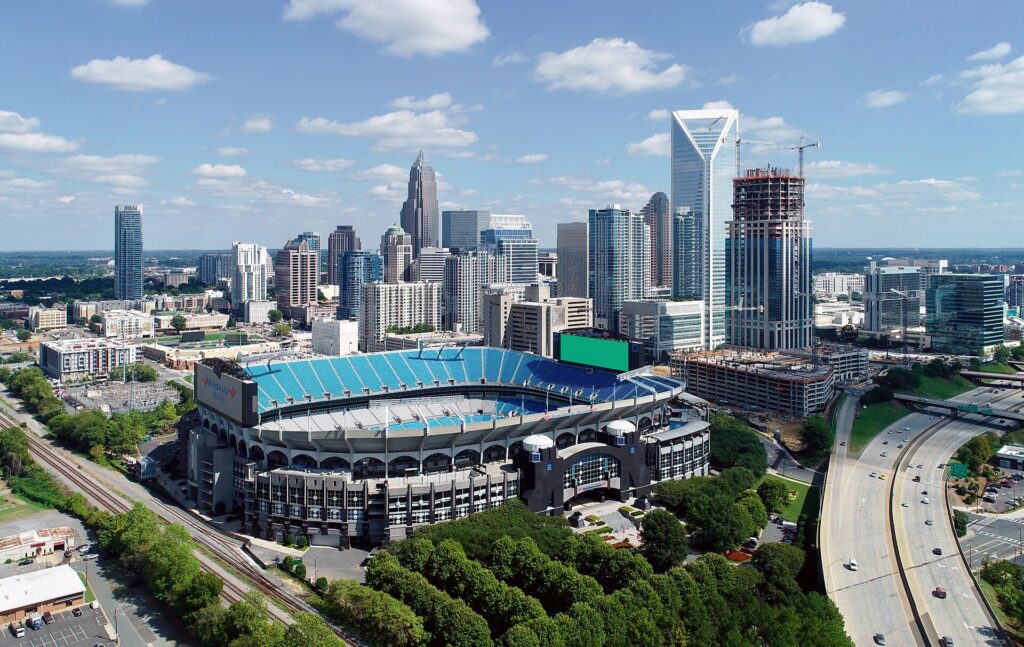
    Aerial view of the Uptown Charlotte skyline
    Uptown Charlotte, where the Bank of America Corporate Center tops the tallest skyline in the Carolinas (Photo: Precisionviews; edits (perspective correction and colour correction) made by Cmao20 (talk). Derivative file of File:Uptown Charlotte 2018 taking by DJI Phantom 4 pro.jpg via Wikimedia Commons, CC BY-SA 4.0)

    Charlotte at a glance for first-timers

    • Airport: Charlotte Douglas International (CLT), about 11 km (7 miles) west of Uptown; a taxi or ride-hail takes 15 to 20 minutes, and the CATS Route 5 bus runs to the Charlotte Transportation Center downtown. See our CLT airport guide.
    • Getting around: the LYNX Blue Line light rail links South End, Uptown, NoDa and the university, and the CityLYNX Gold Line streetcar crosses Uptown east to west. Uptown and South End are walkable. For the Speedway, the lakes, the Whitewater Center and the mountains, you will want a car.
    • Money: U.S. dollars. State and county sales tax is added at the till, and hotel rooms carry extra occupancy taxes. Tipping 18 to 20 percent in sit-down restaurants is customary.
    • Weather: hot, humid summers with afternoon thunderstorms, short and mostly mild winters with the occasional ice storm, and a long spring and fall that are the best times to visit. Our month-by-month guide has the detail.
    • Where to stay: Uptown for the museums, the arenas, the stadium and the light rail; South End for breweries, restaurants and the Rail Trail; Dilworth or Myers Park for a quieter, leafy stay; Concord or University City for race weekends. Our Charlotte hotel search covers them all.

    Uptown: the Square, the wards and the parks

    Charlotte grew up where two old trading paths crossed, and that intersection, Trade and Tryon Streets, is still the center of the city. Locals call it the Square, and each corner holds a bronze statue by Raymond Kaskey representing the forces that built Charlotte: a gold miner for commerce, a mill worker for industry, a railroad builder for transportation, and a mother and child for the future. Above them rises the Bank of America Corporate Center, 60 stories and the tallest building in the Carolinas, a reminder that Charlotte is the second-largest banking center in the country after New York. Uptown is divided into four historic wards. Fourth Ward, to the northwest, is the prettiest, with restored Victorian houses on quiet streets and the Settlers’ Cemetery, which has graves from the Revolutionary era. Third Ward holds Romare Bearden Park, named for the celebrated collagist born in Charlotte, facing Truist Field, where the Charlotte Knights play Triple-A baseball with the skyline as a backdrop; it is one of the best places in the city to spend a summer evening. First Ward, to the east, has First Ward Park and the start of the Little Sugar Creek Greenway.

    Levine Center for the Arts and the NASCAR Hall of Fame

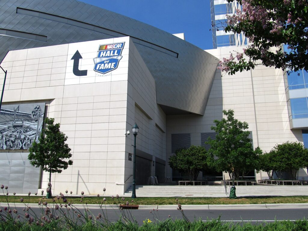
    A few blocks south of the Square on South Tryon, the Levine Center for the Arts gathers several institutions around a single plaza. The Mint Museum Uptown has a strong American collection and an outstanding craft and design gallery of glass, ceramics, furniture and fashion. The Bechtler Museum of Modern Art, in a terracotta building by the Swiss architect Mario Botta, shows mid-century modernism, and Niki de Saint Phalle’s glittering mosaic Firebird on the sidewalk out front is the most photographed sculpture in the city. The Harvey B. Gantt Center for African-American Arts + Culture, named for Charlotte’s first Black mayor, occupies a striking building inspired by the Myers Street School, the city’s first school for Black children. The Mint’s original home, the Mint Museum Randolph in Eastover, is the relocated building of the branch U.S. Mint that opened here in the 1830s to coin gold from the Carolina gold rush, and it became the first art museum in North Carolina in 1936. One block west of the Levine Center, the NASCAR Hall of Fame is the attraction that surprises visitors most. Even people with no interest in racing enjoy it: a banked ramp lined with historic cars shows how steep the tracks really are, the pit-stop challenge lets you change a tire against the clock, and the racing simulators are as close as most of us will get to 190 miles an hour. Allow at least two hours.

    The NASCAR Hall of Fame in Uptown Charlotte
    The NASCAR Hall of Fame, a block from the Levine Center for the Arts and fun even for non-fans (Photo: Ken Lund from Reno, Nevada, USA via Wikimedia Commons, CC BY-SA 2.0)

    South End and the Rail Trail

    Just south of Uptown, along the LYNX Blue Line, South End has turned from a district of rail yards and warehouses into the liveliest neighborhood in the city. The Rail Trail, a walking and cycling path beside the light-rail tracks, ties it together, with public art, pocket parks and a steady stream of people heading between patios. Along and just off it are restaurants, coffee shops, design stores and taprooms, and Atherton Mill, a restored textile mill beside the tracks, has shops and places to eat. Because the Blue Line stops every few blocks, it is easy to ride down from Uptown, walk the Rail Trail south for an hour with stops, and ride back. Farther south on the same line, the Olde Mecklenburg Brewery, known for German-style lagers and a big beer garden, is the city’s most famous brewery.

    Neighborhoods worth a half-day

    NoDa

    North Davidson, universally called NoDa, is Charlotte’s arts district, a former mill village northeast of Uptown with murals on every other wall, small galleries, independent music venues, bars and restaurants along North Davidson and 36th Street. The Blue Line’s 36th Street station puts it ten minutes from the center, and NoDa Brewing is one of the city’s pioneering craft breweries.

    Plaza Midwood

    East of Uptown along Central Avenue, Plaza Midwood is the city’s most eclectic neighborhood: dive bars and cocktail lounges, vintage and record shops, barbecue and taco joints. Continue out Central Avenue and you reach the international corridor, with Vietnamese, Mexican, Salvadoran, Ethiopian and many other restaurants in modest strip malls.

    Dilworth and Myers Park

    Dilworth, laid out in 1891 as Charlotte’s first streetcar suburb, has bungalows, Latta Park and a strip of restaurants along East Boulevard. Myers Park, next door, was planned in the 1910s around Queens Road, whose canopy of huge willow oaks is one of the loveliest streets in the South. Freedom Park, at its edge, is the city’s favorite green space, with a lake and the Festival in the Park each September.

    Camp North End and Optimist Hall

    Just north of Uptown, Camp North End occupies a sprawling 1920s Ford Model T assembly plant later used by the Army, now a creative campus with food stalls, bars, studios, murals and outdoor events. A short ride away, Optimist Hall is a food hall in a restored 1890s textile mill. Together they are the best introduction to how Charlotte has reused its industrial past.

    Museums, culture and family attractions

    Discovery Place Science, on North Tryon in Uptown, is the city’s hands-on science museum, with an IMAX dome theater and galleries that fill a rainy day; its smaller sister, Discovery Place Nature, sits beside Freedom Park. The Charlotte Museum of History, in the east of the city, preserves the Hezekiah Alexander House, a 1774 stone house that is the oldest surviving home in Mecklenburg County, and tells the story of the region’s Revolutionary past, including the Mecklenburg Declaration of Independence, whose claimed date of May 20, 1775 still appears on the North Carolina flag. It is also where you learn why Charlotte is the Queen City, after Queen Charlotte, wife of George III, and why its NBA team is the Hornets: a British general in 1780 is said to have called the town a hornet’s nest of rebellion. The Billy Graham Library, near the airport, is a free museum telling the evangelist’s life story; Graham was born on a dairy farm in Charlotte. For live performance, Blumenthal Arts runs the Belk Theater, which hosts touring Broadway shows, and the Charlotte Symphony performs downtown. For what is on during your dates, our Charlotte events page lists concerts, shows and games.

    The Whitewater Center, the greenways and the lakes

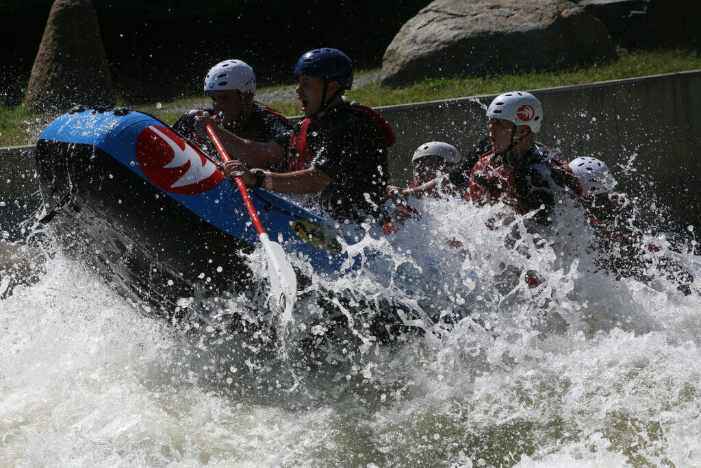
    The U.S. National Whitewater Center, about fifteen minutes west of Uptown on the Catawba River, is the city’s great outdoor playground. At its heart is a man-made whitewater river with rapids big enough for serious rafting and kayaking, surrounded by more than a thousand acres of forest with miles of hiking and mountain-biking trails, zip lines, climbing walls, flatwater paddling on the Catawba, and a riverside bar with live music on summer evenings. Entry to the grounds and trails is free; you pay for parking and activity passes, and it is worth booking rafting ahead on summer weekends. Back in the city, the Little Sugar Creek Greenway runs from the edge of Uptown south past Freedom Park and is part of the longer Cross Charlotte Trail, the best way to see the neighborhoods at walking pace. North of the city, Lake Norman, the largest man-made lake in North Carolina, is where Charlotte goes boating in summer, with marinas and lakeside restaurants in Cornelius and Mooresville.

    The man-made whitewater channels of the U.S. National Whitewater Center in Charlotte
    The U.S. National Whitewater Center, fifteen minutes from Uptown on the Catawba River (Photo: Cpl. Ed Galo via Wikimedia Commons, Public domain)

    Racing: the Speedway and NASCAR country

    Charlotte is the center of American stock-car racing, and most NASCAR teams are based within an hour of Uptown. Charlotte Motor Speedway, about half an hour northeast in Concord, is one of the sport’s great tracks. Its biggest event is the Coca-Cola 600 on the Sunday of Memorial Day weekend, the longest race on the NASCAR calendar, run from late afternoon into the night before one of the largest crowds of any American sporting event; the track’s fall race weekend has in recent years used the Roval, which combines the oval with an infield road course. On race weekends hotels from Concord to Uptown fill and prices climb, and traffic on I-85 is severe, so plan early. Outside race weekends, the Speedway runs track tours, and in the holiday season it becomes a drive-through light show. Several race teams have showrooms open to visitors in Concord and in Mooresville, which calls itself Race City USA; check hours before you go.

    Sports

    Charlotte’s other teams play in or near Uptown. Bank of America Stadium, at the southwest edge of Uptown, is home to the Carolina Panthers of the NFL and Charlotte FC, the MLS club that drew one of the largest crowds in league history to its first home match; it also hosts the ACC Championship Game in December, a college bowl game around New Year and big stadium concerts. The Charlotte Hornets play NBA basketball at the Spectrum Center, beside the light-rail and streetcar stops, from October to April. The Charlotte Knights play at Truist Field from April to September, and the Charlotte Checkers play minor-league hockey at the domed Bojangles Coliseum. Quail Hollow Club, in the south of the city, hosts a PGA Tour event most springs. Check what is on sale in Charlotte before you book flights, because a Panthers game, a race weekend or a big concert can fill every hotel in the center.

    What to eat, and where

    Start with barbecue: North Carolina’s two great styles meet here, the pork shoulder with a tangy, lightly tomatoed vinegar dip of the Piedmont, whose capital, Lexington, is an hour northeast, and the whole-hog, vinegar-and-pepper style of the east. Order it chopped with slaw and hush puppies. Southern cooking fills the rest of the plate: fried chicken, biscuits, shrimp and grits, pimento cheese, collards, banana pudding and sweet tea. Bojangles, the chicken-and-biscuit chain now found across the South, opened its first restaurant in Charlotte in 1977, and Cheerwine, the cherry soda on every menu, comes from Salisbury, forty minutes up I-85. The international corridor along Central Avenue and parts of South Boulevard has some of the best Vietnamese, Mexican and Latin American food in the Carolinas at modest prices. The food halls at Optimist Hall and Camp North End are the easiest way to sample the newer scene, and South End, Plaza Midwood, Dilworth and NoDa are where most of the city’s best chefs cook. Charlotte also has one of the fastest-growing brewery scenes in the South, with dozens of taprooms across South End, NoDa and the old industrial districts.

    Charlotte through the seasons

    Spring (March to May) is the showpiece: dogwoods and azaleas bloom across Myers Park and Dilworth in late March and April, patios reopen in South End, the Knights and Charlotte FC start their seasons, and the Coca-Cola 600 on Memorial Day weekend brings the whole region to Concord. The drawback is the pine pollen, which coats every car in yellow dust for a few weeks in April. Summer (June to August) is hot and humid, with afternoon thunderstorms, so do the Whitewater Center in the morning, the museums in the afternoon, and finish at a ballgame or on a brewery patio; the Fourth of July fireworks over Uptown and Charlotte Pride in August are the big events. Fall (September to November) is the local favorite, warm and dry into October, with Panthers and college football on every screen, the Festival in the Park, the Speedway’s fall race weekend, and color arriving in the Blue Ridge in mid-to-late October. Winter (December to February) is short, mostly mild and the quietest time to visit, with the holiday lights at the Speedway and in McAdenville, the Thanksgiving parade in Uptown, and the Hornets in season. Our month-by-month guide has the fare patterns that go with each season.

    Charlotte with kids

    Charlotte is an easy city with children. Discovery Place Science is the obvious rainy-day morning, with Discovery Place Nature, beside the Freedom Park playground and lake, for younger children. The NASCAR Hall of Fame’s simulators and pit-stop challenge are a hit with anyone over about eight, and the Whitewater Center has kid-friendly zip lines, climbing and flatwater paddling. In summer the splash pads at Romare Bearden Park and First Ward Park are free, and a Knights game at Truist Field, with fireworks nights and a skyline view, is a cheap and cheerful evening. Carowinds, the amusement park that straddles the state line about twenty minutes south of Uptown, has a water park and some of the tallest roller coasters in the country. For families driving to the mountains, the lakes or the coast, our family car rental guide covers the vehicle question.

    Charlotte on a budget

    Much of the best of Charlotte is free: the Square and the Fourth Ward, Romare Bearden Park, the Rail Trail and the greenways, Freedom Park, the grounds and trails of the Whitewater Center (you pay only for parking), the murals of NoDa and Plaza Midwood, the Billy Graham Library, and the Gold Line streetcar across Uptown, which has run fare-free in recent years. Eat well for less along Central Avenue and at the food halls. Hotel rates outside race weekends, big games and conventions are generally lower than in Atlanta or Washington, DC, and a stay in South End or near a Blue Line station can save money without costing convenience. Compare rates by neighborhood on our Charlotte hotel search.

    Day trips from Charlotte

    The Blue Ridge Mountains are the classic escape. Asheville, about two hours west, is a mountain city of breweries, galleries and art deco architecture, and just outside it the Biltmore Estate, the Vanderbilt family’s French Renaissance chateau, is the largest privately owned house in the country. The Blue Ridge Parkway runs past both, with overlooks, waterfalls and trails; parts of the region, including sections of the Parkway, were badly damaged by Hurricane Helene in 2024, so check the park’s site for closures before you plan a route. Closer in, Crowders Mountain State Park, about 45 minutes west, has a steep summit hike with views back to the Charlotte skyline, and Kings Mountain National Military Park, just over the South Carolina line, preserves the site of a 1780 battle that turned the Revolutionary War in the South. Reed Gold Mine, about 40 minutes east, is the site of the first documented gold discovery in the United States, in 1799, with underground tours and gold panning. Charleston and Myrtle Beach are about three and a half hours away and better as overnights, and Atlanta is about four hours down I-85; our Atlanta to Charlotte route guide covers that drive, and our Atlanta guide covers the city at the other end. All of these are car trips; see our Charlotte car rental page.

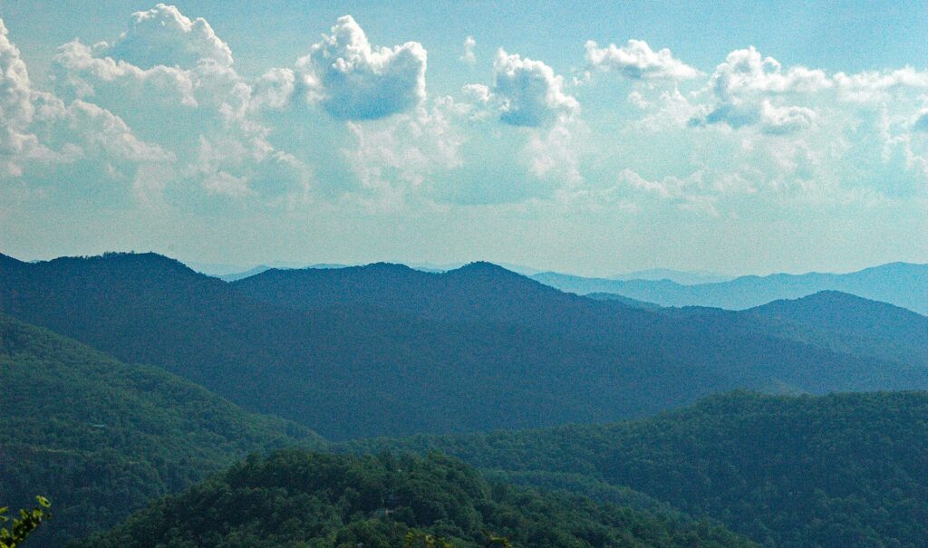
    Mountain ridges seen from the Blue Ridge Parkway in North Carolina
    The Blue Ridge Parkway, about two hours west of Charlotte and the classic mountain day trip (Photo: James St. John via Wikimedia Commons, CC BY 2.0)

    Two sample itineraries

    Two days, no car

    Day one: the Square and a walk through the Fourth Ward in the morning, the Mint Museum Uptown or the Bechtler after lunch, the NASCAR Hall of Fame in the late afternoon, and dinner on Tryon Street or a Hornets game at night. Day two: the Blue Line to South End for brunch and a long walk along the Rail Trail, then the Blue Line north to NoDa for murals, a brewery and live music, and a late dinner in Plaza Midwood or at Optimist Hall.

    Four days, with the region

    Add a day at the Whitewater Center, rafting in the morning and hiking the trails in the afternoon. Then pick up a car and spend one day on the racing trail, with a Speedway tour in Concord and a team showroom in Mooresville followed by an evening at Lake Norman, and one day in the mountains, at Crowders Mountain or, with an early start, Asheville. Return the car at the airport on the way home.

    Practical details

    • Transit: buy tickets from the machines on Blue Line platforms or use the CATS Pass app; the light rail works on proof of payment, so keep your ticket for inspectors. Charlotte Area Transit System (CATS) has maps and service alerts; our transit-versus-car guide goes into detail.
    • From CLT: a taxi or ride-hail to Uptown in 15 to 20 minutes, the CATS Route 5 bus to the Charlotte Transportation Center, or a rental from the airport. The airport’s site covers ground transport.
    • Weather: light clothing, sunscreen and water in summer; layers in spring and fall; a warm coat for winter cold snaps. The National Weather Service’s Greenville-Spartanburg office, which covers Charlotte, has the forecast and the severe thunderstorm warnings common in spring and summer.
    • Time zone: Eastern, the same as New York and Atlanta.
    • Safety: the usual big-city awareness applies, especially in Uptown late at night and around transit stations; do not leave anything visible in a parked car.
    • Entry requirements: visitors from Visa Waiver Program countries need an approved ESTA before boarding; most others need a visa. The State Department’s travel site is the authoritative source. Charlotte’s Got A Lot, the city’s official visitor site, has current event listings.

    Frequently asked questions

    How many days do you need in Charlotte?

    Two full days covers Uptown, the museums, the NASCAR Hall of Fame, South End and NoDa; add one for the Whitewater Center and one or two for the Speedway, Lake Norman or the mountains.

    What is the number one thing to do in Charlotte?

    For most visitors, the NASCAR Hall of Fame, which is fun even for non-fans. For a second choice, walk the Rail Trail through South End on a sunny afternoon, or spend a day rafting at the Whitewater Center.

    Is Charlotte walkable?

    Uptown, South End, NoDa, Plaza Midwood and Dilworth are pleasant on foot, and the Blue Line links the first three. Beyond them, the city assumes a car or a ride-hail.

    Do I need a car in Charlotte?

    Not if you stay in Uptown or South End and stick to the central sights. For the Speedway, the lakes, the Whitewater Center and day trips, yes; rent only for those days.

    Is Charlotte expensive?

    Generally less than Atlanta or Washington, DC, and hotel rates are reasonable outside race weekends, Panthers games and big conventions, when they climb sharply.

    What is Charlotte known for?

    Banking, NASCAR, the Panthers and the Hornets, one of the country’s busiest airport hubs, barbecue and a booming brewery scene, and a Revolutionary history that gave it the nicknames the Queen City and the Hornet’s Nest.

    Ready to go? Compare flights to Charlotte, find a place to stay with our Charlotte hotel search, and if the Speedway, the lakes or the mountains are on the list, price a rental car for those days.

  • Things to Do in Quebec City: A First-Timer’s Guide

    Things to Do in Quebec City: A First-Timer’s Guide

    Quebec City is the only walled city north of Mexico, the oldest French-speaking city on the continent, and, by a wide margin, the most European-feeling place in North America. Its Old Town, a UNESCO World Heritage Site since 1985, climbs from a huddle of seventeenth-century stone houses on the riverbank to a clifftop crowned by a copper-roofed hotel that looks like a fairy-tale castle, and the whole of it can be walked in an afternoon. That is the postcard, and it is real. What surprises first-time visitors is the rest: the battlefield park where the fate of the continent was decided, now the city’s Central Park; the lively working neighbourhoods just outside the walls where the restaurants have moved; a waterfall higher than Niagara fifteen minutes away; an island of farms and cider in the river; a summer music festival that draws headliners to a stage on the Plains; and a winter carnival that turns -20 °C into a party. This guide covers the sights, the neighbourhoods, the seasons, the food, the day trips and the practical details for a first visit.

    If you are still comparing cheap flights to Quebec City, read this alongside our guides to the best time to fly to Quebec City and whether you need a car. Between the three you can plan the whole trip.

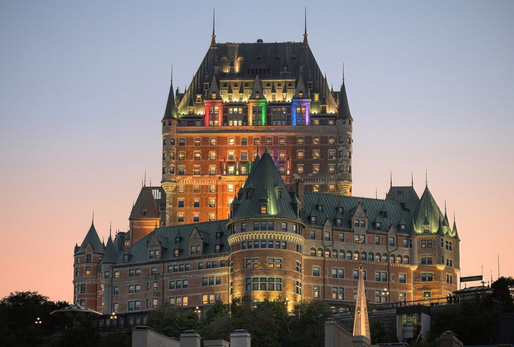
    The Château Frontenac hotel lit up at dusk in Quebec City
    The Château Frontenac at dusk, the most photographed hotel in the world and the centre of Old Quebec (Photo: Wilfredor via Wikimedia Commons, CC0)

    Quebec City at a glance for first-timers

    • Airport: Québec City Jean Lesage International (YQB), about 15 km west of the Old Town; a taxi at a fixed downtown fare takes 20 to 30 minutes, and a city bus route connects to the network. See our YQB airport guide.
    • Getting around: the Old Town is entirely walkable, hilly, and largely off-limits to cars in summer; the RTC buses cover the neighbourhoods beyond; a car is only for the Île d’Orléans, Charlevoix and the countryside.
    • Money: Canadian dollars; Quebec adds the 5 percent federal GST and the 9.975 percent provincial QST at the till. Tipping 15 to 20 percent in restaurants is customary.
    • Language: French, more so than Montreal. In the tourist trade everyone speaks English, but a bonjour goes a long way, and menus and signs are French first.
    • Weather: warm, bright summers; a spectacular fall; a long, snowy, genuinely cold winter that the city celebrates; a late spring. Our month-by-month guide has the detail.
    • Where to stay: inside the walls in Old Quebec for the atmosphere; Saint-Roch or Saint-Jean-Baptiste for the restaurants and lower prices; the Grande Allée for the Plains and the festival. Our Quebec City hotel search covers them all.

    The Upper Town: the Château, the Terrasse and the walls

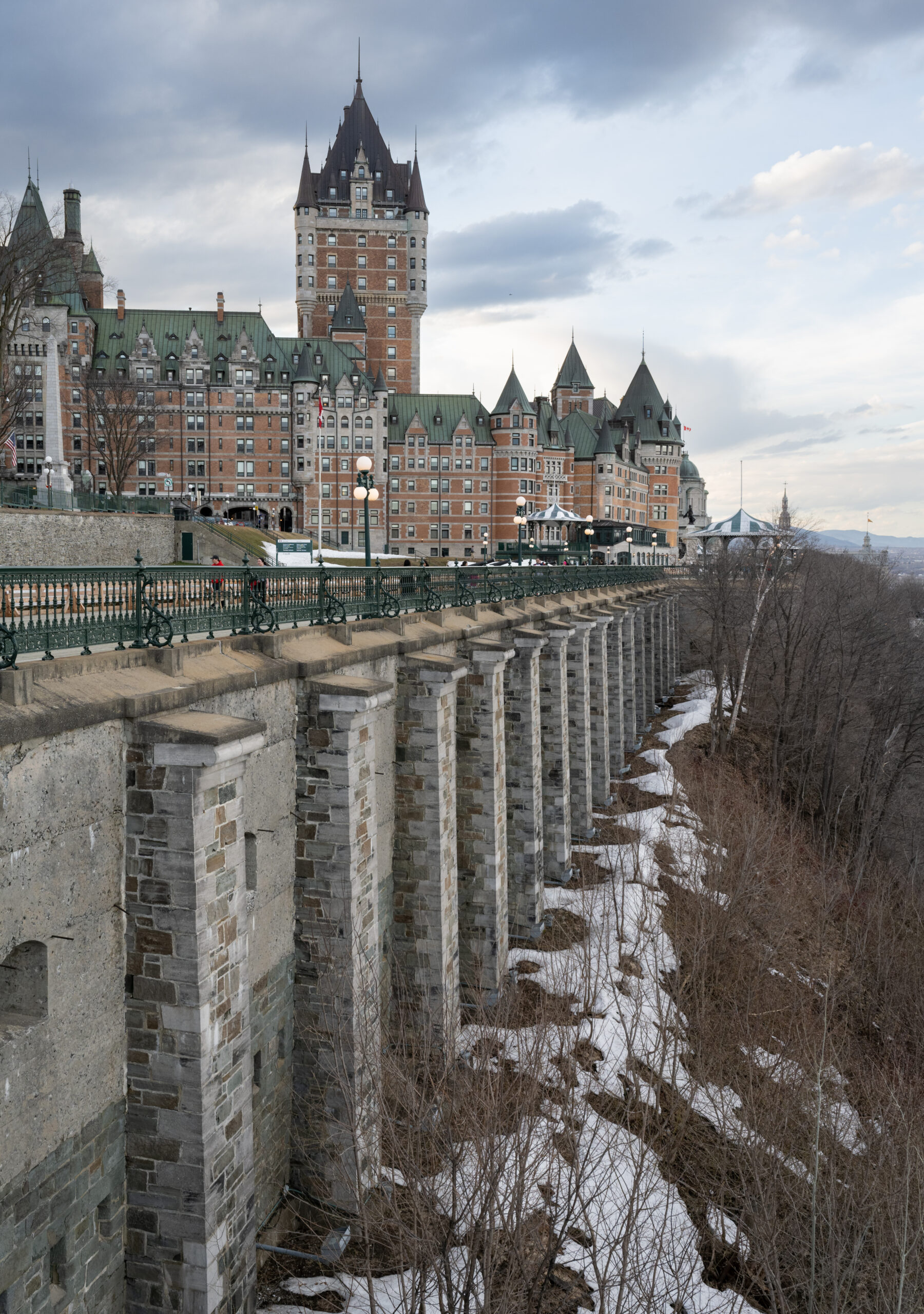
    Start at the top. The Château Frontenac, the Canadian Pacific railway hotel that opened in 1893, is the most photographed hotel in the world and the visual centre of the city; you do not need to stay there to walk through the lobby or take a guided tour. In front of it, the Terrasse Dufferin is a wooden boardwalk along the cliff edge with the St. Lawrence and the Lévis shore below, street musicians in summer and a toboggan run in winter, and at its far end the Promenade des Gouverneurs climbs the cliff to the Citadelle and the Plains. The Place d’Armes beside the hotel is the historic heart, with the Holy Trinity Anglican cathedral, the first outside the British Isles, and the rue du Trésor, where artists sell prints. The Notre-Dame de Québec Basilica, the seat of the oldest diocese in North America north of Mexico, and the Séminaire de Québec, now the Musée de l’Amérique francophone, are a block away. And the ramparts, 4.6 kilometres of walls and gates that encircle the Upper Town, can be walked along the top for much of their length; the Saint-Louis and Saint-Jean gates are the grandest, and the Citadelle, the star-shaped British fort at the highest point, still garrisoned by the Royal 22e Régiment, offers tours and, in summer, a changing of the guard with a regimental goat.

    The Lower Town: Petit-Champlain and Place Royale

    Below the cliff, reached by the Breakneck Stairs or the funicular from the Terrasse, is where the city began. Place Royale is the square where Samuel de Champlain built his habitation in 1608, surrounded by restored stone houses and the little church of Notre-Dame-des-Victoires, and it is the most concentrated piece of seventeenth-century North America that exists. The rue du Petit-Champlain, running from the square toward the river, is one of the oldest commercial streets on the continent, now a pedestrian lane of boutiques, galleries and cafés that is extremely pretty and extremely busy; go early or in the evening. Beyond it, the Old Port and the Marché du Vieux-Port, now the Grand Marché in a new location, hold the farmers’ market, the cruise terminal, and the Musée de la civilisation, a modern museum with strong permanent exhibitions on Quebec’s history and Indigenous peoples and the best rainy-day option in the city. The Lévis ferry, from the Old Port, crosses the river in twelve minutes and gives the classic view of the Château on the cliff; it is the best cheap outing in the city.

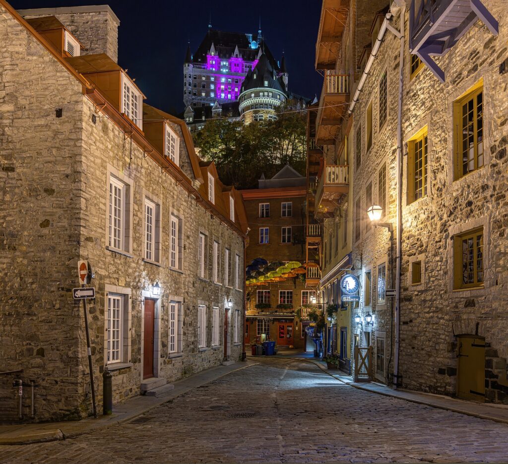
    The rue du Petit-Champlain in the Lower Town of Quebec City at night
    Rue du Petit-Champlain in the Lower Town, one of the oldest commercial streets in North America (Photo: Wilfredor via Wikimedia Commons, CC0)

    The Plains of Abraham and the museums

    West of the Citadelle, the Plains of Abraham are the battlefield where Wolfe defeated Montcalm in 1759 and Britain won Canada, and they are now a 100-hectare park of lawns, gardens and Martello towers that serves as the city’s Central Park: concerts in summer, the Festival d’été’s main stage, cross-country skiing and snowshoeing in winter, and the best walk in the city along the cliff above the river. The Plains of Abraham Museum at the eastern edge explains the battle, and the Musée national des beaux-arts du Québec, on the western edge, holds the definitive collection of Quebec art, from the colonial period to Riopelle, in four buildings including a former prison and a striking glass pavilion by OMA. The Grande Allée, the boulevard running along the northern edge of the park from the Saint-Louis gate, is lined with restaurants and bars in Second Empire townhouses and is the city’s summer terrasse row, with the Parliament Building of Quebec, whose facade is a gallery of the province’s history, at its eastern end; free tours are available.

    Beyond the walls: Saint-Jean-Baptiste, Saint-Roch and Limoilou

    The Old Town is where you look; the neighbourhoods outside the walls are where you eat. Saint-Jean-Baptiste, along the rue Saint-Jean just outside the gate, is a lively strip of bistros, bars, the Épicerie J.A. Moisan grocery, the oldest in North America, and the city’s small gay village; it is the natural evening extension of the Old Town. Down the hill, Saint-Roch was a run-down industrial district twenty years ago and is now the city’s most interesting neighbourhood, with the rue Saint-Joseph’s restaurants, microbreweries, the Jardin Jean-Paul-L’Allier and a tech-and-design economy; it is where the city’s best-regarded chefs have opened. Across the Saint-Charles River, Limoilou is the next wave, a residential neighbourhood of triplexes and small restaurants along the 3e Avenue. All three are a walk or a short bus ride from the walls and are where you will pay noticeably less for dinner.

    Montmorency Falls and the Île d’Orléans

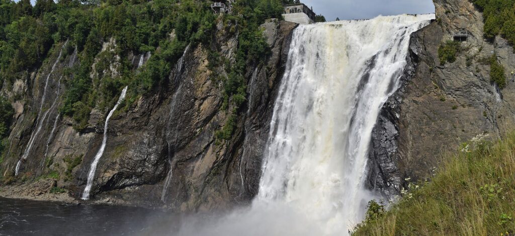
    Montmorency Falls, fifteen minutes east of the Old Town, are 83 metres high, thirty metres higher than Niagara, and drop into the St. Lawrence at the point where the Île d’Orléans bridge crosses the river. A cable car, a suspension bridge over the top of the falls, a staircase down the cliff and, in summer, a zipline and a via ferrata make it a half-day; in winter, the spray freezes into a sugar-loaf cone at the base that ice climbers scale. A city bus reaches the park. The Île d’Orléans, just beyond, is a 67-kilometre loop of farms, orchards, vineyards, cider houses, strawberry fields, chocolate makers and stone churches that has been farmed since the 1650s and is the city’s larder; it needs a car or a bike, and a summer or fall afternoon there, buying cider and strawberries from the roadside stands, is one of the best things you can do in Quebec. Sainte-Anne-de-Beaupré, the pilgrimage basilica, is a little farther along the same road.

    Montmorency Falls near Quebec City
    Montmorency Falls, 83 metres high and fifteen minutes from the Old Town (Photo: The Cosmonaut via Wikimedia Commons, CC BY-SA 2.5 ca)

    Festivals and events

    Quebec City’s two great festivals bracket the year. The Carnaval de Québec, over ten days in early February, is the largest winter carnival in the world: ice sculptures, night parades, a canoe race across the ice-choked river, snow baths, an ice palace, and Bonhomme, the snowman mascot, everywhere. The Festival d’été de Québec, over eleven days in July, puts international headliners on a huge stage on the Plains of Abraham and smaller acts across the city for a single inexpensive pass, and is one of the best-value music festivals in North America; hotels fill months ahead. Between them: the Fêtes de la Nouvelle-France in August, a costumed celebration of the colonial era in the Lower Town; the Grands Feux Loto-Québec fireworks over the river on summer evenings; the Marathon in October; the Marché de Noël allemand, a German Christmas market in the Old Town in December; and the Pentathlon des neiges and other winter sports events on the Plains. Destination Québec cité keeps the calendar, and our Quebec City events page lists what is on sale during your dates.

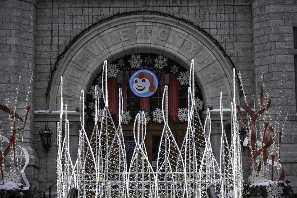
    A Bonhomme Carnaval decoration on a stone archway in Old Quebec during the Winter Carnival
    The Winter Carnival in February, when the city embraces the cold (Photo: Wilfredor via Wikimedia Commons, CC0)

    What to eat, and where

    Quebec City is the capital of Québécois cooking, and a first visit should include the classics: tourtière, the spiced meat pie; poutine, which was invented in the province; pouding chômeur, the Depression-era maple pudding; pea soup, cretons, and, in spring, everything maple at a cabane à sucre. The Old Town’s restaurants along the rue Saint-Louis and in the Lower Town serve these to tourists, some very well and some not; the better versions, and the more inventive cooking, are in Saint-Roch, Saint-Jean-Baptiste and Limoilou, where the city’s best chefs work with the produce of the Île d’Orléans and Charlevoix, whose cheeses, lamb and ciders are the region’s pride. The Grand Marché is the place to graze on all of it. The Grande Allée is for a terrasse and a drink on a summer evening; the microbreweries in Saint-Roch are for the winter. And two Quebec institutions are mandatory: a bowl of café au lait and a croissant in a Saint-Jean bakery, and a queue for a cone at one of the crémeries when the sun is out.

    Quebec City through the seasons

    Summer (June to August) is the city at full volume: the Festival d’été, the New France festival, street performers on the Terrasse, the terrasses on the Grande Allée, the fireworks, the Île d’Orléans in fruit, and cruise ships in the Old Port. It is also the most crowded, and the Old Town’s lanes can be a slow shuffle in July; go early and late. Fall (September to October) is the local favourite and the photographer’s: the maples on the Plains and along the river turn in early October, Charlevoix and the island are at their most beautiful, the crowds thin, and the restaurants are at their best. Winter (December to March) is long, snowy and cold, and the city is transformed: the Old Town under snow with the Christmas market and the lights, the Carnaval in February, the toboggan run on the Terrasse, skiing at Mont-Sainte-Anne and Stoneham forty minutes away, cross-country on the Plains, the ice hotel, the Hôtel de Glace, rebuilt every winter outside the city, and the frozen falls at Montmorency. Dress for it and it is the most magical time to visit. Spring (April to May) is mud, melting snow and sugar shacks, then a burst of green in mid-May; it is the quietest and cheapest season. Our month-by-month guide matches each season to fares.

    Quebec City with kids

    The Old Town is a storybook for children, with the funicular, the Breakneck Stairs, the cannons on the ramparts, the changing of the guard and the goat at the Citadelle, the ferry to Lévis, the horse-drawn calèches, and the toboggan run on the Terrasse in winter. The Musée de la civilisation has excellent family exhibitions, the Aquarium du Québec in the west of the city has polar bears and walruses, Montmorency’s cable car and suspension bridge are an adventure, the Village Vacances Valcartier, half an hour north, is a summer waterpark and a winter tubing park, and the Carnaval is built for families. The island’s strawberry picking in early summer is a happy afternoon. The Old Town’s hills and cobbles are hard work with a stroller; a carrier is easier.

    Quebec City on a budget

    The best of the city is free: the Old Town itself, the ramparts, the Terrasse, Place Royale, the Plains of Abraham, the Parliament tour, the Lévis ferry’s view for a small fare, and the Festival d’été’s wristband is one of the best-value tickets in the country. The museums are moderately priced, and the Musée national des beaux-arts is free on Wednesday evenings for its permanent collection; check its site. Eat cheaply and well in Saint-Roch and Saint-Jean-Baptiste rather than inside the walls, at the Grand Marché, and at the bakeries. Hotels inside the walls are the most expensive in the city, especially in July and during the Carnaval; a room in Saint-Roch or along the Grande Allée is a ten-minute walk and a fraction of the price. Compare by neighbourhood on our Quebec City hotel search.

    Day trips from Quebec City

    Charlevoix, the region of mountains, villages and river views northeast of the city, is the great day trip and better as an overnight: Baie-Saint-Paul’s galleries, the Massif de Charlevoix ski hill in winter, the Malbaie, and the road along the St. Lawrence to Tadoussac, three hours away, where whales feed at the mouth of the Saguenay from June to October. Mont-Sainte-Anne and the Canyon Sainte-Anne, forty minutes east, offer skiing and mountain biking and a gorge with suspension bridges. Jacques-Cartier National Park, forty minutes north, is a glacial valley of canoeing, hiking and, in winter, skiing and snowshoeing. Wendake, the Huron-Wendat community on the city’s northern edge, has an excellent museum and hotel and a traditional longhouse. Montreal is three hours by train or car, and many visitors combine the two; our Montreal guide covers it, and our Montreal to Quebec City route guide covers the drive. All but Montreal need a car; see our Quebec City car rental page, and Bonjour Québec for the wider province.

    Two sample itineraries

    Two days, no car

    Day one: the Terrasse Dufferin and the Château in the morning, the Place d’Armes and the basilica, a walk along the ramparts to the Saint-Jean gate, lunch on the rue Saint-Jean, the Citadelle in the afternoon, the Plains and the Musée national des beaux-arts, and dinner on the Grande Allée or in Saint-Jean-Baptiste. Day two: the funicular or the stairs to the Lower Town first thing before the crowds, Place Royale and the rue du Petit-Champlain, the Musée de la civilisation, the Lévis ferry there and back for the view, lunch at the Grand Marché, a bus to Montmorency Falls in the afternoon, and dinner in Saint-Roch.

    Four days, with a car

    Add a day looping the Île d’Orléans with a stop at Sainte-Anne-de-Beaupré or the Canyon Sainte-Anne, and a day in Charlevoix to Baie-Saint-Paul and back along the river road, or, with more time, on to Tadoussac for the whales.

    Practical details

    • Transit: the RTC buses, with the Métrobus lines the frequent ones; buy tickets or a day pass, or tap a credit card on newer buses. See our transit-versus-car guide for detail.
    • From YQB: a fixed-fare taxi to downtown in 20 to 30 minutes, the city bus, or a rental from the terminal. The airport’s site covers ground transport.
    • Weather: real winter gear from December to March, layers in every other season, and good shoes for the cobbles and hills. Environment Canada’s forecast is the one to check.
    • Time zone: Eastern, the same as Montreal, Toronto and New York.
    • Entry requirements: U.S. citizens need a valid passport; most other visa-exempt visitors arriving by air need an Electronic Travel Authorization. The Government of Canada’s visitor page is the authoritative source.
    • Safety: one of the safest cities in North America; the only hazards are the ice on the stairs in winter and the crowds on the Petit-Champlain in July.

    Frequently asked questions

    How many days do you need in Quebec City?

    Two full days covers the Old Town, the Plains, a museum and Montmorency; three adds the Île d’Orléans and the neighbourhoods outside the walls; four or five adds Charlevoix.

    What is Quebec City best known for?

    The walled Old Town and the Château Frontenac, the Plains of Abraham, the Winter Carnival, the Festival d’été, Montmorency Falls and Québécois food.

    Is Quebec City walkable?

    The Old Town and the neighbourhoods just outside the walls are, very much so, though hilly and cobbled. Montmorency is a bus ride; the island and Charlevoix need a car.

    Do I need to speak French in Quebec City?

    No, but it is more French than Montreal. In hotels, restaurants and shops in the tourist areas English is fine; a bonjour and a merci are appreciated everywhere.

    Do I need a car in Quebec City?

    Not for the city, where a car is a liability inside the walls. For the Île d’Orléans, Charlevoix and the parks, yes; rent for those days only.

    Is Quebec City expensive?

    Hotels inside the walls in July and during the Carnaval are expensive; everything else is moderate, and the neighbourhoods outside the walls are cheaper than Montreal for dining.

    Which is better, Montreal or Quebec City?

    Different things: Montreal is the big, bilingual, festival-and-nightlife city; Quebec City is the historic, French, walkable one. Three hours apart, they are best done together.

    Ready to go? Compare flights to Quebec City, find a place to stay with our Quebec City hotel search, and if the island or Charlevoix is on the list, price a rental car for those days.

  • Things to Do in Halifax: A First-Timer’s Guide

    Things to Do in Halifax: A First-Timer’s Guide

    Halifax is a port city first and everything else second. It sits on one of the largest natural harbours in the world, its history is written in shipwrecks, convoys, an explosion that levelled half the city in 1917 and the graves of Titanic victims, and its downtown runs down a hill to a four-kilometre boardwalk where the ferries, the tall ships and the Navy’s frigates come and go. It is also the biggest city in Atlantic Canada, a university town with a pub on every corner, a music scene out of proportion to its size, a seafood culture built on lobster and scallops and chowder, and the base for the two most famous day trips in the country, Peggy’s Cove and Lunenburg. It is compact, friendly and cheaper than the big cities, and a first visit covers the essentials in two days and the coast in two more. This guide covers the sights, the neighbourhoods, Dartmouth across the water, the food and the pubs, the seasons, the day trips and the practical details.

    If you are still comparing cheap flights to Halifax, read this alongside our guides to the best time to fly to Halifax and whether you need a car. Between the three you can plan the whole trip.

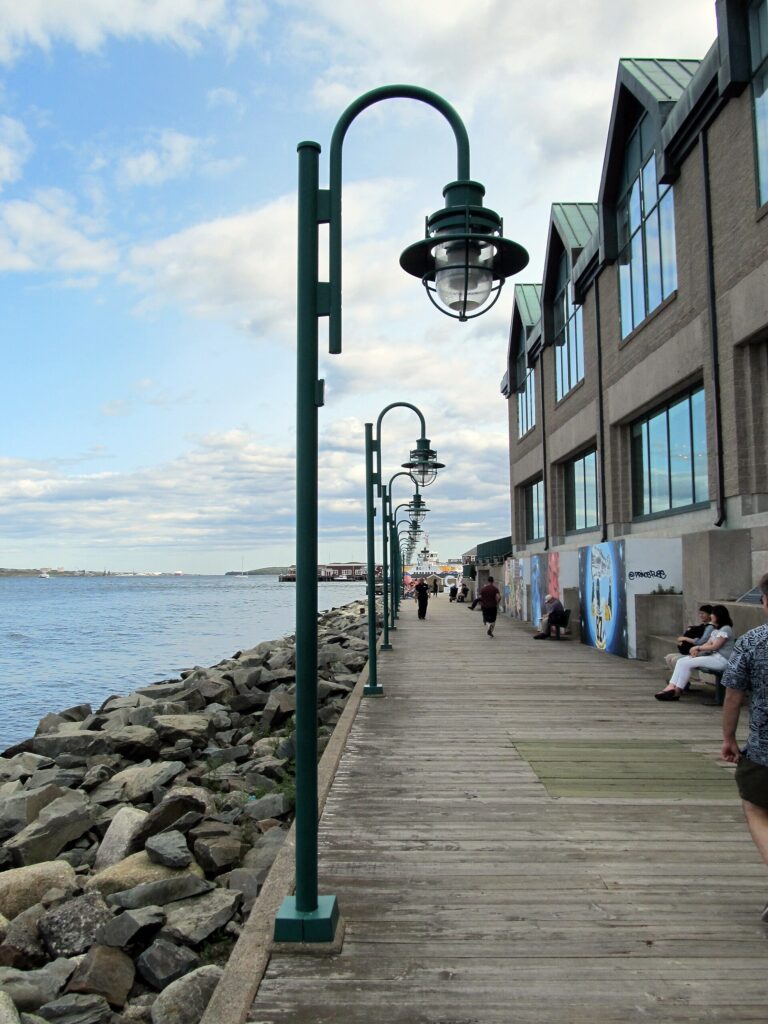
    The Halifax waterfront boardwalk on a summer day
    The Halifax waterfront boardwalk, four kilometres of harbour, ships, patios and buskers (Photo: daryl_mitchell from Saskatoon, Saskatchewan, Canada via Wikimedia Commons, CC BY-SA 2.0)

    Halifax at a glance for first-timers

    • Airport: Halifax Stanfield International (YHZ), about 35 km northeast of downtown in Enfield, the most distant big-city airport in Canada; a taxi or ride-hail takes 30 to 40 minutes, and the MetroX bus reaches downtown in about an hour. See our YHZ airport guide.
    • Getting around: downtown, the waterfront, the Citadel, the Public Gardens and the North End are walkable, though hilly; the ferry to Dartmouth is transit and a sight at once; the buses cover the rest. A car is only for the coast.
    • Money: Canadian dollars; Nova Scotia’s 14 percent HST is added at the till. Tipping 15 to 20 percent in restaurants is customary.
    • Weather: maritime and moody: cool foggy springs, warm summers that peak in August, a long mild fall, and snowy, windy winters with freeze-thaw cycles rather than deep cold. Our month-by-month guide has the detail.
    • Where to stay: the downtown waterfront for the boardwalk and the pubs; the South End near the universities and Point Pleasant for quiet; the North End for the restaurants; Dartmouth across the ferry for value and the view. Our Halifax hotel search covers them all.

    The waterfront boardwalk

    Start at the water. The Halifax waterfront boardwalk runs for about four kilometres along the harbour from the Casino and the Seaport farmers’ market at the south end past the ferry terminal, the Historic Properties warehouses, the Maritime Museum, the tall ships, the hammocks and food stalls, the wave sculpture that every child climbs, and the Navy dockyard at the north end. In summer it is the busiest place in the province, with buskers, patios, ice cream, harbour tours, the Theodore Tugboat replica and, on Canada Day and during the Busker Festival, the whole city; in winter it is a cold, bracing walk with the harbour steaming. The Maritime Museum of the Atlantic, in the middle of it, is the essential indoor stop: the Titanic gallery, with a deck chair and the story of how Halifax’s ships recovered the bodies; the Halifax Explosion gallery, about the 1917 collision that killed nearly two thousand people; the age of sail and the convoys; and the CSS Acadia moored outside. The Canadian Museum of Immigration at Pier 21, at the southern end beside the cruise terminal, tells the story of the million immigrants who entered Canada through this building between 1928 and 1971, and is one of the best museums in the country for anyone with a family connection. The Halifax Seaport Farmers’ Market, the oldest continuously operating farmers’ market in North America, is beside it on Saturday mornings.

    Citadel Hill

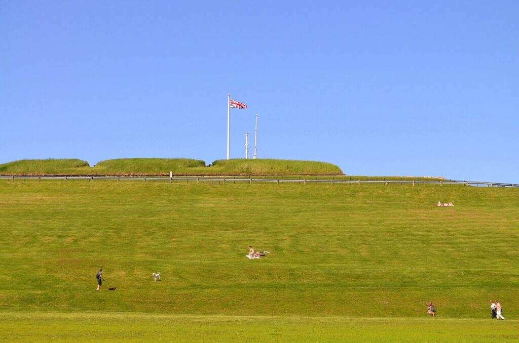
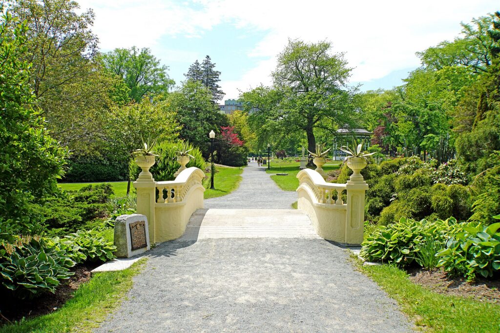
    Above downtown, the Halifax Citadel is the star-shaped fort the British completed in 1856, the fourth on the site, and it is the city’s landmark: the noon gun that fires every day, the 78th Highlanders in kilts in summer, the Town Clock on the slope below that Prince Edward gave the city in 1803, and, from the ramparts, the view over the harbour to Dartmouth and out to sea that explains why the city is here. The fort has a good museum, a ghost tour in the evenings, and a lawn that is the city’s sledding hill in winter and its picnic spot in summer. Around it, the Halifax Common is the big park, and the Public Gardens, at the southern corner, are a formal Victorian garden of ponds, bandstand, fountains and flowerbeds, opened in 1867 and one of the finest surviving examples of their kind in North America; they are free and open from spring to late fall.

    The slopes of Citadel Hill in Halifax
    Citadel Hill, the star-shaped fort above downtown, with the noon gun and the best view of the harbour (Photo: Citobun via Wikimedia Commons, CC BY-SA 4.0)

    Downtown, Spring Garden Road and the South End

    Downtown Halifax is a compact grid of streets running downhill from the Citadel to the water, and its landmarks are close together: the Art Gallery of Nova Scotia, whose great treasure is the reassembled painted house of the folk artist Maud Lewis; Province House, the oldest legislature in Canada, with free tours; St. Paul’s, the oldest Protestant church in the country; the Halifax Central Library, a glass-and-cantilever building on Spring Garden Road that became an instant landmark in 2014 and has a rooftop terrace with a view; and Argyle Street, the pedestrian-friendly block of patios and bars that is the city’s evening centre. Spring Garden Road is the shopping street, running west from the library past the Public Gardens toward the universities. The South End, beyond it, is the leafy district of Dalhousie and Saint Mary’s universities, Victorian houses, and, at its tip, Point Pleasant Park, a 75-hectare wooded park on the harbour mouth with sea views, ruined batteries, a Martello tower and the city’s best walk.

    The Victorian Public Gardens in Halifax
    The Public Gardens, a Victorian garden in the middle of the city since 1867 (Photo: Dennis G. Jarvis via Wikimedia Commons, CC BY-SA 2.0)

    The North End

    North of the Citadel, the North End is the neighbourhood the Explosion destroyed and the one the city’s restaurant scene has since rebuilt. Gottingen Street and Agricola Street are the two spines, lined with the small restaurants, bakeries, cafés, breweries and bars that locals argue over, plus the Hydrostone, the garden-city neighbourhood built after 1917 that is now a pretty strip of shops and cafés on Young Street. The Halifax Explosion memorial at Fort Needham Park, on a hill above the Narrows where the ships collided, is the place to understand what happened; the memorial bells ring at 9:04 each December 6. The North End is a fifteen-minute walk from downtown and is where to eat dinner.

    Dartmouth, by ferry

    The Halifax-Dartmouth ferry is the oldest saltwater ferry service in North America, has run since 1752, and is the single best value in the city: a regular transit fare buys twelve minutes on the harbour with the downtown skyline, the Navy ships and the bridges around you. Dartmouth, on the other side, has reinvented itself in the last decade: Alderney Landing and its farmers’ market at the ferry terminal, the restaurants and shops along Portland Street, the Dartmouth Harbourwalk, and a chain of lakes, Banook and Micmac, with beaches and canoe clubs ten minutes from the ferry. The Alderney Ferry lands you in the middle of it; the Woodside Ferry goes to the eastern side. Do it once for the crossing and again for dinner.

    What to eat, and where

    Halifax eats from the sea. Lobster, from the boiled-whole to the roll, is everywhere and best in season, which on the South Shore is late spring and on the Eastern Shore is summer; Digby scallops, seared, are the province’s other signature; chowder, thick with haddock and cream, is the winter dish; fish and chips with haddock is the everyday one; and oysters from the North Shore and Cape Breton have their own bars downtown. The donair, a Halifax invention of spiced beef, sweet garlic sauce and a pita, is the city’s official food and its 2 a.m. one; every pizza shop sells it. The Seaport market is the Saturday morning; the North End, Argyle Street and the waterfront patios are the evenings; and Dartmouth’s Portland Street is the value. Halifax also has one of the best craft beer scenes in Canada, with a dozen breweries within walking distance of downtown, and the pub culture, live Celtic and folk music most nights, is a genuine part of the city rather than a tourist show; the Old Triangle, the Lower Deck on the waterfront and the Carleton are the standards. Coffee is taken seriously in the North End.

    Music, festivals and events

    Halifax is a music city with a small-city budget, and it punches far above its weight. The Halifax Jazz Festival in July, the Busker Festival on the waterfront in late July or August, the Halifax Pride festival, one of the largest in Canada, in July, the Atlantic Film Festival in September, the Halifax Pop Explosion in October and the Royal Nova Scotia International Tattoo, a military and cultural show in the arena in late June or early July, are the anchors. Natal Day, the city’s birthday on the first weekend of August, brings fireworks over the harbour; Canada Day on the waterfront is the biggest single day. Nocturne, the all-night art festival in October, and the Christmas tree lighting on the Grand Parade in November fill the shoulder seasons. The Halifax Mooseheads play junior hockey at the Scotiabank Centre downtown, which also hosts the arena concerts; the Halifax Wanderers play professional soccer at the Wanderers Grounds beside the Common from spring to fall. Discover Halifax keeps the calendar, and our Halifax events page lists what is on sale during your dates.

    Halifax through the seasons

    Summer (late June to early September) is the season: the boardwalk at full volume, the tall ships, the festivals, the patios, the beaches at Crystal Crescent and Lawrencetown, and the coast at its best. August is the warmest month and the busiest. Fall (mid-September to October) is the local favourite: warm, settled, less foggy than spring, with the film festival and Pop Explosion, the Cabot Trail in colour in mid-October, and the cruise ships in port. Winter (December to March) is grey, wet and windy more than deeply cold, with nor’easters that drop snow and then rain, the Citadel’s sledding hill, the pubs at their cosiest, and the lowest prices of the year. Spring (April to mid-June) is slow, foggy and cool, with the Public Gardens opening in May and the lobster season on the South Shore. Our month-by-month guide matches each season to fares.

    Halifax with kids

    The waterfront is a playground on its own: the wave sculpture, the hammocks, the Theodore Tugboat harbour tour, the ferries, the tall ships in summer and the Maritime Museum’s Titanic gallery. The Citadel’s noon gun, the soldiers and the sledding hill are a hit; the Discovery Centre, the science centre on the waterfront, is the rainy-day option; the Public Gardens have ducks and a model of the Titanic in the pond; Point Pleasant has trails and ruins to explore; and Dartmouth’s lakes have beaches. Peggy’s Cove needs close supervision on the rocks. Lunenburg’s Fisheries Museum and the Bluenose II, when she is in port, are the coastal day.

    Beaches, trails and the outdoors near the city

    Halifax is a city where the outdoors starts at the edge of downtown. Point Pleasant Park is the everyday walk, with 39 kilometres of trails through the woods on the harbour mouth, still recovering from Hurricane Juan’s damage in 2003 and the better for its new sightlines to the sea. McNabs Island, in the middle of the harbour and reached by a short boat from Eastern Passage, has abandoned forts, beaches and trails and almost no people. The Halifax Common and the Dartmouth lakes, Banook and Micmac, are the swimming and paddling spots within the city; Long Lake Provincial Park, on the western edge, has trails and a swimming lake twenty minutes from downtown. The beaches are the summer reason to rent a car for a day: Crystal Crescent, half an hour south, is three white-sand crescents on the open Atlantic with a coastal trail beyond them; Lawrencetown, half an hour east, is the surf beach, with board and wetsuit rentals and a year-round surf community that paddles out in January; Rainbow Haven and Martinique, further along the Eastern Shore, are longer and emptier. The water is cold in every month, warmest in late August and September. For a walk with a view, the Bluff Wilderness Trail southwest of the city and the Polly’s Cove trail beside Peggy’s Cove are the locals’ choices, and Duncan’s Cove, on the way to Crystal Crescent, is a coastal path over granite barrens with the same scenery as Peggy’s Cove and none of the coaches. Kayak rentals and guided paddles run from the waterfront and from the Eastern Passage in summer, and the harbour, with its islands and its Navy ships, is a good place to be on the water.

    Halifax on a budget

    The best of Halifax is free or nearly so: the boardwalk, the Citadel’s grounds and the view, the Public Gardens, Point Pleasant Park, the Common, the ferry crossing for a transit fare, the Seaport market, the Explosion memorial, and the busker and Canada Day festivals. The museums are modestly priced and the Art Gallery has free evenings; check its site. Eat cheaply on donairs, fish and chips, the market stalls and Dartmouth’s Portland Street. Hotels are cheaper than in the big cities outside July and August and the cruise-ship days; compare by neighbourhood on our Halifax hotel search.

    Day trips from Halifax

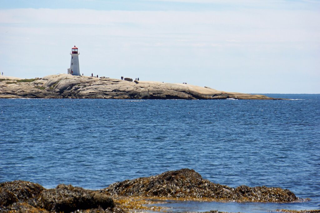
    Peggy’s Cove, 45 minutes southwest, is the tiny fishing village on a granite headland whose lighthouse is the most photographed in Canada; go early or late to avoid the coaches, stay off the black rocks, and have the chowder. Lunenburg, ninety minutes down the South Shore, is a UNESCO World Heritage Site, a perfectly preserved eighteenth-century British colonial town of painted wooden houses on a hill above the harbour, home of the Bluenose II schooner and the Fisheries Museum of the Atlantic, with Mahone Bay‘s three churches and Chester on the way. Together they are the classic day. The Annapolis Valley, an hour northwest, has the wineries, the apple orchards and the tidal marshes of Grand-Pré, a UNESCO site of the Acadian expulsion. Lawrencetown Beach, half an hour east, is the surf beach. The Bay of Fundy and its tides are ninety minutes north. And Cape Breton’s Cabot Trail, five hours away, is the great road trip of the region, better as two or three nights. All of these need a car; see our Halifax car rental page, and Tourism Nova Scotia for the province.
    The lighthouse at Peggy's Cove on the granite shore
    Peggy's Cove, 45 minutes from downtown and the most photographed lighthouse in Canada (Photo: Dennis G. Jarvis via Wikimedia Commons, CC BY-SA 2.0)

    Two sample itineraries

    Two days, no car

    Day one: the Citadel in the morning for the noon gun, the Public Gardens, lunch on Spring Garden Road and the library’s rooftop, the Art Gallery and Province House in the afternoon, a walk down to the waterfront, and dinner and live music on Argyle Street. Day two: the Seaport market or Pier 21 first, the boardwalk end to end with the Maritime Museum in the middle, the ferry to Dartmouth for lunch on Portland Street, back across for an afternoon in Point Pleasant Park, and dinner in the North End.

    Four days, with a car

    Add a day for Peggy’s Cove in the morning and the South Shore to Lunenburg via Chester and Mahone Bay, and a day for the Annapolis Valley wineries and Grand-Pré, or Lawrencetown and the Eastern Shore; with more time, drive the Cabot Trail.

    Practical details

    • Transit: Halifax Transit’s buses and ferries; pay cash with exact change, buy tickets, or use the HFXGO app. See our transit-versus-car guide for detail.
    • From YHZ: a taxi or ride-hail in 30 to 40 minutes, the MetroX 320 bus in about an hour, or a rental from the terminal. The airport’s site covers ground transport.
    • Weather: a windproof, waterproof layer in every season, and warm layers from November to April. Environment Canada’s forecast is the one to check, and the fog rolls in without warning.
    • Time zone: Atlantic, one hour ahead of Toronto and New York.
    • Entry requirements: U.S. citizens need a valid passport; most other visa-exempt visitors arriving by air need an Electronic Travel Authorization. The Government of Canada’s visitor page is the authoritative source.
    • Safety: a safe, friendly city; the rocks at Peggy’s Cove are the one genuine hazard in the region, and they kill visitors who ignore the signs.

    Frequently asked questions

    How many days do you need in Halifax?

    Two full days covers the waterfront, the Citadel, the museums and Dartmouth; two more for Peggy’s Cove, Lunenburg and the valley; and two or three more if the Cabot Trail is the goal.

    What is Halifax best known for?

    The harbour and the boardwalk, the Citadel, the Titanic and Halifax Explosion histories, Pier 21, Peggy’s Cove and Lunenburg nearby, lobster, donairs and the pub music scene.

    Is Halifax walkable?

    Very, though hilly: the waterfront, downtown, the Citadel, the Gardens, the North End and Point Pleasant are all within a half hour of each other on foot, and the ferry covers Dartmouth.

    Do I need a car in Halifax?

    Not for the city. For Peggy’s Cove, Lunenburg, the valley and Cape Breton, yes; rent for those days only.

    When is lobster season in Nova Scotia?

    It varies by district: the South Shore near Halifax fishes from late November to May, so spring is the local peak, while the Eastern Shore and the Gulf side fish in summer. Lobster is available year-round in restaurants.

    Is Halifax expensive?

    Less than Toronto, Vancouver or Montreal outside the July and August peak, though the HST is higher and hotel supply is tight on cruise and festival days.

    Which is better, Peggy’s Cove or Lunenburg?

    Both, in one day: Peggy’s Cove early for the lighthouse without the coaches, then the South Shore road to Lunenburg for lunch and the afternoon.

    Ready to go? Compare flights to Halifax, find a place to stay with our Halifax hotel search, and if the coast is on the list, price a rental car for those days.

  • Things to Do in Winnipeg: A First-Timer’s Guide

    Things to Do in Winnipeg: A First-Timer’s Guide

    Winnipeg is the city in the middle of the continent, the geographic centre of Canada, and, in most of the country’s imagination, a cold place that people fly over on the way to somewhere else. It is cold, in January. It is also one of the most surprising cities in Canada: a place where the Red and Assiniboine rivers have been a meeting point for six thousand years, where a national museum in a building of glass and Tyndall stone rises over that meeting point, where thirty blocks of terracotta warehouses from the 1900s boom survive intact as a film set for New York and Chicago, where the largest French-speaking community in western Canada keeps a winter festival of voyageur fiddling and maple taffy, where Filipino, Ukrainian, Mennonite, Métis and Indigenous cultures have all shaped what is on the plate, and where the Jets’ whiteout and the Blue Bombers’ banjo bowl are the city’s shared religion. It is friendly, affordable and unpretentious, and it rewards a first visit far beyond its reputation. This guide covers the sights, the neighbourhoods, the festivals, the food, the seasons, the day trips and the practical details.

    If you are still comparing cheap flights to Winnipeg, read this alongside our guides to the best time to fly to Winnipeg and whether you need a car. Between the three you can plan the whole trip.

    The Canadian Museum for Human Rights and the downtown Winnipeg skyline at night
    The Canadian Museum for Human Rights at The Forks, the first national museum built outside the capital region (Photo: Ethan Sahagun via Wikimedia Commons, CC BY 4.0)

    Winnipeg at a glance for first-timers

    • Airport: Winnipeg James Armstrong Richardson International (YWG), about 10 km west of downtown, one of the most convenient big-city airports in Canada; a taxi takes 15 to 20 minutes, and a city bus runs to downtown. See our YWG airport guide.
    • Getting around: downtown, The Forks, the Exchange District and Saint-Boniface across the footbridge are walkable; Winnipeg Transit’s buses cover the rest, with the Blue rapid-transit line to the university. A car is for Assiniboine Park in winter and the day trips.
    • Money: Canadian dollars; Manitoba adds the 5 percent federal GST and a 7 percent provincial sales tax at the till. Tipping 15 to 20 percent in restaurants is customary.
    • Weather: the most continental climate of any big Canadian city: long, very cold, sunny winters; short, hot summers; brief springs and falls; and mosquitoes in June and July. Our month-by-month guide has the detail.
    • Where to stay: the Exchange District for the restaurants, galleries and the arena; downtown near The Forks for the museum and the rivers; Osborne Village or Corydon for a neighbourhood feel; the airport strip and Polo Park for value. Our Winnipeg hotel search covers them all.

    The Forks

    Start where the city started. The Forks, at the confluence of the Red and Assiniboine rivers on the edge of downtown, has been a meeting and trading place for Indigenous peoples for six thousand years, then a fur-trade post, then a rail yard, and since the 1980s the city’s living room: the Forks Market, a pair of converted stables full of food stalls, a craft beer hall and local makers; the river walk and the docks, with river taxis in summer; the Oodena Celebration Circle, an earthwork amphitheatre aligned to the stars; the Children’s Museum in an old locomotive shed; the skateboard plaza; and the Esplanade Riel, the cable-stayed footbridge with a restaurant in the middle, which crosses the Red to Saint-Boniface. In winter, The Forks becomes the Arctic Glacier Winter Park: a skating trail down the frozen rivers that in a good year runs for kilometres and is one of the longest naturally frozen trails in the world, warming huts designed by architects from around the world in an annual competition, a toboggan run, and a beer garden on the ice. It is the city’s best free attraction in every season.

    The Forks Market building in Winnipeg
    The Forks Market, at the meeting of the Red and Assiniboine rivers, a gathering place for six thousand years (Photo: Ccyyrree via Wikimedia Commons, CC0)

    The Canadian Museum for Human Rights

    Rising over The Forks, the Canadian Museum for Human Rights is the first national museum built outside the Ottawa region and, since it opened in 2014, the reason many people visit Winnipeg at all. The building alone is worth the trip: a mountain of Tyndall limestone wrapped in a glass “cloud”, with a spiral of glowing alabaster ramps that climb through the galleries to the Tower of Hope, 100 metres above the rivers with a view across the prairie. The galleries are serious and often moving, from the Holocaust and the Holodomor to Indigenous rights, residential schools and the civil rights movement, with a strong Canadian focus and a great deal for children to engage with. Allow at least three hours; the museum is closed on Mondays outside the summer.

    The Exchange District

    North of Portage and Main, the famous windswept intersection, the Exchange District is a National Historic Site of some thirty blocks of terracotta, brick and stone warehouses, banks and office buildings from Winnipeg’s boom years between 1880 and 1920, when it was the “Chicago of the North” and the grain capital of the British Empire. It survived intact because the boom ended, and it is now the city’s most interesting neighbourhood: the restaurants and cocktail bars that locals argue about, the galleries, the theatres, including the Royal Manitoba Theatre Centre, the Winnipeg Art Gallery and its Qaumajuq wing, which holds the world’s largest public collection of Inuit art in a luminous new building, and, in July, the Fringe Festival’s Old Market Square hub. It is also a working film set; the streets have stood in for Chicago, New York and Moscow. Walking tours run in summer, and the Manitoba Museum, with its full-size replica of the Nonsuch, the ketch whose 1668 voyage founded the Hudson’s Bay Company, and its planetarium, is on the district’s northern edge.

    Albert Street in Winnipeg's Exchange District
    The Exchange District, thirty blocks of terracotta and brick from Winnipeg's boom years (Photo: Interlaker via Wikimedia Commons, CC0)

    Saint-Boniface

    Across the Esplanade Riel, Saint-Boniface is the historic French quarter, the largest francophone community in western Canada, and the birthplace of Louis Riel, the Métis leader whose grave is in the cathedral cemetery. The Saint-Boniface Cathedral, whose stone facade survived a 1968 fire and now frames a modern church built inside the ruins, is one of the most striking sights in the city; the Saint-Boniface Museum, in the oldest building in Winnipeg, a Grey Nuns convent from 1846, covers Riel and the Métis; and Provencher Boulevard has the French bakeries, bistros and the Franco-Manitoban cultural centre. In February, Whittier Park hosts the Festival du Voyageur, the largest winter festival in western Canada, ten days of fiddle music, snow sculptures, voyageur history, maple taffy on snow and a great deal of caribou, the spiced fortified wine.

    Assiniboine Park and the zoo

    West of downtown, Assiniboine Park is the city’s great park: the English garden and the Leo Mol sculpture garden, the Pavilion with its galleries of local art, the duck pond, the miniature railway, the Lyric Theatre’s free summer concerts and the new Leaf, a horticultural conservatory of tropical and Mediterranean biomes under a cable-net roof. The Assiniboine Park Zoo‘s Journey to Churchill exhibit is its star: polar bears, most of them orphaned cubs rescued from the Hudson Bay coast, swimming over a glass tunnel, plus muskoxen, wolves and Arctic foxes in a landscape designed to look like the tundra. It is the best zoo exhibit in Canada and the closest most visitors will get to Churchill’s bears. The park is a bus or a drive from downtown.

    More museums and culture

    The Royal Canadian Mint, on the eastern edge of the city, is where every Canadian circulation coin is made, along with coins for dozens of other countries, and the tour is a genuine surprise. The Manitoba Legislative Building, downtown, is a Beaux-Arts palace with the Golden Boy on its dome and a hidden programme of hermetic symbolism that a popular tour decodes. The Winnipeg Railway Museum, the Royal Aviation Museum of Western Canada beside the airport, the Fort Whyte Alive nature centre with its bison herd on the city’s southwestern edge, and the Dalnavert Victorian house museum round out the list. The Royal Winnipeg Ballet, Canada’s oldest, and the Winnipeg Symphony perform at the Centennial Concert Hall; for what is on during your dates, our Winnipeg events page lists concerts, shows and games.

    Sports

    The Winnipeg Jets play at the Canada Life Centre downtown, on the edge of the Exchange, and a Jets game, especially during a playoff whiteout when the whole arena and the streets outside dress in white, is the most Winnipeg thing a visitor can do. The Blue Bombers, the city’s Canadian football team and the most successful of the last decade, play at Princess Auto Stadium at the university from June to November, with the Banjo Bowl against Saskatchewan in September the loudest game of the season. The Winnipeg Goldeyes play independent-league baseball in a riverside ballpark at The Forks in summer, and Valour FC plays professional soccer at the stadium. See what is on sale in Winnipeg for your dates.

    What to eat, and where

    Winnipeg eats from everywhere its people came from. The city has the largest Filipino community in Canada per capita, and the lechon, pancit and halo-halo along the northwestern strips and in the food courts are among the best on the continent. The Ukrainian and Mennonite traditions put perogies, cabbage rolls, kubasa and farmer sausage on every diner menu and every church supper. The Métis and Indigenous food scene, with bannock, bison and wild rice, has moved from festivals to serious restaurants in the Exchange. The Jewish delis on the North End’s Main Street and Selkirk Avenue, the Vietnamese pho along Ellice and Sargent, the Italian strip on Corydon, and the Winnipeg goldeye, a smoked freshwater fish that is the city’s namesake delicacy, fill in the rest. The Forks Market is the place to graze; the Exchange District, Osborne Village, Corydon Avenue and Sherbrook Street are the places to sit down. The city’s other specialities are a cheese-stuffed “fat boy” burger with chili sauce, the honey dill sauce served with chicken fingers everywhere, and the “Winnipeg-style” rye bread that half the country ships in.

    Festivals and events

    Winnipeg keeps a full calendar and two of its festivals are national institutions. Folklorama, over two weeks in August, is the largest and longest-running multicultural festival in the world: forty-odd pavilions across the city, each run by a cultural community with food, dancing and music, visited by shuttle bus in the evenings. The Winnipeg Folk Festival, in July at Birds Hill Park north of the city, is one of the oldest and most loved in North America, with camping, a dozen stages and headliners far beyond folk. The Winnipeg Fringe, in July in the Exchange, is the second largest in North America after Edmonton’s. The Festival du Voyageur in February, the Jazz Winnipeg festival in June, the Manito Ahbee Indigenous festival in May, Pride in June, the Red River Exhibition fair in June, the Winnipeg International Writers Festival in September and Nuit Blanche in the Exchange in late September fill in the year. Tourism Winnipeg keeps the calendar.

    Skaters crossing the rail bridge on the river trail at The Forks in Winnipeg
    The river skating trail at The Forks, one of the longest naturally frozen trails in the world (Photo: Lorie Shaull from St Paul, United States via Wikimedia Commons, CC BY 2.0)

    Winnipeg through the seasons

    Winter (November to March) is the reason for Winnipeg’s reputation and, handled right, one of the reasons to visit: the river skating trail and the warming huts at The Forks, the Festival du Voyageur, the Jets, the polar bears at the zoo, the northern lights on a clear night outside the city, and a city that has never pretended the cold is not there. It is very cold, regularly below -25 °C, and it is also dry and sunny. Spring (April to May) is short, muddy and, when the Red River floods, dramatic; it is the cheapest season. Summer (June to August) is hot, with long days, the Folk Festival, the Fringe, Folklorama, the Goldeyes at the ballpark, the patios on Corydon and in Osborne Village, and the beaches at Grand Beach on Lake Winnipeg an hour north. Fall (September to October) is brief and golden, with the Banjo Bowl, Nuit Blanche and the Jets’ season opening. Our month-by-month guide matches each season to fares.

    Winnipeg with kids

    The Forks was built for children: the Children’s Museum, the skate plaza, the river walk, the market’s food stalls, and in winter the skating trail, the toboggan run and the warming huts. The polar bears at the zoo, the Nonsuch and the planetarium at the Manitoba Museum, the Mint tour, the bison at Fort Whyte and the aviation museum’s hangar fill the other days; the Human Rights Museum has a strong family programme. In summer, the Assiniboine Park train and duck pond, the Goldeyes’ ballpark, the splash pads and Grand Beach’s dunes are the outdoor list. Folklorama’s pavilions are a painless world tour for children.

    Winnipeg on a budget

    Winnipeg is one of the most affordable cities in Canada, and the free list is long: The Forks and the river trail in every season, the Exchange District’s streets, the Legislative Building tour, Assiniboine Park and its gardens, the Saint-Boniface Cathedral ruins, Fort Whyte’s trails on some days, and Nuit Blanche and the Fringe’s outdoor stages. The Human Rights Museum, the art gallery and the Manitoba Museum are moderately priced and have discounted evenings; check their sites. Eat cheaply and well at the Forks Market, the Filipino food courts, the perogy suppers and the pho shops. Hotels are among the cheapest of any big Canadian city outside the Jets’ playoff runs and Folklorama; compare by neighbourhood on our Winnipeg hotel search.

    Day trips from Winnipeg

    Lower Fort Garry, half an hour north on the Red River, is the oldest intact stone fur-trade post in North America, with costumed interpreters in summer. Grand Beach on Lake Winnipeg, an hour north, is one of the best freshwater beaches on the continent, with white sand and dunes; Gimli, on the same lake, is the largest Icelandic community outside Iceland, with a festival in August. Riding Mountain National Park, three hours northwest, is a plateau of forest, lakes and bison above the prairie. Steinbach‘s Mennonite Heritage Village, an hour southeast, tells the story of the prairie’s Mennonite settlers. Whiteshell Provincial Park, two hours east, is Canadian Shield lake country. Birds Hill Park, half an hour northeast, hosts the Folk Festival and has trails and a beach. And Churchill, the polar bear capital, is not a day trip but a two-day train ride or a two-hour flight north, and the reason many visitors come through Winnipeg in October and November. All but Churchill need a car; see our Winnipeg car rental page, and Travel Manitoba for the province.

    Two sample itineraries

    Two days, no car

    Day one: the Canadian Museum for Human Rights in the morning, lunch at the Forks Market, the river walk and the Oodena circle, across the Esplanade Riel to Saint-Boniface for the cathedral and the museum, back for the Legislative Building, and dinner and drinks in the Exchange District. Day two: the Manitoba Museum and the Nonsuch first, the Exchange District on foot with the art gallery and Qaumajuq, lunch on Albert Street, a bus to Assiniboine Park for the polar bears and the Leaf in the afternoon, and dinner in Osborne Village or on Corydon, or a Jets game if the season is on.

    Four days, with a car

    Add a day for the Mint, Fort Whyte’s bison and Lower Fort Garry, and a day for Grand Beach and Gimli in summer, or, in winter, a day skating the river trail and driving out of the city lights for the aurora.

    Practical details

    • Transit: Winnipeg Transit’s buses; pay cash with exact change, buy tickets, or use a Peggo card. See our transit-versus-car guide for detail.
    • From YWG: a taxi or ride-hail in 15 to 20 minutes, the city bus to downtown, or a rental from the terminal. The airport’s site covers ground transport.
    • Weather: serious cold-weather gear from November to March, sun protection and insect repellent in summer. Environment Canada’s forecast is the one to check.
    • Time zone: Central, one hour behind Toronto and the same as Chicago.
    • Entry requirements: U.S. citizens need a valid passport; most other visa-exempt visitors arriving by air need an Electronic Travel Authorization. The Government of Canada’s visitor page is the authoritative source.
    • Safety: the downtown core and the Main Street strip north of the Exchange need ordinary big-city awareness late at night; The Forks, the Exchange and the neighbourhoods are relaxed.

    Frequently asked questions

    How many days do you need in Winnipeg?

    Two full days covers The Forks, the Human Rights Museum, the Exchange, Saint-Boniface and the zoo; three adds the Mint, Fort Whyte and Lower Fort Garry; a fourth adds a lake day in summer.

    What is Winnipeg best known for?

    The Canadian Museum for Human Rights, The Forks, the Exchange District, the Jets’ whiteout, Folklorama, the Festival du Voyageur, the polar bears at the zoo, and being the gateway to Churchill.

    Is Winnipeg worth visiting?

    Yes, and far more than its reputation suggests: a world-class museum, a preserved heritage district, a genuinely multicultural food scene and some of the lowest prices of any big Canadian city.

    Is Winnipeg walkable?

    The core is: The Forks, downtown, the Exchange and Saint-Boniface are within twenty minutes of each other. Assiniboine Park and the neighbourhoods need a bus or a car.

    Do I need a car in Winnipeg?

    Not for the core. For the zoo in winter, the Mint, Fort Whyte and the lake and park day trips, yes; rent for those days only.

    How cold does Winnipeg get?

    January highs are around -12 °C and lows around -21 °C, with cold snaps to -35 °C and wind chills beyond. It is dry and sunny, the city is built for it, and the river trail and the Voyageur festival are the reward.

    Can I see polar bears in Winnipeg?

    Yes, at the Assiniboine Park Zoo’s Journey to Churchill exhibit, year-round. For wild bears, Churchill is a two-hour flight north, best in October and November.

    Ready to go? Compare flights to Winnipeg, find a place to stay with our Winnipeg hotel search, and if the lake or the parks are on the list, price a rental car for those days.

  • Things to Do in Edmonton: A First-Timer’s Guide

    Things to Do in Edmonton: A First-Timer’s Guide

    Edmonton is the northernmost big city in North America, the capital of Alberta, and, by its own cheerful admission, a place that people rarely put on a bucket list. That is their loss. It has the largest stretch of urban parkland in Canada running through its middle, a river valley twenty-two times the size of Central Park that you can hike, ski or cycle end to end. It has a festival season so dense that the city calls itself Festival City without irony, with the second-largest fringe theatre festival in the world and a folk festival on a hillside that regulars call the best-run in North America. It has the Oilers and a downtown that has been rebuilt around their arena, a strip in Old Strathcona that is the best night out in the province, a provincial museum and an art gallery that both punch above their weight, a mall that is still a genuine tourist attraction after forty years, and a food scene shaped by a wave of newcomers that has made it the cheapest good eating in western Canada. And it is the gateway to Jasper and to the north. This guide covers the sights, the neighbourhoods, the festivals, the food, the day trips and the practical details for a first visit.

    If you are still comparing cheap flights to Edmonton, read this alongside our guides to the best time to fly to Edmonton and whether you need a car. Between the three you can plan the whole trip.

    The downtown Edmonton skyline above the North Saskatchewan River valley
    Downtown Edmonton from Saskatchewan Drive, across the largest urban parkland in Canada (Photo: TagaSanPedroAko via Wikimedia Commons, CC BY-SA 4.0)

    Edmonton at a glance for first-timers

    • Airport: Edmonton International (YEG), about 30 km south of downtown near Leduc, one of the more distant airports of any Canadian city; a taxi or ride-hail takes 30 to 45 minutes, and a public bus route connects to the LRT. See our YEG airport guide.
    • Getting around: the LRT covers downtown, the university, the Ice District and the Valley Line to the southeast; downtown, Old Strathcona and the river valley trails between them are walkable. Beyond that, and for the day trips, most visitors rent a car.
    • Money: Canadian dollars. Alberta has no provincial sales tax, so only the 5 percent federal GST is added at the till. Tipping 15 to 20 percent in restaurants is customary.
    • Weather: long, cold, dry winters with more sunshine than you expect; warm, dry summers with daylight past ten at night in June; short springs and falls. Pack layers in every season. Our month-by-month guide has the detail.
    • Where to stay: downtown and the Ice District for the arena, the museums and the LRT; Old Strathcona for restaurants, bars and the Fringe; the south side near the university for value; the west end for the mall. Our Edmonton hotel search covers them all.

    The river valley

    Start with the geography, because the North Saskatchewan River valley is the reason Edmonton is worth visiting and the thing that surprises every first-timer. It is a green gash a hundred metres deep running diagonally across the whole city, and within it are more than twenty parks connected by some 160 kilometres of trails, plus a funicular, a footbridge network, ski hills, golf courses, a zoo, a botanical conservatory and a fort. Start at the 100 Street Funicular beside the Hotel Macdonald, which drops you from downtown to the valley floor with a viewing platform on the way, and walk or cycle in either direction: east to the Muttart Conservatory’s glass pyramids and Gallagher Park, west under the High Level Bridge to Kinsmen Park and the Legislature grounds. Hawrelak Park, further west, is the venue for the Heritage Festival and the Symphony Under the Sky, and Fort Edmonton Park, at the western end, is a living-history park with a fur-trade fort, three period streets, a steam train and a midway that is the city’s best family day. In winter, the trails are groomed for cross-country skiing, the ski hills in the valley open, and the river freezes; the Silver Skate Festival in February and the ice castle installations in past winters have been the valley’s cold-weather draw. Rent a bike from the shops near Old Strathcona or downtown; the valley is flatter than it looks once you are down in it.

    Downtown and the Ice District

    Downtown Edmonton was rebuilt around the Oilers. Rogers Place, the arena that opened in 2016, anchors the Ice District, a cluster of towers, hotels, restaurants and a public plaza that fills on game nights and concert nights and is where a visitor staying downtown ends up. A block east, Churchill Square is the civic centre: the Art Gallery of Alberta, in a swooping steel-and-glass building by Randall Stout that is worth seeing even from outside, the Winspear Centre for the symphony, the Citadel Theatre, city hall, and the Royal Alberta Museum, the largest museum in western Canada, with natural history, Indigenous history and a bug gallery that children remember. The Alberta Legislature, a Beaux-Arts dome on the river bank a short walk south, offers free guided tours, and its grounds, with fountains and wading pools in summer and a light show at Christmas, are the best free afternoon in the city. Jasper Avenue, the downtown’s main street, has the office-tower restaurants and the historic Hotel Macdonald; 104 Street, a block north, is the small pedestrian-friendly strip of independent restaurants and the Saturday farmers’ market in summer.

    The Alberta Legislature Building in Edmonton
    The Alberta Legislature and its grounds, free to tour and the city's best picnic lawn (Photo: WinterE229 (WinterforceMedia) via Wikimedia Commons, CC0)

    Whyte Avenue and Old Strathcona

    South of the river, Old Strathcona was a separate town until 1912, and it kept its brick main street. Whyte Avenue, 82 Avenue, runs through it for a dozen blocks of bars, restaurants, cafés, vintage shops, bookstores, independent theatres and the Old Strathcona Farmers’ Market, which runs on Saturdays year-round in a former bus barn and is one of the best in Canada. It is the city’s nightlife district, its student district and the home of the Fringe, and on a summer evening it is the most alive street in Alberta. The side streets have the Princess Theatre, the Varscona and the Walterdale theatres, the Garneau cinema, and the restaurants that locals argue over. The university campus and the river valley are a ten-minute walk north.

    The Princess Theatre on Whyte Avenue in Old Strathcona, Edmonton
    Whyte Avenue in Old Strathcona, the neighbourhood where Edmonton goes out (Photo: TagaSanPedroAko via Wikimedia Commons, CC BY-SA 4.0)

    West Edmonton Mall

    Forty years after it opened, West Edmonton Mall is still one of the largest shopping centres in the world and still, improbably, one of Alberta’s most visited attractions. The shops are the least of it. Inside are a full waterpark with a wave pool and slides, an indoor amusement park with a roller coaster, an ice rink where the Oilers occasionally practise, a sea-lion show and aquarium, a mini-golf course, a replica of Columbus’s Santa Maria, a themed hotel, a casino, and two streets modelled on Bourbon Street and a European boulevard. It is kitsch and enormous and, on a -30 °C day in January, exactly what a visiting family wants. It is in the west end, a bus or a drive from downtown.

    Museums and culture

    Beyond the Royal Alberta Museum and the Art Gallery of Alberta, Fort Edmonton Park is the third essential, especially with children; the Indigenous Peoples Experience there is one of the best of its kind in the country. The Telus World of Science, in the west end, has the planetarium and an IMAX. The Muttart Conservatory‘s four glass pyramids in the river valley hold arid, temperate and tropical biomes and a rotating feature display, and are photogenic from outside at any time of year. The Alberta Aviation Museum, in a wartime hangar at the old city-centre airport, and the Ukrainian Cultural Heritage Village, a living-history site east of the city, reflect two of the things that built Edmonton. The Citadel Theatre and the Winspear Centre hold the main stages; for what is on during your dates, our Edmonton events page lists concerts, shows and games.

    Festival City

    Edmonton earns its nickname. The Edmonton International Fringe Theatre Festival, in the second half of August in Old Strathcona, is the largest fringe in North America and second in the world only to Edinburgh’s, with more than a thousand performances and a street festival around them. The Edmonton Folk Music Festival, in early August in Gallagher Park, puts the audience on a natural hillside facing the skyline and books far beyond folk; its tickets sell out in hours. The Heritage Festival, on the August long weekend in Hawrelak Park, is a three-day feast of food and performance from more than a hundred cultural communities and one of the best free events in the country. K-Days, the ten-day summer fair in late July, brings a midway and concerts to the Expo Centre. The Edmonton International Street Performers Festival in July, the Taste of Edmonton in late July, the Interstellar Rodeo, Cariwest Caribbean festival, Pride in June, and, in winter, the Silver Skate Festival and the Flying Canoë Volant light festival in the Mill Creek ravine fill in the rest. Explore Edmonton keeps the calendar.

    Crowds on the hill at the Edmonton Folk Music Festival in Gallagher Park
    The Folk Music Festival on the Gallagher Park hill in August, with the skyline as the backdrop (Photo: Mack Male from Edmonton, AB, Canada via Wikimedia Commons, CC BY-SA 2.0)

    Sports

    The Oilers are the city’s religion, and a game at Rogers Place, in the middle of the Ice District, is the single most Edmonton thing a visitor can do; a playoff run in spring turns the district into a street party. The Edmonton Elks play Canadian football at Commonwealth Stadium, north of downtown on the LRT, from June to November, and the stadium also hosts the big summer concerts. The Oil Kings, the junior hockey team, also play at Rogers Place, and are the cheap way to see the arena. See what is on sale in Edmonton for your dates before you book flights.

    What to eat, and where

    Edmonton eats well and cheaply, and the reason is who lives here. It has one of the largest Ukrainian communities outside Ukraine, and perogies, cabbage rolls and kubasa are in every farmers’ market and half the diners. It has a large and long-established Vietnamese community, with the pho and bún along 97 Street, Chinatown’s spine, and on the south side that rank with Calgary’s. It has a big Filipino community, a growing South Asian one along 34 Avenue and in Mill Woods, an Ethiopian strip along 118 Avenue, Lebanese bakeries, and a green-onion-cake tradition, a Chinese pancake adopted as the city’s unofficial street food and sold at every festival. Alberta beef and bison anchor the steakhouses downtown. The independent restaurants that draw the critics are on 104 Street downtown, on Whyte Avenue and its side streets, along 124 Street in the west end, and in the Ritchie and Highlands neighbourhoods. The Old Strathcona and 104 Street farmers’ markets are the places to graze; the craft breweries are concentrated in the Ritchie and Old Strathcona industrial blocks. Brunch is an institution, and the queues on Whyte on a Sunday morning are real.

    Neighbourhoods worth a half-day

    124 Street

    West of downtown, 124 Street is a walkable strip of galleries, independent restaurants, bakeries and design shops, with the High Street market and the Roxy Theatre, and the closest thing Edmonton has to a gallery district.

    Chinatown and 97 Street

    Northeast of downtown, the old Chinatown is threadbare but the food along 97 Street is some of the cheapest and best in the city.

    Ritchie and Mill Creek

    South of Whyte, the Ritchie Market building, with its butcher, brewery and coffee roaster, is the hub of a neighbourhood of breweries and small restaurants, and the Mill Creek ravine trail runs through it into the river valley.

    Highlands and Alberta Avenue

    North of the river, the Highlands is a heritage neighbourhood with a strip of cafés and a golf course above the valley, and Alberta Avenue, 118 Avenue, has the Ethiopian restaurants and the Kaleido arts festival in September.

    Strathcona to the university

    Between Whyte and the river, the tree-lined streets of Garneau and the university campus have the Garneau cinema, the campus’s small museums, and, in winter, the university’s Butterdome and the Clare Drake arena.

    Edmonton through the seasons

    Summer (June to August) is the reason to come: the festivals, the river valley in full leaf, the farmers’ markets, patios on Whyte, and daylight until after ten in June. Fall (September to October) is short, gold and quiet, with the aspens in the valley turning in the last two weeks of September, the Oilers and Elks both in season, and Kaleido and the film festival on the calendar. Winter (November to March) is long and cold but bright and dry, and the city has learned to embrace it: cross-country skiing and skating in the valley, the Silver Skate Festival, Flying Canoë Volant, the Deep Freeze festival on Alberta Avenue, the Legislature’s light display, the mall’s waterpark, and the Oilers at their most intense. Dress properly and it is a good time to visit at the lowest prices of the year. Spring (April to May) is brown and windy, then suddenly green in the second half of May; it is the cheapest season and the least rewarding, unless the Oilers are in the playoffs. Our month-by-month guide matches each season to fares.

    Edmonton with kids

    Few cities are easier with children, especially in winter. Fort Edmonton Park, the Royal Alberta Museum’s bug gallery and children’s gallery, the Telus World of Science, the Valley Zoo, and the waterpark and amusement park at West Edmonton Mall are each a full day. The river valley’s playgrounds, the wading pools at the Legislature grounds in summer, the splash park at Hawrelak, the Muttart pyramids, the funicular ride and the Streetcar across the High Level Bridge, a summer heritage tram with the best view in the city, fill the gaps. K-Days in July is the fair, and the Heritage Festival in August is the cheapest way to feed a family from a hundred countries in an afternoon. Elk Island’s bison, forty minutes east, are the day trip children remember.

    Edmonton on a budget

    Edmonton is the cheapest of Canada’s big cities to visit, helped by the absence of provincial sales tax. The river valley, the Legislature tours and grounds, the funicular, the Muttart’s exterior, the Old Strathcona market, the Heritage Festival, the Fringe’s street festival and the Art Gallery of Alberta’s free evenings cost nothing; the museums and Fort Edmonton are moderately priced and cheaper online. Eat for very little along 97 Street, 34 Avenue and 118 Avenue, at the markets, and at the green-onion-cake stands at any festival. Hotel rates are well below Calgary’s, Vancouver’s or Toronto’s outside Oilers playoff runs and the August festival weeks; compare by neighbourhood on our Edmonton hotel search.

    Day trips from Edmonton

    Elk Island National Park, forty minutes east, is a fenced aspen parkland with free-roaming herds of plains and wood bison, a lake to paddle, a dark-sky preserve and easy trails; it is the day trip every visitor should make. The Ukrainian Cultural Heritage Village is on the same road. Jasper and the northern Rockies are four hours west on the Yellowhead Highway, and Edmonton is Jasper’s airport as much as Calgary is Banff’s; the Icefields Parkway between Jasper and Lake Louise is one of the great drives in the world, and Jasper’s dark-sky festival in October is a reason to make the trip in fall. Drumheller and the badlands are three hours southeast. Calgary is three hours south on the divided Highway 2, and a one-way rental between the two cities is a classic Alberta itinerary; our Calgary to Edmonton route guide covers it, and our Calgary guide covers the other end. The lakes north of the city, Pigeon Lake, Sylvan Lake and Lac Ste. Anne, are the summer cottage country. All of these need a car; see our Edmonton car rental page, and Travel Alberta for the wider province.

    Two sample itineraries

    Two days, no car

    Day one: the Royal Alberta Museum and the Art Gallery of Alberta in the morning, lunch on 104 Street, the Legislature tour and grounds in the afternoon, the funicular and a walk in the river valley, and an Oilers game or a show in the Ice District at night. Day two: the LRT to the university and a walk to Old Strathcona, the farmers’ market if it is Saturday, brunch and the shops on Whyte, a bike along the valley to the Muttart Conservatory and back over the High Level Bridge, and dinner and drinks on Whyte.

    Four days, with a car

    Add a day for Fort Edmonton Park and 124 Street, and a day for Elk Island’s bison with the Ukrainian Village on the way, or, with more time, drive to Jasper for two nights and return the car in Calgary.

    Practical details

    • Transit: Edmonton Transit’s LRT and buses; buy an Arc card or tap a credit card on the validators. See our transit-versus-car guide for detail.
    • From YEG: a taxi or ride-hail in 30 to 45 minutes, the public bus route to the LRT, or a rental from the terminal. The airport’s site covers ground transport.
    • Weather: layers in every season, real cold-weather gear from November to March, sun protection in summer. Environment Canada’s forecast is the one to check.
    • Time zone: Mountain, the same as Calgary and Denver.
    • Entry requirements: U.S. citizens need a valid passport; most other visa-exempt visitors arriving by air need an Electronic Travel Authorization. The Government of Canada’s visitor page is the authoritative source.
    • Safety: a safe city by any standard; parts of downtown and along 97 Street and the LRT stations late at night need ordinary big-city awareness.

    Frequently asked questions

    How many days do you need in Edmonton?

    Two full days covers downtown, Old Strathcona, the river valley and two museums; three adds Fort Edmonton and the mall; four adds Elk Island. Jasper needs two more nights.

    What is Edmonton best known for?

    The Oilers, West Edmonton Mall, the river valley, the Fringe and Folk festivals, and being the gateway to Jasper and the north.

    Is Edmonton worth visiting?

    Yes, especially from June to September when the festivals run and the valley is green, and it is the cheapest big-city break in Canada.

    Is Edmonton walkable?

    Downtown, Old Strathcona and the river valley trails between them are. The rest of the city, including the mall and the airport, assumes a car or a long bus ride.

    Do I need a car in Edmonton?

    Not for the core. For the mall, Fort Edmonton, Elk Island and Jasper, yes; rent for those days, or for the whole trip if Jasper is the plan.

    Is Edmonton cold?

    In winter, genuinely: -20 °C is normal and -30 °C happens. It is also dry and sunny, which makes it more bearable than it sounds, and the city is built to enjoy it. Summers are warm and long.

    Which is better to visit, Edmonton or Calgary?

    Calgary for the Rockies on the doorstep and the Stampede; Edmonton for the festivals, the river valley, the food and the prices. The three-hour drive between them makes doing both easy.

    Ready to go? Compare flights to Edmonton, find a place to stay with our Edmonton hotel search, and if Elk Island or Jasper is on the list, price a rental car for those days.

  • Things to Do in Ottawa: A First-Timer’s Guide

    Things to Do in Ottawa: A First-Timer’s Guide

    Ottawa has a reputation to overcome. It is the capital, which means visitors expect a government town of grey buildings and early nights, and what they find instead is a compact, green, bilingual city on two rivers and a canal, with a concentration of national museums that no other Canadian city can match, a market district that has been feeding people since 1826, a wilderness park fifteen minutes from Parliament, and a calendar of festivals, tulips in May, Canada Day in July, the Skateway in February, that gives every season its own reason to come. It is also cheaper than Toronto and Montreal, easier to get around than either, and small enough that a first visit covers most of it on foot. This guide walks through the sights that earn a day, the neighbourhoods worth a half-day, the museums, Gatineau across the river, the food, the festivals, the day trips, and the practical details.

    If you are still comparing cheap flights to Ottawa, read this alongside our guides to the best time to fly to Ottawa and whether you need a car. Between the three you can plan the whole trip.

    Centre Block and the Peace Tower on Parliament Hill, Ottawa
    Centre Block and the Peace Tower on Parliament Hill, mid-restoration but still the heart of the city (Photo: DXR via Wikimedia Commons, CC BY-SA 4.0)

    Ottawa at a glance for first-timers

    • Airport: Ottawa Macdonald-Cartier International (YOW), about 10 km south of downtown; the O-Train’s Line 2 and Line 4 now connect the terminal to the city, and a taxi takes 20 to 30 minutes. See our YOW airport guide.
    • Getting around: the O-Train light rail runs east-west through downtown and now south to the airport; the core, from Parliament to the ByWard Market to the Glebe, is walkable; the pathways along the canal and the rivers are made for bikes. A car is only for Gatineau Park and day trips.
    • Money: Canadian dollars; Ontario’s 13 percent HST is added at the till. Tipping 15 to 20 percent in restaurants is customary.
    • Language: English and French, with Gatineau across the river mostly French-speaking. Everyone in the tourist trade speaks English.
    • Weather: a genuine four-season city, with hot, humid summers, a glorious brief fall, cold snowy winters that the city embraces, and a spring that arrives all at once in May. Our month-by-month guide has the detail.
    • Where to stay: downtown for Parliament and the museums; the ByWard Market for food and nightlife; the Glebe or Westboro for a residential feel. Our Ottawa hotel search covers them all.

    Parliament Hill and the Peace Tower

    Start where the city does. Parliament Hill, on a limestone bluff above the Ottawa River, is the set piece: the Gothic Revival Centre Block with the Peace Tower, flanked by the East and West Blocks and, behind it, the round Library of Parliament, the only part of the original building to survive the 1916 fire. Centre Block is closed for a restoration that will run for years, so the House of Commons sits temporarily in a glass-roofed courtyard in West Block and the Senate in the old railway station across Wellington Street, and both offer free guided tours when Parliament is not sitting; book through the Parliament of Canada’s visitor site well ahead in summer. In summer, the Changing of the Guard takes place on the lawn every morning and a sound-and-light show plays on the Centre Block facade after dark; on Canada Day, the Hill is the centre of the national celebration. The grounds, the Centennial Flame and the statues are open all year, and the walk behind the buildings along the cliff edge, with the river and Gatineau below, is the best free view in the city. Across Wellington, the Supreme Court and the Bank of Canada Museum, which is small, free and better than it sounds, complete the precinct.

    The Rideau Canal, in every season

    The Rideau Canal was built in the 1820s as a military route between Ottawa and Kingston, and its 202 kilometres of locks, lakes and cut channels are a UNESCO World Heritage Site. In Ottawa it runs from the Ottawa River, where eight stepped locks climb the hill beside the Château Laurier, south through the middle of the city to Dows Lake, and it is the city’s spine. In summer, walk or cycle the paths on either side, rent a kayak or paddleboard at Dows Lake, and watch the locks being cranked by hand at the bottom of the flight. In winter, from January into March in a good year, it freezes into the Rideau Canal Skateway, 7.8 kilometres of maintained ice through the centre of the city, with skate rentals at the access points, warming huts, and BeaverTails pastries sold on the ice. It is one of the great winter experiences in the country, and it is free. The season depends entirely on the weather; check the National Capital Commission’s site for current ice conditions.

    Skaters on the frozen Rideau Canal during Winterlude in Ottawa
    The Rideau Canal Skateway: 7.8 kilometres of skating through the middle of the city in winter (Photo: Michel Rathwell from Cornwall, Canada via Wikimedia Commons, CC BY 2.0)

    The ByWard Market

    East of the canal, the ByWard Market is the oldest part of the city and its liveliest. The market building itself, with its food stalls and artisans, and the outdoor produce and flower stands around it are the daytime draw; the surrounding blocks hold the densest concentration of restaurants, bars, cafés and pubs in Ottawa, which makes it the evening one. It is also where you find the BeaverTail stand that started the chain, the Ottawa Art Gallery, a free contemporary gallery, and, a block north, the Notre-Dame Cathedral Basilica, whose twin spires face the National Gallery. On weekend nights the Market is the city’s nightlife district and can be rowdy; on a weekday morning it is the best place in the city for breakfast and a wander.

    The ByWard Market building in Ottawa
    The ByWard Market, Ottawa's oldest neighbourhood and its food and nightlife district (Photo: Hayden Soloviev via Wikimedia Commons, CC BY 4.0)

    The national museums

    Ottawa’s museums are its strongest hand, and the good ones are genuinely among the best in the country. The National Gallery of Canada, a glass-and-granite building by Moshe Safdie beside the ByWard Market, holds the definitive collection of Canadian art, from the Group of Seven to contemporary Indigenous work, plus a reconstructed convent chapel and Louise Bourgeois’s giant spider, Maman, on the plaza outside. The Canadian Museum of History, across the river in Gatineau with the best view of Parliament from its lawn, is the country’s most visited museum: the Grand Hall of Pacific coast totem poles, the Canadian History Hall, a children’s museum and an IMAX theatre. The Canadian War Museum, west of downtown on the river, is a serious, moving building with a collection that ranges from the War of 1812 to Afghanistan. The Canadian Museum of Nature, in a castle-like Victorian building south of downtown, has the dinosaurs and a blue whale skeleton and is the children’s favourite. The Canada Aviation and Space Museum, out at Rockcliffe, has one of the finest aircraft collections in the world; the Canada Science and Technology Museum and the Canada Agriculture and Food Museum, a working farm in the middle of the city, round out the family options. Most are free on Thursday evenings; a museums passport, sold at the participating institutions, covers several for one price if you plan to see three or more.

    Neighbourhoods worth a half-day

    Centretown and Elgin Street

    The blocks south of Parliament are the working downtown, and Elgin Street, running south from Confederation Square, is its restaurant and bar row, with Ottawa’s city hall and the Museum of Nature at its southern end. Sparks Street, a block from Parliament, is the pedestrian mall, quiet in the evenings and better for lunch.

    The Glebe and Lansdowne

    South along the canal, the Glebe is a leafy neighbourhood of Edwardian houses, independent shops and cafés along Bank Street, and at its foot is Lansdowne Park, with the football stadium, the Aberdeen Pavilion farmers’ market, the Great Lawn and a strip of restaurants. It is where Ottawa spends a Saturday.

    Westboro and Wellington West

    West of downtown, Wellington Street West and Richmond Road run through two neighbourhoods that have become the city’s best stretch of independent restaurants, bakeries, bookshops and outdoor-gear stores, ending at Westboro Beach on the river. The Parkdale Market is the smaller, friendlier cousin of the ByWard.

    Little Italy and Chinatown

    Preston Street, Little Italy, and Somerset Street West, Chinatown, meet near Dows Lake and share the city’s best cheap, good food; Italian Week in June closes Preston to traffic.

    Hintonburg

    Between Little Italy and Westboro, the former working-class neighbourhood is now the city’s most interesting for breweries, galleries and small restaurants, and it borders the City Centre complex of makers and bakers.

    New Edinburgh and Rockcliffe

    East of the Market along Sussex Drive, past the Royal Canadian Mint, where you can tour the production of collector coins, and the prime minister’s residence, are the embassies, Rideau Hall, the governor general’s residence with free tours and grounds open all year, and the grand houses of Rockcliffe Park.

    Gatineau, across the river

    Ottawa’s twin city sits on the Quebec side of the river, and a visit is not complete without crossing. The Museum of History is the first reason. Gatineau Park is the second: 361 square kilometres of Canadian Shield hills, lakes and forest beginning fifteen minutes from Parliament, with the Mackenzie King Estate, the lookouts along the Champlain Parkway, swimming at Meech Lake, hundreds of kilometres of hiking and mountain-bike trails, and, in winter, the best cross-country skiing network in the country. The fall colours in the first two weeks of October are the park’s most famous fortnight. The Nordik Spa in Chelsea, the largest outdoor spa in North America, is the third reason, and the fourth is the casino and the old Hull neighbourhood’s restaurants and terrasses. The park and Chelsea need a car or a bike; the museum and Hull are a walk across the Alexandra or Portage bridge.

    Festivals and events

    Ottawa’s calendar is one of its main attractions, and several of these are worth planning a trip around. The Canadian Tulip Festival, in the second half of May, fills Commissioners Park beside Dows Lake and the Parliament grounds with a million tulips, a gift from the Netherlands that dates from the Second World War. Canada Day, July 1, is the biggest national celebration in the country, with concerts on the Hill and LeBreton Flats and fireworks over the river. Bluesfest, in early-to-mid July at LeBreton Flats, is one of the largest outdoor music festivals in Canada and books headliners far beyond blues. The Ottawa Jazz Festival in late June, Chamberfest in late July, the Ottawa International Animation Festival in September and the Ottawa Race Weekend in late May fill in the summer. In winter, Winterlude, over three weekends in February, brings ice sculptures to Confederation Park, a snow playground in Gatineau and the Skateway at its busiest. Check Ottawa Tourism for dates, and our Ottawa events page for what is on sale during your visit.

    Tulip beds at Commissioners Park during the Canadian Tulip Festival in Ottawa
    Commissioners Park beside Dows Lake during the Canadian Tulip Festival in May (Photo: elPadawan via Wikimedia Commons, CC BY-SA 2.0)

    Sports

    The Ottawa Senators play at the Canadian Tire Centre in Kanata, on the western edge of the city, until their planned move to a new arena at LeBreton Flats; a game night is a bus or a drive. The Ottawa Redblacks play Canadian football at TD Place at Lansdowne from June to November, a far easier evening from downtown, and Atlético Ottawa plays professional soccer in the same stadium. The Ottawa Charge play in the Professional Women’s Hockey League, and the 67’s are the junior hockey team, both at TD Place’s arena. See what is on sale in Ottawa for your dates.

    What to eat, and where

    Ottawa’s food scene has grown up in the last fifteen years, and the pattern is easy to follow: the ByWard Market for breakfast, lunch and late nights, Elgin Street and Centretown for dinner, and the western neighbourhoods, Hintonburg, Wellington West and Westboro, for the independent restaurants that locals argue about. Three things are specifically Ottawan. The BeaverTail, a flat fried pastry with cinnamon sugar or worse, was invented here and is best eaten on the canal ice. The shawarma is the city’s late-night food, with a Lebanese community that has made Ottawa the shawarma capital of Canada; there is one on nearly every downtown block. And the Ottawa Valley supplies the farmers’ markets, the ByWard, Lansdowne and Parkdale, with the maple syrup, cheese and produce that the better restaurants build on. Across the river, Gatineau and Chelsea have the French-Canadian bistros, and a poutine or a tourtière on the Quebec side is worth the bridge. Coffee is taken seriously, especially in Hintonburg and the Glebe.

    Ottawa through the seasons

    Spring (April to May) is the Tulip Festival, the canal filling with water again, and the Race Weekend; April is grey and wet, May is the reward. Summer (June to August) is Canada Day, Bluesfest, the Changing of the Guard, the sound-and-light show, swimming at Meech Lake, the patios in the Market and on Elgin, and hot, humid days that suit the river beaches. Fall (September to October) is the local favourite: warm days, cool nights, the Gatineau hills in colour, the Animation Festival and the Fall Rhapsody in the park. Winter (December to March) is the Skateway, Winterlude, cross-country skiing in Gatineau Park, the Christmas lights on the Hill, and a city that has decided to enjoy the cold. Our month-by-month guide matches each season to fares.

    Ottawa with kids

    Few Canadian cities are easier with children. The Museum of Nature’s dinosaurs, the Museum of History’s children’s museum, the aviation museum’s hangars and the working farm at the Agriculture Museum, where you can watch the cows being milked, fill four days on their own. Skating on the canal in winter, and the Snowflake Kingdom during Winterlude, are the winter draws; the beaches at Meech Lake, Britannia and Westboro, the splash pads in the parks, and the paddle boats at Dows Lake are the summer ones. The Changing of the Guard on the Hill and the Mint tour appeal to older children. Calypso, the large waterpark east of the city, is a car trip.

    Ottawa on a budget

    Much of the best of the city is free: Parliament Hill and its tours, the Changing of the Guard and the sound-and-light show, the Rideau Canal in any season, Rideau Hall’s grounds, the Ottawa Art Gallery, the Bank of Canada Museum, the ByWard Market itself, the river and canal pathways, and Gatineau Park’s trails. The national museums charge admission, but most are free on Thursday evenings, and the museums passport reduces the cost of several. Shawarma and the Market’s food stalls are the cheap meals; the farmers’ markets are the cheap picnics. Hotels are consistently cheaper than Toronto’s or Montreal’s outside Canada Day, the Tulip Festival and Winterlude; compare by neighbourhood on our Ottawa hotel search.

    Day trips from Ottawa

    Gatineau Park is the obvious one. Montreal is two hours by train or car, and many visitors do both cities on one trip; our Montreal guide covers it. Kingston, two hours south, is the other end of the Rideau Canal, with Fort Henry and the Thousand Islands cruises. Merrickville, an hour along the canal, is the prettiest of the canal villages, and Wakefield, in the Gatineau hills, has a covered bridge, a steam-train heritage and the best cafés outside the city. Upper Canada Village, a living-history settlement on the St. Lawrence, is ninety minutes south. Whitewater rafting on the Ottawa River, ninety minutes west, is among the best in North America from May to September. Most of these need a car; see our Ottawa car rental page, and, if you are arriving from Toronto by road, our Toronto to Ottawa route guide.

    Two sample itineraries

    Two days, no car

    Day one: Parliament Hill in the morning, with a tour booked in advance, then the National Gallery, a late lunch in the ByWard Market, the Notre-Dame Basilica, a walk down the canal locks and along the water to the Château Laurier, and dinner and the evening in the Market. Day two: cross the river to the Museum of History for the morning, walk back along the Ottawa River pathway past the War Museum, lunch on Elgin Street, the Museum of Nature or a canal walk to the Glebe and Lansdowne in the afternoon, and dinner in Hintonburg or Wellington West.

    Four days, with a car

    Add a day in Gatineau Park with the Mackenzie King Estate, the lookouts, a swim or a hike, and the Nordik Spa or Wakefield on the way back, and a day for Merrickville and the canal villages, or, in winter, the Skateway in the morning and cross-country skiing in the park in the afternoon.

    Practical details

    • Transit: OC Transpo’s O-Train and buses; buy a Presto card or tap a credit card on the readers. See our transit-versus-car guide for detail.
    • From YOW: the O-Train from the terminal, a taxi or ride-hail in 20 to 30 minutes, or a rental from the terminal. The airport’s site covers ground transport.
    • Weather: Environment Canada’s forecast is the one to check; pack for real cold in winter and real heat in summer.
    • Time zone: Eastern, the same as Toronto, Montreal and New York.
    • Entry requirements: U.S. citizens need a valid passport; most other visa-exempt visitors arriving by air need an Electronic Travel Authorization. The Government of Canada’s visitor page is the authoritative source.
    • Safety: a safe city; the Market late on weekend nights is the only place that needs ordinary caution.

    Frequently asked questions

    How many days do you need in Ottawa?

    Two full days covers Parliament, the canal, the Market and two or three museums; three lets you cross to Gatineau properly; four adds the park and a day trip.

    What is Ottawa best known for?

    Parliament Hill, the Rideau Canal and its winter Skateway, the national museums, the Tulip Festival and Canada Day.

    Is Ottawa worth visiting?

    Yes, and more so than its reputation suggests: it has the best museums in Canada, a walkable core, a wilderness park on its doorstep and lower prices than Toronto or Montreal.

    Is Ottawa walkable?

    Very. Parliament, the Market, the canal, Elgin Street and the National Gallery are all within twenty minutes of each other on foot, and the O-Train covers the rest.

    Do I need a car in Ottawa?

    Not for the city. For Gatineau Park, the canal villages and the rafting rivers, yes; rent for those days only.

    When does the Rideau Canal Skateway open?

    It depends on the cold. In a good winter it opens in January and runs into early March; in a mild one it may open late or for only a few weeks. Check the National Capital Commission’s site for conditions.

    Is Ottawa expensive?

    Less than Toronto, Vancouver or Montreal for hotels and dining, with the exception of Canada Day, the Tulip Festival and Winterlude weekends.

    Ready to go? Compare flights to Ottawa, find a place to stay with our Ottawa hotel search, and if Gatineau Park or the valley is on the list, price a rental car for those days.

  • Things to Do in Calgary: A First-Timer’s Guide

    Things to Do in Calgary: A First-Timer’s Guide

    Calgary gets underestimated. Most visitors treat it as the airport for Banff, spend a night near the highway and drive west, and they miss a city that has quietly become one of the most interesting in Canada: a downtown rebuilt around a river, a music museum and a library that architecture critics travel to see, neighbourhoods full of independent restaurants, a food scene built on Alberta beef and one of the country’s best Vietnamese communities, and, for ten days every July, the biggest party in the country. And the mountains are still ninety minutes away. This guide covers the sights that earn a day, the neighbourhoods worth a half-day, the food, the Stampede and the sports, the day trips that make Calgary a base as much as a destination, and the practical details that turn a stopover into a trip.

    If you are still comparing cheap flights to Calgary, read this alongside our guides to the best time to fly to Calgary and whether you need a car. Between the three you can plan the whole trip.

    Calgary at a glance for first-timers

    • Airport: Calgary International (YYC), in the northeast about 17 km from downtown; the Route 300 bus, a taxi or a rental gets you in. See our YYC airport guide.
    • Getting around: the CTrain covers downtown, Kensington and the Stampede grounds, and is free within the downtown zone; the inner city is walkable and the river pathways are made for bikes. Beyond that, and for the mountains, most visitors rent a car.
    • Money: Canadian dollars. Alberta has no provincial sales tax, so only the 5 percent federal GST is added at the till, which makes shopping and dining noticeably cheaper than in Ontario or Quebec. Tipping 15 to 20 percent in restaurants is customary.
    • Weather: sunny and dry in every season, cold winters with sudden chinook thaws, cool nights even in July, and the possibility of snow in any month. Pack layers. Our month-by-month guide has the detail.
    • Where to stay: downtown for the Tower, Stephen Avenue and the +15; the Beltline for restaurants and nightlife; Kensington or Inglewood for a local feel; the west side of the city if Banff is the focus. Our Calgary hotel search covers them all.

    Downtown: the Tower, Stephen Avenue and the +15

    The Calgary Tower is where to start. It was the tallest structure in the city when it opened in 1968 and has long since been overtaken by the office towers around it, but the observation deck, with a glass floor and a view that stretches from the prairie to the whole front range of the Rockies on a clear day, is still the best way to understand the geography. Below it, Stephen Avenue, the pedestrian stretch of 8 Avenue, is the historic heart of downtown: sandstone buildings from the city’s first boom, restaurants with terraces in summer, the Core shopping centre with its indoor Devonian Gardens, and the Glenbow, the city’s main museum of art and history, which has been closed for a multi-year rebuild; check its site for its reopening status before you plan around it. Above street level, the +15 network of enclosed walkways links most of downtown one storey up, and walking a few blocks of it is a genuinely Calgarian experience, especially in winter.

    Stephen Avenue Walk, the pedestrian street through downtown Calgary
    Stephen Avenue, the pedestrian heart of downtown (Photo: Calgary Convention Centre via Wikimedia Commons, CC0)

    The East Village: Studio Bell and the Central Library

    A decade ago the East Village was a neglected corner between downtown and the river; now it holds two of the best buildings in the country. Studio Bell, home of the National Music Centre, is a curved, copper-clad complex of galleries about Canadian music, with a collection of historic instruments and studios, hands-on exhibits where you can play them, and the Rolling Stones’ mobile recording studio parked inside. The Central Library, a block away, is a timber-and-glass building that straddles the CTrain tracks and has become a landmark on its own; the reading rooms and the children’s floor are open to everyone, and the café is a good stop. Between them, the RiverWalk along the Bow leads to St. Patrick’s Island, a reclaimed park in the river with a beach and a hill, and to Fort Calgary, the site of the original Mounted Police post, now The Confluence historic site.

    The exterior of the Calgary Central Library in the East Village
    The Central Library in the East Village, one of the most admired new buildings in Canada (Photo: Kelapstick via Wikimedia Commons, CC BY-SA 4.0)

    The river: Prince’s Island, the Peace Bridge and the pathways

    Calgary’s downtown was built on the Bow, and the river is the city’s best public space. Prince’s Island Park, reached by footbridges from Eau Claire, is the downtown green: lawns, wetlands, a summer festival stage and the best picnic spot in the city. The Peace Bridge, Santiago Calatrava’s red helix across the river, connects Eau Claire to the north bank and Kensington and is the most photographed structure in the city after the Tower. From either side, the paved river pathways run for kilometres in both directions along the Bow and the Elbow, past Inglewood and the bird sanctuary to the east and toward Edworthy Park and the Douglas Fir Trail to the west. The city has one of the largest urban pathway networks in North America; rent a bike or grab a shared e-scooter and you can see the whole inner city from the water. In summer, locals float the Bow on rafts from Bowness downstream to Prince’s Island, and rafting companies rent the gear.

    Neighbourhoods worth a half-day

    Kensington

    Across the Peace Bridge or a CTrain stop from downtown, Kensington is the walkable village of cafés, bookshops, pubs and independent restaurants along Kensington Road and 10 Street NW. It is the easiest place in the city to spend an unplanned afternoon, and the closest neighbourhood to downtown with a local feel.

    Inglewood

    Calgary’s oldest neighbourhood, along 9 Avenue SE east of the Elbow River, has the best concentration of independent shops, vintage stores, galleries, breweries and restaurants in the city, plus the Inglewood Bird Sanctuary on the river and the Esker Foundation, a free contemporary art gallery that is one of the country’s best. Combine it with the East Village for a full day on foot.

    17th Avenue and the Beltline

    17 Avenue SW is the city’s restaurant and bar row, running for a dozen blocks through the Beltline, and it is the place to eat dinner and stay out. During a Flames playoff run it becomes the Red Mile, a street party that spills out of every bar. The Beltline around it, with Central Memorial Park and the Sheldon Chumir square, is the densest, most walkable residential neighbourhood in the city.

    Mission and 4th Street

    South of 17th, 4 Street SW through Mission is a quieter strip of restaurants and cafés along the Elbow River, with the Lilac Festival closing the street in late May.

    Chinatown and the Vietnamese strip

    Calgary’s Chinatown, beside downtown on the river, is small but has the Chinese Cultural Centre with its painted dome and good dim sum; Centre Street north of the river and 17 Avenue SE, International Avenue, have the Vietnamese restaurants that are one of the city’s culinary strengths. Ginger beef, the sweet crispy dish on every Chinese-Canadian menu in the country, was invented in Calgary.

    Museums, culture and family attractions

    Heritage Park, on the Glenmore Reservoir in the southwest, is a living-history village with a steam train, a paddlewheeler, a 1930s main street and costumed interpreters, and it is the best family day in the city. The Wilder Institute / Calgary Zoo, on St. George’s Island in the river, is one of the largest in Canada, with a strong conservation focus and a Canadian wilds section that suits the climate. TELUS Spark, the science centre in the northeast, has a dome theatre and hands-on galleries. Canada Olympic Park, now WinSport, on the western edge of the city, was the 1988 Winter Olympics venue: in summer you can ride the bobsleigh track and the zipline and see the ski jumps; in winter it is the city’s beginner ski hill, and Canada’s Sports Hall of Fame is on the site. The Military Museums, the largest in western Canada, are worth an afternoon for anyone interested in the subject. For live performance, Arts Commons downtown houses the Calgary Philharmonic and several theatres; Theatre Calgary and Alberta Theatre Projects are the main companies. For what is on stage and in the arenas during your dates, our Calgary events page lists concerts, shows and games.

    The Stampede

    For ten days from the first Friday of July, Calgary becomes the Stampede. The core of it is at Stampede Park, on the CTrain south of downtown: the rodeo every afternoon, the chuckwagon races and the grandstand show every evening, a midway, agricultural shows and concerts. But the Stampede is also the whole city: the parade through downtown on the first morning, free pancake breakfasts hosted by businesses and community groups all over town, office towers closing early, and everyone in boots and a hat. It is the biggest annual event in Canada, hotels sell out months ahead, and it is worth experiencing once even if you have no interest in rodeo. If you are coming for it, book the hotel before the flight and buy rodeo and grandstand tickets early; if you are not, the week after is one of the best-value weeks of the summer.

    Sports

    The Calgary Flames play at the Saddledome, the arena with the sagging roof beside the Stampede grounds, until their new arena beside it is finished; a game there is loud, and the walk back along 17th Avenue afterward is louder. The Calgary Stampeders play Canadian football at McMahon Stadium near the university from June to November. Cavalry FC, the professional soccer club, plays at Spruce Meadows on the southern edge of the city, which is also one of the world’s great show-jumping venues; the tournaments there in June, July and September draw international crowds and are a surprisingly good day out even for non-riders. Check what is on sale in Calgary for your dates before you book flights.

    What to eat, and where

    Two things define Calgary’s food. The first is Alberta beef: the steakhouses downtown and in the Beltline are genuinely good, and a proper Alberta steak is worth one dinner of the trip. The second is a restaurant scene that punches above the city’s size, concentrated in Inglewood, on 17th Avenue, in Kensington and, increasingly, in the industrial-turned-craft-beer district south of the Beltline known as the Barley Belt, where a dozen breweries sit within walking distance of each other. Beyond that: some of the best Vietnamese food in Canada along Centre Street and International Avenue; dim sum in Chinatown; the farmers’ markets, with the Calgary Farmers’ Market in the south and the Crossroads Market near Inglewood, for Alberta produce, bison and honey; and the unavoidable local invention, ginger beef, which every visitor should try once. Brunch is taken seriously, especially in Kensington and Inglewood.

    Calgary through the seasons

    Calgary is a different city in each season, and what you do depends on when you come. Winter (November to March) is cold, bright and dry, and the city is built for it: the +15 network keeps downtown walkable without a coat, the outdoor rinks at Olympic Plaza and Bowness Park are free, WinSport has beginner skiing and tubing twenty minutes from downtown, and the Flames are in season. Chinook days, when the temperature jumps above freezing in an afternoon, are for the river pathways; the cold snaps are for the museums and the Barley Belt. Spring (April to May) is brown before it is green, and the mountains are still skiing; it is the quietest, cheapest time to see the city. Summer (June to August) is patios on 17th Avenue and in Kensington, rafting the Bow, the Stampede, Sled Island and the Folk Festival on Prince’s Island, the Calgary Fringe, and long evenings that stay light past ten. Fall (September to October) is the local favourite: warm, settled, gold along the river, and the larch season in the mountains at the end of September. Beakerhead, the art-and-science festival, and the Calgary International Film Festival fill September; the holiday lights and the Spruce Meadows Christmas market close the year. Our month-by-month guide has the fare patterns that go with each season.

    Calgary with kids

    Calgary is an easy city with children. Heritage Park is the obvious full day, with the steam train, the antique midway and the wagon rides; the zoo, with its dinosaur park and penguin plunge, is the other. TELUS Spark has a dedicated under-eights gallery and a dome theatre. In summer, the wading pools and spray parks in Prince’s Island and Riley Park are free, rafting the Bow with a rental company is a hit with older kids, and the Calaway Park amusement park sits on the western edge of the city on the way to the mountains. In winter, the free outdoor rinks, the tubing park at WinSport and the Glenbow’s children’s programming fill the days. The Stampede has a children’s midway, agricultural shows with real animals, and the free pancake breakfasts that small children find magical. For families heading into the mountains, the Banff gondola, the hot springs and the Johnston Canyon walk are all manageable with young children; our family car rental guide covers the vehicle question.

    Calgary on a budget

    Much of the best of Calgary is free: the river pathways, Prince’s Island, the Peace Bridge, the Central Library, the Esker Foundation, the Inglewood Bird Sanctuary, the Stampede parade and pancake breakfasts, and the CTrain within the downtown zone. The Calgary Tower and Studio Bell charge admission but are modest; Heritage Park and the zoo are the expensive days, and both sell cheaper tickets online in advance. Eat well for less along International Avenue and Centre Street, at the food halls in the Beltline, and at the farmers’ markets. Hotel rates outside Stampede week and the summer Banff season are lower than in Toronto or Vancouver, and the absence of provincial sales tax takes a few percent off everything. Compare rates by neighbourhood on our Calgary hotel search.

    Day trips from Calgary

    Banff is ninety minutes west on the Trans-Canada: the town, the hot springs, the gondola up Sulphur Mountain, Lake Minnewanka, the Bow Valley Parkway and, in winter, three ski areas. Lake Louise is two hours, and Moraine Lake, where private vehicles are now restricted and a shuttle runs from a park-and-ride, is just beyond it; Banff and Lake Louise Tourism and Parks Canada cover the logistics and the park pass every vehicle needs. Canmore, just outside the park gate, is the cheaper and more relaxed base. Kananaskis Country, south of the highway, has the same mountains with a fraction of the visitors. Drumheller, ninety minutes east in the badlands, is a different world: the Royal Tyrrell Museum, one of the world’s great dinosaur museums, the hoodoos, and the eerie eroded valley of the Red Deer River. Head-Smashed-In Buffalo Jump, a UNESCO site two hours south, tells the story of the Plains peoples’ bison hunt. All of these are car trips; see our Calgary car rental page, and ask for winter tires from November to April. Travel Alberta covers the wider province.

    Lake Louise in Banff National Park, two hours west of Calgary
    Lake Louise, two hours from downtown Calgary and the reason many visitors fly in (Photo: Dietmar Rabich via Wikimedia Commons, CC BY-SA 4.0)

    Two sample itineraries

    Two days, no car

    Day one: the Calgary Tower and Stephen Avenue in the morning, Studio Bell and the Central Library in the East Village, a walk along the RiverWalk to Inglewood for lunch and an afternoon among the shops and the Esker Foundation, dinner on 17th Avenue. Day two: the Peace Bridge and Prince’s Island in the morning, brunch in Kensington, a bike along the river pathways in the afternoon, an Alberta steak downtown, and a Flames game or a show at night.

    Four days, with the mountains

    Add a day for Heritage Park or the zoo and the Barley Belt breweries, then pick up a car downtown and spend two days in Banff and Lake Louise, or one day in the mountains and one in Drumheller, returning the car at the airport on the way home.

    Practical details

    • Transit: buy tickets at CTrain stations or through the My Fare app; rides within the downtown zone on 7 Avenue are free. Calgary Transit has maps; our transit-versus-car guide goes into detail.
    • From YYC: the Route 300 bus to downtown, a taxi, or a rental from the terminal. The airport’s site covers ground transport.
    • Weather: layers in every season, sun protection for the altitude, and a warm layer for the evenings even in July. Environment Canada’s forecast is the one to check, and it changes fast.
    • Time zone: Mountain, two hours behind Toronto and one ahead of Vancouver.
    • Entry requirements: U.S. citizens need a valid passport; most other visa-exempt visitors arriving by air need an Electronic Travel Authorization. The Government of Canada’s visitor page is the authoritative source.
    • Safety: a safe city by any standard; the usual big-city awareness applies downtown late at night.

    Frequently asked questions

    How many days do you need in Calgary?

    Two full days covers downtown, the East Village, the river and two neighbourhoods; add two or three for Banff and Lake Louise, and one more for Drumheller.

    What is the number one thing to do in Calgary?

    In July, the Stampede. Any other time, the river: walk or cycle the pathways from Prince’s Island across the Peace Bridge to Kensington, and finish with a steak.

    Is Calgary walkable?

    Downtown, the Beltline, Kensington and Inglewood are; the rest of the city assumes a car. The +15 network makes downtown walkable even in January.

    Do I need a car in Calgary?

    Not for the inner city. For Banff, Drumheller and the suburbs, yes, and that is most visitors; pick it up downtown on the morning you leave.

    Is Calgary expensive?

    Less than Toronto or Vancouver outside Stampede week, helped by the absence of provincial sales tax. Hotels during the Stampede and the summer Banff season are the exception.

    What is Calgary known for?

    The Stampede, the Rockies on its doorstep, the 1988 Winter Olympics, Alberta beef, the energy industry, and a downtown that has reinvented itself around the river.

    Ready to go? Compare flights to Calgary, find a place to stay with our Calgary hotel search, and if the mountains are on the list, price a rental car for those days.

  • Things to Do in Detroit: A First-Timer’s Guide

    Things to Do in Detroit: A First-Timer’s Guide

    Detroit rewards the visitor who arrives with an open mind. For decades the Motor City was shorthand for industrial decline, and the people who have not been still picture empty streets and abandoned factories. What they find instead is a downtown that has filled back up with restaurants, hotels and people, a riverfront that has been turned from parking lots and silos into one of the best urban walks in the country, an art museum with a collection that rivals any in America, the studio where Motown was born, the city that invented techno, and neighborhoods whose food, from Coney Islands and square pizza to Yemeni coffee and Mexican bakeries, reflects more than a century of migration. It is also a city built by and for the automobile, and the story of the car, from the Model T to the modern pickup, is told here better than anywhere on earth. This guide covers the sights that earn a day, the neighborhoods worth a half-day, the music, the sports, the food, the day trips across the river and into the suburbs, and the practical details that make a first visit easy.

    If you are still comparing cheap flights to Detroit, read this alongside our guides to the best time to fly to Detroit and whether to rent a car or rely on transit (in the Motor City, the answer is more nuanced than you might expect). Between the three you can plan the whole trip.

    The Detroit skyline across the Detroit River from Windsor, Ontario
    Downtown Detroit across the river from Windsor, where the best skyline view is in Canada (Photo: Andrew Heneen via Wikimedia Commons, CC BY 4.0)

    Detroit at a glance for first-timers

    • Airport: Detroit Metropolitan Wayne County Airport (DTW), in Romulus, about 32 km (20 miles) southwest of downtown, is one of Delta’s largest hubs, with nonstops across North America and long-haul flights to Europe and Asia. The drive downtown on I-94 takes 25 to 40 minutes. See our DTW airport guide.
    • Getting around: downtown, Midtown and the riverfront are walkable, the elevated People Mover loops around downtown and the QLine streetcar runs up Woodward Avenue to Midtown and New Center. Beyond that core, Detroit is a car city, and our car-versus-transit guide explains when a rental earns its keep.
    • Money: US dollars. Michigan’s sales tax is 6 percent, added at the register, with extra taxes on hotel rooms. Tipping 18 to 20 percent in restaurants is expected. Canadian dollars are sometimes accepted near the border, at a poor rate; use a card.
    • Weather: four distinct seasons: cold, gray and snowy winters, a short spring, warm and humid summers, and a crisp, colorful fall. Our month-by-month guide has the detail.
    • Where to stay: downtown around Campus Martius for walking access to the riverfront, the stadiums and the theaters; Midtown for the museums; Corktown for the restaurants; Dearborn or the northern suburbs if you have a car. Our Detroit hotel search covers them all.

    Downtown: Campus Martius, Woodward and the Art Deco towers

    Downtown Detroit is laid out like a wheel, a plan drawn up by Judge Augustus Woodward after a fire destroyed the town in 1805, with the great avenues radiating from a set of central squares. The hub is Campus Martius Park, the city’s living room, where office workers eat lunch among the fountains, a sandy urban beach appears in summer, and an ice rink and a towering Christmas tree take over from November. Woodward Avenue runs north from here toward Grand Circus Park and the theater district, and south to the river. Detroit’s 1920s boom left one of the finest collections of Art Deco skyscrapers in America, and several have lobbies you can walk into. The Guardian Building, completed in 1929 and nicknamed the Cathedral of Finance, has a vaulted banking hall covered in Pewabic and Rookwood tile in shades of orange and gold; step inside even if you see nothing else. At the foot of Woodward, the Spirit of Detroit, a large bronze figure holding a gilded sphere, sits outside the municipal center, and across Jefferson Avenue Hart Plaza hosts the big summer festivals. The glass towers of the Renaissance Center, long synonymous with General Motors, dominate the riverfront to the east; the ground-floor atrium leads straight out onto the RiverWalk.

    Campus Martius Park in downtown Detroit surrounded by office towers
    Campus Martius, the hub of Judge Woodward's plan and downtown's living room (Photo: Michael Barera via Wikimedia Commons, CC BY-SA 4.0)

    The riverfront: the RiverWalk, the Dequindre Cut and Belle Isle

    Twenty years ago most of the Detroit riverfront was cement silos, parking lots and fences. Today the Detroit RiverWalk runs for more than three miles along the water from near the Renaissance Center east toward the Belle Isle bridge, with gardens, fountains, a carousel and benches facing Windsor, Ontario, which sits directly across the river to the south; this is one of the few places where Canada lies south of the United States. Rent a MoGo bike-share bike and ride east along the river, then turn north up the Dequindre Cut, a former railroad line sunk below street level and turned into a greenway lined with murals and graffiti, which brings you out at Eastern Market. At the eastern end of the RiverWalk, the MacArthur Bridge crosses to Belle Isle, an island park of 982 acres in the middle of the Detroit River, larger than Central Park in New York. It has been run as a Michigan state park since 2014, and it holds a surprising number of treasures: the Belle Isle Aquarium, opened in 1904 in a building by Albert Kahn with a green-tiled vaulted ceiling; the Anna Scripps Whitcomb Conservatory, a glass-domed botanical house; the James Scott Memorial Fountain, a marble extravaganza that runs in the warmer months; the Dossin Great Lakes Museum, which tells the story of the freighters that still pass the island; and a beach and a giant slide for summer afternoons. Walking and cycling onto the island are free; vehicles need a Michigan Recreation Passport, which non-residents buy as a day or annual pass at the entrance.

    Belle Isle Park and the Detroit River in Detroit
    Belle Isle, an island park in the Detroit River larger than Central Park (Photo: Michael Barera via Wikimedia Commons, CC BY-SA 4.0)

    Neighborhoods worth a half-day

    Midtown and the Cultural Center

    North of downtown along Woodward, Midtown is home to Wayne State University, the city’s great museums, and a dense strip of cafes, bars and shops.

    Corktown and Michigan Central

    Detroit’s oldest surviving neighborhood, settled by Irish immigrants in the nineteenth century, is now one of its liveliest dining districts, with barbecue, cocktail bars and bakeries along Michigan Avenue. It is dominated by Michigan Central Station, the huge Beaux-Arts railroad terminal that stood empty for decades as the symbol of the city’s decline. Ford bought it, restored it and reopened it in 2024 as the anchor of a technology campus, and the grand hall is open to visitors; check the station’s current hours and tour options before you go.

    Eastern Market

    The largest historic public market district in the country, with sheds dating to the 1890s, Eastern Market is at its best on a Saturday morning, when farmers, butchers, flower sellers and food trucks fill the sheds and the surrounding streets, and tens of thousands of Detroiters come to shop.

    New Center

    At the north end of the QLine, New Center was built in the 1920s as a second downtown. Its centerpiece is Albert Kahn’s Fisher Building, completed in 1928, whose three-story arcade of marble, bronze and painted ceilings is often called the city’s largest art object. The Motown Museum is a short walk west along West Grand Boulevard.

    Southwest Detroit

    Southwest Detroit, around Bagley Street and Vernor Highway in the area known as Mexicantown, is the heart of the city’s Mexican and Latino community, with taquerias, panaderias and grocery stores, and the best view of the Ambassador Bridge soaring overhead.

    Hamtramck and the east side

    Hamtramck, a separate small city surrounded by Detroit, was built by Polish immigrants who worked in the auto plants and is now home to large Yemeni and Bangladeshi communities as well; its main streets are a lesson in how Detroit has always absorbed newcomers. To the east, the mansions of Indian Village show the wealth of the auto age, and the Heidelberg Project, the artist Tyree Guyton’s long-running outdoor installation of painted houses and found objects, has been partly dismantled and is being transformed; check what is open before making the trip.

    Museums, culture and family attractions

    The Detroit Institute of Arts, in Midtown’s Cultural Center, is one of the great art museums of the United States and the essential visit of any trip. Its heart is Rivera Court, where Diego Rivera’s Detroit Industry murals, painted in 1932 and 1933, cover all four walls with the workers, furnaces and assembly lines of the Ford Rouge plant; they are among the finest works of art in the country, and many visitors come to Detroit for them alone. The rest of the collection runs from ancient Egypt to a Van Gogh self-portrait, the first Van Gogh bought by an American museum, and it is strong in African American art. General admission is free for residents of Wayne, Oakland and Macomb counties, whose taxes support the museum; visitors from elsewhere pay a modest fee. Across the street and nearby, the Charles H. Wright Museum of African American History, one of the largest such museums in the world, walks visitors through the journey from Africa through slavery, the Underground Railroad, which ended for many at the Detroit River, and the Great Migration to the civil rights era. In Dearborn, 20 minutes west, The Henry Ford is a destination in itself: the Henry Ford Museum of American Innovation holds the bus on which Rosa Parks refused to give up her seat, the limousine in which President Kennedy was shot and a hall of historic cars and locomotives; Greenfield Village, next door, is an open-air museum of historic buildings including the Wright brothers’ bicycle shop and Thomas Edison’s Menlo Park laboratory; and the Ford Rouge Factory Tour takes you above the working assembly line where pickups are built. Allow a full day for the complex. For what is on stage at the Fox Theatre, Orchestra Hall and the Detroit Opera House during your dates, our Detroit events page lists concerts, shows and games.

    The Woodward Avenue entrance of the Detroit Institute of Arts
    The Detroit Institute of Arts, home of Diego Rivera's Detroit Industry murals (Photo: Michael Barera via Wikimedia Commons, CC BY-SA 4.0)

    Motown, techno and jazz

    Detroit’s gift to the world is its music, and no visit is complete without a pilgrimage to the Motown Museum on West Grand Boulevard. This modest house, which Berry Gordy named Hitsville U.S.A., is where the Supremes, Marvin Gaye, Stevie Wonder, the Temptations, Smokey Robinson and the Jackson 5 made the records that defined the 1960s, and the guided tour ends in Studio A, the small basement room where the hits were cut; tours sell out, so book ahead. Motown moved to Los Angeles in 1972, but the music never left. Detroit is the birthplace of techno, created in the 1980s by a group of young producers from the suburb of Belleville, and the Movement electronic music festival draws fans from around the world to Hart Plaza on Memorial Day weekend. Jazz has deep roots too: Baker’s Keyboard Lounge, on Livernois Avenue, claims to be the oldest continuously operating jazz club in the world, and the Detroit Jazz Festival on Labor Day weekend is one of the largest free jazz festivals anywhere. The grand old theaters are part of the experience: the Fox Theatre, a 1928 movie palace with about 5,000 seats and one of the most lavish interiors in America, hosts touring shows and concerts, and the Masonic Temple, the largest in the world, has a theater of its own.

    Sports

    Detroit has teams in all four major leagues, and three of the venues are within walking distance of each other downtown. Comerica Park, home of the Tigers, has views of the skyline, a Ferris wheel and a carousel inside the ballpark, and a statue garden of Tiger greats beyond the outfield; Opening Day in early April is an unofficial city holiday. Next door, Ford Field, home of the Lions, was built around an old department store warehouse, and the Lions’ home game on Thanksgiving Day, a tradition that goes back to the 1930s, is one of the fixtures of the American football calendar. Little Caesars Arena, a few blocks north in the District Detroit, is home to the Red Wings, one of the most successful franchises in hockey, which is why Detroit calls itself Hockeytown, and to the Pistons of the NBA. In late May or early June, the Detroit Grand Prix brings IndyCar racing to a street circuit downtown. And a short drive west in Ann Arbor, University of Michigan football fills Michigan Stadium, the Big House, the largest stadium in the United States, on fall Saturdays. Check what is on sale in Detroit for your dates before you book flights.

    What to eat, and where

    Start with the Coney Island, Detroit’s signature hot dog: a natural-casing frank in a steamed bun, covered in a beanless meat chili, mustard and chopped onions. American Coney Island and Lafayette Coney Island stand side by side on Lafayette Boulevard downtown, each with loyalists who will not set foot in the other, and “coney islands”, the diners that serve them, are on street corners across the region. Then there is Detroit-style pizza, baked in rectangular steel pans originally borrowed from the auto plants, with cheese spread to the edges so it caramelizes into a crisp, lacy crust and sauce ladled on top; Buddy’s, which claims to have created it in 1946, is the place to start. Beyond the classics, Detroit’s best food is in its communities: shawarma, grilled meats and Lebanese pastries in Dearborn, home to one of the largest Arab American communities in the country; tacos and tortas in Southwest Detroit; Yemeni coffee houses, Bangladeshi curry and Polish bakeries in Hamtramck, where lines form before dawn for paczki, the Polish doughnuts, on Fat Tuesday; flaming cheese in Greektown; and a new generation of chef-driven restaurants in Corktown, Midtown and downtown. Saturday breakfast at Eastern Market is a Detroit ritual.

    Detroit through the seasons

    Winter (December to March) is cold and gray, with regular snow and occasional deep freezes, but downtown makes the most of it: the rink at Campus Martius, the holiday markets, the Red Wings and Pistons in season, and the auto show at Huntington Place in January. Hotels are at their cheapest. Spring (April to May) is short and changeable; the Tigers open the season in April, the trees on Belle Isle come into leaf, and Movement closes out May with a weekend of techno. Summer (June to August) is the best time to see the city at its liveliest: the RiverWalk, Belle Isle’s beach, the beach at Campus Martius, the Grand Prix, fireworks over the river in late June, patios across downtown and Corktown, and the Woodward Dream Cruise, when tens of thousands of classic cars parade up Woodward Avenue through the northern suburbs on the third Saturday of August. It can be hot and humid, with thunderstorms. Fall (September to November) opens with the Jazz Festival and brings crisp, clear days, color on Belle Isle and in the parks, Lions and Michigan football, the Detroit Free Press Marathon, which crosses into Canada and back, and America’s Thanksgiving Parade on Woodward. Our month-by-month guide has the fare patterns that go with each season.

    Detroit with kids

    Detroit is a better family destination than its reputation suggests. The Henry Ford in Dearborn is the standout, with trains, planes and hands-on invention exhibits in the museum and steam train, carousel and Model T rides at Greenfield Village; allow a full day. The Michigan Science Center in Midtown has a planetarium and plenty of buttons to push, and the Detroit Zoo, just north of the city in Royal Oak, is one of the largest zoos in the Midwest, with a polar bear tunnel and a penguin center where the birds swim overhead. On Belle Isle, the aquarium, the nature center and the giant slide keep children happy for hours, and the RiverWalk’s carousel, splash fountains and wide paths are easy with a stroller. In winter, skating at Campus Martius is a treat, and a Tigers game in summer, with the Ferris wheel and carousel inside the ballpark, is a rite of passage. For families planning to drive, our family car rental guide covers the vehicle question.

    Detroit on a budget

    A great deal of Detroit’s best is free or nearly so: the RiverWalk and the Dequindre Cut, Campus Martius and the downtown lobbies of the Guardian and Fisher Buildings, Belle Isle on foot or by bike, the murals of Eastern Market, the Heidelberg Project, and the big festivals, including the Jazz Festival, the fireworks and the Dream Cruise, which cost nothing to attend. The DIA is free for tri-county residents and inexpensive for everyone else. Food is a bargain by big-city standards: a pair of coneys, a square of pizza, a Dearborn shawarma or a plate of tacos in Southwest Detroit will not dent your budget. Hotels are generally cheaper than in Chicago or Toronto, especially from January to March, though they spike on big event weekends. Compare them by neighborhood on our Detroit hotel search.

    Day trips from Detroit

    Windsor, Ontario, is the day trip everyone asks about, because it is right there: across the river, reached by the Detroit-Windsor Tunnel from downtown or the Ambassador Bridge from Southwest Detroit. Its riverfront parks and sculpture garden have the best view of the Detroit skyline, and there is a casino, Canadian food and a walkable downtown. It is an international border, so the principles are simple. Everyone needs identity and citizenship documents that both countries accept: for US citizens, that means a passport, passport card, NEXUS card or enhanced driver’s license, which Michigan issues; for everyone else, a passport plus whatever visa or status you need to enter Canada and to re-enter the United States, which you should check before you go rather than at the booth. Declare what you carry, leave cannabis behind (it cannot cross the border in either direction, even though it is legal on both sides), and allow extra time for queues. The official sources are the Canada Border Services Agency for entering Canada and U.S. Customs and Border Protection for coming back. Dearborn is 20 minutes west, with The Henry Ford, the Arab American National Museum and the food. Ann Arbor, about 45 minutes west, is a lively college town with the University of Michigan campus, bookshops and an excellent farmers’ market. Frankenmuth, about 90 minutes north, is a Bavarian-themed town famous for fried chicken dinners and a vast year-round Christmas store. Across the river, Point Pelee National Park, about an hour beyond Windsor, is the southernmost tip of mainland Canada and a famous stop for migrating birds and butterflies. For longer drives, see our route guides for driving from Detroit to Toronto, about four hours on Ontario’s Highway 401, and Chicago to Detroit, then read our guides to things to do in Toronto and things to do in Chicago. Price a car on our Detroit car rental page. Visit Detroit, the official tourism site, covers the region.

    Two sample itineraries

    Three days, mostly car-free

    Day one: Campus Martius, the Guardian Building and the downtown lobbies in the morning, lunch at the coney islands on Lafayette, then the RiverWalk and the Dequindre Cut by bike, with dinner in Corktown and a look at Michigan Central. Day two: the QLine to Midtown for the DIA and the Rivera murals, lunch on Cass Avenue, the Wright Museum in the afternoon, and a show at the Fox or a Tigers game at night. Day three: Eastern Market in the morning (on a Saturday if you can), the Motown Museum in the afternoon, and Detroit-style pizza for dinner.

    Five days, with a car

    Add a full day at The Henry Ford and the Rouge Factory Tour with dinner in Dearborn, an afternoon on Belle Isle, and a day in Windsor with your passport, or a drive to Ann Arbor, Cranbrook or Frankenmuth.

    Practical details

    • Transit: the People Mover loops around downtown, the QLine runs up Woodward to New Center, and DDOT and SMART buses cover the city and suburbs. Our transit-versus-car guide goes into detail.
    • From DTW: a taxi or ride-hail in 25 to 40 minutes, a SMART express bus, or a rental from the lots near the terminals. The airport’s site has current ground-transport options.
    • Weather: a serious coat, hat and gloves from December to March, layers in spring and fall, and light clothes and sunscreen in summer. NOAA’s National Weather Service office for Detroit has the forecast.
    • Time zone: Eastern, the same as New York and Toronto and one hour ahead of Chicago.
    • Entry requirements: international visitors from Visa Waiver Program countries need an approved ESTA before flying to the US; most others need a visa. The State Department’s travel site is the authoritative source, and a side trip to Windsor means checking Canada’s rules as well.
    • Safety: downtown, Midtown, Corktown, the riverfront and the main visitor areas are busy and generally safe; use ordinary big-city awareness at night, stick to lit, busy streets, and take a ride-hail rather than walking long distances between neighborhoods after dark.

    Frequently asked questions

    How many days do you need in Detroit?

    Three days covers downtown, the riverfront, the DIA, Motown and Eastern Market; add a day for The Henry Ford in Dearborn and another for Belle Isle, Windsor or Ann Arbor.

    What is the number one thing to do in Detroit?

    The Detroit Institute of Arts and the Rivera murals, followed closely by the Motown Museum. In summer, add a bike ride along the RiverWalk.

    Is Detroit safe for tourists?

    The areas visitors spend their time in, downtown, Midtown, Corktown and the riverfront, are busy and generally safe, especially by day. As in any big city, stay aware at night and use a ride-hail between neighborhoods.

    Do I need a car in Detroit?

    Not for a downtown and Midtown visit, where walking, the QLine and the People Mover cover the sights. For Dearborn, the suburbs and day trips, a car makes life much easier.

    Can I visit Windsor, Canada, from Detroit?

    Yes, easily, through the tunnel or over the bridge, but it is an international border: carry documents both countries accept, such as a passport, and check the official border agency sites before you go.

    What food is Detroit known for?

    The Coney Island hot dog and Detroit-style square pizza, plus Middle Eastern food in Dearborn, paczki in Hamtramck, Vernors, Faygo and Better Made chips.

    Ready to go? Compare flights to Detroit, find a place to stay with our Detroit hotel search, and if Dearborn, Windsor or a road trip is on the list, price a rental car for those days.
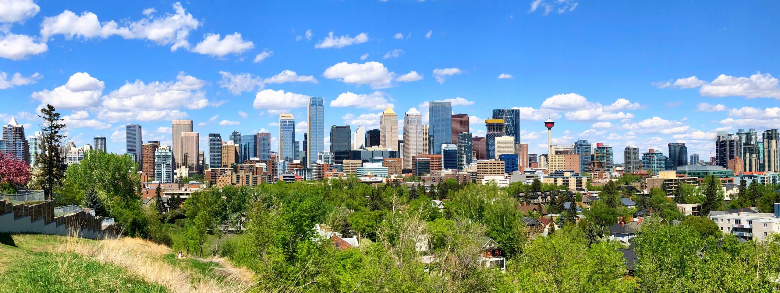
  • Things to Do in Montreal: A First-Timer’s Guide

    Things to Do in Montreal: A First-Timer’s Guide

    Montreal is the closest thing North America has to a European city, and it wears the comparison lightly. The cobblestones and the 17th-century church squares are real, the French is real, and so are the bagels, the hockey, the winter and the festivals that turn the downtown streets into a stage every summer. What makes it easy for a first-time visitor is that it is compact: Old Montreal, downtown, the mountain and the Plateau are all within a few metro stops or a long walk of each other, and each is a half-day or more. This guide covers the sights that earn their reputation, the neighbourhoods locals actually spend their weekends in, the food (which is the real reason many people come), the museums, the sports, the day trips, and the practical details that make the trip work.

    If you are still comparing cheap flights to Montreal, read this alongside our guides to the best time to fly to Montreal and whether you need a car. Between the three you can plan the whole trip.

    The twin-towered façade of Notre-Dame Basilica on Place d'Armes in Old Montreal
    Notre-Dame Basilica on Place d'Armes, the centrepiece of Old Montreal (Photo: Concierge.2C via Wikimedia Commons, CC BY-SA 3.0)

    Montreal at a glance for first-timers

    • Airport: Montréal-Trudeau (YUL), in Dorval about 20 km west of downtown; the 747 bus runs downtown around the clock. See our Trudeau airport guide.
    • Getting around: four metro lines, buses, BIXI bikes and your feet. The city is walkable and most visitors do not need a car unless they are leaving the island.
    • Language: French is the official language and the everyday one; English is widely spoken in hotels, restaurants and shops in the areas visitors frequent. A bonjour goes a long way.
    • Money: Canadian dollars. Menu and shelf prices exclude the federal GST and the Quebec sales tax, which together add about 15 percent at the till. Tipping 15 to 20 percent in restaurants is customary. Tap-to-pay is nearly universal.
    • Where to stay: Old Montreal for atmosphere and boutique hotels; downtown for the Bell Centre, the museums and the underground city; the Quartier des Spectacles for the festivals; the Plateau for a local, café-and-terrace feel. Our Montreal hotel search covers them all.

    Old Montreal and the Old Port

    Notre-Dame Basilica and Place d’Armes

    Start at Place d’Armes, the square where the city was founded, and go inside Notre-Dame Basilica. The exterior is handsome Gothic Revival; the interior is something else, a deep blue vault studded with gold stars above an altar carved in wood, and one of the most beautiful church interiors on the continent. The AURA light-and-sound show in the evenings sells out and is worth booking ahead. Around the square are the old Bank of Montreal head office and the Sulpician seminary, the oldest building in the city.

    The streets and squares

    Rue Saint-Paul, the oldest street in Montreal, runs the length of the old town past galleries, boutiques and the domed Bonsecours Market, now a crafts market. Place Jacques-Cartier slopes down from City Hall to the river, lined with terraces and street performers in summer and a Christmas market in December. The Château Ramezay, an 18th-century governor’s residence, and Pointe-à-Callière, the archaeology museum built over the actual foundations of the first settlement, are the two history museums to prioritise; Pointe-à-Callière in particular is a superb piece of museum design. Old Montreal is at its most atmospheric early in the morning and after dark, when the tour groups are gone and the lamplit streets look like the postcards.

    The Old Port

    Between the old town and the river, the former docks are now a linear park. The big Ferris wheel gives the best view of the old town’s rooftops and the river; Bota Bota, a spa built into a converted ferry, is the most Montreal way to spend a winter afternoon; the Clock Tower at the eastern end has a small urban beach beside it in summer; and the Montreal Science Centre on the King Edward Pier is the best rainy-day option with children. In winter the Old Port has a large skating rink and, on weekends from mid-January, the Igloofest electronic music festival. The river cruises and the jet-boat trips through the Lachine Rapids leave from here.

    The Old Port of Montreal in summer
    The Clock Tower at the eastern end of the Old Port (Photo: Thebrianking via Wikimedia Commons, CC BY-SA 3.0)

    Mount Royal

    The wooded hill in the middle of the city is Montreal’s Central Park, designed by the same architect, Frederick Law Olmsted, and it is the best free thing to do in the city. From the Plateau, the walk up from the Sir George-Étienne Cartier Monument on Avenue du Parc takes twenty to thirty minutes on a winding path and ends at the Kondiaronk Belvedere, the terrace in front of the chalet with the definitive view of downtown and the river. Beaver Lake, on the far side of the summit, has paddle boats in summer and skating and tobogganing in winter; cross-country ski trails loop through the woods. On Sunday afternoons from spring to fall, the Tam-Tams, an informal drum circle that has gathered at the monument for decades, turns the lawn into a festival. On the west flank of the mountain, Saint Joseph’s Oratory is a vast domed basilica with a view of its own; pilgrims still climb its central steps on their knees.

    The Montreal skyline from the Kondiaronk lookout on Mount Royal
    Downtown from the Kondiaronk lookout on Mount Royal, a 20-minute climb from the Plateau (Photo: Andre Carrotflower via Wikimedia Commons, CC BY-SA 4.0)

    The Plateau and Mile End

    East of the mountain, the Plateau Mont-Royal is the neighbourhood that defines the city’s image: three-storey walk-ups with painted cornices and iron outdoor staircases spiralling down to the sidewalk, murals on the gable ends, cafés and terraces on every corner. Boulevard Saint-Laurent, the Main, is the historic dividing line between the French east and the English west and the spine of the neighbourhood’s nightlife; Avenue du Mont-Royal and Rue Saint-Denis are the shopping and café streets; Parc La Fontaine is the front lawn. The murals are the legacy of the annual MURAL festival in June, which paints a fresh crop each year along the Main.

    Outdoor staircases on a residential street in the Plateau Mont-Royal, Montreal
    The outdoor staircases and painted cornices of the Plateau Mont-Royal (Photo: Andre Carrotflower via Wikimedia Commons, CC BY-SA 4.0)

    Mile End, north of the Plateau, is where the bagels are. St-Viateur and Fairmount, both open around the clock, bake Montreal’s wood-fired, honey-sweetened bagels a few blocks apart, and the argument about which is better has run for seventy years. The neighbourhood is also the city’s indie-music and café heartland, with Wilensky’s, a lunch counter unchanged since the 1930s, as its landmark. A morning here, with a bag of hot bagels and a coffee, is the most Montreal morning there is.

    Downtown and the Quartier des Spectacles

    Downtown is Sainte-Catherine Street, the long shopping spine, and the grid around it. The Montreal Museum of Fine Arts on Sherbrooke Street is the one museum every visitor should see, with a strong Canadian collection, Old Masters, decorative arts and blockbuster exhibitions spread across several pavilions; the McCord Stewart Museum, a few blocks east, covers the city’s social history and has an excellent First Nations collection. The Quartier des Spectacles, around Place des Arts, is the festival district, a set of squares wired for light and sound that hosts the jazz festival, the comedy festival and Montréal en Lumière, and is worth wandering on any summer evening. Below all of it runs the RESO, the underground city, roughly 30 kilometres of corridors linking metro stations, shopping centres, hotels and Central Station, which is how Montrealers cross downtown in January. The Bell Centre, home of the Canadiens, sits at the western edge.

    The markets, Little Italy and the canal

    Jean-Talon Market, in Little Italy on the Orange Line, is one of the largest open-air markets in North America and a highlight of any visit: Quebec produce, cheeses, maple products, prepared food and, in late summer, a riot of peppers, corn and tomatoes. Little Italy around it has the espresso bars and trattorias to match. Atwater Market, in the southwest, is smaller and more elegant, with an Art Deco tower and the city’s best butchers, and it sits on the Lachine Canal, whose bike path runs from the Old Port through the reinvented industrial neighbourhoods of Griffintown and Saint-Henri to the rapids at Lachine. A BIXI along the canal, stopping at Atwater for lunch, is a perfect summer half-day.

    Produce stalls at Jean-Talon Market in Montreal
    Jean-Talon Market in Little Italy, one of the largest open-air markets in North America (Photo: figa via Wikimedia Commons, CC BY 3.0)

    Parc Jean-Drapeau and the Olympic Park

    Two islands in the river, reached by the Yellow Line metro, make up Parc Jean-Drapeau: the site of Expo 67, whose Biosphere, Buckminster Fuller’s geodesic dome, is now an environment museum; La Ronde, the city’s amusement park; the casino; a swimming beach; and the Circuit Gilles Villeneuve, the Grand Prix track, which is open to cyclists and skaters the rest of the year. Osheaga, the big summer music festival, happens here. Across town at the east end of the Green Line, the Olympic Park’s leaning tower is still the tallest inclined structure in the world, and the Space for Life complex beside it groups the Biodome, with its recreated ecosystems, the Botanical Garden with its celebrated Chinese and Japanese gardens, the Insectarium and the Planetarium. With children, this is the best day in the city.

    What to eat, and where

    Montreal’s food is the strongest reason to visit, and it rewards a plan. Smoked meat, the city’s cured brisket, is best at Schwartz’s on the Main, where the queue is part of the experience, or at its rivals nearby. Bagels are Mile End, above. Poutine is everywhere, but La Banquise on the Plateau, open all night with dozens of variations, is the pilgrimage. Portuguese grilled chicken from the rotisseries around the Plateau is the local takeout. Tourtière, the meat pie, and maple everything are the Quebec classics, best at the sugar shacks in March or at the markets year-round. The city’s serious restaurants cluster in Little Burgundy, Saint-Henri, the Plateau and Old Montreal, and its bring-your-own-wine restaurants along Rue Duluth and Rue Prince-Arthur are a Montreal institution that makes a good meal considerably cheaper. Quebec cheeses, craft beer from the city’s many microbreweries, and the dépanneurs that sell both on every corner round out the picture. Two festivals bring prix-fixe menus to hundreds of restaurants: MTLàTABLE in November and the winter festival’s food programme in February.

    Sports and live events

    The Montreal Canadiens are the most decorated franchise in hockey and the Bell Centre on a game night is the loudest room in the country; tickets are hard to come by but worth the effort, and the pre-game atmosphere in the bars around the arena is part of it. CF Montréal play soccer at Stade Saputo beside the Olympic Stadium, and the Alouettes play football at the Percival Molson Stadium on the slope of the mountain, one of the most scenic places to watch a game anywhere. The festival calendar is the densest in North America: the jazz festival from late June, the Just for Laughs comedy festival in July, the fireworks competition on summer weekends, Osheaga in early August, Pride, the film festival, and in winter Igloofest and Montréal en Lumière. For tickets across all of it, check what is on sale in Montreal for your dates before you book flights, because the Grand Prix and a Canadiens playoff run can fill the city’s hotels in a day. Tourisme Montréal keeps the festival dates.

    Montreal with kids

    The Biodome, the Insectarium and the Planetarium at Space for Life; the Science Centre and the Ferris wheel in the Old Port; La Ronde and the beach at Parc Jean-Drapeau; the paddle boats on Beaver Lake; the Ecomuseum Zoo in the West Island; and, in winter, skating in the Old Port and tobogganing on the mountain. The metro is an adventure in itself, and children eleven and under ride free.

    Montreal through the seasons

    Montreal changes character with the calendar more than any other Canadian city, and it is worth choosing your season deliberately. Summer (June to August) is the city at full volume: the Jazz Festival, Just for Laughs, the Francofolies and Osheaga back to back, the fireworks competition over the river on summer evenings, terrasses on every street, the Tam-Tams drum circle on Mount Royal every Sunday, and pedestrianized stretches of Mont-Royal Avenue and Sainte-Catherine. Fall (September to October) is the quieter, cheaper version, with the maples on the mountain turning in early October, the Marathon, Pop Montreal, and the best restaurant season of the year as the summer crowds leave. Winter (December to March) is cold, and Montrealers have built a city to enjoy it: the Underground City, with its 30-plus kilometres of connected passages, malls and metro stations, keeps downtown walkable in any weather; the outdoor rinks in the Old Port and at Parc La Fontaine, the Fête des Neiges on Île Sainte-Hélène, Igloofest’s outdoor electronic music in January, Montréal en Lumière and the all-night Nuit Blanche in late February, and the Canadiens at the Bell Centre fill the calendar. Spring (April to May) is mud and sugar shacks, with the cabanes à sucre in the countryside serving maple-drenched meals through March and April, then a sudden explosion of terrasses in May. Our month-by-month guide matches each season to the fare calendar.

    Montreal on a budget

    Montreal is the most affordable of Canada’s big three cities, and the free list is long: Mount Royal and the lookout, the Tam-Tams, the outdoor stages of the summer festivals, the Old Port promenade, Parc La Fontaine, the Lachine Canal path, the markets, the Notre-Dame Basilica exterior and the Place d’Armes, and the Underground City itself. The Montreal Museum of Fine Arts has free admission to its permanent collection for visitors under a certain age and reduced days for everyone; check its site. Eat cheaply and brilliantly at the bagel bakeries, the smoked-meat counters, the Jean-Talon Market stalls, and the Portuguese chicken and Vietnamese pho on Saint-Laurent and in Côte-des-Neiges. The metro’s unlimited weekend and multi-day passes are good value, and BIXI bikes are cheap for short hops. Hotels are noticeably cheaper than Toronto’s outside the festival weeks and the Grand Prix; compare them by neighbourhood on our Montreal hotel search, and see our guide to the best times to book flights and hotels for the booking side.

    Day trips from Montreal

    Quebec City, three hours away by car or by VIA Rail, is the walled capital with the Château Frontenac and the only fortified city north of Mexico; it deserves an overnight, but a long day is possible by train. See our Quebec City guide. Mont-Tremblant, ninety minutes north in the Laurentians, is the ski resort in winter and a lakes-and-hiking base in summer; Tremblant has resort details. The Eastern Townships, an hour and a half east, are wine, cider, lakes and small towns like Magog, Knowlton and North Hatley. Ottawa is two hours west by road or train. In March and April, the sugar shacks in the countryside serve the traditional maple feast; in the fall, the orchards around Mont-Saint-Hilaire and Oka open for apple picking. Most of these are easier with a car; see our Montreal car rental page, and note that Quebec requires winter tires from December 1 to March 15. Bonjour Québec covers the wider province.

    Two sample itineraries

    Two days, no car

    Day one: Notre-Dame Basilica and Old Montreal in the morning, lunch on Rue Saint-Paul, the Old Port and the Ferris wheel in the afternoon, dinner in Old Montreal or Griffintown. Day two: bagels in Mile End, walk south through the Plateau along Saint-Laurent, climb Mount Royal to the lookout, descend to downtown for the Museum of Fine Arts, smoked meat at Schwartz’s for dinner, and a Canadiens game or a show at night.

    Four days, with one day trip

    Add a day for Jean-Talon Market, Little Italy and the Space for Life complex, a day for the Lachine Canal by BIXI with lunch at Atwater Market and an evening in Little Burgundy, and use the fourth for Quebec City by train or Tremblant and the Laurentians by car, rented from a downtown location for that day only.

    Practical details

    • Transit: buy an OPUS card or tickets from any metro station; a three-day pass covers most visits. The STM’s site has maps; our transit-versus-car guide goes into detail.
    • From Trudeau: the 747 bus runs around the clock to downtown and its fare includes 24 hours of transit. The airport’s site covers ground transport.
    • Weather: real winters, humid summers, and two short, lovely shoulders. Our month-by-month guide has the table; check Environment Canada’s forecast before you pack.
    • Driving: no right turns on red on the island of Montreal, and winter tires are mandatory from December 1 to March 15.
    • Entry requirements: U.S. citizens need a valid passport; most other visa-exempt visitors arriving by air need an Electronic Travel Authorization. The Government of Canada’s visitor page is the authoritative source.
    • Safety: a safe city by any standard; the usual big-city awareness applies downtown late at night.

    Frequently asked questions

    How many days do you need in Montreal?

    Three full days covers Old Montreal, the mountain, the Plateau and the museums comfortably; five lets you add the markets, the Olympic Park and a day trip. A weekend is enough for the old town and the Plateau.

    What is the number one thing to do in Montreal?

    Notre-Dame Basilica’s interior, then the walk up Mount Royal to the lookout. And eat a bagel from Mile End on the way.

    Is Montreal walkable?

    Very. Old Montreal, downtown and the Plateau are all connected on foot, and the metro fills the gaps. In winter the underground city keeps you moving without a coat.

    Do I need to speak French in Montreal?

    No, but it helps. English is widely spoken in the areas visitors frequent, and starting with bonjour is both polite and appreciated.

    Do I need a car in Montreal?

    Not for the city. Rent one for Tremblant, the Townships or a road trip to Quebec City, ideally from a downtown location for just those days.
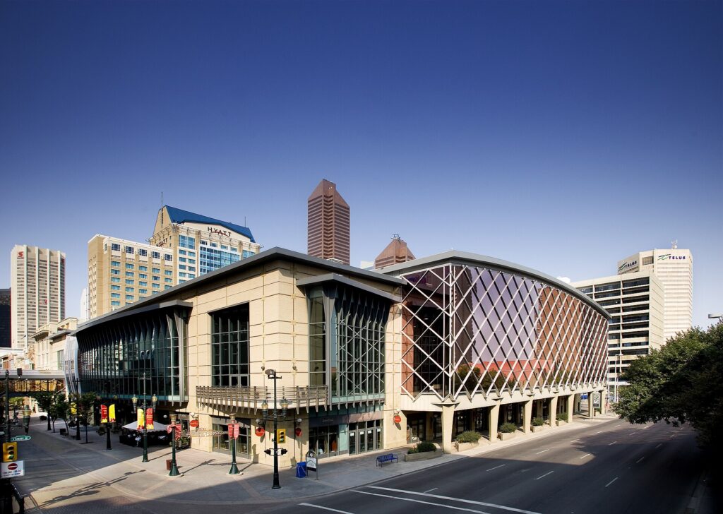
    What is Montreal famous for?

    Its French character, Old Montreal, the Canadiens, the summer festivals, and its food: smoked meat, bagels, poutine and one of the best restaurant scenes in North America.

    Ready to go? Compare flights to Montreal, find a place to stay with our Montreal hotel search, and if Tremblant or the Townships are on the list, price a rental car for those days.