Category: Travel Guides

  • Best Time to Fly to Vancouver: Seasons, Weather & Prices

    Best Time to Fly to Vancouver: Seasons, Weather & Prices

    Vancouver’s weather has a reputation, and the reputation is only half right. Yes, it rains, and from November to February it rains a great deal. But the same Pacific air that brings the rain also gives Vancouver the mildest winters of any major Canadian city, the earliest spring, and a summer that is warm, dry and almost absurdly pleasant. Airfares follow that pattern closely: the city is busiest and most expensive from June to September, when the cruise ships are in and the mountains are green, and quietest in the wet months, with a twist that Toronto does not have, because Whistler’s ski season keeps winter demand higher than you might expect. This guide walks through Vancouver month by month, the fare seasons, the events that push prices up, and which of the region’s airports to fly into.

    The short answer

    For weather and value together, aim for late April to early June or mid-September to mid-October. Spring brings cherry blossoms, long days and dry spells before the summer crowds; early fall keeps most of the summer’s warmth and loses most of its prices. The cheapest fares are usually in November, January and the first half of February, when the rain is heaviest and the days are shortest. The most expensive stretches are July and August, the Christmas and New Year period, and the mid-February and mid-March school breaks, when families fly in for the mountains. Whatever you choose, run a flexible-date search on our Vancouver flights page; on the west coast, shifting a trip by a week can move it from one fare season into another.
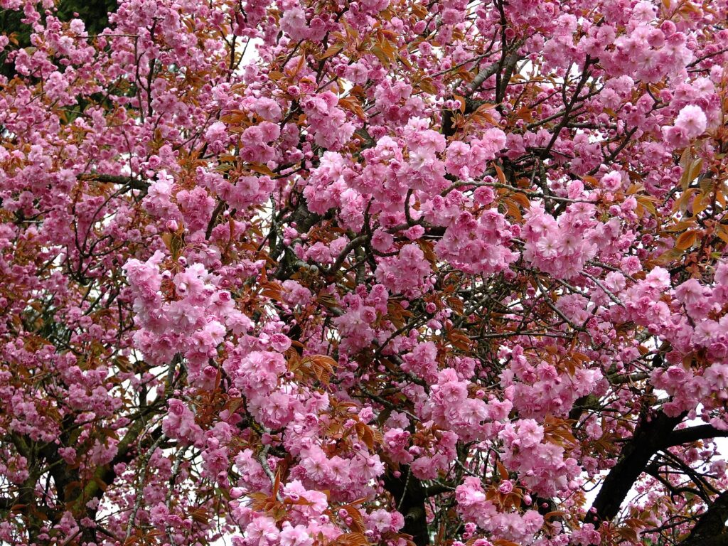
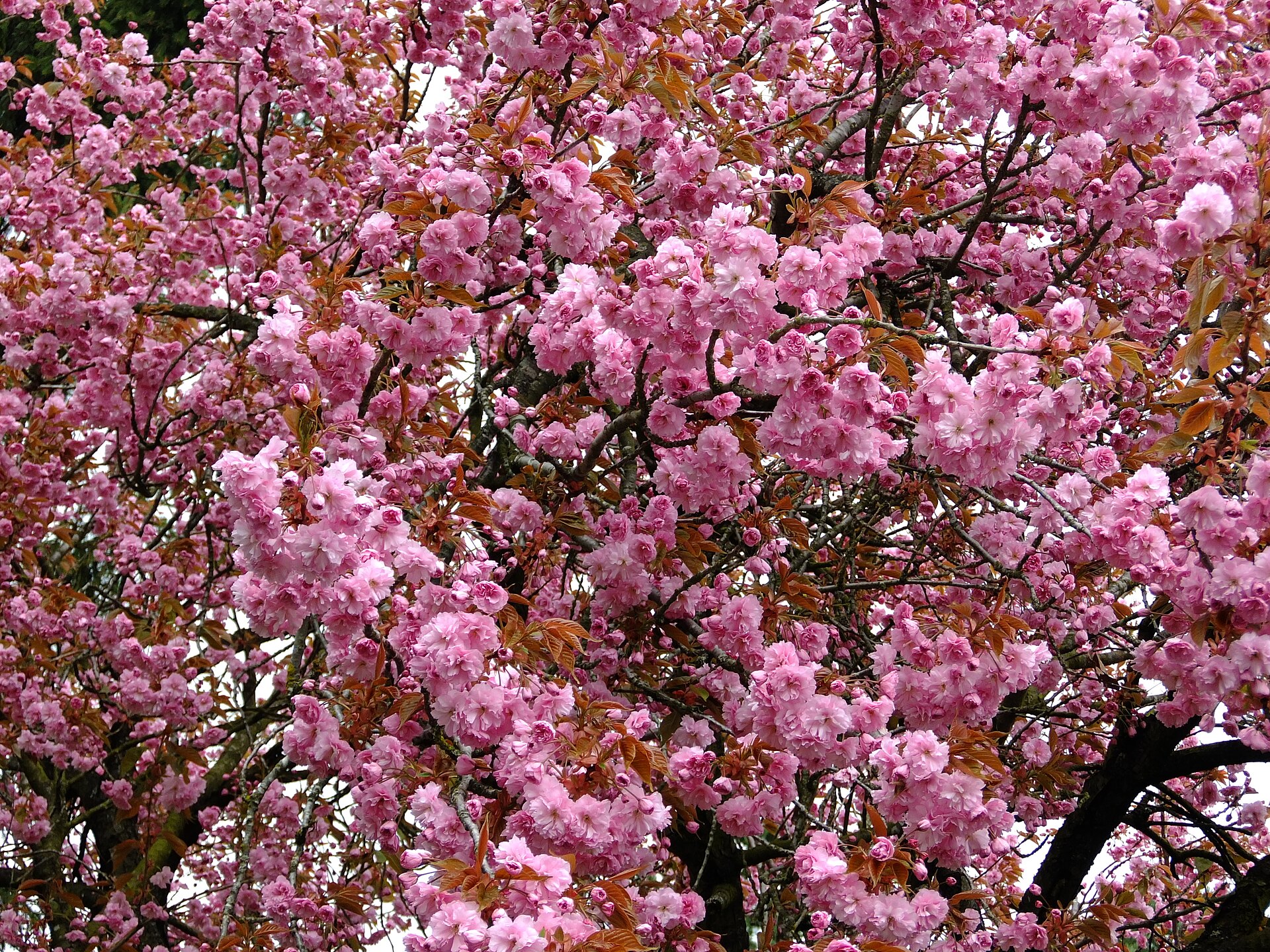
    Cherry blossoms lining a Vancouver street in spring
    Cherry blossoms in Metro Vancouver, a late-March to mid-April spectacle across the region (Photo: Reg Natarajan from Vancouver, Bogotá via Wikimedia Commons, CC BY 2.0)

    Vancouver’s weather, season by season

    Vancouver sits between the Pacific and the Coast Mountains, and both shape the weather. The ocean keeps temperatures in a narrow band year-round; the mountains wring the moisture out of incoming Pacific systems, which is why the North Shore is wetter than the airport and why it can be raining downtown while the sun is out in Richmond. The figures below are approximate seasonal patterns based on the long-term climate normals from Environment and Climate Change Canada; check the current forecast before you pack.

    MonthTypical daytime highTypical overnight lowWhat it feels likeFare pressure
    Januaryaround 7 °Caround 1 °CMild but very wet; snow downtown is rare, snow on the local mountains is notLow, except the first week
    Februaryaround 8 °Caround 2 °CStill wet; the first blossoms appear late in the monthLow to moderate; rises for Family Day and ski weekends
    Marcharound 10 °Caround 3 °CRain eases, cherry blossoms begin, mountains still skiingModerate; spring break spike
    Aprilaround 14 °Caround 6 °CBlossoms at their peak, dry spells lengthenModerate
    Mayaround 18 °Caround 9 °CSpring proper; patios and beaches wake up; cruise season startsModerate, rising
    Junearound 20 °Caround 12 °CWarm, long evenings, occasional grey spells locals call JuneuaryModerate to high
    Julyaround 23 °Caround 14 °CDry, sunny, rarely humid; the best weather of the yearHigh
    Augustaround 23 °Caround 14 °CDry and warm; wildfire smoke from the interior is possible in some yearsHigh
    Septemberaround 19 °Caround 11 °COften the driest, clearest month; cool eveningsModerate, falling after Labour Day
    Octoberaround 14 °Caround 7 °CFall colour, then the rains return late in the monthModerate to low
    Novemberaround 9 °Caround 4 °CThe wettest month; grey and short daysLow
    Decemberaround 6 °Caround 1 °CWet and mild; festive lights and markets; ski season opensLow until mid-month, then peak

    Two things the table does not show. First, the rain is seasonal, not constant: Vancouver gets most of its annual rainfall between October and March, and a July visitor may not see a drop. Second, daylight swings hard: around sixteen hours at the June solstice and barely eight in late December, which matters more here than in most cities because so much of what Vancouver offers is outdoors.

    How Vancouver’s fare seasons work

    Three things drive demand for seats into Vancouver: the summer, when the city is at its best and the Alaska cruise ships turn Canada Place into a revolving door; the mountains, which pull skiers in from December to April; and the Asia-Pacific and transborder business traffic that runs year-round. The result is a fare curve with a high summer plateau, a real but softer winter bump, and two shoulder windows where the weather is often good and the prices are not.

    Peak season

    Late June to early September, plus roughly December 18 to January 3. Summer is when Vancouver’s weather is reliably excellent and when Whistler, Victoria and the Rockies are all in season, so the city becomes the gateway for the whole region. Hotel rates downtown climb sharply on cruise turnaround days, which fall on weekends through the summer. If you must travel in peak, book early, fly mid-week, and price your hotel before you price your flight.

    Shoulder season

    April to mid-June and mid-September to October. The cherry blossoms, the Sun Run and the marathon give spring a festive feel without the summer fares; September is frequently the clearest month of the year and comes with a distinct drop in hotel rates once the cruise season winds down. Watch for the Victoria Day and Thanksgiving long weekends, which behave briefly like peak.

    Low season

    November, January and the first half of February, with a caveat: ski weekends and the February Family Day long weekend can lift fares from Canadian cities, and the mid-March spring break does the same for family travel. Outside those dates, low season is genuinely low. The trade-off is rain and short days, offset by a city that does the indoor things well: museums, Asian food that is among the best in North America, and Whistler an easy day away.

    As elsewhere, mid-week departures and early or late flights often price below Friday and Sunday afternoons on the same route, and a calendar search usually reveals a cheaper pair of dates within a few days of your first choice. Our guide to the best times to book explains how to read those patterns.

    Vancouver month by month

    January

    Mild, wet and quiet. Downtown rarely sees snow that lasts, but Grouse, Cypress and Seymour, the three ski hills you can see from the city, are in full operation, and Whistler is two hours up the Sea to Sky Highway. After the first week, January is one of the two cheapest months to fly in. The Dine Out Vancouver restaurant festival runs from mid-January into February and is a genuine reason to visit; the Vancouver Canucks are at home at Rogers Arena.

    February

    Similar weather, with a difference: the first cherry and plum blossoms appear in the last week, and the light noticeably returns. Fares are low outside the Family Day long weekend (the third Monday of February) and the ski weekends around it. The Lunar New Year parade in Chinatown is one of the largest outside Asia, and the Vancouver International Wine Festival usually lands in late February or March.

    March

    The rain begins to ease and the blossoms take over. Vancouver has tens of thousands of ornamental cherry trees, and from mid-March through April whole streets turn pink; the Vancouver Cherry Blossom Festival celebrates it. The mid-March spring break creates a two-week spike in family travel, especially for the mountains. Book around it and March is a good-value month.

    April

    Peak blossom season, longer dry spells, and a city that suddenly looks like its postcards. The Vancouver Sun Run, one of the largest 10-kilometre races in the world, fills downtown one Sunday in April. Fares are moderate, hotel rates are still well below summer, and the mountains are usually still skiing. April is an underrated month for a first visit.

    May

    Spring proper. The Victoria Day long weekend (the Monday before May 25) marks the unofficial start of summer, cruise season begins at Canada Place, and the Vancouver Marathon runs in early May. Fares rise through the month but stay below June; the first half of May is the value window.

    June

    Long evenings, warm days, and the occasional grey week locals have nicknamed Juneuary. Schools finish at the end of the month and fares step up with them. The Vancouver International Jazz Festival runs around the last week of June into early July, and the Dragon Boat Festival takes over False Creek. If June is your month, travel in the first half.

    July

    The best weather of the year, and the highest prices. Canada Day on July 1 opens the month with fireworks; the beaches at English Bay, Kitsilano and Jericho fill every evening; and the Celebration of Light fireworks competition brings hundreds of thousands of people to the waterfront on three evenings across late July and early August. Book early and expect downtown hotels to be full on weekends.
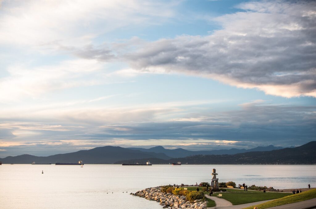
    English Bay Beach in Vancouver on a summer day
    English Bay, the downtown beach where the Celebration of Light fireworks are watched from the sand (Photo: Robbie Vize via Wikimedia Commons, CC BY 3.0)

    August

    Still peak, and still dry and warm. The Pride parade fills the West End on the first Sunday of the month, the Pacific National Exhibition (the PNE) runs from the third week of August to Labour Day, and the cruise season is at its busiest. In some years, wildfire smoke from the interior can settle over the city for days at a time; check the air quality forecast if you have respiratory concerns. The last week of August is slightly softer on prices as families head home.

    September

    Many Vancouverites will tell you this is the best month, and the weather often agrees: dry, clear, warm afternoons and cool evenings, with the mountains sharp on the skyline. Fares and hotel rates fall after Labour Day and the cruise season tails off through the month. The Vancouver Fringe Festival and the start of the Vancouver International Film Festival, which runs from late September into October, are the cultural bookends.

    October

    Fall colour in Stanley Park and along the Seawall, mild days, and a steady slide toward low-season pricing, apart from the Thanksgiving long weekend on the second Monday. The rains usually return in the second half of the month. Early October is one of the best value-for-weather windows of the year.

    November

    The wettest month and, with January, the cheapest. The city is grey and the days short, but it is also when the Vancouver Christmas Market opens downtown in the second half of the month, the local ski hills begin to open, and hotel rates are at their annual low. If you are coming for Whistler’s early season or for a food-and-museums weekend, November delivers it for the least money.

    December

    Two months in one, again. The first half continues November’s pricing with the holiday lights and markets in full swing and the mountains open. From about December 18, fares and hotel rates jump for Christmas and New Year, and Whistler’s holiday weeks drive some of the highest airfares of the whole year into Vancouver. Winter is mild downtown; bring rain gear, not a parka.
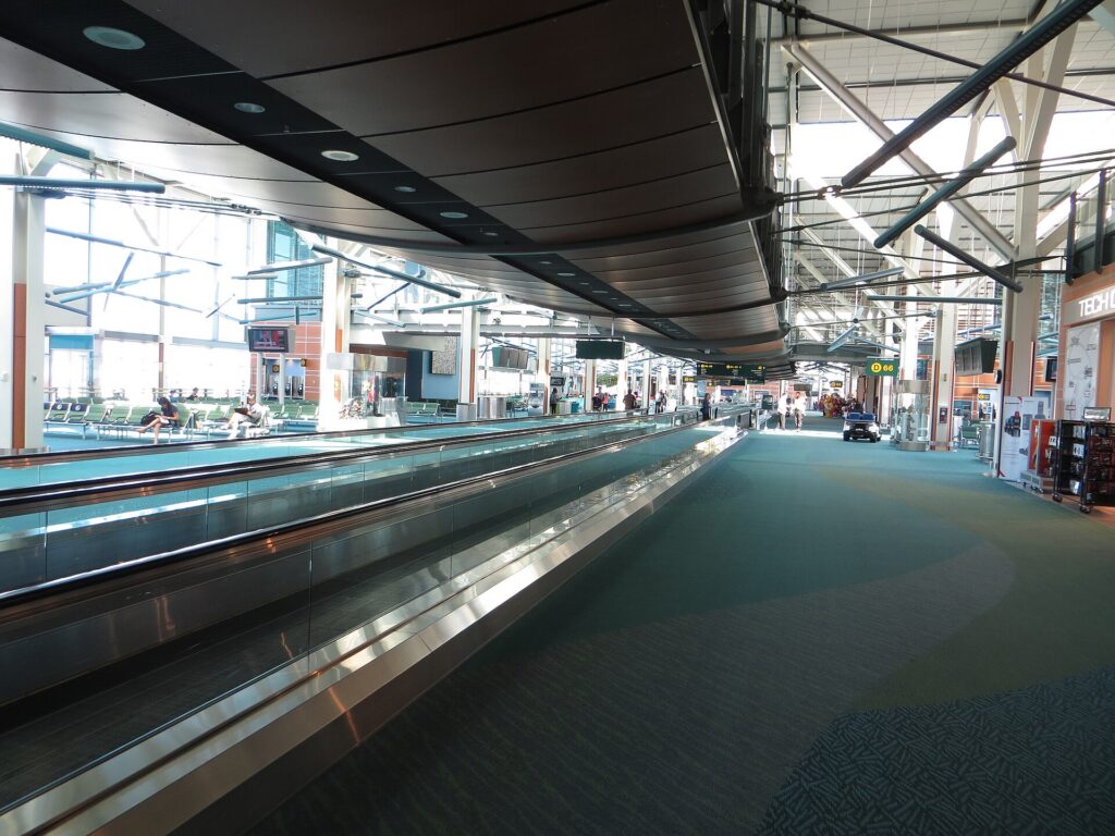
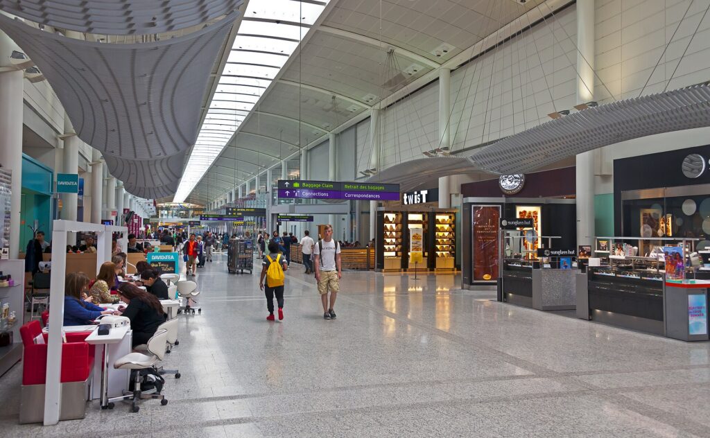
    Inside the terminal at Vancouver International Airport (YVR)
    Inside the terminal at Vancouver International Airport (YVR), 25 minutes from downtown by Canada Line (Photo: Sunnya343 via Wikimedia Commons, CC BY-SA 4.0)

    Events that move Vancouver flight and hotel prices

    Cross-check these against your dates before you book. Exact dates shift each year; Destination Vancouver keeps the current calendar.

    • Family Day weekend (third Monday of February) and the surrounding ski weekends.
    • Spring break (mid-March, two weeks in most BC districts).
    • Victoria Day weekend (Monday before May 25) and the start of cruise season.
    • Cruise turnaround weekends (May to October): tens of thousands of passengers pass through downtown hotels on the busiest Saturdays and Sundays.
    • Canada Day (July 1).
    • Celebration of Light (late July into early August).
    • Vancouver Pride (first weekend of August) and the PNE (late August to Labour Day).
    • Vancouver International Film Festival (late September into October).
    • Thanksgiving weekend (second Monday of October).
    • Christmas to New Year, including Whistler’s holiday weeks.
    • Major games and concerts at Rogers Arena and BC Place: Canucks playoff runs in spring, Whitecaps and BC Lions home dates, and stadium tours. Our Vancouver events page shows what is on sale for your dates.

    Which airport should you fly into?

    Vancouver International (YVR)

    YVR sits on Sea Island in Richmond, about 12 kilometres from downtown, and handles nearly every flight into the region, including the trans-Pacific routes that make Vancouver Canada’s gateway to Asia. Getting downtown is as easy as it gets in North America: the Canada Line SkyTrain runs from a station inside the terminal to Waterfront Station in about 25 minutes, with a modest airport surcharge added to the fare when you board at YVR. Taxis and ride-hail pick up outside arrivals, and the rental counters are in the parkade across from the terminal. TransLink has the transit details; our YVR airport guide covers the layout, and our Vancouver car-versus-transit guide will help you decide whether to book a car at all.

    Abbotsford (YXX)

    About 70 kilometres east of the city in the Fraser Valley, Abbotsford has periodically hosted low-cost carriers on domestic and sun routes. A very low fare can be worth it with a rental car or if you are heading to the Okanagan or the eastern suburbs; without a car, the trip into downtown is slow. Price the whole journey, not the fare.

    Bellingham, Washington (BLI)

    Ninety kilometres south, across the border, Bellingham’s airport is a long-standing option for Canadians chasing cheaper U.S. domestic fares. It only makes sense with a car and a passport, and border wait times can erase the savings on a busy day. If you are a visitor rather than a resident, ignore it.

    Seaplanes and the ferry

    If your trip continues to Victoria or Vancouver Island, Harbour Air flies seaplanes from the downtown waterfront and from YVR’s south terminal, and BC Ferries sails from Tsawwassen, south of the airport. Both are worth factoring into which airport and which side of the city you choose.

    Timing tricks that work for Vancouver

    • Search the whole month. Vancouver’s fare curve has sharp steps around spring break, the long weekends, and the cruise weekends. A calendar view on TicketScanner shows them instantly.
    • Fly mid-week in summer. Saturday and Sunday are cruise turnaround days; Tuesday and Wednesday arrivals avoid both the fare bump and the hotel crush.
    • Book the ski weeks early. Christmas, Family Day and spring break fares from Canadian cities rarely fall as the date approaches. November and January fares, by contrast, are stable enough to wait for the right dates.
    • Price the hotel first in May through September. A cheap fare into a cruise weekend is not cheap once the room is added. Run a Vancouver hotel search for the same dates before you commit to either.
    • Coming from the east? Vancouver is three hours behind Toronto and Montreal. A morning departure eastbound lands mid-afternoon; a red-eye westbound is the classic value flight and worth the tired first day for many travellers. Our note on what to wear on a long flight applies.
    • Build a winter buffer. Fog and the occasional Pacific storm can disrupt YVR between November and February; avoid the tightest connections. Our guide to how early to arrive for an international flight covers what to allow.
    • Flying out of Vancouver instead? The same seasonality applies in reverse; see cheap flights from Vancouver.
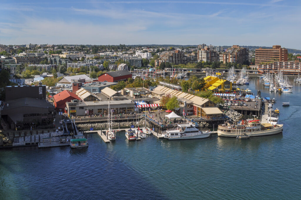
    Granville Island seen from the Granville Bridge in Vancouver
    Granville Island Public Market is a favourite stop on a Vancouver visit (Photo: Joe Mabel via Wikimedia Commons, CC BY-SA 3.0)

    What to pack, by season

    Winter (November to February): a waterproof shell with a hood, waterproof shoes, and layers; an umbrella is optional and locals will judge you for it, but it works. A parka is overkill downtown and essential on the mountains. Spring (March to May): a rain shell, a light sweater, and sunglasses; the weather changes by the hour. Summer (June to September): light clothing, a warm layer for the evenings, which cool quickly by the water, and swimwear. Fall (October): the rain shell again, a warmer jacket by late in the month. Year-round, Vancouver is a walking, cycling and hiking city; bring shoes you can cover kilometres in.

    The best time to fly to Vancouver for…

    Families

    The first half of July for guaranteed beach weather with the least peak-price exposure, or the last week of August into Labour Day for the PNE. Spring break works for a ski-and-city split if you book early.

    The lowest fares

    November, and mid-January to early February outside the Family Day weekend. Pair with Dine Out Vancouver and a day at Whistler or on the local mountains.

    Skiing

    January and February for snow reliability, March for longer days and softer prices once spring break has passed, with Whistler’s holiday weeks the most expensive of all.

    Cherry blossoms and spring

    Late March to mid-April. Book a hotel in the West End or Kitsilano and walk.

    Food and festivals

    Late June to early August for the jazz festival, Celebration of Light and Pride; late January for Dine Out Vancouver at a fraction of the price.

    Cruise passengers

    Arrive a day or two before the ship, mid-week if you can, and stay downtown; the Canada Place cruise terminal is a short taxi ride or a walk from most central hotels.

    Cross-border and international visitors

    U.S. citizens need a valid passport; most other visa-exempt travellers arriving by air need an Electronic Travel Authorization. The Government of Canada’s visitor page explains what applies to you, and CATSA lists what you can carry through security.

    Frequently asked questions

    What is the cheapest month to fly to Vancouver?

    November and January are consistently the lowest, followed by early February and early December. The Christmas weeks and the February and March school breaks are the exceptions in winter.

    What is the best month to visit Vancouver for weather?

    July and August for warmth and dry days, with September a close third and often the clearest. April and May are lovely if you can accept some showers.

    Does it really rain all the time in Vancouver?

    No. Most of the year’s rain falls from October to March. Summer is dry, and September is often the driest month of all.

    Is Vancouver expensive in summer?

    Yes: July and August are the most expensive months for flights and especially for downtown hotels, driven by cruise season and the region’s short, perfect summer. Mid-week travel and early booking help.

    How far ahead should I book?

    Earlier for summer, the holidays and the school breaks, when fares tend only to rise; for November through early February, fares are stable enough that finding the right dates matters more than booking months out.

    Should I fly into Vancouver or Seattle?

    If Vancouver is the destination, fly into YVR: the Canada Line makes the airport-to-downtown trip trivial, and the border crossing from Seattle can take hours on a busy day. Seattle only makes sense as part of a two-city trip with a car.

    When do Vancouver’s cherry blossoms bloom?

    From late March into April, depending on the variety and the year, with the peak usually in the first half of April.

    Ready to pick your dates? Compare fares across the whole month on our Vancouver flights page, then find a room with our Vancouver hotel search. For what to do when you land, start with our first-timer’s guide to Vancouver.

  • Things to Do in Rome: A First-Timer’s Guide

    Things to Do in Rome: A First-Timer’s Guide

    Rome is the one city where the guidebook cliché is simply true: you cannot see it all, and you should stop trying on the first afternoon. Two and a half thousand years of building sit on top of each other in the bend of the Tiber, and the street you take to dinner may follow a road the legions marched on. The trick for a first visit is to pick the handful of things that genuinely earn a whole morning, book the three that need booking, and leave the rest of the time for the neighbourhoods, the food and the long evenings in piazzas, which is where Rome actually happens. This guide covers the ancient centre, the Vatican, the piazzas, the neighbourhoods, the museums, the food, day trips by train, and the practical details that separate a good trip from a hot, queue-heavy one.

    If you are still comparing cheap flights to Rome, read this alongside our guides to the best time to fly to Rome and whether you need a car, which for most visitors here is a firm no. Between the three you can plan the whole trip.

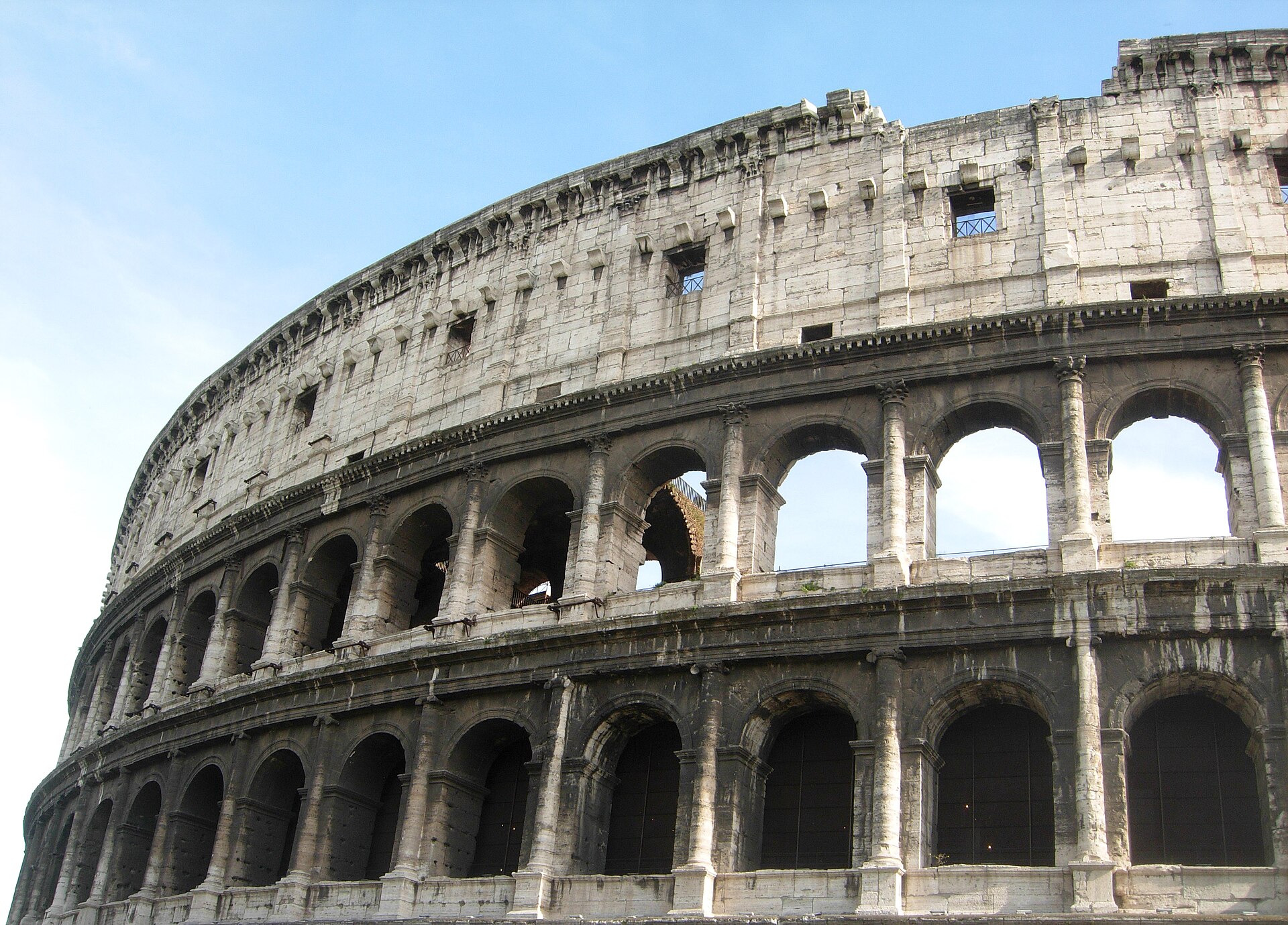
    The Colosseum in Rome seen from the outside
    The Colosseum, the first stop on almost every visit to Rome (Photo: Acediscovery via Wikimedia Commons, CC BY 4.0)

    Rome at a glance for first-timers

    • Airport: Leonardo da Vinci, always called Fiumicino (FCO), about 30 km southwest of the centre; the Leonardo Express train reaches Termini station in around half an hour, and official white taxis charge a fixed fare into the centre. Ciampino (CIA), southeast of the city, handles the low-cost carriers. See our Fiumicino airport guide.
    • Getting around: on foot, above all; the historic centre is compact and most of the famous sights are within a 40-minute walk of each other. The metro skirts the centre, so buses and the number 8 tram fill the gaps.
    • Money: euros. Cards are accepted nearly everywhere, though small bars prefer cash. Tipping is not expected; rounding up is plenty, and the per-person cover charge, the coperto, is normal.
    • Weather: mild, wet winters, long hot summers with July and August well above 30 °C, and two glorious shoulders in spring and autumn. Our month-by-month guide has the detail.
    • Where to stay: the Centro Storico for walking everywhere; Monti for a village feel two minutes from the Forum; Trastevere for the evenings; Prati for the Vatican and calmer streets; around Termini for the budget and the trains. Our Rome hotel search covers them all.

    Ancient Rome: the Colosseum, the Forum and the Palatine

    Start with the Colosseum, because it is the building everyone has already seen and it is still astonishing in person: the largest amphitheatre the Romans ever built, inaugurated in 80 AD, with the exposed hypogeum where animals and gladiators waited beneath the arena floor. It is managed together with the Roman Forum and the Palatine Hill as a single archaeological park, and one ticket covers all three; buy it online from the park’s own site for a timed entry, because the walk-up queue in summer can run to hours and the ticket touts outside are best ignored. Do the Colosseum first thing or late in the day, then cross to the Forum, where the Senate house, the Arch of Titus and the Via Sacra are still legible with a map or a guide. Finish on the Palatine, the hill where Rome was founded and the emperors built their palaces; it is quieter and greener, with views over the Circus Maximus. Allow half a day for the three together and bring water, because the Forum has almost no shade.

    Two more ancient sites deserve a place on a first visit. The Pantheon, the best-preserved building of the ancient world, has a concrete dome that was the largest on earth for more than a thousand years and an open oculus at its centre through which rain falls onto the marble floor; it now charges a small admission for tourists, and the queue moves quickly. The Baths of Caracalla, south of the Circus Maximus, are vast, rarely crowded, and give a better sense of the scale of imperial Rome than anything in the Forum; in summer the opera stages performances among the ruins.

    The historic centre: piazzas, fountains and the Spanish Steps

    The Centro Storico is the medieval and Baroque city packed into the bend of the Tiber, and it is meant to be walked without much of a plan. Piazza Navona, built on the outline of a Roman stadium, holds Bernini’s Fountain of the Four Rivers and Borromini’s church of Sant’Agnese, and is the most theatrical square in the city. The Trevi Fountain, a few streets east, is grander in person than in the photographs and permanently crowded; go before eight in the morning or after eleven at night, and expect the city to manage access to the basin during busy periods after its recent restoration. The Spanish Steps climb from the designer shops of Via Condotti to the church of Trinità dei Monti, and sitting on them is now forbidden, which the police do enforce. Campo de’ Fiori has a morning market; the Jewish Ghetto beside it, one of the oldest Jewish communities in Europe, has the Portico d’Ottavia and the Turtle Fountain. The churches most visitors walk past hold Caravaggios: San Luigi dei Francesi and Sant’Agostino near Navona, and Santa Maria del Popolo at the top of the Tridente, all free to enter.

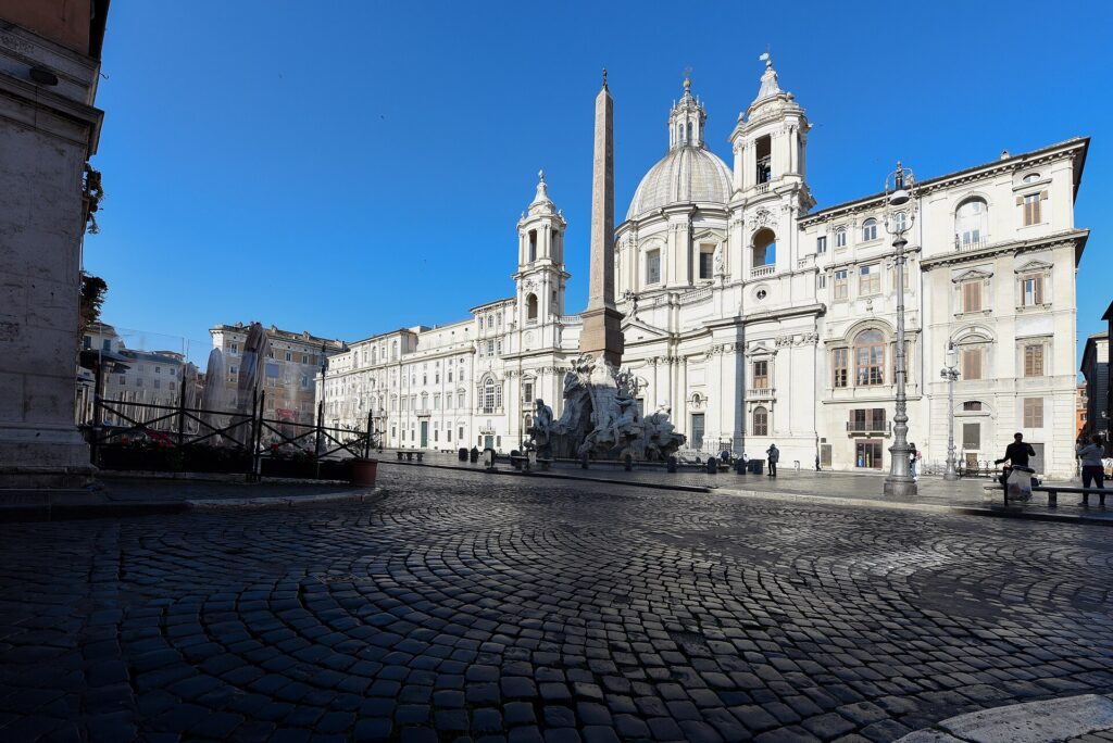
    Piazza Navona in Rome, the Baroque square built on the outline of a Roman stadium
    Piazza Navona, built on the outline of a Roman stadium (Photo: Meshari Alawfi via Wikimedia Commons, CC BY 4.0)

    The Vatican: St Peter’s, the Museums and the Sistine Chapel

    Vatican City is a separate state, but it is a twenty-minute walk or a short metro ride from the centre, and it is a full day. St Peter’s Basilica is free to enter, which is why the security queue in the piazza can be long; arrive when it opens in the morning, dress with shoulders and knees covered, and inside, see Michelangelo’s Pietà and Bernini’s baldachin, then climb the dome for the finest view in Rome. The Vatican Museums are the other half of the day: kilometres of galleries that end in the Raphael Rooms and the Sistine Chapel, where Michelangelo’s ceiling and Last Judgment need no introduction. Book a timed ticket on the museums’ own site weeks ahead in high season; the museums are closed on Sundays except the last Sunday of the month, when entry is free and the queue is enormous. Across the river, Castel Sant’Angelo, Hadrian’s mausoleum turned papal fortress, has a spiral ramp, frescoed apartments and a rooftop terrace facing the dome. Papal audiences are held most Wednesday mornings when the Pope is in Rome, and tickets are free through the Prefecture of the Papal Household.

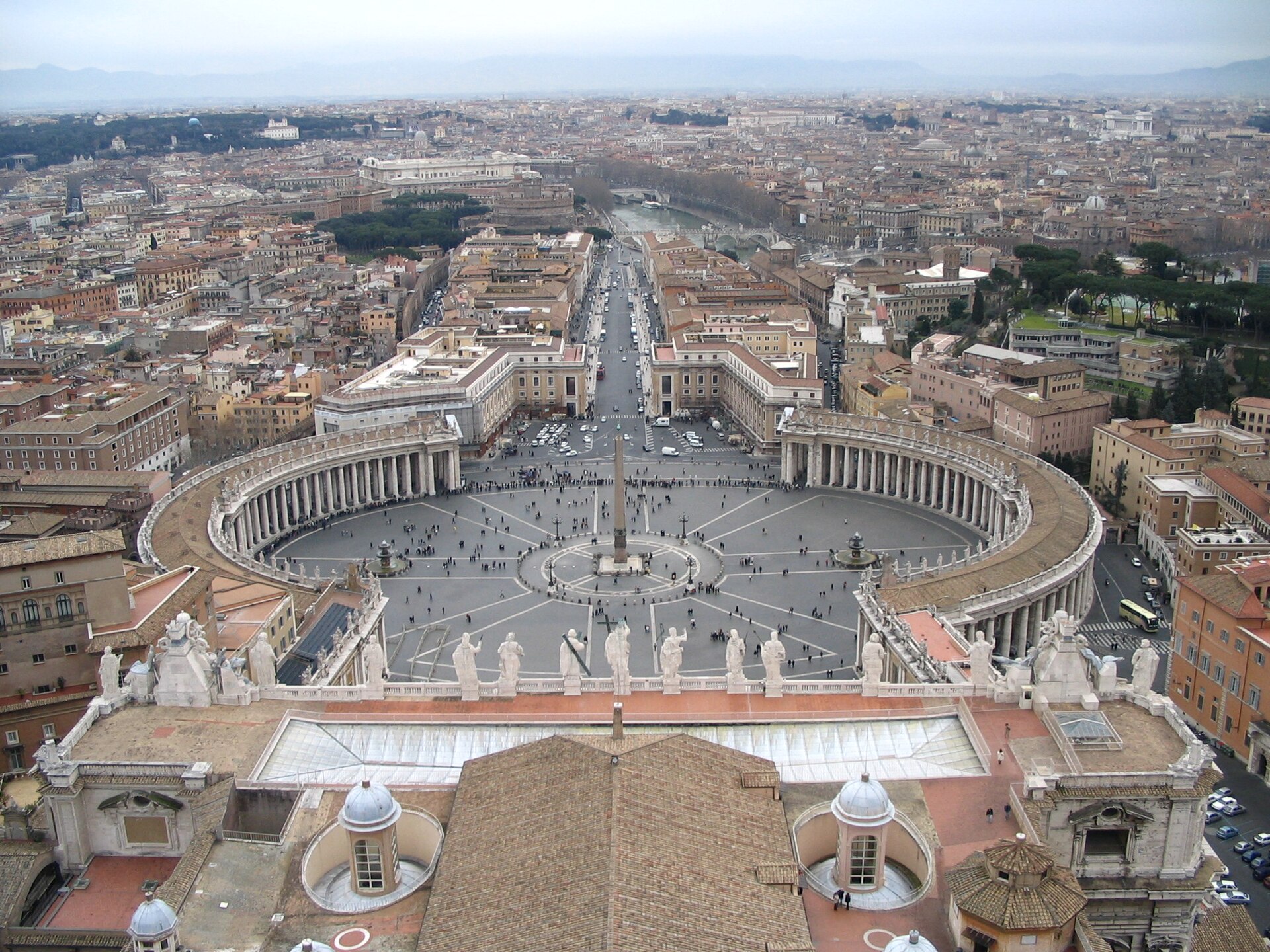
    St Peter's Basilica and St Peter's Square in Vatican City
    St Peter's Basilica: free to enter, and the dome climb is the best view in Rome (Photo: Diliff via Wikimedia Commons, CC BY-SA 3.0)

    Neighbourhoods worth a half-day

    Trastevere

    Across the river from the Ghetto, Trastevere is the neighbourhood people picture when they imagine Rome: cobbled lanes, washing lines, ivy on ochre walls, and the piazza in front of Santa Maria in Trastevere, whose golden mosaics are among the finest in the city. It is quiet in the morning and very lively at night, when the restaurants and bars spill into the streets. Climb the Janiculum hill behind it for the panorama and the noon cannon, and cross the Ponte Sisto footbridge back to the centre.

    Monti

    Tucked between the Forum and Via Nazionale, Monti is the oldest residential quarter in Rome and now its most fashionable small neighbourhood, with wine bars, vintage shops and trattorias around Piazza della Madonna dei Monti. It is two minutes from the Colosseum and feels a world away, and the churches of San Pietro in Vincoli, with Michelangelo’s Moses, and Santa Prassede, with its Byzantine mosaics, are both here.

    Testaccio

    South of the Aventine, working-class Testaccio is the birthplace of Roman cooking: the covered market, the trattorias that built their reputations on the quinto quarto, or fifth quarter, of the animal, the hill of broken amphorae called Monte Testaccio, the Pyramid of Cestius and, beside it, the Non-Catholic Cemetery where Keats and Shelley are buried. It is the best neighbourhood in the city for eating.

    The Aventine

    The hill above Testaccio is residential and calm, and it holds three small pleasures within a hundred metres of each other: the Orange Garden with its view across the river to St Peter’s, the early Christian basilica of Santa Sabina with its carved wooden doors, and the keyhole in the gate of the Knights of Malta, through which the dome is perfectly framed at the end of an avenue of hedges.

    Prati

    The orderly nineteenth-century grid north of the Vatican is where Romans shop on Via Cola di Rienzo, eat at the Mercato Trionfale, one of the city’s largest food markets, and stay away from the crowds. It is the natural base for a Vatican-heavy visit.

    Museums, galleries and culture

    Rome’s museums are as good as any in Europe and, outside the Vatican, far less crowded. The Borghese Gallery, in the park of Villa Borghese, holds Bernini’s Apollo and Daphne and his David, six Caravaggios and a Titian in a villa built to show them off; entry is by timed two-hour slot and must be reserved in advance, and it is the one museum in the city that visitors most regret missing. The Capitoline Museums on the Campidoglio, in the piazza Michelangelo designed, are the oldest public museums in the world, with the bronze she-wolf, the colossal head of Constantine and a window over the Forum. Palazzo Massimo, the main site of the National Roman Museum beside Termini, has the frescoed garden room from the villa of Livia. For the modern city, MAXXI, Zaha Hadid’s museum of twenty-first-century art in Flaminio, and the Auditorium Parco della Musica next to it, Renzo Piano’s three-hall concert complex, are the reasons to leave the centre. For what is on stage during your dates, our Rome events page lists concerts, shows and matches.

    Sports

    Football is the city’s other religion. AS Roma and Lazio share the Stadio Olimpico in the Foro Italico, north of the centre beside the Tiber, and the derby between them, played twice a season, is one of the most intense fixtures in European football. Tickets for Serie A matches are named and sold through the clubs’ own channels, with the buyer’s passport details required, so buy ahead rather than at the turnstile and carry the same ID to the match. The same stadium hosts Italy’s home games in the Six Nations rugby championship in February and March, when the city fills with visiting fans. In May, the Internazionali d’Italia brings the world’s best tennis players to the clay courts of the Foro Italico, and the ring of marble athletes around the Stadio dei Marmi next door is worth a look even without a ticket. Check what is on sale in Rome for your dates before you book flights.

    What to eat, and where

    Roman cooking is simple, specific and fiercely local. The four pastas are cacio e pepe, carbonara, amatriciana and gricia, all built on pecorino, black pepper and, in three of the four, cured pork jowl; order at least two over the trip and you will understand why Romans argue about them. Carciofi alla giudia, artichokes fried until the leaves crisp like petals, are the dish of the Ghetto and are in season from late winter to spring. Supplì, fried rice croquettes with a heart of mozzarella, are the city’s street snack, and pizza al taglio, sold by the slice and weighed, is the lunch; Roman round pizza, thin and crisp, is a dinner dish and most pizzerias only fire their ovens in the evening. Testaccio is the place for offal and oxtail, Trastevere and Monti for a classic trattoria dinner, the Ghetto for Roman-Jewish cooking. Coffee is drunk standing at the bar, quickly, and costs a fraction of the table price; a maritozzo, a sweet bun split and filled with whipped cream, is the proper breakfast pastry. For gelato, trust the shops with covered metal tubs over the fluorescent mountains. Dinner starts late, rarely before half past seven, and a Roman evening is properly begun with an aperitivo in a piazza.

    Rome through the seasons

    Rome is a different city in each season, and what you do depends on when you come. Spring (March to May) is the classic season: wisteria on the walls, azaleas on the Spanish Steps in late April, the Forum green, Holy Week and Easter drawing pilgrims to the Vatican, and the city’s birthday on 21 April. It is also the most crowded, and the most expensive for hotels. Summer (June to August) is hot, often above 35 °C in July and August, but the city adapts: open-air cinema and concerts fill the parks, the opera moves to the Baths of Caracalla, and Romans leave town around Ferragosto on 15 August, when many family restaurants close. Sightsee early, siesta through the afternoon, and eat late. Autumn (September to November) is the Romans’ favourite: warm, golden light, the ottobrata, the run of fine October days the city is known for, the Rome Film Fest, and, by November, rain and the year’s lowest hotel rates. Winter (December to February) is mild by northern standards, damp, and quiet outside the holidays: nativity scenes in every church, the Christmas market in Piazza Navona, the Pope’s Christmas blessing, the Befana on 6 January, then six weeks of the emptiest museums of the year. Our month-by-month guide has the fare patterns that go with each season.

    Parks, views and the Appian Way

    Villa Borghese is the city’s central park, a landscaped estate above the Spanish Steps with rowing boats, bikes for hire, the Bioparco zoo and the Pincio terrace at its western edge, which gives the classic sunset view over Piazza del Popolo to the dome of St Peter’s. The Janiculum above Trastevere is the other great viewpoint, and the Vittoriano, the enormous white monument on Piazza Venezia, has a lift to a rooftop terrace that puts you in the middle of the skyline. South of the walls, the Appia Antica regional park preserves the first miles of the Roman road that ran to the heel of Italy: basalt paving, cypresses, the catacombs of San Callisto and San Sebastiano, and the tomb of Cecilia Metella. The road is closed to traffic on Sundays and holidays, when hiring a bike at the park’s visitor centre and riding out along the stones is one of the best half-days in Rome. The 118 bus runs out along it from the Circus Maximus.

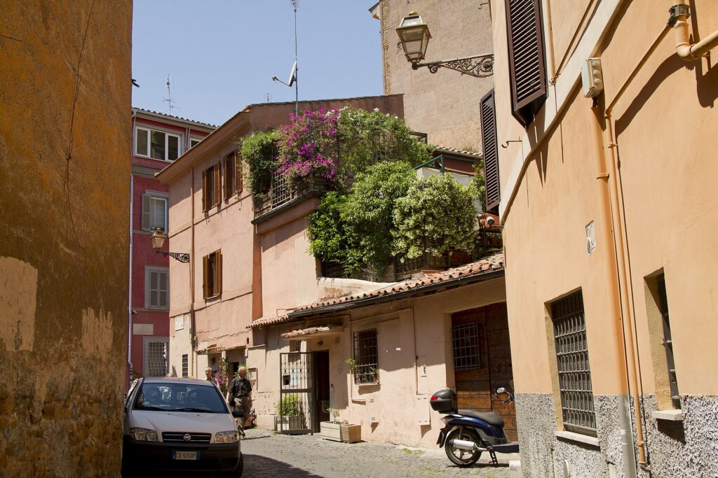
    A narrow street in the Trastevere neighbourhood of Rome
    Trastevere, quiet in the morning and the liveliest neighbourhood in Rome at night (Photo: trolvag via Wikimedia Commons, CC BY-SA 3.0)

    Rome with kids

    Rome is easier with children than its reputation suggests, provided you keep the museum hours short. The Colosseum is the obvious hit, and the underground and arena-floor tours are worth the extra for older kids; the Bocca della Verità, the stone face that supposedly bites liars’ hands, takes ten minutes. Villa Borghese, with its boats, bikes, zoo and puppet theatre, is the full afternoon; Explora, the children’s museum near Piazza del Popolo, suits the under-tens. The catacombs on the Appia Antica are agreeably spooky, Castel Sant’Angelo is a real castle with cannons, and the Vatican dome climb is a genuine adventure for anyone over about eight. Gelato solves most disputes. In summer, the beach at Ostia is half an hour away on the train from Piramide. Strollers cope badly with the cobbles; bring a carrier.

    Rome on a budget

    An extraordinary amount of Rome is free: every church, including St Peter’s; the Pantheon for children and residents and for a small fee for everyone else; the Forum from the pavement of Via dei Fori Imperiali; the fountains, the piazzas, the Spanish Steps, the Pincio, the Janiculum and the Orange Garden; and the nasoni, the cast-iron street fountains that pour cold drinking water on nearly every block, so nobody needs to buy a bottle. State museums, including the Colosseum park, the Borghese and Palazzo Massimo, are free on the first Sunday of each month, and the Vatican Museums on the last Sunday; both come with queues to match. The Roma Pass bundles transit with museum entries and can pay off on a short, busy stay. Drink coffee at the bar, lunch on pizza al taglio, and order the house wine. The hotel tourist tax, charged per person per night, is unavoidable. Compare rates by neighbourhood on our Rome hotel search, and remember that Prati, Testaccio and the streets around Termini are consistently cheaper than the Centro Storico for the same standard of room.

    Day trips from Rome

    Rome’s rail hub makes it the easiest base in Italy for day trips, and almost none of them need a car. Ostia Antica, the excavated port city at the mouth of the Tiber, is a Pompeii without the crowds, half an hour from Piramide on the Metromare line. Tivoli, an hour east, has two UNESCO sites: the fountains and terraces of Villa d’Este and the sprawling ruins of Hadrian’s Villa. The Castelli Romani, the hill towns south of the city, are the Romans’ own escape, with Frascati’s white wine and porchetta stalls half an hour away by regional train. Orvieto, on its volcanic plug in Umbria, has the finest Gothic cathedral façade in Italy and is just over an hour by train. High-speed trains run by Trenitalia and Italo put Florence about an hour and a half away and Naples just over an hour, and from Naples the local train continues to Pompeii; both are long but entirely feasible days. A car earns its keep only for the countryside of Tuscia north of Rome and the cliff village of Civita di Bagnoregio; if that is the plan, see our Rome car rental page and pick the car up at the airport or Termini on the day you leave the city. Turismo Roma, the city’s official tourism site, covers the wider region and current events.

    Two sample itineraries

    Three days, on foot

    Day one: the Colosseum at opening, the Forum and the Palatine, lunch in Monti, the Capitoline Museums and the view from the Vittoriano, dinner in Trastevere. Day two: the Vatican Museums on the first slot, St Peter’s and the dome, lunch in Prati, Castel Sant’Angelo, an evening walk from Piazza Navona to the Pantheon and the Trevi Fountain after dark. Day three: the Borghese Gallery on a reserved slot, a wander through Villa Borghese to the Pincio, the Spanish Steps and the Caravaggios in Santa Maria del Popolo, an afternoon in Testaccio or the Ghetto, and a final dinner of cacio e pepe.

    Five days, with the region

    Add a day for the Appia Antica by bike and the Baths of Caracalla, and a day trip by train to Tivoli, Ostia Antica or Florence, returning to Rome for dinner. Nobody needs a car for any of it.

    Practical details

    • Transit: one ticket covers metro, buses and trams for 100 minutes, with day and multi-day passes available; tap a contactless card at the metro gates or on board. ATAC, the city transit operator, has maps; our transit-versus-car guide goes into detail.
    • From Fiumicino: the Leonardo Express to Termini, the slower FL1 regional train to Trastevere and Ostiense, a fixed-fare white taxi, or an airport bus. Aeroporti di Roma covers both airports.
    • Weather: comfortable shoes for the cobbles, a hat and water in summer, an umbrella from October to March. The Servizio Meteorologico forecast is the official one.
    • Time zone: Central European Time, six hours ahead of Toronto and New York.
    • Entry requirements: Canadian, American, British and most other visa-exempt travellers can spend up to 90 days in any 180 in the Schengen area without a visa, on a passport valid for at least three months beyond the planned departure. The EU’s Entry/Exit System now records non-EU travellers’ fingerprints and photo at the border, and the ETIAS travel authorisation is due to follow; check the official EU travel page for what applies to you before you travel.
    • Safety: violent crime is rare; pickpocketing on the 64 bus, on Metro line A and around Termini is not. Keep bags closed and in front of you in crowds.
    • Dress: shoulders and knees covered inside St Peter’s and the major basilicas, for everyone.

    Frequently asked questions

    How many days do you need in Rome?

    Three full days covers the ancient centre, the Vatican, the Borghese and two neighbourhoods without rushing; five lets you add the Appia Antica, Ostia Antica or Tivoli and a slow afternoon or two.

    What is the number one thing to do in Rome?

    The Colosseum and the Forum on a first morning, then the Pantheon. If you can only book one thing, book the Borghese Gallery.

    Is Rome walkable?

    Entirely, within the historic centre. The Vatican, the Colosseum and Trastevere are all within a 40-minute walk of the Pantheon, and the cobbles reward good shoes.

    Do I need a car in Rome?

    No, and inside the walls it is actively a problem: the historic centre is a camera-enforced limited-traffic zone and parking is scarce. Trains handle nearly every day trip.

    Is Rome expensive?

    Hotels in the centre in spring and autumn are, and the tourist tax adds to every night. Food, coffee, transit and the free churches and piazzas keep the rest of the trip reasonable.

    What is Rome known for?

    The Colosseum, the Vatican, the Pantheon, the fountains and piazzas of the Baroque centre, the four Roman pastas, and two and a half thousand years of history stacked in one walkable city.

    Ready to go? Compare flights to Rome, find a place to stay with our Rome hotel search, and if the countryside is on the list, price a rental car for those days only.

  • Best Time to Fly to Rome: Seasons, Weather & Prices

    Best Time to Fly to Rome: Seasons, Weather & Prices

    Rome has no true off-season, only quieter months and busier ones, and its airfares follow a calendar that is part climate, part Church and part European holiday habit. It is one of the most visited cities in the world, the seat of the Catholic Church, and the capital of a country that takes the whole of August off, which means that seats and hotel rooms are pulled in different directions at different times of year: pilgrims at Easter, tour groups in spring and autumn, North American families in July, Italians leaving the city in August, and Christmas visitors in December. Add a Mediterranean climate that is mild and wet in winter and genuinely hot in high summer, and the “best time” question has several right answers depending on what you want from the trip. This guide walks through the weather month by month, the fare seasons, the holidays and events that move prices, and how to handle the two airports.

    The short answer

    For the best balance of weather, prices and crowds, aim for late April to early June, avoiding Easter week itself, and late September to the end of October, when the heat has broken, the light turns golden and the city is at its most comfortable for walking. The cheapest fares come in January and February, after the Epiphany holiday on 6 January, and in November, when rain and short days keep demand low and hotel rates reach their annual floor. The most expensive stretches are Easter and Holy Week, when pilgrims fill every room near the Vatican, June to August for transatlantic fares, when North American summer travel peaks, and the Christmas and New Year fortnight. August is its own case: flights stay expensive, but the heat and the Roman exodus can soften hotel rates in the city. Whatever you choose, run a flexible-date search on our Rome flights page; a shift of a few days around Easter or a long weekend can change the fare band entirely.

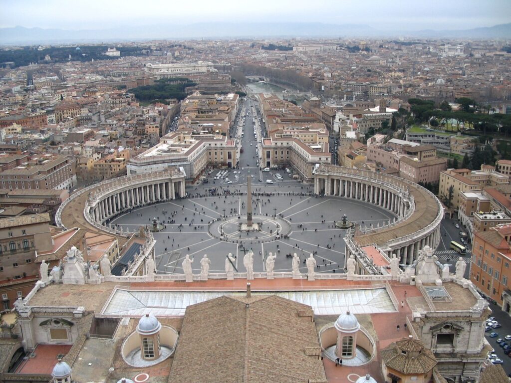
    St Peter's Square in Vatican City seen from the dome of St Peter's Basilica
    St Peter's Square, which fills with pilgrims at Easter, the busiest week of the Roman year (Photo: valyag via Wikimedia Commons, CC BY-SA 3.0)

    Rome’s weather, season by season

    Rome sits about 25 kilometres inland from the Tyrrhenian Sea, in a basin of low hills, and it has a classic Mediterranean climate: hot, dry summers, mild winters with most of the year’s rain, and long, warm shoulders in spring and autumn. Snow is rare enough to make the national news when it happens. The figures below are approximate seasonal patterns based on the long-term climate normals of Italy’s national weather service, the Servizio Meteorologico dell’Aeronautica Militare; check its current forecast before you pack, because a summer heatwave or an autumn storm can move the numbers a long way from the average.

    MonthTypical daytime highTypical overnight lowWhat it feels likeFare pressure
    Januaryaround 12 °Caround 3 °CCool, often sunny, damp in the evenings; occasional frostLow after 6 January
    Februaryaround 13 °Caround 4 °CSimilar, with the first mild days by the end of the monthLow; small rise for Carnival and half-term weeks
    Marcharound 16 °Caround 6 °CChangeable; bright, warm afternoons and showersModerate; high if Easter falls in March
    Aprilaround 19 °Caround 8 °CSpring proper; wisteria and azaleas, some rainy daysHigh, with an Easter spike
    Mayaround 24 °Caround 12 °CWarm and mostly dry; many people’s ideal monthHigh
    Junearound 28 °Caround 16 °CSummer arrives; hot afternoons, long eveningsHigh to peak
    Julyaround 31 °Caround 18 °CHot and dry; heatwaves push well above 35 °CPeak for flights
    Augustaround 31 °Caround 19 °CThe hottest month; Romans leave around FerragostoPeak for flights; city hotels can soften
    Septemberaround 27 °Caround 15 °CStill summer for the first half; the first storms laterHigh
    Octoberaround 22 °Caround 11 °CWarm, golden days between heavy downpoursHigh to moderate
    Novemberaround 16 °Caround 7 °CThe wettest month; mild between the rainLow
    Decemberaround 13 °Caround 4 °CCool, damp and festiveLow until mid-month, then peak

    Three things the table cannot show. First, the summer heat is harder than the numbers suggest: stone streets, little shade in the Forum and the Palatine, and warm nights mean that a 33 °C day in Rome feels more punishing than the same figure at home, and the city now has heatwaves most summers that push the afternoon well past 35 °C. Second, the rain comes in bursts: autumn and winter rain in Rome tends to arrive as heavy downpours that clear within hours rather than steady drizzle, so a wet forecast rarely writes off a whole day. Third, the light: the low, warm light of October and the long evenings of May and June are a large part of why people fall for the city, and they do not show up in any average.

    How Rome’s fare seasons work

    Three calendars drive seats into Rome: the Church, which fills the city at Easter, for major papal ceremonies and for jubilee years; the tourist seasons of spring and autumn, when tour groups, cruise passengers and independent travellers from every continent arrive for the ideal walking weather; and the school and work holidays of North America and Europe, which push transatlantic fares to their annual high in June, July and August. Hotel rates and airfares do not always move together here. Hotels are most expensive in April, May, June, September and October; flights from North America are usually most expensive from mid-June to mid-August; and August can combine high fares with softer hotel rates as the heat keeps some visitors away and Romans head for the coast.

    Peak season

    Easter and Holy Week, late April to the end of June, September and most of October for hotels, plus mid-June to mid-August for transatlantic fares, and roughly 20 December to 6 January. Easter moves each year between late March and late April, and the week before it, with the papal ceremonies in St Peter’s Square, is the single busiest week of the Roman year for hotels near the Vatican and across the centre. Spring weekends when an Italian public holiday creates a long weekend, such as 25 April or 1 May, are also tight. If you must travel in peak, book early, book the Vatican Museums and the Borghese Gallery the moment your dates are fixed, and consider staying in Prati, Testaccio or near Termini rather than the Centro Storico.

    Shoulder season

    March outside Easter, early to mid-November, and the second half of October in most years. March gives you spring flowers and mild afternoons with the risk of showers; late October and early November give you warm days, fewer groups and the new season’s produce in the markets, at the cost of some heavy rain. For many travellers these are the smartest windows of all, since the Vatican queues are shorter and the weather is still good for walking all day.

    Low season

    From 7 January to the end of February, and late November to mid-December. Fares and hotel rates are at their lowest, the museums are at their emptiest, and the weather is cool rather than cold, with plenty of bright days between the rain. The exceptions are the Six Nations rugby weekends in February and March, when Italy’s home matches at the Stadio Olimpico fill hotels with visiting fans, and the European school half-term weeks in February. Pack a warm layer and an umbrella and you will have the Sistine Chapel with a fraction of the summer crowd.

    As elsewhere, mid-week departures and early or late flights usually price below Friday and Sunday afternoons on the same route, and a search across a whole month reveals cheaper pairs of dates close to your first choice. Our guide to the best times to book explains how to read those patterns.

    Rome month by month

    January

    The first week is still holiday season, ending with the Epiphany on 6 January, when the Befana market fills Piazza Navona and families return from the mountains. After that, January is one of the two cheapest months of the year to fly and stay. Days are cool and often clear, nights are chilly, and the queues at the Colosseum and the Vatican Museums are as short as they ever get. The winter sales begin in early January and run for several weeks, which makes it a good month for shopping as well as sightseeing.

    February

    Similar weather with more daylight, and low fares apart from the Six Nations weekends and Carnival, which in Rome is a modest affair of children in costume and confetti in the piazzas rather than the spectacle of Venice. Late-winter produce, including the first Roman artichokes and puntarelle, the bitter chicory salad dressed with anchovy, is in the markets. This is the best value month for a museum-heavy trip.

    March

    Changeable: bright, warm afternoons, cool mornings and a few days of rain. The Rome Marathon closes central streets on a Sunday in March, the Six Nations continues, and fares climb through the month, sharply so if Easter falls early. The artichoke season is at its height, and outdoor tables reappear in the piazzas on sunny days.

    April

    Spring proper, and usually the month of Easter, which brings the Holy Week ceremonies at St Peter’s, the Good Friday Way of the Cross at the Colosseum, and the Easter Sunday blessing in the piazza. The Natale di Roma, the city’s birthday on 21 April, is marked with parades of costumed legionaries near the Circus Maximus, and the Spanish Steps are traditionally decked with azaleas in the second half of the month. Liberation Day on 25 April is a national holiday, and in some years it combines with 1 May to create a long break for Italians. Fares and hotels are high all month.

    May

    For many visitors the ideal month: warm, mostly dry and long. Labour Day on 1 May brings a huge free concert in the piazza in front of St John Lateran, and the Internazionali d’Italia, one of the most important clay-court tennis tournaments in the world, fills the Foro Italico for two weeks. The rose garden on the Aventine opens to the public for the season. Demand is high throughout, especially at weekends.

    June

    Summer arrives, with long evenings and hot afternoons. Republic Day on 2 June brings a military parade along Via dei Fori Imperiali, and the feast of Saints Peter and Paul on 29 June, the patrons of Rome, is a city holiday with a papal Mass. The summer opera season at the Baths of Caracalla begins, open-air cinema and concerts start in the parks, and transatlantic fares move into peak once North American schools finish.

    July

    Hot and dry, with heatwaves most years, and peak season for fares from North America. The city adapts: sightseeing starts at opening time, the afternoon is for a long lunch and a rest, and life resumes in the evening, when the stalls and bars along the Tiber embankments, the Caracalla opera and the outdoor film screenings are in full swing. Book early-morning slots at the Colosseum and the Vatican, carry water and refill it at the nasoni street fountains, and plan indoor visits for the hottest hours.

    August

    The hottest month, and the month Rome empties of Romans. Around Ferragosto, the 15 August holiday, many family-run restaurants, bars and shops close for one to three weeks, and the city takes on a quiet, slightly surreal air, with tourists outnumbering residents in the centre. Flights remain expensive, but hotel rates in the city can ease compared with June and September. Traffic, by contrast, is light, and the museums keep their usual hours. If you come, stay somewhere with good air conditioning and plan a day at the beach at Ostia or a trip to the hills.

    September

    The first half is still summer, with warm evenings and the return of the Romans after the holidays; the second half brings the first autumn storms and the start of the cultural season, with the Romaeuropa festival of music, dance and theatre beginning. Tour groups return in force, and hotel rates climb back to spring levels. Transatlantic fares begin to ease after the first week.

    October

    The Romans’ favourite month, known for the ottobrata, the run of fine, warm days that the city celebrates by eating outside. Heavy rain arrives in bursts, the Rome Film Fest brings premieres and red carpets to the Auditorium Parco della Musica, and the new olive oil and chestnuts appear in the markets. Hotels are still busy, especially at weekends, but fares are lower than in summer.

    November

    The wettest month and, outside the first few days, one of the cheapest. All Saints’ Day on 1 November is a national holiday. The museums are quiet, the rain comes and goes, and mild days between the storms are perfect for walking. Hotel rates reach their annual low in the second half of the month.

    December

    Two months in one. The first half is quiet and good value, with nativity scenes appearing in the churches and the Christmas market opening in Piazza Navona; the Immaculate Conception on 8 December is a public holiday, when the Pope traditionally visits the column in Piazza di Spagna. From about 20 December, fares and hotel rates jump for Christmas, with midnight Mass at St Peter’s and the Pope’s Christmas Day blessing, and they stay high through New Year’s Eve and the Epiphany.

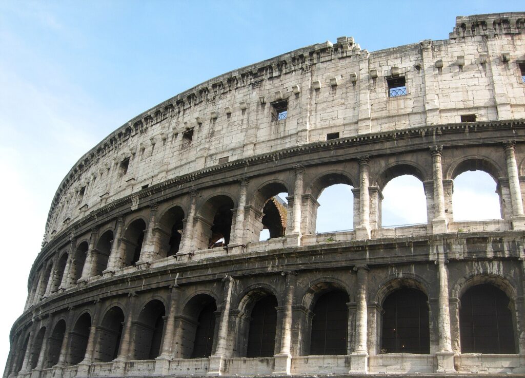
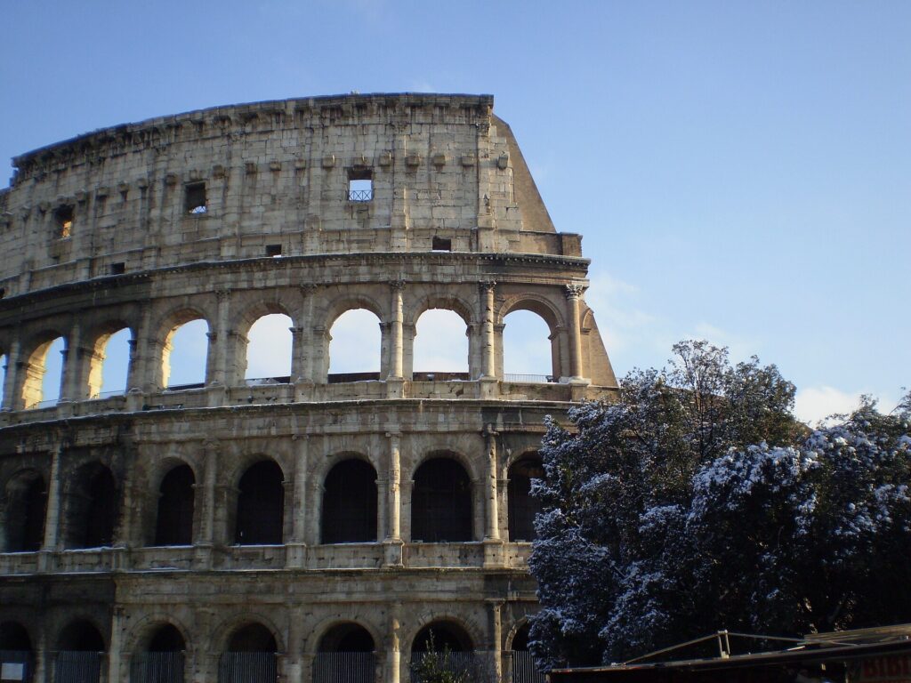
    The Colosseum in Rome with a light covering of snow
    Snow on the Colosseum in February 2012: rare enough in Rome to make the national news (Photo: Barbaking via Wikimedia Commons, CC BY-SA 3.0)

    Events that move Rome flight and hotel prices

    Cross-check these against your dates before you book. Exact dates shift each year; Turismo Roma, the city’s official tourism site, keeps the current calendar, and the Holy See’s site publishes the papal liturgical calendar.

    • Easter and Holy Week (late March to late April): the biggest hotel spike of the year, especially near the Vatican.
    • Six Nations rugby (February and March): Italy’s home weekends at the Stadio Olimpico.
    • Rome Marathon (a Sunday in March).
    • Natale di Roma, Liberation Day and Labour Day (21 April, 25 April, 1 May): a run of holidays that can create long weekends for Italians.
    • Internazionali d’Italia (two weeks in May) at the Foro Italico.
    • Republic Day and Saints Peter and Paul (2 June and 29 June).
    • Ferragosto (15 August): quieter city, busier coast and roads.
    • Rome Film Fest (October) and the autumn trade fairs and congresses, which can fill hotels mid-week.
    • Christmas to Epiphany (roughly 20 December to 6 January).
    • Serie A football, especially the Roma-Lazio derby, and stadium concerts. Our Rome events page shows what is on sale for your dates.

    Getting in from the airport

    Rome has two airports, both run by Aeroporti di Roma. Leonardo da Vinci, known to everyone as Fiumicino (FCO), about 30 kilometres southwest of the centre near the coast, is Italy’s largest airport and the hub of ITA Airways, with nonstop flights from several North American gateways, including New York, Toronto and Montreal, and from nearly every European capital. Ciampino (CIA), about 15 kilometres southeast, is smaller and handles mostly low-cost European airlines. From Fiumicino, the Leonardo Express train runs nonstop to Termini station in around half an hour, and the slower, cheaper FL1 regional line stops at Trastevere, Ostiense and Tiburtina, which suits many hotels better; tickets for both are sold by Trenitalia at the station and online. Licensed white taxis charge a fixed fare from Fiumicino to anywhere inside the Aurelian Walls, and several coach companies run cheaper, slower buses to Termini. From Ciampino, buses run to Termini and to the nearest metro and rail stations. Rental desks are at both airports, though for a city stay you will not want a car. Our Rome car-versus-transit guide covers that decision, and our Fiumicino airport guide covers the layout.

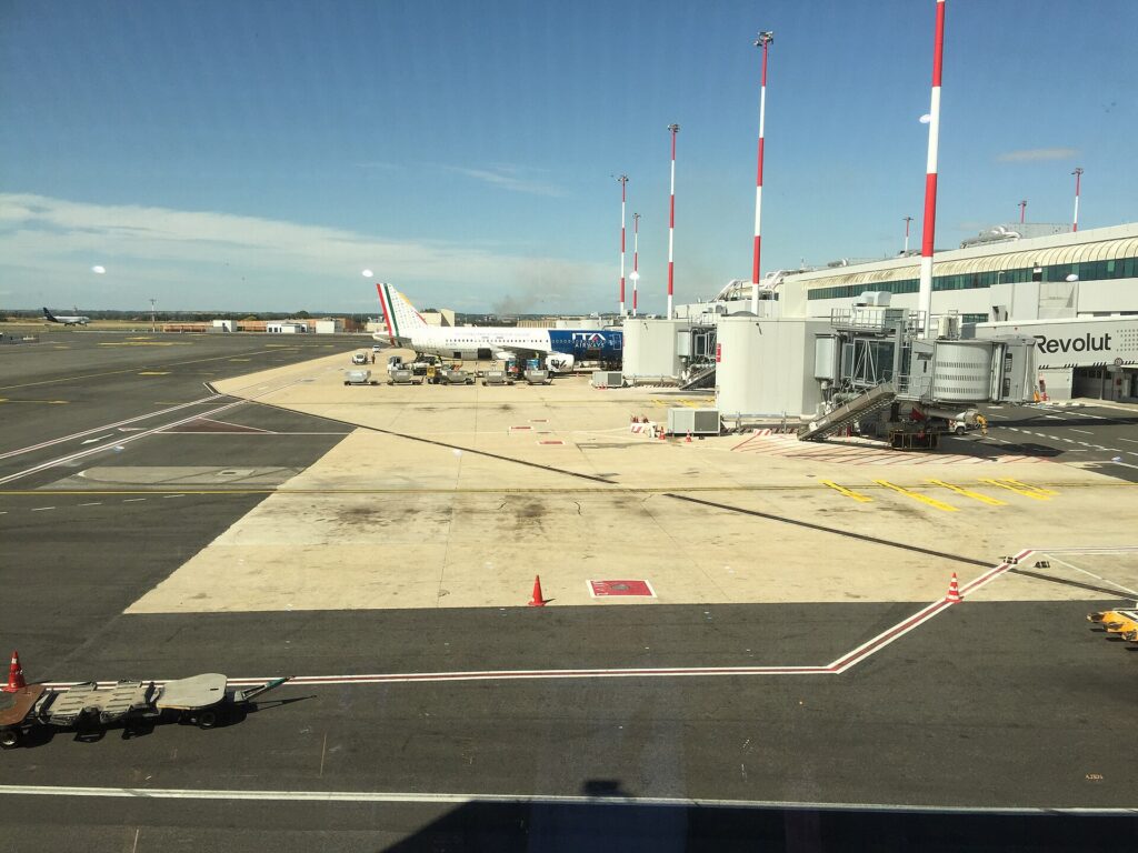
    Aircraft at the gates of Rome Fiumicino airport seen from the terminal
    Rome Fiumicino (FCO), Italy's largest airport, half an hour from Termini by train (Photo: Air fans via Wikimedia Commons, CC0)

    Timing tricks that work for Rome

    • Search the whole month. Easter, the spring holidays and Christmas create sharp edges in the fare calendar. A calendar search on TicketScanner shows them instantly, and the week after Easter is often far cheaper than the week before it.
    • Book the hotel first around Easter. A cheap fare into Holy Week is not cheap once the room is added. Run a Rome hotel search for the same dates before you commit to either.
    • Fly mid-week. Tuesday to Thursday departures are usually the value on transatlantic routes, and Saturday nights in Rome rarely cost more than weekday ones outside the peaks.
    • Consider an open jaw. Many travellers combine Rome with another European city. Flying into Rome and home from Paris or London, or the reverse, can price close to a return and saves a backtrack; our guide to choosing between England, Italy and France helps with the itinerary.
    • Check Ciampino for European hops. If you are arriving from elsewhere in Europe on a low-cost airline, Ciampino may be cheaper, though the transfer into the city is slower.
    • Watch for strikes. Italian transport strikes are announced in advance, and air strikes protect certain morning and evening time bands, but a strike day can still disrupt connections and trains. Allow a buffer, and read our guide to how early to arrive for international departures.
    • Flying out of Rome instead? The same seasonality applies in reverse; see cheap flights from Rome.
    The Spanish Steps in Rome at dusk seen from the Barcaccia fountain
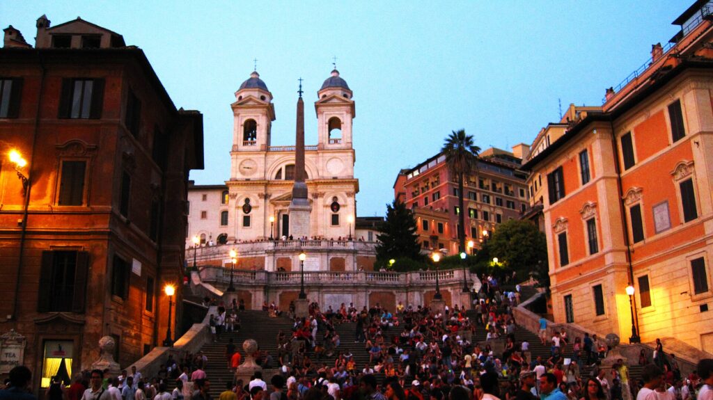
    The Spanish Steps at dusk: in summer, Rome comes alive after the heat of the afternoon (Photo: Eebyrne via Wikimedia Commons, CC BY 3.0)

    What to pack, by season

    Winter (December to February): a warm coat or a padded jacket, layers for heated interiors, a compact umbrella and waterproof shoes for the cobbles, which turn slippery in the rain. Spring (March to May): layers, a light jacket for the evenings and an umbrella for March and April showers. Summer (June to August): light, breathable clothing, a hat, sunscreen and a refillable water bottle, plus a scarf or light layer to cover shoulders in churches, since the dress code at St Peter’s and the major basilicas applies whatever the temperature. Autumn (September to November): summer clothes for September, layers and a rain jacket for October and November. In every season, the single most important item is a pair of comfortable, broken-in walking shoes; a typical day in Rome is fifteen to twenty thousand steps on stone.

    The best time to fly to Rome for…

    Easter and the Vatican

    Holy Week, booked as early as possible, with the hotel first and papal ceremony tickets requested well ahead. For the Vatican without the crowds, January, February and November.

    Walking weather

    Late April to early June and the last week of September through October: warm enough to eat outside, cool enough to walk all day.

    The lowest fares

    Mid-January to the end of February and the second half of November, outside the rugby weekends.

    Food

    February to April for Roman artichokes and spring lamb; October and November for new olive oil, chestnuts and mushrooms.

    Families

    Late June, before the worst of the heat, or the October half-term weeks, when the weather is still warm and the queues are shorter than in summer.

    International visitors

    Canadian, American and British citizens can spend up to 90 days in any 180 in the Schengen area without a visa, on a passport valid for at least three months beyond the planned departure. The EU’s Entry/Exit System now records non-EU travellers’ fingerprints and photo at the border, and the ETIAS travel authorisation is due to follow; the official EU travel page explains what applies to you.

    Frequently asked questions

    What is the cheapest month to fly to Rome?

    January after the Epiphany and February are consistently the lowest, followed by November and the first half of December.

    What is the best month to visit Rome for weather?

    May and October, with late April, early June and late September close behind. July and August are hot; November is the wettest month.

    Is August a bad time to visit Rome?

    It is hot, and many family restaurants close around Ferragosto, but the city is quieter, traffic is light and hotel rates can be lower than in June. Plan early mornings and late evenings and it works.

    How expensive is Rome at Easter?

    Very: Holy Week is the most expensive week of the year for hotels near the Vatican and in the centre, and flights rise too. The week after Easter is noticeably cheaper.

    Should I fly into Fiumicino or Ciampino?

    Fiumicino for flights from North America and most full-service airlines, with the train to Termini. Ciampino only if a low-cost European fare is much cheaper, since the transfer is by bus.

    How far ahead should I book flights to Rome?

    Earlier for Easter, June to August and Christmas, when fares tend only to rise; for January, February and November, fares are stable enough that finding the right dates matters more.

    Does it snow in Rome?

    Rarely. A light snowfall happens every few years and is a news event when it settles; most winter days are cool and bright, or cool and wet.

    Ready to pick your dates? Compare fares across the whole month on our Rome flights page, then find a room with our Rome hotel search. For what to do when you land, start with our first-timer’s guide to Rome.

  • Rome: Car Rental or Public Transit?

    Rome: Car Rental or Public Transit?

    Rome is the easiest decision in this series: for a stay in the city itself, do not rent a car. The historic centre is a camera-enforced limited-traffic zone that will fine a rental car automatically, parking is scarce and confusing, the traffic is a sport the locals have been practising since childhood, and the sights are closer together than most visitors expect, so walking is not only possible but the best way to see the place. What Rome does have is cheap if imperfect transit, licensed taxis with fixed airport fares, and one of Europe’s best rail hubs for day trips. The car question only becomes real when your plans leave the city: a road trip through Tuscany or Umbria, a few days in a farmhouse in the hills, or the small towns of the countryside north of Rome that the trains do not reach. This guide explains how the city is laid out, how transit and tickets work, what driving here is really like, how the limited-traffic zones catch visitors out, and gives you a straightforward way to decide.

    The short answer

    Skip the car for any stay in Rome itself: the Colosseum, the Vatican, the Pantheon, Trastevere, Monti and the Borghese are all walkable from each other, and the metro, buses, trams and taxis cover the rest. Take the train for the classic day trips, Florence, Naples, Pompeii, Orvieto, Tivoli, Ostia Antica and the Castelli Romani, all of which are well served by rail. Rent a car only for the days when you are leaving Rome for the countryside: a Tuscany or Umbria road trip, the hill towns and lakes of Tuscia to the north, the beaches and villages along the southern coast, or a rural stay where the nearest station is miles away. Even then, pick it up on the day you leave the city, not the day you arrive. Compare rental rates for those days on our Rome car rental page.

    How Rome is laid out

    The Rome that visitors come to see is small. The historic centre sits in a bend of the Tiber, mostly inside the Aurelian Walls that the emperors built in the third century, and a brisk walk across it from the Vatican in the west to Termini station in the east takes about an hour. The Centro Storico, with the Pantheon, Piazza Navona and the Trevi Fountain, fills the bend of the river; the ancient centre, with the Colosseum, the Forum and the Palatine, lies to its southeast; Monti sits between the Forum and Termini; and Trastevere, the Vatican and the orderly grid of Prati are across the river on the west bank. Testaccio and the Aventine are to the south. Beyond the walls, the city sprawls for kilometres to the Grande Raccordo Anulare, the motorway ring road known as the GRA, and the airports lie outside it, Fiumicino to the southwest near the coast and Ciampino to the southeast.

    Hotels cluster in the Centro Storico, around Termini for budget and trains, in Trastevere for the evenings, in Monti near the Forum, and in Prati for the Vatican and a calmer residential feel. Our Rome hotel search lets you compare them.

    Getting in from the airport

    Fiumicino (FCO), Rome’s main airport, is about 30 kilometres from the centre and has its own railway station a short walk from arrivals. The Leonardo Express runs nonstop to Termini in around half an hour, every 15 to 30 minutes through the day; the FL1 regional train is cheaper and slower and stops at Trastevere, Ostiense and Tiburtina, which can leave you closer to your hotel. Buy tickets from the machines or the Trenitalia app, and if you have a paper ticket for the FL1, validate it before boarding. Licensed white taxis charge a fixed fare from Fiumicino to any address inside the Aurelian Walls, displayed on the taxi door and at the rank; use only the official rank outside arrivals and ignore anyone offering a ride inside the terminal. Coach companies run cheaper buses to Termini. Ciampino (CIA), about 15 kilometres southeast, has no rail link of its own; buses run to Termini and to the nearest metro and train stations, and taxis charge a fixed fare into the centre. The rental companies have counters at both airports. Aeroporti di Roma has current ground-transport details, and our Fiumicino airport guide covers the layout.

    Rome’s transit, explained

    ATAC, the city transport company, runs the metro, buses and trams. Romans complain about it, and it is sometimes crowded, late or on strike, but for a visitor it is cheap and covers every sight you are likely to want. Its main limitation is that the metro skirts the historic centre rather than crossing it, because every attempt to dig a tunnel through Rome runs into archaeology.

    The metro

    Three lines. Line A runs from the northwest to the southeast and is the one visitors use most: Ottaviano for the Vatican, Flaminio for Piazza del Popolo, Spagna for the Spanish Steps, Barberini for the Trevi Fountain, Repubblica, Termini and San Giovanni. Line B crosses it at Termini and runs south past Cavour for Monti, Colosseo, Circo Massimo and Piramide for Testaccio and the Ostia trains, to EUR; a branch, B1, splits off to the northeast. Line C runs in from the eastern suburbs to San Giovanni, where it meets Line A, and is being extended through the centre toward the Colosseum and beyond; check ATAC’s map for which of the new stations have opened when you travel. Trains run from early morning until about 11.30 pm, later on Friday and Saturday nights.

    Buses and trams

    Buses fill the gaps the metro leaves, and several routes are essentially tourist lines. The 40 and the 64 run from Termini along Via Nazionale to Piazza Venezia, Largo Argentina and the Vatican; the 64 is famously crowded and famously worked by pickpockets. The H bus links Termini with Trastevere. The number 8 tram runs from near Piazza Venezia across the river through Trastevere and is the easiest way into that neighbourhood from the centre when it is running normally; trams 2, 3 and 19 serve Flaminio, the Aventine and the Villa Borghese area. Night buses, marked with an N, run on the main corridors after the metro closes. At rush hour, walking is often faster.

    Fares and tickets

    A standard ticket, the BIT, is valid for 100 minutes on buses and trams, with one metro journey included, and there are 24-hour, 48-hour and 72-hour passes and a weekly ticket. The simplest option for most visitors is to tap a contactless bank card or phone at the metro gates and on the readers aboard buses and trams, using the same card each time. Paper tickets are sold at tobacconists, newsstands and station machines and must be validated on first use, in the gate or in the machine on board; inspectors do check, and the on-the-spot fine is far more than a week of tickets. Check ATAC’s site for current fares before you go.

    Accessibility

    Accessibility is improving but uneven: newer stations have lifts, several older Line A stations do not, and most buses and trams are low-floor. The bigger obstacle is the city itself: cobbles, narrow pavements and steps make the historic centre hard going for wheelchairs and strollers, and taxis are often the practical answer.

    Beyond ATAC

    • Walking. The best way to see Rome, by a long way. The Pantheon is within a 40-minute walk of the Colosseum, the Vatican, Trastevere and the Spanish Steps, and the walks between them are where you find the city. Bring shoes that can handle fifteen kilometres of stone a day.
    • Taxis. Licensed Rome taxis are white, with a roof sign and a licence number on the door. Find them at ranks in the main piazzas and at the stations, or book through an app such as itTaxi or FreeNow; hailing one in the street rarely works. Uber operates mainly as a booking app for licensed taxis and private-hire cars rather than as a cheap alternative.
    • Bikes and e-scooters. Shared e-bikes and e-scooters are available across much of the city through the usual apps. They are handy along the Tiber cycle path and in Villa Borghese and the flatter neighbourhoods; on the cobbles, the hills and in the traffic around Piazza Venezia they take nerve. Italy has tightened its e-scooter rules, and helmets are now compulsory.
    • Regional trains. Trenitalia’s regional lines run from Termini, Tiburtina and Ostiense to Tivoli, Frascati and the Castelli Romani, Orvieto and the coast; the Metromare line runs from next to Piramide to Ostia Antica and the beach at Ostia.
    • High-speed trains. Trenitalia and Italo run fast trains from Termini to Florence in about an hour and a half and Naples in just over an hour, which makes both, and Pompeii beyond Naples, practical day trips. Book ahead for the best fares.
    A Line A metro train arriving at Flaminio station in Rome
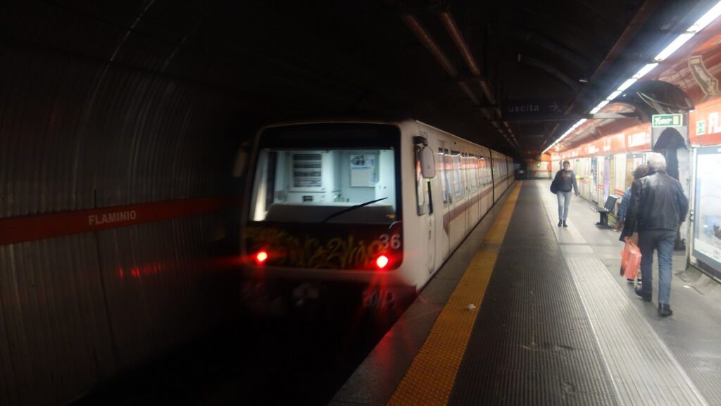
    Line A of the Rome Metro at Flaminio, the stop for Piazza del Popolo (Photo: Mint0ri via Wikimedia Commons, CC0)

    Driving in Rome: what it is really like

    Driving in Rome is not dangerous so much as demanding. Lanes are suggestions, scooters fill every gap on both sides of you, horns are a means of communication rather than an insult, and the large piazzas, Piazza Venezia above all, are roundabouts without markings where confidence counts for more than right of way. The locals are skilled and fast and expect you to be the same. The GRA and the roads into the centre jam every weekday morning and evening. None of that is impossible for a confident driver, but two further features make it a genuinely bad idea for visitors: the limited-traffic zones and the parking.

    A limited-traffic zone gate with camera and sign on Via Cavour in Rome
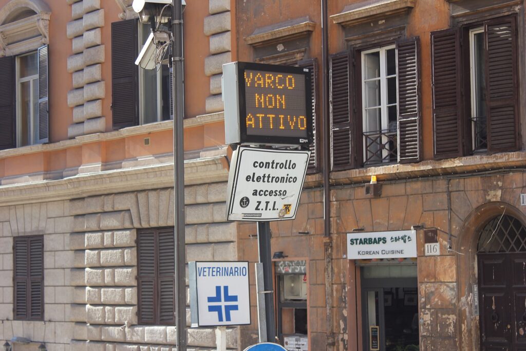
    A ZTL gate on Via Cavour: drive through when it reads varco attivo and the fine follows you home (Photo: CAPTAIN RAJU via Wikimedia Commons, CC BY-SA 4.0)

    The ZTL: the fine you will not see coming

    Most of the historic centre is a Zona a Traffico Limitato, or ZTL, where only residents and permit holders may drive during enforcement hours. The entry points, called varchi, have cameras and an electronic sign that reads “varco attivo” when the zone is being enforced. The main Centro Storico zone is active through the day on weekdays and for much of Saturday, and there are night zones in Trastevere, Testaccio, San Lorenzo and Monti on weekend nights. Drive through an active gate in a rental car and the camera records the plate; months later, the fine arrives through the rental company, which adds its own administration fee for passing on your details, and it is not unusual for a visitor to receive several fines for one confused afternoon. Some hotels inside the zone can register a guest’s plate for access to unload; ask before you arrive, and never assume a satellite navigation app will route you around the zone. Roma Servizi per la Mobilità, the city’s mobility agency, publishes the zones and their hours.

    Parking

    Street parking in Rome follows a colour code. Blue lines mean paid parking, at meters or through parking apps; white lines are free but almost always full; yellow lines are reserved for residents, disabled permit holders or loading, and parking in them risks a fine or a tow. A car left in the wrong place can be towed with impressive speed. There are a few large garages, including under Villa Borghese, and hotel parking in a nearby garage can cost nearly as much per night as the rental itself. In the countryside parking is easier, though usually outside the walls, since most medieval centres have their own ZTL too.

    Rules and conditions worth knowing

    • International Driving Permit. Drivers with a non-EU licence, including Canadian, American and British licence holders, should carry an International Driving Permit alongside their home licence; it is required by Italian law, and you get it at home before you leave.
    • Tolls. The motorways, or autostrade, are tolled. Take a ticket on entry and pay on exit by card or cash, and avoid the yellow Telepass lanes, which are for electronic transponders only. Autostrade per l’Italia publishes routes, tolls and traffic.
    • Speed cameras. Fixed cameras are common, and many motorways use Tutor average-speed cameras over long sections. The motorway limit is 130 km/h, lower in rain.
    • Headlights must be on at all times on motorways and main roads outside built-up areas.
    • No right turn on red. Unlike in North America, a red light means stop, whatever the direction.
    • Drink-driving limits are lower than in most of North America, and zero for drivers with less than three years’ experience.
    • Winter equipment. From 15 November to 15 April, many roads, especially in the Apennines, require winter tyres or snow chains on board where signed; ask the rental company whether the car is equipped if you are heading into the mountains.
    • Fuel. Petrol is benzina and diesel is gasolio; many stations have a cheaper self-service side and a pricier attended side.
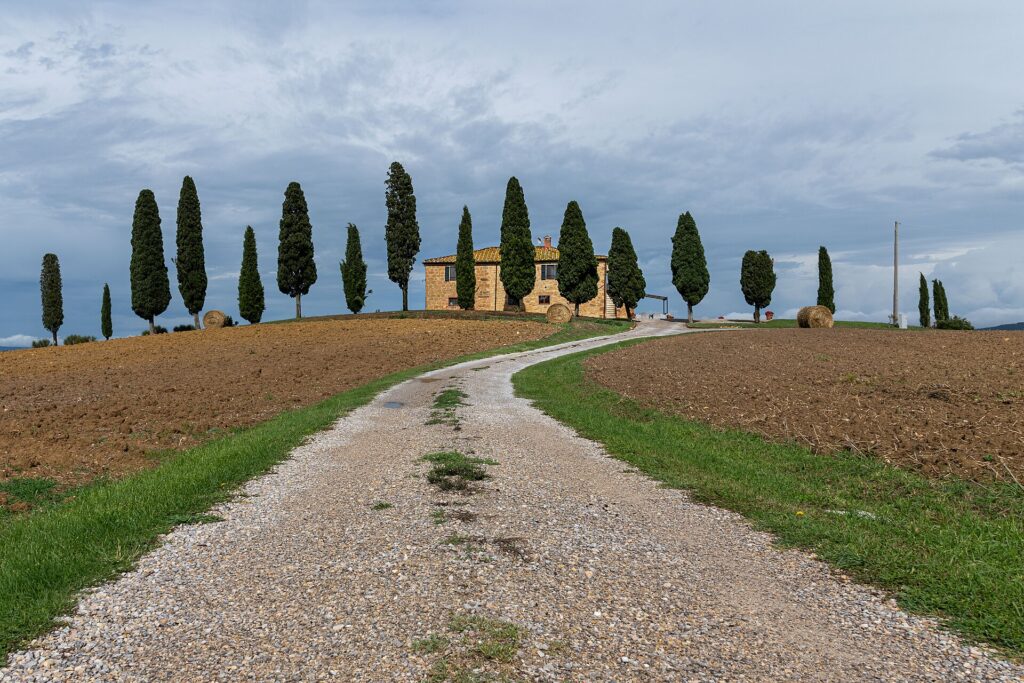
    A country road leading to cypress trees and a farmhouse in the Val d'Orcia, Tuscany
    The Val d'Orcia in southern Tuscany, a little over two hours from Rome and the classic reason to rent (Photo: kuhnmi via Wikimedia Commons, CC BY 2.0)

    When renting a car makes sense

    • A Tuscany or Umbria road trip. The hill towns, vineyards and farmhouse stays of southern Tuscany and Umbria are the classic reason to rent; the A1 motorway puts Orvieto about an hour and a half north and the Val d’Orcia a little over two hours.
    • Tuscia and the lakes. The countryside north of Rome, with Viterbo, Lake Bolsena, Lake Bracciano and the cliff-top village of Civita di Bagnoregio, is poorly served by public transport and rewarding by car.
    • The southern coast. Sperlonga, Sabaudia and the Circeo national park are summer escapes that a car makes simple.
    • Rural stays. An agriturismo in the hills is a wonderful base and almost always car-dependent.
    • Families with luggage leaving Rome. Once you are out of the city, a car solves the logistics of children, bags and small towns.

    If any of those apply, our rental car booking tips cover insurance, deposits and the questions to ask at the counter, and our family car rental guide looks at vehicle choice. Book an automatic well ahead if you need one, since manual transmission is still the default in Italy, and choose the smallest car that fits, because village streets and parking spaces are narrow.

    When it does not

    • You are staying in Rome and your plans are the city: a car will cost you parking and fines and save you nothing.
    • Your day trips are Florence, Naples, Pompeii, Orvieto, Tivoli or Ostia Antica, all easier by train.
    • You are visiting the Amalfi Coast, where the roads are narrow, parking is scarce and the train to Naples or Salerno plus the ferries and buses is the better plan.
    • You are in town for Easter, a papal event or a big match, when traffic and closures around the Vatican and the Stadio Olimpico make driving pointless.

    The hybrid plan for a city-plus-countryside trip

    Go car-free for the Rome days and rent only for the countryside, and think carefully about where you pick up. The best place to collect a car for a road trip is usually Fiumicino airport, even if you are not flying that day: it sits outside the city with direct access to the motorway network, so you never have to drive through the centre or near a ZTL gate, and the Leonardo Express or the FL1 gets you there from Termini or Trastevere in half an hour. The rental offices around Termini are closer to most hotels, but driving out of the station area means navigating some of the busiest streets in Rome. A pattern that works well: arrive at Fiumicino, take the train into the city, spend three or four car-free days in Rome, take the train back out to the airport to collect a car, drive north into Tuscany or Umbria, and either return to Fiumicino for the flight home or drop the car in Florence and continue by train, if the one-way fee is reasonable. Compare the day rates on our Rome car rental page against a full-trip rental and the difference is usually obvious.

    A worked cost comparison

    Numbers change with the season and the booking window, so treat this as a method rather than a quote, and check current rates before deciding. For a four-night city break for two people, the car-free version costs two train tickets each way to the airport or one fixed-fare taxi, a couple of 72-hour transit passes or a few days of contactless fares, and perhaps two or three taxi rides at night; the rental version adds four days of a compact car, four nights of garage parking at central rates, fuel, and the very real risk of a ZTL fine arriving months later with an administration fee on top. The transit option wins by a wide margin. For the same four nights plus a day trip to Florence, the high-speed train, booked ahead, gets two people there and back faster and with less stress than the three-hour drive each way, and avoids Florence’s ZTL too. For a week split between Rome and a Tuscan farmhouse, the hybrid plan is the clear winner: four car-free days in Rome, then a rental collected at Fiumicino for the countryside days only. Run the rental rates for your dates on our Rome car rental page and put them beside the train fares before you choose.

    Driving out of Rome in each season

    Once you are past the GRA, driving in central Italy is a pleasure: good motorways, beautiful secondary roads and towns worth stopping in every half hour. The seasons still shape the experience. In summer, the problem is the exodus: on the weekends of late July and early August, and around Ferragosto on 15 August, the motorways out of Rome and the coast roads to the beaches carry what Italians call the esodo, and the Sunday evening return can double journey times. Leave early, travel mid-week, and never leave anything visible in a parked car. In autumn, the heavy rains of October and November can flood underpasses and turn the GRA into a crawl, but the countryside is at its best for the harvest and the vineyards. In winter, the lowlands are mild, but the Apennines east of Rome get real snow, and the winter-equipment rule from 15 November to 15 April applies on the mountain roads. In spring, the roads are at their most pleasant, with the exception of Easter and the long weekends around 25 April and 1 May, when Romans head for the country in large numbers. In every season, the last few kilometres into a hill town are the ones to watch: the old centres are almost always ZTLs, so park outside the walls and walk in.

    Decision table

    Your tripRecommendationWhy
    City break in Rome, couple or soloNo carWalking, the metro and taxis cover it; parking and ZTL fines are real costs
    Easter, papal events or a big matchNo carClosures and crowds around the Vatican and the Olimpico
    Day trips to Florence, Naples or PompeiiTrainHigh-speed rail is faster than driving and avoids city-centre parking
    Tivoli, Ostia Antica, Orvieto, FrascatiTrainRegional trains and the Metromare serve them directly
    Rome plus a Tuscany or Umbria road tripHybrid: rent at Fiumicino for the countryside daysCar-free city days, easy motorway access from the airport
    Tuscia, the lakes, Civita di BagnoregioOne or two days’ rentalPoor public transport, easy driving
    Farmhouse or villa stayRent for the rural daysMost agriturismi are car-dependent
    Amalfi Coast from RomeTrain to Naples or Salerno, then ferry or busNarrow roads and scarce parking on the coast

    Money-saving tips for both options

    • On transit: tap the same contactless card every time, buy a 48-hour or 72-hour pass for heavy sightseeing days, and walk whenever the distance is under two kilometres, which in the centre is most of the time.
    • At the airport: the FL1 is much cheaper than the Leonardo Express for one or two people; for three or four with luggage, the fixed-fare taxi can be the better deal.
    • On a rental: pick up at Fiumicino on the day you leave Rome, book an automatic early if you need one, carry your International Driving Permit, decline extras you already have through a credit card or home policy (check first), and photograph the car at pickup and return.
    • On fines: learn to recognise the ZTL signs and the “varco attivo” display, and keep to the speed limits on Tutor-monitored motorways; either mistake can cost more than the rental.
    • On timing: avoid the GRA at rush hour and the motorways on summer Saturdays and Sunday evenings; the best time to fly to Rome guide lists the busiest holidays, and our guide to car, transit or taxi in a new city covers the wider trade-offs.

    Frequently asked questions

    Is it worth renting a car in Rome?

    Not for the city. Rent only for the days you spend in the countryside, and pick the car up at Fiumicino on the way out.

    Is Rome public transport good for tourists?

    Good enough, and cheap. The metro, the 40 and 64 buses, the H bus and the 8 tram reach every major sight, although the metro skirts the historic centre and walking is often quicker.

    How do I get from Fiumicino airport to the centre of Rome?

    The Leonardo Express to Termini in around half an hour, the cheaper FL1 regional train to Trastevere, Ostiense and Tiburtina, a fixed-fare white taxi, or an airport coach.

    What is a ZTL in Rome?

    A limited-traffic zone covering most of the historic centre and several neighbourhoods, enforced by cameras at the entry points. Driving through an active gate in a rental car produces a fine, passed on months later with an administration fee.

    Do I need an International Driving Permit in Italy?

    Yes, if your licence was issued outside the EU. Carry it with your home licence.

    Is it easy to find parking in Rome?

    No. Blue lines are paid, white lines are free and nearly always full, and yellow lines are reserved.

    Can I get to Florence or Pompeii from Rome without a car?

    Yes, easily. High-speed trains reach Florence in about an hour and a half and Naples in just over an hour, with the local train from Naples continuing to Pompeii.

    Whichever way you go, start with the flight. Compare cheap flights to Rome, choose a neighbourhood with our Rome hotel search, and if the countryside is on the list, price the rental for those days only on our Rome car rental page. For what to see once you are there, start with our first-timer’s guide to Rome.

  • Best Time to Fly to Los Angeles: Seasons, Weather & Prices

    Best Time to Fly to Los Angeles: Seasons, Weather & Prices

    Los Angeles has the kind of climate that makes “best time to visit” sound like a trick question. It is mild and mostly dry in every month, and there is no season when the city shuts down. But the airfares and hotel rates tell a different story. Los Angeles International is one of the busiest airports in the world, and demand for its seats follows the school calendar, the holidays, the award shows, the theme parks, the festivals in the desert and the conventions downtown far more than it follows the weather. Add a coastal climate where June can be gray at the beach while the Valley bakes, and timing matters more than the postcard suggests. This guide walks through the weather month by month, the fare seasons, the events that move prices, the airports, and the timing tricks that work for Los Angeles.

    The short answer

    For weather and value together, the best windows are mid-September to early November, when the ocean is at its warmest, the summer crowds have gone home and the skies are often the clearest of the year, and late April to mid-May, before the coastal gray and the summer fares set in. The cheapest fares usually come in late January and February, outside the Presidents’ Day weekend, and in the first two weeks of December. The most expensive stretches are mid-June to mid-August, when families fill the theme parks and the beaches, Thanksgiving week, the Christmas and New Year holidays, and the spring break weeks of March and early April. Competition among the many airlines serving Los Angeles keeps fares lower than demand alone would suggest, but the gap between a good week and a bad one is large. Whatever you choose, run a flexible-date search on our Los Angeles flights page; moving a trip by three or four days around a holiday weekend often changes the price band entirely.

    Venice Beach on a sunny day in Los Angeles
    Venice Beach in late summer, when the ocean is at its warmest and the fares start to fall (Photo: Giuseppe Milo via Wikimedia Commons, CC BY 3.0)

    Los Angeles weather, season by season

    Los Angeles has a Mediterranean climate: warm, dry summers, mild winters with a short rainy season, and sunshine for most of the year. What complicates it is geography. The city runs from the Pacific to the mountains, and the temperature can differ by 10 °C (20 °F) between Santa Monica and the San Fernando Valley on the same summer afternoon. The figures below are approximate seasonal patterns for downtown, based on the long-term climate normals published by NOAA and the National Weather Service’s Los Angeles office; the beach cities run cooler in summer and the Valley and inland areas run hotter, so check the forecast for the part of the city where you will be staying.

    MonthTypical daytime highTypical overnight lowWhat it feels likeFare pressure
    Januaryaround 20 °C (68 °F)around 9 °C (49 °F)Mild, clear days between storms; snow on the mountains behind the cityHigh for New Year, then low
    Februaryaround 20 °C (68 °F)around 10 °C (50 °F)The wettest month on average, though most days are dry and brightLow, except Presidents’ Day weekend
    Marcharound 21 °C (70 °F)around 11 °C (52 °F)Green hills, the last rain of the season, wildflowers inlandModerate to high; spring break
    Aprilaround 23 °C (73 °F)around 13 °C (55 °F)Pleasant and settled; cool eveningsModerate; Easter and festival weekends busy
    Mayaround 24 °C (75 °F)around 14 °C (58 °F)“May Gray”: overcast mornings at the coast, sun inland by noonModerate; rises for Memorial Day
    Junearound 26 °C (79 °F)around 17 °C (62 °F)“June Gloom” at the beach, warm inland, long eveningsHigh from mid-month
    Julyaround 29 °C (84 °F)around 18 °C (65 °F)Sunny and warm; hot in the Valley and the desertPeak
    Augustaround 29 °C (85 °F)around 19 °C (66 °F)The warmest month on average; heat waves inlandPeak until the last week
    Septemberaround 29 °C (84 °F)around 18 °C (65 °F)Hot spells, warm ocean, empty beaches after Labor DayModerate, falling after Labor Day
    Octoberaround 26 °C (79 °F)around 16 °C (60 °F)Clear and dry; Santa Ana winds can bring heat and fire weatherLow to moderate
    Novemberaround 23 °C (73 °F)around 12 °C (53 °F)Warm days, cool nights, the first rain in some yearsLow, except Thanksgiving week
    Decemberaround 19 °C (67 °F)around 9 °C (48 °F)Mild and often sunny; storms possibleLow until mid-month, then peak

    Three things the table cannot show. First, the marine layer: in late spring and early summer, a bank of low cloud forms over the cool Pacific overnight and sits over the coast until late morning or, on some days, all day. Locals call it May Gray and June Gloom, and it means that a June beach day in Santa Monica can be 20 °C (68 °F) and overcast while Burbank, fifteen miles inland, is sunny and ten degrees warmer. Second, the ocean: the water off Los Angeles is cold by subtropical standards, around 14 to 16 °C (the upper 50s to about 60 °F) in winter and spring, and only reaching the upper teens to around 21 °C (the upper 60s to around 70 °F) in August and September, which is why the best swimming comes late in the summer. Third, the Santa Ana winds: hot, dry winds from the desert that blow toward the coast mostly between October and early spring, bringing the clearest air and the highest temperatures of the year to the beach and, with them, the serious wildfire risk that the region lives with.

    How Los Angeles fare seasons work

    Three forces drive seats into Los Angeles. The first is leisure travel, which follows the American school calendar: summer, spring break, Thanksgiving and the winter holidays are when families fly in for Disneyland, Universal and the beach. The second is the entertainment and business calendar, with the award season from January to March, the big conventions downtown, and the film, music and tech industries keeping weekday flights busy year-round. The third is the airport itself. LAX is a hub for several major airlines and a gateway to Asia, Australia and Latin America, and with Burbank, Long Beach, Orange County and Ontario also in the region, few cities in the world have more competition on more routes. The result is a strong summer peak, sharp holiday spikes, and long stretches of the year when fares into Los Angeles are among the best value in the country for the distance flown.

    Peak season

    Mid-June to mid-August, the week of Thanksgiving, roughly December 18 to January 2, and the spring break weeks in March and early April. Summer is the longest and most expensive: school is out across the country, the theme parks run extended hours, and international visitors from Europe and Asia add to the domestic crowds. If you must travel in summer, book early, fly mid-week, and consider staying downtown or inland rather than on the coast, where rates climb fastest.

    Shoulder season

    Late April to early June and mid-September to early November. Late spring gives you green hills, settled weather and moderate prices, with May Gray the main drawback for a beach trip. Early fall is the local favorite: the ocean is warm, the days are long enough and the kids are back in school. Watch the long weekends, Memorial Day, Labor Day and Columbus Day or Indigenous Peoples’ Day, and the weekends of big festivals and conventions.

    Low season

    Early to mid-January after the holidays, February outside Presidents’ Day weekend, and the first half of December. Fares and hotel rates are at their lowest, the air is at its clearest after the winter rains, and the snow on the San Gabriel Mountains makes the skyline views the best of the year. The trade-off is a chance of a few days of heavy rain and cooler evenings.

    As elsewhere, mid-week departures and early morning or late evening flights usually price below Friday and Sunday afternoons on the same route, and a search across a whole month reveals cheaper pairs of dates close to your first choice. Our guide to the best times to book explains how to read those patterns.

    Los Angeles month by month

    January

    The year opens with the Rose Parade and the Rose Bowl game in Pasadena on New Year’s Day, which fills hotels across the San Gabriel Valley and keeps fares high through the first weekend. After that, January is one of the best-value months of the year. Days are mild and often brilliantly clear after a storm, the mountains are white, and museums and the Getty are at their least crowded. Award season begins with the Golden Globes in Beverly Hills.

    February

    Statistically the wettest month, but rain comes in a handful of storms rather than every day, and the rest of the month is bright and green. The Grammys are held downtown, Lunar New Year brings the Golden Dragon Parade to Chinatown and celebrations to the San Gabriel Valley, and the Presidents’ Day weekend (the third Monday) is a busy family travel weekend. Outside it, February has some of the lowest fares of the year.

    March

    The hills are at their greenest, wildflowers bloom in the deserts and the Antelope Valley, and the gray whale migration passes Palos Verdes. The Oscars are held at the Dolby Theatre in Hollywood in late winter or early spring, closing streets around Hollywood and Highland for days. The LA Marathon runs from Dodger Stadium to Santa Monica. Spring break starts mid-month for many schools, and fares climb through the second half.

    April

    Settled, pleasant weather, and a busy month for the region because of the Coachella and Stagecoach festivals, held on consecutive weekends in Indio in the desert east of the city. Most festival-goers fly into Los Angeles or Palm Springs, which lifts fares into LAX on those Thursdays and Fridays. Easter and the tail of spring break add to the demand.

    May

    One of the most comfortable months for sightseeing, with warm afternoons and cool evenings, and one of the better value windows before summer. The catch is May Gray at the coast: beach mornings are often overcast, although the sun usually breaks through inland. Memorial Day weekend (the last Monday) is the unofficial start of summer and the one date to book around.

    June

    Summer arrives in stages. The marine layer, now called June Gloom, keeps the beaches cool and cloudy on many mornings, while the Valley and Pasadena warm up quickly. Schools finish across the country in the first half of the month, and fares rise steadily from about the third week. LA Pride fills West Hollywood, and the Hollywood Bowl season begins.

    July

    Peak season. The marine layer burns off earlier, the beaches are at their busiest, the theme parks are packed, and the Dodgers are in full swing. The Fourth of July brings fireworks at the Rose Bowl, the beaches and across the county, and Anime Expo fills the convention center downtown around the holiday. Comic-Con, in San Diego later in the month, pulls visitors through Los Angeles too. Hotel rates are at their annual high, especially at the beach and in Anaheim.

    August

    The warmest month on average, and often the most humid, with heat waves in the Valley and inland. Demand stays high until the last week, when schools in California and much of the country go back and prices soften noticeably.

    September

    The local secret. After Labor Day (the first Monday), the crowds disappear, fares fall and the beaches empty on weekdays, but the weather stays summery, and heat waves in September are common; some of the hottest days of the year arrive now. The Emmys are held in Los Angeles, NFL season starts at SoFi Stadium, and the ocean is at its warmest.

    October

    Clear, dry and warm, with low fares outside the long weekend in the middle of the month. The Santa Ana winds can arrive now, bringing heat, very dry air and a red-flag fire risk; check the forecast and any warnings before you plan a hike. Halloween is huge, with the West Hollywood carnival, haunted attractions at the theme parks, and Día de los Muertos celebrations running into early November.

    November

    Warm days, cool evenings and, in some years, the first rain of the season. Fares are low until Thanksgiving week (the fourth Thursday), one of the busiest travel periods of the year in the United States. The LA Auto Show opens downtown late in the month, and the theme parks switch to their holiday decorations.

    December

    Two months in one. The first half is quiet and cheap, with holiday lights, the Hollywood Christmas Parade and festive seasons at Disneyland and the Grove. From about December 18, fares and hotel rates jump for the Christmas and New Year holidays, when Los Angeles fills with domestic and international visitors and the theme parks hit capacity.

    Downtown Los Angeles at sunset with snow-capped Mount Baldy behind
    Winter in Los Angeles: clear air after the rain, snow on the mountains, and the lowest fares of the year (Photo: Alek Leckszas via Wikimedia Commons, CC BY-SA 4.0)

    Events that move Los Angeles flight and hotel prices

    Cross-check these against your dates before you book. Exact dates shift each year; Discover Los Angeles, the official tourism board, keeps the current calendar.

    • The Rose Parade and Rose Bowl (New Year’s Day, or January 2 when the first falls on a Sunday): Pasadena’s hotels sell out; the Tournament of Roses publishes the details.
    • Award season (January to March): the Golden Globes, the Grammys and the Oscars tighten hotels in Hollywood, Beverly Hills and downtown around their dates.
    • Presidents’ Day weekend (third Monday of February) and spring break (mid-March to mid-April, varying by school district).
    • Coachella and Stagecoach (consecutive weekends in April): fares into LAX and Palm Springs rise for each festival weekend.
    • Memorial Day (last Monday of May), the Fourth of July and Labor Day (first Monday of September): the three biggest summer travel weekends.
    • Anime Expo (around the Fourth of July) and other large conventions at the LA Convention Center, which fill downtown hotels; check the convention calendar if downtown rates look unusually high.
    • Thanksgiving week and Christmas to New Year: the busiest holiday travel of the year.
    • Home games, playoffs and stadium concerts: Dodgers postseason runs, Rams and Chargers games at SoFi, and stadium tours can fill hotels near the venues. Our Los Angeles events page shows what is on sale for your dates.
    • The 2028 Olympic and Paralympic Games, which Los Angeles hosts in the summer of 2028, will make that July and August the most in-demand weeks the city has seen in decades; book very early if you plan to be there.

    Getting in from the airport

    Most visitors arrive at Los Angeles International (LAX), on the coast in Westchester, about 30 kilometers (18 miles) southwest of downtown. It is a horseshoe of terminals around a single loop road, with the Tom Bradley International Terminal at the far end. The loop is notoriously congested, and the airport has been in the middle of a long modernization program: taxis and ride-hail pickups operate from the LAX-it lot, reached by a free shuttle or a short walk from the terminals; the FlyAway bus runs to Union Station downtown and to Van Nuys in the Valley; and the LAX/Metro Transit Center station, linked to the terminals by shuttle and, when complete, by the new automated people mover train, connects the airport to the Metro rail network. Rental companies are reached by shuttle from the terminals. Check the airport’s site for the current state of the people mover and the rental car center before you land.

    Los Angeles also has four other commercial airports, and they are often worth checking. Hollywood Burbank (BUR) is small, quick and closest to Hollywood, Universal and the Valley. Long Beach (LGB) is convenient for the South Bay, Long Beach and the cruise terminals. John Wayne (SNA) in Orange County is the closest to Disneyland, and Ontario (ONT), in the Inland Empire, sometimes has the lowest fares for travelers heading east toward Palm Springs or Joshua Tree. A search that includes all five can turn up a better fare or a shorter drive; our Los Angeles car-versus-transit guide covers the ground transport from each, and our LAX airport guide covers the layout.

    The Theme Building at Los Angeles International Airport (LAX)
    LAX, one of the busiest airports in the world, with the 1961 Theme Building at its center (Photo: Junkyardsparkle via Wikimedia Commons, CC0)

    Timing tricks that work for Los Angeles

    • Search the whole month. Holiday weekends, festivals and school breaks create sharp edges in the fare calendar; a calendar search on TicketScanner shows them instantly.
    • Check all five airports. Burbank, Long Beach, Orange County and Ontario compete with LAX on many routes; the cheapest fare is not always into the biggest airport, and the shortest drive rarely is.
    • Price the hotel before the flight in summer. A cheap fare into July is not cheap once a beach hotel is added. Run a Los Angeles hotel search for the same dates, and compare the beach with Hollywood and downtown.
    • Fly mid-week and avoid the loop at rush hour. Tuesday, Wednesday and Saturday flights are often the cheapest, and an arrival outside the weekday afternoon peak saves an hour on the freeway.
    • Go in September for summer without the summer prices. The weather is as warm as August, the ocean warmer, and fares and hotel rates drop the day after Labor Day.
    • Pair Los Angeles with a road trip. San Diego, Las Vegas and San Francisco are all classic drives, and an open-jaw ticket, flying into one city and out of another, can cost little more than a return; see our Los Angeles to San Diego and Los Angeles to Las Vegas route guides.
    • Allow time at LAX. Security lines and the loop road are unpredictable; our guide to how early to arrive covers what to allow, and if you are flying out of Los Angeles instead, see cheap flights from Los Angeles.
    The Hollywood Bowl amphitheater in the Hollywood Hills
    The Hollywood Bowl, whose summer season runs from June to September (Photo: Royalsafira via Wikimedia Commons, CC BY-SA 4.0)

    What to pack, by season

    Winter (December to February): layers for mild days and chilly evenings, a light jacket or sweater for nights that can drop below 10 °C (50 °F), and a rain jacket and shoes that can handle a downpour. Spring (March to May): layers again, a light jacket for the gray coastal mornings, and sunscreen for the afternoons. Summer (June to August): light clothing, a hat and serious sun protection, swimwear, and a sweater for the beach in the evening, when the ocean breeze makes it cooler than you expect. Fall (September to November): summer clothing into October, with a layer for the evenings, and plenty of water on hot, dry Santa Ana days. In any season, bring comfortable walking shoes.

    The best time to fly to Los Angeles for…

    The beach

    Late July to early October, when the marine layer has cleared and the ocean is at its warmest; September after Labor Day is the sweet spot.

    Theme parks

    Mid-week in January, February, early May, September and early December, avoiding school holidays; lines are shortest and tickets are often cheaper outside the peak dates.

    Sightseeing and museums

    Late winter and spring, from late January to May, for clear air, comfortable temperatures and the lowest crowds at the Getty and Griffith Observatory.

    The lowest fares

    Late January and February, outside Presidents’ Day weekend, and the first half of December.

    Families

    The last two weeks of August, once many schools are back, or the week after spring break in April, when the weather is good and the parks are calmer.

    International visitors

    Canadians need a valid passport; travelers from Visa Waiver Program countries need an approved ESTA before boarding, and everyone else needs a visa. U.S. Customs and Border Protection explains what applies to you, and the TSA lists what you can carry through security. For desert day trips, Joshua Tree National Park is best visited from October to April, when the heat is bearable.

    Frequently asked questions

    What is the cheapest month to fly to Los Angeles?

    February is usually the cheapest, followed by January after the New Year holiday and the first half of December. September and October, outside long weekends, are the best-value months for good weather.

    What is the best month to visit Los Angeles for weather?

    September and October, for warm days, a warm ocean and clear skies. April and May are also excellent, apart from gray mornings at the coast.

    Does it rain much in Los Angeles?

    Not much. Downtown averages around 14 inches (355 mm) a year, almost all of it between November and March, usually in a few heavy storms. Summer is almost completely dry.

    What are May Gray and June Gloom?

    A layer of low cloud that forms over the cool Pacific and covers the coast in late spring and early summer, often burning off by midday. The beaches are cooler and grayer than inland neighborhoods during those weeks.

    Should I fly into LAX or Burbank?

    LAX has far more flights and is closer to the beaches and the Westside; Burbank is quicker to get through and closer to Hollywood, Universal and the Valley. Compare both, along with Long Beach and Orange County, for your dates.

    How far ahead should I book?

    Earlier for summer, spring break, Thanksgiving and the winter holidays, when fares tend only to rise. For January, February, the fall and early December, finding the right dates matters more than booking months ahead.

    When are the Santa Ana winds?

    Mostly between October and March, with the strongest events often in the fall. They bring hot, very dry weather and high fire danger; the National Weather Service issues warnings when they are expected.

    Ready to pick your dates? Compare fares across the whole month on our Los Angeles flights page, then find a room with our Los Angeles hotel search. For what to do when you land, start with our first-timer’s guide to Los Angeles.

  • Los Angeles: Should You Rent a Car or Rely on Public Transit?

    Los Angeles: Should You Rent a Car or Rely on Public Transit?

    Los Angeles is the city that made the car famous, and for decades the answer to “do I need to rent one?” was an automatic yes. That answer is now out of date. The Metro rail network has grown to reach Hollywood, downtown, Koreatown, Pasadena, Long Beach, Santa Monica and, since 2025, a station connected to the airport, and each of the districts most visitors want to see is walkable on its own. At the same time, Los Angeles is still enormous, the freeways still define it, and the beaches of Malibu, the theme parks in Orange County, the San Gabriel Valley’s restaurants and every day trip out of the city are far easier with a car. This guide explains how the city is laid out, how transit works, what driving and parking are really like, and gives you a straightforward way to decide.

    The short answer

    Skip the car if you are staying in Hollywood, downtown, Koreatown, Santa Monica or Pasadena for a city break of three or four days, and your plans are the Walk of Fame, Griffith Observatory, downtown’s museums and food halls, Santa Monica and Venice, Universal Studios and a Dodgers or Lakers game; the Metro, your feet and the occasional ride-hail will cover that, and you will not pay the nightly parking fees that Los Angeles hotels charge. Rent a car if Malibu and the Pacific Coast Highway, Disneyland, the Getty and the Westside, the San Gabriel Valley, Joshua Tree, Palm Springs, San Diego or Las Vegas are on the itinerary, if you are traveling as a family with small children, or if you are staying in the Valley, the South Bay or with friends in the suburbs. For many visitors, the hybrid, car-free for the city days and a short rental for the driving days, is the best of both. Compare rental rates for any of these plans on our Los Angeles car rental page.

    How Los Angeles is laid out

    Los Angeles is not one city but a basin of dozens of them, stitched together by freeways and boulevards. Downtown sits roughly in the middle, with Union Station, the hub of the rail network, on its northern edge. West of downtown, Wilshire Boulevard runs sixteen miles to the ocean through Koreatown, the Miracle Mile and Museum Row, Beverly Hills, Westwood and Santa Monica. To the northwest, Hollywood sits at the foot of the hills, with West Hollywood beside it and Griffith Park above; over the hills is the San Fernando Valley, with Burbank, Universal City and North Hollywood. Pasadena is to the northeast, the San Gabriel Valley to the east, and the airport, the South Bay beaches and Long Beach are to the southwest and south. Malibu stretches along the coast northwest of Santa Monica, and Disneyland is in Anaheim, in Orange County, about 28 miles southeast of downtown. The distances are the thing visitors underestimate: Santa Monica to downtown is about 15 miles, and at rush hour that can take more than an hour by car.

    Hotels cluster in Hollywood, downtown around LA Live and the historic core, in Santa Monica and Venice, in West Hollywood and Beverly Hills, near the airport, and in Anaheim around Disneyland. The base you choose decides how much time you spend in transit. Our Los Angeles hotel search lets you compare them.

    Getting in from the airport

    Los Angeles International (LAX) is on the coast in Westchester, about 18 miles southwest of downtown, and the terminal loop is one of the most congested roads in the region. The FlyAway bus runs from the terminals to Union Station downtown, and to Van Nuys in the Valley, using the freeway carpool lanes where it can. The Metro connection runs from the LAX/Metro Transit Center station, reached from the terminals by a free shuttle and, once it opens, by the airport’s new automated people mover train; from there the C and K lines connect to the rest of the rail network. Taxis and ride-hail pick up at the LAX-it lot, a short shuttle ride or walk from the terminals, rather than at the curb. And every major rental company is reached by shuttle from the arrivals level. The drive downtown or to Santa Monica takes 30 minutes at night and an hour or more at rush hour. If you are arriving at Hollywood Burbank Airport, you are much closer to Hollywood, Universal and the Valley, and there are Metrolink and Amtrak stations beside the airport. Check the airport’s site for current ground-transport details; our LAX airport guide covers the layout.

    A Los Angeles Metro A Line train and Metrolink trains at Union Station
    Metro Rail now links Hollywood, downtown, Pasadena, Long Beach and Santa Monica (Photo: RailTypes via Wikimedia Commons, CC BY 4.0)

    Los Angeles transit, explained

    The Los Angeles County Metropolitan Transportation Authority, known simply as Metro, runs the rail network and most of the buses. It is cheaper and more extensive than its reputation and the fastest way across the city at rush hour on the routes it serves; its limitation is coverage, because much of the Westside and the hills are still a bus ride from the nearest station.

    Metro Rail

    The rail network is a mix of subway and light rail, with lines identified by letter and color. The B Line subway is the visitor’s line: it runs from Union Station through downtown and Koreatown’s edge to Hollywood/Vine and Hollywood/Highland, then under the hills to Universal City and North Hollywood. The D Line subway runs under Wilshire Boulevard from downtown through Koreatown, and is being extended west in stages toward Beverly Hills, Century City and Westwood. The E Line light rail runs from East Los Angeles through Little Tokyo and downtown to Exposition Park, USC and Culver City, and on to downtown Santa Monica, a few blocks from the pier. The A Line runs from the San Gabriel Valley foothills through Pasadena and downtown to Long Beach, one of the longest light-rail lines in the world. The C and K lines serve the South Bay, Inglewood’s stadium district and the airport transit center. Trains run from early morning until around midnight.

    Buses

    Metro’s buses fill in the rest, including the Rapid lines with fewer stops on the main boulevards, and two busways that work like rail: the G Line across the San Fernando Valley and the J Line between the San Gabriel Valley, downtown and San Pedro. Several cities run their own buses that connect with Metro: Santa Monica’s Big Blue Bus, with a Rapid route to the airport; Culver City’s buses; and the city of Los Angeles’s DASH shuttles, which run short, cheap loops through downtown, Hollywood and other neighborhoods, including the route up to Griffith Observatory.

    Fares and tickets

    Metro uses the TAP card, which you can buy at any rail station vending machine or add to the wallet on your phone. You tap on every bus and every train, including at the gates and the validators on the platform, and a single fare includes free transfers for two hours. The best feature for visitors is fare capping: once you have spent the equivalent of a day pass in a day, or a weekly pass in a week, the rest of your rides are free, so there is no need to decide in advance which pass to buy. DASH and the Big Blue Bus accept TAP too. Check Metro’s site for current fares and for any changes to how you can pay before you go.

    Safety and comfort

    Metro has added staff, security and cleaning after years of complaints, and most visitors find the main lines perfectly usable, especially by day. Late at night the usual big-city awareness applies: ride in a busy car and keep valuables out of sight.

    Accessibility

    Every Metro rail station has elevators and step-free boarding, and every Metro bus is low-floor with a ramp or lift. Elevator outages do happen; Metro publishes their status.

    Beyond Metro

    • Walking. Downtown, Little Tokyo, Hollywood Boulevard, Santa Monica and Venice, Old Pasadena and Koreatown are all pleasant on foot. Walking between them is not.
    • Ride-hail and taxis. Uber and Lyft are everywhere and are the default for crossing the gaps in the rail network, especially at night; licensed taxis operate too. For a group of three or four, a short ride-hail trip can cost less than the transit fares combined.
    • Driverless taxis. Waymo operates self-driving robotaxis across a growing part of the city, including Santa Monica, Hollywood and downtown, booked through its app; check its current service area.
    • Metrolink and Amtrak. Metrolink commuter trains run from Union Station to the suburbs, Burbank’s airport, Orange County and the Inland Empire. Amtrak’s Pacific Surfliner runs along the coast to Anaheim, San Diego and Santa Barbara, and is the best car-free day trip out of the city.
    • Bikes and scooters. Metro Bike Share and dockless e-scooters are common in downtown, Hollywood, Santa Monica and Venice, and the Marvin Braude Bike Trail along the beach is the best ride in the city.
    • Universal’s shuttle. Universal Studios runs a free shuttle up the hill from the Universal City/Studio City B Line station.
    The exterior of Union Station in downtown Los Angeles
    Union Station, the hub for Metro Rail, the FlyAway bus, Metrolink and Amtrak (Photo: ZhengZhou via Wikimedia Commons, CC BY-SA 3.0)

    Driving in Los Angeles: what it is really like

    Driving in Los Angeles is less terrifying than its reputation and more time-consuming than visitors expect. The freeways are wide, well signed and fast outside the peaks, and locals refer to them with the definite article: “the 405”, “the 10”, “the 101”. Weekday rush hours run roughly from 6 to 10 a.m. and from 3 to 7 p.m., the 405 through the Sepulveda Pass and past the airport, the 10 between downtown and Santa Monica, and the 101 through Hollywood and the Cahuenga Pass are congested for much of the day, and a single crash can add an hour to a trip. For shorter trips, boulevards like Sunset and Wilshire are often as quick. Locals measure distance in minutes, not miles, and check a traffic app before every trip. Weekend mornings and weekday evenings after seven are the easiest times to drive.

    Traffic on a Los Angeles freeway
    The freeways: fast at 10 p.m., slow at 5 p.m., and the reason Angelenos measure distance in minutes (Photo: Eric Polk via Wikimedia Commons, CC BY-SA 4.0)

    Parking

    Parking is the hidden cost of a Los Angeles rental. Hotels in Hollywood, downtown, Santa Monica and Beverly Hills charge a substantial nightly fee, and many offer valet only. Street parking exists almost everywhere but comes with rules: meters, time limits, residential permit zones, and weekly street-cleaning hours when cars are ticketed or towed. Read every sign on the pole, and remember the curb colors: red means no stopping, white is for passenger loading, green is short-term, and yellow is for commercial loading. Restaurants and bars often offer valet, and many shopping centers and museums, including the Getty Center, charge for their garages. Beach lots fill by late morning on summer weekends.

    Malibu's beach and pier on the Pacific Coast Highway
    Malibu's beach and pier, reached along the Pacific Coast Highway: the drive that makes a rental worthwhile (Photo: Photograph by Mike Peel (www.mikepeel.net). via Wikimedia Commons, CC BY-SA 4.0)

    Rules and conditions worth knowing

    • Carpool lanes on most freeways are marked with a diamond and require two or more people, sometimes three; the ExpressLanes on the 10 and the 110 charge solo drivers a toll and require a FasTrak transponder. Ask the rental company how it handles tolls.
    • Toll roads in Orange County, on the routes around Irvine and inland, are cashless and billed by plate; the rental company will pass the charge on with a fee, so avoid them unless you have agreed a toll plan.
    • Car break-ins are common at trailheads, beaches and tourist areas. Leave nothing visible in the car, not even a jacket or a charging cable, and never leave luggage in the trunk overnight in a street spot.
    • Right turns on red are allowed after a full stop unless a sign says otherwise.
    • Hands-free only: California law bans holding a phone while driving, including at red lights; mount it before you set off.
    • Fuel in California is among the most expensive in the country, which adds up on day trips to Las Vegas or Joshua Tree.
    • Weather and fire: the first rain after a dry spell makes the roads slick, winter storms can close mountain and canyon roads, and wildfires or Santa Ana wind events can close the Pacific Coast Highway and the canyon routes at short notice. Caltrans publishes current conditions and closures.

    When renting a car makes sense

    • Malibu and the Pacific Coast Highway. The beaches at Zuma, Point Dume and El Matador, the canyon roads and the Santa Monica Mountains trailheads are effectively car-only. Check for closures along the fire-affected stretches before you go.
    • Disneyland and Orange County. A car makes the Anaheim day and the beaches of Huntington and Laguna far simpler, especially with children.
    • The Getty, the Westside and the canyons. The Getty Center, Brentwood, Westwood and the hilltop viewpoints are poorly served by rail until the D Line extension is complete.
    • The San Gabriel Valley. The best Chinese restaurants in North America are spread across strip malls in Alhambra, San Gabriel and Monterey Park, and a car turns a food crawl into an afternoon.
    • Day trips and road trips. Joshua Tree, Palm Springs, Big Bear, Santa Barbara and the drives to San Diego and Las Vegas, or up the coast toward San Francisco on our San Francisco to Los Angeles route.
    • Families and anyone staying in the suburbs. Car seats, beach gear and long distances all argue for a car.

    If any of those apply, our rental car booking tips cover insurance, deposits, tolls and the questions to ask at the counter, and our family car rental guide looks at vehicle choice.

    When it does not

    • You are staying in Hollywood, downtown or Santa Monica and your plans are the sights along the B, D and E lines.
    • You are in town for a concert, a game at Crypto.com Arena or Dodger Stadium, or a convention downtown, when parking is expensive and the Metro or a shuttle gets you close.
    • You are traveling solo or as a couple for a short trip, and the rental, the hotel parking, the fuel and the time spent in traffic add up to more than the occasional ride-hail.

    The hybrid plan for a city-plus-coast trip

    Go car-free for the city days and rent for the driving days, and think carefully about where you pick up. Renting at LAX makes sense if you are heading straight to the beach cities, Orange County or out of town, because the airport sits beside the 405 and the 105. Renting from a neighborhood branch in Hollywood, downtown or Santa Monica makes sense if you are spending the first nights in the city, because you avoid the airport’s fees and the queue for the shuttle, and you do not pay hotel parking on the nights the car would sit unused. A pattern that works well: FlyAway or Metro into the city, two or three car-free days, a car picked up on the morning you head for Malibu, the Getty or Disneyland, and returned at the airport on the way home. Compare the day rates on our Los Angeles car rental page against a full-trip rental and the difference is usually obvious.

    A worked cost comparison

    Numbers change with the season and the booking window, so treat this as a method rather than a quote, and check current rates before deciding. For a four-night city break for two people based in Hollywood, the car-free version costs two FlyAway or Metro trips from the airport, capped Metro fares for each day, and perhaps three or four ride-hail trips to Griffith Observatory, the Getty or a late dinner; the rental version adds four days of a compact car, four nights of hotel parking, fuel, the airport fees, and time spent looking for street parking, and buys you very little you could not ride to. The car-free option wins comfortably. For the same four nights plus a day in Malibu and a day at Disneyland, the car-free version needs long ride-hail trips or the train and a bus to Anaheim; a two-day rental picked up from a Hollywood branch, plus fuel and parking at the beach and the park, usually costs less for two people and far less for four, and saves hours. For a week-long family trip with the theme parks and a day in San Diego, a rental for the whole stay is the practical answer, and a hotel with included parking, easier to find in Anaheim, Pasadena or near the airport, saves a meaningful amount. Run the rental rates for your dates on our Los Angeles car rental page and put them beside a realistic ride-hail budget before you choose.

    Driving out of Los Angeles in each season

    The road trips are where a rental earns its keep, and each has its own seasonal quirks. In summer, the Pacific Coast Highway to Malibu is at its most beautiful and its most crowded; go early on a weekday and expect the beach lots to fill by late morning. The Interstate 15 to Las Vegas, about four to five hours in normal traffic, crosses the Mojave Desert, where summer temperatures can pass 43 °C (110 °F); carry water, keep the tank topped up, and avoid the Sunday afternoon return, when the southbound traffic out of Las Vegas backs up for miles. The Interstate 5 to San Diego takes around two to three hours and is busiest on Friday afternoons and holiday weekends. In fall, the desert cools down, making it the best season for Joshua Tree and Palm Springs, but the Santa Ana winds can close canyon roads and PCH during fire events, so check conditions before you go. In winter, the Grapevine, the steep section of the Interstate 5 over the mountains toward San Francisco and the Central Valley, is closed by snow a few times a season, and the Cajon Pass on the Interstate 15 can be affected too; chains may be required on mountain roads to Big Bear. In spring, the deserts bloom and the coast road toward Santa Barbara is at its greenest, although Highway 1 through Big Sur has a history of landslide closures; check Caltrans before planning the full coastal route.

    Decision table

    Your tripRecommendationWhy
    City break in Hollywood or downtown, couple or soloNo carThe B, D and E lines cover the main sights; hotel parking is expensive
    Beach break in Santa Monica or VeniceNo carThe E Line reaches downtown; bikes and the beach path cover the coast
    City plus Malibu, the Getty or DisneylandHybrid: rent from a city branch for the driving daysCar-free city days, car for the places Metro does not reach
    Family trip with theme parksRent for the whole stayCar seats, gear and distances make the car worthwhile daily
    Concert, game or convention downtownNo carParking is scarce and costly; Metro and shuttles serve the venues
    Staying in the Valley, South Bay or suburbsRentTransit exists but trips are long; the car saves hours
    Joshua Tree, Palm Springs or Big BearRentNo practical transit; the drive is the trip
    Road trip to San Diego, Las Vegas or San FranciscoRent (consider one-way)Los Angeles is the start, not the destination; the train is an option to San Diego

    Money-saving tips for both options

    • On transit: load a TAP card into your phone’s wallet and let fare capping do the work; use DASH for short hops downtown and in Hollywood; take the FlyAway or Metro from LAX rather than a ride-hail at rush hour.
    • On a rental: compare airport and neighborhood pickup, book early for summer and the holidays, decline extras you already have through a credit card or home policy (check first), agree a toll plan or avoid the toll roads, and return the car full.
    • On the hotel: if you are renting, price the parking fee into the room rate, and consider a base with free or cheaper parking in Pasadena, the Valley or near the airport.
    • On timing: drive before 7 a.m., between 10 a.m. and 2 p.m., or after 7 p.m.; avoid the 405 and the 10 in the weekday peaks; and check the best time to fly to Los Angeles guide for the busiest holiday weekends.
    • On ride-hail: compare apps, walk a block away from the busiest pickup points, and use it to fill the gaps in the rail network rather than for every trip; our guide to car, transit or taxi in a new city sets out the general trade-offs.

    Frequently asked questions

    Is it worth renting a car in Los Angeles?

    For Malibu, the theme parks, the San Gabriel Valley, day trips or a family trip, yes. For a short city break based in Hollywood, downtown or Santa Monica, no; the Metro, walking and occasional ride-hail are cheaper and often faster.

    Is Los Angeles public transit good for tourists?

    Better than its reputation. The Metro rail lines link Hollywood, downtown, Koreatown, Universal, Pasadena, Long Beach and Santa Monica, and fare capping keeps costs low. Coverage thins out on the Westside, in the hills and at the beaches north of Santa Monica.

    How do I get from LAX to downtown or Hollywood?

    The FlyAway bus to Union Station, the Metro from the LAX/Metro Transit Center, or a taxi or ride-hail from the LAX-it lot. For Hollywood, take the Metro or FlyAway to Union Station and transfer to the B Line.

    Can I visit Disneyland without a car?

    Yes. Take Amtrak’s Pacific Surfliner or Metrolink from Union Station to Anaheim and a short bus or ride-hail to the park, or stay in a hotel near the park that runs a shuttle. It takes longer than driving outside rush hour.

    How bad is traffic in Los Angeles?

    Among the worst in the country at rush hour, especially on the 405, the 10 and the 101. Outside the peaks, and on weekend mornings, it is manageable. Plan in minutes, not miles.

    Whichever way you go, start with the flight. Compare cheap flights to Los Angeles, choose a neighborhood with our Los Angeles hotel search, and if the coast, the parks or the desert are on the list, price the rental for those dates on our Los Angeles car rental page. For what to see once you are there, our first-timer’s guide to Los Angeles has the sights, neighborhoods and itineraries.

  • Things to Do in Los Angeles: A First-Timer’s Guide

    Things to Do in Los Angeles: A First-Timer’s Guide

    Los Angeles is not a city you see; it is a city you assemble. There is no single center, no walkable old town where the sights line up, and the first-time visitor who tries to “do LA” from one hotel in three days usually leaves tired, having spent half of it on the 405. Approached differently, it is one of the great destinations in the world: the Hollywood of the movies and the Hollywood of the hills, a downtown that has rebuilt itself around a concert hall and a free contemporary art museum, forty miles of beaches from Malibu to Palos Verdes, museums funded by oil and film fortunes, Dodger Stadium on a summer evening, and the best Mexican, Korean, Thai and Chinese food in the United States, much of it served from trucks and strip malls. This guide covers the sights that earn a day, the neighborhoods worth a half-day, the food, the sports and theme parks, the day trips, and the practical details that make the geography work for you rather than against you.

    If you are still comparing cheap flights to Los Angeles, read this alongside our guides to the best time to fly to Los Angeles and whether you need a car. Between the three you can plan the whole trip.

    The downtown Los Angeles skyline with the San Gabriel Mountains behind
    Downtown Los Angeles, which has become a destination in its own right over the last decade (Photo: Levi Clancy via Wikimedia Commons, CC BY-SA 4.0)

    Los Angeles at a glance for first-timers

    • Airport: Los Angeles International (LAX), on the coast in Westchester about 30 km (18 miles) southwest of downtown. The FlyAway bus to Union Station, a taxi or ride-hail from the LAX-it lot, the Metro connection from the airport’s transit center, or a rental car gets you in. Burbank, Long Beach, Orange County and Ontario are the alternatives. See our LAX airport guide.
    • Getting around: the Metro rail network now links downtown, Hollywood, Koreatown, Santa Monica, Pasadena, Long Beach and the airport, and each of those districts is walkable on its own. Between districts, and for Malibu, the theme parks and the day trips, most visitors drive or use ride-hail.
    • Money: US dollars. Sales tax in Los Angeles County is among the highest in the country and is added at the register; tipping 18 to 20 percent in restaurants is expected, and many restaurants add a service or health surcharge, so read the bill.
    • Weather: mild and dry almost all year, with a short rainy season from December to March, gray mornings at the coast in May and June, hot inland afternoons in summer and early fall, and the Santa Ana winds that bring fire weather in October and November. Our month-by-month guide has the detail.
    • Where to stay: Hollywood for the sights and the Metro; downtown for the museums, food halls and nightlife; Santa Monica or Venice for the beach; West Hollywood or Beverly Hills for shopping and restaurants; Pasadena for a quieter base. Our Los Angeles hotel search covers them all.

    Hollywood: the Sign, the Walk of Fame and Griffith Observatory

    Start with the view. Griffith Observatory, on the southern slope of Mount Hollywood in Griffith Park, is free to enter, has a planetarium and public telescopes, and offers the single best panorama in the city: the Hollywood Sign to the west, downtown to the southeast, and on a clear winter day the Pacific and Catalina Island beyond. It is also the best place to photograph the Hollywood Sign, which sits on Mount Lee across the canyon; the trails from the observatory and from Bronson Canyon get you closer, and the walk up to the summit behind the letters is a genuine three-hour hike. Down the hill, Hollywood Boulevard is the part every first-timer sees once: the Walk of Fame stars set into the sidewalk, the handprints in the forecourt of the TCL Chinese Theatre, the Dolby Theatre where the Oscars are held, and a lot of costumed characters and souvenir shops. The Hollywood Bowl, the outdoor amphitheater in the hills above, is the summer home of the LA Philharmonic and one of the best concert venues anywhere; bringing a picnic to a Bowl concert on a warm evening is as Los Angeles as it gets. For the working side of the industry, the Warner Bros. Studio Tour in Burbank takes you onto real backlots and sound stages.

    The Hollywood Sign on Mount Lee above Los Angeles
    The Hollywood Sign, best seen from Griffith Observatory or the trails of Griffith Park (Photo: Serouj via Wikimedia Commons, Public domain)

    Downtown: the Broad, Disney Hall and Grand Central Market

    Twenty years ago visitors were told to avoid downtown; now it is where many of them spend their best day. On Grand Avenue, Walt Disney Concert Hall, Frank Gehry’s stainless-steel sail, is the home of the LA Philharmonic and worth a walk around even without a ticket; the Broad next door is a free contemporary art museum with a serious collection, from Basquiat and Koons to Kusama’s infinity rooms, and free timed tickets that you should book ahead. Down the hill, Grand Central Market is the city’s century-old food hall, where a plate of carnitas and a coffee make the best cheap lunch downtown, and the Angels Flight funicular, which bills itself as the shortest railway in the world, climbs back up to Bunker Hill for a small fare. Across Broadway, the Bradbury Building has the wrought-iron atrium from Blade Runner, and The Last Bookstore nearby is one of the most photographed shops in the city. To the north, Olvera Street, the city’s oldest street, is a Mexican marketplace beside the 1818 Avila Adobe, and Union Station across the road is one of the finest railway stations in America and the hub of the Metro system. Little Tokyo, with the Japanese American National Museum, and the Arts District beyond it, with breweries and galleries, round out a full day on foot.

    The Westside: Santa Monica, Venice and the beaches

    The Pacific is what makes Los Angeles a resort as well as a city, and the beach cities are a different world from Hollywood. Santa Monica is the easy one: the pier with its Pacific Park ferris wheel and the sign marking the end of Route 66, the wide beach, Third Street Promenade for shopping, and the Metro E Line, which drops you a block from the sand. From the pier, the paved Marvin Braude Bike Trail runs south along the beach through Venice, whose boardwalk, with its skate park, Muscle Beach and street performers, is the city’s most reliable spectacle, and whose canals and Abbot Kinney Boulevard, a few blocks inland, are its most pleasant surprise. Further south, Manhattan Beach and Hermosa Beach are the volleyball-and-surf towns. North of Santa Monica, the Pacific Coast Highway runs through Pacific Palisades and into Malibu, where the beaches at Zuma, Point Dume and El Matador are the best in the county. The fires of January 2025 destroyed much of Pacific Palisades and stretches of the Malibu coast, and rebuilding will take years; the highway is open, but check current conditions and respect the closures before you plan a day there. The Santa Monica Mountains National Recreation Area behind Malibu has the canyon trails and the old movie ranches.

    Santa Monica Pier and the Pacific Park ferris wheel at the end of Route 66
    Santa Monica Pier, the end of Route 66 and the start of the beach path to Venice (Photo: Ken Lund from Reno, Nevada, USA via Wikimedia Commons, CC BY-SA 2.0)

    Museums and culture

    Los Angeles has more good museums than a first visit can hold, and most of the best are cheap or free. The Getty Center, on a hilltop in Brentwood, is free to enter (you pay for parking), reached by a tram from the parking structure, and combines Richard Meier’s travertine campus, gardens, a collection of European paintings and sculpture, and a view over the whole basin to the ocean; it is the one museum every visitor should see. The Getty Villa in Pacific Palisades, a recreated Roman villa full of Greek and Roman antiquities, needs a separate free timed ticket; check its status after the 2025 fires. On Wilshire Boulevard’s Museum Row, LACMA, the largest art museum in the western United States, has been rebuilding its main galleries for years; the Urban Light lamppost installation out front is always open and always photographed, and the new galleries are worth checking for status before you go. Next door, the Academy Museum of Motion Pictures is the museum the film industry finally built for itself, with the Oscars gallery, real props and costumes, and a sphere-shaped theater; the Petersen Automotive Museum across the street is a showpiece for car lovers; and the La Brea Tar Pits beside them are exactly what they sound like, active asphalt seeps in the middle of the city that have produced millions of Ice Age fossils, with a museum to show them. In Exposition Park, near USC, the Natural History Museum and the California Science Center, the permanent home of the space shuttle Endeavour, are free or cheap and superb with children; the shuttle is being moved into a new wing for a vertical display, so confirm what is viewable when you visit. In San Marino, next to Pasadena, the Huntington Library, Art Museum and Botanical Gardens, with its Gainsborough portraits, Gutenberg Bible and vast gardens, is worth most of a day.

    The Getty Center on its hilltop in Brentwood, Los Angeles
    The Getty Center: free admission, a tram ride up the hill, and one of the best views in the city (Photo: Ken Lund from Reno, Nevada, USA via Wikimedia Commons, CC BY-SA 2.0)

    Neighborhoods worth a half-day

    Koreatown

    The densest neighborhood in the city, west of downtown on the Metro D Line, and home to one of the largest Korean communities outside Korea. It is where Angelenos go for barbecue at midnight, for the Korean spas that are a rite of passage, for karaoke and for the bakeries and cafés along Wilshire and 6th Street. Go hungry and go late.

    Silver Lake, Los Feliz and Echo Park

    The hilly neighborhoods east of Hollywood are the city’s coffee-and-vintage belt: Sunset Junction and the reservoir loop in Silver Lake, Vermont and Hillhurst avenues in Los Feliz below Griffith Park, and Echo Park’s lake with its swan boats and view of the downtown skyline. This is where a visitor with an unplanned afternoon should go.

    West Hollywood and the Sunset Strip

    The Sunset Strip’s rock clubs, the Whisky a Go Go and the Troubadour, the comedy clubs, the design shops of Melrose Avenue and the restaurants along Santa Monica Boulevard make West Hollywood the city’s most concentrated nightlife district, and its Pride and Halloween celebrations are the biggest in the region.

    Beverly Hills and Rodeo Drive

    The most famous three blocks of shopping in the world are worth a walk even if you buy nothing, and the residential streets north of Santa Monica Boulevard, with their palms and mansions, are what most visitors picture when they think of Los Angeles.

    Pasadena

    Fifteen minutes from downtown on the Metro A Line, Pasadena is a proper small city with a walkable Old Town, the Rose Bowl in the Arroyo Seco, the Gamble House and the Craftsman bungalows, and the Huntington and Norton Simon museums.

    Long Beach and San Pedro

    At the south end of the Metro A Line, Long Beach has the Aquarium of the Pacific, the retired ocean liner Queen Mary and a lively waterfront; neighboring San Pedro is the working port, the departure point for Catalina Island, and home to the Korean Bell of Friendship on its clifftop.

    Theme parks

    Southern California invented the theme park and still runs the best ones. Disneyland, the original, and California Adventure next to it are in Anaheim, about 45 km (28 miles) southeast of downtown in Orange County; the drive is an hour in traffic, and most families either stay near the park or give it a full day with an early start. Universal Studios Hollywood, in the hills above Hollywood on the Metro B Line, combines the studio tram tour, the Wizarding World of Harry Potter and Super Nintendo World, and is the park to choose if you have one day and no car. Knott’s Berry Farm near Anaheim and Six Flags Magic Mountain in Valencia are the roller-coaster parks. Every park is cheaper booked online in advance and busiest on Saturdays, in summer and over the winter holidays.

    Sports

    Los Angeles is a two-of-everything sports town. The Dodgers play at Dodger Stadium, the 1962 ballpark in the hills above downtown with a view of the mountains, from late March to October, and a summer evening game with a Dodger Dog is the best cheap night out in the city. The Lakers and the Kings play at Crypto.com Arena beside the LA Live district downtown; the Clippers moved to their own Intuit Dome in Inglewood, next to SoFi Stadium, where the Rams and the Chargers play NFL football from September to January and which hosted matches at the 2026 World Cup. LAFC and the Galaxy play soccer, the Angels play in Anaheim, and college football fills the Rose Bowl and the Coliseum on fall Saturdays. Los Angeles hosts the Olympic Games in the summer of 2028, which will reshape the sports calendar and the hotel market for that year. Check what is on sale in Los Angeles for your dates before you book flights.

    What to eat, and where

    Los Angeles may be the best eating city in the United States, and the reason is that its best food is cheap. Start with tacos: from the trucks and stands of East Los Angeles and Boyle Heights, from the al pastor spits that appear on Hollywood street corners after dark, and from the sit-down Oaxacan and Sinaloan restaurants that are as good as anything in Mexico. Korean barbecue in Koreatown, Thai food in Thai Town on Hollywood Boulevard, Ethiopian along Fairfax in Little Ethiopia, Armenian in Glendale, Japanese on Sawtelle Boulevard and in Little Tokyo, and the Chinese food of the San Gabriel Valley, in Alhambra, San Gabriel and Monterey Park, which is the best in North America, are all within a half-hour drive. The two downtown institutions are Philippe the Original, which claims to have invented the French dip sandwich in 1918, and Langer’s in Westlake, whose pastrami sandwich is the city’s best-known lunch; Grand Central Market and the Smorgasburg market on Sundays at ROW DTLA cover the rest. For a restaurant meal, the concentrations are the Arts District, Silver Lake, West Hollywood, Culver City and Venice’s Abbot Kinney; book ahead for weekends.

    Los Angeles through the seasons

    The climate is mild enough that Los Angeles works in every month, but the city changes more than visitors expect. Winter (December to February) is the secret: clear air after the rains, snow on the San Gabriel Mountains behind the skyline, daytime highs in the high teens Celsius (the 60s Fahrenheit), the Rose Parade on New Year’s Day, the Grammys and the Oscars season, and the lowest hotel rates of the year outside the holidays. Rain, when it comes, comes in a few heavy storms. Spring (March to May) brings wildflowers in the hills, whale migration off Palos Verdes, the LA Marathon, and the coastal gray known as May Gray. Summer (June to September) is the beach, Dodger Stadium, the Hollywood Bowl season, June Gloom on the coast in the mornings, and heat in the Valley and inland that the beach cities never feel; it is also the busiest and most expensive season. Fall (October and November) is the local favorite: the ocean is at its warmest, the crowds have gone, and the Santa Ana winds bring the clearest skies of the year along with the fire risk that comes with them. Halloween, with the West Hollywood carnival, is enormous. Our month-by-month guide has the fare patterns that go with each season.

    Los Angeles with kids

    Few cities are easier with children. The theme parks are the obvious draw, but the free and cheap days are the ones families remember: the California Science Center and the Natural History Museum in Exposition Park, the La Brea Tar Pits, Griffith Observatory and the pony rides and merry-go-round in Griffith Park, the Santa Monica Pier and the beach path on rented bikes, the Aquarium of the Pacific in Long Beach, and the tide pools at Abalone Cove. The Los Angeles Zoo in Griffith Park is a manageable size. Distances are the challenge: plan each day around one part of the city, and if you are driving, leave before eight or after ten. Our family car rental guide covers the vehicle question.

    Los Angeles on a budget

    Much of the best of Los Angeles is free: the beaches, Griffith Observatory and the park, the Getty Center and the Getty Villa, the Broad, the Hollywood Walk of Fame, Olvera Street, the Venice boardwalk, Urban Light at LACMA, the Huntington on its free-admission days, and the hikes in Runyon Canyon and the Santa Monica Mountains. The Metro makes the sights cheap to reach, and daily fare capping means a heavy sightseeing day never costs more than a day pass. Eat from the trucks, the food halls and the strip malls rather than the hotel; a taco dinner for two costs less than a downtown cocktail. Hotel rates are lowest in January and February and in the weeks after Labor Day, and neighborhoods like Koreatown, Culver City and Pasadena are cheaper than the beach or Beverly Hills without being far from anything. Compare rates by neighborhood on our Los Angeles hotel search.

    Day trips from Los Angeles

    Los Angeles is a base for the whole of Southern California. San Diego is two hours south on Interstate 5, a fine city in its own right with the zoo, Balboa Park and Coronado; our Los Angeles to San Diego route guide and our San Diego guide cover it. Santa Barbara is ninety minutes north on the coast, with its Spanish mission and wine country behind it. Joshua Tree National Park is two and a half to three hours east, with Palm Springs and its mid-century architecture and aerial tramway on the way; both are best from October to April. Catalina Island is an hour by ferry from Long Beach or San Pedro, and the Channel Islands, from Ventura, are the wild version. Las Vegas is four hours up Interstate 15 and a classic road trip; our Los Angeles to Las Vegas route guide and our Las Vegas guide have the detail. All of these are car trips except Catalina and San Diego, which has Amtrak’s Pacific Surfliner along the coast; see our Los Angeles car rental page. Visit California covers the wider state, and Discover Los Angeles, the official tourism board, keeps the city’s event calendar.

    Two sample itineraries

    Three days, no car

    Day one: Metro to Hollywood for the Walk of Fame and the Chinese Theatre in the morning, a ride-hail or the DASH bus up to Griffith Observatory for the afternoon and sunset, dinner in Thai Town or Los Feliz. Day two: downtown on foot: the Broad and Disney Hall, lunch at Grand Central Market, Angels Flight, the Bradbury Building and the Last Bookstore, Olvera Street and Union Station, an evening in Little Tokyo or the Arts District, or a Dodgers game if they are home. Day three: the E Line to Santa Monica, the pier and a rented bike to Venice and back, a late lunch on Abbot Kinney, and sunset on the beach.

    Five days, with a car

    Add a day for the Getty Center and Museum Row on Wilshire, with Koreatown barbecue at night, then a day on the Pacific Coast Highway to Malibu’s beaches and a canyon hike, and if the family is along, swap either for Disneyland. Pick the car up on the morning of day four so the city days are car-free and the hotel parking bill is short.

    Practical details

    • Transit: buy a TAP card at any Metro station or load one into your phone’s wallet, tap on every ride, and let the daily and weekly fare caps do the rest. LA Metro has maps; our transit-versus-car guide goes into detail.
    • From LAX: the FlyAway bus to Union Station, the Metro connection from the airport’s transit center, a taxi or ride-hail from the LAX-it pickup lot, or a rental car. The airport’s site covers ground transport and the status of its new people-mover train.
    • Weather: a light layer for the coast in every season, a warm one for winter evenings, sun protection year-round, and a rain jacket from December to March. The National Weather Service’s Los Angeles office is the forecast to check, especially for heat and fire-weather warnings.
    • Time zone: Pacific, three hours behind New York.
    • Entry requirements: Canadians need a valid passport; visitors from Visa Waiver Program countries need an approved ESTA before boarding, and everyone else needs a visa. U.S. Customs and Border Protection is the authoritative source, and the TSA lists what you can carry through security.
    • Safety: the tourist districts are as safe as any big American city’s; downtown’s Skid Row, a few blocks east of the historic core, is best avoided, and the usual awareness applies on the Metro late at night. Lock the car and leave nothing visible in it, anywhere.

    Frequently asked questions

    How many days do you need in Los Angeles?

    Three full days covers Hollywood, downtown and the beach; five adds the Getty and Museum Row, Malibu or a theme park. A week lets you add San Diego, Joshua Tree or Santa Barbara.

    What is the number one thing to do in Los Angeles?

    Griffith Observatory at sunset, for the view of the Sign, the city and the ocean. After that, the Getty Center and a Dodgers game.

    Is Los Angeles walkable?

    District by district, yes: downtown, Hollywood, Santa Monica, Venice, Koreatown, Pasadena and Old Town are all walkable on their own. Between districts, you ride the Metro or drive.

    Do I need a car in Los Angeles?

    Not for a three-day trip based near the Metro. For Malibu, the theme parks, the San Gabriel Valley and any day trip, yes. Most visitors do best with a hybrid: car-free city days, then a rental for the driving days.

    Is Los Angeles expensive?

    Hotels and car rental are pricey by American standards, especially at the beach and in summer; food and the sights are not, because so much of the best of both is cheap or free.

    What is Los Angeles known for?

    Hollywood and the film industry, the beaches and the surf culture, the freeways, the Dodgers and the Lakers, the 1932, 1984 and upcoming 2028 Olympics, the tacos, and the fact that it is a hundred neighborhoods looking for a city.

    Ready to go? Compare flights to Los Angeles, find a place to stay with our Los Angeles hotel search, and if the coast or the desert is on the list, price a rental car for those days.

  • Toronto: Should You Rent a Car or Rely on Public Transit?

    Toronto: Should You Rent a Car or Rely on Public Transit?

    Ask a Torontonian whether you should rent a car for your visit and you will usually get a laugh before you get an answer. The answer, for most trips, is no. Toronto’s downtown is compact and walkable, its subway and streetcar network reaches almost everything a first-time visitor wants to see, and driving in the core means paying for parking that can rival the cost of a hotel room in a smaller city. But “most trips” is not “all trips”. If you are heading to Niagara Falls, cottage country or the suburbs, travelling with small children in January, or splitting your time between the city and somewhere else in Ontario, a car can be the difference between a relaxed week and a logistical one. This guide lays out how the city is built, how its transit really works, what driving here is actually like, and a straightforward way to decide which option fits your trip.

    The short answer

    Skip the car if you are staying downtown or near a subway line and your plans are the city itself: the CN Tower, the museums, the neighbourhoods, a game, a show, the islands. Transit, walking and the occasional taxi will cover all of it, and you will not think about parking once. Rent a car if you have day trips on the list, if you are staying with family in the suburbs, if you are travelling in deep winter with young children and a lot of gear, or if Toronto is one stop on a longer Ontario itinerary. And in many cases the smartest answer is both: go car-free for the city days and pick up a rental from a downtown location for the one or two days you actually need it. Compare rates for either approach on our Toronto car rental page.

    How Toronto is laid out

    Toronto is a grid on a slope that runs gently down to Lake Ontario. Yonge Street is the north-south spine, and the main east-west streets (Front, King, Queen, Dundas, College, Bloor, St. Clair, Eglinton) cross it at roughly even intervals. Downtown is the rectangle between the lake and Bloor Street, and between roughly Bathurst Street in the west and the Don River in the east. Almost everything on a first-time visitor’s list sits inside that rectangle or within one subway ride of it. That geography is why transit works so well here: the sights cluster along two subway lines and a handful of streetcar routes, and the distances between them are short.

    Hotels cluster in four areas. The Entertainment District and the Financial District put you within walking distance of the CN Tower, Union Station, the theatres and the waterfront. Yorkville, at Bloor and Bay, is the upscale option beside the museums. The waterfront hotels trade a slightly longer walk for lake views. Airport-area hotels near Pearson are the cheapest, and the worst choice if you plan to spend your evenings downtown without a car. Our Toronto hotel search lets you compare all four.

    Getting in from the airport

    From Toronto Pearson (YYZ)

    Pearson is about 25 kilometres from downtown, and on a bad afternoon the drive can take an hour. The UP Express train solves that: it leaves Terminal 1 every fifteen minutes for most of the day, stops at Weston and Bloor, and reaches Union Station in about 25 minutes, with PRESTO cards and tap-to-pay accepted. If you are arriving at Terminal 3, the free inter-terminal train takes you to Terminal 1 in a couple of minutes. The cheaper option is the TTC’s 900 Airport Express bus to Kipling station at the western end of the Bloor-Danforth subway line, which works well if your hotel is on that line or you are on a tight budget and have time. Taxis and ride-hail services pick up outside both terminals, and every major rental company has counters in the terminals. The official Pearson site keeps current ground-transport details and terminal maps; our Pearson airport guide covers the layout.

    A UP Express train at the Toronto Pearson airport station
    The UP Express links Pearson Terminal 1 to Union Station in about 25 minutes (Photo: David Wilson from Oak Park, Illinois, USA via Wikimedia Commons, CC BY 2.0)

    From Billy Bishop Toronto City Airport (YTZ)

    Billy Bishop sits on the western edge of the Toronto Islands, and the mainland terminal is at the foot of Bathurst Street. A pedestrian tunnel and a short ferry, both free, connect the two. From the mainland it is a walk to the western waterfront hotels, a streetcar ride along Queens Quay or up Bathurst to the rest of downtown, or a short taxi. If you are flying in from Ottawa, Montreal, Halifax, New York, Boston, Chicago or Washington and staying downtown, Billy Bishop is often the more convenient airport even at a somewhat higher fare; the airport’s site lists routes and access options.

    From Hamilton (YHM)

    If a low-cost fare has brought you into Hamilton, roughly 75 kilometres away, this is the one arrival where a rental car almost always makes sense. Ground transport into Toronto without one is slow, and a car makes Niagara, which is closer to Hamilton than to Toronto, an easy add-on.

    Toronto’s transit, explained

    The Toronto Transit Commission runs the subway, streetcars and buses. It is the third-busiest transit system in North America, it is generally safe and frequent, and for visitors it is simpler than it looks on the map.

    The subway

    Two lines do most of the work. Line 1 (Yonge-University) is a U shape that runs down Yonge Street from the northern suburbs through downtown to Union Station and back up University Avenue and Spadina Road; it touches the Eaton Centre, City Hall, Union Station, the museums at Museum and St. George stations, and Yorkville. Line 2 (Bloor-Danforth) runs east-west across the city along Bloor Street and the Danforth, from Kipling in the west to Kennedy in the east, crossing Line 1 at Bloor-Yonge and St. George. Line 4 (Sheppard) is a short line in the north that few visitors use. Newer light-rail lines have been under construction across the city for years; check the TTC’s current map for what is open when you travel. Trains run from early morning until around 1:30 a.m., later on Saturdays, with a network of Blue Night buses and streetcars covering the small hours.

    The Great Hall inside Union Station, Toronto
    Union Station: the hub for GO Transit, VIA Rail, the UP Express and Line 1 of the subway (Photo: Milan Suvajac via Wikimedia Commons, CC BY-SA 4.0)

    Streetcars

    Toronto has the largest streetcar network in the Americas, and it is the most pleasant way to see the downtown grid. The main east-west routes run along Queen, King, Dundas and College streets and Queens Quay; the north-south routes on Spadina and Bathurst connect the waterfront to the Bloor-Danforth line. Streetcars share the road with cars on most streets, which makes them slower than the subway but far better for watching the city go by. Two rules that catch visitors out: you board through any door and tap on board, and cars driving behind a streetcar must stop when its doors are open, so never step off without looking.

    A red TTC streetcar on a downtown Toronto street
    TTC streetcars run on most of the main downtown east-west streets (Photo: Chicken4War via Wikimedia Commons, CC BY-SA 4.0)

    Fares, PRESTO and tap-to-pay

    You do not need to buy anything before you ride. Tap a contactless credit card, debit card, phone or watch on the reader at any fare gate or on any bus or streetcar and you are paid. A single tap covers a two-hour transfer window in any direction, so a subway ride, a streetcar and a bus within two hours cost one fare. If you would rather not tap a card, buy a PRESTO card from a machine in any subway station and load it; PRESTO also works on the UP Express and on GO Transit and the transit systems in the surrounding regions, and since the One Fare program began, transfers between the TTC and those systems within the window no longer cost a second fare. Children twelve and under ride the TTC free. Check the TTC’s site for current fares and any day-pass options before you go.

    Accessibility

    Most, though not all, subway stations have elevators, all buses and the newer streetcars are low-floor and accessible, and the TTC publishes a list of accessible stations. If step-free access matters, plan around that list rather than assuming every station has it.

    Beyond the TTC

    • GO Transit is the regional rail and bus network, hubbed at Union Station. It reaches Hamilton, Oakville, Oshawa, Barrie and the whole suburban ring, and runs seasonal weekend trains and year-round buses to Niagara Falls. See GO Transit for schedules.
    • VIA Rail runs from Union Station to Montreal, Ottawa, Kingston and Windsor; the Toronto-Montreal corridor is a genuine alternative to flying or driving between the two cities.
    • Bike Share Toronto has hundreds of docks across the central city and operates year-round. It is the best way to cover the waterfront trail and to get between neighbourhoods that are a little too far to walk.
    • The Toronto Islands ferries leave from the Jack Layton Ferry Terminal at the foot of Bay Street; the islands themselves are car-free.
    • Walking and the PATH. Downtown is flat and dense. In winter, the PATH network of underground walkways links Union Station, most of the Financial District and the Eaton Centre, which is how locals move around in January.
    • Taxis and ride-hail. Uber and Lyft both operate, and licensed taxis are plentiful downtown. For a group of three or four, a short taxi ride can cost about the same as transit fares and save real time late at night.

    Driving in Toronto: what it is really like

    Toronto is not a hard city to drive in by the standards of New York or Boston. The grid is logical, drivers are generally orderly, and signage is clear. What makes it tiring is volume. Highway 401, the main east-west artery across the north of the city, is one of the busiest highways in North America. The Gardiner Expressway, the elevated road that carries traffic along the waterfront into downtown, and the Don Valley Parkway, which feeds in from the northeast, both jam solidly in the morning and evening peaks, roughly seven to nine-thirty and four to six-thirty on weekdays, and regularly at other times when there is an event at the stadiums or a lane closed for construction. Summer is construction season, and it shows.

    Traffic on the Gardiner Expressway, Toronto
    The Gardiner Expressway: the main route into downtown by car, and the main reason many visitors leave the car at the hotel (Photo: Coolcaesar via Wikimedia Commons, CC BY 4.0)

    Parking

    This is the deciding factor for most visitors. Downtown hotels typically charge a substantial nightly fee for parking, and overnight rates at commercial lots are not much better. Street parking exists but is metered, time-limited, and on the main streets is prohibited during rush hours, with towing enforced. The city’s Green P lots are the most predictable option. Add it up for a five-night stay and the parking alone can cost more than a week of transit for two people, before you have paid for the car or the fuel.

    Tolls, cameras and rules worth knowing

    • Highway 407, the toll road that runs across the top of the region, uses electronic tolling with no booths. Rental companies pass the tolls through, usually with an administrative fee per trip; ask the counter how they handle it before you use it.
    • Red-light and automated speed cameras operate across the city; fines follow the car, and the rental company will bill you.
    • Streetcars: when a streetcar stops and its doors open, traffic behind it must stop. It is the law in Ontario and it is enforced.
    • Right turns on red are permitted after a full stop unless signed otherwise, as in most of North America.
    • Bike lanes are extensive downtown and often physically separated; check your mirror before every turn.
    • Winter: Ontario does not require winter tires, and rental cars usually come on all-seasons. For the city that is fine. If you are heading north to ski or to cottage country between December and March, ask specifically for a vehicle with winter tires.

    When renting a car makes sense

    • Day trips. Niagara Falls and Niagara-on-the-Lake, Stratford, Prince Edward County, Blue Mountain, Elora, Muskoka and Algonquin are all far easier and more flexible by car. Most of our day-trip suggestions assume one.
    • Family in the suburbs. If you are staying in Mississauga, Brampton, Vaughan, Markham or Scarborough with relatives, a car makes evenings downtown and days in the suburbs both workable.
    • Winter with young children. Strollers, car seats, snowsuits and a streetcar in a February snowstorm are a hard combination. A car and a hotel with parking can be worth every dollar.
    • Multi-stop Ontario or cross-border trips. Toronto to Ottawa, Montreal, Detroit or Buffalo is a natural drive, and a one-way rental can be cheaper than the extra flights.
    • Arriving at Hamilton. Covered above; almost always yes.
    • Accessibility or mobility needs that transit cannot comfortably meet.

    If any of those apply, our rental car booking tips cover insurance, deposits and the questions to ask at the counter, and our family car rental guide looks at vehicle choice.

    When it does not

    • You are staying downtown or within a few minutes of a subway station.
    • Your plans are the icons, the museums, the neighbourhoods, a show and a game.
    • You are visiting for a festival, a conference or a sporting event, when downtown traffic and parking are at their worst.
    • You are travelling as a couple or solo and value your time over a fixed vehicle.
    • You dislike driving in snow and are visiting between December and March.

    The hybrid plan most visitors should use

    Go car-free for the city portion of the trip, then rent a car for exactly the days you need it, picking it up from a downtown location rather than the airport. Downtown pickups let you avoid airport surcharges, skip the drive in from Pearson at peak time, and avoid paying hotel parking on the nights you are not using the car. Book the rental in advance for the specific dates; walk-up availability downtown on a summer weekend is poor. Return it the evening before you fly, take the UP Express or a taxi to the airport, and the whole thing costs a fraction of a week-long rental. Compare the day rates on our Toronto car rental page against the full-trip rate and the difference is usually obvious.

    Decision table

    Your tripRecommendationWhy
    Weekend downtown, couple or soloNo carEverything is walkable or one subway ride; parking would cost more than the transit
    Four or five days, one day trip to NiagaraHybrid: rent for one day downtownCar-free city days, car for the one day it matters
    Family visit to the suburbsRent for the whole staySuburban transit is slower and the car earns its keep daily
    Winter trip with small childrenRent, choose a hotel with parkingWeather and gear make transit hard work
    Ontario road trip starting or ending in TorontoRent (consider one-way)Toronto is the bookend, not the destination
    Flying into HamiltonRent at the airportGround transport without a car is poor
    Conference, TIFF week or a big gameNo carDowntown traffic and parking are at their worst
    Business trip, meetings across the regionRent, or taxi and GODepends on how spread out the meetings are

    Money-saving tips for both options

    • On transit: tap the same card every time so transfers register; use the two-hour window to combine errands; ride the streetcars for sightseeing rather than paying for a bus tour.
    • On a rental: compare downtown and airport pickup prices, book early for summer and holiday weekends, decline extras you already have through your credit card or home insurance (check first), ask about the 407 toll policy, and refuel before you return.
    • On the hotel: if you are renting, price the parking fee into the room rate when you compare; a slightly pricier hotel with included parking can be the cheaper choice.
    • On timing: avoid arriving or leaving downtown by car in the weekday peaks; the best time to fly to Toronto guide lists the event weeks when downtown traffic is heaviest.
    • On the airport run: the UP Express is almost always faster than a taxi from Pearson in daytime traffic, and for one or two people it is cheaper too.

    Frequently asked questions

    Is it worth renting a car in Toronto?

    Only if you are leaving the city, staying in the suburbs, or travelling in winter with young children. For a downtown-focused visit, transit and walking are faster and far cheaper once parking is counted.

    Is Toronto public transit good for tourists?

    Yes. Two subway lines and the downtown streetcars reach nearly every major sight, tap-to-pay means no ticket to buy, and a single fare covers two hours of transfers.

    How do I get from Pearson Airport to downtown Toronto?

    The UP Express train from Terminal 1 to Union Station takes about 25 minutes. The TTC 900 bus to Kipling station is cheaper and slower; taxis and ride-hail are available outside both terminals.

    Can I use my credit card on the TTC?

    Yes. Tap a contactless credit or debit card, or a phone or watch, at the fare gate or on board. A PRESTO card is an alternative and also works on GO Transit and the UP Express.

    Is parking expensive in downtown Toronto?

    Yes. Hotel and commercial lot rates are high enough that for a stay of several nights the parking alone can exceed the cost of transit for two people for the whole trip.

    Do I need winter tires to drive in Toronto?

    Not by law, and rentals usually come on all-season tires, which are adequate for the city. Ask for winter tires if you are driving north to ski country or cottage country between December and March.

    Can I get to Niagara Falls without a car?

    Yes: GO Transit runs seasonal weekend trains and year-round buses, VIA Rail serves the region, and many companies run day tours from downtown. A car gives you more flexibility for Niagara-on-the-Lake and the wineries.

    Whichever way you go, start with the flight. Compare cheap flights to Toronto, choose a neighbourhood with our Toronto hotel search, and if a day trip is on the list, price the rental for those dates on our Toronto car rental page.

  • Best Time to Fly to Toronto: Seasons, Weather & Prices

    Best Time to Fly to Toronto: Seasons, Weather & Prices

    Toronto is a four-season city in the truest sense: the same downtown that sits under a foot of snow in February fills its patios in July, and the price of a seat to Toronto Pearson moves with that calendar. If you are flexible on dates, the difference between a good week and a bad week to fly can be larger than the difference between two airlines. This guide walks through Toronto’s weather month by month, the periods when fares and hotel rates climb, the festivals and long weekends that quietly drive those spikes, and which of the city’s three airports makes sense for your trip.

    The short answer

    For most first-time visitors, the sweet spot is late May through June and again from early September to mid-October. Both windows bring comfortable temperatures, long days in spring and warm lake evenings in fall, and demand that sits below the summer peak. The cheapest fares of the year usually appear from mid-January to early March, when the city is cold, the days are short, and business travel is the main thing filling planes. The most expensive stretches are the summer school holidays (July and August), the Christmas and New Year period, and a handful of event weeks covered below, TIFF in September being the one that surprises people most.

    Whichever window you choose, run a Toronto flight search on TicketScanner with flexible dates before you commit. The calendar view makes it obvious when a mid-week departure or a shift of two or three days changes the price band entirely.

    Cherry blossoms in full bloom at High Park, Toronto, in spring
    High Park cherry blossoms, a late-April to early-May event that fills hotels near the park (Photo: Fabian Roudra Baroi via Wikimedia Commons, CC BY-SA 4.0)

    Toronto’s weather, season by season

    Toronto sits on the northwest shore of Lake Ontario, and the lake matters. It softens the worst of the winter cold compared with cities further inland, keeps spring slightly cooler than you would expect from the calendar, and holds warmth into October. The figures below are approximate seasonal patterns drawn from the long-term climate normals published by Environment and Climate Change Canada; always check the current forecast a few days before you fly, because Toronto can swing ten degrees in a day when a front moves through.

    MonthTypical daytime highTypical overnight lowWhat it feels likeFare pressure
    Januaryaround -1 °Caround -7 °CCold, grey, snow on the ground most weeks; wind off the lake bites downtownLow (after the first week)
    Februaryaround 0 °Caround -6 °CStill deep winter; the coldest snaps of the year often land hereLow, except Family Day weekend
    Marcharound 4 °Caround -2 °CThaw and freeze; slush, then the first mild afternoonsLow to moderate (March Break)
    Aprilaround 12 °Caround 3 °CUnpredictable; a warm week can be followed by a late snowfallModerate
    Mayaround 19 °Caround 9 °CSpring proper; cherry blossoms, patios open, cool eveningsModerate; rises around the long weekend
    Junearound 24 °Caround 14 °CWarm, long days, occasional thunderstormsModerate to high
    Julyaround 27 °Caround 18 °CHot and humid; humidex values well above the thermometerHigh
    Augustaround 26 °Caround 17 °CHot and humid, cooling slightly in the last weekHigh
    Septemberaround 22 °Caround 13 °CWarm days, crisp evenings; the lake is at its warmestModerate, with a TIFF spike
    Octoberaround 14 °Caround 7 °CFall colour in the ravines and High Park; jacket weatherModerate to low
    Novemberaround 7 °Caround 1 °CGrey and damp; first snow is common late in the monthLow
    Decemberaround 1 °Caround -4 °CWinter arrives; festive lights and markets downtownLow until mid-month, then peak

    Two things the table cannot show. First, humidity: a 27 °C July afternoon downtown routinely carries a humidex reading in the mid-30s, so plan indoor breaks if you are not used to it. Second, daylight: Toronto gets roughly fifteen and a half hours of daylight around the June solstice and under nine hours in late December. A winter visit is not shorter in days, but it is much shorter in usable sightseeing light.

    How Toronto’s fare seasons work

    Airfares to Toronto follow a pattern that is more predictable than most travellers assume, because the city’s demand is driven by three overlapping calendars: the school year in Ontario and in the American and European markets that feed it, the business-travel week, and a festival schedule that is heavily concentrated between June and September.

    Peak season

    Late June to the end of August, plus the two weeks around Christmas and New Year. Schools are out across Canada, the United States and the United Kingdom, families travel, and Toronto’s summer festival season is in full swing. Expect the highest fares and the tightest hotel availability, especially on weekends. If you must travel in peak, book early and fly mid-week; a Tuesday or Wednesday departure frequently sits in a lower fare band than the Friday of the same week.

    Shoulder season

    April to mid-June and September to October. This is where value and weather overlap. Demand is real but not frantic, hotels have inventory, and the city is either waking up (spring) or at its most photogenic (fall). Watch for the long weekends, Victoria Day in late May and Thanksgiving in early October, and for the September TIFF window, all of which temporarily behave like peak.

    Low season

    Mid-January to early March, and most of November. Fares are at their lowest, and Toronto’s winter has its own appeal: skating at Nathan Phillips Square, museums without queues, restaurant weeks, and hockey. The trade-off is weather risk. Build a buffer into connections, and if you are flying in from a warm climate, read our note on what to wear on the plane and pack a real coat in your carry-on rather than checking it.

    Fares also move with the day of the week and the time of day. Early-morning and late-evening departures are often priced below mid-day flights on the same route, and a search that spans the whole month will usually reveal a cheaper pair of dates within a few days of your first choice. Our guide to the best times to book flights and hotels goes deeper on how to read those patterns.
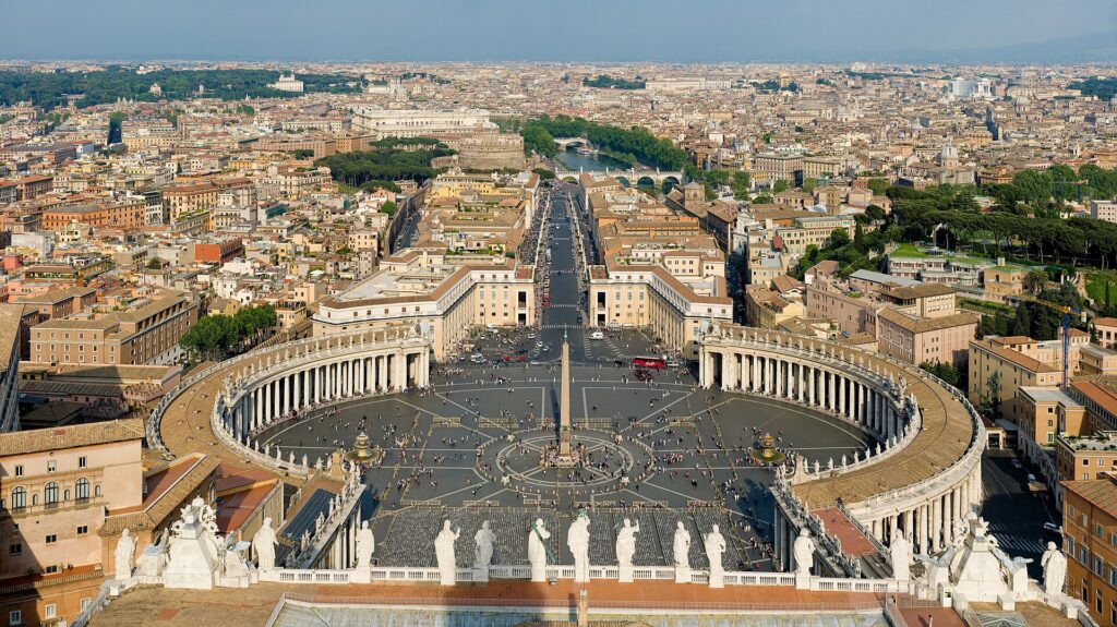
    Toronto month by month

    January

    The first week is still holiday-priced; after that, January is reliably the cheapest month to fly into Toronto. It is also genuinely cold. Highs hover around freezing, lows drop below -10 °C on the colder days, and the wind on the waterfront makes it feel colder still. What January does well: hockey at Scotiabank Arena, the winter restaurant festival (Winterlicious usually runs from late January into February), the PATH network of underground walkways that lets you cross much of the financial district without stepping outside, and museum days at the ROM and the AGO with no crowds. Fly in with a checked-bag-free strategy if you can; winter storms occasionally disrupt Pearson, and being able to walk off with everything you own is worth a lot.

    February

    Similar to January in temperature and price, with one exception: Family Day, an Ontario statutory holiday on the third Monday of February, creates a mini long weekend that lifts fares and hotel rates for a few days. Outside that weekend, February is a strong value month. The Toronto Light Festival at the Distillery District has run in recent winters, and the city’s skating rinks, including the one at Nathan Phillips Square, are at their best. Check the City of Toronto’s festivals and events listings for what is scheduled in the year you travel.

    March

    March is a transition month, and the weather is honest about it: slush, sudden thaws, and the odd late snowstorm. Prices stay low except around March Break, the Ontario school holiday in the middle of the month, when family demand rises and flights from sun destinations back into Toronto get busy. If you are visiting rather than returning, aim for the first or last week of the month.

    April

    Spring arrives unevenly. Early April can still be cold; by the end of the month the patios are cautiously opening and the city is greening up. The Blue Jays’ home season begins at Rogers Centre, which puts a few thousand extra visitors in downtown hotels on game nights. Fares sit in the moderate band, and hotel rates are noticeably lower than they will be in six weeks. April is an underrated month for a museum-and-food trip.
    May

    The best-kept secret in the Toronto calendar. The cherry blossoms in High Park usually peak in late April or the first week of May, drawing big local crowds on the weekend but few overnight visitors. Doors Open Toronto, which lets you inside dozens of buildings normally closed to the public, typically falls in late May. The Victoria Day long weekend (the Monday before May 25) is the one date to book around. Otherwise, May offers spring weather, opening-season energy, and prices well below June.

    June

    Warm, long, and busy. Pride Toronto culminates in one of the largest Pride parades in North America at the end of the month, Luminato brings arts programming across the city, and the summer patio season is fully open. Fares step up from mid-month as schools finish. If June is your month, the first two weeks are the value play.

    July

    Peak season proper. Canada Day on July 1 opens the month with fireworks and a long weekend; the Honda Indy runs at Exhibition Place; Summerlicious brings prix-fixe menus to restaurants across the city; and the humidity settles in. Fares and hotel rates are at their annual high. The Toronto Islands, with their beaches and car-free lanes, are the local escape valve, and the ferry line at Jack Layton Ferry Terminal on a hot Saturday tells you everything about demand.

    August

    Still peak, with two big demand events: the Toronto Caribbean Carnival (often called Caribana), whose grand parade takes place on the Saturday of the first weekend in August, a civic long weekend in Ontario; and the Canadian National Exhibition, the CNE, which runs from mid-August to Labour Day at Exhibition Place. The last week of August, after most families have flown home but before the CNE closes, is a small pocket of slightly softer pricing.

    September

    Many locals will tell you September is the best month in Toronto, and the weather agrees: warm days, cool nights, and a lake that has finally warmed up. The catch is the Toronto International Film Festival, which runs for roughly ten days in early-to-mid September and fills downtown hotels with the film industry. TIFF week fares and room rates behave like peak season. Fly in after the festival closes and you get September weather at shoulder prices. Check TIFF’s official site for the exact dates before you book.
    October

    Fall colour in the ravines, High Park and the Don Valley; crisp days that still reach the mid-teens; and, apart from the Thanksgiving long weekend on the second Monday of the month, steadily falling prices. Nuit Blanche, the all-night contemporary art event, has landed in late September or October in recent years. Late October is one of the best value-for-weather windows of the whole year.

    November

    Grey, damp and quiet, which is exactly why fares and hotel rates are low. The Royal Agricultural Winter Fair fills Exhibition Place for ten days in early November, the Santa Claus Parade runs in the middle of the month, the Cavalcade of Lights switches on the holiday lights at Nathan Phillips Square, and the Distillery Winter Village (formerly the Toronto Christmas Market) opens at the Distillery District in the second half of the month. If you like a city at its festive best without paying festive prices, the last ten days of November are the target.

    December

    Two months in one. The first half continues November’s value pricing with the added bonus of the holiday markets and lights in full swing. From about December 18 onward, fares and hotel rates jump for the Christmas and New Year period and stay high into the first days of January. Winter is fully here: expect snow, short days, and the occasional weather delay at Pearson.

    Snow-covered path in High Park, Toronto, in winter
    Toronto in January: cold, quiet, and usually the cheapest month to fly in (Photo: Chicken4War via Wikimedia Commons, CC BY-SA 4.0)

    Events that move Toronto flight and hotel prices

    The following dates are worth cross-checking against your travel plans before you book. Some are worth planning a trip around; all of them are worth knowing about if your dates happen to overlap. Exact dates shift each year, so confirm with Destination Toronto or the event organizers.

    • Family Day weekend (third Monday of February): short domestic spike.
    • March Break (mid-March): family travel, especially inbound from sun destinations.
    • Victoria Day weekend (Monday before May 25): the unofficial start of summer.
    • Pride Toronto (late June): major weekend demand downtown.
    • Canada Day (July 1) and the surrounding long weekend.
    • Toronto Caribbean Carnival (civic long weekend, early August): one of the busiest weekends of the year for hotels.
    • Canadian National Exhibition (mid-August to Labour Day): steady demand, plus the air show on Labour Day weekend.
    • TIFF (early-to-mid September): the single biggest hotel-rate spike outside the holidays.
    • Thanksgiving weekend (second Monday of October).
    • Christmas to New Year (roughly December 18 to January 3).
    • Major sporting events: Blue Jays playoff games, Raptors and Maple Leafs playoff runs in April through June, and international matches at BMO Field can all tighten hotel availability on short notice. Our Toronto events page lists what is on sale for the dates you are considering.

    Which Toronto airport should you fly into?

    Toronto has two airports inside the city region and a third an hour away that budget carriers have used. The right choice depends on where you are coming from and where you are staying.

    Toronto Pearson International (YYZ)

    Canada’s busiest airport, in Mississauga about 25 kilometres northwest of downtown. Virtually every international flight and most domestic and transborder flights land here. There are two terminals: Terminal 1 is the Air Canada and Star Alliance home, and Terminal 3 hosts most other carriers, including WestJet and the major American airlines. Getting downtown is straightforward: the UP Express train runs from Terminal 1 to Union Station in about 25 minutes, the TTC’s 900 Airport Express bus connects to Kipling subway station, and taxis and ride-hail pick up outside both terminals. Check the official Pearson site for terminal maps and current ground-transport options, and see our Toronto car-rental-versus-transit guide before you reserve a car at the airport.

    Terminal 1 at Toronto Pearson International Airport (YYZ)
    Terminal 1 at Toronto Pearson (YYZ), the hub for Air Canada and most international arrivals (Photo: Daniel Case via Wikimedia Commons, CC BY-SA 3.0)

    Billy Bishop Toronto City Airport (YTZ)

    On an island a few hundred metres from the downtown waterfront, Billy Bishop is one of the most convenient city airports anywhere. Porter Airlines is the main operator, with Air Canada also flying select routes; destinations are mostly short-haul, covering eastern Canada and the northeastern United States, including Newark, Boston, Chicago and Washington. A free pedestrian tunnel and a short ferry connect the terminal to the mainland, and from there it is a walk, a streetcar or a five-minute taxi to most downtown hotels. If you are travelling from a city Billy Bishop serves and staying downtown, it is often worth a slightly higher fare for the hour it saves at each end.

    John C. Munro Hamilton International (YHM)

    About 75 kilometres southwest of Toronto, Hamilton’s airport has periodically hosted low-cost carriers on domestic and sun routes. A very low fare into Hamilton can be worth it if you are renting a car, heading to Niagara, or have time to spare; it is a poor choice if you are staying downtown without a car and arriving late, because the ground-transport options are thin. Compare the total trip cost, not just the fare.

    Timing tricks that actually work for Toronto

    • Search a whole month, not a date. Toronto’s demand curve has sharp edges around long weekends and TIFF. A calendar search on TicketScanner shows those edges instantly; shifting a Friday arrival to Thursday, or leaving on the Tuesday after a long weekend, is often the single cheapest change you can make.
    • Fly mid-week in peak season. July and August weekends are where the highest fares live. Tuesday and Wednesday departures on the same route are frequently in a lower band.
    • Book the event weeks early and the low-season weeks late. TIFF, Caribbean Carnival and Christmas fares rarely fall as departure approaches; January and November fares, by contrast, are stable enough that waiting for the right dates costs little.
    • Price the flight and the hotel together. A cheap fare into a TIFF week is not cheap once you have paid the hotel. Run a Toronto hotel search for the same dates before you commit to either.
    • Consider Billy Bishop for short-haul. From cities it serves, the door-to-door time saving is real, and the fare gap is often smaller than expected.
    • Build a winter buffer. If you are connecting through Pearson between December and March, avoid the tightest connection times. Our guide on how early to arrive for an international flight covers what to allow.
    • Coming from the US Northeast? The New York to Toronto route has its own rhythms, with multiple airports on both ends worth comparing.
    • Flying out of Toronto instead? The same seasonality applies in reverse; see cheap flights from Toronto for outbound routes.
    The flatiron-shaped Gooderham Building in Toronto's Distillery District
    The historic Distillery District, a popular Toronto stop year-round (Photo: Geo Swan, stitched by Marku1988 via Wikimedia Commons, CC BY-SA 3.0)

    What to pack, by season

    Winter (December to March): an insulated, wind-resistant coat, a hat that covers your ears, waterproof boots with grip, and layers for overheated indoor spaces. Spring (April to May): a rain shell, a mid-weight jacket, and shoes you do not mind getting wet; mornings can be near freezing and afternoons mild. Summer (June to August): light, breathable clothing, sun protection, and something for aggressively air-conditioned restaurants and subway cars. Fall (September to November): layers again, a warm jacket by mid-October, and an umbrella in November. Whatever the season, Toronto is a walking city; comfortable shoes matter more than anything else on this list.

    The best time to fly to Toronto for…

    Families

    Late June (before peak fares fully set in) or the last week of August into Labour Day, when the CNE is on and the Toronto Islands, the zoo and Ripley’s Aquarium are all in full summer operation. March Break works well if you are content with indoor attractions.

    The lowest fares

    Mid-January through the first week of March, avoiding Family Day weekend, and the first half of November. Pair with a downtown hotel and lean into the indoor city: the PATH, the museums, the theatre district and the hockey.

    Food and festivals

    July for Summerlicious, patios and the Caribbean Carnival; late January and February for Winterlicious at a fraction of the price. Kensington Market’s pedestrian Sundays run through the summer months.

    Sports

    April to June for hockey and basketball playoff atmosphere; April to September for baseball; the fall for Toronto FC and the Argonauts at BMO Field. Ticket availability, not the fare, is usually the constraint; check what is on sale in Toronto before you book flights.

    Business travel

    Any month, but note that downtown hotels price sharply around TIFF and the big convention weeks. Mid-week arrivals in the shoulder months are the most predictable.
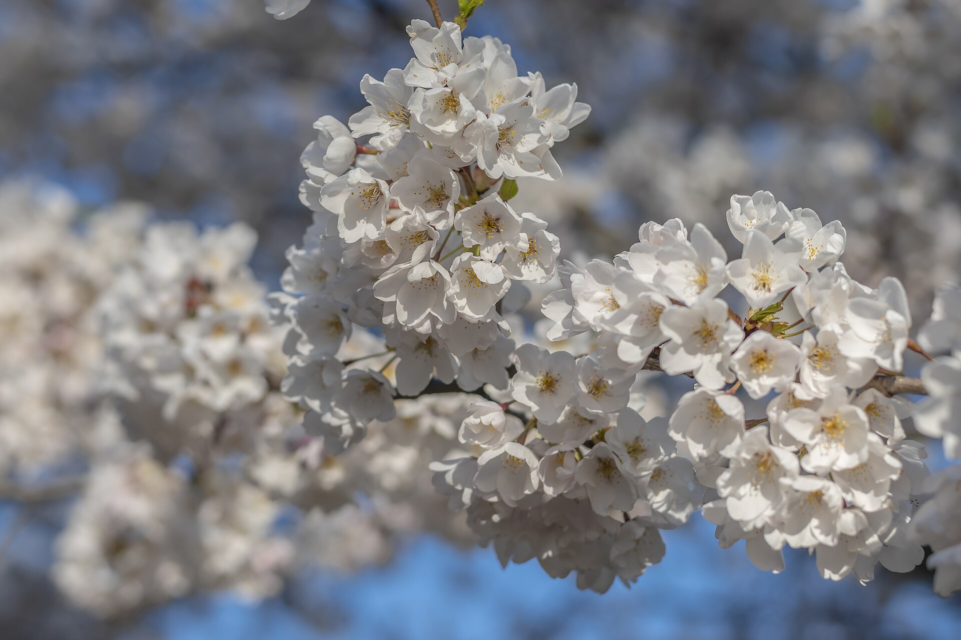
    Cross-border and visiting family

    If you are a U.S. citizen flying in, a valid passport is required, and travellers from visa-exempt countries other than the United States generally need an Electronic Travel Authorization; the Government of Canada’s visitor page explains what applies to you. Canadians returning from abroad should review the current travel advice and entry requirements. Security screening at Canadian airports is run by CATSA, whose site lists what you can carry on.

    Frequently asked questions

    What is the cheapest month to fly to Toronto?

    January and February are consistently the lowest-fare months, followed by November and early December. The first week of January is the exception, as it is still priced with the holidays.

    What is the best month to visit Toronto for weather?

    September for warm days and cool nights, with June a close second. Both are far more comfortable than the humid heart of July and August.

    Is Toronto expensive to visit in summer?

    July and August are the most expensive months for both flights and hotels, driven by school holidays and a dense festival calendar. Mid-week travel and booking well ahead take some of the edge off.

    Should I fly into Pearson or Billy Bishop?

    Pearson for almost all international and long-haul flights and the widest choice of fares; Billy Bishop if you are coming from eastern Canada or the U.S. Northeast and staying downtown, where the convenience is hard to beat.

    How far ahead should I book a flight to Toronto?

    Earlier for peak periods and event weeks, when fares tend only to rise; for low-season dates the fares are stable enough that finding the right pair of days matters more than booking months out. Use flexible-date search and compare across a full month.

    Does it snow in Toronto in April?

    Occasionally, yes, usually early in the month and rarely lasting. By late April the city is firmly in spring, and the High Park cherry blossoms follow soon after.

    When do the High Park cherry blossoms bloom?

    Typically late April to early May, for roughly a week to ten days depending on the year’s weather. The City of Toronto’s parks pages post bloom updates each spring.

    Ready to pick your dates? Compare fares across the whole month on our Toronto flights page, then line up a place to stay with our Toronto hotel search. If you are planning what to do once you land, start with our first-timer’s guide to Toronto.

  • Things to Do in Toronto: A First-Timer’s Guide

    Things to Do in Toronto: A First-Timer’s Guide

    Toronto rewards a plan. Canada’s largest city is spread along a lakefront that runs for kilometres, and its best experiences are clustered in neighbourhoods that are each worth a half-day on their own. Try to see everything with no structure and you will spend your trip on the subway. Group the city by area, give yourself one “big” sight per day and one neighbourhood to wander, and Toronto opens up quickly. This guide is built for a first visit: the landmarks that genuinely earn their reputation, the museums and shows worth booking, the neighbourhoods locals actually spend time in, the food, the sports, the day trips, and the practical details that make the difference between a good trip and a great one.

    If you are still comparing cheap flights to Toronto, read this alongside our guides to the best time to fly to Toronto and whether you need a car. Between the three, you can plan the whole trip.

    Toronto skyline and CN Tower at sunset seen from the Toronto Islands
    The Toronto skyline from the Toronto Islands, a 15-minute ferry ride from downtown (Photo: Jchmrt via Wikimedia Commons, CC BY-SA 4.0)

    Toronto at a glance for first-timers

    • Airports: Toronto Pearson (YYZ), about 25 km northwest of downtown, handles nearly all international flights; Billy Bishop (YTZ) sits on an island minutes from the downtown core and serves short-haul routes in eastern Canada and the U.S. Northeast. See our Toronto Pearson airport guide.
    • Getting around: the TTC subway, streetcars and buses cover the central city well, and downtown is compact enough to walk. Most first-time visitors do not need a car unless they are planning day trips.
    • Money: Canadian dollars. Prices on menus and shelves do not include Ontario’s 13% HST, which is added at the till. Tipping 15 to 20 percent in restaurants is customary. Tap-to-pay is accepted almost everywhere, including on transit.
    • Language: English, with a genuinely multilingual population; Toronto is one of the most diverse cities in the world, and that shows in its food.
    • Where to stay: the Entertainment District and the Financial District for walkability to the big sights; Yorkville for upscale shopping and the museums; the waterfront for lake views; the Bloor-Yonge and Queen West areas for a more local feel. Our Entertainment District hotel guide and Toronto hotel search cover the options.

    The downtown icons

    CN Tower

    Yes, it is touristy, and yes, it is still worth it. The CN Tower was the world’s tallest free-standing structure for more than three decades, and the view from the main observation level takes in the whole city, the lake, and on a clear day the mist of Niagara Falls on the horizon. The glass floor is a rite of passage. The EdgeWalk, a hands-free walk around the outside of the main pod on a harness, is the city’s best-known thrill experience and books out in summer. Go at sunset if you can; the timed-entry ticket system means you should book the slot in advance rather than queue on the day.

    Ripley’s Aquarium of Canada and Rogers Centre

    Both sit at the foot of the tower. Ripley’s Aquarium is one of the best rainy-day and family attractions in the city, with a moving walkway through an underwater tunnel that small children will not want to leave. Next door, Rogers Centre is home to the Toronto Blue Jays from April to September; a weeknight game is one of the cheapest ways to sit under the open roof with the tower lit up above you.

    The Toronto Islands

    The single best thing to do in Toronto on a warm day costs the price of a ferry ticket. The Toronto Islands are a car-free chain of parkland a fifteen-minute ferry ride from the Jack Layton Ferry Terminal at the foot of Bay Street, with beaches, picnic lawns, bike rentals, a small amusement park (Centreville, open in the warmer months) and the definitive view of the skyline. Ward’s Island is the quieter, residential end; Centre Island has the amenities; Hanlan’s Point has the widest beach. Bring water and food, because options on the islands are limited, and check the City of Toronto’s parks pages for ferry schedules, which change by season.

    Downtown Toronto skyline seen from the Toronto Islands ferry
    The city from the Toronto Islands ferry, which leaves from Jack Layton Ferry Terminal at the foot of Bay Street (Photo: Chicken4War via Wikimedia Commons, CC BY-SA 4.0)

    Harbourfront and the waterfront trail

    Between the ferry terminal and the foot of Bathurst Street, Harbourfront Centre runs a year-round program of free outdoor concerts, craft studios you can watch at work, skating in winter and a summer sailing scene. The waterfront trail continues in both directions for kilometres; a rented bike from a Bike Share Toronto dock is the easiest way to cover it.

    Nathan Phillips Square and City Hall

    The plaza in front of Toronto’s modernist City Hall is the city’s civic living room: a reflecting pool in summer, a skating rink in winter, the illuminated TORONTO sign for the obligatory photo, and free events through the year. The Cavalcade of Lights in November switches on the holiday season here.

    St. Lawrence Market

    The St. Lawrence Market, a few blocks east of the Financial District, is the place to eat a peameal bacon sandwich, buy Ontario cheese and maple products, and see how Toronto shopped before supermarkets. The main South Market runs Tuesday to Sunday; the Saturday farmers’ market draws the crowds. Go hungry and go early.

    The Distillery District

    A ten-minute walk east of St. Lawrence Market, the Distillery District is a pedestrian-only cluster of Victorian industrial buildings that once housed the Gooderham & Worts distillery and now hold galleries, restaurants, a brewery, a sake maker and a theatre. It is at its most atmospheric in the evening and, in late November and December, during the Distillery Winter Village, when the lanes fill with lights and market stalls.

    Victorian brick buildings and cobblestone lane in the Distillery District, Toronto
    The pedestrian-only Distillery District, east of downtown (Photo: Mathew Ingram via Wikimedia Commons, CC BY 2.0)

    Museums, galleries and the stage

    Royal Ontario Museum

    Canada’s largest museum, the ROM, sits at Bloor Street and Avenue Road above its own subway station. The dinosaur galleries are the draw for families, the world-culture and natural-history collections reward a full day, and the Michael Lee-Chin Crystal, the angular glass addition on Bloor, is a landmark in its own right. Allow at least three hours.

    The Royal Ontario Museum on Bloor Street, Toronto, with its glass crystal addition
    The Royal Ontario Museum at Bloor and Avenue Road, beside the Museum subway station (Photo: Maksim Sokolov (Maxergon) via Wikimedia Commons, CC BY-SA 4.0)

    Art Gallery of Ontario

    On Dundas Street West at the edge of Chinatown, the AGO holds one of the world’s great collections of Henry Moore sculpture, the definitive gathering of the Group of Seven and Tom Thomson, and a Frank Gehry redesign whose spiral staircase and Galleria Italia are worth the visit alone. Check the gallery’s site for free or reduced-admission evenings, which have run on a regular weekly schedule in recent years.

    Casa Loma

    A Gothic Revival mansion built by a financier who ran out of money before he ran out of ambition, Casa Loma is Toronto’s castle: turrets, secret passages, an underground tunnel to the stables and gardens with a view over the city. It sits north of Dupont Street, an uphill walk from Dupont subway station. Seasonal events, including a summer symphony series and Halloween and holiday programming, sell out.

    The smaller museums worth your time

    The Hockey Hall of Fame at Yonge and Front lets you stand next to the Stanley Cup. The Bata Shoe Museum and the Gardiner Museum of ceramics, both near the ROM, are small, excellent and rarely crowded. The Aga Khan Museum, in Don Mills, pairs a serene modern building with a collection of Islamic art and is one of the city’s most beautiful spaces. Evergreen Brick Works, in the Don Valley, is a reclaimed brick factory with trails, a Saturday farmers’ market and a good café.

    Theatre, music and film

    Toronto is the third-largest English-language theatre centre in the world after London and New York. The Mirvish theatres on King Street West and Yonge Street host the touring Broadway productions; the Four Seasons Centre is home to the Canadian Opera Company and the National Ballet of Canada; Roy Thomson Hall hosts the Toronto Symphony; and Massey Hall, reopened after a full restoration, remains the city’s best room for a concert. Every September the Toronto International Film Festival takes over the Entertainment District, and its year-round home, the TIFF Lightbox on King Street, screens films every day. For what is on sale during your dates, our Toronto events page lists concerts, shows and games.

    Neighbourhoods worth a half-day

    Kensington Market and Chinatown

    Start on Spadina Avenue at Dundas, the heart of the largest of Toronto’s Chinatowns, for dim sum and bakeries, then walk two blocks west into Kensington Market. Kensington is a scruffy, colourful grid of vintage shops, cheese mongers, Latin American and Caribbean grocers, taquerias and patios, and it is at its best on Pedestrian Sundays, when the streets close to traffic on the last Sunday of the month from late spring to fall.

    Colourful shopfronts at Kensington Avenue and Baldwin Street in Kensington Market, Toronto
    Kensington Market, a few blocks west of Chinatown (Photo: Arild Vågen via Wikimedia Commons, CC BY-SA 4.0)

    Queen West, Ossington and Trinity Bellwoods

    Queen Street West from University Avenue to Bathurst is the shopping-and-brunch stretch; keep going past Bathurst and it becomes West Queen West, with galleries, independent boutiques and Graffiti Alley, the lane behind Queen where the murals run for blocks. Trinity Bellwoods Park is the neighbourhood’s front lawn on a summer afternoon, and Ossington Avenue, running north from Queen, has one of the city’s best concentrations of restaurants and bars.

    Yorkville

    Once the centre of the 1960s folk scene, Yorkville is now Toronto’s luxury district: the flagship stores on Bloor Street, the boutique hotels, the galleries on Hazelton Avenue and the outdoor tables where the film festival crowd gathers each September. It sits right beside the ROM, which makes it an easy pairing.

    The Danforth, Leslieville and the Beaches

    Take the Bloor-Danforth subway east and the neighbourhoods change character with each stop. The Danforth around Chester and Pape stations is Greektown, with the restaurants to match. Leslieville, along Queen Street East, is the brunch-and-antiques strip. Keep going east to the Beaches, where a wooden boardwalk runs along Woodbine and Kew beaches and the pace slows down entirely; it is a different city from the Financial District, and it is twenty-five minutes away.

    Little Italy, Koreatown and the west end

    College Street west of Bathurst is Little Italy, still lined with cafés and trattorias and lively late into the night. Bloor Street west of Bathurst is Koreatown, with barbecue restaurants and karaoke. Further west, Roncesvalles Avenue is the Polish-heritage main street beside High Park, Toronto’s largest park, with a free zoo, Grenadier Pond, the famous cherry blossoms in late April or early May, and outdoor Shakespeare in summer.

    Sports and live events

    Toronto is a serious sports city, and a game is one of the most local things a visitor can do. The Maple Leafs and Raptors play at Scotiabank Arena, attached to Union Station; the Blue Jays play at Rogers Centre beside the CN Tower; Toronto FC and the Argonauts share BMO Field at Exhibition Place; and the Marlies, the Leafs’ farm team, are the affordable hockey option. MLSE, which owns most of those teams, lists home schedules; for tickets across all of them, plus concerts at Scotiabank Arena, Budweiser Stage and Massey Hall, check what is on in Toronto for your dates before you book flights, because a playoff run or a stadium tour can tighten hotel availability quickly.

    The festival calendar is dense from June to September: Pride at the end of June, Canada Day on July 1, the Honda Indy in July, the Toronto Caribbean Carnival on the August long weekend, the Canadian National Exhibition from mid-August to Labour Day, and TIFF in September. The City of Toronto’s festivals calendar and Destination Toronto keep current dates.

    What to eat, and where

    Toronto’s defining food experience is not a dish but a map. More than half the city’s residents were born outside Canada, and each community has a main street. Eat dim sum in Chinatown or, for the real thing, in Scarborough or Markham; Caribbean roti and jerk in the west end and in Scarborough; Greek on the Danforth; Italian on College; Korean on Bloor; South Asian on Gerrard Street East, the Gerrard India Bazaar; Portuguese in Little Portugal along Dundas West; and Middle Eastern almost everywhere. The city’s own contributions are the peameal bacon sandwich at St. Lawrence Market and, less romantically, an outstanding brunch culture in Leslieville and on Queen West.

    Two restaurant festivals bring prix-fixe menus to hundreds of restaurants: Winterlicious in late January and February, and Summerlicious in July. Both are good ways to try the city’s more ambitious kitchens at a fixed price. In summer, patios matter: Toronto takes its outdoor dining seriously for the few months it can.

    Toronto with kids

    The Toronto Islands and Centreville, Ripley’s Aquarium, the ROM’s dinosaurs, the High Park zoo and playground, the Toronto Zoo in Scarborough (large, spread out, and best with a full day), skating at Nathan Phillips Square in winter, the Hockey Hall of Fame for older kids, and a Blue Jays game with the roof open. Children under 13 ride the TTC free, which makes getting between all of the above cheap.

    Day trips from Toronto

    Niagara Falls is the obvious one: about an hour and a half by car, reachable by seasonal GO train service and year-round bus, and offered by every tour company in the city. The boat to the base of the Horseshoe Falls is the experience worth paying for; Niagara Falls Tourism covers the rest. Niagara-on-the-Lake, twenty minutes further, is wine country and the home of the Shaw Festival. Stratford, two hours west, runs one of North America’s great theatre festivals from spring to fall. Prince Edward County, two and a half hours east, has wineries, sand dunes and small-town inns. Blue Mountain, north of the city, is the closest ski resort in winter and a hiking and cycling base in summer. Algonquin Provincial Park, three hours north, is the classic Ontario canoe landscape; Ontario Parks handles reservations. Most of these are far easier with a car; see our Toronto car rental page and our rental car booking tips if you are planning more than one.

    Two sample itineraries

    Two days, no car

    Day one: St. Lawrence Market for breakfast, walk to the Distillery District, streetcar back west along King Street through the Financial and Entertainment Districts, CN Tower at sunset, dinner on King West. Day two: Ferry to the Toronto Islands in the morning, back for lunch in Chinatown, Kensington Market in the afternoon, the AGO if it is a late-opening evening, and a game or a show at night.

    Four days, with one day trip

    Add a day for the ROM, Yorkville and Casa Loma, a day for the west end (Queen West, Ossington, High Park or the Beaches, depending on the season), and use the fourth day for Niagara Falls. Rent the car for that single day from a downtown location rather than the airport, which keeps parking out of the equation for the rest of the trip.

    Practical details

    • Transit: tap a credit card, debit card or phone on any TTC vehicle or fare gate, or buy a PRESTO card; a single tap covers a two-hour transfer window. The TTC’s site has maps and service alerts. Our transit-versus-car guide goes into detail.
    • From Pearson: the UP Express train reaches Union Station in about 25 minutes. Details on both airports are on the Pearson and Billy Bishop sites.
    • Weather: humid summers, cold snowy winters, and two lovely shoulder seasons. The best time to fly to Toronto guide has a month-by-month table; check Environment Canada’s forecast before you pack.
    • The PATH: a network of underground walkways connects most of the Financial District, Union Station and the Eaton Centre. In January it is how locals get around downtown without a coat.
    • Entry requirements: U.S. citizens need a valid passport; most other visa-exempt visitors arriving by air need an Electronic Travel Authorization. The Government of Canada’s visitor page is the authoritative source.
    • Safety: Toronto is a large, generally safe city; the usual big-city awareness applies downtown late at night.

    Frequently asked questions

    How many days do you need in Toronto?

    Three full days covers the icons and two or three neighbourhoods comfortably; five lets you add a day trip and slow down. A weekend is enough for the downtown core and the islands.

    What is the number one thing to do in Toronto?

    On a warm day, the ferry to the Toronto Islands, for the skyline view alone. In any season, the CN Tower at sunset is the classic.

    Is Toronto walkable?

    Downtown, very. The stretch from the waterfront north to Bloor Street and from the Distillery District west to Bathurst is flat and dense with things to see. Beyond that, the subway and streetcars fill the gaps.

    Do I need a car in Toronto?

    Not for the city itself. Rent one for day trips to Niagara, wine country or the parks, ideally from a downtown location for just those days.

    What is Toronto known for?

    The CN Tower, its diversity and food, the Toronto International Film Festival, its sports teams, and a waterfront and island park system that most first-time visitors underestimate.

    Is Toronto expensive?

    Hotels downtown are the main cost, especially in summer and during TIFF. Transit, the islands, the markets, the parks and many festivals are free or inexpensive. Booking flights in shoulder season and comparing hotels across neighbourhoods keeps the total manageable.
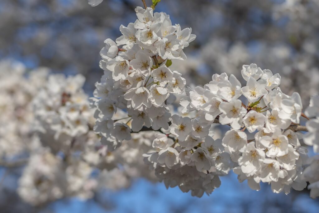
    Ready to go? Compare flights to Toronto, find a place to stay with our Toronto hotel search, and if Niagara is on the list, price a rental car for the day.