Blog

  • Denver: Should You Rent a Car or Rely on Public Transit?

    Denver: Should You Rent a Car or Rely on Public Transit?

    Denver is a city where the honest answer to “should I rent a car?” depends almost entirely on whether you are going into the mountains. The city itself is easier without one than most Western cities: a train runs straight from the airport to Union Station, downtown, LoDo, the Highlands and RiNo are walkable, a light-rail network reaches the suburbs and Golden, and anyone 19 or under rides RTD free. Downtown hotel parking is expensive, and you will not need a car to see the museums, the ballparks or the breweries. But many people who fly to Denver are on their way to the ski areas, Rocky Mountain National Park or Red Rocks, and for those trips a car is usually the simplest answer, as long as you understand what mountain driving involves at altitude and in winter. This guide explains how the city is laid out, how RTD and its fares work, what driving here and on I-70 is really like in every season, the bus and train options into the mountains, and gives you a straightforward way to decide.

    The short answer

    Rent a car if Rocky Mountain National Park, the I-70 ski areas and mountain towns, Mount Blue Sky, Colorado Springs or a Western road trip are on the itinerary, if you are staying in the suburbs or with family, or if you are skiing with children and gear. Skip the car if you are staying downtown, in LoDo or near the Convention Center for a city break, a conference, a concert or a game, and your plans are the museums, Union Station, RiNo, the Highlands, Cherry Creek and a Rockies or Broncos game; the A Line, the light rail, your feet and the occasional ride-hail will cover that, and you will not pay for hotel parking. And if you want the mountains without driving, the ski train, the state’s Bustang buses and private shuttles are a genuine third option for some trips. Compare rental rates for any of these plans on our Denver car rental page.

    How Denver is laid out

    Denver spreads across the high plains at the foot of the Front Range, and the mountains always mark west. The main city grid is aligned north-south, with Broadway dividing east from west addresses and Ellsworth Avenue dividing north from south; numbered avenues run east-west and named streets run north-south. Downtown is the exception. Its grid was laid out along the South Platte River and Cherry Creek, so it sits at an angle to everything else, and its numbered streets (15th Street, 16th Street, 17th Street) are not the same as the city’s numbered avenues (such as 17th Avenue), which trips up many first-time drivers. Union Station and LoDo sit at its northwest end, the Capitol at the southeast end, RiNo to the northeast and the Highlands across I-25. Cherry Creek is a few miles southeast, and the metro area then sprawls for many miles in every direction, with the airport far out on the plains to the northeast and the foothills, Red Rocks and Golden about half an hour west.

    Hotels cluster in LoDo and around Union Station, downtown near the Convention Center and the 16th Street corridor, in Cherry Creek, in the Denver Tech Center to the south, and near the airport. Our Denver hotel search lets you compare them.

    Getting in from the airport

    Denver International (DEN) is about 40 kilometers (25 miles) northeast of downtown, farther out than most big-city airports, but it has a direct rail link. RTD’s A Line commuter train leaves from a station at the south end of the main terminal and reaches Union Station in under 40 minutes, running every 15 minutes for most of the day. It carries a higher airport fare than a regular RTD ride but costs far less than a taxi. RTD also runs SkyRide buses from the airport to Boulder and some suburbs. Taxis and ride-hail pick up on the terminal’s ground-transport level, and the drive downtown via Peña Boulevard and I-70 takes 30 to 50 minutes depending on traffic. Most rental companies are off-airport, reached by shuttle bus, which adds time at both ends. If you are heading straight to the ski areas, several private shuttle companies run door-to-door vans from DEN to the mountain resorts, which is the option to compare against a rental. Check the airport’s site for current ground-transport details; our DEN airport guide covers the layout.
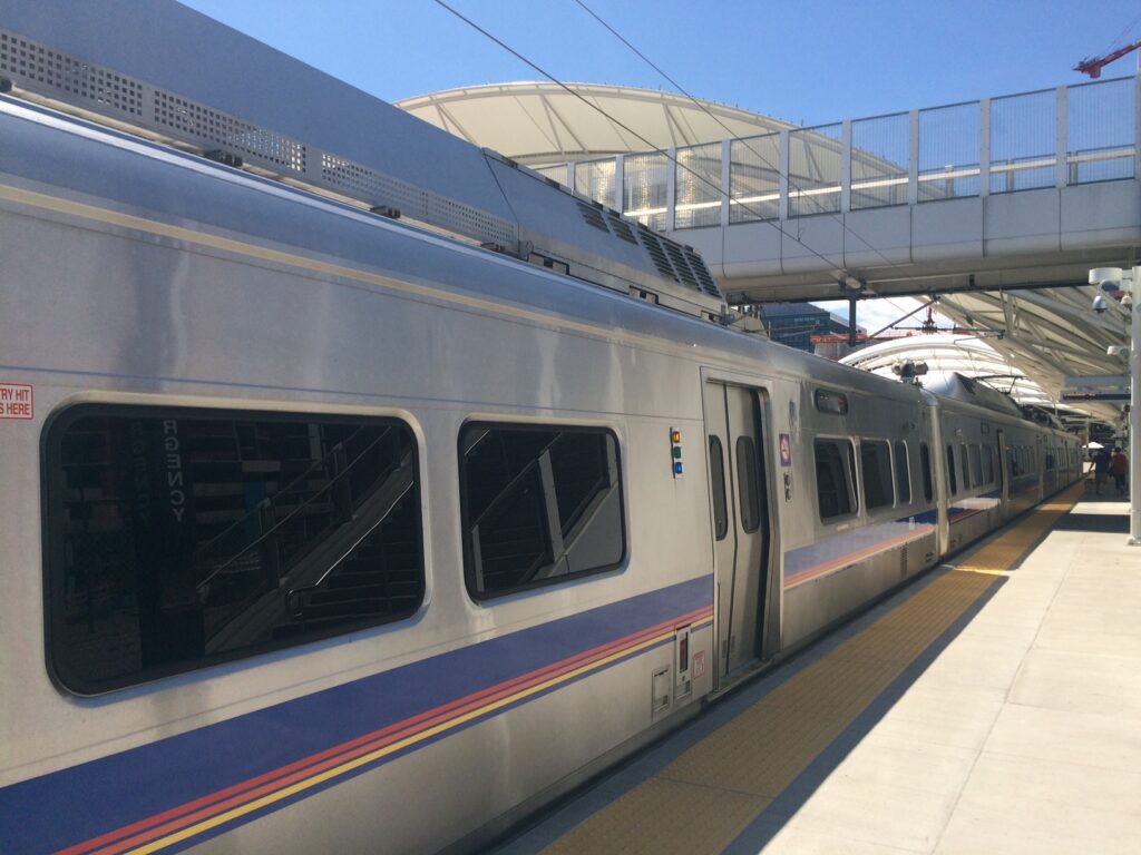
    An RTD A Line commuter train to Denver International Airport at Union Station
    The A Line at Union Station: the train that links downtown with DEN in under 40 minutes (Photo: Point00000 via Wikimedia Commons, CC BY-SA 4.0)

    Denver’s transit, explained

    The Regional Transportation District, RTD, runs the trains and buses across Denver and its suburbs. For a visit based downtown it is entirely adequate, and the rail network is extensive by the standards of Western cities; its limitation is frequency and coverage away from the rail lines, where buses can run every 30 minutes or less often, especially in the evenings and on weekends.

    Commuter rail and light rail

    Almost everything meets at Union Station. The commuter rail lines run from its train hall: the A Line to the airport, the B Line northwest toward Westminster, the G Line to Arvada and Wheat Ridge, and the N Line north toward Thornton. The light-rail network runs from Union Station and a loop through downtown out to the southern and western suburbs: lines serve the Denver Tech Center, Littleton and Lone Tree to the south, Aurora to the east, and the W Line runs west to Lakewood and Golden. For visitors, the most useful stops are Union Station, the downtown loop near the Convention Center and the Performing Arts Complex, the Ball Arena and Empower Field stops for games, and the A Line stops at 38th and Blake for RiNo. Check RTD’s map for current routes before you travel.

    Buses and the MallRide

    Buses fill in the rest of the city, including City Park and Cherry Creek. The free MallRide shuttle has traditionally run along the 16th Street pedestrian corridor between Union Station and Civic Center Station, which makes the length of downtown easy without a ticket; check its current routing, because the street has been through a long reconstruction. The Flatiron Flyer is a fast bus service along US-36 between Union Station and Boulder, and it is the easy way to reach Boulder without a car.

    Fares and tickets

    RTD simplified its fares in recent years into a standard local fare, which covers buses and trains across the system for a set period, and a separate higher fare for trips to or from the airport. Buy tickets through RTD’s mobile ticketing app or from the machines at rail stations, and check RTD’s site for day passes and the current payment options before you arrive. The biggest saving for families: riders 19 and under travel free on all RTD services under the youth zero-fare program. Seniors and riders with disabilities qualify for discounts.

    Accessibility

    RTD’s rail stations are step-free and its trains and buses are accessible, with ramps or lifts on buses and level or near-level boarding on the trains; RTD’s site lists elevator outages and paratransit details.

    Beyond RTD

    • Walking. Downtown, LoDo and the Highlands, linked by pedestrian bridges over I-25, are easy on foot, and RiNo is one train stop from Union Station.
    • The trails. The paved Cherry Creek Trail and South Platte River Trail meet at Confluence Park, just below LoDo, and run for miles, away from traffic. Shared e-bikes and e-scooters are widely available, and a bike is often the quickest way between downtown and Cherry Creek or Washington Park.
    • Taxis and ride-hail. Uber, Lyft and licensed taxis operate across the metro area; for a group, a short ride can beat transit on price and time.
    • Red Rocks shuttles. The amphitheater is not on RTD, but private shuttle services run from downtown and other pickup points on many concert nights.
    • The ski train. The Winter Park Express, run by Amtrak, has operated on winter weekends from Union Station through the Moffat Tunnel to a stop at the base of Winter Park Resort, a scenic ride of about two hours; check Amtrak for the current season.
    • Bustang and mountain shuttles. The Colorado Department of Transportation’s Bustang intercity coaches run from Union Station along I-70 to the mountain towns and on to Glenwood Springs and Grand Junction, with a seasonal service to several ski areas on winter weekends. Private companies run shuttles from DEN and downtown to Vail, Breckenridge, Keystone and other resorts.
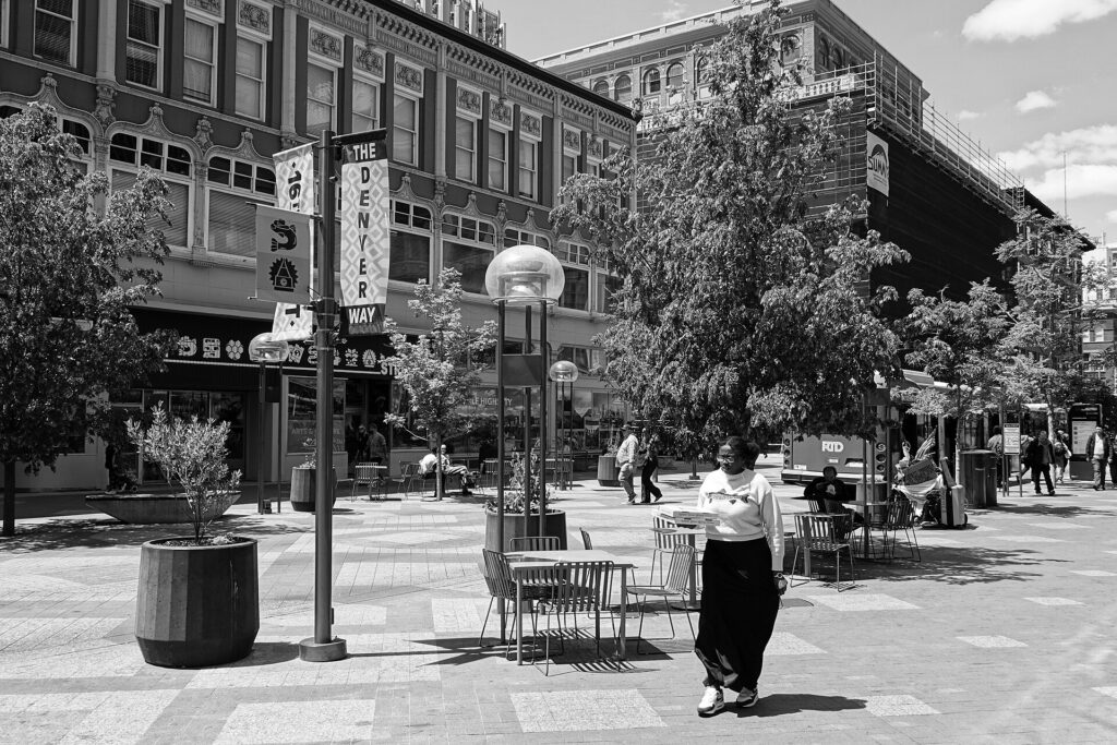
    The 16th Street pedestrian corridor through downtown Denver
    16th Street, the pedestrian spine of downtown Denver between Union Station and Civic Center (Photo: Scott McLeod via Wikimedia Commons, CC BY 4.0)

    Driving in Denver and beyond: what it is really like

    Within the city, Denver is a straightforward place to drive: wide roads, a logical grid outside downtown, and plentiful parking once you leave the core. I-25, the main north-south freeway past downtown, is congested every weekday morning and evening, and its interchange with I-70 north of downtown, known locally as the Mousetrap, is a daily bottleneck. Game days and concerts at Coors Field, Ball Arena and Empower Field back up the streets around LoDo and the I-25 exits, and parking near the venues becomes expensive. Toll roads are the other trap for visitors: E-470, the beltway on the east side that many drivers use to reach the airport, and several other express lanes are cashless and bill by license plate, and a rental company will pass the tolls on with its own fees, so ask about its toll program at the counter or set your navigation to avoid tolls. Peña Boulevard, the main road into the airport, is free.
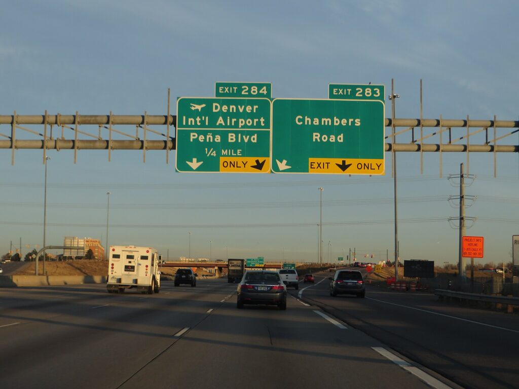
    Interstate 70 on the east side of Denver near the airport exit
    I-70 on Denver's east side, the same highway that carries weekend traffic into the mountains (Photo: Ken Lund from Reno, Nevada, USA via Wikimedia Commons, CC BY-SA 2.0)

    Parking

    Downtown Denver hotels charge a substantial nightly fee for parking, often valet only, and garages near Union Station, Larimer Square and the arenas are priced for commuters and event crowds. Street meters are paid by machine or app, and enforcement runs into the evening and on Saturdays on many blocks, so read the posted hours rather than assuming parking is free after six. Outside the core, parking is easy and often free. The mountain trailheads are a different story: the popular lots in Rocky Mountain National Park, at Hanging Lake and along the I-70 corridor fill early on summer weekends, and several now require reservations, which is one reason to start early.

    Rules and conditions worth knowing

    • Colorado’s traction law. On the I-70 mountain corridor west of Denver, a passenger-vehicle traction law applies during the colder months, generally from September through May, and CDOT can put it into effect on other mountain highways when conditions call for it. When it is in effect, cars need tires rated for mud and snow or winter tires with adequate tread, or four-wheel or all-wheel drive, or chains or an approved traction device. Fines are meaningful, and much higher if an unprepared car blocks the road. Ask the rental company for an all-wheel-drive car with suitable tires, and check that the rental agreement allows chains before you buy any.
    • Road conditions. COtrip, the Colorado Department of Transportation‘s traveler site and app, shows closures, chain and traction-law status and live cameras for every mountain pass; check it before you leave Denver, not when you reach the foothills.
    • Altitude and your car. Engines lose power in thin air, so expect slower climbs on the long grades up I-70, and on the way down, shift to a lower gear rather than riding the brakes; the signs warning truckers that they are “not down yet” apply to rental cars too. Fill up before the long mountain stretches.
    • Altitude and you. The I-70 corridor climbs above 3,000 m (10,000 feet) at the Eisenhower-Johnson Memorial Tunnel and Vail Pass. Headaches and drowsiness are common on a first day up high, so drink water and avoid a long mountain drive straight off a flight.
    • Hail and storms. The Denver area is one of the most hail-prone regions in the country, and summer afternoon storms can dent a car in minutes. Park under cover when storms are forecast, and understand what the rental’s damage waiver covers.
    • Wildlife. Deer and elk cross the foothill and mountain highways at dawn and dusk, and bighorn sheep often graze beside I-70 near Georgetown. Slow down, and never stop in a travel lane to photograph them.
    • Park reservations. Rocky Mountain National Park uses timed-entry reservations for much of the summer and early fall, and Mount Blue Sky requires a timed reservation for the summit road; book before you set off.
    • Cameras and turns. Photo radar and red-light cameras operate in Denver, and the rental company will pass on any fines. Right turns on red are permitted after a full stop unless signed otherwise.
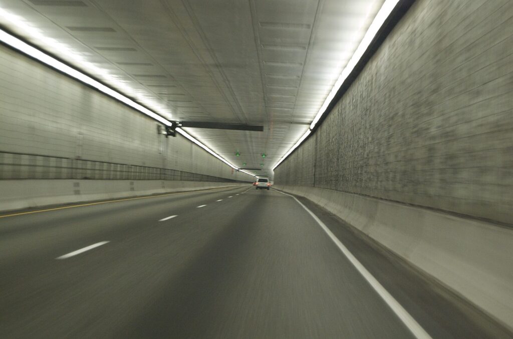
    The Eisenhower-Johnson Memorial Tunnel carrying I-70 under the Continental Divide
    The Eisenhower-Johnson Memorial Tunnel, where I-70 passes under the Continental Divide at about 3,400 meters (Photo: Benjamin Clark from Tallahassee, Florida, USA via Wikimedia Commons, CC BY 2.0)

    When renting a car makes sense

    • Rocky Mountain National Park. There is no public transit from Denver, the drive via Boulder or Loveland takes about two hours, and Trail Ridge Road is best done at your own pace; the town of Estes Park runs free summer shuttles once you arrive.
    • Skiing with a family. Gear, children and flexible timing all argue for a car, as long as it is all-wheel drive with suitable tires.
    • Colorado Springs, Pikes Peak and the Garden of the Gods. About 110 kilometers (70 miles) south on I-25; a day trip that needs a car.
    • Western road trips. Denver to Salt Lake City takes roughly eight hours, either over I-80 through southern Wyoming or along I-70 through Glenwood Canyon and eastern Utah; our Denver to Salt Lake City route guide covers the drive.

    If any of those apply, our rental car booking tips cover insurance, deposits and the questions to ask at the counter, and our family car rental guide looks at vehicle choice.

    When it does not

    • You are staying downtown or in LoDo and your plans are the city.
    • You are in town for a conference, a concert, a Rockies game or a Broncos game, when downtown and stadium parking are at their most expensive and the light rail stops at the gates.
    • You are heading to Winter Park, or a resort served by Bustang or a door-to-door shuttle, and will stay put once you arrive; most ski towns have free local buses.
    • You are traveling solo and the rental, fees, tolls and parking add up to more than the train and a few ride-hail trips.

    The hybrid plan for a city-plus-mountains trip

    Go car-free for the city days and rent for the mountain days, and think carefully about where you pick up. Renting at the airport makes sense if you are heading straight to the mountains on arrival, because E-470 and I-70 let you skirt most of the city, though the off-airport shuttle adds time and airport fees add cost. Renting from a city location makes sense if you are spending the first nights downtown, because you avoid the hotel parking on the nights you are not using the car. A pattern that works well: the A Line into Union Station, two or three car-free days in the city, a rental picked up from a city branch for the mountain days, and the car returned at the airport on the way to the flight home, which most companies allow for little or no extra charge. Book ahead for ski holidays and summer weekends, when all-wheel-drive cars run short, and confirm the tires if you are traveling between September and May. Compare the day rates on our Denver car rental page against a full-trip rental and the difference is usually obvious.

    A worked cost comparison

    Numbers change with the season and the booking window, so treat this as a method rather than a quote, and check current rates before deciding. For a four-night city break downtown for two people, the car-free version costs two return A Line fares, a few days of local transit and perhaps three or four ride-hail trips to Cherry Creek or the Highlands; the rental version adds four days of a compact car, four nights of hotel parking at downtown rates, fuel, toll fees if you take E-470, and airport concession charges, and buys you almost nothing you could not reach by train. The car-free option wins easily. For the same four nights with two days in the mountains, the car-free version adds return Bustang or shuttle tickets to a ski town for two; the hybrid version adds a two-day rental picked up in the city, fuel for the climb up I-70, and parking or resort fees. Priced honestly, the bus or shuttle is often cheaper for one or two people, the rental is usually cheaper for a family of four, and the rental wins on flexibility for Rocky Mountain National Park or an early trailhead. For a ski week at one resort, a door-to-door shuttle often beats a week’s rental plus resort parking. Run the rental rates for your dates on our Denver car rental page and put them beside the shuttle fares before you choose.

    Driving the I-70 mountain corridor in each season

    I-70 west of Denver is the only interstate route through the central Colorado Rockies, and it is both spectacular and demanding. From the foothills it climbs past Idaho Springs and Georgetown to the Eisenhower-Johnson Memorial Tunnel, which carries it under the Continental Divide at about 3,400 m (11,000 feet) and is among the highest vehicle tunnels in the world, then drops to the Summit County resorts and climbs again over Vail Pass. In summer, the problems are traffic and storms: westbound on Friday evening and Saturday morning and eastbound on Sunday afternoon, much of the metro area is on the road, and afternoon thunderstorms bring heavy rain, hail and occasional rockfall or debris-flow closures, most often in Glenwood Canyon farther west. In fall, the aspen weekends in September bring summer-style traffic back, and the first snow on the passes can arrive while Denver is still warm; the traction law starts applying from September. In winter, the highway is plowed and usually open, but storms can close the tunnel approaches or Vail Pass for hours, black ice forms in the shaded stretches even on sunny days, and ski traffic on weekend mornings and Sunday afternoons can turn a 90-minute drive into three hours or more. Leave early or travel mid-week, carry water, snacks and warm layers in case of a closure, and check COtrip before you set off. A peak-period express toll lane runs on part of the corridor near Idaho Springs and can save time on busy days. In spring, March and April bring some of the heaviest snowstorms of the year, so do not assume winter is over; by late May, the roads are usually clear but the high passes can still see snow.

    Decision table

    Your tripRecommendationWhy
    City break downtown or in LoDo, couple or soloNo carThe A Line, light rail and walking cover it; hotel parking is expensive
    Conference, concert or gameNo carEvent parking is costly and the light rail stops at the venues
    Rocky Mountain National ParkRent for those daysNo transit from Denver; the park and Trail Ridge Road need a car
    City plus a mountain day or twoHybrid: rent in the city for the mountain days, or take BustangCar-free city days, car or coach for the mountains
    Ski week at a single resortDoor-to-door shuttle, Bustang or the ski trainResorts have free local buses and parking costs extra
    Family ski trip with gearRent at the airport, all-wheel drive with suitable tiresGear, children, weather and the traction law all argue for a capable car
    Family visit to the suburbsRent for the whole staySuburban distances make the car worthwhile daily
    Western road tripRent (consider one-way to Salt Lake City)Denver is the start, not the destination

    Money-saving tips for both options

    • On transit: take the A Line rather than a taxi from the airport; buy a day pass for a heavy sightseeing day; riders 19 and under are free; use the free MallRide downtown when it is running.
    • On a rental: compare airport and city pickup, book early for ski holidays and summer, ask for all-wheel drive and suitable tires between September and May, decline extras you already have through a credit card or home policy (check first), understand the toll program before you drive E-470, and park under cover in hail season.
    • On the hotel: if you are renting, price the parking fee into the room rate.
    • On timing: avoid I-25 in the weekday peaks and I-70 westbound on Saturday mornings and eastbound on Sunday afternoons; the best time to fly to Denver guide lists the busiest weekends.
    • On the mountains: for one or two people staying in a single ski town, Bustang, the ski train or a shuttle usually costs less than a rental plus fuel and resort parking. Our car, transit or taxi guide covers the general trade-offs.

    Frequently asked questions

    Is it worth renting a car in Denver?

    For Rocky Mountain National Park, a family ski trip, the suburbs or a road trip, yes. For a downtown city break, a conference, a concert or a game, no; the train, light rail and your feet are enough.

    Is Denver public transit good for tourists?

    Good for the core and better than most Western cities: a train from the airport, light rail to the suburbs and Golden, and a free downtown shuttle. It thins out away from the rail lines, and it does not reach the mountains.

    How do I get from Denver airport to downtown?

    The A Line train to Union Station in under 40 minutes, or a taxi or ride-hail in 30 to 50 minutes depending on traffic.

    Can I get to the ski areas from Denver without a car?

    Yes. Private shuttles run from DEN to the major resorts, Bustang runs along I-70 with seasonal ski service, and the Winter Park Express train has run on winter weekends.

    Do I need four-wheel drive or snow tires to drive I-70 in winter?

    Colorado’s traction law requires suitable tires, four-wheel or all-wheel drive, or chains when it is in effect on the mountain corridor, generally from September through May. Ask for an all-wheel-drive rental and check the tires.

    Is parking expensive in downtown Denver?

    At hotels and near the stadiums, yes. Meters are enforced into the evening on many blocks, so check the posted hours.

    Does the altitude affect driving in the mountains?

    Your car will have less power on the climbs and needs lower gears on the descents, and you may feel tired or light-headed on your first day up high. Hydrate and do not push a long drive straight after a flight.

    Whichever way you go, start with the flight. Compare cheap flights to Denver, choose a neighborhood with our Denver hotel search, plan the city days with our first-timer’s guide to Denver, and if the mountains are on the list, price the rental for those dates on our Denver car rental page.

  • Best Time to Fly to Denver: Seasons, Weather & Prices

    Best Time to Fly to Denver: Seasons, Weather & Prices

    Denver is two destinations in one, and its airfares reflect both. It is a sunny, fast-growing city a mile above sea level, with a summer concert season at Red Rocks, four major-league teams, a January stock show that has run for more than a century, and a steady diet of conventions that can fill downtown hotels mid-week. It is also the gateway to the Colorado Rockies, with ski areas, Rocky Mountain National Park and the I-70 mountain towns within two hours, which means demand for seats into Denver tracks the ski calendar and the summer hiking season as much as the city’s own. Add a climate that can deliver a 20 °C (68 °F) afternoon in February and a snowstorm in May, and you have a place where the “best time” question has more than one right answer. The good news is that Denver International is one of the busiest airports in the world and a hub for three competing airlines, so fares are often lower than you would expect for a destination this popular. This guide walks through the weather month by month, the fare seasons, the events and mountain windows that move prices, and how to handle the airport.

    The short answer

    For the city alone, the best value-and-weather windows are September to mid-October, when the summer crowds have gone, the weather is often the most settled of the year and the aspens turn gold in the mountains, and late April to May, before the summer peak, as long as you accept the risk of a spring snowstorm. For the mountains in summer, late June to mid-September is the window when the high roads and trails are reliably open. For skiing, January and early February outside the holiday weekends give the best mix of snow and price. The cheapest fares tend to come in January after New Year, in early November before Thanksgiving, and in the spring shoulder once ski season winds down. The most expensive stretches are June to August, the Christmas and New Year ski weeks, Presidents’ Day weekend and the March spring-break weeks, when skiers from across the country converge on DEN. Whatever you choose, run a flexible-date search on our Denver flights page; with this much competition on most routes, a shift of a few days can change the fare band entirely.

    Quaking aspens turning gold in autumn in Dillon, Colorado
    Aspens turning gold in Summit County, just off I-70 west of Denver, in the second half of September (Photo: Clyde Charles Brown via Wikimedia Commons, CC BY-SA 4.0)

    Denver’s weather, season by season

    Denver sits on the high plains at the foot of the Front Range, about 1,600 m (5,280 feet) above sea level, in the rain shadow of the mountains. That gives it thin, dry air, an enormous amount of sunshine, big swings between day and night, hot summers with afternoon thunderstorms, and winters where snow often melts within days. The figures below are approximate seasonal patterns based on the long-term climate normals from NOAA’s National Weather Service office for Denver and Boulder; check the current forecast before you pack, because Denver’s weather can change by 20 degrees in a day, and the mountains an hour away are always colder than the city.

    MonthTypical daytime highTypical overnight lowWhat it feels likeFare pressure
    Januaryaround 7 °C (44 °F)around -8 °C (17 °F)Sunny and cold; snow comes and melts; occasional Arctic snapsLow after New Year, rising for ski weekends
    Februaryaround 8 °C (46 °F)around -7 °C (19 °F)Similar; warm spells alternate with snowLow to moderate; Presidents’ Day spike
    Marcharound 13 °C (55 °F)around -3 °C (26 °F)Usually the snowiest month, with big spring storms between mild daysHigh during spring-break weeks
    Aprilaround 16 °C (61 °F)around 0 °C (32 °F)Changeable; sunny and warm one day, wet snow the nextModerate, falling as ski season ends
    Mayaround 22 °C (71 °F)around 6 °C (42 °F)Green and pleasant; storms and late snow still possibleModerate; rises for Memorial Day
    Junearound 28 °C (83 °F)around 11 °C (51 °F)Warm and dry, with afternoon thunderstorms and hailHigh
    Julyaround 32 °C (90 °F)around 14 °C (58 °F)Hot days, cool nights, daily storm risk in the mountainsPeak
    Augustaround 31 °C (87 °F)around 13 °C (56 °F)Hot and mostly dry; wildfire smoke possible in some yearsHigh, easing late in the month
    Septemberaround 26 °C (79 °F)around 8 °C (47 °F)Often the best month: warm, dry and clear; aspens turn goldModerate, falling after Labor Day
    Octoberaround 18 °C (65 °F)around 2 °C (35 °F)Crisp and sunny; the first snow usually arrivesLow to moderate
    Novemberaround 11 °C (52 °F)around -4 °C (24 °F)Cooling fast; ski areas open through the monthLow, then high for Thanksgiving
    Decemberaround 7 °C (44 °F)around -8 °C (17 °F)Cold, bright and festive; the mountains are in full winterModerate early, then peak for the holidays

    Three things the table cannot show. First, the sun: Denver’s boosters like to claim 300 days of sunshine a year, and while the real figure depends on how you count a sunny day, it is one of the brightest big cities in the country, and at this altitude the sun burns faster, even in January. Second, the swings: dry air means temperatures can drop 15 to 20 degrees between mid-afternoon and midnight, and a warm, dry downslope wind off the mountains can lift a winter day well above the average, while an Arctic front can do the opposite in a few hours. Third, the mountains: the ski towns and national park an hour or two away sit 900 to 1,800 m (3,000 to 6,000 feet) higher than the city, so they are 10 degrees or more colder, can see snow in any month, and in summer are hit by afternoon lightning storms that make an early start on any hike essential.

    How Denver’s fare seasons work

    Three calendars drive seats into Denver: the mountains, which pull skiers from December to early April and hikers and road-trippers from June to September; the city’s own events, from the Stock Show in January to the Red Rocks concert season and Broncos football in the fall; and conventions and business travel, which keep weekday flights busy year-round. Layered on top is the airport’s role as a connecting hub: United, Southwest and Frontier all run large operations at DEN, and many travelers pass through without ever leaving the terminal. That competition helps keep fares into Denver lower than into many smaller mountain airports, which is why skiers bound for Vail or Breckenridge often fly here and drive. The result is a summer peak, a winter that is busy around the holidays but soft in between, and two good-value shoulders.

    Peak season

    June to mid-August, plus roughly December 20 to January 2, Presidents’ Day weekend in February and the mid-March spring-break weeks. Summer is driven by vacations, national park trips and Red Rocks, and hotel rates in the city and the mountains climb together. The winter peaks are ski traffic: flights from Texas, the Midwest and the coasts fill with families carrying boot bags, and rental cars with four-wheel drive become scarce. If you must travel in peak, book early, fly mid-week, and reserve the rental car at the same time as the flight.

    Shoulder season

    Late April to May and September to October. The city is at its most pleasant, the summer and ski crowds are absent, and fares are moderate. The mountains are between seasons in the spring, when locals call it mud season: the ski areas are closing, the high trails are still under snow, and some mountain restaurants and hotels close for a few weeks. In the fall the aspen color in the second half of September draws weekend crowds to the mountain towns, but the city itself stays reasonably priced. Watch Memorial Day, Labor Day and home Broncos weekends.

    Low season

    Early January after the holidays, parts of early February outside the ski weekends, and November before Thanksgiving. Fares are at their lowest, the city is sunny and cold, and the ski areas are open, often with good snow in January. Build a weather buffer into connections, because snowstorms can briefly shut down the airport or I-70.

    As elsewhere, mid-week departures and early or late flights usually price below Friday and Sunday afternoons on the same route, and a search across a whole month reveals cheaper pairs of dates close to your first choice. Our guide to the best times to book explains how to read those patterns.

    Denver month by month

    January

    After New Year’s week, one of the cheapest months to fly. The city is sunny and cold, with snow that usually melts within a few days, and the ski areas are in prime condition. The National Western Stock Show, a rodeo, horse show and livestock exhibition that runs for about two weeks from early January, fills hotels near the grounds and brings a Western atmosphere to the city; the Stock Show’s site has dates. The Nuggets and Avalanche are at home, and Martin Luther King Jr. weekend is a busy ski weekend.

    February

    Similar weather, more daylight, and low fares outside Presidents’ Day weekend (the third Monday of February), one of the busiest ski weekends of the year. Warm spells are common, so pack for both a snowstorm and a sunny patio. A city-plus-skiing trip is strong value in the first half of the month.

    March

    Usually Denver’s snowiest month, with big, wet spring storms between mild days, and the mountains often at their deepest snowpack. It is also spring-break season: college students and families from Texas and the Midwest fill flights and ski lodges for most of the month, and fares and rental rates rise with them. The St. Patrick’s Day parade downtown is one of the largest in the West. Book around the spring-break weeks and March can still be good value.

    April

    Changeable: warm and sunny one day, wet snow the next. Most ski areas close during the month, though some high-elevation resorts run later; hotel rates in the city fall noticeably; baseball season opens at Coors Field, and the Nuggets and Avalanche playoffs can tighten downtown hotels on game nights in a good year. The first shows of the Red Rocks season begin.

    May

    Spring arrives properly. The parks turn green, patios open across LoHi and RiNo, and Red Rocks gets busy. The mountains are in mud season, with high trails still snowbound and some mountain businesses closed. Memorial Day weekend (the last Monday of May) is the one date to book around. Fares are moderate, and the first half of May is one of the better value windows for the city.

    June

    Warm, dry and long, with afternoon thunderstorms and the year’s highest hail risk; Denver sits in one of the most hail-prone parts of the country, so park a rental under cover when storms are forecast. Denver PrideFest and the Juneteenth Music Festival in Five Points fill the calendar, the high mountain roads start opening, and fares step up from the second week as school holidays begin.

    July

    Peak season. Days are hot, nights are cool, and the mountains are at their greenest, with wildflowers in the high meadows and Trail Ridge Road in Rocky Mountain National Park fully open. The park uses a timed-entry reservation system for much of the summer, so reserve a slot through the National Park Service before you travel. Red Rocks has shows most nights, the Rockies are at home, and hotel rates are at or near their annual high.

    August

    Hot and busy, with the last big family travel weeks of the summer. Wildfire smoke from fires elsewhere in the West can haze the skies for days in some years. The last week or two, once schools in Colorado and neighboring states restart, is slightly softer on prices, and the mountains are still at their summer best.

    September

    The month many locals would send you to: warm, dry afternoons, cool nights, clear skies and the city emptied of summer visitors after Labor Day. In the mountains, the aspens turn gold, usually peaking in the second half of the month, which fills the mountain towns and scenic byways on weekends. Fares are moderate and falling.

    October

    Crisp, sunny days, the first snow in the city usually by the end of the month, and steadily lower prices. The Great American Beer Festival, held in the fall at the Colorado Convention Center, draws brewers and drinkers from across the country and pushes downtown hotel rates up for its dates; check the festival’s site, because its exact timing has varied between September and October. Some high-elevation ski areas open late in the month.

    November

    Winter arrives, more ski areas open, and fares and hotel rates are low until the week of Thanksgiving (the fourth Thursday), when family travel pushes them up for a few days. The Nuggets, Avalanche and Broncos are all in season, and the Denver Film Festival fills the city’s screens in early November.

    December

    Two months in one. The first half is moderately priced, with the Parade of Lights downtown on the first weekend, the holiday market in Civic Center Park, and the mountains building their snowpack. From about December 20, fares, hotel rates and rental car prices jump for the Christmas and New Year ski weeks, which are among the most expensive of the year in the ski towns and at DEN.

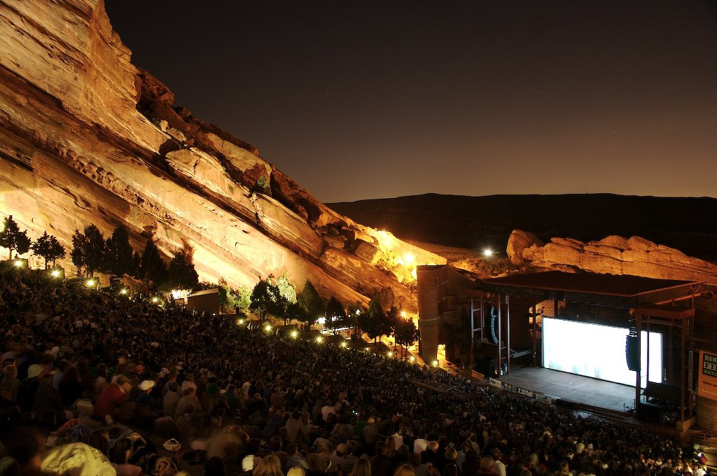
    Red Rocks Amphitheatre near Denver, carved into the red sandstone
    Red Rocks Amphitheatre, a short drive from downtown Denver (Photo: a Wikimedia Commons contributor via Wikimedia Commons, CC BY-SA 3.0)

    Events that move Denver flight and hotel prices

    Cross-check these against your dates before you book. Exact dates shift each year; Visit Denver keeps the current calendar.

    • National Western Stock Show (about two weeks from early January).
    • Martin Luther King Jr. and Presidents’ Day weekends (third Mondays of January and February): major ski weekends.
    • Spring break (most of March, varying by school and state): the biggest ski-travel spike outside the holidays.
    • Memorial Day, the Fourth of July and Labor Day: the summer’s busiest travel weekends.
    • Denver PrideFest (a weekend in late June) and the Juneteenth Music Festival in Five Points.
    • Red Rocks concerts (spring to fall), which fill hotels on the nights of the biggest shows. Our Denver events page shows what is on sale for your dates.
    • Broncos home games (September to January), plus Nuggets and Avalanche playoff runs in spring.
    • Great American Beer Festival (early fall).
    • Thanksgiving, Christmas and New Year, and the ski weeks around them.
    • Large conventions at the Colorado Convention Center, which can fill downtown hotels on weeknights; if mid-week rates look strangely high, that is usually why.

    Getting in from the airport

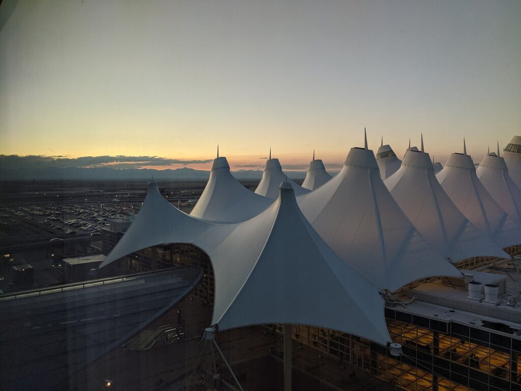
    Denver International Airport (DEN) sits on the open plains about 40 km (25 miles) northeast of downtown, and its white, peaked tent roof, designed to echo the snow-capped Rockies, is visible for miles. It is one of the largest airports in the world by land area and consistently one of the busiest by passengers, with a single main terminal and three concourses linked by an underground train. United runs a major hub here, Southwest has one of its largest operations, and Frontier is based in Denver; there are nonstop flights from almost every large U.S. city, from Canada and Mexico, and from several European and Asian hubs including London, Frankfurt, Munich, Reykjavik and Tokyo. Getting downtown: RTD’s A Line commuter train runs from a station at the south end of the terminal to Union Station in under 40 minutes, every 15 minutes for most of the day, and is by far the easiest option for a city stay. Taxis and ride-hail pick up on the terminal’s ground-transport level, and the drive downtown takes 30 to 50 minutes depending on traffic. Rental car companies are mostly off-airport, reached by shuttle buses from the terminal, so allow extra time both ways. Our Denver car-versus-transit guide works through whether you need a car, and our DEN airport guide covers the layout.

    The peaked white tent roof of the main terminal at Denver International Airport
    Denver International (DEN), whose tent roof echoes the snowy peaks of the Rockies (Photo: Peterquinn925 via Wikimedia Commons, CC BY-SA 4.0)

    Timing tricks that work for Denver

    • Search the whole month. Ski weekends, spring break and the big summer holidays create sharp edges in the fare calendar. A calendar search on TicketScanner shows them instantly, and the week after a holiday is often a bargain relative to the week of it.
    • Price the rental with the flight in ski season. Around Christmas, Presidents’ Day and spring break, all-wheel-drive rentals at DEN sell out and rates climb. Check our Denver car rental page for the same dates before you commit to the fare.
    • Book the hotel early for big weekends. A cheap fare is not cheap once a convention-week or concert-night room is added. Run a Denver hotel search for the same dates first.
    • Fly mid-week. Ski travelers leave on Friday and Saturday and return on Sunday, and business travelers fill Monday mornings and Thursday evenings; Tuesday and Wednesday in the middle of the day are usually the value.
    • Use the hub competition. With United, Southwest and Frontier all fighting for Denver traffic, compare all three, and remember that the cheapest fares may carry bag and seat fees that change the total.
    • Consider a road trip. Salt Lake City, about eight hours west by car, has its own big airport, and flights to Salt Lake City can make a one-way Rockies road trip work; our Denver to Salt Lake City route guide covers the drive.
    • Build a winter buffer. Spring snowstorms in March and April are more disruptive at DEN than midwinter cold, and summer thunderstorms cause afternoon delays. Avoid the tightest connections, and see our guide to how early to arrive for what to allow.
    • Flying out of Denver instead? The same seasonality applies in reverse; see cheap flights from Denver.
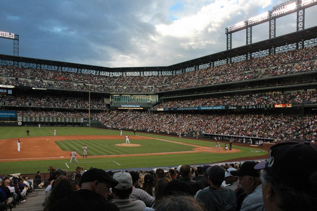
    A Colorado Rockies game at Coors Field in downtown Denver in summer
    A summer game at Coors Field in LoDo, part of the peak season that runs from June to August (Photo: DimiTalen via Wikimedia Commons, CC0)

    What to pack, by season

    Winter (December to February): a warm coat, a hat, gloves, boots with grip, and layers, because a 10 °C (50 °F) sunny afternoon can follow a frigid morning; for the mountains, full ski or snow gear. Spring (March to May): layers, a waterproof jacket and shoes that can handle slush, because a snowstorm is always possible. Summer (June to August): light clothing, a warm layer for cool evenings and for Red Rocks after dark, a rain shell for the afternoon storms, and serious sun protection. Fall (September to October): layers again, a warmer jacket by late October, and sunglasses year-round. In every season, bring a refillable water bottle and lip balm; the air is dry and the altitude makes you thirsty.

    The best time to fly to Denver for…

    Skiing

    January and early February for snow and value, March for deep snow and longer days if you avoid the spring-break weeks, with the Christmas weeks and Presidents’ Day the most expensive.

    Rocky Mountain National Park and summer hiking

    Late June to mid-September, when Trail Ridge Road and the high trails are open; reserve timed entry in advance and start hikes early to beat the afternoon storms.

    Fall color

    The second half of September, give or take a week depending on the year and the elevation; go mid-week to avoid the weekend crowds on the mountain roads.

    Red Rocks concerts

    June to September for the classic warm-evening experience; book tickets first, then the flight and the hotel.

    The lowest fares

    January after New Year, early November, and late April to mid-May.

    International visitors

    Visitors from Visa Waiver Program countries need an approved ESTA before boarding; most others need a visa. The State Department’s travel site explains what applies to you, and the TSA lists what you can carry through security. Rocky Mountain National Park charges an entrance fee and uses timed-entry permits in season.

    Frequently asked questions

    What is the cheapest month to fly to Denver?

    January after the holidays is consistently among the lowest, followed by early November and the spring shoulder from late April to mid-May.

    What is the best month to visit Denver for weather?

    September, with warm, dry days and cool nights, followed by June and early October. July is hot; March is snowy.

    When is ski season near Denver?

    Roughly mid-November to mid-April, with some high-elevation areas opening earlier and closing later. The busiest and priciest weeks are Christmas, Presidents’ Day and spring break.

    Does it snow a lot in Denver?

    The city gets regular snow from October to April, heaviest in March, but it usually melts within a few days under the strong sun. The mountains get far more and keep it.

    Will the altitude affect me when I land?

    Most visitors notice only thirst and faster tiredness in the city. Drink water, go easy on alcohol the first night, and give yourself a day before strenuous activity higher up in the mountains.

    How far ahead should I book?

    Earliest for the ski holidays, spring break and June to August, when fares tend only to rise; for the shoulder and low seasons, fares are stable enough that finding the right dates matters more than booking months out.

    Is Denver or Colorado Springs better to fly into?

    Denver, for most trips: far more routes and usually lower fares. Colorado Springs is worth checking only if your trip is based there.

    Ready to pick your dates? Compare fares across the whole month on our Denver flights page, then find a room with our Denver hotel search. For what to do when you land, start with our first-timer’s guide to Denver, and before you pick up a car, read whether you need one.

  • Things to Do in Denver: A First-Timer’s Guide

    Things to Do in Denver: A First-Timer’s Guide

    Denver gets treated as a runway to the mountains. Most visitors land at DEN, pick up a car and point it west on I-70, and they miss a city that has become one of the most enjoyable in the American West: a restored railroad station that doubles as the city’s living room, an art museum split between a titanium-clad Libeskind building and a Gio Ponti tower, mural-covered warehouse districts full of breweries and food halls, a concert venue carved out of red sandstone that musicians rank among the best on earth, and four major-league teams that all play within a few miles of downtown. And the Front Range is right there on the western horizon, with ski areas, hot springs and a national park within a couple of hours. This guide covers the sights that earn a day, the neighborhoods worth a half-day, the food and beer, the sports and the seasons, the day trips that make Denver a base as much as a destination, and the practical details, including the altitude, that turn a stopover into a trip.

    If you are still comparing cheap flights to Denver, read this alongside our guides to the best time to fly to Denver and whether you need a car (for the city itself, often not; for the mountains, usually yes). Between the three you can plan the whole trip.

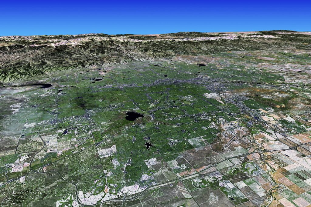
    The Denver skyline with the foothills of the Front Range beyond
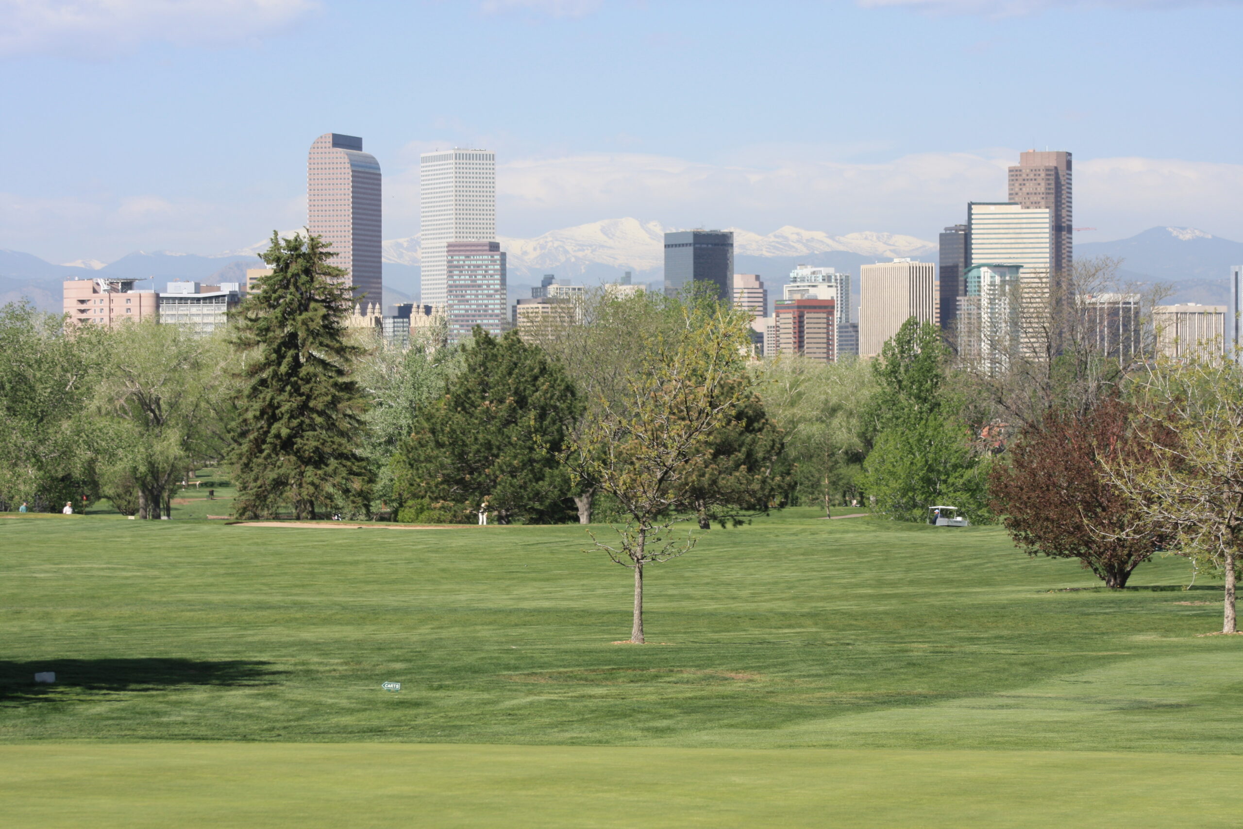
    Downtown Denver on the high plains, with the Front Range on the western horizon (Photo: Thanks to Kevin Day for help in describing the image. Visualization by Earth Observatory. Landsat data and SRTM data coregistration provided by the Landsat Project Science Office at NASA’s Goddard Space Flight Center. via Wikimedia Commons, Public domain)

    Denver at a glance for first-timers

    • Airport: Denver International (DEN), on the plains about 40 km (25 miles) northeast of downtown, is one of the busiest airports in the world and a hub for United, Southwest and Frontier. The RTD A Line train runs from the terminal to Union Station in under 40 minutes. See our DEN airport guide.
    • Getting around: downtown, LoDo, the Highlands and RiNo are walkable, and RTD’s light rail and commuter trains link the center with the airport, the suburbs and Golden. For Red Rocks, Rocky Mountain National Park and the ski areas, most visitors rent a car. Our car-versus-transit guide explains when it helps.
    • Money: US dollars. Sales tax is added at the register rather than shown on the tag, and Denver’s combined rate is higher than the state figure you may have seen quoted; hotel taxes are higher again. Tipping 18 to 20 percent in restaurants is expected.
    • Altitude: the city sits about 1,600 m (5,280 feet) above sea level, and you will feel it more than you expect. Drink more water than usual, go easy on alcohol the first night, and wear sunscreen even in winter.
    • Weather: sunny, dry and changeable: hot summer days with afternoon thunderstorms, a long golden fall, winters milder than the mountains’ reputation suggests, and a snowy March. Our month-by-month guide has the detail.
    • Where to stay: LoDo for Union Station, Coors Field and the restaurants; downtown near the Convention Center for the 16th Street corridor and the theaters; Cherry Creek for shopping; the Highlands or RiNo for a neighborhood feel. Our Denver hotel search covers them all.

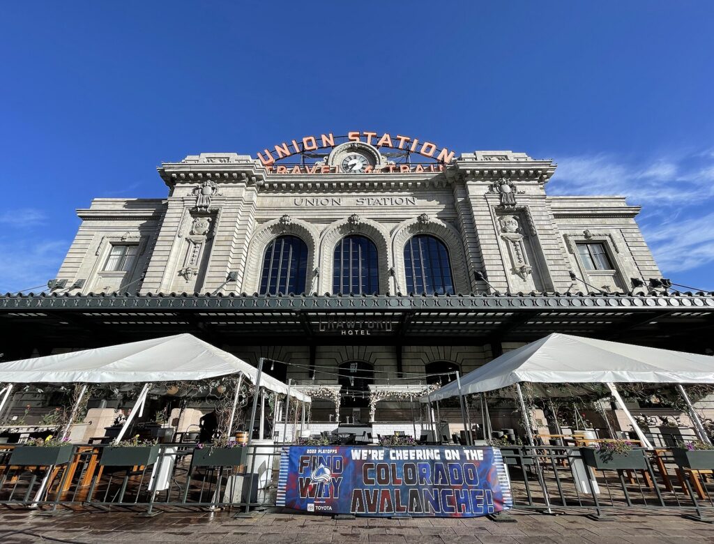
    Union Station, LoDo and Larimer Square

    Denver Union Station is where to start, and it is where many visitors arrive if they take the train from the airport. The Beaux-Arts building, opened in its current form in 1914, was restored in the 2010s into a hotel, a set of restaurants and bars, and a great hall with long communal tables and shuffleboard where locals meet after work; behind it, a white canopy covers the commuter rail platforms, and Amtrak’s California Zephyr still stops here on its run between Chicago and the Bay Area. Around it, LoDo, Lower Downtown, is the city’s historic warehouse district, now a grid of red-brick buildings filled with restaurants, rooftop bars and galleries, with the Dairy Block alley and its food hall a short walk away. Two blocks south, Larimer Square is Denver’s oldest block, a row of Victorian storefronts under strings of lights, with some of the city’s best-known restaurants and patios. Coors Field, home of the Colorado Rockies, anchors the northern edge of LoDo, and on game nights in summer the whole district fills with purple jerseys. It is the natural base for a first visit, and our LoDo hotel page lists what is available.

    The Beaux-Arts facade of Denver Union Station in LoDo
    Denver Union Station, restored as a hotel, food hall and the hub of the city's rail network (Photo: Missvain via Wikimedia Commons, CC BY 4.0)

    Downtown, the Capitol and the Golden Triangle

    From LoDo, the 16th Street pedestrian corridor runs southeast through downtown toward Civic Center Park; it has been through a long reconstruction, so check the city’s updates, but the free MallRide shuttle buses have traditionally run its length between Union Station and Civic Center Station. Along the way you pass the Daniels and Fisher clock tower and, a block off the mall, the Denver Performing Arts Complex, one of the largest performing arts centers in the country, with Broadway tours, the Colorado Symphony, Opera Colorado and the Denver Center Theatre Company under one glass roof. Nearby, a 12-meter (40-foot) blue bear sculpture presses its nose against the windows of the Colorado Convention Center and has become the city’s unofficial mascot. At the far end, the Colorado State Capitol faces the mountains from the top of Civic Center Park, with a dome covered in Colorado gold leaf; free tours run on weekdays, and a step on the west side is marked as one mile above sea level, which is where the Mile High City gets its name (later resurveys moved the exact mile a few steps higher, and both are marked). South of the park, the Golden Triangle holds the city’s densest cluster of museums and the Denver Public Library’s postmodern Central Library by Michael Graves.

    Museums: the Denver Art Museum and its neighbors

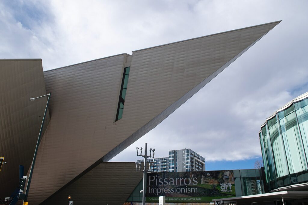
    The Denver Art Museum is the anchor, and its two buildings are reason enough to visit: the Hamilton Building, Daniel Libeskind’s sharp-angled titanium structure that looks like shards of rock, and the Martin Building, Gio Ponti’s castle-like tower clad in glass tiles, reopened after a major renovation. The collections are especially strong in Native American art, the art of the American West and pre-Columbian and Spanish colonial work, and the museum has long offered free general admission to visitors 18 and under. Next door, the Clyfford Still Museum is a quiet concrete building devoted entirely to one abstract expressionist painter, and it is one of the most affecting single-artist museums in the country. Across the street, the History Colorado Center tells the story of the state from Indigenous peoples and the gold rush to ski towns, with hands-on exhibits that suit children. A few blocks away, the U.S. Mint in Denver produces billions of coins a year and runs free guided tours that must be booked in advance.

    The angular titanium-clad Hamilton Building of the Denver Art Museum
    Daniel Libeskind's Hamilton Building, one half of the Denver Art Museum in the Golden Triangle (Photo: Daniel Hartwig via Wikimedia Commons, CC BY 4.0)

    City Park, the Botanic Gardens and the South Platte

    East of downtown, City Park is Denver’s biggest urban park, with lakes, a boathouse, and the view that sells the city: the downtown towers in the foreground and the whole Front Range behind them, best seen from the steps of the Denver Museum of Nature & Science late in the afternoon. The museum itself has excellent dinosaur and gems-and-minerals halls, a planetarium and an IMAX theater. The Denver Zoo shares the park and is one of the most visited in the country. A short drive or bus ride south, the Denver Botanic Gardens on York Street are among the best in the United States, with collections of plants from the world’s dry, high-altitude regions, a Japanese garden, a summer concert series, and Blossoms of Light over the winter holidays. Back toward downtown, Confluence Park marks the spot where Cherry Creek meets the South Platte River and where the city was founded during the 1858 gold rush; the paved Cherry Creek Trail and the South Platte River Trail start here and run for miles, and a bike ride along either is the easiest way to see how the city fits together. Washington Park, south of downtown, is the local favorite for running, paddleboarding and picnics.

    Neighborhoods worth a half-day

    RiNo, the River North Art District

    RiNo, just northeast of downtown along the rail lines, is Denver’s former industrial district turned into the city’s most energetic neighborhood. Almost every wall along Larimer Street and the side alleys carries a mural, many of them painted during the annual Crush Walls festival, and the old warehouses hold breweries, taprooms, galleries and restaurants. Denver Central Market, a food hall in a former warehouse, is a good place to start, and the district is a short walk, scooter ride or A Line stop from Union Station.

    The Highlands and LoHi

    Across the pedestrian bridges over I-25 from LoDo, the Highlands sit on a bluff with the best skyline views in the city. Lower Highlands, known as LoHi, is packed with restaurants, rooftop bars and Little Man Ice Cream, which serves from a building shaped like a giant milk can and draws lines on summer nights.

    Cherry Creek

    Denver’s upscale shopping district, a few miles southeast of downtown, has the Cherry Creek Shopping Center, a walkable grid of independent boutiques and galleries around it, and some of the city’s best hotels and restaurants. The Cherry Creek Trail links it with downtown by bike.

    South Broadway and Baker

    South Broadway is Denver’s vintage, record-store and dive-bar strip, with some of the best small music venues in the city and a steady supply of cheap, good food.

    Five Points and Colfax

    Five Points was once known as the Harlem of the West for its jazz clubs, and it remains the historic heart of Denver’s Black community, with the Blair-Caldwell African American Research Library, a revived restaurant scene and the Juneteenth Music Festival each June. East Colfax Avenue, one of the longest commercial streets in the country, runs past it through Capitol Hill, lined with theaters, diners and music venues including the Ogden and the Bluebird.

    Red Rocks Park and Amphitheatre

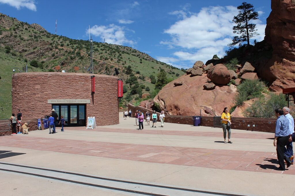
    If you do one thing outside the city, make it Red Rocks. About 25 km (15 miles) west of downtown in the foothills near Morrison, the amphitheater sits between two enormous tilted sandstone monoliths, with a stage framed by rock and a view back across the plains to the Denver skyline. It is owned by the City and County of Denver, it has hosted everyone from the Beatles to U2, and a concert there on a summer night is one of the great live-music experiences in America. The main concert season runs from spring to fall, and popular shows sell out quickly, so check our Denver events page as soon as your dates are set; the summer film series and the long-running Easter sunrise service are other ways in. On days without a show, the amphitheater and the surrounding park are open to the public: locals climb the stadium steps as a workout, the Trading Post Trail loops through the red rock formations, and the visitor center explains the geology and the venue’s history. Go early in summer and bring water. Without a car, shuttle services run from downtown on many concert nights.

    Red Rocks Amphitheatre set between sandstone monoliths in the foothills west of Denver
    Red Rocks Amphitheatre, about half an hour west of downtown and one of the great concert venues in America (Photo: Sarbjit Bahga via Wikimedia Commons, CC BY-SA 4.0)

    Sports

    Denver is one of the few American cities with teams in all four major leagues, and all of them play close to downtown. The Colorado Rockies play baseball at Coors Field in LoDo from spring to early fall; a row of purple seats in the upper deck marks exactly one mile above sea level, and the thin air helps fly balls carry, which is why the park stores its game balls in a humidor. The Denver Broncos play at Empower Field at Mile High, west of downtown across the South Platte, and Broncos Sundays in the fall are the city’s great shared ritual; tickets are hard to come by for big games. The Denver Nuggets (NBA) and the Colorado Avalanche (NHL), both recent champions, share Ball Arena, a short walk from Union Station. The Colorado Rapids play soccer in Commerce City, north of the city. For all of them, check what is on sale in Denver for your dates before you book flights.

    What to eat and drink, and where

    Three things define Denver’s food. The first is green chile: Colorado’s version is a pork-studded stew rather than a sauce, and it goes on burritos, eggs, burgers and fries, usually “smothered”. Every Mexican restaurant on Federal Boulevard and South Santa Fe Drive has an opinion about it, and you should try more than one. The second is beer: Denver is one of the great brewing cities in the country, the Great American Beer Festival takes over the Convention Center every fall, and RiNo, LoDo and the Highlands each have enough taprooms to fill an afternoon; Wynkoop, opposite Union Station, was the city’s first brewpub. The third is a restaurant scene that has grown fast enough that Colorado now has its own Michelin guide, with the most interesting kitchens concentrated in LoHi, RiNo, Larimer Square and along Tennyson Street. Beyond that: food halls, which Denver has more of than most cities its size, including Denver Central Market, Avanti in LoHi, the Milk Market in the Dairy Block and the Stanley Marketplace in a former aviation factory in Aurora; bison and Colorado lamb on steakhouse menus; Rocky Mountain oysters, the famous novelty that is not seafood, for the adventurous; and the Denver omelet, which the city claims as its own.

    Denver through the seasons

    Denver is a different city in each season, and what you do depends on when you come. Winter (December to February) is milder in the city than visitors expect: snow falls, then usually melts within a few days under the strong sun, and a sunny 10 °C (50 °F) afternoon in January is not unusual. It is ski season in the mountains, the Nuggets and Avalanche are at home, and the National Western Stock Show, a rodeo and livestock show that has run every January for more than a century, brings cowboys to the city for two weeks. Spring (March to May) is erratic: March is the snowiest month, and a warm, sunny week can end in a heavy snowstorm, but the parks green up by May and baseball starts. Summer (June to August) is hot, dry and bright, with afternoon thunderstorms; it is patio season in LoHi and RiNo, the best of the Red Rocks season, Denver PrideFest and the Juneteenth Music Festival, and the only reliable time for the high mountain roads and trails. Fall (September to October) is the local favorite: warm days, cool nights, clear skies, the aspens turning gold in the mountains in the second half of September, the Great American Beer Festival, and the Broncos. Our month-by-month guide has the fare patterns that go with each season.

    Denver with kids

    Denver is an easy city with children, helped by the fact that RTD’s buses and trains are free for riders 19 and under. The Denver Museum of Nature & Science, with its dinosaurs and planetarium, and the zoo, next door in City Park, make an obvious full day together. The Denver Art Museum’s free youth admission and hands-on family spaces, the History Colorado Center’s interactive galleries, and the Children’s Museum of Denver at Marsico Campus, near the Downtown Aquarium and the Elitch Gardens amusement park along the South Platte, fill another. In summer, the pedal boats on Ferril Lake in City Park and the playgrounds and lawns of Washington Park are cheap and easy, and a Rockies game, from the inexpensive Rockpile seats in center field, suits young children. Red Rocks on a non-concert morning, the bison herd at the Rocky Mountain Arsenal National Wildlife Refuge near the airport, and the Georgetown Loop Railroad in the mountains are the best short outings. For a family road trip into the mountains, our family car rental guide covers the vehicle question.

    Denver on a budget

    Much of the best of Denver is free or nearly so: the Capitol tour, Union Station’s great hall, the murals in RiNo, the U.S. Mint tour, the City Park view, the river trails, Red Rocks on a non-show day, and the free MallRide shuttle downtown when it is running. Several of the big museums and the Botanic Gardens offer free days for Colorado residents during the year, which also means busier galleries on those days, so check each site. Eat well for less on Federal Boulevard, in the food halls and on South Broadway, and at taprooms that host food trucks. Hotel rates in Denver swing widely with conventions, concerts and ski weekends, and mid-week stays outside summer are usually the best value; the A Line from the airport is much cheaper than a taxi. Compare rates by neighborhood on our Denver hotel search.

    Day trips from Denver

    Boulder, about 40 km (25 miles) northwest and reachable by RTD’s Flatiron Flyer bus, has the Flatirons, the hiking trails from Chautauqua Park and the Pearl Street pedestrian mall. Golden, at the end of RTD’s W Line, has the Coors brewery, the Colorado School of Mines and the road up Lookout Mountain to Buffalo Bill’s grave. Rocky Mountain National Park, about two hours northwest via Estes Park, is the headline trip: alpine lakes, elk herds and Trail Ridge Road, one of the highest continuous paved roads in the country, open roughly from late May to mid-October depending on snow; the park uses a timed-entry reservation system for much of the summer and early fall, so check the National Park Service site before you go. Along I-70, Idaho Springs has hot springs and a historic main street, Georgetown has the Georgetown Loop Railroad, and the ski towns of the Summit County area are about 90 minutes away in good conditions. Mount Blue Sky, formerly Mount Evans, has one of the highest paved roads in North America, open in summer with timed reservations. South on I-25, Colorado Springs, about 110 km (70 miles) away, has the red rock formations of the Garden of the Gods and the road and cog railway up Pikes Peak. Most of these are car trips; see our Denver car rental page, and read our car-versus-transit guide before you drive mountain roads in winter. For a longer road trip, our Denver to Salt Lake City route guide covers the drive west. Colorado’s official tourism site covers the wider state.

    Two sample itineraries

    Two days, no car

    Day one: the A Line into Union Station, a coffee in the great hall and a walk through LoDo and Larimer Square in the morning, the Denver Art Museum and the Clyfford Still Museum in the Golden Triangle, the Capitol and its mile-high step in the late afternoon, and dinner in LoHi after walking across the bridges. Day two: the murals and breweries of RiNo in the morning, lunch at Denver Central Market, City Park and the Museum of Nature & Science in the afternoon with the sunset view from the steps, and a Rockies, Nuggets or Avalanche game at night.

    Four days, with Red Rocks and the mountains

    Add a morning at Red Rocks and an afternoon in Golden, then pick up a car for a day in Rocky Mountain National Park via Boulder, or a day along I-70 to Georgetown and Idaho Springs, and finish with a Red Rocks concert if the calendar allows, returning the car at the airport on the way home.

    Practical details

    • Transit: buy tickets through RTD’s mobile ticketing app or at station machines; riders 19 and under travel free. RTD has maps, fares and service alerts; our transit-versus-car guide goes into detail.
    • From DEN: the A Line to Union Station, a taxi or ride-hail, or a rental from the off-airport lots by shuttle. The airport’s site covers ground transport.
    • Weather: layers in every season, sunscreen and sunglasses year-round, a rain shell for summer afternoons, and a warm coat from November to March. NOAA’s National Weather Service office for Denver and Boulder has the forecast.
    • Altitude: most visitors feel nothing worse than thirst and faster tiredness, but headaches and shortness of breath are common in the first day or two, and more so in the mountains above 2,500 m (8,000 feet). Hydrate, take it easy the first day, and see a doctor if symptoms are severe.
    • Time zone: Mountain, two hours behind New York and one ahead of Los Angeles.
    • Entry requirements: visitors from Visa Waiver Program countries need an approved ESTA before boarding; most others need a visa. The State Department’s travel site is the authoritative source.
    • Safety: the areas visitors spend their time in are busy and generally safe; use ordinary big-city awareness downtown late at night, and in the mountains, respect afternoon lightning and check conditions before hiking.

    Frequently asked questions

    How many days do you need in Denver?

    Two full days covers LoDo, the Golden Triangle museums, RiNo and City Park; add a day for Red Rocks and Golden, and one or two more for Rocky Mountain National Park or the ski areas.

    What is the number one thing to do in Denver?

    A concert at Red Rocks, if the calendar allows. Otherwise, the Denver Art Museum in the morning and the sunset view of the Front Range from City Park.

    Is Denver walkable?

    Downtown, LoDo, Larimer Square, the Highlands and RiNo are, and the light rail links them with the suburbs. The rest of the metro area assumes a car.

    Do I need a car in Denver?

    Not for the city. For Red Rocks outside concert shuttles, Rocky Mountain National Park and the mountains, yes; rent it for those days only.

    Does the altitude affect visitors?

    Mildly, for most people: expect to get thirsty and tired faster, and to feel alcohol more. Symptoms are more likely higher up in the mountains than in the city.

    What is Denver known for?

    The mile-high elevation, the Rocky Mountains on the horizon, Red Rocks, craft beer, green chile, the Broncos, and one of the sunniest, most outdoor-minded populations in the country.

    Ready to go? Compare flights to Denver, find a place to stay with our Denver hotel search, and if the mountains are on the list, price a rental car for those days.

  • Dallas: Should You Rent a Car or Rely on Public Transit?

    Dallas: Should You Rent a Car or Rely on Public Transit?

    Dallas has a reputation as a place where nobody walks and everybody drives, and for much of the metro that reputation is earned. The Dallas-Fort Worth area sprawls across more than a dozen counties, its freeways are among the widest in the country, and its two big cities, its stadiums and its suburbs sit tens of miles apart. It is also incomplete. Dallas also runs one of the longest light-rail networks in the United States, a train goes straight from DFW Airport to downtown, a free vintage trolley covers Uptown, and the neighborhoods most visitors actually spend their time in, downtown, the Arts District, Uptown, Deep Ellum and Bishop Arts, are compact and connected. The right answer depends almost entirely on where you are going beyond the center. This guide explains how the city is laid out, how DART and the regional trains work, what driving here is really like, including the tolls, the heat and the storms, and gives you a straightforward way to decide.

    The short answer

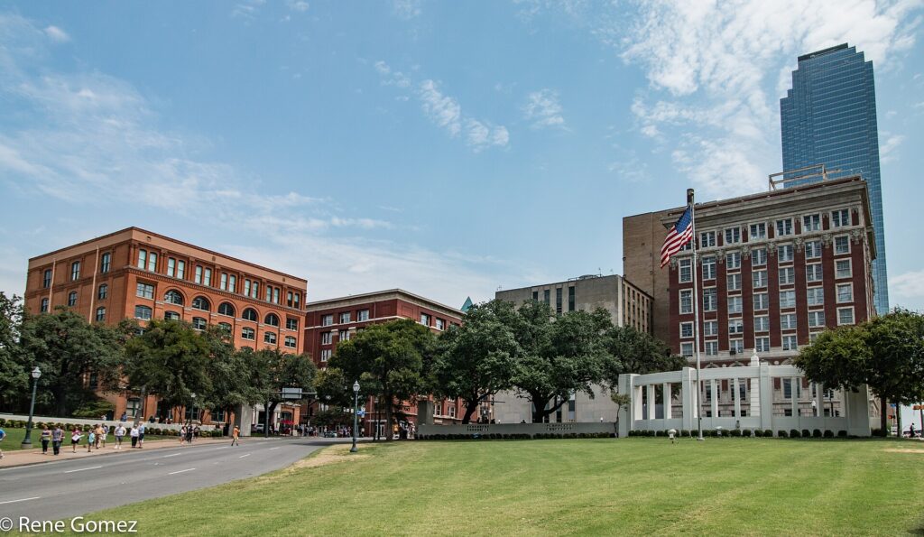
    Skip the car if you are staying downtown, in the Arts District or in Uptown for a city break, a convention or the State Fair, and your plans are the museums, Klyde Warren Park, Dealey Plaza, Deep Ellum, Bishop Arts and a Mavericks game; DART, the M-Line trolley, your feet and the occasional ride-hail will cover it, and you will not pay for hotel parking. Rent a car if you are going to a Cowboys or Rangers game in Arlington, visiting family in the suburbs, spending serious time in Fort Worth, or driving on to Houston, Austin or Waco. For many visitors the hybrid works best: car-free city days and a one- or two-day rental for everything else. Compare rates for any of these plans on our Dallas car rental page.

    How Dallas is laid out

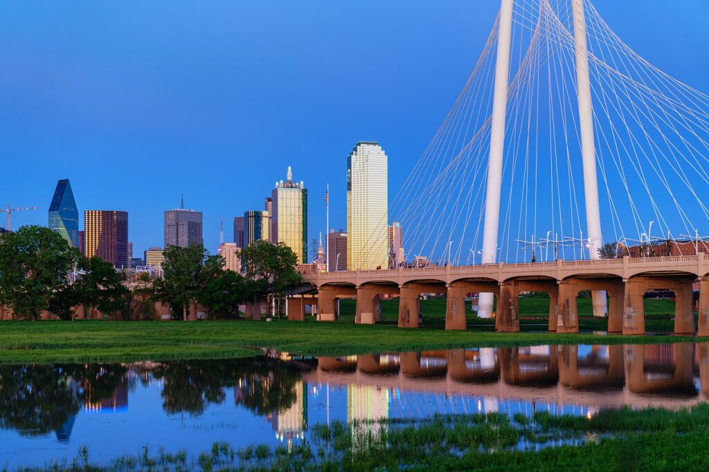
    Downtown Dallas sits inside a tight ring of freeways on the east bank of the Trinity River: I-35E on the west, I-30 on the south, I-345 on the east and Woodall Rodgers, now partly covered by Klyde Warren Park, on the north. The Arts District fills the northern edge of downtown, with Uptown and Victory Park just beyond it; Deep Ellum is directly east; the Cedars and Fair Park are to the southeast; and Oak Cliff, with the Bishop Arts District, is across the river to the southwest. The vast northern suburbs of Richardson, Plano and Frisco lie beyond Uptown and the Park Cities. DFW Airport lies about 32 km (20 miles) to the northwest, halfway to Fort Worth, with Irving and Las Colinas between it and the city, and Arlington, home of the Cowboys and Rangers, sits south of the airport between the two big downtowns. The center is walkable in cooler months; everything beyond it was built around the car.

    Hotels cluster downtown and in the Arts District, in Uptown, around the airport and Las Colinas, and in the northern suburbs along the tollways, where many corporate campuses are. Our Dallas hotel search lets you compare them.

    Getting in from the airport

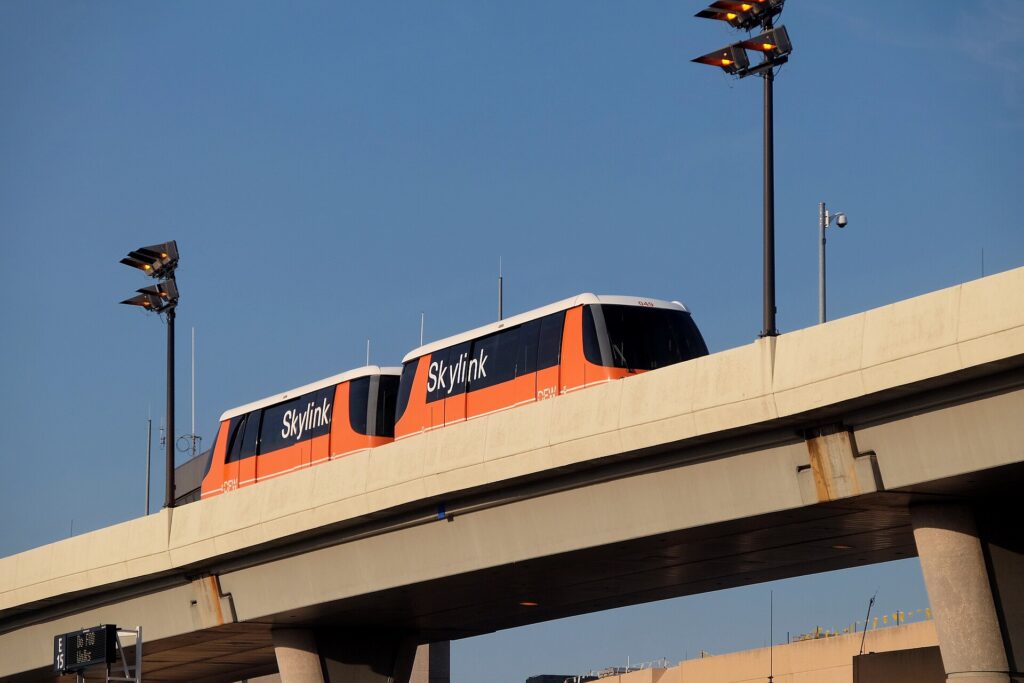
    Dallas has two airports, and the answer is different for each. At DFW, the DART Orange Line leaves from DFW Airport Station at Terminal B and reaches downtown Dallas in about 50 minutes for a standard local fare; from other terminals, ride the Skylink train or the landside Terminal Link shuttle to Terminal B. TEXRail runs from the same station to downtown Fort Worth in under an hour, stopping in Grapevine. Taxis and ride-hail pick up at every terminal, and the drive to downtown Dallas takes 25 to 45 minutes depending on traffic. Every major rental company operates from the consolidated Rental Car Center south of the terminals, reached by dedicated shuttle buses from each terminal. At Love Field, the smaller airport where Southwest is based, downtown is only about 10 km (6 miles) away, a 15- to 20-minute taxi or ride-hail, and a DART shuttle bus connects the terminal to Inwood/Love Field station on the light rail; the rental counters are in the garage across from the terminal. Check the DFW site and the Love Field site for current ground-transport details, and our DFW airport guide for the layout.

    The terminal at Dallas Love Field (DAL)
    Dallas Love Field, Southwest's home base, about 15 to 20 minutes by car from downtown (Photo: EEJCC via Wikimedia Commons, CC BY-SA 4.0)

    Dallas’s transit, explained

    Dallas Area Rapid Transit, known as DART, runs the light rail, the buses and the streetcar across Dallas and a dozen surrounding cities. It is clean, air-conditioned and, on the rail lines, frequent enough for visitors, and it covers more of the places you want to go than its reputation suggests. Its limitation is the metro’s scale: the rail lines radiate from downtown along the main corridors, and the buses that fill the gaps run less often than a visitor from New York or Chicago would expect.

    DART light rail

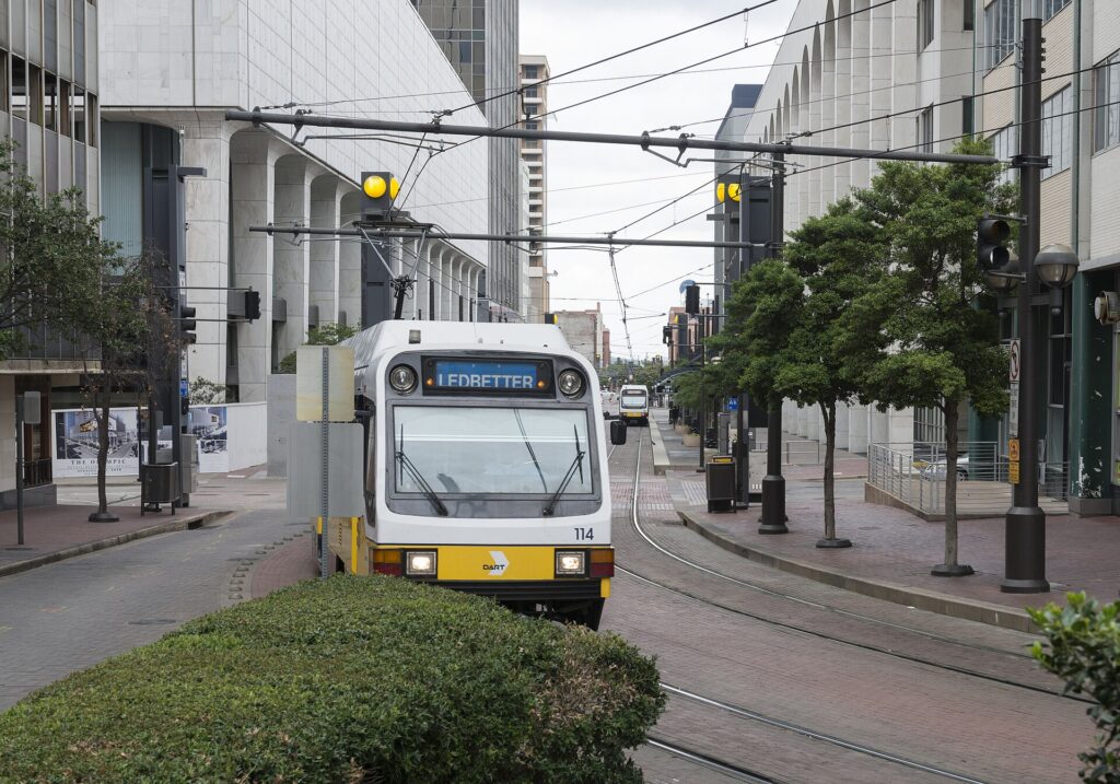
    Four lines, all of which run through the downtown transit mall. The Red and Blue lines run north through Uptown’s Cityplace station toward Richardson, Plano and Garland, and south past Union Station and the Cedars into Oak Cliff, with the Red Line stopping at the Dallas Zoo. The Green Line runs from the northwest past the Market Center and Victory station at the American Airlines Center, through downtown to Deep Ellum and Fair Park, which makes it the State Fair line. The Orange Line shares the Green Line’s tracks in the city, then heads west through Irving and Las Colinas to DFW Airport. DART’s newer Silver Line commuter rail, running across the northern suburbs from DFW to Plano, has been coming into service; check DART’s map for its status when you travel. Trains run from early morning until around midnight.

    Streetcars and the trolley

    The Dallas Streetcar runs from Union Station across the Trinity to the Bishop Arts District in Oak Cliff, which is the easiest car-free way to reach it. The M-Line trolley, run by the McKinney Avenue Transit Authority with restored vintage streetcars, is free and runs every day from the Arts District up McKinney Avenue through Uptown to Cityplace, connecting with DART; the M-Line’s site has the route.

    Buses

    Buses fill in the rest, including routes to White Rock Lake, the Arboretum and the neighborhoods off the rail lines, and on-demand GoLink minibuses serve some suburban zones. Frequencies drop in the evenings and on weekends.

    Fares and tickets

    Buy tickets in the GoPass app or from the machines on every rail platform. Single rides, a midday pass and a day pass are valid across trains, buses and the streetcar, and a regular local pass covers the Orange Line to DFW; continuing into Fort Worth on the TRE or TEXRail needs a regional pass. Reduced fares are available for children, seniors and students. Check DART’s site for current prices before you go.

    Accessibility

    All DART rail stations are accessible, with level boarding from the platforms, and the bus fleet is low-floor with ramps.

    A DART light-rail train in downtown Dallas
    DART light rail, one of the longest light-rail networks in the United States, with a direct line to DFW Airport (Photo: Carol M. Highsmith via Wikimedia Commons, Public domain)

    Beyond DART

    • Walking. Downtown, the Arts District, Klyde Warren Park, Uptown and Deep Ellum are pleasant on foot from October to May. From June to September, save walking for mornings and evenings.
    • The Katy Trail and bikes. The Katy Trail runs about 3.5 miles through Uptown on a former railroad line, and the loop around White Rock Lake is about 9 miles; both are best by bike in the cooler hours.
    • Taxis and ride-hail. Uber, Lyft and taxis operate across the metro and are quick for short hops between Uptown, Deep Ellum and Bishop Arts.
    • Regional trains. The Trinity Railway Express commuter line runs between Dallas Union Station and downtown Fort Worth, with a stop at CentrePort that connects by shuttle bus to DFW, on a reduced weekend schedule. TEXRail links DFW to Grapevine and Fort Worth.
    • Amtrak. The Texas Eagle stops daily at Union Station on its way between Chicago and San Antonio via Fort Worth and Austin; Amtrak has the schedule. There is no passenger train to Houston.
    • Intercity buses connect Dallas with Houston, Austin and San Antonio several times a day, a reasonable alternative to a one-way rental for solo travelers.
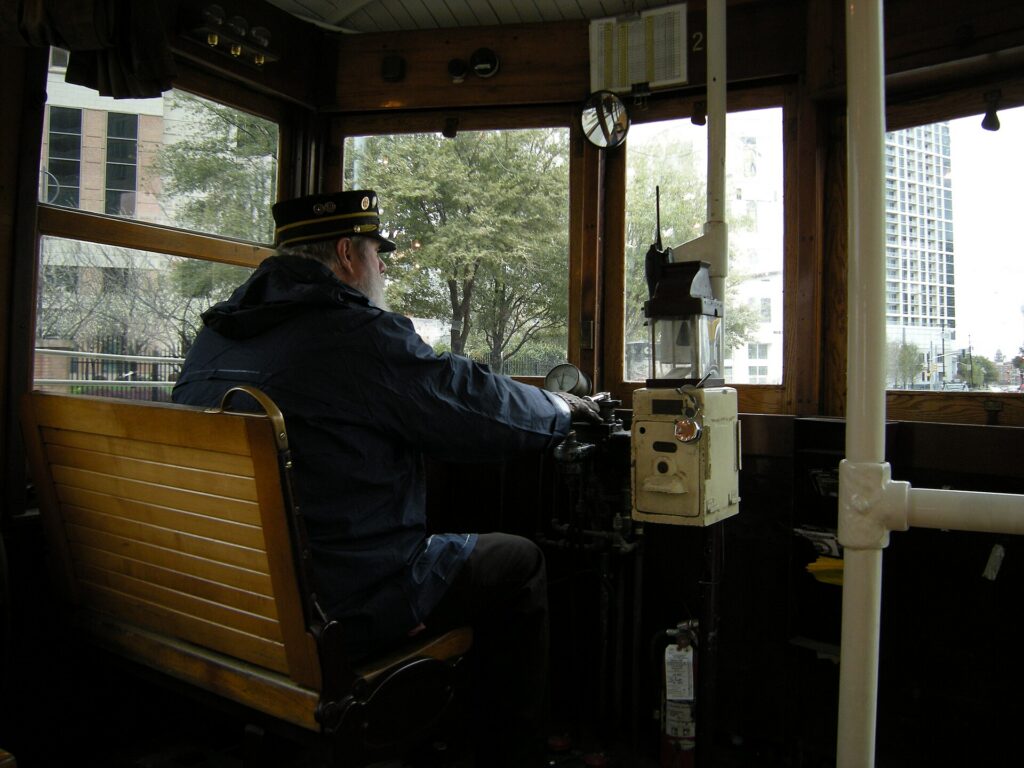
    A vintage M-Line trolley on McKinney Avenue in Uptown Dallas
    The free M-Line trolley runs restored vintage streetcars through Uptown every day (Photo: Joe Mabel via Wikimedia Commons, CC BY-SA 3.0)

    Driving in Dallas: what it is really like

    Dallas is built for driving, and in many ways it is easy: wide freeways, plentiful signage, free parking almost everywhere outside the core, and fuel prices below the national average. The frustrations are specific. Rush hour jams I-35E, US 75, I-635 and the Dallas North Tollway every weekday morning and evening, and a single crash can back up a freeway for miles. Construction is permanent on some corridor or other, and lane shifts and closures change weekly. The interchanges are huge, among them the five-level High Five where US 75 meets I-635, and the frontage roads that run beside every Texas freeway, with their one-way flow and U-turn lanes under the overpasses, take a day to get used to. And game days in Arlington, when the Cowboys or Rangers are at home, clog I-30 and the roads around the stadiums for hours before and after.

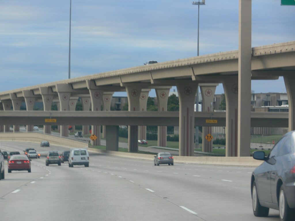
    The five-level High Five Interchange in north Dallas
    The High Five, where US 75 meets I-635: Dallas's freeways are vast, and so are its rush hours (Photo: Photo: Andreas Praefcke via Wikimedia Commons, CC BY 3.0)

    Tolls

    The Dallas North Tollway, the President George Bush Turnpike, the Sam Rayburn Tollway and several other roads are run by the North Texas Tollway Authority, and all of them are cashless: tolls are charged to a TollTag or billed by mail from a photo of the plate, at a higher rate. Express lanes on LBJ Freeway and parts of I-35E use variable pricing. Rental companies handle this through toll programs, usually a flat daily fee plus the tolls, charged on every day of the rental once you use one tolled road. Read the policy at the counter, or set your navigation app to avoid tolls; most city trips add only a few minutes.

    Parking

    Downtown has garages and metered street parking, and most downtown and Uptown hotels charge a nightly fee, often valet-only. Uptown restaurants lean heavily on valet, which is quick and inexpensive by big-city standards. Deep Ellum and Bishop Arts have paid lots and limited street parking, and towing is strictly enforced, so read the signs. Parking at AT&T Stadium and Globe Life Field on game days is expensive and fills early, and some lots are a long walk from the gates. Outside the core, at the Arboretum, the zoo, the malls and the suburbs, parking is plentiful and usually free.

    Rules and conditions worth knowing

    • Heat. A parked car in a Dallas summer becomes dangerously hot in minutes; never leave a child or a pet inside, and use a sunshade.
    • Storms and flash floods. Spring thunderstorms bring hail that can dent a car in minutes and downpours that flood underpasses quickly. Park under cover when storms are forecast, and never drive into water over the road; the National Weather Service’s “Turn Around, Don’t Drown” advice exists for a reason.
    • Ice. On the few days a year when freezing rain hits, bridges and overpasses ice first and the city largely stops. Stay put if you can. DriveTexas publishes road conditions and closures statewide.
    • Phones. Texting while driving is illegal statewide, and handheld phone use is banned in school zones.
    • Right turns on red are permitted after a full stop unless signed otherwise.
    • Move over. Texas law requires you to move over or slow down for stopped emergency, police and road-maintenance vehicles.
    • Speed limits run 60 to 70 mph on urban freeways and up to 75 mph on rural interstates such as I-45 toward Houston.

    When renting a car makes sense

    • Cowboys and Rangers games. AT&T Stadium and Globe Life Field are in Arlington, which has no rail link and very limited public transit; a car, a game-day shuttle or a ride-hail is the practical way in.
    • Fort Worth, properly. The TRE reaches downtown Fort Worth, but the Stockyards and the Cultural District are spread out; a car makes a full day easy.
    • The suburbs. Family in Plano, Frisco or McKinney, or business on a corporate campus along the tollways,.
    • Day trips. Grapevine, Waco, Glen Rose and the lakes are car trips.
    • Texas road trips. Houston, Austin and San Antonio are three to five hours away; our Dallas to Houston route guide covers the most popular drive.
    • Families with young children, for whom a car, a cooler and air conditioning simplify every summer day.

    If any of those apply, our rental car booking tips cover insurance, deposits and the questions to ask at the counter, and our family car rental guide looks at vehicle choice.

    When it does not

    • You are staying downtown, in the Arts District or in Uptown, and your plans are the center.
    • You are in town for a convention, a Mavericks or Stars game, or a concert at the American Airlines Center, all on DART.
    • You are going to the State Fair, where the Green Line stops at the gate and parking is expensive and slow.
    • You flew into Love Field for a short city break; the taxi downtown costs less than a day of hotel parking.

    The hybrid plan for a city-plus-Texas trip

    Go car-free for the city days and rent for the rest, and think carefully about where you pick up. Renting at DFW makes sense if you are heading straight to Arlington, Fort Worth or the suburbs, because the airport sits between them and you avoid downtown traffic entirely. Renting at a neighborhood branch downtown or in Uptown makes sense if you are spending the first nights in the city, because you avoid the airport’s concession fees and several nights of hotel parking. A pattern that works well: the Orange Line or a taxi into the city, two or three car-free days, a rental picked up in town for Fort Worth and a game in Arlington, and the car returned at DFW on the way to the flight home. If you are continuing to Houston, a one-way rental is usually available, though it may carry a drop fee; compare the day rates on our Dallas car rental page against a full-trip rental and the difference is usually clear.

    A worked cost comparison

    Numbers change with the season and the booking window, so treat this as a method rather than a quote, and check current rates before deciding. For a four-night city break downtown for two people, the car-free version costs two Orange Line fares from DFW or one taxi from Love Field, a few DART day passes, and perhaps three or four ride-hail trips to Bishop Arts, Lower Greenville and back; the rental version adds four days of a compact car, four nights of hotel parking, fuel, the airport concession fees and probably a toll-program charge. The transit option wins easily. For the same four nights with a day in Fort Worth and a Rangers game, the car-free version adds TRE regional passes and ride-hail to and from Arlington, which surges on game nights; the hybrid version adds a two-day rental picked up in town, stadium parking and fuel. For two people the costs are often close, and the car wins on convenience; for a family of four, the rental is usually cheaper. For a week split between Dallas and Houston, a one-way rental is the practical answer for most travelers; compare the drop fee against a bus plus a second rental in Houston. Run the rental rates for your dates on our Dallas car rental page and put them beside the transit costs before you choose.

    Driving Dallas to Houston and beyond in each season

    The drive to Houston is the most common road trip out of Dallas: about 385 km (240 miles) south on I-45, three and a half to four hours without traffic, across flat farmland and piney woods. The landmarks are the giant Buc-ee’s travel center at Madisonville, roughly halfway, and the towering statue of Sam Houston beside the highway at Huntsville. In summer, the challenge is heat and holiday traffic; leave early, keep the tank above a quarter, and expect Friday afternoons southbound and Sunday afternoons northbound to be slow. In spring, thunderstorms can bring blinding rain and hail to the open stretches, and flash flooding closes low roads; check the forecast and the National Weather Service before you set out. In fall, the weather is ideal, but football weekends, the State Fair and Texas-OU weekend fill the highways around Dallas. In winter, the road is usually clear, but on the rare ice days the interstate can close entirely, and the right call is to wait a day. In every season, the last hour into Houston, where I-45 meets that city’s traffic, is usually the slowest part of the trip.

    Decision table

    Your tripRecommendationWhy
    City break downtown or Uptown, couple or soloNo carDART, the free trolley and short ride-hail trips cover it; hotel parking is expensive
    Convention or business downtownNo carThe Orange Line runs from DFW to downtown, and the center is compact
    State FairNo carThe Green Line stops at Fair Park; fair parking is slow and costly
    Cowboys or Rangers gameRent for the day, or ride-hailArlington has no rail link and very limited transit
    City plus Fort WorthHybrid: rent in town for the Fort Worth day, or take the TRECar-free city days, car or train for Cowtown
    Family visit to the suburbsRent for the whole staySuburban distances make the car worthwhile daily
    Short trip via Love FieldNo carDowntown is a 15- to 20-minute ride away
    Texas road tripRent (consider one-way to Houston)Dallas is the start, not the destination

    Money-saving tips for both options

    • On transit: ride the free M-Line through Uptown; buy a day pass for a heavy sightseeing day, which also covers the train to DFW; and use the Orange Line rather than a taxi from the airport if you are traveling light.
    • On a rental: compare airport and in-town pickup, book early for October and the holidays, understand the toll program before you drive off, decline extras you already have through a credit card or home policy (check first), and park under cover in hail season.
    • On the hotel: if you are renting, price the nightly parking into the room rate, and consider a hotel near DFW or in the suburbs with free parking for the car days.
    • On timing: avoid the freeways in the weekday peaks and I-30 on game days, and look at the best time to fly to Dallas guide for the busiest weekends.
    • On the big picture: for one or two people staying central, transit plus the occasional ride-hail almost always costs less than a rental; our guide to car, transit or taxi explains how to run the numbers.

    Frequently asked questions

    Is it worth renting a car in Dallas?

    For Arlington, Fort Worth, the suburbs or a road trip, yes. For a city break or a convention based downtown or in Uptown, no; DART, the trolley and ride-hail are enough.

    Is Dallas public transit good for tourists?

    Better than its reputation. The light rail reaches downtown, the Arts District, Deep Ellum, Fair Park, the zoo and DFW, and the free trolley covers Uptown. It thins out quickly in the suburbs and does not reach Arlington.

    How do I get from DFW Airport to downtown Dallas?

    The DART Orange Line from Terminal B in about 50 minutes, or a taxi or ride-hail in 25 to 45 minutes depending on traffic.

    How do I get from Love Field to downtown?

    A taxi or ride-hail in 15 to 20 minutes, or the DART shuttle bus to Inwood/Love Field station and the light rail into downtown.

    Do I need a toll tag to drive in Dallas?

    No, but many major roads are cashless toll roads. A rental car’s toll program covers them for a fee, or you can set your navigation app to avoid tolls.

    Can I get to Fort Worth without a car?

    Yes. The Trinity Railway Express runs between the two downtowns, and TEXRail links DFW with Fort Worth. For the Stockyards and the museums, add a ride-hail or local bus at the Fort Worth end.

    How do I get to a Cowboys game without a car?

    Ride-hail, a game-day shuttle, or a rental; Arlington has no train service. Plan the trip home in advance.

    Whichever way you go, start with the flight. Compare cheap flights to Dallas, choose a neighborhood with our Dallas hotel search, and if Arlington, Fort Worth or a road trip is on the list, price the rental for those dates on our Dallas car rental page. For what to do once you are there, see our first-timer’s guide to Dallas.

  • Best Time to Fly to Dallas: Seasons, Weather & Prices

    Best Time to Fly to Dallas: Seasons, Weather & Prices

    Dallas does not have a single tourist season the way a beach town or a ski resort does, and that makes its airfares more interesting than most. It is one of the largest business-travel markets in the country, with corporate headquarters, conventions and trade shows filling planes and hotels on weekdays all year. It has two major airports, one of them the biggest hub of the world’s largest airline, which keeps seat supply enormous and competition real. And its leisure calendar is shaped by a climate of mild winters, stormy springs, fierce summers and golden falls, with a three-week state fair and a college football rivalry that fill the city every October. The result is a place where the “best time” depends on whether you care most about weather, price or a particular event, and where the answer is often different for flights and for hotels. This guide walks through the weather month by month, the fare seasons, the events that move prices, and how to choose between DFW and Love Field.

    The short answer

    For weather and things to do, the best windows are mid-March to early May, when spring is green, the Arboretum is in bloom and patios are full, and October to early November, when the heat breaks, the State Fair is on and football fills every weekend. The cheapest fares tend to come in January and early February, after the holidays, and in late August and September before the fair, when the heat keeps leisure travelers away. For hotels, summer is the bargain season and Friday and Saturday nights downtown are often cheaper than weeknights. The most expensive stretches are spring break in mid-March, State Fair weekends and Texas-OU weekend in October, Thanksgiving, and the Christmas and New Year holidays. Whatever you choose, run a flexible-date search on our Dallas flights page; with two airports and hundreds of daily flights, a shift of a day or two often changes the fare band entirely.

    Big Tex, the giant cowboy that greets visitors to the State Fair of Texas in Fair Park
    Big Tex at the State Fair of Texas, three and a half weeks every fall that lift hotel rates across Dallas (Photo: Photo: Andreas Praefcke via Wikimedia Commons, CC BY 3.0)

    Dallas’s weather, season by season

    Dallas sits on the North Texas prairie, far from any ocean or mountain range, and that exposure defines its climate: hot, humid air from the Gulf of Mexico in summer, cold fronts sweeping down from the Great Plains in winter, and the collision of the two in spring, which produces some of the most violent thunderstorms in the country. The figures below are approximate seasonal patterns based on the long-term DFW Airport climate normals from NOAA’s National Weather Service; check the current forecast before you pack, because a North Texas cold front can drop the temperature by 20 degrees in an hour.

    MonthTypical daytime highTypical overnight lowWhat it feels likeFare pressure
    Januaryaround 14 °C (57 °F)around 3 °C (37 °F)Mild and often sunny; hard freezes and the odd ice stormLow after New Year’s week
    Februaryaround 16 °C (61 °F)around 5 °C (41 °F)Changeable; warm days and sharp cold snapsLow; rises for Presidents’ Day weekend
    Marcharound 21 °C (69 °F)around 9 °C (49 °F)Spring arrives; windy, with the first stormsHigh for spring break
    Aprilaround 25 °C (77 °F)around 13 °C (56 °F)Warm and green; bluebonnets; severe storms possibleModerate to high
    Mayaround 29 °C (85 °F)around 18 °C (65 °F)The wettest month; humid, with thunderstorms and hailModerate; graduations and Memorial Day
    Junearound 34 °C (93 °F)around 23 °C (73 °F)Hot and humid; storms fade as summer settles inModerate
    Julyaround 36 °C (97 °F)around 25 °C (77 °F)Very hot; 100 °F afternoons are routineModerate for flights; low for hotels
    Augustaround 36 °C (97 °F)around 24 °C (76 °F)The hottest stretch; warm even at midnightLow to moderate
    Septemberaround 32 °C (89 °F)around 21 °C (69 °F)Still summer for most of the month; relief arrives lateLow, rising as the State Fair opens
    Octoberaround 26 °C (79 °F)around 14 °C (58 °F)Warm, dry and bright; the best month for manyHigh, with a Texas-OU spike
    Novemberaround 19 °C (67 °F)around 8 °C (47 °F)Pleasant and mild; the first cold frontsModerate, peak at Thanksgiving
    Decemberaround 14 °C (58 °F)around 4 °C (39 °F)Cool and mostly dry; festive lightsLow until mid-month, then peak

    Three things the table cannot show. First, the spring storms: from March to June, North Texas sits in the path of supercell thunderstorms that can bring large hail, damaging wind, flash flooding and, occasionally, tornadoes. They usually pass in an hour or two, but they can halt operations at DFW and Love Field, delaying flights across the country. Second, the heat: the averages understate a Dallas summer, when a run of 100 °F days with warm, humid nights is normal, pavement radiates heat long after sunset, and a midday walk between museums feels much longer than it looks on the map. Third, the ice: Dallas winters are mild on average, but most years bring a day or two of freezing rain or sleet, and because the city has little equipment for it, an ice storm can close roads, schools and airport runways far more readily than snow does in the North.

    How Dallas’s fare seasons work

    Three calendars drive seats into Dallas. The first is business travel: the metro area is home to a long list of corporate headquarters, including both American Airlines and Southwest Airlines, and its convention center and hotels host trade shows year-round, which keeps Monday-morning and Thursday-evening flights full and weekday hotel rates high. The second is events: the State Fair, college and professional football, big concerts at AT&T Stadium and the holidays create sharp, predictable spikes. The third is leisure, which follows the weather: strong in spring and fall, weak in the heat of summer. On top of all that, the sheer volume of flights through DFW and Love Field keeps fares from most U.S. cities competitive, so Dallas rarely has the sustained price plateaus of a destination like Hawaii or the Rockies.

    Peak season

    Mid-March for spring break, October for the State Fair and football, Thanksgiving week, and roughly December 18 to January 2. Texas-OU weekend, usually the second Saturday of October, is the single biggest hotel squeeze of the fall, and the Christmas holidays push up fares because so many Texans fly out while visitors fly in. If you must travel in peak, book early, fly mid-week, and compare both airports.

    Shoulder season

    April to early June and early November. Spring is lovely and busy with conventions and graduations, and May’s storms bring the occasional disruption; early November, after the fair has closed, offers some of the best weather of the year at noticeably lower hotel rates, until Thanksgiving week.

    Low season

    Early January to early March outside the holiday weekends, and July through September. Winter is the value play for flights, with mild weather most days, and summer is the value play for hotels, which discount heavily when the leisure market disappears into the heat. Pack for 100 °F and plan your days around air conditioning and the result can be a very good-value trip.

    As elsewhere, mid-week departures and early or late flights usually price below Friday and Sunday afternoons on the same route, and a search across a whole month reveals cheaper pairs of dates close to your first choice. Our guide to the best times to book explains how to read those patterns.

    Dallas month by month

    January

    Mild, usually sunny and, after the first week, one of the cheapest months to fly in. The Cotton Bowl Classic at AT&T Stadium around New Year brings a burst of college football fans; after that, the city settles into a quiet stretch of conventions, Mavericks and Stars games at the American Airlines Center, and uncrowded museums. Watch the forecast for ice, which can close the airports for a day.

    February

    Changeable, with springlike afternoons interrupted by sharp cold fronts, and low fares outside Presidents’ Day weekend. Dallas Blooms usually opens at the Arboretum in late February, and it is a good month for museums, restaurants and a basketball or hockey game.

    March

    Spring arrives with wind, warmth and the first thunderstorms. Texas school districts take spring break in mid-March, which fills flights out of Dallas and hotels at family destinations nearby, and the week around it is one of the priciest of the spring. The Lower Greenville St. Patrick’s Day parade and the Arboretum’s tulips are the highlights; book around spring break and late March is excellent.

    April

    The best month for many visitors: warm, green, and with bluebonnets and other wildflowers along the highways outside the city. The Deep Ellum Arts Festival and the Dallas International Film Festival usually fall in spring, the Rangers open their season, and the Mavericks and Stars may begin playoff runs. Severe storms are possible on any afternoon, so keep an eye on warnings.

    May

    Warm, humid and usually the wettest month, with big thunderstorms, hail and the occasional flash flood. Graduations and Memorial Day weekend lift demand, and convention calendars stay busy. Early May is a solid shoulder-season option; build a buffer into connections in case storms delay flights.

    June

    Summer settles in, the storms fade and the heat builds, with highs in the 90s °F by midmonth. Families fly out for vacations, which can make outbound flights busier than inbound ones. Hotel rates begin their summer slide, and evenings at Klyde Warren Park and on the patios are pleasant after dark.

    July

    Very hot, with 100 °F afternoons routine. Fourth of July fireworks draw crowds across the metro, and the Rangers play under their retractable roof. Flights are priced for summer demand from across the country, but hotel rates are among the lowest of the year; this is a good month for a museum-and-restaurant city break if you plan around the heat.

    August

    The hottest stretch, with warm nights and little rain. Leisure demand is at its lowest, school starts early in Texas, and both fares and hotel rates tend to soften in the second half of the month. Come for the value and the indoor attractions, not for walking tours.

    September

    Summer hangs on for most of the month, with relief arriving only in the last week or two. Fares are low early on, college and NFL football begin, and the State Fair of Texas opens in late September, which lifts hotel demand on weekends from then until mid-October.

    October

    The heat breaks, the air dries out, and Dallas is at its best. The State Fair runs through most of the month, with Big Tex, fried everything and free concerts at Fair Park, and the Red River Showdown between Texas and Oklahoma at the Cotton Bowl brings the biggest hotel squeeze of the fall. Add Cowboys home games and busy convention calendars and October is a peak month; book early.

    November

    Mild, often sunny and quieter once the fair has closed, with pleasant weather and softer hotel rates in the first three weeks. Autumn at the Arboretum continues, and holiday lights come on late in the month. Thanksgiving is the exception, with a peak in fares around the holiday and the Cowboys’ traditional home game on the day itself.

    December

    Two months in one. The first half is quiet and good value, with cool weather, holiday lights in Highland Park and the Dallas Marathon. From about December 18, fares jump for the Christmas and New Year holidays as millions of Texans fly out to family and visitors fly in, and the Cotton Bowl brings college football crowds at the turn of the year.

    Flower beds in bloom at the Dallas Arboretum and Botanical Garden
    The Dallas Arboretum in spring, when Dallas Blooms fills the gardens beside White Rock Lake (Photo: Loadmaster (David R. Tribble)

    This image was made by Loadmaster (David R. Tribble).
    Email the author: David R. Tribble
    Also see my personal gallery at Google Photos via Wikimedia Commons, CC BY-SA 3.0)

    Events that move Dallas flight and hotel prices

    Cross-check these against your dates before you book. Exact dates shift each year; Visit Dallas keeps the current calendar.

    • Cotton Bowl Classic (around New Year at AT&T Stadium): a college football crowd on top of the holiday peak.
    • Presidents’ Day weekend (third Monday of February).
    • Texas spring break (mid-March): the biggest family-travel week of the spring.
    • Dallas Blooms (late February to early April): a draw for weekend visitors to the Arboretum.
    • Graduation season and Memorial Day (May).
    • State Fair of Texas (about three and a half weeks from late September into October): weekend hotel rates rise across the city.
    • Texas-OU weekend (usually the second Saturday of October): the single largest hotel spike of the fall.
    • Thanksgiving and the Cowboys’ home game, then Christmas to New Year.
    • Big concerts, playoff runs and major conventions, which can fill downtown hotels on short notice. Our Dallas events page shows what is on sale for your dates.

    Getting in from the airport

    Dallas has two commercial airports, and choosing between them is part of finding the best fare. Dallas Fort Worth International (DFW), halfway between the two cities and about 32 kilometers (20 miles) from downtown Dallas, is one of the busiest airports in the world and the largest hub of American Airlines, with nonstop flights to most of the country and to Europe, Asia and Latin America. Its five terminals are linked airside by the Skylink train, and the airport covers more land than Manhattan. The DART Orange Line runs from Terminal B to downtown Dallas in about 50 minutes, TEXRail runs to downtown Fort Worth, and taxis, ride-hail and the shuttle buses to the consolidated Rental Car Center leave from every terminal. Dallas Love Field (DAL), only about 10 kilometers (6 miles) northwest of downtown, is a smaller single-terminal airport dominated by Southwest Airlines, which has its headquarters there; it serves mainly domestic routes and is by far the quicker ride into the city, about 15 to 20 minutes by car, with a DART shuttle bus to the light rail. Compare both for your dates: the cheapest option often alternates between them. Our DFW airport guide covers the terminals, and our Dallas car-versus-transit guide covers the ride in.

    The Skylink train running past Terminal E at Dallas Fort Worth International Airport
    The Skylink train at DFW, which links all five terminals of one of the busiest airports in the world (Photo: Lars Plougmann from United States via Wikimedia Commons, CC BY-SA 2.0)

    Timing tricks that work for Dallas

    • Search both airports. DFW and Love Field serve different mixes of airlines, and the cheaper one changes from week to week. A flexible-date search on TicketScanner shows both at once.
    • Book the hotel first in October. A cheap fare into Texas-OU weekend is not cheap once the room is added. Run a Dallas hotel search for the same dates before you commit to either.
    • Stay over the weekend. Business travel makes downtown and Uptown hotels busiest Monday to Thursday; Friday and Saturday nights are often much cheaper, and so are Saturday flights.
    • Use the heat to your advantage. July and August bring the lowest hotel rates of the year; plan museums, the aquarium and a Rangers game under the roof, and save outdoor time for mornings and evenings.
    • Fly early in storm season. From March to June, thunderstorms tend to build in the afternoon and evening; morning departures and connections through Dallas are less likely to be caught in ground stops. Our guide to how early to arrive covers what to allow.
    • Consider a Texas road trip. Fares into Houston sometimes undercut Dallas, and a one-way rental between the two cities is a classic four-hour drive on I-45.
    • Flying out of Dallas instead? The same seasonality applies in reverse, with spring break and the holidays the tightest; see cheap flights from Dallas.
    The north side of White Rock Lake in east Dallas
    White Rock Lake, where Dallas walks, cycles and paddles in the cooler hours (Photo: Fred A. Jones Bert Firmin via Wikimedia Commons, Public domain)

    What to pack, by season

    Winter (December to February): a medium jacket, layers and something warmer for the cold snaps and ice days, when the wind makes it feel much colder than the number. Spring (March to May): light layers, a rain jacket and an umbrella for the storms, and sunscreen for the bright afternoons. Summer (June to September): the lightest clothing you own, a hat, sunscreen and a refillable water bottle, plus a light layer for aggressively air-conditioned museums, restaurants and planes. Fall (October to November): summer clothes for the afternoons and a sweater for the evenings, with a jacket by late November. Dallas dresses up more than many American cities, so bring something smart for the steakhouses and the Arts District, and boots if you plan to two-step in Fort Worth.

    The best time to fly to Dallas for…

    The State Fair

    A weekday in the first or third week of the fair, when crowds are smaller and hotels cheaper than on the weekends; book the room first if Texas-OU weekend is the goal.

    A Cowboys game

    September to December, with Thanksgiving Day the most famous home game of the season. Arlington is not on rail, so plan transport to AT&T Stadium in advance.

    Spring flowers and patios

    Late March to April, avoiding spring break week, for Dallas Blooms, wildflowers along the highways and the best patio weather of the year.

    The lowest fares

    January after the first week, early February, and late August into September. Pair winter with museums and basketball, and summer with a pool.

    Families

    Early June, before the peak heat, or the fall weekends outside Texas-OU, when the fair, the zoo and the Perot Museum are all at their best.

    International visitors

    Travelers from Visa Waiver Program countries need an approved ESTA before boarding; most others need a visa. The State Department’s travel site explains what applies to you, and the TSA lists what you can carry through security.

    Frequently asked questions

    What is the cheapest month to fly to Dallas?

    January after New Year’s week is consistently among the lowest, followed by early February and late August into September. Hotels are cheapest in July and August.

    What is the best month to visit Dallas for weather?

    October, with April and early November close behind. Summer is very hot, and May is warm but stormy.

    Should I fly into DFW or Love Field?

    Compare both. DFW has far more airlines and international flights and a direct train to downtown; Love Field is much closer to the city and is Southwest’s home base. The cheaper option changes with your dates.

    How hot does Dallas get in summer?

    Afternoon highs in July and August are typically in the upper 90s °F, around 36 °C, and 100 °F days are routine, with warm, humid nights.

    When is tornado season in Dallas?

    Severe weather peaks from March to June. Storms are usually brief and well forecast; follow local warnings, and expect possible flight delays on stormy afternoons.

    How far ahead should I book?

    Earlier for spring break, October, Thanksgiving and the Christmas holidays, when fares tend only to rise; for January, February and late summer, fares are stable enough that picking the right dates matters more.

    Does it snow in Dallas?

    Rarely, and usually not much. Freezing rain and ice are the bigger winter hazard, and even a thin layer can close roads and delay flights for a day or two.

    Ready to pick your dates? Compare fares across the whole month on our Dallas flights page, then find a room with our Dallas hotel search. For what to do when you land, start with our first-timer’s guide to Dallas.

  • Things to Do in Dallas: A First-Timer’s Guide

    Things to Do in Dallas: A First-Timer’s Guide

    Dallas rarely sells itself on a postcard, and first-time visitors often arrive expecting glass towers, freeways and not much else. They leave having found the largest contiguous arts district in the country, a free art museum with five thousand years of collection, a park built on a deck over a freeway, the most sobering historic site in Texas at Dealey Plaza, neighborhoods of live music, murals and independent restaurants, one of the biggest state fairs in America every fall, and a food scene that runs from brisket and Tex-Mex to tacos as good as any north of the border. It is also the gateway to Fort Worth, a real Western town with cattle drives and world-class museums half an hour away. This guide covers the sights that earn a day, the neighborhoods worth a half-day, the food, the State Fair and the sports, the day trips, and the practical details that turn a business trip or a stopover into a proper visit.

    If you are still comparing cheap flights to Dallas, read this alongside our guides to the best time to fly to Dallas and whether you need a car. Between the three you can plan the whole trip.

    The Dallas skyline across the Trinity River with the Margaret Hunt Hill Bridge
    Downtown Dallas from West Dallas, with Calatrava's Margaret Hunt Hill Bridge over the Trinity River (Photo: Tony Webster via Wikimedia Commons, CC BY-SA 2.0)

    Dallas at a glance for first-timers

    • Airports: Dallas Fort Worth International (DFW), about 32 km (20 miles) northwest of downtown Dallas, is the main airport and the largest hub of American Airlines. Dallas Love Field (DAL), only about 10 km (6 miles) from downtown, is the home base of Southwest Airlines and handles mostly domestic flights. See our DFW airport guide.
    • Getting around: DART runs one of the longest light-rail networks in the country, reaching downtown, the Arts District, Deep Ellum, Fair Park, the zoo and DFW, and the free M-Line trolley covers Uptown. The metro area is enormous, though, and many visitors rent a car for Fort Worth, Arlington and the suburbs.
    • Money: US dollars. Texas has no state income tax, but the combined sales tax in Dallas is 8.25 percent and hotel taxes add noticeably to a room rate. Tipping 18 to 20 percent in restaurants is expected, and valet parking, which is everywhere, deserves a few dollars.
    • Weather: mild winters with the occasional ice storm, a warm and stormy spring, long, very hot summers with regular 100 °F days, and a warm, pleasant fall. Our month-by-month guide has the detail.
    • Where to stay: downtown or the Arts District for museums, DART and Klyde Warren Park; Uptown for restaurants, bars and the trolley; Deep Ellum for live music; near DFW if you are splitting time with Fort Worth. Our Dallas hotel search covers them all.

    Downtown and Dealey Plaza

    Most visitors begin at Dealey Plaza, on the western edge of downtown, where President John F. Kennedy was assassinated on November 22, 1963. The plaza, the grassy knoll and the triple underpass look much as they did that day, and the former Texas School Book Depository on the corner of Elm and Houston streets now houses The Sixth Floor Museum at Dealey Plaza. Its exhibition tells the story of Kennedy’s life, the assassination and its aftermath with film, photographs and the preserved corner window from which the shots were fired, and it is restrained and deeply affecting; allow two hours and book a timed ticket in busy months. A block east, the John F. Kennedy Memorial, an open concrete cenotaph by Philip Johnson, is a quiet place to finish. Nearby, the red sandstone Old Red Courthouse of 1892 houses a museum of Dallas County history, and the West End has the Dallas Holocaust and Human Rights Museum. Walk east to see Thanks-Giving Square with its spiral chapel and Pioneer Plaza, where forty-nine bronze longhorns and three cowboys drive a herd down a hill beside the convention center.

    Dealey Plaza and the former Texas School Book Depository in downtown Dallas
    Dealey Plaza, where President Kennedy was assassinated in 1963, with the Sixth Floor Museum in the former Book Depository (Photo: Renelibrary via Wikimedia Commons, CC BY-SA 4.0)

    The Arts District and Klyde Warren Park

    On the northern edge of downtown, the Dallas Arts District covers nineteen blocks and is the largest contiguous urban arts district in the United States. The anchor is the Dallas Museum of Art, whose collection spans five millennia, from ancient Mediterranean and pre-Columbian works to European painting, American art and contemporary galleries, and whose general admission is free. Across the street, the Nasher Sculpture Center, designed by Renzo Piano, has one of the finest collections of modern sculpture anywhere, with Rodin, Matisse, Picasso and Calder in a walled garden of live oaks, and the free Crow Museum of Asian Art is a quiet hour of jade, bronze and Japanese screens. For performance, the Meyerson Symphony Center by I. M. Pei is home to the Dallas Symphony Orchestra, the red drum of the Winspear Opera House hosts the Dallas Opera and touring Broadway shows, and the vertical Wyly Theatre is home to the Dallas Theater Center.

    Just north, Klyde Warren Park is the city’s favorite public space: a five-acre lawn built on a deck over the sunken Woodall Rodgers Freeway, opened in 2012 and busy from breakfast to late evening. There are food trucks every day, a children’s park with splash fountains, a dog park, free yoga and concerts, and lawn games, and it stitches the Arts District to Uptown in a way that has reshaped the whole area. Across the freeway, the Perot Museum of Nature and Science, a concrete cube with a glass escalator tube running down its face, has five floors of dinosaurs, gems and hands-on engineering labs that keep children busy for a full morning.

    Klyde Warren Park, the deck park over the freeway beside the Dallas Arts District
    Klyde Warren Park, five acres of lawn built over a sunken freeway between the Arts District and Uptown (Photo: Joe Mabel via Wikimedia Commons, CC BY-SA 3.0)

    Reunion Tower, the Trinity River and West Dallas

    Reunion Tower, the concrete shaft topped by a lattice ball that lights up at night, has been the signature of the Dallas skyline since 1978. Its observation deck gives, on a clear evening, the best overview of the city, from the downtown towers to the long green corridor of the Trinity River below. That river is Dallas’s next frontier. For decades it was hidden behind flood levees; now the white arch of the Margaret Hunt Hill Bridge, designed by Santiago Calatrava and opened in 2012, carries traffic across the floodplain to West Dallas, and the old Continental Avenue Bridge beside it has become a pedestrian bridge with seating, shade and views back to the skyline. At the western end, Trinity Groves is a cluster of restaurants and patios, and the sunset view of the city from here is one of the best in town. South of downtown, the Great Trinity Forest is one of the largest urban hardwood forests in the country.

    Neighborhoods worth a half-day

    Deep Ellum

    East of downtown along Elm, Main and Commerce streets, Deep Ellum was the center of the city’s Black commercial life and blues scene in the 1920s, when Blind Lemon Jefferson and Lead Belly played its streets. Today it is the city’s live-music and nightlife district: dozens of venues and bars, murals on nearly every wall, breweries and some of the best barbecue in Dallas. It is on the DART Green Line and walkable from downtown.

    Bishop Arts District

    Across the Trinity in Oak Cliff, a few blocks of 1920s storefronts around Bishop Avenue and Davis Street hold independent boutiques, bookshops, galleries, coffee shops and some of the most interesting restaurants in the city. The Dallas Streetcar runs here from Union Station, and the surrounding streets of Craftsman bungalows make for a good walk.

    Uptown and the Katy Trail

    North of downtown, Uptown is dense, walkable and polished, with restaurants and bars along McKinney Avenue, the West Village at its northern end, and the free M-Line trolley running vintage streetcars through the middle. The Katy Trail, a paved path on a former railroad corridor, runs about 3.5 miles toward Southern Methodist University and is where the city jogs, cycles and walks its dogs.

    Lower Greenville and Knox-Henderson

    Northeast of downtown, Lower Greenville Avenue is a strip of patios, bars and music venues that hosts one of the largest St. Patrick’s Day parades in the South, and Knox-Henderson nearby has restaurants and design shops in a leafier setting. Both are best in the evening.

    The Park Cities

    Highland Park and University Park, north of Uptown, are the city’s old-money enclaves, with SMU, the George W. Bush Presidential Library and Museum, and Highland Park Village, one of the country’s first planned shopping centers, opened in 1931.

    Museums, culture and family attractions

    Beyond the Arts District, the George W. Bush Presidential Library and Museum on the SMU campus has a full-scale replica of the Oval Office and a sobering exhibit on September 11, and the Meadows Museum, also at SMU, holds one of the largest collections of Spanish art outside Spain. Fair Park, east of Deep Ellum, is a National Historic Landmark of Art Deco exhibition halls built for the 1936 Texas Centennial, home to the African American Museum and busiest during the State Fair. The Dallas Zoo, the oldest in Texas, is on the DART Red Line south of downtown, and its Giants of the Savanna habitat lets giraffes, elephants and zebras share one landscape. At White Rock Lake, the Dallas Arboretum and Botanical Garden has sixty-six acres of gardens on the eastern shore, spectacular in spring during Dallas Blooms and in fall, when its pumpkin village draws crowds. For what is on during your dates, our Dallas events page lists concerts, shows and games.

    The State Fair of Texas

    For about three and a half weeks from late September into October, Fair Park becomes the State Fair of Texas, one of the largest state fairs in the country. It is presided over by Big Tex, the 55-foot talking cowboy who has greeted fairgoers since the 1950s, and it runs on fried food: the corny dog was popularized here, and every year the fair crowns new deep-fried inventions in its Big Tex Choice Awards. Beyond the food there are livestock shows, a huge auto show, free concerts every night, the Texas Star, one of the tallest Ferris wheels in North America, and the Art Deco halls of the park, lit up at night. The biggest day is the Red River Showdown, the University of Texas against the University of Oklahoma at the Cotton Bowl stadium inside the fairgrounds, usually in the second week of October, when half the stadium wears burnt orange and half crimson. Take DART’s Green Line to Fair Park rather than driving, go on a weekday for smaller crowds, and bring an appetite. If you are not coming for the fair, remember that it pushes up hotel rates on its weekends, on Texas-OU weekend in particular.

    Sports

    Dallas is a serious sports town, and its teams are spread across the metro. The Dallas Cowboys play at AT&T Stadium in Arlington, halfway to Fort Worth, a vast building with a retractable roof and one of the largest video boards in sport; it hosted matches of the 2026 World Cup, stages the Cotton Bowl Classic around New Year, and runs tours on non-event days, and the Cowboys play at home every Thanksgiving. Next door, the Texas Rangers, the 2023 World Series champions, play at Globe Life Field, which has a retractable roof for the summer heat. Arlington has no light rail, so a car, a shuttle or a ride-hail is the way in. Closer to the center, the Dallas Mavericks and the Dallas Stars share the American Airlines Center in Victory Park, walkable from Uptown and on DART, and a Mavericks game is the easiest big-league night out in the city. Check what is on sale in Dallas for your dates before you book flights.

    What to eat, and where

    Dallas eats Tex-Mex with conviction, and it has a claim on the style: the frozen margarita machine was invented here in 1971. Order cheese enchiladas in chili gravy, fajitas and a frozen margarita at least once. The second pillar is barbecue: Central Texas-style brisket, smoked for hours over post oak and sliced to order, with lines forming before lunch at the best places in Deep Ellum and beyond. Third, tacos: the taquerias of Oak Cliff serve al pastor, barbacoa and breakfast tacos as good as any in the state. Beyond that, Dallas is a steakhouse city, with grand dining rooms downtown and in Uptown, and a city of immigrant food: Korean restaurants along Royal Lane and in Carrollton, Vietnamese in Garland, and a large Asian dining district in Richardson. The Dallas Farmers Market on the edge of downtown has a food hall and weekend stalls, and the craft-brewery scene in Deep Ellum and the Design District is strong.

    Dallas through the seasons

    What you do in Dallas depends heavily on when you come. Spring (March to May) is the best-loved season: Dallas Blooms fills the Arboretum with tulips, bluebonnets line the highways outside the city in late March and April, patios open, and the Deep Ellum Arts Festival and the Lower Greenville St. Patrick’s Day parade bring crowds. It is also severe-storm season, so watch the forecast. Summer (June to mid-September) is long and hot, with afternoons regularly near or above 100 °F; the best plans are museums by day, Klyde Warren Park and the patios after dark, a Rangers game under the roof, and a morning at White Rock Lake before the heat. Fall (late September to November) is Dallas at its best, with the State Fair, Texas-OU weekend, pumpkins at the Arboretum, football every weekend and warm, clear afternoons. Winter (December to February) is mostly mild and sunny, with holiday lights in Highland Park and the Dallas Marathon in December, but an ice storm can shut the city down for a day or two in most winters. Our month-by-month guide has the fare patterns that go with each season.

    Dallas with kids

    Dallas is a very good city for children, largely because so much of it was built for families and for air conditioning. The Perot Museum is the obvious first stop, with its dinosaur hall and hands-on engineering floor. The Dallas Zoo is an easy train ride from downtown, and the Dallas World Aquarium’s rainforest walk-through works for all ages. Klyde Warren Park’s children’s area and splash pad are free, and the Arboretum has a children’s garden built around science and nature. In Arlington, Six Flags Over Texas, the original park of the chain, and its Hurricane Harbor water park fill a summer day. Fort Worth adds the longhorn cattle drive in the Stockyards and an excellent zoo, and Dinosaur Valley State Park, ninety minutes southwest, has real dinosaur footprints in the riverbed that children can stand in. For families renting a vehicle, our family car rental guide covers the choices.

    Dallas on a budget

    A surprising amount of the best of Dallas costs nothing. The Dallas Museum of Art and the Crow Museum are free, Klyde Warren Park and its daily programming are free, and so are Dealey Plaza, the Kennedy Memorial, Pioneer Plaza, the Katy Trail, the murals of Deep Ellum, White Rock Lake and the pedestrian bridge over the Trinity. The M-Line trolley through Uptown is free, and a DART day pass covers everything else on rail, including the airport. The Sixth Floor Museum, Reunion Tower and the Perot Museum charge admission but are fairly priced. Eat well for less at the taquerias of Oak Cliff, the barbecue joints, where a pound of brisket feeds two, and the food trucks at Klyde Warren. Because so much hotel demand is business travel, downtown and Uptown rates often fall on Friday and Saturday nights, and summer is the cheapest season for rooms. Compare rates by neighborhood on our Dallas hotel search.

    Day trips from Dallas

    Fort Worth, about 50 km (30 miles) west, is the essential side trip, and it feels like a different state. In the Stockyards National Historic District, cowhands drive a herd of Texas longhorns down Exchange Avenue twice a day, the Cowtown Coliseum holds a rodeo on weekend nights, and Billy Bob’s Texas is a honky-tonk the size of a warehouse. The Cultural District has three superb museums: the Kimbell Art Museum in Louis Kahn’s vaulted building, the Modern Art Museum of Fort Worth by Tadao Ando, and the free Amon Carter Museum of American Art. Visit Fort Worth has the details, and the Trinity Railway Express commuter train links the two downtowns. Grapevine, beside DFW, has a restored Main Street, wineries and a heritage railroad. Waco, about ninety minutes south on I-35, has Magnolia Market at the Silos and the Waco Mammoth National Monument. For a longer trip, Houston is about four hours south on I-45; our Dallas to Houston driving guide covers the route and our guide to things to do in Houston covers the city. Most of these trips need a car; compare rates on our Dallas car rental page.

    Texas longhorns on the twice-daily cattle drive in the Fort Worth Stockyards
    The longhorn cattle drive in the Fort Worth Stockyards, half an hour west of Dallas (Photo: Lyndi & Jason from Dallastown, Pennsylvania, United States via Wikimedia Commons, CC BY-SA 2.0)

    Two sample itineraries

    Two days, no car

    Day one: Dealey Plaza and the Sixth Floor Museum in the morning, a walk through downtown past Thanks-Giving Square and Pioneer Plaza, lunch from the food trucks at Klyde Warren Park, the Dallas Museum of Art and the Nasher in the afternoon, and dinner and live music in Deep Ellum. Day two: the Perot Museum or a morning on the Katy Trail, the M-Line trolley through Uptown for lunch on McKinney Avenue, the streetcar to Bishop Arts for the afternoon, and sunset at Reunion Tower or Trinity Groves before a Mavericks game or a show.

    Four days, with Fort Worth

    Add a day for White Rock Lake and the Arboretum, the Bush Library and dinner on Lower Greenville, then pick up a car and spend a full day in Fort Worth, starting with the Kimbell and the Modern and finishing with the cattle drive, a steak and a honky-tonk in the Stockyards, returning the car at DFW on the way home.

    Practical details

    • Transit: buy DART tickets and passes in the GoPass app or at the machines on every rail platform; a day pass covers trains and buses. DART has maps and service alerts; our transit-versus-car guide goes into detail.
    • From DFW: the DART Orange Line from Terminal B to downtown in about 50 minutes, TEXRail to downtown Fort Worth, a taxi or ride-hail, or a rental from the consolidated Rental Car Center. The airport’s site covers ground transport. From Love Field, a DART shuttle bus connects to the light rail, and downtown is a short taxi ride.
    • Weather: sun protection and water from May to September, layers for spring and fall, and a proper jacket for winter cold snaps. The National Weather Service’s Fort Worth office covers Dallas and issues the storm warnings worth heeding in spring.
    • Time zone: Central, one hour behind New York and the same as Chicago and Houston.
    • Entry requirements: visitors from Visa Waiver Program countries need an approved ESTA before boarding; most others need a visa. The State Department’s travel site is the authoritative source.
    • Tourist information: Visit Dallas, the official tourism office, has current events and neighborhood guides.

    Frequently asked questions

    How many days do you need in Dallas?

    Two full days covers Dealey Plaza, the Arts District, Klyde Warren Park, Deep Ellum and Bishop Arts; add a third for White Rock Lake and a game, and a fourth for Fort Worth.

    What is the number one thing to do in Dallas?

    The Sixth Floor Museum at Dealey Plaza is the one sight almost every visitor should see. In the fall, the State Fair of Texas is the city’s defining experience.

    Is Dallas walkable?

    Downtown, the Arts District, Uptown, Deep Ellum and Bishop Arts are, and DART and the free trolley connect them. The rest of the metro assumes a car, and the summer heat makes long midday walks hard work.

    Do I need a car in Dallas?

    Not for the central neighborhoods. For Arlington, Fort Worth, the suburbs and road trips, yes; rent it only for the days you need it.

    Is Dallas expensive?

    Moderately. Hotels are cheaper than in New York or Los Angeles and often cheaper at weekends, many major sights are free, and food is good value, but State Fair weekends and big conventions push rates up.

    What is Dallas known for?

    Dealey Plaza and the Kennedy assassination, the Cowboys, the State Fair of Texas, Tex-Mex and brisket, a huge Arts District, and a booming business culture.

    Ready to go? Compare flights to Dallas, find a place to stay with our Dallas hotel search, and if Fort Worth, Arlington or a Texas road trip is on the list, price a rental car for those days.

  • Chicago: Should You Rent a Car or Rely on Public Transit?

    Chicago: Should You Rent a Car or Rely on Public Transit?

    Chicago is the rare American city where most visitors are better off without a car. It has the second-largest public transit system in the country, trains that run from both airports straight into downtown, a 24-hour rail line to O’Hare, a compact core of walkable neighborhoods, a lakefront trail made for bikes, and some of the most expensive parking and highest rental taxes anywhere in the Midwest. The expressways into the city are also among the most congested in the nation. But the question is not quite closed. Chicago is the hub of the Midwest, and a surprising number of travelers use it as the start of a road trip to Wisconsin, Michigan or the Illinois countryside, visit family in the far-flung suburbs, or want the freedom to reach Starved Rock or the Indiana Dunes on their own schedule. This guide explains how the city is laid out, how the ‘L’, the buses and Metra work, what driving and parking here are really like, and gives you a straightforward way to decide.

    The short answer

    Skip the car if you are staying downtown, in River North, the West Loop, the Magnificent Mile or a North Side neighborhood, and your plans are the museums, the lakefront, the river, the ballparks and the restaurants; the ‘L’, the buses, Divvy bikes and your feet will cover all of it, and you will save the parking fees, the taxes and the traffic. That is most visitors. Rent a car if you are driving on to Milwaukee, Wisconsin’s lakes, Michigan or Minneapolis, if you are visiting family in the outer suburbs, if you have a day planned at Starved Rock or Galena, or if you are traveling with small children and a lot of gear to a hotel outside the transit network. And if you need a car for only part of the trip, rent it only for those days, picking up in the city rather than at O’Hare. Compare rental rates for any of these plans on our Chicago car rental page.

    How Chicago is laid out

    Chicago is a grid, and a very logical one. Every address is numbered from the intersection of State and Madison Streets in the Loop, with 800 numbers to a mile, so 1600 North is two miles north of Madison and 3200 West is four miles west of State. Lake Michigan forms the eastern edge of everything. Downtown is the Loop, the business district inside the ring of elevated tracks, with Millennium Park and the Art Institute on its lake side; the Chicago River wraps its north and west sides. North of the river are River North and the Magnificent Mile, then the Gold Coast, Old Town, Lincoln Park and Lakeview along the lake. West of the Loop is the West Loop and Fulton Market; the Museum Campus and the South Loop are to the south, with Chinatown, Pilsen and, farther down the lake, Hyde Park. The city extends for miles in every direction, and the suburbs for many more, with O’Hare on the northwest edge and Midway on the Southwest Side.

    Hotels cluster in the Loop, River North, the Magnificent Mile and the West Loop, with a large group around O’Hare in Rosemont and a scattering in the neighborhoods. Our Chicago hotel search lets you compare them, and it is worth checking the parking fee on any hotel before you decide on a car.

    Getting in from the airports

    O’Hare (ORD) is about 27 km (17 miles) northwest of the Loop. The CTA Blue Line leaves from a station beneath the parking garage in the middle of the terminal complex, runs 24 hours a day, and reaches the Loop in about 45 minutes for a slightly higher fare than a normal ride; it is the cheapest way downtown and, at rush hour, often the fastest. By taxi or ride-hail, the drive along the Kennedy Expressway takes anywhere from 30 minutes late at night to well over an hour at the evening peak. The rental companies share a multi-modal facility reached by the free airport transit train. Midway (MDW), about 16 km (10 miles) southwest of the Loop, is simpler still: the CTA Orange Line starts at the terminal and reaches the Loop in about 25 minutes, and the rental counters and taxis are a short walk away. The Chicago airports’ site covers ground transport at both; our O’Hare airport guide covers the layout.

    A CTA 'L' train on the elevated tracks at the northeast corner of the Loop
    The 'L' on the elevated Loop tracks, the cheapest sightseeing ride in the city (Photo: Daniel Schwen via Wikimedia Commons, CC BY-SA 4.0)

    Chicago’s transit, explained

    The Chicago Transit Authority runs the ‘L’ trains and the city buses, Metra runs the commuter rail to the suburbs, and Pace runs the suburban buses. For a visitor, the CTA alone covers almost everything, and it is frequent, extensive and, on the main lines, around the clock.

    The ‘L’

    Eight color-coded lines and about 145 stations. The Red Line is the backbone, running north-south through the city under State Street, with stops for the Magnificent Mile, Wrigley Field (Addison), Chinatown and the White Sox ballpark. The Blue Line runs from O’Hare through Logan Square, Wicker Park and the Loop to the West Side. Both run 24 hours. The Brown, Green, Orange, Pink and Purple Lines circle the Loop on the elevated tracks that give the district its name, and then fan out to the North Side, the West Side, Oak Park and Midway; the Yellow Line is a short shuttle to Skokie. Riding the Brown Line around the elevated Loop at dusk is one of the best cheap sightseeing trips in the city. Trains on most lines run every few minutes at peak times and less often late at night; check the CTA’s train tracker for real-time arrivals.

    Buses

    The CTA’s bus network follows the grid and reaches everywhere the ‘L’ does not, including the Museum Campus, Navy Pier and the lakefront neighborhoods. Useful routes for visitors run along Michigan Avenue, the lakefront and the major east-west streets, and some of the busiest run through the night. Buses get caught in traffic at rush hour, but for short trips across the grid they are hard to beat.

    Metra and the South Shore Line

    Metra’s eleven commuter lines leave from four downtown terminals, Union Station, the Ogilvie Transportation Center, LaSalle Street and Millennium Station, for the suburbs, including Evanston, Oak Park and the Chicago Botanic Garden. Service is frequent at rush hour and thinner at weekends. The separate South Shore Line runs from Millennium Station to Indiana Dunes National Park and South Bend.

    Fares and tickets

    The simplest way to pay on the CTA is to tap a contactless bank card or a phone wallet at the turnstile or on the bus; you can also buy a reusable Ventra card at stations, or use the Ventra app, which also sells Metra tickets. One-, three- and seven-day unlimited passes are good value if you will ride more than a few times a day, and transfers within two hours are discounted or included depending on how you pay. Trips starting at the O’Hare station cost more than a standard ride. Children under seven ride free, and there are reduced fares for older children, seniors and riders with disabilities. Check the CTA’s site for current fares before you go.

    Accessibility

    Every CTA bus is accessible, and most ‘L’ stations have elevators, though some older stations on the elevated lines do not; the CTA is working through them and marks accessible stations on its maps. Check before relying on a particular station with a wheelchair or a stroller.

    Beyond the CTA

    • Walking and the Pedway. The Loop, River North, the Magnificent Mile and the lakefront are all easy on foot, and the grid makes it hard to get lost. In winter, the Pedway, a network of underground tunnels and overhead bridges beneath about forty blocks of the Loop, links stations, office buildings and department stores out of the wind.
    • Divvy bikes. The city’s bike-share system has thousands of pedal bikes and e-bikes at docks across the city, and the Lakefront Trail, the Riverwalk and a growing network of protected lanes make it the best way to see the shore. Buy a day pass or ride by the minute through the Divvy app.
    • Water taxis. In the warmer months, water taxis run along the river between the train stations, Michigan Avenue and Chinatown, and across the harbor between Navy Pier and the Museum Campus. They are transport and a sightseeing trip at once.
    • Taxis and ride-hail. Licensed taxis and the ride-hail apps operate across the city. For a group of three or four, a short ride is competitive with transit fares, and late at night it is the easy way home from the neighborhoods off the 24-hour lines.
    • Amtrak. Union Station is the hub of the national rail network, with frequent trains to Milwaukee and regular services to Detroit, St. Louis and beyond; Amtrak is a genuine alternative to a rental for trips to Milwaukee.
    A Divvy bike-share bike on the Lakefront Trail in Chicago
    A Divvy bike on the Lakefront Trail, the best way to see the shore (Photo: DimiTalen via Wikimedia Commons, CC0)

    Driving in Chicago: what it is really like

    Driving in Chicago is manageable for anyone used to a big American city, and the grid makes navigation easy, but it is rarely fast. The expressways, the Kennedy to O’Hare, the Dan Ryan south, the Eisenhower west, the Stevenson toward Midway and the Edens north, converge on downtown and jam every weekday morning and evening, and the city consistently ranks among the most congested in the United States. The Circle Interchange, where they meet west of the Loop, is notorious. Lake Shore Drive, officially renamed Jean Baptiste Point DuSable Lake Shore Drive, is the scenic exception: an expressway along the lakefront with the skyline on one side and the beaches on the other, and one of the great urban drives in the country, though it too backs up at rush hour and trucks are banned from it. Downtown streets are dense with pedestrians, cyclists, buses and delivery vehicles, many turns are restricted, and summer brings construction on the main routes and street closures for festivals and parades.

    Lake Shore Drive running north along Lake Michigan in the evening
    Lake Shore Drive, one of the great urban drives in America, and still jammed at rush hour (Photo: Downtowngal via Wikimedia Commons, CC BY-SA 4.0)

    Parking

    Parking is where a Chicago rental gets expensive. The city’s parking meters were leased to a private operator in 2008, and the rates in the Loop and River North are among the highest of any American city; pay at the street boxes or with the ParkChicago app, and read the signs for rush-hour restrictions, which tow cars from some arterial streets at peak times. Downtown hotels charge a substantial nightly fee, often for valet only, and the garages are priced accordingly, although booking a garage space online in advance can cut the rate considerably. In the neighborhoods, residential permit zones cover many side streets in the evenings, and street cleaning signs from spring to fall mean a ticket or a tow for the unwary. In winter, the city bans overnight parking on certain signed arterial streets from December 1 to April 1, and a separate ban kicks in on other routes after a heavy snowfall. The city’s impound lots are a long way from anywhere, and retrieving a towed car costs a day of your trip.

    Rules and conditions worth knowing

    • Tolls. The Illinois Tollway, which includes the roads to O’Hare’s western side, the Tri-State around the suburbs and the route toward Wisconsin, is fully electronic, with no cash booths. Rental companies offer transponder programs for a daily fee; if you decline, you can usually pay the tolls online by license plate within the grace period on the Illinois Tollway’s site. I-PASS and E-ZPass transponders both work.
    • Cameras. Speed cameras operate near parks and schools across the city, and red-light cameras at more than a hundred intersections; the fines follow the car, and the rental company will bill you with a fee on top.
    • Phones. Illinois bans handheld phone use while driving; hands-free only.
    • Right turns on red are permitted after a full stop unless signed otherwise, and many downtown intersections are signed otherwise.
    • Winter driving. The city and state plow quickly, and rental cars on all-season tires cope with most Chicago winters, but lake-effect snow bands and ice storms can make the expressways treacherous for a few hours. Check conditions before long drives from December to March.
    • Fuel and taxes. Layered state, county and city taxes make fuel in Chicago noticeably pricier than in Indiana or Wisconsin, and Chicago and O’Hare add some of the steepest rental taxes and fees in the country. Fill up across the state line on a road trip.
    Traffic on the Kennedy Expressway approaching downtown Chicago
    The Kennedy Expressway, the road from O'Hare, where the Blue Line often beats a taxi at rush hour (Photo: Ken Lund from Reno, Nevada, USA via Wikimedia Commons, CC BY-SA 2.0)

    When renting a car makes sense

    • Midwest road trips. Chicago is the natural start for a drive north to Milwaukee, Madison and Minneapolis, or east around the lake to Michigan; our route guides for Chicago to Minneapolis and Chicago to Detroit cover the two classic runs.
    • State parks and small towns. Starved Rock State Park, Galena and Lake Geneva in Wisconsin are effectively car-only.
    • Family in the suburbs. The suburbs sprawl for 50 miles or more, and while Metra reaches many of them, a car earns its keep daily if your base is out there.
    • Families with small children and gear staying outside the city, where the train is not an option.
    • A hotel near O’Hare for a business trip to the suburbs, where offices are spread out along the tollways.

    If any of those apply, our rental car booking tips cover insurance, deposits and the questions to ask at the counter, and our family car rental guide looks at vehicle choice.

    When it does not

    • You are staying downtown, in River North, the West Loop or a North Side neighborhood, and your plans are the city.
    • You are in town for a convention at McCormick Place, a ball game, a concert or a festival, when traffic and parking are at their worst and transit goes straight to the door.
    • Your day trips are Oak Park, Evanston, the Indiana Dunes or Milwaukee, all of which have direct trains.
    • You are traveling solo or as a couple and would spend more on the rental, taxes and parking than on a week of transit passes and the odd taxi.

    The hybrid plan for a city-plus-road-trip visit

    Go car-free for the city days and rent only for the days you leave town, and think carefully about where you pick up. Renting at O’Hare makes sense if you are driving straight out on arrival toward Wisconsin or the western suburbs, because the tollways are right there and you never enter downtown traffic. For everyone else, it pays to take the Blue Line or the Orange Line into the city, spend the first days without a car, and pick up from a neighborhood or downtown rental office on the morning you leave; you avoid the airport concession fees and several nights of hotel parking. If your road trip ends somewhere else, a one-way rental to Minneapolis or Detroit is a classic Midwest itinerary, though one-way fees vary widely by company and season. Book ahead for summer weekends and holiday weeks. Compare the day rates on our Chicago car rental page against a full-trip rental and the difference is usually obvious.

    A worked cost comparison

    Numbers change with the season and the booking window, so treat this as a method rather than a quote, and check current rates before deciding. For a four-night city break downtown for two people, the car-free version costs two Blue Line trips each way, a pair of multi-day CTA passes, perhaps a Divvy day pass and two or three late-night ride-hail trips; the rental version adds four days of a compact car with Chicago’s rental taxes, four nights of hotel parking at downtown rates, fuel and the airport fees, and buys you nothing you could not reach faster by train. The transit option wins by a wide margin. For the same four nights with a day at Starved Rock, the car-free version cannot easily do it; the hybrid version adds a single-day rental picked up in the city, fuel and a toll or two, and is still far cheaper than a four-day rental with parking. For a week-long road trip to Wisconsin or Michigan that starts in Chicago, a rental is the only practical answer, and the question becomes where to pick it up: O’Hare, if you leave on arrival; the city, if you spend the first nights downtown. Run the rental rates for your dates on our Chicago car rental page and put them beside the transit costs before you choose.

    Driving out of Chicago in each season

    Getting out of Chicago is the hardest part of any road trip from it. In summer, the problem is traffic: northbound on the Edens and the Kennedy on Friday afternoons, as the city heads for Wisconsin’s lakes and the Michigan dunes, and southbound on Sunday evenings, can add an hour or more to the drive, and construction season narrows the expressways from spring to fall. Leave early in the morning or after the evening peak. In fall, the drives north to Door County and Wisconsin’s farm country, and east into Michigan, are at their most beautiful in early-to-mid October, and the roads are quieter once school is back. In winter, the expressways are plowed and generally open, but lake-effect snow can hit northwest Indiana and southwest Michigan hard, making the I-94 run toward Detroit slow or dangerous for a few hours at a time, and Wisconsin and Minnesota can see heavy snow on the way to Minneapolis; check the forecast and the state road-condition sites before you leave, and carry a scraper, a full tank and a warm layer. In spring, the roads are wet and potholed after the freeze-thaw, and the first thunderstorms arrive. In every season, remember that the drive to Detroit crosses into Eastern time, so you lose an hour going east and gain it coming back.

    Decision table

    Your tripRecommendationWhy
    City break downtown, couple or soloNo carThe ‘L’, buses, Divvy and walking cover it; parking and rental taxes are high
    Convention at McCormick PlaceNo carShuttles, buses and Metra serve it; downtown traffic is at its worst
    Ball game, concert or festivalNo carThe Red Line goes to both ballparks; festival street closures make driving miserable
    City plus one day outHybrid: rent in the city for that dayCar-free city days, a single-day rental for Starved Rock or Galena
    Oak Park, Evanston, Milwaukee or the DunesNo car: take the ‘L’, Metra, Amtrak or the South Shore LineAll have direct trains from downtown
    Family visit to the suburbsRent for the whole staySuburban distances make the car worthwhile daily
    Business trip to suburban officesRent at O’HareThe tollways start at the airport; offices are spread out
    Midwest road tripRent (consider one-way to Minneapolis or Detroit)Chicago is the start, not the destination

    Money-saving tips for both options

    • On transit: tap your card or phone, buy a multi-day pass if you will ride often, take the Blue or Orange Line from the airport instead of a taxi, and remember children under seven ride free.
    • On a rental: pick up in the city to avoid the airport fees, rent only for the days you leave town, compare the transponder fee with paying tolls online, decline extras you already have through a credit card or home policy (check first), and fill up outside Chicago.
    • On the hotel: if you are renting, price the parking fee into the room rate, and look at garages you can book online nearby, which are often cheaper than hotel valet.
    • On timing: avoid the expressways in the weekday peaks and on summer Friday afternoons, and watch for convention weeks, when both hotels and traffic are at their worst; the best time to fly to Chicago guide lists the busiest dates.
    • On day trips: for one or two people, a return Amtrak or South Shore Line ticket usually costs less than a day’s rental plus fuel, parking and tolls, and you can read on the way.

    Frequently asked questions

    Is it worth renting a car in Chicago?

    For a city visit, no; the transit is good and parking, taxes and traffic are all expensive. For road trips, the suburbs, state parks and small towns, yes, and rent only for those days.

    Is Chicago public transit good for tourists?

    Very. The ‘L’ and the buses reach almost every sight, the Red and Blue Lines run 24 hours, and both airports have direct train service to the Loop.

    How do I get from O’Hare to downtown Chicago?

    The Blue Line in about 45 minutes, around the clock, or a taxi or ride-hail in 30 minutes to more than an hour depending on traffic.

    How do I get from Midway to downtown Chicago?

    The Orange Line from the terminal to the Loop in about 25 minutes, or a taxi or ride-hail in 20 to 40 minutes.

    Is parking expensive in downtown Chicago?

    Yes, among the most expensive in the country, both on the street and at hotels. Booking a garage online in advance helps, but a downtown visit is cheaper without a car.

    Do I need to pay tolls in a rental car in Chicago?

    Only on the tollways, which are cashless. Use the rental company’s transponder program or pay online by license plate within the grace period.

    Is it safe to ride the ‘L’ at night?

    The main lines are busy into the evening and generally safe; late at night, ride in a car with other passengers, near the front where the operator is, and consider a taxi for the last leg.

    Whichever way you go, start with the flight. Compare cheap flights to Chicago, choose a neighborhood with our Chicago hotel search, read our first-timer’s guide to Chicago, and if a road trip is on the list, price the rental for those dates on our Chicago car rental page.

  • Best Time to Fly to Chicago: Seasons, Weather & Prices

    Best Time to Fly to Chicago: Seasons, Weather & Prices

    Chicago is one of the easiest cities in America to fly to, and one of the trickiest to time. O’Hare is a hub for both United and American, Midway is one of Southwest’s biggest bases, and between them there are nonstop flights from almost every city in North America and from dozens abroad, which keeps fares competitive for most of the year. What moves the price of a Chicago trip is less the flight than the city’s calendar: a summer so good that the whole Midwest wants to be on the lakefront, a festival season that fills Grant Park most weekends, a marathon in October, a holiday season on the Magnificent Mile, and above all the convention center, McCormick Place, the largest in North America, whose trade shows can fill every downtown hotel room on a random Tuesday in spring. Then there is winter, which is cold enough to make January the cheapest month of the year. This guide walks through the weather month by month, the fare and hotel seasons, the events that move prices, and how to handle the two airports.

    The short answer

    For the best balance of weather and price, go in late May to mid-June, when the lakefront comes alive before the summer peak, or in September to mid-October, when the weather is often the best of the year and the summer crowds have gone. The cheapest fares and hotel rates come in January and February, after the New Year week, and in the first half of March, when the city is cold, the museums are quiet and the hotels are hungry. The most expensive stretches are June to August, especially festival weekends like Lollapalooza, marathon weekend in October, the holiday weeks from Thanksgiving to New Year, and any week when a major convention is in town, which can happen in almost any month. Whatever you choose, run a flexible-date search on our Chicago flights page; a shift of a few days, or a switch between O’Hare and Midway, can change the fare band entirely.

    The Chicago skyline from North Avenue Beach on Lake Michigan
    North Avenue Beach, where Chicago spends its summer, and the reason June to August is peak season (Photo: w_lemay via Wikimedia Commons, CC BY-SA 2.0)

    Chicago’s weather, season by season

    Chicago has a continental climate moderated, sometimes, by Lake Michigan. Winters are cold and windy, with snow from December to March and occasional Arctic outbreaks that push wind chills far below zero; spring comes late, and the lake keeps the shore cool into June; summers are warm to hot and humid, with thunderstorms; and fall is long, dry and clear. The figures below are approximate seasonal patterns based on the long-term climate normals from NOAA’s National Weather Service office for Chicago; check the current forecast before you pack, because a spring day by the lake can be 10 degrees cooler than the same day at O’Hare.

    MonthTypical daytime highTypical overnight lowWhat it feels likeFare pressure
    Januaryaround 0 °C (32 °F)around -8 °C (18 °F)Cold, gray and windy; Arctic snaps bring bitter wind chillsLow after New Year’s week
    Februaryaround 2 °C (36 °F)around -6 °C (21 °F)Still deep winter; the snowiest month in some yearsLow; rises for the Auto Show and Presidents’ Day
    Marcharound 8 °C (47 °F)around -1 °C (30 °F)Raw and changeable; a warm day, then snowLow to moderate; spring break and St. Patrick’s weekend
    Aprilaround 15 °C (59 °F)around 4 °C (40 °F)Spring in fits and starts; cool by the lake, rain showersModerate
    Mayaround 21 °C (70 °F)around 10 °C (50 °F)Green and pleasant, but the lakefront can stay chillyModerate; conventions and Memorial Day push it up
    Junearound 27 °C (80 °F)around 16 °C (60 °F)Warm, long days; beaches open; thunderstormsHigh
    Julyaround 29 °C (84 °F)around 19 °C (66 °F)Hot and humid, with heat waves; the lake breeze helpsPeak
    Augustaround 28 °C (82 °F)around 18 °C (64 °F)Hot and humid; the warmest lake swimming of the yearHigh, easing late in the month
    Septemberaround 24 °C (75 °F)around 13 °C (56 °F)Often the best month: warm, dry and sunnyModerate to high
    Octoberaround 17 °C (62 °F)around 7 °C (44 °F)Crisp and clear; fall color in the parksModerate, with a marathon spike
    Novemberaround 9 °C (48 °F)around 1 °C (33 °F)Gray and cooling fast; first snow possibleLow, then high for Thanksgiving
    Decemberaround 2 °C (36 °F)around -5 °C (23 °F)Cold and festive; snow likely by the holidaysModerate early, then peak for the holidays

    Three things the table cannot show. First, the wind chill: Chicago’s nickname has nothing to do with the weather, but the wind off the lake and down the canyons of the Loop makes a -5 °C (23 °F) day feel much colder, and an Arctic outbreak in January or February can push the wind chill to levels where exposed skin is at risk within minutes. Second, the lake effect: in spring and early summer, an onshore breeze can drop the temperature along the shore by 10 degrees or more in an hour, which is why forecasts say “cooler by the lake”, and in winter the lake can add bands of snow. Third, the thunderstorms: summer storms roll in fast from the west, and they are the main cause of delays at O’Hare between June and August, not the snow.

    How Chicago’s fare seasons work

    Three calendars drive demand for Chicago. The first is the leisure season, which is heavily weighted to summer, when the lakefront, the festivals and the ballparks draw visitors from across the Midwest and the country. The second is the convention calendar: McCormick Place and the big downtown hotels host trade shows and medical and industry conferences through most of the year, and a single large show can fill the city’s hotels and lift weekday fares in any month except the depth of winter. The third is the hub effect: because O’Hare and Midway are major connecting airports with heavy competition among United, American and Southwest, airfares to Chicago are often lower than the city’s popularity would suggest, and the hotel is usually the bigger variable in the trip.

    Peak season

    June to August, marathon weekend in October, and roughly the week of Thanksgiving through New Year’s Day. Summer brings the highest hotel rates of the year, with the festival weekends, the Fourth of July and Lollapalooza at the top; the holidays bring demand for the Magnificent Mile lights, the Christkindlmarket and family visits. If you must travel in peak, book early, fly mid-week, and compare hotels across neighborhoods rather than only downtown.

    Shoulder season

    April to May and September to early November. Late May and early June give you long days and blooming parks before the summer surge; September and October give you the city’s most reliable weather. These are also the busiest months for conventions, so check for a large show before you book: a week that looks cheap in the airfare calendar can still carry a hotel spike.

    Low season

    January to mid-March, outside the New Year week and the big February events. Fares and hotel rates are at their lowest, the theaters, museums and restaurants are quiet, and the Bulls and Blackhawks are in season. The trade-off is real cold. Build a buffer into connections, because snowstorms can ground flights at O’Hare for a day, and pack for wind chills below freezing even on a “mild” day.

    As elsewhere, mid-week departures and early or late flights usually price below Friday and Sunday afternoons on the same route, and a search across a whole month reveals cheaper pairs of dates close to your first choice. Our guide to the best times to book explains how to read those patterns.

    Chicago month by month

    January

    The cheapest month of the year to fly and to stay, after the first week. It is also the coldest, with gray skies, regular snow and the possibility of a polar blast. The upside is a city to yourself: no lines at the Art Institute or the Field Museum, easy restaurant reservations, the ice rink in Millennium Park, Bulls and Blackhawks games at the United Center, and the underground Pedway to get around the Loop without a coat. Chicago Restaurant Week, a multi-week run of set-price menus across the city, usually starts in late January or early February.

    February

    Similar weather and low fares, with two exceptions: the Chicago Auto Show at McCormick Place, one of the largest in the country, which fills downtown hotels for about ten days, and the Presidents’ Day weekend. Otherwise February is excellent value for a museum, theater and food trip.

    March

    Raw and changeable, with snow and sixty-degree days in the same week. The river turns green for the St. Patrick’s Day parade weekend, which draws huge crowds downtown, and college spring breaks lift fares in the second half of the month. The first half of March remains one of the cheapest windows of the year.

    April

    Spring arrives, unevenly: the tulips on Michigan Avenue bloom, the Cubs and White Sox open their seasons in weather that can include snow, and the lake keeps the shore cool. Fares are moderate and hotel rates begin to climb, and the first large conventions of the year appear. A good month for the city if you pack layers and do not plan on the beach.

    May

    Green, pleasant and busy. The National Restaurant Association Show and other large conventions at McCormick Place fill hotels for parts of the month, and Memorial Day weekend, when the beaches officially open, is the start of summer. The Riverwalk and the patios come back to life. Book around the big shows and late May is a lovely time to visit.

    June

    Long days, warm weather and the start of the festival season: the Chicago Blues Festival in Millennium Park, the free Grant Park Music Festival concerts, street festivals in the neighborhoods nearly every weekend, and the Pride Parade on the last Sunday of the month. Fares and hotel rates climb through the month; early June is the value play.

    July

    Peak summer. The Fourth of July fireworks, the beaches, the rooftop bars, the ballparks and the architecture cruises are all at full capacity, and the weather is hot and humid with the occasional heat wave. Hotel rates are near their annual high, and Lollapalooza, which can start at the end of July, pushes them higher still.

    August

    Lollapalooza fills Grant Park for four days in late July or early August, and the Chicago Air and Water Show takes over the lakefront sky later in the month. The lake is at its warmest for swimming, the city is at its liveliest, and the last week, once schools start, brings slightly softer prices. Thunderstorms are the main travel hazard.

    September

    The month many Chicagoans would pick: warm and dry, with the beach still usable for the first few weeks and the humidity gone. The Chicago Jazz Festival fills Labor Day weekend, and the Bears’ season begins at Soldier Field. It is also a heavy convention month, so hotel rates can be higher than the weather-and-crowds picture suggests.

    October

    Crisp, clear and colorful in Lincoln Park and along the lakefront. The Chicago Marathon, on a Sunday in early-to-mid October, is one of the world’s major marathons, and that weekend is among the most expensive of the year for hotels. Open House Chicago, when buildings across the city open their doors for free, is a highlight for architecture lovers. Outside marathon weekend, October is excellent value.

    November

    Gray and cooling, with the first snow possible late in the month. The first half is quiet and cheap. The Magnificent Mile Lights Festival on the weekend before Thanksgiving opens the holiday season, the Christkindlmarket opens in Daley Plaza, and Thanksgiving week brings a sharp spike in fares as the whole country travels.

    December

    Two months in one. The first half is festive and moderately priced: the lights, the tree in Millennium Park, the markets, the windows on State Street, holiday shows at the theaters. From about December 18, fares rise sharply for Christmas and New Year, and New Year’s Eve hotel rates downtown are among the highest of the winter.

    Millennium Park in downtown Chicago under snow in winter
    Chicago in winter: cold, windy and the cheapest time of year to visit (Photo: Tony Webster via Wikimedia Commons, CC BY-SA 3.0)

    Events that move Chicago flight and hotel prices

    Cross-check these against your dates before you book. Exact dates shift each year; Choose Chicago, the city’s official tourism site, keeps the current calendar.

    • Chicago Auto Show (February, about ten days at McCormick Place).
    • St. Patrick’s Day parade weekend (usually the Saturday before March 17), when the river is dyed green.
    • Major conventions at McCormick Place, which can fill downtown hotels in any month but cluster in spring and fall; if weekday rates look strangely high, that is usually why.
    • Memorial Day weekend (last Monday of May): the start of beach season.
    • Blues Festival and Pride (June), and the Fourth of July.
    • Lollapalooza (four days in late July or early August): the single biggest summer hotel spike.
    • Air and Water Show (August) and the Jazz Festival (Labor Day weekend).
    • Chicago Marathon (a Sunday in early-to-mid October).
    • Thanksgiving through New Year’s Day, with the Lights Festival the weekend before Thanksgiving.
    • Home games and concerts: Cubs and White Sox from April to September, Bears from September, Bulls and Blackhawks from October. Our Chicago events page shows what is on sale for your dates.

    Getting in from the airports

    Chicago has two commercial airports, both run by the city’s Department of Aviation. O’Hare International (ORD), about 27 km (17 miles) northwest of the Loop, is one of the busiest airports in the world, a hub for United and American, and the city’s main international gateway, with Terminal 5 as its international terminal. The CTA Blue Line runs from beneath the terminal core to the Loop 24 hours a day, in about 45 minutes, and it is often faster than a taxi at rush hour on the Kennedy Expressway, where the drive can take anywhere from 30 minutes to well over an hour. Midway (MDW), about 16 km (10 miles) southwest of the Loop, is smaller and easier, dominated by Southwest, with the CTA Orange Line reaching the Loop in about 25 minutes. Taxis, ride-hail and rental cars are available at both; at O’Hare, the rental companies share a multi-modal facility reached by the airport transit system. Our Chicago car-versus-transit guide works through the ground-transport decision, and our O’Hare airport guide covers the terminals.

    Concourse B in Terminal 1 at Chicago O'Hare International Airport
    O'Hare's Terminal 1, the United hub and one of the busiest airport complexes in the world (Photo: Dllu via Wikimedia Commons, CC BY-SA 4.0)

    Timing tricks that work for Chicago

    • Search both airports. O’Hare and Midway compete on many routes, and Southwest’s big schedule at Midway often undercuts the O’Hare fare on domestic flights; compare both before you book.
    • Check the convention calendar. A cheap weekday fare in May or September can come with a hotel rate that doubles the trip. Run a Chicago hotel search for the same dates before you commit to either.
    • Fly mid-week, stay the weekend. Chicago’s business travel makes Monday morning and Thursday evening flights the busiest, while downtown hotels, full of conventioneers on weekdays, are sometimes cheaper on Friday and Saturday nights outside summer.
    • Go in winter for value. January to early March has the lowest prices of the year and the museums, theaters and restaurants at their most relaxed; just pack for the cold.
    • Consider Milwaukee. Milwaukee’s airport, about 145 km (90 miles) north, has its own Amtrak station on the line to downtown Chicago, and occasionally has better fares.
    • Build a weather buffer. Snow in winter and thunderstorms in summer both cause ground stops at O’Hare; avoid the tightest connections. Our guide to how early to arrive covers what to allow.
    • Flying out of Chicago instead? O’Hare’s route network makes it one of the best departure airports in the country; see cheap flights from Chicago.
    Runners on the streets of Chicago during the Chicago Marathon
    The Chicago Marathon in October, one of the most expensive hotel weekends of the fall (Photo: bradhoc from USA via Wikimedia Commons, CC BY 2.0)

    What to pack, by season

    Winter (December to March): a properly warm, windproof coat, a hat that covers your ears, gloves, a scarf, waterproof boots with grip, and thermal layers for the coldest days; Chicagoans dress for the wind chill, not the thermometer. Spring (April to May): layers, a rain jacket and a warm sweater for the lakefront, which can be much cooler than inland. Summer (June to August): light, breathable clothing, a swimsuit for the beaches, sunscreen, and a light layer for air-conditioned museums and evening boat tours. Fall (September to November): layers again, a medium jacket by October and a warm coat by November. In every season, bring comfortable walking shoes; this is a city best seen on foot.

    The best time to fly to Chicago for…

    Summer on the lakefront

    Mid-June to mid-July for long days and warm beaches, or late August for the warmest water with slightly fewer crowds. Book early and check for festival weekends.

    Good weather without the crowds

    September, avoiding the big convention weeks, or the first half of June.

    The lowest fares

    Mid-January to early March, outside the Auto Show and the long weekends, with Restaurant Week as a bonus.

    Baseball

    Any time from April to September, but May, June and September for comfortable day games at Wrigley without July’s heat.

    Families

    June or August, when the beaches, Navy Pier and the Museum Campus are all in full swing; December for the holiday lights if the budget allows.

    International visitors

    Travelers from Visa Waiver Program countries need an approved ESTA before they board; most others need a visa. The State Department’s travel site explains what applies to you, U.S. Customs and Border Protection covers arrival, and the TSA lists what you can carry through security.

    Frequently asked questions

    What is the cheapest month to fly to Chicago?

    January, after the New Year week, followed by February outside the Auto Show and early March.

    What is the best month to visit Chicago for weather?

    September, with late May, June and early October close behind. July and August are hot and humid; January and February are very cold.

    Should I fly into O’Hare or Midway?

    Whichever is cheaper for your route. O’Hare has far more flights and all long-haul international service; Midway is closer to the Loop and quicker to get through, and it is Southwest’s base.

    How expensive is Chicago during Lollapalooza?

    Very, for hotels: it is one of the most expensive weekends of the summer, and downtown sells out. Flights rise too, though less sharply. Book well ahead or pick another weekend.

    How cold does Chicago get in winter?

    Daytime highs around freezing are typical in January, but Arctic outbreaks can bring temperatures well below -18 °C (0 °F) and dangerous wind chills for a few days most winters.

    How far ahead should I book?

    Earlier for summer, marathon weekend, the holidays and convention weeks, when fares and rates tend only to rise; for January to early March, fares are stable enough that finding the right dates matters more than booking early.

    Why is it called the Windy City?
    Nobody is entirely sure. One popular theory credits the city’s boastful nineteenth-century boosters and politicians, another simply the weather; either way, the wind off Lake Michigan makes the name feel earned in January.

    Ready to pick your dates? Compare fares across the whole month on our Chicago flights page, then find a room with our Chicago hotel search. For what to do when you land, start with our first-timer’s guide to Chicago.

  • Things to Do in Chicago: A First-Timer’s Guide

    Things to Do in Chicago: A First-Timer’s Guide

    Chicago surprises people who have not been. Visitors expect a big Midwestern city of offices and winter wind, and they find instead the most beautiful skyline in America rising straight out of a river, a lakefront of beaches and parkland that runs for miles without a single private building on it, one of the three or four great art museums in the country, neighborhoods with more personality than most whole cities, and a food scene that goes far beyond the deep-dish pizza everyone arrives wanting to try. It is a city built to be walked and ridden: the ‘L’ rattles above the Loop, the Riverwalk runs beneath the bridges, and the Lakefront Trail is where half the city spends its summer evenings. This guide covers the sights that earn a day, the neighborhoods worth a half-day, the food, the music and the sports, the day trips that the trains make easy, and the practical details that turn a long weekend into a trip you will want to repeat.

    If you are still comparing cheap flights to Chicago, read this alongside our guides to the best time to fly to Chicago and whether you need a car (for the city itself, you probably do not). Between the three you can plan the whole trip.

    The Chicago skyline across the water from the Adler Planetarium
    The Chicago skyline from the Museum Campus, the best free view in the city (Photo: Sea Cow via Wikimedia Commons, CC BY-SA 4.0)

    Chicago at a glance for first-timers

    • Airports: two of them. O’Hare International (ORD), about 27 km (17 miles) northwest of downtown, is one of the busiest airports in the world and a hub for United and American; the CTA Blue Line runs from the terminal to the Loop around the clock. Midway (MDW), on the Southwest Side, is smaller, closer and mostly domestic, with the Orange Line at the door. See our O’Hare airport guide.
    • Getting around: the CTA’s ‘L’ trains and buses cover the city, and the Red and Blue Lines run 24 hours; tap a contactless card or phone at the turnstile. The Loop, River North, the Magnificent Mile and the lakefront are all walkable, and Divvy bikes are everywhere. Our car-versus-transit guide explains when a car helps.
    • Money: US dollars. Chicago’s combined sales tax is one of the highest of any big American city, a little over 10 percent, and it is added at the register rather than shown on the tag; hotel taxes are higher still. Tipping 18 to 20 percent in restaurants is expected.
    • Weather: four emphatic seasons: cold, windy winters, a late and changeable spring, warm and humid summers cooled by the lake, and a crisp, clear fall. Our month-by-month guide has the detail.
    • Where to stay: the Loop for the museums, Millennium Park and the theaters; River North and the Magnificent Mile for restaurants and shopping; the West Loop for the dining scene; Lincoln Park or Wicker Park for a neighborhood feel. Our Chicago hotel search covers them all.

    The Loop and Millennium Park

    The Loop, named for the ring of elevated tracks that circles it, is the business district and the historic core, and it is where the city’s reputation as the birthplace of the skyscraper was earned after the Great Fire of 1871. Start at Millennium Park, on its eastern edge, which is free and is the city’s front lawn: Anish Kapoor’s Cloud Gate, the polished steel sculpture everyone calls the Bean, reflects the skyline and the crowds; Jaume Plensa’s Crown Fountain projects the faces of Chicagoans onto two glass towers that spout water in summer; Frank Gehry’s Jay Pritzker Pavilion hosts free concerts on summer evenings; and the Lurie Garden is a quiet planted meadow in the middle of it all. In winter the McCormick Tribune ice rink opens beside the Bean. From there, walk the Loop’s streets for the architecture: the Rookery, with a light-filled lobby remodeled by Frank Lloyd Wright; the dark brick Monadnock Building; the untitled Picasso in Daley Plaza, Chagall’s Four Seasons mosaic a few blocks south and Calder’s red Flamingo in Federal Plaza. The Chicago Cultural Center, across Michigan Avenue from the park, is free and has what is claimed as the largest Tiffany glass dome in the world. For the view, the Willis Tower Skydeck, on the 103rd floor of the building that was the world’s tallest when it opened in 1973, has the Ledge, glass boxes that hang out over the street.

    The Chicago skyline reflected in Cloud Gate, the Bean, in Millennium Park
    Cloud Gate in Millennium Park, the sculpture every Chicagoan calls the Bean (Photo: Roman Boed from The Netherlands via Wikimedia Commons, CC BY 2.0)

    The river: the architecture cruise and the Riverwalk

    If you do one paid thing in Chicago, make it an architecture river cruise. The Chicago River runs through the middle of downtown, and a ninety-minute boat trip up its main and branch channels passes more than a century of skyscrapers, from the Wrigley Building and the Gothic Tribune Tower to the corncob towers of Marina City and the glass curves of the newer residential towers, with a guide explaining how the city reinvented the tall building again and again. The Chicago Architecture Center runs the best-known tour and has a gallery and a large model of the city at its riverside home; several other operators leave from the docks near Michigan Avenue. On foot, the Riverwalk follows the south bank of the main branch for more than a mile from the lake toward the Loop’s western edge, with wine bars, kayak rentals and seating on the water beneath the bascule bridges, several of which still lift for sailboats in spring and fall. The DuSable Bridge on Michigan Avenue is the classic spot to stand, with the river canyon on one side and the start of the Magnificent Mile on the other.

    The lakefront, the Magnificent Mile and Navy Pier

    Chicago’s great civic decision was to keep its lakefront public, and the result is extraordinary: parks, beaches and a trail along Lake Michigan for most of the city’s length. The Lakefront Trail runs about 29 km (18 miles) along the shore, with separate paths for bikes and walkers on the busiest stretches; rent a Divvy bike and ride north from Grant Park past Oak Street Beach to Lincoln Park, and you will see the skyline from its best angle. In summer, North Avenue Beach and Oak Street Beach fill with volleyball, sunbathers and swimmers, a surreal sight with office towers a few hundred yards behind the sand. Grant Park, between the Loop and the lake, holds Buckingham Fountain, which runs from spring to fall with a water show at the top of every hour. The Magnificent Mile, North Michigan Avenue from the river to Oak Street, is the city’s grand shopping street, with the historic Water Tower, one of the few buildings to survive the 1871 fire, and 360 Chicago, the observation deck near the top of the former John Hancock Center, whose lake view many locals prefer to the Skydeck. Navy Pier, a short walk east, is touristy but fun with children, with the Centennial Wheel, boat tours and fireworks on summer evenings.

    The Chicago Lakefront Trail along Lake Michigan with the skyline behind
    The Lakefront Trail, about 18 miles of public shoreline and the best way to see the city by bike (Photo: AlphaBeta135 via Wikimedia Commons, CC BY 4.0)

    Neighborhoods worth a half-day

    River North and the West Loop

    River North, just north of the river, has the densest concentration of restaurants, galleries and hotels in the city. The West Loop, and especially Randolph Street and Fulton Market, is where Chicago’s dining reputation is made: former meatpacking warehouses turned into restaurants, food halls and hotels, with some of the most talked-about kitchens in the country within a few blocks of each other.

    Lincoln Park and Old Town

    North of downtown along the lake, Lincoln Park combines the park itself, with the free Lincoln Park Zoo and the glasshouse conservatory, with a leafy neighborhood of brownstones, bars and blues clubs. Old Town, just south, is home to The Second City, the improv theater that launched a remarkable share of American comedy.

    Wicker Park, Bucktown and Logan Square

    On the Blue Line northwest of the Loop, Wicker Park and Bucktown center on the six-way intersection of Milwaukee, North and Damen Avenues: vintage shops, record stores, bars and brunch. The 606, an elevated rail line turned into a trail, runs through both. Logan Square, a few stops farther, has the boulevards, the cocktail bars and the Sunday farmers’ market.

    Lakeview and Wrigleyville

    Home to Wrigley Field and the Cubs, and to the lively bars around it on game days; Northalsted, in Lakeview, is one of the oldest recognized LGBTQ neighborhoods in the country. Farther north, Andersonville keeps its Swedish heritage and a strip of independent shops, and Uptown has the Green Mill, a jazz club with Prohibition-era history and live music every night.

    Pilsen and Chinatown

    Pilsen, on the Lower West Side, is the historic heart of Mexican Chicago, with street murals, bakeries, taquerias and the free National Museum of Mexican Art. Chinatown, on the Red Line south of the Loop, has dim sum, bakeries and a riverside park with water taxis back downtown in summer.

    Hyde Park

    On the South Side by the lake, Hyde Park is home to the University of Chicago, Frank Lloyd Wright’s Robie House and the Museum of Science and Industry, and it is the site of the Obama Presidential Center in Jackson Park; check its opening status and ticketing before you go.

    Museums, culture and family attractions

    The Art Institute of Chicago, on Michigan Avenue at the edge of Millennium Park, is one of the great museums of the world, and it deserves at least half a day: Seurat’s A Sunday on La Grande Jatte, Hopper’s Nighthawks, Grant Wood’s American Gothic, one of the finest Impressionist collections outside Paris, the miniature Thorne Rooms, and Renzo Piano’s Modern Wing. The Museum Campus, on the lake south of Grant Park, groups three institutions within a short walk: the Field Museum, whose natural history halls hold SUE, one of the most complete Tyrannosaurus rex skeletons ever found; the Shedd Aquarium, with beluga whales and a vast Caribbean reef tank; and the Adler Planetarium, the first planetarium in the Western Hemisphere, with the best skyline view in the city from its front lawn. The Museum of Science and Industry in Hyde Park, housed in a surviving building from the 1893 World’s Fair, has a captured German U-boat, a replica coal mine and hands-on exhibits that keep children busy for hours. The Museum of Contemporary Art near the Water Tower and the free Garfield Park Conservatory on the West Side round out the list. For performance, the Chicago Symphony Orchestra at Symphony Center and the Lyric Opera are world-class, the Goodman and Steppenwolf lead a deep theater scene, and the Broadway houses in the Loop host the touring hits. For what is on stage and in the arenas during your dates, our Chicago events page lists concerts, shows and games.

    The blues, jazz and the summer festivals

    Chicago invented electric blues, when musicians from the Mississippi Delta plugged in on the South Side after the Second World War, and the city still has clubs where you can hear it most nights of the week: Buddy Guy’s Legends in the South Loop and Kingston Mines and B.L.U.E.S. in Lincoln Park are the best known. Jazz has the Green Mill in Uptown and a handful of rooms downtown. In summer the music moves outdoors and much of it is free. The Chicago Blues Festival takes over Millennium Park in June, the Grant Park Music Festival gives free classical concerts at the Pritzker Pavilion through the summer, and the Chicago Jazz Festival fills Labor Day weekend. Lollapalooza, one of the biggest music festivals in the country, occupies Grant Park for four days in late July or early August. The Pride Parade on the last Sunday of June, the Air and Water Show over North Avenue Beach in August, and neighborhood street festivals nearly every summer weekend make the season one long party. In March, the city dyes the river green for the St. Patrick’s Day parade weekend, and in November the Magnificent Mile Lights Festival opens the holidays, with the German-style Christkindlmarket in Daley Plaza running until Christmas Eve.

    Sports

    Chicago is one of the great sports towns, with two teams in baseball and a fan base that fills bars from April to February. Wrigley Field, home of the Cubs since 1916, is the second-oldest ballpark in the major leagues, with ivy on the outfield walls, a hand-turned scoreboard and rooftop bleachers across the street; a day game there is one of the classic American experiences, even for people who do not follow baseball. The White Sox play at Rate Field on the South Side, on the Red Line, with cheaper tickets and excellent ballpark food. The Bears play football at Soldier Field on the lakefront from September to January; the Bulls and the Blackhawks share the United Center on the West Side, where the Michael Jordan statue stands outside; the Fire play soccer at Soldier Field and the Sky play basketball at Wintrust Arena. Check what is on sale in Chicago for your dates before you book flights.

    What to eat, and where

    Start with the classics, and then go further. Deep-dish pizza, baked in a tall pan with the cheese under the tomato sauce, is the famous one, and Lou Malnati’s, Giordano’s and Pizzeria Uno, which claims to have invented it in 1943, all have their loyalists; allow 45 minutes for it to bake. Locals, it should be said, eat more tavern-style pizza, a cracker-thin crust cut into squares. The Chicago-style hot dog comes on a poppy-seed bun with yellow mustard, onion, bright green relish, tomato, a pickle spear, sport peppers and celery salt, and never ketchup. The Italian beef, thin-sliced roast beef soaked in its juices on a roll with sweet peppers or hot giardiniera, is the city’s great sandwich. Beyond that, Chicago’s food is its neighborhoods: tacos and carnitas in Pilsen and Little Village, the Puerto Rican jibarito in Humboldt Park, Vietnamese on Argyle Street in Uptown, Korean and Middle Eastern on the North Side, Polish in Avondale, and some of the most ambitious fine dining in the country in the West Loop. Grab a bag of cheese-and-caramel popcorn, the “Chicago mix”, on the Magnificent Mile, and eat brunch in Wicker Park or Logan Square.

    Chicago through the seasons

    Chicago’s seasons are so distinct that it can feel like four different cities. Winter (December to March) is cold, windy and sometimes brutal, with lake-effect snow and wind chills that keep locals indoors; it is also when the museums are quiet, the theaters and the Bulls and Blackhawks are in season, the rink in Millennium Park is open, and hotels are at their cheapest. The Pedway, a network of underground walkways beneath the Loop, helps. Spring (April to May) arrives late and unevenly; the lake keeps the shore cool while the suburbs warm up, and the Cubs’ season opens in April weather that can include snow. Summer (June to August) is the reason people fall for the city: the beaches, the Lakefront Trail, the free concerts, the festivals, the patios and rooftop bars, and day games at Wrigley. It can be hot and humid, with thunderstorms, but the lake breeze helps. Fall (September to November) is crisp and clear, with the marathon in October, Open House Chicago opening the doors of buildings across the city, and the Bears at Soldier Field. Our month-by-month guide has the fare patterns that go with each season.

    Chicago with kids

    Chicago is excellent with children. The Museum Campus alone fills two days: the dinosaurs at the Field Museum, the belugas and the dolphins at the Shedd, and the sky shows at the Adler. The Museum of Science and Industry is a full day on its own, and the Chicago Children’s Museum is on Navy Pier, alongside the Centennial Wheel and summer boat rides. Lincoln Park Zoo is free, compact and easy with a stroller, and the farm-in-the-zoo section is a hit with small children. In summer, the Crown Fountain in Millennium Park doubles as a splash pad, the Maggie Daley Park next door has a climbing wall, play garden and, in winter, a skating ribbon, and the beaches have lifeguards from late May to Labor Day. A Cubs day game is a rite of passage. Kids ride the ‘L’ for free under seven, and the elevated ride around the Loop on the Brown Line is an attraction in itself. For families planning trips beyond the city, our family car rental guide covers the vehicle question.

    Chicago on a budget

    A remarkable amount of Chicago’s best is free: Millennium Park and the Bean, the Lakefront Trail and the beaches, the Riverwalk, the Lincoln Park Zoo and Conservatory, the Garfield Park Conservatory, the Chicago Cultural Center, the National Museum of Mexican Art, the Loop’s public art, and the summer concerts in Millennium and Grant Parks. The big museums offer free days for Illinois residents but not for visitors, so budget for them, and consider a multi-attraction pass if you plan to see four or more. Eat well for less on hot dogs, Italian beef, tacos in Pilsen and dim sum in Chinatown. A multi-day CTA pass makes transit almost free per ride, and hotel rates from January to March are among the lowest of any big American city. Compare rates by neighborhood on our Chicago hotel search.

    Day trips from Chicago

    Oak Park, on the Green Line or Metra just west of the city, has the largest collection of Frank Lloyd Wright buildings anywhere, including his Home and Studio and Unity Temple; the Frank Lloyd Wright Trust runs the tours. Evanston, on the Purple Line or Metra north, has the Northwestern University campus on the lake, and neighboring Wilmette has the domed Bahá’í House of Worship; the Chicago Botanic Garden in Glencoe is on the same Metra line. Indiana Dunes National Park, about an hour east on the South Shore Line train, has beaches and giant sand dunes on the southern shore of Lake Michigan; the National Park Service has the trail and beach details. Milwaukee, about 145 km (90 miles) north and 90 minutes by Amtrak, has Calatrava’s winged art museum on the lake, the Harley-Davidson Museum and its own brewing tradition. By car, Starved Rock State Park, about two hours southwest, has canyons and waterfalls along the Illinois River, and Lake Geneva in Wisconsin and Galena in the far northwest of the state are classic weekend escapes. For longer road trips, see our route guides for driving from Chicago to Minneapolis and Chicago to Detroit, or price a car on our Chicago car rental page. Choose Chicago, the city’s official tourism site, covers the region.

    The Chicago Riverwalk beneath the towers of the Chicago River
    The Riverwalk along the main branch of the Chicago River, with the Wrigley Building beyond (Photo: MK Feeney via Wikimedia Commons, CC BY 2.0)

    Two sample itineraries

    Three days, no car

    Day one: Millennium Park and the Bean in the morning, the Art Institute until mid-afternoon, then the architecture river cruise and a walk along the Riverwalk, with dinner in River North. Day two: the Museum Campus in the morning, lunch in Chinatown by water taxi or the Red Line, the Skydeck or 360 Chicago at sunset, and deep-dish pizza. Day three: a Divvy ride up the Lakefront Trail to Lincoln Park and the zoo, an afternoon in Wicker Park, and a blues club or a show at Second City at night.

    Five days, with the neighborhoods and a day out

    Add a day in Hyde Park for the Museum of Science and Industry and the Robie House, a Cubs game at Wrigley in season, a dinner on Randolph Street in the West Loop, and a day trip to Oak Park by the Green Line or to the Indiana Dunes on the South Shore Line.

    Practical details

    • Transit: tap a contactless card or phone at any ‘L’ turnstile or bus, or buy a Ventra card or multi-day pass. The CTA has maps and service alerts; our transit-versus-car guide goes into detail.
    • From O’Hare: the Blue Line to the Loop in about 45 minutes, a taxi or ride-hail, or a rental from the multi-modal facility. The Chicago airports’ site covers both O’Hare and Midway.
    • Weather: layers in every season, a serious coat, hat and gloves from December to March, and sunscreen for the beach in summer. NOAA’s National Weather Service office for Chicago has the forecast, and “cooler by the lake” is a real thing.
    • Time zone: Central, one hour behind New York and two ahead of Los Angeles.
    • Entry requirements: visitors from Visa Waiver Program countries need an approved ESTA before boarding; most others need a visa. The State Department’s travel site is the authoritative source.
    • Safety: the areas visitors spend their time in, downtown, the lakefront and the North Side neighborhoods, are busy and generally safe; use ordinary big-city awareness late at night, and on the ‘L’ late at night ride in a car with other passengers.

    Frequently asked questions

    How many days do you need in Chicago?

    Three full days covers the Loop, the Art Institute, the river cruise, the Museum Campus and one or two neighborhoods; add a day or two for Hyde Park, a ball game and a day trip.

    What is the number one thing to do in Chicago?

    The architecture river cruise, followed closely by the Art Institute. In summer, add a bike ride along the Lakefront Trail.

    Is Chicago walkable?

    Very, in the Loop, River North, the Magnificent Mile, the lakefront and the North Side neighborhoods, and the ‘L’ links them. The grid is logical and every address is numbered from State and Madison.

    Do I need a car in Chicago?

    Not for the city, where parking is expensive and transit is good. Rent one for Starved Rock, Galena or a road trip, and only for those days.

    Is Chicago expensive?

    Cheaper than New York or San Francisco, especially for hotels outside summer and big convention weeks, but taxes are high. Much of the best of the city is free.

    What food is Chicago known for?

    Deep-dish pizza, the Chicago-style hot dog and the Italian beef sandwich, plus tavern-style thin crust, cheese-and-caramel popcorn and an outstanding restaurant scene in the West Loop.

    Ready to go? Compare flights to Chicago, find a place to stay with our Chicago hotel search, and if a road trip is on the list, price a rental car for those days.

  • Minneapolis: Should You Rent a Car or Rely on Public Transit?

    Minneapolis: Should You Rent a Car or Rely on Public Transit?

    Minneapolis is one of the few mid-sized American cities where a visitor can genuinely get by without a car. A light-rail line runs from both airport terminals straight into downtown, a second line connects downtown with the University of Minnesota and downtown Saint Paul, the core is compact and walkable, and in winter the skyways let you cross dozens of blocks without stepping outside. Add a superb bike network for the lakes and the river, and a city break here is easy on transit. But the Twin Cities are also a spread-out metro built around freeways, the buses thin out beyond the core, and the places many visitors want to see beyond the city, Stillwater, Duluth, the North Shore and the lake country, are car trips. Winter adds its own rules, from snow emergency towing to ice on I-35. This guide explains how the city is laid out, how transit and fares work, what driving here is really like in every season, and gives you a straightforward way to decide.

    The short answer

    Skip the car if you are staying downtown, in the North Loop or near the river for a city break, a conference, a concert or a game, and your plans are the riverfront, the museums, the lakes, the Mall of America and Saint Paul; the Blue and Green Lines, the skyways, a bike and the occasional ride-hail will cover all of that, and you will save on downtown parking. Rent a car if Duluth, the North Shore, Stillwater, the lake country or the river towns are on the itinerary, if you are staying in the suburbs or with family, if you are traveling with young children and gear in winter, or if Minneapolis is one stop on a Midwest road trip. And for most visitors who want both, the hybrid, a few car-free days in the city and a rental for the days out, is the best value. Compare rental rates for any of these plans on our Minneapolis car rental page.

    How Minneapolis is laid out

    The Mississippi runs through the middle of Minneapolis from north to southeast. Downtown sits on the west bank at St. Anthony Falls, with the North Loop warehouse district on its northwestern edge beside Target Field, and the stadium district of Downtown East on the other side. Across the river are Northeast, the arts and brewery quarter, and the main campus of the University of Minnesota. South Minneapolis, a large grid of numbered streets and named avenues, holds Eat Street, Uptown, Lake Street, the Chain of Lakes and Minnehaha Falls. Saint Paul, the state capital, is about 16 km (10 miles) east along I-94, and the airport and the Mall of America sit in between, to the south. A ring of interstates, I-494 and I-694, circles the whole metro, and I-35 splits in two, running through Minneapolis as I-35W and through Saint Paul as I-35E. The inner city is compact and well served; the suburbs beyond it assume a car.

    Hotels cluster downtown along Nicollet Mall and near the convention center, in the North Loop, by the river at St. Anthony Main, near the University, in downtown Saint Paul, and in Bloomington near the airport and the Mall of America, which is also on the Blue Line. Our Minneapolis hotel search lets you compare them.

    Getting in from the airport

    Minneapolis-Saint Paul International (MSP) is about 16 km (10 miles) south of downtown Minneapolis, and it is one of the best-connected airports in the country by rail. The METRO Blue Line light rail stops at both terminals and runs to downtown Minneapolis in about 25 minutes for a standard transit fare, continuing to Target Field station in the North Loop; the ride between Terminal 1 and Terminal 2 is free, which matters because the terminals are not within walking distance of each other. For Saint Paul, a Metro Transit bus runs from Terminal 1 to downtown Saint Paul, or you can take the Blue Line downtown and change to the Green Line. Taxis and ride-hail pick up at both terminals, and the drive to either downtown takes about 20 minutes outside rush hour. The rental counters are in the parking ramps beside each terminal. Check the airport’s site for current ground-transport details and which airlines use which terminal; our MSP airport guide covers the layout.

    A METRO Blue Line light-rail train in downtown Minneapolis
    The METRO light rail: the Blue Line runs from both airport terminals to downtown in about 25 minutes (Photo: Tony Webster from Minneapolis, Minnesota, United States via Wikimedia Commons, CC BY 2.0)

    Minneapolis transit, explained

    Metro Transit runs the light rail, the buses and the rapid-bus lines across the Twin Cities. For a visitor based in the core it is entirely adequate; its limitation, as in most American cities, is that service away from the main corridors is less frequent than a visitor from Chicago or New York would expect, and evenings and weekends are thinner still.

    The light rail

    Two lines. The Blue Line runs from Target Field through downtown along 5th Street, then south past Cedar-Riverside, Lake Street and Minnehaha Falls (50th Street/Minnehaha Park station) to Fort Snelling, both airport terminals, and the Mall of America in Bloomington. The Green Line runs from Target Field through downtown on the same tracks, across the river to the University of Minnesota, and then along University Avenue, past the Hmong and Vietnamese restaurants, the soccer stadium and the State Capitol, to Union Depot in downtown Saint Paul, in around 45 minutes end to end. An extension of the Green Line to the southwestern suburbs has been under construction for years; check Metro Transit’s site for its status when you travel. Trains run from early morning until after midnight, with more limited service in the small hours.

    Buses and rapid buses

    Buses fill in the rest, including the routes to the Walker, Mia, Uptown and the lakes. A growing network of rapid-bus lines, identified by letters and colors, runs on the busiest corridors with fewer stops and ticket machines at the stations. Frequencies drop in the evenings and on weekends outside the core routes; check times before relying on a bus for a late return.

    Fares and tickets

    Buy tickets from the machines at any light-rail or rapid-bus station, which take cards and cash, or use the Metro Transit app on your phone; a reloadable Go-To card is worth it for a longer stay, and day passes are available. A single fare includes transfers between trains and buses for a set period. The light rail works on proof of payment: there are no turnstiles, so buy before you board, because inspectors check and the fines are steep. Fares are modest by big-city standards; check Metro Transit’s site for current prices before you go.

    Accessibility

    Every light-rail station is step-free, trains have level boarding, and buses are low-floor with ramps; the skyways are accessible by elevator from most connected buildings.

    Beyond Metro Transit

    • Walking and the skyways. Downtown, the North Loop and the riverfront are walkable, and the skyway system, roughly 15 km (9.5 miles) of enclosed, heated bridges and corridors one story above the street, connects some 80 blocks of downtown, including hotels, restaurants, the arenas and the convention center. The skyways are owned by the buildings they cross, so hours vary: most are open from early morning into the evening on weekdays, with shorter hours on weekends. Saint Paul has its own, smaller system.
    • Bikes. Minneapolis is one of the most bike-friendly cities in the country, with separated paths around the Chain of Lakes, along both banks of the Mississippi, and on the Midtown Greenway, a former rail corridor across South Minneapolis. Shared bikes and e-scooters are widely available in the warmer months.
    • Taxis and ride-hail. The main apps and licensed taxis operate across the Twin Cities; for a group, a short ride to Uptown, Northeast or the lakes is competitive with transit and quicker to the places off the rail lines.
    • The State Fair buses. In late August, express buses and free park-and-ride shuttles run to the fairgrounds from across the metro, and they are far easier than driving and parking at the fair.
    • Intercity trains and buses. Amtrak runs daily trains between Chicago and Saint Paul’s Union Depot, which is on the Green Line, via Milwaukee; intercity buses connect the Twin Cities with Duluth, Chicago and other Midwest cities.
    An enclosed skyway over 3rd Avenue South in downtown Minneapolis in winter
    The skyways: about 15 km (9.5 miles) of heated walkways above downtown, which is how Minneapolis gets around in January (Photo: Tony Webster from Minneapolis, Minnesota, United States via Wikimedia Commons, CC BY-SA 2.0)

    Driving in the Twin Cities: what it is really like

    By the standards of the biggest American cities, the Twin Cities are easy to drive: a logical freeway network, plenty of parking outside the downtowns, and drivers who are, on the whole, courteous to the point of indecision at four-way stops. The frustrations are specific. Rush hour on I-94 between the two downtowns, on I-35W, on I-494 near the airport and on the Crosstown (Highway 62) is slow every weekday morning and afternoon. Construction season runs from spring thaw to late fall and closes lanes, ramps and sometimes entire stretches of freeway for weeks. Event traffic around Target Field, U.S. Bank Stadium and Target Center snarls the edges of downtown before and after games. And winter changes everything, from how you drive to where you can park.

    Parking

    Downtown Minneapolis parking is expensive by Midwest standards, though well below Chicago’s: hotels charge a substantial nightly fee, often valet-only, and the public ramps raise their rates on game and concert nights near the stadiums. On-street meters are common downtown and in the busier neighborhoods, many run into the evening, and you can pay at the meter or by app. Outside the core, parking at the lakes, Minnehaha Falls, the Mall of America and the suburbs is easy and often free, although the lakeside lots fill on summer weekends.

    Rules and conditions worth knowing

    • Snow emergencies. After a significant snowfall, Minneapolis declares a snow emergency with a three-day parking rotation so the plows can clear the streets: from 9 p.m. on day one, no parking on marked Snow Emergency Routes; from 8 a.m. on day two, no parking on the even-numbered side of other streets; from 8 a.m. on day three, no parking on the odd-numbered side. Cars left in the way are ticketed and towed, and visitors are caught every winter. The City of Minneapolis announces emergencies on its site and through text alerts, and Saint Paul runs its own similar system. The simple fix is to park in a hotel lot or a ramp when snow is forecast.
    • Winter tires are not required in Minnesota, and rental cars usually come on all-seasons, which is generally fine in the plowed metro. Leave extra following distance, watch for black ice on bridges and ramps, and keep the tank at least half full in the cold.
    • Headlights are required whenever it is raining or snowing, not just at night.
    • Hands-free law. Holding a phone while driving is illegal in Minnesota; use a mount and voice control.
    • Express lanes on I-394, I-35W and I-35E charge solo drivers a variable toll electronically through a transponder; unless your rental includes one, stay in the regular lanes. Otherwise there are no toll roads in Minnesota.
    • Right turns on red are permitted after a full stop unless signed otherwise.
    • Deer are common on rural highways at dawn and dusk, especially in the fall.
    A snowstorm in Minneapolis
    After a big snowfall, snow emergency rules decide where you can park, and cars in the wrong place are towed (Photo: Tony Webster from Portland, Oregon, United States via Wikimedia Commons, CC BY 2.0)

    When renting a car makes sense

    • Duluth and the North Shore. Two and a half hours north on I-35, then up Highway 61 along Lake Superior to Gooseberry Falls, Split Rock Lighthouse and beyond; there is no practical way to do it without a car.
    • Stillwater and the St. Croix Valley, about 45 minutes east, and the river towns of Red Wing and Wabasha to the south along the Mississippi bluffs.
    • Paisley Park, the Minnesota Landscape Arboretum and the western suburbs, which are poorly served by transit.
    • The lake country. A weekend “up north” at a cabin or resort in the Brainerd lakes or beyond is a Minnesota institution, and a car is essential.
    • Family in the suburbs. The Twin Cities suburbs are spread out and designed around driving; a car earns its keep daily.
    • Midwest road trips. Minneapolis is a natural stop on a loop through Wisconsin and Chicago; our Chicago to Minneapolis route guide covers the drive, and our Chicago car-versus-transit guide covers the other end.

    If any of those apply, our rental car booking tips cover insurance, deposits and the questions to ask at the counter, and our family car rental guide looks at vehicle choice.

    When it does not

    • You are staying downtown, in the North Loop or by the river and your plans are the city.
    • You are in town for a conference, a game or a concert, when downtown parking is at its worst and the light rail stops at the stadium doors.
    • You are visiting the State Fair, where the express buses and shuttles beat driving and parking.
    • You are traveling solo or as a couple and the rental, insurance and hotel parking add up to more than the trains and a few rides.

    The hybrid plan for a city-plus-day-trips visit

    Go car-free for the city days and rent for the days out, and think carefully about where you pick up. Renting at the airport makes sense if you are heading straight out of town, or staying in Bloomington or the suburbs, because the freeways are minutes from the terminal and you never enter downtown traffic. Renting from a downtown or neighborhood branch makes sense if you are spending the first nights in the city, because you avoid the airport fees and the hotel parking on the nights you are not using the car. A pattern that works well: the Blue Line into the city, two or three car-free days, pick up a rental downtown, drive to Stillwater or Duluth for the days out, and return the car at the airport on the way to the flight home. Minnesota adds a rental-vehicle tax on top of the airport fees, so the gap between an airport rental and a downtown one can be noticeable; compare the day rates on our Minneapolis car rental page against a full-trip rental and the difference is usually obvious.

    A worked cost comparison

    Numbers change with the season and the booking window, so treat this as a method rather than a quote, and check current rates before deciding. For a four-night city break downtown for two people, the car-free version costs two Blue Line rides from the airport and back, a couple of transit day passes, and perhaps two or three evening ride-hail trips; the rental version adds four days of a compact car, four nights of hotel parking at downtown rates, fuel and the airport fees and taxes. The transit option wins easily. For the same four nights with a day in Stillwater, the hybrid version adds one day’s rental picked up downtown, fuel and parking in Stillwater, which is far cheaper than keeping a car for the whole stay. For a week with two nights in Duluth and on the North Shore, a rental for the whole trip starts to make sense, especially for a family, and the airport pickup is the simplest. Run the rental rates for your dates on our Minneapolis car rental page and put them beside the transit costs before you choose.

    Traffic on Interstate 35W in Minneapolis
    Interstate 35W, the main north-south freeway through Minneapolis (Photo: Gabriel Vanslette via Wikimedia Commons, CC BY 3.0)

    Driving north to Duluth and the North Shore in each season

    The drive from the Twin Cities to Duluth is about 250 km (155 miles) on I-35, a straightforward divided interstate through farmland, forest and lake country that takes about two and a half hours; from Duluth, Highway 61 runs northeast along the shore of Lake Superior toward Two Harbors, Gooseberry Falls, Split Rock Lighthouse and, eventually, the Canadian border. In summer, the problems are traffic and parking: northbound on Friday afternoon and southbound on Sunday afternoon, much of the metro is heading to and from the cabin, and the state park lots on the North Shore fill by late morning on weekends. Leave early, or go mid-week. In fall, the color along the North Shore usually peaks from late September into early October, and those weekends bring summer-level traffic and full hotels in Duluth and the shore towns; book ahead. In winter, I-35 is plowed and generally open, but snow and blowing snow can reduce visibility sharply in open country, Duluth’s streets climb steep hills from the lake, and Lake Superior can generate its own snow squalls; check Minnesota 511 before you leave, carry a winter kit, and keep the tank full. In spring, the thaw brings potholes and frost-heaved roads, and the waterfalls along the shore are at their most powerful as the snow melts.

    Decision table

    Your tripRecommendationWhy
    City break downtown, couple or soloNo carThe Blue Line from the airport, the skyways and a bike cover it; parking is expensive
    Conference, game or concertNo carEvent parking is costly and the light rail stops at the stadiums
    State Fair visitNo carExpress buses and park-and-ride shuttles beat driving
    City plus a day in Stillwater or the river townsHybrid: rent downtown for one dayCar-free city days, car for the day out
    Duluth and the North ShoreRent, ideally at the airportI-35 is minutes from the terminal; the shore needs a car
    Family visit to the suburbsRent for the whole staySuburban distances make the car worthwhile daily
    Winter trip with young childrenRent, and park in a ramp or hotel lotGear, cold and snow emergency rules all argue for a garage
    Midwest road tripRent (consider one-way from Chicago)Minneapolis is a stop, not the destination

    Money-saving tips for both options

    • On transit: ride the Blue Line from the airport rather than a taxi; buy a day pass for a heavy sightseeing day; use the free ride between terminals if your airline is in the other one.
    • On a rental: compare airport and downtown pickup, book early for summer weekends, the State Fair and fall color season, decline extras you already have through a credit card or home policy (check first), and stay out of the express lanes without a transponder.
    • On the hotel: if you are renting, price the parking fee into the room rate, and consider staying in Saint Paul or Bloomington, where parking is cheaper and the light rail still reaches downtown Minneapolis.
    • On timing: avoid I-94 and I-35W in the weekday peaks and I-35 north on summer Friday afternoons; our best time to fly to Minneapolis guide lists the busiest weekends.
    • On winter: check for snow emergencies every evening after a snowfall, because a tow and impound fee will wipe out anything you saved on the rental.

    Frequently asked questions

    Is it worth renting a car in Minneapolis?

    For Duluth, the North Shore, Stillwater, the suburbs or a road trip, yes. For a city break based downtown or in the North Loop, no; the light rail, the skyways and a bike are enough.

    Is Minneapolis public transit good for tourists?

    Good within the core: the Blue Line reaches the airport, Minnehaha Falls and the Mall of America, and the Green Line reaches the University and Saint Paul. Buses cover the lakes and neighborhoods, less frequently.

    How do I get from MSP airport to downtown Minneapolis?

    The Blue Line light rail from either terminal in about 25 minutes, or a taxi or ride-hail in about 20 minutes outside rush hour.

    Can I get to Saint Paul without a car?

    Yes. The Green Line runs from downtown Minneapolis to downtown Saint Paul in around 45 minutes, and a bus runs from the airport’s Terminal 1.

    What is a snow emergency?
    A declaration after heavy snow that sets a three-day rotation of parking restrictions so the plows can clear the streets. Cars parked in the wrong place are ticketed and towed, so park in a ramp or hotel lot when snow is forecast.

    Are the skyways open all the time?
    No. They belong to the buildings they connect, so hours vary; most are open from early morning into the evening on weekdays, with shorter hours on weekends.

    Do I need winter tires to drive in Minnesota?

    No, and rentals usually come on all-seasons. Drive slowly on snow, leave plenty of distance, and check road conditions before heading north in winter.

    Whichever way you go, start with the flight. Compare cheap flights to Minneapolis, choose a neighborhood with our Minneapolis hotel search, and if Duluth or the St. Croix are on the list, price the rental for those dates on our Minneapolis car rental page.