Blog

  • Best Time to Fly to Minneapolis: Seasons, Weather & Prices

    Best Time to Fly to Minneapolis: Seasons, Weather & Prices

    Minneapolis is a city of extremes, and its airfares follow the thermometer more closely than almost anywhere in America. It has the coldest winters of any major U.S. metro, with snow on the ground from December into March and cold snaps that push temperatures far below zero Fahrenheit, and summers that are warm, green and so good that the whole Upper Midwest heads for the lakes. Between them sit a short spring and a long, golden fall. On top of the weather comes a calendar with a few very sharp peaks: the Minnesota State Fair, twelve days at the end of summer that draw close to two million people; the Christmas and New Year weeks; and the stadium concerts, Vikings games and conventions that can fill downtown hotels on a given weekend. The airport adds its own twist: MSP is a major Delta hub and the home base of Sun Country, which means excellent nonstop coverage but fares that respond sharply to competition. This guide walks through the weather month by month, the fare seasons, the events that move prices, and how to handle the airport.

    The short answer

    For the best balance of weather and price, go in late May to mid-June, when the lakes and patios open before the summer peak, or in September to mid-October, when the weather is often the most settled of the year and the fall color arrives. The cheapest fares and hotel rates come in January and February, after the New Year week, and in November before Thanksgiving; this is when the city is cold, bright and quiet, and hotels are hungry. March and April are also good value for a city break, if you can live with the slush. The most expensive stretches are July and August, especially the State Fair fortnight that ends on Labor Day, the Christmas and New Year weeks, and any weekend with a big stadium concert or convention downtown. Whatever you choose, run a flexible-date search on our Minneapolis flights page; a shift of a few days can change the fare band entirely.
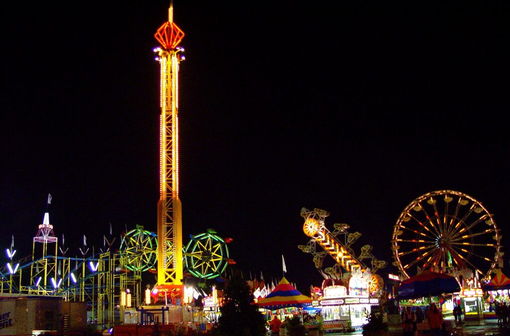
    Rides on the midway at the Minnesota State Fair
    The Minnesota State Fair, twelve days ending on Labor Day that fill hotels across the metro (Photo: Xopher Smith from minneapolis, mn, usa via Wikimedia Commons, CC BY 2.0)

    Minneapolis weather, season by season

    Minneapolis sits in the middle of the continent, far from any ocean, and it gets the full force of both the Arctic air that pours south in winter and the warm, humid air that flows up from the Gulf in summer. Winters are long and cold, with around 130 cm (50 inches) of snow in a typical season and Arctic outbreaks that bring wind chills of -34 °C (-30 °F) or lower; spring comes late and fast; summers are warm to hot, with thunderstorms; and fall is crisp and clear. The figures below are approximate seasonal patterns based on the long-term climate normals from NOAA’s National Weather Service office for the Twin Cities; check the current forecast before you pack, because a winter week can swing between a thaw and a deep freeze.

    MonthTypical daytime highTypical overnight lowWhat it feels likeFare pressure
    Januaryaround -5 °C (23 °F)around -13 °C (8 °F)The coldest month; snow cover, bright sun, and Arctic cold snaps well below 0 °FLow, except the first days of the month
    Februaryaround -2 °C (28 °F)around -11 °C (13 °F)Still deep winter, with longer days; the Winter Carnival and pond hockey seasonLow
    Marcharound 5 °C (41 °F)around -4 °C (25 °F)Thaw and refreeze; big snowstorms are still possibleLow to moderate
    Aprilaround 13 °C (56 °F)around 3 °C (37 °F)Unpredictable; the lake ice goes out, snow is possible early in the monthModerate
    Mayaround 21 °C (69 °F)around 9 °C (49 °F)Spring in a rush; trees leaf out and the patios openModerate; rises for Memorial Day
    Junearound 26 °C (78 °F)around 15 °C (60 °F)Long, green days; the wettest month, with thunderstormsModerate to high
    Julyaround 28 °C (83 °F)around 18 °C (64 °F)Warm to hot and sometimes humid; lake season at its peakHigh
    Augustaround 27 °C (80 °F)around 17 °C (62 °F)Warm; the State Fair closes out the summerHigh, peaking for the State Fair
    Septemberaround 22 °C (72 °F)around 12 °C (53 °F)Often the most pleasant month; warm days, cool nightsModerate, falling after Labor Day
    Octoberaround 15 °C (58 °F)around 4 °C (40 °F)Crisp; fall color peaks early in the month; first frostModerate
    Novemberaround 6 °C (42 °F)around -3 °C (27 °F)Gray and cooling fast; first lasting snow usually arrivesLow, except Thanksgiving
    Decemberaround -2 °C (28 °F)around -10 °C (14 °F)Winter proper, with snow cover and holiday lightsLow until mid-month, then peak

    Three things the table cannot show. First, the cold snaps: most winters bring a spell of several days when the temperature stays below 0 °F (-18 °C) around the clock and the wind chill falls far lower, and the National Weather Service issues cold warnings; exposed skin can freeze in minutes. This is when the skyways earn their keep. Second, the sun: Minneapolis winters are cold but often bright, and a still, sunny day at -10 °C feels far better than the number suggests. Third, summer storms: June and July thunderstorms can be severe, with heavy rain, hail and the occasional tornado warning, and they can ground flights at MSP for an hour or two in the afternoon or evening.

    How Minneapolis fare seasons work

    Three calendars drive seats into Minneapolis: the weather, which makes summer the city’s high season and winter its low one; the events calendar, with the State Fair, the stadiums and the Minneapolis Convention Center filling hotels on particular dates; and the local travel pattern, because in winter the planes out of MSP are full of Minnesotans heading for Florida, Arizona and Mexico, which pushes up fares on those routes but leaves the flights into the city relatively quiet. The result is a warm-season plateau from June to early September with a State Fair spike at the end, a cheap and quiet winter with a Christmas spike in the middle, and two shoulder seasons where the weather is good and the prices are not.

    Peak season

    June to Labor Day, plus roughly December 18 to January 3. July and August are the busiest months for leisure visitors, with the lakes, the ballpark and the festivals at their best, and families from across the region filling the downtown hotels on weekends. The State Fair, the twelve days ending on Labor Day, is the sharpest spike of the year for hotel rates across the metro. If you must travel in peak, book early, fly mid-week, and price the hotel before the flight.

    Shoulder season

    Mid-April to May and September to October. Late May and early June give you the city waking up after winter, with lakes, patios and ball games; September and early October give you the most reliable weather of the year and the fall color. Watch Memorial Day weekend, Labor Day, the Twin Cities Marathon weekend in early October, and home Vikings weekends, which can lift downtown hotel rates.

    Low season

    November before Thanksgiving, early December, and January to March outside the holiday weeks. Fares into MSP are at their lowest, the city is cold, bright and uncrowded, and the museums, theaters and arenas are in full swing. Pack for real cold and build a weather buffer into connections through other hubs.

    As elsewhere, mid-week departures and early or late flights usually price below Friday and Sunday afternoons on the same route, and a search across a whole month reveals cheaper pairs of dates close to your first choice. Our guide to the best times to book explains how to read those patterns.

    Minneapolis month by month

    January

    The coldest month and, after the first few days, one of the cheapest to fly in. Highs usually sit well below freezing, and at least one Arctic outbreak is normal. The city carries on regardless: the skyways connect downtown, the frozen lakes fill with skaters, pond hockey players and ice-fishing houses, Theodore Wirth Park has cross-country skiing and tubing, and the Saint Paul Winter Carnival begins in late January. The Timberwolves and the Wild are in season, and theater tickets are easier to find than at any other time.

    February

    Similar weather with noticeably more daylight, and low fares throughout. The Winter Carnival runs into early February, the Loppet ski festival fills Theodore Wirth Park around the same time, and it is an excellent month for a museum-theater-and-food trip with a few hours on the ice for good measure.

    March

    Thaw and refreeze, with at least one big snowstorm in many years. Fares into the city stay low, although Minnesota’s school spring breaks push up the price of flights from MSP to warm-weather destinations. The high-school hockey and basketball tournaments fill arenas and some hotels in March, and the end of the month usually brings the first real sign of spring.

    April

    The most changeable month: 20 °C (68 °F) one day and snow the next. The ice goes out on the lakes, the Twins open at Target Field in hats and gloves, and hotel rates are still well below summer levels. Good for a city break; not ideal for the lakes.

    May

    Spring in a rush. Trees leaf out, the paths around the lakes fill, the patios in the North Loop and Northeast open, and Art-A-Whirl brings open studios to Northeast. Fares are moderate, and the first three weeks of May are one of the best value windows of the year before Memorial Day lifts prices.

    June

    Long, green days, the wettest month, and the start of peak season. Twin Cities Pride fills Loring Park in late June, the Lake Harriet bandshell concerts begin, and fares step up from mid-month as schools finish. Early June is the value play.

    July

    Peak summer: warm to hot, occasionally humid, and the lakes at their best. The Aquatennial, with fireworks over the river, fills the downtown calendar; the Fourth of July brings more fireworks; and outdoor concerts and Twins games fill the evenings. Hotel rates are high on weekends and fares are at their summer level.

    August

    Warm, with the Minnesota Fringe Festival early in the month and the Minnesota State Fair from late August through Labor Day. The fair is one of the largest in the country, drawing close to two million visitors, and it fills hotel rooms across the whole metro; the State Fair’s site has dates. Book the hotel first, and early.

    September

    The month many locals would send you to: warm afternoons, cool nights, lower humidity, and the summer crowds gone after Labor Day. Fall color begins up north late in the month, the Vikings season starts, and fares are moderate and falling.

    October

    Crisp days and fall color along the Mississippi and the lakes, usually peaking in the metro in early-to-mid October. The Twin Cities Marathon in early October fills hotels for one weekend, and the MEA break, when most Minnesota schools close for a long weekend in mid-to-late October, is a busy family travel weekend. Otherwise, prices are moderate and the weather is often excellent until the end of the month.

    November

    Gray, cooling fast, and cheap. The first lasting snow usually arrives, the holiday lights switch on late in the month, and fares and hotel rates are at their annual low apart from the Thanksgiving weekend, when fares on the busiest days rise sharply.

    December

    Two months in one. The first half continues November’s pricing, with snow on the ground, holiday markets and lights, and theaters staging seasonal shows. From about December 18, fares jump for the Christmas and New Year weeks, when the city fills with people coming home.
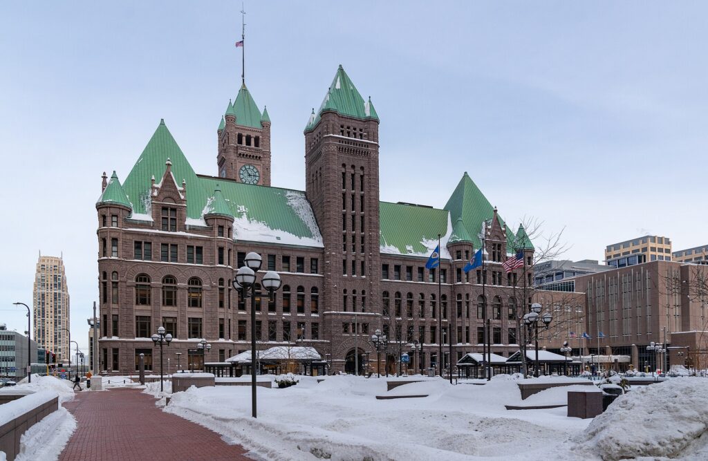
    Minneapolis City Hall and a snow-covered Government Plaza in winter
    Minneapolis in winter: the coldest big city in the country, and the cheapest months to fly (Photo: Tony Webster from Minneapolis, Minnesota, United States via Wikimedia Commons, CC BY-SA 2.0)

    Events that move Minneapolis flight and hotel prices

    Cross-check these against your dates before you book. Exact dates shift each year; Meet Minneapolis, the city’s tourism office, keeps the current calendar.

    • Saint Paul Winter Carnival (late January to early February): a local draw that lifts Saint Paul hotels on the big weekends.
    • High-school state tournaments (March): hockey and basketball tournaments that fill arenas and some downtown hotels.
    • Memorial Day weekend (last Monday of May): the unofficial start of lake season.
    • Twin Cities Pride (late June) and the Fourth of July.
    • Aquatennial (July): fireworks over the Mississippi and a busy downtown.
    • Minnesota State Fair (twelve days ending on Labor Day): the single largest hotel spike of the year.
    • Twin Cities Marathon (early October) and the MEA school break (mid-to-late October).
    • Thanksgiving and Christmas to New Year.
    • Stadium concerts, Vikings home games and major conventions, which can fill downtown on any weekend. Our Minneapolis events page shows what is on sale for your dates.

    Getting in from the airport

    Minneapolis-Saint Paul International (MSP) sits between the two cities, about 16 km (10 miles) south of downtown Minneapolis and a similar distance from downtown Saint Paul, and it is regularly rated among the best airports in North America in passenger surveys. It is a major hub for Delta and the home base of Sun Country, with nonstop flights to most large U.S. cities and to Amsterdam, Paris, London, Reykjavik and several other international destinations. There are two terminals: Terminal 1 handles Delta and most other airlines, and Terminal 2 handles Sun Country, Southwest and a few others; check which one your airline uses, because they are not walking distance apart, although the light rail connects them for free. Getting downtown is easy: the METRO Blue Line light rail runs from stations at both terminals to downtown Minneapolis in about 25 minutes, for a standard transit fare, and continues to Target Field in the North Loop. For Saint Paul, a Metro Transit bus runs from Terminal 1 to downtown Saint Paul, or you can change to the Green Line downtown. Taxis and ride-hail take about 20 minutes to either downtown outside rush hour, and the rental counters are in the parking ramps at each terminal. Our Minneapolis car-versus-transit guide works through whether you need a car, and our MSP airport guide covers the layout.
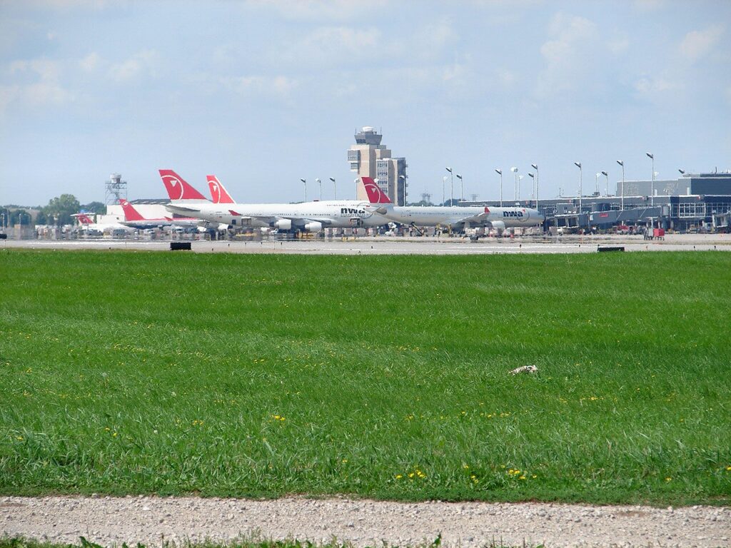
    The departures area at Minneapolis-Saint Paul International Airport (MSP)
    Minneapolis-Saint Paul International (MSP), a Delta hub and the home of Sun Country (Photo: Cory W. Watts from Madison, Wisconsin, United States of America via Wikimedia Commons, CC BY-SA 2.0)

    Timing tricks that work for Minneapolis

    • Search the whole month. The State Fair, the holiday weeks and the big stadium weekends create sharp edges in the fare calendar. A calendar search on TicketScanner shows them instantly, and the week after Labor Day is often a bargain relative to the week before.
    • Book the hotel first in late August. A cheap fare into State Fair week is not cheap once the room is added. Run a Minneapolis hotel search for the same dates before you commit to either.
    • Compare carriers, not just dates. MSP is a Delta hub, so nonstops on some routes are dominated by one airline; Sun Country, Southwest and the other carriers can undercut it on particular routes and days. A search across all of them is where the savings are.
    • Fly mid-week. Business travel makes Monday morning and Thursday and Friday evening the busiest flights on many routes; Tuesday and Wednesday are usually the value.
    • Use the winter. If you do not mind the cold, January and February offer the lowest fares and hotel rates of the year, and the city’s indoor attractions are at their best.
    • Consider Chicago for a road trip. Flights to Chicago are sometimes cheaper, and the drive or the train north through Wisconsin is a classic Midwest trip; our Chicago to Minneapolis route guide covers the drive, and our guide to the best time to fly to Chicago covers that end.
    • Build a winter buffer. MSP’s snow crews are very good and the airport rarely closes, but connecting hubs elsewhere can be disrupted; avoid the tightest connections from December to March. Our guide to how early to arrive covers what to allow.
    • Flying out of Minneapolis instead? Winter fares to warm destinations rise sharply around the school breaks; see cheap flights from Minneapolis.
    Lake Harriet in Minneapolis in summer
    Lake Harriet in summer, the short high season that drives fares (Photo: Sharon Mollerus via Wikimedia Commons, CC BY 2.0)

    What to pack, by season

    Winter (December to March): a properly insulated coat, a warm hat that covers your ears, insulated gloves or mittens, a scarf, and waterproof boots with grip; add thermal layers for anything outdoors, and do not underestimate the wind chill. Spring (April to May): layers, a waterproof jacket and shoes that can handle slush early and rain later. Summer (June to August): light clothing, sunscreen, a rain layer for the thunderstorms, insect repellent for evenings by the lakes, and a light sweater for air-conditioned theaters. Fall (September to October): layers again, and a warmer jacket by late October. The skyways and the light rail mean you can spend a winter day downtown in indoor clothes, but you will still need the coat to get to and from them.

    The best time to fly to Minneapolis for…

    The State Fair

    The last week of August or the days before Labor Day, booked as early as you can manage, with the hotel first.

    The lakes and summer weather

    Mid-June to early September for warmth, or early June and the first half of September for the best balance of weather and price.

    Fall color

    Late September for the North Shore and northern Minnesota, early-to-mid October for the Twin Cities and the Mississippi bluffs. Explore Minnesota publishes a fall color report each season.

    A real Minnesota winter

    Late January to mid-February, for the Winter Carnival, the frozen lakes and the lowest prices of the year.

    The lowest fares

    January and February after the New Year week, and November before Thanksgiving.

    International visitors

    Visitors from Visa Waiver Program countries need an approved ESTA before boarding; most others need a visa. The State Department’s travel site explains what applies to you, and the TSA lists what you can carry through security.

    Frequently asked questions

    What is the cheapest month to fly to Minneapolis?

    January and February are consistently the lowest for fares and hotel rates, followed by November outside Thanksgiving and early December.

    What is the best month to visit Minneapolis for weather?

    September, with June, July and August close behind for warmth. May and October are lovely in a good year.

    How cold is Minneapolis in winter?

    Daytime highs in January average around -5 °C (23 °F), with nights well below that, and most winters bring a cold snap when temperatures stay below 0 °F (-18 °C) for days. With proper clothing and the skyways, it is very manageable.

    How expensive is Minneapolis during the State Fair?

    Hotel rates across the metro climb steeply for the fair’s twelve days, and rooms near the fairgrounds sell out. Flights rise too, though less sharply. The week after Labor Day is much cheaper.

    Does MSP close for snow?

    Rarely. The airport handles heavy snow as a matter of routine, although major storms can cause delays and cancellations, especially on connections through other hubs.

    How far ahead should I book?

    Earlier for the State Fair, the holiday weeks and summer weekends, when fares tend only to rise; for January through March and November, fares are stable enough that finding the right dates matters more.

    Is Minneapolis worth visiting in winter?

    Yes, if you dress for it. Fares and hotel rates are at their lowest, the theaters and museums are in full season, and the frozen lakes and winter festivals are a genuine attraction.

    Ready to pick your dates? Compare fares across the whole month on our Minneapolis flights page, then find a room with our Minneapolis hotel search. For what to do when you land, start with our first-timer’s guide to Minneapolis.

  • Things to Do in Minneapolis: A First-Timer’s Guide

    Things to Do in Minneapolis: A First-Timer’s Guide

    Minneapolis rewards people who come without expectations. Visitors picture a cold Midwestern business city, and they find a downtown built on the only major waterfall on the Mississippi, a chain of lakes inside the city limits ringed by busy paths, two art museums that would be the pride of a city three times its size, a theater scene second only to New York’s by some counts, and neighborhoods where breweries, Somali restaurants, Scandinavian bakeries and Indigenous kitchens sit a few blocks apart. The winters are genuinely hard, and the city has answered them with enclosed skyways, a winter festival calendar and a stubborn habit of going outside anyway. This guide covers the sights that earn a day, the neighborhoods worth a half-day, the food, the State Fair and the sports, the day trips, and the practical details that turn a quick visit into a trip.

    If you are still comparing cheap flights to Minneapolis, read this alongside our guides to the best time to fly to Minneapolis and whether you need a car. Between the three you can plan the whole trip.

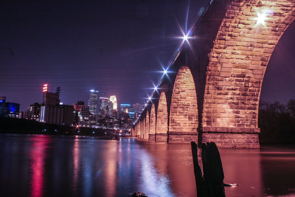
    The Stone Arch Bridge and the downtown Minneapolis skyline above the Mississippi River
    The Stone Arch Bridge and downtown Minneapolis, just below St. Anthony Falls (Photo: Tony Webster from Portland, Oregon, United States via Wikimedia Commons, CC BY 2.0)

    Minneapolis at a glance for first-timers

    • Airport: Minneapolis-Saint Paul International (MSP), about 16 km (10 miles) south of downtown Minneapolis, between the two cities. The METRO Blue Line light rail runs from both terminals to downtown in about 25 minutes. See our MSP airport guide.
    • Getting around: two light-rail lines, the Blue Line to the airport and the Mall of America and the Green Line to the University and downtown Saint Paul, plus buses. Downtown is walkable, and in winter the skyways let you cross it indoors. For day trips, most visitors rent a car.
    • Money: US dollars. Sales tax is added at the register, with extra city taxes on downtown hotels and restaurants; Minnesota does not tax most clothing, which makes shopping slightly cheaper. Tipping 18 to 20 percent in restaurants is expected.
    • Weather: four emphatic seasons: long, cold, snowy winters with Arctic outbreaks that push temperatures far below 0 °F, a short spring, warm and sometimes humid summers with thunderstorms, and a crisp, colorful fall. Our month-by-month guide has the detail.
    • Where to stay: downtown for the skyways, the theaters and the stadiums; the North Loop for restaurants and the riverfront; the St. Anthony Main side of the river for a quieter base by the falls; near the University or in Saint Paul if your plans are on that side. Our Minneapolis hotel search covers them all.

    Downtown: Nicollet Mall, the IDS Center and the skyways

    Downtown Minneapolis is compact, and its spine is Nicollet Mall, a pedestrian and transit street with public art and the bronze statue of Mary Tyler Moore tossing her hat, a nod to the television show set in the city. The IDS Center, the tallest building in the state since 1973, stands on the Mall, and its glass-roofed Crystal Court is the central crossroads of the skyway system, roughly 15 km (9.5 miles) of enclosed, heated bridges and corridors one story above the street that link some 80 blocks of downtown. Walking it in January, from a hotel to dinner to a Timberwolves game without a coat, is a genuinely Minneapolitan experience. The skyways are owned by the buildings they pass through, so hours vary: most are open from early morning into the evening on weekdays, with shorter hours on weekends. A block west, Hennepin Avenue is the theater district, with the restored Orpheum, State and Pantages theaters staging touring Broadway shows, and the First Avenue nightclub, where Prince filmed Purple Rain and whose exterior wall is covered in silver stars for the acts that have played there.

    The riverfront: St. Anthony Falls, the Stone Arch Bridge and Mill City

    Minneapolis exists because of St. Anthony Falls, the only natural major waterfall on the whole Mississippi, whose power drove the flour mills that made the city, for half a century, the milling capital of the world. The Stone Arch Bridge, a curving railroad viaduct built in 1883 and now open only to walkers and cyclists, crosses the river just below the falls and is the best viewpoint in the city, with the skyline on one side and the falls and mill ruins on the other. On the west bank, the Mill City Museum, run by the Minnesota Historical Society, is built inside the burned-out ruins of the Washburn A Mill, once the largest flour mill in the world; the Flour Tower ride and the observation deck are the highlights. Beside it, Water Works, a riverside park built into old mill foundations, is home to Owamni, the award-winning Indigenous restaurant, and the Guthrie Theater, the most celebrated regional theater in the country, has a cantilevered “Endless Bridge” over the riverbank that is free to walk onto during building hours. Across the river, the east bank has the cobblestone St. Anthony Main and Nicollet Island with its Victorian houses. The whole stretch is part of the Mississippi National River and Recreation Area, and the riverside paths continue for miles in both directions.

    The Walker, the Sculpture Garden and Mia

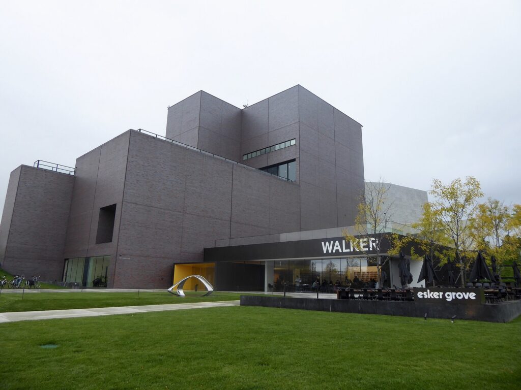
    Minneapolis has two art museums that justify the trip on their own. The Walker Art Center, on the edge of downtown by Loring Park, is one of the country’s leading museums of contemporary art. Across the street, the free Minneapolis Sculpture Garden holds some forty works across eleven acres, including Spoonbridge and Cherry by Claes Oldenburg and Coosje van Bruggen, the giant spoon with a cherry balanced on it that appears on half the postcards in town. The Minneapolis Institute of Art, universally called Mia, in the Whittier neighborhood south of downtown, is an encyclopedic museum that runs from Egyptian antiquity through European painting, including a well-known Rembrandt, to one of the strongest Asian collections in the country, and general admission is free. On the University of Minnesota campus, the free Weisman Art Museum, in a stainless-steel building by Frank Gehry, is worth the stop for the building alone, and the American Swedish Institute, in a turreted mansion south of downtown, tells the story of the Scandinavians who shaped the state.

    The Walker Art Center, the contemporary art museum beside the Minneapolis Sculpture Garden
    The Walker Art Center, one of the country's leading contemporary art museums, beside the free Sculpture Garden (Photo: Daniel X. O'Neil via Wikimedia Commons, CC BY 2.0)

    The lakes, the Grand Rounds and Minnehaha Falls

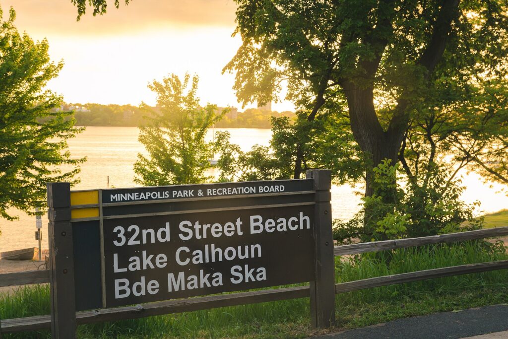
    The city’s best public space is not downtown at all. The Chain of Lakes, a few miles southwest of downtown, is where Minneapolis lives in summer: Bde Maka Ska, the largest, with beaches, sailboats and paddleboard and kayak rentals; the quieter Lake of the Isles, ringed by grand houses; Cedar Lake, with the most natural shoreline; and Lake Harriet, with a bandshell that hosts free concerts on summer evenings, rose gardens and the restored Como-Harriet streetcar, which runs short rides in summer. Paved paths, separate for walkers and cyclists, circle every lake. They are part of the Grand Rounds, a loop of parkways and trails of about 80 km (50 miles) around the city, which links the lakes to the Mississippi and to Minnehaha Falls, a 16-meter (53-foot) waterfall in a wooded gorge made famous by Longfellow’s Song of Hiawatha. The falls are free, a short walk from a Blue Line station, and in a hard winter they freeze into a column of ice. The Minneapolis Park and Recreation Board runs it all; rent a bike and you can see the lakes and the falls in a day.

    The 32nd Street beach on Bde Maka Ska, the largest of the Minneapolis lakes
    Bde Maka Ska, the largest of the Chain of Lakes, where Minneapolis spends its summer (Photo: Tony Webster from Minneapolis, Minnesota, United States via Wikimedia Commons, CC BY-SA 2.0)

    Neighborhoods worth a half-day

    The North Loop

    The old warehouse district beside Target Field is now the city’s most fashionable neighborhood: brick lofts, boutique hotels, independent shops and many of the city’s best restaurants and cocktail bars along Washington Avenue, a short walk from the riverfront.

    Northeast

    Across the river, “Nordeast”, the old immigrant working-class district, is now the arts and brewery quarter: studios in former factories such as the Northrup King Building, a dense cluster of taprooms, old Polish delis, and Art-A-Whirl in May, one of the largest open-studio weekends in the country.

    Uptown and Lyn-Lake

    The streets around Hennepin and Lake, a short walk from Bde Maka Ska, are the traditional nightlife district; Lyn-Lake, a few blocks east, is the more independent strip. Combine either with the lakes.

    Eat Street and Whittier

    Nicollet Avenue south of downtown, branded Eat Street, has a mile of Vietnamese, Mexican, Somali and Korean restaurants and runs past Mia. Farther south, Lake Street and the Midtown Global Market, a food hall in a former Sears building, show the city’s immigrant communities at their liveliest.

    Cedar-Riverside and the University

    The West Bank, by the University of Minnesota, is the heart of the largest Somali community in the country, with cafés, markets and restaurants. Across the river, the main campus, Dinkytown and the Weisman are a Green Line stop away.

    Saint Paul

    The other Twin City deserves at least half a day. The Green Line runs to its downtown in around 45 minutes, past the Hmong and Vietnamese restaurants of University Avenue. Saint Paul has the Cass Gilbert-designed Minnesota State Capitol, the Cathedral of Saint Paul on its hill, Summit Avenue, a long boulevard of Victorian mansions where F. Scott Fitzgerald lived as a young man, the Science Museum, and the free Como Park Zoo and Conservatory.

    Museums, culture and family attractions

    For live performance, Minneapolis is exceptional. Beyond the Guthrie and the Hennepin Avenue theaters, the Minnesota Orchestra plays at Orchestra Hall on Nicollet Mall, the Children’s Theatre Company beside Mia is one of the most honored in the nation, and dozens of smaller companies give the Twin Cities more theater seats per person than almost anywhere outside New York. The music scene produced Prince, the Replacements and Hüsker Dü, and the clubs still matter: First Avenue and its smaller room, the 7th St Entry, the Turf Club in Saint Paul, and the Dakota for jazz. Prince fans can tour Paisley Park, his home and studio complex in suburban Chanhassen, about half an hour southwest; book ahead. The Mall of America, at the end of the Blue Line, is the largest mall in the country. Historic Fort Snelling, on the bluffs where the Minnesota River meets the Mississippi, tells the story of the fort and of the Dakota people whose homeland this is. For what is on during your dates, our Minneapolis events page lists concerts, shows and games.

    The State Fair and the festival year

    For twelve days ending on Labor Day, the Minnesota State Fair is the center of the state’s universe. It is one of the largest state fairs in the country, drawing close to two million visitors to the fairgrounds between the two downtowns, and locals call it the Great Minnesota Get-Together without irony. The attractions are prize animals, butter sculptures, a midway, grandstand concerts and, above all, the food, much of it on a stick. Go on a weekday morning and take the fair’s express buses or park-and-ride shuttles rather than driving. The rest of the year has its own calendar. The Saint Paul Winter Carnival, from late January into early February, is one of the oldest winter festivals in the country, with ice sculptures and parades; the Loppet ski festival fills Theodore Wirth Park around the same time; the Aquatennial in July has fireworks over the river; Twin Cities Pride fills Loring Park in late June; and the Twin Cities Marathon, in early October, runs past the lakes and the river. If you are coming for the fair, book the hotel first: rooms across the metro fill in late August.

    Sports

    Minneapolis has a team in every major league, and most play downtown. The Twins play baseball at Target Field in the North Loop, an open-air ballpark with a skyline view; April and September games can be cold, so bring a layer. The Vikings play at U.S. Bank Stadium, the translucent-roofed building in Downtown East that hosted a Super Bowl. The Timberwolves and the Lynx, one of the most successful franchises in WNBA history, play at Target Center, connected to the skyways. The Wild play hockey in downtown Saint Paul, in a state that takes the sport more seriously than any other, and Minnesota United play soccer at Allianz Field on the Green Line. Check what is on sale in Minneapolis for your dates before you book flights.

    What to eat, and where

    Minnesota’s food reputation used to rest on hotdish, the tater-tot-topped casserole of the church basement, and it still makes an appearance. The dish every visitor should try is the Jucy Lucy (or Juicy Lucy, depending on which bar you ask), a burger with the cheese sealed inside the patty, which two South Minneapolis bars, Matt’s and the 5-8 Club, both claim to have invented; let it cool before you bite. The North Loop and Northeast have the chef-driven restaurants; Owamni, on the riverfront, serves Indigenous food without wheat, dairy or cane sugar; Eat Street and Lake Street have pho, taquerías and Somali restaurants serving rice, goat and sambusas; University Avenue in Saint Paul is the place for Hmong food; and the Scandinavian heritage survives in bakeries and holiday lefse. Walleye, the state fish, turns up as a sandwich or pan-fried at supper clubs. Minnesota changed its liquor laws in 2011 to allow brewery taprooms, and the result is one of the densest craft-beer scenes in the country, concentrated in Northeast.

    Minneapolis through the seasons

    Winter (December to early March) is cold, sometimes brutally so, with snow on the ground for months and cold snaps below -25 °C (-13 °F), but the city is built for it: the skyways connect downtown, the lakes freeze solid enough for skating, pond hockey and ice fishing, Theodore Wirth Park has cross-country skiing and a tubing hill minutes from downtown, and the museums and theaters are at their best on a January night. Spring (late March to May) arrives late; the ice leaves the lakes in April, and the Twins’ home opener is often a hat-and-gloves affair. Summer (June to August) is the payoff: long evenings on the lakes, patios in the North Loop, the Aquatennial, and the State Fair to close it out. Fall (September to October) is the local favorite: warm afternoons, cool nights, the marathon, and fall color along the river that peaks in early-to-mid October. Our month-by-month guide has the fare patterns that go with each season.

    Minneapolis with kids

    Minneapolis is an easy city with children, in any weather. The Mall of America’s Nickelodeon Universe and aquarium are the obvious indoor day, and the Blue Line takes you there. In Saint Paul, the Science Museum of Minnesota has dinosaurs and a giant-screen theater, the Minnesota Children’s Museum is built for the under-tens, and the free Como Park Zoo and Conservatory is one of the best-value family days anywhere. In summer, the lake beaches, the Lake Harriet streetcar and Minnehaha Falls fill the days; in winter, the Children’s Theatre Company, tubing at the parks and the Winter Carnival’s ice sculptures keep everyone busy. For families heading north to Duluth, our family car rental guide covers the vehicle question.

    Minneapolis on a budget

    Much of the best of Minneapolis is free: Mia, the Sculpture Garden, the Weisman, the Stone Arch Bridge and the riverfront, the Chain of Lakes, Minnehaha Falls, the Lake Harriet bandshell concerts, the Guthrie’s Endless Bridge, the skyways, and the Como Park Zoo. The Walker has free hours on certain evenings; check its site. Light-rail fares are modest, and the ride between the two airport terminals is free. Eat well for less on Eat Street, at the Midtown Global Market on Lake Street, in the Somali cafés of Cedar-Riverside and along University Avenue in Saint Paul. Hotel rates in winter are among the lowest of any major American city, and outside State Fair week, convention weeks and big stadium events, downtown rates are reasonable year-round. Compare rates by neighborhood on our Minneapolis hotel search.

    Day trips from Minneapolis

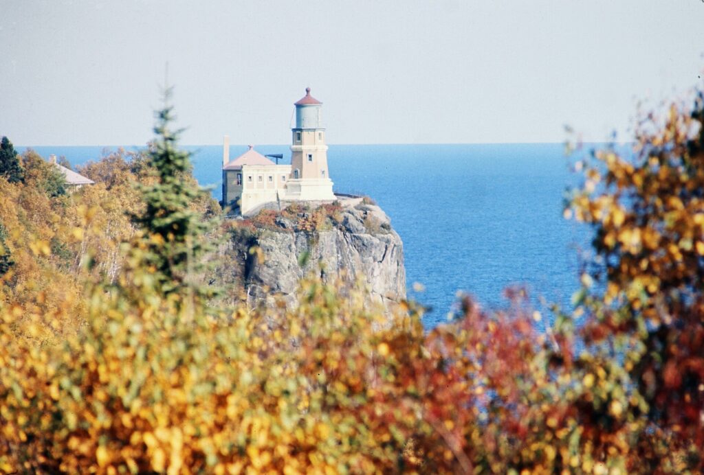
    Stillwater, about 45 minutes east on the St. Croix River, is the prettiest small town in the metro: a brick main street of antique shops and restaurants, a historic lift bridge, and paddlewheel cruises in summer. Duluth, about two and a half hours north on I-35, sits at the western tip of Lake Superior, with the Aerial Lift Bridge, a lakefront walk and the ore boats, and it is the gateway to the North Shore: Gooseberry Falls and Split Rock Lighthouse, both state parks, are within an hour of it along one of the most scenic roads in the Midwest. South along the Mississippi, Red Wing and Wabasha, where the National Eagle Center watches the bald eagles that winter on the river, make a good loop past the bluffs in fall color season. All of these are car trips; see our Minneapolis car rental page, and in winter check road conditions before heading north. Explore Minnesota covers the wider state. If you are combining the Twin Cities with Chicago, our Chicago to Minneapolis route guide covers the drive, and our guide to things to do in Chicago covers the other end.

    Split Rock Lighthouse on the cliffs above Lake Superior
    Split Rock Lighthouse on the North Shore, an easy extension of a Duluth day trip (Photo: Chris Light via Wikimedia Commons, CC BY-SA 4.0)

    Two sample itineraries

    Two days, no car

    Day one: Nicollet Mall and the Crystal Court, the Mill City Museum and the Guthrie’s Endless Bridge, a walk across the Stone Arch Bridge, lunch in the North Loop, the Walker and the Sculpture Garden in the afternoon, and a show on Hennepin Avenue or at First Avenue. Day two: Mia in the morning, lunch on Eat Street, an afternoon on a rented bike around the Chain of Lakes and down the Minnehaha Parkway to the falls, then the Blue Line back downtown and dinner in Northeast among the breweries.

    Four days, with Saint Paul and the St. Croix

    Add a day in Saint Paul by Green Line, then pick up a car for a day in Stillwater, or a night in Duluth and on the North Shore, returning it at the airport on the way home.

    Practical details

    • Transit: buy tickets at the light-rail station machines or in the Metro Transit app, or use a Go-To card; a day pass pays off on a busy sightseeing day. Metro Transit has maps and service alerts; our transit-versus-car guide goes into detail.
    • From MSP: the Blue Line from either terminal to downtown in about 25 minutes, a taxi or ride-hail in about 20 minutes outside rush hour, or a rental from the terminal ramps. The airport’s site covers ground transport and which airlines use which terminal.
    • Weather: serious winter gear from December to March, layers in spring and fall, and sunscreen and a rain layer in summer. NOAA’s National Weather Service office for the Twin Cities has the forecast and winter weather warnings.
    • Time zone: Central, one hour behind New York and two ahead of Los Angeles.
    • Entry requirements: visitors from Visa Waiver Program countries need an approved ESTA before boarding; most others need a visa. The State Department’s travel site is the authoritative source.
    • Safety: the areas visitors spend their time in, downtown, the riverfront, the lakes and the main neighborhoods, are busy and generally safe; use ordinary big-city awareness late at night downtown and on the light rail.

    Frequently asked questions

    How many days do you need in Minneapolis?

    Two full days covers downtown, the riverfront, the Walker, Mia and the lakes; add a day for Saint Paul and one or two for Stillwater, Duluth or the North Shore.

    What is the number one thing to do in Minneapolis?

    In late August, the State Fair. Any other time, the river: walk the Stone Arch Bridge at sunset, with St. Anthony Falls below and the skyline lit up behind it.

    Is Minneapolis walkable?

    Downtown, the North Loop, the riverfront and Uptown are, and the skyways make downtown walkable even in January. The lakes and Minnehaha Falls are best reached by bike or light rail.

    Do I need a car in Minneapolis?

    Not for downtown, the riverfront, the lakes or Saint Paul; the light rail and a bike cover them. For Stillwater, Duluth, the North Shore and the suburbs, yes.

    How cold does Minneapolis get in winter?

    January daytime highs are usually well below freezing, and cold snaps with temperatures below -25 °C (-13 °F) happen most winters. The skyways, the museums and good boots make it very manageable.

    What is Minneapolis known for?

    The lakes, St. Anthony Falls, the skyways, Prince, the Guthrie, the State Fair, the Jucy Lucy, and a winter locals are quietly proud of surviving.

    Ready to go? Compare flights to Minneapolis, find a place to stay with our Minneapolis hotel search, and if Duluth or the St. Croix are on the list, price a rental car for those days.

  • Phoenix: Should You Rent a Car or Rely on Public Transit?

    Phoenix: Should You Rent a Car or Rely on Public Transit?

    Phoenix is one of the most car-dependent big cities in the United States, and for most visitors the honest answer to “should I rent a car?” is yes. The metro area sprawls across a desert valley roughly the size of a small state, the attractions are spread between Phoenix, Scottsdale, Tempe, Mesa and a dozen other cities, the best trailheads have no transit at all, and Sedona and the Grand Canyon, the reasons many people fly here, are road trips. But there are real exceptions. Sky Harbor is only a few kilometers from downtown and is linked to the light rail by a free airport train, the light rail runs through the three most walkable districts in the Valley, driverless robotaxis and ride-hail cover the gaps, and a visitor on a downtown conference, a Tempe stay or a resort break may barely need a car at all. This guide explains how the Valley is laid out, how Valley Metro and its fares work, what driving here is really like in the heat and the monsoon, when a car earns its keep, and gives you a straightforward way to decide.

    The short answer

    Rent a car if Sedona, the Grand Canyon, Tucson or any other day trip is on the itinerary, if you want to hike Camelback, South Mountain or the McDowell Sonoran Preserve at dawn, if you are staying in Scottsdale, the suburbs or with family, if you are following several teams around the Cactus League ballparks, or if you are traveling with children. That is most visitors. Skip the car if you are staying downtown, in Roosevelt Row or in Tempe for a conference, a game, a concert or a short city break, and your plans are the museums, the ballpark, the arts district, Mill Avenue and the airport; the light rail, your feet and the occasional ride-hail will cover that, and you will not pay for parking. And if you are staying at a resort and plan to spend most of the time by the pool, ride-hail for the occasional outing is often cheaper than a car sitting in a valet lot. Compare rental rates for any of these plans on our Phoenix car rental page.

    How Phoenix is laid out

    Phoenix and its neighbors fill a broad, flat valley ringed by mountains, and almost all of it is laid out on a single grid. In Phoenix, Central Avenue divides east from west and Washington Street divides north from south; numbered Streets run north-south east of Central, and numbered Avenues run north-south west of it, so 16th Street and 16th Avenue are about 5 kilometers (3 miles) apart. The major arterials fall roughly every mile, which makes navigation easy and distances long. Downtown sits near the center of the city, with Roosevelt Row immediately north and Sky Harbor immediately east. Tempe and Arizona State University are a short hop southeast of the airport, Mesa beyond them, Scottsdale to the northeast, and the West Valley cities of Glendale, Peoria, Goodyear and Surprise to the west, where many spring training ballparks and the Cardinals’ stadium sit. A web of freeways links it all: I-10 and I-17 meet west of downtown at the interchange locals call the Stack, and the Loop 101, Loop 202 and Loop 303 ring the Valley, with SR 51 and US 60 filling in.

    Hotels cluster downtown around the convention center and the ballpark, near the airport, along the Camelback corridor, in Old Town Scottsdale and the resort belt north of it, in Tempe, and in the Roosevelt Row area. Our Phoenix hotel search lets you compare them.

    Getting in from the airport

    Phoenix Sky Harbor International (PHX) is about 5 kilometers (3 miles) east of downtown, and getting into the city is unusually easy. The free PHX Sky Train runs around the clock between Terminals 3 and 4, the East Economy parking area, and the 44th Street station, where you change to the Valley Metro light rail for downtown Phoenix, Tempe or Mesa; the trip downtown takes around half an hour including the change. The Sky Train also connects to the Rental Car Center, the consolidated facility west of the terminals where every major company has its counters, and shuttle buses run there as well. Taxis and ride-hail pick up at marked zones outside each terminal, and the drive downtown takes 10 to 15 minutes outside rush hour; driverless Waymo robotaxis also serve the airport. For Scottsdale, allow 20 to 30 minutes by car, and for the West Valley 30 to 45. Check the airport’s site for current ground-transport details; our PHX airport guide covers the layout.

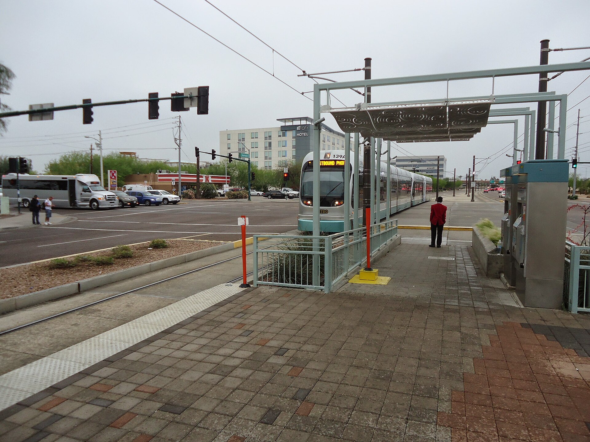
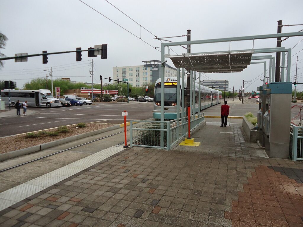
    A Valley Metro light rail train approaching a station in downtown Phoenix
    Valley Metro light rail links the airport's Sky Train, Tempe, downtown and Central Avenue (Photo: Tomwsulcer via Wikimedia Commons, CC0)

    Phoenix transit, explained

    Valley Metro runs the light rail, the Tempe Streetcar and most of the bus network across the region. It is clean, air-conditioned and straightforward, and along its core corridor it is a genuinely useful way for a visitor to get around; its limitation is coverage, because a single rail system cannot serve a metro area this spread out, and the buses that fill in the rest run on the mile grid at frequencies that suit commuters more than sightseers.

    The light rail

    The light rail runs for more than 40 kilometers (25 miles) through the heart of the Valley. From the east, it starts in Mesa, runs through downtown Mesa and Tempe, past Arizona State University and Tempe Town Lake, crosses to the 44th Street station for the airport, and continues along Washington and Jefferson Streets into downtown Phoenix, stopping near Chase Field, the convention center and the downtown arena. From downtown it turns north along Central Avenue past Roosevelt Row, the Heard Museum and the Phoenix Art Museum, and on to north Phoenix, and since the South Central extension opened in 2025, a branch also runs south from downtown along Central Avenue toward South Mountain. The system operates as two lines that share tracks through downtown; check Valley Metro’s map for the current line names and end stations. Trains run from early morning until late evening, roughly every 12 to 20 minutes depending on the time of day.

    Streetcar and buses

    The Tempe Streetcar loops through downtown Tempe, along Mill Avenue and past the lake and the university, connecting to the light rail. Valley Metro’s buses run along most of the major arterials on the mile grid, with express routes to the suburbs; they reach places like the Desert Botanical Garden and the Phoenix Zoo, but frequencies drop in the evenings and on weekends, and waiting at a bus stop in summer is hard work. Check the timetable before relying on a bus for a return trip.

    Fares and tickets

    One fare system covers the light rail, streetcar and local buses. Buy single rides or a day pass from the ticket machines on every light-rail platform, or use the Valley Metro app on your phone, and keep your ticket with you, because fare inspectors check on board. A day pass is the best value for a sightseeing day with several rides, and reduced fares are available for seniors and younger riders. Check Valley Metro’s site for current fares and payment options before you go.

    Accessibility

    Every light-rail station is level-boarding and step-free, and the fleet of trains, streetcars and buses is accessible; the stations have shade structures, which matter more here than almost anywhere.

    Beyond Valley Metro

    • Free circulators. Several cities run free neighborhood shuttles: the Scottsdale Trolley loops Old Town and the resort corridor, and Tempe’s Orbit buses serve the neighborhoods around the university. They are handy for short hops once you are in those districts.
    • Ride-hail and robotaxis. Uber and Lyft operate across the Valley, and Phoenix is one of the places where driverless Waymo robotaxis carry the public, across much of Phoenix, Scottsdale, Tempe, Mesa and Chandler. For short trips, especially in a group, ride-hail is competitive with transit and much faster to places the light rail does not reach.
    • Walking and cycling. Downtown, Roosevelt Row, Old Town Scottsdale and Mill Avenue are walkable, and paths along the canals and around Tempe Town Lake are good for cycling in the cooler months; shared bikes and e-scooters operate in parts of the Valley. In summer, walking more than a few blocks in the afternoon is not advisable.
    • Tours. Day tours to Sedona and the Grand Canyon pick up from hotels across the Valley, and they are the main alternative to driving for visitors who want the canyon without the car; the Grand Canyon Railway from Williams, about three hours north, is another.
    • Intercity travel. Buses connect Phoenix with Tucson, Flagstaff, Las Vegas and Southern California. Amtrak does not serve Phoenix itself; the nearest station is in Maricopa, about 55 kilometers (35 miles) south.
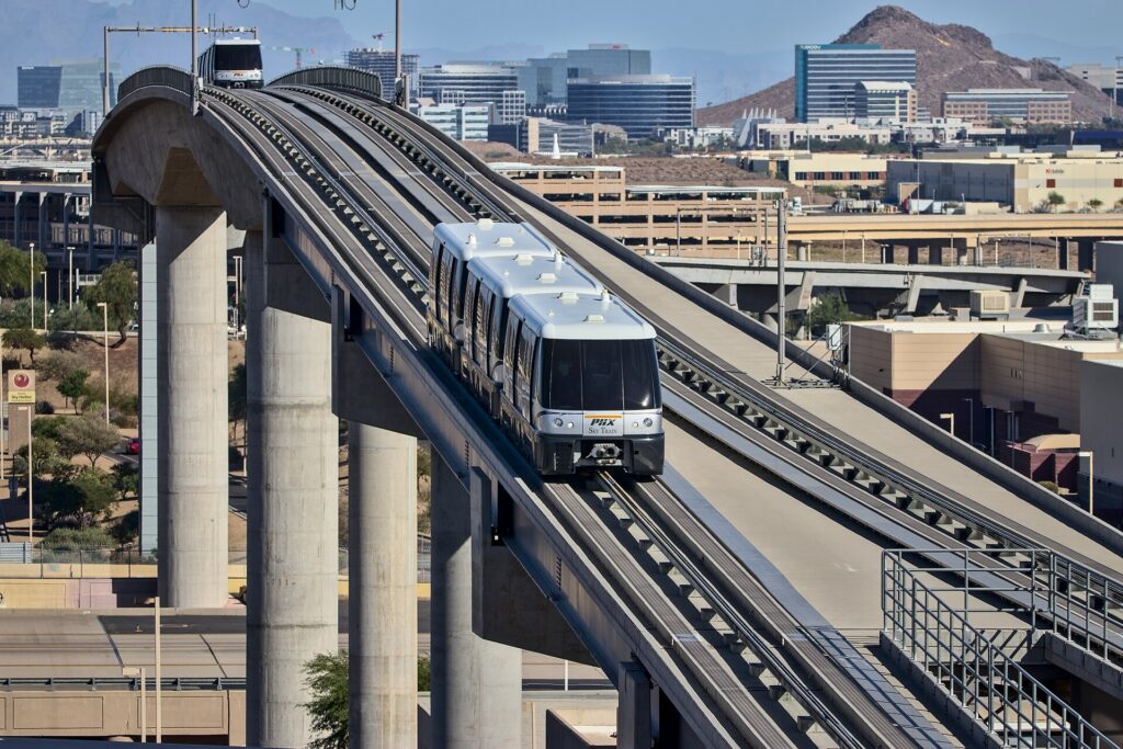
    The PHX Sky Train approaching Terminal 4 at Phoenix Sky Harbor
    The free PHX Sky Train connects the terminals, the light rail and the Rental Car Center (Photo: Hunter Trick (TrickHunter) via Wikimedia Commons, CC BY-SA 4.0)

    Driving in Phoenix: what it is really like

    By the standards of most large American cities, Phoenix is easy to drive: a logical grid, wide arterials, a dense freeway network, good signage and plentiful parking outside the busiest districts. The frustrations are specific. Weekday rush hours, roughly 6 to 9 a.m. and 3:30 to 6:30 p.m., slow I-10 through Tempe and the West Valley, I-17 north of downtown, SR 51, and the Loop 101 through Scottsdale and Tempe. Big events, from spring training and the Phoenix Open to Cardinals games in Glendale, bring heavy traffic around the venues. Construction is constant on a freeway network that is still growing. And the distances are long: a trip from a Scottsdale resort to a ballpark in Goodyear can take the best part of an hour.

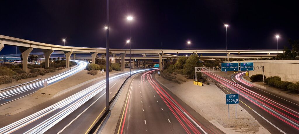
    The Stack, the interchange of Interstate 10 and Interstate 17 in Phoenix, at night
    The Stack, where I-10 meets I-17 west of downtown; the freeways are easy outside the weekday rush hours (Photo: Alan Stark from Goodyear, AZ, United States via Wikimedia Commons, CC BY-SA 2.0)

    Parking

    Parking in Phoenix is easier and cheaper than in most big cities. Downtown has metered street parking and many garages, which get busy and more expensive on game and concert nights. Old Town Scottsdale has free public parking garages, with time limits on some spaces. Tempe’s Mill Avenue area has garages and metered streets. The resorts usually charge for self-parking or valet, sometimes folded into the resort fee, so check before you book. Trailhead parking is the real challenge: the small lots at Camelback’s Echo Canyon and Cholla trails and at Piestewa Peak fill early on cool-season weekends, often before sunrise, so arrive early or use ride-hail. At Sky Harbor, the economy lots are linked to the terminals by the Sky Train.

    Rules and conditions worth knowing

    • The heat and your car. A parked car becomes dangerously hot within minutes in summer; never leave a child or a pet inside, even briefly. Use a windshield sunshade, cover the steering wheel and seats, keep extra water in the car, and remember that batteries and tires are more likely to fail in extreme heat, so do not skip the rental company’s warning lights.
    • Dust storms. During the monsoon, a haboob can cut visibility to near zero on the freeway in seconds. ADOT’s advice is to pull as far off the road as you safely can, turn off all your lights, set the parking brake and take your foot off the brake pedal so that other drivers do not follow your taillights, and wait until it passes.
    • Flooded washes. Never drive into a flooded road or wash, even if it looks shallow; the water can be far deeper and faster than it appears. Under Arizona’s so-called Stupid Motorist Law, drivers who go around barricades into flooded areas can be billed for the cost of their rescue.
    • Cameras. Several Valley cities, notably Scottsdale and Paradise Valley, use speed and red-light cameras on city streets; fines follow the car and the rental company will bill you, often with a fee.
    • Phones. Arizona law bans holding a phone while driving; use a mount and hands-free mode.
    • HOV lanes. The carpool lanes on the freeways are restricted to vehicles with two or more people during weekday rush hours and open to everyone at other times; check the signs.
    • Right turns on red are permitted after a full stop unless signed otherwise.
    • Road conditions. AZ511, run by the Arizona Department of Transportation, publishes closures, crashes and weather alerts, including snow on I-17 and I-40 in the high country.
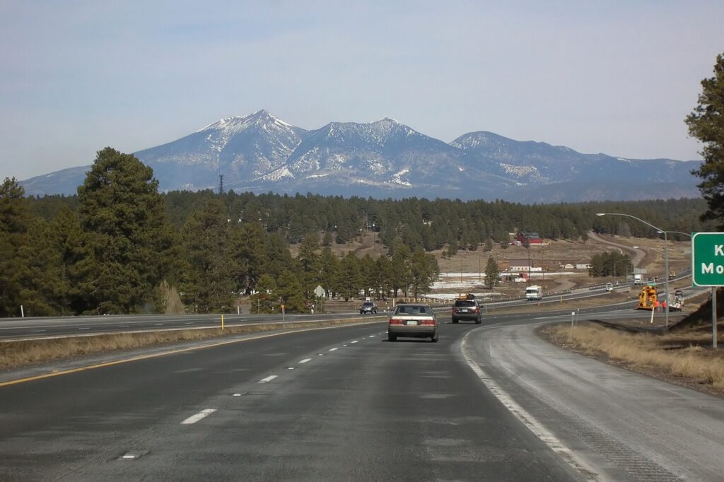
    Interstate 17 near Flagstaff in the Arizona high country
    I-17 climbs from the desert to the pine country around Flagstaff in about two hours (Photo: Bernard Gagnon via Wikimedia Commons, CC BY-SA 3.0)

    When renting a car makes sense

    • Sedona and the Grand Canyon. Sedona is about two hours north on I-17 and the Grand Canyon’s South Rim three and a half to four hours; a car lets you reach the trailheads early and stop at Montezuma Castle and Jerome along the way. Many Sedona trailhead lots require a Red Rock Pass, and the national park charges a vehicle entrance fee.
    • Sunrise hikes. Camelback, Piestewa Peak, South Mountain and the McDowell Sonoran Preserve are best at first light, before the heat, when transit is not running to them and ride-hail can be slow to arrive.
    • Scottsdale and the resort belt. The resorts, Taliesin West, the Musical Instrument Museum and the golf courses are spread across the northeast Valley, well away from the light rail.
    • Spring training. Ten ballparks across the Valley, several in the West Valley far from the rail line; a car makes a ballpark tour easy.
    • Families. Car seats, pool bags and the summer heat all argue for a car, and our family car rental guide looks at vehicle choice.
    • Road trips. Tucson, Las Vegas via the Hoover Dam, San Diego and Southern California; our Phoenix to San Diego route guide and Las Vegas to Phoenix route guide cover two classics.

    If any of those apply, our rental car booking tips cover insurance, deposits and the questions to ask at the counter.

    When it does not

    • You are staying downtown, in Roosevelt Row or in Tempe, and your plans are along the light rail.
    • You are in town for a convention, a Suns or Diamondbacks game, or a concert downtown, when parking near the venues is at its most expensive and the light rail stops beside them.
    • You are staying at a resort and plan to spend most of your time by the pool and the spa, with ride-hail for the occasional dinner.
    • You want the Grand Canyon for a day and are happy to take an organized tour.

    The hybrid plan for a city-plus-desert trip

    Go car-free for the city days and rent for the day trips, and think about where you pick up. Every major company operates from the Sky Harbor Rental Car Center, which is convenient but adds airport fees and surcharges, some of which have long helped fund the region’s sports venues. Neighborhood rental offices in Phoenix, Tempe and Scottsdale avoid some of those charges and make sense if you are spending the first nights in the city. A pattern that works well: take the Sky Train and light rail or a ride-hail to your hotel, spend two or three car-free days downtown and in Tempe, pick up a car from a city location for Scottsdale, a sunrise hike and a night in Sedona or at the Grand Canyon, and return it to the airport on the way to your flight home, which many companies allow at little or no extra cost. Book early for February and March, when the Rental Car Center can run short of cars. Compare the day rates on our Phoenix car rental page against a full-trip rental and the difference is usually obvious.

    A worked cost comparison

    Numbers change with the season and the booking window, so treat this as a method rather than a quote, and check current rates before deciding. For a three-night city break downtown for two people, the car-free version costs two light-rail day passes each and perhaps three or four ride-hail trips to the Desert Botanical Garden, Old Town Scottsdale and back; the rental version adds three days of a compact car, airport fees and surcharges, three nights of hotel parking and fuel, and buys you little you could not reach otherwise. The transit option wins. For a four-night stay with a day in Sedona, the car-free version adds an organized Sedona tour for two; the hybrid version adds a one-day rental from a city location, fuel and a Red Rock Pass. For two people the rental is usually cheaper than the tour and far more flexible; for one person the tour can be competitive. For a week at a Scottsdale resort with golf, hiking and the Grand Canyon, a rental for the whole stay is the only practical answer, and the airport pickup, despite the surcharges, is simpler than paying for ride-hail across the Valley every day. Run the rental rates for your dates on our Phoenix car rental page and put them beside the tour and ride-hail costs before you choose.

    Driving out of Phoenix in each season

    The highways out of Phoenix are good, but they cross some of the most extreme terrain in the country, and conditions change fast with altitude and season. I-17 north to Sedona and Flagstaff climbs from the desert floor to over 2,000 meters (about 7,000 feet) near Flagstaff in about two hours; in summer it is the escape route, jammed northbound on Friday afternoons and southbound on Sunday afternoons, and in winter the upper stretch and I-40 can be snowy or icy while Phoenix is sunny and warm, so check AZ511 before you leave and ask for an all-wheel-drive car if snow is forecast. US 93 northwest to Las Vegas runs through Wickenburg and Kingman and crosses the Colorado River on the bridge beside the Hoover Dam; it is about five hours, remote in places, and fuel stops are far apart. I-8 west to San Diego crosses the low desert past Gila Bend and Yuma, some of the hottest country in North America in summer, before climbing through the mountains east of San Diego; about five and a half hours in all, and Border Patrol checkpoints operate on some highways in the borderlands, so carry ID. I-10 runs southeast to Tucson in about two hours and west to Los Angeles. In summer, the risk on every route is the heat: a breakdown in the desert is dangerous, so start with a full tank, carry plenty of water, keep your phone charged, and stay with the car if it breaks down. During the monsoon, add dust storms and flash floods. In winter, the low desert is perfect for driving, and the high country needs respect. For the canyon, Grand Canyon National Park posts current road and weather conditions.

    Decision table

    Your tripRecommendationWhy
    City break downtown or in TempeNo carThe light rail links the airport, downtown, Roosevelt Row and Tempe
    Convention or game downtownNo carThe light rail stops beside the venues; event parking is expensive
    Resort stay, mostly by the poolNo car, ride-hail for outingsAvoids resort parking fees for a car you rarely use
    Scottsdale, golf and sunrise hikesRent for the whole stayResorts, courses and trailheads are far from transit
    City plus Sedona or the Grand CanyonHybrid: rent from a city location for the trip daysCar-free city days, car for the high country
    Grand Canyon without drivingOrganized tourHotel pickup and no long drive
    Spring training ballpark tourRent at the airportTen ballparks spread across the Valley
    Arizona or Southwest road tripRent (consider one-way to Las Vegas or San Diego)Phoenix is the start, not the destination

    Money-saving tips for both options

    • On transit: the Sky Train is free; buy a day pass for a heavy sightseeing day on the light rail; use the free Scottsdale Trolley and Tempe Orbit once you are in those districts.
    • On a rental: compare airport and neighborhood pickup, book early for February and March, decline extras you already have through a credit card or home policy (check first), and buy the Red Rock Pass or national park pass in advance where you can.
    • On the hotel: if you are renting, price the parking or resort fee into the room rate, and look at resorts whose fees include parking.
    • On timing: avoid the freeways in the weekday rush hours, I-17 northbound on summer Friday afternoons and southbound on Sunday afternoons; the best time to fly to Phoenix guide lists the busiest weeks, and for a wider Southwest trip our guide to whether you need a car in Las Vegas covers the other end of the drive.
    • On ride-hail: for a group of three or four on a short trip, a single ride often costs less than four transit fares and saves waiting in the heat.

    Frequently asked questions

    Is it worth renting a car in Phoenix?

    For Scottsdale, the trailheads, the ballparks, Sedona and the Grand Canyon, yes, and that is most visitors. For a downtown or Tempe stay built around the light rail, no.

    Is Phoenix public transit good for tourists?

    Good along its core corridor: the light rail links the airport’s Sky Train, Tempe, downtown, Roosevelt Row and the Heard Museum. It thins out quickly beyond that, and the buses are slow for sightseeing.

    How do I get from Phoenix Sky Harbor to downtown?

    The free Sky Train to the 44th Street station and then the light rail, in about half an hour, or a taxi, ride-hail or robotaxi in 10 to 15 minutes outside rush hour.

    Can I get to Sedona or the Grand Canyon without a car?

    Yes, on organized day tours that pick up from Phoenix hotels, or by combining an intercity bus with local tours. A car gives you far more flexibility.

    Is it safe to drive in Phoenix in summer?

    Yes, with precautions: keep water in the car, never leave anyone in a parked vehicle, pull off the road in a dust storm, and never drive into a flooded wash.

    Is parking expensive in Phoenix?

    Less than in most big cities. Downtown garages cost more on event nights, resorts charge for parking or valet, and Old Town Scottsdale has free public garages.

    Do I need a four-wheel drive for Arizona?

    Not for the paved highways to Sedona, the Grand Canyon, Tucson, Las Vegas or San Diego. Consider all-wheel drive in winter if snow is forecast for Flagstaff and the high country.

    Whichever way you go, start with the flight. Compare cheap flights to Phoenix, choose a neighborhood with our Phoenix hotel search, and if Sedona or the Grand Canyon is on the list, price the rental for those dates on our Phoenix car rental page. For what to do once you arrive, start with our first-timer’s guide to Phoenix.

  • Best Time to Fly to Phoenix: Seasons, Weather & Prices

    Best Time to Fly to Phoenix: Seasons, Weather & Prices

    Phoenix turns the usual travel calendar upside down, and its prices follow. It is one of the sunniest large cities in the United States, with winters so mild that it fills with visitors escaping snow from Canada and the Midwest, a spring that brings half of Major League Baseball to town for training camp, and a summer so hot that locals leave and resorts cut their rates to a fraction of the winter price. Sky Harbor is also a major airline hub, which keeps fares competitive year-round, so the real swings are in the hotel rooms and resort rates rather than the seats. Add the monsoon, the season of dust storms and sudden downpours from midsummer, and you have a place where the right time to go depends on whether you want golf and hiking, baseball, a pool, or the lowest possible total price. This guide walks through the weather month by month, the fare seasons, the events that move prices, how to handle the heat, and how to get into the city from the airport.

    The short answer

    For the best weather, come from late October to early December or from late February to April, when days are warm, nights are cool, and the trails, patios and golf courses are at their best. For the lowest prices, look at June to mid-September, when resort and hotel rates fall steeply because of the heat; if you can handle spending the middle of the day indoors or in a pool, summer is extraordinary value. The most expensive stretches are mid-February to late March, when spring training, spring break and the peak of the winter-visitor season overlap, the week of the WM Phoenix Open in early February, and the Christmas and New Year holidays around the Fiesta Bowl. Whatever you choose, run a flexible-date search on our Phoenix flights page, and price the hotel for the same dates before you commit; in Phoenix, the room usually moves the total more than the fare.

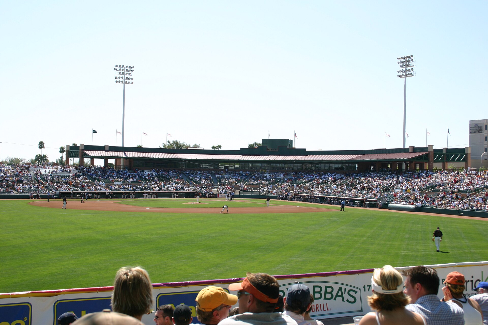
    The view from the lawn seats at Scottsdale Stadium during spring training
    Cactus League spring training, the busiest and most expensive weeks of the Phoenix year (Photo: Cygnusloop99 via Wikimedia Commons, CC BY-SA 3.0)

    Phoenix weather, season by season

    Phoenix sits in a broad desert basin, the Valley of the Sun, a little over 300 meters (about 1,100 feet) above sea level in the Sonoran Desert. It receives only about 180 mm (7 inches) of rain a year, sunshine on the great majority of days, very low humidity for most of the year, mild winters and some of the hottest summers of any large city in the country. The figures below are approximate seasonal patterns at Sky Harbor, based on the long-term climate normals published by NOAA and the National Weather Service’s Phoenix office; check the current forecast before you pack, especially for heat warnings in summer and dust-storm warnings during the monsoon.

    MonthTypical daytime highTypical overnight lowWhat it feels likeFare pressure
    Januaryaround 19 °C (67 °F)around 8 °C (46 °F)Sunny, mild afternoons and chilly nights; occasional winter rainHigh; peak for resorts, Barrett-Jackson week
    Februaryaround 22 °C (71 °F)around 9 °C (48 °F)Warm, bright days; wildflowers start in wet yearsPeak; Phoenix Open, then spring training
    Marcharound 25 °C (77 °F)around 12 °C (54 °F)Near perfect; the desert in bloomPeak; spring training and spring break
    Aprilaround 29 °C (85 °F)around 16 °C (61 °F)Warm to hot afternoons, pleasant evenings; saguaros begin to bloomHigh, easing through the month
    Mayaround 35 °C (95 °F)around 21 °C (70 °F)Hot and very dry; pool season in full swingModerate, falling
    Junearound 40 °C (104 °F)around 26 °C (79 °F)Extreme dry heat; the hottest days often come nowLow
    Julyaround 41 °C (106 °F)around 29 °C (84 °F)Extreme heat with rising humidity; monsoon storms and dust stormsLow, except the Fourth of July
    Augustaround 41 °C (105 °F)around 28 °C (83 °F)Hot, humid by desert standards; flash floods possibleLow
    Septemberaround 38 °C (100 °F)around 25 °C (77 °F)Still very hot; the monsoon fades by the end of the monthLow to moderate, rising after Labor Day
    Octoberaround 32 °C (89 °F)around 18 °C (65 °F)Warm and dry; the first comfortable evenings in monthsModerate
    Novemberaround 24 °C (76 °F)around 12 °C (53 °F)Ideal: warm, sunny afternoons and cool nightsModerate to high; Thanksgiving spike
    Decemberaround 19 °C (66 °F)around 7 °C (45 °F)Mild days, cold nights, occasional rainModerate until mid-month, then peak

    Three things the table cannot show. First, the heat is relentless in summer: an average July high around 41 °C (106 °F) means plenty of afternoons well above that, and in recent summers the city has recorded long runs of days at or above 43 °C (110 °F). The low humidity makes it feel manageable in the shade, but you lose water faster than you notice, and outdoor exertion in the afternoon is dangerous. Second, the nights stay hot: the pavement and buildings of a metro area of several million people hold the day’s heat, so summer lows are often near 29 °C (84 °F) and there is little relief after dark. Third, the monsoon: officially from mid-June to the end of September, and most active in July and August, it brings moisture from the south, sudden thunderstorms, lightning, flash floods in normally dry washes and towering walls of dust known as haboobs that can drop visibility on the freeways to almost nothing in minutes.

    How Phoenix fare seasons work

    Sky Harbor is one of the busiest airports in the country, a hub for American Airlines and one of Southwest’s largest operations, with other U.S. carriers and several low-cost airlines adding capacity. That competition keeps airfares into Phoenix reasonable in most months, and it means the sharp price swings are usually in the rooms. Three calendars drive them: the winter-visitor season, from roughly January to April, when Canadians and Midwesterners fill the resorts and golf courses; the event calendar, led by spring training, the Phoenix Open and major college and pro sporting events; and the heat, which empties the resorts from June to September. The result is a long, expensive high season in late winter and spring, a deep summer trough, and a pleasant, moderately priced fall.

    Peak season

    January to mid-April, with the highest prices from the Phoenix Open in early February through the end of spring training in late March, plus the Christmas and New Year holidays. In those weeks the famous resorts in Scottsdale and Paradise Valley can charge several times their summer rates, golf tee times are booked weeks out, and spring break adds families and college students in March. If you must travel in peak, book the hotel as early as possible, fly midweek, and consider Tempe, Mesa or the West Valley near the ballparks rather than Scottsdale for better rates.

    Shoulder season

    Mid-April to May, and October to mid-December outside Thanksgiving. Late April and early May give you pool weather and lower resort rates before the real heat; October is warm and dry, and November is arguably the best month of the year for weather, with rates that have not yet reached their winter levels. Watch Thanksgiving week, the Arizona State Fair weekends and Cardinals home games.

    Low season

    June to mid-September. Resort and hotel rates drop to their lowest of the year, many resorts run summer packages aimed at Arizona residents that visitors can often book too, and restaurants offer summer deals. The trade-off is the heat. Airfares into Phoenix are usually good value in summer, though flights out of Phoenix on summer weekends can be busy with locals heading for the California coast and the mountains, which sometimes lifts round-trip prices for the return leg.

    As elsewhere, midweek departures and early or late flights usually price below Friday and Sunday afternoons on the same route, and a search across a whole month reveals cheaper pairs of dates close to your first choice. Our guide to the best times to book explains how to read those patterns.

    Phoenix month by month

    January

    Sunny, mild and firmly in high season. Afternoons are pleasant for hiking and golf, nights are cold enough for a jacket, and a winter storm occasionally brings a day of rain and dusts the mountains to the north with snow. The Barrett-Jackson collector car auction fills Scottsdale for a week in the second half of the month, and the resorts are busy with winter visitors. Fares from colder cities rise after the first week of the year.

    February

    The start of the very top of the season. The WM Phoenix Open at TPC Scottsdale, usually in the first half of the month, is one of the best-attended golf tournaments in the world and sends Scottsdale hotel rates soaring; the Scottsdale Arabian Horse Show follows. Pitchers and catchers report for spring training in mid-February, and the first Cactus League games start in the last week of the month. In a wet winter, the wildflowers begin.

    March

    The most expensive month for hotels and one of the best for weather. Spring training fills ten ballparks across the Valley, spring break brings families and students, and the Heard Museum’s Guild Indian Fair and Market takes over its grounds in early March. The desert is at its greenest, the trails are busy from dawn, and every patio is full. Book early, and expect the rates to stay high until the last spring training game.

    April

    Warm to hot, with afternoons that climb toward 30 °C (86 °F) and beyond, and a noticeable drop in hotel rates once spring training ends. The saguaros begin to bloom late in the month, the Diamondbacks open their season at Chase Field, and the pools are open everywhere. It is one of the better value windows for a resort stay with weather that still suits hiking at dawn.

    May

    Hot and dry, with highs around 35 °C (95 °F) and rising. Resort rates fall steadily through the month, Memorial Day weekend is busy with locals by the pool, and the saguaro blossoms peak. Hike early and treat the afternoons as pool time.

    June

    The start of the real heat and of the low season, and often the month with the hottest, driest days of the year before the monsoon moisture arrives. Hotel rates are near their annual low. Do everything outdoors at sunrise, and plan air-conditioned afternoons in museums such as the Heard or the Musical Instrument Museum, or at a resort pool.

    July

    The hottest month on average, with the monsoon adding humidity, evening thunderstorms and dust storms. The Fourth of July weekend brings some demand, but otherwise July is one of the cheapest months of the year. Many locals escape to Flagstaff and the pine country two hours north, which is a good plan for visitors too. Take the heat and the storms seriously; see the safety section below.

    August

    Much like July, with a little more humidity and the strongest monsoon storms. Schools in Arizona go back early in the month, which empties the resort pools of local families on weekdays. Prices stay low throughout, and the Mercury and the Diamondbacks give you air-conditioned evenings.

    September

    Still very hot, but the monsoon fades and the heat starts to ease by the end of the month. Labor Day weekend is busy with locals, the Cardinals and ASU football start their seasons, and rates begin to rise slowly as the first winter visitors book. Late September is a good compromise of lower prices and slightly kinder weather.

    October

    The heat breaks, usually during the first half of the month, and evenings become pleasant for the first time since spring. The Arizona State Fair runs for several weekends in the fall, patio season restarts, and hotel rates climb but stay well below winter levels. A strong month for a city break with some hiking.

    November

    Many locals’ favorite month: warm afternoons, cool nights, clear skies, and the winter visitors not yet at full strength. Rates are moderate apart from Thanksgiving week, when fares from across the country rise. Golf courses reopen after their fall reseeding, and the holiday light displays begin at the zoo late in the month.

    December

    Two months in one. The first half is mild and moderately priced, with the Desert Botanical Garden’s luminaria nights and holiday events across the Valley. From the week before Christmas, fares and hotel rates jump for the holidays, and the Fiesta Bowl and its associated events around New Year bring college football fans to town.

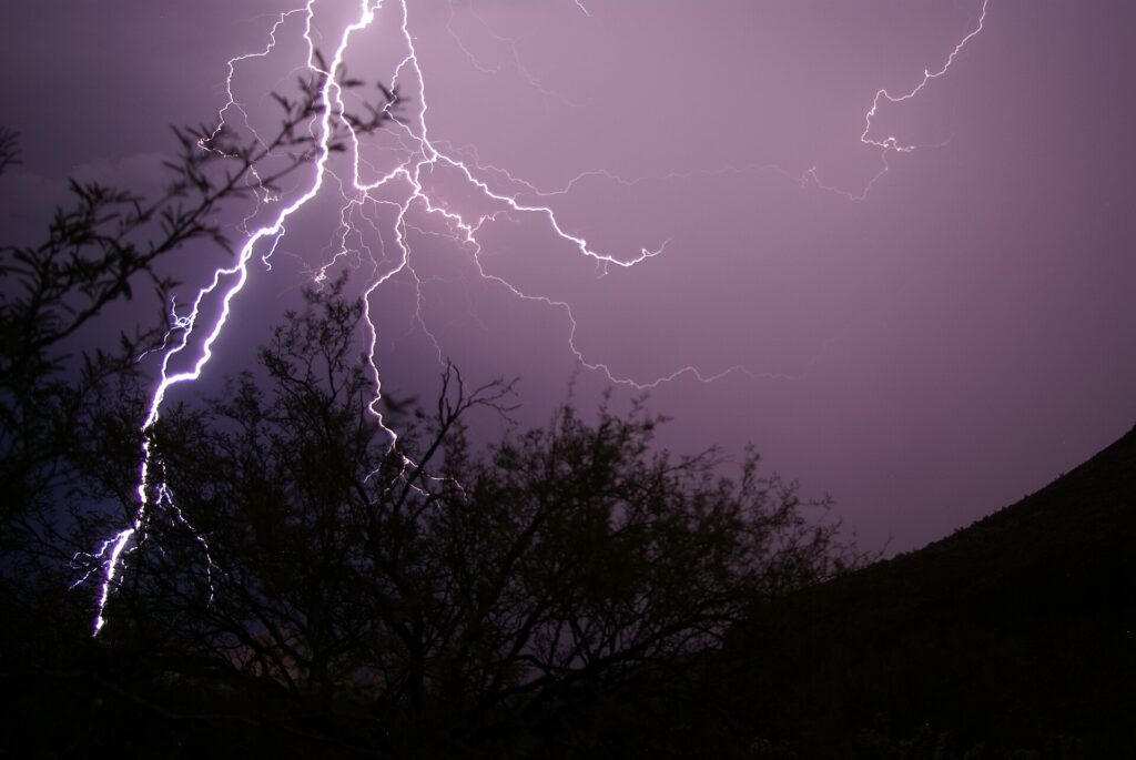
    A monsoon lightning strike over the desert north of Phoenix
    The summer monsoon brings lightning, dust storms and sudden downpours, mostly in July and August (Photo: Shredex via Wikimedia Commons, CC BY-SA 3.0)

    Events that move Phoenix flight and hotel prices

    Cross-check these against your dates before you book. Exact dates shift each year; Visit Phoenix keeps the current calendar.

    • Barrett-Jackson (second half of January, Scottsdale): collectors and car enthusiasts fill the resorts.
    • WM Phoenix Open (early February, TPC Scottsdale): the biggest single hotel spike in Scottsdale.
    • Cactus League spring training (late February to late March): the peak of the year across the Valley.
    • Spring break (March, varying by school district and university).
    • Memorial Day, Fourth of July and Labor Day weekends: busy with locals, but rarely expensive for visitors.
    • Arizona State Fair (several weekends in the fall).
    • Thanksgiving week and the Christmas and New Year holidays, including the Fiesta Bowl.
    • Super Bowls, college football championship games and the NCAA Final Four, which the region hosts every few years and which send prices through the roof.
    • Big conventions at the Phoenix Convention Center, and Suns, Cardinals and Diamondbacks home games. Our Phoenix events page shows what is on sale for your dates.

    Getting in from the airport

    Phoenix’s main airport, Phoenix Sky Harbor International (PHX), is only about 5 kilometers (3 miles) east of downtown, and it serves the whole Valley. Its passenger terminals, currently 3 and 4, are connected by the PHX Sky Train, a free automated train that also runs to the 44th Street station on the Valley Metro light rail and to the Rental Car Center. American Airlines and Southwest are the largest operators, and there are nonstop flights from almost every large U.S. city, from several Canadian and Mexican cities, and from London. Getting downtown is easy: ride the Sky Train to 44th Street and take the light rail, which runs through downtown Phoenix, Tempe and Mesa; take a taxi or ride-hail from the curb, about a 10-to-15-minute drive to downtown; or pick up a car from the consolidated Rental Car Center, which every major company uses. Phoenix-Mesa Gateway Airport (AZA), about 50 kilometers (30 miles) southeast, is served mainly by low-cost carriers and can be worth checking if you are staying in the East Valley. Our Phoenix car-versus-transit guide works through whether to rent, and our PHX airport guide covers the layout.

    American Airlines jets at the gates at Phoenix Sky Harbor International Airport
    Phoenix Sky Harbor (PHX), a hub for American Airlines about 5 km from downtown (Photo: Robert693 via Wikimedia Commons, CC BY-SA 4.0)

    Timing tricks that work for Phoenix

    • Price the room first. Airline competition at Sky Harbor keeps fares fairly steady, while resort rates can triple between August and March. Run a Phoenix hotel search for your dates before you commit to the flight.
    • Search the whole month. The Phoenix Open, spring training and holiday weekends create sharp edges in the calendar; a calendar search on TicketScanner shows them instantly, and the week after spring training ends is often dramatically cheaper than the week before.
    • Fly midweek. Friday and Sunday afternoons are the busiest times at Sky Harbor on most routes; Tuesday to Thursday is usually the value.
    • Use the shoulders. Late October to early December offers weather as good as March for a fraction of the price, and late April is pool season before the summer heat.
    • Consider a road trip. Las Vegas is about five hours away; compare fares into both cities with our Las Vegas flights page and our guide to the best time to fly to Las Vegas, and see the Las Vegas to Phoenix route guide.
    • Build a monsoon buffer. Summer thunderstorms and dust storms can delay flights at Sky Harbor, mostly in the afternoons and evenings of July and August; morning flights are the safer bet, and our guide to how early to arrive covers what to allow.
    • Flying out of Phoenix instead? The same seasonality applies in reverse; see cheap flights from Phoenix.
    Saguaro cactus in the Sonoran Desert southwest of Phoenix
    Saguaros in the Sonoran Desert, at their best in the mild months from November to April (Photo: BLMArizona via Wikimedia Commons, Public domain)

    Staying safe in the heat

    If you travel between May and September, plan the trip around the heat rather than in spite of it. Schedule outdoor sightseeing and hiking for the first hours after sunrise, and spend the early afternoon indoors, in the water or resting. Drink water steadily through the day rather than waiting until you are thirsty, add electrolytes if you are active, and wear a hat, loose light clothing and sunscreen. On any desert trail, carry more water than you think you need and turn around well before you run low; the City of Phoenix closes some of its most popular summit trails during the hottest hours when a heat warning is in effect. Never leave a child or a pet in a parked car, even for a moment, and be careful with metal seat-belt buckles and dark pavement, which can burn skin. During the monsoon, never drive or walk into a flooded wash, and if a dust storm reaches the freeway, pull off the road as far as you safely can and wait it out. The National Weather Service in Phoenix publishes daily heat and storm forecasts; make checking them part of your morning.

    What to pack, by season

    Winter (December to February): layers for mild days, a warm jacket for evenings that can drop close to freezing, and sunglasses; add a proper coat if you are heading north to Sedona, Flagstaff or the Grand Canyon, where it snows. Spring (March to May): light clothing, swimwear, a layer for the evenings, and high-factor sunscreen, because the sun is already intense. Summer (June to September): the lightest, loosest clothing you own, a wide-brimmed hat, sunscreen, a large refillable water bottle, and a sweater for the aggressively air-conditioned restaurants and theaters. Fall (October to November): summer clothing into October, with a light jacket for November nights. In every season, bring sturdy shoes with grip for the rocky desert trails, and something smarter for the resort restaurants.

    The best time to fly to Phoenix for…

    Spring training

    The first three weeks of March, booked as early as you can manage, with the hotel first; late February has lower rates and fewer crowds but not every team is playing yet.

    Golf and resorts

    November and early December for excellent weather at moderate rates, or January to April for the full high-season experience at high-season prices.

    Hiking and the desert

    November to March, starting early on the trails; late February to April for wildflowers and cactus blooms.

    Sedona and the Grand Canyon

    April to May and September to October, when Phoenix is warm, and Sedona and the Grand Canyon’s South Rim, which sits at about 2,100 meters (7,000 feet), are comfortable; in winter the rim can be snowy and very cold. See Grand Canyon National Park for conditions.

    The lowest prices

    June to mid-September, when resort rates are at their lowest of the year, provided you plan around the heat.

    Families

    Fall break in October or the week after Thanksgiving for comfortable weather and moderate rates; summer is cheap and the resort pools are superb, but outdoor sightseeing with children is limited to the early mornings.

    Cross-border and international visitors

    Canadians need a valid passport; travelers from Visa Waiver Program countries need an approved ESTA before boarding, and everyone else needs a visa. U.S. Customs and Border Protection explains what applies to you, and the TSA lists what you can carry through security. Remember that Arizona stays on Mountain Standard Time all year.

    Frequently asked questions

    What is the cheapest month to fly to Phoenix?

    For the total trip, July and August, when resort and hotel rates are at their lowest; airfares are usually reasonable too. June and early September are close behind.

    What is the best month to visit Phoenix for weather?

    November and March, with late October, early December, February and April close behind.

    How hot does Phoenix get in summer?

    Average highs are around 40 to 41 °C (104 to 106 °F) from June to August, and many days go higher. Nights often stay near 29 °C (84 °F). Plan outdoor time for early morning and check the National Weather Service forecast daily.

    When is monsoon season in Phoenix?

    Officially from mid-June to the end of September, with the most storms in July and August. Expect afternoon and evening thunderstorms, dust storms and occasional flash flooding.

    How expensive is Phoenix during spring training?

    It is the most expensive stretch of the year for hotels, especially in Scottsdale. Flights rise less sharply. The week after spring training ends is much cheaper.

    How far ahead should I book?

    Well ahead for February and March, the Phoenix Open and the holidays; for the summer and fall, rates are stable enough that choosing the right dates matters more than booking early.

    Does Phoenix change its clocks?

    No. Arizona stays on Mountain Standard Time all year, so it matches Pacific time in summer and Mountain time in winter; check your connection times carefully.

    Ready to pick your dates? Compare fares across the whole month on our Phoenix flights page, then find a room with our Phoenix hotel search. For what to do when you land, start with our first-timer’s guide to Phoenix.

  • Things to Do in Phoenix: A First-Timer’s Guide

    Things to Do in Phoenix: A First-Timer’s Guide

    Phoenix is easy to misread from the air. Coming in to land, it looks like one enormous grid of rooftops and swimming pools stretching to the mountains, and plenty of visitors treat it that way: a resort, a round of golf, a spring training game and a flight home. They miss a city with some of the best museums in the West, a botanical garden devoted entirely to the desert, mountains you can climb before breakfast without leaving the city limits, an arts district that fills with thousands of people on the first Friday of every month, a food scene rooted in Sonoran Mexican cooking, and a winter climate that makes it the warmest big-city escape in the country from November to April. Sedona and the Grand Canyon are a morning’s drive away. This guide covers the sights that earn a day, the neighborhoods worth a half-day, the food, spring training and the sports, the day trips that make Phoenix a base as much as a destination, how to handle the summer heat, and the practical details that turn a resort stay into a trip.

    If you are still comparing cheap flights to Phoenix, read this alongside our guides to the best time to fly to Phoenix and whether you need a rental car. Between the three you can plan the whole trip.

    The downtown Phoenix skyline with desert mountains behind
    Downtown Phoenix from South Mountain, at the center of a desert valley ringed by mountains (Photo: Alan Stark from Goodyear, AZ, United States via Wikimedia Commons, CC BY-SA 2.0)

    Phoenix at a glance for first-timers

    • Airport: Phoenix Sky Harbor International (PHX), about 5 km (3 miles) east of downtown, one of the closest big-city airports to its center in the country; the free PHX Sky Train links the terminals to the light rail, and a taxi, ride-hail or rental gets you anywhere in the Valley. See our PHX airport guide.
    • Getting around: Valley Metro light rail runs from the airport’s Sky Train connection through downtown Phoenix, Tempe and Mesa. Beyond that corridor, the Valley is built for driving, and most visitors rent a car for at least part of their stay.
    • Money: U.S. dollars. Sales tax is added at the register, and hotels and rental cars carry their own extra taxes and fees, so compare total prices. Many resorts add a nightly resort fee. Tipping 18 to 20 percent in restaurants is standard.
    • Weather: sunny almost every day, with mild winters, hot springs and falls, and summers that regularly pass 43 °C (110 °F). Arizona does not observe daylight saving time. Our month-by-month guide has the detail.
    • Where to stay: downtown for the ballpark, the convention center and the light rail; Roosevelt Row for galleries, bars and a local feel; Scottsdale for resorts, golf and nightlife; Tempe for the university and the lake; the Camelback corridor and Paradise Valley for the classic desert resorts. Our Phoenix hotel search covers them all.

    Downtown: Heritage Square, the Heard and the sports district

    Downtown Phoenix spent decades emptying out after dark and has spent the last two filling back up, helped by the light rail, the Arizona State University campus, and a cluster of new apartment towers. Start at Heritage Square, a block of restored late-19th-century houses that survived the city’s growth, including the Victorian Rosson House, which you can tour, and a converted brick building that holds Pizzeria Bianco, the restaurant that made Phoenix a name among pizza obsessives. The Arizona Science Center is next door, and the Children’s Museum of Phoenix is a few blocks away. A few blocks south, Chase Field, the home of the Arizona Diamondbacks, has a retractable roof and air conditioning that make summer baseball bearable, and the downtown arena beside it hosts the Suns, the Mercury and the big touring concerts. A short ride north on the light rail, the Heard Museum is one of the finest museums of American Indian art and culture in the country, with galleries on the peoples of the Southwest, a celebrated collection of Hopi katsina dolls, contemporary art, and a long-running, sobering exhibit on the federal boarding-school era; plan at least half a day. The Phoenix Art Museum, a few blocks away on Central Avenue, is one of the largest art museums in the Southwest, with strong fashion and Western American collections.

    Papago Park and the Desert Botanical Garden

    If you only do one thing in Phoenix, make it the Desert Botanical Garden. Set among the red sandstone buttes of Papago Park, on the border of Phoenix, Scottsdale and Tempe, it holds tens of thousands of desert plants from around the world along easy looped trails, with towering saguaros, blooming cactus gardens in spring, a wildflower loop, and exhibits on how the peoples of the Sonoran Desert have lived from its plants for centuries. Go at opening time in any season except winter, and consider the evening events: in December the garden’s paths are lined with thousands of luminarias, paper-bag lanterns, for one of the Valley’s favorite holiday traditions. Beside it, the Phoenix Zoo is spread across the same desert landscape and has a strong Arizona trail. Papago Park itself is free: the short scramble up to Hole-in-the-Rock, a natural window in a sandstone butte, is the classic sunset view over the city, and the lagoons, the white pyramid of Hunt’s Tomb (the resting place of Arizona’s first governor) and the flat walking loops around the buttes make an easy morning.

    Saguaros and cactus gardens at the Desert Botanical Garden in Papago Park
    The Desert Botanical Garden in Papago Park, the one sight no first visit should skip (Photo: Simeon87 via Wikimedia Commons, CC BY-SA 3.0)

    The mountains in the city: Camelback, Piestewa and South Mountain

    What sets Phoenix apart from other Sun Belt cities is the mountains rising straight out of its neighborhoods. Camelback Mountain, the humped red peak between Phoenix and Paradise Valley, has two summit trails, Echo Canyon and Cholla, that are steep, rocky and genuinely strenuous, with handrails on the steepest sections of Echo Canyon; the view from the top across the whole Valley is worth it, but this is not a casual stroll, and the fire department carries out rescues here every year. Piestewa Peak, in the Phoenix Mountains Preserve to the north, has a similarly steep summit trail and gentler loops around its base. South Mountain Park and Preserve, on the city’s southern edge, is one of the largest city parks in the United States, with about 80 kilometers (50 miles) of trails, petroglyphs, and a road to Dobbins Lookout that gives you the famous view of the downtown skyline without the climb. In Scottsdale, the McDowell Sonoran Preserve protects a vast stretch of desert with well-marked trailheads and some of the best saguaro forests near the city. The rule for all of them is the same: start at first light, carry far more water than you think you need, and be off the trail before the day heats up.

    Camelback Mountain seen from Papago Park in Phoenix
    Camelback Mountain from Papago Park: a steep sunrise climb with a view over the whole Valley (Photo: Dru Bloomfield from Scottsdale, Arizona, USA via Wikimedia Commons, CC BY 2.0)

    Neighborhoods worth a half-day

    Roosevelt Row

    Just north of downtown, Roosevelt Row is the city’s arts district: murals on nearly every wall, galleries in old bungalows, coffee shops, bars and some of the best independent restaurants in Phoenix. On First Fridays, the monthly evening art walk, the streets fill with galleries, food trucks and street performers; it is one of the largest events of its kind in the country and free. It is on the light rail.

    Old Town Scottsdale

    Scottsdale’s historic core mixes Western-themed souvenir shops, serious galleries of Southwestern and Native art, the Scottsdale Museum of Contemporary Art, and a dense entertainment district of restaurants, cocktail bars and nightclubs that is the Valley’s busiest nightlife. On Thursday evenings the galleries host an art walk, and a free trolley loops the district.

    Tempe and Mill Avenue

    Home of Arizona State University, Tempe is the Valley’s college town: Mill Avenue has bars, restaurants and shops, Tempe Town Lake on the Salt River has paths for walking and cycling and paddleboard rentals, and the streetcar loops through downtown and the campus. It is on the light rail, and the Papago buttes rise just across the water.

    Arcadia and the Camelback corridor

    East Phoenix at the foot of Camelback Mountain, Arcadia is a leafy neighborhood of ranch houses and old citrus groves, with some of the city’s most popular brunch spots and patios. West of it, the Biltmore district is home to the Arizona Biltmore, the 1929 resort whose patterned concrete blocks show the influence of Frank Lloyd Wright; its lobby is worth a look even if you are not staying.

    Mesa and the Asian District

    Mesa, the Valley’s second-largest city, has a revived downtown on the light rail with the Arizona Museum of Natural History, and along Dobson Road an Asian District of Chinese, Vietnamese, Korean, Japanese and Filipino restaurants and markets that is one of the best-value food trips in the metro area.

    Museums, culture and family attractions

    The Musical Instrument Museum, in north Phoenix, is one of the most unexpected museums in the country: thousands of instruments from nearly every nation on Earth, with headsets that play each gallery’s music as you approach, an experience room where you can play some of them, and galleries devoted to famous musicians. In Scottsdale, Taliesin West, Frank Lloyd Wright’s winter home and architecture school, built from desert stone in the 1930s, is part of a UNESCO World Heritage listing of Wright’s work, and it can be seen only on guided tours, which are worth booking ahead in winter and spring. Pueblo Grande Museum Archaeological Park, beside the airport, preserves a platform mound built by the Hohokam, the people who dug the irrigation canals along the Salt River more than a thousand years ago; the modern city’s canals follow many of the same routes. For performance, the Orpheum Theatre and Symphony Hall downtown host the Phoenix Symphony, Arizona Opera and Ballet Arizona. For what is on stage and in the arenas during your dates, our Phoenix events page lists concerts, shows and games.

    Spring training and the winter season

    From mid-February to late March, the Valley becomes the home of the Cactus League, as half of Major League Baseball’s teams hold spring training in ten ballparks spread across Phoenix, Scottsdale, Tempe, Mesa, Glendale, Goodyear, Peoria and Surprise. The ballparks are small, the seats are close, tickets cost a fraction of a regular-season game, and on a warm March afternoon with a lawn seat and a cold drink it is one of the best days out in American sport. It is also the busiest time of the year for hotels, because it coincides with the peak of the winter-visitor season. Early February brings the WM Phoenix Open at TPC Scottsdale, one of the best-attended golf tournaments in the world, famous for the rowdy stadium around its 16th hole; January brings the Barrett-Jackson collector car auction to Scottsdale; and the Heard Museum’s Guild Indian Fair and Market, one of the most important Native art markets in the country, fills its grounds in early March. If your trip falls in this window, book the hotel before the flight; if it does not, the weeks just before and after are some of the best-value weeks of the Valley’s high season.

    Sports

    Phoenix is a four-league market with a year-round calendar. The Arizona Diamondbacks play baseball at Chase Field downtown from April to September, with the roof closed and the air conditioning running through the summer. The Phoenix Suns play basketball from October to April in the downtown arena, which they share with the Phoenix Mercury of the WNBA in summer. The Arizona Cardinals play NFL football at State Farm Stadium in Glendale, a building with a retractable roof and a grass field that rolls outside to catch the sun; the same stadium hosts the Fiesta Bowl around New Year and has staged several Super Bowls. Phoenix Raceway in Avondale hosts NASCAR weekends, and ASU’s Sun Devils play college football in Tempe. Golf is the other sport: the Valley has roughly 200 courses, and winter tee times at the famous ones sell out. Check what is on sale in Phoenix for your dates before you book flights.

    What to eat, and where

    Phoenix food starts with Sonoran Mexican cooking, the style of the neighboring Mexican state: flour tortillas as thin as paper, carne asada grilled over mesquite, cheese crisps, green corn tamales in late summer, and the chimichanga, the deep-fried burrito whose invention both Phoenix and Tucson claim. The Sonoran hot dog, bacon-wrapped and piled with beans, onions, tomatoes, mayonnaise and jalapeño sauce in a soft bolillo roll, is sold from carts and small stands across the city and is worth one lunch. Beyond that, the city has a national reputation for pizza, led by Pizzeria Bianco at Heritage Square; an excellent Asian food corridor in Mesa; a strong brunch culture in Arcadia and Roosevelt Row; and a growing group of chefs cooking with desert ingredients such as prickly pear, mesquite flour, cholla buds and Medjool dates from the farms of the lower Colorado River. Craft breweries are everywhere, and prickly pear margaritas are the local signature cocktail. The Saturday-morning farmers’ market downtown is good for Arizona produce, citrus in winter and local honey.

    Phoenix through the seasons

    Phoenix runs on a reversed calendar: winter is high season, and summer is when locals leave. Winter (December to February) is sunny and mild, with afternoons in the high teens to low 20s Celsius (mid-60s to low 70s Fahrenheit), chilly nights, and snow visible on the high peaks to the north; it is golf, hiking and patio season, the resorts are full of winter visitors from Canada and the Midwest, and the Phoenix Open arrives in early February. Spring (March to May) is the best of the year: spring training, wildflowers in wet years, the saguaros blooming white from late April, and pool weather by May. Summer (June to September) is extreme: highs regularly above 43 °C (110 °F), overnight lows that can stay above 30 °C (86 °F), and the monsoon from July bringing dust storms, lightning and sudden downpours. The city moves indoors, into the pools and up to the cool pine country two hours north, and resort rates fall dramatically. Fall (October to November) brings the heat down to perfect by November, with the Arizona State Fair, football and the return of the winter visitors. Our month-by-month guide has the fare patterns that go with each season.

    Staying safe in the summer heat

    Phoenix heat is not an inconvenience to push through; it is a genuine health risk, especially for visitors who are not used to it. From roughly late May to late September, plan outdoor activity for the first hours after sunrise and the evening, and spend the middle of the day indoors or in the water. Heat illness can develop quickly, and thirst is a late signal, so drink water steadily through the day and add electrolytes if you are active; wear a hat, loose light clothing and sunscreen. On the trails, start at dawn, carry more water than you expect to need, and turn back well before you run low; on days when a heat warning is in effect, the city closes the trails at Camelback and Piestewa Peak during the hottest hours. Dark pavement, playground slides, car seats and seat-belt buckles can get hot enough to burn skin, and a parked car heats up dangerously within minutes, so never leave a child or a pet in one, even briefly. The National Weather Service office in Phoenix issues the forecasts and heat warnings; check them each morning, and treat its advice as the plan for the day.

    Phoenix with kids

    Phoenix is an easy family city, especially from October to April. The Phoenix Zoo and the Desert Botanical Garden, side by side in Papago Park, make a full day. The Arizona Science Center downtown has a planetarium and hands-on galleries, the Children’s Museum of Phoenix is one of the best for under-tens in the West, and the Musical Instrument Museum’s experience room is a hit with every age. OdySea Aquarium, on the Salt River Pima-Maricopa Indian Community’s land beside Scottsdale, has sharks, penguins and hands-on exhibits. In summer, the big resort pools with lazy rivers and water slides, the Valley’s water parks and the ice rinks become the plan. Spring training suits children perfectly, with lawn seating and players signing autographs along the fences. For families heading out on day trips, our family car rental guide covers the vehicle question.

    Phoenix on a budget

    A lot of the best of Phoenix is free: the hiking trails at Camelback, Piestewa Peak, South Mountain and the McDowell Sonoran Preserve, Papago Park and Hole-in-the-Rock, Tempe Town Lake, First Fridays on Roosevelt Row, the Thursday art walk in Old Town Scottsdale, and the Arizona Capitol Museum. The Desert Botanical Garden, the Heard and the Musical Instrument Museum charge admission but are worth it, and some museums offer free or reduced entry on certain evenings; check their sites. Summer is the budget season: resort rates can drop to a fraction of their winter level, and many restaurants run summer deals for locals. Eat well for less along Dobson Road in Mesa, at the taquerias and Sonoran hot dog stands across the city, and at happy hours. A light-rail day pass covers downtown, Tempe and Mesa. Compare rates by neighborhood on our Phoenix hotel search.

    Day trips from Phoenix

    Sedona is about two hours north on I-17: red rock buttes, vortex trails, Cathedral Rock and Bell Rock, galleries and a canyon drive up Oak Creek to Flagstaff; many trailhead lots need a Red Rock Pass, and a free trailhead shuttle runs on busy days. On the way, Montezuma Castle National Monument preserves a cliff dwelling set into a limestone wall, and the old mining town of Jerome clings to a hillside above the Verde Valley. The South Rim of Grand Canyon National Park is about three and a half to four hours each way and is better as an overnight trip. Closer in, the Superstition Mountains east of Mesa have Lost Dutchman State Park, Canyon Lake and the start of the Apache Trail; Tucson, about two hours south, has Saguaro National Park and its own Sonoran food scene; and Casa Grande Ruins National Monument, an hour south, protects a four-story Hohokam great house. Las Vegas is about five hours northwest by way of the Hoover Dam; see our Las Vegas guide and the Las Vegas to Phoenix route guide. San Diego and the Pacific are about five and a half hours west on I-8; our Phoenix to San Diego route guide covers the drive. All of these are car trips; see our Phoenix car rental page, and carry extra water in summer. Visit Arizona covers the wider state.

    Cathedral Rock in Sedona, two hours north of Phoenix
    Cathedral Rock in Sedona, about two hours north of Phoenix on I-17 (Photo: Nikolai Gates Vetr via Wikimedia Commons, CC BY-SA 4.0)

    Two sample itineraries

    Three days, light car use

    Day one: the Heard Museum in the morning by light rail, lunch at Heritage Square, the Arizona Science Center or the Phoenix Art Museum in the afternoon, and dinner and bars on Roosevelt Row. Day two: a sunrise hike on Piestewa Peak or South Mountain, the Desert Botanical Garden, sunset at Hole-in-the-Rock, and an evening on Mill Avenue in Tempe. Day three: the Musical Instrument Museum, Taliesin West in the afternoon, and dinner and nightlife in Old Town Scottsdale, with ride-hail filling the gaps.

    Five days, with Sedona and the Grand Canyon

    Add a spring training game or a spa afternoon at a resort, then pick up a car and drive north to Sedona for a night, continue to the Grand Canyon’s South Rim for sunset and sunrise, and return through Flagstaff and down I-17, dropping the car at the Sky Harbor Rental Car Center on the way home.

    Practical details

    • Transit: buy light-rail and bus passes at station machines or in the Valley Metro app. Valley Metro has maps; our car-versus-transit guide goes into detail.
    • From PHX: the free Sky Train to the light rail at 44th Street, a taxi or ride-hail, or a rental from the Rental Car Center. The airport’s site covers ground transport.
    • Weather: sun protection and water in every season, a warm layer for winter evenings, and serious heat precautions from May to September. The National Weather Service’s Phoenix office issues heat and dust-storm warnings.
    • Time zone: Mountain Standard Time all year. Arizona does not change its clocks, so it matches Los Angeles in summer and Denver in winter; the Navajo Nation in the northeast does observe daylight saving time.
    • Entry requirements: Canadians need a valid passport; visitors from Visa Waiver Program countries need an approved ESTA before boarding, and everyone else needs a visa. U.S. Customs and Border Protection is the authoritative source.
    • Safety: the tourist areas are generally safe with ordinary big-city awareness; the heat, the trails and monsoon flash floods are the real hazards, so never drive into a flooded wash.

    Frequently asked questions

    How many days do you need in Phoenix?

    Three days covers the museums, the Desert Botanical Garden, a sunrise hike and two neighborhoods; add one for Sedona and two for the Grand Canyon.

    What is the number one thing to do in Phoenix?

    The Desert Botanical Garden, ideally at opening time, followed by sunset at Hole-in-the-Rock next door. From February to March, add a spring training game.

    Is Phoenix walkable?

    Downtown, Roosevelt Row, Old Town Scottsdale and Mill Avenue in Tempe are, and the light rail links several of them. The rest of the Valley assumes a car, and summer heat limits walking anywhere.

    Do I need a car in Phoenix?

    Not for downtown, Tempe and a resort stay with ride-hail. For Scottsdale’s attractions, the trailheads, Sedona and the Grand Canyon, yes, and that is most visitors.

    Is it safe to visit Phoenix in summer?

    Yes, if you plan around the heat: outdoor activity at dawn and dusk, the middle of the day indoors, plenty of water, and a check of the National Weather Service forecast each day. Resort rates are at their lowest.

    What is Phoenix known for?

    Desert sunshine, winter golf and resorts, spring training baseball, saguaros and the Sonoran Desert, Sonoran Mexican food, and being the gateway to Sedona and the Grand Canyon.

    Ready to go? Compare flights to Phoenix, find a place to stay with our Phoenix hotel search, and if Sedona or the Grand Canyon is on the list, price a rental car for those days.

  • Cancun: Should You Rent a Car or Rely on Public Transit?

    Cancun: Should You Rent a Car or Rely on Public Transit?

    Cancun splits visitors into two camps. Many never need a car at all: they take a shuttle from the airport to an all-inclusive in the Hotel Zone, ride the cheap, frequent city buses when they want to see downtown, take the ferry to Isla Mujeres, and book a tour for Chichén Itzá. Others treat Cancun as the airport for the whole Mexican Caribbean and want to drive south to Tulum and the cenotes, west to the colonial towns and the ruins, and stop wherever a jungle road or a quiet beach looks interesting. Both approaches work, and the right one depends less on the city than on the trip you have in mind. Driving here is also genuinely different from driving at home, with mandatory Mexican insurance that catches many visitors out at the rental counter, speed bumps that appear without warning, and full-service gas stations with their own etiquette. This guide explains how the area is laid out, how the buses, colectivos, ferries and the new train work, what driving is really like, when a car is worth it, and gives you a straightforward way to decide.

    The short answer

    Skip the car if you are staying in the Hotel Zone or downtown and your plans are the beaches, downtown, Isla Mujeres and one or two organized day trips; the R-1 and R-2 buses, taxis, ferries and tours cover all of it, and you avoid the insurance, the parking and the stress. That is most visitors on a first trip. Rent a car if you want to explore the Riviera Maya on your own schedule, visit several cenotes, reach Chichén Itzá or Tulum at opening time before the tour buses, stay in Tulum, Puerto Morelos or Playa del Carmen, or are traveling as a family or group, where a car quickly becomes cheaper than tours. And if you want independence without driving, the ADO buses, the colectivo vans and the Tren Maya connect Cancun with Playa del Carmen, Tulum, Valladolid and Chichén Itzá. Compare rental rates for any of these plans on our Cancun car rental page.

    How Cancun is laid out

    Cancun is really two cities joined by one road. The Hotel Zone, a thin barrier island shaped like a 7, runs for about 22 kilometers between the Caribbean and the Nichupté lagoon, and almost everything on it sits on Boulevard Kukulcán, with addresses given as kilometer markers from km 0 near downtown to the mid-20s near Punta Nizuc. Downtown, El Centro, is on the mainland at the northern end, laid out around Avenida Tulum, the main street, with the ADO bus station, the markets and the square at Parque de las Palapas. North of downtown, Puerto Juárez has the Isla Mujeres ferry pier, and beyond it are the newer resorts of Costa Mujeres. The airport is on the mainland south of the city, near the southern end of the Hotel Zone. From there, Highway 307 runs south along the coast through Puerto Morelos, Playa del Carmen and the resort corridor of the Riviera Maya to Tulum, while Highway 180D, a toll road, runs west across the peninsula to Valladolid, Chichén Itzá and Mérida.

    Hotels cluster along the whole length of the Hotel Zone, with the densest nightlife around Punta Cancún at km 9, and in smaller, cheaper properties downtown. Our Cancun hotel search lets you compare them.

    Getting in from the airport

    Cancun International (CUN) has several terminals, spaced well apart and linked by an inter-terminal shuttle, and every transport option starts outside the one you land at. ADO buses run from the terminals to the downtown bus station on Avenida Tulum and directly to Playa del Carmen, for a modest fare; from downtown, the R-1 or R-2 city bus or a taxi reaches the Hotel Zone. Pre-booked shuttles, shared or private, are the most popular way to reach Hotel Zone and Riviera Maya resorts, and many all-inclusives include or sell them. Airport taxis are federally licensed and charge fixed, zone-based fares that are higher than city taxis; ordinary city taxis and most ride-hail drivers are not allowed to pick up at the terminals. The drive to the Hotel Zone takes 15 to 30 minutes, to downtown about 25, and to Playa del Carmen roughly 45 minutes to an hour. Every major rental company has counters in the terminals or a free shuttle to a nearby lot. On the way out, you will pass a hall of people offering transport and “information”; many are selling timeshares, so head for the exit and your pre-arranged ride. The airport operator, ASUR, lists the terminals, and our CUN airport guide covers the layout.

    ADO bus platforms outside a terminal at Cancun International Airport
    ADO buses leave the airport terminals for downtown Cancun and Playa del Carmen (Photo: Mrkstvns via Wikimedia Commons, CC BY-SA 4.0)

    Cancun’s transit, explained

    Cancun has no metro or tram; its public transport is a dense network of privately operated city buses, supplemented by intercity coaches, shared vans and, since late 2023, a long-distance train. It is cheap, frequent on the routes that matter to visitors, and entirely adequate for a Hotel Zone and downtown stay.

    The Hotel Zone buses

    The routes visitors use are the R-1 and R-2, which run the length of Boulevard Kukulcán through the Hotel Zone and into downtown along Avenida Tulum, with a windshield sign showing “Zona Hotelera” or the route number. They come every few minutes for most of the day and run from early morning until late at night, you flag them down at the marked stops or anywhere safe along the boulevard, and you pay the driver in cash in pesos, a small flat fare, with no transfers. Keep small bills and coins; drivers rarely have change for a large note. The ride from the southern Hotel Zone to downtown takes 30 to 45 minutes depending on traffic. The buses are basic and busy at shift-change times, but safe and very widely used by visitors.

    ADO intercity buses

    ADO runs comfortable, air-conditioned, first-class coaches from the downtown terminal and the airport to Puerto Morelos, Playa del Carmen, Tulum, Valladolid, Chichén Itzá, Mérida and beyond. Buy tickets at the counter, from machines or online, and on busy routes buy a day ahead in high season. For a car-free Riviera Maya trip, ADO is the backbone.

    Colectivos

    Shared white vans, known as colectivos, run constantly along Highway 307 from downtown Cancun to Puerto Morelos and Playa del Carmen, and from Playa del Carmen onward to Tulum, stopping anywhere along the highway on request. They are cheaper than ADO, leave when full, and are the easiest way to reach the resort entrances, cenotes and small beaches between the towns. Pay in cash in pesos.

    The Tren Maya

    The Tren Maya, a new intercity railway around the Yucatán Peninsula, has a station near Cancun’s airport and connects with Puerto Morelos, Playa del Carmen, Tulum, Valladolid, Chichén Itzá and Mérida. It is comfortable and scenic, but frequencies are still limited and the stations can be some way from the town centers or sites they serve, so check the current timetable and onward connections before you plan a day around it.

    Accessibility

    This is Cancun’s weakest area. Many city buses have steps and few are wheelchair-accessible, and sidewalks in the Hotel Zone are narrow in places. ADO coaches and the Tren Maya are more accommodating, and accessible private transfers and taxis can be arranged in advance.

    A city bus in the Cancun Hotel Zone
    The R-1 and R-2 buses run the length of the Hotel Zone into downtown for a small flat fare (Photo: O.iyle via Wikimedia Commons, CC BY-SA 4.0)

    Beyond the buses

    • Taxis. Plentiful in the Hotel Zone and downtown, and unmetered: fares are set by zone, rates in the Hotel Zone are higher than downtown, and you should always agree on the price before getting in. Hotels can tell you the going rate for common trips, and many display a rate sheet.
    • Ride-hail. Uber operates in Cancun, but it has faced strong opposition from local taxi unions, and pickups at the airport and some hotels are restricted. Check what is permitted when you travel, and treat it as a useful extra rather than something to rely on.
    • Ferries. Passenger ferries leave for Isla Mujeres from Puerto Juárez, north of downtown, and from piers in the Hotel Zone; a separate car ferry runs from Punta Sam, although you do not need a car on the island. For Cozumel, ferries leave from Playa del Carmen.
    • Walking and cycling. Downtown and Punta Cancún are walkable, and a paved path runs along much of Boulevard Kukulcán for bikes and runners, best used in the early morning before the heat and traffic build.
    • Golf carts. On Isla Mujeres, a rented golf cart is the classic way to tour the island, and a scooter or bicycle works too.
    • Tours. For Chichén Itzá, Tulum, the cenotes, Isla Contoy and the whale sharks, organized tours with hotel pickup are the most common car-free option and remove every logistical question.
    A fast ferry crossing from Cancun to Isla Mujeres
    Ferries to Isla Mujeres leave from Puerto Juárez and the Hotel Zone; no car needed on the island (Photo: Bernard DUPONT via Wikimedia Commons, CC BY-SA 2.0)

    Driving in Cancun and beyond: what it is really like

    Outside the city, driving on the Yucatán Peninsula is easier than many visitors expect: the land is flat, the main highways are in reasonable condition, and signage to the big sights is clear. The challenges are specific. Topes, speed bumps, appear on every road through every village and at many junctions, sometimes unmarked and occasionally large enough to damage a car taken at speed. Highway 307, the coastal road from Cancun to Tulum, is busy with trucks, tour buses and colectivos stopping without warning, and its speed limits change frequently. In the city, Boulevard Kukulcán and Avenida Tulum get congested at rush hour, and Cancun’s many traffic circles (glorietas) take some getting used to. And the road rules are enforced by several layers of police, from municipal traffic officers in town to the National Guard on the highways.

    Boulevard Kukulcán, the single road through the Cancun Hotel Zone
    Boulevard Kukulcán, where every Hotel Zone address is a kilometer marker (Photo: MARELBU via Wikimedia Commons, CC BY 3.0)

    Parking

    Parking is rarely a serious problem. Most Hotel Zone resorts have parking for guests, sometimes for a daily fee; downtown has street parking and paid lots; and the malls have large lots. The public beaches in the Hotel Zone have limited parking, and the spaces at Playa Delfines fill early on weekends. At the archaeological sites, Chichén Itzá and Tulum have paid parking lots, and Tulum’s town and beach road can be congested. Never leave valuables visible in a parked car, and use the attended lots where they exist.

    Rules and conditions worth knowing

    • Mexican liability insurance is mandatory, and your insurance at home and most credit-card coverage do not satisfy it. Many online quotes exclude it, so the price at the counter can be far higher than the price you booked; read what the rate includes before you pay, and expect a sizable deposit hold on your credit card.
    • Your license: a valid U.S. or Canadian driver’s license is generally accepted for tourists; carry your passport and rental papers too.
    • Gas stations are full-service. Check that the pump reads zero before fueling begins, pay in pesos where you can, and tip the attendant a little for washing the windshield.
    • Toll roads: the 180D toll highway to Valladolid and Chichén Itzá is faster, safer and better maintained than the free road; tolls are paid at booths, and cash in pesos is the safest way to pay.
    • Checkpoints by the military or National Guard are routine on the highways; slow down, be polite, and follow instructions.
    • Police stops: if you are stopped, stay calm and courteous and ask for a written ticket that you can pay officially; the U.S. State Department and the Government of Canada both publish advice on driving in Mexico.
    • Night driving: avoid rural roads after dark, when topes, pedestrians, cyclists and animals are hard to see.
    • Help on the road: 911 is Mexico’s emergency number, and the government’s Green Angels roadside assistance patrols the main highways.

    When renting a car makes sense

    • The cenotes. The Ruta de los Cenotes near Puerto Morelos and the cenotes around Tulum and Valladolid are spread out and best visited early, when the water is clearest and the crowds are thin.
    • Chichén Itzá at opening time. Driving out the evening before, staying in Valladolid, and walking in at opening is the best way to see the site, and impossible on a day tour.
    • Tulum and the Riviera Maya. A car lets you base yourself in Tulum or Puerto Morelos and cover the ruins, beaches, parks and Sian Ka’an on your own schedule.
    • Families and groups. For four people, a rental quickly becomes cheaper than tours and taxis, and car seats solve a real problem.
    • A Yucatán loop. Cancun, Valladolid, Mérida and back is one of the great road trips in Mexico, and a round trip back to the airport avoids the steep one-way fees most companies charge.

    If any of those apply, our rental car booking tips cover insurance, deposits and the questions to ask at the counter, and our family car rental guide looks at vehicle choice.

    When it does not

    • You are staying at an all-inclusive in the Hotel Zone and plan to leave it only for downtown, Isla Mujeres and one or two tours.
    • You are staying downtown and are happy with the R-1 and R-2 buses and the ferries.
    • You are in town for a wedding, a conference or spring break, when the car will sit in the lot.
    • You want to see Tulum and Playa del Carmen and are comfortable on ADO buses and colectivos.

    The hybrid plan for a beach-plus-ruins trip

    Go car-free for the beach days and rent for the exploring days, and think about where you pick up. Renting at the airport makes sense if you are heading straight to Tulum, Puerto Morelos or Playa del Carmen, because Highway 307 starts beside the terminal and you never enter city traffic. If you are spending the first nights in the Hotel Zone, a shuttle from the airport and a one- or two-day rental from a Hotel Zone or downtown office for the Chichén Itzá or cenote days saves you paying for a car that sits in the resort lot. A pattern that works well: shuttle to the Hotel Zone, three car-free days of beach, downtown and Isla Mujeres, then a rental for the second half of the trip, driving to Valladolid and Chichén Itzá, down to Tulum and the cenotes, and back to the airport for the flight home. Book ahead for Christmas, spring break and Easter, and check what insurance is included before you commit. Compare day rates on our Cancun car rental page against a full-trip rental and the difference is usually clear.

    A worked cost comparison

    Prices change with the season, the exchange rate and the booking window, so treat this as a method rather than a quote, and check current rates before deciding. For a five-night all-inclusive stay in the Hotel Zone for two people, the car-free version costs a return airport shuttle, a few R-1 bus rides and a taxi back from downtown, return ferry tickets to Isla Mujeres, and one organized Chichén Itzá tour; the rental version adds five days of a compact car with the mandatory insurance, resort parking, fuel and tolls, and buys you little you could not have reached by bus, ferry or tour. The car-free option wins clearly. For the same five nights with two days of exploring, the car-free version adds two organized tours for two; the hybrid version adds a two-day rental from the Hotel Zone with insurance, fuel, the 180D tolls and site parking. For two people the costs are often close, and the rental wins on flexibility and early starts; for a family of four, the rental is usually clearly cheaper. For a week based in Tulum or Puerto Morelos, a rental from the airport is the most practical answer unless you are comfortable with colectivos and taxis for every outing. Run the rental rates for your dates, with insurance, on our Cancun car rental page and put them beside the tour prices before you choose.

    Driving Highway 307 and the Riviera Maya in each season

    Highway 307 from Cancun to Tulum is a divided highway for most of its length and one of the main arteries of the Mexican Caribbean, and conditions change through the year. In winter (December to April), the weather is dry and the driving easy, but traffic is at its heaviest, the resort entrances and the big parks see queues, and the Tulum ruins and the popular cenotes are crowded by mid-morning; go early. Around Easter week, Mexican families fill the roads and the beaches, and you should expect slower traffic everywhere. In late spring, the roads are quieter, the heat builds, and the first rains arrive; this is an excellent time to drive. In summer, short, heavy downpours can flood low sections of road and city streets for an hour or two, and visibility drops sharply in a storm; slow down and wait it out. In the fall, hurricane season can close roads, ferries and the airport for a few days, and fuel stations can run short as a storm approaches; if a warning is issued, follow official instructions, fill the tank early and stay put. The drive west to Valladolid and Chichén Itzá on the 180D is straight, fast and largely empty in every season; plan to arrive before dark. In any season, the combination of a quiet cenote in the morning and an empty beach in the afternoon is the reason many visitors rent a car here in the first place.

    Decision table

    Your tripRecommendationWhy
    All-inclusive in the Hotel ZoneNo carShuttle, R-1 and R-2 buses, ferries and tours cover it
    Spring break or a weddingNo carThe car would sit in the lot; taxis handle nights out
    Downtown stay on a budgetNo carCheap buses to the beaches, ADO for day trips
    Beach plus a day or two of ruins and cenotesHybrid: rent for those days, or book toursCar-free beach days, flexibility for the exploring days
    Chichén Itzá at opening timeRentOvernight in Valladolid and beat the tour buses
    Based in Tulum or Puerto MorelosRent at the airportHighway 307 starts at the terminal; sights are spread out
    Family of four or moreRentCheaper than tours for a group, and car seats are easier
    Riviera Maya without drivingADO, colectivos and the Tren MayaFrequent, cheap and connect the main towns and sites

    Money-saving tips for both options

    • On transit: use the R-1 and R-2 instead of taxis within the Hotel Zone, carry small bills and coins, take colectivos rather than ADO for short hops along Highway 307, and buy ADO tickets a day ahead in high season.
    • On taxis: agree on the fare before you get in, ask your hotel for the going rate, and remember that downtown taxis are cheaper than those waiting at Hotel Zone resorts.
    • On a rental: compare prices that include Mexican liability insurance, not headline rates; check what your credit card covers for collision damage, and get it in writing; photograph the car before you leave; and return it with a full tank from a station you trust. Mexico’s consumer protection agency, Profeco, handles complaints about misleading pricing.
    • On tolls and fuel: the 180D toll is worth it for time and safety; carry pesos for the booths and the gas stations.
    • On timing: rent outside Christmas, spring break and Easter if you can, and avoid Highway 307 on holiday weekends; the best time to fly to Cancun guide lists the busiest weeks.

    Frequently asked questions

    Is it worth renting a car in Cancun?

    For exploring the cenotes, Tulum, Valladolid and Chichén Itzá on your own schedule, or for a family, yes. For a Hotel Zone beach stay with a tour or two, no; buses, taxis and ferries are enough.

    Is public transport in Cancun good for tourists?

    Yes, for a cheap, basic system. The R-1 and R-2 buses cover the Hotel Zone and downtown frequently, and ADO coaches, colectivos and the Tren Maya link the wider region.

    How do I get from Cancun airport to the Hotel Zone?

    A pre-booked shuttle or an airport taxi in 15 to 30 minutes, or the ADO bus to downtown followed by the R-1 or R-2 city bus or a taxi.

    Can I get to Chichén Itzá or Tulum without a car?

    Yes. ADO buses run from downtown Cancun to both, the Tren Maya serves stations near each, and organized tours with hotel pickup are widely available.

    Do I need Mexican car insurance?

    Yes. Mexican third-party liability insurance is required by law, and insurance from home usually does not cover it. Check that it is included in the rental price before you pay.

    Is it safe to drive in the Cancun area?

    The main highways are generally safe in daylight, and many visitors drive the region without problems. Watch for speed bumps, avoid rural roads at night, and check your government’s current advisory before you go.

    Are taxis in Cancun metered?

    No. Fares are set by zone, so agree on the price before you get in. Hotel Zone taxis charge more than those downtown.

    Whichever way you go, start with the flight. Compare cheap flights to Cancun, choose an area with our Cancun hotel search, and if the ruins and cenotes are on the list, price the rental for those days on our Cancun car rental page. For the sights themselves, read our first-timer’s guide to Cancun.

  • Best Time to Fly to Cancun: Seasons, Weather & Prices

    Best Time to Fly to Cancun: Seasons, Weather & Prices

    Cancun’s travel calendar is set by other people’s winters. When Toronto, Chicago and Calgary are frozen, demand for seats into Cancun International climbs, every resort in the Hotel Zone fills, and fares from almost every city in Canada and the United States reach their peak. When summer arrives up north, Cancun gets hotter, wetter and cheaper, except for the weeks when Mexican and European families take their own holidays. On top of that sit spring break, Easter week, the U.S. and Canadian long weekends, and two natural hazards that no other North American beach destination faces in quite the same way: the Atlantic hurricane season, which runs for half the year, and the sargassum seaweed that can wash up on the Caribbean-facing beaches in the warmer months. Add the fact that Cancun is the second-busiest airport in Mexico, with nonstop service from dozens of cities and a huge charter and package market, and the “best time” question has several right answers. This guide walks through the weather month by month, the fare seasons, the events that move prices, and how to handle the airport.

    The short answer

    For the best mix of weather and value, aim for late April to early June, after spring break and Easter but before the rainy season sets in, and mid-November to mid-December, when the rains have ended and the high-season crowds have not yet arrived. For pure weather, December to April is ideal, dry and sunny with comfortable nights, but it is also the most expensive stretch of the year. The cheapest fares and hotel rates usually come in September and October, the heart of hurricane season, with late August and early November not far behind. The most expensive stretches are Christmas to New Year, February and March with Presidents’ Day, Family Day and spring break, Easter week, and the peak of Mexican summer holidays in late July and early August. Whatever you choose, run a flexible-date search on our Cancun flights page; a shift of a few days around a holiday week can change the fare band entirely.

    An aerial view of the Cancun Hotel Zone beach and turquoise water
    The Cancun Hotel Zone from the air (Photo: dronepicr via Wikimedia Commons, CC BY 2.0)

    Cancun’s weather, season by season

    Cancun has a tropical savanna climate: hot every day of the year, with a dry season from roughly November to April and a wet season from May or June to October. The Caribbean keeps things steady, so it rarely goes much above the low 30s °C (low 90s °F) and rarely falls below the high teens °C (mid-60s °F) even on a winter night. The figures below are approximate seasonal patterns based on the long-term climate normals from Mexico’s national weather service, the Servicio Meteorológico Nacional (SMN), part of the national water commission, Conagua; check the current forecast before you pack, and in hurricane season, keep an eye on the tropics.

    MonthTypical daytime highTypical overnight lowWhat it feels likeFare pressure
    Januaryaround 28 °C (82 °F)around 19 °C (66 °F)Dry, sunny and breezy; the occasional norte brings a cool, windy day with rough seasHigh, peak in the first week
    Februaryaround 28 °C (82 °F)around 19 °C (66 °F)Similar, with the driest, most reliable weather of the yearHigh; peaks for Presidents’ Day and Family Day
    Marcharound 30 °C (86 °F)around 21 °C (70 °F)Warmer and still dry; ideal beach weatherPeak for spring break
    Aprilaround 31 °C (88 °F)around 22 °C (72 °F)Hot and mostly dry; the sea warms upHigh around Easter, then falling
    Mayaround 32 °C (90 °F)around 23 °C (73 °F)Hot and increasingly humid; the first rains and often the start of the seaweed seasonLow to moderate
    Junearound 32 °C (90 °F)around 24 °C (75 °F)Humid, with short, heavy afternoon showers; hurricane season beginsModerate, rising late in the month
    Julyaround 33 °C (91 °F)around 24 °C (75 °F)Hot and sticky; a drier spell mid-summer is commonHigh for summer holidays
    Augustaround 33 °C (91 °F)around 24 °C (75 °F)The hottest weeks; the tropics become more activeHigh early, falling later
    Septemberaround 32 °C (90 °F)around 24 °C (75 °F)Among the wettest months and the peak of hurricane seasonLowest of the year
    Octoberaround 31 °C (88 °F)around 23 °C (73 °F)Still wet and stormy, with drier spells toward the endLow
    Novemberaround 29 °C (84 °F)around 21 °C (70 °F)The rains taper off and the air freshensLow early, rising for U.S. Thanksgiving
    Decemberaround 28 °C (82 °F)around 20 °C (68 °F)Dry, sunny and pleasant; nortes beginModerate until mid-month, then peak

    Three things the table cannot show. First, hurricanes: the Atlantic season runs from June 1 to November 30, with the greatest risk from August to October. A direct hit on Cancun is rare in any given year, and most weeks even in September are simply hot, humid and punctuated by afternoon storms, but a tropical storm can close the airport and the beaches for a few days; buy travel insurance that covers weather, and follow the U.S. National Hurricane Center and the SMN when you travel. Second, sargassum: since the early 2010s, large mats of floating brown seaweed have drifted onto the Mexican Caribbean coast in the warmer months, typically from spring into late summer. The amount varies enormously from year to year and even week to week; the east-facing beaches of the Hotel Zone, Playa del Carmen and Tulum are the most exposed, while the north-facing beaches of the Hotel Zone, Costa Mujeres and Isla Mujeres’ Playa Norte are usually far less affected. The state and several independent monitoring networks publish seaweed forecast maps, and it is worth looking at them before you choose a hotel. Third, the nortes: in winter, cold fronts from the north can bring two or three days of wind, clouds, cooler air and rough, murky water, which briefly cancels snorkel trips and ferries.

    How Cancun’s fare seasons work

    Three calendars drive seats into Cancun: the winter escape from Canada and the northern United States, which fills planes from December to April; the school holidays of the United States, Canada and Mexico, which create sharp spikes at Christmas, spring break, Easter and in summer; and the weather, which empties the resorts in the rainiest and most storm-prone weeks of the fall. Package and charter airlines add capacity in winter and pull it back in summer, which is one reason fares from smaller Canadian cities can swing more than those from big U.S. hubs. The result is a long winter plateau with holiday spikes, a soft late spring, a summer bump, and a deep autumn trough.

    Peak season

    Mid-December to mid-April, with the most expensive weeks from roughly December 20 to January 3, around Presidents’ Day and Family Day in February, through the whole of March for spring break, and during Easter week, whether it falls in March or April. Resorts sell out, all-inclusive rates reach their annual maximum, and the flights from Canada and the Northeast fill early. If you must travel in peak, book early, fly mid-week, and compare packages against booking flight and hotel separately.

    Shoulder season

    Late April to early June, and mid-November to mid-December, plus the Mexican summer holiday peak in July and early August, which lifts hotel rates more than international fares. Late spring gives you hot, mostly dry days and warm water at a clear discount, with the caveat that the seaweed season often begins in May. Late fall gives you the start of the dry season before the holiday rush, with U.S. Thanksgiving the one week to watch.

    Low season

    Late August through early November, and to a lesser degree June. Fares and hotel rates are at their lowest, the beaches and ruins are uncrowded, and the weather is hot, humid and wet, with a real if modest chance of a tropical storm. Build flexibility into the trip, choose a refundable rate or good insurance, and you can have a Caribbean beach for a fraction of the winter price.

    As with most routes, mid-week departures and early or late flights usually price below Saturday departures on the same route, and a search across a whole month reveals cheaper pairs of dates close to your first choice. Our guide to the best times to book explains how to read those patterns.

    Cancun month by month

    January

    Dry, sunny and warm, with comfortable nights and the occasional windy norte. The first week is among the most expensive of the year as the holidays end; after that, fares ease a little but remain high as the winter escape from Canada and the northern U.S. gets into its stride. Visibility is often excellent for snorkeling between fronts, and this is a strong month for Chichén Itzá and the ruins, when walking in the midday sun is bearable.

    February

    Often the most reliable weather of the year and one of the busiest months. The Presidents’ Day weekend in the U.S. and Family Day in several Canadian provinces, both on the third Monday, push fares up, and Carnival, the week before Lent, brings parades to downtown and Isla Mujeres in some years. Book early.

    March

    Spring break runs through the whole month, with U.S. colleges and schools, Ontario’s March Break and other Canadian school breaks landing on different weeks, and the Hotel Zone’s Party Center is at its loudest. The spring equinox draws big crowds to Chichén Itzá for the serpent shadow on the pyramid. Weather is excellent; prices are at their peak. If you want calm, choose a resort away from Punta Cancún or look north to Costa Mujeres.

    April

    Hot and dry. Easter week, Semana Santa, is the biggest domestic holiday in Mexico, and beaches, ferries and ruins are packed with Mexican families as well as foreign visitors. Once Easter has passed, rates fall noticeably, and the last two weeks of April are one of the best-value windows of the year for good weather.

    May

    Hot and increasingly humid, with the first rains toward the end of the month. It is one of the best-value months of the year, the sea is warm and clear, and turtle nesting season begins on the beaches. It is also, in many years, when sargassum starts to arrive on the Caribbean-facing beaches, so check the seaweed maps and favor a north-facing beach if the forecasts look heavy.

    June

    Hurricane season opens, but June storms tend to be weaker, and the month is more often humid with short, heavy afternoon showers than genuinely stormy. The whale shark season off Isla Mujeres and Holbox usually starts in late May or June. Fares are moderate, climbing late in the month as North American schools finish.

    July

    Hot and busy. Mexican school holidays begin in July, and European and North American families arrive, which keeps hotel rates high. A drier mid-summer spell is common, whale sharks are at their most reliable, and sargassum can be heavy. Fares are high, especially for the U.S. Independence Day and Canada Day weeks.

    August

    The hottest weeks and the start of the most active part of hurricane season. The first half is still busy with Mexican and European families; the second half, once schools return, gets steadily quieter and cheaper. Plan outdoor sightseeing for early morning and evening.

    September

    The cheapest month of the year, and among the wettest, with the statistical peak of hurricane season. Resorts run their deepest discounts, some restaurants and smaller hotels close for renovations, and the beaches are nearly empty. The autumn equinox brings another serpent shadow to Chichén Itzá. Travel with flexibility and good insurance, and it can be excellent value.

    October

    Still wet and stormy for much of the month, with drier spells arriving toward the end. Fares remain low apart from Canadian Thanksgiving, on the second Monday, which brings a small bump from Canada. The sea is warm, the seaweed has usually eased, and crowds are thin.

    November

    The rains taper off and the dry season returns. Día de Muertos on November 1 and 2 brings altars and celebrations to the region, and fares are low in the first half of the month. The week of U.S. Thanksgiving, the fourth Thursday, is the first real spike of the winter, and prices climb steadily into December.

    December

    Two months in one. The first half is one of the best-kept secrets in the Caribbean: dry, sunny, warm and comparatively affordable. From around December 18, fares and resort rates jump for the Christmas and New Year holidays, which are the most expensive weeks of the year and sell out months ahead.

    The Nichupté lagoon and the Cancun Hotel Zone
    The Nichupté lagoon, on the quiet side of the Hotel Zone (Photo: Manuel Canela from Cancun, Mexico via Wikimedia Commons, CC BY 2.0)

    Events that move Cancun flight and hotel prices

    Cross-check these against your dates before you book. Exact dates shift each year, and Mexican holidays and school calendars are published by the Mexican government each year.

    • Christmas to New Year: the most expensive two weeks of the year.
    • Presidents’ Day and Family Day (third Monday of February): a big winter-escape weekend from the U.S. and Canada.
    • Spring break (the whole of March, varying by school and college): the Hotel Zone’s busiest and loudest weeks.
    • Easter week (Semana Santa, March or April): Mexico’s biggest domestic travel week.
    • The spring and autumn equinoxes at Chichén Itzá (around March 21 and September 22): big crowds at the site.
    • Mexican summer holidays (July to mid-August): high hotel rates, especially at weekends.
    • U.S. Thanksgiving (fourth Thursday of November): the start of the winter season.
    • Large conventions, weddings and concerts in the Hotel Zone, which can fill resorts at short notice. Our Cancun events page shows what is on sale for your dates.

    Getting in from the airport

    Cancun International (CUN), operated by the airport group ASUR, sits about 20 kilometers (12 miles) south of downtown and roughly 15 to 25 minutes by road from most Hotel Zone resorts. It is the gateway for the entire Mexican Caribbean, from Costa Mujeres to Tulum, and has nonstop flights from most large Canadian and U.S. cities and from Mexico City, Europe and Latin America, with Mexican carriers such as Aeroméxico, Volaris and Viva Aerobus serving domestic routes. The airport has several terminals, well apart from one another and linked by a shuttle, so check which one your airline uses, especially when returning. Getting to your hotel: ADO buses run from the terminals to the downtown bus station and to Playa del Carmen; pre-booked shared and private shuttles are the most common option for the Hotel Zone and Riviera Maya; licensed airport taxis operate from the terminals at set fares; and every major rental company has counters or a shuttle to its lot. In the arrivals halls, walk past the eager people offering transport, free tours or “information”; many are selling timeshares. Our Cancun car-versus-transit guide works through the transport decision, and our CUN airport guide covers the layout.

    A terminal at Cancun International Airport (CUN)
    Cancun International (CUN), the second-busiest airport in Mexico and the gateway to the whole Mexican Caribbean (Photo: Antony-22 via Wikimedia Commons, CC BY-SA 4.0)

    Timing tricks that work for Cancun

    • Search the whole month. The holiday weeks create sharp edges in the fare calendar. A calendar search on TicketScanner shows them instantly, and the week after Easter is often dramatically cheaper than the week of it.
    • Price the package and the pieces. Cancun is one of the biggest package markets in North America, and a flight-plus-all-inclusive bundle can undercut booking separately in winter. Run a Cancun hotel search for the same dates and compare.
    • Fly mid-week. Saturday is the classic changeover day for package travelers and resorts; Tuesday and Wednesday departures are often cheaper.
    • Choose your beach by season. In the sargassum months, a north-facing hotel in the Hotel Zone or Costa Mujeres, or a day trip to Isla Mujeres, protects the beach part of your trip.
    • Consider the whole coast. Tulum now has its own international airport, and for a Tulum-focused trip it can be worth comparing fares; for Cancun, Playa del Carmen and Puerto Morelos, CUN is the obvious choice.
    • Build in flexibility in hurricane season. Refundable rates and insurance that covers weather are worth the modest extra from August to October. Our guide to how early to arrive for an international flight covers the return leg.
    • Flying out of Cancun instead? The same seasonality applies in reverse; see cheap flights from Cancun.
    The Maya ruins of Tulum above a Caribbean beach
    The ruins at Tulum, two hours south of Cancun and busiest in the winter high season (Photo: Erik Cleves Kristensen via Wikimedia Commons, CC BY 2.0)

    What to pack, by season

    Dry season (November to April): light summer clothing, swimwear, a light sweater or jacket for breezy evenings and the occasional norte, and comfortable walking shoes for the ruins. Wet season (May to October): the lightest, most breathable clothing you own, a compact umbrella or rain jacket for the afternoon storms, and plenty of insect repellent. Year-round: high-factor, reef-safe sunscreen, a hat, sunglasses, a rash guard for long snorkel sessions, water shoes for the cenotes and rocky entries, and a smart-casual outfit, because some resort restaurants have a dress code at dinner. Bring your passport, of course, and a photocopy or photo of it kept separately.

    The best time to fly to Cancun for…

    The best weather

    February to April, with January and March close behind. It is dry and sunny, but also the most expensive season.

    The lowest fares

    September and October, followed by late August, early November, and late April to early June outside the holiday weeks.

    Beaches without seaweed

    November to April, when sargassum is least likely. In the warmer months, choose a north-facing beach and check the seaweed maps.

    Snorkeling, diving and whale sharks

    Late spring and summer for warm, calm water and the whale shark season from roughly June to September; winter for dry weather between nortes.

    Families

    The weeks just after Easter, late June, or the first half of December, when the weather is good and the holiday crowds are thinner.

    Canadian and American visitors

    U.S. and Canadian citizens flying to Mexico need a valid passport and, at the time of writing, no visa for a tourist stay; the immigration officer decides the length of stay granted on arrival. Requirements can change, so check the U.S. State Department or the Government of Canada’s travel site before you book, and Mexico’s National Migration Institute for the Mexican rules. Quintana Roo also charges foreign visitors a small state tourism fee, known as Visitax; check the current requirement before you travel.

    Frequently asked questions

    What is the cheapest month to fly to Cancun?

    September is usually the cheapest, followed by October, late August and early November. Late April to early June is the cheapest window with reliably good weather.

    What is the best month to visit Cancun for weather?

    February to April is dry and sunny, with March and April the warmest of the dry months. December and January are also excellent, with slightly cooler nights.

    When is hurricane season in Cancun?

    June 1 to November 30, with the greatest risk from August to October. A direct hit is rare in any given year, but a storm can disrupt a trip, so travel with flexibility and insurance.

    When is sargassum season in Cancun?

    Seaweed usually arrives in spring and peaks in summer, easing in the fall, but it varies greatly by year. North-facing beaches and Isla Mujeres are usually the least affected.

    Is it worth going to Cancun in the rainy season?

    Often, yes. Rain usually comes in short afternoon bursts, the prices are far lower and the crowds thinner. Just avoid rigid plans in September and October.

    How far ahead should I book?

    Well ahead for Christmas, spring break and Easter, when fares tend only to rise. For May, June and the fall, fares are softer, and finding the right dates matters more than booking early.

    Is Cancun crowded during spring break?

    The Party Center and some Hotel Zone resorts are very crowded through March. Families and couples who want quiet should look at Costa Mujeres, Puerto Morelos or adult-focused resorts away from Punta Cancún.

    Ready to pick your dates? Compare fares across the whole month on our Cancun flights page, then find a room with our Cancun hotel search. For what to do when you land, start with our first-timer’s guide to Cancun.

  • Things to Do in Cancun: A First-Timer’s Guide

    Things to Do in Cancun: A First-Timer’s Guide

    Cancun has a reputation that is both deserved and incomplete. Yes, it is a 22-kilometer strip of resorts on a sandbar, with water so blue it looks retouched, spring-break clubs at the elbow of the island and all-inclusive buffets from one end to the other. But visitors who never leave the hotel pool miss nearly everything that makes this corner of Mexico remarkable: a working downtown with taco stands, markets and a lively evening square; Isla Mujeres a short ferry ride across the bay; a reef system that runs south for hundreds of kilometers; the freshwater sinkholes called cenotes scattered through the jungle; and the Maya world, from a small ruin beside the Hotel Zone golf course to Chichén Itzá, one of the most famous archaeological sites on the planet, a morning’s drive inland. This guide covers the beaches and sights that earn a day, the neighborhoods worth a half-day, the food, the big dates and the sports, the day trips that make Cancun a base rather than just a resort, and the practical details that turn a week at a hotel into a real trip.

    If you are still comparing cheap flights to Cancun, read this alongside our guides to the best time to fly to Cancun and whether you need a car. Between the three you can plan the whole trip.

    Aerial view of the Cancun Hotel Zone between the Caribbean and the Nichupté lagoon
    The Hotel Zone, a 22-kilometer sandbar with the Caribbean on one side and the lagoon on the other (Photo: dronepicr via Wikimedia Commons, CC BY 2.0)

    Cancun at a glance for first-timers

    • Airport: Cancun International (CUN), about 20 km (12 miles) south of downtown and roughly 15 to 25 minutes by road from most Hotel Zone resorts. It has several terminals that are not within walking distance of each other, so check which one your airline uses. ADO buses run to downtown and Playa del Carmen, and taxis, shuttles and rental counters are all at the terminals. See our CUN airport guide.
    • Getting around: the R-1 and R-2 city buses run the length of Boulevard Kukulcán through the Hotel Zone and into downtown for a small flat fare in pesos, and they run frequently from early morning until late at night. Taxis are plentiful but unmetered, so agree on the price before you get in. For Chichén Itzá, Tulum and the cenotes, most visitors book a tour or rent a car.
    • Money: Mexican pesos. US dollars are widely accepted in the Hotel Zone, but usually at a poor exchange rate, so pay in pesos where you can and withdraw from bank ATMs inside branches or malls. Tipping 10 to 15 percent in restaurants is customary, and a small tip for housekeeping, bartenders and guides is expected even at all-inclusives.
    • Weather: warm every day of the year. The dry season from November to April is the high season; the wet season from May to October is hotter and more humid, and the Atlantic hurricane season runs from June through November. Seaweed called sargassum can foul the Caribbean-facing beaches in the warmer months. Our month-by-month guide has the detail.
    • Where to stay: the Hotel Zone for the beach and the big resorts; downtown for local food, lower prices and the bus station; Costa Mujeres and Playa Mujeres, north of the city, for newer, quieter resorts; Puerto Morelos or Playa del Carmen if you would rather be in a town than on a strip. Our Cancun hotel search covers them all.

    The Hotel Zone: Boulevard Kukulcán and the beaches

    The Hotel Zone, the Zona Hotelera, is a long, thin barrier island shaped like the number 7, with the Caribbean on one side and the Nichupté lagoon on the other. A single road, Boulevard Kukulcán, runs its full length, and every address is given as a kilometer marker, from km 0 near downtown to the mid-20s at Punta Nizuc near the airport. The short upper arm of the 7, from roughly km 3 to km 9, faces north onto the Bahía de Mujeres, and its beaches, including Playa Langosta, Playa Tortugas and Playa Caracol, have calm, shallow water that suits children and weak swimmers. The long arm faces east onto the open Caribbean, with bigger waves, stronger currents and a flag system you should take seriously; red and black flags mean stay out of the water. Playa Delfines, around km 18, is the most famous public beach, with no hotel in front of it, a lookout over the sea, and the big colored CANCUN letters that everyone photographs. Playa Chac Mool and Playa Gaviota Azul, near Punta Cancún, are the other good public options. Every beach in Mexico is federal property and open to all, and public access points are signposted from the boulevard. Do not swim in the lagoon itself: crocodiles live there, and the signs mean it.

    Playa Delfines, the best-known public beach in the Cancun Hotel Zone
    Playa Delfines, a public beach with no hotel in front of it, around km 18 of Boulevard Kukulcán (Photo: ERVIN ESCOBAR via Wikimedia Commons, CC BY-SA 3.0)

    Downtown Cancun: Parque de las Palapas and the markets

    Cancun was built from scratch in the early 1970s as a planned resort, and its downtown, known simply as El Centro, grew up as the city where the people who run the resorts actually live. It is not pretty in the way of a colonial town, but it is lively, cheap and very Mexican. Start at Parque de las Palapas, the main square, where families gather after dark around food stalls selling marquesitas (crisp rolled crepes filled with cheese and Nutella), esquites and tacos, with live music on weekends. Avenida Tulum, the main street, runs past the city hall and the ADO bus station. Mercado 28 is the souvenir market, with hammocks, silver, blankets and embroidered clothing at lower prices than the Hotel Zone once you bargain. Mercado 23, a few blocks away, is the locals’ market for fruit, spices, piñatas and cheap lunch counters. The streets around Avenida Yaxchilán are full of taquerías and cantinas. The R-1 and R-2 buses connect the Hotel Zone to Avenida Tulum in about half an hour, and a taxi back after dinner is inexpensive.

    The water: Isla Mujeres, the reefs and the underwater museum

    The single best half-day from the Hotel Zone is a ferry to Isla Mujeres, a small, laid-back island across the bay. Ferries leave from Puerto Juárez, just north of downtown, and from piers in the Hotel Zone, and the crossing takes roughly 20 minutes from Puerto Juárez and longer from the Hotel Zone. On the island, Playa Norte has shallow, glassy water and some of the best sunsets in the region, the small town is walkable, and a rented golf cart takes you down to Punta Sur, the cliffs at the southern tip, where a sculpture garden and a small Maya shrine look out over the sea. The waters around Cancun belong to a marine national park, and they are part of the Mesoamerican Reef, the largest reef system in the Western Hemisphere. Snorkel and dive boats leave from the Hotel Zone marinas to shallow reefs off Punta Nizuc and Isla Mujeres, and to the Underwater Museum of Art, known as MUSA, a collection of hundreds of submerged sculptures designed to become an artificial reef and draw divers away from the natural one. From around June to September, whale sharks, the largest fish in the sea, gather off Isla Mujeres and Holbox, and tours leave at dawn; responsible operators limit swimmers per shark. For the reef at its best without a boat, Puerto Morelos, 30 minutes south, has a protected reef a short swim from the beach. CONANP, Mexico’s national protected-areas agency, manages the marine parks.

    Turquoise water and beach on Isla Mujeres, a short ferry ride from Cancun
    Isla Mujeres, the best half-day escape from the Hotel Zone (Photo: dronepicr via Wikimedia Commons, CC BY 2.0)

    Neighborhoods worth a half-day

    Punta Cancún and the Party Center

    The elbow of the Hotel Zone, around km 9, is where Cancun’s nightlife concentrates: a few blocks of big clubs, bars and restaurants, including the long-running Coco Bongo show-and-club. It is loud, expensive and busiest during spring break, and lively and well policed every evening.

    The lagoon side and La Isla

    Between km 12 and km 13, the La Isla shopping center sits on canals off the lagoon, with an aquarium and restaurants facing the water; the lagoon-side restaurants farther south are the places to watch the sun set over the mangroves.

    Costa Mujeres and Puerto Juárez

    North of downtown, the old fishing village of Puerto Juárez, with the Isla Mujeres ferry pier and simple seafood restaurants, gives way to Costa Mujeres and Playa Mujeres, where the newest large resorts line a quieter stretch of north-facing beach.

    Puerto Morelos

    Half an hour south, Puerto Morelos is the Riviera Maya’s small-town counterpoint to Cancun: a square by the sea, a leaning lighthouse, the reef just offshore and, inland, the Ruta de los Cenotes, a road lined with swimming holes in the jungle.

    Museums, culture and family attractions

    The Museo Maya de Cancún, at around km 16.5 of the Hotel Zone, is the essential rainy-day or first-afternoon stop, a modern museum run by Mexico’s national institute of anthropology and history with a strong collection of Maya artifacts from across the peninsula. Its admission includes the adjoining San Miguelito archaeological site, a small cluster of structures shaded by jungle, and a couple of kilometers south, the El Rey ruins sit beside the lagoon, often patrolled by large iguanas. INAH, which runs both and every other major site in the region, publishes opening days and fees. For families, the theme parks run by Grupo Xcaret, south of Cancun on the road to Tulum, are a big draw: Xcaret combines underground rivers, a butterfly pavilion, animal exhibits and an evening show about Mexican history and culture, Xel-Há is built around a snorkeling inlet, and Xplor is zip lines and underground rafting. Closer in, the Hotel Zone has an interactive aquarium, a water park and a family adventure park, and the ferry to Isla Mujeres is an adventure on its own for younger children. For shows, concerts and matches during your dates, our Cancun events page lists what is on sale.

    Festivals and the big dates

    Cancun does not have one defining festival the way some cities do; instead, its calendar is shaped by the holidays of the countries its visitors come from and by Mexico’s own. Spring break, spread across March, fills the Party Center and the Hotel Zone with American college students, and Semana Santa, the Easter week, brings Mexican families to the beaches in huge numbers. Carnival, the week before Lent in February or early March, brings parades and costumes to downtown and to Isla Mujeres. At the start of November, Día de Muertos brings altars, marigolds and candlelit cemeteries, and Xcaret stages a large festival around it. Nature keeps its own calendar: sea turtles nest on the Hotel Zone and Riviera Maya beaches from roughly May to October, and hotels often protect the nests with small fenced corrals. At Chichén Itzá, the spring and autumn equinoxes, around March 21 and September 22, produce the famous shadow of a serpent descending the steps of the great pyramid, and draw very large crowds. Avoid those weeks for quiet, or book early for the spectacle.
    Sports

    For spectator sport, the local team is the Tigres de Quintana Roo, who play in the Mexican Baseball League at the Estadio Beto Ávila in spring and summer; a game is cheap, loud and a genuinely local night out, with beer, tortas and a brass band. Concerts and boxing or lucha libre cards appear through the year; check what is on sale in Cancun for your dates. For participant sport, the water is the stadium. Diving ranges from easy reef dives and MUSA to the extraordinary cavern dives in the cenotes, which require certification and a specialized guide. Deep-sea fishing charters leave the marinas for sailfish, mahi-mahi and marlin, with sailfish most reliable in late winter and spring. Kiteboarding is popular on the north-facing beaches when the winter winds blow. The lagoon, meanwhile, is a playground for paddleboards and the speedboat “jungle tours” through the mangroves.

    What to eat, and where

    Cancun sits on the Yucatán Peninsula, and the peninsula has its own cuisine, distinct from the Mexican food most visitors know. The signature dish is cochinita pibil, pork marinated in sour orange and achiote and slow-cooked in banana leaves, served in tacos or tortas, usually in the morning; look for it in the markets and at the downtown taquerías. Sopa de lima, a chicken soup sharpened with local lime, panuchos and salbutes, small fried tortillas topped with shredded turkey or chicken and pickled onion, and poc chuc, grilled citrus-marinated pork, are the other Yucatecan staples. On the coast, the specialty is seafood: ceviche, aguachile, shrimp and fish tacos, and tikin xic, a whole fish rubbed with achiote and grilled, best eaten at a beach restaurant in Puerto Juárez, Isla Mujeres or Puerto Morelos. The Hotel Zone has the expensive steakhouses, sushi bars and international restaurants you would expect, but eating downtown is cheaper and better; Parque de las Palapas, Mercado 28 and Avenida Yaxchilán are the places to start, and tacos al pastor from a busy street stand are one of the great bargains of the trip. Try a local craft beer or a mezcal alongside the tequila.

    Cancun through the seasons

    Cancun is warm all year, but the character of a visit changes with the season. Winter (December to March) is high season: dry, sunny days, comfortable nights, and the occasional norte, a cold front from the north that brings wind, cloud and a couple of cooler days with rough seas. It is the most expensive and most crowded time. Spring (April to May) is hotter and still mostly dry, with spring break and Easter at the start and some of the best-value weeks of the year in late April and May, although this is also when the seaweed season usually begins. Summer (June to August) is hot and humid, with short tropical downpours, Mexican and European family holidays, whale sharks, turtle nesting, and the sargassum at its most variable; some years the east-facing beaches are clear, others they are heavily affected for weeks. Fall (September to November) is the heart of hurricane season, with September and October the wettest and quietest months and the lowest prices; by mid-November the weather turns dry again and the high season begins. Hurricanes are a real risk but not a constant one: most weeks, even in September, are simply hot with afternoon storms. Mexico’s national weather service and the U.S. National Hurricane Center track every storm. Our month-by-month guide has the fare patterns that go with each season.

    Cancun with kids

    Cancun is one of the easiest international destinations for families, especially from North America: short nonstop flights, no jet lag from the eastern half of the continent, and resorts built around children. Choose a hotel on the calm, shallow north-facing beaches rather than the surf-pounded east side. The ferry to Isla Mujeres and a golf cart around the island are a hit at almost any age. The Grupo Xcaret parks are the big full-day outings, with the most animal and water attractions for younger children at Xcaret and the snorkeling lagoon at Xel-Há for confident swimmers. The Museo Maya is manageable in an hour, and the iguanas at the El Rey ruins are a bonus. For older children, snorkeling at Puerto Morelos, a swim in a shallow cenote on the Ruta de los Cenotes, and an early morning at Chichén Itzá before the heat builds are memorable. Bring reef-safe sunscreen, rash guards and hats; the sun is fierce. For the vehicle question on a family trip, our family car rental guide covers car seats and choice of vehicle.

    Cancun on a budget

    Cancun can be very expensive or surprisingly cheap, depending on a few choices. The beaches are free and public, and a day at Playa Delfines, Playa Tortugas or Playa Norte on Isla Mujeres costs little beyond lunch. The R-1 and R-2 buses cost a fraction of a taxi, and the ADO buses to Playa del Carmen and Tulum and the colectivo vans along the coast make the Riviera Maya cheap to explore independently. Stay downtown and you can spend a fraction of Hotel Zone rates while being a short bus ride from the sand, and eat at the markets and taquerías for the price of a single resort cocktail. The archaeological sites charge modest fees compared with the theme parks; Chichén Itzá and Tulum can both be reached by ADO bus without a tour. The biggest savings are in timing: late April to early June and September to mid-November are far cheaper than winter, and package deals that bundle a flight and an all-inclusive hotel can undercut booking the two separately. Compare rates by area on our Cancun hotel search.

    Day trips from Cancun

    Chichén Itzá, roughly two and a half hours west by the toll highway, is the great Maya city of the peninsula and a UNESCO World Heritage Site: the pyramid of Kukulcán, the Great Ball Court, the Sacred Cenote and a vast site that is best seen at opening time, before the tour buses arrive; climbing the pyramid is no longer allowed. Combine it with a swim at a nearby cenote and lunch in Valladolid, a colonial town of pastel streets and a cathedral on a leafy square. Tulum, two hours south on Highway 307, has the most photographed ruins in Mexico, set on a cliff above a turquoise beach, plus a bohemian beach strip; go early. On the way, Playa del Carmen has ferries to Cozumel, a world-class dive island. The cenotes, from the Ruta de los Cenotes near Puerto Morelos to the famous Gran Cenote and Dos Ojos near Tulum, are the region’s natural wonder: clear freshwater pools in collapsed limestone caves, perfect for swimming and snorkeling. Holbox, a car-free island off the northern tip of the peninsula, is a long day or better an overnight, reached by road and a ferry from Chiquilá. Isla Contoy, a protected bird sanctuary north of Isla Mujeres, admits a limited number of visitors each day through licensed boat tours. And Sian Ka’an, the vast biosphere reserve south of Tulum and another UNESCO World Heritage Site, is a full day of lagoons, mangroves and dolphins. Most of these work as tours, by bus or with a rental; see our Cancun car rental page and our guide to getting around without one.

    El Castillo, the pyramid of Kukulcán at Chichén Itzá
    El Castillo at Chichén Itzá, about two and a half hours from Cancun and best seen at opening time (Photo: Daniel Schwen via Wikimedia Commons, CC BY-SA 4.0)

    Two sample itineraries

    Four days, no car

    Day one: a Hotel Zone beach in the morning, the Museo Maya and San Miguelito in the afternoon heat, and sunset on the lagoon side. Day two: an early ferry to Isla Mujeres, a golf cart to Punta Sur, lunch and Playa Norte, then back for dinner downtown at Parque de las Palapas. Day three: a snorkel or MUSA boat trip in the morning and an afternoon on Playa Delfines. Day four: an organized tour to Chichén Itzá, a cenote and Valladolid, which leaves early and returns after dark.

    Seven days, with the Riviera Maya

    Spend three days in Cancun as above, then pick up a car or take the ADO bus south: a night in Puerto Morelos with an afternoon on the Ruta de los Cenotes, two nights in Tulum for the ruins, the Gran Cenote and Sian Ka’an, and a final day at Xcaret or Xel-Há on the way back to the airport. Our car-versus-transit guide helps you decide how to cover that stretch.

    Practical details

    • Entry requirements: U.S. and Canadian citizens flying to Mexico need a valid passport and, at the time of writing, no visa for a tourist stay; the immigration officer on arrival decides how many days you are granted, so keep the record of entry you are given until you leave. Rules can change, so check the U.S. State Department or Government of Canada travel site before you go, and Mexico’s National Migration Institute for the Mexican side.
    • From CUN: the ADO bus to downtown, a pre-booked shuttle, an airport taxi, or a rental from the terminal. In arrivals, walk briskly past the people offering “free” transport or information; many are timeshare sales staff. Our airport guide covers the layout, and the operator’s site, ASUR, lists the terminals.
    • Tourist fees: the state of Quintana Roo charges foreign visitors a small tourism fee known as Visitax, and hotels add lodging taxes; check the current requirements before you travel.
    • Water and health: do not drink the tap water; hotels provide purified water. Use strong, reef-safe sunscreen and insect repellent, particularly at dusk and in the jungle.
    • Time zone: Quintana Roo stays on Eastern Standard Time all year, so it matches New York and Toronto in winter and runs an hour behind them in summer.
    • Safety: the Hotel Zone and the main tourist areas are well policed and most visits are trouble-free, but crime does occur in the region, as in any large city. Check your government’s current advisory for Quintana Roo, use official taxis at night, and keep valuables in the hotel safe.

    Frequently asked questions

    How many days do you need in Cancun?

    Four days covers the beaches, Isla Mujeres, downtown and a day trip to Chichén Itzá. A week lets you add Tulum, the cenotes and a slower pace on the Riviera Maya.

    What is the number one thing to do in Cancun?

    Beyond the beach itself, take the ferry to Isla Mujeres for a day. For the bigger picture, an early morning at Chichén Itzá is the one experience most visitors remember longest.

    Is Cancun walkable?

    Parts of it are. Downtown and Punta Cancún are pleasant on foot, but the Hotel Zone stretches over 20 kilometers, so use the buses or taxis to cover it.

    Do I need a car in Cancun?

    Not for the Hotel Zone, downtown or Isla Mujeres. For Tulum, the cenotes and Chichén Itzá, a car gives you freedom and early starts, but tours, ADO buses and the Tren Maya are real alternatives.

    Which Cancun beaches are best for swimming?

    The north-facing beaches between roughly km 3 and km 9, such as Playa Langosta and Playa Tortugas, and Playa Norte on Isla Mujeres, have the calmest water. The east-facing beaches are beautiful but often rough.

    What is Cancun known for?

    Turquoise Caribbean water, the resort strip of the Hotel Zone, spring break, the nearby Maya ruins of Chichén Itzá and Tulum, the cenotes, and some of the best diving and snorkeling in the Americas.

    Ready to go? Compare flights to Cancun, find a place to stay with our Cancun hotel search, and if the ruins and cenotes are on the list, price a rental car for those days.

  • Miami: Should You Rent a Car or Rely on Public Transit?

    Miami: Should You Rent a Car or Rely on Public Transit?

    Miami is a city where the answer to “should I rent a car?” depends almost entirely on where you sleep and what you want to see. The famous parts of the city, South Beach, downtown, Brickell and Wynwood, are compact, flat and increasingly well served by free trolleys, the free Metromover and ride-hail, and parking in them is expensive and scarce. But Miami-Dade is a huge, sprawling county built around the car, the transit network thins out quickly beyond the core, and the trips that many visitors come for, the Everglades, the Florida Keys and the drive up the coast, are car trips. In between sits a surprisingly useful set of options: a rail line from the airport to downtown, a free people mover, trolleys on Miami Beach, and a fast intercity train to Fort Lauderdale, Palm Beach and Orlando. This guide explains how the city is laid out, how transit and fares work, what driving here is really like, when a car earns its keep, and gives you a straightforward way to decide.

    The short answer

    Skip the car if you are staying in South Beach, Brickell or downtown and your plans are the beach, the Art Deco District, Wynwood, Little Havana, the museums and the nightlife; walking, the free trolleys and Metromover, the Airport Flyer bus and the occasional ride-hail will cover it, and you will not pay nightly valet fees. Rent a car if the Everglades, the Florida Keys or the Gulf Coast are on the itinerary, if you are staying in the suburbs, Doral or near the airport, if you are traveling with small children and gear, or if Miami is one stop on a Florida road trip. And if you want the best of both, rent for a day or two in the middle of a car-free stay. Compare rental rates for any of these plans on our Miami car rental page.

    How Miami is laid out

    Miami is really two cities joined by causeways. On the mainland, the City of Miami has downtown and Brickell on Biscayne Bay, Wynwood, the Design District and Little Haiti to the north, Little Havana to the west, and Coconut Grove and Coral Gables (a separate city) to the south, with the airport about 13 kilometers (8 miles) west of downtown. Across the bay, Miami Beach is a separate city on a long barrier island, with South Beach at its southern tip, Mid-Beach and North Beach above it, and the towns of Surfside, Bal Harbour and Sunny Isles continuing north. Five causeways cross the bay between them; the MacArthur and the Julia Tuttle carry most of the traffic. Beyond that, Miami-Dade County spreads west toward the Everglades and south toward Homestead and the Keys, and north into Broward County and Fort Lauderdale without a break. The core is compact enough to explore without a car; the county is not.

    Hotels cluster in South Beach, along Collins Avenue in Mid-Beach and North Beach, in Brickell and downtown, near the airport and in Doral, and in smaller numbers in Coconut Grove and Coral Gables. If you are going car-free, South Beach, Brickell and downtown are the easiest bases.

    Getting in from the airport

    Miami International (MIA) is well connected by Florida standards. The free MIA Mover train runs from the terminal to the Miami Intermodal Center, where you will find the Rental Car Center, with every major company under one roof, and the Miami Airport station for Metrorail’s Orange Line, which reaches downtown and Brickell in around 15 to 20 minutes, and for Tri-Rail, the commuter train north to Fort Lauderdale and Palm Beach. For Miami Beach, the Airport Flyer bus runs from the terminal to South Beach and up Collins Avenue for a standard bus fare, and takes around 45 minutes to an hour depending on traffic. Taxis charge flat fares to zones on Miami Beach, and ride-hail pickups are on the arrivals level; the drive to South Beach takes 20 to 40 minutes, longer at rush hour. Check the airport’s site for current ground-transport details; our MIA airport guide covers the layout.

    A Metromover car on its elevated track in downtown Miami
    The Metromover: free, automated and the easiest way around downtown and Brickell (Photo: Phillip Pessar via Wikimedia Commons, CC BY 2.0)

    Miami’s transit, explained

    Miami-Dade Transit runs Metrorail, Metromover and the Metrobus network. The rail lines are clean, elevated and useful for the corridors they serve, and the free Metromover is one of the best-value rides in the country; the limitation is coverage, because Metrorail does not cross the bay to Miami Beach, and the buses that fill the gaps are often slow in traffic.

    Metrorail

    An elevated heavy-rail system of about 40 kilometers (25 miles) with two lines, Green and Orange, that share tracks through the center of the city. The Orange Line starts at the airport; the Green Line starts in the northwest suburbs; both run through the Civic Center hospital district, Overtown and downtown (Government Center station), then south through Brickell and on to Vizcaya, Coconut Grove, Douglas Road, University (for Coral Gables and the University of Miami) and Dadeland. For a visitor, the useful stretch is the airport to downtown and the run south to Vizcaya and the Grove. Trains run from early morning until around midnight, with lower frequency in the evenings and on weekends.

    Metromover

    A free, automated, elevated people mover with three loops: the Inner Loop around downtown, the Omni Loop north to Museum Park, the Pérez Art Museum and the Adrienne Arsht Center, and the Brickell Loop south through the financial district. It connects with Metrorail at Government Center and Brickell stations, stops near Bayside Marketplace and the Kaseya Center, and is the easiest way to move around the core. Riding a full loop is also a cheap tour of the skyline.

    Buses and trolleys

    Metrobus covers the whole county, including the Airport Flyer to Miami Beach and routes across the causeways, but buses share the roads with everyone else and can be slow. For visitors, the more useful services are the free trolleys: the City of Miami trolley routes serve Brickell, downtown, Wynwood, Little Havana, Coconut Grove and other neighborhoods; the Miami Beach trolley runs free loops through South Beach, Mid-Beach and North Beach; and Coral Gables runs its own free trolley along Ponce de Leon Boulevard. Several cities also run Freebee, a free on-demand electric shuttle booked through an app, within set zones.

    Fares and tickets

    Metromover and the city trolleys are free. For Metrorail and Metrobus, you can load an EASY Card or EASY Ticket at station machines, pay through the transit agency’s app, and, on most readers, tap a contactless bank card or phone wallet; check the current options and fares on the Miami-Dade Transit site before you go. Day and week passes are available and can pay off on a heavy sightseeing day.

    Accessibility

    All Metrorail and Metromover stations have elevators, and buses and trolleys have ramps or lifts. Elevator outages do happen, so check the agency’s service alerts before relying on a particular station.

    Beyond Miami-Dade Transit

    • Walking and cycling. South Beach, downtown, Brickell and Wynwood are flat and walkable, though the heat and the sun from May to October make distances feel longer. Citi Bike Miami docks are spread across Miami Beach and the city, the Miami Beach Beachwalk and Baywalk are good for cycling, and shared e-scooters operate in parts of the city.
    • Taxis and ride-hail. Uber, Lyft and licensed taxis operate everywhere. For a group of three or four, a ride across the causeway is often competitive with transit and much faster.
    • Brightline. The intercity train runs from MiamiCentral station downtown to Aventura, Fort Lauderdale, Boca Raton, West Palm Beach and Orlando International Airport, in about three and a half hours to Orlando. Brightline is the way to add a Fort Lauderdale or Palm Beach day, or the theme parks, without a car.
    • Tri-Rail. The Tri-Rail commuter line runs north from the airport through Broward and Palm Beach counties, with some trains continuing to MiamiCentral downtown; it is slower than Brightline but cheaper.
    • Tours and shuttles. Tour companies run day trips from Miami hotels to the Everglades, Key West and the Keys, a practical alternative to driving for a single day out.
    A Miami-Dade Metrorail train on the elevated line
    Metrorail's Orange Line links the airport with downtown and Brickell (Photo: Dough4872 via Wikimedia Commons, CC BY-SA 4.0)

    Driving in Miami: what it is really like

    Driving in Miami is not difficult in the technical sense: the roads are flat, wide and on a grid, and signage is clear. It is, however, stressful. Traffic on I-95, the Palmetto Expressway (SR 826) and the Dolphin Expressway (SR 836) is heavy for much of the day, not only at rush hour, and local driving is assertive: fast lane changes, late merges and little patience at green lights. The causeways to Miami Beach back up on weekend evenings, during events and whenever there is a crash or a drawbridge opening, and South Beach itself is slow going at night. Heavy summer downpours can reduce visibility to almost nothing and flood low-lying streets within minutes.

    A causeway crossing Biscayne Bay between Miami and Miami Beach
    The causeways to Miami Beach, which back up on weekend evenings and event nights (Photo: Ivan Curra via Wikimedia Commons, CC BY-SA 3.0)

    Parking

    Parking is the strongest argument against a car in the core. Many South Beach hotels offer only valet parking, charged by the night, and it can add significantly to the cost of a stay. On-street parking in South Beach and Brickell is metered, paid by app or machine, and expensive, and the city garages fill on weekends and during events; residential zones are strictly enforced and towing is fast and costly. Downtown and Brickell have plenty of garages, priced for office workers during the week. Outside the core, parking at the malls, Coral Gables, Coconut Grove, Key Biscayne and the Everglades visitor centers is straightforward, though Shark Valley’s lot fills early on winter weekends.

    Rules and conditions worth knowing

    • Tolls are all electronic. The Dolphin Expressway, the Airport Expressway, Florida’s Turnpike, the express lanes on I-95 and the Rickenbacker and Venetian Causeways charge tolls, mostly with no cash booths. Rental companies bill tolls plus a daily convenience fee through their own programs, which can add up; ask at the counter what applies, and whether you can use your own transponder. SunPass explains how Florida’s system works.
    • Headlights in the rain. Florida law requires headlights in rain, smoke and fog. In a heavy downpour, slow down and leave a large gap; do not stop in the travel lanes.
    • Flooded streets. Heavy storms and the seasonal king tides in the fall can flood streets in Miami Beach, Brickell and other low-lying areas. Do not drive through standing water; salt water damages cars, and the rental agreement will not cover it kindly.
    • Hurricanes. If a storm threatens, follow evacuation orders; Miami Beach and the Keys are evacuated first. FL511 publishes road conditions and closures.
    • Red-light cameras operate at many intersections; fines follow the car, and the rental company will bill you with a fee added.
    • Right turns on red are permitted after a full stop unless signed otherwise.
    • Move over for emergency and service vehicles stopped on the shoulder, which is Florida law, and do not hold a phone while driving through school or work zones.
    The Seven Mile Bridge on the Overseas Highway in the Florida Keys
    The Seven Mile Bridge on the Overseas Highway: Key West is three and a half to four hours from Miami (Photo: David Broad via Wikimedia Commons, CC BY 3.0)

    When renting a car makes sense

    • The Everglades. Shark Valley and the Ernest F. Coe Visitor Center at the main park entrance are each about an hour from the city and have no useful public transit; Everglades National Park charges a per-vehicle entrance fee.
    • The Florida Keys. Key Largo is an easy day, Key West a long one, and the drive down the Overseas Highway is part of the experience.
    • Staying outside the core. Doral, the airport area, Kendall and the western suburbs are poorly served by transit for visitors.
    • Families with small children and gear. Beach equipment, strollers and car seats are easier with a car, especially for trips to Zoo Miami, Key Biscayne and the Everglades.
    • Florida road trips. Miami to Orlando, Naples and the Gulf Coast, or Palm Beach; our Orlando to Miami route guide covers the drive most visitors combine with the theme parks.

    If any of those apply, our rental car booking tips cover insurance, deposits and the questions to ask at the counter, and our family car rental guide looks at vehicle choice.

    When it does not

    • You are staying in South Beach and your plans are the beach, the Art Deco District and the restaurants.
    • You are in Brickell or downtown, where the Metromover, Metrorail and trolleys connect most of what you want to see.
    • You are in town for Art Basel, the Heat, a concert or a cruise, when parking is at its worst and ride-hail is easier.
    • You are traveling solo or as a couple and the rental, tolls, insurance and nightly valet add up to more than the rides you would take.

    The hybrid plan for a city-plus-Everglades-or-Keys trip

    Go car-free for the city days and rent for the day trips, and think carefully about where you pick up. Renting at the airport’s Rental Car Center makes sense if you are heading straight out of town on arrival, or if you are staying near the airport or in Doral; it has the widest choice and the easiest access to the highways. Renting from a neighborhood office in Miami Beach or Brickell makes sense if you are spending the first nights in the city, because you avoid the airport fees and the nightly valet on the nights you are not using the car. A common pattern that works well: the Airport Flyer, Metrorail or a taxi to your hotel, two or three car-free days, a one- or two-day rental from a city office for the Everglades and Key Largo, and a return at the airport on the way home, where one-way returns within the city are usually allowed. Book ahead for the winter season and the holidays, and ask about the toll program when you pick up. Compare the day rates on our Miami car rental page against a full-trip rental and the difference is usually obvious.

    A worked cost comparison

    Numbers change with the season and the booking window, so treat this as a method rather than a quote, and check current rates before deciding. For a four-night beach break in South Beach for two people, the car-free version costs the Airport Flyer or a flat-rate taxi each way, free trolleys on Miami Beach, and three or four ride-hail trips across the causeway to Wynwood, Little Havana and Brickell; the rental version adds four days of a compact car, four nights of hotel valet, the rental toll program, fuel and airport fees, and buys you very little you could not reach otherwise. The car-free option wins easily. For the same four nights with a day in the Everglades and a day in Key Largo, the car-free version adds two guided tours with hotel pickup for two people; the hybrid version adds a two-day rental from a city office, fuel, tolls, the park entrance fee and two nights of valet if you keep the car overnight. Priced honestly, the tours are often competitive for a couple who want a guide and an airboat ride, and the rental wins for families and anyone who wants to set their own pace, stop at the fruit stands in Homestead or snorkel at John Pennekamp. For a week split between Miami and Key West, a rental is the practical answer, and a one-way rental or a flight home from Key West is worth pricing. Run the rental rates for your dates on our Miami car rental page and put them beside the tour prices before you choose.

    Driving from Miami to the Keys in each season

    The Overseas Highway, US 1, runs from the mainland at Florida City across dozens of bridges to Key West, and it is one of the great drives in the United States. It is also mostly a two-lane road with few places to pass, and first-time visitors underestimate how long it takes. From Miami, allow around an hour to Key Largo and three and a half to four hours to Key West without traffic, and more with it. In winter, the high season, the road is at its busiest: southbound traffic builds on Friday afternoons and northbound on Sunday afternoons, and the stretch through the Upper Keys can crawl on holiday weekends. Leave early, or travel mid-week. In spring, the weather is at its best, with calm seas for snorkeling, but spring break and festival weekends add traffic. In summer, the road is quieter, the water is warm, and afternoon thunderstorms can make the bridges slow and slick; drive in the morning when you can. In fall, the peak of hurricane season, check the forecast before you set out; the Keys are the first place in the region to be evacuated, and the Overseas Highway is the only road out. In every season, obey the speed limits, which drop through the towns and are strictly enforced, watch the mile markers that serve as addresses along the route, and allow time to stop; the drive across the Seven Mile Bridge is a reason to go in itself. The Florida Keys tourism council has current information for each island.

    Decision table

    Your tripRecommendationWhy
    Beach break in South Beach, couple or soloNo carWalking, free trolleys and ride-hail cover it; hotel valet is expensive
    City break in Brickell or downtownNo carMetromover, Metrorail and trolleys link the core and the airport
    Art Basel, a cruise or a big eventNo carParking is at its worst; ride-hail and transit are easier
    City plus the Everglades or Key LargoHybrid: rent for a day or two from a city office, or take a tourCar-free city days, car or tour for the day trips
    Miami plus Key WestRent (consider one-way)The Overseas Highway is the trip; transit does not serve it well
    Family with small childrenRent for the whole stayGear, heat and spread-out attractions favor a car
    Staying near the airport or in DoralRent at the airportTransit to the sights is slow from the suburbs
    Florida road trip with OrlandoRent, or take Brightline one wayThe train links downtown Miami and Orlando airport

    Money-saving tips for both options

    • On transit: use the free Metromover and trolleys; take the Airport Flyer to Miami Beach instead of a taxi if you travel light; buy a day pass for a heavy Metrorail day.
    • On a rental: compare airport and city pickup, book early for the winter season, ask how the toll program is charged, decline extras you already have through a credit card or home policy (check first), and fill the tank before you return the car.
    • On the hotel: if you are renting, price the nightly valet into the room rate, and consider a hotel in Mid-Beach, Brickell or downtown with cheaper self-parking.
    • On timing: avoid I-95 and the causeways at rush hour, and the Overseas Highway southbound on Friday afternoons and northbound on Sunday afternoons in winter; the best time to fly to Miami guide lists the busiest weekends.
    • On day trips: for one or two people doing a single Everglades day, a guided tour with hotel pickup can cost less than a rental plus valet, tolls and fuel.

    Frequently asked questions

    Is it worth renting a car in Miami?

    For the Everglades, the Keys, the suburbs or a Florida road trip, yes. For a beach or city break based in South Beach, Brickell or downtown, no; transit, trolleys and ride-hail are enough.

    Is Miami public transit good for tourists?

    Good for the airport, downtown, Brickell and the Metrorail corridor south to Coconut Grove, with the free Metromover and trolleys filling gaps. It is weaker for Miami Beach, which has no rail link, and for the suburbs.

    How do I get from Miami airport to South Beach?

    The Airport Flyer bus in around 45 minutes to an hour, a flat-rate taxi, or ride-hail in 20 to 40 minutes depending on traffic.

    Can I visit the Everglades without a car?

    Yes, on a guided tour with hotel pickup from Miami; tour companies run daily trips. Public transit does not reach the park entrances.

    How do tolls work in a Miami rental car?

    Tolls are collected electronically, and rental companies charge them to you through their own programs, usually with a daily fee. Ask at the counter what the program costs before you drive away.

    Is parking expensive in South Beach?

    Yes. Hotel valet is charged by the night, street meters are pricey, garages fill on weekends, and towing in residential zones is strict.

    Can I take the train from Miami to Orlando?

    Yes. Brightline runs from downtown Miami to Orlando International Airport in about three and a half hours, with stops in Fort Lauderdale, Boca Raton and West Palm Beach.

    Whichever way you go, start with the flight. Compare cheap flights to Miami, choose a base with our South Beach hotel search, and if the Everglades or the Keys are on the list, price the rental for those dates on our Miami car rental page. For what to see once you arrive, start with our first-timer’s guide to Miami.

  • Best Time to Fly to Miami: Seasons, Weather & Prices

    Best Time to Fly to Miami: Seasons, Weather & Prices

    Miami turns the usual travel calendar upside down. In most of the United States, summer is peak season and winter is cheap; in Miami, the months when the rest of North America is cold are the ones that fill every hotel on Miami Beach, and the long, hot, stormy summer is when prices fall. On top of that seasonal swing sit some of the biggest events in the country, from Art Basel in December to spring break, Ultra and the Formula 1 Grand Prix, a cruise port that sends hundreds of thousands of passengers through the airport every winter weekend, and one of the busiest international gateways in the country, with flights to almost every capital in Latin America and the Caribbean. Add hurricane season, which runs for half the year, and the “best time” question has several right answers depending on what you want. This guide walks through the weather month by month, the fare seasons, the events that move prices, and how to handle the airport.

    The short answer

    For the best mix of weather and value, aim for late April to mid-May, after spring break and before the rainy season, and November to mid-December, when the humidity has broken but the winter crowds and holiday prices have not yet arrived. For pure weather, January to April is ideal, but it is also the most expensive stretch of the year. The cheapest fares and hotel rates usually come from late August to October, the heart of hurricane season, with June and early July not far behind. The most expensive stretches are Christmas to New Year, Art Basel week in early December, February and March with Presidents’ Day and spring break, and the weekends of Ultra and the Grand Prix. Whatever you choose, run a flexible-date search on our Miami flights page; a shift of a few days around a festival or a holiday weekend can change the fare band entirely.

    A colorful lifeguard tower on South Beach in Miami Beach
    South Beach in the dry season, when the winter escape fills every hotel on Miami Beach (Photo: Radomianin via Wikimedia Commons, CC BY-SA 4.0)

    Miami’s weather, season by season

    Miami has a tropical monsoon climate: warm every day of the year, with a dry, sunny winter and a hot, humid, rainy summer. The ocean keeps the extremes in check, so it rarely goes much above the low 30s °C (low 90s °F) even in August, and it almost never freezes. The figures below are approximate seasonal patterns based on the long-term climate normals from NOAA and the National Weather Service’s Miami office; check the current forecast before you pack, and in hurricane season, keep an eye on the tropics.

    MonthTypical daytime highTypical overnight lowWhat it feels likeFare pressure
    Januaryaround 24 °C (76 °F)around 16 °C (61 °F)Dry, sunny and pleasant; occasional cool fronts bring a few chilly nightsHigh, especially holiday weekends
    Februaryaround 26 °C (78 °F)around 17 °C (63 °F)The classic winter escape; low humidity, blue skiesPeak; Presidents’ Day and festivals
    Marcharound 27 °C (80 °F)around 19 °C (66 °F)Warm and dry; the beach is busyPeak; spring break, Ultra, Miami Open
    Aprilaround 28 °C (83 °F)around 21 °C (70 °F)Warm and still mostly dry; one of the nicest monthsHigh early, easing after Easter
    Mayaround 30 °C (87 °F)around 23 °C (74 °F)Hot; the rainy season usually starts in the second halfModerate; Grand Prix and Memorial Day spikes
    Junearound 32 °C (89 °F)around 25 °C (77 °F)Hot and humid, with afternoon storms most days; hurricane season beginsLow to moderate
    Julyaround 33 °C (91 °F)around 26 °C (78 °F)Steamy mornings, thunderstorms in the afternoon, warm seaModerate; July 4 weekend busier
    Augustaround 33 °C (91 °F)around 26 °C (79 °F)The hottest, most humid month; hurricane risk risingLow
    Septemberaround 32 °C (89 °F)around 25 °C (78 °F)Peak of hurricane season; hot, wet and quietLowest of the year
    Octoberaround 30 °C (86 °F)around 24 °C (75 °F)Still humid and stormy early, drier by the end of the monthLow
    Novemberaround 27 °C (81 °F)around 21 °C (69 °F)The dry season arrives; warm and comfortableModerate; Thanksgiving spike
    Decemberaround 26 °C (78 °F)around 18 °C (64 °F)Dry, sunny and mild; perfect beach weather for northernersHigh for Art Basel, peak from mid-month

    Three things the table cannot show. First, the rain pattern: summer rain in Miami usually arrives as a short, intense thunderstorm in the afternoon, often with lightning, and then clears; a forecast of rain every day in July rarely means a washed-out day, only a planned indoor hour. Second, the humidity: the heat index from June to September often feels far hotter than the thermometer reads, and walking tours are best done early. Third, hurricane season: it officially runs from June 1 to November 30, with the greatest activity from mid-August to mid-October. A direct hit on Miami in any given year is unlikely, but storms do cause cancellations and evacuations; the National Hurricane Center is the source to watch, and travel insurance is worth considering for trips in those months.

    How Miami’s fare seasons work

    Four forces drive seats into Miami: the winter escape, when travelers from the northern US, Canada and Europe head south between December and April; the events calendar, which piles some of the biggest festivals in the country into the same winter and spring months; the cruise port, which makes Friday to Sunday the busiest days at the airport from November to April; and Miami’s role as the gateway to Latin America and the Caribbean, which keeps international traffic high all year and adds holiday peaks of its own at Christmas and in the summer. The result is a long, expensive winter, a spring punctuated by event spikes, and a summer and fall where fares and hotel rates drop to their lowest of the year.

    Peak season

    Mid-December to April. The Christmas and New Year fortnight is the most expensive, followed closely by February and March, when the weather, Presidents’ Day, the festivals and spring break overlap. Art Basel week in early December is a separate spike, driven by hotels rather than seats; Miami Beach rates can multiply for that week alone. If you must travel in peak, book early, fly mid-week, avoid the cruise weekends if you can, and consider staying in Brickell, downtown or Mid-Beach rather than South Beach itself.

    Shoulder season

    Late April to May, and November to mid-December. These are the value windows: the weather is warm and mostly dry, the beach is less crowded, and hotels drop well below their February rates. Watch Easter weekend, the Grand Prix weekend in early May, Memorial Day at the end of May, and Thanksgiving in November, which each bring short spikes.
    Low season

    June to October, deepest from late August to early October. Fares and hotel rates are at their lowest, the ocean is at its warmest, and restaurants run the Miami Spice fixed-price menus in August and September. The trade-offs are heat, humidity, afternoon storms and the risk of a hurricane disrupting plans; book flexible rates, and watch the tropics in the week before you fly. The July 4 weekend and the Latin American summer holidays keep July busier than August.

    As elsewhere, mid-week departures and early or late flights usually price below Friday and Sunday afternoons on the same route, and a search across a whole month reveals cheaper pairs of dates close to your first choice. Our guide to the best times to book explains how to read those patterns.

    Miami month by month

    January

    Dry, sunny and warm by day, with the occasional cool front that sends locals into jackets and leaves visitors on the beach. After New Year’s Day, fares ease briefly before the winter peak builds; the Martin Luther King Jr. Day weekend (the third Monday of January) is busy. Art Deco Weekend on Ocean Drive, usually in mid-January, celebrates the district’s architecture with tours and street events, and the cruise season is in full swing, filling the airport on weekends.

    February

    The classic Miami month and one of the most expensive. The weather is close to perfect, the Presidents’ Day weekend (the third Monday of February) and the Canadian and European winter holidays bring crowds, and the calendar is full: the Miami International Boat Show, the Coconut Grove Arts Festival and the South Beach Wine and Food Festival all fall in February. Book early.

    March

    Warm, dry and busy. Spring break brings college students to South Beach for most of the month, and Miami Beach has in recent years imposed curfews, parking restrictions and extra security on the busiest weekends. The Calle Ocho festival in Little Havana, Miami Music Week and the Ultra Music Festival in late March, and the Miami Open tennis tournament into early April all push hotel rates up. It is a great month for weather and a hard one for value.

    April

    One of the best months. It is warm and still mostly dry, spring break is over, and fares and hotel rates fall steadily after Easter weekend. The sea is warming up, the evenings are long, and the beach is noticeably quieter by the end of the month. The second half of April is one of the strongest value-and-weather windows of the year.

    May

    Hot, with the rainy season typically beginning in the second half of the month. The Formula 1 Miami Grand Prix at Hard Rock Stadium in early May fills hotels across the county for its weekend, and Memorial Day weekend at the end of the month is busy on Miami Beach. Outside those dates, May is shoulder season with good prices.
    June

    Hurricane season officially begins on June 1, but early-season storms are usually weaker and less frequent. Afternoon thunderstorms become a daily rhythm, the humidity climbs, and hotel rates fall. Early June is a good time for a beach-and-food trip if you can handle the heat: the ocean is warm, the hotel pools are quiet, and restaurant reservations are easy again.

    July

    Hot, humid and stormy in the afternoons, with a warm ocean that feels like bath water. The July 4 weekend brings fireworks and crowds, and summer holidays in Latin America and Europe keep international traffic busy, so July is not as cheap as August. Plan outdoor sights for the mornings and museums, lunch and a siesta for the afternoons.

    August

    The hottest and most humid month, with hurricane risk rising through the month. Fares and hotel rates fall toward their annual low, and Miami Spice brings fixed-price menus at many of the city’s best restaurants, which makes August a genuinely good month for food lovers. Keep your plans flexible and watch the tropics.

    September

    The peak of hurricane season and the quietest, cheapest month of the year. The weather is hot and wet, and most days still include sunshine; hotel rates on Miami Beach are at their lowest, and Miami Spice continues. Labor Day weekend is the only real spike. If you are flexible and willing to rebook if a storm threatens, September offers the best value.

    October

    Still humid and stormy early in the month, with hurricane risk continuing, then noticeably drier and more comfortable by the end. Stone crab season opens in mid-October, fares remain low, and the Dolphins, Heat and Hurricanes seasons are under way. Late October is a good bet for value with improving weather.

    November

    The dry season arrives, the humidity drops, and Miami becomes very pleasant again. Hurricane season officially ends on November 30, the cruise season ramps up, and prices rise steadily through the month. Thanksgiving week (the fourth Thursday of November) is busy and expensive, but the first half of the month is one of the best value windows of the year.

    December

    Two months in one. Art Basel Miami Beach in early December makes that week one of the most expensive of the year for hotels, but the weeks either side are good value, with dry weather and holiday lights. From about December 18, fares and hotel rates jump for Christmas and New Year, which are the most expensive weeks of the year, with the Orange Bowl and New Year’s Eve fireworks over Biscayne Bay adding to the demand.

    The Cape Florida Lighthouse on Key Biscayne
    The Cape Florida Lighthouse on Key Biscayne, a quiet beach day in any season (Photo: Paolo Bernabei via Wikimedia Commons, CC BY-SA 3.0)

    Events that move Miami flight and hotel prices

    Cross-check these against your dates before you book. Exact dates shift each year; Greater Miami and the Beaches, the official tourism board, keeps the current calendar.

    • Christmas to New Year, with the Orange Bowl and New Year’s Eve: the most expensive fortnight of the year.
    • Presidents’ Day weekend (third Monday of February) and the February festivals: the Boat Show, the Coconut Grove Arts Festival and the South Beach Wine and Food Festival.
    • Spring break (most of March, varying by college and school district).
    • Miami Music Week, Ultra and the Miami Open (late March into early April).
    • Formula 1 Miami Grand Prix (early May): a single weekend spike across the county.
    • Memorial Day, July 4 and Labor Day weekends: short, sharp peaks on Miami Beach.
    • Thanksgiving (fourth Thursday of November).
    • Art Basel Miami Beach (early December): the biggest hotel spike of the year outside the holidays.
    • Heat, Dolphins and Marlins home games, stadium concerts and playoff runs. Our Miami events page shows what is on sale for your dates.
    • Cruise weekends from November to April, when Saturday and Sunday departures fill flights and airport-area hotels on Friday nights.
    Getting in from the airport

    Miami International (MIA) is about 13 kilometers (8 miles) west of downtown and is one of the busiest international airports in the country. It is a major hub for American Airlines and the leading gateway between the US and Latin America, with nonstop flights to most large US and Canadian cities and to London, Madrid, Frankfurt and many other European hubs. The terminal is a single long building divided into North, Central and South sections. Getting into the city: the MIA Mover train links the terminal to the Miami Intermodal Center, where you can board Metrorail’s Orange Line to downtown and Brickell, pick up a car at the Rental Car Center, or connect to Tri-Rail for Fort Lauderdale and Palm Beach. The Airport Flyer bus runs directly to Miami Beach, taxis charge flat fares to zones on Miami Beach, and ride-hail pickups are on the arrivals level. Two other airports are worth checking: Fort Lauderdale-Hollywood, about 45 minutes north, often has lower fares from budget airlines, and Palm Beach, about 90 minutes north, is smaller and quieter. Our Miami car-versus-transit guide works through the ground options, and our MIA airport guide covers the layout.

    Miami International Airport (MIA)
    Miami International (MIA), the leading gateway between the US and Latin America (Photo: Dough4872 via Wikimedia Commons, CC BY-SA 4.0)

    Timing tricks that work for Miami

    • Search the whole month. Art Basel, spring break, Ultra and the holiday weekends create sharp edges in the fare calendar. A calendar search on TicketScanner shows them instantly, and the week after a big event is often a bargain compared with the week of it.
    • Book the hotel first in winter. A cheap fare into Art Basel week or the February festivals is not cheap once the room is added. Check South Beach hotel rates for the same dates before you commit to either.
    • Avoid the cruise rush. If you are not sailing, skip Friday arrivals and Sunday afternoon departures in winter, when cruise passengers fill flights and the airport.
    • Cruising? Fly in the day before. Ships do not wait for delayed flights, and a night in Miami is cheaper than missing the boat, especially in winter weather up north.
    • Compare Fort Lauderdale. Budget airlines serve Fort Lauderdale heavily, and the fare difference can easily cover the extra drive or a Brightline ticket. If you are combining Miami with the theme parks, check flights to Orlando and consider driving or taking the train south.
    • Use the hurricane season, carefully. Late August to October is the cheapest time of year; book flexible fares and refundable hotels, and watch the National Hurricane Center’s outlook the week before you fly.
    • Build a winter buffer. Snow in the northern US and Canada disrupts connections into Miami in winter, and summer thunderstorms can delay afternoon flights; avoid the tightest connections. Our guide to how early to arrive covers what to allow.
    • Flying out of Miami instead? The seasons shape outbound fares too; see cheap flights from Miami.
    High-rise towers in Brickell, Miami's financial district
    Brickell, a good alternative base when Miami Beach hotels are full (Photo: Phillip Pessar via Wikimedia Commons, CC BY 2.0)
    What to pack, by season

    Winter (December to February): summer clothes for the day, a light sweater or jacket for cool fronts and air-conditioned restaurants, and a swimsuit for the beach. Spring (March to May): light clothing, sunglasses, a hat and strong sunscreen, because the sun is intense even when the air is not. Summer (June to August): the lightest breathable clothes you own, a compact umbrella or rain jacket for the afternoon storms, sandals that can handle a downpour, and plenty of sunscreen. Fall (September to November): the same as summer until October, with a light layer by November. In every season, bring something a little smarter for dinner in Miami Beach or Brickell, and a layer for the air conditioning, which is set cold everywhere.
    The best time to fly to Miami for…

    Beach weather

    January to April for dry, sunny days and comfortable evenings, or late April and early May for warmer water with fewer crowds.

    Art Basel

    Early December, booked months in advance, with the hotel first and a stay in Wynwood, Brickell or downtown if Miami Beach is full.

    The lowest fares

    Late August to October, with flexible bookings and an eye on the tropics. Early June and the first half of November are good compromises.

    Food lovers

    August and September for Miami Spice, or mid-October to early May for stone crab season.

    Cruises

    November to April is the main season; fly in the day before, and check airport and PortMiami transfers in advance.

    International visitors

    Canadians need a valid passport; visitors from Visa Waiver Program countries need an approved ESTA before boarding, and everyone else needs a visa. U.S. Customs and Border Protection explains what applies to you, and the TSA lists what you can carry through security.

    Frequently asked questions

    What is the cheapest month to fly to Miami?

    September is usually the cheapest, followed by late August, October and early June. Hotel rates on Miami Beach follow the same pattern.

    What is the best month to visit Miami for weather?

    March and April for warm, dry days, with January, February and November close behind. Summer is hot, humid and stormy.

    Is it safe to visit Miami during hurricane season?

    Most days of hurricane season are simply hot and humid, and a direct hit in any given year is unlikely. Book flexible rates, consider travel insurance, and follow the National Hurricane Center if a storm develops.

    How expensive is Miami during Art Basel?

    Very: hotel rates on Miami Beach and in Wynwood climb steeply and restaurants book out. Flights rise less. The weeks either side of Art Basel are much better value.

    Should I fly into Miami or Fort Lauderdale?

    Miami for the most nonstop and international options and the easiest transit into the city; Fort Lauderdale for lower fares on many domestic routes. Compare both before you book.

    How far ahead should I book?

    Well ahead for the holidays, Art Basel, February, spring break and the big festival weekends, when fares tend only to rise. For summer and fall, flexibility on dates matters more than booking early.

    Does it rain every day in Miami in summer?

    Often, but usually as a short afternoon thunderstorm rather than an all-day downpour. Plan the beach for the morning and keep an indoor option for mid-afternoon.

    Ready to pick your dates? Compare fares across the whole month on our Miami flights page, then find a room with our South Beach hotel search. For what to do when you land, start with our first-timer’s guide to Miami, and if the Everglades or the Keys are on the list, price a rental car for those days.