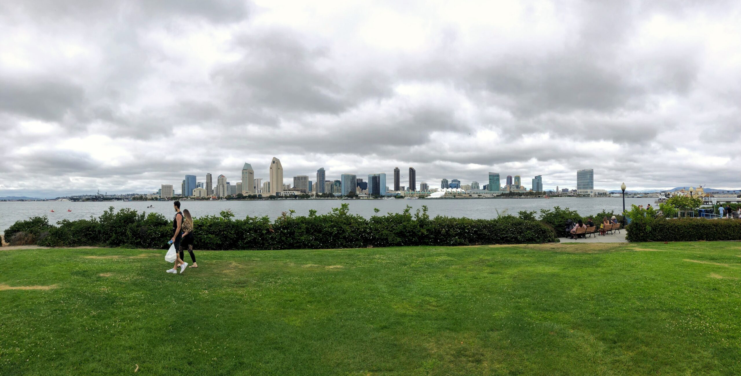
Category: Travel Guides

  • San Diego: Should You Rent a Car or Rely on Public Transit?

    San Diego: Should You Rent a Car or Rely on Public Transit?

    San Diego sits in the middle of the American spectrum on this question. It is neither a transit city nor as car-dependent as Phoenix or Los Angeles. The downtown core is compact and walkable, the Trolley links it to Old Town, Mission Valley, the university area and the Mexican border, a ferry crosses the bay to Coronado, and the airport is only a few kilometers from the Gaslamp Quarter. But the things that make San Diego special are spread along a long coastline: La Jolla, Point Loma, the beach towns and North County are either off the rail network or a slow bus ride away, and most day trips are car trips. This guide explains how the city is laid out, how the MTS Trolley, buses and coastal trains work, what driving and parking are really like, when a car earns its keep, and gives you a straightforward way to decide.

    The short answer

    Rent a car if La Jolla, Torrey Pines, Point Loma and the beach towns are the heart of your trip, if you are staying in a beach neighborhood or in North County, if you plan day trips to the Safari Park, LEGOLAND, Temecula, Julian or the desert, if you have young children, or if this is part of a road trip. Skip the car if you are staying downtown in the Gaslamp Quarter or Little Italy for a convention, a Padres game or a short city break, and your plans are the waterfront, the USS Midway, Balboa Park, Old Town, Coronado by ferry and a day in Tijuana; the Trolley, the ferry, buses and the occasional ride-hail will cover that, and you will avoid steep downtown hotel parking fees. Many visitors do best with a hybrid: car-free city days and a car for the coast and the day trips. Compare rental rates for any of these plans on our San Diego car rental page.

    How San Diego is laid out

    Downtown San Diego sits on the east shore of San Diego Bay, with the Gaslamp Quarter, East Village and Petco Park to the south, Little Italy and the airport to the north, and Balboa Park rising on the mesa just to the northeast. West of the airport, the Point Loma peninsula shelters the bay, with Cabrillo National Monument at its tip and Ocean Beach at its northern end. North of that, Mission Bay’s lagoons are fronted by Mission Beach and Pacific Beach, and La Jolla sits on the headland beyond, about 20 kilometers (12 miles) from downtown. Inland, Old Town and Mission Valley follow the San Diego River east toward San Diego State University, and North County’s beach towns and inland suburbs stretch 50 kilometers (30 miles) up the coast. The freeways tie it together: I-5 runs north-south along the coast from the Mexican border through downtown to Los Angeles; I-805 is its inland twin; I-8 runs east from Ocean Beach through Mission Valley toward Arizona; I-15 heads inland to Escondido, Temecula and Las Vegas; and SR 163 runs through Balboa Park’s canyon between downtown and the northern suburbs.

    Hotels cluster downtown around the Gaslamp and the convention center, in Little Italy, near the airport and on Harbor and Shelter Islands, in Mission Valley along I-8, in the beach neighborhoods, in Coronado and in La Jolla. Our San Diego hotel search lets you compare them.

    Getting in from the airport

    San Diego International (SAN) sits on the bay about 5 kilometers (3 miles) northwest of downtown, and getting into the city is quick. A taxi or ride-hail from the marked zones outside the terminals takes about ten minutes to the Gaslamp outside rush hour and about twenty to La Jolla or Pacific Beach. On public transit, an MTS bus runs between the terminals and downtown, and the airport-run shuttle connects the terminals with the Old Town Transit Center, where you can change to the Trolley, the Coaster commuter train and Amtrak. For a rental, shared shuttle buses run from the terminals to the consolidated Rental Car Center on the north side of the airport, where the major companies have their counters. The airport has been redeveloping Terminal 1 and its roads for several years, so pickup zones and routes may have moved since your last visit; check the airport’s site for current ground-transport details. Our SAN airport guide covers the layout.

    San Diego transit, explained

    The San Diego Metropolitan Transit System (MTS) runs the Trolley and most buses across the southern half of the county, and the North County Transit District runs the Coaster commuter train and North County’s buses. Its limitation is the coast, where rail barely reaches and the buses are slow for sightseeing.

    The Trolley

    The San Diego Trolley, opened in 1981, is the backbone. The UC San Diego Blue Line runs from the Mexican border at San Ysidro through downtown and Old Town, then north along the Mid-Coast extension to UC San Diego and the University Towne Center area near La Jolla. The Green Line runs from downtown past Old Town, through Mission Valley’s hotels and malls, to Snapdragon Stadium, San Diego State and Santee. The Orange Line runs east from downtown to El Cajon, and the Copper Line links El Cajon and Santee; a vintage Silver Line loops downtown on limited days. Trains run from early morning until around midnight, typically every 15 minutes on the main lines through the day and less often late at night. Downtown stops serve Little Italy, the Santa Fe Depot, the convention center, the Gaslamp and Petco Park.

    Buses

    MTS buses cover most of the city, and several are useful to visitors: routes along Park Boulevard and El Cajon Boulevard pass Balboa Park and the zoo, buses from the Old Town Transit Center fan out to Ocean Beach, Mission Beach, Pacific Beach and La Jolla, and routes cross the Coronado Bridge to Coronado. Frequencies drop in the evenings and on weekends on many routes, so check the timetable before relying on a bus for a late return.

    The Coaster and the Pacific Surfliner

    NCTD’s Coaster runs up the coast from the Santa Fe Depot downtown through Old Town, Sorrento Valley, Solana Beach, Encinitas and Carlsbad to Oceanside, with a busier schedule on weekdays than at weekends. It is a scenic and relaxed way to reach the North County beach towns. Amtrak’s Pacific Surfliner follows much of the same line and continues to Los Angeles Union Station in about three hours, then on to Santa Barbara. Coastal landslides near San Clemente have periodically suspended or reduced service in recent years, so check the current status before building a trip around the train.

    Fares and tickets

    One fare system covers the Trolley and MTS buses. Pay with a PRONTO card or the PRONTO app, which cap what you pay at the price of a day pass once you have taken enough rides in a day, or buy tickets from the machines on the Trolley platforms. Tap before boarding, because fare inspectors check on board. The Coaster and the Surfliner have their own fares, and reduced fares are available for seniors, riders with disabilities and younger riders. Check the MTS site for current fares before you go.

    Accessibility

    The Trolley has low-floor cars and step-free stations throughout, and all MTS buses are accessible, with ramps and space for wheelchairs.

    Beyond MTS

    • The Coronado ferry. Ferries cross the bay from the Broadway Pier area downtown to the Coronado Ferry Landing in about fifteen minutes, with bicycles welcome on board; the landing is a short walk from Orange Avenue.
    • Ride-hail and taxis. Uber and Lyft operate across the county, and for trips to La Jolla, Point Loma, the beach towns and the brewery districts, they are much faster than the bus. Surge pricing after big events can be steep.
    • Walking and cycling. Downtown, the Embarcadero, Coronado and the beach boardwalks are excellent on foot or by bike. Shared e-bikes and e-scooters operate in many neighborhoods, subject to city rules, including slow zones on the boardwalks.
    • Tours and hop-on buses. Trolley-style sightseeing tours loop the main sights,, and day tours run to the Safari Park.
    • Crossing to Tijuana. The Blue Line runs to San Ysidro, where most visitors walk across the border. Carry a valid passport; Mexico’s Instituto Nacional de Migración sets the entry rules, and the return requires U.S. entry documents that U.S. Customs and Border Protection accepts for your nationality.
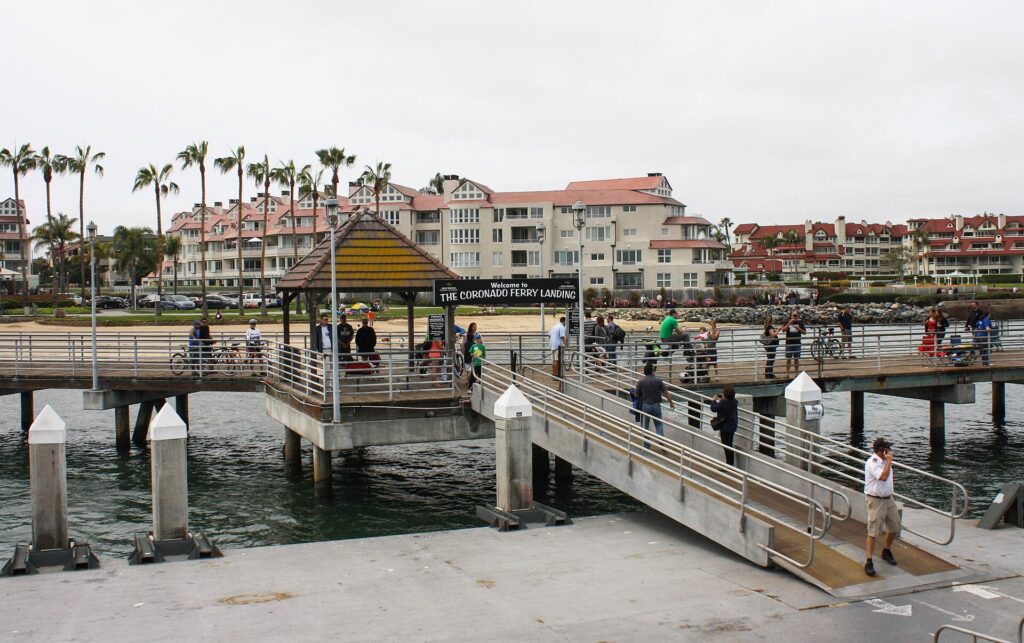
    The Coronado Ferry Landing on San Diego Bay
    The Coronado Ferry Landing, a short crossing from downtown and a short walk from Orange Avenue (Photo: Bernard Gagnon via Wikimedia Commons, CC BY-SA 3.0)

    Driving in San Diego: what it is really like

    By the standards of Southern California, San Diego is a reasonable place to drive: the freeways are well signed, the streets are easy to navigate once you know the main corridors, and traffic is lighter than in Los Angeles. The frustrations are specific. Weekday rush hours, roughly 6 to 9 a.m. and 3 to 7 p.m., slow I-5 and I-805 through the central city and at the Merge, where the two meet near Del Mar, along with I-15 and I-8 through Mission Valley. Sunday afternoons bring heavy northbound traffic on I-5 as weekend visitors head back to Orange County and Los Angeles. Events clog downtown, from Padres games and conventions to the Comic-Con crowds, and summer weekends fill the roads to the beaches.
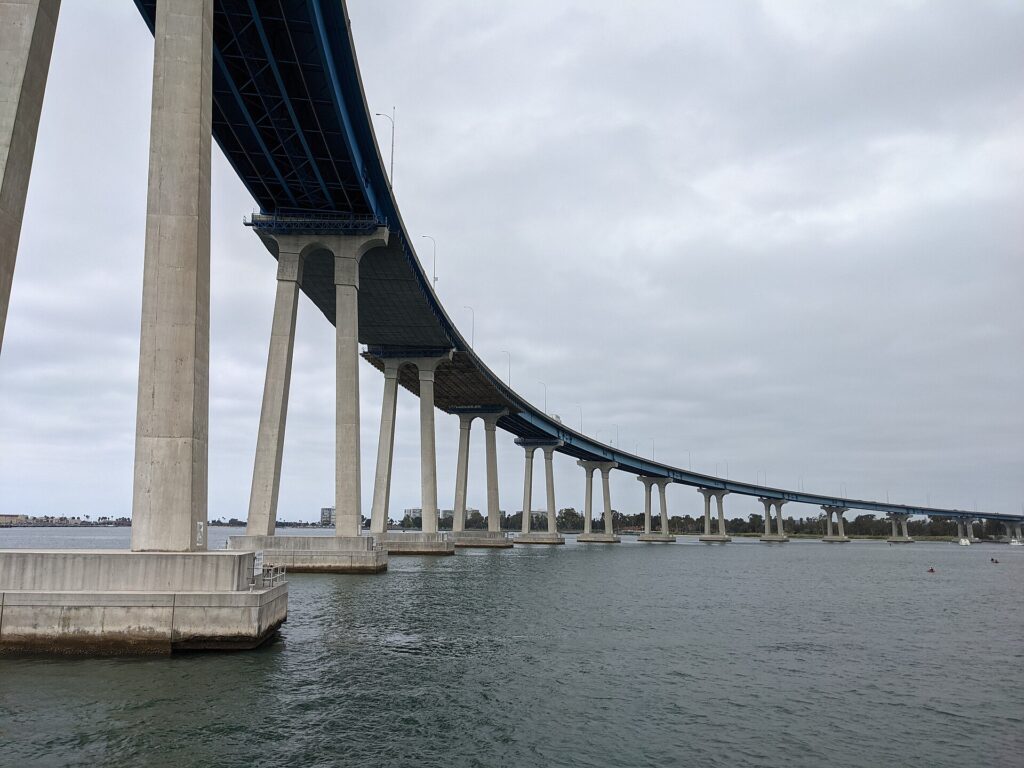
    The curving San Diego-Coronado Bridge over San Diego Bay
    The San Diego-Coronado Bridge, the drive to Coronado's beaches and the Hotel del Coronado (Photo: Mds08011 via Wikimedia Commons, CC BY 4.0)

    Parking

    Parking is the real cost of a car in San Diego. Downtown has metered street parking with posted hours and many garages, which charge premium event rates on game and concert nights, and most downtown hotels charge a hefty nightly fee for parking or valet. Balboa Park’s lots, free for decades, have moved to paid parking in recent years, so check the park’s current rules before you go. In La Jolla, time-limited street parking near the Cove and the village fills quickly, especially on weekends, and paid garages fill the gap. The beach lots in Mission Beach, Pacific Beach and Ocean Beach fill by late morning on summer weekends, and street parking in those neighborhoods is tight. Never leave valuables visible in a parked car at a beach or trailhead.

    Rules and conditions worth knowing

    • The border. Southbound I-5 and I-805 end at the San Ysidro crossing, and the last U.S. exits come quickly; watch the signs, because missing them puts you in the lanes for Mexico, where most rental agreements do not allow the car to go.
    • Mexico with a rental. Most U.S. rental companies forbid or restrict driving into Mexico, and those that allow it require Mexican auto insurance; for a Tijuana day trip, walking across is far simpler.
    • Express lanes and tolls. The I-15 Express Lanes and the I-5 lanes in North County are free for qualifying carpools and tolled for solo drivers with a FasTrak account, and SR 125 in the South Bay is a toll road; rental companies bill tolls through their own programs, often with a daily fee, so ask at the counter.
    • Phones. California law bans holding a phone while driving; use a mount and hands-free mode.
    • Right turns on red are permitted after a full stop unless signed otherwise.
    • Checkpoints. Border Patrol checkpoints operate on the main highways north and east of the city, including I-5 near San Onofre; carry ID.
    • Road conditions. 511 San Diego and the California Department of Transportation publish closures, crashes and conditions, including winter snow on the mountain roads to Julian and on I-8 east of the city.

    When renting a car makes sense

    • The coast. La Jolla, Torrey Pines, Point Loma, Cabrillo National Monument, Sunset Cliffs and the beach towns are strung along the shore, with slow bus links between them; a car lets you see several in a day.
    • North County and inland day trips. The Safari Park, LEGOLAND and the Flower Fields in Carlsbad, the Temecula wine country, Julian and Anza-Borrego are all a 40-minute to two-hour drive away.
    • Beach stays. If you are staying in Mission Beach, Pacific Beach, La Jolla or North County, a car makes getting downtown and to the attractions much easier.
    • Families. Car seats, beach gear and early starts at the zoo all argue for a car, and our family car rental guide looks at vehicle choice.
    • Road trips. Los Angeles is two to three hours north and Phoenix about five and a half hours east; our Los Angeles to San Diego route guide and Phoenix to San Diego route guide cover the drives.

    If any of those apply, our rental car booking tips cover insurance, deposits and the questions to ask at the counter.

    When it does not

    • You are staying downtown and your plans are the waterfront, Balboa Park, Old Town and Coronado by ferry.
    • You are in town for a convention, Comic-Con or a Padres game, when downtown parking is at its most expensive and the Trolley stops beside the venues.
    • Your main day trip is Tijuana, which is easiest on the Trolley and on foot.
    • You are staying at a single resort in Coronado or on Mission Bay and plan to spend most of the time on the sand, with ride-hail for the occasional dinner.

    The hybrid plan for a city-plus-coast trip

    Go car-free for the downtown days and rent for the coast and the day trips, and think about where you pick up. Every major company operates from the airport’s Rental Car Center, which is convenient but adds airport fees and surcharges; neighborhood offices downtown and elsewhere in the city can avoid some of those charges and make sense if you are spending the first nights in the Gaslamp or Little Italy. A pattern that works well: take a taxi or ride-hail from the airport, spend two or three car-free days on the waterfront, in Balboa Park, in Old Town and on the Coronado ferry, then pick up a car for La Jolla, Point Loma and the beaches, and a day in Carlsbad, Temecula or at the Safari Park, and return it to the airport on the way to your flight home. Compare the day rates on our San Diego car rental page against a full-trip rental and the difference is usually obvious.

    A worked cost comparison

    Numbers change with the season and the booking window, so treat this as a method rather than a quote, and check current rates before deciding. For a three-night city break downtown for two people, the car-free version costs a couple of ride-hail trips from and to the airport, Trolley and bus fares capped at a day pass each per day, the ferry to Coronado, and perhaps two ride-hail trips to La Jolla and Ocean Beach; the rental version adds three days of a compact car, airport fees and surcharges, three nights of downtown hotel parking and fuel. Transit wins clearly, largely because of parking. For a five-night stay with two coast days and a trip to the Safari Park, the hybrid version adds a two-day rental from a city location and fuel, against ride-hail trips of 30 to 60 minutes each way for the car-free version; the rental usually wins for two or more people. For a week at a beach hotel with a family, a rental for the whole stay is the practical answer, especially if the hotel’s parking is free or reasonable. Run the rental rates for your dates on our San Diego car rental page and put them beside the parking and ride-hail costs before you choose.

    Driving out of San Diego in each season

    The highways out of San Diego are good, but each has its own character. I-5 north to Los Angeles follows the coast through North County and past Camp Pendleton, about 200 kilometers (120 miles) downtown to downtown; allow two hours with light traffic and three or more at rush hour, on Friday afternoons northbound and on Sunday afternoons,. I-15 north reaches Temecula in about an hour and Las Vegas in about five, crossing the Mojave, where summer heat makes a breakdown dangerous. I-8 east to Phoenix climbs through the mountains east of the city, where winter storms can bring snow and ice to the high passes, then drops into the low desert past El Centro and Yuma, some of the hottest country in North America in summer; about five and a half hours in all, with fuel stops far apart. The mountain roads to Julian occasionally require chains after winter snow. In fall, Santa Ana wind events bring wildfire risk and occasional road closures. In summer, start desert drives early with a full tank and plenty of water. Before any long drive, check the Caltrans and 511 San Diego conditions.

    Decision table

    Your tripRecommendationWhy
    City break downtownNo carThe waterfront, Balboa Park, Old Town and Coronado by ferry are all reachable without one
    Convention, Comic-Con or a Padres gameNo carThe Trolley stops beside the venues; event and hotel parking is expensive
    Tijuana day tripNo carTrolley to San Ysidro and walk across; rentals rarely allowed into Mexico
    Coronado or Mission Bay resort, mostly on the sandNo car, ride-hail for outingsAvoids parking fees for a car you rarely use
    La Jolla, Point Loma and the beach townsRent for those daysThe coast is poorly served by rail
    City plus North County day tripsHybrid: rent from a city location for the trip daysCar-free downtown, car for the Safari Park, Carlsbad or Temecula
    Family beach holidayRent for the whole stayCar seats, beach gear and spread-out attractions
    Southern California or Southwest road tripRent (consider one-way to Los Angeles or Phoenix)San Diego is one stop on the route

    Money-saving tips for both options

    • On transit: use PRONTO so your fares cap at a day pass automatically, and combine the Trolley with the Coronado ferry and walking downtown.
    • On a rental: compare airport and neighborhood pickup, rent only for the days you need, book early for summer, and decline extras you already have through a credit card or home policy (check first).
    • On the hotel: if you are renting, price the parking into the room rate; beach and Mission Valley hotels often charge far less than downtown.
    • On timing: avoid I-5 at rush hour and on Sunday afternoons northbound; our best time to fly to San Diego guide lists the busiest weeks, and for the rest of Southern California, our guide to renting a car in Los Angeles covers the other end of I-5, and our Phoenix car guide covers the far end of I-8.
    • On ride-hail: for a group of three or four on a short trip, a single ride often costs less than four fares and saves a long bus ride; our guide to car, transit or taxi sets out the general trade-offs.
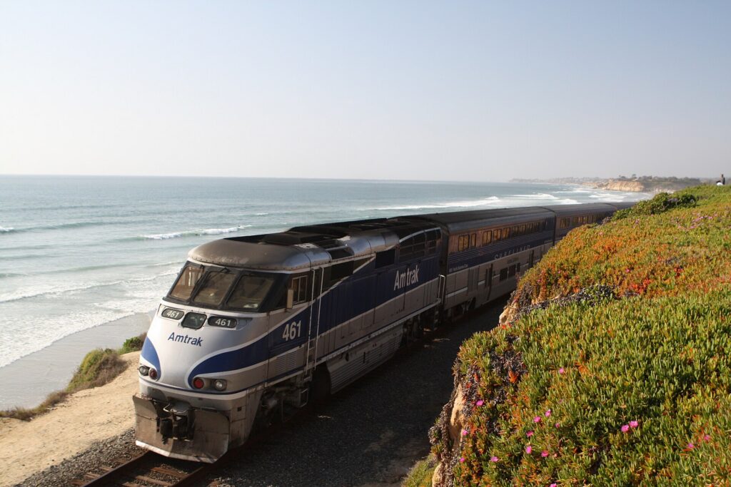
    An Amtrak Pacific Surfliner train in Del Mar, north of San Diego
    The Pacific Surfliner and the Coaster follow the coast north to the beach towns and Los Angeles (Photo: catlin.wolfard via Wikimedia Commons, CC BY-SA 3.0)

    Frequently asked questions

    Is it worth renting a car in San Diego?

    For La Jolla, Point Loma, the beach towns and North County day trips, yes. For a downtown stay built around the waterfront, Balboa Park, Old Town and Coronado, no.

    Is San Diego public transit good for tourists?

    Good for downtown, Old Town, Mission Valley and the border, and the ferry covers Coronado. The coast is harder: buses reach the beaches and La Jolla, but slowly.

    How do I get from San Diego airport to downtown?

    A taxi or ride-hail in about ten minutes, or an MTS bus. The airport shuttle to the Old Town Transit Center connects with the Trolley, the Coaster and Amtrak.

    Can I take the Trolley to Mexico?

    Yes. The Blue Line runs to San Ysidro, where you walk across the border. Carry a valid passport and the documents you need to re-enter the United States.

    Is parking expensive in San Diego?

    Downtown, yes, especially at hotels and on event nights. It is easier and cheaper in the beach neighborhoods outside summer weekends, and in Mission Valley.

    Can I take the train from San Diego to Los Angeles?

    Yes, on the Amtrak Pacific Surfliner from the Santa Fe Depot or Old Town to Union Station in about three hours, when coastal landslides are not disrupting service.

    Can I drive a rental car into Mexico?

    Usually not. Most U.S. rental companies forbid it, and those that allow it require Mexican insurance. Walk across at San Ysidro instead.

    Whichever way you go, start with the flight. Compare cheap flights to San Diego, choose a neighborhood with our San Diego hotel search, and if the coast or North County is on the list, price the rental for those dates on our San Diego car rental page. For what to do once you arrive, start with our first-timer’s guide to San Diego.

  • Things to Do in San Diego: A First-Timer’s Guide

    Things to Do in San Diego: A First-Timer’s Guide

    San Diego sells itself on the weather, and the weather deserves the reputation: mild in every month, dry for most of the year, and rarely too hot or too cold to be outside. But visitors who treat it as a beach town with a zoo miss most of the city. San Diego has one of the largest urban cultural parks in the country, an aircraft carrier you can walk from the flight deck to the engine room, the site where European settlement of California began, and a coastline that changes character every few miles, from the surf beaches of Pacific Beach to the sea lions of La Jolla and the tide pools of Point Loma. This guide covers the sights that earn a day, the neighborhoods worth a half-day, the beaches, the food, the sports, the day trips, and the practical details that turn a sunny long weekend into a proper trip.

    If you are still comparing cheap flights to San Diego, read this alongside our guides to the best time to fly to San Diego and whether you need a rental car. Between the three you can plan the whole trip.

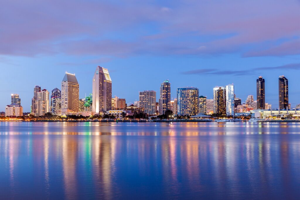
    The downtown San Diego skyline across San Diego Bay
    Downtown San Diego at dusk, seen across the bay from Coronado (Photo: russellstreet via Wikimedia Commons, CC BY-SA 2.0)

    San Diego at a glance for first-timers

    • Airport: San Diego International (SAN), about 5 km (3 miles) northwest of downtown on San Diego Bay. Taxis, ride-hail, buses and the Rental Car Center shuttle serve it. See our SAN airport guide.
    • Getting around: the MTS Trolley links downtown, Old Town, Mission Valley, the university area and the Mexican border at San Ysidro. The beaches, La Jolla and Point Loma are easier by car or ride-hail, and many visitors rent for part of the stay.
    • Money: U.S. dollars. Sales tax is added at the register, and hotels and rental cars carry their own taxes and fees, so compare total prices. Tipping 18 to 20 percent in restaurants is standard.
    • Weather: afternoons around 19 °C (66 °F) in winter and 24 to 26 °C (76 to 78 °F) in late summer, a gray marine layer that often covers the coast in May and June, and most of the modest rain between November and March. Our month-by-month guide has the detail.
    • Where to stay: the Gaslamp Quarter for nightlife, the ballpark, the convention center and the Trolley; Little Italy for restaurants and a calmer downtown base; Coronado for the classic beach resort; Mission Beach and Pacific Beach for sand and surf; La Jolla for the prettiest coast and the highest prices. Our San Diego hotel search covers them all.

    Balboa Park and the San Diego Zoo

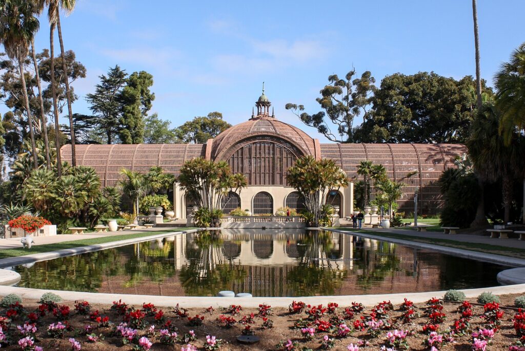
    Start at Balboa Park, a short drive or bus ride northeast of downtown and the cultural center of the city. Its core, the Prado, is a promenade of ornate Spanish Colonial Revival buildings put up for the Panama-California Exposition of 1915, crowned by the tiled dome and bell tower of the California Building. Around it are more than fifteen museums: the San Diego Museum of Art; the free Timken Museum of Art, a small jewel with works by old masters; the Museum of Us, devoted to human cultures; the Natural History Museum; the Fleet Science Center; and the Mingei, a museum of folk art and design. The Botanical Building, a vast wooden lath structure behind a long lily pond, is one of the most photographed spots in the city. On Sunday afternoons, free concerts at the Spreckels Organ Pavilion, home to one of the largest outdoor pipe organs in the world, draw a relaxed crowd. Walking the Prado and the gardens is free; the museums charge admission, so price a multi-museum pass if you plan several.

    The San Diego Zoo, at the northern edge of the park, is one of the most famous zoos in the world, its habitats set in planted canyons. Allow most of a day, arrive at opening time and use the aerial tram and the guided bus to cover the steep terrain.

    The Botanical Building and lily pond in Balboa Park, San Diego
    The Botanical Building and its lily pond, at the heart of Balboa Park (Photo: Bernard Gagnon via Wikimedia Commons, CC BY-SA 3.0)

    The waterfront: the USS Midway, the Embarcadero and the bay

    San Diego is a Navy city, and the waterfront shows it. The USS Midway Museum, moored at Navy Pier, is an aircraft carrier that served from the end of the Second World War until the early 1990s and is now one of the most visited naval museums in the country. Climb into the cockpits on the flight deck, walk the crew’s berths and engine room, and listen to the volunteer docents, many of them veterans; plan three to four hours. A short walk north, the Maritime Museum of San Diego keeps a fleet of historic vessels led by the Star of India, an iron-hulled sailing ship launched in 1863 and one of the oldest ships still able to sail. South of the Midway, the Embarcadero path runs past Tuna Harbor to Seaport Village, a cluster of waterfront shops and restaurants, and on past the convention center. Harbor cruises and the Coronado ferry leave from the Broadway Pier area.

    Old Town and the birthplace of California

    In 1769, a Spanish expedition founded a presidio and a mission on the hill above the San Diego River, the first permanent European settlement in what is now California. Old Town San Diego State Historic Park, run by California State Parks, preserves the town that grew below it in the Mexican and early American periods, with restored adobe houses, a schoolhouse, a newspaper office, a blacksmith and small museums that are free to enter. The surrounding streets of Mexican restaurants and souvenir shops are touristy, but the history is real. On the hill above, Presidio Park has lawns, views over Mission Valley and the Junípero Serra Museum. The mission itself moved inland in 1774, and Mission San Diego de Alcalá, the first of the twenty-one California missions, is still an active parish with a whitewashed church, gardens and a small museum. Old Town is on the Trolley and the Coaster commuter train.

    Coronado

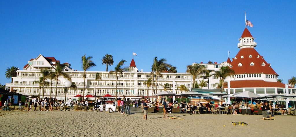
    Across the bay, Coronado is a quiet, affluent town on a peninsula joined to the mainland by the narrow Silver Strand, and reached most dramatically over the tall, curving San Diego-Coronado Bridge or by the ferry from downtown. Its landmark is the Hotel del Coronado, a vast white Victorian beach resort with red turrets, opened in 1888 and one of the grandest wooden buildings in the United States. You do not need to stay there to walk its lobby and grounds and continue onto Coronado Beach, one of the widest and most consistently praised beaches in the country, its sand flecked with glittering mica. Bicycles are an easy way to explore the flat streets and the bayside path. The ferry landing has the best view of the downtown skyline at dusk.

    The Hotel del Coronado and Coronado Beach
    The Hotel del Coronado, opened in 1888, behind one of the widest beaches in the country (Photo: Beyond My Ken via Wikimedia Commons, CC BY-SA 4.0)

    La Jolla and Torrey Pines

    About twenty minutes north of downtown, La Jolla is San Diego at its most beautiful: sandstone cliffs, coves of clear water and a village of galleries, boutiques and restaurants above them. At La Jolla Cove and along the cliffs toward the Children’s Pool, sea lions and harbor seals haul out on the rocks; keep your distance and respect the seasonal closures that protect seal pups. The cove is part of an ecological reserve with some of the best snorkeling in Southern California, including bright orange garibaldi, the state marine fish. Guided kayak tours paddle to the sea caves beneath the cliffs, and beginners take surf lessons at gentle La Jolla Shores just north. North again, Torrey Pines State Natural Reserve protects the rarest native pine in the country on eroded bluffs high above the Pacific, with short trails to viewpoints and a path down to the beach.

    Point Loma, Ocean Beach and the beach towns

    At the tip of the Point Loma peninsula, Cabrillo National Monument marks the spot where Juan Rodríguez Cabrillo landed in 1542, the first European expedition to reach what is now the West Coast of the United States. It has the best panoramic view in the city, across the bay to downtown and Coronado; the restored Old Point Loma Lighthouse; and tide pools rich with anemones, crabs and sea stars at low tide, mostly in winter. From December to March, it is also a good place to watch for migrating gray whales. Just north, Sunset Cliffs is a stretch of eroded bluffs where locals gather in the evening; stay back from the crumbling edges. Ocean Beach is the most laid-back beach community, with surf shops, dive bars, a long fishing pier, a dog beach and a Wednesday farmers’ market. Across the channel, Mission Beach has a busy boardwalk and Belmont Park, where the wooden Giant Dipper roller coaster has run since 1925, while Pacific Beach is the younger, louder surf and bar district.

    The Pacific here is cooler than many visitors expect, in the upper teens Celsius (low to mid-60s Fahrenheit) for much of the year and around 20 to 22 °C (high 60s to low 70s Fahrenheit) in late summer, so a wetsuit helps outside August and September. Swim near a staffed lifeguard tower, and if a rip current pulls you out, swim parallel to the shore until you are free. After heavy rain, runoff can foul the water near river mouths, and the county posts beach advisories and closures; check before swimming, especially near the border, where sewage flows from the Tijuana River have closed beaches in Imperial Beach for long periods.

    Neighborhoods worth a half-day

    The Gaslamp Quarter

    The Gaslamp Quarter is the historic heart of downtown: around sixteen blocks of Victorian and early-20th-century buildings along Fifth Avenue, restored as a district of restaurants, rooftop bars, nightclubs and hotels. It is busiest on weekend nights and game days, when crowds pour out of Petco Park at its southern end.

    Little Italy

    North of downtown along India Street, Little Italy grew up around the families of Italian tuna fishermen and is now one of the city’s best dining districts, with piazzas, espresso bars and the Mercato, a large Saturday farmers’ market. It is on the Trolley and walkable from the waterfront.

    North Park and Hillcrest

    Just north of Balboa Park, North Park is the center of the craft beer scene, with breweries, taprooms and vintage shops along 30th Street and University Avenue. Neighboring Hillcrest, long the heart of the LGBTQ community and home of San Diego Pride, has a lively restaurant row.

    Barrio Logan

    Under the approaches to the Coronado Bridge, Chicano Park holds one of the largest collections of outdoor murals in the country, painted on the bridge’s pillars since the 1970s and now a National Historic Landmark. The surrounding streets have galleries, coffee shops and taquerias.

    Museums, culture and family attractions

    Beyond Balboa Park and the waterfront, San Diego’s culture is spread around the city. The Museum of Contemporary Art San Diego has its main home on the cliffs in La Jolla. The Old Globe in Balboa Park and the La Jolla Playhouse are two of the most respected regional theaters in the country, and several of their productions have gone on to Broadway. The San Diego Symphony plays at the Rady Shell, an outdoor venue on the bay beside Seaport Village. SeaWorld San Diego, on Mission Bay, is as much a roller coaster park as a marine park. For what is on during your dates, our San Diego events page lists concerts, shows and games.

    Sports

    The San Diego Padres play Major League Baseball at Petco Park, on the edge of the Gaslamp Quarter, from April to September; it is regularly named one of the best ballparks in the country, with the brick Western Metal Supply building built into the left-field corner. San Diego FC joined Major League Soccer in 2025 and plays at Snapdragon Stadium in Mission Valley, which it shares with the San Diego Wave of the National Women’s Soccer League and San Diego State football. The public Torrey Pines golf courses on the cliffs host a PGA Tour event each winter and have staged the U.S. Open. Check what is on sale in San Diego before you book flights.

    What to eat, and where

    San Diego’s signature food comes from across the border. The fish taco, battered white fish in a corn tortilla with cabbage, crema and salsa, arrived from Baja California and is now found everywhere from beach shacks to sit-down restaurants. The California burrito, carne asada, cheese and French fries in a flour tortilla, is a local invention and the classic late-night meal. On Saturday mornings, the Tuna Harbor Dockside Market sells the catch straight off the boats. Craft beer is the other obsession: the county has well over a hundred breweries, and the bitter, piney West Coast IPA is closely associated with the city. Little Italy and North Park have the most ambitious restaurants, and Convoy Street in Kearny Mesa the best Asian food.

    San Diego through the seasons

    San Diego has less seasonal swing than almost any big city in the country, but the seasons still shape a trip. Winter (December to February) brings afternoons around 19 °C (66 °F), clear days between occasional rainstorms, gray whales offshore, and December Nights, Balboa Park’s free holiday festival, in early December. Spring (March to May) brings wildflowers to Anza-Borrego in wet years and the Flower Fields in Carlsbad; by May, the marine layer often keeps the coast gray until midday, a pattern locals call May Gray. Summer (June to September) starts with June Gloom and turns sunny and warm from July, with the San Diego County Fair at Del Mar, Comic-Con in July, the Del Mar racing season, and the warmest ocean of the year. Fall (October to November) is many locals’ favorite, with warm, clear days, quieter beaches, and occasional Santa Ana winds that bring hot, dry air from the desert and raise the fire danger. Our month-by-month guide has the fare patterns for each season.

    San Diego with kids

    Few cities are as easy with children. The San Diego Zoo and the Safari Park are the headline attractions, and LEGOLAND California in Carlsbad, about forty minutes north, is aimed squarely at children up to about twelve. The Fleet Science Center has hands-on galleries, and the USS Midway fascinates every age. Mission Bay’s calm beaches suit small children, and the Cabrillo tide pools make a great morning at low tide. For day trips, our family car rental guide covers the vehicle question.

    San Diego on a budget

    Many of San Diego’s best experiences are free: every beach, the Embarcadero, Balboa Park’s Prado and gardens, the Sunday organ concerts, the Timken Museum of Art, the adobe museums of Old Town, the murals of Chicano Park, the seals of La Jolla, Sunset Cliffs, and Torrey Pines, where you pay only to park. Eat well for less at taco shops, along Convoy Street and at happy hours. A Trolley day pass covers downtown, Old Town and the border. Hotels are cheapest in winter outside the holidays and most expensive in July, August and convention weeks; compare rates by neighborhood on our San Diego hotel search.

    Day trips from San Diego

    The San Diego Zoo Safari Park, near Escondido about forty-five minutes north, shows African and Asian animals in large open enclosures from a tram or on a guided safari. Carlsbad has LEGOLAND, the spring Flower Fields and a pleasant beach village,. Inland, the Temecula Valley wine country is about an hour north, and the old gold-mining town of Julian, about an hour and a half into the mountains, is famous for apple pie. Los Angeles is two to three hours north by car or on the Amtrak Pacific Surfliner; see our Los Angeles guide and the Los Angeles to San Diego route guide. Phoenix is about five and a half hours east on I-8; our Phoenix guide and the Phoenix to San Diego route guide cover that trip. Most of these work best by car; see our San Diego car rental page, and the San Diego Tourism Authority for the wider county.

    A day in Tijuana: what to know first

    Tijuana is directly across the border, and the Blue Line Trolley runs from downtown to the San Ysidro crossing in under an hour, and most visitors walk across. Treat the documents as the plan. To enter Mexico, carry a valid passport; Mexico’s immigration authority, the Instituto Nacional de Migración, sets the rules on visas and visitor permits, which depend on your nationality and on how far and how long you travel. To come back, everyone must pass U.S. inspection: U.S. citizens need a passport, passport card or another document approved for land crossings, and international visitors need a visa or visa waiver status that allows them to re-enter. Check U.S. Customs and Border Protection before you go, especially if you are not a U.S. citizen. Return waits on foot can run to several hours on weekend afternoons; CBP publishes live wait times. Most U.S. rental companies restrict or forbid taking their cars into Mexico, so walk.

    Two sample itineraries

    Three days, light car use

    Day one: the USS Midway in the morning, a walk along the Embarcadero to Seaport Village, the ferry to Coronado for the beach and the Hotel del Coronado, and dinner in Little Italy. Day two: the San Diego Zoo at opening time, the Prado and the museums of Balboa Park in the afternoon, and beers and dinner in North Park. Day three: Old Town by Trolley in the morning, then La Jolla Cove, the seals and a kayak tour to the sea caves, and sunset at Sunset Cliffs, with ride-hail filling the gaps.

    Five days, with the coast and a day trip

    Add a morning at Cabrillo National Monument and the tide pools and an afternoon on the Mission Beach boardwalk, then pick up a car for the Safari Park and Carlsbad or the Temecula wine country, or spend a day in Tijuana on foot with your passport, and drop the car at the Rental Car Center on the way home.

    Practical details

    • Transit: pay Trolley and bus fares with the PRONTO card or app, or buy a day pass. MTS has maps and timetables; our car-versus-transit guide goes into detail.
    • From SAN: a taxi or ride-hail downtown in about ten minutes, a bus or the airport shuttle to the Old Town Transit Center, or a rental from the Rental Car Center. The airport’s site covers ground transport.
    • Weather: layers in every season, because coastal mornings can be cool and gray even in summer, and sunscreen year-round, since the marine layer does not stop you burning.
    • Time zone: Pacific Time, with daylight saving time from March to November.
    • Entry requirements: Canadians need a valid passport; visitors from Visa Waiver Program countries need an approved ESTA before boarding, and everyone else needs a visa. U.S. Customs and Border Protection is the authoritative source.
    • Safety: the tourist areas are generally safe with ordinary big-city awareness; keep valuables out of sight in parked cars at beaches and trailheads, stay back from cliff edges, and swim near lifeguards.

    Frequently asked questions

    How many days do you need in San Diego?

    Three days covers Balboa Park, the zoo, the waterfront and La Jolla; add a day for the beaches and Point Loma, and one more for the Safari Park, Carlsbad or Tijuana.

    What is the number one thing to do in San Diego?

    Balboa Park and the San Diego Zoo, ideally on the same day, followed closely by the coastline at La Jolla Cove.

    Is San Diego walkable?

    Downtown is, and the Trolley links it to Old Town. Getting between the beach towns usually takes a car, bus or ride-hail.

    Do I need a car in San Diego?

    Not for a downtown stay with Balboa Park, Old Town and Coronado by ferry. For La Jolla, Point Loma, the beach towns and North County, a car makes life much easier.

    Can you swim in the ocean in San Diego?

    Yes, all year with a wetsuit, and comfortably without one in late summer. Swim near lifeguards and check water quality advisories after rain.

    What is San Diego known for?

    Year-round mild weather, beaches and surfing, the San Diego Zoo and Balboa Park, the Navy, fish tacos and craft beer, Comic-Con, and its position on the Mexican border.

    Ready to go? Compare flights to San Diego, find a place to stay with our San Diego hotel search, and if La Jolla, the beaches or North County are on the list, price a rental car for those days.

  • Best Time to Fly to San Diego: Seasons, Weather & Prices

    Best Time to Fly to San Diego: Seasons, Weather & Prices

    San Diego has one of the gentlest climates of any big city in the United States, and that changes how you should think about timing a trip. There is no month when the weather rules the city out: winters are mild, summers are warm rather than hot, and the swing between the coolest and warmest months is only a few degrees. What moves prices instead is demand. Summer brings families, beach crowds and Comic-Con, the single biggest week of the hotel year; spring break and the holidays fill the rooms again; and a steady calendar of conventions can push downtown rates up in any month. Add the marine layer that grays the coast in late spring and early summer, and you have a city where the best time to go depends on whether you want the warmest ocean, the lowest total price or the clearest skies. This guide walks through the weather month by month, the fare seasons, the events that move prices, and how to get into the city from the airport.

    The short answer

    For the best mix of weather and value, come from mid-September to early November, when the summer crowds have gone, the days are warm and sunny, and the ocean is still at its warmest. For the lowest prices, look at January and February outside the holiday weekends, when hotels drop their rates and the weather is mild and often clear, if cool for swimming. The most expensive stretches are mid-June to late August, when school holidays, beach season and the San Diego County Fair overlap, the week of Comic-Con in July, spring break in March and early April, and the Thanksgiving, Christmas and New Year holidays. Whatever you choose, run a flexible-date search on our San Diego flights page, and price the hotel for the same dates before you commit; in summer, the room usually moves the total more than the fare.

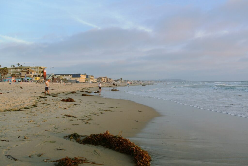
    The sand and surf at Pacific Beach in San Diego
    Pacific Beach in summer, the busiest and most expensive season on the San Diego coast (Photo: Adbar via Wikimedia Commons, CC BY-SA 3.0)

    San Diego weather, season by season

    San Diego sits on the Pacific in the far southwest corner of the country, and the cool California Current offshore moderates its climate in every season. It receives only about 250 mm (10 inches) of rain a year, almost all of it between November and March, and sees long runs of dry, sunny weather from summer into fall. The figures below are approximate seasonal patterns at San Diego International Airport, on the bay, based on the long-term climate normals published by NOAA and the National Weather Service’s San Diego office; check the current forecast before you pack, especially for winter storms and for Santa Ana wind and fire warnings in the fall.

    MonthTypical daytime highTypical overnight lowWhat it feels likeFare pressure
    Januaryaround 19 °C (66 °F)around 9 °C (49 °F)Mild, often clear days and cool nights; the wettest stretch of the yearLow; busier around the holiday weekends
    Februaryaround 19 °C (66 °F)around 10 °C (51 °F)Similar to January, with occasional rainstorms; gray whales offshoreLow; Presidents’ Day weekend busier
    Marcharound 19 °C (67 °F)around 12 °C (53 °F)Pleasant and green; the last of the rainModerate to high; spring break
    Aprilaround 21 °C (69 °F)around 13 °C (56 °F)Mild and mostly dry; wildflowers inlandModerate; Easter and spring break weeks higher
    Mayaround 21 °C (70 °F)around 16 °C (60 °F)May Gray: cloudy mornings on the coast, sun inlandModerate; Memorial Day weekend busy
    Junearound 23 °C (73 °F)around 17 °C (62 °F)June Gloom: gray starts, warm afternoonsHigh from mid-month; county fair
    Julyaround 24 °C (76 °F)around 19 °C (66 °F)Sunny and warm; the marine layer burns off earlierPeak; Fourth of July, Comic-Con
    Augustaround 26 °C (78 °F)around 20 °C (68 °F)The warmest month, with the warmest oceanPeak until mid-month, easing after
    Septemberaround 26 °C (78 °F)around 19 °C (66 °F)Warm and sunny; occasional hot spellsModerate after Labor Day
    Octoberaround 24 °C (75 °F)around 16 °C (61 °F)Clear and warm; Santa Ana winds possibleModerate
    Novemberaround 21 °C (70 °F)around 12 °C (54 °F)Mild and sunny; the first rains late in the monthModerate; Thanksgiving spike
    Decemberaround 19 °C (66 °F)around 9 °C (48 °F)Mild days, chilly nights, occasional rainLow until mid-month, then high

    Three things the table cannot show. First, the marine layer: in late spring and early summer, a deck of low cloud forms over the cool ocean at night and covers the coast until late morning or, on some days, all day. Locals call it May Gray and June Gloom, and it can make a beach day in early June feel cooler than one in October. Second, the ocean lags the air: the water is coolest in late winter and spring and warmest in August and September, so late summer and early fall are the best months for swimming, surfing and snorkeling without a wetsuit. Third, the Santa Ana winds: a few times each fall and winter, hot, dry winds blow from the deserts toward the coast, sending temperatures well above normal, dropping humidity to near zero and raising the wildfire danger across the county.

    How San Diego fare seasons work

    San Diego International is one of the busiest single-runway commercial airports in the country, with Southwest as its largest carrier, a strong Alaska Airlines presence, the other big U.S. airlines serving their hubs, and a handful of international routes to Canada, Mexico, Europe and Asia. That low-cost competition keeps domestic fares reasonable in most months, especially from the West and Southwest, and it means the sharpest price swings are in the hotel rooms. Three calendars drive them: school holidays, which fill the beach hotels from mid-June to August and again at spring break and the winter holidays; the convention calendar, led by Comic-Con in July, which can lift downtown rates in any month; and big events such as the county fair, the Del Mar racing season and major sporting weekends. The result is a long, expensive summer, busy holiday spikes, and quiet, good-value stretches in winter and after Labor Day.

    Peak season

    Mid-June to late August, plus spring break, Thanksgiving week, the Christmas and New Year holidays, and Comic-Con week. In summer the beach hotels charge their highest rates and weekends book up weeks ahead. If you must travel in peak, book the hotel early, fly midweek, and consider staying downtown or in Mission Valley, where rates are often lower than on the sand and the Trolley links you to the sights.

    Shoulder season

    March to May outside spring break, and mid-September to early November. These are many locals’ favorite months: spring is green, mild and quiet midweek, although May brings the gray mornings, and fall is warm, clear and uncrowded once the schools go back. Watch Easter, Memorial Day, the Labor Day weekend and big conventions.

    Low season

    Mid-November to mid-December outside Thanksgiving, and January and February outside the holiday weekends. Hotel rates are at their lowest of the year, and the zoo and Balboa Park are quiet. The ocean is cold for swimming, but it is prime time for whale watching and golf.

    As elsewhere, midweek departures and early or late flights usually price below Friday and Sunday afternoons on the same route, and a search across a whole month reveals cheaper pairs of dates close to your first choice. Our guide to the best times to book explains how to read those patterns.

    San Diego month by month

    January

    Quiet, mild and good value. Winter storms bring most of the year’s rain, usually a day or two at a time. Gray whales pass the coast on their southbound migration, and the PGA Tour’s event at Torrey Pines usually arrives late in the month or in early February. Martin Luther King Jr. weekend is busier; the rest of the month is one of the cheapest windows of the year.

    February

    Much like January, with a chance of rain and some of the clearest views of the year between storms. Whale watching peaks as the gray whales head north again with their calves, hotel rates stay low apart from Presidents’ Day weekend.

    March

    Green hills, the last of the rain, and the arrival of spring break, which lifts hotel rates and fills the beaches and theme parks for several weeks, depending on school calendars. In a wet year, the desert wildflowers at Anza-Borrego are spectacular, and the Flower Fields in Carlsbad start to bloom. The Padres open their season at the end of the month or in early April.

    April

    Mild and mostly dry, with the Flower Fields in full color and the San Diego Crew Classic rowing regatta on Mission Bay early in the month. Easter week and the tail of spring break are busy; the rest of April is a strong shoulder month for a city break.

    May

    The start of May Gray: many mornings on the coast are overcast and cool, and some days the sun never breaks through, while inland is warm and bright. Hotel rates are moderate until Memorial Day weekend, which marks the unofficial start of summer.

    June

    June Gloom continues, especially early in the month, but afternoons warm up and schools let out by mid-month, when rates jump. The San Diego County Fair runs at the Del Mar Fairgrounds from early June into early July. Book beach hotels early for the second half of the month.

    July

    Sunny, warm and the most expensive month of the year. The Fourth of July brings fireworks over the bay and crowds on every beach, the Del Mar racing season opens in mid-July, San Diego Pride fills Hillcrest, and Comic-Con International takes over the convention center and the whole of downtown for several days, usually in the second half of the month. During Comic-Con, downtown hotels sell out months in advance and rates rise across the city.

    August

    The warmest month, with the warmest ocean, and peak season until the schools go back, which in California can be as early as mid-August. After that, weekday rates ease noticeably while the weather stays perfect.

    September

    One of the best months of the year. After Labor Day weekend, the crowds thin, hotel rates fall, and the weather is warm and sunny, with the ocean still at its warmest. Occasional hot spells, sometimes driven by Santa Ana winds, can push the temperature well above normal even on the coast.

    October

    Clear, warm and quiet, with some of the most reliable sunshine of the year. Santa Ana winds are most likely from October on and bring hot, dry days and fire warnings. Rates are moderate apart from big convention weeks.

    November

    Mild and sunny, with the first winter rain usually arriving late in the month. Rates are moderate until Thanksgiving week, when fares from across the country rise. The San Diego Bay Wine and Food Festival usually runs in November.

    December

    Two months in one. The first half is quiet and good value, with December Nights, Balboa Park’s free holiday festival, in early December. From the week before Christmas, fares and hotel rates jump for the holidays, and the Holiday Bowl college football game brings fans to town near the end of the month.

    The San Diego Convention Center during Comic-Con
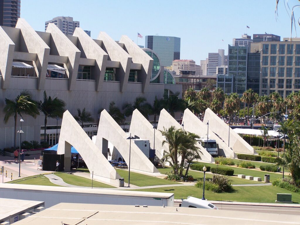
    The San Diego Convention Center, home of Comic-Con, the biggest hotel week of the year (Photo: William Tung via Wikimedia Commons, CC BY-SA 2.0)

    Events that move San Diego flight and hotel prices

    Cross-check these against your dates before you book. Exact dates shift each year; the San Diego Tourism Authority keeps the current calendar.

    • Comic-Con International (July, San Diego Convention Center): the biggest hotel spike of the year; badges sell out long in advance through Comic-Con’s own site.
    • Spring break (March and early April, varying by school district and university).
    • San Diego County Fair (early June to early July, Del Mar).
    • Fourth of July and the Del Mar racing season (mid-July to early September).
    • San Diego Pride (July, Hillcrest).
    • Memorial Day and Labor Day weekends: the bookends of beach season.
    • Thanksgiving week and the Christmas and New Year holidays, including the Holiday Bowl.
    • Big conventions at the convention center in any month, and Padres and San Diego FC home games. Our San Diego events page shows what is on sale for your dates.

    Getting in from the airport

    San Diego International (SAN), sometimes still called Lindbergh Field, sits on the bay about 5 kilometers (3 miles) northwest of downtown, which makes it one of the most convenient big-city airports in the country. It has two terminals, Terminal 1 and Terminal 2; Terminal 1 has been rebuilt as part of a multi-year redevelopment, so road and parking layouts are still changing, and it is worth checking the airport’s site for current details. Getting downtown is easy: a taxi or ride-hail takes about ten minutes outside rush hour; public transit options include an MTS bus and the airport’s shuttle to the Old Town Transit Center, where you can change to the Trolley, the Coaster and Amtrak; and shuttle buses run from the terminals to the consolidated Rental Car Center on the north side of the airport. The airport has an overnight curfew on departures, so the last flights out leave before midnight and the first leave after dawn. Our San Diego car-versus-transit guide works through whether to rent, and our SAN airport guide covers the layout.

    Terminal 2 at San Diego International Airport (SAN)
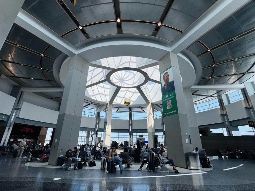
    San Diego International (SAN), about 5 km (3 miles) from downtown (Photo: Missvain via Wikimedia Commons, CC0)

    Timing tricks that work for San Diego

    • Price the room first. Airline competition at SAN keeps many fares steady, while beach hotel rates can double between February and July. Run a San Diego hotel search for your dates before you commit to the flight, and check whether a big convention is in town.
    • Search the whole month. Comic-Con, spring break and holiday weekends create sharp edges in the calendar; a calendar search on TicketScanner shows them instantly, and the week after Labor Day is often far cheaper than the week before.
    • Fly midweek. Friday and Sunday afternoons are the busiest times at SAN; Tuesday to Thursday is usually the value.
    • Compare Los Angeles. LAX has far more international and long-haul flights, and the drive or the Pacific Surfliner train takes two to three hours; compare fares with our Los Angeles flights page and our guide to the best time to fly to Los Angeles, and see the Los Angeles to San Diego route guide.
    • Consider Tijuana for Mexico. The Cross Border Xpress, a pedestrian bridge from the U.S. side at Otay Mesa straight into Tijuana’s airport, opens up Mexican domestic fares. You need a ticket for a flight from Tijuana and a valid passport; Mexico’s Instituto Nacional de Migración sets the entry rules, and the U.S. return goes through normal CBP inspection.
    • Allow for the marine layer. Low cloud occasionally slows early-morning arrivals in late spring and summer; a buffer for tight connections helps, and our guide to how early to arrive covers what to allow.
    • Flying out of San Diego instead? The same seasonality applies in reverse; see cheap flights from San Diego.
    Sunset Cliffs on the Point Loma peninsula in San Diego
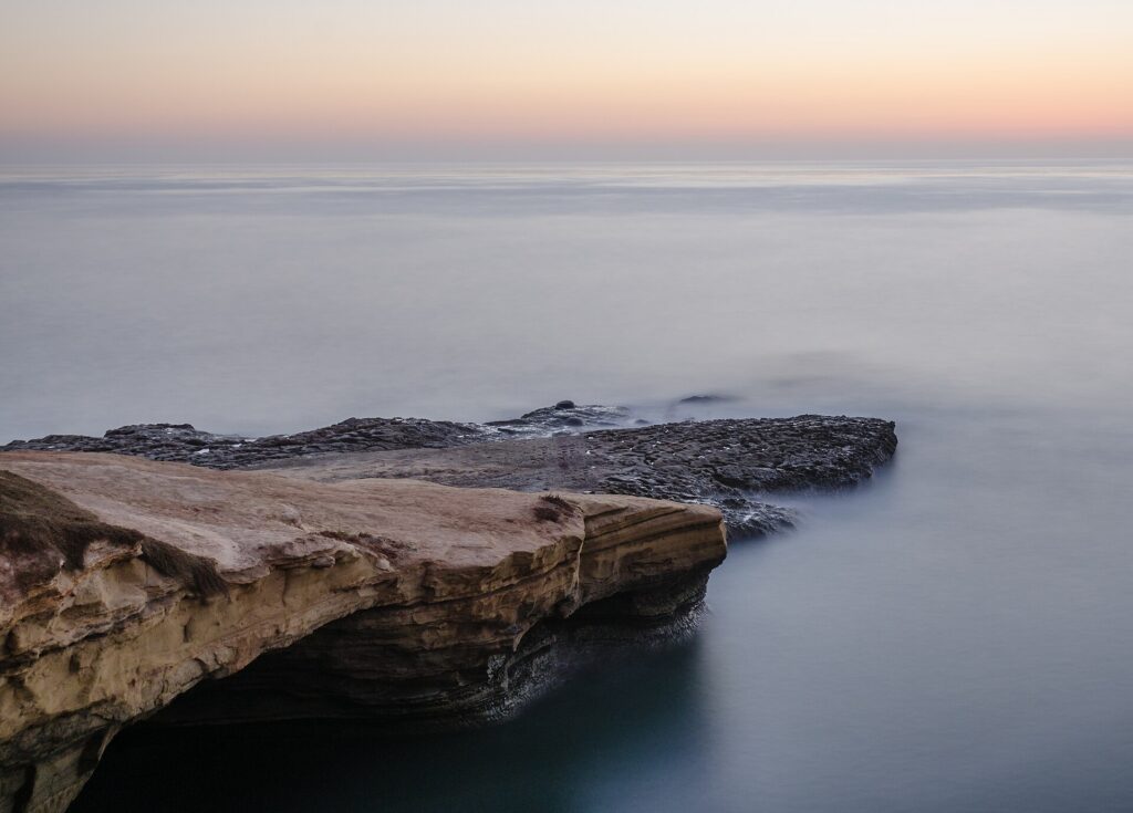
    Sunset Cliffs on Point Loma, as good in a clear January as in July (Photo: Tuxyso via Wikimedia Commons, CC BY-SA 3.0)

    May Gray, June Gloom and the beach calendar

    If the beach is the point of the trip, the calendar matters more than the table suggests. From roughly May to early July, the marine layer often sits over the coast until late morning, and some days it never clears; the sand is quieter, the light is soft, and a sweater is welcome, but it is not the postcard. From mid-July, the clouds burn off earlier and the afternoons are reliably bright. The water is warmest from August into early October, typically around 20 to 22 °C (high 60s to low 70s Fahrenheit), and coolest from January to April, when most surfers wear full wetsuits. After heavy winter rain, check the county’s beach water quality advisories before swimming. The practical conclusion: for swimming and sunbathing, September is the sweet spot, with warm water, clear skies and lower rates; for a mild, affordable city break with beach walks rather than beach days, January to April works well.

    What to pack, by season

    Winter (December to February): layers for mild days, a warm jacket for evenings that can drop below 10 °C (50 °F), a light rain shell, and sunglasses; add warmer clothing if you are heading to Julian or the mountains, where it can snow. Spring (March to May): light clothing, a sweater or jacket for gray mornings and cool evenings, and sunscreen. Summer (June to September): beachwear, a hat and high-factor sunscreen, which you need even under the marine layer, plus a light layer for evenings on the water. Fall (October to November): summer clothing into October, with a jacket for November nights. In every season, bring comfortable walking shoes for Balboa Park and the cliffs.

    The best time to fly to San Diego for…

    Beaches and swimming

    Late July to early October, and especially September after Labor Day, when the water is warmest and the crowds have thinned.

    Whale watching

    December to March for gray whales migrating along the coast, with a peak in January and February; blue whales and other species feed offshore in summer.

    Comic-Con

    Plan months ahead: secure the badge first, then book the hotel through the official housing process or as early as possible, and compare flights into SAN and LAX.

    Baseball

    April to September at Petco Park; weeknight games and midweek flights in April, May and September are the best value.

    The lowest prices

    January and February outside the holiday weekends, with mid-November to mid-December close behind.

    Families

    Summer for the warmest beaches, if you book early and accept peak rates; spring break and fall break for comfortable weather and slightly lower prices. The zoo, LEGOLAND and SeaWorld are quieter midweek outside school holidays.

    Road trips

    Spring and fall for combining San Diego with Los Angeles or Phoenix; in summer, the drive east on I-8 crosses some of the hottest desert in the country, so see our guide to the best time to fly to Phoenix before planning a desert leg.

    Cross-border and international visitors

    Canadians need a valid passport; travelers from Visa Waiver Program countries need an approved ESTA before boarding, and everyone else needs a visa. U.S. Customs and Border Protection explains what applies to you, including for re-entry after a day in Tijuana, and the TSA lists what you can carry through security.

    Frequently asked questions

    What is the cheapest month to fly to San Diego?

    For the total trip, January and February, when hotel rates are at their lowest outside the holiday weekends; airfares are usually reasonable too. Early December and late September are close behind.

    What is the best month to visit San Diego for weather?

    September and October, with warm, clear days and the warmest ocean. April and early November are close behind.

    Is San Diego warm enough for the beach in winter?

    For walking, sitting in the sun and tide pooling, often yes, with afternoons around 19 °C (66 °F). For swimming, the ocean is cold without a wetsuit.

    What is June Gloom?

    The low marine cloud that often covers the coast on late-spring and early-summer mornings, sometimes all day. It usually clears inland first and becomes less frequent from mid-July.

    How expensive is San Diego during Comic-Con?

    It is the most expensive week of the year for downtown hotels, and rates rise across the city. Flights rise less sharply. Book as early as possible, or avoid those dates if you are not attending.

    How far ahead should I book?

    Well ahead for summer, Comic-Con, spring break and the holidays; for winter and fall, rates are stable enough that choosing the right dates matters more than booking early.

    Does it rain much in San Diego?

    No. About 250 mm (10 inches) a year, almost all between November and March, often in a few storms. Summers are nearly dry.

    Ready to pick your dates? Compare fares across the whole month on our San Diego flights page, then find a room with our San Diego hotel search, perhaps in the Gaslamp Quarter. For what to do when you land, start with our first-timer’s guide to San Diego.

  • Philadelphia: Should You Rent a Car or Rely on Public Transit?

    Philadelphia: Should You Rent a Car or Rely on Public Transit?

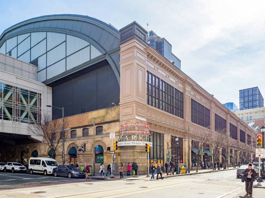
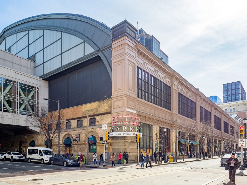
    Philadelphia is a city that punishes cars and rewards feet. William Penn laid out Center City in 1682 as a tight grid of narrow streets between two rivers, long before anyone imagined parking, and the historic core around Independence Hall still has brick sidewalks, cobbled lanes and streets barely wide enough for a delivery truck. Almost everything a first-time visitor wants to see, from the Liberty Bell to Reading Terminal Market, the art museum and the restaurants of Rittenhouse Square, fits inside an area you can walk across in under an hour, and SEPTA’s subway, trolleys, buses and regional trains cover the rest, including a direct train from the airport. Driving, by contrast, means some of the most congested expressways on the East Coast, a parking authority whose enforcement is part of local folklore, and hotel parking fees that add up quickly. But the car still has a job here. Valley Forge, Longwood Gardens, Lancaster County’s Amish country, Bucks County and the Jersey Shore are all classic day trips, and most of them are hard or impossible without one. This guide explains how the city is laid out, how SEPTA and the other rail systems work, what driving is really like, and gives you a straightforward way to decide.

    The short answer

    Skip the car for a city visit, which is what most first trips to Philadelphia are: SEPTA, your feet, Indego bike share and the occasional taxi will cover the historic district, Center City, the Parkway museums, South Philadelphia, Fishtown and University City, and you will save the parking and the stress. Rent a car only for the days you leave the city, for Valley Forge, Longwood Gardens and the Brandywine Valley, Lancaster County, New Hope and Bucks County, Gettysburg or the Shore, or if you are visiting family in the suburbs, traveling with small children and a lot of gear, or making Philadelphia one stop on an East Coast road trip. For most visitors, the right answer is a car-free city stay plus a one- or two-day rental. Compare rental rates for those days on our Philadelphia car rental page.

    How Philadelphia is laid out

    Center City is the rectangle between the Delaware River on the east and the Schuylkill River on the west, roughly two miles across and a mile deep, with City Hall at the center where Broad Street and Market Street cross. North-south streets are numbered, starting from Front Street at the Delaware and rising to the twenties by the Schuylkill, and east-west streets carry names, many of them trees, such as Chestnut, Walnut, Locust, Spruce and Pine. Old City and Society Hill, with Independence Hall and the oldest houses, fill the eastern end near the Delaware; Rittenhouse Square anchors the western half; the Benjamin Franklin Parkway runs diagonally northwest from City Hall to the art museum. South Philadelphia, with the Italian Market, East Passyunk and the stadiums, stretches below South Street; Northern Liberties and Fishtown lie north along the Delaware; University City is across the Schuylkill to the west. Most streets in the grid are one-way, which is logical once you know the pattern and baffling until you do. Beyond Center City the city runs far to the northeast and northwest, and the suburbs, the Main Line, Montgomery County, Delaware County, Bucks County and South Jersey across the river, are where public transit starts to thin out.

    Hotels cluster around City Hall and the Convention Center, around Rittenhouse Square, in Old City near the historic sites, in University City near 30th Street Station, and in a large group near the airport. Our Philadelphia hotel search lets you compare them.

    Getting in from the airport

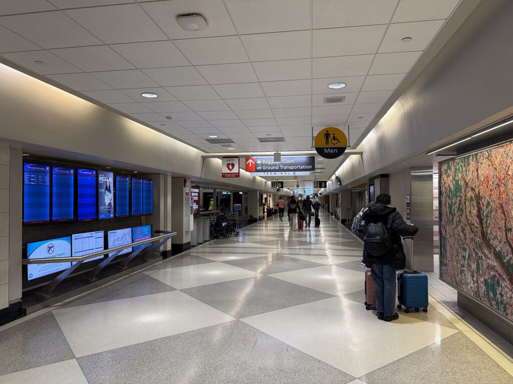
    Philadelphia International (PHL) is in the southwest corner of the city, about 13 km (8 miles) from Center City, and it has one of the simplest airport connections in the country. The SEPTA Airport Line, a Regional Rail service, stops at every terminal and runs to University City, 30th Street Station, Suburban Station and Jefferson Station in around 25 minutes, typically every half hour from early morning until late evening; SEPTA’s site lists the current ticket options for the line. Taxis charge a flat fare between the airport and Center City, which takes the guesswork out of the trip, and ride-hail pickups are in marked zones outside baggage claim. The drive takes about 20 minutes in light traffic on I-95 and much longer at rush hour. The rental car companies are off-airport and run shuttles from the terminals to their lots. Unless you are heading straight out of the city, there is no reason to pick up a car on arrival. The airport’s site covers current ground transport, and our PHL airport guide covers the layout.

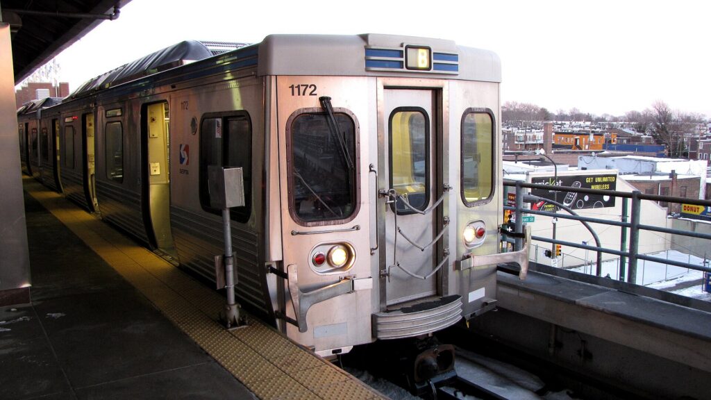
    A SEPTA Market-Frankford Line train in Philadelphia
    The Market-Frankford Line, which links Old City, City Hall, 30th Street Station and Fishtown (Photo: Ben Schumin from Montgomery Village, Maryland, USA via Wikimedia Commons, CC BY-SA 2.0)

    Philadelphia’s transit, explained

    SEPTA, the Southeastern Pennsylvania Transportation Authority, runs almost everything: two subway lines, a network of trolleys, the buses, and a large Regional Rail system that reaches the suburbs, the airport and Trenton in New Jersey. It is one of the few American transit systems that uses every mode, and for a visitor based in Center City it covers nearly everything worth seeing. It has also faced serious funding shortfalls in recent years that have brought threatened and sometimes actual service cuts, so check current schedules on SEPTA’s site before relying on a route, especially in the evenings.

    The subway and trolleys

    Two lines form a cross through the city. The Market-Frankford Line runs east-west under Market Street through Center City, with stops for Old City, Independence Mall, City Hall and 30th Street Station, then rises onto an elevated track to University City in the west and to Fishtown and the Northeast in the other direction. The Broad Street Line runs north-south under Broad Street, meeting the Market-Frankford Line at City Hall, and is the way to the stadiums at the southern end and to Temple University in the north. SEPTA has been renaming its rail transit lines under a SEPTA Metro brand, so on newer maps and signs the Market-Frankford Line appears as the L and the Broad Street Line as the B. The subway-surface trolleys run underground beneath Market Street in Center City and surface in West Philadelphia, which makes them useful for University City, and a separate trolley line runs along Girard Avenue past the zoo and through Fishtown.

    Buses

    Buses fill in the rest of the city, including the routes along South Street, Chestnut and Walnut, up to the art museum area, and out to Manayunk. Frequencies are good on the main corridors and much thinner late at night and on the outer routes. Check real-time arrivals in the SEPTA app rather than trusting a printed schedule.

    Regional Rail

    More than a dozen Regional Rail lines fan out from the Center City tunnel, which links Jefferson Station, Suburban Station and 30th Street Station. For visitors, the most useful are the Airport Line, the Manayunk/Norristown Line, the Chestnut Hill lines for the northwest neighborhoods, and the Trenton Line, which connects with New Jersey Transit trains to New York for travelers who want the cheaper, slower alternative to Amtrak. Service on most lines is roughly hourly outside the rush.

    Fares and tickets

    The simplest way to pay on the subway, trolleys and buses is to tap a contactless bank card or phone at the reader, or to load a reusable SEPTA Key card at station kiosks; paying with a Key card or contactless costs less than paying cash on a bus, and transfers are handled automatically within a set time. Regional Rail fares depend on the zone and whether you travel at peak times, and the Airport Line has its own fare. Day and weekly passes are available and worth it on a heavy sightseeing day. Young children ride free with a fare-paying adult; check SEPTA for the current age limit and fares before you go.

    Accessibility

    Every SEPTA bus is accessible, and a growing number of subway and Regional Rail stations have elevators, but some older subway stations and trolley stops still do not. SEPTA’s site lists accessible stations and elevator outages, and it is worth checking before you plan a route with luggage or a stroller.

    Beyond SEPTA

    • Walking. Center City is flat and compact, and you can walk from Independence Hall to Rittenhouse Square in about 25 minutes and to the art museum in about 40. On a pleasant day, walking is faster than waiting for a bus for most trips inside the grid.
    • Indego bike share. Indego has hundreds of stations across Center City and the neighborhoods around it, including electric bikes, and the Schuylkill River Trail from Center City past Boathouse Row is the best ride in the city.
    • PATCO. The PATCO Speedline runs from Center City across the Benjamin Franklin Bridge to Camden and the South Jersey suburbs, and it is the way to the Adventure Aquarium and the Battleship New Jersey.
    • Amtrak and New Jersey Transit. Amtrak connects 30th Street Station with New York, Washington and Boston on the Northeast Corridor, and with Harrisburg via Lancaster on the Keystone line, which makes Amish country a feasible car-free day trip. New Jersey Transit runs trains to Atlantic City and the River Line from Camden to Trenton.
    • Taxis and ride-hail. Uber, Lyft and licensed taxis operate across the city; for a group of three or four, a short ride is competitive with transit fares and far quicker for late-night returns.
    • Seasonal ferry. In the warmer months, a passenger ferry has typically crossed the Delaware between Penn’s Landing and the Camden waterfront; check before you go.
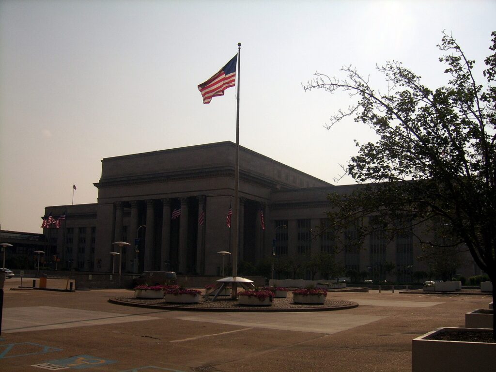
    30th Street Station, Philadelphia's main Amtrak and Regional Rail hub
    30th Street Station, where Amtrak, Regional Rail and the Airport Line meet (Photo: Reading Tom from Reading, UK via Wikimedia Commons, CC BY 2.0)

    Driving in Philadelphia: what it is really like

    Philadelphia is not the hardest city in the country to drive in, but it is harder than its size suggests. The Schuylkill Expressway (I-76), the main route from the western suburbs, Valley Forge and the Pennsylvania Turnpike into Center City, is a narrow, winding road squeezed between the river and the hills, and it jams every weekday morning and evening and often on weekends; locals have called it the “Sure-Kill” for decades. I-95 along the Delaware, the route from the airport and to New York, has its own rush-hour crawl and a long-running program of construction. The Vine Street Expressway (I-676) across the north of Center City links the two and backs up at both ends. Roosevelt Boulevard in the Northeast, a twelve-lane road with a grim safety record, now has automated speed cameras. Inside Center City, the grid of narrow one-way streets, double-parked delivery trucks, cyclists, pedestrians who cross against the light, and the cobblestones and tight corners of Old City and Society Hill make driving slow and stressful for anyone who does not know the pattern.

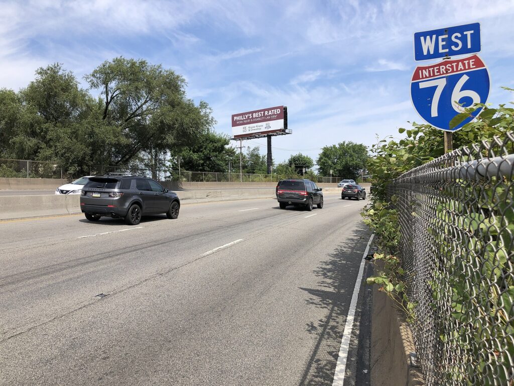
    Traffic on the Schuylkill Expressway (Interstate 76) in Philadelphia
    The Schuylkill Expressway, the main road in from the western suburbs and one of the most congested in the region (Photo: Famartin via Wikimedia Commons, CC BY-SA 4.0)

    Parking

    This is where most visitors decide the car is not worth it. On-street parking in Center City is scarce, metered and time-limited, and residential blocks in the surrounding neighborhoods are restricted to permit holders for all but a short period. The Philadelphia Parking Authority enforces the rules with an efficiency that has been the subject of its own reality television show, and a ticket or a tow is an expensive souvenir. Garages and lots are plentiful around City Hall, the Convention Center and Old City, and many offer early-bird and evening rates, but daily rates are high, and hotels charge a substantial nightly fee, often for valet only. Outside Center City, parking at the stadiums, the zoo, Valley Forge, Longwood Gardens and most suburban sights is simple, and the historic sites in Old City have a garage under the Independence Visitor Center. Pay street meters at the kiosk or with the parking authority’s app, read every sign on the block, and never park in a bus zone, a loading zone or a crosswalk.

    Rules and conditions worth knowing

    • Tolls. The Pennsylvania Turnpike, the New Jersey Turnpike and the bridges across the Delaware are tolled, most of them electronically. Many Pennsylvania Turnpike plazas no longer take cash, and the bill follows the plate; ask the rental company how its toll program works and what it charges.
    • Cameras. Red-light cameras operate at many intersections, and speed cameras on Roosevelt Boulevard and in school zones; fines follow the car, and the rental company will bill you with a fee on top.
    • Wipers on, lights on. Pennsylvania law requires headlights whenever your wipers are in use because of the weather.
    • Right turns on red are permitted after a full stop unless signed otherwise, which in Center City they often are. Left turns on red from one one-way street onto another are also legal after a stop.
    • Snow. A few storms a year bring snow emergency routes, where parked cars must be moved or towed; if you have a rental in the city during a storm, check where it is parked.
    • Game days. Eagles, Phillies, Flyers and 76ers games back up I-95, I-76 and Broad Street around the stadium complex in South Philadelphia. Take the Broad Street Line instead.
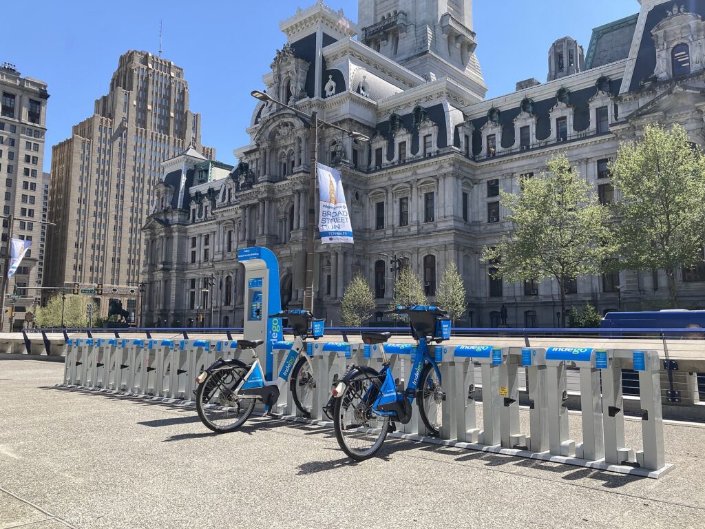
    An Indego bike share station in Philadelphia
    Indego bike share, the quickest way along the Schuylkill River Trail (Photo: Robert Perry via Wikimedia Commons, CC0)

    When renting a car makes sense

    • Valley Forge and the Main Line. Valley Forge National Historical Park is about 40 minutes northwest, and the park itself, with its driving tour past the encampment sites, is best seen by car.
    • Longwood Gardens and the Brandywine Valley. About an hour southwest, with Winterthur and the Brandywine museum nearby; public transport barely reaches them.
    • Lancaster County. The train reaches Lancaster city, but the farms, covered bridges and back roads of Amish country need a car.
    • Bucks County and New Hope. An hour north along the Delaware, with Washington Crossing Historic Park on the way.
    • The Jersey Shore. Cape May, Ocean City and the smaller shore towns are far easier by car; Atlantic City is the exception, with bus and train service.
    • East Coast road trips. Philadelphia sits between Washington and New York on I-95; our route guides for Washington, DC to Philadelphia and Philadelphia to Boston cover the drives, and our guides to Washington, DC and Boston cover what to do when you arrive.

    If any of those apply, our rental car booking tips cover insurance, deposits and the questions to ask at the counter, and our family car rental guide looks at vehicle choice.
    When it does not

    • You are staying in Center City, Old City or University City and your plans are the historic district, the museums, the markets and the neighborhoods.
    • You are in town for a convention, a game, a graduation or the Fourth of July, when parking is at its worst and SEPTA goes where you are going.
    • You are arriving or leaving by Amtrak, or combining Philadelphia with New York or Washington by train.
    • You are traveling solo or as a couple, and the rental, insurance, tolls and hotel parking add up to more than a week of transit and taxis.

    The hybrid plan for a city-plus-countryside trip

    Go car-free for the city days and rent for the countryside days, and think carefully about where you pick up. Renting at the airport makes sense only if you are heading straight out of the city on arrival, toward Longwood Gardens and the Brandywine Valley, for example, which are closer to PHL than to Center City. Renting from a downtown or 30th Street Station location makes sense if you are spending the first nights in the city, because you avoid the airport’s concession fees and the nightly hotel parking on the days you are not using the car. A common pattern that works well: the Airport Line into the city, two or three car-free days, pick up a rental in Center City in the morning, drive out for Valley Forge or Lancaster County, and return it that evening or on the way back to the airport. Leave early to beat the Schuylkill Expressway, and plan the return for after the evening rush. Compare the day rates on our Philadelphia car rental page against a full-trip rental and the difference is usually obvious.

    A worked cost comparison

    Numbers change with the season and the booking window, so treat this as a method rather than a quote, and check current rates before deciding. For a four-night city break in Center City for two people, the car-free version costs two return Airport Line fares, transit rides or a couple of day passes, an Indego ride or two along the river, and perhaps two or three short taxi trips at night; the rental version adds four days of a compact car, four nights of hotel parking at Center City rates, fuel and the airport concession fees, and buys you very little you could not walk or ride to. The transit option wins easily. For the same four nights with a day at Longwood Gardens and a day in Lancaster County, the car-free version would need an Amtrak return to Lancaster and taxis once you arrive, and would struggle to reach Longwood at all; the hybrid version adds a two-day rental picked up downtown, fuel, a toll or two and one or two nights of parking. The hybrid wins on both cost and time for almost everyone. For a family of four visiting the suburbs for a week, a rental for the whole stay is the practical answer, and the airport pickup is worth its fee. Run the rental rates for your dates on our Philadelphia car rental page and put them beside the transit costs before you choose.

    Driving out of Philadelphia in each season

    The day trips from Philadelphia are easy drives in any season, but the traffic changes with the calendar. In summer, the problem is the Shore: the Atlantic City Expressway and the roads to Cape May and Ocean City fill on Friday afternoons and Sunday evenings from Memorial Day to Labor Day, so go mid-week or leave very early. Summer thunderstorms can also flood low roads, including sections of the Schuylkill Expressway, for an hour or two. In fall, the roads to Bucks County, Lancaster County and the Brandywine Valley fill on foliage weekends in October, and Eagles Sundays make I-95 around the stadiums slow; weekday trips are calmer. In winter, snow is occasional rather than constant, and the main highways are plowed quickly, but a nor’easter can make the suburbs slow for a day or two, and the Christmas displays at Longwood Gardens draw heavy evening traffic through December. Rental cars come on all-season tires, which are fine for most winter days. In spring, the Schuylkill Expressway is at its worst on weekday rush hours as always, but the drive to Valley Forge and Longwood during the April blossoms and the May garden season is one of the best reasons to have a car. In every season, the rule is the same: leave Center City before the morning rush or after it, and come back after the evening one.

    Decision table

    Your tripRecommendationWhy
    City break in Center City, couple or soloNo carWalking, SEPTA and Indego cover it; parking is expensive and strictly enforced
    Fourth of July, a convention or a gameNo carStreets close, parking vanishes, and SEPTA goes to the Parkway and the stadiums
    City plus Valley Forge or Longwood GardensHybrid: rent downtown for one or two daysCar-free city days, car only when you leave
    Lancaster County and Amish countryRent for the day, or Amtrak plus a local tourThe train reaches Lancaster, but the farms and back roads need a car
    Philadelphia with New York or WashingtonNo car; take the trainAmtrak between city centers is faster than driving and parking
    Family visit to the suburbsRent for the whole staySuburban transit is thin and distances are long
    Jersey Shore beach daysRent, and go mid-weekMost shore towns are hard to reach without a car
    East Coast road tripRent (consider one-way)Philadelphia is a stop on I-95, not the destination

    Money-saving tips for both options

    • On transit: tap a contactless card or use a SEPTA Key card rather than paying cash; buy a day pass for a heavy sightseeing day; walk inside Center City whenever the weather allows.
    • On a rental: compare airport and downtown pickup, rent only for the days you leave the city, check the toll program before you drive, decline extras you already have through a credit card or home policy (check first), and fill the tank away from the airport.
    • On the hotel: if you are renting, price the parking fee into the room rate, and look at garages with evening or weekend rates near your hotel, which are often cheaper than hotel valet.
    • On timing: avoid the Schuylkill Expressway and I-95 in the weekday peaks and on game days, and the Shore roads on summer weekends; the best time to fly to Philadelphia guide lists the busiest weekends in the city.
    • On intercity trips: for New York, the SEPTA Trenton Line plus New Jersey Transit is slower than Amtrak but usually much cheaper; for Washington and Boston, compare Amtrak with a one-way rental for a group.

    Frequently asked questions

    Is it worth renting a car in Philadelphia?

    For a city visit, no; walking and SEPTA cover the sights, and parking is expensive and strictly enforced. For Valley Forge, Longwood Gardens, Lancaster County, Bucks County or the Shore, yes, for those days only.

    Is SEPTA good for tourists?

    Good within the city: the two subway lines, the trolleys and the buses reach nearly every sight, and the Airport Line connects every terminal to Center City. Check current schedules, as service levels have been affected by funding problems.

    How do I get from Philadelphia airport to Center City?

    The SEPTA Airport Line train in around 25 minutes, typically every half hour, or a flat-fare taxi or ride-hail in 20 to 40 minutes depending on traffic.

    How do I pay for SEPTA?

    Tap a contactless bank card or phone at the reader, or buy and load a SEPTA Key card at a station kiosk. Paying cash on a bus costs more and does not include a transfer.

    Can I get to Valley Forge without a car?

    It is possible by SEPTA bus from the Norristown area, but it is slow, and the park is spread out. A car, a bike or a tour is far easier.

    Is parking expensive in Philadelphia?

    In Center City, yes: street spaces are scarce and time-limited, garage day rates are high, and hotels charge a substantial nightly fee. Outside the center, parking is easy.

    Is it hard to drive in Philadelphia?

    The expressways are congested and the Center City grid is narrow, one-way and busy with pedestrians and cyclists. It is manageable with patience and a navigation app, but most visitors are happier without a car in the city.

    Whichever way you go, start with the flight. Compare cheap flights to Philadelphia, choose a neighborhood with our Philadelphia hotel search, and if the countryside is on the list, price the rental for those days on our Philadelphia car rental page. For what to see once you are here, start with our first-timer’s guide to Philadelphia.

  • Best Time to Fly to Philadelphia: Seasons, Weather & Prices

    Best Time to Fly to Philadelphia: Seasons, Weather & Prices

    Philadelphia is one of the easiest big cities in the country to time well, because its price calendar is driven by a handful of predictable things rather than by one overwhelming season. There is the tourist calendar, which peaks with the Fourth of July in the city where the Declaration of Independence was signed and stays busy through the summer. There is the university calendar, with dozens of colleges in and around the city sending families into hotels for move-in weekends in late August and graduations in May. There is the convention calendar at the Pennsylvania Convention Center, which can fill Center City hotels on any weeknight of the year. And there is the sports calendar, which in a city this devoted to its teams can tighten rooms on an Eagles weekend in a way that surprises visitors. Philadelphia International is also a major American Airlines hub with nonstop service across the country and to Europe, so fares from most places are competitive in every month. This guide walks through the weather month by month, the fare and hotel seasons, the events that move prices, and how to get into the city from the airport.

    The short answer

    For the best balance of weather and price, go in late April to mid-May, before the summer heat and outside the graduation weekends, or in late September through October, when the humidity has broken, the evenings are cool and the fall foliage is starting in Fairmount Park and along the Wissahickon. The cheapest time to fly and stay is January and February, outside the long weekends and the Flower Show in early March, with the first three weeks of November close behind. The most expensive stretches are the Fourth of July week, the summer from mid-June to mid-August, the graduation weekends in May, Thanksgiving and the Christmas to New Year period, and any weekend when a big convention, a stadium concert or an Eagles playoff game lands in town. Whatever you choose, run a flexible-date search on our Philadelphia flights page; moving your trip by a few days around a holiday weekend or a graduation can change the fare band entirely.

    A band marching in the Fourth of July parade in Philadelphia
    The Fourth of July parade in Philadelphia, the peak of the city's busiest and most expensive week (Photo: Reading Tom from Reading, UK via Wikimedia Commons, CC BY 2.0)

    Philadelphia’s weather, season by season

    Philadelphia sits between the Delaware and Schuylkill rivers, about 100 kilometers (60 miles) inland from the Atlantic, with a humid climate that gives it four very distinct seasons. Summers are hot and sticky with afternoon thunderstorms, winters are cold with a few snowfalls most years and the occasional big storm, and spring and fall are the seasons worth planning a trip around. The figures below are approximate seasonal patterns based on the long-term climate normals for Philadelphia International Airport from NOAA’s National Weather Service, whose Mount Holly office covers the city; check the current forecast before you pack, because March and November can each hold a mild afternoon and a hard freeze in the same week.

    MonthTypical daytime highTypical overnight lowWhat it feels likeFare pressure
    Januaryaround 5 °C (41 °F)around -3 °C (27 °F)Cold and often gray; snow in some years, raw wind off the riversLow, except New Year’s Day and MLK weekend
    Februaryaround 7 °C (45 °F)around -2 °C (28 °F)Still cold; the likeliest month for a heavy snowstormLow; rises for Presidents’ Day weekend
    Marcharound 12 °C (54 °F)around 2 °C (36 °F)Changeable; mild spells, late snow and plenty of windModerate; the Flower Show and spring break
    Aprilaround 18 °C (64 °F)around 7 °C (45 °F)Spring proper; cherry blossoms, showers, green parksModerate; school groups arrive
    Mayaround 24 °C (75 °F)around 13 °C (55 °F)Warm and pleasant; humidity starts to build late in the monthHigh on graduation weekends
    Junearound 29 °C (84 °F)around 18 °C (64 °F)Hot and humid; long evenings and thunderstormsHigh
    Julyaround 31 °C (88 °F)around 22 °C (72 °F)The hottest month; heat waves push the heat index far higherPeak around the Fourth, then high
    Augustaround 30 °C (86 °F)around 21 °C (70 °F)Hot and sticky; locals leave for the Jersey ShoreHigh, easing after mid-month
    Septemberaround 26 °C (79 °F)around 17 °C (63 °F)Warm and gradually drier; tropical storm remnants possibleModerate, falling after Labor Day
    Octoberaround 20 °C (68 °F)around 10 °C (50 °F)Crisp, sunny and colorful; many locals’ favorite monthModerate; high on convention weeks
    Novemberaround 14 °C (57 °F)around 4 °C (39 °F)Cool and increasingly gray; the leaves finish early in the monthLow until Thanksgiving week
    Decemberaround 8 °C (46 °F)around 0 °C (32 °F)Cold and festive; snow is possible but not reliableLow until mid-month, then peak

    Three things the table cannot show. First, the humidity: a July afternoon at 31 °C (88 °F) in Philadelphia feels much hotter than the same temperature in a dry climate, and the brick and asphalt of Center City hold the heat long after sunset, so plan the historic sites for the morning and the air-conditioned museums for the afternoon. Second, the snow: the city averages a modest amount each winter, but it tends to come in a few storms rather than a steady covering, and one big nor’easter can close schools and snarl flights for a day or two. Third, the rivers and the wind: a January day that looks mild on paper can feel bitter on the open plaza of Independence Mall or along the Delaware waterfront, so pack for the wind chill rather than the thermometer.

    How Philadelphia’s fare seasons work

    Four calendars drive seats and rooms in Philadelphia. The leisure calendar builds from the spring school-trip season into a summer peak around the Fourth of July. The university calendar puts parents into hotels for move-in in late August, family weekends in the fall and a run of commencement weekends through May, with the University of Pennsylvania’s graduation in mid-May the biggest single squeeze on Center City and University City rooms. The convention calendar at the Pennsylvania Convention Center, one of the largest in the Northeast, fills downtown hotels on weeknights with little regard for the season. And the sports calendar adds pressure on Eagles weekends in the fall and during any playoff run. Airfares are steadier than hotel rates, because PHL is a large American Airlines hub with competition from other carriers on the busiest routes, but the flights that matter to leisure travelers, Friday and Sunday afternoons, fill quickly on the big weekends. The pattern is a summer plateau with a sharp Fourth of July spike, a strong spring and fall, and a genuinely cheap winter.

    Peak season

    Mid-June to mid-August, the Fourth of July week above all, plus Thanksgiving week and roughly December 20 to January 2. The Fourth is Philadelphia’s own holiday: the Welcome America festival runs for days around it, and the free Parkway concert and fireworks draw huge crowds, so Old City and Center City hotels fill and rates climb well ahead. The rest of the summer is steady family and international travel, with the heat keeping a lid on the very highest prices. Graduation weekends in May behave like peak for hotels even though flights are only moderately busy. If you must travel in peak, book early, fly mid-week, and compare hotels near City Hall and in University City with those in Old City.

    Shoulder season

    April to early June and September to October. April brings the cherry blossoms and the first Phillies games but also the school groups that crowd Independence Hall into June; May is lovely apart from the graduation weekends. September, after Labor Day, is warm and quieter, and October is often the best month of the year for walking the city, with the foliage turning in Fairmount Park and along the Wissahickon at the end of the month. Watch the convention calendar and Eagles home dates, which can push weekday or weekend rates into peak territory at short notice.

    Low season

    January to early March, and November before Thanksgiving. Fares and hotel rates are at their lowest, the museums are at their emptiest, and the city is still busy enough to feel alive, with the 76ers and Flyers at home, the ice rinks open at Dilworth Park and on the waterfront, and restaurants eager for business. The exceptions are New Year’s Day, when the Mummers Parade fills Broad Street, the MLK and Presidents’ Day long weekends, and the Flower Show in early March. Build a weather buffer into any connection in January and February.

    As elsewhere, mid-week departures and early morning or late evening flights usually price below Friday and Sunday afternoons on the same route, and a search across a whole month reveals cheaper pairs of dates close to your first choice. Our guide to the best times to book explains how to read those patterns.

    Philadelphia month by month

    January

    Cold, gray and, after New Year’s Day, one of the cheapest months of the year. The Mummers Parade opens the year with string bands and sequined costumes along Broad Street, and then the city settles into winter. Highs hover a few degrees above freezing, snow falls in some years, and the major museums, from the art museum to the Barnes and the Penn Museum, are at their least crowded. Independence Hall and the Liberty Bell have the shortest lines of the year. Hotel rates in Center City drop sharply outside convention weeks, and a museum-and-restaurant long weekend is exceptional value.

    February

    Similar weather, with the highest chance of a real snowstorm, and low fares outside the Presidents’ Day weekend. The 76ers and Flyers are deep into their seasons at the arena in South Philadelphia, Philly Restaurant Week often falls in the winter months, and the skating rinks are open. If you are flexible, February is the month to find the lowest combination of flight and hotel prices.

    March

    Changeable, with mild afternoons, late snow and plenty of wind. The Philadelphia Flower Show, one of the largest and oldest in the world, fills the Convention Center for about a week in early March and brings a noticeable hotel spike to Center City. St. Patrick’s Day brings a parade and packed bars, and college spring breaks nudge fares from other cities up for a couple of weeks. The second half of March, with the first blossoms appearing, is a good value window.

    April

    Spring proper. The cherry trees bloom in Fairmount Park, around the Horticultural Center and along the river in the first half of the month, and a cherry blossom festival centered on the park’s Japanese House and Horticultural Center marks the season. The Phillies open their season at Citizens Bank Park, the Penn Relays fill Franklin Field in the last week of April, and school groups begin to crowd the historic district. Book Independence Hall tickets ahead from now until June.

    May

    Warm, green and one of the best months to walk the city, with one caveat: graduation weekends. Penn, Temple, Drexel, Villanova and many other colleges hold commencements across the month, and Penn’s in mid-May in particular fills hotels in University City and Center City. The Broad Street Run, a ten-mile race down the city’s spine, is usually the first Sunday of May, and Memorial Day weekend opens the Shore season. Check your dates against the university calendars before booking.

    June

    Hot, humid and busy. Spruce Street Harbor Park opens on the Delaware waterfront, the Odunde Festival on South Street is one of the largest African American street festivals in the country, Philly Pride fills the Gayborhood, and the Roots Picnic brings a big hip-hop and soul lineup to the city around the start of the month. Welcome America begins in the last days of June. Fares climb steadily as schools finish; early June is the value play.

    July

    Peak season, and the Fourth of July is the main event: a week of Welcome America festivities with free museum days, neighborhood block parties, the parade past Independence Hall, and the free concert on the Benjamin Franklin Parkway that ends with fireworks over the art museum. Rooms in Old City and Center City are at their annual maximum and sell out early. The rest of July is hot, with heat waves that make midday sightseeing hard work; the Phillies at home on a summer evening is the classic way to spend it.

    August

    Hot and sticky, and noticeably quieter as locals head for the Jersey Shore. Hotel rates often ease in the first half of the month, before the college move-in weekends late in August send parents and students into the city’s hotels, and before Labor Day weekend. For a visitor who can handle the heat and plans indoor afternoons, the middle of August can be surprisingly good value.

    September

    Warm, gradually drier and much calmer after Labor Day. The Philadelphia Fringe Festival fills theaters and odd spaces across the city for most of the month, the Eagles season begins, and the waterfront parks are still open. Remnants of tropical storms occasionally bring a day or two of heavy rain. Fares and hotel rates fall after Labor Day, apart from Eagles home weekends and big conventions.

    October

    Crisp, sunny and colorful, and for many Philadelphians the best month of the year. The foliage turns in Fairmount Park and along the Wissahickon in the second half of the month, Eastern State Penitentiary runs its famous Halloween nights, and in years when the Phillies reach the postseason the whole city turns red. Rates are moderate but can jump on college family weekends and convention weeks, so compare a few date pairs.

    November

    Cool and increasingly gray, with the leaves finishing early in the month and some of the lowest prices of the year until Thanksgiving. The Philadelphia Marathon takes over the Parkway and the river drives the weekend before Thanksgiving, and on Thanksgiving morning one of the oldest holiday parades in the country marches through Center City. The Christmas Village opens near City Hall in late November, and the Eagles are in full swing.

    December

    Two months in one. The first half is festive and reasonably priced, with the Christmas Village, the rinks at Dilworth Park and on the waterfront, and holiday concerts on the Avenue of the Arts. In years when the Army-Navy Game is played in Philadelphia, that December weekend fills hotels. From about December 20, fares climb for the holidays and stay high through New Year’s Day and the Mummers.

    Costumed performers in the Mummers Parade on New Year's Day in Philadelphia
    The Mummers Parade on New Year's Day, the colorful start to Philadelphia's cheapest season (Photo: Kevin Burkett from Philadelphia, Pa., USA via Wikimedia Commons, CC BY-SA 2.0)

    Events that move Philadelphia flight and hotel prices

    Cross-check these against your dates before you book. Exact dates shift each year; Visit Philadelphia keeps the current calendar.

    • New Year’s Day and the Mummers Parade on Broad Street.
    • Philadelphia Flower Show (early March) at the Convention Center.
    • Penn Relays (last week of April) at Franklin Field.
    • Graduation weekends (through May), especially Penn’s in mid-May.
    • Welcome America and the Fourth of July (late June to July 4): the single biggest hotel spike of the year in Old City and Center City.
    • College move-in (late August) and Labor Day weekend.
    • Eagles home games (September to January), and any Eagles, Phillies, 76ers or Flyers playoff run. Our Philadelphia events page shows what is on sale for your dates.
    • Philadelphia Marathon (the weekend before Thanksgiving) and Thanksgiving itself.
    • Christmas to New Year, plus the Army-Navy Game in the years it is played in the city.
    • Large conventions, which can fill Center City hotels on weeknights without warning; if your mid-week rates look strangely high, that is usually why.

    Getting in from the airport

    Philadelphia International (PHL) is in the southwest corner of the city beside the Delaware River, about 13 km (8 miles) from Center City, and it is the only major airport most visitors need to consider. It is a large hub for American Airlines, which flies nonstop to most big U.S. cities and to a long list of European destinations, and most other major U.S. carriers serve it too. The terminals are lettered A to F along a single curving building, with international flights mainly at Terminal A. Getting downtown is straightforward: the SEPTA Airport Line regional train stops at every terminal and runs to University City, 30th Street Station, Suburban Station and Jefferson Station in around 25 minutes, typically every half hour; taxis charge a flat fare to Center City; ride-hail pickups are in marked zones; and the rental car companies run shuttles from the terminals to their lots. Traffic on I-95 can stretch the drive from 20 minutes to well over 40 at rush hour, which is when the train earns its keep. Two alternatives are worth knowing about. Newark and Baltimore/Washington airports are each around 90 minutes away by car or train and occasionally have cheaper fares, and for travelers coming from New York, Washington or Boston, Amtrak to 30th Street Station is often faster door to door than flying. Our PHL airport guide covers the layout, and our car-versus-transit guide explains the onward options.

    Terminal B at Philadelphia International Airport (PHL)
    Philadelphia International (PHL), a major American Airlines hub about 13 kilometers (8 miles) from Center City (Photo: Dough4872 via Wikimedia Commons, CC BY-SA 4.0)

    Timing tricks that work for Philadelphia

    • Search the whole month. The Fourth of July, graduation weekends and holiday weekends create sharp edges in the fare calendar, and a calendar search on TicketScanner shows them instantly.
    • Book the hotel first around the Fourth and in May. A cheap fare into Welcome America week or Penn’s graduation weekend is not cheap once the room is added. Run a Philadelphia hotel search for the same dates before you commit to either.
    • Check the convention calendar. If mid-week rates in Center City look high, shift a night or two, or look at University City and the hotels near the airport on the Airport Line.
    • Fly mid-week, stay the weekend. Business travel makes Monday morning and Thursday evening flights busy; Tuesday and Wednesday departures and Saturday night stays are usually the value.
    • Compare the train. From New York, Washington or Boston, price Amtrak or a drive against the flight; our route guides for Washington, DC to Philadelphia and Philadelphia to Boston cover the road option.
    • Build a winter buffer. Snow and nor’easters can disrupt PHL between December and March; avoid the tightest connections. Our guide to how early to arrive covers what to allow.
    • Flying out of Philadelphia instead? PHL’s hub status means good nonstop options in every direction; see cheap flights from Philadelphia.
    Shoppers browsing food stalls inside Reading Terminal Market
    Reading Terminal Market, a Philadelphia institution since 1893 (Photo: ajay_suresh via Wikimedia Commons, CC BY 2.0)

    What to pack, by season

    Winter (December to February): a warm, windproof coat, a hat, gloves and waterproof shoes, because slush at the curb is more common than snow on the ground. Spring (March to May): layers, a light rain jacket and an umbrella, and a warmer layer for March evenings. Summer (June to August): light, breathable clothing, a refillable water bottle, sun protection and a light layer for air-conditioned museums and restaurants that can feel chilly after the heat outside. Fall (September to November): layers again, a medium jacket by late October, and comfortable walking shoes in every season, because the brick sidewalks and cobblestones of Old City are uneven. If a game is on the plan, add something green for the Eagles or red for the Phillies; you will fit in immediately.

    The best time to fly to Philadelphia for…

    The Fourth of July

    Arrive a few days before the Fourth to catch the Welcome America events, book as early as you can manage, and book the hotel first.

    History without the crowds

    January, February and November, when the lines at the Liberty Bell are short and timed tickets for Independence Hall are easy to get. Avoid April to June, when school groups fill the historic district.

    The best weather

    Late April to mid-May and late September to October, with October the most reliable for dry, sunny days.

    The lowest fares and hotel rates

    January and February outside the long weekends, and the first three weeks of November. Pair them with the museums and restaurants.

    Families

    Early June, before the peak, or the second half of October; in summer, plan indoor afternoons and use the waterfront parks and the Dilworth Park fountains in the evenings.

    International visitors

    Visitors from Visa Waiver Program countries need an approved ESTA before boarding; most others need a visa. The State Department’s travel site explains what applies to you, and the TSA lists what you can carry through security. For what to see once you land, start with our first-timer’s guide to Philadelphia, and if you are combining cities, our guides to New York, Washington, DC and Boston cover the rest of the Northeast Corridor.

    Frequently asked questions

    What is the cheapest month to fly to Philadelphia?

    January and February are consistently the lowest for both flights and hotels, followed by November before Thanksgiving and the second half of March outside the Flower Show.

    What is the best month to visit Philadelphia for weather?

    October, with May and late September close behind. July and August are hot and humid, and January and February are cold.

    How busy is Philadelphia around the Fourth of July?

    Very. It is the single most expensive week of the year for Old City and Center City hotels, and the Parkway concert and fireworks draw enormous crowds. Book months ahead, or come a week later for summer weather at lower prices.

    Is PHL a good airport to fly into?

    Yes. It is a large hub with plenty of nonstop options, it is close to the city, and the Airport Line train connects every terminal to Center City in around 25 minutes.

    Should I fly or take the train from New York or Washington?

    Take the train or drive. Amtrak reaches 30th Street Station from New York in roughly 70 to 90 minutes and from Washington in about two hours, which beats flying once airport time is counted.

    How far ahead should I book?

    Earlier for the Fourth of July, graduation weekends in May, Thanksgiving and the Christmas holidays, when fares tend only to rise; for January, February and November, fares are stable enough that finding the right dates matters more than booking far ahead.

    Does it snow in Philadelphia?

    Most winters bring a few snowfalls, usually in a handful of storms between December and March, and some years bring one big nor’easter. Many winter days are simply cold and dry.

    Ready to pick your dates? Compare fares across the whole month on our Philadelphia flights page, then find a room with our Philadelphia hotel search. For how to get around once you arrive, read our guide to renting a car or using public transit in Philadelphia.

  • Things to Do in Philadelphia: A First-Timer’s Guide

    Things to Do in Philadelphia: A First-Timer’s Guide

    Philadelphia is where the United States was argued into existence, and you can still stand in the room where it happened. Independence Hall, the Liberty Bell and the brick streets of Old City sit within a few blocks of each other, and most of them are free. But visitors who come for the history and leave after an afternoon miss the reason people fall for the place: a compact, walkable grid of rowhouse neighborhoods, one of the great art museums in the country at the top of a boulevard modeled on the Champs-Élysées, a collection of Impressionist paintings so large it needs its own building, thousands of murals, an open-air market that has been selling produce for more than a century, a restaurant scene built on small BYOB dining rooms, and sports fans whose reputation arrives before they do. It is also cheaper than New York or Boston and sits between them on the rail line. This guide covers the sights that earn a day, the neighborhoods worth a half-day, the museums, the food, the big events, the day trips, and the practical details that make a first visit work.

    If you are still comparing cheap flights to Philadelphia, read this alongside our guides to the best time to fly to Philadelphia and whether to rent a car or use public transit. Between the three you can plan the whole trip.

    Independence Hall, the red-brick State House in Philadelphia
    Independence Hall, where the Declaration of Independence and the Constitution were debated and signed (Photo: 颐园居 via Wikimedia Commons, CC BY-SA 4.0)

    Philadelphia at a glance for first-timers

    • Airport: Philadelphia International (PHL), in the southwest of the city about 13 km (8 miles) from Center City. The SEPTA Airport Line train reaches the downtown stations in around 25 minutes, and taxis charge a flat fare to Center City. See our PHL airport guide.
    • Getting around: Center City and Old City are flat, compact and best on foot. SEPTA’s two subway lines, trolleys, buses and Regional Rail cover the rest, and Indego bike share docks are everywhere. A car is a burden in the center and useful only for day trips.
    • Money: U.S. dollars. Sales tax in the city is higher than in the rest of Pennsylvania, but most clothing is exempt, which is a small bonus for shoppers. Tipping 18 to 20 percent in restaurants is customary.
    • Weather: four distinct seasons, with a hot and humid summer, a cold but usually manageable winter, and a spring and fall that are the best times to walk the city. Our month-by-month guide has the detail.
    • Where to stay: Old City for the historic sites on your doorstep; Rittenhouse Square for restaurants and a residential feel; around City Hall and the Convention Center for transit and value; University City near 30th Street Station if you arrive by train. Our Philadelphia hotel search covers them all.

    Independence National Historical Park and Old City

    Start where the country did. Independence National Historical Park, run by the National Park Service, covers the blocks around Independence Mall, and its centerpiece is Independence Hall, the red-brick State House where the Declaration of Independence was debated and signed in 1776 and the Constitution was drafted in 1787. Tours are free and ranger-led, but for most of the year you need a timed ticket, released online in advance for a small booking fee and handed out on the day at the Independence Visitor Center until they run out; book before you fly if your dates are fixed. Across Chestnut Street, the Liberty Bell Center holds the cracked bell itself, with no ticket needed, just a security line that is shortest first thing in the morning. At the north end of the mall, the National Constitution Center is the best museum in the country on how the Constitution works, with a hall of life-size bronze statues of the signers. Two blocks east, the Museum of the American Revolution tells the story of the war with real objects, including George Washington’s own field tent, and it is worth two hours even for visitors who think they know the story. Allow a full morning for the hall, the bell and one museum, and book the Independence Hall tour first.

    The streets around the park are the oldest part of the city. Elfreth’s Alley, a narrow lane of small houses dating to the early 1700s, is billed as the oldest continuously inhabited residential street in the country. Christ Church, where Washington and Franklin worshiped, is on Second Street, and Benjamin Franklin is buried in its burial ground a few blocks away, where visitors toss pennies onto his grave. The Benjamin Franklin Museum sits underground at Franklin Court, beneath a steel frame that outlines the house he lived in. Carpenters’ Hall, where the First Continental Congress met, and the Betsy Ross House are both within a ten-minute walk. In the evenings, Old City’s galleries, bars and restaurants along Market, Chestnut and Second streets fill up, and on the first Friday of each month the galleries stay open late.

    Center City: City Hall, Reading Terminal and the squares

    William Penn laid out Philadelphia in 1682 as a grid between two rivers, with a central square and four smaller squares around it, and the plan still works. At the center, City Hall is the largest municipal building in the country, a wedding cake of granite and marble topped by a bronze statue of Penn himself; for most of the twentieth century no building in the city was allowed to rise above his hat. Tours of the building and the tower observation level run on weekdays when they are operating, and the view down Broad Street and out to the Parkway is the best way to understand the city’s layout. Beside it, Dilworth Park has fountains in summer and an ice rink in winter, and across the street LOVE Park holds Robert Indiana’s famous red sculpture. Two blocks east, Reading Terminal Market, opened in 1893 beneath the train shed of the old Reading Railroad, is the best indoor market in the country, with more than seventy vendors selling roast pork sandwiches, cheesesteaks, soft pretzels, Pennsylvania Dutch baked goods and ice cream under one roof. Go at breakfast or mid-afternoon to avoid the lunch crush. Penn’s other squares are worth a detour: Rittenhouse Square is the elegant living room of the western half of Center City, Washington Square holds the Tomb of the Unknown Revolutionary War Soldier, and Franklin Square has a carousel and a mini-golf course laid out around Philadelphia landmarks.

    Vendors and shoppers inside Reading Terminal Market in Philadelphia
    Reading Terminal Market, open since 1893 and the best place in the city for lunch (Photo: ajay_suresh via Wikimedia Commons, CC BY 2.0)

    The Benjamin Franklin Parkway and the museums

    The Parkway runs diagonally from City Hall to the art museum, lined with flags and fountains, and it holds more of the city’s great collections than any other mile. At the top, the art museum, long known as the Philadelphia Museum of Art and recently rebranded as the Philadelphia Art Museum, is one of the largest in the country, with Van Gogh’s Sunflowers, Cézanne’s Large Bathers, a superb collection of Duchamp, complete rooms of European architecture and an Asian wing that includes a Japanese teahouse. Most visitors also run up the front steps made famous by Rocky, and the bronze statue of the boxer stands at the bottom for photographs. Down the Parkway, the Barnes Foundation displays one of the world’s great collections of Renoir, Cézanne and Matisse, hung exactly as the collector Albert Barnes arranged it, wall by wall, with old keys and hinges between the paintings; timed tickets are wise. The Rodin Museum, with The Thinker at its gate, is small and lovely. The Franklin Institute is the city’s science museum, with a walk-through giant heart and a planetarium, and the Academy of Natural Sciences of Drexel University across Logan Square has the dinosaur hall that children remember. Just beyond the art museum, Eastern State Penitentiary, a crumbling castle-like prison that opened in 1829 and held Al Capone, is one of the most atmospheric sights in the country, and in the fall it runs a famous Halloween event.

    The main building of the Philadelphia art museum at the top of the Benjamin Franklin Parkway
    The art museum at the top of the Parkway, home of the Rocky Steps and one of the great collections in the country (Photo via Wikimedia Commons, Public domain)

    The rivers, Fairmount Park and Boathouse Row

    Behind the art museum, the Schuylkill River curves north past Boathouse Row, a line of Victorian rowing clubhouses outlined in lights at night, and the paved Schuylkill River Trail runs along the water from Center City to the park and beyond. It is the best walk, run or bike ride in the city. Fairmount Park, which begins here, is one of the largest urban park systems in the country, with historic country houses, the Japanese House and Garden, the Horticultural Center, and, in the northwest, the wooded gorge of the Wissahickon Valley, where the gravel Forbidden Drive follows the creek for miles and feels nothing like a city. On the other side of Center City, the Delaware River waterfront at Penn’s Landing has the Independence Seaport Museum, the tall ships, the Race Street Pier park under the Benjamin Franklin Bridge, and, in summer, Spruce Street Harbor Park, with hammocks, floating barges and food stalls. In winter the same stretch becomes Blue Cross RiverRink, an outdoor skating rink with a lodge. A long-running project to cap the I-95 highway will link Old City to the river more directly when it is complete.

    Neighborhoods worth a half-day

    Society Hill and Washington Square West

    South of Independence Hall, Society Hill has the largest concentration of original eighteenth- and early nineteenth-century houses in the country, on quiet brick streets lit by gas lamps. Washington Square West, next door, is the heart of the Gayborhood, with rainbow street signs, independent restaurants along 13th Street and the lively bars of Midtown Village.

    Rittenhouse and Fitler Square

    The most elegant part of Center City, with the square itself, the boutiques and restaurants along Walnut and Chestnut streets, and brownstone blocks running west toward the Schuylkill. It is the best neighborhood for a hotel if restaurants matter more than history.

    South Street, Queen Village and the Italian Market

    South Street is the city’s bohemian strip, with tattoo parlors, bars and Philadelphia’s Magic Gardens, a maze of mirror-and-tile mosaics built by the artist Isaiah Zagar. A few blocks south and west, the Italian Market on 9th Street, one of the oldest open-air markets in the country, sells produce, cheese, fresh pasta and Mexican and Vietnamese groceries under metal awnings. Keep walking to where 9th Street meets Passyunk Avenue and you reach Pat’s and Geno’s, the rival cheesesteak stands that face each other across the intersection.

    East Passyunk

    Passyunk Avenue runs diagonally through South Philadelphia, and its eastern stretch is one of the best restaurant streets in the city, with small BYOB dining rooms, Italian bakeries, a lit fountain and a neighborhood feel that the tourist strips lack.

    Fishtown and Northern Liberties

    North of Old City along the Delaware, these former industrial neighborhoods have become the center of the city’s nightlife, with breweries, music venues, coffee roasters and many of its most talked-about restaurants along Frankford Avenue and Girard Avenue. The Market-Frankford Line gets you there in minutes.

    University City

    West of the Schuylkill, around the University of Pennsylvania and Drexel, the Penn Museum is one of the great archaeology museums in the world, with a granite sphinx, Egyptian mummies and treasures from the royal cemetery at Ur. 30th Street Station, the grand Amtrak terminal, is on the edge of the neighborhood.

    Manayunk and Chestnut Hill

    Two hilltop neighborhoods in the northwest, both on Regional Rail. Manayunk has a steep Main Street of bars and shops beside the old canal; Chestnut Hill has cobbled Germantown Avenue, independent shops and the Morris Arboretum. Either makes a gentle half-day away from the center.

    Murals, oddities and family attractions

    Philadelphia has more public murals than almost any city in the world, thanks to Mural Arts Philadelphia, which began as an anti-graffiti program in the 1980s and has painted thousands of walls since; walking and trolley tours explain the best of them, but you will see dozens simply walking through South Philadelphia or along the Market-Frankford Line. The Mütter Museum of the College of Physicians is a Victorian cabinet of medical curiosities, with skeletons, preserved specimens and slices of Einstein’s brain, and it is either the highlight of the trip or something you will never forgive the person who suggested it. The Philadelphia Zoo, the first in the country to be chartered, has an overhead trail network that lets the big cats and primates roam above visitors’ heads. The Please Touch Museum, in a grand building left over from the 1876 Centennial Exposition in Fairmount Park, is designed for children under eight. Across the Delaware in Camden, reached by the PATCO train or, in summer, a ferry from Penn’s Landing, the Adventure Aquarium and the Battleship New Jersey make a family day. For live performance, the Philadelphia Orchestra plays at the Kimmel Center on Broad Street’s Avenue of the Arts, the Academy of Music next door is the oldest opera house in the country still used for its original purpose, and the Walnut Street Theatre is the oldest theater in the country. Our Philadelphia events page lists concerts, shows and games during your dates.

    The big events: the Fourth of July and New Year’s Day

    Philadelphia treats the Fourth of July as its own holiday, which in a sense it is. The city’s Welcome America festival runs for several days around it, with free museum days, neighborhood events, a parade past Independence Hall and a free concert on the Parkway that ends with fireworks over the art museum; in 2026 the city was a focal point of the nation’s 250th anniversary celebrations. The other signature day is New Year’s Day, when the Mummers Parade, a century-old tradition of string bands, comic brigades and sequined, feathered costumes, fills Broad Street for most of the day. In early March, the Pennsylvania Horticultural Society’s Philadelphia Flower Show, one of the oldest and largest in the world, turns the Convention Center into a series of vast garden displays. The Penn Relays, the oldest and largest track meet in the country, fill Franklin Field in late April; the Broad Street Run, a ten-mile race straight down the city’s spine, is in early May; the Philadelphia Marathon is the weekend before Thanksgiving; and on Thanksgiving morning one of the oldest holiday parades in the country marches up the Parkway. From late November, a German-style Christmas Village fills the plaza by City Hall. Visit Philadelphia keeps the current calendar.

    Sports

    Philadelphia’s fans are loud, loyal and famous for it, and a game here is one of the best nights out in the city. All four major teams play at the South Philadelphia Sports Complex at the southern end of the Broad Street Line. The Eagles play NFL football at Lincoln Financial Field from September to January, won their second Super Bowl in February 2025, and are the closest thing the city has to a religion; tickets are hard to come by. The Phillies play baseball at Citizens Bank Park from April to September, and a summer evening there, with a roast pork sandwich and the skyline beyond the outfield, is easy to arrange. The Flyers (NHL) and the 76ers (NBA) share the arena next door. The Union play MLS soccer at Subaru Park on the river in Chester, just south of the airport. College basketball has deep roots too: the Big 5 rivalries between the city’s universities are played in historic gyms such as Penn’s Palestra. Check what is on sale in Philadelphia for your dates before you book flights.

    What to eat, and where

    Start with the cheesesteak, thin-sliced beef on a long roll with fried onions and your choice of provolone, American or Cheez Whiz. Pat’s and Geno’s in South Philadelphia are the tourist rite of passage, but locals will send you to a dozen neighborhood shops instead, and every one of them has an opinion. Many Philadelphians would argue the city’s best sandwich is actually the roast pork, with sharp provolone and broccoli rabe, the version at DiNic’s in Reading Terminal Market being the most famous. Then there are the hoagie, the city’s word for a sub, the twisted soft pretzel sold on street corners in the morning, water ice in summer, tomato pie served at room temperature in the Italian bakeries, and scrapple for the adventurous at breakfast. Beyond the classics, Philadelphia’s restaurant scene is one of the most creative in the country, and much of it is built on small, chef-owned BYOB restaurants, where you bring your own wine and the bill is lower for it; state-run liquor stores sell wine and spirits, and many supermarkets now sell beer and wine. Washington Avenue in South Philadelphia is lined with Vietnamese pho shops, the blocks around the Italian Market have some of the best Mexican food on the East Coast, Chinatown near the Convention Center has hand-pulled noodles and dim sum, and Fishtown and East Passyunk hold many of the city’s most talked-about dining rooms.

    Philadelphia through the seasons

    Philadelphia changes with the seasons more than visitors expect. Spring (March to May) starts with the Flower Show, brings cherry blossoms to Fairmount Park and the Horticultural Center in April, and ends with graduations, the Penn Relays and the first Phillies games; it is one of the best times to walk the city, although school groups crowd Independence Hall from April to June. Summer (June to August) is hot and often humid, so plan the historic sites for the morning, the museums for the afternoon, and the evenings for Spruce Street Harbor Park, rooftop bars and outdoor concerts; the Fourth of July is the peak. Fall (September to November) is the local favorite: warm, dry September days, Eagles season, the Fringe Festival, Halloween at Eastern State and foliage along the Wissahickon in late October. Winter (December to February) is cold, with a few snowy days most years, but the Christmas Village, the rinks at Dilworth Park and Penn’s Landing, the Mummers on New Year’s Day, and the empty galleries in January make it a surprisingly good time for a museum-focused trip at low prices. Our month-by-month guide has the fare patterns that go with each season.

    Philadelphia with kids

    Philadelphia is an easy city with children, because the history comes with real objects and costumed characters. The Liberty Bell and Independence Hall work best after the Museum of the American Revolution has set the scene, and in summer, storytellers and characters in eighteenth-century dress are stationed around Old City. The Franklin Institute, with its giant heart, the Academy of Natural Sciences, with its dinosaurs, and the Please Touch Museum for the youngest fill the rainy days. The Philadelphia Zoo and the Adventure Aquarium across the river are full-day outings. Franklin Square has the carousel and mini golf, Spruce Street Harbor Park and the Dilworth Park fountains are free summer entertainment, and a Phillies game is a good first ballgame. Sesame Place, the Sesame Street theme park, is about forty minutes north in Bucks County. If you are driving in from elsewhere, our family car rental guide covers the vehicle question.

    Philadelphia on a budget

    Much of the best of Philadelphia is free: the Liberty Bell and Independence Hall, the walk through Old City and Society Hill, Elfreth’s Alley, the murals, the Schuylkill River Trail and Boathouse Row, Fairmount Park and the Wissahickon, the Rocky Steps, Penn’s Landing and the parks along the river. The art museum and the Barnes have pay-what-you-wish or reduced-price periods at set times, so check their sites before you go. Eat for less at Reading Terminal Market, in Chinatown, on Washington Avenue and around the Italian Market, and take advantage of the BYOB restaurants, where skipping a wine list makes a big difference to the bill. Hotel rates are generally lower than in New York, Boston or Washington, especially on weekends and in January and February, and staying near City Hall rather than in Old City often saves money without adding much walking. Compare rates by neighborhood on our Philadelphia hotel search.

    Day trips from Philadelphia

    Valley Forge, where Washington’s army spent the winter of 1777 to 1778, is about 40 minutes northwest; Valley Forge National Historical Park has miles of trails and a driving tour past the reconstructed huts. Longwood Gardens, one of the great gardens of the country, with conservatories, fountain shows and a spectacular Christmas display, is about an hour southwest near Kennett Square, and the Brandywine Valley around it holds the Winterthur estate and the Brandywine museum with its Wyeth paintings. Lancaster County, the heart of Pennsylvania Dutch and Amish country, with farm stands, covered bridges and horse-drawn buggies on the back roads, is about 90 minutes west. New Hope and Bucks County, an hour north on the Delaware, pair artists’ galleries with Washington Crossing Historic Park. Gettysburg is about two and a half hours west. Atlantic City is about an hour east, and Cape May, with its Victorian houses and beaches, is about two hours south at the tip of New Jersey. By train, New York is about 70 to 90 minutes away and Washington, DC about two hours; our guides to things to do in New York and things to do in Washington, DC cover both, and drivers heading north can use our Philadelphia to Boston route guide on the way to Boston. Most of the countryside trips need a car; see our Philadelphia car rental page, and rent only for the days you leave the city.

    Boathouse Row on the Schuylkill River in Philadelphia
    Boathouse Row on the Schuylkill, where the river trail and Fairmount Park begin (Photo: Dough4872 via Wikimedia Commons, CC BY-SA 4.0)

    Two sample itineraries

    Three days, no car

    Day one: Independence Hall, the Liberty Bell and the Museum of the American Revolution in the morning, lunch at Reading Terminal Market, then Elfreth’s Alley, Christ Church and Franklin Court in the afternoon, and dinner in Old City. Day two: the art museum at opening, the Rocky Steps, a walk along Boathouse Row on the river trail, the Barnes in the afternoon, and dinner around Rittenhouse Square. Day three: the Magic Gardens and South Street, a cheesesteak at the Italian Market, East Passyunk for the afternoon, and a Phillies game or a night in Fishtown.

    Five days, with the region

    Add a day for Eastern State Penitentiary, the Penn Museum and University City, then rent a car for Valley Forge and Longwood Gardens, or for Lancaster County, returning it before you head back into the city. New York or Washington by train is the car-free alternative for the fifth day.

    Practical details

    • Transit: use a SEPTA Key card or tap to pay where accepted on the subway, trolleys and buses; Regional Rail fares depend on the zone and the time of day. SEPTA has maps and service alerts; our transit-versus-car guide goes into detail.
    • From PHL: the Airport Line train to Center City, a flat-fare taxi or ride-hail, or a rental from the airport’s rental car facilities. The airport’s site covers ground transport.
    • Weather: light clothing and water in summer, layers in spring and fall, a warm coat from December to February. The National Weather Service’s Mount Holly office covers Philadelphia.
    • Time zone: Eastern, the same as New York, Washington and Boston.
    • Safety: Center City, Old City and the main visitor areas are busy and generally safe; as in any large city, stay aware late at night, and ask your hotel before walking to unfamiliar neighborhoods after dark.
    • Entry requirements: visitors from Visa Waiver Program countries need an approved ESTA before boarding; most others need a visa. The State Department’s travel site is the authoritative source.

    Frequently asked questions

    How many days do you need in Philadelphia?

    Two full days covers the historic district, the art museum and a neighborhood or two; three lets you add the Barnes, South Philadelphia and a game, and a fourth makes room for Valley Forge or Longwood Gardens.

    Is the Liberty Bell free?

    Yes, and so is Independence Hall, although the hall requires a free timed ticket for most of the year. The Constitution Center and the Museum of the American Revolution charge admission.

    What is the number one thing to do in Philadelphia?

    Tour Independence Hall and see the Liberty Bell, then walk the brick streets of Old City to Elfreth’s Alley and Franklin’s grave. Finish with a sandwich at Reading Terminal Market.

    Is Philadelphia walkable?

    Very. Center City is a flat grid about two miles wide between the rivers, and you can walk from Independence Hall to the art museum in around 40 minutes.

    Do I need a car in Philadelphia?

    No. Parking is expensive and enforcement is famously strict, and SEPTA and your feet cover the city. Rent for Valley Forge, Lancaster County or the Jersey Shore if you want them.

    Where should I get a cheesesteak?

    Pat’s and Geno’s are the famous pair; locals argue for a long list of neighborhood shops across the city. Try one of each and join the argument.

    Ready to go? Compare flights to Philadelphia, find a place to stay with our Philadelphia hotel search, and if Valley Forge or Amish country is on the list, price a rental car for those days.

  • Houston: Should You Rent a Car or Rely on Public Transit?

    Houston: Should You Rent a Car or Rely on Public Transit?

    Houston is the car city other car cities point to. It covers more than 600 square miles, has no zoning code to concentrate its offices, shops and homes, and is laced with freeways, toll roads and three concentric ring roads, and most Houstonians drive everywhere. So the honest answer to “should I rent a car?” is often yes. But not always. METRO’s light-rail Red Line runs through the part of Houston most visitors actually want to see, linking downtown, Midtown, the Museum District, Hermann Park, the Texas Medical Center and NRG Park, and a stay inside that corridor can be done comfortably with the train, your feet and the occasional ride-hail, without paying for hotel parking or sitting in freeway traffic. This guide explains how the city is laid out, how METRO works, what driving here is really like, when a car earns its keep, and how to decide.

    The short answer

    Rent a car if Space Center Houston, Galveston or the Kemah Boardwalk is on the itinerary, if you are visiting family in the suburbs, eating your way along Bellaire Boulevard, working in the Energy Corridor or The Woodlands, or driving on to Dallas, Austin or San Antonio. That is a lot of visitors. Skip the car if you are staying downtown, in Midtown, in the Museum District or near the Medical Center, and your plans are the museums, Hermann Park, the Theater District, a convention at the George R. Brown or a game at NRG Stadium or Daikin Park; the Red Line, walking and a few ride-hail trips to Montrose or the Heights will cover it. Compare rental rates for any of these plans on our Houston car rental page.

    How Houston is laid out

    Think of Houston as a wheel. At the hub is downtown, on the south bank of Buffalo Bayou. Around it runs the 610 Loop, about ten kilometers (six miles) out, and “inside the Loop” is local shorthand for the older, denser, more walkable city: downtown, Midtown, Montrose, the Museum District, the Heights, EaDo, the Third Ward and River Oaks. The second ring is Beltway 8, whose main lanes are the Sam Houston Tollway, and the third, far out in the suburbs, is the Grand Parkway. Radial freeways run out like spokes: I-45 north toward IAH and Dallas and southeast toward Galveston, I-10 west through the Energy Corridor and east toward Louisiana, I-69/US-59 southwest and northeast, and US-290 to the northwest. The Galleria and Uptown sit just outside the Loop on its west side, the Medical Center and NRG Park inside it to the south, and Space Center Houston about 40 kilometers (25 miles) southeast. A trip that looks short on the map can take 45 minutes at rush hour.

    Hotels cluster downtown, in the Galleria area, around the Medical Center and the Museum District, in Montrose, along I-10 in the Energy Corridor, and near both airports. Our Houston hotel search lets you compare them.

    Getting in from the airport

    Neither airport has a rail link. George Bush Intercontinental (IAH) is about 37 kilometers (23 miles) north of downtown; the drive takes 30 to 45 minutes without traffic and an hour or more at rush hour, via I-69, I-45 or the Hardy Toll Road. Taxis and ride-hail pick up outside every terminal, and taxis charge fixed zone fares to downtown and some other districts, so check the posted rate before you set off. METRO’s local bus to downtown is cheap but takes around an hour. The rental companies share a consolidated rental car center reached by a shuttle bus from the terminals. William P. Hobby (HOU) is about 11 kilometers (7 miles) southeast of downtown, 20 to 30 minutes by car on I-45; taxis and ride-hail are quick and relatively cheap from here, local METRO buses connect to downtown, and the rental cars are close to the terminal. Hobby is also the better airport for Space Center Houston and Galveston, which are on its side of the city. The Houston Airport System’s site has current ground-transport details, and our guides to IAH and Hobby cover the layouts.

    A METRORail train in downtown Houston
    The METRORail Red Line, which links downtown, the Museum District, the Medical Center and NRG Park (Photo: Zereshk via Wikimedia Commons, CC BY 3.0)

    Houston’s transit, explained

    METRO, the Metropolitan Transit Authority of Harris County, runs the light rail, the bus network and the commuter park-and-ride buses. It is cheap and, along its core routes, frequent and dependable; its limitation is coverage, because the rail network is short for a city this size.

    METRORail

    Three lines. The Red Line is the one that matters most: it runs north to south from the Northline area through downtown along Main Street, then through Midtown, the Museum District (with stops by the Museum of Fine Arts and the Museum of Natural Science), Hermann Park and Rice University, the Texas Medical Center, and NRG Park, home of the Texans and the rodeo. Trains run frequently from early morning until around midnight. The Green Line runs east from downtown through EaDo, past Shell Energy Stadium, into the historic East End, and the Purple Line runs southeast through the Third Ward, past Texas Southern University and the University of Houston. Both share tracks through downtown and connect with the Red Line there. Rail is proof-of-payment: you pay at the platform machine or tap your fare card on the validator before boarding, and inspectors check tickets on board.

    Buses

    The bus network was redesigned around a grid of frequent routes, many of which run every 15 minutes or better throughout the day, seven days a week, and it reaches Montrose, the Heights, the Galleria, Chinatown and the airports. In Uptown, the METRORapid Silver Line runs bus rapid transit in dedicated lanes along Post Oak Boulevard past the Galleria. Outside the frequent network, some routes run only every half hour or hourly, especially in the evening; check times before relying on one.

    Fares and tickets

    METRO charges a flat local fare on buses and trains, among the lowest of any major American system, and it includes free transfers in any direction for three hours. Pay with a reloadable METRO Q fare card, through the METRO Q Mobile Ticketing app, or with exact cash on buses; check METRO’s site for current fares, day-pass options and whether tapping a bank card is accepted when you travel. Riders aged 70 and over ride free, and seniors, students and riders with disabilities qualify for reduced fares.

    Accessibility

    All rail stations are level-boarding and all buses are low-floor and accessible, and METROLift provides paratransit for riders who qualify.

    Beyond METRO

    • Walking and the tunnels. Downtown, Midtown, Montrose, the Museum District and the Heights are walkable in themselves, and downtown’s tunnel network, roughly six miles of air-conditioned passages under the office towers, is a lifesaver in summer. Note that the tunnels are open on weekdays during business hours only.
    • Bikes and the bayou trails. Houston BCycle, the city’s bike share, has stations downtown and in the inner neighborhoods, and a long and growing network of hike-and-bike trails follows Buffalo Bayou and the other bayous. In summer, ride early or late.
    • Taxis and ride-hail. Uber, Lyft and licensed taxis operate across the city.
    • Space Center Houston and Galveston. Neither is practical by public transit for a visitor. Ride-hail works for the Space Center, and organized tours run to both. On the island, Galveston’s restored trolley and local buses help once you are there.
    • Intercity travel. Amtrak’s Sunset Limited stops in Houston a few times a week on its route between New Orleans and Los Angeles, and intercity buses connect Houston with Dallas, Austin and San Antonio many times a day, a reasonable alternative to a one-way rental for solo travelers.
    A shopping and food plaza in the downtown Houston pedestrian tunnel system
    Downtown's air-conditioned tunnel network, open on weekdays, and the best way to cross the core in August (Photo: Ymblanter via Wikimedia Commons, CC BY-SA 3.0)

    Driving in Houston: what it is really like

    Houston’s freeways are enormous, including stretches of the Katy Freeway (I-10) among the widest in the world, and drivers move fast. The frustrations are specific. Rush hour, roughly 6 to 9 in the morning and 3:30 to 7 in the evening, jams every radial freeway and the 610 Loop, especially the West Loop by the Galleria and I-45 north of downtown. Construction is permanent somewhere, and a years-long rebuild of I-45 and the freeways around downtown is under way. And Texas frontage roads, the one-way service roads that run beside most freeways, take getting used to: exits come early, businesses sit on the frontage road rather than the freeway, and many interchanges have “Texas U-turn” lanes that let you reverse direction without a traffic light. Houston’s freeways have a reputation for serious crashes, so leave space and drive defensively. Houston TranStar publishes live traffic speeds, incidents and flood-prone roadways.

    The interchange of Interstate 10 and US-59 near downtown Houston
    The I-10 and US-59 interchange near downtown, where two of the radial freeways that shape Houston traffic meet (Photo: Ken Lund via Wikimedia Commons, CC BY-SA 2.0)

    Tolls

    Houston has an extensive network of toll roads, including the Sam Houston Tollway, the Hardy Toll Road to IAH, the Westpark Tollway and parts of the Grand Parkway, and most of them are fully cashless. Tolls are collected by transponder, the local EZ TAG issued by the Harris County Toll Road Authority, which also works with the Texas TxTag and Dallas TollTag, or by a bill mailed to the plate owner. With a rental car, that owner is the rental company, which will pass the tolls on with a daily or per-use fee. Ask at the counter how its toll program works; for a short stay, setting your navigation app to avoid tolls is often cheaper.

    Parking

    Downtown has plenty of garages and surface lots, priced highest on weekdays and during games and concerts, and metered street parking paid by machine or through the city’s ParkHouston app; read the posted hours on each meter. Hotels downtown and in the Galleria charge a nightly fee, often valet-only. Valet is common at restaurants across the city, and malls generally offer free self-parking. Space Center Houston charges for parking, and Galveston charges for parking along much of the seawall.

    Rules and conditions worth knowing

    • Flooding. Heavy rain can flood underpasses and low roads within minutes. Never drive into water on the road; the National Weather Service’s advice is “turn around, don’t drown”. The NWS Houston/Galveston office issues flash-flood warnings.
    • Hurricanes. From June to November, a tropical storm can close roads and trigger evacuations along the coast. If one is forecast, follow official guidance and do not head for Galveston.
    • Heat. A parked car becomes dangerously hot within minutes in summer; never leave children or pets inside, even briefly, and use a sunshade.
    • Speed limits are typically 60 to 65 mph on urban freeways and up to 75 mph on rural interstates, and frontage roads are often 45 to 55 mph.
    • Right turns on red are permitted after a full stop unless signed otherwise.
    • Texting while driving is illegal statewide, and handheld phone use is banned in school zones.
    • Move over or slow down for stopped emergency, tow and highway maintenance vehicles with flashing lights; it is the law in Texas.
    • Red-light cameras were banned in Texas in 2019, but police patrol the freeways heavily.

    When renting a car makes sense

    • Space Center Houston. It is 40 kilometers (25 miles) southeast, with no rail link; a car also lets you add the Kemah Boardwalk or Galveston the same day.
    • Galveston. An hour down I-45, with beaches, the Strand and the cruise terminals, and far easier with your own wheels.
    • Chinatown, Hillcroft and the suburbs. The best international food is spread along miles of suburban boulevards.
    • Business outside the core. The Energy Corridor, the Westchase district, The Woodlands and the port are all car commutes.
    • Family visits. Most Houstonians live beyond the Loop, and a car earns its keep daily.
    • Texas road trips. Dallas is about four hours north, Austin about three hours west and San Antonio a little farther; our Dallas to Houston route guide covers the most popular drive.

    If any of those apply, our rental car booking tips cover insurance, deposits and the questions to ask at the counter, and our family car rental guide looks at vehicle choice.
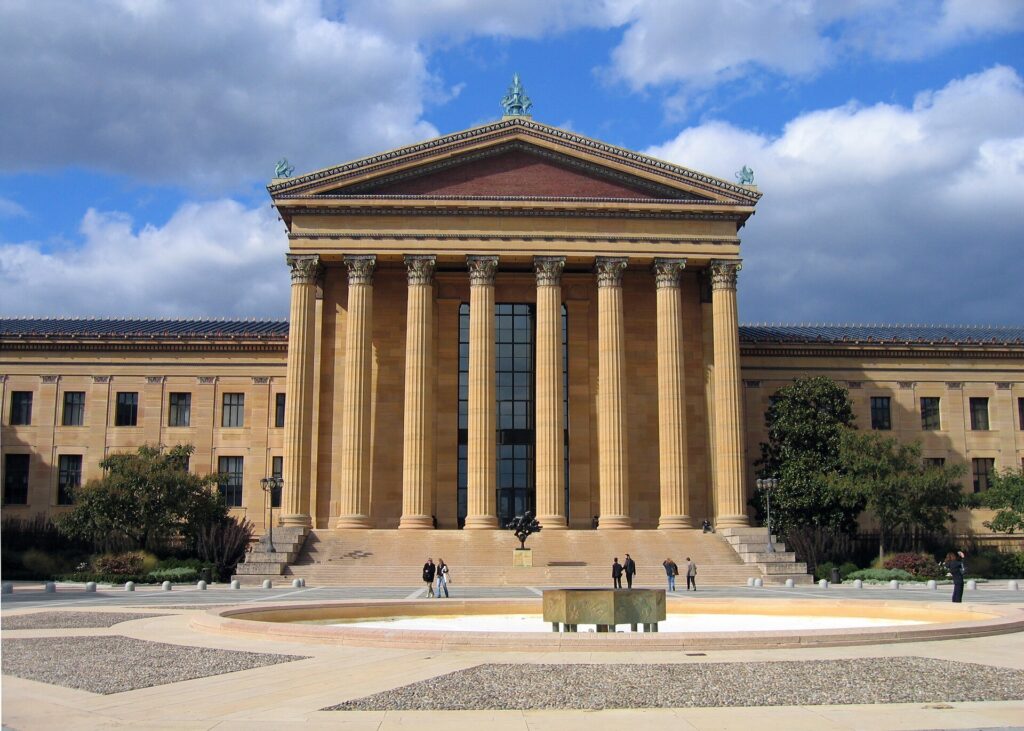
    When it does not

    • You are staying downtown, in Midtown, in the Museum District or near the Medical Center, and your plans are along the Red Line.
    • You are in town for a convention, a medical appointment in the Medical Center, or a Texans game or the rodeo at NRG Park, all of which are on the train.
    • You are visiting for a short city break and happy to use ride-hail for Montrose and the Heights.
    • You are traveling solo, and the rental, tolls, insurance and hotel parking add up to more than a handful of ride-hail trips.

    The hybrid plan for a city-plus-coast trip

    Go car-free for the city days and rent for the Space Center and Galveston, and think about where you pick up. If you fly into Hobby and are heading straight for the coast, renting at the airport makes sense: you are already on the south side, and the Space Center and Galveston are down I-45 without crossing the city. If you are spending the first nights in the Museum District or downtown, take a taxi or ride-hail in, use the Red Line for a few days, and rent from a city location for the days you need a car, which avoids the airport concession fees and several nights of hotel parking. If you are combining Houston with Dallas, a one-way rental between the two is usually available, though it may carry a drop fee; read our Dallas car-versus-transit guide for that end of the trip. Compare the day rates on our Houston car rental page against a full-trip rental and the difference is usually obvious.

    A worked cost comparison

    Numbers change with the season and the booking window, so treat this as a method rather than a quote, and check current rates before deciding. For a four-night city break in the Museum District for two people, the car-free version costs two ride-hail trips to and from the airport, a handful of METRO fares, and perhaps four short ride-hail trips to Montrose, the Heights and back; the rental version adds four days of a car, hotel parking, tolls and fees, fuel and airport concession charges. The car-free option wins easily. For the same four nights with a day at Space Center Houston and a day in Galveston, the car-free version adds two long ride-hail round trips or two tour tickets per person; the hybrid version adds a two-day rental from a city location, fuel, a little in tolls and parking at the Space Center and on the island. For two people the hybrid usually comes out ahead, and for a family of four it is clearly cheaper and far more flexible. For a week visiting family in the suburbs, or a business trip to the Energy Corridor, a rental for the whole stay is the only practical answer. Run the rental rates for your dates on our Houston car rental page and put them beside the ride-hail estimates before you choose.

    Driving to Galveston, Dallas and beyond in each season

    The two drives most visitors make are south to the coast and north to Dallas. Galveston is about an hour down I-45, past the NASA turnoff and across the causeway onto the island. Dallas is about 385 kilometers (240 miles) north on I-45, three and a half to four hours without traffic, past the Sam Houston statue at Huntsville and the giant Buc-ee’s travel center at Madisonville. In summer, the challenge is heat and weekend traffic: southbound to Galveston on Saturday mornings and northbound on Sunday afternoons, the freeway crawls, so leave early, and keep the tank well above a quarter on the long Dallas run. Summer is also hurricane season, and if a storm is approaching, the coast is the place not to be; watch the forecast and the DriveTexas road-conditions map. In fall, the weather is ideal and the coast is quieter after Labor Day, though football weekends fill the highways. In winter, the roads are usually clear, sea fog can settle over the causeway and the coast, and on the rare days of ice, when bridges and overpasses freeze first, the right call is to wait a day. In spring, thunderstorms bring blinding rain and street flooding, and a slow drive is a safe one. In every season, crossing Houston itself is usually the slowest part of the trip.

    Decision table

    Your tripRecommendationWhy
    City break in the Museum District, downtown or MidtownNo carThe Red Line links the main sights; hotel parking and tolls add up
    Convention, Medical Center visit or game at NRGNo carAll are on the Red Line, and event parking is expensive
    City plus Space Center Houston and GalvestonHybrid: rent for the coast daysCar-free city days, car for the southeast
    Flying into Hobby for the coastRent at the airportHobby is already on the south side, on the way to both
    Staying in Montrose or the HeightsNo car, or a short rentalWalkable neighborhoods; ride-hail fills the gaps
    Family visit to the suburbsRent for the whole staySuburban distances make the car worthwhile daily
    Business in the Energy Corridor or The WoodlandsRent at IAHBoth are freeway commutes far from the rail line
    Texas road tripRent (consider one-way to Dallas)Houston is the start, not the destination

    Money-saving tips for both options

    • On transit: use the free three-hour transfer window to link trains and buses on one fare, and pick a hotel within walking distance of a Red Line station.
    • On a rental: compare airport and city pickup, understand the toll program before you drive away, set your navigation to avoid tolls on short hops, decline extras you already have through a credit card or home policy (check first), and book early for rodeo season.
    • On the hotel: if you are renting, price the parking fee into the room rate, and look for hotels with free self-parking outside downtown.
    • On timing: avoid the freeways in the weekday peaks and I-45 to Galveston on summer Saturday mornings; the best time to fly to Houston guide lists the busiest weeks.
    • On the airport run: for two or more people, a taxi’s fixed zone fare or a ride-hail from Hobby is cheap; from IAH, compare it with the bus if you are traveling light.

    Frequently asked questions

    Is it worth renting a car in Houston?

    For Space Center Houston, Galveston, the suburbs or a road trip, yes. For a stay along the Red Line in the Museum District, downtown or Midtown, usually not.

    Is Houston public transit good for tourists?

    Good along the Red Line, which links downtown, the Museum District, Hermann Park, the Medical Center and NRG Park, and very cheap. Beyond that corridor, you will rely on buses, ride-hail or a car.

    How do I get from IAH to downtown Houston?

    A taxi at a fixed zone fare or a ride-hail in 30 to 45 minutes without traffic, or METRO’s local bus in about an hour for the standard fare.

    Can I get to Space Center Houston without a car?

    Yes, by ride-hail or on an organized tour, but there is no practical public transit option. With a car, you can add Kemah or Galveston the same day.

    Do I need an EZ TAG to drive in Houston?

    Not necessarily. Many toll roads are cashless, so a rental car’s toll program or a bill by mail will cover you, usually with a fee. Ask at the counter, or set your navigation to avoid tolls.

    Is driving in Houston difficult?

    The freeways are big, fast and busy, and rush hour is slow, but the roads are wide and well signed. Leave space, learn the frontage-road system, and never drive into floodwater.

    Is parking expensive in Houston?

    Downtown and hotel parking can be, especially on event nights. Malls generally offer free self-parking, and outside the core it is rarely a problem.

    Whichever way you go, start with the flight. Compare cheap flights to Houston, choose a neighborhood with our Houston hotel search, and if Space Center Houston or Galveston is on the list, price the rental for those dates on our Houston car rental page.

  • Things to Do in Houston: A First-Timer’s Guide

    Things to Do in Houston: A First-Timer’s Guide

    Houston has a reputation problem. People picture freeways, refineries and humidity, and many visitors fly in for a conference or a connection at IAH without ever seeing the city. The ones who stay find the fourth-largest city in the country and, by some measures, the most diverse: a museum district with around twenty institutions within walking distance of each other, the Menil Collection and the Rothko Chapel, NASA’s Mission Control, a bayou turned into one of the best urban parks in Texas, neighborhoods of bungalows, murals and taquerias, the biggest rodeo on earth every spring, and a food scene that runs from brisket and Tex-Mex to Viet-Cajun crawfish, Nigerian suya and Pakistani kebabs. The Gulf of Mexico is an hour away at Galveston. This guide covers the sights, the neighborhoods, the food, the rodeo and the sports, the day trips, and the practical details, including the heat, that turn a business trip into a proper visit.

    If you are still comparing cheap flights to Houston, read this alongside our guides to the best time to fly to Houston and whether you need a car. Between the three you can plan the whole trip.

    The downtown Houston skyline above Buffalo Bayou Park
    Downtown Houston from Buffalo Bayou Park, the 160-acre green corridor along the river where the city was founded (Photo: Michael Barera via Wikimedia Commons, CC BY-SA 4.0)

    Houston at a glance for first-timers

    • Airports: George Bush Intercontinental (IAH), about 37 km (23 miles) north of downtown, is the main international gateway and a major hub for United Airlines. William P. Hobby (HOU), about 11 km (7 miles) southeast of downtown, is a big Southwest Airlines base with domestic flights and some routes to Mexico and the Caribbean. See our guides to Bush Intercontinental (IAH) and Hobby (HOU).
    • Getting around: the METRORail Red Line links downtown, Midtown, the Museum District, Hermann Park, the Texas Medical Center and NRG Park. The metro area is vast, though, and most visitors rent a car for Space Center Houston and Galveston.
    • Money: US dollars. The combined sales tax in Houston is 8.25 percent, and hotel taxes add noticeably to a room rate. Tipping 18 to 20 percent in restaurants is expected.
    • Weather: short, mild winters, a warm and green spring, a long, hot and humid summer, and a pleasant fall. Hurricane season runs from June to November. Our month-by-month guide has the detail.
    • Where to stay: downtown for the Theater District, the ballpark and Discovery Green; the Museum District or Montrose for art, restaurants and the Red Line; the Galleria for shopping; the Heights for a neighborhood feel. Our Houston hotel search covers them all.

    Downtown: Discovery Green, the tunnels and the Theater District

    Discovery Green, a twelve-acre park opened in 2008 beside the George R. Brown Convention Center, gave the east side of downtown a front lawn, with a lake, splash fountains, free concerts and, in winter, an ice ribbon for skating. Below the streets runs the downtown tunnel system, roughly six miles of air-conditioned pedestrian passages lined with food courts and shops that link around 95 blocks of office towers; it is open on weekdays during business hours only. On the northwest side of downtown, the Theater District packs one of the largest concentrations of performing-arts seats in the country outside New York into a few blocks: Jones Hall for the Houston Symphony, the Wortham Theater Center for the Houston Grand Opera and the Houston Ballet, the Alley Theatre, and the Hobby Center for touring Broadway.

    Buffalo Bayou Park, the Cistern and the bats

    Houston was founded in 1836 on the banks of Buffalo Bayou, the slow river that winds through downtown to the Ship Channel, and after decades of neglect it is now the city’s best public space. Buffalo Bayou Park, about 160 acres along both banks between Shepherd Drive and downtown, has paved hike-and-bike trails, a skate park, a dog park, sculpture, gardens and some of the best skyline views in the city, especially at sunset from the Rosemont Bridge. Kayak rentals and boat tours run on the water. Inside the park, the Cistern, a 1926 underground drinking-water reservoir with a forest of more than two hundred concrete columns, has been reopened for guided tours and immersive art installations, and its echo is unforgettable; book ahead. At dusk from spring to fall, head to the Waugh Drive Bridge, where a colony of Mexican free-tailed bats, estimated at around a quarter of a million, pours out from under the bridge to feed.

    The Museum District and Hermann Park

    South of Midtown, the Museum District holds around twenty museums within about a mile and a half, most of them on or near the Red Line. The anchor is the Museum of Fine Arts, Houston, one of the largest art museums in the country, with three main gallery buildings, including a glass hall by Mies van der Rohe and the Kinder Building, opened in 2020 for modern and contemporary art. The Isamu Noguchi-designed Cullen Sculpture Garden across the street is free, and general admission to the museum is free one day a week; check the museum’s site for the current day. The Houston Museum of Natural Science is the other giant, with the Morian Hall of Paleontology, a dazzling hall of gems and minerals, a planetarium, and the Cockrell Butterfly Center, a three-story glass rainforest full of free-flying butterflies. Smaller stops include the free Contemporary Arts Museum Houston, the Holocaust Museum Houston and the Children’s Museum Houston.

    Beside the museums, Hermann Park is Houston’s Central Park: 445 acres of lawns, lakes and oaks. The Houston Zoo, one of the most visited in the country, fills the middle; the Japanese Garden is peaceful; paddle boats run on McGovern Lake; and the Miller Outdoor Theatre stages free concerts, plays and dance performances on summer and fall evenings. The vast Texas Medical Center, the largest medical complex in the world, rises just south.

    The Museum of Fine Arts, Houston in the Museum District
    The Museum of Fine Arts, Houston, the anchor of a Museum District of around twenty institutions (Photo: Michael Barera via Wikimedia Commons, CC BY-SA 4.0)

    The Menil Collection and the Rothko Chapel

    If you see one thing in Houston that you cannot see anywhere else, make it the Menil Collection. It is the private collection of Dominique and John de Menil, oil-industry philanthropists who gathered surrealist paintings by Magritte and Max Ernst, antiquities, Byzantine icons, and African and Pacific art, housed since 1987 in a low, light-filled building by Renzo Piano set among the gray bungalows of Montrose. Admission is free, and so is everything on the surrounding campus: the Cy Twombly Gallery, a Dan Flavin light installation at Richmond Hall, the Menil Drawing Institute, and lawns shaded by live oaks. Two blocks away, the Rothko Chapel, commissioned by the de Menils and opened in 1971, is an octagonal, nondenominational space holding fourteen dark canvases by Mark Rothko. For many visitors it is the most moving room in Texas. Outside, Barnett Newman’s steel Broken Obelisk stands in a reflecting pool, dedicated to Martin Luther King Jr. Allow a half-day for the whole campus.

    Space Center Houston

    About 40 km (25 miles) southeast of downtown, beside NASA’s Johnson Space Center at Clear Lake, Space Center Houston is the official visitor center and the city’s most famous attraction. “Houston” was the first word Neil Armstrong radioed back after Apollo 11 touched down. The essential experience is the tram tour onto the working NASA campus: depending on the day, it visits the restored Apollo-era Historic Mission Control, set up as it was during the Moon landings, the astronaut training facility, and Rocket Park, where one of the three remaining Saturn V moon rockets lies on its side in a hangar, 363 feet (110 meters) of it. Back at the center, Independence Plaza lets you walk through a space shuttle replica mounted on top of the original Boeing 747 shuttle carrier aircraft, and the galleries hold flown capsules, spacesuits and moon rocks brought back by the Apollo astronauts. Allow most of a day, buy tickets online, and arrive early for the tram. There is no rail link, so you will need a car, a ride-hail or a tour.

    The Saturn V moon rocket in Rocket Park at NASA's Johnson Space Center
    The Saturn V in Rocket Park, one of the stops on the Space Center Houston tram tour (Photo: Jim Evans via Wikimedia Commons, CC BY-SA 4.0)

    Neighborhoods worth a half-day

    Montrose

    West of the Museum District, Montrose is the city’s bohemian heart and the historic center of LGBTQ life in Houston: tree-lined streets of bungalows, vintage shops, bars, coffee shops and some of the city’s best restaurants along Westheimer Road. The Menil campus sits at its eastern edge. It is walkable and a good base; see our Montrose hotel guide.

    The Heights

    Northwest of downtown, the Heights was laid out in the 1890s as a separate town, and its Victorian houses and Craftsman bungalows now surround a lively strip of boutiques, antiques stores and restaurants on 19th Street. Heights Boulevard has a walking trail down its grassy esplanade, and weekend brunch here is an institution.

    EaDo and the East End

    East of downtown, EaDo (East Downtown) has gone from warehouses to murals, breweries and apartments, with Shell Energy Stadium, home of the Houston Dynamo and Houston Dash soccer teams, at its center. Beyond it, the East End along Navigation Boulevard and Harrisburg is the historic heart of Mexican-American Houston, with taquerias, panaderías, colorful murals and the restaurant widely credited with bringing fajitas to a mainstream audience in the 1970s. The METRORail Green Line runs through both.

    Third Ward

    South of downtown, the Third Ward is one of the historic centers of Black Houston, home to Texas Southern University and the University of Houston. Emancipation Park was bought in 1872 by formerly enslaved people to hold Juneteenth celebrations, and it still hosts them. Project Row Houses, an art project in a row of shotgun houses, is nationally admired.

    Uptown, the Galleria and River Oaks

    West of the Loop, Uptown is Houston’s second downtown, built around The Galleria, the largest shopping mall in Texas, with an ice rink under its glass roof. The free Gerald D. Hines Waterwall Park, a sixty-four-foot horseshoe of falling water beneath Williams Tower, is the neighborhood’s great free sight. Next door, River Oaks is the city’s grandest residential enclave.

    Chinatown and the Mahatma Gandhi District

    In southwest Houston, miles of Bellaire Boulevard form one of the largest Asian dining districts in the country, with Vietnamese, Chinese, Taiwanese and Korean restaurants, bakeries and crawfish houses in strip malls. Nearby, the Mahatma Gandhi District along Hillcroft Avenue has Indian and Pakistani restaurants and sweet shops. You will need a car or a ride-hail.

    More history and culture

    East of the city, the San Jacinto Battleground State Historic Site marks the spot where Sam Houston’s army defeated Santa Anna on April 21, 1836, winning Texas its independence in a battle that lasted about eighteen minutes. Its star-topped column is taller than the Washington Monument, with an observation deck at the top. The Orange Show Monument, a folk-art maze built by a postman, and the Beer Can House, clad in flattened cans, are the most delightful oddities in the city; the same organization runs the Art Car Parade every spring. Bayou Bend, the Museum of Fine Arts’ American decorative arts in a River Oaks mansion and gardens, is a lovely morning. In the west, Memorial Park, nearly twice the size of New York’s Central Park, has forest trails and the Houston Arboretum. For concerts, shows and games during your dates, our Houston events page lists what is on.

    The Houston Livestock Show and Rodeo

    For about three weeks from late February into March, the Houston Livestock Show and Rodeo takes over NRG Park, and it is billed as the largest livestock exhibition and rodeo in the world. It opens with the World’s Championship Bar-B-Que Contest, when hundreds of teams smoke brisket on the grounds, and with trail riders who ride into the city on horseback from across Texas. Then come the livestock shows and auctions, a carnival, a vast shopping hall, a wine competition, and, every night in NRG Stadium, a professional rodeo followed by a concert from a major country, pop, Latin or hip-hop star. Locals dress in boots and hats all month, and the proceeds fund scholarships across Texas. Take the METRORail Red Line to the NRG Park stations rather than driving, buy concert tickets early for the big names, and book your hotel before your flight if your dates overlap with it.

    Sports

    The Houston Astros, World Series champions in 2017 and 2022, play at Daikin Park downtown, under a retractable roof that makes July baseball bearable. The Houston Rockets play basketball at the Toyota Center, a few blocks away. The Houston Texans play NFL football at NRG Stadium, also roofed, which hosted matches of the 2026 World Cup and has hosted two Super Bowls. The Dynamo in MLS and the Dash in the NWSL play at Shell Energy Stadium in EaDo. The Red Line serves NRG Park and downtown, so you rarely need to drive to a game. Check what is on sale in Houston for your dates before you book flights.

    What to eat, and where

    Houston is one of the great eating cities in America, thanks to immigrants from Mexico, Vietnam, China, India, Pakistan, Nigeria, El Salvador and dozens of other countries. Start with Tex-Mex and fajitas, which Houston helped put on menus nationwide, and with breakfast tacos and kolaches, the Czech-Texan pastries sold at shops across the city. Then barbecue: Houston’s pitmasters now rank among the best in the state, with lines out the door at weekends. Houston’s signature crossover is Viet-Cajun crawfish, boiled and tossed in garlic butter and spices, at its best from roughly February to May. Gulf oysters, shrimp and red snapper appear on menus everywhere. Beyond that, eat pho on Bellaire Boulevard, biryani on Hillcroft, suya in the southwest, and steak in the Galleria. Montrose, the Heights and Midtown have the chef-driven restaurants.

    Houston through the seasons

    Spring (March to May) is the favorite season: azaleas in River Oaks, bluebonnets along the highways outside the city, the rodeo, patio season, and warm, green days before the summer heat; it is also the start of the storm season, so watch the forecast. Summer (June to September) is long, hot and very humid, with the heat index regularly above 100 °F (38 °C) and afternoon thunderstorms; plan museums by day and the bayou at dawn or dusk. It is also hurricane season, which runs from June to November and peaks from mid-August to early October; most years pass without a direct hit, but travelers should keep an eye on forecasts from the National Hurricane Center. Fall (October to November) brings relief, with warm, clear days, football and patio season again. Winter (December to February) is short and mostly mild, with holiday lights, ice skating at Discovery Green and the Houston Marathon in January, though an occasional hard freeze can close roads for a day. Our month-by-month guide has the fare patterns that go with each season.

    Houston with kids

    Houston is an excellent city for children, partly because so much of it is air-conditioned. Space Center Houston is the obvious highlight. The Children’s Museum Houston, the Houston Museum of Natural Science with its dinosaurs and butterflies, and the Houston Zoo fill a day in the Museum District, and the Hermann Park railroad and paddle boats are next door. Discovery Green’s splash fountains and playground are free, and so are the Miller Outdoor Theatre’s summer shows. At Brazos Bend State Park, an hour southwest, children can watch alligators basking beside the lakes from a safe distance. For families renting a vehicle, our family car rental guide covers the choices.

    Houston on a budget

    A surprising amount of the best of Houston is free. The Menil Collection, the Rothko Chapel, the Cy Twombly Gallery, the Contemporary Arts Museum and the Museum of Fine Arts on its free day cost nothing, and neither do Buffalo Bayou Park, the bats, Hermann Park, the Waterwall, Discovery Green, the Miller Outdoor Theatre and the murals of EaDo. METRO’s local fare is one of the cheapest of any big American transit system, and transfers within a few hours are free. Space Center Houston and the zoo are the expensive days. Eat well for less on Bellaire Boulevard and Hillcroft, at the taquerias of the East End, and at the barbecue joints. Business-driven downtown and Galleria hotels often drop their rates on weekends. Compare rates by neighborhood on our Houston hotel search.

    Day trips from Houston

    Galveston, about 80 km (50 miles) southeast on I-45, is the essential side trip: a barrier island with beaches along the long seawall built after the 1900 Storm, still the deadliest natural disaster in American history. The Strand Historic District has cast-iron Victorian storefronts, and the East End has some of the finest Victorian houses in Texas. Galveston is also where the Union Army read the order announcing the end of slavery in Texas on June 19, 1865, the origin of Juneteenth, and today it is one of the country’s busiest cruise ports. Visit Galveston has the details. Space Center Houston and the Kemah Boardwalk are on the way. Brazos Bend State Park, about an hour southwest, has alligators, wetland birds and an observatory. For longer trips, Austin is about three hours west and San Antonio a little farther, and Dallas is about four hours north on I-45; our Dallas to Houston driving guide covers the route, and our guide to things to do in Dallas covers the city. Most of these trips need a car; compare rates on our Houston car rental page.

    Victorian storefronts in the Strand Historic District in Galveston
    The Strand in Galveston, an hour southeast of Houston on the Gulf of Mexico (Photo: Michael Barera via Wikimedia Commons, CC BY-SA 4.0)

    Two sample itineraries

    Two days, no car

    Day one: the Museum of Fine Arts or the Museum of Natural Science in the morning, a walk through Hermann Park, lunch in Montrose, the Menil Collection and the Rothko Chapel in the afternoon, and dinner on Westheimer Road. Day two: Discovery Green and the Theater District in the morning, a walk or kayak along Buffalo Bayou Park and a tour of the Cistern, the bats at the Waugh Drive Bridge at dusk, and an Astros or Rockets game or a show at night.

    Four days, with Space Center Houston and Galveston

    Add a day for the Heights, the East End and dinner on Bellaire Boulevard, then pick up a car and spend a full day at Space Center Houston, then a final day in Galveston, returning the car at Hobby or IAH on the way home.

    Practical details

    • Transit: pay for METRO with a METRO Q fare card or the METRO Q Mobile Ticketing app; a single fare includes free transfers for a few hours. METRO has maps and service alerts; our transit-versus-car guide goes into detail.
    • From the airports: taxis, ride-hail and rentals serve both; METRO buses also link each airport with downtown, slowly but cheaply. The Houston Airport System’s site covers ground transport at IAH and Hobby.
    • Weather: light, breathable clothes, sun protection and water from May to October, an umbrella year-round, and a light jacket for air-conditioned interiors and winter cold fronts. The National Weather Service’s Houston/Galveston office issues the heat, flood and storm warnings worth heeding; never drive into floodwater.
    • Time zone: Central, one hour behind New York and the same as Dallas and Chicago.
    • Entry requirements: visitors from Visa Waiver Program countries need an approved ESTA before boarding; most others need a visa. The State Department’s travel site is the authoritative source.
    • Tourist information: Visit Houston, the official tourism office, has current events and neighborhood guides.

    Frequently asked questions

    How many days do you need in Houston?

    Two full days covers the Museum District, the Menil and the Rothko Chapel, Buffalo Bayou and downtown; add a third for Space Center Houston and a fourth for Galveston.

    What is the number one thing to do in Houston?

    Space Center Houston and its tram tour to Mission Control. For art lovers, the Menil Collection and the Rothko Chapel.

    Is Houston walkable?

    Downtown, Midtown, the Museum District, Montrose and the Heights are walkable in themselves, and the Red Line connects several of them. The city as a whole is built around the car, and summer heat makes long midday walks hard going.

    Do I need a car in Houston?

    Not for the Museum District, Montrose and downtown. For Space Center Houston, Galveston, Chinatown and most of the suburbs, yes; rent it only for the days you need it.

    When is hurricane season in Houston?

    June 1 to November 30, with the greatest risk from mid-August to early October. Most visits are unaffected, but watch the forecast in those months and consider flexible bookings.

    What is Houston known for?

    NASA and Mission Control, the energy industry, the Texas Medical Center, the rodeo, one of the most diverse populations in the country, and a food scene to match.

    Ready to go? Compare flights to Houston, find a place to stay with our Houston hotel search, and if Space Center Houston or Galveston is on the list, price a rental car for those days.

  • Best Time to Fly to Houston: Seasons, Weather & Prices

    Best Time to Fly to Houston: Seasons, Weather & Prices

    Houston is a business city first, and its airfares show it. Two big airports, a United Airlines hub at Bush Intercontinental and a large Southwest Airlines operation at Hobby, compete for the traffic of the energy industry, the Texas Medical Center and one of the busiest convention calendars in the country, which keeps weekday flights full all year. Leisure demand layers on top: the rodeo in late February and March, spring break, the holidays, and the cruise passengers heading for Galveston. The weather adds its own twist. Houston’s winters are mild and its springs and falls are lovely, but its summers are long, hot and humid, and the city sits in the path of Gulf of Mexico hurricanes from June to November, which is exactly why late summer brings some of the lowest hotel rates of the year. This guide walks through the weather month by month, the fare seasons, the events that move prices, and how to choose between IAH and Hobby.

    The short answer

    For weather, the best windows are mid-October to early December and March to April, when days are warm, the humidity eases and the city lives outdoors. For value, late August and September and January after the holidays are usually the cheapest times to fly and to book a room, though late summer is hot and falls in the most active part of hurricane season. The most expensive stretches are rodeo season and spring break, from late February to mid-March, the week of the Offshore Technology Conference in early May, when the energy industry fills every hotel in the city, Thanksgiving, and the Christmas and New Year weeks. Whatever you choose, run a flexible-date search that includes both airports on our Houston flights page; a shift of a few days around the rodeo or a big convention can change the fare band entirely.

    A rodeo performance inside NRG Stadium (formerly Reliant Stadium) during the Houston Livestock Show and Rodeo
    The Houston Livestock Show and Rodeo, about three weeks from late February that fill hotels across the city (Photo: No machine-readable author provided. W0lfie assumed (based on copyright claims). via Wikimedia Commons, CC BY-SA 2.5)

    Houston’s weather, season by season

    Houston sits on the flat coastal plain about 80 kilometers (50 miles) from the Gulf of Mexico, and the Gulf defines its climate: warm, moist air for most of the year, heavy rain that can fall in any month, long humid summers, and short winters broken by cold fronts from the north. The figures below are approximate seasonal patterns based on the long-term climate normals for Bush Intercontinental from NOAA’s National Weather Service Houston/Galveston office; check the current forecast before you pack, because a Gulf downpour or a winter front can change the day in an hour.

    MonthTypical daytime highTypical overnight lowWhat it feels likeFare pressure
    Januaryaround 17 °C (63 °F)around 6 °C (43 °F)Mild and changeable; gray, damp days and occasional cold fronts; hard freezes are rareLow after New Year’s week
    Februaryaround 19 °C (67 °F)around 8 °C (47 °F)Mild, with the first azaleas late in the monthLow, rising sharply once the rodeo opens
    Marcharound 23 °C (74 °F)around 12 °C (53 °F)Warm and green; azaleas and bluebonnets; thunderstorms beginHigh: rodeo and spring break
    Aprilaround 27 °C (80 °F)around 16 °C (60 °F)Warm and pleasant, with the risk of severe storms and heavy rainModerate; Easter weekend busier
    Mayaround 31 °C (87 °F)around 20 °C (68 °F)Hot and increasingly humid; downpours can flood streetsModerate, with a sharp spike for the Offshore Technology Conference
    Junearound 33 °C (92 °F)around 23 °C (74 °F)Hot and sticky, with afternoon storms; hurricane season beginsModerate to high for flights, soft for hotels
    Julyaround 35 °C (95 °F)around 24 °C (75 °F)Hottest and most humid; heat index often above 38 °C (100 °F)Moderate; hotels at their cheapest
    Augustaround 35 °C (95 °F)around 24 °C (75 °F)Just as hot; tropical storm risk risingLow to moderate
    Septemberaround 32 °C (90 °F)around 21 °C (70 °F)Still hot and humid; the heart of hurricane seasonLow
    Octoberaround 28 °C (82 °F)around 16 °C (61 °F)Relief arrives with the first real fronts; often the best monthModerate; conventions and playoff baseball can lift it
    Novemberaround 22 °C (72 °F)around 11 °C (51 °F)Mild, dry and sunnyModerate, with a Thanksgiving spike
    Decemberaround 18 °C (64 °F)around 7 °C (45 °F)Mild, sometimes gray; cold fronts bring brief chillsLow until mid-month, then peak

    Three things the table cannot show. First, the humidity: from May to September the air is heavy with Gulf moisture, mornings are muggy even before sunrise, and the heat index, which combines temperature and humidity, is what you will actually feel. The National Weather Service issues heat advisories most summers; take them seriously, drink water and plan outdoor sightseeing for early morning or evening. Second, the rain: Houston receives around 50 inches (about 1,270 mm) a year, spread across every month, and it often arrives in short, intense downpours that can flood underpasses and low streets within an hour. Never drive into water on the road. Third, the hurricane season, which the next section covers in more detail.

    Hurricane season, in perspective

    The Atlantic hurricane season officially runs from June 1 to November 30, and the greatest risk to the Texas coast is from mid-August to early October. Most years pass without a direct hit on Houston, and most summer trips go ahead without a second thought, but the city has been struck hard in the past: Hurricane Harvey brought catastrophic flooding in 2017, and Hurricane Beryl knocked out power across much of the region in July 2024. The practical advice is simple. If you are booking for August through October, choose fares and hotels with flexible change policies or consider travel insurance that covers named storms, watch the outlooks from NOAA’s National Hurricane Center in the week before you travel, and remember that storms are tracked for days before they arrive, so airlines usually issue travel waivers well in advance.

    How Houston’s fare seasons work

    Three calendars drive seats into Houston. The first is business: the energy industry, the Medical Center, NASA contractors and the port keep Monday-morning and Thursday-evening flights full in every season, and big conventions at the George R. Brown Convention Center and NRG Park can fill downtown hotels without warning. The second is leisure, concentrated in rodeo season, spring break, the holidays and the cruise season out of Galveston. The third is the weather, which pushes visitors away in late summer and pulls them back in the fall. Because Houston is served by two large airports with different main airlines, competition on popular routes is strong, and a fare that looks high at one airport is often lower at the other.

    Peak season

    Late February to mid-March, for the Houston Livestock Show and Rodeo and spring break; the week of the Offshore Technology Conference in early May; Thanksgiving week; and the Christmas and New Year fortnight, from roughly the third week of December to the first days of January. During the rodeo, hotels near NRG Park and downtown fill for the big concert nights, and Texas school spring break, usually in the middle two weeks of March, adds families flying in and out. OTC week is the single sharpest hotel spike for business travelers. In summer, flights stay reasonably busy because Houstonians are flying out on vacation, but hotels in the city are soft.

    Shoulder season

    April to May outside OTC week, and October to early December outside Thanksgiving. These are the months with the most comfortable weather and moderate prices; October and November in particular are the local favorites. Watch Easter, Memorial Day, the Astros’ October playoff runs, and big home football weekends.

    Low season

    January after New Year’s week and early February, and late August through September. January is mild and quiet, apart from Houston Marathon weekend in mid-January. Late summer is hot, humid and in the heart of hurricane season, and it is when downtown and Galleria hotels discount most heavily; if you can handle the heat and book flexibly, it is excellent value.

    As elsewhere, mid-week departures and early or late flights usually price below Friday and Sunday afternoons on the same route, and a search across a whole month reveals cheaper pairs of dates close to your first choice. Our guide to the best times to book explains how to read those patterns.

    Houston month by month

    January

    Mild and changeable, with highs in the 60s °F and the occasional cold front that makes a jacket necessary for a day or two. After New Year’s week it is one of the cheapest months to fly and to stay, and it is a comfortable time for Space Center Houston, the museums and the bayou. The Houston Marathon in mid-January fills downtown hotels for one weekend. Hard freezes are rare but do happen; when they do, the city is not built for ice and roads can close for a day.

    February

    Mild, with azaleas starting to bloom by the end of the month. Fares stay low through the first half, then climb when the Houston Livestock Show and Rodeo opens in late February with its barbecue contest and trail rides. Mardi Gras is celebrated on Galveston Island in the weeks before Lent, and it fills the island’s hotels on its weekends.

    March

    Warm, green and beautiful, with azaleas in River Oaks and bluebonnets along the highways outside the city. It is also the busiest leisure month of the year: the rodeo runs into mid-March with a concert every night, and Texas school spring break, usually in the middle of the month, adds family travel. Book early, and compare IAH and Hobby.

    April

    One of the best months to visit, warm and pleasant before the humidity builds, with patio season in full swing and the Art Car Parade bringing hundreds of decorated vehicles to the streets. Spring storms can be severe, with hail and heavy rain, so keep an eye on the forecast. Fares are moderate apart from Easter weekend.

    May

    Hot and increasingly humid, with the chance of heavy rain. The Offshore Technology Conference at NRG Park in early May draws tens of thousands of energy-industry visitors, and hotel rates across the city jump that week; check the dates before you book. Memorial Day weekend is busy on the roads to Galveston. Otherwise, fares are moderate.

    June

    Summer arrives in earnest, and hurricane season begins on June 1. Afternoon thunderstorms are frequent. Juneteenth on June 19 is celebrated in Emancipation Park and in Galveston, where the holiday began, and Houston’s Pride celebrations take place during the month. Flights are busy with summer travelers, but city hotels start to soften.

    July

    The hottest, most humid month, with the heat index often above 100 °F (38 °C). The Fourth of July brings fireworks downtown, and the rest of the month is for air-conditioned museums, roofed baseball at Daikin Park, and early-morning or evening outings. Hotels are at their cheapest of the year, and fares ease after the holiday.

    August

    Just as hot, with rising tropical storm risk. Houston Restaurant Weeks, when many of the city’s restaurants offer fixed-price menus for charity, run through the month and into early September. Families head back to school in mid-August, and fares and hotel rates fall. Book flexibly.

    September

    Still hot and humid, and the peak of hurricane season. It is usually the cheapest month of the year for flights and hotels, and most years it passes without incident, but watch the forecasts in the days before you travel and avoid non-refundable bookings where you can. Labor Day weekend is busy on the roads to the coast.

    October

    Relief. The first real cold fronts arrive, the humidity drops, and the city moves back outdoors. It is often the best month of the year to visit. Fares are moderate, though large conventions and an Astros playoff run can tighten hotels on particular weeks, and the Texas Renaissance Festival draws weekend crowds northwest of the city through the fall.

    November

    Mild, dry and sunny, with comfortable days for Galveston, the bayou and outdoor dining. Fares are moderate until Thanksgiving, when the week’s flights are among the most expensive of the year; the city’s Thanksgiving parade runs downtown that morning. The week after Thanksgiving is a good-value window.

    December

    Mild, with occasional gray days and short cold snaps. The first half of the month is quiet and reasonably priced, with holiday lights across the city and ice skating at Discovery Green. From around the third week of the month, fares jump for the Christmas and New Year weeks as Houstonians fly home and visitors arrive.

    The pond in Hermann Park, Houston
    Hermann Park in spring, the season when Houston is at its greenest and most comfortable (Photo: Yinan Chen via Wikimedia Commons, Public Domain)

    Events that move Houston flight and hotel prices

    Cross-check these against your dates before you book. Exact dates shift each year; Visit Houston keeps the current calendar.

    • Houston Marathon (a Sunday in mid-January): fills downtown hotels for one weekend.
    • Houston Livestock Show and Rodeo (about three weeks from late February into March): the city’s biggest leisure event; the rodeo’s site has dates and the concert lineup.
    • Texas spring break (usually mid-March, varies by school district).
    • Offshore Technology Conference (early May): the sharpest business-hotel spike of the year.
    • Juneteenth (June 19) and Houston Pride (June).
    • Fourth of July, Memorial Day and Labor Day weekends, when Galveston and the coast fill up.
    • Hurricane season (June to November, peaking from mid-August to early October): low prices, higher risk.
    • Thanksgiving and Christmas to New Year.
    • Astros playoff runs, Texans home games, and stadium concerts. Our Houston events page shows what is on sale for your dates.
    • Big conventions, which can fill downtown hotels on weeknights; if your mid-week rates look strangely high, that is usually why.

    Getting in from the airport

    Houston has two commercial airports, both run by the Houston Airport System. George Bush Intercontinental (IAH), about 37 kilometers (23 miles) north of downtown, is the larger: a major United Airlines hub with nonstop flights across the United States and to dozens of cities in Latin America, Europe, Asia and the Middle East, and several terminals linked by an airside train. The drive downtown takes 30 to 45 minutes without traffic and closer to an hour at rush hour; taxis and ride-hail pick up outside every terminal, a shuttle bus runs to the consolidated rental car center, and METRO’s local bus service to downtown is cheap but slow. William P. Hobby (HOU), about 11 kilometers (7 miles) southeast of downtown, is dominated by Southwest Airlines, has a compact terminal with an international concourse for flights to Mexico, Central America and the Caribbean, and is 20 to 30 minutes from downtown by car. Hobby is also the closer airport for Space Center Houston and Galveston. Our guides to IAH and Hobby cover the layouts, and our Houston car-versus-transit guide works through whether to rent.

    George Bush Intercontinental Airport (IAH) in Houston
    Bush Intercontinental (IAH), a major United Airlines hub and Houston's main international gateway (Photo: Famartin via Wikimedia Commons, CC BY-SA 4.0)

    Timing tricks that work for Houston

    • Search both airports. United dominates IAH and Southwest dominates Hobby, and the cheaper airport changes from route to route and week to week. A calendar search on TicketScanner that includes both shows the difference instantly.
    • Book the hotel first for the rodeo and OTC. A cheap fare is not cheap once the room is added. Run a Houston hotel search for the same dates before you commit to either.
    • Fly mid-week, stay the weekend. Business traffic makes Monday morning and Thursday evening the priciest flights on most routes, while downtown and Galleria hotels often discount Friday and Saturday nights.
    • Book flexibly in late summer. August and September are the cheapest months, and a refundable fare or a flexible hotel rate costs little extra insurance against a tropical storm.
    • Pair Houston with Dallas. The two cities are about four hours apart on I-45, and fares into Dallas sometimes undercut Houston; a one-way rental makes a classic Texas trip. Our guide to the best time to fly to Dallas covers that end.
    • Allow time at IAH. Security and immigration lines can be long at peak times; our guide to how early to arrive covers what to allow.
    • Flying out of Houston instead? The same seasonality applies in reverse; see cheap flights from Houston.
    The lake at Discovery Green in downtown Houston, with the George R. Brown Convention Center behind
    Discovery Green, downtown Houston's front lawn, busiest from October to April when the heat eases (Photo: Another Believer via Wikimedia Commons, CC BY-SA 3.0)

    What to pack, by season

    Summer (June to September): the lightest, most breathable clothes you own, a hat, sunscreen, a refillable water bottle, a compact umbrella for the afternoon storms, and a light layer for the fierce air-conditioning indoors. Spring and fall (March to May, October to November): light clothes for warm days, a light jacket for the evenings and the odd cold front, and rain gear. Winter (December to February): layers and a medium jacket; most days are mild, but a front can drop the temperature sharply overnight. In every season, comfortable shoes for the museums and something smarter for Houston’s restaurants, which dress up more than visitors expect.

    The best time to fly to Houston for…

    The rodeo

    Late February to mid-March, booked as early as you can manage, with the hotel first and concert tickets bought when the lineup is announced.

    Space Center Houston and Galveston

    April to May or October to November, when the weather is warm enough for the beach but not punishing, and the Space Center’s tram lines are shorter than in the summer holidays.

    The best weather

    Mid-October to early December and March to April. Days are warm, evenings are comfortable, and the humidity is manageable.

    The lowest fares

    Late August and September, and January after the holidays. For late summer, book flexibly and keep an eye on the tropical forecast.

    Families

    Spring break is busy but ideal for the Space Center and the museums; the week after Thanksgiving and late October are calmer. In summer, lean on the indoor attractions and plan Galveston for the morning.

    International visitors

    Visitors from Visa Waiver Program countries need an approved ESTA before boarding; most others need a visa. The State Department’s travel site explains what applies to you, and the TSA lists what you can carry through security. IAH handles most long-haul arrivals, so allow time for immigration and customs.

    Frequently asked questions

    What is the cheapest month to fly to Houston?

    September is usually the lowest, followed by late August and January after New Year’s week. Early December before the holiday rush is also good value.

    What is the best month to visit Houston for weather?

    October and November, with March and April close behind. Summer is hot and humid; winter is mild but can be gray.

    Should I avoid Houston during hurricane season?

    Not necessarily. The season runs from June to November and most visits are unaffected, but from mid-August to early October book flexibly, consider travel insurance, and check the National Hurricane Center’s outlook before you go.

    How hot does Houston get in summer?

    Highs are typically in the mid-90s °F (about 35 °C) in July and August, and the humidity pushes the heat index above 100 °F (38 °C) on many days.

    Should I fly into IAH or Hobby?

    Compare both. IAH has far more international flights and is the United hub; Hobby is closer to downtown, the Space Center and Galveston, and is Southwest’s base.

    How far ahead should I book?

    Earlier for the rodeo, spring break, OTC week, Thanksgiving and Christmas, when fares tend only to rise; for late summer and January, finding the right dates matters more than booking early.

    Does it snow in Houston?

    Very rarely. Measurable snow falls only once every few years at most, but hard freezes do happen occasionally in winter, and the city is not equipped for ice when they do.

    Ready to pick your dates? Compare fares across the whole month on our Houston flights page, then find a room with our Houston hotel search. For what to do when you land, start with our first-timer’s guide to Houston.

  • San Francisco: Should You Rent a Car or Rely on Public Transit?

    San Francisco: Should You Rent a Car or Rely on Public Transit?

    San Francisco is one of the few American cities where the honest answer to “should I rent a car?” is, for most visitors, no. The city is small, about 11 km (7 miles) across, dense and walkable, and its transit network, a mix of buses, light rail, historic streetcars, cable cars, BART and ferries, reaches nearly every sight a visitor wants to see. Driving, by contrast, means steep hills, one-way grids, expensive and scarce parking, bridge tolls and, at the tourist viewpoints, a well-documented problem with car break-ins. But the Bay Area is much bigger than the city, and the places that draw many visitors beyond it, the redwoods at Muir Woods, the wine country of Napa and Sonoma, the Monterey coast and Big Sur, Yosemite and the long drive south to Los Angeles, are far easier with a car. This guide explains how the city is laid out, how transit and fares work, what driving and parking are really like, when a car earns its keep, and gives you a straightforward way to decide.

    The short answer

    Skip the car for the days you spend in San Francisco itself. If your plans are the Golden Gate Bridge, Alcatraz, Fisherman’s Wharf, Chinatown, North Beach, Golden Gate Park and the Mission, Muni, the cable cars, BART and your own feet will cover them, and you will save the nightly hotel parking fee and the worry of leaving a car on the street. Rent a car for the days you leave the city: wine country, the coast, Point Reyes, Monterey and Big Sur, Yosemite, or a one-way drive to Los Angeles. Rent for the whole stay only if you are staying with family in the suburbs, working in Silicon Valley, or traveling with small children and a lot of gear to places transit does not reach. For most visitors, the right plan is a car-free city stay followed by a rental on the day you leave town. Compare rental rates for any of these plans on our San Francisco car rental page.

    How San Francisco is laid out

    San Francisco occupies the tip of a peninsula, with the Pacific on the west, the bay on the north and east, and the Golden Gate Bridge leading north to Marin County. Market Street is the main diagonal spine, running from the Ferry Building on the waterfront southwest toward Twin Peaks, and most transit runs along or under it. North of Market are the Financial District, Union Square, Chinatown, Nob Hill, North Beach and, on the northern waterfront, Fisherman’s Wharf and the Marina; south of Market are SoMa, the convention center, the ballpark, Mission Bay, and then the Mission and the Castro. The western half of the city, the Richmond and the Sunset, is a grid of residential streets that runs out to Ocean Beach, with Golden Gate Park between them and the Presidio at the northern end. The eastern half is compact enough to walk, if you accept the hills; the western half is best reached by Muni.

    Hotels cluster around Union Square, in the Financial District and SoMa, along the Embarcadero, and at Fisherman’s Wharf, with smaller properties in Nob Hill, North Beach and the Marina. Our San Francisco hotel search lets you compare them, and it is worth checking each hotel’s parking fee if you do plan to drive, because it can add a large sum to every night of the stay.

    Getting in from the airport

    San Francisco International (SFO) is about 21 km (13 miles) south of downtown, in San Mateo County. BART runs from its own station at the International Terminal straight to the downtown stations under Market Street in about 30 minutes, for a distance-based fare that includes an airport surcharge; it is usually the fastest option at rush hour. The free AirTrain links all the terminals, the BART station and the rental car center, where every major company has its counters. Taxis and ride-hail pick up from designated zones on the arrivals level, and the drive downtown on US-101 takes 25 to 45 minutes depending on traffic. If you are flying into Oakland (OAK) instead, a BART connector links the airport to the main network. Check the airport’s site for current ground-transport details; our SFO airport guide covers the layout.

    A historic F-line streetcar running along the Embarcadero in San Francisco
    The F line: historic streetcars from the Castro to Fisherman's Wharf, for the standard Muni fare (Photo: Grendelkhan via Wikimedia Commons, CC BY-SA 4.0)

    San Francisco’s transit, explained

    Transit in San Francisco is a patchwork of agencies that works better than its reputation. Within the city, Muni, run by SFMTA, operates the buses, the light rail, the historic streetcars and the cable cars. BART is the regional rapid-transit system connecting the city to the airport and the East Bay, Caltrain runs down the peninsula to Silicon Valley, and several ferry operators cross the bay. One card, Clipper, works across all of them.

    Muni buses and light rail

    Muni’s buses and electric trolleybuses cover virtually every street in the city, and the busiest routes, such as the 38R on Geary to the Richmond and the 14R on Mission Street, run every few minutes. Muni Metro light rail runs underground beneath Market Street, sharing four downtown stations with BART (Embarcadero, Montgomery, Powell and Civic Center), and then fans out to the Castro, the Sunset, Ocean Beach and the ballpark. The Central Subway, which opened in 2022, extends the T line under Union Square to Chinatown. Several routes run all night on an owl schedule.

    Historic streetcars

    The F line runs restored streetcars from cities around the world along Market Street from the Castro to the Ferry Building, and then along the Embarcadero to Fisherman’s Wharf. It is a practical way to reach the Wharf and a sightseeing ride in itself, and it charges the standard Muni fare.

    Cable cars

    Three lines survive: the Powell-Hyde and Powell-Mason lines from Union Square over Nob Hill to the Wharf area, and the California Street line from the Financial District over Nob Hill. They are genuine public transit, but slow, with a separate, higher single fare that does not include transfers; most visitors ride them once or twice for the experience, which the Visitor Passport covers.

    BART and Caltrain

    BART is the fastest way to the airport, the Mission (16th Street and 24th Street stations), Oakland and Berkeley, but it runs only along the Market Street and Mission corridor within the city and does not serve the Wharf, the Presidio or Golden Gate Park. Caltrain, whose electrified trains leave from Fourth and King streets near the ballpark, runs down the peninsula to Palo Alto and San José.

    Fares and tickets

    Use a Clipper card, which you can buy at stations or add to the wallet on your phone, or the MuniMobile app for Muni tickets. A Muni fare includes transfers to other Muni buses and trains for a set period, generally two hours; the cable cars are priced separately. The Muni Visitor Passport, sold for one, three or seven consecutive days, covers unlimited rides on buses, light rail, streetcars and cable cars, and is the best deal for most sightseers. BART and Caltrain charge by distance. Children and teenagers have ridden Muni free under the city’s youth program; check SFMTA’s site for current fares and rules before you go.

    Accessibility

    Muni buses are low-floor or lift-equipped, the underground Muni Metro and BART stations have elevators, and Muni’s accessible-services pages describe the stops that work for wheelchairs. The cable cars and the steepest hills are the exception; for those, the buses that run parallel routes are the accessible alternative.

    Beyond Muni and BART

    • Walking. The northeastern quarter of the city, from the Ferry Building through Chinatown and North Beach to the Wharf, is walkable in an afternoon. The hills are real, so plan routes that go around them, or take the cable car up and walk down.
    • Ferries. Golden Gate Ferry runs from the Ferry Building to Sausalito and Larkspur, San Francisco Bay Ferry to Oakland, Alameda and Vallejo, and other operators from Pier 41 to Sausalito and Tiburon. The ferry to Sausalito is the easiest way to see the bay, the bridge and Alcatraz from the water. The Alcatraz boat leaves from Pier 33.
    • Bikes and scooters. Bay Wheels bike share, including e-bikes, has docks across the eastern half of the city. The flat waterfront from the Ferry Building to the Golden Gate Bridge, the car-free stretch of Golden Gate Park and the ride across the bridge to Sausalito are excellent; the hills elsewhere are best left to e-bikes.
    • Taxis, ride-hail and robotaxis. Uber, Lyft and licensed taxis operate everywhere, and driverless Waymo cars run as a ride-hail service across the city, which many visitors try once for the novelty. For a group of three or four, a short ride is competitive with transit fares.
    • Regional buses. Golden Gate Transit buses cross the bridge to Marin, and on busy weekends a seasonal shuttle serves Muir Woods, where reservations are required for parking and the shuttle; the park’s site explains the system.
    The Golden Gate Bridge seen from a ferry on San Francisco Bay
    The bay from a ferry deck, the easiest car-free way to Sausalito (Photo: Missvain via Wikimedia Commons, CC0)

    Driving in San Francisco: what it is really like

    Driving in San Francisco is manageable but rarely pleasant for visitors. The hills are the first surprise: some streets are steep enough that you cannot see the road ahead as you crest them, and stopping and starting on a slope at a four-way stop takes concentration. The grid is full of one-way streets, turn restrictions and transit-only lanes painted red, which private cars may not use except to turn at the next corner, and cameras enforce them. Cable car tracks and streetcar rails run down the middle of several streets, and cable cars have the right of way. Pedestrians and cyclists are everywhere and expect drivers to yield. Traffic is heaviest on the approaches to the Bay Bridge, on US-101 where it runs through the city on Van Ness Avenue and Lombard Street, and on Nineteenth Avenue through the Sunset, which is the route between the Golden Gate Bridge and the southern freeways.

    Parking and break-ins

    Parking is the bigger issue. Street parking in the busy neighborhoods is scarce, meters are demand-priced and cost more at busy times, residential areas limit non-permit holders to a couple of hours, and weekly street-cleaning hours are strictly ticketed. Many major streets become tow-away zones during rush hours, and curb colors carry rules of their own: red for no stopping, yellow for commercial loading, white for passenger drop-off, green for short-term parking and blue for disabled permits. City and private garages downtown and at the Wharf are the reliable option, and hotels charge a substantial nightly fee for valet or self-parking. Then there are the break-ins. Vehicle break-ins have long been a well-known problem in San Francisco, and although reported numbers have fallen from their peak, rental cars parked at tourist stops, such as the Golden Gate Bridge viewpoints, the Palace of Fine Arts, Alamo Square, Twin Peaks and Fisherman’s Wharf, remain frequent targets. The practical precautions are simple: leave nothing in the car at all, not even a jacket or an empty bag; do not move luggage into the trunk in the parking lot, where it can be seen; park in a staffed garage where you can; and never leave bags in the car overnight. Many visitors plan their day so that the car goes straight from the hotel garage to the highway with the luggage and comes back empty.

    The hairpin bends of Lombard Street on Russian Hill
    Lombard Street: a reminder that San Francisco's hills make driving harder than the map suggests (Photo: Infrogmation via Wikimedia Commons, CC BY-SA 4.0)

    Rules and conditions worth knowing

    • Curb your wheels on hills. City law requires it on steep grades: turn the front wheels toward the curb when facing downhill and away from it when facing uphill, and set the parking brake. Parking enforcement does ticket this.
    • Bridge tolls. The Golden Gate Bridge charges a toll southbound, into the city, and the Bay Bridge charges westbound, into the city; both are cashless. Rental companies usually enroll the car in a toll program that adds a service fee, and the Golden Gate Bridge allows a one-time payment online after crossing; ask at the counter which applies.
    • Transit lanes. Red-painted lanes are for Muni and taxis; driving in them outside a turn brings a camera ticket to the rental company, which will pass it on with a fee.
    • Right turns on red are permitted after a full stop unless signed otherwise, and California requires hands-free use of phones while driving.
    • Fuel in California is among the most expensive in the country, so factor it into any long drive.
    • Road conditions. 511.org covers Bay Area traffic and transit, and Caltrans publishes highway closures, including Highway 1 through Big Sur and the mountain roads to Yosemite.

    When renting a car makes sense

    • Wine country. Napa and Sonoma are an hour to ninety minutes north, and the wineries are spread out; a car works if someone in the group is not drinking, and a tour is the alternative.
    • The coast and Point Reyes. Point Reyes National Seashore, the coast road north through Marin, and Half Moon Bay to the south are car trips.
    • Monterey, Carmel and Big Sur, two to three hours south, are best explored by car, with stops along the way.
    • Yosemite, about four hours east, needs a car and ideally a night or two.
    • Silicon Valley and the suburbs. If you are working in the South Bay or visiting family across the Bay Area, the distances make a car worthwhile daily.
    • California road trips. The drive south to Los Angeles is a classic; our San Francisco to Los Angeles route guide covers the options, and our Los Angeles car-versus-transit guide explains why the car question flips once you get there.

    If any of those apply, our rental car booking tips cover insurance, deposits and the questions to ask at the counter, and our family car rental guide looks at vehicle choice.
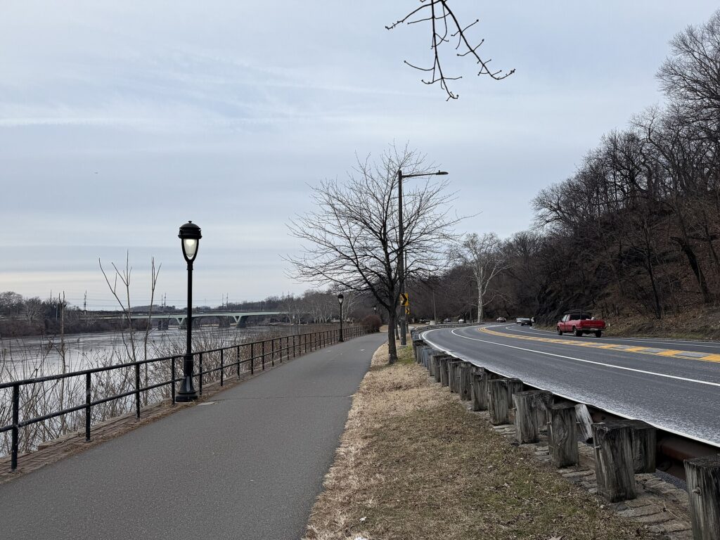
    When it does not

    • You are staying in the city and your plans are the bridge, Alcatraz, the Wharf, the museums and the neighborhoods.
    • You are in town for a conference at Moscone Center, a Giants or Warriors game, or a festival, when parking is at its worst and transit stops at the door.
    • You want Sausalito or Muir Woods for a day, which a ferry, a bike or a tour covers.
    • Your hotel charges a large nightly parking fee and the car would sit in the garage most of the stay.

    The hybrid plan for a city-plus-day-trips visit

    Go car-free for the city days and rent only for the days you leave town, and think carefully about where you pick up. Collecting a car at the SFO rental car center makes sense if you are heading straight out of town on arrival, south to Monterey or east to Yosemite, because the freeways are right there and you never enter city traffic. Renting from one of the downtown or Fisherman’s Wharf offices makes sense if you are spending your first nights in the city, because you avoid paying for a car, and hotel parking, on the nights you are not using it. A pattern that works well: BART into the city, three car-free days, pick up a rental in the city on the morning you leave, spend a day in wine country or on the coast, and either return the car at the airport on the way to your flight or keep driving south to Los Angeles on a one-way rental. On the day you pick up, check out of the hotel with your bags already in the car, and keep them out of sight. Compare the day rates on our San Francisco car rental page against a full-trip rental, and the difference is usually obvious.

    A worked cost comparison

    Numbers change with the season and the booking window, so treat this as a method rather than a quote, and check current rates before deciding. For a four-night city stay for two people, the car-free version costs a return BART trip from the airport for two, two three-day Visitor Passports, and perhaps a couple of ride-hail trips at night; the rental version adds four days of a compact car, four nights of hotel parking at city rates, fuel, bridge tolls and garage fees at the sights, and buys you very little you could not reach by transit. The transit option wins easily. For the same four nights with a day in wine country, the car-free version adds a guided wine tour for two; the hybrid version adds a one-day rental from a city office, fuel and a Golden Gate Bridge toll. For a couple, the costs are often similar, and the choice comes down to whether anyone wants to stay sober enough to drive; for a family of four, the rental usually wins. For a week that ends with a drive down the coast to Los Angeles, a one-way rental picked up on the last city morning is the only practical answer, and a one-way drop fee is usually cheaper than the extra days and parking of a car collected at the airport on arrival. Run the rental rates for your dates on our San Francisco car rental page and put them beside the transit and tour costs before you choose.

    Driving south to Monterey, Big Sur and Los Angeles in each season

    The drive south from San Francisco is one of the great road trips in the country, and the route you choose matters more than the season. The fastest way to Los Angeles is Interstate 5 through the Central Valley, about six hours without stops; US-101 through Salinas, Paso Robles and Santa Barbara takes an hour or so longer and is far more scenic; and Highway 1 along the coast through Big Sur is an all-day drive, or better, two days with a night in Monterey or Big Sur. In summer, the coast is often foggy in the mornings, the Big Sur pullouts are crowded, and the Central Valley on Interstate 5 is very hot; start early. In fall, the fog lifts, the light is golden and the traffic thins after Labor Day, which makes September and October the best months for the coast road. In winter, the storms that bring San Francisco its rain can trigger landslides that close sections of Highway 1 through Big Sur, sometimes for months, so check Caltrans before you set off and have US-101 as the fallback; the Grapevine on Interstate 5 north of Los Angeles is occasionally closed by snow. In spring, the hills are green, the wildflowers are out and the coast is at its most dramatic, though some Highway 1 repairs may still be under way. If Yosemite is on the list, note that Tioga Road through the high country closes for the winter, usually from November until late spring, and chains may be required on the park roads in snow. Whichever route you take, our San Francisco to Los Angeles route guide covers the drive, and our Los Angeles first-timer’s guide covers what to do when you arrive.

    Highway 1 and Bixby Creek Bridge on the Big Sur coast
    Highway 1 at Bixby Bridge, the reason to rent a car on the way south to Los Angeles (Photo: Daniel Hartwig from San Jose, CA, USA via Wikimedia Commons, CC BY 2.0)

    Decision table

    Your tripRecommendationWhy
    City break, couple or soloNo carMuni, the cable cars, BART and walking cover the sights; parking is costly and break-ins are common
    Conference at Moscone CenterNo carBART and Muni stop nearby; downtown parking is scarce and expensive
    City plus Sausalito or Muir WoodsNo car: ferry, bike or tourThe ferry and the Muir Woods shuttle or a tour cover both
    City plus a day in wine countryHybrid: one-day rental from a city office, or a tourCar-free city days; a designated driver or a guide for Napa and Sonoma
    Monterey, Big Sur or YosemiteRent for those daysLong drives with spread-out stops
    Family visit to the suburbs or Silicon ValleyRent for the whole staySuburban distances make the car worthwhile daily
    Family with small children and gearCar-free in the city, rent for day tripsTransit and taxis work in the city; a car helps beyond it
    California road tripRent one-way to Los AngelesSan Francisco is the start, not the destination

    Money-saving tips for both options
    • On transit: buy a Visitor Passport if you will ride the cable cars more than once; use Clipper for BART and the ferries; walk downhill and ride uphill.
    • On a rental: rent only for the days you leave the city, compare airport and city pickup, decline extras you already have through a credit card or home policy (check first), and ask how the rental company handles bridge tolls before you drive onto the Golden Gate Bridge.
    • On parking: compare a garage near your hotel with the hotel’s own fee, and never leave anything in the car.
    • On timing: avoid the Bay Bridge and US-101 at rush hour, and leave for wine country or the coast early on weekends; the best time to fly to San Francisco guide lists the busiest weekends.
    • On day trips: for one or two people, a ferry to Sausalito or a guided tour to Muir Woods or wine country often costs less than a rental plus parking, fuel and tolls.

    Frequently asked questions

    Is it worth renting a car in San Francisco?

    Not for the city itself; transit, walking and the occasional ride-hail are cheaper and easier. Rent only for day trips or a road trip beyond the city.
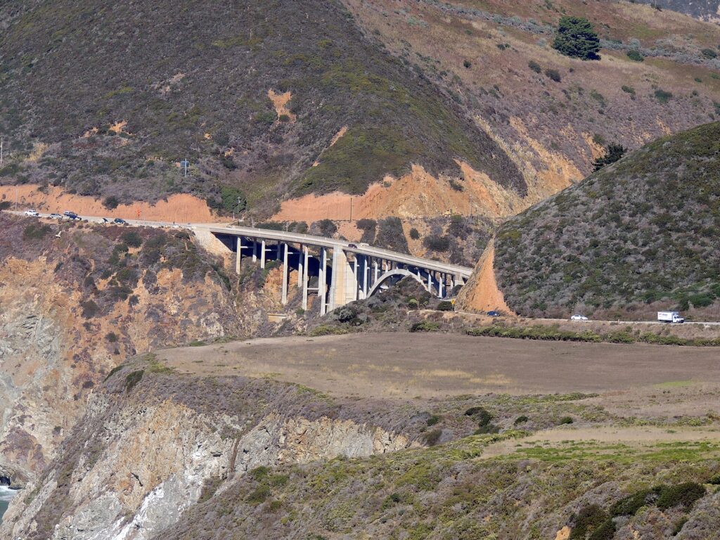
    Is San Francisco public transit good for tourists?

    Yes. Muni buses, light rail, streetcars and cable cars reach almost every sight, BART connects the airport and the East Bay, and one Clipper card or Visitor Passport covers it all.

    How do I get from SFO to downtown San Francisco?

    BART from the International Terminal in about 30 minutes, or a taxi or ride-hail in 25 to 45 minutes depending on traffic.

    Is it safe to leave a car parked in San Francisco?

    Vehicle break-ins are common, especially at tourist spots. Leave nothing in the car, including in the trunk, and use a staffed garage where you can.

    How do I pay the Golden Gate Bridge toll in a rental car?

    The toll is charged southbound and is cashless. Most rental companies bill it through a toll program with a service fee; the bridge also accepts a one-time online payment after crossing. Ask at the counter.

    Can I get to Muir Woods without a car?

    Yes, by guided tour or by the seasonal shuttle, and reservations are required for the shuttle and for parking.

    Is it hard to drive in San Francisco?

    The hills, one-way streets, transit lanes and parking rules take concentration, and parking is scarce and expensive. It is manageable, but most visitors find it is not worth the stress.

    Whichever way you go, start with the flight. Compare cheap flights to San Francisco, choose a neighborhood with our San Francisco hotel search, and if wine country or the coast is on the list, price the rental for those days on our San Francisco car rental page. For what to see once you are there, start with our first-timer’s guide to San Francisco.