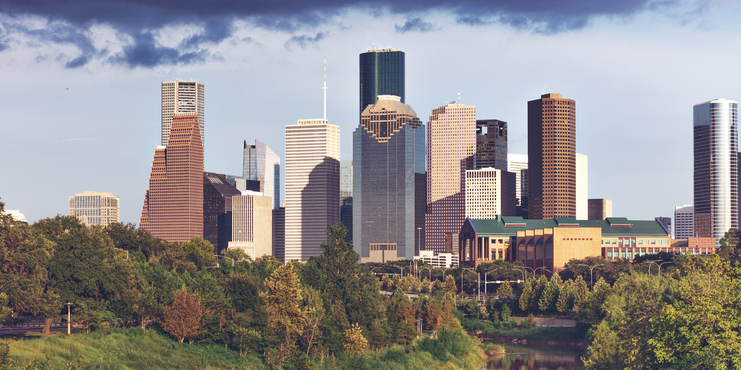
Houston is the car city other car cities point to. It covers more than 600 square miles, has no zoning code to concentrate its offices, shops and homes, and is laced with freeways, toll roads and three concentric ring roads, and most Houstonians drive everywhere. So the honest answer to “should I rent a car?” is often yes. But not always. METRO’s light-rail Red Line runs through the part of Houston most visitors actually want to see, linking downtown, Midtown, the Museum District, Hermann Park, the Texas Medical Center and NRG Park, and a stay inside that corridor can be done comfortably with the train, your feet and the occasional ride-hail, without paying for hotel parking or sitting in freeway traffic. This guide explains how the city is laid out, how METRO works, what driving here is really like, when a car earns its keep, and how to decide.
The short answer
Rent a car if Space Center Houston, Galveston or the Kemah Boardwalk is on the itinerary, if you are visiting family in the suburbs, eating your way along Bellaire Boulevard, working in the Energy Corridor or The Woodlands, or driving on to Dallas, Austin or San Antonio. That is a lot of visitors. Skip the car if you are staying downtown, in Midtown, in the Museum District or near the Medical Center, and your plans are the museums, Hermann Park, the Theater District, a convention at the George R. Brown or a game at NRG Stadium or Daikin Park; the Red Line, walking and a few ride-hail trips to Montrose or the Heights will cover it. Compare rental rates for any of these plans on our Houston car rental page.
How Houston is laid out
Think of Houston as a wheel. At the hub is downtown, on the south bank of Buffalo Bayou. Around it runs the 610 Loop, about ten kilometers (six miles) out, and “inside the Loop” is local shorthand for the older, denser, more walkable city: downtown, Midtown, Montrose, the Museum District, the Heights, EaDo, the Third Ward and River Oaks. The second ring is Beltway 8, whose main lanes are the Sam Houston Tollway, and the third, far out in the suburbs, is the Grand Parkway. Radial freeways run out like spokes: I-45 north toward IAH and Dallas and southeast toward Galveston, I-10 west through the Energy Corridor and east toward Louisiana, I-69/US-59 southwest and northeast, and US-290 to the northwest. The Galleria and Uptown sit just outside the Loop on its west side, the Medical Center and NRG Park inside it to the south, and Space Center Houston about 40 kilometers (25 miles) southeast. A trip that looks short on the map can take 45 minutes at rush hour.
Hotels cluster downtown, in the Galleria area, around the Medical Center and the Museum District, in Montrose, along I-10 in the Energy Corridor, and near both airports. Our Houston hotel search lets you compare them.
Getting in from the airport
Neither airport has a rail link. George Bush Intercontinental (IAH) is about 37 kilometers (23 miles) north of downtown; the drive takes 30 to 45 minutes without traffic and an hour or more at rush hour, via I-69, I-45 or the Hardy Toll Road. Taxis and ride-hail pick up outside every terminal, and taxis charge fixed zone fares to downtown and some other districts, so check the posted rate before you set off. METRO’s local bus to downtown is cheap but takes around an hour. The rental companies share a consolidated rental car center reached by a shuttle bus from the terminals. William P. Hobby (HOU) is about 11 kilometers (7 miles) southeast of downtown, 20 to 30 minutes by car on I-45; taxis and ride-hail are quick and relatively cheap from here, local METRO buses connect to downtown, and the rental cars are close to the terminal. Hobby is also the better airport for Space Center Houston and Galveston, which are on its side of the city. The Houston Airport System’s site has current ground-transport details, and our guides to IAH and Hobby cover the layouts.
Houston’s transit, explained
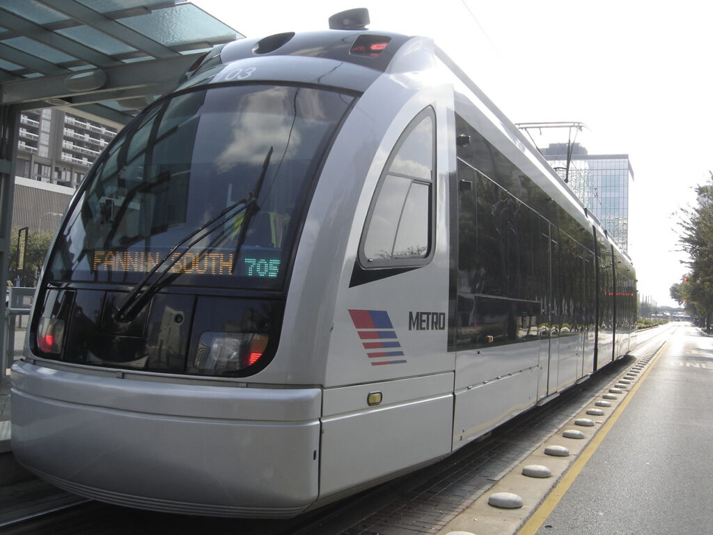
METRO, the Metropolitan Transit Authority of Harris County, runs the light rail, the bus network and the commuter park-and-ride buses. It is cheap and, along its core routes, frequent and dependable; its limitation is coverage, because the rail network is short for a city this size.
METRORail
Three lines. The Red Line is the one that matters most: it runs north to south from the Northline area through downtown along Main Street, then through Midtown, the Museum District (with stops by the Museum of Fine Arts and the Museum of Natural Science), Hermann Park and Rice University, the Texas Medical Center, and NRG Park, home of the Texans and the rodeo. Trains run frequently from early morning until around midnight. The Green Line runs east from downtown through EaDo, past Shell Energy Stadium, into the historic East End, and the Purple Line runs southeast through the Third Ward, past Texas Southern University and the University of Houston. Both share tracks through downtown and connect with the Red Line there. Rail is proof-of-payment: you pay at the platform machine or tap your fare card on the validator before boarding, and inspectors check tickets on board.
Buses
The bus network was redesigned around a grid of frequent routes, many of which run every 15 minutes or better throughout the day, seven days a week, and it reaches Montrose, the Heights, the Galleria, Chinatown and the airports. In Uptown, the METRORapid Silver Line runs bus rapid transit in dedicated lanes along Post Oak Boulevard past the Galleria. Outside the frequent network, some routes run only every half hour or hourly, especially in the evening; check times before relying on one.
Fares and tickets
METRO charges a flat local fare on buses and trains, among the lowest of any major American system, and it includes free transfers in any direction for three hours. Pay with a reloadable METRO Q fare card, through the METRO Q Mobile Ticketing app, or with exact cash on buses; check METRO’s site for current fares, day-pass options and whether tapping a bank card is accepted when you travel. Riders aged 70 and over ride free, and seniors, students and riders with disabilities qualify for reduced fares.
Accessibility
All rail stations are level-boarding and all buses are low-floor and accessible, and METROLift provides paratransit for riders who qualify.
Beyond METRO
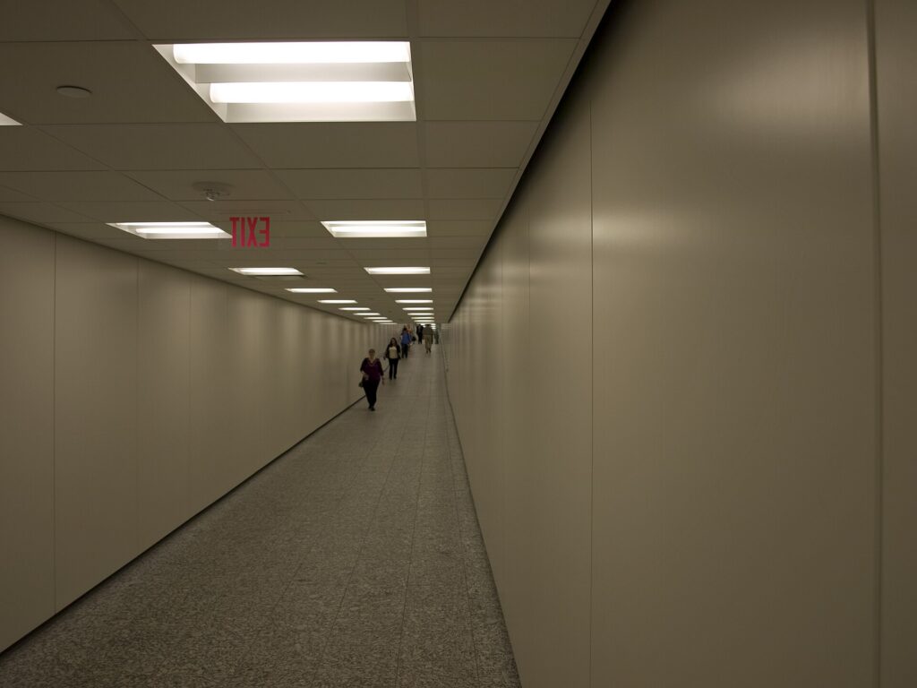
- Walking and the tunnels. Downtown, Midtown, Montrose, the Museum District and the Heights are walkable in themselves, and downtown’s tunnel network, roughly six miles of air-conditioned passages under the office towers, is a lifesaver in summer. Note that the tunnels are open on weekdays during business hours only.
- Bikes and the bayou trails. Houston BCycle, the city’s bike share, has stations downtown and in the inner neighborhoods, and a long and growing network of hike-and-bike trails follows Buffalo Bayou and the other bayous. In summer, ride early or late.
- Taxis and ride-hail. Uber, Lyft and licensed taxis operate across the city.
- Space Center Houston and Galveston. Neither is practical by public transit for a visitor. Ride-hail works for the Space Center, and organized tours run to both. On the island, Galveston’s restored trolley and local buses help once you are there.
- Intercity travel. Amtrak’s Sunset Limited stops in Houston a few times a week on its route between New Orleans and Los Angeles, and intercity buses connect Houston with Dallas, Austin and San Antonio many times a day, a reasonable alternative to a one-way rental for solo travelers.
Driving in Houston: what it is really like
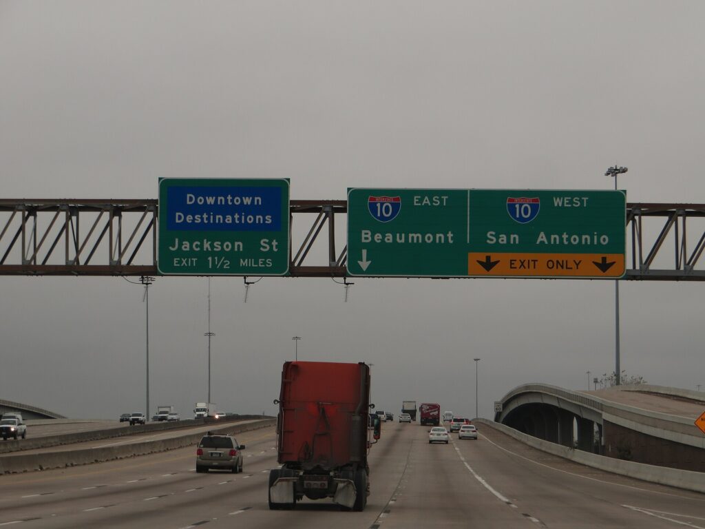
Houston’s freeways are enormous, including stretches of the Katy Freeway (I-10) among the widest in the world, and drivers move fast. The frustrations are specific. Rush hour, roughly 6 to 9 in the morning and 3:30 to 7 in the evening, jams every radial freeway and the 610 Loop, especially the West Loop by the Galleria and I-45 north of downtown. Construction is permanent somewhere, and a years-long rebuild of I-45 and the freeways around downtown is under way. And Texas frontage roads, the one-way service roads that run beside most freeways, take getting used to: exits come early, businesses sit on the frontage road rather than the freeway, and many interchanges have “Texas U-turn” lanes that let you reverse direction without a traffic light. Houston’s freeways have a reputation for serious crashes, so leave space and drive defensively. Houston TranStar publishes live traffic speeds, incidents and flood-prone roadways.
Tolls
Houston has an extensive network of toll roads, including the Sam Houston Tollway, the Hardy Toll Road to IAH, the Westpark Tollway and parts of the Grand Parkway, and most of them are fully cashless. Tolls are collected by transponder, the local EZ TAG issued by the Harris County Toll Road Authority, which also works with the Texas TxTag and Dallas TollTag, or by a bill mailed to the plate owner. With a rental car, that owner is the rental company, which will pass the tolls on with a daily or per-use fee. Ask at the counter how its toll program works; for a short stay, setting your navigation app to avoid tolls is often cheaper.
Parking
Downtown has plenty of garages and surface lots, priced highest on weekdays and during games and concerts, and metered street parking paid by machine or through the city’s ParkHouston app; read the posted hours on each meter. Hotels downtown and in the Galleria charge a nightly fee, often valet-only. Valet is common at restaurants across the city, and malls generally offer free self-parking. Space Center Houston charges for parking, and Galveston charges for parking along much of the seawall.
Rules and conditions worth knowing
- Flooding. Heavy rain can flood underpasses and low roads within minutes. Never drive into water on the road; the National Weather Service’s advice is “turn around, don’t drown”. The NWS Houston/Galveston office issues flash-flood warnings.
- Hurricanes. From June to November, a tropical storm can close roads and trigger evacuations along the coast. If one is forecast, follow official guidance and do not head for Galveston.
- Heat. A parked car becomes dangerously hot within minutes in summer; never leave children or pets inside, even briefly, and use a sunshade.
- Speed limits are typically 60 to 65 mph on urban freeways and up to 75 mph on rural interstates, and frontage roads are often 45 to 55 mph.
- Right turns on red are permitted after a full stop unless signed otherwise.
- Texting while driving is illegal statewide, and handheld phone use is banned in school zones.
- Move over or slow down for stopped emergency, tow and highway maintenance vehicles with flashing lights; it is the law in Texas.
- Red-light cameras were banned in Texas in 2019, but police patrol the freeways heavily.
When renting a car makes sense
- Space Center Houston. It is 40 kilometers (25 miles) southeast, with no rail link; a car also lets you add the Kemah Boardwalk or Galveston the same day.
- Galveston. An hour down I-45, with beaches, the Strand and the cruise terminals, and far easier with your own wheels.
- Chinatown, Hillcroft and the suburbs. The best international food is spread along miles of suburban boulevards.
- Business outside the core. The Energy Corridor, the Westchase district, The Woodlands and the port are all car commutes.
- Family visits. Most Houstonians live beyond the Loop, and a car earns its keep daily.
- Texas road trips. Dallas is about four hours north, Austin about three hours west and San Antonio a little farther; our Dallas to Houston route guide covers the most popular drive.
If any of those apply, our rental car booking tips cover insurance, deposits and the questions to ask at the counter, and our family car rental guide looks at vehicle choice.
When it does not
- You are staying downtown, in Midtown, in the Museum District or near the Medical Center, and your plans are along the Red Line.
- You are in town for a convention, a medical appointment in the Medical Center, or a Texans game or the rodeo at NRG Park, all of which are on the train.
- You are visiting for a short city break and happy to use ride-hail for Montrose and the Heights.
- You are traveling solo, and the rental, tolls, insurance and hotel parking add up to more than a handful of ride-hail trips.
The hybrid plan for a city-plus-coast trip
Go car-free for the city days and rent for the Space Center and Galveston, and think about where you pick up. If you fly into Hobby and are heading straight for the coast, renting at the airport makes sense: you are already on the south side, and the Space Center and Galveston are down I-45 without crossing the city. If you are spending the first nights in the Museum District or downtown, take a taxi or ride-hail in, use the Red Line for a few days, and rent from a city location for the days you need a car, which avoids the airport concession fees and several nights of hotel parking. If you are combining Houston with Dallas, a one-way rental between the two is usually available, though it may carry a drop fee; read our Dallas car-versus-transit guide for that end of the trip. Compare the day rates on our Houston car rental page against a full-trip rental and the difference is usually obvious.
A worked cost comparison
Numbers change with the season and the booking window, so treat this as a method rather than a quote, and check current rates before deciding. For a four-night city break in the Museum District for two people, the car-free version costs two ride-hail trips to and from the airport, a handful of METRO fares, and perhaps four short ride-hail trips to Montrose, the Heights and back; the rental version adds four days of a car, hotel parking, tolls and fees, fuel and airport concession charges. The car-free option wins easily. For the same four nights with a day at Space Center Houston and a day in Galveston, the car-free version adds two long ride-hail round trips or two tour tickets per person; the hybrid version adds a two-day rental from a city location, fuel, a little in tolls and parking at the Space Center and on the island. For two people the hybrid usually comes out ahead, and for a family of four it is clearly cheaper and far more flexible. For a week visiting family in the suburbs, or a business trip to the Energy Corridor, a rental for the whole stay is the only practical answer. Run the rental rates for your dates on our Houston car rental page and put them beside the ride-hail estimates before you choose.
Driving to Galveston, Dallas and beyond in each season
The two drives most visitors make are south to the coast and north to Dallas. Galveston is about an hour down I-45, past the NASA turnoff and across the causeway onto the island. Dallas is about 385 kilometers (240 miles) north on I-45, three and a half to four hours without traffic, past the Sam Houston statue at Huntsville and the giant Buc-ee’s travel center at Madisonville. In summer, the challenge is heat and weekend traffic: southbound to Galveston on Saturday mornings and northbound on Sunday afternoons, the freeway crawls, so leave early, and keep the tank well above a quarter on the long Dallas run. Summer is also hurricane season, and if a storm is approaching, the coast is the place not to be; watch the forecast and the DriveTexas road-conditions map. In fall, the weather is ideal and the coast is quieter after Labor Day, though football weekends fill the highways. In winter, the roads are usually clear, sea fog can settle over the causeway and the coast, and on the rare days of ice, when bridges and overpasses freeze first, the right call is to wait a day. In spring, thunderstorms bring blinding rain and street flooding, and a slow drive is a safe one. In every season, crossing Houston itself is usually the slowest part of the trip.
Decision table
| Your trip | Recommendation | Why |
|---|---|---|
| City break in the Museum District, downtown or Midtown | No car | The Red Line links the main sights; hotel parking and tolls add up |
| Convention, Medical Center visit or game at NRG | No car | All are on the Red Line, and event parking is expensive |
| City plus Space Center Houston and Galveston | Hybrid: rent for the coast days | Car-free city days, car for the southeast |
| Flying into Hobby for the coast | Rent at the airport | Hobby is already on the south side, on the way to both |
| Staying in Montrose or the Heights | No car, or a short rental | Walkable neighborhoods; ride-hail fills the gaps |
| Family visit to the suburbs | Rent for the whole stay | Suburban distances make the car worthwhile daily |
| Business in the Energy Corridor or The Woodlands | Rent at IAH | Both are freeway commutes far from the rail line |
| Texas road trip | Rent (consider one-way to Dallas) | Houston is the start, not the destination |
Money-saving tips for both options
- On transit: use the free three-hour transfer window to link trains and buses on one fare, and pick a hotel within walking distance of a Red Line station.
- On a rental: compare airport and city pickup, understand the toll program before you drive away, set your navigation to avoid tolls on short hops, decline extras you already have through a credit card or home policy (check first), and book early for rodeo season.
- On the hotel: if you are renting, price the parking fee into the room rate, and look for hotels with free self-parking outside downtown.
- On timing: avoid the freeways in the weekday peaks and I-45 to Galveston on summer Saturday mornings; the best time to fly to Houston guide lists the busiest weeks.
- On the airport run: for two or more people, a taxi’s fixed zone fare or a ride-hail from Hobby is cheap; from IAH, compare it with the bus if you are traveling light.
Frequently asked questions
Is it worth renting a car in Houston?
For Space Center Houston, Galveston, the suburbs or a road trip, yes. For a stay along the Red Line in the Museum District, downtown or Midtown, usually not.
Is Houston public transit good for tourists?
Good along the Red Line, which links downtown, the Museum District, Hermann Park, the Medical Center and NRG Park, and very cheap. Beyond that corridor, you will rely on buses, ride-hail or a car.
How do I get from IAH to downtown Houston?
A taxi at a fixed zone fare or a ride-hail in 30 to 45 minutes without traffic, or METRO’s local bus in about an hour for the standard fare.
Can I get to Space Center Houston without a car?
Yes, by ride-hail or on an organized tour, but there is no practical public transit option. With a car, you can add Kemah or Galveston the same day.
Do I need an EZ TAG to drive in Houston?
Not necessarily. Many toll roads are cashless, so a rental car’s toll program or a bill by mail will cover you, usually with a fee. Ask at the counter, or set your navigation to avoid tolls.
Is driving in Houston difficult?
The freeways are big, fast and busy, and rush hour is slow, but the roads are wide and well signed. Leave space, learn the frontage-road system, and never drive into floodwater.
Is parking expensive in Houston?
Downtown and hotel parking can be, especially on event nights. Malls generally offer free self-parking, and outside the core it is rarely a problem.
Whichever way you go, start with the flight. Compare cheap flights to Houston, choose a neighborhood with our Houston hotel search, and if Space Center Houston or Galveston is on the list, price the rental for those dates on our Houston car rental page.
Keep planning with TicketScanner
- Houston car rentals — compare IAH, Hobby and city pickup
- Cheap flights to Houston
- Houston hotels — factor parking into the rate
- Things to do in Houston: a first-timer's guide
- Best time to fly to Houston: month by month
- William P. Hobby (HOU) airport guide
- Driving Dallas to Houston
- Dallas: rent a car or use public transit?
- Rental car booking tips
- Car, transit or taxi in a new city?
Leave a Reply