Tag: Canada Travel

  • Things to Do in Winnipeg: A First-Timer’s Guide

    Things to Do in Winnipeg: A First-Timer’s Guide

    Winnipeg is the city in the middle of the continent, the geographic centre of Canada, and, in most of the country’s imagination, a cold place that people fly over on the way to somewhere else. It is cold, in January. It is also one of the most surprising cities in Canada: a place where the Red and Assiniboine rivers have been a meeting point for six thousand years, where a national museum in a building of glass and Tyndall stone rises over that meeting point, where thirty blocks of terracotta warehouses from the 1900s boom survive intact as a film set for New York and Chicago, where the largest French-speaking community in western Canada keeps a winter festival of voyageur fiddling and maple taffy, where Filipino, Ukrainian, Mennonite, Métis and Indigenous cultures have all shaped what is on the plate, and where the Jets’ whiteout and the Blue Bombers’ banjo bowl are the city’s shared religion. It is friendly, affordable and unpretentious, and it rewards a first visit far beyond its reputation. This guide covers the sights, the neighbourhoods, the festivals, the food, the seasons, the day trips and the practical details.

    If you are still comparing cheap flights to Winnipeg, read this alongside our guides to the best time to fly to Winnipeg and whether you need a car. Between the three you can plan the whole trip.
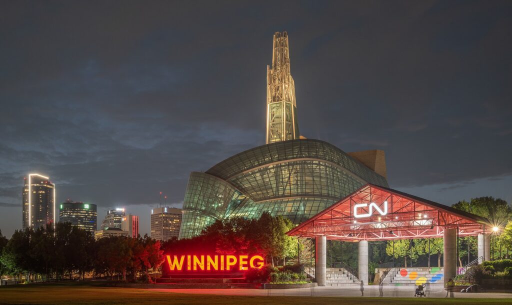
    The Canadian Museum for Human Rights and the downtown Winnipeg skyline at night
    The Canadian Museum for Human Rights at The Forks, the first national museum built outside the capital region (Photo: Ethan Sahagun via Wikimedia Commons, CC BY 4.0)

    Winnipeg at a glance for first-timers

    • Airport: Winnipeg James Armstrong Richardson International (YWG), about 10 km west of downtown, one of the most convenient big-city airports in Canada; a taxi takes 15 to 20 minutes, and a city bus runs to downtown. See our YWG airport guide.
    • Getting around: downtown, The Forks, the Exchange District and Saint-Boniface across the footbridge are walkable; Winnipeg Transit’s buses cover the rest, with the Blue rapid-transit line to the university. A car is for Assiniboine Park in winter and the day trips.
    • Money: Canadian dollars; Manitoba adds the 5 percent federal GST and a 7 percent provincial sales tax at the till. Tipping 15 to 20 percent in restaurants is customary.
    • Weather: the most continental climate of any big Canadian city: long, very cold, sunny winters; short, hot summers; brief springs and falls; and mosquitoes in June and July. Our month-by-month guide has the detail.
    • Where to stay: the Exchange District for the restaurants, galleries and the arena; downtown near The Forks for the museum and the rivers; Osborne Village or Corydon for a neighbourhood feel; the airport strip and Polo Park for value. Our Winnipeg hotel search covers them all.

    The Forks

    Start where the city started. The Forks, at the confluence of the Red and Assiniboine rivers on the edge of downtown, has been a meeting and trading place for Indigenous peoples for six thousand years, then a fur-trade post, then a rail yard, and since the 1980s the city’s living room: the Forks Market, a pair of converted stables full of food stalls, a craft beer hall and local makers; the river walk and the docks, with river taxis in summer; the Oodena Celebration Circle, an earthwork amphitheatre aligned to the stars; the Children’s Museum in an old locomotive shed; the skateboard plaza; and the Esplanade Riel, the cable-stayed footbridge with a restaurant in the middle, which crosses the Red to Saint-Boniface. In winter, The Forks becomes the Arctic Glacier Winter Park: a skating trail down the frozen rivers that in a good year runs for kilometres and is one of the longest naturally frozen trails in the world, warming huts designed by architects from around the world in an annual competition, a toboggan run, and a beer garden on the ice. It is the city’s best free attraction in every season.
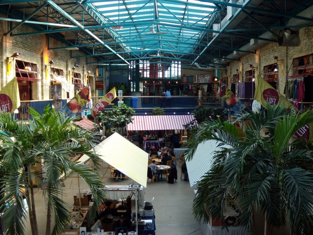
    The Forks Market building in Winnipeg
    The Forks Market, at the meeting of the Red and Assiniboine rivers, a gathering place for six thousand years (Photo: Ccyyrree via Wikimedia Commons, CC0)

    The Canadian Museum for Human Rights

    Rising over The Forks, the Canadian Museum for Human Rights is the first national museum built outside the Ottawa region and, since it opened in 2014, the reason many people visit Winnipeg at all. The building alone is worth the trip: a mountain of Tyndall limestone wrapped in a glass “cloud”, with a spiral of glowing alabaster ramps that climb through the galleries to the Tower of Hope, 100 metres above the rivers with a view across the prairie. The galleries are serious and often moving, from the Holocaust and the Holodomor to Indigenous rights, residential schools and the civil rights movement, with a strong Canadian focus and a great deal for children to engage with. Allow at least three hours; the museum is closed on Mondays outside the summer.

    The Exchange District

    North of Portage and Main, the famous windswept intersection, the Exchange District is a National Historic Site of some thirty blocks of terracotta, brick and stone warehouses, banks and office buildings from Winnipeg’s boom years between 1880 and 1920, when it was the “Chicago of the North” and the grain capital of the British Empire. It survived intact because the boom ended, and it is now the city’s most interesting neighbourhood: the restaurants and cocktail bars that locals argue about, the galleries, the theatres, including the Royal Manitoba Theatre Centre, the Winnipeg Art Gallery and its Qaumajuq wing, which holds the world’s largest public collection of Inuit art in a luminous new building, and, in July, the Fringe Festival’s Old Market Square hub. It is also a working film set; the streets have stood in for Chicago, New York and Moscow. Walking tours run in summer, and the Manitoba Museum, with its full-size replica of the Nonsuch, the ketch whose 1668 voyage founded the Hudson’s Bay Company, and its planetarium, is on the district’s northern edge.
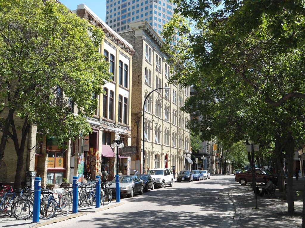
    Albert Street in Winnipeg's Exchange District
    The Exchange District, thirty blocks of terracotta and brick from Winnipeg's boom years (Photo: Interlaker via Wikimedia Commons, CC0)

    Saint-Boniface

    Across the Esplanade Riel, Saint-Boniface is the historic French quarter, the largest francophone community in western Canada, and the birthplace of Louis Riel, the Métis leader whose grave is in the cathedral cemetery. The Saint-Boniface Cathedral, whose stone facade survived a 1968 fire and now frames a modern church built inside the ruins, is one of the most striking sights in the city; the Saint-Boniface Museum, in the oldest building in Winnipeg, a Grey Nuns convent from 1846, covers Riel and the Métis; and Provencher Boulevard has the French bakeries, bistros and the Franco-Manitoban cultural centre. In February, Whittier Park hosts the Festival du Voyageur, the largest winter festival in western Canada, ten days of fiddle music, snow sculptures, voyageur history, maple taffy on snow and a great deal of caribou, the spiced fortified wine.

    Assiniboine Park and the zoo

    West of downtown, Assiniboine Park is the city’s great park: the English garden and the Leo Mol sculpture garden, the Pavilion with its galleries of local art, the duck pond, the miniature railway, the Lyric Theatre’s free summer concerts and the new Leaf, a horticultural conservatory of tropical and Mediterranean biomes under a cable-net roof. The Assiniboine Park Zoo‘s Journey to Churchill exhibit is its star: polar bears, most of them orphaned cubs rescued from the Hudson Bay coast, swimming over a glass tunnel, plus muskoxen, wolves and Arctic foxes in a landscape designed to look like the tundra. It is the best zoo exhibit in Canada and the closest most visitors will get to Churchill’s bears. The park is a bus or a drive from downtown.

    More museums and culture

    The Royal Canadian Mint, on the eastern edge of the city, is where every Canadian circulation coin is made, along with coins for dozens of other countries, and the tour is a genuine surprise. The Manitoba Legislative Building, downtown, is a Beaux-Arts palace with the Golden Boy on its dome and a hidden programme of hermetic symbolism that a popular tour decodes. The Winnipeg Railway Museum, the Royal Aviation Museum of Western Canada beside the airport, the Fort Whyte Alive nature centre with its bison herd on the city’s southwestern edge, and the Dalnavert Victorian house museum round out the list. The Royal Winnipeg Ballet, Canada’s oldest, and the Winnipeg Symphony perform at the Centennial Concert Hall; for what is on during your dates, our Winnipeg events page lists concerts, shows and games.

    Sports

    The Winnipeg Jets play at the Canada Life Centre downtown, on the edge of the Exchange, and a Jets game, especially during a playoff whiteout when the whole arena and the streets outside dress in white, is the most Winnipeg thing a visitor can do. The Blue Bombers, the city’s Canadian football team and the most successful of the last decade, play at Princess Auto Stadium at the university from June to November, with the Banjo Bowl against Saskatchewan in September the loudest game of the season. The Winnipeg Goldeyes play independent-league baseball in a riverside ballpark at The Forks in summer, and Valour FC plays professional soccer at the stadium. See what is on sale in Winnipeg for your dates.

    What to eat, and where

    Winnipeg eats from everywhere its people came from. The city has the largest Filipino community in Canada per capita, and the lechon, pancit and halo-halo along the northwestern strips and in the food courts are among the best on the continent. The Ukrainian and Mennonite traditions put perogies, cabbage rolls, kubasa and farmer sausage on every diner menu and every church supper. The Métis and Indigenous food scene, with bannock, bison and wild rice, has moved from festivals to serious restaurants in the Exchange. The Jewish delis on the North End’s Main Street and Selkirk Avenue, the Vietnamese pho along Ellice and Sargent, the Italian strip on Corydon, and the Winnipeg goldeye, a smoked freshwater fish that is the city’s namesake delicacy, fill in the rest. The Forks Market is the place to graze; the Exchange District, Osborne Village, Corydon Avenue and Sherbrook Street are the places to sit down. The city’s other specialities are a cheese-stuffed “fat boy” burger with chili sauce, the honey dill sauce served with chicken fingers everywhere, and the “Winnipeg-style” rye bread that half the country ships in.

    Festivals and events

    Winnipeg keeps a full calendar and two of its festivals are national institutions. Folklorama, over two weeks in August, is the largest and longest-running multicultural festival in the world: forty-odd pavilions across the city, each run by a cultural community with food, dancing and music, visited by shuttle bus in the evenings. The Winnipeg Folk Festival, in July at Birds Hill Park north of the city, is one of the oldest and most loved in North America, with camping, a dozen stages and headliners far beyond folk. The Winnipeg Fringe, in July in the Exchange, is the second largest in North America after Edmonton’s. The Festival du Voyageur in February, the Jazz Winnipeg festival in June, the Manito Ahbee Indigenous festival in May, Pride in June, the Red River Exhibition fair in June, the Winnipeg International Writers Festival in September and Nuit Blanche in the Exchange in late September fill in the year. Tourism Winnipeg keeps the calendar.
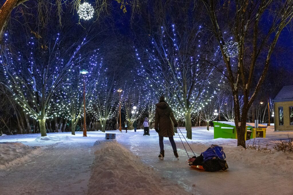
    Skaters crossing the rail bridge on the river trail at The Forks in Winnipeg
    The river skating trail at The Forks, one of the longest naturally frozen trails in the world (Photo: Lorie Shaull from St Paul, United States via Wikimedia Commons, CC BY 2.0)

    Winnipeg through the seasons

    Winter (November to March) is the reason for Winnipeg’s reputation and, handled right, one of the reasons to visit: the river skating trail and the warming huts at The Forks, the Festival du Voyageur, the Jets, the polar bears at the zoo, the northern lights on a clear night outside the city, and a city that has never pretended the cold is not there. It is very cold, regularly below -25 °C, and it is also dry and sunny. Spring (April to May) is short, muddy and, when the Red River floods, dramatic; it is the cheapest season. Summer (June to August) is hot, with long days, the Folk Festival, the Fringe, Folklorama, the Goldeyes at the ballpark, the patios on Corydon and in Osborne Village, and the beaches at Grand Beach on Lake Winnipeg an hour north. Fall (September to October) is brief and golden, with the Banjo Bowl, Nuit Blanche and the Jets’ season opening. Our month-by-month guide matches each season to fares.
    Winnipeg with kids

    The Forks was built for children: the Children’s Museum, the skate plaza, the river walk, the market’s food stalls, and in winter the skating trail, the toboggan run and the warming huts. The polar bears at the zoo, the Nonsuch and the planetarium at the Manitoba Museum, the Mint tour, the bison at Fort Whyte and the aviation museum’s hangar fill the other days; the Human Rights Museum has a strong family programme. In summer, the Assiniboine Park train and duck pond, the Goldeyes’ ballpark, the splash pads and Grand Beach’s dunes are the outdoor list. Folklorama’s pavilions are a painless world tour for children.

    Winnipeg on a budget

    Winnipeg is one of the most affordable cities in Canada, and the free list is long: The Forks and the river trail in every season, the Exchange District’s streets, the Legislative Building tour, Assiniboine Park and its gardens, the Saint-Boniface Cathedral ruins, Fort Whyte’s trails on some days, and Nuit Blanche and the Fringe’s outdoor stages. The Human Rights Museum, the art gallery and the Manitoba Museum are moderately priced and have discounted evenings; check their sites. Eat cheaply and well at the Forks Market, the Filipino food courts, the perogy suppers and the pho shops. Hotels are among the cheapest of any big Canadian city outside the Jets’ playoff runs and Folklorama; compare by neighbourhood on our Winnipeg hotel search.

    Day trips from Winnipeg

    Lower Fort Garry, half an hour north on the Red River, is the oldest intact stone fur-trade post in North America, with costumed interpreters in summer. Grand Beach on Lake Winnipeg, an hour north, is one of the best freshwater beaches on the continent, with white sand and dunes; Gimli, on the same lake, is the largest Icelandic community outside Iceland, with a festival in August. Riding Mountain National Park, three hours northwest, is a plateau of forest, lakes and bison above the prairie. Steinbach‘s Mennonite Heritage Village, an hour southeast, tells the story of the prairie’s Mennonite settlers. Whiteshell Provincial Park, two hours east, is Canadian Shield lake country. Birds Hill Park, half an hour northeast, hosts the Folk Festival and has trails and a beach. And Churchill, the polar bear capital, is not a day trip but a two-day train ride or a two-hour flight north, and the reason many visitors come through Winnipeg in October and November. All but Churchill need a car; see our Winnipeg car rental page, and Travel Manitoba for the province.

    Two sample itineraries

    Two days, no car

    Day one: the Canadian Museum for Human Rights in the morning, lunch at the Forks Market, the river walk and the Oodena circle, across the Esplanade Riel to Saint-Boniface for the cathedral and the museum, back for the Legislative Building, and dinner and drinks in the Exchange District. Day two: the Manitoba Museum and the Nonsuch first, the Exchange District on foot with the art gallery and Qaumajuq, lunch on Albert Street, a bus to Assiniboine Park for the polar bears and the Leaf in the afternoon, and dinner in Osborne Village or on Corydon, or a Jets game if the season is on.

    Four days, with a car

    Add a day for the Mint, Fort Whyte’s bison and Lower Fort Garry, and a day for Grand Beach and Gimli in summer, or, in winter, a day skating the river trail and driving out of the city lights for the aurora.

    Practical details

    • Transit: Winnipeg Transit’s buses; pay cash with exact change, buy tickets, or use a Peggo card. See our transit-versus-car guide for detail.
    • From YWG: a taxi or ride-hail in 15 to 20 minutes, the city bus to downtown, or a rental from the terminal. The airport’s site covers ground transport.
    • Weather: serious cold-weather gear from November to March, sun protection and insect repellent in summer. Environment Canada’s forecast is the one to check.
    • Time zone: Central, one hour behind Toronto and the same as Chicago.
    • Entry requirements: U.S. citizens need a valid passport; most other visa-exempt visitors arriving by air need an Electronic Travel Authorization. The Government of Canada’s visitor page is the authoritative source.
    • Safety: the downtown core and the Main Street strip north of the Exchange need ordinary big-city awareness late at night; The Forks, the Exchange and the neighbourhoods are relaxed.

    Frequently asked questions

    How many days do you need in Winnipeg?

    Two full days covers The Forks, the Human Rights Museum, the Exchange, Saint-Boniface and the zoo; three adds the Mint, Fort Whyte and Lower Fort Garry; a fourth adds a lake day in summer.

    What is Winnipeg best known for?

    The Canadian Museum for Human Rights, The Forks, the Exchange District, the Jets’ whiteout, Folklorama, the Festival du Voyageur, the polar bears at the zoo, and being the gateway to Churchill.

    Is Winnipeg worth visiting?

    Yes, and far more than its reputation suggests: a world-class museum, a preserved heritage district, a genuinely multicultural food scene and some of the lowest prices of any big Canadian city.

    Is Winnipeg walkable?

    The core is: The Forks, downtown, the Exchange and Saint-Boniface are within twenty minutes of each other. Assiniboine Park and the neighbourhoods need a bus or a car.

    Do I need a car in Winnipeg?

    Not for the core. For the zoo in winter, the Mint, Fort Whyte and the lake and park day trips, yes; rent for those days only.

    How cold does Winnipeg get?

    January highs are around -12 °C and lows around -21 °C, with cold snaps to -35 °C and wind chills beyond. It is dry and sunny, the city is built for it, and the river trail and the Voyageur festival are the reward.

    Can I see polar bears in Winnipeg?

    Yes, at the Assiniboine Park Zoo’s Journey to Churchill exhibit, year-round. For wild bears, Churchill is a two-hour flight north, best in October and November.

    Ready to go? Compare flights to Winnipeg, find a place to stay with our Winnipeg hotel search, and if the lake or the parks are on the list, price a rental car for those days.

  • Edmonton: Should You Rent a Car or Rely on Public Transit?

    Edmonton: Should You Rent a Car or Rely on Public Transit?

    Edmonton is a car city that has been building its way toward being something else. It is enormous by area, spread across the prairie on both sides of a deep river valley, with an airport thirty kilometres from downtown and a mall in the west end that is one of its biggest attractions; most of its residents drive, and most visitors assume they will too. But the last decade has changed the picture for a visitor with a downtown or Old Strathcona base: the LRT now links the airport bus, the university, downtown, the Ice District and the southeast at street level, the two central neighbourhoods are walkable and connected by the river valley trails, and parking downtown on a game night is enough to make anyone reconsider. So the answer depends on which Edmonton you are visiting. This guide explains how the city is laid out, how transit and fares work, the airport transfer, what driving and parking are really like in every season, when a car is worth it, and gives you a straightforward way to decide.

    The short answer

    Rent a car if Jasper, Elk Island, the Ukrainian Village, the lakes, a drive to Calgary or the north is on the itinerary, if you are staying in the suburbs or with family, if West Edmonton Mall is a major part of the plan, or if you are visiting in deep winter with young children. That is a large share of visitors. Skip the car if you are staying downtown, in the Ice District or in Old Strathcona for a city break, an Oilers game, a conference or the August festivals, and your plans are the museums, the Legislature, Whyte Avenue and the river valley; the LRT, your feet and the occasional ride-hail will cover that, and you avoid downtown parking and the long airport drive. For many first-timers, the hybrid is right: car-free in the city, a one- or two-day rental picked up downtown for Elk Island and the mall. Compare rental rates for any of these plans on our Edmonton car rental page.

    How Edmonton is laid out

    Edmonton is a numbered grid on the prairie, split diagonally by the North Saskatchewan River valley, with avenues running east-west and streets north-south from a centre point near the old town; 100 Street and 100 Avenue meet downtown, and the numbers climb outward. Downtown sits on the north bank of the river, with the Ice District and Rogers Place on its northern edge, Churchill Square and the museums in its middle, the Legislature on its southwestern corner above the valley, and Jasper Avenue running through it. Across the High Level Bridge to the south are the university and Old Strathcona, with Whyte Avenue (82 Avenue) as its main street. The west end holds 124 Street, the mall and the Telus World of Science; the north holds Commonwealth Stadium and Alberta Avenue; the southeast holds Mill Woods and the Valley Line; and the city then continues for kilometres in every direction. The inner core is compact and walkable; everything beyond it assumes a car or a long bus ride.

    Hotels cluster downtown and in the Ice District, in Old Strathcona and near the university, along the west end near the mall, and on the south side along Gateway Boulevard for value. Most Edmonton hotels outside the downtown core include parking, which changes the arithmetic. Our Edmonton hotel search lets you compare them.

    Getting in from the airport

    Edmonton International (YEG) is about 30 kilometres south of downtown beside Leduc, and the transfer is the first transport decision of the trip. A taxi or ride-hail takes 30 to 45 minutes and is priced for the distance; for one person it is the single most expensive thing about a car-free Edmonton visit. The airport’s public bus, Route 747, runs to Century Park LRT station on the south side of the city, from which the Capital Line reaches the university and downtown in about 25 minutes, for a modest combined fare; it is the cheap option and takes about an hour. Hotel shuttles serve the airport-area and some downtown hotels. And every major rental company is in the terminal, with the divided Queen Elizabeth II Highway running straight from the airport to the city’s southern edge in about half an hour. For two or more people, or with luggage, a rental picked up at the airport is often cheaper than two taxi rides, and it is the obvious choice if the trip includes Jasper or Elk Island. Check the airport’s site and Edmonton Transit for current service; our YEG airport guide covers the layout.

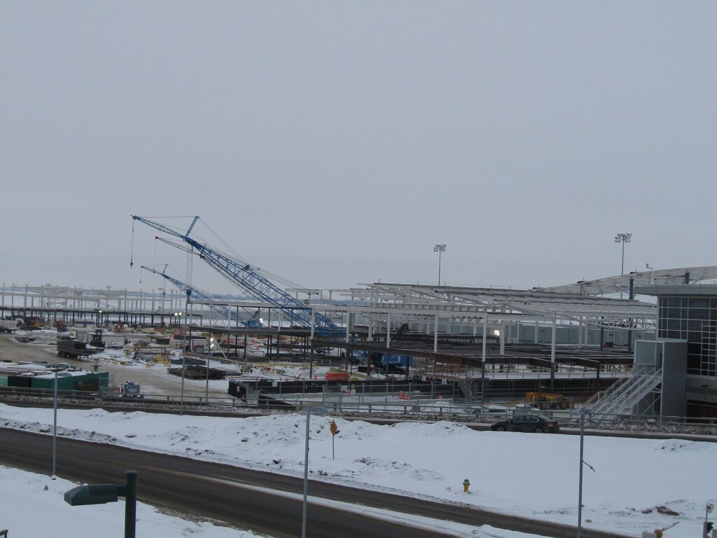
    The terminal at Edmonton International Airport (YEG)
    Edmonton International, 30 kilometres from downtown: the transfer is the first transport decision of the trip (Photo: Ohyeh via Wikimedia Commons, CC BY-SA 3.0)

    Edmonton’s transit, explained

    Edmonton Transit Service runs the LRT and the bus network. It is clean and generally reliable, and for a visitor based downtown or in Old Strathcona it covers the core well; its limitation, as in Calgary, is coverage of the outer city and the evening frequencies on the buses.

    The LRT

    Three lines. The Capital Line runs from Clareview in the northeast, past Commonwealth Stadium, through downtown in a tunnel with stations at Churchill (for the museums and city hall), Central and Bay/Enterprise, then south across the river to the University, Southgate mall and Century Park, where the airport bus connects. The Metro Line shares the downtown tunnel and runs northwest past the Royal Alexandra Hospital and MacEwan University toward the north. The Valley Line, the newest, runs at street level from downtown at Churchill and 102 Street, across a new bridge over the river valley past the Muttart Conservatory and Bonnie Doon, and southeast to Mill Woods, with a western extension under construction toward the mall. For a visitor, the Capital Line is the workhorse: it links the stadium, downtown and the university in fifteen minutes, and the Old Strathcona strip is a ten-minute walk from University station. Rogers Place is beside MacEwan station on the Metro Line and a short walk from Churchill. Trains run from early morning until after midnight.

    Buses

    Buses fill in the rest: the Route 747 airport service, the routes to the mall and the west end, Fort Edmonton Park, the Telus World of Science, Whyte Avenue’s own crosstown route, and the neighbourhoods off the rail lines. Frequencies drop in the evenings and on weekends outside the core routes; check times before relying on a bus for a late return, and use ride-hail for the last leg if in doubt.

    Fares and tickets

    Edmonton uses the Arc card, the regional smart card, which you can buy at LRT stations and load with value; you can also tap a contactless credit or debit card or phone wallet directly on the validators at stations and on buses. A fare gives you 90 minutes of transfers across the LRT and buses, and daily fare caps apply so that you never pay more than a day pass. Children twelve and under ride free. The airport bus charges a premium fare. Check Edmonton Transit’s site for current prices.

    Accessibility

    Every LRT station is step-free, and every bus is low-floor and accessible.

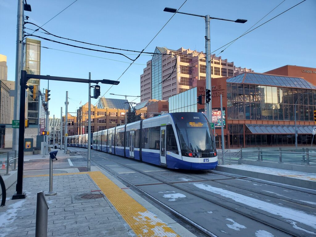
    A Valley Line LRT train departing Churchill stop in downtown Edmonton
    The Valley Line at Churchill stop: Edmonton's newest LRT line runs at street level through downtown (Photo: Matthew Boonstra via Wikimedia Commons, CC BY-SA 4.0)

    Beyond Edmonton Transit

    • Walking. Downtown is compact; the Legislature to the Ice District is twenty minutes; the High Level Bridge takes you from downtown to the university and Old Strathcona in half an hour on foot, and the pedestrian path on the bridge has the best view in the city.
    • Bikes and the valley trails. The river valley’s 160 kilometres of trails connect nearly every sight a visitor wants, from the Legislature to Fort Edmonton and from the Muttart to Hawrelak Park. Bike-share e-bikes and scooters operate in the warmer months, and rental shops downtown and near Whyte hire by the day. The funicular at 100 Street drops you into the valley from downtown without the climb.
    • The High Level Bridge Streetcar. A heritage tram runs across the top deck of the High Level Bridge between downtown and Old Strathcona on summer days; it is transport, a sight and the best photo in the city for a small fare.
    • Taxis and ride-hail. Uber and licensed taxis cover the city; for a group, a short ride to the mall or 124 Street is competitive with transit fares and far quicker.
    • Intercity. Buses connect Edmonton with Calgary, Red Deer, Jasper and the north from the downtown terminal; the Calgary route is frequent and cheap and competitive with a one-way rental for a solo traveller.

    Driving in Edmonton and beyond: what it is really like

    Edmonton is an easy city to drive in by the standards of the big eastern cities: wide roads, a logical grid, plentiful and often free parking outside the core, and drivers who are calm. The frustrations are specific. The Anthony Henday ring road and the Whitemud and Yellowhead freeways jam in the weekday peaks and after any crash; the river crossings are the pinch points, with the High Level, Walterdale and Groat bridges backing up at rush hour; construction season runs from May to October and the Valley Line’s western extension has closed lanes in the west end for years; and Whyte Avenue on a weekend night is a slow crawl with nowhere to park. And winter is the real difference. Snow stays on the ground from November to March, the side streets rut and narrow between snowbanks, black ice on the bridges is routine, and extreme cold, -30 °C and below, is a normal occurrence that a rental car needs to be ready for.

    Parking

    Downtown parking is the one place Edmonton is genuinely expensive. The Ice District’s garages are priced for game nights, when the streets around Rogers Place fill hours before the puck drops; the office-tower lots and hotel garages charge nightly fees comparable to Calgary’s; and street parking downtown is metered by the EPark system, which uses licence plates and an app or a machine, and is free in the evenings and on Sundays and holidays. Outside the core, parking is easy and usually free: the museums, Fort Edmonton, the Legislature grounds, the mall, the parks and the Valley Zoo all have lots, and most hotels outside downtown include parking in the rate, which is a genuine saving compared with Toronto or Vancouver. Whyte Avenue is the exception in the south: the strip itself is tight, but the side streets and the market lot are workable except on weekend evenings and during the Fringe.

    Rules and conditions worth knowing

    • Winter tires are not required by law in Alberta, and rental cars usually come on all-seasons. For the city, in a normal winter, that is manageable with care. For the Yellowhead to Jasper or any highway between November and April, ask for winter tires when you book. Alberta 511 publishes road conditions and closures.
    • Extreme cold. Below about -25 °C, cars struggle to start and tire pressure drops. Rentals are generally in good condition, but park in a garage on the coldest nights if you can, and keep the tank above half full.
    • Block heaters. Edmonton’s parking lots have electrical outlets for a reason. A rental will usually have a block-heater cord; ask at the counter how to use it if the forecast is severe.
    • Photo radar is widespread across the city, including automated speed and intersection cameras; fines follow the car and the rental company will bill you.
    • Right turns on red are permitted after a full stop unless signed otherwise.
    • Wildlife on the highways. Deer are common on the Yellowhead and Highway 2 at dawn and dusk; moose are a genuine hazard on the road to Jasper and in the north. Slow down at those hours.
    • Park passes. Elk Island and Jasper both need a Parks Canada pass per vehicle, sold online and at the gates.
    • Fuel is cheaper in Alberta than in most of Canada.
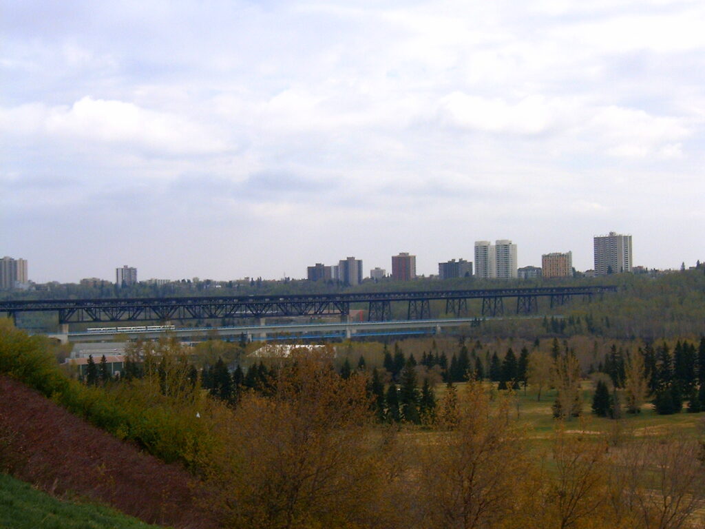
    The High Level Bridge over the North Saskatchewan River in Edmonton
    The High Level Bridge links downtown to Old Strathcona and the university: a walk, a bike ride or a summer streetcar (Photo: Glenlarson at English Wikipedia via Wikimedia Commons, Public domain)

    When renting a car makes sense

    • Jasper and the northern Rockies. Four hours west on the Yellowhead; the drive is the point, the trailheads are spread out, and the Icefields Parkway continues south to Lake Louise for a return via Calgary.
    • Elk Island National Park, forty minutes east, with the bison herds and the dark-sky preserve, has no transit.
    • The Ukrainian Cultural Heritage Village, on the same road as Elk Island.
    • West Edmonton Mall and the west end, if it is a major part of the plan; the bus works, but with children and a waterpark day, a car is easier.
    • Fort Edmonton Park and the Valley Zoo, which are reachable by bus but awkward.
    • Family in the suburbs. Edmonton’s suburbs are on transit but spread out; a car earns its keep daily.
    • Deep winter with young children. A car, a hotel with parking and a plugged-in block heater make the whole trip simpler.
    • Alberta road trips. Calgary via Highway 2 and Drumheller, the lakes, or the north; our Calgary to Edmonton route guide covers the first of those, and our Calgary transit guide the other end.

    If any of those apply, our rental car booking tips cover insurance, deposits and the questions to ask at the counter.

    When it does not

    • You are staying downtown or in Old Strathcona and your plans are the city.
    • You are in town for an Oilers game, a concert at Rogers Place or a conference in the Ice District, when parking is at its worst and the LRT stops at the door.
    • You are coming for the Fringe or the Folk Festival, when Old Strathcona and Gallagher Park are pedestrian zones in all but name and the LRT and the valley trails are the way in.
    • You are travelling solo and the rental, insurance and downtown parking add up to more than the airport bus, a few transit fares and a ride-hail or two.

    The hybrid plan

    Go car-free for the city days and rent for the day trips, and think about where you pick up. If Jasper is in the plan, rent at the airport on arrival or on the way out and skip the city drive; the Yellowhead west is reached from the ring road without touching downtown. If Elk Island and the mall are the goal, pick up downtown or on the south side on the morning you need it, avoid the airport concession fees, and return it the same evening or at the airport on the way home, which most companies allow within the city at little or no extra charge. Ask for winter tires from November to April. Compare the day rates on our Edmonton car rental page against a full-trip rental and the difference is usually obvious.

    A worked cost comparison

    Numbers change with the season and the booking window, so treat this as a method rather than a quote, and check current rates before deciding. For a three-night city break downtown for two people, the car-free version costs the airport bus and LRT each way, a couple of day passes, and two or three short ride-hails to 124 Street or Whyte; the rental version adds three days of a compact car, three nights of downtown hotel parking, fuel and the airport concession fees, and buys you the mall and Fort Edmonton in exchange. If those two are on the list, the rental is close to break-even; if they are not, transit wins clearly. For the same three nights plus Elk Island, a one-day rental from downtown plus the park pass and fuel is cheap and turns a logistical problem into a forty-minute drive; the hybrid wins. For a week with Jasper, a rental for the whole stay from the airport is the only practical answer, and it is still cheaper than two taxis plus a mid-trip pickup. Run the rates for your dates and put them beside the transit fares before you choose.

    The Yellowhead Highway approaching the Rockies in Jasper National Park
    The Yellowhead Highway into Jasper, four hours west of Edmonton and the main reason to rent for the whole trip (Photo: Benfwilliamson via Wikimedia Commons, CC0)

    Driving to Jasper in each season

    The Yellowhead Highway (Highway 16) west from Edmonton to Jasper is four hours of divided highway across the parkland to Hinton, then two-lane road into the mountains and the park gate. In summer, it is an easy, beautiful drive, with the only problems being traffic through the townsite and full parking lots at Maligne Lake and the Athabasca Falls by mid-morning; leave early. In fall, the larches and aspens turn in late September, the Dark Sky Festival in October fills the town, and the first snow can arrive in the mountains while Edmonton is still mild. In winter, the highway is plowed and generally open, but the section west of Hinton ices and drifts, wildlife is on the road at dusk, daylight is short, and a rental without winter tires is not the vehicle for it; check Alberta 511 before leaving and carry a full tank, warm clothes and a charged phone. Marmot Basin’s ski season and the frozen Maligne Canyon icewalk are the reasons to make the drive in the cold. In spring, the road is wet, the trails above the valley are still snowbound into June, and the animals, including bears, are on the move. In every season, the last hour, as the mountains rise out of the foothills, is one of the reasons people fly to Edmonton in the first place.

    Decision table

    Your tripRecommendationWhy
    City break downtown or in Old Strathcona, couple or soloNo carThe LRT and the valley trails cover it; downtown parking is expensive
    Oilers game, arena concert or conferenceNo carThe LRT stops at the door; game-night parking is the worst in the city
    Fringe or Folk Festival weekNo carOld Strathcona and Gallagher Park are best reached on foot or by LRT
    City plus Elk Island or the mallHybrid: one-day rental from downtownCar-free city days, a car for the day trips
    Jasper, several daysRent at the airport for the whole tripThe Yellowhead starts at the ring road; the park needs a car
    Family visit to the suburbsRent for the whole staySuburban distances make the car worthwhile daily
    Deep winter with childrenRent, with winter tires, at a hotel with parkingCold, gear and the mall all argue for a car
    Alberta road tripRent (consider one-way to Calgary)Edmonton is the start, not the destination

    Money-saving tips for both options

    • On transit: take the Route 747 bus and the LRT from the airport rather than a taxi; tap a credit card and let the daily fare cap work for you; children twelve and under are free; ride the summer streetcar over the High Level Bridge for the price of a coffee.
    • On a rental: compare airport and downtown pickup, book early for the August festivals and the ski weeks, ask for winter tires in the cold months, decline extras you already have through a credit card or home policy (check first), plug in the block heater on the coldest nights, and buy the park pass online before you reach the gates.
    • On the hotel: if you are renting, choose a hotel outside the core that includes parking; if you are not, stay on the Capital Line and ride in.
    • On timing: avoid the river crossings and the ring road in the weekday peaks, the Ice District in the two hours before a game, and Whyte Avenue on weekend nights; the best time to fly to Edmonton guide lists the busiest weekends.
    • On the day trips: for one or two people, an intercity bus to Jasper or Calgary can beat a rental if you do not need a car at the other end.

    Frequently asked questions

    Is it worth renting a car in Edmonton?

    For Jasper, Elk Island, the suburbs, the mall or a road trip, yes, and that covers many visitors. For a downtown or Old Strathcona city break, an Oilers game or the festivals, no; the LRT and your feet are enough.

    Is Edmonton public transit good for tourists?

    Good within the core: three LRT lines link the stadium, downtown, the Ice District, the university and the southeast, and an airport bus connects at Century Park. It thins out quickly beyond that and does not reach the mall by rail yet.

    How do I get from Edmonton airport to downtown?

    The Route 747 bus to Century Park LRT station and the train downtown, in about an hour; a taxi or ride-hail in 30 to 45 minutes; a hotel shuttle; or a rental from the terminal.

    Can I get to Jasper from Edmonton without a car?

    Yes, by intercity bus or by VIA Rail’s transcontinental train, which stops in Jasper on a few days a week. Within the park, though, you will want a car or a tour to reach the lakes and trailheads.

    Do I need winter tires to drive in Edmonton?

    Not by law in Alberta, but the highways to Jasper and Calgary ice from November to April; ask for them when you book, and for the city alone, drive carefully on all-seasons.

    Is parking expensive in downtown Edmonton?

    On weekdays and game nights, yes; evenings, Sundays and holidays are free on the street. Outside the core, parking is easy and most hotels include it.

    Can I drive a rental car to Calgary and leave it there?

    Yes; one-way rentals between Edmonton and Calgary are routine, usually with a modest drop fee. Our Calgary to Edmonton route guide covers the drive.

    Whichever way you go, start with the flight. Compare cheap flights to Edmonton, choose a neighbourhood with our Edmonton hotel search, and if Jasper or Elk Island is on the list, price the rental for those dates on our Edmonton car rental page.

  • Best Time to Fly to Edmonton: Seasons, Weather & Prices

    Best Time to Fly to Edmonton: Seasons, Weather & Prices

    Edmonton’s year has two halves that could belong to different cities. From June to early September it is Festival City, with a river valley in full leaf, daylight past ten at night, and a calendar so dense that the Fringe, the Folk Festival and the Heritage Festival run within a fortnight of each other. From November to March it is the coldest big city in Canada, dry, bright and often below -20 °C, with a population that has decided to enjoy it. Fares follow that split more sharply than in most Canadian cities: a summer plateau with an August spike, a long cheap winter, and two shoulders that are short and, for the flight-shopper, the best value of the year. There is one wildcard, the Oilers, whose playoff runs in April, May and June can fill the city’s hotels at a moment’s notice. This guide walks through the weather month by month, the fare seasons, the events that move prices, and the airport, which is farther from the city than most.

    The short answer

    The best combination of weather and value is the first three weeks of June, when the valley is green, the days are at their longest and the festival season has begun but the August crowds have not, and the first half of September, when the summer weather usually holds, the aspens begin to turn and fares ease after Labour Day. The cheapest fares come in January and February outside the holiday weeks, and in November and April. The most expensive stretches are the first three weeks of August, when the Folk Festival, the Heritage Festival and the Fringe run back to back and hotel rates across the city climb, the Christmas and New Year weeks, and any Oilers playoff series, which can double downtown hotel rates on game nights with a few days’ notice. Whatever you choose, run a flexible-date search on our Edmonton flights page; a shift of a few days at either end of August can change the fare band entirely.

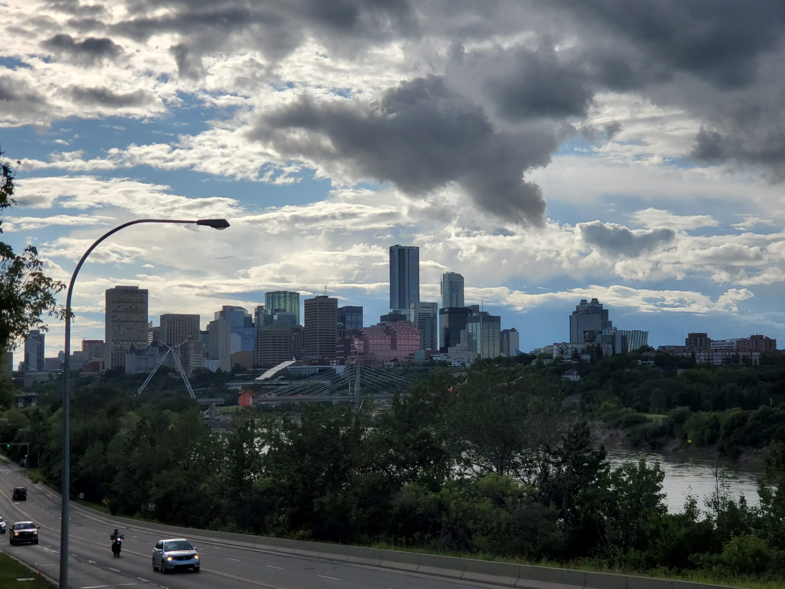
    The downtown Edmonton skyline seen from across the river valley
    Downtown Edmonton above the North Saskatchewan valley (Photo: Matthew Boonstra via Wikimedia Commons, CC BY-SA 4.0)

    Edmonton’s weather, season by season

    Edmonton sits at 53 degrees north, farther north than any other big city on the continent, and its climate is continental to the core: cold, dry winters with far more sunshine than eastern Canada’s, warm and fairly dry summers, and short transitions between. The reward for the latitude is the light, with sunset after ten in late June and a long blue dusk beyond it. The figures below are approximate seasonal patterns based on the long-term climate normals from Environment and Climate Change Canada; check the current forecast before you pack.

    MonthTypical daytime highTypical overnight lowWhat it feels likeFare pressure
    Januaryaround -6 °Caround -15 °CCold, dry, bright; cold snaps to -30 °C and belowLow after the first week
    Februaryaround -3 °Caround -12 °CSimilar; the light returns fast; Silver Skate FestivalLow; Family Day spike
    Marcharound 3 °Caround -8 °CThaw and refreeze; late stormsLow; spring-break spike
    Aprilaround 12 °Caround -1 °CBrown, windy, unpredictable; Oilers playoffs beginLow, unless the Oilers are winning
    Mayaround 18 °Caround 5 °CGreen arrives in the second half; snow still possibleModerate; May long weekend and playoffs
    Junearound 21 °Caround 10 °CLong, warm, showery; sunset after 10 p.m.Moderate
    Julyaround 24 °Caround 12 °CWarm, dry, sunny; the warmest month; K-DaysModerate to high
    Augustaround 23 °Caround 11 °CWarm, settled; Folk, Heritage and Fringe festivalsPeak in the first three weeks
    Septemberaround 17 °Caround 5 °CCooling fast; aspens gold in the last two weeks; frostModerate, falling after Labour Day
    Octoberaround 10 °Caround -1 °CCrisp; first snow usually arrivesLow; Thanksgiving spike
    Novemberaround 0 °Caround -9 °CWinter sets in; short daysLow
    Decemberaround -5 °Caround -13 °CCold, festive, dark by 4:30 p.m.Low until mid-month, then a holiday rise

    Two things the table cannot show. First, Edmonton’s dryness: winter cold here is a dry cold, which is more bearable than the damp -10 °C of Toronto, and summers rarely have the humidity of the east. Second, the daylight: seventeen hours of it in late June, less than eight in late December. A June visit feels longer than the calendar says; a December one feels shorter.

    How Edmonton’s fare seasons work

    Three things drive seats into Edmonton: leisure demand, which follows the weather and the festivals; the energy and government economies, which fill weekday flights from Calgary, Toronto and Vancouver year-round and keep hotels busy mid-week; and the north, because Edmonton is the connecting airport for Fort McMurray, Yellowknife and the territories, which adds a steady base of traffic that does not care about the season. The result is a fare curve with a summer plateau, an August peak, a long soft winter with holiday bumps, and an Oilers wildcard.

    Peak season

    Late July through the third week of August, plus roughly December 18 to January 3. K-Days at the end of July starts it; the Folk Festival in the second weekend of August, the Heritage Festival on the August long weekend and the Fringe in the second half of the month keep hotels full for three weeks. Book early for any of these, and book the hotel first for the Folk Festival weekend.

    Shoulder season

    June to late July, and September to mid-October. June is the best-value warm month, with the longest days and the Street Performers Festival and Pride to start the season; September is quieter and cheaper, with the valley in colour. Watch the May long weekend, Labour Day and Thanksgiving.

    Low season

    November, and mid-January to April outside the Family Day weekend and the March spring break. Fares are at their lowest, hotel rates too, and the city’s winter festivals and the Oilers are the draw. The exception is a playoff run: if the Oilers are alive in April or May, downtown hotel rates on game nights climb steeply and flights from Canadian cities fill with travelling fans, sometimes within a day of a series being confirmed.

    As elsewhere, mid-week departures and early or late flights usually price below Friday and Sunday afternoons on the same route, and a whole-month search reveals cheaper pairs of dates close to your first choice. Our guide to the best times to book explains how to read those patterns.

    The frozen North Saskatchewan River in Edmonton in winter
    The river valley in winter: cold, dry and bright, and the cheapest season to fly in (Photo: formulanone from Huntsville, United States via Wikimedia Commons, CC BY-SA 2.0)

    Edmonton month by month

    January

    Cold, dry and bright, and, after the first week, the cheapest month of the year to fly in. The river valley trails are groomed for skiing, the Ice District is at its busiest with the Oilers, the Deep Freeze festival on Alberta Avenue and the Flying Canoë Volant light festival in the Mill Creek ravine give the city its winter colour, and the mall’s waterpark is the family fallback. Dress for -25 °C and it is a fine, cheap trip.

    February

    Similar weather with noticeably more daylight. The Silver Skate Festival in Hawrelak Park is the city’s main winter event, and the Family Day long weekend on the third Monday is the one date when fares from other Canadian cities rise. Otherwise a low-fare month.

    March

    Thaw and refreeze, with late snowstorms most years. The mid-to-late March spring break lifts fares for a fortnight; the rest of the month is cheap and unglamorous.

    April

    Brown, windy and unpredictable, the least rewarding month for scenery and one of the cheapest, with one large exception: the NHL playoffs begin in mid-April, and in a year when the Oilers go deep, the city transforms and hotel rates with it. If the team is in contention, book early or plan around game nights.

    May

    Green arrives in the second half of the month, the farmers’ markets move outdoors, and the patios open on Whyte. The May long weekend (the Monday before May 25) is the traditional start of the camping season and a busy travel weekend, and a continuing playoff run keeps downtown tight. Early May is the value play.

    June

    The best-value warm month: the valley is green, the days run past ten at night, the Street Performers Festival and Pride open the festival season, and fares are moderate. The Oilers’ season ends, with a Stanley Cup Final in mid-June if the year is a good one.

    July

    Warm, dry and sunny, the warmest month of the year, with Taste of Edmonton, the Street Performers, the Freewill Shakespeare Festival in Hawrelak Park and, in the last ten days, K-Days, the summer fair. Fares step up through the month toward August.

    August

    Peak. The Folk Music Festival on the second weekend, the Heritage Festival over the August long weekend, and the Fringe in the second half fill the city, and the hotels in Old Strathcona and downtown sell out around them. The last week of August, once the Fringe closes, is a small pocket of relief before September. If you are coming for the festivals, book the hotel first; the Edmonton hotel search shows what is left.

    September

    Cooling fast but often lovely, with the aspens gold in the valley in the last two weeks, the Kaleido festival on Alberta Avenue, the film festival, and the Oilers and Elks both in season. Fares ease after Labour Day, and mid-September is one of the best-value windows of the year.

    October

    Crisp, with the first lasting snow usually by the end of the month. Fares are low apart from the Thanksgiving weekend on the second Monday, and Jasper’s Dark Sky Festival in the middle of the month is a reason to combine the city with the mountains.

    November

    Winter sets in, the days shorten, and fares and hotel rates are at their annual low. The Canadian Finals Rodeo, when it is in the city, and the Oilers are the draw; the Legislature’s lights switch on at the start of December.

    December

    Two months in one. The first half continues November’s pricing with the holiday lights on the Legislature grounds and in the Ice District; the last two weeks bring the holiday rise as students and families move, and the northern connections fill with workers heading home.

    Events that move Edmonton flight and hotel prices

    Cross-check these against your dates before you book. Exact dates shift each year; Explore Edmonton keeps the current calendar.

    • Family Day weekend (third Monday of February).
    • Spring break (mid-to-late March).
    • Oilers playoff series (mid-April to mid-June in a good year): the single most unpredictable hotel spike in the city.
    • May long weekend (Monday before May 25).
    • K-Days (late July).
    • Edmonton Folk Music Festival (second weekend of August).
    • Heritage Festival (August long weekend).
    • Edmonton International Fringe Theatre Festival (second half of August).
    • Labour Day and the university move-in (first week of September).
    • Thanksgiving (second Monday of October).
    • Christmas to New Year.
    • Stadium concerts at Commonwealth Stadium and arena shows at Rogers Place; our Edmonton events page shows what is on sale for your dates.

    Getting in from the airport

    Edmonton has one commercial airport, Edmonton International (YEG), about 30 kilometres south of downtown beside Leduc, which makes it one of the more distant airports of any Canadian city. It has a single terminal, nonstop flights from most Canadian cities and several U.S. hubs, seasonal European and sun-destination service, and heavy traffic to the north. Getting downtown takes planning: a taxi or ride-hail takes 30 to 45 minutes and is priced for the distance; the airport’s public bus route runs to the Century Park LRT station on the south side, from which the train reaches downtown in about 25 minutes; private shuttles serve the hotels; and every major rental company is in the terminal. For a group, or with luggage, the rental is often the cheapest way into the city and the natural choice if Jasper or Elk Island is in the plan. Our YEG airport guide covers the layout, and our car-versus-transit guide works through whether you need one.

    The departures area at Edmonton International Airport (YEG)
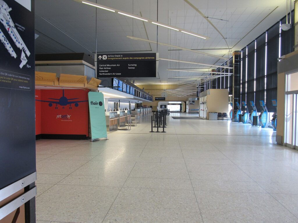
    Edmonton International (YEG), about 30 kilometres south of downtown (Photo: Khoshhat via Wikimedia Commons, CC BY-SA 4.0)

    Timing tricks that work for Edmonton

    • Search the whole month. The August festivals create a three-week plateau with sharp edges: late July and the last days of August are noticeably cheaper. A calendar search on TicketScanner shows the edges instantly.
    • Check the Oilers’ schedule. A home playoff game can make downtown hotels unaffordable for a night; shift by a day, stay in Old Strathcona or the west end, or embrace it and get a ticket. Our Edmonton events page lists what is on sale.
    • Book the hotel first for the Folk Festival. Rooms near Gallagher Park disappear before fares rise; run an Edmonton hotel search before you commit to the flight.
    • Price Calgary too. Calgary’s airport is three hours south on a divided highway, often has better fares, especially from overseas, and a one-way rental between the two cities is a classic Alberta itinerary. Compare Calgary flights against Edmonton’s, and see our Calgary to Edmonton route guide.
    • Fly mid-week. Edmonton’s business and northern traffic makes Monday morning and Friday afternoon the busiest and priciest flights on the Calgary, Vancouver and Toronto routes; Tuesday to Thursday is the value.
    • Think of June as August without the crowds. The valley is green, the light is longer, and the city is cheaper.
    • Build a winter buffer. Extreme cold and snow can disrupt YEG between November and March, and the drive from the airport is long; avoid the tightest connections. Our guide to how early to arrive covers what to allow.
    • Flying out of Edmonton instead? The same seasonality applies in reverse; see cheap flights from Edmonton.
    The interior atrium at West Edmonton Mall
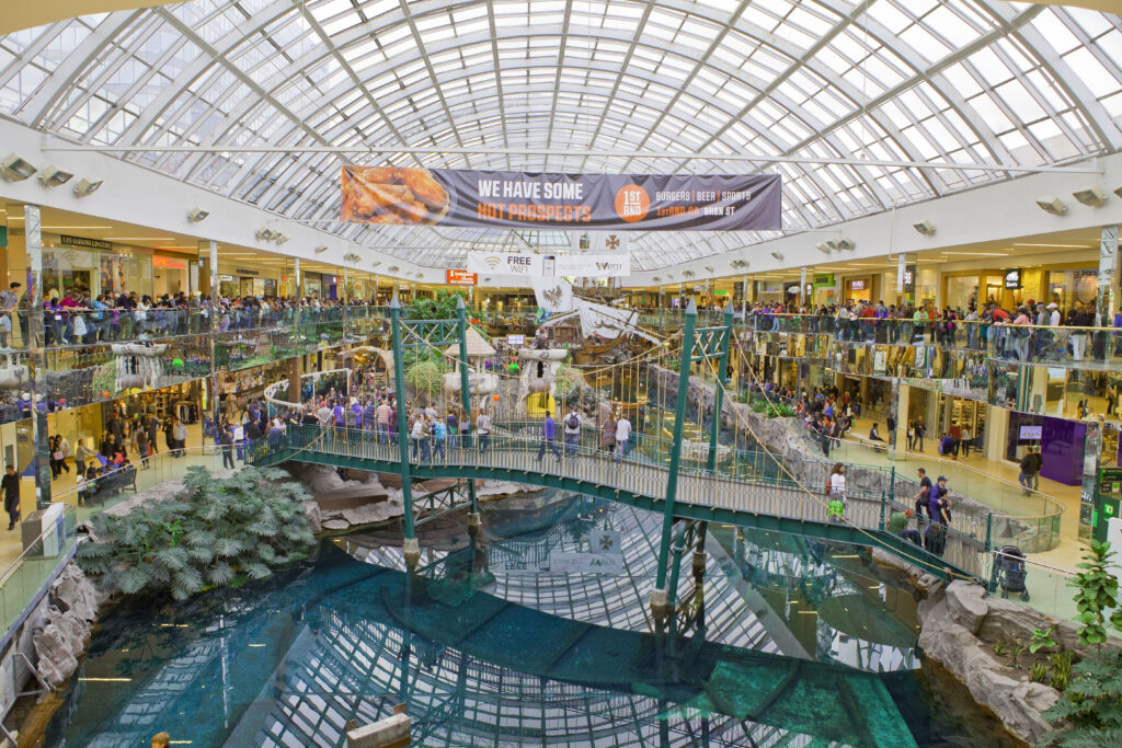
    West Edmonton Mall, one of the largest shopping and entertainment complexes in North America (Photo: GoToVan via Wikimedia Commons, CC BY 2.0)

    Edmonton or Calgary: choosing your gateway

    Alberta has two big airports three hours apart on a divided highway, and for many trips it is worth pricing both. Calgary has more nonstop routes, especially from the United States and Europe, and its fares from overseas are frequently lower; Edmonton has the shorter drive to Jasper, the direct connections to the north, and, for a city-focused trip, the cheaper hotels once you land. The classic way to use both is a one-way rental: fly into whichever is cheaper, drive the Icefields Parkway between Jasper and Lake Louise in the middle of the trip, and fly home from the other, which most rental companies allow for a modest drop fee. Compare Calgary flights against Edmonton’s for your dates, and read our Calgary to Edmonton route guide for the drive between them. For a trip that is only Edmonton, the difference between the two airports rarely justifies the three hours on Highway 2, except in the August festival weeks or during a playoff run, when Edmonton’s own fares are at their highest and Calgary’s may not be.

    How far ahead to book

    Edmonton rewards early booking for its August peak and its holiday weeks and patience for everything else. For the Folk Festival, the Heritage Festival and the Fringe, both flights and hotels tend only to rise as the dates approach, and Old Strathcona’s rooms sell out weeks ahead, so book as soon as your dates are fixed, with the hotel first. For June, July and September, a few weeks out is usually enough for the flight and hotel rates are stable. For the low season, from October through April, fares are low and flat, last-minute deals are common on the Calgary, Vancouver and Toronto routes, and the only reason to book early is to lock in a particular non-stop time. The exception is playoff hockey, which nobody can plan around: if the Oilers advance, everyone books at once, and the traveller who moves the same day the series is confirmed gets the room. In every season, a whole-month search on our Edmonton flights page will show you the cheap dates near your own.

    What to pack, by season

    Winter (November to March): a genuinely warm coat rated for -25 °C or colder, a hat, insulated gloves, a scarf or neck warmer, boots with grip and insulation, and layers; the dry cold is more bearable than it sounds but it is not forgiving of underdressing. Spring (April to May): layers, a windproof shell, and be ready for snow into May. Summer (June to August): light clothing, sun protection, a warm layer for the cool evenings, an eye mask if the late light bothers you, and rain gear for the June showers. Fall (September to October): layers, a warm jacket by October, and walking shoes for the valley trails.

    The best time to fly to Edmonton for…

    The festivals

    The first three weeks of August, booked early with the hotel first; the Folk Festival’s tickets sell out in hours when they go on sale in the spring.

    The Oilers

    October to April for regular-season games; April to June, at short notice and high prices, for the playoffs.

    Jasper and the northern Rockies

    Late June to mid-September for hiking, with the Dark Sky Festival in October and the ski season at Marmot Basin from November to April; the Icefields Parkway is at its best from July to September.

    The lowest fares

    November, January and February outside the holiday weeks, and April if the Oilers are out of contention.

    Families

    Late June or the last week of August, when the valley and Fort Edmonton are at their best and the festival hotels have eased; in winter, the mall’s waterpark and the valley’s skating make January a cheap and workable option.

    Cross-border and international visitors

    U.S. citizens need a valid passport; most other visa-exempt travellers arriving by air need an Electronic Travel Authorization. The Government of Canada’s visitor page explains what applies to you, and CATSA lists what you can carry through security.

    Frequently asked questions

    What is the cheapest month to fly to Edmonton?

    November and January are consistently the lowest, with February, early March and April close behind outside the holiday weekends and any Oilers playoff run.

    What is the best month to visit Edmonton?

    August for the festivals, June for weather and value, September for the fall colour in the valley. For a winter visit, February has the most light and the Silver Skate Festival.

    How cold does Edmonton get?

    Winter highs are around -5 °C and lows around -15 °C on an average day, with cold snaps to -30 °C or below most winters. It is a dry cold, and the sun is out most days.

    Should I fly into Edmonton or Calgary?

    Edmonton for the city itself, Jasper and the north; Calgary for Banff and often for the cheaper fare from overseas. The three-hour drive between them makes a one-way rental an easy way to do both.

    How far is the airport from downtown?

    About 30 kilometres, 30 to 45 minutes by taxi, or bus plus LRT in about an hour. Factor the transfer into a short trip.

    How far ahead should I book?

    Earlier for the August festivals and the Christmas weeks, when fares only rise; for the low season, fares are stable and finding the right dates matters more. Playoff travel is booked at short notice by everyone, so move quickly when a series is confirmed.

    Ready to pick your dates? Compare fares across the whole month on our Edmonton flights page, then find a room with our Edmonton hotel search. For what to do when you land, start with our first-timer’s guide to Edmonton.

  • Things to Do in Edmonton: A First-Timer’s Guide

    Things to Do in Edmonton: A First-Timer’s Guide

    Edmonton is the northernmost big city in North America, the capital of Alberta, and, by its own cheerful admission, a place that people rarely put on a bucket list. That is their loss. It has the largest stretch of urban parkland in Canada running through its middle, a river valley twenty-two times the size of Central Park that you can hike, ski or cycle end to end. It has a festival season so dense that the city calls itself Festival City without irony, with the second-largest fringe theatre festival in the world and a folk festival on a hillside that regulars call the best-run in North America. It has the Oilers and a downtown that has been rebuilt around their arena, a strip in Old Strathcona that is the best night out in the province, a provincial museum and an art gallery that both punch above their weight, a mall that is still a genuine tourist attraction after forty years, and a food scene shaped by a wave of newcomers that has made it the cheapest good eating in western Canada. And it is the gateway to Jasper and to the north. This guide covers the sights, the neighbourhoods, the festivals, the food, the day trips and the practical details for a first visit.

    If you are still comparing cheap flights to Edmonton, read this alongside our guides to the best time to fly to Edmonton and whether you need a car. Between the three you can plan the whole trip.

    The downtown Edmonton skyline above the North Saskatchewan River valley
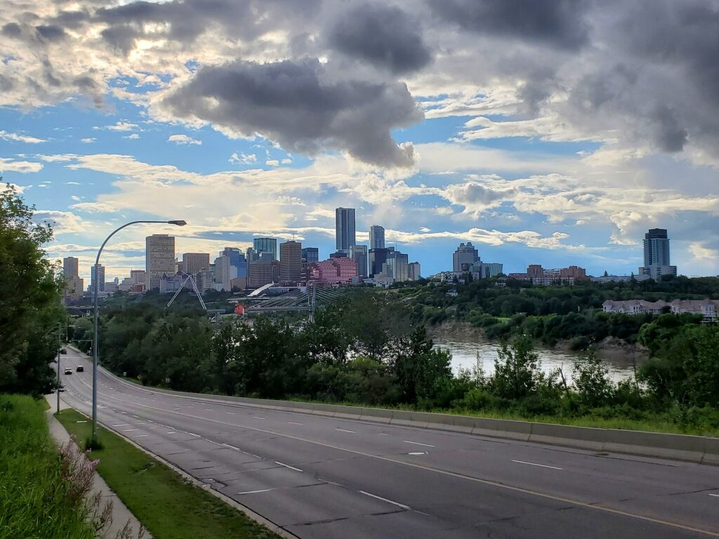
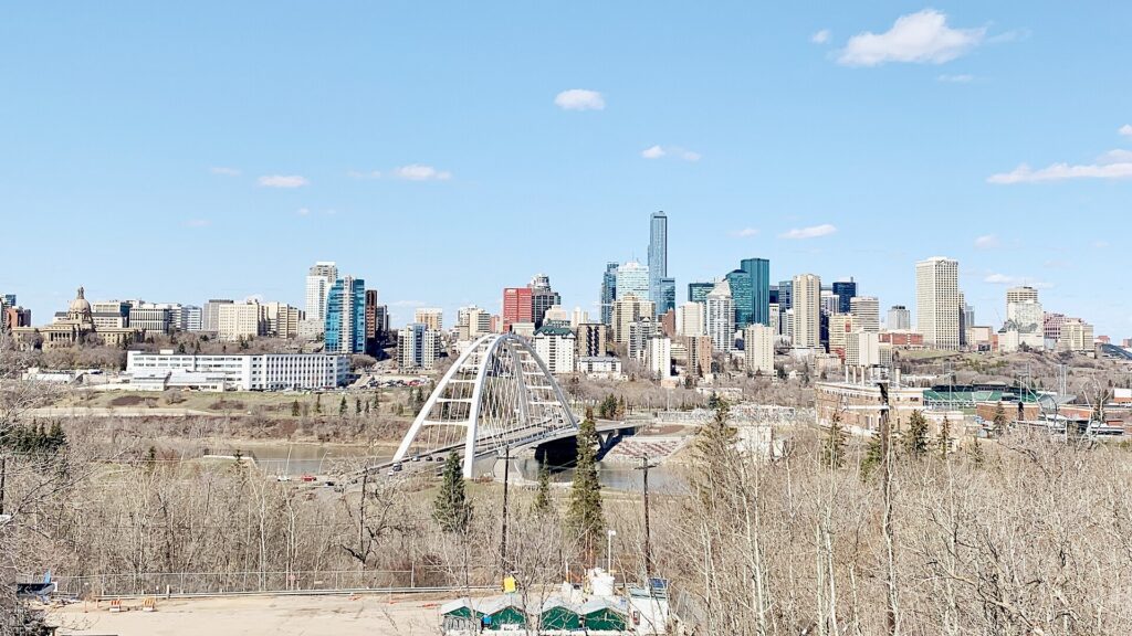
    Downtown Edmonton from Saskatchewan Drive, across the largest urban parkland in Canada (Photo: TagaSanPedroAko via Wikimedia Commons, CC BY-SA 4.0)

    Edmonton at a glance for first-timers

    • Airport: Edmonton International (YEG), about 30 km south of downtown near Leduc, one of the more distant airports of any Canadian city; a taxi or ride-hail takes 30 to 45 minutes, and a public bus route connects to the LRT. See our YEG airport guide.
    • Getting around: the LRT covers downtown, the university, the Ice District and the Valley Line to the southeast; downtown, Old Strathcona and the river valley trails between them are walkable. Beyond that, and for the day trips, most visitors rent a car.
    • Money: Canadian dollars. Alberta has no provincial sales tax, so only the 5 percent federal GST is added at the till. Tipping 15 to 20 percent in restaurants is customary.
    • Weather: long, cold, dry winters with more sunshine than you expect; warm, dry summers with daylight past ten at night in June; short springs and falls. Pack layers in every season. Our month-by-month guide has the detail.
    • Where to stay: downtown and the Ice District for the arena, the museums and the LRT; Old Strathcona for restaurants, bars and the Fringe; the south side near the university for value; the west end for the mall. Our Edmonton hotel search covers them all.

    The river valley

    Start with the geography, because the North Saskatchewan River valley is the reason Edmonton is worth visiting and the thing that surprises every first-timer. It is a green gash a hundred metres deep running diagonally across the whole city, and within it are more than twenty parks connected by some 160 kilometres of trails, plus a funicular, a footbridge network, ski hills, golf courses, a zoo, a botanical conservatory and a fort. Start at the 100 Street Funicular beside the Hotel Macdonald, which drops you from downtown to the valley floor with a viewing platform on the way, and walk or cycle in either direction: east to the Muttart Conservatory’s glass pyramids and Gallagher Park, west under the High Level Bridge to Kinsmen Park and the Legislature grounds. Hawrelak Park, further west, is the venue for the Heritage Festival and the Symphony Under the Sky, and Fort Edmonton Park, at the western end, is a living-history park with a fur-trade fort, three period streets, a steam train and a midway that is the city’s best family day. In winter, the trails are groomed for cross-country skiing, the ski hills in the valley open, and the river freezes; the Silver Skate Festival in February and the ice castle installations in past winters have been the valley’s cold-weather draw. Rent a bike from the shops near Old Strathcona or downtown; the valley is flatter than it looks once you are down in it.

    Downtown and the Ice District

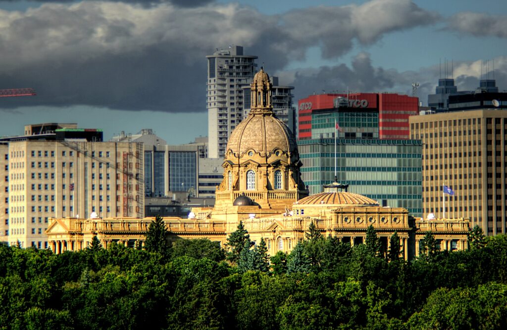
    Downtown Edmonton was rebuilt around the Oilers. Rogers Place, the arena that opened in 2016, anchors the Ice District, a cluster of towers, hotels, restaurants and a public plaza that fills on game nights and concert nights and is where a visitor staying downtown ends up. A block east, Churchill Square is the civic centre: the Art Gallery of Alberta, in a swooping steel-and-glass building by Randall Stout that is worth seeing even from outside, the Winspear Centre for the symphony, the Citadel Theatre, city hall, and the Royal Alberta Museum, the largest museum in western Canada, with natural history, Indigenous history and a bug gallery that children remember. The Alberta Legislature, a Beaux-Arts dome on the river bank a short walk south, offers free guided tours, and its grounds, with fountains and wading pools in summer and a light show at Christmas, are the best free afternoon in the city. Jasper Avenue, the downtown’s main street, has the office-tower restaurants and the historic Hotel Macdonald; 104 Street, a block north, is the small pedestrian-friendly strip of independent restaurants and the Saturday farmers’ market in summer.

    The Alberta Legislature Building in Edmonton
    The Alberta Legislature and its grounds, free to tour and the city's best picnic lawn (Photo: WinterE229 (WinterforceMedia) via Wikimedia Commons, CC0)

    Whyte Avenue and Old Strathcona

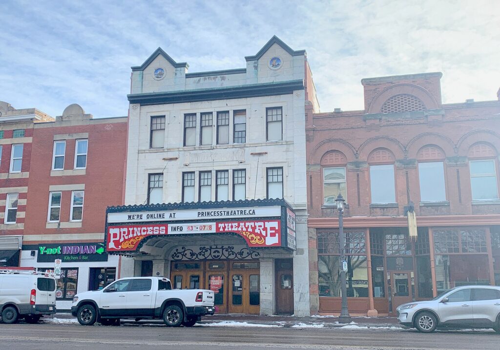
    South of the river, Old Strathcona was a separate town until 1912, and it kept its brick main street. Whyte Avenue, 82 Avenue, runs through it for a dozen blocks of bars, restaurants, cafés, vintage shops, bookstores, independent theatres and the Old Strathcona Farmers’ Market, which runs on Saturdays year-round in a former bus barn and is one of the best in Canada. It is the city’s nightlife district, its student district and the home of the Fringe, and on a summer evening it is the most alive street in Alberta. The side streets have the Princess Theatre, the Varscona and the Walterdale theatres, the Garneau cinema, and the restaurants that locals argue over. The university campus and the river valley are a ten-minute walk north.

    The Princess Theatre on Whyte Avenue in Old Strathcona, Edmonton
    Whyte Avenue in Old Strathcona, the neighbourhood where Edmonton goes out (Photo: TagaSanPedroAko via Wikimedia Commons, CC BY-SA 4.0)

    West Edmonton Mall

    Forty years after it opened, West Edmonton Mall is still one of the largest shopping centres in the world and still, improbably, one of Alberta’s most visited attractions. The shops are the least of it. Inside are a full waterpark with a wave pool and slides, an indoor amusement park with a roller coaster, an ice rink where the Oilers occasionally practise, a sea-lion show and aquarium, a mini-golf course, a replica of Columbus’s Santa Maria, a themed hotel, a casino, and two streets modelled on Bourbon Street and a European boulevard. It is kitsch and enormous and, on a -30 °C day in January, exactly what a visiting family wants. It is in the west end, a bus or a drive from downtown.

    Museums and culture

    Beyond the Royal Alberta Museum and the Art Gallery of Alberta, Fort Edmonton Park is the third essential, especially with children; the Indigenous Peoples Experience there is one of the best of its kind in the country. The Telus World of Science, in the west end, has the planetarium and an IMAX. The Muttart Conservatory‘s four glass pyramids in the river valley hold arid, temperate and tropical biomes and a rotating feature display, and are photogenic from outside at any time of year. The Alberta Aviation Museum, in a wartime hangar at the old city-centre airport, and the Ukrainian Cultural Heritage Village, a living-history site east of the city, reflect two of the things that built Edmonton. The Citadel Theatre and the Winspear Centre hold the main stages; for what is on during your dates, our Edmonton events page lists concerts, shows and games.

    Festival City

    Edmonton earns its nickname. The Edmonton International Fringe Theatre Festival, in the second half of August in Old Strathcona, is the largest fringe in North America and second in the world only to Edinburgh’s, with more than a thousand performances and a street festival around them. The Edmonton Folk Music Festival, in early August in Gallagher Park, puts the audience on a natural hillside facing the skyline and books far beyond folk; its tickets sell out in hours. The Heritage Festival, on the August long weekend in Hawrelak Park, is a three-day feast of food and performance from more than a hundred cultural communities and one of the best free events in the country. K-Days, the ten-day summer fair in late July, brings a midway and concerts to the Expo Centre. The Edmonton International Street Performers Festival in July, the Taste of Edmonton in late July, the Interstellar Rodeo, Cariwest Caribbean festival, Pride in June, and, in winter, the Silver Skate Festival and the Flying Canoë Volant light festival in the Mill Creek ravine fill in the rest. Explore Edmonton keeps the calendar.

    Crowds on the hill at the Edmonton Folk Music Festival in Gallagher Park
    The Folk Music Festival on the Gallagher Park hill in August, with the skyline as the backdrop (Photo: Mack Male from Edmonton, AB, Canada via Wikimedia Commons, CC BY-SA 2.0)

    Sports

    The Oilers are the city’s religion, and a game at Rogers Place, in the middle of the Ice District, is the single most Edmonton thing a visitor can do; a playoff run in spring turns the district into a street party. The Edmonton Elks play Canadian football at Commonwealth Stadium, north of downtown on the LRT, from June to November, and the stadium also hosts the big summer concerts. The Oil Kings, the junior hockey team, also play at Rogers Place, and are the cheap way to see the arena. See what is on sale in Edmonton for your dates before you book flights.

    What to eat, and where

    Edmonton eats well and cheaply, and the reason is who lives here. It has one of the largest Ukrainian communities outside Ukraine, and perogies, cabbage rolls and kubasa are in every farmers’ market and half the diners. It has a large and long-established Vietnamese community, with the pho and bún along 97 Street, Chinatown’s spine, and on the south side that rank with Calgary’s. It has a big Filipino community, a growing South Asian one along 34 Avenue and in Mill Woods, an Ethiopian strip along 118 Avenue, Lebanese bakeries, and a green-onion-cake tradition, a Chinese pancake adopted as the city’s unofficial street food and sold at every festival. Alberta beef and bison anchor the steakhouses downtown. The independent restaurants that draw the critics are on 104 Street downtown, on Whyte Avenue and its side streets, along 124 Street in the west end, and in the Ritchie and Highlands neighbourhoods. The Old Strathcona and 104 Street farmers’ markets are the places to graze; the craft breweries are concentrated in the Ritchie and Old Strathcona industrial blocks. Brunch is an institution, and the queues on Whyte on a Sunday morning are real.

    Neighbourhoods worth a half-day

    124 Street

    West of downtown, 124 Street is a walkable strip of galleries, independent restaurants, bakeries and design shops, with the High Street market and the Roxy Theatre, and the closest thing Edmonton has to a gallery district.

    Chinatown and 97 Street

    Northeast of downtown, the old Chinatown is threadbare but the food along 97 Street is some of the cheapest and best in the city.

    Ritchie and Mill Creek

    South of Whyte, the Ritchie Market building, with its butcher, brewery and coffee roaster, is the hub of a neighbourhood of breweries and small restaurants, and the Mill Creek ravine trail runs through it into the river valley.

    Highlands and Alberta Avenue

    North of the river, the Highlands is a heritage neighbourhood with a strip of cafés and a golf course above the valley, and Alberta Avenue, 118 Avenue, has the Ethiopian restaurants and the Kaleido arts festival in September.

    Strathcona to the university

    Between Whyte and the river, the tree-lined streets of Garneau and the university campus have the Garneau cinema, the campus’s small museums, and, in winter, the university’s Butterdome and the Clare Drake arena.

    Edmonton through the seasons

    Summer (June to August) is the reason to come: the festivals, the river valley in full leaf, the farmers’ markets, patios on Whyte, and daylight until after ten in June. Fall (September to October) is short, gold and quiet, with the aspens in the valley turning in the last two weeks of September, the Oilers and Elks both in season, and Kaleido and the film festival on the calendar. Winter (November to March) is long and cold but bright and dry, and the city has learned to embrace it: cross-country skiing and skating in the valley, the Silver Skate Festival, Flying Canoë Volant, the Deep Freeze festival on Alberta Avenue, the Legislature’s light display, the mall’s waterpark, and the Oilers at their most intense. Dress properly and it is a good time to visit at the lowest prices of the year. Spring (April to May) is brown and windy, then suddenly green in the second half of May; it is the cheapest season and the least rewarding, unless the Oilers are in the playoffs. Our month-by-month guide matches each season to fares.

    Edmonton with kids

    Few cities are easier with children, especially in winter. Fort Edmonton Park, the Royal Alberta Museum’s bug gallery and children’s gallery, the Telus World of Science, the Valley Zoo, and the waterpark and amusement park at West Edmonton Mall are each a full day. The river valley’s playgrounds, the wading pools at the Legislature grounds in summer, the splash park at Hawrelak, the Muttart pyramids, the funicular ride and the Streetcar across the High Level Bridge, a summer heritage tram with the best view in the city, fill the gaps. K-Days in July is the fair, and the Heritage Festival in August is the cheapest way to feed a family from a hundred countries in an afternoon. Elk Island’s bison, forty minutes east, are the day trip children remember.

    Edmonton on a budget

    Edmonton is the cheapest of Canada’s big cities to visit, helped by the absence of provincial sales tax. The river valley, the Legislature tours and grounds, the funicular, the Muttart’s exterior, the Old Strathcona market, the Heritage Festival, the Fringe’s street festival and the Art Gallery of Alberta’s free evenings cost nothing; the museums and Fort Edmonton are moderately priced and cheaper online. Eat for very little along 97 Street, 34 Avenue and 118 Avenue, at the markets, and at the green-onion-cake stands at any festival. Hotel rates are well below Calgary’s, Vancouver’s or Toronto’s outside Oilers playoff runs and the August festival weeks; compare by neighbourhood on our Edmonton hotel search.

    Day trips from Edmonton

    Elk Island National Park, forty minutes east, is a fenced aspen parkland with free-roaming herds of plains and wood bison, a lake to paddle, a dark-sky preserve and easy trails; it is the day trip every visitor should make. The Ukrainian Cultural Heritage Village is on the same road. Jasper and the northern Rockies are four hours west on the Yellowhead Highway, and Edmonton is Jasper’s airport as much as Calgary is Banff’s; the Icefields Parkway between Jasper and Lake Louise is one of the great drives in the world, and Jasper’s dark-sky festival in October is a reason to make the trip in fall. Drumheller and the badlands are three hours southeast. Calgary is three hours south on the divided Highway 2, and a one-way rental between the two cities is a classic Alberta itinerary; our Calgary to Edmonton route guide covers it, and our Calgary guide covers the other end. The lakes north of the city, Pigeon Lake, Sylvan Lake and Lac Ste. Anne, are the summer cottage country. All of these need a car; see our Edmonton car rental page, and Travel Alberta for the wider province.

    Two sample itineraries

    Two days, no car

    Day one: the Royal Alberta Museum and the Art Gallery of Alberta in the morning, lunch on 104 Street, the Legislature tour and grounds in the afternoon, the funicular and a walk in the river valley, and an Oilers game or a show in the Ice District at night. Day two: the LRT to the university and a walk to Old Strathcona, the farmers’ market if it is Saturday, brunch and the shops on Whyte, a bike along the valley to the Muttart Conservatory and back over the High Level Bridge, and dinner and drinks on Whyte.

    Four days, with a car

    Add a day for Fort Edmonton Park and 124 Street, and a day for Elk Island’s bison with the Ukrainian Village on the way, or, with more time, drive to Jasper for two nights and return the car in Calgary.

    Practical details

    • Transit: Edmonton Transit’s LRT and buses; buy an Arc card or tap a credit card on the validators. See our transit-versus-car guide for detail.
    • From YEG: a taxi or ride-hail in 30 to 45 minutes, the public bus route to the LRT, or a rental from the terminal. The airport’s site covers ground transport.
    • Weather: layers in every season, real cold-weather gear from November to March, sun protection in summer. Environment Canada’s forecast is the one to check.
    • Time zone: Mountain, the same as Calgary and Denver.
    • Entry requirements: U.S. citizens need a valid passport; most other visa-exempt visitors arriving by air need an Electronic Travel Authorization. The Government of Canada’s visitor page is the authoritative source.
    • Safety: a safe city by any standard; parts of downtown and along 97 Street and the LRT stations late at night need ordinary big-city awareness.

    Frequently asked questions

    How many days do you need in Edmonton?

    Two full days covers downtown, Old Strathcona, the river valley and two museums; three adds Fort Edmonton and the mall; four adds Elk Island. Jasper needs two more nights.

    What is Edmonton best known for?

    The Oilers, West Edmonton Mall, the river valley, the Fringe and Folk festivals, and being the gateway to Jasper and the north.

    Is Edmonton worth visiting?

    Yes, especially from June to September when the festivals run and the valley is green, and it is the cheapest big-city break in Canada.

    Is Edmonton walkable?

    Downtown, Old Strathcona and the river valley trails between them are. The rest of the city, including the mall and the airport, assumes a car or a long bus ride.

    Do I need a car in Edmonton?

    Not for the core. For the mall, Fort Edmonton, Elk Island and Jasper, yes; rent for those days, or for the whole trip if Jasper is the plan.

    Is Edmonton cold?

    In winter, genuinely: -20 °C is normal and -30 °C happens. It is also dry and sunny, which makes it more bearable than it sounds, and the city is built to enjoy it. Summers are warm and long.

    Which is better to visit, Edmonton or Calgary?

    Calgary for the Rockies on the doorstep and the Stampede; Edmonton for the festivals, the river valley, the food and the prices. The three-hour drive between them makes doing both easy.

    Ready to go? Compare flights to Edmonton, find a place to stay with our Edmonton hotel search, and if Elk Island or Jasper is on the list, price a rental car for those days.

  • Best Time to Fly to Ottawa: Seasons, Weather & Prices

    Best Time to Fly to Ottawa: Seasons, Weather & Prices

    Ottawa is a four-season capital, and that is not a slogan. It has a hot, humid summer, a brilliant short fall, a cold winter that the city has turned into an attraction, and a spring that arrives all at once in May with a million tulips. Its airfares follow that calendar closely, with three sharp spikes, the Tulip Festival, Canada Day and Bluesfest, and Winterlude, sitting on top of a fare curve that is otherwise gentler and lower than Toronto’s or Montreal’s. Ottawa is also a government town, which means the weekday flights fill with business travellers when Parliament is sitting and empty in August and over the holidays, a pattern that works in a leisure traveller’s favour. This guide walks through the weather month by month, the fare seasons, the events that move prices, and the airport, which has changed a great deal in the last few years.

    The short answer

    The best combination of weather and value is September to mid-October, when the summer humidity breaks, the Gatineau hills turn colour, and fares and hotel rates ease after Labour Day. Early June is the other excellent window, after the Tulip Festival and before Canada Day, with long warm days and the city’s summer programming beginning. The cheapest fares come in late January through March outside the Winterlude weekends, and in November. The most expensive stretches are the Canada Day week around July 1, which runs straight into Bluesfest, the Tulip Festival in the second half of May, particularly the Victoria Day long weekend, and the Winterlude weekends in February, when the Skateway is at its busiest. Whatever you choose, run a flexible-date search on our Ottawa flights page; a shift of a few days around Canada Day or the tulips can change the fare band entirely.

    Red tulips at Commissioners Park during the Canadian Tulip Festival in Ottawa
    The Canadian Tulip Festival in May, the first of Ottawa's three big fare spikes (Photo: elPadawan via Wikimedia Commons, CC BY-SA 2.0)

    Ottawa’s weather, season by season

    Ottawa sits inland at the meeting of the Ottawa, Rideau and Gatineau rivers, far from the moderating effect of the Great Lakes, and its climate is more continental than Toronto’s: hotter in July, colder in January, with more snow and a faster transition between them. The figures below are approximate seasonal patterns based on the long-term climate normals from Environment and Climate Change Canada; check the current forecast before you pack.

    MonthTypical daytime highTypical overnight lowWhat it feels likeFare pressure
    Januaryaround -6 °Caround -14 °CCold, snowy, bright; the Skateway usually opensLow after the first week
    Februaryaround -4 °Caround -13 °CCold and often sunny; Winterlude weekendsLow, with Winterlude and Family Day spikes
    Marcharound 2 °Caround -7 °CThaw begins; Skateway closes; slush and sugar shacksLow; spring-break spike
    Aprilaround 11 °Caround 1 °CGrey, wet, then suddenly warm; the canal refillsLow to moderate
    Mayaround 19 °Caround 8 °CSpring in a rush; tulips, patios, the Race WeekendModerate to high in the second half
    Junearound 24 °Caround 13 °CWarm, long days; Jazz FestivalModerate, rising late in the month
    Julyaround 27 °Caround 16 °CHot and humid, with storms; Canada Day and BluesfestPeak in the first half
    Augustaround 25 °Caround 15 °CWarm, humid, settled; the city emptiesModerate; lower than July
    Septemberaround 20 °Caround 10 °CWarm days, cool nights; the best monthModerate, falling after Labour Day
    Octoberaround 13 °Caround 4 °CCrisp; Gatineau colour peaks in the first two weeksLow to moderate; Thanksgiving spike
    Novemberaround 5 °Caround -2 °CGrey; first snow; lights go upLow
    Decemberaround -3 °Caround -10 °CCold and festive; lights on the HillLow until mid-month, then a holiday rise

    Two things the table cannot show. Ottawa’s humidity makes July feel hotter and January feel colder than the numbers, and the winter here is real: -20 °C cold snaps are normal, the snowbanks last until April, and the city is built for it, with an indoor life, a cross-country ski culture and the Skateway. Visitors who arrive dressed for Toronto’s winter are underdressed.

    How Ottawa’s fare seasons work

    Ottawa’s flights are driven by three calendars: the government’s, which fills weekday flights from September to June and empties them in August and over the holidays; the festivals’, which produce the three spikes; and the university’s, with Carleton and the University of Ottawa moving tens of thousands of students in and out in early September, late December and late April. Underneath, leisure demand follows the weather. The result is a fare curve with a summer plateau that is lower than Toronto’s, two spring and summer spikes, and a winter that is cheap apart from February’s festival weekends.

    Peak season

    The second half of May through mid-July, plus roughly December 18 to January 3. The Tulip Festival and the Victoria Day weekend lift the second half of May; late June brings the Jazz Festival and school holidays; Canada Day, July 1, is the single biggest hotel spike of the year, with the national celebration on the Hill and at LeBreton Flats, and Bluesfest follows within a week or two. Book early for any of these, and book the hotel before the flight.

    Shoulder season

    Early May, mid-July through August, September and October. August is the pleasant surprise: the government is on holiday, the festival crowds have gone, the weather is settled, and fares and rooms are noticeably softer than July’s. September and early October are the best weather of the year and the best value of the warm months, with the Gatineau colours peaking in the first two weeks of October. Watch Labour Day and Thanksgiving.

    Low season

    November, and mid-January to April outside the Winterlude weekends, Family Day and the March spring break. Fares are at their lowest, the Skateway and the ski trails are open, and the museums are empty. Build a weather buffer into connections and pack properly.

    As elsewhere, mid-week departures and early or late flights usually price below Friday and Sunday afternoons on the same route, and a whole-month search reveals cheaper pairs of dates close to your first choice. Our guide to the best times to book explains how to read those patterns.

    Parliament Hill and the Ottawa skyline seen across the Ottawa River
    Parliament Hill above the Ottawa River, seen from the Gatineau side (Photo: LBM1948 via Wikimedia Commons, CC BY-SA 4.0)

    Ottawa month by month

    January

    Cold, bright and, after the first week, one of the cheapest months to fly in. The Rideau Canal Skateway usually opens in January, depending on the cold, and once it does the city’s winter comes alive; the Gatineau Park ski trails are in full operation, the Senators are at home, and the museums are quiet. Fares from Canadian cities are at their annual low.

    February

    Winterlude runs over the first three weekends, with ice sculptures in Confederation Park, the snow playground in Gatineau, and the Skateway at its busiest, and it is the one winter stretch when hotels fill and fares rise, especially over the Family Day long weekend on the third Monday. The weekdays between are still cheap, and February is the safest month for good ice.

    March

    The thaw. The Skateway usually closes in the first half of the month, the sugar shacks in the Ottawa Valley and across the river open for maple season, and the mid-to-late March spring break lifts fares for a fortnight. Otherwise a cheap, grey month.

    April

    Wet, grey and then, in the last week, suddenly warm. The canal refills, the paths dry out, and the city’s bikes come out. Fares are low, hotel rates are low, and the museums are the plan.

    May

    Spring arrives in a rush, and the second half is peak: the Canadian Tulip Festival fills Commissioners Park and the Hill for two weeks in the middle of the month, the Race Weekend brings tens of thousands of runners in the last weekend, and the Victoria Day long weekend on the Monday before May 25 sits in the middle of it. Early May is the value play, and it is often warm enough.

    June

    Long, warm, green and lively, with Italian Week on Preston Street, the Jazz Festival in the last week and the Changing of the Guard beginning on the Hill. Fares are moderate and rise as the month ends; the first three weeks are among the best windows of the year.

    July

    Peak. Canada Day on July 1 is the national celebration, and the city is at its fullest and most expensive for the days around it; Bluesfest follows within a week or two at LeBreton Flats and draws big-name headliners for ten days. After Bluesfest ends, the second half of July eases, though the weather stays hot and humid. If you are coming for either event, book the hotel first; the Ottawa hotel search shows what is left.

    August

    The quiet month, and the value month of the summer. Parliament and the civil service are on holiday, the festival crowds have gone, Chamberfest and the Lebanese Festival are the calendar, and the beaches at Meech Lake and Westboro are in use. Fares and hotel rates are noticeably lower than July’s.

    September

    The best month by most measures: warm days, cool nights, the humidity gone, and fares easing after Labour Day. The students return in the first week and the government in the second, which busies the weekday flights, but the weekends and the hotels are soft. The Animation Festival is in late September.

    October

    Crisp and colourful. The Gatineau hills peak in the first two weeks, and the park’s Fall Rhapsody weekends are the busiest of the season on the parkways; Thanksgiving, on the second Monday, is the one date to book around. Fares fall through the month.

    November

    Grey, cold and the cheapest month of the year, with the Christmas lights on the Hill switching on in early December to look forward to. The Senators and Redblacks are both in season. A museums-and-restaurants trip in November costs a fraction of one in July.

    December

    Two months in one. The first half is November’s pricing with the lights on the Hill and in the Market; the last two weeks bring the holiday rise as students and families move, though it is gentler than in Toronto, and the Skateway may open by New Year in a cold year.

    Skaters on the Rideau Canal Skateway during Winterlude
    Winterlude in February: the one winter stretch when Ottawa fares and hotels rise (Photo: Michel Rathwell from Cornwall, Canada via Wikimedia Commons, CC BY 2.0)

    Events that move Ottawa flight and hotel prices

    Cross-check these against your dates before you book. Exact dates shift each year; Ottawa Tourism keeps the current calendar.

    • Winterlude (first three weekends of February) and the Family Day long weekend.
    • Spring break (mid-to-late March).
    • Canadian Tulip Festival (mid-to-late May) and the Victoria Day weekend.
    • Ottawa Race Weekend (last weekend of May).
    • Ottawa Jazz Festival (late June).
    • Canada Day (July 1): the single largest hotel spike of the year.
    • Bluesfest (early-to-mid July).
    • Labour Day and the university move-in (first week of September).
    • Thanksgiving (second Monday of October) and the Gatineau colour weekends.
    • Christmas to New Year.
    • Senators playoff runs and stadium concerts at TD Place; our Ottawa events page shows what is on sale for your dates.

    Getting in from the airport

    Ottawa has one commercial airport, Ottawa Macdonald-Cartier International (YOW), about 10 kilometres south of downtown, with a single, easy terminal, nonstop flights from most Canadian cities and a handful of U.S. hubs, and seasonal flights to Europe and the sun destinations. The big change of the last few years is rail: the O-Train’s Line 2 and its airport branch, Line 4, now connect the terminal to the city, with a change at South Keys, and take you to Bayview to join the east-west Line 1 through downtown. Taxis and ride-hail pick up outside arrivals and take 20 to 30 minutes to the centre, and the rental counters are in the terminal. Check the airport’s site and OC Transpo for current service; our YOW airport guide covers the layout, and our car-versus-transit guide works through whether you need a rental.

    The terminal at Ottawa Macdonald-Cartier International Airport (YOW)
    Ottawa Macdonald-Cartier International (YOW), now linked to downtown by the O-Train (Photo: dave_7 from Lethbridge, Canada via Wikimedia Commons, CC BY-SA 2.0)

    Timing tricks that work for Ottawa

    • Search the whole month. Ottawa’s spikes are short and sharp: a week either side of Canada Day or the tulips can be dramatically cheaper. A calendar search on TicketScanner shows them instantly.
    • Consider August. It is the anomaly in Ottawa’s calendar: summer weather, empty government, low fares.
    • Book the hotel first for Canada Day, the tulips and Winterlude. Rooms disappear before fares rise; run an Ottawa hotel search before you commit to the flight.
    • Fly mid-week, but not with Parliament. Monday morning and Thursday evening are the government-traveller flights on the Toronto and Montreal routes when the House is sitting; Tuesday and Wednesday, and any day in August, are softer.
    • Price Montreal too. Montreal’s airport is two hours away by train or car and often has better international fares; a Montreal flight plus the train or a one-way rental can beat a direct flight to Ottawa from overseas, and you get two cities for one trip.
    • Toronto by road or rail. From Toronto, VIA Rail and the 401 are competitive with flying once airport time is counted; our Toronto to Ottawa route guide covers the drive.
    • Build a winter buffer. Snow can disrupt YOW between December and March; avoid the tightest connections. Our guide to how early to arrive covers what to allow.
    • Flying out of Ottawa instead? The same seasonality applies in reverse; see cheap flights from Ottawa.

    Ottawa, Montreal or Toronto: choosing your gateway

    Ottawa’s airport is convenient, but it is a regional one, and for anyone flying in from outside Canada the cheapest route is often through one of its bigger neighbours. From the United States, nonstop flights to Ottawa exist from a handful of hubs, and a connection through Toronto or Montreal is normal; from Europe, direct service is seasonal and limited, and most itineraries route through Toronto or Montreal anyway. That makes it worth pricing three options rather than one. First, a direct or one-stop fare into Ottawa. Second, a fare into Montreal, followed by VIA Rail’s two-hour service or a one-way rental up Highway 417, which turns the trip into a two-city holiday and often costs less overall. Third, a fare into Toronto, with a four-and-a-half-hour train or a short connecting flight; Toronto’s long-haul fares are frequently the lowest in the country, and the onward leg is cheap if booked early. The right answer depends on your origin and your dates, but the pattern is consistent: in Ottawa’s three spike periods, when direct fares are at their highest, the Montreal or Toronto route is most likely to save money, and in the low season, when Ottawa’s own fares are soft, the direct flight usually wins on time. Run all three on TicketScanner before you commit, and remember that a hotel in Montreal for a night is not a cost if you wanted to see Montreal anyway.

    How far ahead to book

    Ottawa rewards early booking for its spikes and patience for everything else. For Canada Day, the Tulip Festival and the Winterlude weekends, both flights and hotels tend only to rise as the date approaches, and downtown rooms sell out weeks ahead, so book as soon as your dates are fixed, with the hotel first. For the summer plateau and September, a few weeks out is usually enough for the flight, and hotel rates are stable. For the low season, from November through April, fares are low and flat, last-minute deals are common on the Toronto and Montreal routes, and the only reason to book early is to lock in a particular non-stop time. In every season, a whole-month search on our Ottawa flights page will show you the cheap dates near your own; the difference between a Wednesday and the adjacent Friday can be larger than any discount you will find by waiting.

    What to pack, by season

    Winter (December to March): a genuinely warm coat, a hat, gloves, a scarf, boots with grip, and layers; skates can be rented on the canal. Spring (April to May): a rain shell, layers, and a warm jacket for April; May can be hot. Summer (June to August): light clothing, sun protection, a rain shell for the storms, and something for air-conditioned museums. Fall (September to October): layers, a warm jacket by October, and walking shoes for the Gatineau trails.

    The best time to fly to Ottawa for…

    The tulips

    Mid-to-late May, booked early; the exact peak depends on the spring, and the festival’s site posts bloom updates.

    Canada Day

    Arrive by June 29 and leave July 2 or later, booked months ahead with the hotel first.

    Skating the canal

    February, with January and early March as the fringe; check the ice report before booking non-refundable fares, and consider Winterlude for the atmosphere or a mid-week in late January for the space.

    Fall colours

    The first two weeks of October, with the weekend parkway closures in Gatineau Park adding to the crowds; a weekday is better.

    The lowest fares

    November, and late January to April outside the festival and holiday weekends.

    Families

    August for the beaches and empty museums, or early July for Canada Day if you book far ahead.

    Cross-border and international visitors

    U.S. citizens need a valid passport; most other visa-exempt travellers arriving by air need an Electronic Travel Authorization. The Government of Canada’s visitor page explains what applies to you, and CATSA lists what you can carry through security.

    Frequently asked questions

    What is the cheapest month to fly to Ottawa?

    November and late January through March, outside the Winterlude and Family Day weekends, are consistently the lowest, with April close behind.

    What is the best month to visit Ottawa?

    September for weather and value, May for the tulips, February for the Skateway, and July for Canada Day, in roughly that order of ease.

    How expensive is Ottawa over Canada Day?

    Hotels downtown are at their annual maximum and book out; fares rise too, but less sharply. A week later, the city is at August prices.

    Is Ottawa cheaper than Toronto or Montreal to fly to?

    Often, from Canadian cities; from overseas, Montreal and Toronto usually have the cheaper long-haul fares and Ottawa is a short connection or a train ride from either.

    Can I rely on the Skateway being open?

    No. It depends on sustained cold; February is the safest bet, and a mild winter can shorten or nearly cancel the season. Have a Gatineau Park backup plan.

    How far ahead should I book?

    Earlier for Canada Day, the Tulip Festival and Winterlude, when fares only rise; for the low season, fares are stable and finding the right dates matters more.

    Ready to pick your dates? Compare fares across the whole month on our Ottawa flights page, then find a room with our Ottawa hotel search. For what to do when you land, start with our first-timer’s guide to Ottawa.

  • Ottawa: Should You Rent a Car or Rely on Public Transit?

    Ottawa: Should You Rent a Car or Rely on Public Transit?

    Ottawa is one of the easiest Canadian cities to visit without a car, and one of the few where the question is genuinely close for a lot of visitors. The core is compact: Parliament Hill, the ByWard Market, the National Gallery, the canal, Elgin Street and the Glebe are all within a half-hour walk of each other, the O-Train now runs from the airport through downtown, and the city has more kilometres of paved recreational pathway than almost anywhere in North America. But Ottawa’s second great attraction is Gatineau Park, a wilderness of hills and lakes fifteen minutes from Parliament that has no useful transit at all, and its third is the countryside of canal villages, rafting rivers and sugar shacks around it. So the answer depends on which Ottawa you are visiting. This guide explains how the city is laid out, how transit and fares work, what driving and parking are really like, when a car is worth it, and gives you a straightforward way to decide.

    The short answer

    Skip the car if you are staying downtown, in the ByWard Market or in the Glebe, and your plans are Parliament, the museums, the canal and the neighbourhoods; the O-Train, your feet and a bike will cover everything, and you will not pay downtown parking. Rent a car if Gatineau Park, the Nordik Spa, Wakefield, Merrickville, the rafting rivers or a road trip on to Montreal or Kingston is on the itinerary, if you are staying in the suburbs or Kanata, or if you are visiting in winter with young children. And for most first-time visitors who want both, the hybrid answer is the right one: car-free in the city, a one- or two-day rental picked up downtown for the park and the day trips. Compare rental rates for any of these plans on our Ottawa car rental page.

    How Ottawa is laid out

    Ottawa sits on the south bank of the Ottawa River, with Gatineau, Quebec, on the north bank and five bridges between them. The Rideau Canal runs south from the river through the middle of the city and splits the centre in two: west of it, Parliament Hill, the Sparks Street mall, Centretown and Elgin Street; east of it, the Château Laurier, the Rideau Centre, the ByWard Market, the National Gallery and Lowertown. The Glebe and Lansdowne are south along the canal; Little Italy, Chinatown and Dows Lake are to the southwest; Hintonburg, Wellington West and Westboro run west along the river; New Edinburgh, Rockcliffe and the aviation museum are east along Sussex Drive. Beyond that, the city is a wide ring of suburbs, with Kanata and the Senators’ arena far to the west, Orleans to the east, and Barrhaven and the airport to the south. The inner ring is walkable and cyclable; the suburbs assume a car.

    Hotels cluster around Parliament and the Rideau Centre, in the ByWard Market, along the O-Train corridor to the west, and near the airport and in Kanata for business travellers. Our Ottawa hotel search lets you compare them.

    Getting in from the airport

    Ottawa Macdonald-Cartier International (YOW) is about 10 kilometres south of downtown, and the arrival options have improved sharply. The O-Train‘s Line 4 runs from a station at the terminal to South Keys, where you change to Line 2 north to Bayview and then Line 1 east into downtown; it is a two-change journey but a cheap and reliable one. Taxis and ride-hail pick up outside arrivals and reach the centre in 20 to 30 minutes on the Airport Parkway. Every major rental company has counters in the terminal. Check the airport’s site and OC Transpo for current service; our YOW airport guide covers the layout.

    uOttawa station on the O-Train Confederation Line in Ottawa
    The O-Train's Line 1 at uOttawa station: the rail spine through downtown (Photo: Hutima via Wikimedia Commons, CC BY-SA 4.0)

    Ottawa’s transit, explained

    OC Transpo runs the O-Train light rail and the bus network on the Ontario side; the STO runs the buses in Gatineau, and the two systems accept each other’s fares on cross-river routes. The O-Train has had a difficult first few years, with reliability problems on Line 1 that made local headlines, so check for service notices on the day; when it is running, it is the fastest way across the city.

    The O-Train

    Line 1, the Confederation Line, runs east-west through downtown in a tunnel, with stations at Parliament, Rideau (for the Market and the Rideau Centre), uOttawa and Lyon, and continues west to Tunney’s Pasture and beyond, and east to Blair and, as the extensions open, toward Orleans. Line 2, the Trillium Line, runs north-south from Bayview, where it meets Line 1, past Carleton University and south to Limebank, and Line 4 branches off it to the airport at South Keys. For a visitor, Line 1 is the one you will use daily: Parliament station is a block from the Hill, Rideau is under the Market, and the ride between them is two minutes.

    Buses

    Buses feed the rail lines and cover the neighbourhoods off them, including Elgin Street, the Glebe and Lansdowne, Westboro and Wellington West, the Museum of Nature, the aviation museum at Rockcliffe, and, on game nights, the Senators’ arena in Kanata. Frequencies are good on the main routes during the day and thin out in the evenings; check times before relying on a bus for a late return.

    Fares and tickets

    Tap a contactless credit or debit card, or a phone wallet, on the readers at O-Train fare gates and bus doors, or buy a Presto card, the same card used in Toronto, and load it; single-ride paper tickets are also sold at station machines. A fare gives you 90 minutes of transfers across trains and buses, and day passes are available. Children twelve and under ride free with a fare-paying adult. Fares to and from the airport station are the standard fare. Check OC Transpo’s site for current prices and any special-event fares.

    Accessibility

    Every O-Train station is step-free, and every bus is low-floor and accessible.

    Beyond OC Transpo

    • Walking. Parliament to the Market is ten minutes; the Market to the Glebe is thirty along the canal. Most of a first visit is on foot.
    • Bikes and the pathways. The National Capital Commission’s pathway network runs for hundreds of kilometres along the canal, both rivers and out into Gatineau; bike-share e-bikes and scooters operate from spring to fall, and rental shops near the Market and at Dows Lake hire by the day. On Sunday mornings in summer, the parkways along the river and in Gatineau Park close to cars for cyclists. For a warm-weather visit, a bike is the best transit in the city.
    • Taxis and ride-hail. Uber, Lyft and licensed taxis cover the city; for a group, a short ride is competitive with transit fares and far quicker to Westboro or the aviation museum.
    • Crossing to Gatineau. The Museum of History and old Hull are a walk over the Alexandra or Portage bridge; STO buses cross from downtown; a bike is the best way to the Gatineau side’s paths.
    • Intercity. VIA Rail runs from the station east of downtown to Montreal in two hours and Toronto in four and a half; intercity buses serve the same cities and the towns of the valley.
    The Rideau Canal locks below the Château Laurier in Ottawa
    The canal locks below the Château Laurier: the pathways that start here are Ottawa's best summer transit (Photo: DavidWEnstrom via Wikimedia Commons, CC BY-SA 4.0)

    Driving in Ottawa: what it is really like

    Ottawa is an easy city to drive in by the standards of the big Canadian cities. The roads are wide, the grid is mostly logical, the Queensway (Highway 417) runs east-west across the city and is the way to the suburbs, and traffic is calmer than in Toronto or Montreal. The frustrations are specific. The Queensway jams in the weekday peaks, especially through the centre. The bridges to Gatineau back up at rush hour with commuters crossing provinces. Downtown is a tangle of one-way streets around Parliament, with Wellington Street in front of the Hill closed to through traffic, and it is not a place to drive between sights that are ten minutes apart on foot. Construction season runs from May to October. And winter is real: snow is cleared efficiently, but the side streets narrow to one lane between snowbanks, freezing rain is a hazard, and the Gatineau Park roads are closed to cars for the ski season.

    Parking

    Downtown hotels charge a nightly parking fee that is lower than Toronto’s but not trivial, and the commercial garages around the Rideau Centre and Sparks Street are priced accordingly. Street parking is metered downtown, with a phone-app option, and is free on Sundays and holidays in most of the core; it is scarce in the ByWard Market at any hour, and nearly impossible on a summer weekend evening. The museums have their own lots, which are the easy part; the aviation and agriculture museums, the War Museum and the Museum of History all have parking on site. In Gatineau Park, the parking lots at the lakes and the main trailheads fill by mid-morning on summer weekends and during the fall colour season, and the park charges for parking at the popular beaches. During Canada Day, the Tulip Festival and Winterlude, parking near the events is not worth attempting; take the O-Train.

    Rules and conditions worth knowing

    • Two provinces. Cross a bridge and the rules change: Quebec requires winter tires on every vehicle from December 1 to March 15, including rentals, and Quebec’s rental cars will have them; Ontario does not require them, and an Ontario rental may be on all-seasons. If you plan to drive in Gatineau in winter, ask for winter tires when you book.
    • Right turns on red are permitted after a full stop in Ottawa and, since 2003, in Gatineau outside the old Montreal-style ban, but watch for signs at individual intersections.
    • Photo radar and red-light cameras operate in Ottawa’s school zones and at major intersections; fines follow the car and the rental company will bill you.
    • Gatineau Park’s parkways close to cars on summer Sunday mornings and for the winter; check the National Capital Commission’s site for closures and the fall colour weekend shuttle system.
    • Highway 417 and the 401 to Toronto are toll-free; the 407 near Toronto is a toll road that bills the rental company by plate. See our Toronto to Ottawa route guide.
    • Fuel is cheaper in Ontario than in Quebec; fill up on the Ottawa side.
    • Wildlife is real on the Gatineau Park roads and the rural highways at dusk.
    The view from the Champlain Lookout in Gatineau Park in autumn
    Gatineau Park, fifteen minutes from Parliament and the main reason to rent a car (Photo: Dwong33 via Wikimedia Commons, Public domain)

    When renting a car makes sense

    • Gatineau Park. The Mackenzie King Estate, the Champlain Lookout, Meech Lake and the trailheads have no useful transit; a car turns the park from a logistical problem into a fifteen-minute drive.
    • Chelsea, Wakefield and the Nordik Spa, in the hills beyond the park.
    • Merrickville and the canal villages, an hour southwest along the Rideau.
    • Whitewater rafting on the Ottawa River near Beachburg, ninety minutes west.
    • Upper Canada Village, Kingston and the Thousand Islands, ninety minutes to two hours south.
    • Sugar shacks in March and April, in the valley on both sides of the river.
    • Senators games at the Kanata arena, which is a long bus ride from downtown; a car or a ride-hail is faster.
    • Staying in the suburbs or Kanata, or visiting family there.
    • A road trip on to Montreal, Quebec City or Toronto; one-way rentals between the cities are routine.

    If any of those apply, our rental car booking tips cover insurance, deposits and the questions to ask at the counter.

    When it does not

    • You are staying downtown, in the Market or in the Glebe and your plans are the city.
    • You are in town for Canada Day, the Tulip Festival or Winterlude, when the streets around the events close and parking vanishes.
    • You are visiting in summer and happy to cycle; the pathways reach most of what a visitor wants.
    • You are travelling solo and the rental, insurance and parking add up to more than a couple of ride-hails and a day pass.

    The hybrid plan

    Go car-free for the city days and rent for the park and the countryside. Pick the car up downtown, not at the airport: the airport concession fees are avoided, you do not pay hotel parking on the nights you are not using the car, and the drive to Gatineau Park from downtown is fifteen minutes over the Portage Bridge. Most companies have branches around the Rideau Centre and along Catherine Street south of downtown. Return it downtown before the last city day or at the airport on the way to the flight, which most companies allow within the city at little or no extra charge. Ask for winter tires from November to April if Gatineau is in the plan. Compare the day rates on our Ottawa car rental page against a full-trip rental and the difference is usually obvious.

    A worked cost comparison

    Numbers change with the season and the booking window, so treat this as a method rather than a quote, and check current rates before deciding. For a three-night city break downtown for two, the car-free version costs two O-Train fares from the airport and back, a day pass or two, a bike-share afternoon and perhaps one ride-hail to Westboro for dinner; the rental version adds three days of a compact car, three nights of hotel parking, fuel and airport fees, and buys almost nothing you could not walk or ride to. Transit wins easily. For the same three nights plus a Gatineau Park day, the car-free version adds a taxi or ride-hail to the park and back, which is possible but awkward for a trailhead; the hybrid version adds a one-day rental from downtown, fuel and park parking, and gives you the whole park, the lookouts and Wakefield. The hybrid wins on value and flexibility. For a five-day trip with Merrickville, rafting and a drive on to Montreal, a rental for the whole stay from the airport, returned one-way in Montreal, is the only practical answer. Run the rates for your dates and put them beside the transit fares before you choose.

    York Street in the ByWard Market, Ottawa
    The ByWard Market: walkable from Parliament, and the hardest place in the city to park (Photo: Tony Webster via Wikimedia Commons, CC BY-SA 4.0)

    Decision table

    Your tripRecommendationWhy
    City break downtown, couple or soloNo carEverything is walkable or on Line 1; parking is a cost with no benefit
    Canada Day, Tulip Festival or WinterludeNo carStreet closures and no parking; the O-Train stops at the events
    City plus Gatineau ParkHybrid: one-day rental from downtownCar-free city days, a car for the park
    Summer visit, activeNo car, rent bikesThe pathway network reaches most sights and the Gatineau side
    Winter with young childrenRent, with winter tiresGear, cold and Gatineau’s ski trails all argue for a car
    Family visit to the suburbs or KanataRent for the whole staySuburban distances make the car worthwhile daily
    Ottawa plus Montreal or KingstonRent (consider one-way) or take the trainVIA Rail is competitive between the cities; a car adds the countryside
    Senators game nightRide-hail or a rentalThe Kanata arena is a long bus ride from downtown

    Money-saving tips for both options

    • On transit: tap a credit card rather than buying paper tickets; use a day pass on a heavy museum day; children twelve and under are free; take the O-Train from the airport.
    • On a rental: pick up downtown rather than at the airport, rent only for the park and day-trip days, ask for winter tires in the cold months if Gatineau is in the plan, decline extras you already have through a credit card or home policy (check first), and fill up in Ontario.
    • On the hotel: if you are renting, price the parking fee into the room rate, or choose a hotel with free parking on the O-Train corridor and ride in.
    • On timing: avoid the Queensway and the bridges in the weekday peaks, and Gatineau Park’s parkways on summer Sunday mornings and fall colour weekends, when they close or fill; the best time to fly to Ottawa guide lists the busy weekends.
    • On the museums: the parking lots are free or cheap, but the O-Train and the pathways reach the National Gallery, the Museum of History and the Museum of Nature without a car.

    Frequently asked questions

    Is it worth renting a car in Ottawa?

    Not for the city, which is compact and well served by the O-Train and the pathways. For Gatineau Park, the canal villages, the rafting rivers or the suburbs, yes; rent for those days only.

    Is Ottawa public transit good for tourists?

    Good within the core: Line 1 links Parliament, the Market and the university in minutes, and the airport is now on the rail network. Buses cover the rest. Check for O-Train service notices on the day.

    How do I get from Ottawa airport to downtown?

    The O-Train, with changes at South Keys and Bayview, for a standard fare; a taxi or ride-hail in 20 to 30 minutes; or a rental from the terminal.

    Can I get to Gatineau Park without a car?

    Only awkwardly: a taxi or ride-hail to a trailhead, a bike along the pathways to the park’s southern edge, or a tour. A one-day rental is the practical answer.

    Do I need winter tires in Ottawa?

    Not by law in Ontario, but yes in Quebec from December 1 to March 15, which includes Gatineau and the park. Ask for them when you book.

    Is parking expensive in downtown Ottawa?

    Moderate by big-city standards, with hotel fees lower than Toronto’s; the ByWard Market is the hard place to park at any time, and event days are impossible.

    Should I drive or take the train from Toronto or Montreal?

    VIA Rail is two hours from Montreal and four and a half from Toronto, city centre to city centre, and is hard to beat for a city visit. Drive if you want the countryside or are continuing on a road trip; our Toronto to Ottawa guide covers the route, and our Montreal transit guide covers the other end.

    Whichever way you go, start with the flight. Compare cheap flights to Ottawa, choose a neighbourhood with our Ottawa hotel search, and if Gatineau Park is on the list, price the rental for those days on our Ottawa car rental page.

  • Things to Do in Ottawa: A First-Timer’s Guide

    Things to Do in Ottawa: A First-Timer’s Guide

    Ottawa has a reputation to overcome. It is the capital, which means visitors expect a government town of grey buildings and early nights, and what they find instead is a compact, green, bilingual city on two rivers and a canal, with a concentration of national museums that no other Canadian city can match, a market district that has been feeding people since 1826, a wilderness park fifteen minutes from Parliament, and a calendar of festivals, tulips in May, Canada Day in July, the Skateway in February, that gives every season its own reason to come. It is also cheaper than Toronto and Montreal, easier to get around than either, and small enough that a first visit covers most of it on foot. This guide walks through the sights that earn a day, the neighbourhoods worth a half-day, the museums, Gatineau across the river, the food, the festivals, the day trips, and the practical details.

    If you are still comparing cheap flights to Ottawa, read this alongside our guides to the best time to fly to Ottawa and whether you need a car. Between the three you can plan the whole trip.

    Centre Block and the Peace Tower on Parliament Hill, Ottawa
    Centre Block and the Peace Tower on Parliament Hill, mid-restoration but still the heart of the city (Photo: DXR via Wikimedia Commons, CC BY-SA 4.0)

    Ottawa at a glance for first-timers

    • Airport: Ottawa Macdonald-Cartier International (YOW), about 10 km south of downtown; the O-Train’s Line 2 and Line 4 now connect the terminal to the city, and a taxi takes 20 to 30 minutes. See our YOW airport guide.
    • Getting around: the O-Train light rail runs east-west through downtown and now south to the airport; the core, from Parliament to the ByWard Market to the Glebe, is walkable; the pathways along the canal and the rivers are made for bikes. A car is only for Gatineau Park and day trips.
    • Money: Canadian dollars; Ontario’s 13 percent HST is added at the till. Tipping 15 to 20 percent in restaurants is customary.
    • Language: English and French, with Gatineau across the river mostly French-speaking. Everyone in the tourist trade speaks English.
    • Weather: a genuine four-season city, with hot, humid summers, a glorious brief fall, cold snowy winters that the city embraces, and a spring that arrives all at once in May. Our month-by-month guide has the detail.
    • Where to stay: downtown for Parliament and the museums; the ByWard Market for food and nightlife; the Glebe or Westboro for a residential feel. Our Ottawa hotel search covers them all.

    Parliament Hill and the Peace Tower

    Start where the city does. Parliament Hill, on a limestone bluff above the Ottawa River, is the set piece: the Gothic Revival Centre Block with the Peace Tower, flanked by the East and West Blocks and, behind it, the round Library of Parliament, the only part of the original building to survive the 1916 fire. Centre Block is closed for a restoration that will run for years, so the House of Commons sits temporarily in a glass-roofed courtyard in West Block and the Senate in the old railway station across Wellington Street, and both offer free guided tours when Parliament is not sitting; book through the Parliament of Canada’s visitor site well ahead in summer. In summer, the Changing of the Guard takes place on the lawn every morning and a sound-and-light show plays on the Centre Block facade after dark; on Canada Day, the Hill is the centre of the national celebration. The grounds, the Centennial Flame and the statues are open all year, and the walk behind the buildings along the cliff edge, with the river and Gatineau below, is the best free view in the city. Across Wellington, the Supreme Court and the Bank of Canada Museum, which is small, free and better than it sounds, complete the precinct.

    The Rideau Canal, in every season

    The Rideau Canal was built in the 1820s as a military route between Ottawa and Kingston, and its 202 kilometres of locks, lakes and cut channels are a UNESCO World Heritage Site. In Ottawa it runs from the Ottawa River, where eight stepped locks climb the hill beside the Château Laurier, south through the middle of the city to Dows Lake, and it is the city’s spine. In summer, walk or cycle the paths on either side, rent a kayak or paddleboard at Dows Lake, and watch the locks being cranked by hand at the bottom of the flight. In winter, from January into March in a good year, it freezes into the Rideau Canal Skateway, 7.8 kilometres of maintained ice through the centre of the city, with skate rentals at the access points, warming huts, and BeaverTails pastries sold on the ice. It is one of the great winter experiences in the country, and it is free. The season depends entirely on the weather; check the National Capital Commission’s site for current ice conditions.

    Skaters on the frozen Rideau Canal during Winterlude in Ottawa
    The Rideau Canal Skateway: 7.8 kilometres of skating through the middle of the city in winter (Photo: Michel Rathwell from Cornwall, Canada via Wikimedia Commons, CC BY 2.0)

    The ByWard Market

    East of the canal, the ByWard Market is the oldest part of the city and its liveliest. The market building itself, with its food stalls and artisans, and the outdoor produce and flower stands around it are the daytime draw; the surrounding blocks hold the densest concentration of restaurants, bars, cafés and pubs in Ottawa, which makes it the evening one. It is also where you find the BeaverTail stand that started the chain, the Ottawa Art Gallery, a free contemporary gallery, and, a block north, the Notre-Dame Cathedral Basilica, whose twin spires face the National Gallery. On weekend nights the Market is the city’s nightlife district and can be rowdy; on a weekday morning it is the best place in the city for breakfast and a wander.

    The ByWard Market building in Ottawa
    The ByWard Market, Ottawa's oldest neighbourhood and its food and nightlife district (Photo: Hayden Soloviev via Wikimedia Commons, CC BY 4.0)

    The national museums

    Ottawa’s museums are its strongest hand, and the good ones are genuinely among the best in the country. The National Gallery of Canada, a glass-and-granite building by Moshe Safdie beside the ByWard Market, holds the definitive collection of Canadian art, from the Group of Seven to contemporary Indigenous work, plus a reconstructed convent chapel and Louise Bourgeois’s giant spider, Maman, on the plaza outside. The Canadian Museum of History, across the river in Gatineau with the best view of Parliament from its lawn, is the country’s most visited museum: the Grand Hall of Pacific coast totem poles, the Canadian History Hall, a children’s museum and an IMAX theatre. The Canadian War Museum, west of downtown on the river, is a serious, moving building with a collection that ranges from the War of 1812 to Afghanistan. The Canadian Museum of Nature, in a castle-like Victorian building south of downtown, has the dinosaurs and a blue whale skeleton and is the children’s favourite. The Canada Aviation and Space Museum, out at Rockcliffe, has one of the finest aircraft collections in the world; the Canada Science and Technology Museum and the Canada Agriculture and Food Museum, a working farm in the middle of the city, round out the family options. Most are free on Thursday evenings; a museums passport, sold at the participating institutions, covers several for one price if you plan to see three or more.

    Neighbourhoods worth a half-day

    Centretown and Elgin Street

    The blocks south of Parliament are the working downtown, and Elgin Street, running south from Confederation Square, is its restaurant and bar row, with Ottawa’s city hall and the Museum of Nature at its southern end. Sparks Street, a block from Parliament, is the pedestrian mall, quiet in the evenings and better for lunch.

    The Glebe and Lansdowne

    South along the canal, the Glebe is a leafy neighbourhood of Edwardian houses, independent shops and cafés along Bank Street, and at its foot is Lansdowne Park, with the football stadium, the Aberdeen Pavilion farmers’ market, the Great Lawn and a strip of restaurants. It is where Ottawa spends a Saturday.

    Westboro and Wellington West

    West of downtown, Wellington Street West and Richmond Road run through two neighbourhoods that have become the city’s best stretch of independent restaurants, bakeries, bookshops and outdoor-gear stores, ending at Westboro Beach on the river. The Parkdale Market is the smaller, friendlier cousin of the ByWard.

    Little Italy and Chinatown

    Preston Street, Little Italy, and Somerset Street West, Chinatown, meet near Dows Lake and share the city’s best cheap, good food; Italian Week in June closes Preston to traffic.

    Hintonburg

    Between Little Italy and Westboro, the former working-class neighbourhood is now the city’s most interesting for breweries, galleries and small restaurants, and it borders the City Centre complex of makers and bakers.

    New Edinburgh and Rockcliffe

    East of the Market along Sussex Drive, past the Royal Canadian Mint, where you can tour the production of collector coins, and the prime minister’s residence, are the embassies, Rideau Hall, the governor general’s residence with free tours and grounds open all year, and the grand houses of Rockcliffe Park.

    Gatineau, across the river

    Ottawa’s twin city sits on the Quebec side of the river, and a visit is not complete without crossing. The Museum of History is the first reason. Gatineau Park is the second: 361 square kilometres of Canadian Shield hills, lakes and forest beginning fifteen minutes from Parliament, with the Mackenzie King Estate, the lookouts along the Champlain Parkway, swimming at Meech Lake, hundreds of kilometres of hiking and mountain-bike trails, and, in winter, the best cross-country skiing network in the country. The fall colours in the first two weeks of October are the park’s most famous fortnight. The Nordik Spa in Chelsea, the largest outdoor spa in North America, is the third reason, and the fourth is the casino and the old Hull neighbourhood’s restaurants and terrasses. The park and Chelsea need a car or a bike; the museum and Hull are a walk across the Alexandra or Portage bridge.

    Festivals and events

    Ottawa’s calendar is one of its main attractions, and several of these are worth planning a trip around. The Canadian Tulip Festival, in the second half of May, fills Commissioners Park beside Dows Lake and the Parliament grounds with a million tulips, a gift from the Netherlands that dates from the Second World War. Canada Day, July 1, is the biggest national celebration in the country, with concerts on the Hill and LeBreton Flats and fireworks over the river. Bluesfest, in early-to-mid July at LeBreton Flats, is one of the largest outdoor music festivals in Canada and books headliners far beyond blues. The Ottawa Jazz Festival in late June, Chamberfest in late July, the Ottawa International Animation Festival in September and the Ottawa Race Weekend in late May fill in the summer. In winter, Winterlude, over three weekends in February, brings ice sculptures to Confederation Park, a snow playground in Gatineau and the Skateway at its busiest. Check Ottawa Tourism for dates, and our Ottawa events page for what is on sale during your visit.

    Tulip beds at Commissioners Park during the Canadian Tulip Festival in Ottawa
    Commissioners Park beside Dows Lake during the Canadian Tulip Festival in May (Photo: elPadawan via Wikimedia Commons, CC BY-SA 2.0)

    Sports

    The Ottawa Senators play at the Canadian Tire Centre in Kanata, on the western edge of the city, until their planned move to a new arena at LeBreton Flats; a game night is a bus or a drive. The Ottawa Redblacks play Canadian football at TD Place at Lansdowne from June to November, a far easier evening from downtown, and Atlético Ottawa plays professional soccer in the same stadium. The Ottawa Charge play in the Professional Women’s Hockey League, and the 67’s are the junior hockey team, both at TD Place’s arena. See what is on sale in Ottawa for your dates.

    What to eat, and where

    Ottawa’s food scene has grown up in the last fifteen years, and the pattern is easy to follow: the ByWard Market for breakfast, lunch and late nights, Elgin Street and Centretown for dinner, and the western neighbourhoods, Hintonburg, Wellington West and Westboro, for the independent restaurants that locals argue about. Three things are specifically Ottawan. The BeaverTail, a flat fried pastry with cinnamon sugar or worse, was invented here and is best eaten on the canal ice. The shawarma is the city’s late-night food, with a Lebanese community that has made Ottawa the shawarma capital of Canada; there is one on nearly every downtown block. And the Ottawa Valley supplies the farmers’ markets, the ByWard, Lansdowne and Parkdale, with the maple syrup, cheese and produce that the better restaurants build on. Across the river, Gatineau and Chelsea have the French-Canadian bistros, and a poutine or a tourtière on the Quebec side is worth the bridge. Coffee is taken seriously, especially in Hintonburg and the Glebe.

    Ottawa through the seasons

    Spring (April to May) is the Tulip Festival, the canal filling with water again, and the Race Weekend; April is grey and wet, May is the reward. Summer (June to August) is Canada Day, Bluesfest, the Changing of the Guard, the sound-and-light show, swimming at Meech Lake, the patios in the Market and on Elgin, and hot, humid days that suit the river beaches. Fall (September to October) is the local favourite: warm days, cool nights, the Gatineau hills in colour, the Animation Festival and the Fall Rhapsody in the park. Winter (December to March) is the Skateway, Winterlude, cross-country skiing in Gatineau Park, the Christmas lights on the Hill, and a city that has decided to enjoy the cold. Our month-by-month guide matches each season to fares.

    Ottawa with kids

    Few Canadian cities are easier with children. The Museum of Nature’s dinosaurs, the Museum of History’s children’s museum, the aviation museum’s hangars and the working farm at the Agriculture Museum, where you can watch the cows being milked, fill four days on their own. Skating on the canal in winter, and the Snowflake Kingdom during Winterlude, are the winter draws; the beaches at Meech Lake, Britannia and Westboro, the splash pads in the parks, and the paddle boats at Dows Lake are the summer ones. The Changing of the Guard on the Hill and the Mint tour appeal to older children. Calypso, the large waterpark east of the city, is a car trip.

    Ottawa on a budget

    Much of the best of the city is free: Parliament Hill and its tours, the Changing of the Guard and the sound-and-light show, the Rideau Canal in any season, Rideau Hall’s grounds, the Ottawa Art Gallery, the Bank of Canada Museum, the ByWard Market itself, the river and canal pathways, and Gatineau Park’s trails. The national museums charge admission, but most are free on Thursday evenings, and the museums passport reduces the cost of several. Shawarma and the Market’s food stalls are the cheap meals; the farmers’ markets are the cheap picnics. Hotels are consistently cheaper than Toronto’s or Montreal’s outside Canada Day, the Tulip Festival and Winterlude; compare by neighbourhood on our Ottawa hotel search.

    Day trips from Ottawa

    Gatineau Park is the obvious one. Montreal is two hours by train or car, and many visitors do both cities on one trip; our Montreal guide covers it. Kingston, two hours south, is the other end of the Rideau Canal, with Fort Henry and the Thousand Islands cruises. Merrickville, an hour along the canal, is the prettiest of the canal villages, and Wakefield, in the Gatineau hills, has a covered bridge, a steam-train heritage and the best cafés outside the city. Upper Canada Village, a living-history settlement on the St. Lawrence, is ninety minutes south. Whitewater rafting on the Ottawa River, ninety minutes west, is among the best in North America from May to September. Most of these need a car; see our Ottawa car rental page, and, if you are arriving from Toronto by road, our Toronto to Ottawa route guide.

    Two sample itineraries

    Two days, no car

    Day one: Parliament Hill in the morning, with a tour booked in advance, then the National Gallery, a late lunch in the ByWard Market, the Notre-Dame Basilica, a walk down the canal locks and along the water to the Château Laurier, and dinner and the evening in the Market. Day two: cross the river to the Museum of History for the morning, walk back along the Ottawa River pathway past the War Museum, lunch on Elgin Street, the Museum of Nature or a canal walk to the Glebe and Lansdowne in the afternoon, and dinner in Hintonburg or Wellington West.

    Four days, with a car

    Add a day in Gatineau Park with the Mackenzie King Estate, the lookouts, a swim or a hike, and the Nordik Spa or Wakefield on the way back, and a day for Merrickville and the canal villages, or, in winter, the Skateway in the morning and cross-country skiing in the park in the afternoon.

    Practical details

    • Transit: OC Transpo’s O-Train and buses; buy a Presto card or tap a credit card on the readers. See our transit-versus-car guide for detail.
    • From YOW: the O-Train from the terminal, a taxi or ride-hail in 20 to 30 minutes, or a rental from the terminal. The airport’s site covers ground transport.
    • Weather: Environment Canada’s forecast is the one to check; pack for real cold in winter and real heat in summer.
    • Time zone: Eastern, the same as Toronto, Montreal and New York.
    • Entry requirements: U.S. citizens need a valid passport; most other visa-exempt visitors arriving by air need an Electronic Travel Authorization. The Government of Canada’s visitor page is the authoritative source.
    • Safety: a safe city; the Market late on weekend nights is the only place that needs ordinary caution.

    Frequently asked questions

    How many days do you need in Ottawa?

    Two full days covers Parliament, the canal, the Market and two or three museums; three lets you cross to Gatineau properly; four adds the park and a day trip.

    What is Ottawa best known for?

    Parliament Hill, the Rideau Canal and its winter Skateway, the national museums, the Tulip Festival and Canada Day.

    Is Ottawa worth visiting?

    Yes, and more so than its reputation suggests: it has the best museums in Canada, a walkable core, a wilderness park on its doorstep and lower prices than Toronto or Montreal.

    Is Ottawa walkable?

    Very. Parliament, the Market, the canal, Elgin Street and the National Gallery are all within twenty minutes of each other on foot, and the O-Train covers the rest.

    Do I need a car in Ottawa?

    Not for the city. For Gatineau Park, the canal villages and the rafting rivers, yes; rent for those days only.

    When does the Rideau Canal Skateway open?

    It depends on the cold. In a good winter it opens in January and runs into early March; in a mild one it may open late or for only a few weeks. Check the National Capital Commission’s site for conditions.

    Is Ottawa expensive?

    Less than Toronto, Vancouver or Montreal for hotels and dining, with the exception of Canada Day, the Tulip Festival and Winterlude weekends.

    Ready to go? Compare flights to Ottawa, find a place to stay with our Ottawa hotel search, and if Gatineau Park or the valley is on the list, price a rental car for those days.

  • Calgary: Should You Rent a Car or Rely on Public Transit?

    Calgary: Should You Rent a Car or Rely on Public Transit?

    Calgary is the first city in this series where the honest answer to “should I rent a car?” is often yes. It is a spread-out, car-oriented prairie city with a good but limited light-rail system, and, more to the point, most people who fly here are on their way to Banff, Lake Louise and the Rockies, ninety minutes west on a highway that was built for exactly that drive. But “often” is not “always”. If your trip is the city itself, the CTrain and the walkable downtown core cover it well, downtown parking on a weekday is expensive, and scheduled shuttle coaches run straight from the airport to Banff for visitors who would rather not drive in the mountains. This guide explains how the city is laid out, how transit and fares work, what driving here is really like in every season, how the mountain shuttles compare with a rental, and gives you a straightforward way to decide.

    The short answer

    Rent a car if Banff, Lake Louise, Kananaskis, Drumheller or the wider Rockies are on the itinerary, if you are staying in the suburbs or with family, if you are visiting in winter with young children and ski gear, or if Calgary is one stop on an Alberta road trip. That is most visitors. Skip the car if you are staying downtown or in the Beltline for a city break, a conference or the Stampede, and your plans are downtown, the river pathways, Kensington, Inglewood, 17th Avenue and a Flames game; the CTrain, your feet and the occasional taxi will cover that, and you will not pay for parking. And if you want the mountains without the driving, the shuttle coaches to Banff and Lake Louise are a genuine third option. Compare rental rates for any of these plans on our Calgary car rental page.

    How Calgary is laid out

    Calgary is a grid on the prairie, split into quadrants (NW, NE, SW, SE) by Centre Street and the Bow River, and every address carries its quadrant; 17th Avenue SW and 17th Avenue SE are several kilometres apart. Downtown sits on the south bank of the Bow, with the Beltline, the dense inner neighbourhood of restaurants and apartments, directly south of it, and Kensington across the river to the northwest. Inglewood, the oldest neighbourhood, is a short hop east along the river; Mission and 17th Avenue are south of the Beltline. The city then sprawls for kilometres in every direction, with the airport in the northeast and the Trans-Canada Highway running west out of the city toward the mountains. The inner ring is compact and walkable; everything beyond it assumes a car.

    Hotels cluster downtown around the Calgary Tower and Stephen Avenue, in the Beltline, along the airport corridor in the northeast, and in the west of the city on the Trans-Canada, which is where visitors on their way to Banff often stay. Our Calgary hotel search lets you compare them.

    Getting in from the airport

    Calgary International (YYC) is in the northeast of the city, about 17 kilometres from downtown, and the CTrain does not reach it. Calgary Transit’s Route 300 runs a direct bus between the terminal and downtown in about 45 minutes, for a premium fare; the regular Route 100 connects the airport to the Blue Line CTrain at McKnight-Westwinds station for a standard fare and a longer trip. Taxis and ride-hail pick up outside arrivals, and the drive downtown along Deerfoot Trail takes 25 to 40 minutes depending on traffic. Every major rental company has counters in the terminal, and the rental car centre is a short walk or shuttle from the doors. If Banff is your destination, several scheduled shuttle companies run coaches straight from the airport to Banff and Lake Louise several times a day, which is the option to compare against a rental. Check the airport’s site for current ground-transport details; our YYC airport guide covers the layout.

    A CTrain light-rail train on 7 Avenue in downtown Calgary
    The CTrain on 7 Avenue: free to ride within the downtown zone (Photo: Milan Suvajac via Wikimedia Commons, CC BY-SA 4.0)

    Calgary’s transit, explained

    Calgary Transit runs the CTrain light rail and the bus network. It is clean, safe and reliable, and for a downtown-based visit it is entirely adequate; its limitation is coverage, because the two rail lines serve the city’s spine and the buses that fan out from them run less frequently than a visitor from Toronto or Montreal would expect.

    The CTrain

    Two lines. The Red Line runs from the deep northwest through Kensington (Sunnyside station), across the river into downtown along 7 Avenue, and south past the Stampede grounds (Victoria Park/Stampede and Erlton/Stampede stations) and Chinook Centre to the far south. The Blue Line runs from the northeast, where a bus links it to the airport, through downtown on the same 7 Avenue tracks and out to the west, past the University of Calgary’s western campus. Both lines share the downtown transit corridor along 7 Avenue, and every CTrain ride within the downtown free-fare zone along 7 Avenue is free; you only tap or buy a ticket when you leave the zone. A third line, the Green Line, has been under construction for years; check Calgary Transit’s map for its status when you travel. Trains run from early morning until after midnight.

    Buses

    Buses fill in the rest, including the airport routes, the MAX rapid-bus lines with their own lanes on the busier corridors, and the routes to the zoo, Heritage Park, WinSport and the outer neighbourhoods. Frequencies drop sharply in the evenings and on weekends outside the core routes; check times before relying on a bus for a return trip.

    Fares and tickets

    Buy single tickets or a day pass from the machines at any CTrain station, or use the My Fare app on your phone; tickets are valid for 90 minutes of travel in any direction across trains and buses. There is no tap-to-pay with a credit card on Calgary Transit at the time of writing, so plan to use the app or the machines. The Route 300 airport bus charges a higher fare than the standard one. Children twelve and under ride free with a fare-paying adult. Check Calgary Transit’s site for current fares before you go.

    Accessibility

    Every CTrain station is step-free and every bus is low-floor and accessible; the system is one of the more accessible in Canada.

    Beyond Calgary Transit

    • Walking and the +15. Downtown, the Beltline and the river pathways are walkable, and the +15 skywalk network, some 18 kilometres of enclosed bridges and corridors one storey above street level, connects most downtown buildings, the Core shopping centre and the Calgary Tower, which is how the city gets around in January.
    • The river pathways. Calgary has one of the longest urban pathway networks in North America, running along the Bow and Elbow rivers past Prince’s Island, the Peace Bridge, Inglewood and out to Fish Creek. A rented bike or a shared e-scooter, which are widely available in the warmer months, is the best way to see the inner city.
    • Taxis and ride-hail. Uber and licensed taxis operate across the city; for a group, a short ride is competitive with transit fares and far quicker to the neighbourhoods off the CTrain.
    • Mountain shuttles. Scheduled coaches run from the airport and downtown hotels to Canmore, Banff and Lake Louise year-round, and within Banff National Park the Roam transit buses connect the town, the hot springs, the gondola, Lake Louise and Moraine Lake in season, where private vehicles are now heavily restricted. A visitor who wants the mountains without driving can do it entirely by coach and bus; Banff and Lake Louise Tourism lists the operators.
    • Intercity buses connect Calgary with Edmonton, Red Deer and the mountain towns from the downtown terminal.
    One of the +15 elevated walkways connecting downtown Calgary buildings
    The +15 network: 18 kilometres of enclosed walkways above downtown, which is how Calgary gets around in January (Photo: Mule hollandaise via Wikimedia Commons, CC0)

    Driving in Calgary and beyond: what it is really like

    Calgary is an easy city to drive in by the standards of the big eastern cities: wide roads, a logical grid, plentiful parking outside the core, and drivers who are, on the whole, calm. The frustrations are specific. Deerfoot Trail, the north-south freeway between the airport and downtown, jams every weekday morning and evening and whenever there is a crash, which is often. Crowchild and Glenmore Trails are the other reliable bottlenecks. The Stampede closes streets around the grounds for ten days in July and makes downtown parking nearly impossible. And construction season runs from May to October on the main routes.

    Traffic on Deerfoot Trail, Calgary's main north-south freeway
    Deerfoot Trail, the route between the airport and downtown, and the city's most reliable traffic jam (Photo: davebloggs007 via Wikimedia Commons, CC BY 2.0)

    Parking

    Downtown Calgary has some of the highest weekday parking rates in Canada, driven by the energy-industry office towers; hotels charge a substantial nightly fee, and the commercial lots are priced for corporate accounts. The good news for visitors is that the picture changes outside office hours: street parking is free in the evenings and on Sundays and holidays, and many lots drop their rates after 6 p.m. and on weekends. The city runs on the ParkPlus system, which uses licence plates rather than tickets on the dashboard; register the rental’s plate at a machine or in the app when you park on the street. Outside the core, parking at the zoo, Heritage Park, the malls and the mountain trailheads is straightforward, though Banff’s town centre and the Lake Louise and Moraine Lake lots fill early in summer, which is exactly why Parks Canada has moved to shuttles there.

    Rules and conditions worth knowing

    • Winter tires are not required by law in Alberta, and rental cars usually come on all-seasons. For the city, in a chinook winter, that is generally fine. For the Trans-Canada to Banff and any mountain road between November and April, ask for winter tires when you book; the highway can be dry in Calgary and glare ice at Canmore on the same afternoon. Alberta 511 publishes road conditions and closures.
    • Hail. Calgary sits in one of the most hail-prone regions in North America, and a summer thunderstorm can dent a car in minutes. Park under cover when storms are forecast, and understand what the rental’s damage waiver covers.
    • Wildlife on the highways. Deer and elk are common on the Trans-Canada at dawn and dusk, and bighorn sheep on the road at Banff are a daily event. Slow down and do not stop in the driving lane to photograph them.
    • Park passes. Every vehicle entering Banff National Park needs a Parks Canada pass, sold online and at the park gates; Kananaskis Country requires its own Alberta conservation pass.
    • Photo radar and intersection cameras operate across the city; fines follow the car and the rental company will bill you.
    • Right turns on red are permitted after a full stop unless signed otherwise.
    • Fuel is cheaper in Alberta than in most of Canada, one small point in the rental’s favour.
    The Trans-Canada Highway approaching the Rockies near Banff
    The Trans-Canada Highway west of Calgary: Banff is 90 minutes, Lake Louise two hours (Photo: Chris Woodrich via Wikimedia Commons, CC BY-SA 4.0)

    When renting a car makes sense

    • Banff, Lake Louise and the Icefields Parkway. The drive is the point, the trailheads are spread out, and a car lets you go early, before the shuttles and the crowds; note the restrictions at Moraine Lake and plan around the shuttle there.
    • Kananaskis Country, the less-visited mountain range south of the Trans-Canada, is effectively car-only.
    • Drumheller and the badlands, ninety minutes east, home of the Royal Tyrrell dinosaur museum, is a car trip.
    • Family in the suburbs. Calgary’s suburbs are on transit but spread out; a car earns its keep daily.
    • Winter with young children and ski gear. A car and a hotel with parking make the whole trip simpler.
    • Alberta road trips. Calgary to Edmonton, Waterton, Head-Smashed-In Buffalo Jump or Jasper via the Icefields Parkway; our Calgary to Edmonton route guide covers the first of those.

    If any of those apply, our rental car booking tips cover insurance, deposits and the questions to ask at the counter, and our family car rental guide looks at vehicle choice.

    When it does not

    • You are staying downtown or in the Beltline and your plans are the city.
    • You are in town for a conference, a Flames game or the Stampede, when downtown parking is at its worst and the CTrain stops at the grounds.
    • You want the mountains for a day or two and are happy to take the coach and use the Roam buses in Banff.
    • You are travelling solo and the rental, insurance and parking add up to more than the shuttles.

    The hybrid plan for a city-plus-mountains trip

    Go car-free for the city days and rent for the mountain days, and think carefully about where you pick up. Renting at the airport makes sense if you are heading straight to Banff on arrival, because the Trans-Canada is a few minutes from the terminal and you never enter downtown traffic. Renting downtown makes sense if you are spending the first nights in the city, because you avoid the airport concession fees and the hotel parking on the nights you are not using the car. A common pattern that works well: coach or taxi into the city, two or three car-free days, pick up a rental downtown, drive to Banff for the mountain days, and return the car at the airport on the way to the flight home, which most companies allow within the city at little or no extra charge. Book ahead for July, August and the ski holidays, and ask for winter tires from November to April. Compare the day rates on our Calgary car rental page against a full-trip rental and the difference is usually obvious.

    A worked cost comparison

    Numbers change with the season and the booking window, so treat this as a method rather than a quote, and check current rates before deciding. For a four-night city break downtown for two people, the car-free version costs a return airport bus or taxi for two, a couple of transit day passes, and perhaps two or three short ride-hail trips to Inglewood and back; the rental version adds four days of a compact car, four nights of hotel parking at downtown rates, fuel and the airport concession fees, and buys you very little you could not walk or ride to. The transit option wins easily. For the same four nights with two days in Banff, the car-free version adds return coach tickets to Banff for two and the free Roam buses in the park; the hybrid version adds a two-day rental picked up downtown, the park pass, fuel for the round trip, and parking in Banff. Priced honestly, the coach is usually cheaper for two people, and the rental is usually cheaper for four, and the rental wins on flexibility for anyone who wants Moraine Lake shuttles, Kananaskis, an early trailhead or a stop in Canmore. For a seven-day mountain trip based in Canmore or Banff, a rental is the only practical answer, and the airport pickup, with its concession fee, is still cheaper than the taxi into the city and back to collect a car downtown. Run the rental rates for your dates on our Calgary car rental page and put them beside the coach fares before you choose.

    Driving the Calgary-to-Banff corridor in each season

    The Trans-Canada from Calgary to Banff is a divided highway for its whole length, with wildlife fencing and overpasses through the park, and in summer it is one of the easiest mountain drives anywhere. It is also where most first-time visitors underestimate the conditions. In summer, the problems are traffic and parking: westbound on Friday evening and eastbound on Sunday afternoon, all of Calgary is on the road, and the Lake Louise and Moraine Lake lots fill before eight in the morning, which is why Parks Canada runs shuttles from a park-and-ride and restricts private vehicles at Moraine. Go early, or go on a weekday. In fall, the larch fortnight at the end of September brings summer traffic back for two weeks, and the first snow can arrive in the mountains in September while Calgary is still warm. In winter, the highway is plowed and generally open, but it ices at the Canmore gap and in the shade of the mountains even on a sunny day, and a chinook that clears Calgary’s streets can leave the Bow Valley in a snowstorm; winter tires, a full tank, and a check of Alberta 511 before you leave are not optional. Ski traffic to Sunshine, Lake Louise and Norquay makes weekend mornings busy. In spring, the road is often wet, the hiking trails are still snowbound above the valley floor, and the animals are on the move at dusk. In every season, the drive itself, with the front range appearing on the horizon about half an hour out of the city, is one of the reasons people fly to Calgary in the first place.

    Decision table

    Your tripRecommendationWhy
    City break downtown, couple or soloNo carThe CTrain, the +15 and the river pathways cover it; weekday parking is expensive
    Stampede weekNo carStreets close, parking vanishes, and the CTrain stops at the grounds
    Banff and Lake Louise, several daysRent at the airportThe highway starts at the terminal; trailheads need a car
    City plus a mountain day or twoHybrid: rent downtown for the mountain days, or take the coachCar-free city days, car or coach for the Rockies
    Mountains without drivingCoach to Banff plus Roam busesScheduled shuttles and park transit cover the main sights
    Family visit to the suburbsRent for the whole staySuburban distances make the car worthwhile daily
    Winter ski trip with childrenRent at the airport with winter tiresGear, weather and the highway all argue for a car
    Alberta road tripRent (consider one-way to Edmonton)Calgary is the start, not the destination

    Money-saving tips for both options

    • On transit: ride the CTrain free within the downtown zone; buy a day pass for a heavy sightseeing day; children twelve and under are free.
    • On a rental: compare airport and downtown pickup, book early for July, August and the ski weeks, ask for winter tires in the cold months, decline extras you already have through a credit card or home policy (check first), park under cover in hail season, and buy the park pass online before you reach the gates.
    • On the hotel: if you are renting, price the parking fee into the room rate, and remember that street parking downtown is free in the evenings and on Sundays.
    • On timing: avoid Deerfoot in the weekday peaks and the Trans-Canada westbound on Friday evening and eastbound on Sunday afternoon in summer, when all of Calgary is coming back from the mountains; the best time to fly to Calgary guide lists the busiest weekends.
    • On the mountain shuttles: for one or two people going to Banff for a few days, a return coach ticket and the free Roam buses usually cost less than a rental plus fuel, parking and the park pass.

    Frequently asked questions

    Is it worth renting a car in Calgary?

    For the Rockies, the badlands, the suburbs or a road trip, yes, and that is most visitors. For a downtown city break, a conference or the Stampede, no; the CTrain and your feet are enough.

    Is Calgary public transit good for tourists?

    Good within the inner city: two CTrain lines, a free downtown zone and the +15 network cover the core. It thins out quickly beyond that, and it does not reach the airport by rail.

    How do I get from Calgary airport to downtown?

    The Route 300 bus in about 45 minutes, a taxi or ride-hail in 25 to 40 minutes, or the Route 100 bus to the Blue Line CTrain for a standard fare.

    Can I get to Banff from Calgary without a car?

    Yes. Scheduled coaches run from the airport and downtown to Banff and Lake Louise several times a day, and Roam transit covers the main sights within the park.

    Do I need winter tires to drive to Banff?

    Not by law in Alberta, but the Trans-Canada and every mountain road can be icy from November to April; ask for them when you book.

    Is parking expensive in downtown Calgary?

    On weekdays during office hours, very. Evenings, Sundays and holidays are free on the street and cheap in most lots.

    Can I take a rental car into Banff National Park?

    Yes, with a Parks Canada pass for the vehicle. Note that private vehicles are restricted at Moraine Lake and, at peak times, at Lake Louise, where shuttles run from a park-and-ride.

    Whichever way you go, start with the flight. Compare cheap flights to Calgary, choose a neighbourhood with our Calgary hotel search, and if the mountains are on the list, price the rental for those dates on our Calgary car rental page.

  • Best Time to Fly to Calgary: Seasons, Weather & Prices

    Best Time to Fly to Calgary: Seasons, Weather & Prices

    Calgary is two destinations in one, and its airfares reflect both. It is a prairie city with the sunniest climate of any major Canadian city, a ten-day rodeo in July that is the biggest annual event in the country, and a downtown that empties and fills with the energy industry’s calendar. It is also the gateway to Banff, Lake Louise and the Canadian Rockies, an hour and a half west, which means demand for seats into Calgary tracks the mountain seasons as much as the city’s own. Add the chinook, the warm winter wind that can turn a -20 °C morning into a +10 °C afternoon, and you have a place where the “best time” question has more than one right answer. This guide walks through the weather month by month, the fare seasons, the events and mountain windows that move prices, and how to handle the airport.

    The short answer

    For the city alone, the best value-and-weather windows are late May to late June, before the Stampede and the peak mountain season, and September, when the summer crowds have gone and the weather is often the most settled of the year. For the Rockies, early September to early October is the connoisseur’s choice: warm days, cold nights, larches turning gold in the last week of September, and fewer people on the trails. The cheapest fares come in January and February outside the ski-holiday weeks, and in November. The most expensive stretches are Stampede week in early-to-mid July, when the city’s hotels are as full as they ever get, July and August generally, when Banff drives demand, and the Christmas and New Year ski weeks. Whatever you choose, run a flexible-date search on our Calgary flights page; a shift of a few days around the Stampede or a long weekend can change the fare band entirely.

    The downtown Calgary skyline
    Downtown Calgary, with the Calgary Tower on the skyline (Photo: AceYYC via Wikimedia Commons, CC BY-SA 4.0)

    Calgary’s weather, season by season

    Calgary sits a kilometre above sea level on the edge of the prairies, in the rain shadow of the Rockies. That gives it dry air, an enormous amount of sunshine, cold winters interrupted by chinooks, cool nights even in July, and the ability to snow in any month of the year. The figures below are approximate seasonal patterns based on the long-term climate normals from Environment and Climate Change Canada; check the current forecast before you pack, because Calgary’s weather changes faster than almost anywhere else in the country.

    MonthTypical daytime highTypical overnight lowWhat it feels likeFare pressure
    Januaryaround -1 °Caround -12 °CCold and sunny; chinooks bring sudden thaws, cold snaps bring -30 °CLow, except the first week and ski weekends
    Februaryaround 1 °Caround -10 °CSimilar; the light returns noticeablyLow; rises for Family Day and school breaks
    Marcharound 5 °Caround -6 °CThaw and refreeze; late snowstorms are common; the mountains are still deep in ski seasonLow to moderate; spring break spike
    Aprilaround 11 °Caround -2 °CUnpredictable; sun one day, snow the next; brown before it is greenModerate
    Mayaround 16 °Caround 3 °CSpring proper, with the risk of a snowfall right up to the end of the monthModerate; rises for the May long weekend
    Junearound 20 °Caround 8 °CThe wettest month, with afternoon thunderstorms, but long and greenModerate to high
    Julyaround 24 °Caround 10 °CWarm, dry days and cool nights; hail is possiblePeak, with a Stampede spike
    Augustaround 23 °Caround 9 °CWarm and dry; wildfire smoke from BC or the interior is possible in some yearsHigh
    Septemberaround 18 °Caround 5 °COften the most settled month; warm days, frosty nights, larch season in the mountainsModerate, falling after Labour Day
    Octoberaround 12 °Caround -1 °CCrisp; first snow usually arrives; the mountains are between seasonsLow to moderate
    Novemberaround 4 °Caround -7 °CWinter arrives; ski hills open through the monthLow
    Decemberaround -1 °Caround -11 °CCold, bright, festive; the mountains are in full winterLow until mid-month, then peak

    Three things the table cannot show. First, the chinook: a warm, dry wind off the mountains that can raise the temperature by 15 to 20 degrees in a few hours, melting the snow and giving Calgary winter days that feel like April. It is why winter here is more variable, and often more pleasant, than the averages suggest. Second, the sun: Calgary records more hours of sunshine than any other large Canadian city, and even January is bright. Third, the altitude and the dry air: nights are cool in every month, sunburn comes faster than you expect, and you will drink more water than you planned.

    How Calgary’s fare seasons work

    Three calendars drive seats into Calgary: the Rockies, which pull visitors from June to September and skiers from December to April; the Stampede, which fills the city for ten days in July; and the energy industry, whose conferences and business travel keep the weekday flights busy year-round and, when the sector is booming, keep hotel rates high on weeknights. The result is a summer plateau with a sharp Stampede spike on top, a winter that is softer than summer but never as cheap as Toronto’s because of the skiing, and two shoulders where the weather is good and the prices are not.

    Peak season

    Late June to early September, plus roughly December 18 to January 3. Stampede week, which starts on the first Friday of July, is in a class of its own: hotel rates across the city climb steeply, downtown books out months ahead, and flights from across Canada and the U.S. fill with visitors in cowboy hats. The rest of July and August is driven by Banff and Lake Louise, whose summer season is short and intense; the city’s hotels absorb the overflow. If you must travel in peak, book early, fly mid-week, and consider basing yourself in Canmore or the city rather than in Banff itself.

    Shoulder season

    May to late June and September to mid-October. Late May and June give you spring in the city and early summer in the mountains, with some high lakes still frozen into June; September gives you the most reliable weather of the year and the larch turn in Kananaskis and around Lake Louise, which briefly makes the last week of September as busy in the mountains as August. Watch the May long weekend, Labour Day and Thanksgiving.

    Low season

    November, and mid-January to early March outside the ski-holiday weeks. Fares are at their lowest, the city is sunny and cold, and the mountains are in full ski season with Banff Sunshine, Lake Louise and Norquay all operating. The exceptions are the Family Day long weekend in February and the mid-to-late March spring break, when family ski travel lifts fares from other Canadian cities. Build a weather buffer into connections and pack for real cold.

    As elsewhere, mid-week departures and early or late flights usually price below Friday and Sunday afternoons on the same route, and a search across a whole month reveals cheaper pairs of dates close to your first choice. Our guide to the best times to book explains how to read those patterns.

    Calgary month by month

    January

    Cold, bright and, after the first week, one of the two cheapest months to fly in. Highs hover around freezing, cold snaps drop far below, and a chinook can arrive any day and make it feel like spring. The mountains are in prime ski condition, the Flames are at home at the Saddledome, and the city’s indoor attractions, the Central Library, Studio Bell, TELUS Spark, the +15 skywalk network for getting between downtown buildings without a coat, are at their least crowded. Ski weekends and the return from the holidays keep some flights from Canadian cities busier than the season suggests.

    February

    Similar weather with more daylight, and low fares outside the Family Day long weekend (the third Monday of February), which is a big ski-travel weekend. The Calgary Snow Show and a winter festival calendar in the city and in Banff fill the month; this is a strong value month for a city-plus-skiing trip if you avoid the long weekend.

    March

    Thaw and refreeze, with late snowstorms most years and the mountains still deep in ski season, which is often at its best in March for snow depth and longer days. The mid-to-late March spring break is a two-week spike in family ski travel; book around it and March is good value.

    April

    The most unpredictable month: warm sunny days, then a foot of snow, then brown grass. Ski season winds down in Banff through April and into May at Sunshine; hotel rates in the city are noticeably lower than they will be in eight weeks; and the Flames’ season ends, or the playoffs begin, which can tighten downtown hotels on game nights. Good for a museum-and-food trip; not ideal for hiking.

    May

    Spring arrives, unevenly. The river pathways and Prince’s Island Park green up, patios open on 17th Avenue and in Kensington, and the mountains are between seasons: lower trails open, high lakes and passes still frozen. The May long weekend (the Monday before May 25) is the one date to book around. Fares are moderate, and the second half of May is one of the better value windows for the city.

    June

    Long, green and the wettest month of the year, with afternoon thunderstorms that clear quickly. The Sled Island music festival fills the city’s venues in late June, Lake Louise thaws by mid-month, and fares step up from the third week as schools finish and the Stampede approaches. Early June is the value play.

    July

    Peak season, and the Stampede, ten days from the first Friday, is the city’s defining event: the rodeo and chuckwagon races at Stampede Park, the parade, the free pancake breakfasts across the city, and a downtown that dresses in denim and hats for a week and a half. Hotel rates are at their annual maximum and rooms downtown sell out well in advance; the Stampede’s site has dates. The week after the Stampede is a small pocket of relief before August, and it coincides with the best mountain weather.

    August

    Warm, dry and busy with Banff traffic. The Calgary Folk Music Festival and Pride fill the calendar, wildfire smoke can settle over the city for days in some years, and the last week, once families head home, is slightly softer on prices. Hail is a genuine August hazard for rental cars; park under cover when a storm is forecast.

    September

    The month many Calgarians would send you to: settled, sunny, warm afternoons and cold nights, with the summer crowds gone from the city after Labour Day. In the mountains, the larch trees turn gold in the last week of the month, which draws big crowds to Lake Louise and Kananaskis for a fortnight; book those hotels early even though the city is quiet. Fares are moderate and falling.

    October

    Crisp days, the first lasting snow usually by mid-month, and steadily lower prices apart from the Thanksgiving weekend on the second Monday. The mountains are between seasons, with hiking finishing and skiing not yet started; the city itself is at its quietest and cheapest for a fall visit.

    November

    Winter arrives, the ski hills open through the month, and fares and hotel rates are at their annual low. The Flames and Stampeders are both in season, the holiday lights switch on in late November, and a city-and-early-ski trip is exceptional value.

    December

    Two months in one. The first half continues November’s pricing with the festive lights, the Christmas market at Spruce Meadows, and the mountains in full winter. From about December 18, fares and hotel rates jump for the Christmas and New Year ski weeks, which are among the most expensive of the year in Banff and Lake Louise and push demand into Calgary’s hotels too.

    The Bow River running through Calgary
    The Bow River, which threads through downtown Calgary and its pathway system (Photo: Phil Whitehouse via Wikimedia Commons, CC BY 2.0)

    Events that move Calgary flight and hotel prices

    Cross-check these against your dates before you book. Exact dates shift each year; Tourism Calgary keeps the current calendar.

    • Family Day weekend (third Monday of February): the biggest ski-travel weekend of the winter.
    • Spring break (mid-to-late March, varies by school board).
    • May long weekend (Monday before May 25): the unofficial start of the mountain summer.
    • Calgary Stampede (ten days from the first Friday of July): the single largest hotel spike of the year.
    • Labour Day weekend and the larch season (last week of September, first week of October) in the mountains.
    • Thanksgiving weekend (second Monday of October).
    • Christmas to New Year and the ski weeks either side.
    • Flames playoff runs (April to June in a good year), Stampeders home games, and stadium concerts. Our Calgary events page shows what is on sale for your dates.
    • Energy-industry conferences, which can fill downtown hotels on weeknights without warning; if your dates are mid-week and the rates look strangely high, that is usually why.

    Getting in from the airport

    Calgary has one commercial airport, Calgary International (YYC), in the northeast of the city about 17 kilometres from downtown, and it is the gateway for the whole southern Rockies. The domestic and international terminals are connected, WestJet is headquartered here and Air Canada is the other major operator, and there are nonstop flights from most large Canadian and U.S. cities and from London, Frankfurt, Amsterdam, Tokyo and several other international hubs. Getting downtown: Calgary Transit’s Route 300 bus runs a direct service between the airport and downtown, taxis and ride-hail pick up outside arrivals, and the rental counters are in the terminal; the CTrain light rail does not reach the airport, although a bus connects to the Blue Line. For most visitors heading to Banff, the question is not how to get downtown but whether to rent a car at the airport or take one of the scheduled shuttle coaches that run straight to Banff and Lake Louise; our Calgary car-versus-transit guide works through that decision, and our YYC airport guide covers the layout.

    The terminal at Calgary International Airport (YYC)
    Calgary International (YYC), the gateway airport for Banff and the Rockies (Photo: Milan Suvajac via Wikimedia Commons, CC BY-SA 4.0)

    Timing tricks that work for Calgary

    • Search the whole month. The Stampede and the ski weekends create sharp edges in the fare calendar. A calendar search on TicketScanner shows them instantly, and the week after the Stampede is often a bargain relative to the week of it.
    • Book the hotel first in July. A cheap fare into Stampede week is not cheap once the room is added. Run a Calgary hotel search for the same dates before you commit to either.
    • Fly mid-week. Calgary’s business traffic makes Monday morning and Friday afternoon the busiest and priciest flights on most routes; Tuesday to Thursday in the middle of the day is usually the value.
    • Think of Calgary as the Rockies’ airport. If Banff is the goal, September’s larch season and June’s early summer both offer mountain weather that is nearly as good as August at a fraction of the price.
    • Consider Edmonton for a road trip. Three hours north, Edmonton’s airport occasionally has better fares, and a one-way rental between the two cities is a classic Alberta itinerary.
    • Build a winter buffer. Snow and, occasionally, extreme cold can disrupt YYC between November and March; avoid the tightest connections. Our guide to how early to arrive covers what to allow.
    • Flying out of Calgary instead? The same seasonality applies in reverse; see cheap flights from Calgary.
    Upper Kananaskis Lake in Kananaskis Country
    Kananaskis Country, less than an hour from Calgary and a popular day trip (Photo: Cszmurlo via Wikimedia Commons, CC BY 2.5)

    What to pack, by season

    Winter (November to March): a warm, wind-resistant coat, a hat, gloves, boots with grip, and layers, because a chinook can turn a parka day into a fleece day by lunchtime. Spring (April to May): layers and a rain shell, and be ready for snow. Summer (June to August): light clothing for the days, a warm layer for the cool evenings, sun protection for the altitude, and a rain shell for the afternoon storms. Fall (September to October): layers again, a warm jacket by October, and sunglasses year-round. For the mountains in any season, add hiking shoes and a warmer layer than the city needs.

    The best time to fly to Calgary for…

    The Stampede

    Early-to-mid July, booked as early as you can manage, with the hotel first.

    Banff and the Rockies in summer

    Late June for long days and green valleys, or the first three weeks of September for the best weather and fewer crowds; the larch turn at the end of September is spectacular but busy.

    Skiing

    January and February for snow and value, March for longer days, with the Christmas weeks and Family Day weekend the most expensive.

    The lowest fares

    November, and mid-January to early March outside the long weekend. Pair with a city-and-ski itinerary.

    Families

    The last week of August into Labour Day, or the July week after the Stampede, when the mountains are at their best and the city has calmed down.

    Cross-border and international visitors

    U.S. citizens need a valid passport; most other visa-exempt travellers arriving by air need an Electronic Travel Authorization. The Government of Canada’s visitor page explains what applies to you, and CATSA lists what you can carry through security. Banff National Park requires a park pass for every vehicle; Parks Canada sells them online and at the gates.

    Frequently asked questions

    What is the cheapest month to fly to Calgary?

    November and January are consistently the lowest, followed by February and early March outside the ski holidays and October outside Thanksgiving.

    What is the best month to visit Calgary for weather?

    September, with July and August close behind for warmth. June is green but wet; May can still snow.

    How expensive is Calgary during the Stampede?

    Very: it is the single most expensive week of the year for hotels, and downtown books out months ahead. Flights rise too, though less sharply. The week after is dramatically cheaper.

    What is a chinook?

    A warm, dry wind that descends from the Rockies and can raise Calgary’s temperature by 15 to 20 degrees in a few hours, melting snow in midwinter. Calgarians love them; visitors find them disorienting.

    Should I fly into Calgary or Edmonton for Banff?

    Calgary. It is an hour and a half from Banff; Edmonton is four hours. Only consider Edmonton if the fare gap is large and you are planning a road trip anyway.

    How far ahead should I book?

    Earlier for the Stampede, the Christmas ski weeks and July and August generally, when fares tend only to rise; for November through early March, fares are stable enough that finding the right dates matters more.

    Does it snow in Calgary in summer?

    Rarely in July, but it has snowed in every month of the year, and a cold, wet day in June or early September is normal. Pack a warm layer whenever you come.

    Ready to pick your dates? Compare fares across the whole month on our Calgary flights page, then find a room with our Calgary hotel search. For what to do when you land, start with our first-timer’s guide to Calgary.

  • Things to Do in Calgary: A First-Timer’s Guide

    Things to Do in Calgary: A First-Timer’s Guide

    Calgary gets underestimated. Most visitors treat it as the airport for Banff, spend a night near the highway and drive west, and they miss a city that has quietly become one of the most interesting in Canada: a downtown rebuilt around a river, a music museum and a library that architecture critics travel to see, neighbourhoods full of independent restaurants, a food scene built on Alberta beef and one of the country’s best Vietnamese communities, and, for ten days every July, the biggest party in the country. And the mountains are still ninety minutes away. This guide covers the sights that earn a day, the neighbourhoods worth a half-day, the food, the Stampede and the sports, the day trips that make Calgary a base as much as a destination, and the practical details that turn a stopover into a trip.

    If you are still comparing cheap flights to Calgary, read this alongside our guides to the best time to fly to Calgary and whether you need a car. Between the three you can plan the whole trip.

    Calgary at a glance for first-timers

    • Airport: Calgary International (YYC), in the northeast about 17 km from downtown; the Route 300 bus, a taxi or a rental gets you in. See our YYC airport guide.
    • Getting around: the CTrain covers downtown, Kensington and the Stampede grounds, and is free within the downtown zone; the inner city is walkable and the river pathways are made for bikes. Beyond that, and for the mountains, most visitors rent a car.
    • Money: Canadian dollars. Alberta has no provincial sales tax, so only the 5 percent federal GST is added at the till, which makes shopping and dining noticeably cheaper than in Ontario or Quebec. Tipping 15 to 20 percent in restaurants is customary.
    • Weather: sunny and dry in every season, cold winters with sudden chinook thaws, cool nights even in July, and the possibility of snow in any month. Pack layers. Our month-by-month guide has the detail.
    • Where to stay: downtown for the Tower, Stephen Avenue and the +15; the Beltline for restaurants and nightlife; Kensington or Inglewood for a local feel; the west side of the city if Banff is the focus. Our Calgary hotel search covers them all.

    Downtown: the Tower, Stephen Avenue and the +15

    The Calgary Tower is where to start. It was the tallest structure in the city when it opened in 1968 and has long since been overtaken by the office towers around it, but the observation deck, with a glass floor and a view that stretches from the prairie to the whole front range of the Rockies on a clear day, is still the best way to understand the geography. Below it, Stephen Avenue, the pedestrian stretch of 8 Avenue, is the historic heart of downtown: sandstone buildings from the city’s first boom, restaurants with terraces in summer, the Core shopping centre with its indoor Devonian Gardens, and the Glenbow, the city’s main museum of art and history, which has been closed for a multi-year rebuild; check its site for its reopening status before you plan around it. Above street level, the +15 network of enclosed walkways links most of downtown one storey up, and walking a few blocks of it is a genuinely Calgarian experience, especially in winter.

    Stephen Avenue Walk, the pedestrian street through downtown Calgary
    Stephen Avenue, the pedestrian heart of downtown (Photo: Calgary Convention Centre via Wikimedia Commons, CC0)

    The East Village: Studio Bell and the Central Library

    A decade ago the East Village was a neglected corner between downtown and the river; now it holds two of the best buildings in the country. Studio Bell, home of the National Music Centre, is a curved, copper-clad complex of galleries about Canadian music, with a collection of historic instruments and studios, hands-on exhibits where you can play them, and the Rolling Stones’ mobile recording studio parked inside. The Central Library, a block away, is a timber-and-glass building that straddles the CTrain tracks and has become a landmark on its own; the reading rooms and the children’s floor are open to everyone, and the café is a good stop. Between them, the RiverWalk along the Bow leads to St. Patrick’s Island, a reclaimed park in the river with a beach and a hill, and to Fort Calgary, the site of the original Mounted Police post, now The Confluence historic site.

    The exterior of the Calgary Central Library in the East Village
    The Central Library in the East Village, one of the most admired new buildings in Canada (Photo: Kelapstick via Wikimedia Commons, CC BY-SA 4.0)

    The river: Prince’s Island, the Peace Bridge and the pathways

    Calgary’s downtown was built on the Bow, and the river is the city’s best public space. Prince’s Island Park, reached by footbridges from Eau Claire, is the downtown green: lawns, wetlands, a summer festival stage and the best picnic spot in the city. The Peace Bridge, Santiago Calatrava’s red helix across the river, connects Eau Claire to the north bank and Kensington and is the most photographed structure in the city after the Tower. From either side, the paved river pathways run for kilometres in both directions along the Bow and the Elbow, past Inglewood and the bird sanctuary to the east and toward Edworthy Park and the Douglas Fir Trail to the west. The city has one of the largest urban pathway networks in North America; rent a bike or grab a shared e-scooter and you can see the whole inner city from the water. In summer, locals float the Bow on rafts from Bowness downstream to Prince’s Island, and rafting companies rent the gear.

    Neighbourhoods worth a half-day

    Kensington

    Across the Peace Bridge or a CTrain stop from downtown, Kensington is the walkable village of cafés, bookshops, pubs and independent restaurants along Kensington Road and 10 Street NW. It is the easiest place in the city to spend an unplanned afternoon, and the closest neighbourhood to downtown with a local feel.

    Inglewood

    Calgary’s oldest neighbourhood, along 9 Avenue SE east of the Elbow River, has the best concentration of independent shops, vintage stores, galleries, breweries and restaurants in the city, plus the Inglewood Bird Sanctuary on the river and the Esker Foundation, a free contemporary art gallery that is one of the country’s best. Combine it with the East Village for a full day on foot.

    17th Avenue and the Beltline

    17 Avenue SW is the city’s restaurant and bar row, running for a dozen blocks through the Beltline, and it is the place to eat dinner and stay out. During a Flames playoff run it becomes the Red Mile, a street party that spills out of every bar. The Beltline around it, with Central Memorial Park and the Sheldon Chumir square, is the densest, most walkable residential neighbourhood in the city.

    Mission and 4th Street

    South of 17th, 4 Street SW through Mission is a quieter strip of restaurants and cafés along the Elbow River, with the Lilac Festival closing the street in late May.

    Chinatown and the Vietnamese strip

    Calgary’s Chinatown, beside downtown on the river, is small but has the Chinese Cultural Centre with its painted dome and good dim sum; Centre Street north of the river and 17 Avenue SE, International Avenue, have the Vietnamese restaurants that are one of the city’s culinary strengths. Ginger beef, the sweet crispy dish on every Chinese-Canadian menu in the country, was invented in Calgary.

    Museums, culture and family attractions

    Heritage Park, on the Glenmore Reservoir in the southwest, is a living-history village with a steam train, a paddlewheeler, a 1930s main street and costumed interpreters, and it is the best family day in the city. The Wilder Institute / Calgary Zoo, on St. George’s Island in the river, is one of the largest in Canada, with a strong conservation focus and a Canadian wilds section that suits the climate. TELUS Spark, the science centre in the northeast, has a dome theatre and hands-on galleries. Canada Olympic Park, now WinSport, on the western edge of the city, was the 1988 Winter Olympics venue: in summer you can ride the bobsleigh track and the zipline and see the ski jumps; in winter it is the city’s beginner ski hill, and Canada’s Sports Hall of Fame is on the site. The Military Museums, the largest in western Canada, are worth an afternoon for anyone interested in the subject. For live performance, Arts Commons downtown houses the Calgary Philharmonic and several theatres; Theatre Calgary and Alberta Theatre Projects are the main companies. For what is on stage and in the arenas during your dates, our Calgary events page lists concerts, shows and games.

    The Stampede

    For ten days from the first Friday of July, Calgary becomes the Stampede. The core of it is at Stampede Park, on the CTrain south of downtown: the rodeo every afternoon, the chuckwagon races and the grandstand show every evening, a midway, agricultural shows and concerts. But the Stampede is also the whole city: the parade through downtown on the first morning, free pancake breakfasts hosted by businesses and community groups all over town, office towers closing early, and everyone in boots and a hat. It is the biggest annual event in Canada, hotels sell out months ahead, and it is worth experiencing once even if you have no interest in rodeo. If you are coming for it, book the hotel before the flight and buy rodeo and grandstand tickets early; if you are not, the week after is one of the best-value weeks of the summer.

    Sports

    The Calgary Flames play at the Saddledome, the arena with the sagging roof beside the Stampede grounds, until their new arena beside it is finished; a game there is loud, and the walk back along 17th Avenue afterward is louder. The Calgary Stampeders play Canadian football at McMahon Stadium near the university from June to November. Cavalry FC, the professional soccer club, plays at Spruce Meadows on the southern edge of the city, which is also one of the world’s great show-jumping venues; the tournaments there in June, July and September draw international crowds and are a surprisingly good day out even for non-riders. Check what is on sale in Calgary for your dates before you book flights.

    What to eat, and where

    Two things define Calgary’s food. The first is Alberta beef: the steakhouses downtown and in the Beltline are genuinely good, and a proper Alberta steak is worth one dinner of the trip. The second is a restaurant scene that punches above the city’s size, concentrated in Inglewood, on 17th Avenue, in Kensington and, increasingly, in the industrial-turned-craft-beer district south of the Beltline known as the Barley Belt, where a dozen breweries sit within walking distance of each other. Beyond that: some of the best Vietnamese food in Canada along Centre Street and International Avenue; dim sum in Chinatown; the farmers’ markets, with the Calgary Farmers’ Market in the south and the Crossroads Market near Inglewood, for Alberta produce, bison and honey; and the unavoidable local invention, ginger beef, which every visitor should try once. Brunch is taken seriously, especially in Kensington and Inglewood.

    Calgary through the seasons

    Calgary is a different city in each season, and what you do depends on when you come. Winter (November to March) is cold, bright and dry, and the city is built for it: the +15 network keeps downtown walkable without a coat, the outdoor rinks at Olympic Plaza and Bowness Park are free, WinSport has beginner skiing and tubing twenty minutes from downtown, and the Flames are in season. Chinook days, when the temperature jumps above freezing in an afternoon, are for the river pathways; the cold snaps are for the museums and the Barley Belt. Spring (April to May) is brown before it is green, and the mountains are still skiing; it is the quietest, cheapest time to see the city. Summer (June to August) is patios on 17th Avenue and in Kensington, rafting the Bow, the Stampede, Sled Island and the Folk Festival on Prince’s Island, the Calgary Fringe, and long evenings that stay light past ten. Fall (September to October) is the local favourite: warm, settled, gold along the river, and the larch season in the mountains at the end of September. Beakerhead, the art-and-science festival, and the Calgary International Film Festival fill September; the holiday lights and the Spruce Meadows Christmas market close the year. Our month-by-month guide has the fare patterns that go with each season.

    Calgary with kids

    Calgary is an easy city with children. Heritage Park is the obvious full day, with the steam train, the antique midway and the wagon rides; the zoo, with its dinosaur park and penguin plunge, is the other. TELUS Spark has a dedicated under-eights gallery and a dome theatre. In summer, the wading pools and spray parks in Prince’s Island and Riley Park are free, rafting the Bow with a rental company is a hit with older kids, and the Calaway Park amusement park sits on the western edge of the city on the way to the mountains. In winter, the free outdoor rinks, the tubing park at WinSport and the Glenbow’s children’s programming fill the days. The Stampede has a children’s midway, agricultural shows with real animals, and the free pancake breakfasts that small children find magical. For families heading into the mountains, the Banff gondola, the hot springs and the Johnston Canyon walk are all manageable with young children; our family car rental guide covers the vehicle question.

    Calgary on a budget

    Much of the best of Calgary is free: the river pathways, Prince’s Island, the Peace Bridge, the Central Library, the Esker Foundation, the Inglewood Bird Sanctuary, the Stampede parade and pancake breakfasts, and the CTrain within the downtown zone. The Calgary Tower and Studio Bell charge admission but are modest; Heritage Park and the zoo are the expensive days, and both sell cheaper tickets online in advance. Eat well for less along International Avenue and Centre Street, at the food halls in the Beltline, and at the farmers’ markets. Hotel rates outside Stampede week and the summer Banff season are lower than in Toronto or Vancouver, and the absence of provincial sales tax takes a few percent off everything. Compare rates by neighbourhood on our Calgary hotel search.

    Day trips from Calgary

    Banff is ninety minutes west on the Trans-Canada: the town, the hot springs, the gondola up Sulphur Mountain, Lake Minnewanka, the Bow Valley Parkway and, in winter, three ski areas. Lake Louise is two hours, and Moraine Lake, where private vehicles are now restricted and a shuttle runs from a park-and-ride, is just beyond it; Banff and Lake Louise Tourism and Parks Canada cover the logistics and the park pass every vehicle needs. Canmore, just outside the park gate, is the cheaper and more relaxed base. Kananaskis Country, south of the highway, has the same mountains with a fraction of the visitors. Drumheller, ninety minutes east in the badlands, is a different world: the Royal Tyrrell Museum, one of the world’s great dinosaur museums, the hoodoos, and the eerie eroded valley of the Red Deer River. Head-Smashed-In Buffalo Jump, a UNESCO site two hours south, tells the story of the Plains peoples’ bison hunt. All of these are car trips; see our Calgary car rental page, and ask for winter tires from November to April. Travel Alberta covers the wider province.

    Lake Louise in Banff National Park, two hours west of Calgary
    Lake Louise, two hours from downtown Calgary and the reason many visitors fly in (Photo: Dietmar Rabich via Wikimedia Commons, CC BY-SA 4.0)

    Two sample itineraries

    Two days, no car

    Day one: the Calgary Tower and Stephen Avenue in the morning, Studio Bell and the Central Library in the East Village, a walk along the RiverWalk to Inglewood for lunch and an afternoon among the shops and the Esker Foundation, dinner on 17th Avenue. Day two: the Peace Bridge and Prince’s Island in the morning, brunch in Kensington, a bike along the river pathways in the afternoon, an Alberta steak downtown, and a Flames game or a show at night.

    Four days, with the mountains

    Add a day for Heritage Park or the zoo and the Barley Belt breweries, then pick up a car downtown and spend two days in Banff and Lake Louise, or one day in the mountains and one in Drumheller, returning the car at the airport on the way home.

    Practical details

    • Transit: buy tickets at CTrain stations or through the My Fare app; rides within the downtown zone on 7 Avenue are free. Calgary Transit has maps; our transit-versus-car guide goes into detail.
    • From YYC: the Route 300 bus to downtown, a taxi, or a rental from the terminal. The airport’s site covers ground transport.
    • Weather: layers in every season, sun protection for the altitude, and a warm layer for the evenings even in July. Environment Canada’s forecast is the one to check, and it changes fast.
    • Time zone: Mountain, two hours behind Toronto and one ahead of Vancouver.
    • Entry requirements: U.S. citizens need a valid passport; most other visa-exempt visitors arriving by air need an Electronic Travel Authorization. The Government of Canada’s visitor page is the authoritative source.
    • Safety: a safe city by any standard; the usual big-city awareness applies downtown late at night.

    Frequently asked questions

    How many days do you need in Calgary?

    Two full days covers downtown, the East Village, the river and two neighbourhoods; add two or three for Banff and Lake Louise, and one more for Drumheller.

    What is the number one thing to do in Calgary?

    In July, the Stampede. Any other time, the river: walk or cycle the pathways from Prince’s Island across the Peace Bridge to Kensington, and finish with a steak.

    Is Calgary walkable?

    Downtown, the Beltline, Kensington and Inglewood are; the rest of the city assumes a car. The +15 network makes downtown walkable even in January.

    Do I need a car in Calgary?

    Not for the inner city. For Banff, Drumheller and the suburbs, yes, and that is most visitors; pick it up downtown on the morning you leave.

    Is Calgary expensive?

    Less than Toronto or Vancouver outside Stampede week, helped by the absence of provincial sales tax. Hotels during the Stampede and the summer Banff season are the exception.

    What is Calgary known for?

    The Stampede, the Rockies on its doorstep, the 1988 Winter Olympics, Alberta beef, the energy industry, and a downtown that has reinvented itself around the river.

    Ready to go? Compare flights to Calgary, find a place to stay with our Calgary hotel search, and if the mountains are on the list, price a rental car for those days.