
Seattle is a city where the right answer to “should I rent a car?” depends almost entirely on where you are going after you land. For the city itself, the answer is usually no: the light rail runs from the airport terminal to downtown, the core is compact and walkable if hilly, the buses, streetcars, monorail, water taxis and ferries cover most of what a visitor wants, and parking downtown is expensive and car break-ins are common. But Seattle is also the gateway to Mount Rainier, the Olympic Peninsula, the Cascades, the San Juan Islands and Vancouver, and none of those is practical on public transit alone. Add a region split by water and hills, with tolled bridges and a tunnel, ferries that carry cars, and an international border two hours north, and it is worth getting the plan right. This guide explains how the city is laid out, how transit and fares work, what driving here is really like, how the ferries and the border fit in, and gives you a straightforward way to decide.
The short answer
Skip the car if you are staying downtown, near Pike Place Market, in Belltown, South Lake Union or Capitol Hill, and your plans are the market, the waterfront, Seattle Center, Pioneer Square, the neighborhoods, a game and a ferry ride; the light rail, buses, your feet and the occasional ride-hail will cover that, and you will not pay for hotel parking. The same goes for most cruise passengers, who can ride the light rail or take a transfer from the airport to the piers. Rent a car if Mount Rainier, the Olympic Peninsula, the North Cascades, Leavenworth or a road trip to Vancouver or Portland is on the itinerary, if you are staying with family in the suburbs, or if you are traveling with young children and a lot of gear. For a city-plus-mountains trip, rent only for the days you leave the city. Compare rental rates for any of these plans on our Seattle car rental page.
How Seattle is laid out
Seattle is squeezed onto a narrow strip of hilly land between Puget Sound to the west and Lake Washington to the east, and the water shapes everything. Downtown faces Elliott Bay, with Pike Place Market and the waterfront at its edge, Belltown to the north, Pioneer Square and the Chinatown-International District to the south, and the stadiums just beyond. Seattle Center and South Lake Union sit about a mile north, below Queen Anne Hill, and Capitol Hill and First Hill rise steeply to the east. Lake Union and the Ship Canal then cut the city in two, and the northern neighborhoods, Fremont, Ballard, Wallingford and the University District, are reached by a handful of bridges, several of them drawbridges that lift for boats. Interstate 5 runs north-south through the middle of everything, State Route 99 runs through a tunnel under downtown, and two floating bridges, I-90 and SR 520, cross Lake Washington to Bellevue, Redmond and the Eastside, where Microsoft and many other employers are based. The practical result is that short distances on the map can mean a steep climb, a bridge opening or a traffic jam, and that the core is far easier on foot and transit than by car.
Hotels cluster downtown around the retail core and Pike Place Market, in Belltown and South Lake Union, in Bellevue for Eastside business, and along International Boulevard near the airport, where cruise passengers and early flyers often stay. Our Seattle hotel search lets you compare them.
Getting in from the airport
Seattle-Tacoma International (SEA) is about 20 kilometers (13 miles) south of downtown, and it is one of the few big U.S. airports with rail straight into the city. The Link light rail station is a covered walk from the terminal across the parking garage, and 1 Line trains run to Pioneer Square, downtown and Capitol Hill in roughly 40 minutes, frequently from early morning until around midnight. Taxis, ride-hail and hotel shuttles pick up on designated floors of the parking garage, and the drive downtown along I-5 takes 25 minutes at quiet times and an hour or more at rush hour. The rental car facility is off the airport grounds, reached by a dedicated shuttle bus from the terminal, so allow extra time at both ends of the trip. For cruise passengers, most lines sell transfers from the airport to the piers, and ride-hail is the simplest alternative. Check the Port of Seattle, which runs the airport, for current ground-transport details; our SEA airport guide covers the layout.
Seattle’s transit, explained
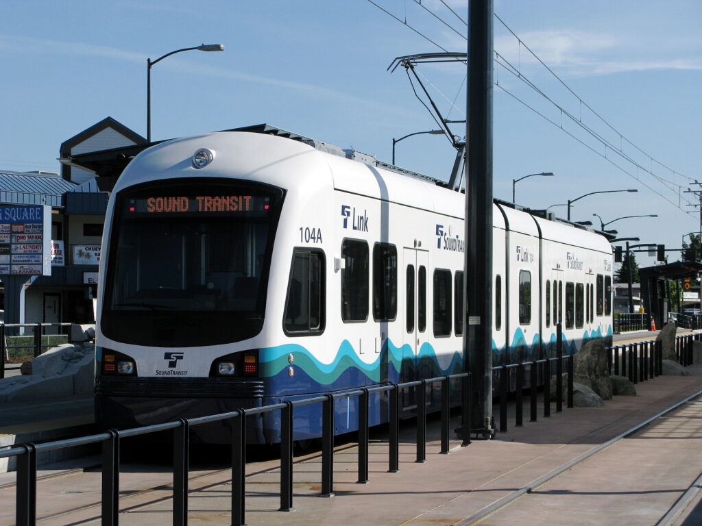
Seattle’s transit is run by several agencies that share one fare system: Sound Transit runs the Link light rail and regional express buses, King County Metro runs the city buses and the water taxis, the city runs the streetcars, and a private operator runs the monorail. For a visitor based in the core, it covers the sights well, and it has improved dramatically in the last decade as the light rail has grown.
Link light rail
The 1 Line is the backbone. From the airport it runs north through the Rainier Valley and the stadiums to the International District, Pioneer Square and a tunnel under downtown, then on to Capitol Hill, the University of Washington, the University District, Northgate and Lynnwood in the northern suburbs. For a visitor it connects the airport, downtown, the stadiums, Capitol Hill and the university in one line. The 2 Line serves Bellevue and Redmond on the Eastside and is designed to connect to downtown Seattle across the I-90 floating bridge; check Sound Transit’s map for which segments are running when you travel. Trains are frequent through the day, clean and step-free.
Buses, streetcars and the monorail
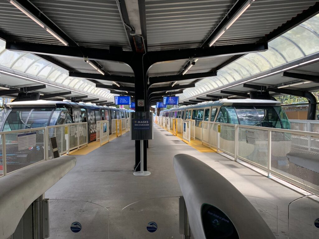
King County Metro buses cover the rest of the city, with the lettered RapidRide lines running the busiest corridors frequently all day: the C Line to West Seattle, the D Line to Ballard and the E Line up Aurora Avenue. The Seattle Streetcar has two separate lines, one from Westlake through South Lake Union and one from Pioneer Square through the International District to First Hill and Capitol Hill. The Seattle Center Monorail, built for the 1962 World’s Fair, runs between Westlake Center downtown and Seattle Center in about two minutes, every few minutes through the day, and it is the easiest way to reach the Space Needle.
Fares and tickets
The regional fare card is ORCA, which works on the light rail, buses, streetcars, water taxis, the monorail and, for walk-on passengers, some ferry routes. Buy a card at a light-rail station vending machine or load one online, add value, and tap it on the reader before boarding a train or as you board a bus; transfers within a set window are included. The Transit GO Ticket app sells mobile tickets on most services as an alternative. Children and teenagers 18 and under ride free on most local transit in the region, and seniors and riders with disabilities can get a reduced-fare permit. Check current fares on the agencies’ sites before you go.
Accessibility
Every light-rail station is step-free with elevators, buses are low-floor with ramps, and the streetcars board level with the platform. Elevator outages at the deep downtown and Capitol Hill stations do happen, so check service alerts if you depend on them.
Beyond buses and trains
- Walking. Downtown, the market, the waterfront, Belltown and Pioneer Square are easy walking, and the new waterfront promenade makes a flat route along the water. The hills between the waterfront and First Hill or Capitol Hill are steep enough to change your route; take the light rail up and walk down.
- Washington State Ferries. From Colman Dock downtown, ferries cross to Bainbridge Island and Bremerton, and other routes leave from Edmonds, Mukilteo, West Seattle and Anacortes for the Kitsap and Olympic peninsulas, Whidbey Island and the San Juans. Walk-on passengers ride cheaply and never wait long; cars can wait hours on summer weekends, and some routes, including the San Juans, take vehicle reservations. WSDOT runs the system and publishes schedules and wait times.
- Water taxis. King County’s passenger-only water taxis run from Pier 50 downtown to West Seattle, for Alki Beach, and to Vashon Island.
- Taxis and ride-hail. Uber, Lyft and licensed taxis operate across the city; for a group, or for the neighborhoods off the light rail such as Fremont and Ballard, a short ride is quick and competitive with transit.
- Bikes and scooters. Shared e-bikes and e-scooters are widely available, and the Burke-Gilman Trail along the Ship Canal and the Elliott Bay Trail along the water are excellent flat rides. The hills make an electric assist worthwhile.
- Trains and intercity buses. Amtrak Cascades trains run from King Street Station north to Vancouver and south to Portland, and intercity buses serve the same corridor.
Driving in Seattle: what it is really like
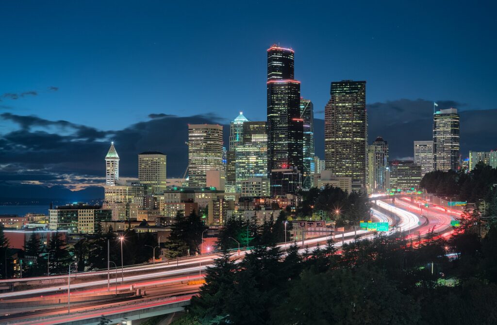
Seattle is not an easy city to drive in, and locals will tell you so. I-5 through downtown is congested for much of the day and badly so at rush hour, with reversible express lanes north of downtown that change direction by time of day. SR 99, the main alternative, runs through a tolled tunnel under downtown. The bridges are the choke points: the floating bridges to the Eastside back up every weekday, and the drawbridges over the Ship Canal lift for boats outside rush hours, stopping traffic for several minutes at a time. Downtown streets are steep, many are one-way, and bus lanes, bike lanes and turn restrictions change block by block. None of this is dangerous, but it is slow, and on a short visit it eats into your time.
Parking
Downtown parking is expensive. Hotels charge a substantial nightly fee, and commercial garages are priced for commuters and event crowds; on game nights near the stadiums and at Seattle Center, rates climb higher still. Street parking is metered through pay stations and the PayByPhone app, and the city adjusts rates by neighborhood and time of day according to demand, so check the posted hours carefully. Outside the core, in Fremont, Ballard and the residential neighborhoods, parking is easier but often time-limited or reserved for residents. On the hills, set the parking brake and turn your wheels toward the curb. The most important rule: leave nothing visible in a parked car. Car break-ins are common in Seattle, including at trailheads, viewpoints and hotel garages, and rental cars are a favorite target.
Rules and conditions worth knowing
- Tolls. The SR 520 floating bridge, the SR 99 tunnel and the express toll lanes on I-405 are tolled electronically, with no booths. Rental companies pass the tolls on with their own fees; ask how their toll program works when you pick up the car, and plan routes around the tolled roads if you want to avoid it.
- Hands-free law. Washington bans holding a phone while driving, including at red lights; use a mount and hands-free mode.
- Right turns on red are permitted after a full stop unless signed otherwise, and pedestrians have the right of way at every intersection, marked or not.
- Mountain passes in winter. Snoqualmie Pass on I-90 and Stevens Pass on US 2 can require traction tires or chains when conditions are bad, and they occasionally close. WSDOT publishes pass reports; check before you go from November to April.
- Mount Rainier in winter. The park requires every vehicle to carry tire chains during the winter season, and the road to Paradise has its own hours and closures. See Mount Rainier National Park. Many rental agreements restrict the use of chains, so read yours before you plan a winter visit.
- Ferries. Arrive early for car ferries in summer, check whether your route takes reservations, and remember that a car on a ferry costs far more than a walk-on passenger.
- Wildlife and rain. Deer and elk are common on rural roads at dawn and dusk, and the first rain after a dry spell makes roads slick with oil; slow down.
Driving to Vancouver and crossing the border
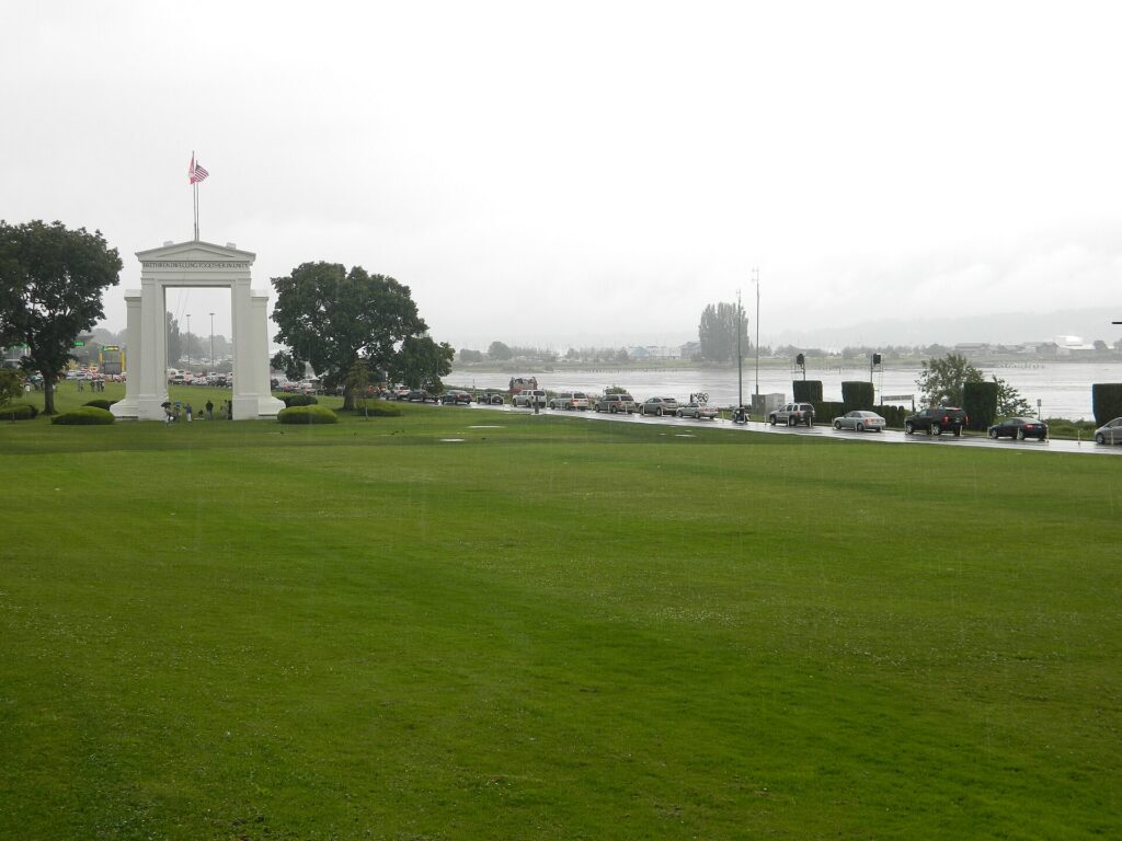
The drive north to Vancouver is one of the classic Pacific Northwest road trips: about 230 kilometers (140 miles) on I-5, around three hours without a long border queue, through the farmland of the Skagit Valley and past Bellingham to the border at Blaine. There are several crossings in the area; the Peace Arch and Pacific Highway crossings at Blaine are the busiest, and the crossings at Lynden and Sumas, a little farther east, are the alternatives when the main queues are long. Waits range from minutes to hours, and are worst on summer weekends, holidays in either country and Friday and Sunday afternoons; both governments publish current wait times, and drivers enrolled in NEXUS have dedicated lanes.
The documents you need depend on your citizenship and on how you cross, so treat the rules as principles and check the official sources before you leave: every traveler needs acceptable identity and travel documents, U.S. and Canadian citizens need a passport or another approved document, and many other nationalities need a visa or an electronic authorization for one or both countries. The Canada Border Services Agency sets the rules for entering Canada, and U.S. Customs and Border Protection sets them for coming back. Two more principles: cannabis is legal in both Washington and British Columbia but it is illegal to carry it across the border in either direction, and firearms, some foods and large amounts of cash have declaration rules of their own. If you are driving a rental, confirm before you book that the company allows the car into Canada, carry the rental agreement, and expect a one-way drop-off across the border to be expensive or unavailable. Our Seattle to Vancouver route guide covers the drive, and our Vancouver car-or-transit guide explains why many visitors do not need a car once they arrive.
When renting a car makes sense
- Mount Rainier. Paradise is two to two and a half hours away, there is no scheduled public transit into the park, and the trailheads are spread out.
- The Olympic Peninsula. Hurricane Ridge, Lake Crescent, the Hoh Rain Forest and the coast are a loop of several hundred miles, usually with a ferry crossing; it is effectively car-only.
- The North Cascades, Leavenworth and the mountain passes, all day trips or overnights over the Cascades.
- A road trip to Vancouver or Portland, if you want to stop along the way; otherwise the train is a strong alternative.
- Family in the suburbs or the Eastside. Transit reaches much of the region, but suburban distances add up.
- The San Juan Islands with a car. Possible with a ferry reservation from Anacortes, although walking on and renting bikes or using local shuttles on the islands is often easier.
If any of those apply, our rental car booking tips cover insurance, deposits and the questions to ask at the counter, and our family car rental guide looks at vehicle choice.
When it does not
- You are staying downtown or near the market and your plans are the city.
- You are in town for a cruise, a conference or a game, when parking downtown is at its worst and the light rail stops at the stadiums and the airport.
- You are going to Vancouver and back without stops, when the Amtrak Cascades train avoids the border traffic, the car rental’s cross-border rules and parking at both ends.
- You want Bainbridge, Alki or Vashon for a day, which are all walk-on trips by ferry or water taxi.
The hybrid plan for a city-plus-mountains trip
Go car-free for the city days and rent for the days you leave town, and think carefully about where you pick up. The airport rental facility has the widest choice but adds a shuttle ride and airport concession fees; renting from a downtown or neighborhood branch avoids those fees and means you never pay hotel parking on the nights you are not using the car. A pattern that works well: the light rail in from the airport, two or three car-free days downtown, a car picked up in the city for a day at Mount Rainier and a night on the Olympic Peninsula, then the car returned before heading home by light rail. If Vancouver is part of the trip, consider doing that leg by train and keeping the rental for the Washington days, or check the cross-border and one-way rules carefully if you plan to drive. Book ahead for July, August and holiday weekends. Compare the day rates on our Seattle car rental page against a full-trip rental and the difference is usually obvious.
A worked cost comparison
Numbers change with the season and the booking window, so treat this as a method rather than a quote, and check current rates before deciding. For a four-night city break downtown for two people, the car-free version costs two return light-rail fares from the airport, a few transit day trips, a ferry to Bainbridge and perhaps two or three ride-hail trips to Fremont and Ballard; the rental version adds four days of a compact car, four nights of downtown hotel parking, tolls, fuel and the airport fees, and buys you very little you could not ride to. Transit wins easily. For the same four nights with a day at Mount Rainier, the hybrid version adds a one-day rental from a city branch, fuel for the round trip and the park entrance fee, and it is almost always cheaper than a guided tour for two, and far cheaper than keeping a car all week. For a week touring Rainier, the Olympic Peninsula and the islands, a rental is the only practical answer, and the ferry fares for the car belong in the budget alongside fuel. For a Seattle-and-Vancouver trip, compare the train for two against a rental with cross-border permission, parking in two expensive downtowns and the border wait; for most couples without other plans on the road, the train wins. Run the rental rates for your dates on our Seattle car rental page and put them beside the transit and train fares before you choose.
Driving out of Seattle in each season
The roads out of Seattle change character with the seasons. In summer, the challenge is volume: I-5 north toward the border and south toward Tacoma is slow on Friday afternoons, the car ferries to Bainbridge, Kingston and the San Juans can have waits of several sailings, and the parking areas at Paradise on Mount Rainier and at popular trailheads fill early, so leave at dawn. Wildfire smoke can close trails and roads in the Cascades in August and September. In fall, the first rains make the roads slick, the leaves turn along US 2 and the North Cascades Highway, and the high passes can get their first snow by late October; the North Cascades Highway, SR 20, closes for the winter once the snow arrives. In winter, the city itself rarely sees snow, but when it does the hills become impassable and the region slows to a crawl; the passes need traction tires or chains at times, Rainier requires chains to be carried, and the ski traffic to Snoqualmie Pass makes weekend mornings busy on I-90. Days are short, so plan to be off mountain roads before dark. In spring, the roads to Paradise and Hurricane Ridge have limited hours, the high roads open in stages through late spring and early summer, and the tulip weekends in the Skagit Valley in April back up I-5 north. In every season, check WSDOT’s travel alerts before you set out, and the drive itself, with Rainier or the Olympics appearing through the clouds, is the reason you rented the car.
Decision table
| Your trip | Recommendation | Why |
|---|---|---|
| City break downtown, couple or solo | No car | Light rail from the airport, a walkable core and expensive parking |
| Alaska cruise before or after | No car | Light rail, cruise transfers or ride-hail cover the airport-to-pier run |
| City plus a day at Mount Rainier | Hybrid: rent for one day from a city branch | Car-free city days, no hotel parking, no transit into the park |
| Olympic Peninsula or North Cascades | Rent for the trip | Long loops with no practical transit |
| Seattle plus Vancouver, no stops | Train | Avoids border traffic, cross-border rental rules and parking in both cities |
| Pacific Northwest road trip | Rent, with cross-border permission | Stops along the way make the car worthwhile; check the one-way fee |
| Business trip to Bellevue or Redmond | Light rail or ride-hail; rent if meetings are spread out | The Eastside is car-oriented, but tolls and traffic add up |
| Family visit to the suburbs | Rent for the whole stay | Suburban distances make the car worthwhile daily |
Money-saving tips for both options
- On transit: get an ORCA card or the mobile ticket app on day one; children and teenagers ride free; walk on the ferries rather than driving on.
- On a rental: compare airport and city pickup, book early for summer, understand the toll program before you drive, decline extras you already have through a credit card or home policy (check first), and confirm the Canada policy if Vancouver is even a possibility.
- On the hotel: if you are renting, price the parking fee into the room rate, and consider a hotel outside the core with free parking for the car days.
- On timing: avoid I-5 and the floating bridges at rush hour, the car ferries on summer Friday afternoons and Sunday evenings, and the border on holiday weekends in either country; the best time to fly to Seattle guide lists the busiest weekends.
- On the mountains: for one day at Rainier, a one-day rental almost always beats a tour for two or more people; for a solo traveler, compare the two.
Frequently asked questions
Is it worth renting a car in Seattle?
For Mount Rainier, the Olympic Peninsula, the Cascades or a road trip, yes. For a downtown city break, a cruise or a conference, no; the light rail, buses and your feet are enough.
Is Seattle public transit good for tourists?
Good in the core: the light rail links the airport, downtown, the stadiums, Capitol Hill and the university, and buses, streetcars, the monorail and the water taxis fill most gaps. It thins out in the suburbs and does not reach the national parks.
How do I get from Sea-Tac to downtown Seattle?
The Link light rail in roughly 40 minutes from a station beside the terminal, or a taxi or ride-hail in 25 minutes to an hour depending on I-5 traffic.
Can I drive a rental car from Seattle to Vancouver?
Usually, but not always: confirm that your rental company allows the car into Canada, carry the agreement, and expect one-way cross-border drop-offs to cost extra or be unavailable. Check the border documents you need before you go.
Can I get to Mount Rainier without a car?
Not on scheduled public transit. Guided day tours run from Seattle, but for most visitors a one-day rental is simpler and cheaper.
Is parking expensive in downtown Seattle?
Yes, both at hotels and in commercial garages, especially on game nights. Street parking is metered with demand-based rates, and you should never leave anything visible in the car.
Do Seattle’s toll roads work with rental cars?
Yes. The tolls are electronic, and the rental company bills them to you, usually with a service fee; ask at the counter how their program works.
Whichever way you go, start with the flight. Compare cheap flights to Seattle, choose a neighborhood with our Seattle hotel search, and if Rainier or Vancouver is on the list, price the rental for those dates on our Seattle car rental page. For the rest of the trip, see our first-timer’s guide to Seattle.
Keep planning with TicketScanner
- Seattle car rentals — compare airport and city pickup
- Cheap flights to Seattle
- Seattle hotels — factor parking into the rate
- Things to do in Seattle: a first-timer's guide
- Best time to fly to Seattle: month by month
- Seattle-Tacoma International (SEA) airport guide
- Driving Seattle to Vancouver
- Vancouver: car rental or public transit?
- Rental car booking tips
- Car, transit or taxi in a new city?
Leave a Reply