Tag: Seattle

  • Best Time to Fly to Seattle: Seasons, Weather & Prices

    Best Time to Fly to Seattle: Seasons, Weather & Prices

    Seattle’s reputation for rain is the first thing most people think of when they plan a trip, and it is the least useful. The city gets less rain in a year than New York, Boston or Miami; what it has instead is a long, soft, gray season from October to May, when drizzle falls on more days than not, and a short, brilliant summer from July to September that is among the driest and most comfortable of any big American city. Airfares follow that summer closely, and they are pushed higher by something most visitors do not see coming: Seattle is the main U.S. home port for Alaska cruises, and from spring to fall, tens of thousands of passengers fly in and out on the weekends to board ships at the downtown piers. Add a large tech-industry business market, a convention calendar, a busy sports schedule, and a steady flow of Canadians coming south from Vancouver, and the “best time” question has a clear answer and a few important exceptions. This guide walks through the weather month by month, the fare seasons, the events and cruise weekends that move prices, and how to handle the airport.

    The short answer

    For weather, the best time to visit Seattle is July to mid-September, when the rain almost stops, the mountains are out and the evenings are long. For value, the sweet spots are late May and June, when the city is green and the summer rush has not peaked, and the second half of September, often warm and dry with the cruise and family crowds thinning. The cheapest fares usually come from January to early March and in November outside Thanksgiving week, when the city is gray, mild and quiet. The most expensive stretches are July and August, especially Friday to Sunday on cruise-ship weekends, the big summer event weekends like Seafair and Labor Day, and the Thanksgiving and Christmas holidays. Whatever you choose, run a flexible-date search on our Seattle flights page; moving a trip from a Saturday to a Tuesday in summer can change the fare and the hotel rate more than moving it by a month.
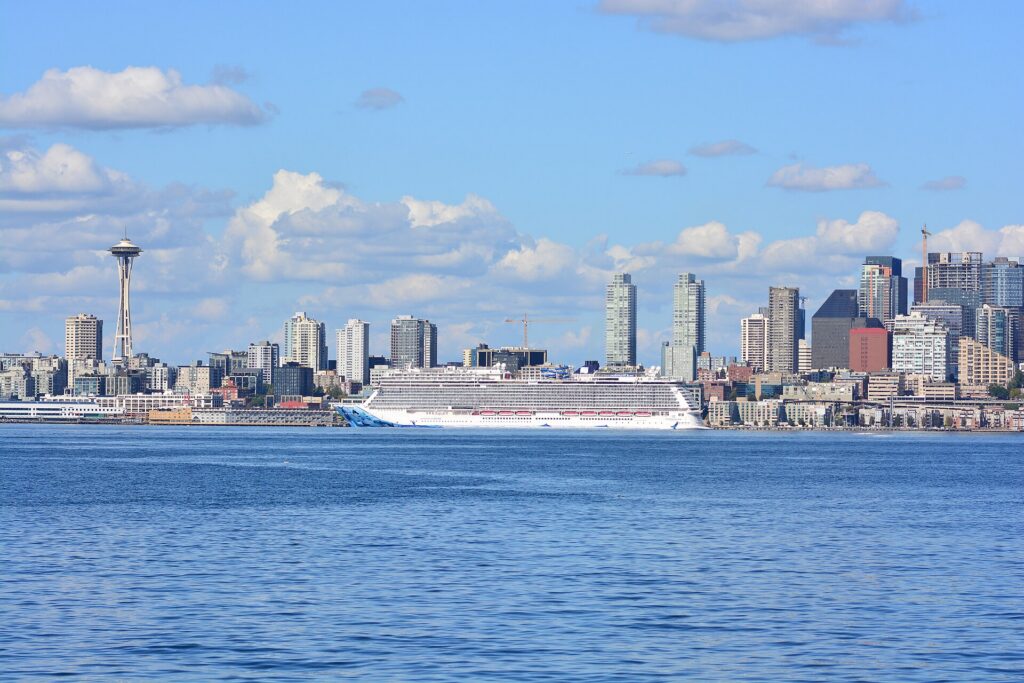
    An Alaska cruise ship docked at Pier 66 on the Seattle waterfront
    Alaska cruise ships turn around in Seattle every weekend from spring to fall, filling flights and hotels (Photo: Joe Mabel via Wikimedia Commons, CC BY-SA 4.0)

    Seattle’s weather, season by season

    Seattle sits on Puget Sound between the Olympic Mountains to the west and the Cascades to the east, and the Pacific keeps it mild: winters rarely freeze for long, summers rarely get hot, and the city’s rain, about 990 mm (39 inches) a year at the airport, falls mostly as light, persistent drizzle between October and May. The figures below are approximate seasonal patterns at Sea-Tac, based on the long-term climate normals published by NOAA and the National Weather Service’s Seattle office; check the current forecast before you pack, and remember that the mountains an hour away can be twenty degrees colder than the city.

    MonthTypical daytime highTypical overnight lowWhat it feels likeFare pressure
    Januaryaround 9 °C (48 °F)around 3 °C (37 °F)Gray, damp and dark by late afternoon; snow in the city is rare but possibleLow, except the New Year week
    Februaryaround 10 °C (50 °F)around 3 °C (37 °F)Much the same, with a little more light and the odd bright, cold dayLow; rises for Presidents’ Day weekend
    Marcharound 12 °C (54 °F)around 4 °C (39 °F)Showers and sun breaks; cherry blossoms by the end of the monthLow to moderate
    Aprilaround 15 °C (59 °F)around 6 °C (43 °F)Changeable; tulips in the Skagit Valley; the first cruise ships arriveModerate; spring break spike
    Mayaround 19 °C (66 °F)around 9 °C (48 °F)Greener and drier; long evenings beginModerate; cruise weekends start to bite
    Junearound 22 °C (71 °F)around 12 °C (53 °F)Pleasant, but often gray until July; locals call it “June gloom”High, rising through the month
    Julyaround 26 °C (79 °F)around 14 °C (57 °F)Dry, sunny and long; the driest month of the yearPeak
    Augustaround 26 °C (79 °F)around 14 °C (57 °F)Warm and dry; heat waves and wildfire smoke are possible in some yearsPeak
    Septemberaround 22 °C (72 °F)around 12 °C (53 °F)Often the best month: warm, dry, clear, with cooler nightsHigh early, easing after Labor Day
    Octoberaround 16 °C (60 °F)around 8 °C (46 °F)Crisp and colorful, with the rain returning by mid-monthModerate, falling
    Novemberaround 11 °C (51 °F)around 4 °C (40 °F)The wettest month; windstorms are possibleLow, except Thanksgiving week
    Decemberaround 8 °C (46 °F)around 2 °C (36 °F)Dark, damp and festive; snow in the mountains, rain in the cityLow until mid-month, then peak

    Three things the table cannot show. First, the gray: it is the number of cloudy days, not the amount of rain, that defines Seattle’s winter. In midwinter the sun sets around half past four in the afternoon, and whole weeks can pass under low cloud, which some visitors find cozy and others find oppressive; if you are coming for views of Mount Rainier and the Olympics, winter is the season you are least likely to see them. Second, the summer is genuinely dry: July and August together average only a small fraction of the annual rain, humidity is low, and a typical summer day is clear, 25 °C and bright until after nine in the evening. Many homes and older hotels have no air conditioning, so the occasional heat wave, when the temperature can climb well past 32 °C (90 °F), is felt more than the numbers suggest. Third, wildfire smoke: in some recent summers, fires in Washington, Oregon or British Columbia have blown smoke over the city for days at a time, usually in August or September, turning the sky orange and hiding the mountains. It is not every year, and it is unpredictable, but it is worth checking air quality before a late-summer trip built around hiking.

    How Seattle’s fare seasons work

    Four calendars drive seats into Seattle. The first is the weather, which concentrates leisure travel into the dry months. The second is the Alaska cruise season, roughly late April to October, when ships leave from the downtown piers and from Smith Cove near Magnolia, turning over thousands of passengers every weekend; cruise travelers typically fly in on Friday or Saturday, sail, and fly home a week later, which fills flights and downtown and airport hotels on exactly the days leisure visitors want. The third is business travel: the region’s big tech, aerospace and health employers keep weekday flights busy year-round, and the Seattle Convention Center fills downtown hotels whenever a large conference is in town. The fourth is sports and events, from Seahawks home games in the fall and winter to Seafair, Bumbershoot and the summer stadium concerts. The result is a high, long summer, a winter that is genuinely cheap outside the holidays, and two shoulders where the weather and the prices both cooperate.

    Peak season

    Late June to early September, plus Thanksgiving week and roughly December 18 to January 2. July and August are the most expensive months for both flights and hotels, and within them, Friday-to-Sunday cruise turnaround days are the sharpest spikes; downtown hotel rates on a summer Saturday can be a multiple of a midweek night in February. If you must travel in peak, book early, fly midweek, and consider arriving on a Tuesday or Wednesday, when the cruise crowds are at sea.

    Shoulder season

    May to late June and mid-September to October. May and June give you green hillsides, long evenings and blooming gardens, with the risk of cool gray days into early July; September gives you the most reliable weather of the year with thinning crowds after Labor Day. Early October is crisp and colorful, and fares drop steadily through the month. Watch Memorial Day, Labor Day and any weekend with a big convention.

    Low season

    Early November to mid-December, and January to early March, apart from the holidays and Presidents’ Day weekend. Fares and hotel rates are at their lowest, the museums, restaurants and markets are uncrowded, and the ski areas at Snoqualmie Pass and Stevens Pass, an hour or two east, are open. The trade-off is short days, frequent drizzle and a low chance of seeing the mountains. Pack a waterproof layer and plan an indoor day for every outdoor one.

    As elsewhere, midweek departures and early or late flights usually price below Friday and Sunday afternoons on the same route, and a search across a whole month reveals cheaper pairs of dates close to your first choice. Our guide to the best times to book explains how to read those patterns.

    Seattle month by month

    January

    Gray, mild and, after New Year, one of the two cheapest months to fly. Highs hover around 9 °C (48 °F), the rain is usually a drizzle rather than a downpour, and snow in the city is unusual but brings everything to a halt when it comes, because Seattle’s hills and its limited fleet of plows do not mix. The museums, Pike Place Market and the restaurants are at their least crowded, the Kraken are in season, and the Seahawks may be at home in the playoffs. A good month for a food-and-culture trip at low prices.

    February

    Similar weather with a little more daylight, and low fares outside Presidents’ Day weekend (the third Monday of February), when school breaks send families to the mountains. The Chinese New Year celebrations in the Chinatown-International District fall in late January or February, and the ski areas are at their deepest. Strong value for a city break.

    March

    Showers, sun breaks and the first real sense of spring. The cherry trees on the University of Washington quad bloom in the second half of the month and draw big weekend crowds; Emerald City Comic Con, one of the larger fan conventions on the West Coast, has taken place in spring in recent years and can fill downtown hotels. Otherwise fares are still low, and March is one of the better value months.

    April

    Changeable, with warm sunny days, cold showers and everything in between. The Skagit Valley Tulip Festival, about an hour north, runs through the month and packs the fields on weekends; the Mariners’ season is under way; and the first Alaska cruise ships of the year arrive toward the end of the month. Washington’s school spring break, usually in early April, is a small spike. Otherwise a moderate, good-value month.

    May

    Drier, greener and noticeably longer days. Opening Day of boating season, on the first Saturday of May, fills the Montlake Cut with decorated boats and a rowing regatta; the Seattle International Film Festival starts in the second half of the month; and Northwest Folklife fills Seattle Center over Memorial Day weekend. Cruise weekends start to push up hotel rates. Early May is the value window.

    June

    Pleasant but often gray until the Fourth of July, which locals call “June gloom”. The Fremont Solstice Parade and festival fall near the solstice, and Pride, one of the largest on the West Coast, fills the last weekend of the month with a parade downtown and events on Capitol Hill. Fares climb from mid-month as schools let out; the first half of June is the last shoulder bargain before summer.

    July

    The start of Seattle’s real summer: dry, sunny, and light until well after nine at night. The Fourth of July fireworks over Lake Union draw big crowds to Gas Works Park, Seafair’s neighborhood festivals and parades run through the month, and Mount Rainier’s wildflower season starts late in the month. Every cruise weekend is busy, and fares and hotels are at their annual peak.

    August

    Warm, dry and busy. Seafair Weekend, usually the first weekend of August, brings hydroplane races and an air show over Lake Washington; the Mariners are chasing the playoffs; and Rainier’s meadows are at their best. Heat waves and wildfire smoke are possible, and the last week, once schools start elsewhere, can be slightly softer on price.

    September

    The month many Seattleites would send you to. Labor Day weekend brings Bumbershoot to Seattle Center and PAX West, a large gaming convention, to downtown, and hotels are tight; after that, the weather is often the most settled of the year, the summer crowds leave, and fares ease week by week. The Seahawks’ home season and the University of Washington’s football Saturdays begin. The second half of the month is the best value-and-weather combination of the year.

    October

    Crisp, colorful and increasingly wet, with the rain usually returning for good by the middle of the month. Fall color in the Arboretum and along the Cascades highways, salmon runs in the local creeks, and the Kraken’s season opener fill the calendar, and fares keep falling. The Alaska cruise season winds down over the course of the month.

    November

    The wettest month, with the occasional windstorm and some of the cheapest fares of the year outside Thanksgiving week, one of the busiest travel periods in the country. The holiday lights go up downtown and at Pike Place late in the month, and the ski areas usually open by Thanksgiving if the snow cooperates.

    December

    Two months in one. The first half continues November’s low prices, with holiday markets, the lights, the Christmas ships that sail the lakes and the Sound with choirs aboard, and the mountains in early winter. From about December 18, fares jump for the Christmas and New Year holidays, and the Space Needle’s New Year’s Eve fireworks draw crowds to Seattle Center.
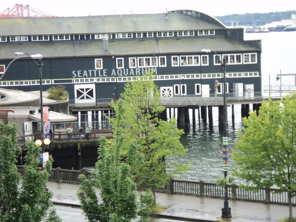
    The Seattle Aquarium on the waterfront on a typical rainy day
    A typical gray-season day on the Seattle waterfront: drizzle, not downpour (Photo: MarmadukePercy via Wikimedia Commons, CC BY-SA 3.0)

    Events that move Seattle flight and hotel prices

    Cross-check these against your dates before you book. Exact dates shift each year; Visit Seattle keeps the current calendar.

    • Alaska cruise turnaround weekends (late April to October): the steadiest weekend pressure on flights and downtown hotels all summer.
    • Memorial Day weekend and Northwest Folklife at Seattle Center.
    • Pride (last weekend of June).
    • Fourth of July and Seafair Weekend (usually the first weekend of August).
    • Labor Day weekend, with Bumbershoot and PAX West at the same time.
    • Large conventions at the Seattle Convention Center, which can fill downtown on weeknights; if midweek rates look strangely high, that is usually why.
    • Seahawks home games (September to January) and Mariners, Sounders and Kraken home stands, plus stadium concerts. Our Seattle events page shows what is on sale for your dates.
    • Thanksgiving week and Christmas to New Year.
    • Canadian long weekends, such as Victoria Day in May, BC Day in early August and Canadian Thanksgiving in October, which bring Vancouver-area visitors south and lengthen the border queues on I-5.

    Getting in from the airport

    Seattle’s main airport is Seattle-Tacoma International (SEA), run by the Port of Seattle and universally called Sea-Tac, about 20 kilometers (13 miles) south of downtown. It is the main hub for Alaska Airlines and a major hub for Delta, with nonstop flights to most large U.S. and Canadian cities and to Europe and Asia, and it is busy enough that you should allow real time for security at peak hours. Getting downtown: the Link light rail station is a walk across the parking garage from the terminal, and trains reach downtown in roughly 40 minutes; taxis and ride-hail pick up on a floor of the garage; and the rental car facility is a shuttle ride away from the terminal. If you are on a cruise, most lines run transfers from the airport to the piers, and taxis and ride-hail make the trip in 25 minutes to an hour depending on I-5 traffic. For combined trips with Vancouver, it is worth pricing an open-jaw ticket, into Seattle and out of Vancouver International (YVR) or the reverse; Bellingham, near the border, has a small airport with limited service. Our Seattle car-versus-transit guide works through the ground options, and our SEA airport guide covers the layout.
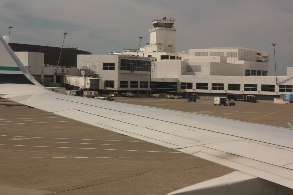
    The Central Terminal at Seattle-Tacoma International Airport (SEA)
    Seattle-Tacoma International (SEA), the hub for Alaska Airlines and a major Delta gateway (Photo: Walter Siegmund (talk) via Wikimedia Commons, CC BY-SA 3.0)

    Timing tricks that work for Seattle

    • Avoid cruise turnaround days. In summer, Friday to Sunday flights and downtown hotel nights carry the cruise premium. Arrive Tuesday or Wednesday and the same trip can cost noticeably less.
    • Book the hotel first in summer. A cheap fare into a Seafair or Labor Day weekend is not cheap once the room is added. Run a Seattle hotel search for the same dates before you commit to either.
    • Aim for September. The second half of the month has summer weather at shoulder prices, and it is the local favorite for a reason.
    • Consider an open jaw with Vancouver. Seattle and Vancouver are about three hours apart by road or four by train, and flying into one and out of the other can save a long backtrack; our best time to fly to Vancouver guide covers the other end.
    • Use winter for a city break. From January to early March, fares and hotel rates are at their lowest and the city’s food, coffee and museums are at their least crowded.
    • Allow time at Sea-Tac. Security lines at peak summer and holiday hours can be long; our guide to how early to arrive covers what to allow.
    • Flying out of Seattle instead? The same seasonality applies in reverse; see cheap flights from Seattle.
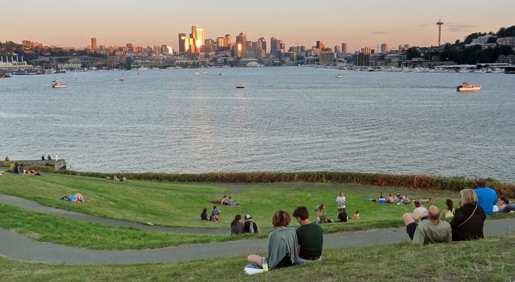
    The Seattle skyline across Lake Union from Gas Works Park
    The skyline across Lake Union from Gas Works Park, where summer evenings stay light past nine (Photo: WikiPedant via Wikimedia Commons, CC BY-SA 4.0)

    What to pack, by season

    Winter (November to February): a warm waterproof jacket with a hood, layers, and shoes that can handle wet sidewalks; do as locals do and skip the umbrella, which the wind turns inside out. Spring (March to May): layers and the same waterproof jacket, because showers and sun breaks alternate hourly. Summer (June to September): light clothing for the days, a sweater or light jacket for the evenings and the ferry decks, sunglasses and sunscreen for the long, bright days, and hiking shoes if you are heading to Rainier or the Olympics. Fall (October): layers again, and the waterproof jacket back in the bag by mid-month. For the mountains in any season, pack warmer than the city requires; the Paradise area of Mount Rainier can have snow on the ground into July.

    The best time to fly to Seattle for…

    Summer weather and views of the mountains

    Mid-July to mid-September, when rain is rare and Mount Rainier and the Olympics are visible most days.

    Mount Rainier and the national parks

    Late July to early September for wildflowers at Paradise and open high roads; the park has used timed-entry reservations for its busiest areas in peak summer. Mount Rainier National Park has current conditions and requirements.

    An Alaska cruise

    May, June and September usually offer lower cruise and hotel prices than July and August. Fly in at least a day before sailing, and avoid booking the tightest flight home on disembarkation morning.

    The lowest fares

    January to early March and November outside Thanksgiving. Pair them with a museum-and-food itinerary and a waterproof jacket.

    Families

    Late June or late August, when the weather is reliable and the city’s parks, beaches and ferries are at their best; book early, and avoid cruise weekends if you can.

    Cross-border and international visitors

    Canadians need a valid passport to fly in; travelers from Visa Waiver Program countries need an approved ESTA before boarding, and everyone else needs a visa. U.S. Customs and Border Protection explains what applies to you, and the TSA lists what you can carry through security. If your trip includes Vancouver or Victoria, check the Canada Border Services Agency for what you need to enter Canada, and remember that the rules differ depending on whether you cross by land, sea or air.

    Frequently asked questions

    What is the cheapest month to fly to Seattle?

    January and February are consistently the lowest, followed by early March and November outside Thanksgiving week.

    What is the best month to visit Seattle for weather?

    August and September, with July close behind. All three are dry and sunny, and September is usually less crowded and cheaper.

    Does it really rain all the time in Seattle?

    No. The city’s annual rainfall is lower than New York’s or Boston’s; it just falls as frequent light drizzle from October to May. Summers are among the driest of any big American city.

    How do Alaska cruises affect Seattle prices?

    From late April to October, cruise passengers fill flights and hotels from Friday to Sunday. Midweek arrivals avoid most of that premium.

    Should I fly into Seattle or Vancouver for a Pacific Northwest trip?

    Price both. Seattle usually has more nonstop options from U.S. cities, but an open-jaw ticket, into one and out of the other, often works best if you plan to visit both.

    How far ahead should I book?

    Early for July, August, Labor Day and the holidays, when fares tend only to rise; for November through early March, fares are stable enough that finding the right dates matters more than booking months ahead.

    When can you see Mount Rainier from Seattle?

    On clear days in any season, but most reliably from July to September. Locals say “the mountain is out” when it appears, and in winter it can stay hidden for weeks.

    Ready to pick your dates? Compare fares across the whole month on our Seattle flights page, then find a room with our Seattle hotel search. For what to do when you land, start with our first-timer’s guide to Seattle.

  • Seattle: Should You Rent a Car or Rely on Public Transit?

    Seattle: Should You Rent a Car or Rely on Public Transit?

    Seattle is a city where the right answer to “should I rent a car?” depends almost entirely on where you are going after you land. For the city itself, the answer is usually no: the light rail runs from the airport terminal to downtown, the core is compact and walkable if hilly, the buses, streetcars, monorail, water taxis and ferries cover most of what a visitor wants, and parking downtown is expensive and car break-ins are common. But Seattle is also the gateway to Mount Rainier, the Olympic Peninsula, the Cascades, the San Juan Islands and Vancouver, and none of those is practical on public transit alone. Add a region split by water and hills, with tolled bridges and a tunnel, ferries that carry cars, and an international border two hours north, and it is worth getting the plan right. This guide explains how the city is laid out, how transit and fares work, what driving here is really like, how the ferries and the border fit in, and gives you a straightforward way to decide.

    The short answer

    Skip the car if you are staying downtown, near Pike Place Market, in Belltown, South Lake Union or Capitol Hill, and your plans are the market, the waterfront, Seattle Center, Pioneer Square, the neighborhoods, a game and a ferry ride; the light rail, buses, your feet and the occasional ride-hail will cover that, and you will not pay for hotel parking. The same goes for most cruise passengers, who can ride the light rail or take a transfer from the airport to the piers. Rent a car if Mount Rainier, the Olympic Peninsula, the North Cascades, Leavenworth or a road trip to Vancouver or Portland is on the itinerary, if you are staying with family in the suburbs, or if you are traveling with young children and a lot of gear. For a city-plus-mountains trip, rent only for the days you leave the city. Compare rental rates for any of these plans on our Seattle car rental page.

    How Seattle is laid out

    Seattle is squeezed onto a narrow strip of hilly land between Puget Sound to the west and Lake Washington to the east, and the water shapes everything. Downtown faces Elliott Bay, with Pike Place Market and the waterfront at its edge, Belltown to the north, Pioneer Square and the Chinatown-International District to the south, and the stadiums just beyond. Seattle Center and South Lake Union sit about a mile north, below Queen Anne Hill, and Capitol Hill and First Hill rise steeply to the east. Lake Union and the Ship Canal then cut the city in two, and the northern neighborhoods, Fremont, Ballard, Wallingford and the University District, are reached by a handful of bridges, several of them drawbridges that lift for boats. Interstate 5 runs north-south through the middle of everything, State Route 99 runs through a tunnel under downtown, and two floating bridges, I-90 and SR 520, cross Lake Washington to Bellevue, Redmond and the Eastside, where Microsoft and many other employers are based. The practical result is that short distances on the map can mean a steep climb, a bridge opening or a traffic jam, and that the core is far easier on foot and transit than by car.

    Hotels cluster downtown around the retail core and Pike Place Market, in Belltown and South Lake Union, in Bellevue for Eastside business, and along International Boulevard near the airport, where cruise passengers and early flyers often stay. Our Seattle hotel search lets you compare them.

    Getting in from the airport

    Seattle-Tacoma International (SEA) is about 20 kilometers (13 miles) south of downtown, and it is one of the few big U.S. airports with rail straight into the city. The Link light rail station is a covered walk from the terminal across the parking garage, and 1 Line trains run to Pioneer Square, downtown and Capitol Hill in roughly 40 minutes, frequently from early morning until around midnight. Taxis, ride-hail and hotel shuttles pick up on designated floors of the parking garage, and the drive downtown along I-5 takes 25 minutes at quiet times and an hour or more at rush hour. The rental car facility is off the airport grounds, reached by a dedicated shuttle bus from the terminal, so allow extra time at both ends of the trip. For cruise passengers, most lines sell transfers from the airport to the piers, and ride-hail is the simplest alternative. Check the Port of Seattle, which runs the airport, for current ground-transport details; our SEA airport guide covers the layout.

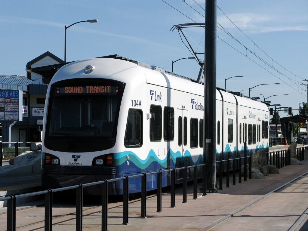
    A Sound Transit Link light rail train in Seattle
    Link light rail: from the Sea-Tac terminal to downtown in roughly 40 minutes (Photo: Oran Viriyincy via Wikimedia Commons, CC BY-SA 2.0)

    Seattle’s transit, explained

    Seattle’s transit is run by several agencies that share one fare system: Sound Transit runs the Link light rail and regional express buses, King County Metro runs the city buses and the water taxis, the city runs the streetcars, and a private operator runs the monorail. For a visitor based in the core, it covers the sights well, and it has improved dramatically in the last decade as the light rail has grown.

    Link light rail

    The 1 Line is the backbone. From the airport it runs north through the Rainier Valley and the stadiums to the International District, Pioneer Square and a tunnel under downtown, then on to Capitol Hill, the University of Washington, the University District, Northgate and Lynnwood in the northern suburbs. For a visitor it connects the airport, downtown, the stadiums, Capitol Hill and the university in one line. The 2 Line serves Bellevue and Redmond on the Eastside and is designed to connect to downtown Seattle across the I-90 floating bridge; check Sound Transit’s map for which segments are running when you travel. Trains are frequent through the day, clean and step-free.

    Buses, streetcars and the monorail

    King County Metro buses cover the rest of the city, with the lettered RapidRide lines running the busiest corridors frequently all day: the C Line to West Seattle, the D Line to Ballard and the E Line up Aurora Avenue. The Seattle Streetcar has two separate lines, one from Westlake through South Lake Union and one from Pioneer Square through the International District to First Hill and Capitol Hill. The Seattle Center Monorail, built for the 1962 World’s Fair, runs between Westlake Center downtown and Seattle Center in about two minutes, every few minutes through the day, and it is the easiest way to reach the Space Needle.

    Fares and tickets

    The regional fare card is ORCA, which works on the light rail, buses, streetcars, water taxis, the monorail and, for walk-on passengers, some ferry routes. Buy a card at a light-rail station vending machine or load one online, add value, and tap it on the reader before boarding a train or as you board a bus; transfers within a set window are included. The Transit GO Ticket app sells mobile tickets on most services as an alternative. Children and teenagers 18 and under ride free on most local transit in the region, and seniors and riders with disabilities can get a reduced-fare permit. Check current fares on the agencies’ sites before you go.

    Accessibility

    Every light-rail station is step-free with elevators, buses are low-floor with ramps, and the streetcars board level with the platform. Elevator outages at the deep downtown and Capitol Hill stations do happen, so check service alerts if you depend on them.

    Beyond buses and trains

    • Walking. Downtown, the market, the waterfront, Belltown and Pioneer Square are easy walking, and the new waterfront promenade makes a flat route along the water. The hills between the waterfront and First Hill or Capitol Hill are steep enough to change your route; take the light rail up and walk down.
    • Washington State Ferries. From Colman Dock downtown, ferries cross to Bainbridge Island and Bremerton, and other routes leave from Edmonds, Mukilteo, West Seattle and Anacortes for the Kitsap and Olympic peninsulas, Whidbey Island and the San Juans. Walk-on passengers ride cheaply and never wait long; cars can wait hours on summer weekends, and some routes, including the San Juans, take vehicle reservations. WSDOT runs the system and publishes schedules and wait times.
    • Water taxis. King County’s passenger-only water taxis run from Pier 50 downtown to West Seattle, for Alki Beach, and to Vashon Island.
    • Taxis and ride-hail. Uber, Lyft and licensed taxis operate across the city; for a group, or for the neighborhoods off the light rail such as Fremont and Ballard, a short ride is quick and competitive with transit.
    • Bikes and scooters. Shared e-bikes and e-scooters are widely available, and the Burke-Gilman Trail along the Ship Canal and the Elliott Bay Trail along the water are excellent flat rides. The hills make an electric assist worthwhile.
    • Trains and intercity buses. Amtrak Cascades trains run from King Street Station north to Vancouver and south to Portland, and intercity buses serve the same corridor.
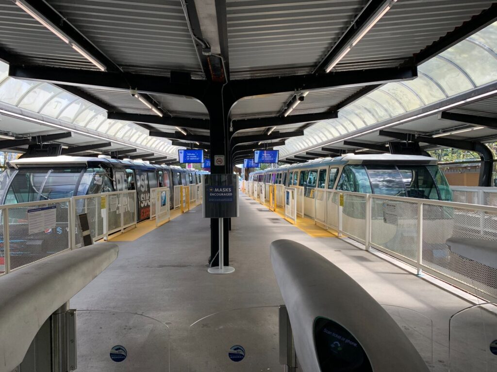
    The Seattle Center Monorail station at the northern end of the line from Westlake Center
    The 1962 monorail still covers the mile from downtown to the Space Needle in about two minutes (Photo: Naus via Wikimedia Commons, CC BY-SA 4.0)

    Driving in Seattle: what it is really like

    Seattle is not an easy city to drive in, and locals will tell you so. I-5 through downtown is congested for much of the day and badly so at rush hour, with reversible express lanes north of downtown that change direction by time of day. SR 99, the main alternative, runs through a tolled tunnel under downtown. The bridges are the choke points: the floating bridges to the Eastside back up every weekday, and the drawbridges over the Ship Canal lift for boats outside rush hours, stopping traffic for several minutes at a time. Downtown streets are steep, many are one-way, and bus lanes, bike lanes and turn restrictions change block by block. None of this is dangerous, but it is slow, and on a short visit it eats into your time.

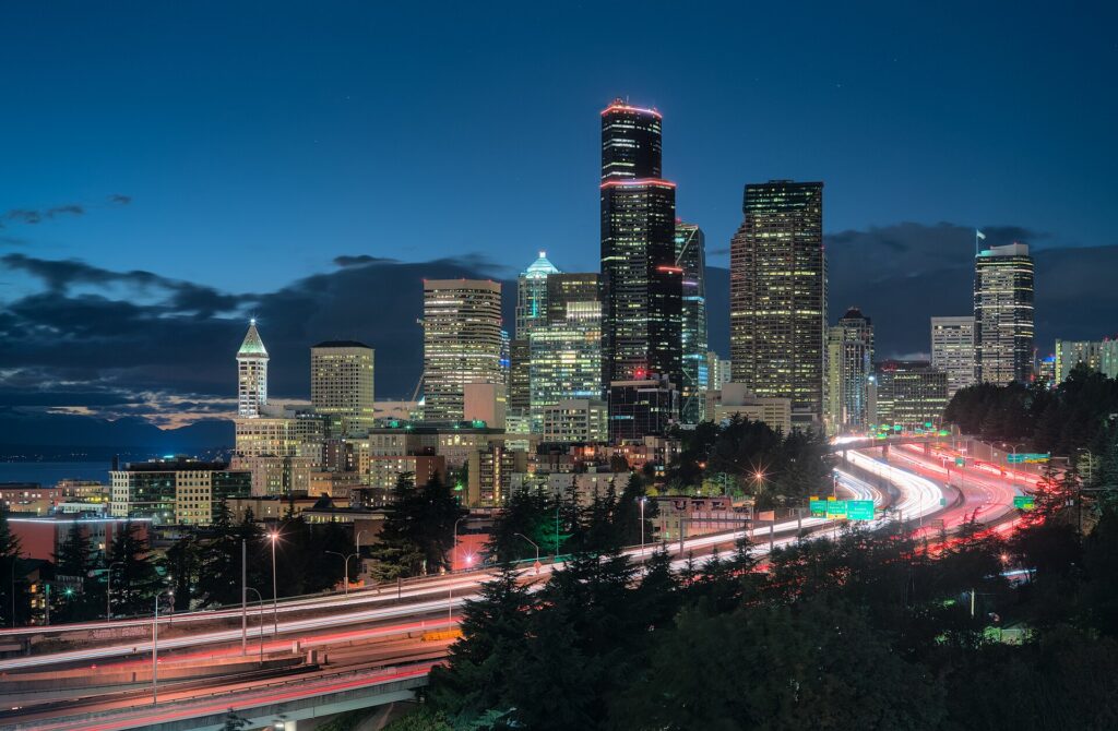
    Interstate 5 and the Seattle skyline at dusk
    I-5 through downtown Seattle, the city's spine and its most reliable traffic jam (Photo: Dllu via Wikimedia Commons, CC BY-SA 4.0)

    Parking

    Downtown parking is expensive. Hotels charge a substantial nightly fee, and commercial garages are priced for commuters and event crowds; on game nights near the stadiums and at Seattle Center, rates climb higher still. Street parking is metered through pay stations and the PayByPhone app, and the city adjusts rates by neighborhood and time of day according to demand, so check the posted hours carefully. Outside the core, in Fremont, Ballard and the residential neighborhoods, parking is easier but often time-limited or reserved for residents. On the hills, set the parking brake and turn your wheels toward the curb. The most important rule: leave nothing visible in a parked car. Car break-ins are common in Seattle, including at trailheads, viewpoints and hotel garages, and rental cars are a favorite target.

    Rules and conditions worth knowing

    • Tolls. The SR 520 floating bridge, the SR 99 tunnel and the express toll lanes on I-405 are tolled electronically, with no booths. Rental companies pass the tolls on with their own fees; ask how their toll program works when you pick up the car, and plan routes around the tolled roads if you want to avoid it.
    • Hands-free law. Washington bans holding a phone while driving, including at red lights; use a mount and hands-free mode.
    • Right turns on red are permitted after a full stop unless signed otherwise, and pedestrians have the right of way at every intersection, marked or not.
    • Mountain passes in winter. Snoqualmie Pass on I-90 and Stevens Pass on US 2 can require traction tires or chains when conditions are bad, and they occasionally close. WSDOT publishes pass reports; check before you go from November to April.
    • Mount Rainier in winter. The park requires every vehicle to carry tire chains during the winter season, and the road to Paradise has its own hours and closures. See Mount Rainier National Park. Many rental agreements restrict the use of chains, so read yours before you plan a winter visit.
    • Ferries. Arrive early for car ferries in summer, check whether your route takes reservations, and remember that a car on a ferry costs far more than a walk-on passenger.
    • Wildlife and rain. Deer and elk are common on rural roads at dawn and dusk, and the first rain after a dry spell makes roads slick with oil; slow down.

    Driving to Vancouver and crossing the border

    The drive north to Vancouver is one of the classic Pacific Northwest road trips: about 230 kilometers (140 miles) on I-5, around three hours without a long border queue, through the farmland of the Skagit Valley and past Bellingham to the border at Blaine. There are several crossings in the area; the Peace Arch and Pacific Highway crossings at Blaine are the busiest, and the crossings at Lynden and Sumas, a little farther east, are the alternatives when the main queues are long. Waits range from minutes to hours, and are worst on summer weekends, holidays in either country and Friday and Sunday afternoons; both governments publish current wait times, and drivers enrolled in NEXUS have dedicated lanes.

    The documents you need depend on your citizenship and on how you cross, so treat the rules as principles and check the official sources before you leave: every traveler needs acceptable identity and travel documents, U.S. and Canadian citizens need a passport or another approved document, and many other nationalities need a visa or an electronic authorization for one or both countries. The Canada Border Services Agency sets the rules for entering Canada, and U.S. Customs and Border Protection sets them for coming back. Two more principles: cannabis is legal in both Washington and British Columbia but it is illegal to carry it across the border in either direction, and firearms, some foods and large amounts of cash have declaration rules of their own. If you are driving a rental, confirm before you book that the company allows the car into Canada, carry the rental agreement, and expect a one-way drop-off across the border to be expensive or unavailable. Our Seattle to Vancouver route guide covers the drive, and our Vancouver car-or-transit guide explains why many visitors do not need a car once they arrive.

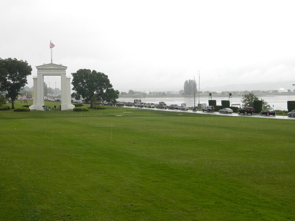
    The Peace Arch at the border crossing between Blaine, Washington, and Surrey, British Columbia
    The Peace Arch at Blaine, the busiest crossing on the drive from Seattle to Vancouver (Photo: Weixi Zeng via Wikimedia Commons, CC BY-SA 3.0)

    When renting a car makes sense

    • Mount Rainier. Paradise is two to two and a half hours away, there is no scheduled public transit into the park, and the trailheads are spread out.
    • The Olympic Peninsula. Hurricane Ridge, Lake Crescent, the Hoh Rain Forest and the coast are a loop of several hundred miles, usually with a ferry crossing; it is effectively car-only.
    • The North Cascades, Leavenworth and the mountain passes, all day trips or overnights over the Cascades.
    • A road trip to Vancouver or Portland, if you want to stop along the way; otherwise the train is a strong alternative.
    • Family in the suburbs or the Eastside. Transit reaches much of the region, but suburban distances add up.
    • The San Juan Islands with a car. Possible with a ferry reservation from Anacortes, although walking on and renting bikes or using local shuttles on the islands is often easier.

    If any of those apply, our rental car booking tips cover insurance, deposits and the questions to ask at the counter, and our family car rental guide looks at vehicle choice.

    When it does not

    • You are staying downtown or near the market and your plans are the city.
    • You are in town for a cruise, a conference or a game, when parking downtown is at its worst and the light rail stops at the stadiums and the airport.
    • You are going to Vancouver and back without stops, when the Amtrak Cascades train avoids the border traffic, the car rental’s cross-border rules and parking at both ends.
    • You want Bainbridge, Alki or Vashon for a day, which are all walk-on trips by ferry or water taxi.

    The hybrid plan for a city-plus-mountains trip

    Go car-free for the city days and rent for the days you leave town, and think carefully about where you pick up. The airport rental facility has the widest choice but adds a shuttle ride and airport concession fees; renting from a downtown or neighborhood branch avoids those fees and means you never pay hotel parking on the nights you are not using the car. A pattern that works well: the light rail in from the airport, two or three car-free days downtown, a car picked up in the city for a day at Mount Rainier and a night on the Olympic Peninsula, then the car returned before heading home by light rail. If Vancouver is part of the trip, consider doing that leg by train and keeping the rental for the Washington days, or check the cross-border and one-way rules carefully if you plan to drive. Book ahead for July, August and holiday weekends. Compare the day rates on our Seattle car rental page against a full-trip rental and the difference is usually obvious.

    A worked cost comparison

    Numbers change with the season and the booking window, so treat this as a method rather than a quote, and check current rates before deciding. For a four-night city break downtown for two people, the car-free version costs two return light-rail fares from the airport, a few transit day trips, a ferry to Bainbridge and perhaps two or three ride-hail trips to Fremont and Ballard; the rental version adds four days of a compact car, four nights of downtown hotel parking, tolls, fuel and the airport fees, and buys you very little you could not ride to. Transit wins easily. For the same four nights with a day at Mount Rainier, the hybrid version adds a one-day rental from a city branch, fuel for the round trip and the park entrance fee, and it is almost always cheaper than a guided tour for two, and far cheaper than keeping a car all week. For a week touring Rainier, the Olympic Peninsula and the islands, a rental is the only practical answer, and the ferry fares for the car belong in the budget alongside fuel. For a Seattle-and-Vancouver trip, compare the train for two against a rental with cross-border permission, parking in two expensive downtowns and the border wait; for most couples without other plans on the road, the train wins. Run the rental rates for your dates on our Seattle car rental page and put them beside the transit and train fares before you choose.

    Driving out of Seattle in each season

    The roads out of Seattle change character with the seasons. In summer, the challenge is volume: I-5 north toward the border and south toward Tacoma is slow on Friday afternoons, the car ferries to Bainbridge, Kingston and the San Juans can have waits of several sailings, and the parking areas at Paradise on Mount Rainier and at popular trailheads fill early, so leave at dawn. Wildfire smoke can close trails and roads in the Cascades in August and September. In fall, the first rains make the roads slick, the leaves turn along US 2 and the North Cascades Highway, and the high passes can get their first snow by late October; the North Cascades Highway, SR 20, closes for the winter once the snow arrives. In winter, the city itself rarely sees snow, but when it does the hills become impassable and the region slows to a crawl; the passes need traction tires or chains at times, Rainier requires chains to be carried, and the ski traffic to Snoqualmie Pass makes weekend mornings busy on I-90. Days are short, so plan to be off mountain roads before dark. In spring, the roads to Paradise and Hurricane Ridge have limited hours, the high roads open in stages through late spring and early summer, and the tulip weekends in the Skagit Valley in April back up I-5 north. In every season, check WSDOT’s travel alerts before you set out, and the drive itself, with Rainier or the Olympics appearing through the clouds, is the reason you rented the car.

    Decision table

    Your tripRecommendationWhy
    City break downtown, couple or soloNo carLight rail from the airport, a walkable core and expensive parking
    Alaska cruise before or afterNo carLight rail, cruise transfers or ride-hail cover the airport-to-pier run
    City plus a day at Mount RainierHybrid: rent for one day from a city branchCar-free city days, no hotel parking, no transit into the park
    Olympic Peninsula or North CascadesRent for the tripLong loops with no practical transit
    Seattle plus Vancouver, no stopsTrainAvoids border traffic, cross-border rental rules and parking in both cities
    Pacific Northwest road tripRent, with cross-border permissionStops along the way make the car worthwhile; check the one-way fee
    Business trip to Bellevue or RedmondLight rail or ride-hail; rent if meetings are spread outThe Eastside is car-oriented, but tolls and traffic add up
    Family visit to the suburbsRent for the whole staySuburban distances make the car worthwhile daily

    Money-saving tips for both options

    • On transit: get an ORCA card or the mobile ticket app on day one; children and teenagers ride free; walk on the ferries rather than driving on.
    • On a rental: compare airport and city pickup, book early for summer, understand the toll program before you drive, decline extras you already have through a credit card or home policy (check first), and confirm the Canada policy if Vancouver is even a possibility.
    • On the hotel: if you are renting, price the parking fee into the room rate, and consider a hotel outside the core with free parking for the car days.
    • On timing: avoid I-5 and the floating bridges at rush hour, the car ferries on summer Friday afternoons and Sunday evenings, and the border on holiday weekends in either country; the best time to fly to Seattle guide lists the busiest weekends.
    • On the mountains: for one day at Rainier, a one-day rental almost always beats a tour for two or more people; for a solo traveler, compare the two.

    Frequently asked questions

    Is it worth renting a car in Seattle?

    For Mount Rainier, the Olympic Peninsula, the Cascades or a road trip, yes. For a downtown city break, a cruise or a conference, no; the light rail, buses and your feet are enough.

    Is Seattle public transit good for tourists?

    Good in the core: the light rail links the airport, downtown, the stadiums, Capitol Hill and the university, and buses, streetcars, the monorail and the water taxis fill most gaps. It thins out in the suburbs and does not reach the national parks.

    How do I get from Sea-Tac to downtown Seattle?

    The Link light rail in roughly 40 minutes from a station beside the terminal, or a taxi or ride-hail in 25 minutes to an hour depending on I-5 traffic.

    Can I drive a rental car from Seattle to Vancouver?

    Usually, but not always: confirm that your rental company allows the car into Canada, carry the agreement, and expect one-way cross-border drop-offs to cost extra or be unavailable. Check the border documents you need before you go.

    Can I get to Mount Rainier without a car?

    Not on scheduled public transit. Guided day tours run from Seattle, but for most visitors a one-day rental is simpler and cheaper.

    Is parking expensive in downtown Seattle?

    Yes, both at hotels and in commercial garages, especially on game nights. Street parking is metered with demand-based rates, and you should never leave anything visible in the car.

    Do Seattle’s toll roads work with rental cars?

    Yes. The tolls are electronic, and the rental company bills them to you, usually with a service fee; ask at the counter how their program works.

    Whichever way you go, start with the flight. Compare cheap flights to Seattle, choose a neighborhood with our Seattle hotel search, and if Rainier or Vancouver is on the list, price the rental for those dates on our Seattle car rental page. For the rest of the trip, see our first-timer’s guide to Seattle.

  • Things to Do in Seattle: A First-Timer’s Guide

    Things to Do in Seattle: A First-Timer’s Guide

    Seattle has a reputation that arrives before you do: rain, coffee, grunge, tech money and the Space Needle. Some of that is true and most of it is beside the point. What first-time visitors actually find is a city squeezed between saltwater and freshwater, with snow-capped volcanoes on the horizon, a century-old public market that is still a working market, a new waterfront that has replaced an elevated highway with a promenade, ferries that double as the cheapest harbor cruise in the country, and neighborhoods that each feel like a small town with its own main street. Mount Rainier, the Olympic Peninsula, the San Juan Islands and Vancouver are all within a few hours. This guide covers the sights that earn a day, the neighborhoods worth a half-day, the food, the sports, the seasons, the day trips that make Seattle a base for the whole Pacific Northwest, and the practical details that turn a cruise stopover or a work trip into a proper visit.

    If you are still comparing cheap flights to Seattle, read this alongside our guides to the best time to fly to Seattle and whether you need a rental car. Between the three you can plan the whole trip.

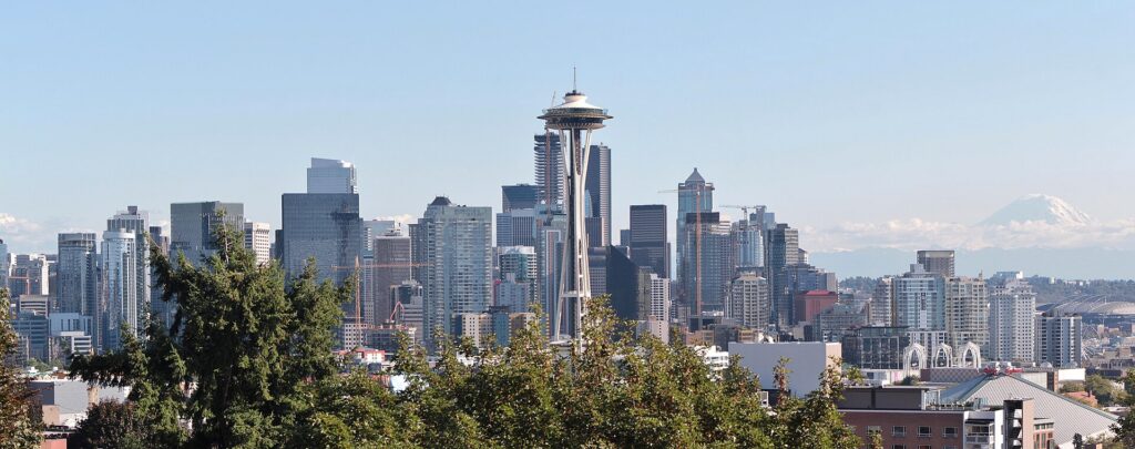
    The Seattle skyline and the Space Needle with Mount Rainier behind
    Downtown Seattle and the Space Needle, with Mount Rainier on the horizon (Photo: SounderBruce via Wikimedia Commons, CC BY-SA 4.0)

    Seattle at a glance for first-timers

    • Airport: Seattle-Tacoma International (SEA), about 20 km (13 miles) south of downtown; the Link light rail runs from the terminal to downtown in roughly 40 minutes, and a taxi, ride-hail or rental covers everything else. See our SEA airport guide.
    • Getting around: downtown, Pike Place Market, the waterfront, Pioneer Square and Capitol Hill are walkable, if hilly, and the light rail, buses, streetcars and the monorail link most of what a visitor needs. For Mount Rainier, the Olympic Peninsula and the drive to Vancouver, you will want a car.
    • Money: U.S. dollars. Washington has no state income tax, and it makes up for it at the register: the combined sales tax in Seattle is just over 10 percent, among the highest of any big U.S. city, and hotels and rental cars carry extra taxes on top. Tipping 18 to 20 percent in restaurants is standard.
    • Weather: mild all year, rarely very hot or very cold, with a famously gray, drizzly stretch from October to May and a dry, sunny summer from July to September. Our month-by-month guide has the detail.
    • Where to stay: downtown and around Pike Place Market for walking to almost everything; Belltown for bars and restaurants; South Lake Union and Queen Anne for Seattle Center; Capitol Hill for nightlife; the airport strip if you have an early flight or a cruise transfer. Our Seattle hotel search covers them all.

    Pike Place Market and the waterfront

    Start where Seattle starts. Pike Place Market opened in 1907 so that farmers could sell directly to shoppers, and more than a century later it is still a working market rather than a museum: produce stalls, flower sellers, fishmongers, bakeries, butchers, craft tables and tiny restaurants spread over several levels on the bluff above Elliott Bay. Go early, before the cruise-ship and tour-group crowds arrive around mid-morning, and walk the whole thing: the arcade under the famous neon clock, the fish stall where the staff throw salmon over the counter, Rachel the bronze pig, the lower levels full of comic shops and oddities, and Post Alley, with its notorious gum wall. The coffee shop that bills itself as the original Starbucks draws a queue all day; the market is full of better places to sit down. From the market’s newer terraces, the Overlook Walk now carries you straight down the bluff to the waterfront, which the city has rebuilt as a continuous public promenade since the elevated Alaskan Way Viaduct was torn down. Along it you will find the Seattle Aquarium and its newer Ocean Pavilion, the Seattle Great Wheel on Pier 57, souvenir shops and seafood bars on the old piers, and Colman Dock, the ferry terminal. A short walk north of the market, the Olympic Sculpture Park, run by the Seattle Art Museum, zigzags down to the water with large outdoor works and a view across the Sound to the Olympic Mountains, and it is free.

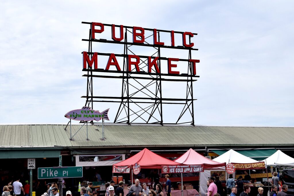
    The neon Public Market Center sign and clock at Pike Place Market
    Pike Place Market, open since 1907 and still a working market (Photo: Madi Fawcett via Wikimedia Commons, CC BY-SA 4.0)

    Seattle Center: the Space Needle, Chihuly and MoPOP

    The grounds of the 1962 World’s Fair, about a mile north of downtown, hold three of the city’s most visited sights. The Space Needle is the one everyone photographs, and the observation level, with its glass walls and a rotating glass floor below, gives a full circle of city, water and, on a clear day, Mount Rainier; the view is worth paying for in clear weather and is not in fog, so check the sky before you buy. Beside it, Chihuly Garden and Glass shows the work of the Tacoma-born glass artist Dale Chihuly in darkened galleries, a glass-and-steel conservatory and a garden where glass sculptures grow among the plants; it is far better than its gift-shop reputation suggests. The Museum of Pop Culture, MoPOP, is the lumpy, multicolored Frank Gehry building the monorail runs through, with exhibits on Seattle music from Jimi Hendrix to Nirvana, science fiction, horror and video games, and a hands-on studio where you can play instruments. The Pacific Science Center, with its white Gothic arches, is the family option, and Climate Pledge Arena, rebuilt inside the old roof, hosts the Kraken, the Storm and the big concerts. The best way to arrive is the Seattle Center Monorail, another 1962 survivor, which covers the mile from Westlake Center in about two minutes. For the classic postcard view of the Needle in front of the skyline, walk up to Kerry Park on Queen Anne Hill at sunset.

    Pioneer Square, the Underground and the International District

    Seattle’s original downtown burned to the ground in 1889 and was rebuilt in brick and stone, a story level higher than before, which left the old storefronts at the bottom of the new streets. Pioneer Square is that rebuilt district, with Romanesque buildings, cast-iron pergolas, art galleries, bookshops and bars, and the Underground Tour takes you through the buried sidewalks and basements below with a guide and a good deal of humor. The free Seattle unit of Klondike Gold Rush National Historical Park, in a historic building on the square, explains how the 1897 gold rush turned Seattle into the outfitting town for the stampede north and made the city’s fortune. Smith Tower, which opened in 1914 and was for decades the tallest building on the West Coast, has an open-air observation deck and a speakeasy-style bar. A few blocks east, the Chinatown-International District is one of the oldest Asian American neighborhoods on the West Coast, with Chinese, Japanese, Vietnamese and Filipino roots; the Wing Luke Museum tells that history through the old hotel it occupies, and Uwajimaya, the big Asian grocery, has an excellent food court. The Mariners’ and Seahawks’ stadiums sit just south of both neighborhoods.

    On the water: ferries, lakes and the great parks

    Seattle is built around water, and seeing the city from it is not optional. The simplest and cheapest way is the Washington State Ferries run from Colman Dock to Bainbridge Island, about 35 minutes each way, with the skyline, the Space Needle and, in clear weather, Mount Rainier and the Olympics all in view from the outside decks; walk-on passengers pay only on the westbound leg, and Winslow, the town at the ferry landing, has cafés, a small museum of art and wine bars within a few minutes’ walk. The run to Bremerton is longer and threads through narrower passages. On the city’s freshwater side, Lake Union is ringed with houseboats, seaplane docks and kayak rentals, and paddling past the floating homes of Eastlake and Westlake is a classic summer afternoon. Gas Works Park, on the north shore, turned a rusting gasification plant into a grassy hill with the best view of downtown across the lake. The Hiram M. Chittenden Locks in Ballard lift boats between the lake system and Puget Sound, and the fish ladder beside them has an underwater viewing room where you can watch salmon climbing upstream, best from July into September. Discovery Park, the largest park in the city, has bluffs, meadows, forest trails and a beach walk to the West Point Lighthouse; the Washington Park Arboretum and its Japanese Garden are the city’s gardens; and Alki Beach in West Seattle, reached by the water taxi from Pier 50 and a short walk or shuttle, has a long beach promenade with a skyline view.

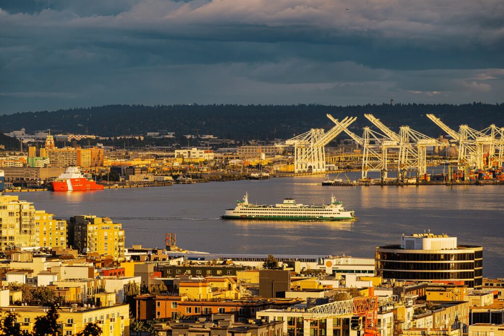
    A Washington State ferry crossing Elliott Bay, seen from Queen Anne Hill
    The Bainbridge Island ferry: the cheapest harbor cruise in the country (Photo: Guywelch2000 via Wikimedia Commons, CC BY 4.0)

    Neighborhoods worth a half-day

    Capitol Hill

    The densest, liveliest neighborhood in the city, a short ride from downtown on the light rail. The Pike and Pine corridor is Seattle’s nightlife and restaurant strip, with record stores, cocktail bars, music venues and a long history as the center of the city’s LGBTQ community. At the north end, Volunteer Park has a Victorian glass conservatory, a water tower you can climb for the view and the Seattle Asian Art Museum, and Lake View Cemetery next door is where Bruce Lee and his son Brandon are buried.

    Fremont

    The self-declared “Center of the Universe” has a sense of humor about itself: a giant concrete troll crushing a real Volkswagen under the Aurora Bridge, a salvaged Soviet-era statue of Lenin, a rocket bolted to a building, and a Sunday market. It sits on the Ship Canal with a flat towpath trail along the water toward Gas Works Park, and its streets are full of cafés, breweries and vintage stores. The Fremont Solstice Parade, with its painted cyclists, is the neighborhood’s big day in June.

    Ballard

    Settled by Scandinavian fishermen and still home to the fishing fleet that works the Alaska waters, Ballard is now one of the city’s best places to eat and drink. The National Nordic Museum tells the story of Nordic immigration to the Northwest, the brewery district between the Locks and downtown Ballard has more than a dozen taprooms within walking distance, Ballard Avenue is lined with restaurants in old brick buildings, and the Sunday farmers market is one of the best in the city.

    Queen Anne and South Lake Union

    Queen Anne rises steeply above Seattle Center, with grand old houses, Kerry Park’s famous view and a pleasant village along the top of the hill. South Lake Union, below it, has been rebuilt as Amazon’s headquarters district, with the glass Spheres downtown, the Museum of History and Industry in Lake Union Park, and the Center for Wooden Boats, where you can rent a rowboat or sailboat by the hour.

    The University District

    The University of Washington’s campus has a Gothic-style library, views of Rainier across the Drumheller Fountain, and a quad of cherry trees that draws crowds when they bloom in late March. The Burke Museum of natural history and culture, with its visible working labs, and the Henry Art Gallery are both on campus, and the light rail makes it an easy trip from downtown.

    Museums, culture and family attractions

    The Seattle Art Museum downtown, with Jonathan Borofsky’s giant Hammering Man outside, has strong collections of Northwest Coast Native art, Asian art and modern American painting; its sister museum, the Asian Art Museum, is in Volunteer Park. The Museum of Flight, beside Boeing Field in the south of the city, is one of the largest air and space museums in the world, with a Concorde, the first jet Air Force One, a space shuttle trainer and the original red barn where Boeing began; plan half a day. The Frye Art Museum on First Hill is free, and the Seattle Aquarium on the waterfront has sea otters, a giant Pacific octopus and a focus on the life of Puget Sound. For performing arts, Benaroya Hall is home to the Seattle Symphony, McCaw Hall at Seattle Center hosts Seattle Opera and Pacific Northwest Ballet, the Paramount and the Moore are the grand old theaters for touring shows, and the Showbox, the Crocodile and the Neptune keep the city’s music reputation alive. For what is on stage and in the arenas during your dates, our Seattle events page lists concerts, shows and games.

    Sports

    Seattle is a loud sports town, and its stadiums are downtown, which makes a game easy to fit in. The Seahawks play NFL football at Lumen Field from September to January, in a stadium designed to trap crowd noise, and the Seattle “12th Man” is famous for it. The Sounders, one of the best-supported clubs in Major League Soccer, share the same stadium and march to their matches with a crowd behind a band, and the Reign play women’s professional soccer there too; Lumen Field also hosted matches during the 2026 World Cup. Next door, the Mariners play baseball at T-Mobile Park from April to September under a retractable roof that keeps rain off without closing the stadium in. The Kraken, the city’s NHL team, and the Storm, a four-time WNBA champion, play at Climate Pledge Arena at Seattle Center, and University of Washington football at Husky Stadium on the lake is a fall Saturday tradition, with fans arriving by boat. Check what is on sale in Seattle for your dates before you book flights.

    What to eat, and where

    Seattle eats from the water. Salmon is the signature, grilled, smoked or cured, and the first Copper River salmon of the season, flown in from Alaska in May, is a local event. Oysters from Puget Sound and Hood Canal, Dungeness crab and geoduck, the giant local clam, turn up on menus from waterfront shacks to the city’s best restaurants, and an oyster happy hour is one of the city’s great bargains. Coffee is the other obsession: the city built the modern espresso-bar culture, and independent roasters on Capitol Hill, in Fremont and in Ballard are where to taste it. Beyond that, Seattle’s food reflects its Pacific Rim ties: dim sum, pho and Vietnamese sandwiches in the International District, Japanese and Korean cooking across the city, and teriyaki, which Seattle adopted as its own everyday takeout decades ago. At the market, look for Beecher’s handmade cheese, the Russian pastries at Piroshky Piroshky and the tiny doughnuts at the Daily Dozen. The local street food is the Seattle dog, a grilled hot dog with cream cheese and onions, sold outside the stadiums and bars late at night. Washington is the second-largest wine-producing state in the country, and the tasting rooms of Woodinville, half an hour northeast, make an easy afternoon; Ballard and Fremont are the center of the craft beer scene.

    Seattle through the seasons

    Seattle is two cities, depending on when you arrive. Summer (July to September) is the reason locals put up with the rest of the year: dry, sunny, rarely hot, with long evenings that stay light past nine and the mountains visible almost every day. This is the season for ferries, kayaks, the Locks’ salmon run, rooftop bars and day trips to Rainier and the Olympics, and it is also the Alaska cruise season, when ships dock at the city’s piers every weekend. Seafair fills late July and early August with neighborhood parades, hydroplane races on Lake Washington and an air show over the lake, and Bumbershoot takes over Seattle Center on Labor Day weekend. Fall (October to November) starts golden and turns gray, with the rain usually returning by mid-October; it is a good season for museums, food and the start of the Seahawks and Kraken seasons. Winter (December to February) is mild, dark and damp, with snow rare in the city but deep in the mountains an hour east, where the ski areas at Snoqualmie Pass open. Spring (March to June) brings cherry blossoms on the university quad in late March, the tulip fields of the Skagit Valley in April, the Northwest Folklife Festival at Seattle Center on Memorial Day weekend, and Pride at the end of June. Our month-by-month guide has the fare patterns that go with each season.

    Seattle with kids

    Seattle is an easy city with children, rain or shine. Seattle Center is the obvious base, with the Pacific Science Center, the Seattle Children’s Museum, MoPOP’s instrument studio, the International Fountain, which children run through all summer, and the monorail to get there. The Woodland Park Zoo in the north of the city is known for its naturalistic habitats, and the Seattle Aquarium and a ferry ride to Bainbridge make a full waterfront day. The Museum of Flight lets kids sit in cockpits and walk through a Concorde, the fish ladder at the Locks is a hit in late summer, and the beaches at Alki and Golden Gardens are the summer afternoons. For rainy days, the Pacific Science Center, the children’s floors at the Central Library and the indoor play spaces of the big museums fill the gap. For families heading out on day trips to Rainier or the Olympics, our family car rental guide covers the vehicle question.

    Seattle on a budget

    Seattle is not a cheap city, but a lot of its best is free: Pike Place Market, the waterfront promenade, the Olympic Sculpture Park, the Klondike Gold Rush museum in Pioneer Square, the Locks and the fish ladder, Gas Works Park, Discovery Park, Kerry Park, the Fremont Troll and the Central Library, a striking glass-and-steel building downtown. The Frye Art Museum is always free, and several other museums offer free or reduced entry on certain days; check their sites. The Bainbridge ferry is one of the best-value harbor views anywhere, and children and teenagers 18 and under ride most local transit free. Eat well for less in the International District, at the market’s counters, at oyster and seafood happy hours, and at the city’s many teriyaki shops. A combination ticket like the CityPASS can pay off if you plan to do the Needle, Chihuly, the aquarium and MoPOP. Hotels are cheapest from November to March and most expensive on summer cruise weekends; compare rates by neighborhood on our Seattle hotel search.

    Day trips from Seattle

    Mount Rainier, the 4,392-meter (14,410-foot) volcano that dominates the skyline, is about two to two and a half hours to the Paradise area of Mount Rainier National Park, where the wildflower meadows peak from late July into August; the park has used timed-entry reservations for its busiest areas in peak summer, so check before you go. Snoqualmie Falls, an 82-meter (268-foot) waterfall, is about 45 minutes east. The Olympic Peninsula, across the Sound by ferry, has Hurricane Ridge, glacier-fed lakes, the Hoh Rain Forest and wild Pacific beaches; it is better as an overnight trip. Bainbridge Island is the easiest half-day by ferry, and the San Juan Islands, reached by state ferry from Anacortes about 90 minutes north, are the place for orca-watching and island inns. Leavenworth, a Bavarian-themed mountain town over Stevens Pass, is about two and a half hours east, and Tacoma, 45 minutes south, has the Museum of Glass and Chihuly’s Bridge of Glass.

    Vancouver is the big one, and it works better as two or three nights than as a day trip. It is about three hours north on I-5 when the border queue is short, or a scenic four-hour ride on the Amtrak Cascades train, which runs along the shore of Puget Sound and Chuckanut Bay for long stretches; see our Vancouver guide for what to do when you arrive and our Seattle to Vancouver route guide for the drive. Crossing into Canada, every traveler needs acceptable identity and travel documents for their citizenship, and the rules for returning to the U.S. are set separately; check the Canada Border Services Agency before you go north and U.S. Customs and Border Protection before you come back. Apart from Bainbridge and the train to Vancouver, these day trips are car trips; see our Seattle car rental page, and carry tire chains for Rainier and the mountain passes in winter.

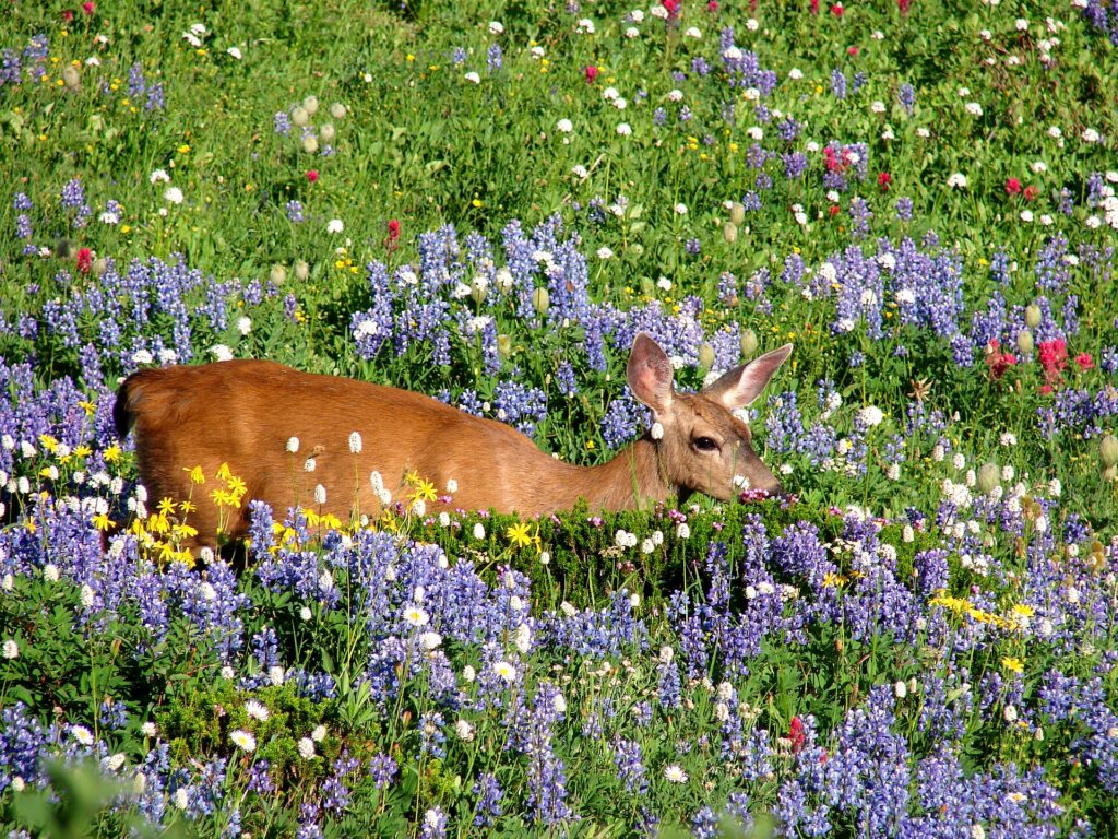
    Mount Rainier above the wildflower meadows at Paradise
    Mount Rainier from Paradise, about two and a half hours from downtown Seattle (Photo: Mount Rainier National Park from Ashford, WA, United States via Wikimedia Commons, Public domain)

    Two sample itineraries

    Three days, no car

    Day one: Pike Place Market at opening time, the Overlook Walk down to the waterfront and the aquarium, the Olympic Sculpture Park in the afternoon, and dinner in Belltown. Day two: the monorail to Seattle Center for the Space Needle, Chihuly and MoPOP, then an afternoon ferry to Bainbridge and back for the skyline at sunset, and oysters downtown. Day three: the Underground Tour and the Klondike museum in Pioneer Square, lunch in the International District, the light rail to Capitol Hill for Volunteer Park and an evening on Pike and Pine, with a Mariners, Sounders or Kraken game if one is on.

    Five days, with the mountains and Vancouver

    Add a day for Fremont, Ballard and the Locks by bus or bike, then pick up a car and drive to Mount Rainier for a day, and either spend a night on the Olympic Peninsula or head north to Vancouver for two days, returning the car in Seattle or, if the rental company allows it, one way across the border.

    Practical details

    • Transit: load an ORCA card or a mobile ticket for the light rail, buses, streetcars, water taxis and monorail. Sound Transit has the Link maps; our car-versus-transit guide goes into detail.
    • From SEA: the Link light rail to downtown, a taxi or ride-hail from the parking garage, or a rental from the off-site rental car facility. The Port of Seattle, which runs the airport, covers ground transport.
    • Weather: layers and a waterproof jacket in every season; locals rarely carry umbrellas, because the rain is usually a drizzle. Sunglasses in summer, when the light is long and bright.
    • Time zone: Pacific, three hours behind New York, the same as Vancouver.
    • Entry requirements: Canadians need a valid passport to fly in; visitors from Visa Waiver Program countries need an approved ESTA before boarding, and everyone else needs a visa. U.S. Customs and Border Protection is the authoritative source. Visit Seattle has the current events calendar.
    • Safety: the tourist areas are generally safe with ordinary big-city awareness; parts of downtown around Third Avenue and Pioneer Square can feel rough at night, and car break-ins are common, so leave nothing visible in a parked car.

    Frequently asked questions

    How many days do you need in Seattle?

    Three days covers Pike Place, the waterfront, Seattle Center, Pioneer Square, a ferry ride and two neighborhoods; add one for Mount Rainier and two for Vancouver or the Olympic Peninsula.

    What is the number one thing to do in Seattle?

    Pike Place Market at opening time, followed by the walk down to the waterfront and a ferry to Bainbridge for the view of the city from the water.

    Is Seattle walkable?

    Downtown, the market, the waterfront, Pioneer Square, Belltown and Capitol Hill are, although the hills are steep. The light rail, buses and monorail link most of the rest.

    Do I need a car in Seattle?

    Not for the city itself, where parking is expensive and transit is good. For Mount Rainier, the Olympic Peninsula and the drive to Vancouver, yes; rent it for those days only.

    Does it really rain all the time in Seattle?

    No. Seattle gets less rain in a year than New York or Boston, but it falls as frequent drizzle from October to May under gray skies. July to September is dry and sunny.

    What is Seattle known for?

    Pike Place Market, the Space Needle, coffee, seafood, Boeing and the tech industry, the grunge music of the early 1990s, and a setting between Puget Sound, the lakes and the mountains.

    Ready to go? Compare flights to Seattle, find a place to stay with our Seattle hotel search, and if Rainier or Vancouver is on the list, price a rental car for those days.